2021+ Strategic Plan International GNSS Service
←
→
Page content transcription
If your browser does not render page correctly, please read the page content below
International GNSS Service

2021+ Strategic Plan

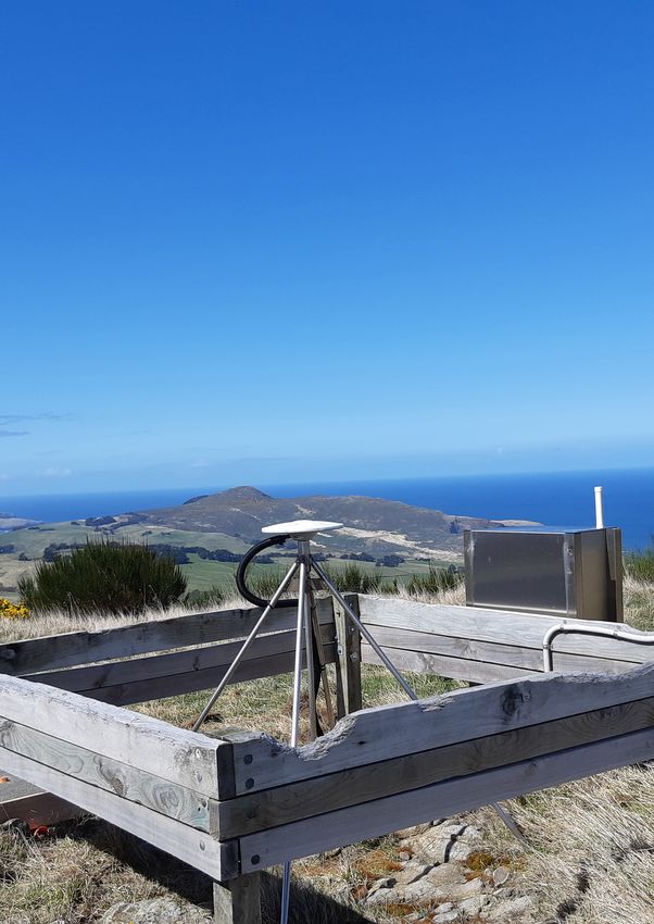
SCTB00ATA- IGS station, operated by GNS
    Science Te Pu Ao on behalf of Toitū Te Whenua
    Land Information New Zealand and New Zealand
    Earthquake Commission as part of the GeoNet
    programme
    Scott Base (Antarctica)
    Photo Courtesy of P. Gentle (LINZ)

                                          Editors
                               Allison B. Craddock
                             Mayra I. Oyola-Merced
                               IGS Central Bureau

                       Layout and Graphics
                                   Ashley Santiago
                                                                                                          Table of Contents
                                 IGS Central Bureau

                       Contact Information
                                                                                                          2   Acknowledgements
                                  IGS Central Bureau
                   NASA Jet Propulsion Laboratory
                  California Institute of Technology
                                                                                                          4   Mission, Vision, Values
                                        M/S 238-540
                               4800 Oak Grove Drive
                        Pasadena, California 91101
                                                                                                          5   Executive Summary
                           United States of America

                          www.igs.org | cb@igs.org
                                                                                                          6   IGS at a Glance

                                                       The International GNSS Service (IGS) ensures       8   Strategic Plan Development + Process
                                                       open access, high-quality GNSS data products
                                                       that enable access to the definitive global
                                                       reference frame for scientific, educational, and   10 IGS Strategy for 2021 & Beyond
                                                       commercial applications.

             The IGS is a service of Global Geodetic                                                      12 Goals & Objectives
                    Observing System International
              Association of Geodesy International
                 Union of Geodesy and Geophysics                                                          26 Implementation
          IGS is a Network Member of International
           Council for Science - World Data System                                                        27 Looking Forward
          © 2021 California Institute of Technology.
                 All Sponsorship is acknowledged

2    International GNSS Service 2021+ Strategic Plan                                                                                International GNSS Service 2021+ Strategic Plan   3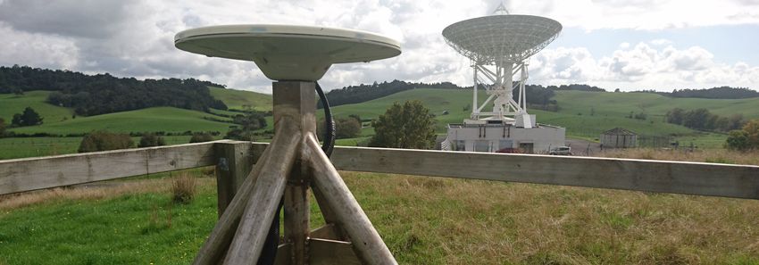
Mission
                                                      The International GNSS Service
                                                                                             Message from the IGS
                                                      provides, on an openly available
                                                      basis, the highest-quality GNSS
                                                      data, products and services in
                                                                                             Governing Board Chair
                                                      support of the terrestrial reference
                                                      frame, Earth observation and                                              Dear IGS Community Members,
                                                      research; positioning, navigation                                         For over twenty-five years, the International GNSS Service (IGS, where
                                                      and timing; and other applications                                        GNSS stands for Global Navigation Satellite Systems) has carried out
                                                      that benefit science and society.                                         its mission to advocate for and provide freely and openly available high-
                                                                                                                                precision GNSS data and products. In 2020, despite a global pandemic and
                                                                                                                                interruptions on our life and work schedules, the IGS continued to sustain
                                                                                                                                our community’s needs. While delivery of the IGS reference frame, orbit,
                                                                                                                                clock and atmospheric products continues to drive the core activities, the
                                                                                                                                IGS transformation to a multi-GNSS service is of highest priority, and is
                                                                                                                                reflected both directly and indirectly throughout the 2021+ Strategic Plan.
                                               A better understanding of the Earth
                          Vision               through the application of GNSS                                                  The IGS continues to coordinate a collaborative research infrastructure
                                                                                                                                and provide operations at the global scale, operating as a service of the
                                                                                                Felix Perosanz                  International Association of Geodesy (IAG), and a contributor to the Global
                                                                                                Chair of the IGS                Geodetic Observing System (GGOS). Accordingly, the IGS is also represented
                                                                                                Governing Board                 in IAG and GGOS governance, bureaus, commissions and working groups,
                                                                                                Centre National                 ensuring the IGS retains its strong level of international significance and
                                                                                                d’Etudes Spatiales              sustainability. A number of IGS community leaders also participate in the

                                                      Organizational                            (CNES), France                  United Nations Global Geospatial Information Management (UN GGIM)
                                                                                                                                efforts on Geodesy, which aims to enhance the sustainability of the global

                                                      Values
                                                                                                                                geodetic reference frame and infrastructure through intergovernmental
                                                                                                                                advocacy for geodesy.

                                                      Fundamental to the IGS are key         This plan was developed by the IGS Governing Board with the help and support of the Central Bureau, and
                                                      values that are shared across the      guided by extensive community feedback and discussions. It presents a forward-looking strategy addressing
                                                      organization, these are:               the role of IGS as facilitator, incubator, coordinator, and advocate working towards three major goals in service
                                                                                             to our community and beyond. The plan focuses on how the IGS maintains and enhances its leadership role
                                                                                             within the broader GNSS community as societal demands for GNSS products and services continues to
                                                      • Advocacy of an open data             grow. Central to the goals and objectives are the complementary roles of the IGS as a collaborative research
                                                        policy, with data and products       program, as well as an operational service. The plan seeks to maintain appropriate balance of the two roles
                                                        openly available,                    to ensure ongoing support from associate members and collaborating organizations.
                                                      • Welcome contributions from           The IGS 2021+ Strategic Plan has been balanced to address both internal and external factors driving IGS
                                                        and participation with all           organizational growth towards multi-GNSS technical excellence. Looking forward, implementation of this
                                                        organizations,                       plan will include ensuring sustainable and resilient contributions to the IGS community and its work, as it
                                                                                             is the breadth and number of contributors to the IGS as well as their high levels of commitment that have
                                                      • Effective reliability through
                                                                                             ensured the high level of performance and reliability of product generation and delivery thus far.
                                                        the redundancy of IGS                The plan continues in the spirit of previous strategic plans in that it is intended to guide our service to the
                                                        components,                          community, and is not intended to be restrictive. It is our hope that the guidance in this plan will ensure the
                                                      • Technical evolution through          best possible IGS for the ever-growing community of users relying upon its openly available high-quality
                                                                                             GNSS data and products.
                                                        “friendly competition”,
                                                      • Dedicated engagement with
                   BAKE00CAN                            policy entities to raise mutual
                   Baker Lake, Canada                   awareness of IGS and geodesy                                                                                                       Felix Perosanz
                   Photo Courtesy of CDDIS
                                                        in general.

4   International GNSS Service 2021+ Strategic Plan                                                                                             International GNSS Service 2021+ Strategic Plan             5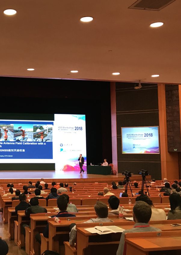
1,428                                IGS MAIL
                                                                                                                                          SUBSCRIBERS

                                                                                                     500+                                         100
                                                                                                                        Worldwide
                                                                                                                        Reference    in over                       countries
                                                                                                                        Stations

       IGS At A Glance
       The International GNSS Service (IGS,
       where GNSS stands for Global Navigation
       Satellite Systems) is the world’s largest
       GNSS organization, with an over twenty-
                                                      IGS is a voluntary federation of self-funded
                                                      agencies, universities, and research
                                                      institutions all over the world, working
                                                      together to provide the highest precision
                                                                                                     300+             Associate
                                                                                                                      Members                  142           Contributing
                                                                                                                                                             Organizations
       five years of history of advocating for and    GNSS satellite orbits in the world.
       providing freely and openly available high-    Access to very high precision products is
       precision GNSS data and products. The IGS
       consists of over 300 Associate Members
                                                      provided freely and openly for scientific
                                                      advancement and public benefit. IGS data       Providing Data & Products from over             145 Satellites
                                                                                                          4 Global              2 Regional
       (AM), representing over 45 countries and       and analysis products support a wide
       over 200 contributing organizations.           variety of applications that touch millions
                                                      of users in virtually all segments of the      in                     &                            Constellations
       As of early 2021, the IGS consists of over     global economy.
       300 Associate Members, representing

                                                                                                     108
       over 45 countries. The 36-member IGS           IGS products support access to and
       Governing Board guides the coordination        realization of the International Terrestrial                   Agencies operating GNSS Network Tracking Stations
       of over 142 contributing organizations         Reference Frame, providing support
       participating within IGS, including 108        for geodetic research and scholarly
       operators of GNSS network tracking             applications. Furthermore, IGS Working
       stations, 6 global Data Centers, 13 Analysis   Groups and Pilot Projects work for the

                                                                                                     23           Regional/Project
                                                                                                                                                       21          Associate
       Centers, and 4 product coordinators, 21        continuous development of new and
       Associate Analysis Centers, 23 regional/       improved applications and products. As
       project Data Centers, 14 technical Working     a technical service of the International                      Data Centers                                Analysis Centers
       Groups, two active pilot projects (i.e.,       Association of Geodesy, IGS functions as
       Multi-GNSS and Real-time), and the Central     a component of the IAG Global Geodetic
       Bureau.                                        Observing System (GGOS) and a network

                                                                                                     14                                        13
                                                      member of the International Science                    Technical
                                                      Council’s World Data System.
                                                                                                             Working                                         Analysis Centers
                                                                                                             Groups

                                                                                                             11 TB (135 million files)
                                                                                                                over the last 5 years                6      Global Data Centers

6 International GNSS Service 2021+ Strategic Plan                                                                                        International GNSS Service 2021+ Strategic Plan 7
DUND00NZ- IGS station, operated by GNS
Science Te Pu Ao on behalf of Toitū Te Whenua
Land Information New Zealand and New Zealand
Earthquake Commission as part of the GeoNet
programme
Dunedin (New Zealand)
Photo Courtesy of Paul Aichholze

                                                Strategic Plan
                                                Development Process
                                                The IGS Governing Board and Associate Members
                                                participated in a comprehensive, thoughtful, and
                                                transformative strategic planning process facilitated
                                                by the IGS Central Bureau.

                                                The strategic plan, covering the period      •   Research, analysis, and updating of
                                                2021 and beyond, was created over a              our understanding of economic, social,
                                                two-year period. The following activities        and cultural external environmental
                                                took place in an over-arching and multi-         changes
                                                modal community engagement and plan          •   Creation of a Vision 2021+ document
                                                development process:                             to serve as a launching pad
                                                                                             •   Development of an environmental scan
                                                •   Convening a Strategic Planning Task          and analysis of strengths, weaknesses,
                                                    Force working session to co-plan and         opportunities, and threats
                                                    oversee the planning process             •   Online membership survey with nearly
                                                •   Series of dedicated Central Bureau           100 completed surveys
                                                    working sessions                         •   Review of internal organizational
                                                •   Open meetings at various conferences         documents, including the 2017
                                                    with     Associate    Members      and       Strategic Plan, organizational structure
                                                    stakeholders                                 information, conference materials, and
                                                •   Facilitated dedicated workshop with          other organizational materials
                                                    Governing Board Members to address       •   Development of a framework of
                                                    key issues faced by the IGS, the             organizational goals, strategies, and
                                                    GNSS community, the membership,              recommendations
                                                    and considered history, current          •   Preparation of an implementation plan
                                                    environment, and future opportunities        for the strategic plan
                                                    in developing the future direction       •   Board review, approval, and adoption
                                                                                                 of the full strategic plan

                                                                                       International GNSS Service 2021+ Strategic Plan      9
1
                                                                                                                     Achieve Multi-GNSS

                                                                                                       GOAL
                                                                                                                     Technical Excellence
                                                                                                                     Increase organizational capability
                                                                                                                     by identifying barriers to multi-
                                                                                                                     GNSS success throughout the
                                                                                                                     IGS, supporting solutions to key
                                                                                                                     challenges, and reinforcing the
                                                                                                                     importance of continuous technical
                                                                                                                     evolution.

        Serving the global
        community with
        3 strategic priorities
                                                                                                              2
                                                                                                                     Strengthen

                                                                                                       GOAL
        As scientific and other GNSS applications    improvement of the IGS suite of data                            Outreach
        proliferate, the work of the IGS and its     and data products, made possible by the                         and Engagement
        constituent elements continues to increase   efforts of many dedicated contributors
        in relevance. The role of IGS has been       to the IGS. This Strategic Plan, produced                       Advocate for open access geodetic
        elevated as applications that essentially    with the assistance of the Central Bureau                       and GNSS data and products
        rely on the IGS data and products have       and built upon the feedback of many IGS                         that facilitate collaborations,
        greatly expanded both within and outside     community members, outlines key points                          standardization, and inclusivity.
        of the sciences. The IGS Governing           of the IGS goals and the anticipated path
        Board works in support of continuous         to meet its objectives in 2021 and beyond.

                                                                                                              3
                                                                                                                     Build Sustainability

                                                                                                       GOAL
                                                                                                                     and Resilience
                                                                                                                     Foster a resilient, sustainable, and
                                                                                                                     effective organization to support
                                                                                                                     an expanding and evolving IGS
                                                                                                                     community.

10 International GNSS Service 2021+ Strategic Plan                                                International GNSS Service 2021+ Strategic Plan 11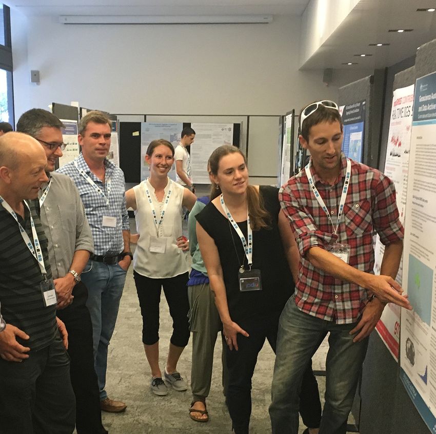
IGS 2021+ Strategic
Plan Matrix                                              Facilitation              Coordination                  Incubation                       Advocacy

                                                     Identify impediments       Coordinating (and            Identify and incubate            Advocate the benefit
                                                     to multi-GNSS in           tracking progress)           aspects of IGS                   and critical need of
                                                     each working group         the various multi-           component work that              Multi-GNSS through
  GOAL 1

                                                     and infrastructural        GNSS contributions           are in need of special           case studies, leadership,
                                                     component, and             (achievements) across        attention to make a              and demonstration
                                                     facilitate solutions to    all Working Groups           strong step toward multi-
                            Multi-GNSS               these blockages            and Infrastructural          GNSS
                        Technical Excellence                                    components

                                                     Facilitating               Coordinating outreach        Incubating the next             Advocating for
                                                     collaborations             to relevant agencies &       generation of IGS               standardization and
                                                     with stakeholder           institutions, to attract     community members               interoperability essential
  GOAL 2

                                                     organizations and          and promote IGS              through Inclusion               to organizational
                                                     groups to diversify and    scientific and user          campaigns targeted at           sustainability and user
                                                     increase participation     applications                 organizations and early-        community engagement
                             Outreach and            of IGS users and                                        career scientists
                             Engagement              contributors

                                                     Facilitating integration   Coordinating                 Incubating organizational        Advocating for open
                                                     and evolution as both a    technological                sustainability and               access geodetic and
                                                     collaborative research     and geographical             resilience through               multi-GNSS data,
  GOAL 3

                                                     program and operational    infrastructural innovation   personnel redundancy             products, and metadata
                                                     service                    and diversity                and modularity                   via alignments with
                                                                                                                                              major United Nations
                          Sustainability and                                                                                                  frameworks and
                             Resilience                                                                                                       national/regional
                                                                                                                                              agendas

12 International GNSS Service 2021+ Strategic Plan                                                                      International GNSS Service 2021+ Strategic Plan 13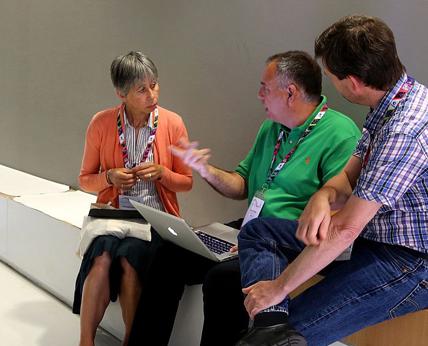
GOAL 1

Achieve Multi-GNSS
Technical Excellence
Increase organizational capability by identifying
barriers to multi-GNSS success throughout the IGS,
supporting solutions to key challenges, and reinforcing
the importance of continuous technical evolution.

Goal 1 aims for IGS to become the premier      The evolution of products to include
source for high-quality multi-GNSS data,       all GNSS constellations is an ongoing
products, standards, and expertise in the      challenge     for     the   IGS.     Product
world, with these resources made openly        enhancements often trigger discussions
available to all user communities. The         around the purpose and scope of the IGS,
IGS will continue to support the current       resulting in a review of data and product
core scientific user’s needs to build          release policies. At the time of this writing,
and sustain a viable global multi-GNSS         a review of the policies as they relate to
infrastructure and to reliably produce high-   real time multi-GNSS combined products
quality benchmarked products to advance        is underway, in anticipation of such a
knowledge and use of Earth systems and         product.
observations. Concurrently, the IGS will
strive to work with emerging users who
have the potential to shape the future
direction of the IGS.

                                        International GNSS Service 2021+ Strategic Plan 15
MAS100ESP
  Gran Canaria, Spain
  Photo Courtesy of ESA/ESOC

        Objective 1.1 – Identify                        Objective 1.2 – Coordinate                     Objective 1.3 – Identify and                         Objective 1.4 – Advocate the
        impediments to multi-GNSS                       and monitor progress                           incubate aspects of IGS                              benefit and critical need of
        in each working group and                       of the various multi-                          component work that are in                           multi-GNSS through case
        infrastructural component,                      GNSS contributions and                         need of special attention in                         studies, leadership, and
        and facilitate solutions                        achievements across                            order to make a strong step                          demonstration.
        to these blockages being                        all working groups and                         toward multi-GNSS
        available in the future.                        Infrastructural components

        The IGS recognizes that to meet ongoing         The IGS must continue to optimize its          The IGS is a strong, collaborative                   By participating on the United Nations
        changes and challenges associated with          use of multi-GNSS technology to increase       community that must continue to enable               Committee of Experts on Global Geospatial
        Earth-observing activities, it must offer a     service performance. New resources             the resolution of technological or capacity          Information Management Subcommittee
        high-quality service, and enhance service       must be regularly developed to reflect the     weaknesses. By conducting a gap                      on Geodesy, the IGS is a key advocate of
        performance and capabilities whenever           changing needs of IGS product users, and       analysis and needs assessment within                 policy for countries around the world to
        possible. To accomplish this, the IGS strives   existing resources must evolve to keep         each component, areas of multi-GNSS                  cooperate in extending the Global Geodetic
        to maintain all components to the highest       pace with demand. For broadest impact, it      capability in need of special attention will         Reference Frame as a basis for mapping
        levels of quality and accuracy; advocates       is essential for all available GNSS signals    be identified, reported to the Governing             and geodetic measurement.
        for multi-GNSS compatible improvements          to be integrated within the IGS portfolio of   Board for intervention, and supported
        in IGS infrastructure, network and analysis;    data and products.                             by sessions at community workshops                   The IGS is also active through its role as
        and continues to monitor and improve site-                                                     and other events. Those aspects of the               an IAG service with the United Nations
        related data quality.                           With the ever-evolving nature of multi-        multi-GNSS capability in need of greatest            International Committee on GNSS, which
                                                        GNSS technological and application             attention will be prioritized and incubated          coordinates among multiple GNSS
        IGS components will conduct self-               developments, coordination of efforts          across the IGS scope of work.                        providers on important policy matters
        assessments to determine what impedes           across IGS technical working groups, as                                                             relating to interoperability and performance
        progress toward multi-GNSS capabilities         well as infrastructural components such                                                             of the various global navigation satellite
        in their work, and report these issues to       as analysis centers and data centers,                                                               systems. The IGS is a key committee
        the Governing Board for intervention and        will be essential. Monitoring of each                                                               member that advises ICG on scientific and
        action.                                         component’s progress toward multi-GNSS                                                              policy matters. These and other efforts
                                                        excellence will be documented in the IGS                                                            benefit from the broad advocacy efforts in
                                                        Annual Technical Report and presented at                                                            which the IGS participates.
                                                        year-end Governing Board meetings.

16 International GNSS Service 2021+ Strategic Plan                                                                                                    International GNSS Service 2021+ Strategic Plan 17
GOAL 2

                                          Strengthen Outreach
                                          and Engagement
                                          Advocate for open access geodetic and GNSS
                                          data and products that facilitate collaborations,
                                          standardization, and inclusivity.

                                          In order to support the advancement of         Goal 2 is supported by objectives that
                                          knowledge and innovations derived from         seek to maintain or increase diverse
                                          Earth observations, the IGS advocates for      personnel expertise to influence GNSS
                                          openly available GNSS data and products.       policy and to advocate the value and
                                          This enables innovative and cost-effective     impact of open access GNSS data
                                          research projects, as well as a variety        and products. It encourages the IGS
                                          of other applications to be undertaken.        to engage, communicate and educate
                                          Significant societal benefit arises from       where it can positively in- fluence the
                                          the IGS products, and subsequently these       open access of GNSS and geodetic data
                                          benefits will be communicated to a wide        products. It supports the development
                                          variety of potential users, especially those   of    complementary      communications,
                                          in regions currently under-represented in      education, and outreach to organizations
                                          IGS components and governance.                 whose principles and interests may be
                                                                                         aligned with those of IGS in promoting
                                                                                         open data for public benefit.

Attendees at East Lake (Donghu)
International Conference Center for the
2018 IGS Workshop in Wuhan, China
Photo Courtesy of Wuhan Unviersity

                                                                                  International GNSS Service 2021+ Strategic Plan 19
Objective 2.1 – Facilitate Objective 2.2 – Coordinate Objective 2.3 – Incubate Objective 2.4 – Advocate
collaborations with outreach to relevant the next generation of for standardization
stakeholder organizations agencies and institutions, IGS community members and interoperability
and groups to diversify and in order to attract and through Inclusion essential to organizational
increase participation of promote IGS scientific and campaigns targeted at sustainability and user
IGS users and contributors user applications organizations and early- community engagement
career scientists
The IGS recognizes that global access The efficient and ongoing integration of IGS Leveraging on its network of experts, the The IGS will promote standards to
to expertise and trustworthy data is products and services into existing global IGS will continue to engage as a community encourage open availability of multi-GNSS
vital to the success of the organization. Earth-observing and navigation systems is through a number of channels. Principally, data and products for societal benefit. It
Maintaining organizational connections of great mutual importance to the IGS and the IGS workshops, held biannually in will support the principal organizations
to global expertise and other resources its diverse pool of collaborators. locations around the world, are a principal involved with GNSS standards to positively
requires a deliberate, long term objective avenue for connecting the entire IGS influence the development of relevant
that the IGS must continue to pursue. A Actively seeking out new avenues for community of participants, users and standards. The IGS will advocate for open
multi-channel approach will be maintained engagement and cooperation with Earth stakeholders. access to data and products complying
by IGS to connect and engage the IGS scientific organizations will broaden to these standards. In this regard, a key
community with leading experts, and the IGS user community, and ultimately Technical workshops involving subject and unique attribute of IGS as a self-
expert organizations, in disciplines that produce a finely networked web of product matter experts addressing highly supported federation is its impartiality
are stakeholders to the IGS. The outcome and organizational integration within and specialized topics are held more frequently, and independence of financial influence
of this objective will be a comprehensive around the IGS. This will ensure the optimal as are interactions within the IGS working in developing its products and promoting
network of expertise to enable the success use of organizational and technological groups, committees, and projects. To open standards. Such standards will serve
of the IGS community as well as geodesy resources, and broaden the general user promote awareness, inclusion, and to propagate availability of open GNSS
in general. community while integrating it internally. transparency within IGS, the IGS Governing data and products to maximize their
Board, Associate Members and other benefits and impacts.
The IGS will continue to participate in interested parties engage in an annual
GGOS. Noting the important connection open meeting, which was successfully
to GNSS applications in land surveying, initiated in 2016.
IGS will maintain a relationship with the
International Federation of Surveyors. The IGS will also expand its engagement
Through IAG and GGOS, IGS will participate to reach an even broader audience through
in relevant activities of the Group on virtual meetings and workshops. The IGS
Earth Observations (GEO) as well as the community of experts will be encouraged
committee on Earth Observation Satellites to contribute knowledge and information,
(CEOS). As part of its obligation as a which will be publicly available on the IGS
service of the IAG, the IGS will continue website. Similar avenues for interaction
to participate in relevant United Nations will be introduced at IGS Workshops,
committees, such as the Committee of including clinics for the latest technology,
Experts on Global Geospatial Information special plenary presentations, and other
Management and the International designated events for discussion and
Committee on GNSS (ICG). By working education across areas of interest.
with these organizations, the IGS seeks
to build a broader global awareness and
participation with nations and regions not
currently active within the Service.
2016 IGS Workshop Poster Session 2017 IGS Workshop participants
Photo Courtesy of IGS Central Bureau Photo Courtesy of IGN/Xavier Della Chiesa
20 International GNSS Service 2021+ Strategic Plan International GNSS Service 2021+ Strategic Plan 21WGTN00NZL- IGS station, operated by GNS Science Te
Pu Ao on behalf of Toitū Te Whenua Land Information
New Zealand and New Zealand Earthquake Commission
as part of the GeoNet programme
Wellington (New Zealand)
Photo Courtesy of Brendon Glendinning
GOAL 3
Build Sustainability
and Resilience
Foster a resilient, sustainable, and effective
organization to support an expanding and evolving
IGS community.
Goal 3 calls for IGS to vigilantly maintain developing diverse contributions to the IGS.
effective organizational resilience The desired outcome is a well-managed
and sustainability. Objectives relate to and supported organization with a diverse
strengthening governance and related user base, and a well-defined vision and
practices, as well as strengthening and means for the future.
22 International GNSS Service 2021+ Strategic Plan International GNSS Service 2021+ Strategic Plan 23Objective 3.1 - Facilitate Objective 3.2 – Coordinate Objective 3.3 - Incubating Objective 3.4 - Advocate
integration and evolution innovation and diversity organizational for open access geodetic
as both a collaborative in technological and sustainability and resilience and multi-GNSS data,
research program and geographical infrastructure through personnel products, and metadata
operational service redundancy and modularity via alignments with major
United Nations frameworks
As the IGS matures, it takes on two This objective seeks to support the IGS Above all else, it is the IGS community
critical tasks in service to the community; self-funded participant model, as well as members -- its people -- who ensure and national/regional
fostering collaboration and advances to increase contributions to IGS through the organization and its mission are agendas
in GNSS research, as well as providing diverse sources. By helping the IGS successful. In order to ensure the long-
an essential foundation for scientific participants to succinctly articulate the IGS term sustainability and success, as well The IGS, as a technical service of the IAG, will
innovations via a high-quality operational value proposition, the IGS may positively as to facilitate additional diversity in be a strong supporter of the implementation
GNSS data and product service. In order impact participant funding over the long participation, a practice of personnel of the United Nations Global Geodetic
to achieve the organizational vision of “a term. Sponsors must be convinced that by redundancy will be put into action. All Reference Frame as the basis upon which
better understanding of the Earth through supporting the IGS, their investments are component leadership roles will be all spatial data and positioning activities
the application of GNSS” the IGS must leveraged multifold by the benefits of IGS supported by an understudy, so that should be founded. IGS will work with the
continue to ensure support for operations participation. Growth may be realized as component leaders are able to better International Federation of Surveyors and
and research, as they are inextricably new opportunities are pursued that may allocate their time, and to ensure that IAG to encourage open sharing of geodetic
linked. lead to more diverse participation within organizational knowledge is shared and data and information that contributes to
IGS. passed on in the best possible manner. the implementation of global, regional,
and national reference frames, as well
By developing a better understanding of as the inter-relationships among these
its users and impacts, the IGS can help its frames. Through participation in the UN
participants justify their involvement, and GGIM Subcommittee on Geodesy, IGS
hence funding for IGS. The overall output of will support advocacy for guidelines and
this objective will be a stable organization standards to advance the interoperability
of diverse participants who are stably of geodetic reference systems and data.
funded over the long term to support IGS
activities. Major United Nations frameworks,
including the Sustainable Development
Goals (SDGs), Sendai Framework for
Disaster Risk Reduction, UN Framework
Convention on Climate Change, and
the UN GGIM-World Bank Integrated
Geospatial Information Framework, serve
as key advocacy and communications
Satellite geodesy practices carried out by the tools for all geospatial information
students of the USACH (University of Santiago de applications. IGS will work with the UN
Chile) monitoring the Villarrica Volcano (39 ° 25’S - GGIM Subcommittee on Geodesy and UN
71 ° 56’W) in the SOUTH of Chile. International Committee on GNSS (ICG)
The project is part of an agreement with the to identify linkages to the aforementioned
National Geology and Mining Service(SNGM) and is frameworks and encourage existing
performed every six months. and emerging applications of GNSS that
Photo Courtesy of José Antonio Tarrío Mosquera contribute to global sustainability and
disaster risk reduction.
24 International GNSS Service 2021+ Strategic Plan International GNSS Service 2021+ Strategic Plan 25WARK00NZL- IGS station, operated by GNS Science Te Pu
Ao on behalf of Toitū Te Whenua Land Information New
Zealand and New Zealand Earthquake Commission as part
of the GeoNet programme. Co-located with a VLBI station.
Warkworth, Auckland (New Zealand)
Photo Courtesy of Miles Ryan
Implementation Looking Forward
The IGS is developing a strategic within each IGS component, as well as This Strategic Plan provides a clear limits of technology to improve the overall
implementation action plan in support of the organization overall, will be presented direction for advancing IGS in 2021 and effectiveness of the organization. We
the Goals and Objectives stated above. within the framework of the strategic plan. beyond. The IGS will remain committed envision that, guided by this plan, IGS will
This action plan will start with each While implementation is an iterative and to providing its world standard products emerge and continue to be an organization
component identifying achievable year 1 evolving process, the goals will serve as to diverse users working on innovative that is well positioned to take on its next
and 2 goals. Progress will be monitored the key focal point for all IGS work moving applications. The IGS will continue to build set of challenges in the years ahead.
by the Governing Board and recorded in forward. a sustainable organization that pushes the
the Annual Technical Report, where efforts
26 International GNSS Service 2021+ Strategic Plan International GNSS Service 2021+ Strategic Plan 27/company/igsorg @igsorg @igsorg
You can also read