Appendices Ealing Town Centre 2019 Liveable Neighbourhoods Bid - November 2019 - Ealing Council
←
→
Page content transcription
If your browser does not render page correctly, please read the page content below
Appendices
Ealing Town Centre 2019 Liveable Neighbourhoods Bid
                                                November 2019
2

Contents
   A. Prospectus for Change (see separate document)
   B.   Background
   C. Existing Context
   D. Existing Situation
   E.   High-level Healthy Streets Assessment
   F.   Summary of Identified Issues
   G. Strategic Case and Priorities for Change
   H. Outline Framework for Change
   I.   Project Scope
   J.   Delivery ‘Outline’ Projects, Estimated Costs and Phasing
   K.   Intervention Impact Assessment
   L.   Council’s Statement of Support
Appendix B
Background

             November 2019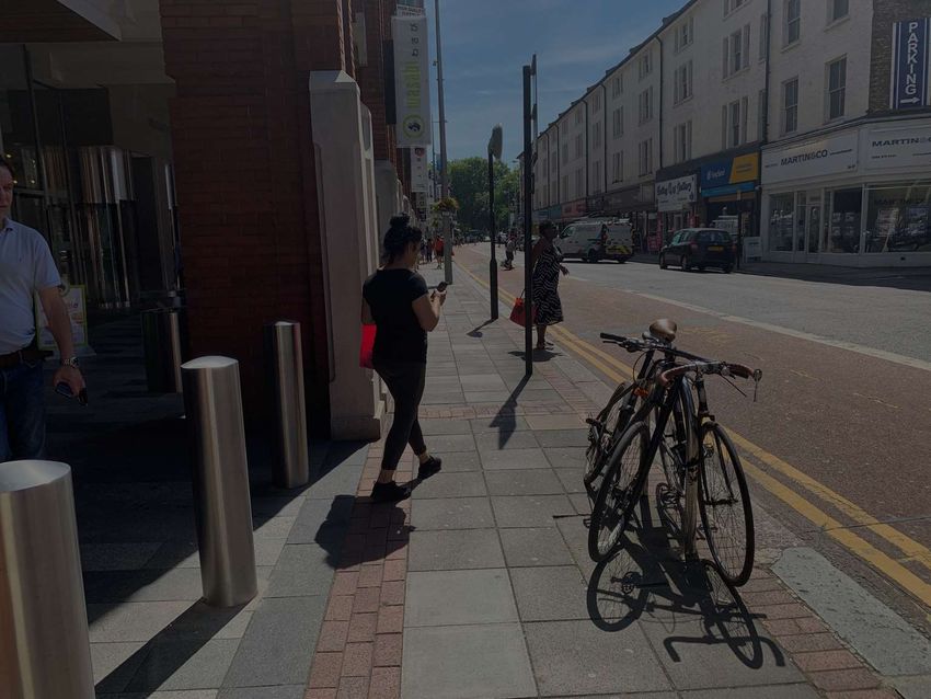
STRATEGIC SITE PLAN                                                                                                                    1

 The maps below show the area covered by Ealing Town Centre Liveable
 Neighbourhoods proposal.                                                       EALING TOWN CENTRE, ACTIVE TRAVEL CATCHMENT AREA AND
                                                                                SURROUNDING NEIGHBOURHOODS
 EALING TOWN CENTRE BOUNDARY

 The boundaries for Ealing Town Centre and the zone of further influence were
 established based on discussions with technical stakeholders.
EXISTING AND FUTURE DEVELOPMENTS 2
The plan below shows development sites located within the Ealing town centre: identified, at the consultation stage and
under construction. Additional information includes site area, current use, allocated use and indicative delivery times.
9.Craven House, Bilton
House and land rear of 10.Perceval House
Cavalier House
Area: 0.49ha
The Local Plan is currently under revision and several updates are expected. 1.Ealing Broadway
Current use: Surface level Crossrail Station
Area: 1.03ha car park for Perceval
Current use: Offices with Area: 1.64ha
House
residential and ex-servicemen Current use: Transport hub,
Allocation: Residential,
club small retail, office, fitness
office, retail and civic
Allocation: Office-led club and squash courts
centre
redevelopment with ancillary Allocation: Mixed-use
Indicative delivery: 2016-
commercial, small residential development, station
2021
and/or community improvements
Indicative delivery: 2021-2026 Indicative delivery: 2011-
2021
(obtained planning
Madeley Road permission)
The Broadway
8.93-113 Uxbridge
2.Eastern Gateway
Road
Area: 0.83ha
1 51-53 The Mall W5
Current use: Offices, Area: 0.20ha
education Current use: Retail, pub
Allocation: Office-led
redevelopment with
3 and offices
Allocation: Mixed-use
development including
ancillary commercial and
limited 2 replacement office
Indicative delivery:
education/community
Indicative delivery: 2021- 10 2021-2026
2025
9 4
5 3.Arcadia
7.49-69 Uxbridge
Road
7 6 9-42 The Broadway
Area: 1.78ha
Area: 0.86ha
Current use: Offices, police
station
8 Current use: Retail,
commercial, service –level
car park
Allocation: Office-led
Allocation: Mixed-use
redevelopment with
development, additional
ancillary commercial and
retail, commercial, leisure
cultural
and residential
Indicative delivery: 2021-
Indicative delivery: 2021-
2025
2025
4.Ealing Broadway
6.Cinema 5.Sandringham Mews
Area: 0.88ha Shopping Centre
Area: 0.63ha Area: 3.58ha
Current use: Cleared site Current use: Retail,
with offices, restaurant, Current use: Retail,
restaurants/cafes, public commercial, offices,
community and car park Development sites identified in Development Plan Document (2013) house and surface level
Allocation: Currently under public library and car park
car park Allocation: Mixed-use
construction for cinema, Development sites identified in Development Plan Document (2013) currently under construction
Allocation: Mixed-use development, additional
retail, commercial and Development sites identified in Development Plan Document (2013) at consultation stage development with retail
residential retail, commercial, leisure,
and cultural residential and community
Indicative delivery: 2021 Potential development sites (Ealing Council, 2019) Indicative delivery: 2021- Indicative delivery: 2021-
2025 2025
Appendix C
Existing Context
HISTORICAL EALING                                                                                                                                                        3

 In 19th century, Ealing Town Centre was concentrated along The Broadway and High Street and extended from Haven Green to Ealing Green. Bond Street did not yet exist.

 Middlesex XV                                                                     Surrey I
 Surveyed: 1864 to 1865                                                           Surveyed: 1867
 Published: 1868                                                                  Published: 1871
EALING TOWN CENTRE AS A DESTINATION                                                                                                                                                4

 Past Ealing (source: @eyes_of_ealing)   Historical photographs of Ealing town centre show its original character and ambience though with significantly lower traffic flows and the
                                         presence of trams
EALING TOWN CENTRE AS A DESTINATION                                                     5

   Listed buildings (Steer, 2018)
                                                                 Ealing town centre
                                                                 has a rich cultural
   Ealing town centre has multiple Grade 1 and Grade 2           offer (Questors
   Listed Buildings. Of particular significance are Pitzhanger   Theatre on Mattock
   Manor and Gallery. There is a high concentration of           Lane)
   Grade 2 buildings in Ealing Village and along the
   Broadway, Mattock Lane and Haven Green.

                                                                 Green spaces are
                                                                 one of areas key
                                                                 assets (Walpole
                                                                 Park)

   Competition (Steer, 2018)
                                                                 Due to connectivity
                                                                 issues, the new
                                                                 public space at
                                                                 Dickens Yard fails
                                                                 to attract
                                                                 substantial footfall

                                                                 Public space in
                                                                 Ealing Broadway
                                                                 shopping centre is
                                                                 popular with local
   Ealing town centre is competing with                          people.
   surrounding Metropolitan Centres (Uxbridge,
   Harrow, Hounslow and Kingston upon Thames)
   and shopping destinations (Brent Cross and
   Westfield). They are all within driveable
   distance.
BUSINESSES                                                                                                                                      6

 Ealing Metropolitan Centre Policy Allocations
                                                                                                                           Public realm along
 This diagram extracted from Ealing Town Centre retail                                                                     Springbridge Road
 study (2017) shows primary and secondary shopping
 frontages.

                                                                                                                           Socio-
                                                                                                                           demographic
                                                                                                                           diversity is
                                                                                                                           reflected in
                                                                                                                           shopping offer

  Based on the high-level analysis using Google Maps, there are over 360 businesses within Ealing town centre (excluding
  Ealing Broadway shopping centre and the Arcadia centre). Table and diagram below show their breakdown by category.

           Businesses in Ealing TC                                                                                         Market stalls by
  Food and drink                114                                                                                        Broadway /
                                                                                                                           Springbridge Road
  Food retail                   12
                                                                                                                           junction are
  Non-food retail               69                                                                                         popular but also
  Health and beauty             40                                                                                         impede on
                                                                                                                           pedestrian
  Fitness                        8
                                                                                                                           movement
  Professional services         60
  Sui generis                    5
  Hotel                          5
  Travel                          8
  Estate agents                  17
                                                                                                                           The Broadway
  Nursery                         1                                                                                        opposite Ealing
  Education                       8                                                                                        Broadway station
  Post Office                     2
  Non-profit                      4
  Taxi                            1
  Other                          15
  Total                          369
BUSINESSES 7
This diagram shows the type of businesses by specific location within the Ealing town centre. Its provides a basis for reviewing existing loading and servicing restrictions facilities.
Types of businesses
Madeley Road
The Broadway
1
2
3
4
8
7 5
6
9
17
10
15 16
11 18
14
12
Areas with
13 19 22 higher business
Shopping
centre
concentration
20 Food and drink Taxi
Non-food retail Education
21 Food retail Hotel
Professional
services Nursery
Health and Travel
beauty
Estate agents Sui generis
Charity/non-
profit Post office
Fitness OtherPUBLIC REALM AND ENVIRONMENT 8
Green and public spaces in Ealing town centre
Public space in the
Madeley Road Green and public spaces are Ealing town courtyard of Ealing
Haven Broadway shopping
Green spaces centre’s main asset. Within the walkable
Green centre
distance there are three beautiful parks and
Public spaces
two public spaces with places to sit and rest
and rich activity/event offer.
Ealing Newly re-
developed Dickens
Common Yard
Ealing
Green
Walpole Park
Green spaces in Ealing borough
Pedestrianised
space on Oak Road
Walpole Park with
the view on
Pitzhanger ManorPEOPLE 9
The City Planner tool was used to extract socio-demographic data for specific area of interest. For the purpose of establishing theCOMMUNITY AND
baseline for Living STAKEHOLDER
ENGAGEMENT
Neighbourhoods proposal relevant statistics were extracted for Ealing town centre and surrounding neighbourhoods. Of particular relevance are the following:
• Population growth (52% and 25% for Ealing town centre and ETC and surrounding neighbourhoods respectively) and employment growth (35% and 31%).
• Over 20% of all households have 1 or more people with long-term disability
• 65% of households report one or more cars or vans
DEMOGRAPHICS
Ealing TC+ Area of
Ealing TC Impact
Population 2011 25,497 88,177
Population and Employment 18,311 40,348
Employment Population Growth (2011-2041) 52% 25%
Employment Growth (2011-2041) 35% 31%
0 to 15 15% 18%
16 to 24 9% 10%
25 to 34 26% 22%
Age
35 to 49 24% 24%
50 to 64 14% 15%
65 and over 11% 12%
Male 50% 50%
Gender
Female 50% 50%
No long-term disability 80% 76%
Disability 1 person with long-term disability 17% 20%
2 or more people with long-term disability 3% 4%
Mainly work from home 12% 11%
Public Transport 55% 50%
Travel to Work
Driving van or car 21% 26%
Other methods 13% 13%
Higher Managerial, Admin or Professional 22% 18%
Lower Managerial, Admin or Professional 30% 27%
Intermediate occupations 11% 11%
Small Employers and Account Workers 9% 10%
Occupation Lower Supervisory and Technical Occupations 4% 4%
Semi-Routine Occupations 6% 8%
Routine Occupations 4% 6%
Unemployed 6% 7%
Full-time students 8% 9%
Zero cars or vans in household Urban41% mobility, educational
35%
Car availability
One or more cars or vans advantage,
59% city living 65% and
IMD Rank 1008 - 4484
students and graduates 79-4615in
Income Rank 1163 - 4474 11 - 4691
Ealing TC
Employment Rank 858 - 4661 39 - 4661
Education, Skills and Training Rank 3298 - 4767 582 - 4774
IMD
Health Deprivation and Disability Rank 576 - 3791 182 - 4293
Crime Score 282 - 4594 232 - 4594
Barriers to Housing and Services Rank 1927 - 4077 2 - 4451
Living Environment Rank 152 - 3776 152 - 3903
Ealing town centre Ealing town centre and surrounding neighbourhoods
Maps on the left identify the
areas highlighted to extract
the data from City Planner
Tool.PEOPLE 10
Transport Classification of Londoners: segment summary (Transport for London) COMMUNITY AND STAKEHOLDER
ENGAGEMENT
Transport Classification of Londoners
Urban mobility, educational
advantage, city living and
students and graduates in Ealing
town centre
High proportion of ‘detached retirement’ in
surrounding neighbourhoodsPUBLIC HEALTH AND WELL-BEING 11
2018 Ealing residents’ survey
In Ealing, 24% of journeys less
than 2 miles are made by car.
A journey distance of 2 miles
takes approximately 15min by
cycle.
In Ealing, main barriers to cycling are:
In Ealing, 31% of respondents 1. ‘I don’t have a bike’ (50%)
take a walk lasting at least 10 2. ‘I am too busy’ (18%)
minutes, 7 days a week. 3. ‘I don’t feel safe’ (13%)
Walking has to be brisk to
maximise health benefits.
Weekly exercise
recommendation is 150 min.
In Ealing, 19% of respondents
take a cycle ride 7 days a
week.
In Ealing, main barriers to walking are:
1. ‘None of these, I do this regularly’ (45%)
2. ‘None of these, I don’t want to do this more’ (19%)
3. ‘I am too busy’ (18%)PUBLIC HEALTH AND WELL-BEING 12
HRBS 2017 for Ealing’s primary schools (borough-wide)
Latest 3 years of NCMP data analysed by the pupils’
home wards.
A health related behaviour survey was conducted in Ealing’s primary schools in 2017. Whilst over 80% of pupils
responded that they can ride a bicycle and also own a bicycle, only 9% cycle to schools most days or every Over 20% of reception and almost 40% of Year 6 pupils in Ealing are
day. classified as overweight and very overweight.
% of overweight & very
Ward overweight pupils
Reception Year 6
Ealing Broadway 15.9% 32.7%
Cleveland 22.1% 32.6%
Hanger Hill 17.0% 32.6%
Ealing Common 19.7% 35.2%
Walpole 17.5% 25.2%
Ealing average 21.0% 38.1%
Source: National Child Measurement Programme (NCMP), 3-
years pooled data, 2015/16 - 2017/18LIVEABLE NEIGHBOURHOOD PROPOSAL: CONTEXT
SCHOOLS 13
This map shows the spatial distribution in Ealing
town centre and surrounding neighbourhoods
North Ealing Primary School and the number of students at each school.
St Gregory’s Catholic
697 Primary School
619 St Augustine’s
682 Priory
Montpelier Primary 468
Notting Hill and
School
Ealing High School
902
St Benedict’s
School 1104
Harvington
Prep The Ellen Wilkinson
Avenue House School Durston House School
School
School 109
122 407 1400
Christ the Saviour
La Chouette
Church of England
Primary School 784
School39
Ealing Independent
College
Insights Independent 110 Clifton Lodge School
School60 School 141
Ealing Green College
Ealing town centre/
Metropolitan Town Centre
123 Number of students (Schools ATLAS)
Grange Primary
School
800SCHOOLS 14
In 2017/18 56% of secondary pupils lived up to 1 mile from their
school and 57% travelled actively to school. 85% of primary
pupils lived up to 1 mile distant but only 69% travelled actively to
school.
The proportion of car journeys (totalling 23%, down from 25% in
2016/17) was higher than the number of pupils living over 1 mile
from school, suggesting that a number of these car journeys are
short distance and therefore walkable or cyclable.SCHOOLS 15
STARS – Sustainable Travel: Active, Responsible, Safe (Transport for London)
STARS is TfL's accreditation scheme for London schools and nurseries. STARS inspires young Londoners to travel to
school sustainably, actively, responsibly and safely by championing walking, scooting and cycling. STARS supports
pupils' wellbeing, helps to reduce congestion at the school gates and improve road safety and air quality.
STARS Schools
There are very few STARS schools in
Ealing town centre and surrounding
neighbourhoodsAppendix D Existing Situation
AIR AND NOISE POLLUTION                                                                                                                                             16

 Air Quality: LAEI focus areas 2013 (TfL Playbook)                                                                     COMMUNITY AND STAKEHOLDER
                                                                                                                       ENGAGEMENT

                                                     Uxbridge Road/ New Broadway/The Broadway/The Mall
                                                     corridor is a part of London Atmospherics Emissions
                                                     Inventory (LAEI 2013) focus areas and Low Emission Bus
                                                     Zones.                                                    Green spaces in Ealing Town Centre provide alternative
                                                                                                               routes where air and noise pollution levels are lower.

 Noise pollution across Ealing (Defra)

                                                                              Noise pollution is problematic
                                                                              along Uxbridge Road/ New
                                                                              Broadway/The Broadway/The
                                                                              Mall corridor. High levels of
                                                                              noise are also recorded
                                                                              around Ealing Common.
AIR AND NOISE POLLUTION 17
NO2 pollution (LondonAir, 2016) NO2 pollution (LondonAir, 2016) O3 (ozone) pollution (LondonAir, 2016) PM10 pollution (LondonAir, 2016)
Ozone levels are lower along urban polluted PM10 pollution levels recorded pass
areas (key movement corridors in Ealing annual mean objective, with higher
Based on the annual data from 2016, all key movement corridoes within Ealing town concentrations recorded along the
town centre) and higher in surrounding
centre fail annual mean objective for NO2 emissions. Uxbridge Road corridor is especially railway line, Uxbridge Road corridor
parks (Lammas Park and Pitshanger Park).
problematic reaching the highest levels on the scale. The Broadway and Madeley Road and Madeley Road.
This is because ozone disappears when it
also raise concern. High levels of NO2 are also detected along the railway line.
reacts with other pollutants, such as nitric
oxide (NO).
No exposure threshold has been identified
below which no ones health is affected by
ozone exposure. This is because different
individuals respond differently to ozone
exposure.WALKING 18
The majority of trips within Ealing town centre (including from Ealing town centre is identified as highly walkable. Indicative
surrounding neighbourhoods) are within a 10 minute walk walkability decreases in surrounding neighbourhoods to the
Broadway /
north of town centre Springbridge Road
junction/ staggered
10min walking isochrone Walkability crossing
Lack of crossing
points (High Street)
Existing pedestrian densities are highest by the Ealing There is a high number of car-only switchable trips within
Broadway station and around the Broadway Ealing town centre and surrounding neighbourhoods. Isolated and
inaccessible
Pedestrian density Car-only walking potential density pedestrian link
(Haven Place)
Poor wayfinding
outside Ealing
Broadway StationWALKING 19
Ealing town centre has the highest number of potentially walkable trips among London’s Metropolitan Town Centres.
Potentially walkable trips in London town centres (Analysis of Walking Potential, 2017)
Uxbridge
Shepherds
Bush
Kingston
upon
Thames
Bromley
Metropolitan
town centresACCESSIBILITY 20
Poor surfacing quality (including pot-holes) along The Mall
Bus stop H is not accessible can be challenging for wheelchair users Physical barriers to
accessibility by The
Broadway
Environment can be
challenging for
people with visual
impairments
Poor wayfinding by Ealing Broadway station can make it
Short crossing times and insufficient space at the refuges
particularly hard for people with learning disabilities to find
at Broadway / Springbridge Road staggered crossings
their way around Ealing town centre
can make it difficult and unsafe to cross
Mobility scooter
user (The Grove)
Ealing Broadway station does not have step-free access
Tactile paving surface and dropped kerb on residential
streets (Eaton Rise)
Wheelchair user with
companion in
Walpole ParkCYCLING 21
The table below shows the total number of cycles recorded along the key movement corridors within Ealing Town Cycle theft
Centre for morning, lunchtime and evening peaks and all day total between 7am-7pm. The busiest links are
highlighted in green. Uxbridge /The Mall/ The Broadway corridor is the busiest route: with a high number of cyclists
travelling eastbound in the morning peak and westbound in the evening peak.
Key movement corridors in Ealing Town Centre Lack of cycle storage
New New The
The
Spring The Broadway Broadway Broadway Broadway Uxbridge Uxbridge
Bond High Broadway
Bridge (by M&S) (by Dickens (by Dickens (by Ealing Road Road
Street Street (by M&S)
Road eastbound
westbound
Yard) Yard) Broadway eastbound westbound Cycling on footways Fragmented cycle network
eastbound westbound Station)
170 84 218 380 479 355 367 208 506 419
7am-7pm
3% 2% 4% 9% 5% 6% 7% 3% 7% 7%
34 8 37 96 67 76 50 38 111 63
8am-9am
7% 1% 6% 17% 6% 10% 8% 4% 10% 9%
6 6 4 17 19 18 25 10 18 12
12am-1pm
1% 1% 1% 4% 2% 3% 4% 1% 3% 2%
33 21 35 52 100 45 82 20 52 87
5pm-6pm
4% 4% 5% 10% 9% 7% 11% 3% 7% 11%
Total number of cyclists recorded
% of modal share on that movement corridor
All of the trips to and from Ealing town centre originating
Comprehensive annual journey surveys show that cycling
in the surrounding neighbourhoods (identified wider area
in Ealing is growing. Figures show a 1.4% increase in cycle-
of impact) are within a 10min cycle.
mode share from 1% (2005 to 2008) to 2.4% (2013/14 to
10min cycling isochrone 2015/16). This represents 8,119 trips per day and this is
illustrated in graph 4.1. The increased popularity of cycling
post-2012 has been ascribed in part to the ‘Olympic Cyclists dismounting due to poor
effect’. However, this enthusiasm has not been sustained connectivity and road hazard concerns
in Ealing (Ealing Council Cycle Plan, 2019-2022).
No cycle facilities by traffic-dominated Madeley Road/The
Broadway roundaboutCYCLING 22
Cycle tracks
Cycle lane provision is very
fragmented in Ealing town centre
and surrounding neighbourhoods.
There is substantial cycle parking provision within
Cycle parking
Ealing town centre. However, based on
community engagement findings and site visits,
some of the key destinations are still
lacking/cycle parking is located inconveniently
(for example Ealing Broadway shopping centre).
Cycle parking along The Broadway is well used during the dayPUBLIC TRANSPORT ACCESSIBILITY 23
The map on the right shows Public Transport Accessibility Level (PTAL) scores for Ealing
Town Centre and surrounding areas. The PTAL ratings show whether the area is poorly
connected to public transport services (0), or very well connected (6b). Ealing Town
Centre scored 6a-6b (best) with accessibility decreasing appreciably outward from the
to the north and south, between 1b – 2 (poor). No change is anticipated for those areas
by 2031.
The diagram below summarises the Public Transport Accessibility Index data extracted Poor PTAL (1-2) north of town
centre
from TfL’s City Planner Toolkit. A slight increase (improvement) is forecasted between PTAI
baseline (2015) scores and 2041.
Ealing town centre and zone of further influence scores are above the London average
for PTAI: this applies to all public transport accessibility (for 2015 and 2041) and buses and
rail specifically.
Poor PTAL (1-2) south of town
centre
• 2015 PTAI ranges from 0-155. Average 2041 PTAI in London is 8.7
• 2041 PTAI ranges from 0-188. Average 2041 PTAI in London is 10.2
• 2015 Bus PTAI ranges from 0-52. Average 2015 Bus PTAI in London is 5.5
• 2015 Rail PTAI ranges from 0-75. Average 2015 Rail PTAI in London is 1.6BUSES 24
Bus walls on The
Broadway
The map below shows all bus routes within Ealing town centre and surrounding neighbourhoods.
Bus routes (source: TfL Playbook)
Bus stands on
Haven Green
Bus stop on High
Street
Bus walls on New
BroadwayBUSES 25 The map below shows the distribution of bus-stops within Ealing town centre and surrounding neighbourhoods. The majority of bus stops are concentrated along Uxbridge Road corridor and The Broadway: these cater for local trips but Bus stop by Ealing Common also as an interchange for longer journeys. Bus stops (TfL Bus Journey Planner)
RAIL                                                                                                                                                                        26

 Ealing Broadway station is managed by TfL Rail and has nine platforms. It offers Central and District underground lines                   COMMUNITY AND STAKEHOLDER
 and is located in fare zone 3.                                                                                                            ENGAGEMENT
 Overground railway connections from Ealing Broadway serve Heathrow Airport and Paddington, some of the west
 London suburbs and stations further afield in the Home Counties, enabling rapid access to Reading and Oxford and to
 further destinations such as Bath, Bristol and South Wales (Steer, 2018).

 As shown in the diagrams below the number of London Underground entries and exits reached approximately 16.5-
 18.5 million in the past years. For National Rail it reached a total of 5-6.5 million. These numbers are expected to
 increase significantly in the future due to Crossrail development and population and employment growth in the area.

                                                 London Underground annual entry and exit
                                                           (Ealing Broadway)
                                19
                                                                                      18.6
                            18.5

                                                                                                                           Existing rail connections
                                18
                                                                                                                           operating Ealing Broadway
                                                         17.38                                                             station
                            17.5
              (million)

                                17                                      16.84                    16.79
                                         16.64

                            16.5

                                16

                            15.5
                                         2013             2014          2015          2016       2017

                                                 National Rail Network annual entry and exit
                                                              (Ealing Broadway)
                            7
                                                                                     6.581
                                                                                                 6.373                                           Elizabeth line extension

                            6                                          5.818

                                       5.334            5.286
                (million)

                            5

                            4

                            3
                                     2012-2013        2013-2014      2014-2015     2015-2016   2016-2017
CRIME AND PERSONAL SECURITY 27
Crime statistics identify two hot-spots: Isolated spaces in Ealing town centre
Crime types in Ealing town centre between
August 2018 and July 2019 • the area surrounding Ealing Broadway
station including Haven Green, and
• the pedestrian routes to the rear of the
Ealing Broadway Shopping Centre.
Anti-social behaviour, drug-related crimes and
issues associated with increasing levels of
homelessness and rough sleeping are
predominant in these locations. Violence and
sexual offences and theft are also a common
Crime levels in Ealing town centre between
August 2018 and July 2019 problem.
The diagram showing crime levels in Ealing
town centre between August 2018 and July
2019 shows that there is little seasonal change:
the number of reported incidents remains
relatively constant, with the highest number
(over 300) reported in March 2019.
Indices of Deprivation, Crime, 2019
All crime reported in July 2019 within All crime reported in July 2019 within
highlighted area highlighted area
Crime hot-spotsCRIME AND PERSONAL SECURITY 28
Crime hot-spots and isolated spaces after dark
The diagram below shows identified isolated spaces in Ealing town centre. A site audit was conducted after dark to gain a better understanding of pedestrian and cyclist
experience and fear of crime in these locations.
Madeley RoadCRIME AND PERSONAL SECURITY 29
Street lights in Ealing town centre
The map below shows the location of streets lights in Ealing Town Centre. Despite good lighting provision, some spaces (Haven Green, The Common) attract crime or feel intimidating.
Additionally, spaces with insufficient street lighting are highlighted, I.e., to the rear of Ealing Broadway shopping Centre, part of Haven Place, and Sandringham Mews.
Lamp column Solar bollard Traffic sign Locations with limited/no street lightingROAD SAFETY 30
2016 Maps available from TfL’s Bikedata Tool were extracted for years 2016 and
2017. They show collisions, where casualties were either cyclists or a
pedestrians. The data is from DfT/police STATS19. Pink stars represent slight,
purple serious and red fatal collision severity.
The analysis of spatial distribution of collisions identified the following areas of
particular road safety-related concerns:
• New Broadway/The Broadway/The Mall/Uxbridge Road
• High Street
• The Broadway by Ealing Broadway station
• A406
2017 2017
Ealing town centre has been identified as Killed/Seriously injured road
an area with poorest cycling and walking causalities continue to
safety record. remain above the LIP target.
Uxbridge Road corridor is among the most hazardous routes for
cyclists and pedestriansROAD SAFETY 31
*
• There is a slight mismatch between the total number of accidents quoted in the ‘Road Danger Reduction Statement’ and on the map. This is due to software issue which miscount the total
accidents (by plus/minus one accident). The number quoted in the statement is correct.ROAD SAFETY 32
*
* There is a slight mismatch between the total number of accidents quoted in the ‘Road Danger Reduction Statement’ and on the map. This is due to software issue which miscount the total
accidents (by plus/minus one accident). The number quoted in the statement is correct.VEHICLE DOMINATION 33
Bottleneck by
The maps below show typical traffic in Ealing town centre on typical weekday (Tuesday) during evening peak and on Saturday in the early M&S junction
afternoon. Red lines indicate the locations where traffic moves slowest.
Congestion by
Ealing Broadway
station
Based on site visits, analysis of traffic survey data and road allocation (including on-street parking provision, number of lanes) areas of vehicle
domination within Ealing town centre were identified.
Private cars
Areas dominated of vehicle domination queuing along
Bond Street
Madeley Road
Restaurants’ and cafes’
outdoor seating is
affected by noise and
air pollution caused by
nearby trafficVEHICLE DOMINATION 34
The diagrams below show traffic counts along the key movement corridors in Ealing town centre during morning peak (8-9am), interpeak (12-1pm), evening peak (5-6pm) and all day total
(7am-7pm). The data was collected on Tuesday 15th July 2014. All key streets remain busy throughout the day, with only slight differences in traffic volumes between different times of the
day.
Morning peak (8am-9am) Inter peak (12pm-1pm)
Evening peak (5pm-6pm) All day (7am-7pm)
6949FREIGHT 35
Servicing yard on top of the Arcadia centre Through freight movement affects the ambience of
DHL LGV on High
Ealing town centre
Street
Supply delivery to a
shop on Madeley
Road
Freight fleet on key movement corridors often draws UPS delivery vehicle stopping along The Broadway
attention away from local heritage and architecture
HGV on Madeley
Road
Same UPS delivery vehicle spotted earlier stopping by High proportion of Heavy Goods Vehicles along
Ealing Broadway station the Uxbridge Road corridor impacts negatively on
perceptions of road safety among cyclists and
pedestrians
Servicing and
deliveries in Dickens
YardFREIGHT 36
Based on the modelled freight flow
(AM 2012) map, at the moment
majority of freight movement
happens along A40 and M4.
Uxbridge Road corridor within
Ealing town centre towards Acton
also indicates high modelled
freight flow.
Based on TfL’s modelling it is
expected that the freight flow
change within Ealing Town Centre
and surrounding neighbourhoods
will reach more than 80% increase
north of Ealing Broadway and
between 40-80% increase along
the majority of Uxbridge Road
corridor.OFF-STREET PARKING 37
Spring Bridge car
park
There are 8 public car parks in Ealing Town Centre, which provide a total of over 1900 parking spaces. The map below
shows their location, including access points and indication of one-way/two-way traffic management.
Other information includes number of spaces, opening hours and operator.
Springbridge
multi-storey car park Station car park
Mon-Sun 7am-6pm Mon-Sat 7am-7pm
465 spaces, 65 spaces
8 disabled bays
9 motorcycle bays Sandringham Mews
9 parent and child car park
bays
Council operated Morrisons customer car
park
Mon-Sat 7am-10pm
Sun 11am-5pm
For customers only,
max stay 1.5hr
Dicken’s Yard car park
Mon-Sun 24hr Madeley Road
Perceval House car 510 spaces,
park 26 disabled bays
Staff Mon-Fri till 6pm 4 electric charging
Public after 6pm and points
Sat-Sun 8am-6pm
Private car park 85 spaces
6 disabled bays
Council operated Station car park
Private car park
Permit holders only
Arden Road car park EB Shopping Centre car
Mon-Sun 8am-6pm park
Or 24hr annual permit
Sandringham Mews car
Mon-Sun 6am-12am Access to EB
27 spaces 600 spaces on weekdays
park 800 spaces on weekend
shopping centre car
2 disabled bays
3 motorcycle bays 24hr park from Windsor
Council operated Road
Car park access Vehicle movementCONTROLLED PARKING ZONES 38
On-street parking on Bond Street impacts negatively on its
The map below (Ealing Council) shows controlled parking zones within and in the vicinity of Ealing tow centre.
ambience
On-street parking on High Street
On-street parking on residential streetAppendix E High Level Healthy Streets Assessment
HIGH-LEVEL HEALTHY STREETS ASSESSMENT                                                                                                                                     39

                                             The Broadway (Ealing Broadway Station)                     The section of the Broadway in front of Ealing Broadway station

                                             •   Vehicle domination and speeding vehicles along
                                                 Ealing Broadway, secluded nature of several
                                                 pedestrian links and multiple isolated spaces impact
                                                 on perception of safety
                                             •   Haven Place is not wheelchair accessible and
                                                 presents challenges to pedestrians with other
                                                 mobility impairments.

       Existing Healthy Streets Assessment

                                             Haven Green
                                                                                                        Route across Haven Green

                                             •   Haven Green has multiple pedestrian routes, which
                                                 are popular among pedestrians and pass through a
                                                 local ‘haven’, quiet environment with a relaxing
                                                 atmosphere
                                             •   Due to the presence of large green space air is
                                                 cleaner
                                             •   The key safety concerns arise after dark, when the
                                                 space becomes a local crime hot-spot, with higher
                                                 levels of anti-social behaviour related activity.

       Existing Healthy Streets Assessment
HIGH-LEVEL HEALTHY STREETS ASSESSMENT 40
The Broadway Northern Section Footway along the northern section of the Broadway
• There is poor provision of places to stop and rest
along the corridor
• Vehicle domination along the corridor impacts on
pedestrian and cyclist comfort, noise levels and air
quality
• Despite attracting a diversity of pedestrians visiting
local shops and passing through (as it is the key
route from and to Ealing Broadway station), this link
scored poorly for ‘easy to cross’ and ‘shade and
shelter’
• Cycling levels are high, especially during the
morning peak hours, yet a significant number of
people are deterred from cycling due to the road
safety concerns
• Overcrowding by the Bus stop H (in front of
Existing Healthy Streets Assessment Sainsbury’s) impacts on the effective width and
creates a pedestrian pinch-point
• Footways are not sufficient in width for the volume
of pedestrian movement.
The Broadway Southern section Footway along the southern section of the Broadway
• Conditions along southern footway of The
Broadway are similar to the northern section
• There is poor crossing provision, which severs
movement within the core of the town centre.
There are also limited places to rest in vicinity
• Vehicle domination along the corridor has
significant negative effect on pedestrian and cyclist
comfort, noise levels and air quality, as well as road
safety.
Existing Healthy Streets AssessmentHIGH-LEVEL HEALTHY STREETS ASSESSMENT 41
The Mall The northern section of the Mall
• Public realm around The Mall is impacted by
significant street clutter which impedes pedestrian
movement.
• Trees along the footway provide shade, but there
are limited numbers of places to stop, rest or
shelter
• The Mall scores poorly for air quality and noise
pollution, due to high traffic volumes in this
location.
Existing Healthy Streets Assessment
Uxbridge Road
Segregated shared-use path along Uxbridge Road
• Uxbridge Road has poor crossing provision. There
are also limited places to rest
• Uxbridge Road feels safe (personal security)
although there is limited natural surveillance,
compared to other parts of the town centre. As
the distance to Ealing Common decreases, fear of
crime increases
• Uxbridge Road scores poorly for air quality and
noise pollution, due to the high volume of traffic.
Existing Healthy Streets AssessmentHIGH-LEVEL HEALTHY STREETS ASSESSMENT 42
New Broadway Way-finding sign located on the New Broadway
• New Broadway (north and south), score well for
pedestrian inclusivity and experience. The footways are
generally wide and recently improved public realm is of
high quality
• There are multiple accessible bus stops, which
encourage people to use buses for local trips and as a
part of a longer multi-modal journey
• There is good provision of places to rest and stop
• High volumes of traffic along New Broadway impact on
air pollution and noise ratings. The severance cause by
the wide carriageway makes it challenging to cross
between north and south sections of the street
• New Broadway outperforms all other town centre
locations within the assessed area for pedestrian
inclusivity, local attractors and levels of sustainable and
Existing Healthy Streets Assessment public transport travel.
Spring Bridge Road
Narrow footways along Spring Bridge Road
• The footways along Springbridge Road are narrow and
poorly maintained, making them inaccessible for
pedestrians, especially more vulnerable users
• There are no places to rest and stop and while there are
some places to visit and see, the public realm does not
complement the frontages
• Due to the dominance of one-way traffic and vehicle
idling related to car-park access points, the air quality is
poor and noise pollution is high
• There is no crossing provision, making this road
challenging for pedestrians to access Haven Green
• There is a high concentration of access points to car-parks
(four in total), where drivers rarely choose to give way to
pedestrians.
Existing Healthy Streets AssessmentHIGH-LEVEL HEALTHY STREETS ASSESSMENT 43
Bond Street Footway along the Bond Street
• Street clutter (including A-boards) reduce the effective
width of footways
• The footways were widened recently, making them more
pedestrian friendly: however, the carriageway is now
more hazardous for cyclists
• There is poor crossing provision with severance caused
by the carriageway and on-street parking: however, at
the time of the audit desire lines were impacted by on-
going construction on the eastern side of the street.
Existing Healthy Streets Assessment
High Street
Bollards and cycle parking impedes on the effective width of the
• The character of the street changes closer to Haven footway along the High Street
Green
• Air and noise pollution is negatively affected by the
motor vehicles, especially caused by queueing during
peak hours related to the access to Ealing Broadway
shopping centre car park (The Grove junction)
• There is poor crossing provision with severance caused
by carriageway and on-street parking on the western
side of the street.
Existing Healthy Streets AssessmentHIGH-LEVEL HEALTHY STREETS ASSESSMENT 44
Mattock Lane On-street parking along Mattock Lane dominates the streetscape
• Currently, the streetscape is dominated by on-street
parking
• Despite the vicinity of Walpole Park, Mattock Lane can
feel isolated and intimidating, especially after dark.
Existing Healthy Streets Assessment
The Grove
Restricted access to the eastern section of The Grove
• The Grove is a residential street, but a key link to access
Ealing Broadway shopping centre car park through
Windsor Road
• The motorway-scale ramp vehicle entry and exit to the
Ealing Broadway shopping centre car park makes the
street very difficult to cross when using the northern
footway
• East-west access is restricted (gated, only emergency
access allowed) impacting positively on cyclist and
pedestrian comfort.
Existing Healthy Streets AssessmentHIGH-LEVEL HEALTHY STREETS ASSESSMENT 45
Gordon Road Lack of speed reduction measures along Gordon Road attracts
rat-running
• On-going rat-running impacts on pedestrians’ comfort
and perception of safety among the cyclists, deterring
them from using it as a potential quieter route
• There are four designated crossing islands along the
entire length of the street, which provide safer crossing
options as well as act as speed reduction measure
• Footways at the east end are often over capacity,
leading to pedestrians walking on the carriageway,
which impacts on their safety
• Extreme camber of footway at multiple crossovers poses
a challenge for pedestrians with impairments
• While trees provide shade, there is a limited shelter and
very few places to stop and rest.
Existing Healthy Streets Assessment
Carlton Road
On-street parking along Carlton Road dominates the streetscape
• On-street parking and narrow effective widths impact on
pedestrian and cyclist comfort
• The street is primarily residential
• There is very limited crossing provision
• While trees provide shade, there is a limited shelter and
very few places to stop and rest.
Existing Healthy Streets AssessmentAppendix F Summary of Identified Issues
WALKING                                                                                                                                                                         46

PEDESTRIAN ENVIRONMENT RAG ASSESSMENT
                                                                                                                  Bike-share schemes are gaining popularity in Ealing town centre

                                  Good

                                  Average

                                  Poor
                                  Pedestrian-only

       The following key issues have been identified from site visits, data analysis, stakeholder and community
       engagement:

       •   Pedestrian routes to the rear of Ealing shopping centre and Haven Place link are underutilised
           largely due to personal security concerns
       •   Pedestrian comfort on some of the key links in the town centre is extremely poor
       •   Pedestrian provision along the residential roads is typically no better than adequate and often
           dominated by on-street parking.
       •   The Common feels isolated - pedestrian routes are not intuitive and can be challenging for more
           vulnerable users.
CYCLING 47
CYCLIST ENVIRONMENT RAG ASSESSMENT
Bike-share schemes are gaining popularity in Ealing town centre
Good
Average
Poor
The following key issues have been identified from site visits, data analysis, stakeholder and community engagement:
• The Uxbridge Road corridor, Spring Bridge Road are poor cyclist environments due to the volume of traffic flows
and lack of cycle provision, with concerns related to safety at junctions
• The westbound cycle lane on New Broadway is frequently obstructed by unloading vans and parked vehicles
• Gordon Street is a popular rat-run and speeding vehicles passing along it can often be intimidating for cyclistsEXISTING SITUATION: BUSES
BUSES 48
BUS PROVISION RAG ASSESSMENT
Bus stop on The Broadway, by Sainsbury’s, is often
congested due to the number of waiting passengers and
passing pedestrians creating an intense environment during
peak journey times
Good
Average
Poor
Not applicable
The following key issues have been identified from site visits, data analysis, stakeholder and community engagement:
• Queueing along the Broadway and Spring Bridge Road impacts on bus speed and service reliability
• The high volume of stopping and terminating buses by Ealing Broadway station results in ‘bus-walls’ which
contribute to congestion and impact on the quality of public realm.
• Bus stop H by Sainsbury’s (on The Broadway) acts primarily as a bus and station interchange. Groups of waiting
passengers have significant impact on the effective width of the footway and create a pinch-point impeding
pedestrian through movement.PUBLIC REALM AND ENVIRONMENT 49
PUBLIC REALM AND ENVIRONMENT RAG ASSESSMENT
Poor quality public realm along The Mall
Good
Average
Poor
The following key issues have been identified from site visits, data analysis, stakeholder and community
engagement:
• The pedestrian and street environment along Uxbridge Road corridor is poor in non-improved sections, primarily
due to volume of motor traffic, including goods vehicles, contributing to noise and air pollution. This contributes
to severance and divides town centre into segments.
• Poor wayfinding along the corridor means that visitors can miss-out on key attractors in the area, despite
walkable distance.
• The high number of buses and cycle parking facilities impacts adversely on the ambience and setting of Haven
Green.
• Ealing Common is regarded by some as a generally unsafe walking and cycling environment.
• The area to the rear of the Ealing Broadway shopping centre is isolated and attracts criminal activity.
• The area currently dedicated to car parks (e.g. Sandringham Mews) could serve community better.TRAFFIC MANAGEMENT 50
TRAFFIC MANAGEMENT AND ROAD SAFETY RAG ASSESSMENT
HGVs and LGVs along Bond Street impact on perception of
safety and its character.
Good
Average
Poor
The following key issues have been identified from site visits, data analysis, stakeholder and community engagement:
• Vehicle domination along Uxbridge Road corridor, and Mendeley Road results in higher collision risks and
impacts negatively on the perception of road safety
• Poor traffic management on Springbridge Road, The Grove, Florence Road and Windsor Road is associated
primarily with car park access arrangements. Queueing occurs especially during peak hours and on the
weekend.
• High Street and Bond Street have a high ‘place’ potential, yet due to unfavourable traffic management, they
act primarily as links for vehicle traffic
• Speeding along Gordon Road impacts adversely on road safety
• The junction of Uxbridge Road/The Common was recently redeveloped and provides a safer environment for
cyclists and pedestrians
• Filtered west-east access to The Grove makes it safer and stops through traffic/rat-running.PARKING AND DELIVERIES AND SERVICING 51
PARKING AND DELIVERIES AND SERVICING RAG ASSESSMENT
Ealing Broadway shopping centre car park access impacts on
streets and spaces due to existing access arrangements
Good
Average
Poor
The following key issues have been identified from site visits, data analysis, stakeholder and community
engagement:
• One way system and car park access arrangement impact on Springbridge Road, The Grove, Florence
Road and Windsor Road. Queueing occurs especially during peak hours and on the weekend.
• Not many visitors are aware of Dickens Yard underground car park and despite a convenient central
location it is underutilised.
• On-street parking dominates the streetscape along Mattock Lane, The Common and Carlton Road.EALING TOWN CENTRE SUMMARY OF OVERALL IDENTIFIED ISSUES 52
The diagram below aims to summarise using ‘red for poor’, ‘amber for average’ and ‘green for good’ the existing situation in The Main Identified Issues
Ealing town centre. This takes in to consideration the outcomes of data analysis, site visits, technical stakeholder discussions Vehicle Domination and Rat-Running
and community engagement. • Town centre streets and spaces prioritise strategic vehicular
movement over local sustainable access and movement
Existing ‘RAG’ situation
• Unfavourable traffic management and parking access
arrangements lead to a pressurised, confusing and tense
N environment for all road users but particularly for pedestrians
and cyclists
• There is a large volume of HGVs passing through the town
centre
• Rat-running and the school run in residential streets impacts
on pedestrian and cyclist road safety.
Poor Pedestrian and Cyclist Priority
• The walking and cycling experience within the core of Ealing
P
town centre is often intense and confusing particularly for
P vulnerable users
A406
• Junctions and crossings are often inadequate
P
• Footways are in disrepair, narrow and cluttered
• Cycle infrastructure is fragmented
• There is insufficient cycle parking for station and town centre
use
• Wayfinding and legibility is poor.
Bus Accessibility
• The existing town centre and station bus routes, stops and
stands do not provide the appropriate level of service now,
or in anticipation of the arrival of the Elizabeth Line (Crossrail)
Key Movements
Extremely at Ealing Broadway station.
poor Local movement Areas of intense conflict between different travel modes
Local + strategic movement P Main car parks Public Realm and Environment
West Ealing station • The public realm does not generally complement the town
Bus-only route
Ealing Broadway station centre’s character
Local + strategic + rat-running
Excellent • Noise and poor air pollution adversely affect people’s health
North Ealing station
and well-being throughout the town centre.
Bus-walls on The Broadway Strategic freight movement in the Poor crossing provision and vehicle Isolated spaces exacerbate fear of
town centre domination crime and create severanceEALING TOWN CENTRE WIDER AREA SUMMARY OF OVERALL IDENTIFIED ISSUES 53
This diagram below summarises the overall issues identified from data analysis, site visits, technical stakeholder and community discussions and engagement.
Existing Ealing Town Centre Wider Area Existing Situation Identified Issues Plan
Existing ‘RAG’ situation
The Main Identified Issues
Traffic Management and Parking
• Area wide rat-running to avoid congestion the A406, A40 and the Uxbridge Road
Corridor impacts road safety, air quality and the quality of the local environment
• There is a lack of car club and electric charging points in the neighbourhoods.
Pedestrians and Cyclists
• Footways are in disrepair and narrow in some locations impeding pedestrian access
• Wayfinding is poor for both pedestrians and cyclists
• Crossings and junctions prioritise traffic movement. There is a lack of dropped kerbs
and tactile paving
• There is limited cycle parking and storage provision on residential streets and near
attractors including schools, churches and other high streets.
Behaviour Change
• Schools located within the area are not a part of TfL’s STARS programme and other
educational/cycle training initiatives are limited
• The environment around schools is perceived as dangerous and discourages
parents and children from travelling actively.
Environment
• Some green spaces are underutilised due to poor wayfinding, connectivity and poor
quality crossings.
Schools Strategic movement mixes with local movements creating vehicle dominated streets and spaces
Environment around schools Severance caused by railway line
Strategic roads that do not provide adequately for pedestrians and cyclists
Green spaces
Residential streets with potential to become attractive cyclist and pedestrian linksAppendix G Strategic Case and Priorities for Change
STRATEGIC CASE: SETTING OUT PRIORITIES                                                                                                                                                54

 The flow diagram below demonstrates how the Mayor Transport Strategy Outcomes, data analysis, the outcomes of community and technical stakeholder engagement collectively set the
 strategic case and priorities for change:

     MTS Outcome Scores                             Other Data Reviewed                          Community Engagement                             Technical Stakeholders

  The MTS scores above were extracted              A comprehensive data analysis covered:     Public engagement covered:                    A    visioning     workshop   with   technical

  from TfL’s City Planner Tool.       The score    • TfL’s Playbook                                                                         stakeholders       took place in September
                                                                                              • Key local stakeholder interviews
  establishes whether a specific ‘Healthy          • TfL’s City Planner Tool                                                                2019 and was attended by Council
                                                                                              • Pop-up events at Dickens Yard and           officers (Highways, Regeneration and
  Streets’ Indicator has been identified as        • Bikedata Tool
                                                                                                 Ealing Broadway Shopping Centre            Planning, Cycling, Environment and Air
  low or high priority (on a scale 1-5, 1 is the   • Analysis of Cycling Potential (TfL)
  lowest priority, 5 the highest). Healthy         • Strategic Cycling Analysis (TfL)         • Local groups engagement                     Quality, Leisure and Parks, Public Health

  Streets indicators that scored above 2.5         • Analysis of Walking Potential (TfL)                                                    and Mental Health, Crime and Personal
                                                                                              • Test and review workshop
  ‘medium to high priority’ are highlighted        • Propensity to Cycle Tool                                                               Security)        and   a      London    Buses
                                                                                              • Online survey                               representative.
  in red in the above diagram. Based on            • Transport Classification of Londoners

  this score, priorities for Ealing are:           • Metropolitan Police data                 • Vox-pops                                    The visioning exercise identified areas of
                                                   • Census 2011
  • Inclusive Public Transport                                                                Findings of community engagement are          priority which are summarised as:
                                                   • Indices of Multiple Deprivation
                                                                                              summarised in proceeding pages but in         • Improving the pedestrian environment
  • Green / Environment                            • Schools Atlas (Mayor of London)
                                                                                              summary identify the following priorities:
  • Active Travel                                  • Cycling and walking isochrones                                                         • Improving the cyclist environment
                                                   • Site audits                              • Improving the pedestrian and cyclist
  • Quality Public Transport                                                                                                                • Improving the functionality of streets
                                                   • Ealing Council’s data (public health,       environment
  • Unlocking Development.                           retail, travel to school)                                                              • Improving access for people with
                                                                                              • Reducing the dominance of vehicles
                                                   Findings are summarised in proceeding                                                        disabilities
                                                                                                 and associated environmental impacts
                                                   pages.                                                                                   • Ensuring the future of Ealing town
                                                                                              • Improving the quality of streets and
                                                                                                                                                centre as a place.
                                                                                                 spaces including green infrastructure.
STRATEGIC CASE: SETTING OUT PRIORITIES 55
The table below shows which key themes came through during desktop analysis and public
engagement. The table shows there is a clear similarity between what the data and site audits Changing purpose of town centres
identified, with what the local community and technical stakeholders were identifying as important Population and employment growth RESILIANT
Data analysis Technical Retail, lifestyle and transport trends FUTURE-PROOFED
Focus Community Businesses
and audits Stakeholders Climate emergency
Walking Key drivers
X X X X Health crisis
Cycling X X X X Living longer
FLEXIBLE
Buses X
Rail
HEALTH AND WELL-BEING
X X
Public transport accessibility
Vehicle domination X X X
Air and noise pollution X X X
Crime X X
Accessibility X X
Road safety X X
Destination X X X
Public realm X X X X
Green and public spaces X X X X
Technology
Based on the Cleaner and greener
findings from data Good streets
growth
analysis and Connecting town
centre and
stakeholder Accessibility surrounding
engagement the neighbourhoods
Road Healthier Sustainable
hierarchy of key Buses
safety streets travel
proposals was
Public Crime Reducing
established, varying transport reduction congestion
from important accessibility
Behaviour
(lower priority) and Freight
change
very important
(higher priority).
Lower Priority Higher Priority
Ealing Town Centre Area of impact
High levels of TCoL urban mobility, High proportion of TCoL ‘detached
educational advantage, city living retirement’ and ‘settled suburbia’
and students and graduates School catchment areasAppendix H Outline Framework for Change
THE AMBITION AND PRINCIPLES FOR CHANGE                                                                                                                                          56

                                                                               VISION
                                                                  A fully interconnected town
                                                                  centre and neighbourhood
                                                                 with local people choosing to
                                                                 walk, cycle or take the bus as
                                                                 default modes to access local
                                                                    amenities, shops, green
                                                                  spaces, friends and family.

                                                                     Sustainable change that fosters
                                                                         social resilience and the
                                                                    capacity of local communities to
                                                                     engage with changes in place
                                                                          over time by promoting
                                                                      representation, agency, and
                                                                       stability (Gehl Institute, 2018)

                                                                    A ‘clean air’ place, self-
                                                                  sufficient in meeting day-to-
                                                                 day needs whether related to
                                                                   the high street, local retail,
                                                                     business or leisure, with
                                                                     minimal need for travel
                                                                    elsewhere other than by
                                                                         public transport.
                THE EXISTING SITUATION                                                                    LOVE LOCAL AMBITION
                • Strategic traffic movement passes through Ealing                                        • Town centre accessible to all, and where people choose to spend time
                  town centre – its link function prioritised over place                                  • Town centre’s assets are revealed and fully celebrated
                  character                                                                               • Sustainable, efficient movement system
                • Local people choose to go to other centres – by                                         • Walk, cycle, bus and rail are default travel modes
                  car                                                                                     • An active and healthier, happier community with a sense of identity
                • Health, well-being and air quality compromised by                                         and belonging
                  traffic levels                                                                          • Decrease in health inequality
                • Other (very) short-distance journeys made by car                                        • Connected, walkable green spaces
                • Severance caused by Uxbridge Road, railway line                                         • Public space users feel welcome, respected, and safe
                  and vehicle domination                                                                  • Local access traffic prioritised over strategic through movements
                • Poor connectivity between local neighbourhoods                                          • Parents encourage their children cycling and walk to school
                • Exclusion of vulnerable users                                                           • Technology and innovation is tested and implemented
Appendix I Project Scope
LIVEABLE NEIGHBOURHOOD PROPOSAL: PHASES 1, 2 AND 3                                                                           57

        Phase 1 ‘Project start-up’         Phase 2 ‘Delivering Positive Change’   Phase 3 ‘Delivering Larger Scale Change’
        Do minimum / low risk / low cost                Do something                               Do maximum
EALING TOWN CENTRE PHASE 1 : PROJECT START-UP 58
Phase One – (Year One and Two) - Community Panel, Data Collection, Enabling Studies, Small-Scale
Interventions, Trials and Strategy Development
Community Panel
The first element will be to set up a community panel, who will have ongoing involvement in the
programme to help advise, shape and critique initiatives, schemes and champion projects including
trials as well as help disseminate information and updates to the wider community. This community
panel will aim to include a wide range of people from across the diverse local community, businesses, Community panel Kensal Consultative Group
developers, councillors, professionals, charities, TfL, London Buses, emergency services, health
professions and council officers. Together the panel will prepare a clear engagement strategy and
communication channels to enable a more collaborative and cohesive way of working and ultimately
deliver quality longer standing projects that are value for money and bring about healthy lifestyle
changes.
Masterplan Development Quick-win public realm
improvements
Alongside the community panel, the masterplan will be further developed with the aim of agreeing
small-scale, medium-scale and large-scale initiatives, projects, trials and schemes to be brought
forward in subsequent years. During this phase detailed discussions with developers including
Small-scale interventions – Green roof shelter
Filmworks and other development sites will be undertaken to ensure that they are integrated, and
further sustainable links, spaces and necessary infrastructure are future proofed.
Neighbourhood and Behaviour Change Initiatives
Low-risk, low cost interventions will be implemented to show community intent. These may include a
arrange of physical and behavioural change initiatives, schemes and trials. These need to be in line
with the agreed masterplan, strategies and framework for change to avoid piecemeal projects being
progressed that do not deliver against the long-term vision and objectives. These measures, schemes
and initiatives will aim to improve access for vulnerable users, improve road safety, address Public bike maintenance
Accessible way-finding
equipment
fragmented links and routes and personal security challenges.
Also, active travel training programmes will be introduced in local schools in the surrounding
neighbourhoods.
High quality localised crossingsYou can also read