BALLYVOURNEY AND BALLYMAKEERA FRS INTERIM WORKS - Ecological Impact Assessment
←
→
Page content transcription
If your browser does not render page correctly, please read the page content below
BALLYVOURNEY AND BALLYMAKEERA FRS INTERIM
WORKS
Ecological Impact Assessment

                                          CP19008RP001

                                        Ballyvourney and
                                Ballymakeera FRS Interim
                                Works - Ecological Impact
                                             Assessment
                                                      F02

                                       3rd December 2019

                                         rpsgroup.com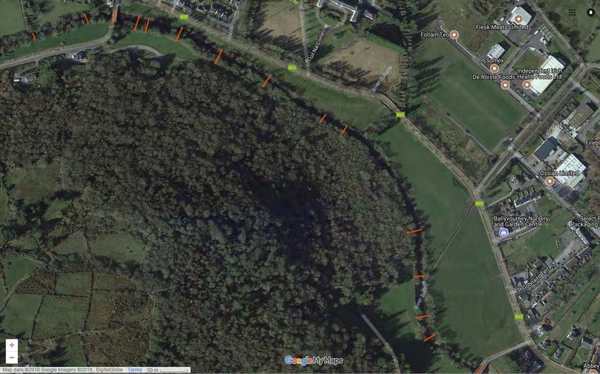
ECOLOGICAL IMPACT ASSESSMENT

  Document status
                                                                                                                          Review
  Version       Purpose of document              Authored by                 Reviewed by              Approved by
                                                                                                                          date
                                                 Green Leaf Ecology          Michelle Bennett
                Ecological Impact                                                                     Michelle
  F02                                            and Michael                                                              03/12/19
                Assessment                                                   Mark Magee               Bennett
                                                 Houston, RPS

  Approval for issue

  Michelle Bennett                                                                                   3 December 2019

© Copyright RPS Group Limited. All rights reserved.
The report has been prepared for the exclusive use of our client and unless otherwise agreed in writing by
RPS Group Limited no other party may use, make use of or rely on the contents of this report.
The report has been compiled using the resources agreed with the client and in accordance with the scope
of work agreed with the client. No liability is accepted by RPS Group Limited for any use of this report, other
than the purpose for which it was prepared.
RPS Group Limited accepts no responsibility for any documents or information supplied to RPS Group
Limited by others and no legal liability arising from the use by others of opinions or data contained in this
report. It is expressly stated that no independent verification of any documents or information supplied by
others has been made.
RPS Group Limited has used reasonable skill, care and diligence in compiling this report and no warranty is
provided as to the report’s accuracy.
No part of this report may be copied or reproduced, by any means, without the written permission of RPS
Group Limited.

   Prepared by:                                                         Prepared for:

   RPS                                                                  Cork County Council

                                                                        Coastal Management & Flood Projects Dept.,
   Innishmore, Ballincollig
                                                                        County Hall, Carrigrohane Road
   Co. Cork P31 KR68
                                                                        Cork

   T     +353 21 466 5900                                               T      +353 21 4276891

   E     ireland@rpsgroup.com                                           E      corporate.affairs@corkcoco.ie

CP19008RP001 | Ballyvourney and Ballymakeera FRS Interim Works - Ecological Impact Assessment | F02 | 3rd December 2019
rpsgroup.com                                                                                                                   Page ii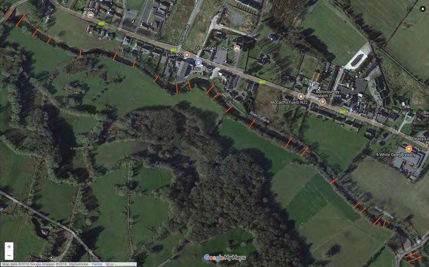
ECOLOGICAL IMPACT ASSESSMENT

Contents
1       INTRODUCTION ................................................................................................................................ 1
        1.1      Background .............................................................................................................................. 1
        1.2      Description of the Project ......................................................................................................... 1
2       METHODOLOGY ............................................................................................................................... 3
        2.1      Relevant Planning Policy and Legislation ................................................................................ 3
        2.2      Desk Study ............................................................................................................................... 4
        2.3      Field Survey ............................................................................................................................. 4
                 2.3.1       Kerry Slug ................................................................................................................... 5
                 2.3.2       Otter Survey ................................................................................................................ 6
                 2.3.3       Bat Survey .................................................................................................................. 6
        2.4      Aquatic Ecology ....................................................................................................................... 8
                 2.4.1       Habitat Assessment .................................................................................................... 9
                 2.4.2       Biological Water Quality............................................................................................ 10
                 2.4.3       Macroinvertebrate Biodiversity Assessment ............................................................. 10
                 2.4.4       Aquatic Plant Biodiversity Assessment .................................................................... 10
                 2.4.5       Freshwater Pearl Mussel .......................................................................................... 10
        2.5      Impact Assessment Criteria ................................................................................................... 10
        2.6      Survey Constraints ................................................................................................................. 11
3       RECEIVING ENVIRONMENT .......................................................................................................... 12
        3.1      Site Summary and Context .................................................................................................... 12
        3.2      Designated Sites .................................................................................................................... 12
        3.3      Terrestrial Ecology ................................................................................................................. 20
                 3.3.1       Habitats ..................................................................................................................... 20
                 3.3.2       Species ..................................................................................................................... 23
        3.4      Aquatic Ecology ..................................................................................................................... 28
                 3.4.1       Habitat Assessment .................................................................................................. 28
                 3.4.2       Biological Water Quality............................................................................................ 29
                 3.4.3       Freshwater Pearl Mussel .......................................................................................... 29
        3.5      Summary of Ecological Evaluation ........................................................................................ 30
4       POTENTIAL IMPACTS OF THE PROPOSED DEVELOPMENT ................................................... 32
        4.1      Construction Phase ................................................................................................................ 32
                 4.1.1       Designated Sites ....................................................................................................... 32
                 4.1.2       Habitats ..................................................................................................................... 33
                 4.1.3       Fauna ........................................................................................................................ 33
        4.2      Operational Phase ................................................................................................................. 36
                 4.2.1       Designated Sites ....................................................................................................... 36
                 4.2.2       Habitats ..................................................................................................................... 36
                 4.2.3       Fauna ........................................................................................................................ 37
        4.3      Decommissioning Phase ........................................................................................................ 37
                 4.3.1       Designated Sites ....................................................................................................... 37
                 4.3.2       Habitats ..................................................................................................................... 37

CP19008RP001 | Ballyvourney and Ballymakeera FRS Interim Works - Ecological Impact Assessment | F02 | 3rd December 2019
rpsgroup.com                                                                                                                                              Page iii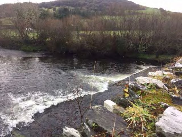
ECOLOGICAL IMPACT ASSESSMENT

                  4.3.3        Fauna ........................................................................................................................ 38
5        MITIGATION .................................................................................................................................... 40
         5.1      Construction Phase ................................................................................................................ 40
                  5.1.1        Pollution Prevention Measures ................................................................................. 40
                  5.1.2        Invasive Species ....................................................................................................... 42
                  5.1.3        Works Management .................................................................................................. 43
         5.2      Operational Phase ................................................................................................................. 44
         5.3      Decommissioning Phase ........................................................................................................ 44
                  5.3.1        Pollution Prevention Measures ................................................................................. 44
         5.4      Residual Impacts .................................................................................................................... 45
6        CONCLUSION ................................................................................................................................. 46
7        REFERENCES ................................................................................................................................. 47

Tables
Table 2-1: Suitability of Habitats for Bats .................................................................................................... 7
Table 2-2: Aquatic Habitat Valuation Scale ................................................................................................. 9
Table 3-1: International and National Designated Sites within 15km of the Proposed Interim Works
             Area ........................................................................................................................................ 13
Table 3-2: Terrestrial Habitats Present within the Proposed Interim Works Area ...................................... 23
Table 3-3: Summary of Q-Ratings .............................................................................................................. 29
Table 3-4: Ecological Features within the Proposed Site and Its Receiving Environment ......................... 30
Table 5-1: Table of Construction Phase Mitigation Measures................................................................... 40
Table 5-2: Table of Decommissioning Phase Mitigation Measures ........................................................... 44

Figures
Figure 1-1:       Map of the Proposed Interim Works at Ballymakeera .............................................................. 2
Figure 3-1:       European Sites within 15km of the Proposed Interim Works, Ballymakeera .......................... 18
Figure 3-2:       Nationally Designated Sites within 15km of the Proposed Interim Works, Ballymakeera ...... 19
Figure 3-3:       Interim Works Area: Habitat Map ............................................................................................ 22
Figure 3-4:       Photographs of Giant Knotweed at the Village Bend, March 2019......................................... 25
Figure 3-5:       Interim Works Area: Invasive Alien Species ........................................................................... 26

Appendices
Appendix A                Baile Mhic Íre Interim Works Report
Appendix B                Geographical Reference for Ecological Assessment
Appendix C                NBDC Protected and Invasive Species Records from OS Grid Square W27D
Appendix D                Aquatic Ecology Survey Results - Sullane River Habitat Assessment

CP19008RP001 | Ballyvourney and Ballymakeera FRS Interim Works - Ecological Impact Assessment | F02 | 3rd December 2019
rpsgroup.com                                                                                                                                                Page iv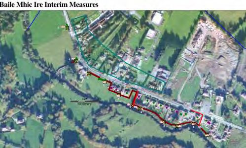
ECOLOGICAL IMPACT ASSESSMENT
1 INTRODUCTION
Greenleaf Ecology was commissioned by RPS on behalf of Cork County Council (CCC) to undertake an
Ecological Assessment of interim flood defence works to be carried out at Ballymakeera, County Cork. The
contracting authority for the works is CCC. The interim works have been designed by the Office of Public
Works (OPW), who are the lead agency for flood risk management in the Republic of Ireland.
The purpose of this ecological assessment is to: gather data on existing ecological conditions in the interim
flood defence works project area; evaluate the ecological features present; scope for notable species or
habitats and identify potential ecological constraints to the proposed project.
1.1 Background
As part of the Lee Catchment Flood Risk Assessment and Management Study (CFRAMS), Ballymakeera
and Ballyvourney were highlighted as an area where a flood relief scheme was required due to flood events
generally arising from flooding of the Sullane River. Interim works are now proposed to be carried out
pending the finalisation and approval of, and implementation of, a permanent solution. The objective of these
works is to provide interim defences to defend against a 20-year event, that are practical, safe and do not
increase flood risk. The interim hard defences will consist of 1,000kg (10KN) sand bags and / or
impermeable liners and other works are also proposed as discussed later within this report. The specific
locations of the proposed defences and detail on the flood levels to be protected against are included in the
OPW Ballymakeera Proposed Interim Works Report as included in Appendix A.
Due to the objective of the interim works to provide temporary flood defences prior to the implementation of
the Main Flood Relief Scheme (FRS), alternatives to the proposed works (as described in Section 1.2) were
not considered.
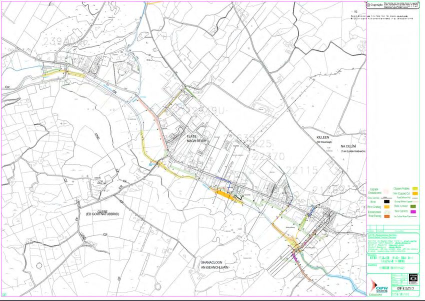
1.2 Description of the Project
The following interim works are proposed (as detailed in Appendix A):
Interim hard defences are anticipated to consist of 1000Kg (I0KN) sand bags and impermeable liners.
The location of the interim hard defences is illustrated by the maroon line in Figure 1.1. No instream
works will be required to install the sandbags. The precise line of the defences will be agreed with CCC
during a site walkover in advance of the commencement of works. While proposals are for an interim
period, the materials proposed to be used have a design life of 20 years.
Land-raising at field access points at three locations, to allow access to/from the existing gateways
whilst also mitigating against the 20-year flood levels. The proposed land raising areas are illustrated
with green lines in Figure 1.1.
The fitting of two non-return valves on the outlets of two existing pipe outfalls. Also, a sump would likely
need to be constructed on the dry side of each piped outlet and a pump is to be available in times of
need. The pipes requiring non-return valves and a sump are illustrated with a red line in Figure 1.1.
Monitoring of the condition of the interim defences will be by way of quarterly inspections. Furthermore,
in the event of a flood warning from the national weather services, a site inspection will also be carried
out beforehand if required.
The interim defences will be removed as the construction of the main scheme progresses.
CP19008RP001 | Ballyvourney and Ballymakeera FRS Interim Works - Ecological Impact Assessment | F02 | 3rd December 2019
rpsgroup.com Page 1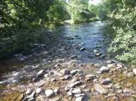
ECOLOGICAL IMPACT ASSESSMENT
The following information has also been provided by CCC with respect to the Contractor’s obligations:
Proposals are in place for landowner and stakeholder liaison prior to and during the carrying out of the
works by means of an appointed Liaison Officer. Stakeholders identified include the National Parks and
Wildlife Services (NPWS) and Inland Fisheries Ireland (IFI). The proposed site compound for the works
will be agreed with CCC and with local landowners.
The Contractor’s Ecologist will prepare an Invasive Species Management Plan for the works. It is not
envisaged that material will need to be removed from site. Any hedgerows or trees required to be
removed will be removed in accordance with the provisions of the Wildlife Act.
A detailed method statement will be agreed with CCC on the measures to be taken by the Contractor to
avoid sediment or soil loss and hydrocarbon / polluting substance release and these measures will be
designed to ensure the protection of the water quality of the Sullane River and its associated salmonid
and freshwater pearl mussel habitat.
The area hatched in green in Figure 1-1 shows the area to be protected from flooding during the 20-year
flood event and the OPW’s Report (Appendix A) also identifies individual buildings to be protected.
The design team has advised that there will be no practicable alteration to the behaviour of the Sullane River
as a result of the proposed works.
Figure 1-1: Map of the Proposed Interim Works at Ballymakeera
These works will be advance works of the OPW Main FRS where the preferred option may include a
combination of embankments, walls, gabion / rock armour protection, bridge underpinning and localised
dredging, channel widening and creation of a compound channel, road raising, culvert upsizing and works to
the pipe network.
CP19008RP001 | Ballyvourney and Ballymakeera FRS Interim Works - Ecological Impact Assessment | F02 | 3rd December 2019
rpsgroup.com Page 2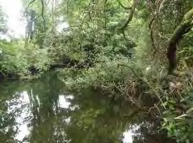
ECOLOGICAL IMPACT ASSESSMENT
2 METHODOLOGY
2.1 Relevant Planning Policy and Legislation
This report has been prepared with regards to the following legislation, policy documents and guidelines as
relevant:
CIEEM (2015) Guidelines for Ecological Report Writing;
CIEEM (2018) Guidelines for Ecological Impact Assessment in the UK and Ireland: Terrestrial,
Freshwater, Coastal and Marine. Chartered Institute of Ecology and Environmental Management,
Winchester;
DoEHLG (2010) Appropriate Assessment of Plans and Projects in Ireland Guidance for Planning
Authorities. Department of the Environment, Heritage and Local Government;
European Communities (2000) Managing Natura 2000 Sites: the provisions of Article 6 of the ‘Habitats’
Directive 92/43/EEC, Office for Official Publications of the European Communities, Luxembourg,
European Commission;
EC (2002) Assessment of Plans and Projects Significantly Affecting Natura 2000 Sites: Methodological
guidance on the provisions of Article 6(3) and (4) of the Habitats Directive 92/43/EEC, Office for Official
Publications of the European Communities, Luxembourg. European Commission;
EC (2007) Guidance document on Article 6(4) of the 'Habitats Directive' 92/43/EEC – Clarification of the
concepts of: alternative solutions, imperative reasons of overriding public interest, compensatory
measures, overall coherence, opinion of the commission. European Commission;
EC (2013) Interpretation Manual of European Union Habitats. Version EUR 28. European Commission;
EPA (2002) Guidelines on the information to be contained in Environmental Impact Statements.
Environmental Protection Agency;
EPA (2003), Advice Notes on current practice in the preparation of Environmental Impact Statements.
Environmental Protection Agency;
Fossitt, J., 2000. A Guide to Habitats in Ireland. The Heritage Council, Kilkenny;
HA (2001) DMRB Volume 10 Section 4 Part 4 - Ha 81/99 - Nature Conservation Advice In Relation To
Otters. The Highways Agency;
National Parks and Wildlife Service (NPWS) (2013) The Status of EU Protected Habitats and Species in
Ireland. National Parks and Wildlife Service, Department of the Environment, Heritage and Local
Government, Dublin, Ireland;
NPWS (2014) Guidance to Manage the Risk to Marine Mammals from Man-Made Sound Sources in
Irish Waters. Department of Arts, Heritage and Gaeltacht.
NRA (2008) Environmental Impact Assessment of National Road Schemes – A Practical Guide Rev. 1.
National Roads Authority;
NRA (2009) Guidelines for the Assessment of Ecological Impacts of National Road Schemes Rev. 2.
National Roads Authority;
NRA (2008) NRA Guidelines on Ecological Surveying Techniques for Protected Flora and Fauna on
National Road Schemes). National Roads Authority;
NRA Environmental Assessment and Construction Guidelines (both adopted and draft versions).
Studies were also carried out in accordance with the following legislation:-
Council Directive 92/43/EEC of 21 May 1992 on the conservation of natural habitats and of wild fauna
and flora (Habitats Directive) and Directive 2009/147/EC (codified version of Directive (79/409/EEC as
amended (Birds Directive)) – transposed into Irish law as European Communities (Birds and Natural
Habitats) Regulations 2011;
European Communities (Environmental Impact Assessment) Regulations, 1989 to 2006;
CP19008RP001 | Ballyvourney and Ballymakeera FRS Interim Works - Ecological Impact Assessment | F02 | 3rd December 2019
rpsgroup.com Page 3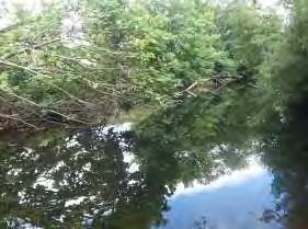
ECOLOGICAL IMPACT ASSESSMENT
European Communities (Environmental Liability) Regulations, 2008 (S.I. No. 547 of 2008);
European Communities (Quality of Salmonid Waters) Regulations, 1988 (S.I. No. 84 of 1988);
Flora Protection Order, 2015;
Planning and Development Act, 2000 (as amended);
Roads Acts 1993 to 2007(as amended);
Water Framework Directive (2000/60/EC); and
Wildlife Act 1976, as amended.
2.2 Desk Study
The sources of published material that were consulted as part of the desk study for the purposes of the
ecological appraisal are as follows:-
Review of the National Parks & Wildlife Service (NPWS) natural heritage database for designated areas
of ecological interest and sites of nature conservation importance within and adjacent to the study area;
Review of Ordnance Survey maps and ortho-photography;
Review of the National Biodiversity Data Centre (NBDC) database for records of rare and protected
species within a 2km radius of the proposed development site, including:
– Annex I habitats, Annex II species and their habitats, and Annex IV species and their breeding sites
and resting places (wherever they occur) as identified in the EU Habitats Directive;
– The presence of species of flora and fauna as identified and strictly protected under the European
Communities (Birds and Natural Habitats) Regulations, 2011; and
– Species of fauna and flora which are protected under the Wildlife Acts, 1976-2000 ‘Protected
species and natural habitats’ as defined in the Environmental Liability Directive (2004/35/EC) and
European Communities (Environmental Liability) Regulations, 2008;
Review of the Cork County Development Plan 2015-2021;
1:50,000 Ordnance Survey (OS) Map; Discovery Series;
Environmental Protection Agency mapping (http://gis.epa.ie/Envision);
RPS (2012) Baile Bhuirne and Baile Mhic Íre Flood Risk Assessment Study: SEA Review Study and
Constraints;
McCarthy Hyder Consultants (2009) N22 Baile Bhuirne- Macroom (Baile Bhuirne to Coolcour)
Environmental Impact Statement Volume 2: Main Text; and
ESB (2015) Grousemount Wind Farm, Co. Kerry. Environmental Impact Statement- Volume 1 of 3.
The results of ecology surveys for the OPW Main Scheme, undertaken by Conservation Services and one of
the authors of this report, were reviewed to inform the baseline for the interim works area.
2.3 Field Survey
Walkover surveys of the Main Scheme area (which includes the interim works area) were carried out by
ecologist Ms Karen Banks between May 2017 and July 2018. Areas highlighted during the desktop
assessment were investigated further, and a habitat survey was carried out. Habitats on site were classified
in accordance with the Heritage Council publication ‘A Guide to Habitats in Ireland’ (Fossitt, 2000). The
classification is a standard scheme for identifying, describing and classifying wildlife habitats in Ireland. The
classification is hierarchical and operates at three levels, using codes to differentiate habitats based on the
plant species present. Species recorded in this report are given both their Latin and common names,
following the nomenclature as given in the ‘New flora of the British Isles’ (Stace, 2010).
CP19008RP001 | Ballyvourney and Ballymakeera FRS Interim Works - Ecological Impact Assessment | F02 | 3rd December 2019
rpsgroup.com Page 4
ECOLOGICAL IMPACT ASSESSMENT
Survey for invasive species was conducted during the habitat and botanical surveys were undertaken in
June and July 2017. These surveys included the identification and mapping of Invasive Alien Species (IAS).
Further targeted IAS surveys of the proposed interim works area were undertaken in March 2018 in order to
identify and map the extent of IAS in advance of works. These surveys were conducted in accordance with
the NRA publication “Guidelines for the Management of Noxious Weeds and Non- Native Invasive Plant
Species on National Roads”.
The site walkover conducted in May 2017 included an assessment of the presence, or likely presence, of
protected species. The survey was conducted in accordance with the standard protected species survey
guidelines contained in the National Roads Authority publication ‘Ecological Surveying Techniques for
Protected Flora and Fauna during the Planning of National Road Schemes’ (2008). The surveys were
conducted for areas of habitat that might support protected mammals in addition to recording any field signs,
such as well-used pathways, droppings, places of shelter and features or areas likely to be of particular
value as foraging resources. Any badger setts present were recorded during the site walkover, along with
potential pine marten den sites. In addition, the suitability of the habitat for pygmy shrew, hedgehog, hares,
Irish stoat, pine marten amphibians and invertebrates were recorded. Following the results of the site
walkover targeted mammal surveys were undertaken as detailed in the following sections.
A walkover survey of the proposed interim works area was undertaken on 25th March 2019 in order to verify
and update the above detailed surveys.
2.3.1 Kerry Slug
A hand search survey of the Main Scheme area was carried out by Mott MacDonald Ecologists Erin
Johnston and Rita Mansfield between 19th and 21st November 2018. The survey had regard to the following
publications:
Ecological Surveying Techniques for protected Flora and Fauna during the Planning of National Road
Schemes – NRA 2009
Revised Distribution and Habitat Associations for the Protected Slug Geomalacus (Gastropoda,
Arionidae) in Ireland – McDonnell et al. 2013.
Weather conditions during the survey period were suitable for Kerry Slug survey: conditions were wet in the
days preceding the survey and dry and humid during the survey period, with no rainfall having occurred
within 24hours in advance of the survey date. Temperatures ranged from 8°C to 13°C.
Where Kerry slugs were found, they were photographed, and their location recorded. Equipment used
included Samsung Galaxy tablet with ArcGIS online with pre-loaded base maps.
Where suitable habitat was confirmed to be present, a transect was walked and micro-habitats searched for
Kerry slugs. It should be noted that a number of areas were identified as suitable habitat at desktop
assessment stage but were later determined to be unsuitable through field survey. This hand search was
carried out from ground level and under license from the NPWS (License number: C138-2017).
Where no Kerry slugs were found via hand searching, a metric trap survey was carried out within suitable
Kerry slug habitat which might be affected by the scheme (with the exception of areas where Kerry slug has
historically been confirmed as present). Metric trapping was carried out between 19th November and 3rd
December 2018 in accordance with the following publications:
Gormally & MacDonnell (2011) A live trapping method for the protected European slug, Geomalacus
maculosus Allman 1843 (Arionidae). Which has since been further refined in terms of seasonality,
temperature conditions, and habitats which are appropriate for trapping by Johnston et al. (2017)
Monitoring the EU protected Geomalacus maculosus (Kerry Slug): what are the factors affecting catch
returns in open and forested habitats.
McDonnell et al. (2013) Revised Distribution and Habitat Associations for the Protected Slug
Geomalacus (Gastropoda, Arionidae) in Ireland.
CP19008RP001 | Ballyvourney and Ballymakeera FRS Interim Works - Ecological Impact Assessment | F02 | 3rd December 2019
rpsgroup.com Page 5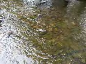
ECOLOGICAL IMPACT ASSESSMENT
Johnston et al. (2016) Monitoring the EU protected Geomalacus maculosus (Kerry Slug): what are the
factors affecting catch returns in open and forested habitats? Ecological Research.
2.3.2 Otter Survey
Otter surveys of the Main Scheme area were conducted on 21st and 22nd December 2017 and 22nd and 23rd
February 2018 along the Sullane River and its tributaries. A further survey of the proposed interim works
area was conducted on 25th March 2019.
The river banks were searched for field signs including:
Sleeping and resting places including holts, couches and natal dens;
Breeding sites;
Spraints;
Pathways/ trails;
Slides;
Hairs;
Footprints; and
Food remains.
Natal dens tend to be well hidden and therefore can be hard to locate. Survey for natal dens was undertaken
by searching for field signs including:
A heavily used path or paths from the water into dense cover or an enclosed structure;
Bedding within the structure which may consist of grass, ferns or reeds (bedding may also be present in
other types of resting places);
A latrine containing a large number of spraints at the den or within 2m of it (however, it is important to
note that there are often no droppings at a natal den as the female will excrete in the water to ensure
that there are no signs of occupation near the natal den);
A cub play area which may be a well-worn area around a tree or on a bank; and
Different sized otter prints.
2.3.3 Bat Survey
Bat survey was undertaken at the Main Scheme area in accordance with the following guidelines:-
Bat Conservation Ireland, (2010). Guidance notes for Planners, Engineers, Architects, and Developers;
Collins, J. (ed.) (2016). Bat Surveys for Professional ecologists: Good Practice Guidelines (3rd ed.). The
Bat Conservation Trust, London; and
Kelleher, C. & Marnell, F. (2006). Bat Mitigation Guidelines for Ireland.
2.3.3.1 Preliminary Roost Assessment
The trees at the interim works area were surveyed in conjunction with the site walkover for potential roost
sites and signs of bats. A detailed inspection of the exterior of trees was undertaken to look for features that
bats could use for roosting (Potential Roost Features, or PRFs) from ground level. The aim of the survey was
to determine the actual or potential presence of bats and the need for further survey and/or mitigation.
A detailed inspection of each tree within the site, and to approximately 10m either side of the proposed area
of works was undertaken. The inspection was carried out in daylight hours from ground level, and
information was compiled about the tree, PRFs and evidence of bats. All trees, or groups of trees, surveyed
were numbered and marked on a map and a description of each PRF observed was recorded.
CP19008RP001 | Ballyvourney and Ballymakeera FRS Interim Works - Ecological Impact Assessment | F02 | 3rd December 2019
rpsgroup.com Page 6ECOLOGICAL IMPACT ASSESSMENT
PRFs that may be used by bats include:
Rot holes;
Hazard beams;
Other horizontal or vertical cracks or splits (e.g. frost cracks) in stems or branches;
Lifting bark;
Knotholes arising from naturally shed branches or branches previously pruned back to the branch collar;
Man-made holes (e.g. flush cuts) or cavities created by branches tearing out from parent stems;
Cankers in which cavities have developed;
Other hollows or cavities;
Double leaders forming compression forks with included bark and potential cavities;
Gaps between overlapping stems or branches;
Partially detached ivy with stem diameters in excess of 50mm; and
Bat or bird boxes.
Signs of a bat roost (excluding the actual presence of bats), include:
Bat droppings in, around or below a PRF;
Odour emanating from a PRF;
Audible squeaking at dusk or in warm weather; and
Staining below the PRF.
It should be noted that bats or bat droppings are the only conclusive evidence of a roost and many roosts
have no external signs. Therefore, this survey and evaluation was relatively basic as only those PRFs at
ground level could be inspected closely to ascertain their true potential to support roosting bats. Trees were
categorised according to the highest suitability PRF present. The criteria for categorisation of suitability for
bats is described further in Table 2.1.
Table 2-1: Suitability of Habitats for Bats
Description
Suitability Commuting and Foraging Habitats
Roosting Habitats
Negligible Negligible habitat features on site likely Negligible habitat features on site likely
to be used by roosting bats. to be used by commuting or foraging
bats.
Low A structure with one or more potential Habitat that could be used by small
roost sites that could be used by numbers of commuting bats such as
individual bats opportunistically. gappy hedgerow or un-vegetated
However, these potential roost sites do stream, but isolated, i.e., not very well
not provide enough space, shelter, connected to the surrounding landscape
protection, appropriate conditions and/or by other habitat.
suitable surrounding habitat to be used Suitable, but isolated habitat that could
on a regular basis or by larger numbers be used by small numbers of foraging
of bats (i.e., unlikely to be suitable for bats such as a lone tree (not in a
maternity or hibernation). parkland situation) or a patch of scrub.
A tree of sufficient size and age to
contain PRFs but with none seen from
the ground or features seen with only
very limited roosting potential.
CP19008RP001 | Ballyvourney and Ballymakeera FRS Interim Works - Ecological Impact Assessment | F02 | 3rd December 2019
rpsgroup.com Page 7ECOLOGICAL IMPACT ASSESSMENT
Description
Suitability Commuting and Foraging Habitats
Roosting Habitats
Moderate A structure or tree with one or more Continuous habitat connected to the
potential roost sites that could be used wider landscape that could be used by
by bats due to their size, shelter, bats for commuting such as lines of
protection, conditions and surrounding trees and scrub or linked back gardens.
habitat but unlikely to support a roost of Habitat that is connected to the wider
high conservation status (with respect to landscape that could be used by bats for
roost type only- the assessments in this foraging such as trees, scrub, grassland
table are made irrespective of species or water.
conservation status, which is established
after presence is confirmed).
High A structure or tree with one or more Continuous, high quality habitat that is
potential roost sites that are obviously well connected to the wider landscape
suitable for use by larger numbers of that is likely to be used regularly by
bats on a more regular basis and commuting bats such as river valleys,
potentially for longer periods of time due streams, hedgerows, lines of trees and
to their size, shelter, protection, woodland edge.
conditions and surrounding habitat. High quality habitat that is well
connected to the wider landscape that is
likely to be used regularly by foraging
bats such as broadleaved woodland,
tree-lined watercourses and grazed
parkland.
Site is close to and connected to known
roosts.
2.3.3.2 Activity Survey
Bat surveys for the Main Scheme were conducted by an experienced and licenced bat ecologist (Karen
Banks) in accordance with Collins, J. (ed.) (2016) Bat Surveys for Professional Ecologists: Good Practice
Guidelines (3rd edn), the Bat Conservation Trust; and Kelleher, C. & Marnell, F. (2006) Bat Mitigation
Guidelines for Ireland. Six dusk bat activity surveys were conducted across the Main Scheme area between
May and September 2017 using an Anabat Walkabout detector, which records bat echolocation calls directly
on to an internal SD memory card. An Anabat Express static bat detector was left in different locations
across the study area for six nights to supplement the activity transect survey.
2.3.3.3 Bird Survey
Four Kingfisher surveys of the Main Scheme area were undertaken between April and July 2017 in
accordance with Ecological Surveying Techniques for protected Flora and Fauna during the Planning of
National Road Schemes – NRA 2009.
2.4 Aquatic Ecology
Aquatic Ecology surveys for the Main Scheme were undertaken by Mr Bill Quirke, Conservation Services, in
2018.
CP19008RP001 | Ballyvourney and Ballymakeera FRS Interim Works - Ecological Impact Assessment | F02 | 3rd December 2019
rpsgroup.com Page 8ECOLOGICAL IMPACT ASSESSMENT
2.4.1 Habitat Assessment
Assessment consists of walking and/or wading the entire channel length.
The assessed channel is demarcated into habitat sections based on:
1. Stream width and depth;
2. Substrate type, i.e. relative dominance of large rocks, cobble, gravel, sand, mud, etc.;
3. Flow type, i.e. relative dominance of riffle, glide and pool;
4. Flow diversity, substrate diversity and channel sinuosity;
5. Dominant bank-side vegetation;
6. In-stream vegetation;
7. Degree of shade by bank-side vegetation.
As indicated in Table 2.2, based on these criteria, on a scale of None/ Poor/ Fair/ Good/ Very Good/
Excellent, the value of each stream/river section is assessed for:
Salmonid spawning;
Salmonid nursery area for juvenile salmonids;
Adult salmonids;
Freshwater Pearl Mussels;
Lamprey spawning;
Lamprey nursery.
Table 2-2: Aquatic Habitat Valuation Scale
Scale Assessment
None The ecologist carrying out the assessment regards it as impossible that the stream could
support the species in the relevant life stage
Poor Unlikely but possible that the stream could support the species in the relevant life stage
Fair Species life stage likely to be present at low density
Good Species life stage likely to be present at moderate density
Very Good Species life stage likely to be present at high density
Excellent Conditions ideal for the species life stage
Intermediate categories are also used, e.g., fair-good, thereby providing a ten-point scale.
Locations for identification of habitat sections are recorded as Irish Grid References using a GPS.
Geotagged photographs are taken to illustrate the habitat quality.
As required by Inland Fisheries Ireland (IFI), in each habitat section sections of river bank subject to river
erosion are identified, delimited and mapped.
Within each habitat section, surface siltation on substrates in shallow riffle areas are described using EPA’s
categories for degree of siltation as described in the EPA Standard Operating Procedure for River Biological
Monitoring Field Sampling Survey Version 1.6 (EPA 2017), and where relevant photographed. Interstitial
sediment is assessed using the qualitative silt plume method, as used by EPA and described in Section 2.9
of the North South 2 Project Monitoring Methods Report Freshwater Pearl Mussel Sub-basin Plans (Anon
2009).
Locations for identification of habitat sections are recorded as Irish Grid References using a GPS and
freshwater habitat sections will be mapped and photographed.
CP19008RP001 | Ballyvourney and Ballymakeera FRS Interim Works - Ecological Impact Assessment | F02 | 3rd December 2019
rpsgroup.com Page 9ECOLOGICAL IMPACT ASSESSMENT
2.4.2 Biological Water Quality
Invertebrates are sampled using the standard kick sampling and rock washing method employed by EPA
(ISO 7828:1985). After field sampling the sample is thoroughly sieved and live sorted for 30 minutes under
laboratory conditions (ISO 5667-3:1994). Invertebrates are preserved in 70% alcohol, examined
microscopically and identified to the taxonomic level required to calculate Q-ratings by the EPA methodology
(McGarrigle et al 2002). The preserved samples are archived for future examination or verification. Based on
the relative abundance of indicator species, a biotic index (Q-rating) is determined in accordance with the
biological assessment procedure used by the Environmental Protection Agency (McGarrigle et al 2002 & S.I.
No. 258 of 1998) and more detailed unpublished methodology (McGarrigle, Clabby, Lucey & Bradley pers.
comm.)
2.4.3 Macroinvertebrate Biodiversity Assessment
Macroinvertebrates are sampled at c. 8 locations along the section of river using the standard EPA kick
sampling method. All habitat types present in the section are sampled to ensure accurate representation of
the invertebrate biodiversity in the section. At each site the samples are combined into a composite sample
which is live sorted for 1 hour under laboratory conditions. Macroinvertebrates are preserved and identified
to the lowest practicable taxonomic level. Abundance ratings and ecological notes for each invertebrate
taxon are presented. The invertebrate community in each sample is rated on the basis of water quality
indicators, biodiversity, and presence of rare or unusual species.
2.4.4 Aquatic Plant Biodiversity Assessment
At each of the biodiversity assessment sites, submerged, emergent and floating vegetation are surveyed
using the MTR method as described in the EPA Standard Operating Procedure for River Biological
Monitoring Field Sampling Survey Version 1.6 (EPA 2017).
2.4.5 Freshwater Pearl Mussel
The Sullane River is known to accommodate Freshwater Pearl mussel populations and the evidence is well
documented. Freshwater Pearl Mussel (FPM) surveys were conducted in 2013 and 2014 by RPS for the
purpose of the overall flood relief scheme and separate condition surveys were conducted in 2007 and 2016
by Moorkens and Associates on behalf of the NPWS. Therefore, an additional field survey for the interim
scheme was deemed unnecessary and this assessment will be based on previous studies of the area. The
surveys followed the standard survey methodology as published by the National Parks and Wildlife Service
(Anon., 2004) and updated methodologies developed by Dr. Evelyn Moorkens.
2.5 Impact Assessment Criteria
The information gathered from desk study and survey has been used to make an ecological impact
assessment (EcIA) of the proposed development upon the identified ecological features. The EcIA has been
undertaken following the methodology set out in CIEEM (2018). EcIA is based upon a source-pathway-
receptor model, where the source is defined as the individual elements of the proposed development that
have the potential to affect identified ecological features. The pathway is defined as the means or route by
which a source can affect the ecological features. An ecological feature is defined as the species, habitat or
ecologically functioning unit of natural heritage importance. Each element can exist independently however
an effect is created where there is a linkage between the source, pathway and feature.
A significant effect is defined in CIEEM (2016) as:
“an effect that either supports or undermines biodiversity conservation objectives for ‘important
ecological features’…. or for biodiversity in general”.
CP19008RP001 | Ballyvourney and Ballymakeera FRS Interim Works - Ecological Impact Assessment | F02 | 3rd December 2019
rpsgroup.com Page 10ECOLOGICAL IMPACT ASSESSMENT Further, BS 42020:2013 states that if an effect is sufficiently important to be given weight in the planning balance or to warrant the imposition of a planning condition, e.g. to provide or guarantee necessary mitigation measures, it is likely to be “significant” in that context at the level under consideration. The converse is also true: insignificant effects would not warrant a refusal of permission or the imposition of conditions. The geographical reference used for ecological valuation follows NRA (2009) Guidelines for the Assessment of Ecological Impacts of National Road Schemes Rev. 2., as detailed in Appendix B. 2.6 Survey Constraints Access to the rear of some of the properties to be protected by hard defences was not gained, therefore it was not possible to undertake a close examination of trees at this location for bat potential. However, a survey of this area was undertaken using close focus binoculars from adjacent fields and also from the other side of the river bank. CP19008RP001 | Ballyvourney and Ballymakeera FRS Interim Works - Ecological Impact Assessment | F02 | 3rd December 2019 rpsgroup.com Page 11
ECOLOGICAL IMPACT ASSESSMENT

3             RECEIVING ENVIRONMENT
3.1            Site Summary and Context
The site for the proposed interim works is located at Ballymakeera, a village located approximately 13.6km
north-west of Macroom, Co. Cork. The National Soils Map indicates that the site comprises made ground
and alluvial soils1 underlain by Bird Hill Formation bedrock; purple siltstone and fine sandstone. The Sullane
River runs to the south of Ballymakeera and the N22.

3.2            Designated Sites
A review of European designated sites within a 15km radius of the proposed development was undertaken
(www.npws.ie). Special Areas of Conservation (SACs) are sites of international importance due to the
presence of Annex I habitats and / or Annex II species listed under the EU Habitats Directive. Special
Protection Areas (SPAs) are designated for birds based on the presence of internationally significant
populations of listed bird species.
A review of nationally designated sites was also undertaken. Natural Heritage Areas (NHAs) are sites
deemed to be of national ecological importance and are afforded protection under the Wildlife (Amendment
Act) 2000. The proposed Natural Heritage Area (pNHA) have not been statutorily proposed or designated,
however do have some protection under Agri Environmental Options Scheme (AEOS), Coillte, County
Development Plans and Licensing Authorities.
There are seven European Sites within 15km of the proposed site. The proposed site is located c. 0.12km
from St Gobnait’s Wood SAC and c. 0.7km from Mullaghanish to Musheramore Mountains SPA. A review of
nationally designated sites indicates that there is one Natural Heritage Area and nine proposed Natural
Heritage Areas (pNHAs) within 15km of the proposed works area. A list of designated sites recorded within
15km of the proposed works is presented in Table 3.1. European Sites and proposed Natural Heritage Areas
are illustrated in Figure 3.1 and Figure 3.2 respectively.

1
    Teagasc subsoils mapping available at https://gis.epa.ie/geonetwork/srv/eng/catalog.search#/metadata/5f1999f0-37e4-4c14-acf8-
    3b42bfdae894

CP19008RP001 | Ballyvourney and Ballymakeera FRS Interim Works - Ecological Impact Assessment | F02 | 3rd December 2019
rpsgroup.com                                                                                                                   Page 12
ECOLOGICAL IMPACT ASSESSMENT
Table 3-1: International and National Designated Sites within 15km of the Proposed Interim Works Area
Do Any Potential Source-Pathway-
Distance from
Receptor Links Exist Between the
the
Site Name and Code Qualifying Interests/ Conservation Interest Proposed Development and the
Development
Designated Site and Any Likely
Site (km)2
Significant Effects
The Gearagh SAC and Annex I Habitats 10.1km No, due to the distance and absence of
pNHA (Site Code: Water courses of plain to montane levels with the Ranunculion hydrological or habitat connectivity.
000108) fluitantis and Callitricho-Batrachion vegetation [3260]
Rivers with muddy banks with Chenopodion rubri p.p. and
Bidention p.p. vegetation [3270]
Old sessile oak woods with Ilex and Blechnum in the British
Isles [91A0]
Alluvial forests with Alnus glutinosa and Fraxinus excelsior
(Alno-Padion, Alnion incanae, Salicion albae) [91E0]
Annex II Species
Lutra (Otter) [1355]
St. Gobnait’s Wood SAC Annex I Habitats 115m No, due to the absence of hydrological or
and pNHA (Site Code: Old sessile oak woods with Ilex and Blechnum in the British habitat connectivity.
000106) Isles [91A0]
Mullaghanish Bog SAC Annex I Habitats 4.3km No, due to the distance and absence of
and pNHA (Site Code: Blanket bogs (* if active bog) [7130] hydrological or habitat connectivity.
001890)
Blackwater River (Cork / Annex I Habitats 12.9km No, due to the distance and absence of
Waterford) SAC (Site Estuaries [1130] hydrological or habitat connectivity.
Code: 002170)
Mudflats and sandflats not covered by seawater at low tide
[1140]
Perennial vegetation of stony banks [1220]
Salicornia and other annuals colonising mud and sand [1310]
2
Distance measured “as the crow flies”
CP19008RP001 | Ballyvourney and Ballymakeera FRS Interim Works - Ecological Impact Assessment | F02 | 3rd December 2019
rpsgroup.com Page 13ECOLOGICAL IMPACT ASSESSMENT
Do Any Potential Source-Pathway-
Distance from
Receptor Links Exist Between the
the
Site Name and Code Qualifying Interests/ Conservation Interest Proposed Development and the
Development
Designated Site and Any Likely
Site (km)2
Significant Effects
Atlantic salt meadows (Glauco-Puccinellietalia maritimae)
[1330]
Mediterranean salt meadows (Juncetalia maritimi) [1410]
Water courses of plain to montane levels with the Ranunculion
fluitantis and Callitricho-Batrachion vegetation [3260]
Old sessile oak woods with Ilex and Blechnum in the British
Isles [91A0]
Alluvial forests with Alnus glutinosa and Fraxinus excelsior
(Alno-Padion, Alnion incanae, Salicion albae) [91E0]
Taxus baccata woods of the British Isles [91J0]
Annex II Species
Margaritifera margaritifera (Freshwater Pearl Mussel) [1029]
Austropotamobius pallipes (White-clawed Crayfish) [1092]
Petromyzon marinus (Sea Lamprey) [1095]
Lampetra planeri (Brook Lamprey) [1096]
Lampetra fluviatilis (River Lamprey) [1099]
Alosa fallax fallax (Twaite Shad) [1103]
Salmo salar (Salmon) [1106]
Lutra lutra (Otter) [1355]
Trichomanes speciosum (Killarney Fern) [1421]
Killarney National Park, Annex I Habitats 6.5km No, due to the distance and absence of
Macgillycuddy's Reeks Oligotrophic waters containing very few minerals of sandy hydrological or habitat connectivity.
and Caragh River plains (Littorelletalia uniflorae) [3110]
Catchment SAC and
Oligotrophic to mesotrophic standing waters with vegetation of
pNHA (Site Code:
the Littorelletea uniflorae and/or Isoeto-Nanojuncetea [3130]
000365)
Water courses of plain to montane levels with the Ranunculion
fluitantis and Callitricho-Batrachion vegetation [3260]
Northern Atlantic wet heaths with Erica tetralix [4010]
CP19008RP001 | Ballyvourney and Ballymakeera FRS Interim Works - Ecological Impact Assessment | F02 | 3rd December 2019
rpsgroup.com Page 14ECOLOGICAL IMPACT ASSESSMENT
Do Any Potential Source-Pathway-
Distance from
Receptor Links Exist Between the
the
Site Name and Code Qualifying Interests/ Conservation Interest Proposed Development and the
Development
Designated Site and Any Likely
Site (km)2
Significant Effects
European dry heaths [4030]
Alpine and Boreal heaths [4060]
Juniperus communis formations on heaths or calcareous
grasslands [5130]
Calaminarian grasslands of the Violetalia calaminariae [6130]
Molinia meadows on calcareous, peaty or clayey-silt-laden soils
(Molinion caeruleae) [6410]
Blanket bogs (* if active bog) [7130]
Depressions on peat substrates of the Rhynchosporion [7150]
Old sessile oak woods with Ilex and Blechnum in the British
Isles [91A0]
Alluvial forests with Alnus glutinosa and Fraxinus excelsior
(Alno-Padion, Alnion incanae, Salicion albae) [91E0]
Taxus baccata woods of the British Isles [91J0]
Annex II Species
Geomalacus maculosus (Kerry Slug) [1024]
Margaritifera margaritifera (Freshwater Pearl Mussel) [1029]
Euphydryas aurinia (Marsh Fritillary) [1065]
Petromyzon marinus (Sea Lamprey) [1095]
Lampetra planeri (Brook Lamprey) [1096]
Lampetra fluviatilis (River Lamprey) [1099]
Salmo salar (Salmon) [1106]
Rhinolophus hipposideros (Lesser Horseshoe Bat) [1303]
Lutra lutra (Otter) [1355]
Trichomanes speciosum (Killarney Fern) [1421]
Najas flexilis (Slender Naiad) [1833]
Alosa fallax killarnensis (Killarney Shad) [5046]
CP19008RP001 | Ballyvourney and Ballymakeera FRS Interim Works - Ecological Impact Assessment | F02 | 3rd December 2019
rpsgroup.com Page 15ECOLOGICAL IMPACT ASSESSMENT
Do Any Potential Source-Pathway-
Distance from
Receptor Links Exist Between the
the
Site Name and Code Qualifying Interests/ Conservation Interest Proposed Development and the
Development
Designated Site and Any Likely
Site (km)2
Significant Effects
The Gearagh SPA (Site Special Conservation Interests 10.4km No, due to the distance and absence of
Code: 004109) Wigeon (Anas penelope) [A050] hydrological or habitat connectivity.
Teal (Anas crecca) [A052]
Mallard (Anas platyrhynchos) [A053]
Coot (Fulica atra) [A125]
Mullaghanish to Special Conservation Interests 740m No, due to the absence of hydrological or
Musheramore Mountains Hen Harrier (Circus cyaneus) [A082] habitat connectivity and lack of suitability
SPA (Site Code: 004162) of habitat in the proposed works area for
the SCI of this SPA.
Sillahertane Bog NHA Peatlands 9.3km No, due to the distance and absence of
(Site Code: 001882) hydrological or habitat connectivity.
Lough Allua pNHA (Site Lough Allua is an expanded section of the river Lee where it 10.4km No, due to the distance and absence of
Code: 001065) meets an obstruction of rock and glacial debris above hydrological or habitat connectivity.
Inchigeelagh in Co. Cork. The floor of the valley is flat-
bottomed so that the lakeshore is complex with numerous
bays, peninsulas and narrows. In addition, the fluctuation in
water level seems unusually great so that a considerable area
of surrounding land is flooded in winter. The Lough Allua area
has significant heritage value because of its diversity of
habitats and the presence of several unusual plants, including
a protected species.
Prohus Wood pNHA (Site Prohus Wood which is situated 7km west of Macroom consists 6.2km This site is located adjacent to the
Code: 001248) predominantly of young trees, partly coppiced growing on rocky Sullane River c. 8km downstream of the
ground which slopes to the east. This site is a very young wood proposed works area. Theoretically,
derived from widespread clearance about forty years ago there is a remote indirect connectivity
(1986). The site has not developed much habitat diversity but is between the proposed site and this
developing quite naturally and is of local importance. pNHA.
Roughty River pNHA This site is located in a valley approximately 4km north-east of 14.1km No, due to the distance and absence of
(Site Code: 001376) Kilgarvan in Co. Kerry. A hawkweed, Hieracium scullyi, occurs hydrological or habitat connectivity.
here at its only known site in the world.
CP19008RP001 | Ballyvourney and Ballymakeera FRS Interim Works - Ecological Impact Assessment | F02 | 3rd December 2019
rpsgroup.com Page 16ECOLOGICAL IMPACT ASSESSMENT
Do Any Potential Source-Pathway-
Distance from
Receptor Links Exist Between the
the
Site Name and Code Qualifying Interests/ Conservation Interest Proposed Development and the
Development
Designated Site and Any Likely
Site (km)2
Significant Effects
Boylegrove Wood pNHA Boylegrove Wood is a small deciduous woodland located c. 12.4km No, due to the distance and absence of
(Site Code: 001854) 2km north of the village of Kilmichael and 6km south-west of hydrological or habitat connectivity.
Macroom Town, west County Cork. To the south of the wood
between the woodland and the river is heathland with many
rock outcrops which is used for rough grazing. The rest of the
surrounding land consists of large agricultural fields. The wood
is part of an old estate attached to Boylegrove House.
Ballagh Bog pNHA (Site Ballagh Bog is located 9km south-east of the village of 14.8km No, due to the distance and absence of
Code: 001886) Kilgarvan on the east side of Carran Mountain, at an altitude of hydrological or habitat connectivity.
375-450m. The site, which comprises a high-level river plain
and surrounding mountain slopes, is underlain by Old Red
Sandstone. Although not re-surveyed, a recent report
described the site as comprising a series of small, slightly
raised valley bogs situated in the bends of a mountain stream,
merging with mountain slopes dominated by Purple Moor-grass
(Molinia caerulea).
CP19008RP001 | Ballyvourney and Ballymakeera FRS Interim Works - Ecological Impact Assessment | F02 | 3rd December 2019
rpsgroup.com Page 17ECOLOGICAL IMPACT ASSESSMENT Figure 3-1: European Sites within 15km of the Proposed Interim Works, Ballymakeera CP19008RP001 | Ballyvourney and Ballymakeera FRS Interim Works - Ecological Impact Assessment | F02 | 3rd December 2019 rpsgroup.com Page 18
You can also read