BULLETS, BOMBS, AND ICE CREAM: THE UNINTENDED CONSEQUENCES OF GOOGLE EARTH'S NEW CAR TOGRAPHIC WORLD
←
→
Page content transcription
If your browser does not render page correctly, please read the page content below

R e u t e r s p h o t o RT X V F M O b y J o r g e S i l va
Views and opinions
A child navigates over Mexico City in a Google Earth search set up on many screens in Cancun, 5 December 2010.
Bullets, Bombs, and Ice Cream: The
Unintended Consequences of Google
Earth’s New Cartographic World –
(Observations with respect to Insurgent Surveillance Target Acquisition)
by Nicholas Kaempffer
Introduction
M
y interest in Google Earth
was first piqued after a
friend of mine, Corporal
Johann Reimer, had
D N D p h o t o A R 2 0 0 9 - Z 0 4 3 - 13 b y M a s t e r C o r p o r a l J o n a t h a n J o h a n s e n
returned from a nine month
tour at Kandahar Airfield, Afghanistan, in
2006. As the initial medic on the scene of a
mass-casualty incident, he helped apply life-
saving first aid to soldiers wounded by a rocket
attack against one of the base’s many mess
halls. As all soldiers do, Johann found humour
in the story of a wounded but happy comrade,
saved by the ice cream he had bent to retrieve,
which left his posterior to absorb several pieces
of shrapnel otherwise aimed at his chest. The
architect of the rocket strike, later killed by an
American gunship, was begrudgingly admired
for his skill in accurately targeting specific
facilities on the base. Months later, I noticed
Kandahar airfield at night, 26 July 2009.
several news outlets on the internet referring to
Vol. 13, No. 3, Summer 2013 • Canadian Military Journal 71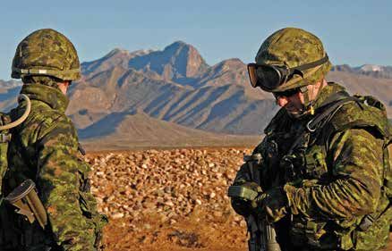
Views and opinions
insurgent use of Google Earth to plot rocket firing solutions in     Martin Dodge, in their excellent essay entitled Satellite
Afghanistan and Iraq, and I couldn’t help but think back to the      Imagery and the Spectacle of Secret Places, (rightfully, I
tale of the life-saving ice cream. This short article will address   maintain) contextualize Europe’s history of state involvement
the ever-unfolding and still-unfinished story of insurgent utili-    in cartography, stating:
zation of Google Earth, set within the history of cartography
and empire, and the decentralization of geographic knowledge              Large-scale national topographic surveys commis-
in the 21st Century. The first two chapters, In the Interest of           sioned throughout Europe from the eighteenth and
Empire, and Knowledge as Power, will situate the reader within            nineteenth centuries and extended to European colo-
the history of mapping, security, and the state. From Enter               nies were established primarily to help military forces
Google Earth onwards to the final conclusion, a discussion on             to maintain state control over territory. State mapping
insurgent use of Google Earth, a powerful, satellite-based,               agencies almost all trace their origins to military
global cartographic application, including case studies, will be          needs and the cartographic specifications underlying
undertaken. The intent here is to highlight how the technical             most contemporary national ‘framework’ geospatial
innovation Google Earth is revolutionizing public access to               data-sets are derived from the needs of war fighting.5
geographic information, now that cartography is becoming a
decentralized endeavour. This unprecedented access to spe-                The power of the map became of utmost importance, not
cialized satellite material, once under the sole purview of the      only to the state that endeavoured to chart its empire, but to
state, has generated unintended insurgent utilization by virtue      rival nations, who had a great amount to gain by acquiring the
of the transition from state to public ownership of geographic       cartographic knowledge of their opponents. In this manner,
data. To properly contextualize this evolution, the initial link     wars for information started in earnest.
between the state security and cartographic knowl-
edge must be discussed.

In the Interest of Empire

M      aps and the military have a long and inter-
       woven history, as conquest and empire have
relied upon cartography for navigation, commerce,
strategy, and tactics. The first ‘Empire Maps’ were
produced by the Spanish and Portuguese in the 16th

                                                                                                                                          R e u t e r s p h o t o RT R 3 3 7 H I b y H a n d o u t
Century, and were known as the Padreo Real, and
the Padron Real. These maps were highly coveted
and jealously guarded by Boards of Trade, as car-
tographer and author David Turnbull noted:
“Portugal and Spain were the first nations to
attempt to construct spaces within which to regu-
late all geographical knowledge.”1 Akin to quell-
ing a prison riot before it started, these states were
attempting to ‘lock down’ cartographic knowledge,
                                                       Peter Birch, Google Earth Product Manager, presents the future of Google 3D Maps
through proactive, not reactive action, leaving rival at the company’s offices in San Francisco, 6 June 2012.
nations unaware and unable to compete for terri-
tory in the ‘New World.’2 By establishing trade boards that Knowledge as Power
allowed for the maintenance of trade monopolies, the Spanish
and the Portuguese were able to safeguard the physical secu-
rity of their colonies, upon which hinged the economic secu-         F   rom both a strategic and economic perspective, it is vital
                                                                         for states to map, not only their internal boundaries, but
rity of the state. Thus, maps became highly coveted and jeal- those of their neighbours. In an ever globalizing world, the
ously guarded by the state as they became both the ‘blue- scale of ‘neighbour’ has increased to encompass the planet,
prints’ of colonialism, and instruments of warfare. However, meaning that nations invest enormous efforts of capital and
the Portuguese and Spanish could not maintain their strangle- manpower to map the ‘other.’ Today’s surveillance technology
hold on maps of the ‘New World’ forever, and, plagued by is a far cry from Lord Baden-Powell’s mapping of enemy posi-
technical problems, the Padreo Real and the Padron Real fell tions by hand 6 – indeed, it is a world of satellites, spy planes,
into disuse and obscurity.3 Despite the inherent technical and and clandestine operations. The Cold War and cartography
financial difficulties of charting empire, the allure of carto- were very much correlated in the rise of modern geographic
graphic knowledge meant that great efforts were made, spe- survey technology, as states spared little expense to map enemy
cifically by the French via the Cassinis, to map the territory of positions, routes, infrastructure, and activities. While this tech-
the state.4 Thus, it is clear that since the advent of ‘empire nology and cartographic knowledge was initially hidden from
mapping,’ the state has had a vested interest in limiting access the public, brought out only occasionally for the needs of
to cartographic information in order to control knowledge national security,7 the civilian world gained slowly gained
vital for economic benefit and security. Chris Perkins, and access to cartographic knowledge once only held within the

72                                                      Canadian Military Journal          • Vol. 13, No. 3, Summer 2013
Views and opinions
purview of the state. As the commercial demand grew, the                 eyes. Throngs of amateur Google Earth “spies”
public began to utilize military cartographic technology for             began the task of seeking out and testing the technol-
civil activities. The Global Positioning System, widely known            ogy against the planet’s secret spaces, pooling their
by its acronym GPS, was initially developed by the govern-               findings in online communities. Perhaps the most
ment of the United States to fixate military movements on                famous of these “finds” was an enormous Chinese
battlefield maps, and it is now available globally to the public.8       military training area, a mock-up of a section of the
GPS is still owned by the US government, and it is considered            Chinese-Indian mountain border, discovered by a
a national resource, with every aspect of the service controlled         Californian living in Germany. The intrigue of this
by the state. In the event of a conflict, or situation where it          discovery propelled the story around the world with
deems necessary, the US government is able to either reduce              the momentum of the newest espionage blockbuster.12
the accuracy of, or completely block out civilian GPS receiv-
ers.9 This fact, in itself, has led to many nations and organiza-         With the introduction of Google Earth, the general public
tions, including China, Russia, and the European Union, to           is gaining access to cartographic knowledge once highly
develop native systems to provide GPS capability. Moreover, it       restricted and controlled, often with controversial results. The
demonstrates the continued need for the state to strictly control    conflict between public the private rights, and state security in
access to and use of cartographic resources. This brings about       the age of Google Earth will be in focus for the remainder of
the interesting question of what governments are to do when          this short article.
they can no longer control the creation and
distribution of cartographic knowledge, spe-
cifically when said knowledge contains infor-
mation vital to military interests.

Enter Google Earth

                                                                                                                                         D N D p h o t o V L 2 0 0 7- 10 0 4 - 01 b y C o r p o r a l B r u n o Tu r c o tt e
D      eveloped privately by Keyhole Inc., and
       purchased by Google in 2004, Google
Earth is a virtual globe, map, and geographi-
cal program available for free, on the inter-
net.10 Simply put, Google Earth gives users
access to the world at their fingertips, and by
utilizing satellite photos at an average reso-
lution of 15m per pixel, almost any part of
the planet can be ‘zoomed in’ upon, provid-
ing information on buildings, roads, topogra-
phy, and so on. When combined with
another Google product, known as ‘Google Canadian soldiers synchronizing their global positioning system with the Defence Advanced
Street View,’ users are able to view a digital GPS Receiver (DAGR) satellite, 28 January 2007.
image of the street correlated to the location
they are viewing on Google Earth.11 Thus, Google Earth pro- Information Wars
vides citizens free imagery and cartographic knowledge which
was once under the sole purview of the state. Roger Stahl, in
his essay, Becoming Bombs: 3D Animated Satellite Imagery             W   hen the state was the traditional bastion for cartographic
                                                                         knowledge, access to information could be highly regu-
and the Weaponization of the Civic Eye, discusses the impact lated and controlled. In the case of war and conflict, the axiom
and power of Google Earth:                                      of “what you don’t know, can’t hurt you” could not be further
                                                                from the truth. Warfare has always been, and will continue to
      Since its public unveiling in 2005, Google Earth has      be driven by information, meaning, what you don’t know can
      been unable to shed its martial aura. Because the         kill you. Thus, the state took issues of surveillance and imagery
      view from the sky has so long been a lever of mili-       seriously, both to safeguard secrets, and to preserve strategy.
      tary power, the new “regimes of visibility” precipi-      Google Earth, in essence, provides the general public the
      tated by Google Earth have become sites of contest        power of the ever-seeing satellite eye, removing state suprem-
      both in terms of domestic national security and inter-    acy in the realm of geographically situated knowledge. The
      national geopolitics. To many in the West, its unveil-    corporate interests of Google are directly challenging state
      ing recalled Cold War rumours of spy satellites that      secrets, and suddenly, governments are no longer ‘in the driv-
      could read a license plate from space and a hundred       er’s seat.’ Journalist Roger Stahl reported the laconic view of
      Hollywood scenes of five-star generals doing so from      Lieutenant General Leonid Sazhin, an analyst for the Russian
      high-tech dungeons deep in the earth. As the fabled       Federal Security Service, who claimed: “Terrorists don’t need
      technology settled into everyday civilian life, it        to reconnoitre the target. Now an American company is work-
      seemed to recruit a nation of desktop generals who        ing for them.”13 The institutionalized state control of geo-
      scanned the contours of the globe with bombsight          graphic knowledge is under threat, as Harley states: ‘‘[O]fficial

Vol. 13, No. 3, Summer 2013              • Canadian Military Journal                                                             73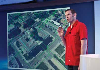
Views and opinions
map-making agencies, usually under the cloak of
‘national security,’ have been traditionally reticent
about publishing details about what rules govern
the information they exclude especially where this
involves military installations or other politically
sensitive sites.”14 Google Earth has upset govern-
ment hegemony over satellite imagery, and sig-
nificant concern has been raised internationally
over state secrets and security infrastructure

                                                                                                                                                    R e u t e r s p h o t o RT R 1 Q TO I b y O l e g Po p o v
shown within the plain sight of the public eye.
Furthermore, Google Earth is being used by indi-
viduals and organizations in active, not passive
methods, to challenge long-established state dom-
ination over space and military intelligence. The
first case study that will be examined with be the
use of Google Earth by Palestinian militants to
strike targets within Israel.

Take 3 rd World Ideology, Add 2 nd World                Palestinian militants from the al-Aqsa Martyrs Brigades parade in Ramallah, 15 June 2007.
Weaponry, Plus 1 st World Technology,
Equals…                                                                Google Earth and the ‘War on Terror’

W       ithin the tragic tale of the long-established Israeli-
        Palestinian conflict, it is clear that Israel has held the     I  n Western society, a key indicator that individuals/govern-
                                                                          ments/corporations take reservation with an issue is demon-
                                                                       strated in their willingness to take legal action against a per-
dominating position of military supremacy via technology and
surveillance for several decades. This balance of power is             ceived slight or injustice. Take the seemingly-unprecedented
slowly starting to shift, and one element in this ever-changing        example of British troops stationed in Basra, Iraq, where mem-
equation is the introduction and utilization of Google Earth by        bers of the Royal Green Jackets, an infantry unit, have threat-
Palestinian militants to more accurately strike Israel with            ened to sue Google if soldiers were wounded by an attack
rockets.15 Striking distant targets with indirect fire (munitions      facilitated by Google Earth Images.18 In an article describing a
fired beyond line-of-sight) is extremely difficult, as numerous        historical ‘first,’ journalist Elinor Mills detailed how British
variables are required to predict the necessary point of aim.          soldiers had reacted to the knowledge that “… documents seized
Imagery from Google Earth allows the collection of distance,           in raids on insurgents’ homes were printouts from photos taken
altitude, and target identification, allowing militants the ability    from Google Earth that show the location of buildings, tents,
to both fixate (figure out where they are) and orient (what way        latrines and lightly armoured vehicles.”19 When confronted with
they need to point) rocket positions, to strike Israeli positions      evidence that insurgents had pinpointed the precise latitude and
using firing tables. In layman’s terms, Google Earth allows            longitude of soldiers’ quarters, a British intelligence officer sur-
Palestinian militant groups, such as the al-Aqsa Martyrs               mised the situation by stating: “This is evidence, as far as we are
Brigade, to more accurately strike specific locations within           concerned, for planning terrorist attacks…We believe they use
Israel, by giving them a better picture of real-world intelli-         Google Earth to identify the most vulnerable areas, such as
gence on the ground.16 This cartographic knowledge was once            tents.”20 Reports of similar incidents have occurred throughout
almost exclusively held by the Israelis, and Google Earth is, in       Iraq, and the discovery of instructional videos located online
essence, ‘levelling the playing field’ between the two combat-         briefing insurgents on how to use Google Earth to attack
ants. Khaled Jaabari, a commander for the al-Aqsa Martyrs              Coalition forces has made such news mainstream.21 Google
Brigade, stated: “We [al-Aqsa Martyrs Brigade] obtain the              Earth is becoming more than just an interesting application – it
details from Google Earth and check them against our maps of           is becoming a weapon. Weapons do not have to consist of rifles,
the city centre and sensitive areas.”17 Thus, Google Earth is          helicopter gunships, or grenades, as Captain (ret’d) Nathan Fick
narrowing the technical divide between two historically mis-           recalled in his memoirs One Bullet Away: “In the Marines, any-
matched opponents. Ten years ago, militants such as Khaled             thing can be a weapon; it’s a whole new way of thinking. My
Jaabari simply could not match the surveillance and carto-             plastic MRE (Meal, Ready-to-Eat) spoon was a weapon if I used
graphic capabilities of the Israelis, who spent millions, if not       it as an insulator on a radio antenna so that I could talk to jets
billions of dollars to maintain such superiority. Now, groups          and call in air strikes.”22 Concerns of the nefarious capabilities
like the al-Aqsa Martyrs Brigade are receiving high quality            unintentionally laden within Google Earth have prompted con-
geographic information, for free. While this cost is easy for          troversy regarding the safety of soldiers deployed overseas dur-
them to bear, it is certainly the opposite for the Israelis, and       ing the ‘War on Terror,’ as well as within domestic security cir-
efforts have been undertaken to have imagery purposely cen-            cles. China, Iran, Turkey, Morocco, Bahrain, Sudan, Jordan,
sored or lowered in resolution to make targeting more diffi-           Sweden, and the United States have all undertaken efforts to
cult. Following the next case study of Google Earth and the            block or ban Google Earth from photographing certain facili-
‘War on Terror,’ further discussion will deal with state               ties, including the White House, and Google Street View has
responses and security issues regarding Google Earth.                  been banned from photographing military bases in the United

74                                                       Canadian Military Journal              • Vol. 13, No. 3, Summer 2013
Views and opinions
States, as well as around sensitive facilities in Great Britain.23                      Implications and Conclusions
Despite the efforts of many states in limiting the impact of sen-
sitive cartographic knowledge to outsiders, access to Google
Earth is widely available internationally, and on several occa-
sions, Google has accidently revealed areas blurred out at the
                                                                                        G     oogle Earth represents more than a dual use (civilian/
                                                                                              military) technology – it marks the movement of carto-
                                                                                        graphic information, once jealously guarded and vetted by the
request of governments.24 While Chris Perkins and Martin                                state, into the public domain under private control. Maps pos-
Dodge assert that “…the most effective mapping…has been,                                sess enormous power, and the aforementioned transition is not
and often still is, the exclusive preserve of the military,” they                       without growing pains, as seen in case studies of Israel, and
miss the point that insurgents do not need extraordinary com-                           the ‘War on Terror.’ While the unintended capabilities of
plex or detailed maps to strike targets.25 Simply put, Google                           Google Earth represent a threat to the control of cartographic
Earth provides, for free, a static, ‘bird’s-eye view’ of the battle-                    knowledge by the state, there is hope that the decentralization
fields of the 21st Century, a capability unavailable to all but a                       of geographic information will result in a more harmonious
select group of states ten years ago. Google Earth can be, and                          world. While this short article was intended to inform the
has been used, to assist in successful insurgent operations that                        reader about a developing cartographic story, the conclusion
would have been unimaginable without the cartographic power                             has not yet been written, as Google Earth remains in its
of the state. This decentralization of knowledge is unprece-                            infancy. Ultimately, like most things in this world, Google
dented, and this trend will likely increase, not decrease over                          Earth will become what we, as humanity, make of it.
time. Prior to concluding, this article will look at the response
of Google Earth to claims that it threatens national security.                          Lieutenant Nicholas Kaempffer, an artillery officer, has a Bachelor of Arts
                                                                                        (Honours) degree in Geography from Queen’s University. He is a Troop
Responses from Google Earth                                                             Commander at the Royal Regiment of Canadian Artillery School (RCAS).

G     oogle Earth has been both praised and pil-
      loried for its responses to requests based
upon national security concerns. While Google
Earth director John Hanke has pointed out that
terrorists have, and will continue to attack tar-

                                                                                                                                                                             R e u t e r s p h o t o RT R 2 M U LV b y T h o m a s Pe t e r
gets with or without Google Earth, on several
occasions, Google has acquiesced to demands to
reduce resolution on locations deemed sensitive,
including complexes in India, Great Britain, and
the United States.26 Furthermore, as Google
Earth is based out of the United States, they are
prohibited in exporting Google Earth to Iran,
due to U.S. regulations.27 Despite the downscal-
ing of resolutions in some sensitive areas, what
is clear is that Google Earth is here to stay, and
that it will be continued to be used for both                        German Chancellor Angela Merkel and Google north and central Europe head Philipp
                                                                     Schindler look at a Google Earth application during a media night in Berlin, 24 May 2011.
peaceful and nefarious applications.

               NOTES

1.    David Turnbull, “Cartography and science in early           prime example of military cartography at work.     18.   Elinor Mills, “Google, British Military Discuss
      modern Europe: Mapping the construction of knowl-     8.    Perkins and Dodge, p. 1.                                 Google Earth Use in Attacks,” at CNET, 2007, at
      edge spaces,” in Imago Mundi, Vol. 48, No.1, p. 7.    9.    Ibid.                                                    https://moodle.queensu.ca/file.php/868/Google_
2.    Ibid.                                                 10.   Google Earth (2010), at http://www.google.com/           Maps_Military_Uses_001.pdf
3.    Ibid, p. 14.                                                earth/index.html.                                  19.   Ibid.
4.    Ibid, p. 16.                                          11.   Google Street View (2010), at < http://www.        20.   Ibid.
5.    Chris Perkins and Martin Dodge, “Satellite imag-            google.com/intl/en_us/help/maps/streetview/>.      21.   Stahl.
      ery and the spectacle of secret spaces,” in           12.   Roger Stahl, “Becoming Bombs: 3D Animated          22.   Nathan Fick, One Bullet Away (New York, First
      Geoforum, 2009, p. 2.                                       Satellite Imagery and the Weaponization of the           Mariner Books, 2005), p. 28.
6.    Lord Baden-Powell, founder of the Boy Scouts,               Civic Eye,” in MediaTropes, 2010, Vol. 2, No. 2,   23.   1. Stahl. 2. Federal Aviation Administration.
      was an English officer during the 19th -20th                2:2, p. 65.                                              “Every US Military Base Identified on Google
      Centuries, famous for his intelligence work,          13.   Ibid, p. 66.                                             Maps,” at < Seeandavoid.org.> 3. Mike Ferro,
      whereby he would disguise himself as a butterfly      14.   J.B. Harley, “Maps, knowledge and power,” in D.          “Google Earth Uncovers Secret UK Nuke Base –
      collector and sketch sensitive enemy military               Cosgrove and S. Daniels, (Eds.), The Iconography         Is Technology Out of Hand?” 2009, at https://
      installations, hiding the outlines within the wings         of Landscape (Cambridge, PA: Cambridge                   moodle.queensu.ca/file.php/868/Google_Maps_
      of his drawings.                                            University Press, 1988), p. 301.                         Military_Uses_003.pdf.
7.    A case in point was President Kennedy’s publica-      15.   Clancy Chassay and Bobby Johnson, “Google          24.   Ferro.
      tion of Russian nuclear missile installations in            Earth Used to Target Israel,” 2007, in Guardian,   25.   Perkins and Dodge, p. 2.
      Cuba during the Cuban Missile Crisis. Surveillance          at < http://www.guardian.co.uk/technology/2007/    26.   Ferro.
      photos from American U2 spy planes was used to              oct/25/google.israel.>                             27.   Google Earth Support Forums, 2010, at http://
      garner both political support at home, and within     16.   Ibid.                                                    www.google.com/support/forum/p/earth/thread?ti
      the United Nations for a blockade of Cuba – a         17.   Ibid.                                                    d=403a43f2bf5def3b&hl=en.

Vol. 13, No. 3, Summer 2013                            • Canadian Military Journal                                                                                 75
You can also read