Canada's Rivers at Risk - Environmental Flows and Canada's Freshwater Future
←
→
Page content transcription
If your browser does not render page correctly, please read the page content below
Canada’s
Rivers at Risk
Environmental Flows and Canada’s Freshwater Future
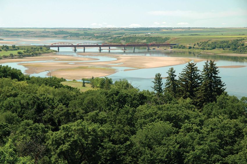
Table of Contents
ACKNOWLEDGEMENTS
Canada’s River’s at Risk

WWF-Canada acknowledges the valuable                 Cover page                                         Rivers
contributions of the river scientists, advocates,    Large photo © Garth Lenz / WWF-Canada              Skeena © Mike Ambach / WWF-Canada
and managers from across Canada who lent
their time and insights to this report. Special
                                                     Dam © Ontario Power Generation
                                                     Sunset © Becky Swainson
                                                                                                        Mackenzie © Tessa Macintosh / WWF-Canada
                                                                                                        Fraser © Michel Roggo / WWF-Canon
                                                                                                                                                            2    Summary
thanks to Becky Swainson for synthesizing vast       Irrigation © Photodisc                             Athabasca © Jiri Rezac / WWF-UK
volumes of information into the technical study      Parliament © Jupiter Images                        Nipigon © Gord Ellis
on which Canada’s Rivers at Risk is based, and
to Brian Richter, Oliver Brandes, Tim Morris,
                                                     Dry earth © Photodisc                              Grand © GRCA photo by Carl Hiebert
                                                                                                        Ottawa © Alex Indigo
                                                                                                                                                            4    Introduction
                                                     Table of contents
David Schindler, Tom Le Quesne and Allan Locke                                                          South Saskatchewan © Rob Huntley
                                                     © Garth Lenz / WWF-Canada
for their thoughtful reviews. WWF-Canada also
wishes to acknowledge Sarah Weber of Lightning       Summary
                                                                                                        St. Lawrence © Dave Finger
                                                                                                        Saint John © Gilbert Van Ryckevorsel / WWF-Canada   6    Environmental Flows: Threats and Impacts
Editorial and the staff at Mystique Creative for     © Garth Lenz / WWF-Canada
                                                                                                        Conclusion
their work on the final product.                     Introduction
                                                                                                                                                            8    Skeena River
                                                                                                        © Garth Lenz / WWF-Canada
Finally, WWF-Canada gratefully acknowledges          © Greg Stott / WWF-Canada
                                                                                                        Back cover
John McCutcheon for his long-standing commit-        Environmental Flows                                © Garth Lenz / WWF-Canada
ment to freshwater protection in Canada. We also     Large photo © Frank Parhizgar / WWF-Canada
thank the Pat and John McCutcheon Charitable
Foundation and Ted Hogarth for providing financial
                                                     Dam © Patricia Buckley / WWF-Canada
                                                     Irrigation © Patricia Buckley / WWF-Canada
                                                                                                                                                            10   Mackenzie River
support to this project.                             Climate change © Patricia Buckley / WWF-Canada
WWF-Canada would like to thank Coca-Cola in
Canada for its financial support of this project.                                                                                                           12   Fraser River
                                                                                                                                                            14   Athabasca River
KEY TERMS
Average discharge: A measure of                      Species Conservation Council (CESCC)               intergovernmental treaty – the Convention           16   Nipigon River
the long-term average volume of water                uses COSEWIC assessments to develop                on Wetlands – commonly referred to as
flowing out of a river or stream. The                species conservation strategies.                   the Ramsar Convention.
Mackenzie River has an average discharge
of 9,020 cubic metres per second (m3/s) –
                                                     Floodplain: The flat land adjacent to a            Transboundary river: A river that intersects        18   Grand River
                                                     stream or river that is inundated by water         (flows across) at least one political border.
equivalent to approximately 3.5 Olympic
                                                     during high-flow periods.                          Borders can be between countries or within
swimming pools draining every second.
In contrast, the Grand River, with its average       IJC: The International Joint Commission.
                                                                                                        countries (in Canada, between provinces or          20   Ottawa River
                                                                                                        between provinces and territories). See also
discharge of 34 m3/s, drains the equivalent          The IJC is an independent, binational
                                                                                                        boundary river.
of 0.014 Olympic swimming pools per
second.
                                                     organization that aims to prevent and resolve
                                                     water-related disputes between Canada              UNESCO World Heritage site: A site that             22   South Saskatchewan River
                                                     and the United States and provide counsel          the United Nations Educational, Scientific
Boundary river: A river that forms a political
border. Borders can be between countries
or within countries (in Canada, between
                                                     on the effective management of shared
                                                     water resources.
                                                                                                        and Cultural Organization World Heritage
                                                                                                        Committee (UNESCO) recognizes as having             24   St. Lawrence River
                                                                                                        great cultural or natural significance.
provinces or between provinces and                   Important Bird Area: A site that Bird
territories). See also transboundary river.          Life International – a global partnership of
                                                     conservation organizations – recognizes as
                                                                                                        Watershed: An area of land that collects
                                                                                                        and drains precipitation through streams,
                                                                                                                                                            26   Saint John River
Canadian Heritage River: A river
                                                     providing critical habitat for bird populations.   rivers, and other outlets into a common
recognized nationally for its importance to
Canada’s river heritage. Upon review by              Interbasin diversion: The unnatural
                                                     movement of water (e.g., through a pipe
                                                                                                        body of water. It is also known as a basin,
                                                                                                        catchment, drainage basin, or river basin.          28   Charting the Course Ahead
the board of the Canadian Heritage River
System (CHRS), ministers responsible des-            or a canal) from one basin (or watershed)
ignate, by formal proclamation, nominated            to another.
rivers that satisfy the selection criteria and       Mainstem: The principal river in a water-
successfully pass the approval process.              shed into which water from smaller streams
COSEWIC: The Committee on the                        and rivers (i.e., tributaries) in the basin
Status of Endangered Wildlife in Canada.             eventually flow.
COSEWIC is group of wildlife experts                 Ramsar wetland site: A wetland identified
that assesses the status of species at risk          as being of international importance,
in Canada. The Canadian Endangered                   especially as waterfowl habitat, under an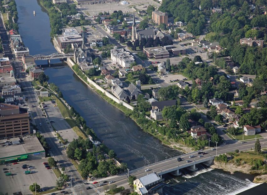
Summary
                                                                                                                                           Environmental Flows in Canada's Rivers:
                                                                                                                                           Status and Forecast                                                                   The coloured icons summarize the status
                                                                                                                                                                                                                                 and forecast for environmental flows for the
                                                                                                                                                                                                                                 10 Canadian rivers profiled in this report.
Canada is among the world's most water wealthy nations. But missing from this story is a critical component of
                                                                                                                                                                                                                                 Icon colour represents the status – blue is
freshwater health: flow. Evaluating the health of our freshwater resources from the perspective of river flow
                                                                                                                                                                                                                                 “natural,” green is “good,” yellow is “fair,”
and nature’s needs, as opposed to raw quantities, yields a more sobering picture of fresh water in Canada. It also
                                                                                                                                                                                                                                 and red is “poor.” Arrow direction (upward,
provides insight into key threats, and the actions needed to avert a crisis and maintain Canada’s most precious
                                                                                                                                                                                                                                 downward, or horizontal) indicates the
natural resource.
                                                                                                                                                                                                                                 forecast: improving, declining, or steady.
A river’s flow regime – its natural pattern of high and low flows – is much like blood pressure in the human body: a vital
indicator of overall ecosystem health. If we wish to maintain the many social, cultural, and economic benefits that rivers
provide – a reliable water supply, fish and other foods, water purification, and spiritual and recreational values – then we
must maintain the flow regimes that support these benefits. The science of environmental flows provides a framework for
better understanding flow regimes and the tools needed for protecting and restoring river health.

Given the mounting pressures on the planet’s finite fresh water, maintaining river flows is a growing challenge. Many of the                                                          Mackenzie
world’s rivers are at risk from the impacts of producing more food, generating electricity, fuelling industry, and quenching the
thirst of expanding cities. Climate change further compounds these problems by introducing new threats and uncertainties.                  Skeena
Canada’s Rivers at Risk assesses how these many pressures are affecting environmental flows in 10 of the nation’s rivers.
Overall, their status is troubling, and the forecast less certain than we might expect. Three primary threats to freshwater flow emerge:
    Flow regulation and fragmentation by dams, locks, and weirs have altered flows and water levels, and species are suffering;
                                                                                                                                                                                                                                  St. Lawrence
    Water withdrawals and diversions for cities and agriculture are drawing down rivers, some to dangerous levels;
    Climate change is altering the entire context of water management, as glaciers melt, precipitation patterns shift, and
    droughts and floods become more frequent and intense.
                                                                                                                                                                               Athabasca

Flow regimes in some of Canada’s most important rivers, such as the South Saskatchewan and the St. Lawrence, have                                                                                        Nipigon
been modified to the extent that ecosystems are in serious trouble. Soon many others – including some of the planet’s                                    Fraser                                                            Ottawa
increasingly scarce large, free-flowing rivers like the Skeena, the Athabasca, and the Mackenzie – could be in trouble as                                               S. Saskatchewan
well, as demands on their waters grow and climate change intensifies.                                                                                                                                                                                  Saint John
Yet Canada, unlike many countries, still has the opportunity to avert a national water crisis by keeping rivers flowing, for nature
and for people – but only if we take immediate action:                                                                                                                                                                                  Grand
                                                                                                                                                                                                                                                                  0   200 400
    Take aggressive action on climate change. Be part of the global solution to stopping climate change by helping to create                                                                                                                                                km
    and implement a fair, effective, and science-based global agreement, while reducing Canadian emissions and protecting
    rivers here at home as the climate changes.                                                                                            The 10 rivers assessed in Canada’s Rivers at Risk and their watersheds
    Keep water use within nature’s limits. Maintain water withdrawals within each watershed’s sustainable limits and prohibit
    interbasin transfers that move water from one watershed to another.
                                                                                                                                           Why These 10 Rivers?
    Change the flow. Design and operate dams and other instream infrastructure to better balance nature’s needs (the flow
                                                                                                                                           The 10 rivers included in Canada’s Rivers at Risk represent a range of geographical regions and ecosystems within the
    regimes required to sustain healthy rivers) with human needs for hydropower, navigation, flood control, and water storage.
                                                                                                                                           country’s major drainage basins (Pacific, Arctic, Hudson Bay, and Atlantic). The rivers range from pristine and free flowing
Acting on these three key steps will require changes to how we manage fresh water in Canada. We will need to                               to highly modified and managed systems. They are rivers of national significance – a number cross or form international or
focus on whole watersheds, applying the principles of Integrated River Basin Management to ensure coordination of                          interprovincial/territorial borders, many are critical to Canada’s primary industries, such as fishing, mining, or forestry, and
the conservation, management, and development of fresh water. Federal and provincial governments must lead the way,                        some are of particularly high national conservation value. The intent in focusing on these rivers is to draw attention to the
collaborating with a broad range of stakeholders, to protect and restore environmental flows and river health as a                         diversity of existing and potential threats to environmental flows in Canada's rivers, and to highlight examples of where
foundation of a secure freshwater future for Canada.                                                                                       efforts have been made to mitigate these issues and where they remain unaddressed.

2   wwf   – canada’s rivers at risk                                                                                                                                                                                   environmental flows and canada’s freshwater future         3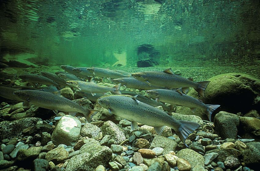
Introduction reading the
report cards:
STATUS & FORECAST
The status and Blue indicates a Green indicates Yellow indicates a Red indicates a
forecast of environ- natural status; a good status; fair status; flows poor status; flows
mental flows for the flows are not notice- flows are slightly are increasingly are substantially
10 rivers are shown ably altered from altered from the altered from the altered from the
Nothing, perhaps not Nowhere on the planet are fewer people stewards of
such vast freshwater resources as in Canada. The
in coloured icons
that summarize the
the natural regime,
and key species
natural regime, but
key species and
natural regime and
there is evidence of
natural regime, and
key species and
information included and ecosystems ecosystems remain negative impacts ecosystems that
even climate change, country ranks among the world’s top nations in terms
of renewable water supply and shares the planet’s
in individual report that depend on generally healthy. on key species depend on natural
cards for each river. natural flows are The downward and ecosystems. flows are signifi-
will matter more to largest freshwater ecosystem – the Great Lakes.
Such global treasures make Canada enviable in an
generally healthy.
The horizontal arrow
arrow indicates a
declining forecast.
The upward arrow
indicates an
cantly affected.
The downward
humanity’s future on this increasingly thirsty and warming world. indicates a steady
forecast.
improving forecast. arrow indicates a
declining forecast.
But this perspective is misleading. Water is constantly
planet over the next moving, and it is this constant motion – the flow of water –
that provides much more insight into the availability of
century than the fate of fresh water and the health of freshwater ecosystems than
do national statistics or global rankings based on volume
our rivers. alone. Focusing on flow draws attention to the scale that
matters most when it comes to fresh water – the watershed.
– Fred Pearce, When the Rivers Run Dry Nature’s boundaries, not political boundaries, define
What Are Environmental Flows?
when and where water flows, and how much is available,
The Brisbane Declaration, a widely endorsed global call to action to protect the world’s rivers, provides the most common
both for nature and for people.
definition of environmental flows:
Healthy rivers provide many goods and services that we Environmental flows describe the quantity, timing and quality of water flows required to sustain freshwater and
tend to take for granted: a reliable water supply, fish and estuarine ecosystems and the human livelihoods and well-being that depend on these ecosystems.
other foods, water purification, and cultural, spiritual, and
Every river exhibits its own natural flow regime that is an expression of the local and regional climate interacting with the
recreational values. If we wish to maintain these vital
geology, soils, and vegetative cover in the river’s watershed. The flow regime includes the variable pattern of high and
functions and values, then we must maintain the river flows
low flows that occur in any given year and across many years. River scientists agree that flow regime is a fundamental
that are fundamental to them. In this sense, water flow is
determinant of the health of a river. But addressing environmental flows is as much a social process as it is scientific study.
much like blood pressure: a vital – but not the sole –
Science plays an important role in assessing the impacts of human water use on river health, but effectively addressing
indicator of ecosystem health.
environmental flows ultimately depends on a range of stakeholders with various interests deciding together to take action.
The concept of environmental flows provides the scientific
About the Report
foundation for defining how much water a river needs to
Canada’s Rivers at Risk assesses the status of environmental flows in 10 Canadian rivers, and provides a forecast of
remain healthy and productive. It is based on the understand-
likely future conditions. The report focuses on the impacts of three key threats to environmental flows – flow regulation and
ing that there are limits to the degree to which we can
fragmentation, water withdrawals and diversions, and climate change – and identifies actions to address these threats.
modify natural water flows, by withdrawing and diverting
It is based on scientific information drawn from publications by academics, governments, industry organizations, and
water or building dams and other instream infrastructure,
environmental NGOs, complemented by interviews with 22 experts from these sectors who have detailed knowledge about
before freshwater ecosystems – and the many social,
specific rivers. The full technical study on which this report is based is available online at wwf.ca/rivers.
cultural, and economic benefits they provide – become
compromised. Put differently, the concept of environmental Environmental flow assessments are summarized in individual report cards for each of the 10 rivers. In the top right corner
flows changes fundamentally the perspective and question of each report card is a coloured icon that represents the status and forecast for each river (the icons are described above).
underlying fresh water management. It forces us to look The status is based on evaluation of the cumulative impacts of the key threats noted above. The forecast indicates the likely
at water use from ecosystem outward – to answer the trajectory of the status of environmental flows in each river, based on evaluation of potential future threats, such as increased
question of how much water we can use by first asking water withdrawals or construction of new dams, as well as current and proposed measures aimed at protecting and restoring
how much water the river can give. environmental flows.
4 wwf – canada’s rivers at risk environmental flows and canada’s freshwater future 5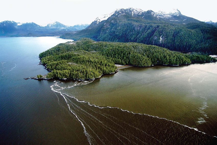
Environmental Flows:
Threats and Impacts

Threats to environmental flows in Canada are the same as those affecting rivers around the planet. Modification
of flows by dams and other instream infrastructure, growing water withdrawals and diversions, and the pervasive
threat of climate change can result in grave consequences for the integrity and biodiversity of rivers, and often for             Cumulative Impacts at the Watershed Scale
the communities and economies that are so intimately linked to them.
                                                                                                                                  Taken individually, flow regulation and fragmentation, withdrawals and diversions, and climate change can have
                                       Flow Regulation and Fragmentation                                                          significant impacts on environmental flows and river health. Watersheds are complex systems, however, and rarely
                                       Flow regulation and fragmentation by dams and other instream infrastructure such           does a single threat occur in isolation. What matters most – and what typically garners the least attention – is how
                                       as locks, weirs, and dikes are significant threats to environmental flows in the world’s   these pressures come together at the watershed scale. Urban planning, proposals for new dams and infrastructure,
                                       rivers. In 2000, there were 849 large dams and thousands more smaller dams in              and applications to withdraw or divert more water are typically considered individually, through different regulatory
                                       Canadian rivers and streams. While the era of dam building in Canada was once              and decision-making processes. The key challenge, then, in effectively addressing environmental flows is to consider
                                       thought to be over, growing demand for low-carbon energy supply (e.g., hydropower)         the cumulative impacts on rivers of multiple stresses – both existing and potential – and to understand how threats
                                       is now driving new construction. New proposals and projects of various sizes – from        interact with one another and possibly result in magnified impacts and unexpected consequences.
                                       small-scale projects to large-scale developments – are emerging across Canada.

                                       Dams and other instream infrastructure affect freshwater ecosystems by altering
                                       flow patterns and severing connections between different parts of a river, by dis-
                                       connecting rivers from floodplains and wetlands, and often by storing water that
                                       would naturally flow freely downstream.

                                       Withdrawals and Diversions
                                       Globally, freshwater withdrawals – the removal of water from ecosystems for
                                                                                                                                                                                   Climate Change
                                       use in agriculture, industry, and municipalities – have risen 35-fold in the past
                                                                                                                                                                                   Evidence shows that climate change will result in – and indeed is already
                                       300 years and have increased by 20% per decade since 1960. In Canada, the five
                                                                                                                                                                                   causing – significant changes to water cycles globally and locally. Even
                                       main water users are thermal power generation, manufacturing, municipalities,
                                                                                                                                                                                   small changes in temperature and precipitation can result in relatively large
                                       agriculture, and mining. Some water uses are more consumptive than others.
                                                                                                                                                                                   changes in the magnitude and timing of flow, and the intensity of floods
                                       Consumptive use removes water from a river system and makes it unavailable for
                                                                                                                                                                                   and droughts. In a recent review of worldwide changes in river flows,
                                       further use downstream, posing a greater threat to environmental flows than do
                                                                                                                                                                                   scientists concluded that the traditional assumption of “stationarity” –
                                       uses that return water directly into the same water body or watershed. Irrigation
                                                                                                                                                                                   which assumes that river flow data from the past can be used to predict
                                       is the largest consumptive use of water; according to Environment Canada, 94%
                                                                                                                                                                                   the availability of water in the future – is almost certainly wrong in this new
                                       of water withdrawn for agriculture in Canada in 2005 was consumed.
                                                                                                                                                                                   era of climate change.
                                       Diversions – when water is artificially moved between watersheds – can cause
                                                                                                                                                                                   Studies show that maximum river flows are generally decreasing across
                                       a decrease or an increase in river flows; both can have negative impacts. Canada
                                                                                                                                                                                   most of Canada and that spring runoff is occurring earlier than in the past.
                                       diverts more water from one watershed to another than any other country on earth.
                                                                                                                                                                                   These effects of climate change are expected to persist and intensify in
                                       Withdrawal and diversion of large amounts of fresh water can significantly alter the                                                        the foreseeable future, and will be particularly problematic in regions where
                                       quantity and timing of river flows. When water is withdrawn or diverted is as                                                               other stressors are already affecting environmental flows. Climate change
                                       important as how much. Taking water during low flows and droughts typically has a                                                           is also likely to intensify competition for water resources, making
                                       greater impact on river health than does taking water during other periods.                                                                 protection of environmental flows even more challenging in the future.

6   wwf   – canada’s rivers at risk                                                                                                                                                                       environmental flows and canada’s freshwater future         7
Skeena environmental flows
status: Natural
forecast: Steady
River
Flow
Regulation • The mainstem is free flowing and unaffected
and by flow regulation and fragmentation
Fragmentation
• There are eight current licences and seven
active applications for run-of-river hydropower
projects in the watershed
• An area the size of Vancouver Island in the
headwaters has been licensed for coal bed
• Relative to total flow, withdrawals from methane extraction; such development could
Withdrawals the mainstem are not a major concern reduce important groundwater contributions
and to river flow
• Because of low flows in tributaries, with-
Diversions drawals for agriculture in the interior of the
watershed are cause for some concern • A combination of low rainfall and increasing
water withdrawals is raising concern over
low flows, which prevent salmon from reaching
spawning beds in Maxan Lake
• Average annual and late summer flows have
declined in the interior of the watershed since
the 1930s
• Average air temperature in the watershed
Climate
is expected to rise by 2.4 to 6.4˚C by
Change the 2050s • A 56% decrease in snowpack is expected by
2050, which will cause lower summer flows
At a glance Flowing unimpeded from its headwaters in northern
British Columbia, the Skeena River rushes southwest
Length: 580 km through the Coast Mountains to meet the Pacific Ocean
Average Discharge: 1,760 m3/s south of Prince Rupert. The river and its watershed
Watershed Area: 54,432 km2 support incredible biodiversity and natural resources,
Major Drainage Basin: Pacific Ocean most notably the salmon that begin life here and return
Jurisdiction: British Columbia years later to spawn in its pristine waters.
Rugged mountains, dense forests, grizzlies, and ancient
totem poles characterize the Skeena watershed. Numerous
Looking Ahead
fish species inhabit the river, including oolichan, lake and
In the Skeena, we have the opportunity to protect one of the continent’s scarce wild rivers. However, an independent
cutthroat trout, Dolly Varden, and five salmon species. The
scientific review panel recently expressed concerns that current regulations and existing water management are inadequate
regional economy and culture depend significantly on the
for safeguarding wild salmon habitat from the cumulative impacts of development projects in the watershed.
Skeena. Its natural flows sustain Canada’s second largest
wild salmon fishery, worth almost $110 million annually. Concern is growing over the future of the Skeena. NGO advocacy and a two-year protest and blockade by members of the
Salmon are the foundation of the rich First Nations culture Tahltan First Nation helped gain a moratorium on coal bed methane development in the river’s headwaters. Opposition is
Prince Rupert of the watershed, where fishing continues in the traditional growing to a proposed pipeline that would bring oil from the Athabasca oil sands through the Skeena watershed to a potential
e way today as it has for millennia. supertanker port on the B.C. coast. Local residents and others advocating responsible development of independent power
r
Skee na R i v
projects are closely watching development of run-of-river hydropower. But emerging changes to provincial policy may
Development has not yet compromised environmental
improve protection of environmental flows. The B.C. government’s Living Water Smart initiative states that by 2012 water
flows in the river but soon could. Proposed mines, coal
laws will improve ecosystem protection, and that legislation will recognize the flow requirements of ecosystems and species.
bed methane fields, oil and gas pipelines, and run-of-river
hydropower projects, all of which could negatively affect Protecting the Skeena will require proactive steps to ensure that development occurs in a sustainable way. Watershed
flow regime, are examples of the recent unprecedented scale governance based on principles of ecosystem based management is emerging as a promising approach to securing a
development interest in the Skeena watershed. vibrant and thriving Skeena watershed for future generations.
8 wwf – canada’s rivers at risk environmental flows and canada’s freshwater future 9
Mackenzie environmental flows
status: Natural
forecast: Steady
River
Flow • Flow regulation and fragmentation
Regulation moderately affect the river
and • The mainstem is free flowing; a large
• The W.A.C. Bennett Dam on the Peace River
Fragmentation dam alters flows of a major tributary,
the Peace River has reduced seasonal flow variations in
the Mackenzie River
• Summer flow in the Slave River declined by
35% between 1950 and 2005 due to the
combined effects of the W.A.C. Bennett Dam
• Relative to total flow, withdrawals from and climate change
Withdrawals the mainstem are not a major concern
and • Spring runoff is beginning earlier; warmer
• Large withdrawals for oil sands develop-
Diversions ment are taken from the Athabasca River, temperatures could reduce flow in the
a major tributary of the Mackenzie Mackenzie and negatively affect its fragile
delta ecosystem
• Climate change is expected to magnify the
negative impacts of the growing Athabasca
oil sands development on the quantity of
• Average air temperature in the water flowing downstream
Mackenzie Delta region has increased by
Climate 1.7˚C over the past century – more than
• Warming of the Arctic is expected to result in
Change anywhere else in Canada
changes to the hydrology of northern rivers like
• The Arctic is warming faster than the Mackenzie; the scope and magnitude of
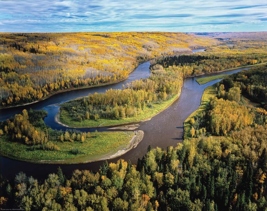
At a glance Named Deh Cho, or “big river,” by the Dene people,
the Mackenzie River flows northward from Great Slave
anywhere else on earth
these changes remain uncertain
Length: 1,738 km Lake through pristine wilderness to the Arctic Ocean.
Average Discharge: 9,020 m3/s One of the world’s few large wild rivers, the free-flowing
Watershed Area: 1,800,000 km2 Mackenzie is a remarkable ecosystem of continental
Major Drainage Basin: Arctic Ocean and global importance.
Jurisdictions: NWT, Yukon, British Columbia,
Alberta, Saskatchewan Draining 20% of Canada’s land mass and gathering waters
from British Columbia, Alberta, Saskatchewan, Yukon, and Looking Ahead
Beaufort Sea NWT, the Mackenzie watershed intersects many political Protecting one of the planet’s few remaining large free-flowing rivers will require long-term planning, given the dramatic changes
boundaries. Approximately 7,800 people, 70% of whom expected due to climate change and the growing interest in developing the Mackenzie's water resources.
Inuvik
are Aboriginal, live near the river in 13 communities.
Peel The foundations for such planning already exist, and there is growing recognition of the importance of environmental flows.
River
At its mouth, the river deposits vast quantities of sediment, The NWT government and the federal Department of Indian and Northern Affairs are developing a water resources management
Mac
forming the magnificent Mackenzie Delta, which supports strategy for the territory. Northern Voices, Northern Waters, the discussion paper framing the strategy, proposes
ke
nzie River
numerous species of land and marine mammals, fish, and an objective aimed at protecting environmental flows.
birds. Seven internationally recognized Important Bird Areas
Yellowknife
Many of the threats to environmental flows in the Mackenzie, however, originate in upstream jurisdictions outside NWT.
occur near the Mackenzie’s shores. One of the most pro-
Great Slave
Recognizing the need to address transboundary water management issues, the governments of Canada, B.C., Alberta,
Liard River Lake ductive ecosystems in northern Canada, the Mackenzie Delta
Saskatchewan, Yukon, and NWT developed the Mackenzie River Basin Transboundary Master Agreement, which came
depends on the river’s flow regime to feed its more than
Peace River into effect in 1997. It commits its signatories to a set of principles under which neighbouring jurisdictions are to negotiate
50,000 lakes. The river provides 11% of freshwater flow into
bilateral agreements to manage shared waters. Unfortunately, to date only one bilateral agreement is in place.
the Arctic Ocean, playing a significant role in regulating ocean
circulation and Arctic climate systems. As climate change Protecting the Mackenzie’s environmental flows will depend on strong bilateral agreements between neighbouring
Athabasca
River
and development in northern Canada intensify, protection of provinces and territories. Legal analysts point to the need for stronger federal government participation to ensure that such
environmental flows will be critical to securing the health of agreements are reached. Without federal leadership upstream jurisdictions are likely to delay negotiations, or agree to only
the river as well as the species and people that depend on it. modest commitments, so as not to constrain their own future uses of the shared waters of the Mackenzie watershed.
10 wwf – canada’s rivers at risk environmental flows and canada’s freshwater future 11
Fraser environmental flows
status: Good
forecast: Steady
River
Flow • Flow regulation and fragmentation
Regulation moderately affect the river
and • The mainstem is free flowing; dams • Downstream of the dam and interbasin
Fragmentation on tributaries alter flow regimes diversion on the Nechako River, a Fraser
tributary, summer flows have decreased by
up to 60%, coinciding with recruitment failure
in endangered white sturgeon
• Large water withdrawals in the interior of the
• Relative to total flow, withdrawals from watershed, especially during dry periods,
the mainstem are not a major concern have led to localized low flows and stressed
Withdrawals
and • The Kemano Diversion moves two-thirds freshwater species
of the Nechako average flow from the
Diversions
Fraser watershed to the west coast for • Record low flows and water levels have
industrial hydropower generation occurred in the interior due to lower snowpack,
earlier melt, and warm, dry weather; these
conditions are expected to persist
• Where flows have declined, water temperatures
often exceed the optimum for salmonids and
• Average air temperature is expected to routinely reach lethal levels above 25°C
Climate rise by up to 1.7˚C by 2050
At a glance The Fraser River is the lifeblood of a vast watershed
that stretches from the high Rockies to the Pacific.
Change • Spring runoff is occurring earlier • If flows continue to decline, Fraser salmon may
than in the past 85 years have difficulty accessing and navigating migration
Length: 1,375 km Having sustained Aboriginal cultures for thousands of
routes and could be seriously threatened
Average Discharge: 3,972 m3/s years, the watershed is now home to two-thirds of British
Watershed Area: 234,000 km2 Columbians and contributes 80% of the province’s
Major Drainage Basin: Pacific Ocean economic output.
Jurisdiction: British Columbia
The Fraser River fishing industry is worth over $300 million
annually. The Fraser is one of the world’s greatest salmon
rivers, producing more salmon than any other river on earth.
White sturgeon, North America’s largest freshwater fish,
Kemano Looking Ahead
Diversion which COSEWIC lists as endangered, also live in the river.
Keeping the Fraser free flowing and healthy is vital to a healthy and prosperous B.C. Efforts to protect the salmon and preserve
Along the lower Fraser, extensive diking and drainage for
the ecosystem are critical to the provincial economy and culture. A combination of provincial policy initiatives and innovative
Nechako flood control and agriculture have altered flows and reduced
River organizations provide a promising platform for protecting the river well into the future.
the extent of wetlands and habitat, negatively affecting
freshwater life. Salmon are highly sensitive to changes in The B.C. Fish Protection Act includes provisions for prohibiting new dams on “sensitive” rivers, including a number in
iver
er R
water flows and temperature, and have recently declined the Fraser watershed. B.C. Hydro has completed water-use plans for most of its generating facilities, including several
Fras
markedly in the river. Sockeye returns from 2007 to 2009 on Fraser River tributaries, with the goal of balancing water use for hydropower generation and the flow requirements to
were the lowest observed in 30 years. Habitat degradation maintain healthy freshwater ecosystems. More recently, provincial agencies, in collaboration with the federal Department
and the damming of tributaries also coincided with of Fisheries and Oceans, published guidelines for evaluating the flow needs of fish as they relate to hydropower proposals,
significant recruitment failure (a major decline in the number and the B.C. government, through its Living Water Smart initiative, aims to include provisions for environmental flows in
Vancouver
of fish reaching adulthood) in white sturgeon. revised water legislation.
The mainstem of the Fraser River remains free flowing. Local and regional organizations are crucial to the success of these initiatives. At the watershed scale, the Fraser Basin
However, flow regulation and fragmentation of tributaries, Council is a unique partnership of public and private interests that emphasizes an integrated approach to realizing social,
and demand for water for agricultural and urban uses will economic, and environmental benefits. Other innovations in water management are occurring on a smaller scale. In the
all continue to make management of flows on the Nicola sub-watershed a successful community-led process has resulted in the Nicola Water Use Management Plan, which
river challenging. specifies how water will be managed to balance the needs of people and ecosystems.
12 wwf – canada’s rivers at risk environmental flows and canada’s freshwater future 13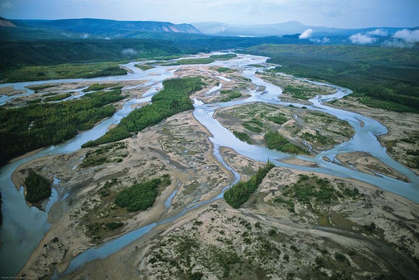
Athabasca environmental flows
status: Good
forecast: Declining
River
Flow
Regulation • The mainstem is free flowing and unaffected
and by flow regulation and fragmentation • Oil sands operations are permitted to withdraw
Fragmentation
large volumes of water from the river, even
during low-flow periods when fish and fish
habitat are most threatened
• Only 3.3% of the water withdrawn is returned
to the river; the rest ends up in toxic tailings
• Oil sands operators are licensed to ponds because it is too polluted to be returned
withdraw 441 million m3 of fresh water to the ecosystem after use
Withdrawals from the Athabasca each year – more water
and than the City of Toronto uses in one year
Diversions • Summer flows in the Athabasca declined by
• Water use by oil sands operations is projected 19.8% between 1958 and 2003, and by almost
to increase by more than 200% by 2015 30% since 1970
• Studies indicate that annual runoff may decline
a further 30%, with minimum flows in the
Athabasca declining a further 7 to 10%
• Average air temperature in the region is • If flows decline as predicted, water supplies
Climate expected to rise by up to 4˚C by 2050
may be insufficient to sustain both the rapidly
At a glance The Athabasca River runs unimpeded from its source
in the Columbia Icefields to the west side of Lake
Change • Regional climate warming is three times expanding oil sands production and the integrity
the global average of the river and the Peace-Athabasca Delta
Length: 1,538 km Athabasca. It provides the largest direct inflow of water
Average Discharge: 784 m3/s to the Peace-Athabasca Delta – the world’s largest boreal
Watershed Area: 155,000 km2 freshwater delta – which is highly sensitive to changes
Major Drainage Basin: Arctic Ocean in natural variability in river flows and water levels.
Jurisdiction: Alberta
The Athabasca supports over 30 species of fish and its
upper section in Jasper National Park, designated as
a Canadian Heritage River, is a popular destination for
recreation. The Peace-Athabasca Delta is one of the most Looking Ahead
Peace-Athabasca
Delta
Lake Athabasca
important waterfowl nesting and staging areas in North Protection of environmental flows in the Athabasca is at the centre of one of Canada’s most important freshwater decisions –
America; a million or more birds use the ecosystem each the development of a new water management framework to regulate withdrawals from the river by the oil sands industry.
year during fall migration. It is recognized internationally
Phase 1 – the current, interim framework – specifies how much water industry is allowed to withdraw for different ranges of
Fort McMurray
as a Ramsar wetland site and is a significant part of Wood
river flow in an effort to manage water use in ways that better respect the natural flow regime. While a good approach, the
Buffalo National Park, a UNESCO World Heritage site. The
Phase 1 framework has been criticized for being unenforceable, not establishing incentives for industry to reduce water use,
er
Athabasca Chipewyan and Mikisew Cree First Nations, and
v
and neglecting the impact of climate change on future river flows. Importantly, it fails to establish an “ecosystem base flow” –
Ri
Ath ab a sc a
Fort Chipewyan Métis rely on the river and the delta for
a flow threshold below which no further withdrawals are permitted.
cultural and spiritual values, as well as for commercial and
Edmonton
subsistence fisheries. The Phase 2 framework – currently under development – must establish a much more robust approach to protecting
environmental flows in the Athabasca. A committee representing the federal and provincial governments, industry, First
While the upper Athabasca remains largely undisturbed,
Nations, Métis groups, and NGOs – including WWF-Canada – is weighing environmental, social, and economic values as it
downstream the river’s waters are a primary input to the
develops recommendations for the Phase 2 framework, to be submitted to government regulators by December 2009.
world’s largest energy project – the Athabasca oil sands. The
rapidly increasing water demand for oil sands mining poses a To effectively protect river flows and the Peace-Athabasca Delta, the Phase 2 framework must establish an ecosystem base
serious threat to environmental flows in the lower Athabasca, flow, consider the effects of climate change on future river flows, and be legally enforceable. Such a framework would set a
particularly given the declining river flows anticipated as a precedent for protection of environmental flows in Alberta and in Canada. Ensuring that it does ultimately depends on the
result of climate change. leadership and cooperation of federal and provincial regulators.
14 wwf – canada’s rivers at risk environmental flows and canada’s freshwater future 15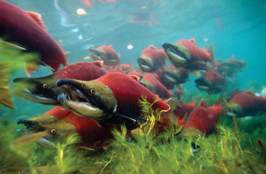
Nipigon environmental flows
status: Fair
forecast: Improving
River
Flow • Flow regulation and fragmentation
Regulation strongly affect the river and its tributaries
and • Three hydropower dams regulate flow
Fragmentation along almost the entire river’s length • Only 3 metres of the river’s original 95-metre
vertical drop remains unharnessed by dams
• From the 1960s to the late 1980s, river levels
fluctuated by as much as 3 metres daily,
stranding fish and their eggs and drying out
spawning beds
• Relative to total flow, withdrawals from
Withdrawals the mainstem are not a major concern • The Ogoki Diversion increased water levels
and • The Ogoki Diversion into the Nipigon in Lake Nipigon by 0.62 metres and increased
Diversions basin has significantly changed average flows in the Nipigon by 50%,
watershed flow significantly destabilizing the river channel
• Warmer temperatures are expected to cause
earlier snowmelt and runoff, decreased
summer runoff, and reduced water volumes
in the watershed
• Average air temperature in northwestern
At a glance The Nipigon River drains the rugged boreal landscape of
Ontario’s remote Lake Nipigon basin. Harnessing the river
Climate
Ontario has increased by 1 to 1.5°C over
the past 100 years
• Reduced flow volumes and warmer surface
Change water temperatures, due to climate change,
Length: 51 km for hydropower has drastically altered environmental • Precipitation is predicted to decline by up could put unique brook trout at risk and alter
Average Discharge: 330 m3/s flows in the Nipigon, creating serious consequences to 20% by 2090 species distributions
Watershed Area: 24,650 km2 for freshwater ecosystems.
Major Drainage Basin: Atlantic Ocean
Jurisdiction: Ontario The Nipigon is the largest river flowing into Lake Superior,
discharging its waters to the newly created Lake Superior
National Marine Conservation Area. Forty-six fish species
inhabit the Nipigon River system, including rare species
Ogoki Diversion
of sturgeon and cisco along with the largest remaining
population of “coaster” brook trout, which are unique to
Looking Ahead
Lake Superior. Historically found throughout Lake Superior
The Nipigon River ecosystem and its fish populations have begun to recover in recent years, as improved operations of
tributaries, coasters have declined dramatically due to
hydropower dams have restored environmental flows to more natural conditions.
habitat and flow changes. Today they live in only a few
tributaries, including the Nipigon. Early efforts to remediate water-level fluctuations in the river set a precedent for management of environmental flows in the
Lake Nipigon
province. In 1990, local Ministry of Natural Resources staff approached Ontario Hydro about modifying dam operations to
The once turbulent Nipigon has been tamed to a series
reduce the extreme and frequent variations in flow that affect brook trout. An interim flow agreement was established
of lakes with few stretches of rapids between them. Dams
in September 1990. Concurrently, the provincial and federal governments, Ontario Hydro, and local citizens formed the
Nipigon
River constructed to generate hydropower for local needs
Nipigon River Management Committee.
Nipigon
have significantly altered river flows, but one of the most
dramatic changes is a result of demand for electricity over In 1994, the interim agreement was expanded into a watershed management plan that gave the flow needs of fish high
1,000 kilometres away in southern Ontario. The Ogoki priority. The plan remains in place today, and enormous improvements in the river have been observed since the plan was
Lake Superior
Diversion, constructed in 1943, diverts water that naturally established. With extreme flow fluctuations reduced, brook trout and pike populations have rebounded. A 2002 amendment
flowed north to James Bay southward through the Nipigon to Ontario’s Lakes and Rivers Improvement Act now requires water management plans for all dams and water-control
system into the Great Lakes to increase hydropower structures. The plans must specify flow and water-level options that recognize multiple needs, including those related to
generation at Niagara Falls. Over 60 years later, the resulting fisheries, hydropower, and the environment.
increased flows continue to cause significant erosion of
river banks and large landslides along the length of the river. Restoration of more natural flow regimes in the Nipigon demonstrates that, where the will exists, positive change is possible.
16 wwf – canada’s rivers at risk environmental flows and canada’s freshwater future 17Grand environmental flows
status: Fair
forecast: Steady
River
Flow • Flow regulation and fragmentation
Regulation strongly affect the river and its tributaries
and • The watershed is highly regulated by more • Regulation has provided flood control and
Fragmentation than 100 dams and control structures flow augmentation, but has also modified the
natural flow regime extensively
• Dams have fragmented the watershed and
curtailed high flows that would naturally flush
nutrients and sediment downstream
• Withdrawals in the watershed are among • Withdrawals peak when flow is at its lowest;
Withdrawals the highest from any watershed in Ontario
and the provincial government classifies the lower
• Demand for water is expected to grow by Grand as a “high use” watershed during
Diversions
57% between 2001 and 2031 summer low-flow conditions
• At peak demand, in the middle Grand as much
as 20% of flow is withdrawn; in the Whiteman’s
Creek sub-watershed, permitted withdrawals
exceed summer mean flows
• Average air temperature in the watershed
is expected to rise by 2.6 to 5.6°C over the • Warmer winters could lower water supply
At a glance Flowing through lush agricultural land and expand-
ing cities, the Grand River was once described as a
Climate next century and reduce flows; a predicted 10% reduction
Change in spring peak flow will decrease flushing and
Length: 300 km • Precipitation is predicted to increase by 11
sewer. It is now recognized as a Canadian Heritage further reduce water quality
to 18% by 2090
Average Discharge: 80 m /s 3
River and is one of only two Canadian rivers to receive
Watershed Area: 6,800 km2 the prestigious International Thiess Riverprize.
Major Drainage Basin: Atlantic Ocean
Jurisdiction: Ontario The Grand River has changed enormously since European
settlement began in Ontario. The draining of wetlands and
clearing of forests reduced the watershed’s ability to
retain water and moderate high flows. The consequences
were spring flooding and summer drought, which spurred
an era of infrastructure development that left a legacy
of numerous dams, reservoirs, and control structures Looking Ahead
throughout the watershed. Managing environmental flows in the Grand River demonstrates the challenge of addressing multiple and sometimes
competing interests in the waters and other resources of Canada’s rivers. It also reveals that society’s demands – for flood
The Grand is a hard-working river. The river and its water-
Guelph
control, water supply, or electricity generation – need not undermine objectives to maintain healthy freshwater ecosystems.
Waterloo shed are an important source of drinking water, assimilate
Kitchener
Cambridge waste from 28 water treatment plants, support a productive A number of efforts at various scales are aimed at improving environmental flows in the Grand. Fisheries management
agricultural sector, and provide abundant recreation oppor- projects include removing and retrofitting dams and reservoirs to improve fish habitat and restore free-flowing water. To
Gra
nd
Riv
tunities. Fly fishing alone contributes more than $1 million to better manage the impacts of water withdrawals, the provincial government has decided not to accept new applications
er
Brantford the local economy each year. There are 82 species of fish for withdrawals during low-flow periods in “high use” watersheds such as the lower Grand. As well, the Grand River
in the watershed, representing about 50% of all fish species Conservation Authority has established, in collaboration with water users, a low-water response team to coordinate efforts
in Canada. Six of the 29 fish species COSEWIC lists as to conserve water and keep it in the river during dry periods.
Lake Erie
vulnerable, threatened, or endangered live in the Grand River.
Challenges remain, however. The increasing demand for water from rapidly expanding urban centres along the Grand
Although the Grand’s status remains fair, years of river is a growing concern. While many municipalities in the watershed are recognized as leaders in urban water conservation,
modification and increasing water withdrawals for agriculture proposals to build a pipeline to bring more water inland from Lake Erie persist as local demand outstrips local supply.
and urban development continue to pose challenges to Discharging additional water into the Grand from beyond the watershed will have unknown effects on the flow and
securing environmental flows in the river. integrity of the river ecosystem.
18 wwf – canada’s rivers at risk environmental flows and canada’s freshwater future 19Ottawa environmental flows
status: Fair
forecast: Declining
River
Flow • Flow regulation and fragmentation
Regulation strongly affect the river and its tributaries
and • Over 50 major dams alter flows of the • Dams and reservoirs store spring runoff,
Fragmentation Ottawa and its tributaries reducing the magnitude of peak flows;
regulation decreased the ratio of maximum
to minimum flows from about 10:1 in 1870
to only 5:1 by 1930
• Dams and regulation have significant negative
impacts on Ottawa River lake sturgeon pop-
Withdrawals ulations, blocking migration routes, altering
• Relative to total flow, withdrawals from the flow regimes, and disturbing spawning habitat
and mainstem are not a major concern
Diversions
• Dams and development have altered
floodplains; unique vegetation communities
adapted to flooding and drying are now rare
• Only one set of large rapids on the lower
section of the Ottawa River, the Deschênes
• Average air temperature has increased Rapids, remains intact and mostly unaffected
by 0.5°C since 1945 and is expected to by dams or regulation
Climate rise by 4 to 5˚C by 2100
Change • Precipitation has increased 13% since • Studies predict that higher temperatures
1939 and is predicted to increase further and increased evaporation will reduce
At a glance Severely fragmented by hydropower dams in both the
Quebec and Ontario portions of its watershed, the
by 5 to 17% by 2075
river flow by 1 to 8%
Length: 1,271 km Ottawa River is one of the most regulated river systems
Average Discharge: 470 m3/s in Canada. Its natural flow regimes have been dramatically
Watershed Area: 146,300 km2 altered, compromising habitat and the diversity and
Major Drainage Basin: Atlantic Ocean distribution of the river’s fish and shoreline vegetation.
Jurisdictions: Quebec, Ontario
Historically significant, the Ottawa provided a travel route
for First Nations peoples and European explorers, fur traders,
Looking Ahead
settlers, and log drivers. For 580 kilometres the river forms
A comprehensive, watershed-based plan to revise the operation of dams to better balance environmental objectives and
the Quebec–Ontario border, and the nation’s capital is on its
hydropower generation could reverse the continuing decline of the Ottawa. As with all boundary rivers, the challenge
shores. The Ottawa provides drinking water for more than a
in developing and implementing an effective water management plan lies in effective collaboration among the relevant
million people, and numerous major dams in its watershed
governments, partners, and interests.
generate over 4,000 megawatts of hydropower and control
flooding. Eighty-five fish species inhabit the river, including The federal, Ontario, and Quebec governments established the Ottawa River Regulation Planning Board in 1983 to ensure
river redhorse and lake sturgeon – both of which COSEWIC integrated management of dams and reservoirs in the watershed, and to minimize flooding while acknowledging the various
has listed as species of special concern. The shorelines interests of river users. The board, however, has no clear mandate to integrate environmental flows into dam operations. Each
Ottawa River
of the Ottawa provide habitat for the nationally significant operator develops its own criteria within the constraints its respective government (Ontario or Quebec) sets out, and provincial
Ottawa wood turtle and the endangered musk turtle, and its wetlands regulations differ greatly on each side of the river. In Ontario, for example, water management plans developed by Ontario
and floodplains support more than 300 bird species, as well Power Generation and the Ontario Ministry of Natural Resources for the Madawaska and Bonnechere Rivers, two tributaries
as rare vegetation types adapted to its cycles. of the Ottawa, show how dams can be operated to better address environmental flows. However, this approach is far from the
norm in the watershed.
Because no comprehensive plan is in place for integrating
environmental flows into hydropower operations, the river The Ottawa is expected to be designated as a Canadian Heritage River in 2009, which may facilitate discussion of the
is likely to continue its decline, which climate change will need for an integrated management strategy for the river as a whole. Only Ontario is supporting the nomination so far,
only intensify. limiting the potential for a full watershed scale approach to maintaining environmental flows.
20 wwf – canada’s rivers at risk environmental flows and canada’s freshwater future 21South environmental flows
status: Poor
forecast: Declining
Saskatchewan
Flow • Flow regulation and fragmentation
Regulation strongly affect the river and its tributaries
and • The basin contains 13 large hydropower
Fragmentation dams and hundreds more smaller dams • On the Bow River, up to 90% of flow is
diverted for irrigation; dramatic flow reduction
sometimes makes it possible to walk across
River
the riverbed below the Eastern Irrigation
District Dam
• Rapid water-level fluctuations due to dams
cause habitat instability and limit fish produc-
Withdrawals • In the basin, water allocations are the tion; moderation of floods by dams causes a
and highest for any Canadian river, totalling decline in riparian cottonwood forests
Diversions 70% of the natural river flow
• Studies show that maintaining ecosystem
integrity requires 85% of natural flow, yet only
30% of it is currently unallocated
• Downstream of the Gardiner Dam, summer
flows have declined by 84% since the early
• Climate change is already causing warmer 20th century
Climate average air temperature and drier conditions
Change • Climate change will have severe impacts in the
• The size of source glaciers decreased by
50% between 1975 and 1998 region, already the driest in Canada; the water
supply is predicted to decline by 8.4% by 2050
At a glance Heavy exploitation and an arid climate have made the
South Saskatchewan River Canada’s most threatened
Length: 1,392 km river in terms of environmental flows. In some areas,
Average Discharge: 280 m3/s more water is allocated for use than is available and the
Watershed Area: 148,000 km2 river almost runs dry.
Major Drainage Basin: Hudson Bay
Jurisdictions: Alberta, Saskatchewan Flowing steeply from its headwaters in the Rocky Mountains
eastward across the dry plains of Alberta and Saskatchewan,
Looking Ahead
the South Saskatchewan supports hydropower, a growing
Restoring environmental flows in the South Saskatchewan, a transboundary river, can be achieved only if Alberta and
population, and most of Canada’s irrigated agriculture.
Saskatchewan work together, along with the federal government, to manage water use along its entire length.
Mountain whitefish and rainbow and cutthroat trout are
found near its source in the Rockies, and threatened In 2008, Alberta announced that it would review its century-old water allocation system. The review is an unparalleled
populations of lake sturgeon live in warmer downstream opportunity to spur restoration of environmental flows in the South Saskatchewan. Water policy advocates are urging
waters. Cottonwood forests in the riparian zone rely on the government to set water aside specifically for the environment, and to establish legally enforceable objectives for
Calgary Saskatoon
cyclic changes in river flow, but numerous dams and reser- environmental flows, supported by water management plans. Such modifications would set a new standard for water
Red Deer
River
Bow
River
voirs and extensive withdrawals have substantially altered allocation systems in Canada. Downstream in Saskatchewan the story may be different. A 2004 study titled Water Wealth:
aska
hS flow regimes in the South Saskatchewan system. Droughts A Fifty-Year Water Development Plan for Saskatchewan proposed the construction of four more major dams on the South
ut he
tc
wan
So
River
Oldman
River
are a persistent risk in the river basin, which is located in Saskatchewan, which would effectively “drown” the river under a series of artificial reservoirs.
the semi-arid Palliser Triangle region, and are expected to
These disparate proposals reveal the challenges encountered with respect to transboundary rivers. The Prairie Provinces
increase in frequency and duration due to climate change.
Water Board, and the Master Agreement on Apportionment it administers, provide a forum for addressing such challenges
Flows in the South Saskatchewan have declined to crisis in the South Saskatchewan. While the agreement has served as an effective mechanism for apportioning shared water,
levels. In 2006, Alberta made the unprecedented decision to it makes no provisions for environmental flows to support nature’s water needs. Given the growing pressures of climate
place a moratorium on new applications for water withdrawals change, rising water demands, and new dam proposals in the watershed, modernizing the existing apportionment
from the Bow, Oldman, and South Saskatchewan rivers. agreement to integrate environmental flows would benefit nature and people over the long term.
22 wwf – canada’s rivers at risk environmental flows and canada’s freshwater future 23You can also read