City of Swan Gidgegannup Local Area Plan - Including Gidgegannup, Red Hill and Avon Valley National Park
←
→
Page content transcription
If your browser does not render page correctly, please read the page content below
City of Swan
Gidgegannup
Local Area Plan
Including Gidgegannup,
Red Hill and Avon
Valley National Park

November 2016

                                                                    c   es
                                                             p   la
                                                         e
                                                      rs
                                                 ve
                                            di
                                       ty
                                  ci
                              e
                         on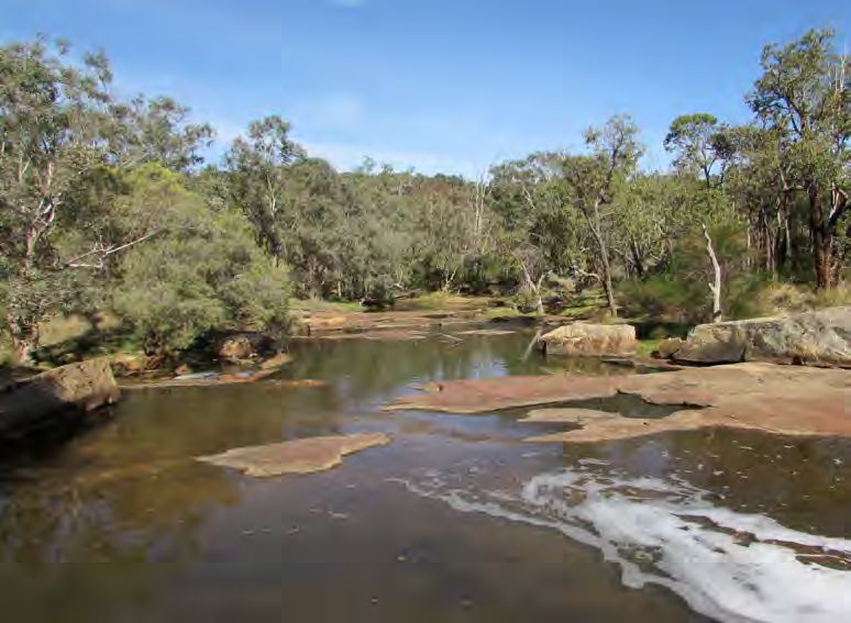
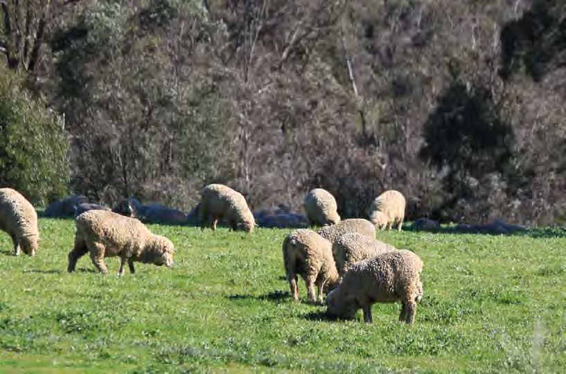
From LEFT: Small Farm Field Day.
Kangaroo Paw. Wineries with
Hills in the background.

                                   © 2016 City of Swan. Copyright subsists in this
                                   publication and such copyright is the property of
                                   the City of Swan. A reproduction of this publication
                                   or any part thereof without the written consent
                                   of the Chief Executive Officer of the City of Swan
                                   is not permitted and will be regarded as an
                                   infringement of the copyright.
                                   Photographs by G. McKinnon, J. Tinsley and
                                   R. Steenkamp.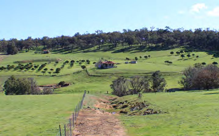
Table of Contents
Mayor’s Message                                  4    6.0 NATURAL Environment                                           33
1.0 Introduction	                                 5      6.1 Natural Resource Management and Environmental Protection   33

   1.1 What is Local Area Planning?               5   7.0 Built Environment                                             41
   1.2	The Local Area Plan Model                 6       7.1 Aboriginal Heritage                                        41
   1.3 Guiding Principles                         7      7.2	European Heritage                                          43
Part 1 – The Gidgegannup Local Area	             10      7.3 Housing                                                    44
                                                         7.4 Built Form                                                 44
2.0 Context                                      10
                                                         7.5 Community Facilities and Open Space                        47
   2.1	The Gidgegannup Local Area Plan           10      7.6	Development Opportunities                                  49
   2.2 Spatial Distribution                      12      7.7 Infrastructure Services                                    50
   2.3 History                                   12      7.8	Transport and Access                                       51
   2.4 Socio-economic Profile                    15
                                                      References	56
3.0 Governance                                   17
                                                      PART 2 - community enGAGEMENT	                                    57
   3.1 Regional Planning                         17
   3.2 Local Planning                            18   8.0 community workshop	                                           57
   3.3	Decision Making                           19      8.1 Background                                                 57
4.0 Social environment                           20      8.2 Purpose                                                    57
                                                         8.3 Conduct                                                    57
   4.1 Population                                20
   4.2 Community Planning and Service Delivery   22   Part 3 - local area plan	                                         68
   4.3 Community Safety                          24   9.0 local area plan	                                              68
5.0	Economic environment                         25      9.1 A Vision for the Future                                    68
   5.1	Economy and Employment                    25      9.2	Objectives                                                 68
   5.2 Retail and Commerce                       27      9.3 Strategies and Actions                                     69
   5.3 Agriculture and Rural Produce             27
   5.4	Tourism                                   29

                                                                                                                         1
List of Tables                                                                               List of Figures and Diagrams
Table No.   Page   Description                                                               Figure No.   Page   Description
Table 1     19     Strategies and Actions relating to the governance framework applicable    Figure 1       5    Integrated Planning Framework Model
                   to the Gidgegannup Local Area Plan                                        Figure 2       6    Local Area Planning Model
Table 2     21     Strategies and Actions relating to the population applicable to the       Figure 3       8    Gidgegannup local area street map
                   Gidgegannup Local Area Plan
                                                                                             Figure 4       9    City of Swan Local Planning Scheme No. 17 Zoning Plan
Table 3     24     Strategies and Actions relating to community services and safety
                                                                                             Figure 5      10    City of Swan Local Area Plan areas
                   applicable to the Gidgegannup Local Area Plan
                                                                                             Figure 6      11    Gidgegannup local area suburb breakdown
Table 4     31     Strategies and Actions relating to the economic environment applicable
                   to the Gidgegannup Local Area Plan                                        Figure 7      13    Early allocation of land along the Swan River (Source: Bourke, 1987)

Table 5     40     Strategies and Actions relating to the natural environment and resource   Figure 8      14    Gidgegannup local area aerial (2014)
                   management relating to the Gidgegannup Local Area Plan                    Figure 9      15    Gidgegannup Local Area Plan socio-economic statistics (ABS 2011)
Table 6     47     Hierarchy of community facilities and current level of provision for
                                                                                             Figure 10     17    The Planning Framework
                   Gidgegannup local area
                                                                                             Figure 11     20    Forecast population growth for the Gidgegannup local area
Table 7     55     Strategies and Actions relating to the built environment applicable to
                                                                                                                 (Source: Forecast.id, 2015)
                   Gidgegannup Local Area Plan
                                                                                             Figure 12     25    Industries of employment (2006 to 2010) for the City of Swan and
Table 8     59     Results from the Community Engagement in Gidgegannup local area -                             Gidgegannup local area (Source: Profile.id, 2015)
                   Likes
                                                                                             Figure 13     26    Commercial land use plan
Table 9     62     Results from the Community Engagement in Gidgegannup local area -
                   Concerns                                                                  Figure 14     28    Extract from the Rural Precinct Plan in the Draft Local Rural Planning
                                                                                                                 Strategy
Table 10    65     Results from the Community Engagement in Gidgegannup local area -
                                                                                             Figure 15     34    Extractive Industries and Extraction Areas in Gidgegannup area
                   Suggestions
                                                                                             Figure 16     35    Ecological Corridors in Gidgegannup local area
Table 11    71     Governance: The Gidgegannup Local Area Plan Strategies and Actions
                                                                                             Figure 17     37    Bush forever, rivers and water bodies

Table 12    73     Social Environment: The Gidgegannup Local Area Plan Strategies and        Figure 18     39    Bushfire Hazard Mapping for Gidgegannup area
                   Actions                                                                   Figure 19     42    Aboriginal Heritage Sites (Source: DoAA, 2013)
Table 13    76     Economic Environment: The Gidgegannup Local Area Plan Strategies and      Figure 20     48    Gidgegannup recreation and open space
                   Actions                                                                   Figure 21     52    Functional Road Hierarchy and proposed alignment of Perth Adelaide
Table 14    78     Natural Environment: The Gidgegannup Local Area Plan Strategies and                           Highway
                   Actions                                                                   Figure 22     53    Gidgegannup public transport and cycle network
Table 15    81     Built Environment: The Gidgegannup Local Area Plan Strategies and
                   Actions

 2
NOTE: The Introduction and Part 1 of this document
 are the Discussion Paper, which is released early in
 the LAP process prior to community consultation.
 At the release of the full draft Local Area Plan for
 final community consultation, and at adoption, the
 discussion paper is not updated to be current.

From Top:
Percy Cullen Recreation Centre and Oval. Gidgegannup.
Building of the Gidgegannup Hall 1928.

                                                        3
Mayor’s Message

The City of Swan comprises a large land area with diverse
communities. Planning for such a diverse area requires
creative solutions.

Local Area Plans provide the opportunity to recognise the unique character
and needs of these diverse communities.

Local Area Planning involves local community members working together
with the City to identify the specific issues affecting their community and
producing a plan that provides solutions to meet the specific needs of
their local area and to support its unique character. This Local Area Plan is
therefore an important document for the City to plan for infrastructure and
services and manage change at a local level.

                                                                                Mayor Mick Wainwright.
The City appreciates the tremendous support and contribution made by
community members and other stakeholders in developing this Local
Area Plan.

  4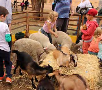
1.0 Introduction
The City’s Place Management approach to service delivery       1.1          What is Local Area Planning?
recognises that the City is made up of many communities        Local Area Planning (formerly Place Planning) has been adopted by
(Places) which may have very different needs and               Council under its Integrated Planning Framework (Figure 1) and provides a
                                                               mechanism for local communities to address issues through a consultative
aspirations. Documents such as the City’s Strategic            process. The process establishes a vision and objectives for each local area
Community Plan and Local Planning Strategy guide the City’s    and identifies strategies and actions to achieve the vision and objectives
                                                               that, together with strategies and actions identified in the Strategic
business planning by identifying future land use, strategies   Community Plan and the Local Planning Strategy, informs the City’s
and actions at the district level but do not necessarily       business planning process.
identify the particular needs and aspirations of individual    City of Swan Integrated Planning Framework Model
communities.

                                                                                                                  STRATEGIC COMMUNITY PLAN
                                                                              STRATEGIES                                  (10 YEARS)

                                                                                                                                              RESOURCING
                                                                                                                                              • FINANCIAL
                                                                           COMMUNITY VISION                          STRATEGIC PRIORITIES     • ASSETS
                                                                                                                           (5 YEARS)          • WORKFORCE

                                                                                                                                              SERVICE PLANS
                                                                           PLANNING STRATEGY

                                                                                                                  CORPORATE BUSINESS PLAN
                                                                                                                          (5 YEARS)

                                                                           LOCAL AREA PLANS

                                                                                                                          BUDGET
                                                                                                                           (1 YEAR)

                                                               Figure 1.    Integrated Planning Framework Model

                                                                                                                                                              5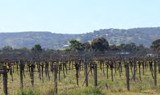
1.2 The Local Area Plan Model
t
loymen
The Local Area Planning Model (Figure 2) indicates how Local Area
Planning integrates with the Strategic Community Plan (SCP) and the Local
nd Emp
Planning Strategy (LPS) in order to inform corporate business planning
Regi
to achieve place based planning and service delivery. Each ‘ring’ of the
on
e
ya
model informs the next ring in a two way process. The results of annual
erc
al Pl
Econom
mm
monitoring of the service delivery will in turn provide input into the other
a
Pla
Co
nnin
rings, thereby closing the loop.
Co
ce
nd
rp
g
Ba
la
ora
sed
t ai
Loc
teB
1.2.1 Strategic Community Plan Strategy Local Planni
Lo
Re
al
Ser
ning
cal
P la ng
usi
lan Str
nn
vice
lP
nes
Are
ing a ate
At the centre of the model is the Strategic Community Plan 2012–2022 oc Ec gy
aP
o
s
L nom
Deli
ism
Plan
(SCP), which is a document mandated by the Department for Local nce ic r
lan
Tou
gy
a
Lo
very
n
er
ate
ca
ning
Government at the core of business planning by local governments under
lP
Str
v
Go
lan
the Integrated Planning Framework. The SCP sets out a vision, aspirations
ng
ning
Strategy Local Planni
and objectives for the City of Swan over the next 10 years and includes
l Protection
Strategy Local Plann
five key result areas, being; Economic Environment, Natural Environment,
Population Strategic Environmenta
Built Environment, Social Environment and Governance Framework.
Community
Natural En
Each result area has a number of outcomes with objectives, strategies
and measures for each. The themes for each Local Area Plan are therefore Plan
al
ing
Plann
ci
uni t y
So
aligned to the key result areas under the SCP in order to ensure direct
v
ning
i
Comm
r
Natu
o
ral Re
nm
alignment between the two (refer to Figure 2). The SCP is currently
ing
lan
sourc
en
es e Ma
S
undergoing a major review as part of the City’s legislative requirement.
t
P
t
rvic nage
r
l
ate
a
e ment
ty S
c
The community will be consulted during this review which will guide the
Lo
gy
u ni
Built E ronmet Lo
gynvi
strategic direction for the City of Swan for the period 2017-2027. m Wa
te ca
Com tra lP
ty
te
lan S
fe
ng r
ning
Strategy Local Planni Ma
Sa
na
ity
1.2.2 Draft Local Planning Strategy ge
un
es
m
Ac t
m
en
liti
m
pace
Tran
t
ivit
Co
i
The Draft Local Planning Strategy (LPS) is a land use planning tool
Fac
Infrastru
ge
yC
Housing
spor
S
prescribed under the Planning and Development Act 2005. The LPS
d Herita
ity
en
pen
un
tre
t an
examines key land use planning issues and defines strategies and actions
m
lic O
c
s
ture Serv
Com
to respond to those issues at the district level. These issues flow into
d Ac
n
Pu b
esign a
each other and cross the key result areas under the SCP. The LPS does
cess
not, however, consider differences between Places, in particular differing
ices
Urban D
community priorities. Strategies and actions under the LPS will therefore
be carried forward to the Local Area Plans under relevant result area
themes but further refined and prioritised relevant to the local area as a
result of the Local Area Plan community workshops.
Figure 2. Local Area Planning Model
6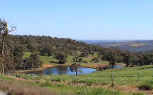
1.2.3 Local Area Plans
The Local Area Plans (LAPs) consolidate the outcomes and objectives from the SCP and the          1.3 Guiding Principles
strategies and actions from the LPS and further develop these specific to the relevant local
area and prioritise them. This will be guided by a vision and objectives for the local area,
established from a community workshop/s to be conducted for each local area. Outcomes             1.3.1 Sustainability
of the LAPs, importantly, also provide feedback to the LPS and the SCP. Dependent upon the        Create communities that are economically, socially and environmentally
point within the cycle of review of the SCP and the LPS, LAPs therefore also inform the SCP       sustainable by:
and LPS.
                                                                                                     Supporting opportunities for business and local employment;
                                                                                                     Promoting alternative transport modes;
1.2.4 Place Based Service Delivery                                                                   Respecting the natural environment; and
The outcome of the model is Place based delivery of services in accordance with adopted              Building active and connected communities.
strategies and actions detailed in the LAPs and integrated through the City of Swan’s Corporate
Business Planning Process. It is the responsibility of the relevant Place Leader to liaise with
Business Unit Managers on the delivery of those services and to report on issues in this regard
                                                                                                  1.3.2 Access and equity
to the Executive as well as through the quarterly reporting process.                              Create communities where services and facilities are accessible to people with
                                                                                                  disabilities and provide opportunities that meet the needs of all sectors of the
                                                                                                  local community.
1.2.5 Format of a Local Area Plan
The format of this Local Area Plan is as follows:                                                 1.3.3 Safety
   Part 1 – The Gidgegannup local area (Discussion Paper);                                        Create communities where people feel safe to live, work and recreate.
   Part 2 – Community engagement: findings from the workshop(s) and survey; and
   Part 3 – Local Area Plan: strategies and actions.                                              1.3.4 Identity
                                                                                                  Maintain and enhance the unique identity of each Place created by its natural and
                                                                                                  built form landscape character.

                                                                                                  1.3.5 Participation
                                                                                                  Local Area Plans are developed in co-operation with local communities.

                                                                                                  1.3.6 Prioritisation
                                                                                                  Local strategies and actions are prioritised by the local community.

                                                                                                  1.3.7 Integration
                                                                                                  The strategies and actions of Local Area Plans are integrated with the strategies
                                                                                                  and actions of other strategies of the City and the City’s business planning
                                                                                                  processes.

                                                                                                                                                                                      7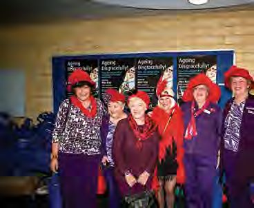
Avon Valley
                                                                                     National
                                                                                     Park
                                                                                                                                                                                                   Percy Cullen
                                                                                                                                                                                                   Oval &
                                                                                                                                                                                                   Recreation
                                                                                                                                                                                                   area

    Bullsbrook

                                                                           Copley Dale
                                                                           Nature Reserve
                                                                                 Copley Dale Road

                                                                                                                                                                                      INSERT:
                 Walyunga                                                                                                                                                             Gidgegannup townsite.
                 National
                 Park

                                                                                                                                                          Berry Road

                                       Lancewood Avenue

                         Brigadoon
                                                                                                                    Reserve Road
                                                                                                     Reen Road
                                                      O’Brian Road

                                                                                                                                   Gidgegannup
                                                                                                                                                      Lilyd

                     Baskerville
                                                                                                                                                       ale R

                                                                                                                                     Bu
                                                                                                                                       nn
                                                                                                                                                            o

                                                                                                                                         ing
                                                                                                                                                         ad

                      Darling Range                                               ad
                                                                              y Ro
                                                                                        Stoneville Road

                      Regional                                             dya
                                                                       Too
                                                                                                                                               Road

                      Park
                                                                                                                                                                                                         N
                                                        Rolan

                            Red Hill
                                                             d  Road

                  John Forrest
                  National
                  Park

                                                                                                                                                                       Figure 3.   The Gidgegannup local area street map

8
                                                                                                          To Great Eastern HWY
REGIONAL RESERVES LOCAL RESERVES STRATEGIC REGIONAL RURAL ZONES ABBREV
REGIONAL
REGIONAL
REGIONAL RESERVES
RESERVES
RESERVES LOCAL
LOCAL RESERVES
RESERVES STRATEGIC
STRATEGIC
CENTRE
STRATEGIC REGIONAL
REGIONAL
ZONES
REGIONAL
STRATEGIC RURAL
RURAL
REGIONALRURAL ZONES
ZONES ABBR
ABBREVI
REGIONAL RESERVESLOCAL RESERVES
LOCAL RESERVES ZONES
RURAL ZONES ABBREVIAT
ABBR
REGIONAL
PARKS & RECREATION RECREATION CENTRECENTRE
CENTRE ZONES
ZONES
CENTRE ZONES
ZONES GENERAL RURAL REGION
REGIONAL RES
CITY CENTRE- REGIONAL
CG RESERV
Commo
REGION
PARKS PARKS & RECREATION
& RECREATION RECREATION
RECREATION GENERAL
GENERAL RURALRURAL HS High Sc
Avon Valley PARKS & RECREATION RECREATION BUSINESS GENERAL RURAL CG
Commonwe
CG Commonwealth C
PARKS & RECREATION RECREATION CITY CITY CENTRE-
CENTRE- GENERAL RURAL CG CGSpecialG
PRIMARY REGIONAL CITY CENTRE-
CITY CENTRE- SU
HS High SchooH
HS
LOCAL ROAD BUSINESS
BUSINESS
BUSINESS SPECIAL RURAL HS
TS
High School
HSTechnic
CITY BUSINESS
National Park ROADS
PRIMARY
PRIMARY REGIONAL
REGIONAL
PRIMARY REGIONAL
PRIMARY REGIONAL LOCAL
LOCAL LOCAL
ROAD ROAD
ROAD
LOCAL ROAD
CENTRE-
SHOPPING
SPECIAL
SPECIAL
SPECIAL RURALRURAL
RURAL
SPECIAL RURAL
SEC TS
SU
Special
SU SU SpecialSU Use Use
State En
Technical
TS TS Technical SchoolS
ROADSROADS
ROADS ROADS CITY
CITY CITY CENTRE-
CENTRE-
CENTRE- WSD TSWater A
CITY CENTRE- SEC
SEC SEC State Energy
State Energ
OTHER REGIONAL ROADS SHOPPING SHOPPING
SHOPPING SWAN VALLEY RURAL SEC Com
PUBLIC PURPOSES CITY SHOPPING
CENTRE- WSD WSD
WSD Auth
WaterWater
Authority
SWAN VALLEY REGIONALWSD RE
OTHER REGIONAL ROADS SWAN VALLEY RURALRURAL
REGIONAL RESERVES LOCAL RESERVES STRATEGIC REGIONAL RURAL ZONES OTHER
ABBREVIATIONS
OTHER REGIONAL
REGIONAL
OTHER ROADSROADS
ROADS
REGIONAL PUBLIC PUBLIC
PUBLIC
PURPOSES
PUBLIC
PURPOSES
PURPOSES
PURPOSES
COMMERCIAL
CITY
CITY
DEFERRED
CITY CENTRE-
CENTRE-
CENTRE-
CITY CENTRE-
SWAN VALLEY
SWANRURAL
VALLEY RURAL R
REGIONAL
REGIONAL
Restrict
REGION
RESERV RES
COMMERCIAL DEFERRED REGION
CENTRE ZONES RAILWAYS
REGIONAL RESERVES - PUBLIC PURPOSES
PUBLIC UTILITIES COMMERCIAL
COMMERCIAL
CENTRE-
DEFERRED
DEFERRED
CITY COMMERCIAL DEFERRED RURAL LIVING
R R
LOCAL
RRestricted P
R RESE
Restricted Public
RAILWAYS
RAILWAYS PUBLICPUBLIC UTILITIES
UTILITIES RURAL
RURAL RURAL
LIVINGLIVING
LIVING
RAILWAYS PUBLIC UTILITIES
PUBLIC UTILITIES SHOWROOM
CITY CENTRE- RURAL LIVING LOCAL
PrimaryR
PARKS & RECREATION RECREATION GENERAL RURAL Commonwealth Government RAILWAYS CITY CENTRE- LOCAL RESERV
PS
CG CITY CENTRE-
CITY CENTRE- LOCAL RESERVES
LOCAL
CITY CENTRE- SHOWROOM
SHOWROOM PPS PS Pre - Pr
HS High School STATE FORESTS SHOWROOM SHOWROOM RURAL RESIDENTIAL PS Primary Primary Sc
BUSINESS SU Special Use CITY CENTRE-
PS
WP PSSchool
PPS
Western
Pre - Prima
PRIMARY REGIONAL STATESTATE STATE FORESTS
FORESTS
FORESTS RURAL
RURAL RURAL RESIDENTIAL
RESIDENTIAL
RESIDENTIAL PPS PPS Pre - Primary
PPSWater Sch
LOCAL ROAD SPECIAL RURAL TS Technical School STATE FORESTS MIXED USE
CITY CENTRE- RURAL RESIDENTIAL WC WP
Western
PowerPo
C
ROADS CITY CENTRE- CITY
CITY CENTRE-
CENTRE-
CITY CENTRE-
WP WP Western WP
SEC WATERWAYS
State Energy Commission MIXED MIXED
USE USE LANDSCAPE
FESA
WC WC Water WC
WC Fire
Water CorE
&
SHOPPING MIXED USE Corporatio
WSD Water Authority of WA
WATERWAYS
WATERWAYS CITY MIXED
CENTRE-USE C&C Civic &
FESA& Eme
FESAFESAFire &Fire
SWAN VALLEY RURAL WATERWAYS WATERWAYS LANDSCAPE
LANDSCAPE
LANDSCAPE CB
Emergenc
FESA
Cemete
OTHER REGIONAL ROADS PUBLIC PURPOSES RESIDENTIAL
CITY CITY CENTRE-
CENTRE- LANDSCAPE C&C
C&C C&C Civic &Civic & Cu
CITY CENTRE- REGIONAL RESERVESPUBLIC
- PARKS PURPOSES
& RECREATION CITY CENTRE-
CITY CENTRE- P
Cultural
C&CPrison
CB
COMMERCIAL DEFERRED RESIDENTIAL
RESIDENTIAL
RESIDENTIAL RESOURCE CB CBHSCemeteries
Cemeteries
Boar
CBHigh
R Restricted Public Access RESIDENTIAL P PPrison
Sc
PUBLICPUBLICPUBLIC
PURPOSESPURPOSES
PURPOSES RESOURCE
RESOURCE
P TAPrison P Telstra
RAILWAYS PUBLIC UTILITIES RURAL LIVING PUBLIC PURPOSES RESOURCE RESOURCE HS
HS HS CPHigh School
High Schoo
HSCar Par
CITY CENTRE- LOCAL RESERVES - PUBLIC PURPOSES TA
WATER CATCHMENTS TA TA Telstra
TelstraTA
SHOWROOM PS Primary School CP CP Car Park
CP
Car Park
WATERWATER WATER CATCHMENTS
CATCHMENTS
CATCHMENTS
CP
STATE FORESTS RURAL RESIDENTIAL PPS Pre - Primary School WATER CATCHMENTS
COMMERCIAL / INDUSTRIAL ZONES
Western Power
CITY CENTRE- WP
MIXED USE WC Water Corporation RESIDENTIAL ZONES MISCELLANEOUS NOTATIONS SPECIA
COMMERCIAL
COMMERCIAL COMMERCIAL
COMMERCIAL //INDUSTRIAL
/ INDUSTRIAL
/ INDUSTRIAL ZONES
INDUSTRIALZONES
ZONES RESIDENTIAL
RESIDENTIAL
ZONES RESIDENTIAL ZONES
ZONES
ZONES MISCELLANEOUS
MISCELLANEOUS
MISCELLANEOUS NOTATIONS
NOTATIONS
NOTATIONS SPE
SPECIAL
WATERWAYS LANDSCAPE
FESA
C&C
Fire & Emergency
Civic & Cultural
Services
RESIDENTIAL ZONES MISCELLANEOUS NOTATIONS SPECIAL C
SPE
CITY CENTRE-
CB Cemeteries Board GENERAL COMMERCIAL R CODE & BOUNDARY F
RESIDENTIAL RESIDENTIAL DEVELOPMENT R20
PUBLIC PURPOSES
P Prison
GENERALGENERAL
GENERAL COMMERCIAL
COMMERCIAL
COMMERCIAL FL
RESOURCE GENERAL COMMERCIAL
R20R20 R20 &RBOUNDARY
R CODE CODE
R&CODE
& BOUNDARY
BOUNDARY FLOOD
Walyunga HS
TA
High School
Telstra
HIGHWAY SERVICE
RESIDENTIAL
RESIDENTIAL
RESIDENTIAL DEVELOPMENT
DEVELOPMENT
DEVELOPMENT
RESIDENTIAL DEVELOPMENT
R CODE
R20 & BOUNDARY
A
WATER CATCHMENTS National Park REGIONAL RESERVES LOCAL RESERVES
CP
STRATEGIC REGIONAL
Car Park
HIGHWAY
HIGHWAY
HIGHWAY SERVICE
SERVICE
HIGHWAY RURAL ZONES
SERVICE
SERVICE
RESIDENTIAL REDEVELOPMENT
ABBREVIATIONS
RESIDENTIAL
RESIDENTIAL REDEVELOPMENT
REDEVELOPMENT AIR
AIRCR
RESIDENTIAL REDEVELOPMENT
CENTRE ZONES REGIONAL
RESIDENTIAL REDEVELOPMENT
RESERVES - PUBLIC PURPOSES
AU ADDITIONAL USE
INDUSTRIAL DEVELOPMENT RESIDENTIAL ADDITIONAL
AU AU ADDITIONAL USEUSE USE
AU ADDITIONAL
COMMERCIAL / INDUSTRIAL ZONES RESIDENTIAL ZONES
PARKS & RECREATION MISCELLANEOUS
RECREATIONNOTATIONS SPECIAL CONTROL AREAS
INDUSTRIAL
INDUSTRIAL
INDUSTRIAL
CITY CENTRE-
GENERAL RURAL
DEVELOPMENT
DEVELOPMENT
DEVELOPMENT RESIDENTIAL
CGRESIDENTIAL
Commonwealth
RESIDENTIAL
Government
AU ADDITIONAL USE
INDUSTRIAL DEVELOPMENT HS
RESIDENTIAL
High School
BUSINESS RU RESTRICTED USE
PRIMARY REGIONAL
LOCAL ROAD
GENERAL INDUSTRIAL
SPECIAL RURAL
OTHER
SU
ZONES
Special Use
RU RESTRICTED
USEUSE USE
RESTRICTED
OTHER ZONES
Technical School
RU RU
TS
GENERAL COMMERCIAL ROADS
RESIDENTIAL DEVELOPMENT R20 R CODE & BOUNDARY CITY CENTRE-
FLOOD
GENERAL GENERAL
GENERAL
PRONE INDUSTRIAL
INDUSTRIAL
INDUSTRIAL
GENERAL INDUSTRIAL OTHER
OTHER ZONES
ZONES
OTHER
SEC ZONES
State Energy Commission
RESTRICTED
RU RESTRICTED USE
SHOPPING WSD PRIVATE CLUBS
Water Authority of WA &
MUNICIPAL BOUNDARY
LIGHT INDUSTRIAL SWAN VALLEY RURAL
OTHER REGIONAL ROADS PUBLIC PURPOSES INSTITUTIONS
PRIVATE
HIGHWAY SERVICE
RESIDENTIAL REDEVELOPMENT
CITY CENTRE-
AIRCRAFT LIGHT
NOISE
LIGHT INDUSTRIAL
EXPOSURE
INDUSTRIAL
PRIVATE
PRIVATE
REGIONALCLUBS CLUBS
PRIVATE
RESERVES & CLUBS
&
CLUBS
&
- PARKS&& RECREATION MUNICIPAL MUNICIPAL
MUNICIPAL BOUNDARY
STRATEGIC BOUNDARY
BOUNDARY
REGIONAL
MUNICIPAL BOUNDARY
COMMERCIALLIGHT INDUSTRIAL
LIGHT INDUSTRIAL
DEFERRED INSTITUTIONS
INSTITUTIONS
INSTITUTIONS
R INSTITUTIONS
Restricted Public Access CENTRE BOUNDARY
SPECIAL USE STRATEGIC STRATEGIC
STRATEGIC REGIONAL
REGIONAL
REGIONAL
RAILWAYS AU ADDITIONAL
PUBLIC USE
UTILITIES RURAL LIVING STRATEGIC REGIONAL
LOCAL RESERVES CENTRE CENTRE BOUNDARY
BOUNDARY
INDUSTRIAL DEVELOPMENT RESIDENTIAL CITY CENTRE- SPECIAL
SPECIAL USE USE - USE
SPECIAL PUBLIC PURPOSES CENTRE BOUNDARY
CENTRE BOUNDARY
SHOWROOM PS
SPECIAL
Primary School
USE SRZ 2/ SPECIAL RURAL & SPECIAL USE
MAP DATA SOURCE SRZ
SRZ SRZ
2/ 2/
SRZ 2/2/SPECIAL
ZONE BOUNDARY
SPECIAL
& RURAL
RURAL &USE
SPECIAL
& SPECIAL USE USE
STATE FORESTS RURAL RESIDENTIAL PPS Pre - Primary School
SUZ 2 SPECIAL RURAL
SPECIAL SPECIAL
RURAL & SPECIAL USE
GENERAL INDUSTRIAL OTHER ZONES Gidgegannup
RU RESTRICTED USE CITY CENTRE- MAPMAP
DATAMAP
DATA DATA SOURCE
SOURCE
SOURCE
MAP DATA SOURCE
WP Western Power
SUZ 2SUZZONE
SUZ 2 2 BOUNDARY
ZONE BOUNDARY
ZONE BOUNDARY
ZONE BOUNDARY
MIXED USE WC Water Corporation SUZ 2
WATERWAYS townsite Theme
Theme Theme Custodian
Custodian
LANDSCAPE
Custodian
Source
Source Source
FESA Fire & Emergency Services
DEVELOPMENT
Theme Custodian Custodian SourceCity of Swan
Source
Cadastre Theme
C&C Civic & Cultural
PRIVATE CLUBS & CITY CENTRE-
LIGHT INDUSTRIAL
INSTITUTIONS
MUNICIPAL BOUNDARY
RESIDENTIAL MRS Reserves
City of Swan
CB Cemeteries Board DCA
DCA 11DEVELOPMENT
CONTRIBUTION
DEVELOPMENT
DEVELOPMENT
DPI DPI DEVELOPMENT
11 DCA
DCA 11CONTRIBUTION
AREA BOUNDARY
PUBLIC PURPOSES STRATEGIC REGIONAL CadastreCadastre
Cadastre
Zoning Cadastre
MRS Reserves
City City
of Swan
City of Swan
of Swan City
City of Swan City of City
City of Swan
DPI RESOURCE
Swan
City of Swan
of Swan
of Swan
City of Swan
DPI
P Prison DCA
DCA
DCA
DCA 1DCA
1DCA CONTRIBUTION
11 AREA
CONTRIBUTION
CONTRIBUTION
CENTRE BOUNDARY MRSMRS Reserves
Reserves DPI DPI
MRS Reserves
Road Names DPI
City ofCity
Swan DPI DPI City of Swan
DPI
HS High School AREA
AREA BOUNDARY
BOUNDARY
BOUNDARY
SPECIAL USE Zoning Zoning City City of Swan of Swan City City City of Swan
of Swan TA AREA BOUNDARY
Darling Range Zoning of Swan of Swan Telstra
Zoning City of Swan City of Swan
Road Names City of Swan City City City of Swan
of Swan
RoadRoad Names
Names Road Names City City
of of Swan
Swan City of Swan of Swan City of Swan
CP Car Park
WATER CATCHMENTS SRZ 2/ SPECIAL RURAL & SPECIAL USE
Regional Park
MAP DATA SOURCE ZONE BOUNDARY
SUZ 2
REGIONAL RESERVES STRATEGIC
LOCAL RESERVES COMMERCIAL REGIONAL
/ INDUSTRIAL ZONES RURAL ZONES ZONES
RESIDENTIAL ABBREVIATIONS
MISCELLANEOUS NOTATIONS SPECIAL CONTROL AREAS
Theme Custodian Source
CENTRE ZONES REGIONAL RESERVES - PUBLIC PURPOSES
CadastrePARKS & RECREATION
City of Swan City of Swan
Red Hill
RECREATION GENERAL COMMERCIAL DCA
DCA 11
DEVELOPMENT
CONTRIBUTION GENERAL RURAL
LOCAL PLANNING SCHEME NO. 17
FLOOD PRONE
CG Commonwealth Government R CODE & BOUNDARY
MRS Reserves DPI DPI CITY CENTRE- AREA BOUNDARY RESIDENTIAL DEVELOPMENT Notification R20
John Forrest LOCAL PLANNING SCHEME NO.
1717 17
HS High School
LOCAL PLANNING SCHEME NO.
Zoning City of Swan City of Swan BUSINESS
PRIMARY REGIONAL
Road Names City of Swan City of Swan
NationalLOCAL
ParkROAD HIGHWAY SERVICE SPECIAL RURAL
use or
Special
PlanningTechnical
UseAny
reproduction
SU
SchemeSchool
of or from the Local
No. 17 maps without the LOCAL
LOCALPLANNING PLANNING SCHEME NO.
SCHEME NO. 17
LEGEND
TS
ROADS CITY CENTRE- RESIDENTIAL REDEVELOPMENT consent of the City of Swan will amount to a AIRCRAFT NOISE EXPOSURE
SEC State Energy Commission
OTHER REGIONAL ROADS PUBLIC PURPOSES
SHOPPING
INDUSTRIAL DEVELOPMENT SWAN VALLEY RURAL
RESIDENTIAL
copyright infringement under the
WSD Water Authority
Commonwealth CopyrightAUof WA Act ADDITIONAL
1968. USE
LEGEND LEGEND
LEGEND
LEGEND
CITY CENTRE- REGIONAL RESERVES - PARKS & RECREATION
COMMERCIAL DEFERRED
N
R Restricted Public Access UPDATED 6 January 2015
RURALZONES
LIVING RU RESTRICTED USE
RAILWAYS PUBLIC UTILITIES GENERAL INDUSTRIAL
CITY CENTRE- OTHER LOCAL RESERVES - PUBLIC PURPOSES
STATE FORESTS
LOCAL PLANNING SCHEME NO. RURAL
17PRIVATE
SHOWROOM
CLUBS &
RESIDENTIAL
PS
PPS
Primary School
Pre - Primary School
MUNICIPAL BOUNDARY
LIGHT INDUSTRIAL
CITY CENTRE- INSTITUTIONS WP Western Power
WATERWAYS
LEGEND
MIXED USE
SPECIAL USE
WC
FESA
Water Corporation
Fire & Emergency Services
STRATEGIC REGIONAL
CENTRE BOUNDARY
LANDSCAPE C&C Civic & Cultural
CITY CENTRE-
RESIDENTIAL CB SRZ 2/
Cemeteries Board SPECIAL RURAL & SPECIAL USE
P Prison ZONE BOUNDARY
PUBLIC PURPOSES MAP DATA SOURCE
RESOURCE HS SUZ 2
High School
TA Telstra
Theme Custodian Source CP Car Park
WATER CATCHMENTS
Figure 4. City of Swan Local Planning Scheme
Cadastre City of Swan
No. 17 Zoning Plan
City of Swan DCA
DCA 11
DEVELOPMENT
CONTRIBUTION
MRS Reserves DPI DPI AREA BOUNDARY Notification
COMMERCIAL / INDUSTRIAL ZONES Zoning
RESIDENTIAL ZONES
Road Names
City of Swan
City of Swan
City of Swan
MISCELLANEOUS NOTATIONS
City of Swan SPECIAL CONTROL AREAS Any use or reproduction of or from the Local
Planning Scheme No. 17 maps without the
consent of the City of Swan will amount to a
copyright infringement under the
GENERAL COMMERCIAL R CODE & BOUNDARY FLOOD PRONE Commonwealth Copyright Act 1968.
RESIDENTIAL DEVELOPMENT R20 9
UPDATED 6 January 2015
HIGHWAY SERVICE AIRCRAFT NOISE EXPOSURE
RESIDENTIAL REDEVELOPMENTPart I – The Gidgegannup Local Area
2.0 Context
2.1 The Gidgegannup Local Area
The Gidgegannup local area is located 45 kilometres northeast of Perth
CBD and 23km northeast of Midland Strategic Metropolitan Centre,
comprising the localities of Gidgegannup, Red Hill and the Avon Valley
National Park to the north. The Gidgegannup local area occupies a land
area of 43,270 ha. This area is bounded by the Shire of Chittering in the Bullsbrook
north, Shire of Toodyay in the north and east, the Shire of Mundaring in
the south and Bullsbrook, Upper Swan, Swan View local areas to the west
and southwest (Figure 5).
Forming the north-west boundary of Gidgegannup, is the Avon River,
which is joined by the Swan River at Walyunga National Park, 72km
Gidgegannup
upstream from the river mouth. Located between the Avon and Swan Gnangara Upper Swan
Valleys, Gidgegannup area is considered as a transition area between Ellenbrook
the urban areas of Midland Place and the predominantly rural area of the
Darling Ranges. The Avon River offers an array of tourism opportunities,
with its locality in the Darling Range also offering nature-based tourism
experiences along winding roads and walking and cycling trails in the
nature parks.
A large area, covering 46% of the Gidgegannup area, is zoned ‘General Swan Valley
Agriculture’ under the City of Swan’s Local Planning Scheme (LPS 17),
Ballajura
thereby maintaining the natural character and visual amenity of the rural Urban
landscape. The rural character of this community is constantly under Malaga
Growth
Corridor Swan View
pressure from residential development and also mining of valuable Noranda
Altone
regional resources including bauxite/alumina. The City recognises that
N
Midland
these pressures contribute to the need to review all current rural policies
and recently developed its Draft Local Rural Planning Strategy (LRPS) to
Guildford/
guide the future land use planning direction of rural areas in the City. Hazelmere
Figure 5. City of Swan Local Area Plan areas
10Yanchep Avon Valley
National Park
Bullsbrook
Joondalup
Gidgegannup
Perth Berry Road
Gidgegannup
Lancewood Avenue
Reen Road
Reserve Road
O’Brian Road
Armadale
Lilyd
ale R
Bu
ad
o
nn
y Ro
ad
ing
dya
Too
Stoneville Road
Rockingham
Road
Rolan
Red Hill
d Road
N
Figure 6. The Gidgegannup local area suburb breakdown
112.2 Spatial Distribution Early records of the Gidgegannup area and the Swan-Avon River
date as far back as the 1830s when Bland, Agett and Trimmer
Little development occurred in the Gidgegannup area,
outside of agricultural activities until the 1920s and 1930s.
The majority of the City of Swan’s rural land falls within followed the Avon River from York, proving that it was part of the Development was initiated at this time with the Bunning
its Rural Place Management area, which includes the Swan River (The Perth Gazette and Western Australian Journal, 17 brothers releasing their Gidgegannup land and selling it
Gidgegannup and Bullsbrook local areas. The majority May 1834). It was recorded at the time that water was found in on easy terms ranging from 100 to 2,000 acres in size. The
of land in the Gidgegannup local area is zoned for rural abundance, in pools but not in a connected stream. Through this brothers also established a research centre and a model
purposes including agriculture (46.12%), regional reserves journey it was confirmed that the Swan River extended no less farm along Toodyay Road, to demonstrate the suitability
(22.28%), rural landscape (21.7%), rural residential (5.75%) than 170 miles north from the town of Beverlee (1834). of this area for agricultural purposes. Today, evidence of
and special rural which is less than 1%. The Gidgegannup this is still found on the orange orchids farm opposite the
The early settlers travelled along York Road from Perth to
Townsite area contains the largest number of urban land Lilydale Road intersection along Toodyay Road. In 1946,
Toodyay district, meandering through the hills (Bourke). In 1836,
uses including residential and commercial. Refer to Figure the local Agricultural Society was formed and together
Governor Stirling commissioned an investigation to create a
4 for the City of Swan Local Planning Scheme No. 17 Zoning with the Hampstead Hills Progress Association (formed
more direct route through the hills from Upper Swan which
Plan. in the 1930’s) they built an Agricultural Hall with timber
subsequently became the Old Toodyay Road. An exploration
from the Goldfields (Bourke). The original Agricultural Hall
by Drummond, Whitfield and members of the Andersen
was built near the townsite along Toodyay Road, but was
family, guided by an Aboriginal called Babbing, originally set
2.3 History out to find the gap in the hills visible from ‘Belvoir’ Upper
later replaced by the current brick building located on the
showgrounds site.
The name Gidgegannup was recorded as Gidgegannup Swan (Gidgegannup History Group, 1994). Detours were later
Springs in 1852 and later in 1873 as “Gijegannup”, from the constructed as the roads were too steep. By 1945, the district known as ‘Hampstead Hills’ was
Aboriginal word that means “place where spears are made” changed to ‘Gidgegannup’. The townsite only fully took
Smaller townsites developed along the road at ‘Bailup’ and
(Gidgegannup Place Plan 2004). Aboriginal groups travelled off after the 1950s with a general store, tea rooms and a
‘Worriloo’ (now called Wooroloo) on the northern and southern
through the Gidgegannup district to hunt kangaroos and garage being constructed. By the 1980s the Gidgegannup
routes, but never fully developed as towns. Both these areas are
other native animals. In the 1830s, the local Perth Gazette population had increased to the extent that necessitated the
today outside the City’s boundaries.
made mention of a ‘Hills tribe’, which was often in conflict building of a primary school in Gidgegannup opposite the
with the ‘Weeipe tribe’ of the Upper Swan area, but From the 1850s convict prisoners were brought to Western local shops along Toodyay Road.
boundaries of the tribal territories were not clear (Bourke, Australia from Britain as labourers to improve roads in the colony,
A summary of Gidgegannup’s rich history is detailed in later
1992). and in 1852 a convict depot was established at Guildford. This
chapters of this Local Area Plan document.
depot housed ticket-of-leave men employed on public works
During the early years of European settlement in the Swan including the upkeep of Toodyay Road. A sub-branch of the
district in 1829, the earliest land allocations along the Guildford depot was established on Toodyay Road at Toodyay
eastern banks of the Swan River took the form of long linear Greenmount (now called Red Hill) which was constructed so that
strips. These linear land allocations stretched back several workers could live closer to their work on Toodyay Road (Bourke).
miles into the Darling Range. The Gidgegannup area was The ruins of the original buildings along Toodyay Road are still
formed on land which formed part of Swan Locations 4, 5, visible today.
5a, 6 and 9 (Figure 7). The rear parts of these grants were
often not considered suitable for agriculture by the early By 1886, the colonial government signed an agreement with the
settlers. Waddington syndicate to build the Midland Railway between
Guildford and Walkaway, southeast of Geraldton. As payment,
The geology in the Hills, largely consisting of ironstone the syndicate was given large grants of Crown land along the
gravel or sold rock deficient of nutrients, made this land route of about 40,000 acres which was later sold to the Copley
unsuitable for agricultural purposes and settlers also had family, and located in Gidgegannup. Part of the Copley land was
no access to artificial fertilisers to improve soil quality for later sold to a sawmill firm of Bunning Brothers which intended
agricultural activities (Bourke, 1992). to cut jarrah logs on a large scale.
12ABOVE:
Figure 7. Early allocation of land along the Swan River
Farming in the early days of Gidgegannup. (Source: Bourke, 1987)
13ABOVE: Berry Road Hinterland
above: Red Hill
above: Gidgegannup townsite
Figure 8. Gidgegannup local area aerial (2014)
142.4 Socio-economic Profile
EMPLOYMENT STATUS
AGE COMPOSITION
2,597
Unemployed
Full Time 1.5%
59.6%
85 + Part Time
0.5% 36.7%
80 - 84
0.6% usual resident population
75 - 79
1.8% 0.07 persons per hectare
70 - 74
4.0%
65 - 69
5.2%
60 - 64
5.3% INCOME LEVELS 49.9% 29.5%
55 - 59 25.1%
7.6%
50 - 54
10.1%
45 - 49
9.6%
40 - 44
9.7% 26.9% 43.6% 24.9%
35 - 39
7.4%
30 - 34 23.4%
3.4%
25 - 29
2.8%
The top 4 industries of
Low Moderate High
20 - 24
2.7% employment are:
1,388
15 - 19
8.3% Construction (11.2%)
10 - 14
7.9% Public Administration & Safety(8.8%)
5-9
7.4% Retail Trade (8.4%)
0-4
6 in every 10 people drive to persons comprise Gidgegannup
5.4% Health Care & Social Assistance
work LAP labour force
(7.8%)
HOME OWNERSHIP Fully Owned LEVEL OF EDUCATION
33.1%
Not Stated 42.1%
9 in every 10 people speak 2.73 average persons per
8.2%
English only at home dwelling
Mortgage
50.7% 23.5%
Renting
9.9%
BROADBAND CONNECTION ONE CAR HOUSEHOLDS lly
Owned 23.2%
7.7%
Fu N 13.7%
% 12.6% ot
Sta
32.0%
ted
77.0%
77.0% 27.3%
8.0%
Renting
e4
ag
22
tg
.4
r %
Mo
Bachelor Diploma Vocational No Qualification
or
higher
Gidgegannup local area City of Swan Greater Perth Figure 9. Gidgegannup Local Area Plan socio-economic statistics (Source: ABS 2011)
15“Recognising that a ‘one size fits all’ approach does not effectively meet the challenges in giving the attention necessary to service such a large
and diverse area, the City of Swan has implemented a Place Management approach.
The primary objective of this corporate initiative, is to ensure that the organisation is working in a cross-functional integrated manner in its
planning and delivery of services, programs and infrastructure unique to Place. It shifts the focus from organisational outputs to community
outcomes” (City of Swan’s Place Management Approach).
ABOVE: Rural Place Office in Gidgegannup townsite.
163.0 Governance
Governance is the framework of laws, policies, strategies,
es
resources and processes that enable decisionmaking.
m
State
Sche
Local Area Planning is part of a framework of strategic and statutory
nning
Plann
instruments and documents produced by the Western Australian Planning
Re
la
Commission at the regional level and local strategic and statutory instruments
ing S
gi
nal P
on
produced by the City. Regional planning provides the broad framework within a lP es
ici
t
rateg
which planning at the local level is required to be consistent. Similarly, the la l
Regio
nn
in Po
Local Area Plan (LAP) is required to be consistent with the City’s local planning g in
g
y
framework of policies, strategies and structure plans. The principal documents St
ra ann
te P l
that directly influence the direction of the Gidgegannup LAP are discussed in g e
ie at
the following sections. s St
lanning Regional
gic P Sta
tu
e
3.1 Regional Planning
rat
to
Regio
nal S
ry
l St
e s
tr uctur Polici
Plan
e P la tional
Regiona
ns Opera
3.1.1 Directions 2031 and Beyond
ning
The Western Australian Planning Commission (WAPC) published Directions Planning
2031 and Beyond (Directions 2031) as the State’s blueprint for managing the Framework
growth of the Perth metropolitan region, looking at the planning and delivery
of housing, infrastructure and services necessary to accommodate anticipated
Loc
nning
population growth. The Outer Metropolitan Perth and Peel Sub-Regional la ns Local
rea P P lanni
a
A ng Sc
Local
l
Strategy was prepared pursuant to Directions 2031 to provide guidance at the heme
s
Pla
tat
s
local level.
ut
c
gi
o
te ry
tra lan P
l S ning
3.1.2 Draft Perth and Peel@3.5million
Loca
s Lo
an ca
The WAPC recently released the Draft Perth and Peel@3.5million (PP@3.5m) Pl l Pl
e an
strategic suite of draft planning frameworks for public viewing. This document t ur ni
tr uc ng
also includes the North-East Sub-Regional Planning Framework (NESRPF) to lS Po
gies
Local
realise the vision encapsulated in Directions 2031 and Beyond and also the ca lici
Lo es
Strate
d
State Planning Strategy 2050. an
Laws
t
r ic
st
ning
Di
Plan
Figure 10. The Planning Framework Local
173.1.3 North-East Sub-Regional Planning Framework 3.2.3 Gidgegannup Rural Strategy 2006
Four draft sub-regional planning frameworks were developed as part of the PP@3.3m In 2006, the City of Swan developed the Gidgegannup Rural Strategy POL-C-087 as a local
(Department of Planning, 2015). The North-East Sub-Regional Planning Framework (NESRPF) planning policy to guide strategic and statutory land use and development decisions for the
is one of three frameworks prepared for the outer sub-regions of Perth and Peel. The NESRPF Gidgegannup area which also included part of Red Hill. The overarching vision for Gidgegannup
establishes a long-term and integrated planning framework for land use and infrastructure was stated as: “Hills lifestyle with managed growth” (City of Swan, 2006). This vision was
provision as it builds on principles of Directions 2031 and Beyond. developed as part of the formulation of the North Eastern Hills Settlement Pattern Plan and
given effect through the Gidgegannup Rural Strategy 2006.
3.1.4 Metropolitan Region Scheme
The Metropolitan Region Scheme (MRS) is the State government’s broad brush land use zoning 3.2.4 Gidgegannup/Brigadoon Place Plan 2004 - 2014
of land for the Perth metropolitan region and with which zoning under local planning schemes
is required to be consistent. An application for the proposed lifting of ‘Urban Deferment’ The Gidgegannup/Brigadoon Place Plan 2004 – 2014 was endorsed by Council on 24th
pertaining to the Gidgegannup Urban Precinct is currently with the Western Australian Planning November, 2004 after extensive consultation with the community and stakeholders. The
Commission for consideration. At the time of writing this report no final outcome was available. purpose of the Place Plan was to provide the rationale for the land use precincts and guide
development in the area covered by Gidgegannup Rural Strategy Policy POL-C-087. For that
3.1.5 The North Eastern Hills Settlement Pattern Plan 2002 purpose the Place Plan was referred to the Western Australian Planning Commission (WAPC)
for formal endorsement with the Policy. The Gidgegannup/Brigadoon Place Plan 2004 includes
The Western Australia Planning Commission (WAPC) adopted the North Eastern Hills Settlement draft local policy provisions to guide the Local Structure Plans/Outline Development Plans,
Pattern Plan in April 2004, to define the settlement pattern for the North Eastern Hills. This future subdivisions and land use developments for Gidgegannup area over a 5 to 10 year
plan defined the role of this area in the region, and the concept of rural-residential/landscape period.
protection and the long-term special agricultural areas for special resource conservation/
management.
3.2.5 City of Swan Local Planning Scheme No. 17
3.2 Local Planning The City of Swan Local Planning Scheme No. 17 (LPS 17) sets the land use zones, the uses
permitted within those zones and the requirements for development of land. Many of
the strategies and actions identified in the Local Area Plan will be implemented through
3.2.1 Draft City of Swan Local Planning Strategy 2014 Amendments to LPS 17.
The Draft Local Planning Strategy 2014 (LPS 2014) is a strategic plan for the entire City of
Swan district that is prescribed under the Planning and Development Act 2005 and provides
the strategic direction for the City to inform the Local Planning Scheme, through which it is
implemented.
3.2.2 Local Rural Planning Strategy 2016
The City of Swan’s Local Rural Planning Strategy 2016 (LRPS) was developed to inform the
City of Swan’s Draft Local Planning Strategy 2014 and will guide the future land use planning
direction of rural areas within the City over the next 10 to 15 years. The LRPS consolidates the
Bullsbrook Townsite and Rural Strategy; Gidgegannup Rural Strategy; Swan Hills Rural Strategy;
and considers recent changes to the State’s planning framework including; the WAPC’s State
Planning Policy 2.5 ‘Land Use Planning in Rural Areas (2012)’ and the Rural Planning Guidelines.
The LRPS was endorsed by Council on 19 October 2016.
183.3 Decision Making Table 1. Strategies and actions relating to the governance framework applicable to the Gidgegannup Local Area
Plan
The process of decision making for local area plans sits within the
City of Swan Strategic Community Plan 2012–2022
local area planning model described in Part 1.1, which ultimately leads
to Place based service delivery. The decision making process in the G1.1 Provide accountable and transparent leadership
development of the Local Area Plan also includes community engagement – G1.1.2 Integrate planning resources and reporting.
processes. Community workshops were held in the development of – G1.1.3 Manage future local government reforms.
the Strategic Community Plan (2012-2022), which sets the overarching
G1.2 Promote the City of Swan as a place to live work and invest
strategies for development and service delivery in the City of Swan. The
– G1.2.1 Develop successful and collaborative partnerships.
Gidgegannup Local Area Plan will also include community engagement
– G1.2.2 Advocate for infrastructure and access to services.
through a request for submissions, community workshops, and online
– G1.2.3 Promote, advocate and market the City’s profile.
engagement. This information will then inform the final development of
the Gidgegannup Local Area Plan. G2.1 Improve capability and capacity
– G2.1.1 Strengthen Place based delivery model.
– G2.1.2 Improve organisational systems.
– G2.1.3 Strengthen customer service.
– G2.1.4 Use resources efficiently and effectively.
S2.1 Strengthen Place based access and delivery of services
– S2.1.1 Strengthen Place based management of services.
– S2.1.2 Create a sense of place and culture and belonging through inclusive community
interaction and participation.
– S2.1.3 Advocate and continue to strengthen relationships with our diverse cultural community.
Key issues
A rural landscape - ‘Hills’ Lifestyle within Perth Metropolitan
area with services for a rural community.
Issues facing this community include isolation in terms of
services and place delivery.
Lack of services.
Protecting the natural environment against increase in
subdivision of rural land.
194.0 Social
4.1 Population Population growth can be attributed to a number of factors
The majority of residents in Gidgegannup in 2011 were born
in Australia, 72.4% in comparison to 64.3% of residents
The Gidgegannup local area largely consists of rural and including: in the City of Swan. A small percentage of people in
rural-residential land, with the exception of a small residential Gidgegannup in 2011, were born overseas (21%), and an
Forecasted increases are based on dwelling additions in even smaller proportion from a non-English speaking
area and associated land uses in the Gidgegannup townsite
the north, west and south of Gidgegannup of which the background (5.7%). In 2011, 15.4% of the people in
area and Red Hill locality north of Jane Brook. Gidgegannup
largest development is expected within the Gidgegannup Gidgegannup were born in English speaking countries other
is known for its rural lifestyle at the foothills of the Darling
Townsite. It is forecasted that 975 dwellings could than Australia, including the United Kingdom (11.6%), New
Scarp. The population of this area was 2,597 persons in 2011
potentially be developed at the site between 2025 to Zealand (2.0%) and South Africa (0.8%). English is therefore
(Census), representing 2.39% of the City’s population with 918
2036 (Forecast.id). the most spoken language with 90.7% of people speaking
households (Profile.id, 2015). The Gidgegannup population
is distributed widely over an area of 39,451 hectares, and a Low level of infill development which is expected only English (Forecast. id, 2015).
low population density of 0.07 persons per hectare (Profile.id, between 2-3 dwellings per annum.
2015) which is a strong indicator of its rural character. Gain of young families from the first home-buyers with A high proportion of Gidgegannup’s population holds an
Population trends for the Gidgegannup area show that by children between the ages of 0 to 14 years. educational qualification, if compared to the City of Swan.
2015 the projected population is forecast at 2,872 persons According to Forecast.id this is one of the most significant
Modest gain of older adults and retirees between the indicators of the socio-economic outlook of a community.
and will increase to 6,583 persons by 2036, with the average ages of 45 and 64 years.
household size falling from 2.86 to 2.78 by 2026 (Forecast. Overall, a high number (47.1% of people older than 15
id). This population increase assumes that the number of In 2011, approximately 41.1% of households in Gidgegannup years) in Gidgegannup had a formal qualification in 2011,
dwellings in Gidgegannup will increase by an average of 56 were made up of couples with children, compared with if compared to the City of Swan’s 39.7%. Also 42.1% held
dwellings per annum to 2,471 in 2036 (Forecast.id). 37.2% of households in the City of Swan. Overall, 32.6% of no qualification in 2011, which is significantly lower than
couples in Gidgegannup do not have children compared to the City of Swan, with 49.0% of the residents without a
In 2011, the dominant group in Gidgegannup was the age qualification. The largest changes in the level of qualification
the City of Swan’s 23.7%.
group between 50 and 54 years, which accounted for 10.3% in Gidgegannup between 2006 and 2011 were within the
of the Gidgegannup population. The largest increase in group vocational qualifications which showed an increase
80 to 84
persons according to Forecast.id, between 2011 and 2026, of 119 persons and the category of no qualifications, an
75 to 79
is forecast to take place in the age group 60 to 64, which is increase of 110 persons. With regards to the workforce, a
70 to 74
expected to increase by 85 persons, representing 7.0% of large number of residents are employed as Professionals
65 to 69
the total persons in this age group in Gidgegannup in 2026 60 to 64 (17.2%), Managers (17.6%), and Technicians and Trades
(Forecast.id). Between 2026 and 2036, a further increase in 55 to 59 Workers (18.6%) in Gidgegannup area.
this age category of 125 persons is expected to occur, for a 50 to 54
total of 374 persons for this age category in Gidgegannup. 45 to 49 The weekly income of Gidgegannup’s households is also
2036
However, this increase in persons will not show a proportional 40 to 44 one of the most important indicators of the economic
2026
increase in the population of Gidgegannup but a decrease 35 to 39 position of its community, which aligns to the level of
from 7.0% to 5.7% of Gidgegannup’s population. 2015
30 to 34 qualifications and type of occupations present in this
25 to 29 community. In general, 29.5% of the households of
20 to 24
Gidgegannup in 2011 earned a high income and 26.9%
15 to 19
were low income households, which is higher than the
10 to 14
City of Swan’s 20.8% and 25.6%, respectively.
5 to 9
0 to 4
0.0 2.0 4.0 6.0 8.0 10.0 12.0
Figure 11. Forecast population growth for the Gidgegannup local area
(Source: Forecast.id, 2015)
20Key issues
Pressure placed on housing and infrastructure supply due to population growth.
The largest increase in population in Gidgegannup will occur within the empty nesters (parents whose children have left the family home to establish new households
elsewhere) and retirees groups (people at retirement age).
Significant growth within the age group between 0 to 14 years.
Table 2. Strategies and actions relating to population applicable to the Gidgegannup Local Area Plan
City of Swan Strategic Community Plan 2012–2022
S1.1.1 Develop acceptable service levels and service delivery models.
S2.1.1 Strengthen Place based management of services.
S2.1.2 Create a sense of place and culture and belonging through inclusive community interaction and participation.
S2.1.3 Advocate and continue to strengthen relationships with our diverse cultural community.
Above: Seniors. Small Farm Field Day 2015.
214.2 Community Planning and Service An increase of the number of children in the Rural Place area will show a significant growth but specifically
an increase of 1,263 young persons in the Gidgegannup area between 2011 and 2026. The significant changes
Delivery recorded for the Gidgegannup local community and services provided by the City, include the following:
Community wellbeing is one of the priority areas for the City of Swan
as reflected in the City’s Strategic Community Plan (2012) (SCP). The
SCP strategies for this priority area is reflected in actions to identify the
Early Years (0–8 years)
service levels linked to service delivery models pertaining to the aged, According to ABS Census data this age group (0-8 years) represented 11.31% of Gidgegannup local area’s
youth, families and children. population in 2011 compared to 13.49% for the City. Since 2006, this age group has shown no significant change,
but anecdotal information exists to show that there is an increase in this age category across the City and it will
The City’s community development programs are provided for children continue to grow over the next 10 years to 13% of the population (Forecast.id, 2015). Services are provided for
and young people including children between the ages of 0 to 14 years children and their parents through programs currently run by the City of Swan’s Community Development and
(early and middle years) and young people between the ages of 12 to Library programs and services across all the City’s Place areas. Services include the promotion of early literacy
25 years. The City of Swan’s service delivery is aligned to the industry and building community capacity. These literacy programs are designed to encourage children and their parents/
standards but creates an overlap between the middle years and young guardians to play, learn and grow together. The City of Swan currently runs the Gidgegannup story-time for
people. Children between the ages of 12 to 14 years are catered for in children and parents every fortnight through the Gidgegannup Playgroup.
programs and services for both middle years and young people. In terms
of presenting accurate ABS data per age group, as the overlapping age
groups are reflected in both groups, the statistics that are presented Middle Years (9–14 years)
in this section are only indicative of the number of children and young
people within Gidgegannup local area in comparison to the City of Swan’s According to ABS Census data this age group (9–14 years) consisted of 243 young people in 2011, representing
and other local areas. 9.36% of the Gidgegannup population, which is higher than the City of Swan’s 9.06%. This group will show an
increase according to Forecast.id (2015) to 554 persons in 2036. However, this increase in young people will not
Population information about the age structure of the population is show a proportional increase in the population of Gidgegannup but a decrease from 9.36% to 8.4%.
important in the planning process as this guides the planning around age-
based facilities and services, especially related to the early years group
(0-8 years), middle years (9-14 years), young people (12-25 years) and
also seniors. Rural lifestyle areas such as Gidgegannup and Bullsbrook are
more attractive to mature aged families seeking a rural environment and
lifestyle (Forecast.id, 2015). Specific services and programs for these age
groups are currently run throughout the City and listed in the following
sections.
4.2.1 Children
During June this year the City of Swan engaged stakeholders within the
City to participate in a Draft Children’s Discussion Paper. This discussion
paper covered the age groups early years and middle years and set out
what the current status is of children within the City of Swan. The key
outcomes of this investigation, specifically to guide planning for these
age groups within the Gidgegannup local area, are reflected in this report.
ABOVE. Children at a local skate park facility
22Youth (12–25 years) is reflected in the City of Swan’s Strategy for the Ageing Population (SAP) adopted at an
Ordinary Council Meeting on 1 July 2015, as: “City of Swan communities are places where
Young people in the Gidgegannup local area comprised ageing residents enjoy healthy and fulfilling lives whilst actively contributing to the social
16.6% of the population in 2011. A large number of and economic fabric of Swan” (City of Swan, 1 July 2015).
young people attend schools outside the City of Swan
The implementation of the vision of the SAP will be achieved by overarching objectives and
boundaries, within the Shire of Mundaring at Eastern Hills
a series of strategies and actions through the SAP. Refer to Table 3 for SAP key outcomes
Senior High School and Helena College, a private school
and strategies and actions specific to this Local Area Plan. This will be incorporated and
in Glen Forrest. But also within the City’s boundaries
implemented through this local area process.
there are private schools in Guildford and the Swan
Valley. Existing youth services and facilities offered to
young people in this age category include a skate park,
BMX dirt track, and there are a number of local sporting
and equestrian clubs in the Gidgegannup area. The City’s
Youth Development team will engage with the young
people in this area during this consultation process to
establish what their specific needs are that will inform the
outcomes of this Local Area Plan. The outcomes of this
survey will be included in the final Local Area Plan. Key Issues
Young people in Gidgegannup use facilities outside the area.
4.2.2 Aged Services Communication and involvement of all age groups in services
At present, approximately 10.1% of Gidgegannup’s and activities.
population is within the age group 50 to 54 years, which Lack of research information pertaining to specific age groups
is lower than the City of Swan’s 12.02%. An increase
and their needs for leisure and recreational spaces.
in population numbers within the age group 60 to 69
years did not show a significant increase in numbers
(from 271 to 274) between 2006 and 2011, but this
age group represents a much higher percentage of
the Gidgegannup population, at 10.54%, than the City
of Swan’s 7.91%. A significant change within this age
category in Gidgegannup is expected to happen by 2036,
with an increase of more than 200 persons, this category
will represent 5.7% of the total Gidgegannup population
in 2036. This will not be much different from the City of
Swan’s 5.1% in 2036. The largest 5 year age group in 2026
is expected to be the 50 to 54 years, with a total of 289
persons (Forecast.id, 2015).
This ageing population will have implications with regards
to provision of services, and appropriate accommodation
enabling seniors to age in place. The City of Swan’s
vision for supporting its ageing population into the future
FROM TOP: Ageing Disgracefully
23You can also read


