Community Emergency Plan Ring Creek - Squamish-Lillooet Regional ...
←
→
Page content transcription
If your browser does not render page correctly, please read the page content below
Community Emergency Plan
Ring CreekTable of Contents
Key definitions .............................................................................................................................................. 3
Introduction ................................................................................................................................................. 4
Community Overview ................................................................................................................................... 5
Demographics .......................................................................................................................................... 5
Land Use ................................................................................................................................................... 5
Critical infrastructure............................................................................................................................... 5
Response Capabilities .............................................................................................................................. 6
Hazard, Risk and Evacuation ........................................................................................................................ 7
Evacuation Routes ................................................................................................................................... 7
Interface Fire ............................................................................................................................................ 9
Debris Flow/Landslide ........................................................................................................................... 10
Severe Storm (All Seasons) .................................................................................................................... 11
Earthquake ............................................................................................................................................. 12
Community Map – Ring Creek ............................................................................................................... 14
Community Action Plan .............................................................................................................................. 15
2Key definitions
Emergency An event that requires prompt coordination of actions to protect
the health, safety or welfare of people, or to limit damage to
property or the environment.
Hazard A potentially damaging physical event, phenomenon or human
activity that may cause the loss of life or injury, property damage,
social and economic disruption or environmental degradation.
Resilience Resilience is the capacity to adapt; by persevering, recuperating or
changing to reach and maintain an acceptable level of functioning.
Disaster resilience is built through empowering organizations,
communities and society to share responsibility for keeping
hazards from becoming disasters.
Risk The combination of the likelihood and the consequence of a
specified hazard event happening.
Vulnerability Physical, social, economic and environmental factors or processes,
that increase the susceptibility of a community to negative
impacts from hazards. It is also a measure of how well prepared
and equipped a community is to minimize impacts and cope with
hazards.
3Community Emergency Plan
Ring Creek
2017
Introduction
The SLRD Emergency Management Program provides emergency management services to the
~5,000 SLRD residents in the four Electoral Areas and partners closely with member
municipalities. In addition to the Emergency Management Program, the SLRD funds and/or
operates select Emergency Services in the region including:
• 9-1-1 Services
• Diking and drainage in Electoral Area D
• Fire and Rescue Services
• Wildfire Fuel Management Program.
Major emergencies and disasters are on the increase in Canada and worldwide. Disaster effects
may be direct (e.g. damage to house, loss of income) or indirect (e.g. increased insurance
premiums, reduced air quality due to smoke from wildfires elsewhere).
A number of communities in the SLRD are geographically isolated from traditional first
responder organizations such as fire, police and emergency medical services. Communications
and other infrastructure may be limited or prone to outages. The effect of this geographical
separation is that communities will likely lead their own response, making community
knowledge, preparation and skill building a vital aspect of emergency preparedness and
increasing the resilience of these communities to adverse events.
The purpose of a Community Risk Assessment (CRA) is to guide practical steps in preparedness,
response, recovery and mitigation that reduce both the likelihood of emergencies and the
consequences when disaster cannot be avoided. Risk information also informs community
residents, business owners, and institution managers of the hazards to expect and how best to
prepare for them. Further, A CRA provides a platform from which to advance community-level
emergency management and evacuation policy and planning.
A Community Action Plan (CAP) provides a blueprint for communities to increase their
resilience through increasing skills, knowledge and connectedness – benefiting the community
before a major emergency, during response and through the recovery process.
4Community Overview
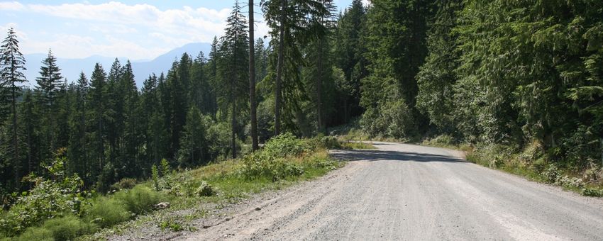
Ring Creek (RC) is a small settlement of ~50 residents at an elevation of 610m, located 6km to
the east of the District of Squamish and surrounded by forested Crown owned land. Current
residential development consists of freehold lots extending along a short section of Garibaldi
Park Road and Ring Creek Road. The community is well known to the mountain biking
community as it sits among and near some of the best known, and most widely used mountain
bike trails in the sea to Sky Corridor.
The community is most obviously exposed to interface fire risk due to the surrounding forest,
and the large volume of summer traffic along Garibaldi Park Road to the park entrance
increases the potential of an interface fire starting from a vehicle accident or other human
cause. Landslides represent both a direct risk and indirect risk, with a 2009 landslide blocking
Garibaldi Park Road below the community. Severe storms may result in extended utility
outages. The community has the potential to become isolated due to the effects of all three
hazards. Earthquake is a further hazard, not specifically treated here, but emergency
preparedness measures for the other three hazards are consistent with those required for
earthquake.
Demographics
A mix of full time and seasonal residents.
Land Use
Single family homes.
Critical infrastructure
Drinking Water Independent supply at each property
Sanitary/Waste Water Septic tank or field.
Treatment
Electrical Power Systems Off grid, systems supplied by property owners
Gas Heating Systems No
Communications Landline, internet access and unreliable cellphone reception
5Response Capabilities
Structural fire No service to this community.
Wildland interface fire Crews dispatched from Pemberton.
Opportunity for more local training
Medical Nearest BCAS base in Squamish
Police Nearest RCMP detachment in Squamish
Evacuation Opportunity for community training
Communication Landline, internet and some cellphone
reception, subject to any infrastructure
impacts.
6Hazard, Risk and Evacuation
RING CREEK HAZARD PROFILE
Debris Flow/ Severe Storm/ Hazardous
Flood Interface Fire Earthquake
Landslide Utility failure Material
KEY:*
HIGH RISK
MODERATE RISK
LOW RISK
UNLIKELY
*Note that risk does not equal impact. A low risk event may still occur with high impact.
The risk assessment examines the high and moderate risk hazards.
Evacuation Routes
Evacuation route will be down the Garibaldi Park Road towards Squamish at the direction of
first responders, and the recommended evacuation route and reception centre locations will
also be printed on the official evacuation notice delivered by first responders and/or published
on the SLRD website. There are no obvious vehicular alternatives to Garibaldi Park Road. In the
event of a fast moving interface fire closing Garibaldi Park Road below the community,
evacuation upwards and east to the Diamond Head parking lot of Garibaldi Park, and air
assisted evacuation, may be the only option but has multiple additional risks including the time
it would take to evacuate the entire community plus any recreational users in the area.
Community Muster Point, if required, will be the intersection of Garibaldi Park and Ring Creek
Roads. The Muster Point will be used if evacuation is necessary by RCMP escort due to road
conditions, or to receive additional information before evacuating.
7Types of Evacuation
Evacuation
Alert This is the time to get ready to leave, putting together ‘grab
and go’ bags with essential supplies, papers and
prescriptions, and making any other arrangements to leave
the property with all household members and pets.
Residents may self-evacuate (voluntary) during this time,
particularly if they have mobility issues or health conditions
that may make it difficult to evacuate quickly. This is also
the time to move livestock to safer areas.
Evacuation
Order Mandatory evacuation occurs when a population is ordered
to leave a defined area according to a formal written
document that outlines the impact area and why an
evacuation is necessary.
Shelter-in
-Place Essentially, an instruction to the public to stay inside for
safety reasons. It may also mean “seal the room”, i.e. take
steps to stop outside smoke or other contaminants from
entering the room.
Evacuation
Rescind Formal notification that it is safe to return to the evacuated
area. The affected area may still be under an Evacuation
Alert under further notice, if the hazard still presents a
threat.
8Interface Fire
Ring Creek is located in a wildfire environment. Wildfires will happen – exclusion is not a choice.
The variables in a wildfire scenario are:
• when the fire occurs, and
• where the fire occurs.
During the summer of 2017, a small wildfire ignited within 3.5km of the Ring Creek community
but was rapidly contained and extinguished. However, the risk cannot be understated. The
2015 Elaho Fire north west of Squamish extended over 12,000 hectares and burned for almost
two months before being assessed as 100% contained.
Potential ignition of an interface fire includes a lightning or human caused forest fire, a
structural fire in the community that spreads to the wildland area, ignition relating to a vehicle
accident or sparking, and a vehicle collision related fire on Garibaldi Park Road that spreads.
The heavy volume of recreational traffic through the community during the summer months
increases risk of a human caused ignition.
The consequences of an interface fire event have the potential to be severe/catastrophic for
the Ring Creek community depending on ignition point, dryness, and wind conditions.
EVACUATION PROTOCOL:
At the Evacuation Alert stage:
• Residents with mobility or chronic health issues may choose to voluntarily evacuate to
ensure their safety and continuity of care. If they choose to stay at this time, they should
contact the SLRD Emergency Program staff to discuss their situation and/or make
arrangements with a neighbor if they do not have a vehicle, and their primary
healthcare provider if evacuation is medically complicated (e.g. dialysis, oxygen tanks).
• All other residents should make preparations to leave, ensuring that they have a plan for
the safe evacuation of all people and pets, gather essential documents, medicines and
necessities of food, clothing and other items.
At the Evacuation Order or Tactical Evacuation stage:
• At the direction of BC Wildfire Service, RCMP or other authorized first responders,
residents will evacuate according to the evacuation route directions given.
• All residents must leave, ensuring that all people and pets in their household safely
evacuate, and taking the previously gathered essential documents, medicines,
necessities of food, clothing and other items. If these items have not been gathered in
advance, there may be no time to take anything at the time of evacuation.
9• Emergency Support Services (ESS) will be provided to those evacuated, including
emergency accommodation if required.
Debris Flow/Landslide
Ring Creek is surrounded by variably steep slopes of Crown owned forested land that has a
number of feeder creeks and streams. The slopes above development have a variable landslide
risk depending on vegetation, soil and rock ground composition, slope gradient and moisture
content. For example, a fire in a forested area above and away from the community may
destabilise previously stable soil, releasing woody debris and soil downslope during spring
freshet or a high volume rain event. A 2009 landslide blocked Garibaldi Park Road below the
community and took seven months to fully remediate the road, highlighting the potential for
the community to become isolated for an extended period.
EVACUATION PROTOCOL:
Evacuate if directed by first responders (imminent threat, tactical evacuation), and/or if an
evacuation order is issued by the SLRD due to conditions being assessed as dangerous enough
to warrant an evacuation of identified properties. First responders and the SLRD will take a
conservative approach in assessing Debris Flow risk evacuation trigger points, to ensure
resident safety. Evacuation will apply to all identified properties at risk, which may result in a
partial for full evacuation of the affected community. Evacuation route is via Highway 99, north
or south depending on location of Reception/Registration centres, and potentially depending
on whether the highway is blocked in one direction due to a related landslide event.
Trigger points for evacuation are taken from the BC Forest Service Wet Weather Safety
Guidelines (rainfall and snow melt), advice from provincial experts, and conditions at the time.
Evacuation Alert Trigger Points
• Rainfall event forecast of 25 – 45mm or more in less than 24 hours
• Rainfall event forecast of 25 – 45mm or more in less than 24 hours, plus snow melt
calculations (see table #1 below)
• Cumulative rainfall of 40mm or more over >5 days, with additional continued rain
forecast and/or snow melt calculations (see table #1 below).
Snow Melt Soil Moisture Input
Snow melt is an important factor in determining the total soil moisture input. The following
tables provide guidance as to the amount of snow melt that must be added to the
precipitation forecast or recorded in a rain gauge in applicable situations. Snow melt must be
considered at or above the slope where the melt event is occurring.
10Table #1: 24 Hour Snowmelt additions during rain-on-snow events
Average Open Area Forested Area
temperatur Wind* Wind*
e Low Moderate High Low Moderate High
0.5-2.0˚C 3mm 10mm 25mm 1mm 5mm 11mm
2.1 – 5.0˚C 15mm 35mm 75mm 5mm 10mm 25mm
5.1-10.0˚C 25mm 70mm 120mm 10mm 28mm 40mm
10.1-15˚C 35mm 95mm 160mm 15mm 40mm 60mm
*Low Wind (30km/hr): Small trees sway, maps/paper difficult to hold
still.
High Wind (>20km/hr, gusts >40km/hr): Whole trees in motion, clouds moving rapidly, rain
blowing sideways.
Tactical Evacuation Trigger Points
Heavy rainfall is occurring, and ANY of the following are observed:
• Sudden muddy water in creeks (especially in gullies)
• Sudden lack of flow in creeks during wet weather
• Cracks appearing in the soil
• Small (anything ≥1m x 1m) sloughs of soil occurring
• Landslides occurring in the general area, or sounds of landslides occurring
• Blocked culverts
• Forecast rainfall is occurring, and stream full conditions are occurring or close to
occurring.
• Thunderstorm or heavy rainfall event not forecast, generating torrential downpours
and/or observed debris activity in the affected slide areas.
• Cumulative rainfall of 45mm over >5 days or more, with additional continued rain
forecast, plus additional snow melt calculations from table #1 (above).
Severe Storm (All Seasons)
The community may become temporarily isolated by a severe winter snow storm or summer
storm with high winds that down trees and potentially knock out power lines nearby. Winter
heating is a concern, especially for vulnerable residents. Extended power outages present
health and safety risks including food spoilage, shortage and inability to store medications
requiring refrigeration (e.g. insulin). Blocked roads compromise community access to
11emergency health services.
EVACUATION PROTOCOL:
Shelter in place until downed power lines are confirmed by first responders or BC Hydro as no
longer hazardous. If emergency assistance is required, call 9-1-1 (if able). If a storm related
evacuation is required, follow the instructions of first responders and official information from
the SLRD. In the event of evacuation, Emergency Support Services (ESS) will be provided to
those evacuated, including emergency accommodation if required.
Residents who are vulnerable due to health conditions should discuss a plan in advance with
their primary healthcare provider. This may include voluntary self-evacuation when a severe
storm event is forecast, access to a back up power supply, and additional supplies of medication
or an emergency prescription.
Earthquake
Depending on epicentre, type, and severity, a full range of impacts are possible for Ring Creek.
Isolation is a significant possibility if Garibaldi Park Road is blocked (likely) even if structural
damage is minimal in the community. Damage to waste water treatment and drinking water
systems in conjunction with extended isolation would create public health concerns. Damage
to communications infrastructure in the wider area, e.g. cellphone towers, may compromise
communication to external response agencies.
SLRD ALERT.
Be in the know, not in the dark.
Free emergency notification service
direct from the SLRD to you.
Text, voice message and email options
Sign up: http://www.slrd.bc.ca/SLRDAlert
12EVACUATION PROTOCOL:
Remain in the ‘Stop/Cover/Hold’ position until shaking stops. If you are able, shelter in place
until downed power lines are confirmed by first responders or BC Hydro as no longer
hazardous. If you feel your house is unsafe, including if you smell gas, exit the building
immediately. If emergency assistance is required, call 9-1-1. If an earthquake related general
evacuation is required, follow the instructions of first responders and official information from
the SLRD. Through Rapid Damage Assessment by trained teams, individual residences may be
assessed as unsafe, in which case evacuation will be required. Emergency Support Services
(ESS) will be provided to those evacuated, including emergency accommodation, food and
clothing if required.
13Community Map – Ring Creek
SLRD - Area D
Ga r
ib al d i
P ar
kR
d
Ring Creek
Ring Creek Rd
to Squamish eek
Ring Cr
District
of Squamish
M am quam
Riv er
Stream s
Ring Creek
±
and Surroundings
1:20,000
0 95 190 380
Met ers Street Centreline
14Community Action Plan
The SLRD will work with community representatives every three (3) years to review, assess and
update the Community Action Plan.
Historical Actions
• Independent power systems add to community resilience when other power
infrastructure is affected.
• Independent water and waste treatment system may be a protective element in the
event of damaged infrastructure in neighbouring communities.
Current and Future Potential Actions by the Community
• Establish a Neighbourhood Emergency Team (NET) with members who have completed
a criminal record check (free for volunteers and required in order to be placed in many
volunteer roles during response). The SLRD can support the NET through training in
basic emergency preparedness, evacuation notification, recovery considerations and
other relevant topics that facilitate a two-way knowledge exchange of local government
emergency processes and community capacity building. The SLRD can also connect
communities to funding when it is available (e.g. FireSmart) and may sponsor a training
session by an external provider for multiple communities if budget is available and there
is sufficient demand. NET team members would be utilised in a disaster response as
qualified volunteers under the direction of the relevant agency. The size of the NET, its
organization and the level of training is at the discretion of the community and is
independent of the SLRD.
NET team members may be progressively trained in:
o First Aid and simple triage
o Evacuation Processes
o Radio Communication
o Locating victims and resources
o BC Wildfire S-100 Basic Fire Suppression and Safety
• Work to achieve official FireSmart Community status
• Work with the SLRD to develop a basic Disaster Recovery Plan
• Identify vulnerable residents and develop a plan with them for their continued safety in
the event of a major emergency (EMBC resources available to assist planning)
• Identify and document skilled individuals in the community (e.g. doctors, nurses,
electricians, engineers).
• Practice evacuation notification with the delivery of emergency preparedness public
information resources to each house (these resources available through the SLRD)
15• Campaign to get all residents signed up to the SLRD Alert emergency mass notification
system for direct communication by email, text and landline from SLRD to residents and
their nominated emergency contacts.
Looking for more information to make your community
Disaster Resilient?
SLRD www.slrd.bc.ca/services/emergency-management
GENERAL http://www2.gov.bc.ca/gov/content/safety/emergency-
preparedness- response-recovery
ANIMALS http://www.cdart.org/beprepared.htm
FIRE SMART www.firesmartcanada.ca
16You can also read