CONTINENTAL DIVIDE NATIONAL SCENIC TRAIL - DAY & OVERNIGHT HIKES: Continental Divide Trail Coalition
←
→
Page content transcription
If your browser does not render page correctly, please read the page content below
CONTINENTAL DIVIDE
NATIONAL SCENIC TRAIL
DAY & OVERNIGHT HIKES:
     WYOMING
CONTINENTAL DIVIDE TRAIL COALITION
            VISIT WYOMING!
Day & Overnight Hikes on the Continental Divide Trail
THE COWBOY STATE
The Continental Divide Trail National Scenic Trail (CDT) travels through some of Wyoming’s most stunningly
diverse landscapes: Yellowstone National Park - our nation’s first national park - with steaming geysers and
volcanic activity, the craggy Teton Wilderness and Absaroka Mountain Range, the geographic phenomenon
of Two Ocean Pass, the Bridger Wilderness, and the spectacular Wind River Range boasting 1,300 lakes
and some of the largest glaciers in the lower 48 states. On the CDT, you’ll also encounter the restored
South Pass City, where hundreds of thousands of pioneers passed on the Mormon, Oregon, and California
Trails; the expansive Great Divide Basin – the only place that the Continental Divide splits and rejoins -
where rainfall doesn’t flow to any ocean; the deserted mining town of Battle; and the gentle Sierra Madre
Mountains. In Wyoming, the CDT also spans the ancestral and present-day lands of the Cheyenne, Ute,
Eastern Shoshone, Shoshone - Bannock, and Apsaalooké (Crow) peoples.

We’ve put together the state’s best day and overnight hikes on the CDT for you to explore some of our
favorite parts of Wyoming! Hikes in this guide are organized south to north.

Elevation: Many of these hikes are at elevations above 5,000 feet. Remember to bring plenty of water, sun
protection, extra food, and know that a distance at elevation may be more challenging than that at sea
level. Also, remember that at high elevation in the mountains weather can change quickly. It can go from
sunny and warm to wet and cold in just minutes, so make sure you are prepared and bring extra layers.

Water Availability: The CDT in Wyoming passes through a number of very dry areas. Plan ahead so you
know where you will be able to find water and, as always, remember to bring plenty of water and stay
hydrated.

Navigation: Download the CDTC mapset at https://continentaldividetrail.org/maps. The Guthook Guides
phone application also provides a trail map and user-friendly, crowd-sourced waypoint information for the
entire CDT.

HIKE TYPES:
       			                   OUT AND BACK                   POINT TO POINT                      LOOP

                                             Did You Know?
    • While Wyoming is the tenth largest state by land area, it is the least populous state in the U.S.
      As of 2021, the total population of the state is 569,013 people.
    • Ninety-six percent of Yellowstone National Park, which became the nation’s first national park
      in 1872, lies within Wyoming. Twenty-six present-day Native tribes have ancestral connections
      to Yellowstone. Early in the park’s history, White park superintendents dispossessed Indigenous
      peoples from their ancestral lands to make the park “safe” for visitors.
    • The nation’s first national monument is also in Wyoming. Devil’s Tower National Monument
      was designated in 1906 by President Roosevelt with the Antiquities Act. The Lakota name for
      Devil’s Tower is Mato Tipila, which translates to “Bear Rock,” “Bear Lodge,” or “Bear Tipi.”
    • Wyoming’s state mammal is the bison, the state bird is the meadowlark, and the state reptile
      is the horned toad.
    • Wyoming once recorded the world’s largest swing dance!
    • Wyoming was the first state to have a female governor. Nellie Taylor Ross became the first and
      only female governor of Wyoming from 1925-1927.

COVER PHOTO BY CRAIG HALL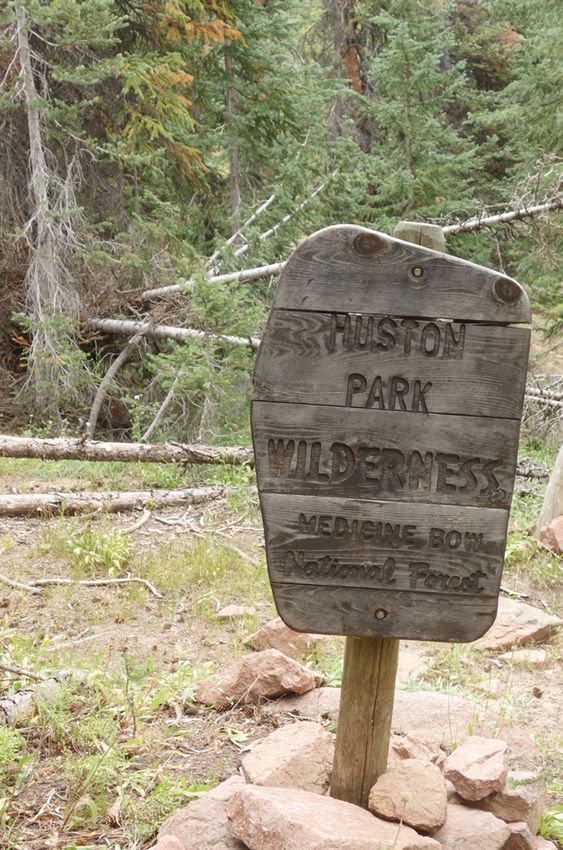
Explore the Sierra Madre Mountains among spruce forest and grassy
                                  meadows. Enjoy enchanting views of the Platte Valley and the Snowy
                                  Range Mountains. This section of the trail is mainly in the serene
Huston Park                       Huston Park Wilderness, a grassy trail marked with posts. Camping
                                  opportunities abound in the Huston Park Wilderness and to the north
Wilderness                        if you decide to turn this into an overnight trip. If you choose to hike
                                  from Battle Pass Trailhead, you have the option of detouring from
Length: 3 miles or 8.5 miles      the CDT to climb Red Mountain. Named for the beautiful red granite
Difficulty: Moderate              that comprises its rounded summit, Red Mountain is one of the tallest
Closest Town: Encampment          mountains in the Sierra Madre Range. From the parking lot on WY-70,
                                  begin southbound on the CDT. The summit of Red Mountain is less
                                  than a mile off-trail from the CDT and can be reached via an unmarked
                                  scramble on the gently sloping north face of the mountain. Return by
                                  scrambling back down to rejoin the CDT, then hiking northbound to
                                  the parking lot for 3 miles. If you hike from Green Mountain Trailhead,
                                  you’ll find a less traveled trail through old growth forest and can make
                                  an 8.5 mile out-and-back hike, walking 1.8 miles on the Green Mountain
                                  Trail and then 2 miles north on the CDT to a high point.

                                  Directions from Encampment: To Green Mountain Trailhead: Drive
                                  about 5.5 miles west of Encampment on WY-70, then go south on
                                  Forest Road (FR) 550 for 6.4 miles and turn right (west) on FR 406.
                                  4WD and high-clearance vehicles are recommended for the 2.4 miles
                                  on FR 406 to Green Mountain Trailhead. You will need to hike 1.8 miles
                                  on Green Mountain Trail to reach the CDT. To Battle Pass Trailhead:
                                  Drive 11.9 miles west of Encampment on WY-70 to the top of Battle
                                  Pass. Look for a parking lot on the south side of the pass. There is also
                                  parking 2 miles north of the Battle Pass parking area.

                                  Maps: USGS 7.5 Quadrangles: Solomon Creek and Red Mountain; CDT
                                  Map Set: Maps 216 - 218, Section WY01.
ENTERING HUSTON PARK
WILDERNESS AREA. PHOTO BY MIKE
HENRICK                           For More Information: Medicine Bow-Routt National Forest, Brush
                                  Creek/Hayden Ranger District: (307) -326-5258.

                                        For a gentle hike with views of Wyoming sagebrush and
                                        mesas, take the CDT north from Bridger Pass Road. This
                                        relatively flat section runs somewhat parallel to Sage Creek
Bridger Pass Rd                         Road and crosses a few dirt roads along the way. A good
North on the CDT                        turn around spot is at 3 miles when the CDT hits another
                                        dirt road and turns left to follow this road. If you would
Length: 6 miles                         like to visit Teton Reservoir, a bit farther south on Sage
Difficulty: Easy                        Creek Road, it makes for a nice afternoon stop and also a
Closest Town: Rawlins                   possible camp spot at the BLM campsite.

                                        Directions from Rawlins: Take WY-71 S/Sage Creek Rd for
                                        12.6 miles until the road splits. Take a right onto Bridger
                                        Pass Rd and continue for 0.4 miles. You can find parking
                                        on the side of the road and take the CDT north as it leaves
                                        the road.

                                        Maps: USGS 7.5 Quadrangles: Coal Mine Ridge and La
                                        Marsh Creek West; CDT Map Set: Map 228, Section WY05.

                                        For More Information: BLM Rawlins Field Office: (307)-
THE VIEW FROM SAGE CREEK ROAD.
PHOTO BY STEVEN SHATTUCK                328-4200.

                                 Find out more at continentaldividetrail.org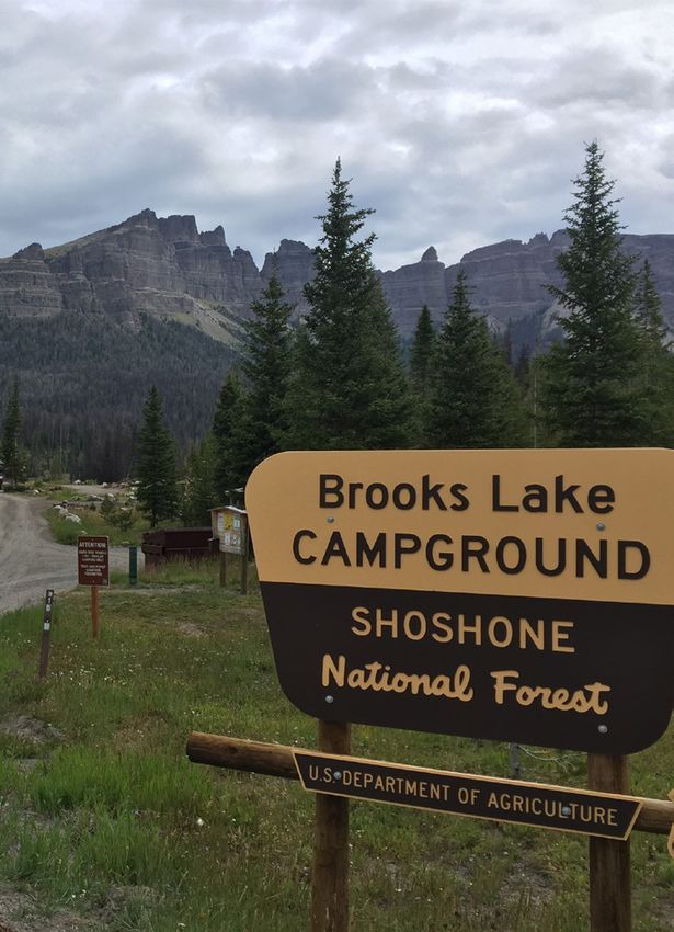
Experience the only place where the Continental Divide splits, creating
                                       a large circular basin where the water does not flow into the Pacific
                                       or Atlantic Oceans, but into a succession of ponds and salt flats in an
Crooks Gap Road                        area known as the Chain-of-Lakes. Native shrubs such as sagebrush,
to Bison Basin                         saltbush, and active sand dunes dominate the landscape. The Crooks
                                       Gap Road to Bison Basin Road segment is a 24-mile stretch of the
Road                                   CDT located southeast of Lander and northwest of Rawlins. It is ripe
                                       with potential wilderness experiences, including possible wild horse
Length: 24 miles                       sightings. Brenton Springs, a perennial spring 4 miles into this segment,
Difficulty: Difficult                  offers the first water source. The landscape takes on a new character
Closest Town: Rawlins                  as the route heads out of the basin and up onto Crooks Mountain.
                                       It is rumored that “Crooks Gap” and “Crooks Mountain” were named
                                       perhaps as the site of an ambush or as a hideout for a gang of outlaws.
                                       The less exciting truth is that they were named after General George
                                       Crook, an army commander. In spite of the unrelenting sun, this
                                       segment of the CDT is very pleasurable. You’ll walk through sagebrush,
                                       limber pine, and the occasional cottonwood or aspen tree.

                                       Directions from Rawlins: Drive 67 miles northwest of Rawlins on
                                       US-287 to the small town of Jeffrey City. From Jeffrey City, follow the
                                       graded and well-maintained Crooks Gap Rd. south for 5 miles until a
                                       fork appears in the road. Take the left fork and continue south past a
                                       sign that says Wamsutter 52 miles, Sweetwater Mill 31. There is also a
                                       large sign for the Jackpot uranium mine on the side of Sheep Mountain.
                                       At mile 12, the road crosses a cattle guard. Park south of the cattle
                                       guard on Bureau of Land Management (BLM) administered land. The
                                       CDT continues just to the south of a fence, following a faint two-track
                                       heading west.

                                       Maps: USGS 7.5 Quadrangles: Crooks Peak, Brenton Springs, Crooks
                                       Mountain, and Soap Hole; BLM Surface Management Status: Bairoil
                                       and South Pass; CDT Mapset: Maps 241 - 244, Section WY09.
 THE SUN SETTING OVER THE GREAT
 DIVIDE BASIN NEAR BISON BASIN ROAD.
 PHOTO BY MATT BERGER                  For More Information: BLM Lander Field Office: (307)-332-8400.

                                                Heading north from Sweetwater River, you will wind
                                                through the Wyoming grasslands and sagebrush as the
                                                trail follows the river north for 3 miles. The trail is gentle
Sweetwater Bridge                               and stays relatively flat, gaining less than 500 ft in the 10
                                                miles to Atlantic City.
Length: Variable (3 - 10 miles)
Difficulty: Easy                                Directions from Atlantic City: Take Riverview Cutoff south
Closest Town: Atlantic City                     of town for 8.3 miles. Turn left and continue for 1.5 miles.
                                                Then take a slight right to continue for 0.2 miles until you
                                                reach a turn on the left for a track where the CDT heads to
                                                the east. This is where you can pick up the trail going north,
                                                however, if you want to pick up the trail after crossing
                                                Sweetwater Bridge, continue down the road 0.2 miles.

                                                Maps: USGS 7.5 Quadrangles: Radium Springs and Atlantic
                                                City; CDT Map Set: Maps 248 and 249, Section WY09 and
                                                WY10.

                                                For More Information: BLM Lander Field Office: (307)-
A SUNSET SOUTH OF ATLANTIC CITY.                332-8400.
PHOTO BY DAHN PRATT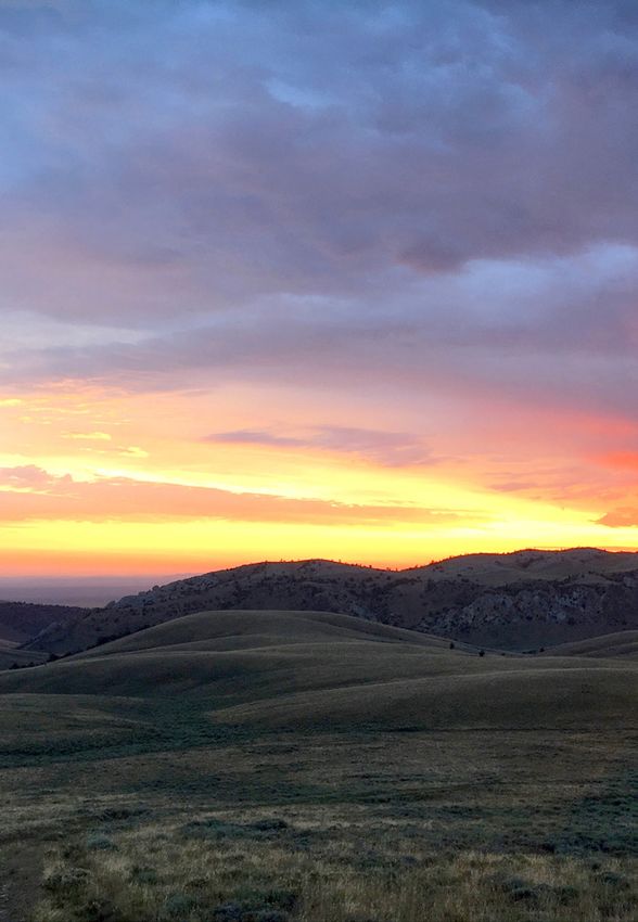
Rugged and unspoiled terrain awaits you as you step back in time along
                                this historically rich section of trail. South Pass City is a historical site
                                where 17 of the town’s 23 original structures have been restored and
South Pass City                 are exhibited with artifacts from the original buildings. The famous
                                South Pass, which is a few miles south of South Pass City, has the gentle
Length: 20 miles                grade of emigrant trails, rising to an elevation of 7,526 feet. This feature
Difficulty: Difficult           provided the 19th century emigrants with a relatively “smooth” crossing
Closest Town: Lander            of the Continental Divide. Without South Pass, wagon travel across the
                                continent would have been very difficult. The CDT also intersects with
                                four historic trails at South Pass; the California, Oregon, Mormon, and
                                Pony Express Trails. Heading north on the CDT, you will cross WY-28
                                and follow a Forest Service Road to a high point. Just after crossing Pine
                                Creek after 9 miles, continue for less than 0.5 miles and reach Pine Creek
                                Pass at 9,250 feet. Going south from South Pass City you can walk along
                                Willow Creek towards South Pass until reaching another Forest Service
                                Road.

                                    Directions from Lander: Drive 8.8 miles to the junction of WY-28 and
                                    US-287. Follow WY-28 for 23 miles and turn left (south) onto S Pass City
                                    Rd. After 1.6 miles, turn right to stay on S Pass City Rd. (Note that there
                                    are two developed BLM campgrounds along this road). After another
                                    0.6 miles, turn right onto S Pass Main St and continue for 150 feet before
                                    reaching the trailhead and parking lot at Willow Creek on the left.

                                    Maps: USGS 7.5 Quadrangles: South Pass City and Anderson Ridge;
                                    USFS: Bridger-Teton National Forest, Pinedale Ranger District; BLM:
                                    South Pass and Lander; CDT Mapset: Maps 251 and 252, Section WY11.
SOUTH PASS CITY.
PHOTO BY MATT BERGER            For More Information: BLM Lander Field Office: (307)-332-8400;
                                Bridger-Teton National Forest, Pinedale Ranger District: (307)-367-4326.

                                        The CDT stretches for nearly 70 miles through this spectacular area
                                        teeming with wildlife, glacial lakes, and towering spires. The trail
                                        network is extensive, creating many loops for hiking. A classic loop
Elkhart Park                            from Elkhart Park uses the CDT to connect a number of alpine lakes
Loop: Island &                          including Little Seneca Lake, Island Lake, and the Pole Creek Lakes.
                                        Pack your fly rod so you can cast for rainbow and cutthroat trout at
Seneca Lakes                            Island Lake. To complete this loop, take the Pole Creek Trail for 5.5
                                        miles and turn left onto the Seneca Lake Trail for 4.4 miles before
Length: 25.5 miles                      reaching the CDT/Highline Trail. Turn right (south) and continue on
Difficulty: Difficult                   the Highline Trail for 6 miles until a junction with the Pole Creek Trail.
Closest Town: Pinedale                  Take the Pole Creek Trail for 4 miles back to the Seneca Lake Trail
                                        and turn left (west) to continue for 5.5 miles to your starting point.

                                        Directions from Pinedale: Take Fremont Lake Road to FR 740/
                                        Skyline Drive and continue for approximately 9 miles to the Elkhart
                                        Park and Long Lake Trailhead to Little Seneca Lake.

                                        Maps: USGS 7.5 Quadrangles: Fremont Lake South, Fremont Lake
                                        North, Bridger Lakes, Fremont Peak South, Horseshoe Lake, Halls
                                        Mountain, and Fayette Lake; USFS: Bridger-Teton National Forest,
                                        Pinedale Ranger District and Bridger Wilderness; CDT Mapset: Maps
                                        263, Section WY14.

ISLAND LAKE WITH VIEWS OF FREMONT       For More Information: Bridger-Teton National Forest, Pinedale
PEAK. PHOTO BY RYAN CHOI                Ranger District: (307)-367-4326.

                                    Find out more at continentaldividetrail.org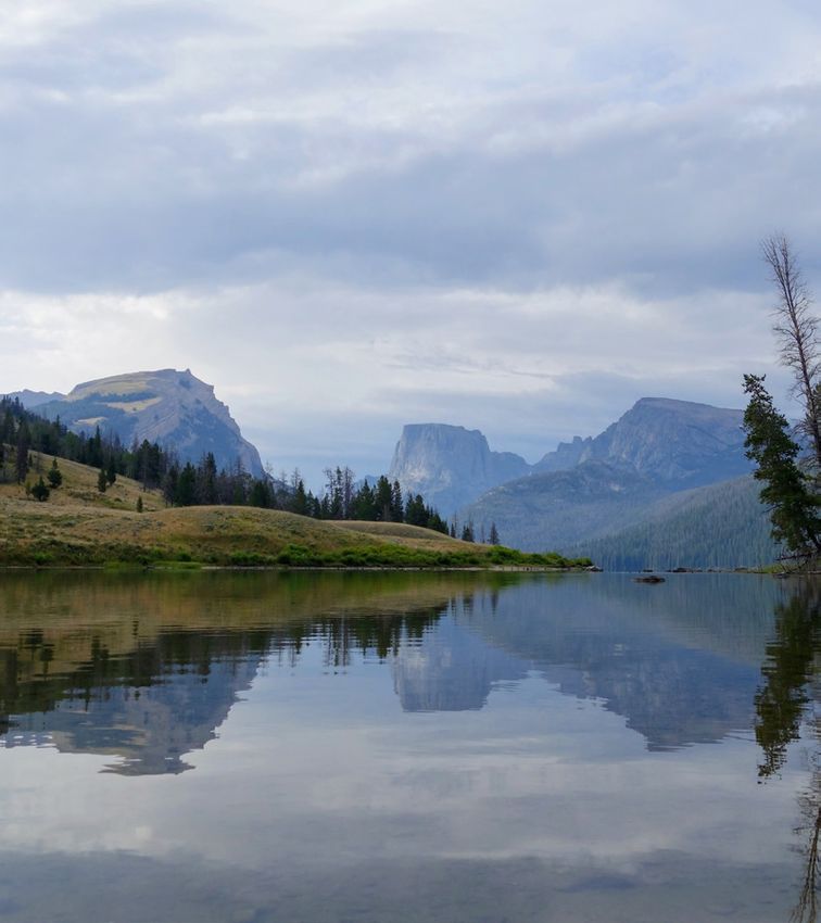
Journey out of Pinedale to Green River Lakes. Carved out by
                                            glaciers and replenished each year from the snowmelt of the
                                            Wind River Range, the lakes are the source for the Green River,
Green River                                 a major tributary of the vast Colorado River system. Stands
                                            of aspen and pine cover the hillsides as you start from the
Lakes                                       Green River Lakes Trailhead. We recommend heading south
                                            to hike along the lakes, leaving the crowds behind as you
Length: 7 miles to the end of the           make your way towards the Bridger Wilderness and along
lower lake                                  the eastern shores of the lakes. If you go north, you are sure
Difficulty: Moderate                        to find solitude where you may encounter wildlife, but it is
Closest Town: Pinedale                      rare to see another human in the Gunsight/Roaring Fork area.
                                            The view of the Tetons from Gunsight Pass is incredible. On
                                            a summer adventure, one might discover abundant mountain
                                            wildflowers and glimpses of wildlife such as moose, deer, elk,
                                            bear, hawks, and eagles.

                                            Directions from Pinedale: Take US-191 west from Pinedale.
                                            About 6 miles from Pinedale, you will reach the Cora turnoff
                                            at the junction of WY-352. Turn right, towards Cora, and keep
                                            going until you reach Green River Lakes. The last 23 miles
                                            of the trip is on a rough dirt road maintained by the Forest
                                            Service. It is suitable for most cars during the summer, but
                                            slow speeds are necessary, so plan a leisurely pace for your
                                            trip.

                                            Maps: USGS 7.5 Quadrangles: Green River Lakes, Union Peak,
                                            and Fish Creek Park; Bridger-Teton National Forest, Pinedale
                                            Ranger District and Bridger Wilderness; CDT Mapset: Map
                                            266, Section WY15.

                                            For More Information: Bridger-Teton National Forest, Pinedale
GREEN RIVER LAKES. PHOTO BY JOHNNY CARR
                                            Ranger District: (307)-367-4326.

                                          Heading north from Union Pass, you’ll leave a landscape of wet
                                          meadows and marshy ponds. After around 1.8 miles, walk along
                                          the shore of Lake of the Woods, a beautiful alpine lake known for
Union Pass to                             its fishing, swimming, and picnic opportunities. The trail jumps
Shoshone Pass                             off and on dirt roads in the woods a couple of times, and you
                                          will reach a high point at a road junction before dropping down
Length: Variable (4 - 8 miles)            to Salt Creek 3.6 miles into your hike. The trail continues rolling
Difficulty: Moderate                      up and down as it heads north through sparse forest, marshland,
Closest Town: Dubois                      and shrubland.

                                          Directions from Dubois: Head west on US-26 W/US-287 N for
                                          6.7 miles. Turn left onto Union Pass Rd/Warm Spring Creek Rd
                                          and continue for 3.5 miles. Turn right to stay on Union Pass Rd/
                                          Warm Spring Creek Rd for 10.6 miles until you reach Union Pass.
                                          Continue for less than 1 mile and turn left onto FR 693 and you
                                          will find parking and the CDT. Head north (across the road) to
                                          hike.

                                          Maps: USGS 7.5 Quadrangle: Fish Lake; CDT Mapset: Map 270,
                                          Section WY16.

HIKING FROM UNION PASS.                   For More Information: Bridger-Teton National Forest, Pinedale
PHOTO BY JOHNNY CARR                      Ranger District: (307)-367-4326.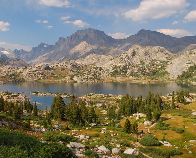
The Shoshone National Forest was set aside in 1891 as part of the
Yellowstone Timberland Reserve, making it the first national forest in
the U.S. It consists of some 2.4 million acres of varied terrain ranging
Brooks Lake from sagebrush flats to rugged mountains. With Yellowstone National
Park on its northwestern border, the Shoshone encompasses the area
from the Montana state line south to Lander, WY. The Brooks Lake Area
Length: Variable (5 - 8 miles) of the Shoshone National Forest sits just outside the Teton Wilderness.
Difficulty: Moderate Travelers can explore this spectacular area from the Brooks Lake
Closest Town: Dubois Trailhead to atop Bear Cub Pass. However, there are several options for
hiking in the Brooks Lake Area. For a day hike, follow the well-marked
trail to Upper and Lower Jade Lakes. The loop follows Jade Creek and
eventually links up to the CDT just after the upper lake. At the next
intersection, turn right and take the Yellowstone Trail back to Brooks
Lake. You can lengthen this loop by continuing upstream (north) on
the CDT instead and hiking to Upper Brooks Lakes before turning
back (south) on the Yellowstone Trail. Grizzly bears, black bears, elk,
moose, mule deer, bighorn sheep, and numerous smaller predators
and birds can be found in the luxurious meadows and thick forests.
Directions from Dubois: Drive 20 miles on WY-26/US-287 as it parallels
the Wind River. North of Dubois, the road becomes mountainous but
is maintained and kept open year round. Approximately five miles
above the Tie Hack Memorial, FR 515 takes off to the north. Following
this dirt road for about 5 miles will bring you to Brooks Lake. Here you
will find campgrounds, trailheads, and the historic Brooks Lake Lodge.
Maps: USGS 7.5 Quadrangles: Togwotee Pass and Lava Mountain;
USFS: Bridger-Teton National Forest, Buffalo and Jackson Ranger
Districts; CDT Mapset: Maps 275 and 276, Section WY18.
ARRIVING AT BROOKS LAKE CAMPGROUND.
PHOTO BY JOHNNY CARR For More Information: Shoshone National Forest, Wind River Ranger
District: (307)-455-2466.
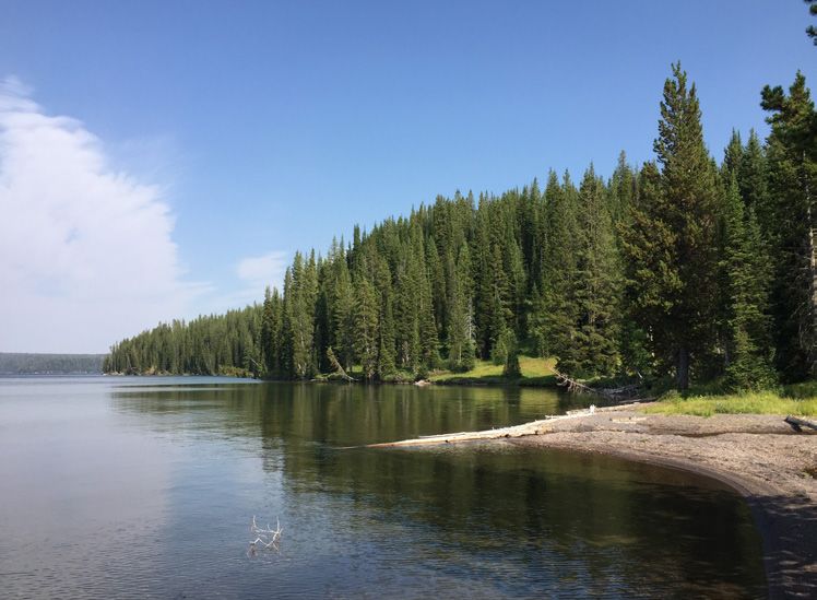
Entering Yellowstone from the south, there are two trailheads that
offer access to the CDT. From the Dogshead/Channel Trailhead,
follow the CDT to Shoshone Lake and enjoy your lunch at a campsite
Yellowstone in a meadow on the south shore of this enchanted lake, the largest
National Park lake in the contiguous US without road access. Alternatively,
backpack in and wake up early to see an abundance of wildlife
Length: Shoshone Lake Loop - 28 activity along the lake’s shoreline. From the Heart Lake Trailhead,
miles; Heart Lake Loop - 34 miles head south and you’ll find more alpine scenery, hot springs, geysers,
Difficulty: Easy - Moderate and the fourth largest lake in the park. Permits are required for
Closest Town: Moran backcountry camping. Both hikes can be shortened for day trips.
Directions from Moran: Head north on US-191 N/US-287N/US-89N
for 41 miles. You will pass into both Grand Teton and Yellowstone
National Parks. In Yellowstone, Heart Lake Trailhead is on the right 14
miles past the entrance. Dogshead/Channel Trailhead for Shoshone
Lake is shortly after the Heart Lake Trailhead, on the left.
Maps: USGS 7.5 Quadrangles: Mount Sheridan, Lewis Falls, Shoshone
Geyser Basin, and Old Faithful; Trails Illustrated #201C; CDT Mapset:
Maps 285-290, Section WY21 and WY22.
For More Information: Yellowstone National Park: (307)-344-7381.
SHOSHONE LAKE. PHOTO BY JOHNNY CARR Note that there is a fee to enter Yellowstone National Park.
Find out more at continentaldividetrail.org
Photo by Steven Shattuck

      FIND OUT MORE AT
 CONTINENTALDIVIDETRAIL.ORG

CONTINENTAL DIVIDE TRAIL COALITION

   @CONTINENTALDIVIDETRAILCOALITION          @CDTCOALITION              @CDNST1

       710 10TH STREET, SUITE 200 | GOLDEN, CO 80401 | (303) 996-2759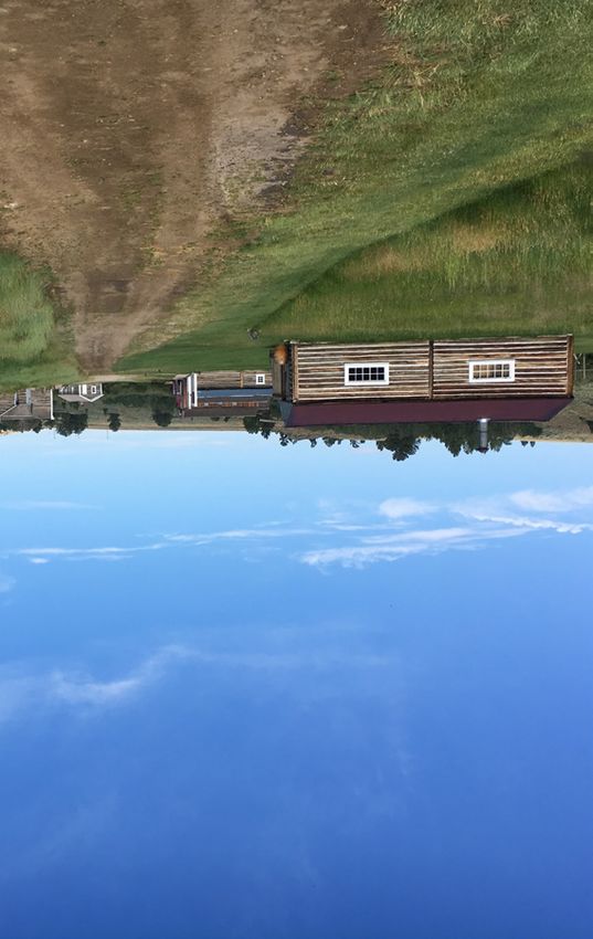
You can also read