COROMANDEL ZONE PLAN TE MAHERE Ā-ROHE O COROMANDEL - Waikato Regional Council
←
→
Page content transcription
If your browser does not render page correctly, please read the page content below
“WELL MANAGED
COROMANDEL           CATCHMENTS THAT
                     ENHANCE ECONOMIC
ZONE PLAN            AND ENVIRONMENTAL
                     SUSTAINABILITY,
                     RECOGNISE
TE MAHERE Ā-ROHE O   COMMUNITY
COROMANDEL           AND CULTURAL
                     ASPIRATIONS, WHILE
                     MITIGATING NATURAL
                     RISKS.”

                                     1
Peer reviewed by:

Michelle Lewis, Senior Catchment Planner

Aniwa Tawa, Catchment Team Leader Approved for release by:

Adam Munro, Section Manager Hauraki/Coromandel

Prepared by:

Dean Allen, Zone Manager – Coromandel, Integrated Catchment Management

Rebecca Hare, Angus McKenzie – Place Group Limited

For

Waikato Regional Council
Private Bag 3038
Waikato Mail Centre
Hamilton 3240

ACKNOWLEDGMENTS:

Coromandel Catchment Committee (Councillors, community and iwi members)
Coromandel Zone Team (Catchment Management, Operations, Manager Hauraki Coromandel)
Integrated Catchment Management Directorate (River and Catchment Services, Natural Heritage Services, Land
Management Advisory Services, Biosecurity Animal Pests and Plant Pests, and Regional Hazards)
Science and Strategy Directorate (Policy and Coastal Science)
Communications and Engagement Section

Disclaimer

This zone plan has been prepared for the use of Waikato Regional Council as a non-statutory strategic document. The
2012 Coromandel Zone Plan has been used as the primary base document to develop this plan. The development process
has included a refresh and restructure of information in the 2012 Coromandel Zone Plan, with limited engagement with
stakeholders.

The council requests that if excerpts or inferences are drawn from this document for further use by individuals or
organisations, due care should be taken to ensure that the appropriate context has been preserved, and is accurately reflected
and referenced in any subsequent spoken or written communications.

While Waikato Regional Council has exercised all reasonable skill and care in controlling the contents of this report, the
council accepts no liability in contract, tort or otherwise, for any loss, damage, injury or expense (whether direct, indirect or
consequential) arising out of the provision of this information or its use by you or any other party.
CONTENTS
NGĀ ŪPOKO

CONTENTS                                   1
NGĀ ŪPOKO

EXECUTIVE SUMMARY                          2
HE KŌRERO WHAKARĀPOPOTO

1. INTRODUCTION                            4
HE KUPU WHAKATAKI

2. COROMANDEL ZONE DESCRIPTION             8
NGĀ KŌRERO MŌ TE ROHE O COROMANDEL

3. LEGISLATION AND POLICY FRAMEWORK       12
TE TURE ME TE KAUPAPAHERE

7. KEY MATTERS FOR THE ZONE               19
NGĀ KAUPAPA MATUA I TE ROHE

8. PLAN IMPLEMENTATION                    25
TE WHAKATINANATANGA O TE MAHERE

6. FUNDING, MONITORING AND REVIEW         37
TAHUA PŪTEA, AROTURUKI ME TE AROTAKENGA

9. GLOSSARY OF TERMS                      39
TE KUPUTAKA

10. REFERENCES                            40
TE PUNA KŌRERO

EXECUTIVE SUMMARY
    HE KŌRERO WHAKARĀPOPOTO

    “WELL MANAGED CATCHMENTS THAT ENHANCE ECONOMIC AND
    ENVIRONMENTAL SUSTAINABILITY, RECOGNISE COMMUNITY AND
    CULTURAL ASPIRATIONS, WHILE MITIGATING NATURAL RISKS.”
              CO R OM A N D E L Z O N E V I S I O N

    The Coromandel Zone Plan (the zone plan) provides the             The ICM directorate is primarily focused on delivery of
    broad direction for the implementation of Waikato Regional        catchment management, river system management, flood
    Council’s (the council) Integrated Catchment Management           control programmes and asset management activities. These
    directorate activities within the Coromandel Zone (the zone).     are undertaken alongside supporting activities which are
                                                                      delivered regionally, including hazard management and
    The council undertakes a range of activities to protect the
                                                                      community safety activities, biodiversity and natural heritage
    region’s water, soil, air, geothermal areas and coasts, and its
                                                                      operations, biosecurity operations and land management
    mission is to work with others to build a Waikato region that
                                                                      advisory services.
    has a healthy environment, a strong economy and vibrant
    communities.                                                      The zone plan is guided by Waikato Regional Council’s
                                                                      Strategic Direction 2016-19 and The Peninsula Project 2004.
    The council’s work, functions and priorities are guided by
                                                                      It also assists the implementation of operational programmes
    statutory and non-statutory requirements and decisions
                                                                      identified in the council’s key statutory documents including
    made by councillor representatives. These decisions are then
                                                                      the Waikato Regional Policy Statement and the Waikato
    implemented through five directorates: Community and
                                                                      Regional Plan. It is important to note that the Coromandel
    Services, Finance, Integrated Catchment Management (ICM),
                                                                      Zone Plan is supported by a number of existing and to be
    Resource Use and Science and Strategy.
                                                                      developed harbour and catchment management p lans,
                                                                      which provide further detail on many of the issues and
                                                                      actions identified in this plan.

2   CO R OMA N D E L Z O N E P L A N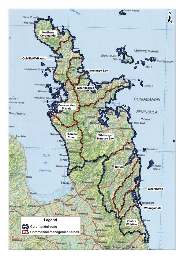
The zone plan includes the following interrelated 30 year
goals to guide the implementation of ICM activities within
the zone:

1.    Protect people, property and essential services from
      flooding.

2.    Protect and improve water quality by enhancing and
      stabilising catchments.

3.    Improve the diversity and habitat for indigenous plants
      and animals.

4.    Enhance and protect coastal environments
      in the zone.

5.    Collaborate and strengthen partnerships with mana
      whenua and community.

The 30 year goals have been developed in response to the
following key matters identified for the zone as part of the
development of this plan:
•    The challenge of addressing declining fresh water quality
     in some parts of the zone.
•    Realising greater opportunities for sustainable land
     management and the implementation of catchment
     management activities.
•    Protecting and enhancing coastal environments.
•    Promoting and supporting indigenous biodiversity
     enhancement and effective pest management.
•    The ongoing need to manage natural hazard risks.
•    Forge and strengthen partnerships with mana whenua,
     stakeholders and community groups.

The zone plan includes a high level programme of
implementation actions, grouped in focus areas that
respond directly to the goals identified. These actions will
inform the preparation of a more detailed annual works
programme for the zone that is to be monitored through the
Coromandel Catchment Committee. All actions included in
this plan are either directly funded through the Coromandel
Zone or funded as part of wider council activities. Many of
the actions rely on involvement (and funding) from other
stakeholders.

The implementation of the zone plan, and its effectiveness,
will be monitored and reported on an annual basis to the
community through the Coromandel Catchment Committee.
Further reviews will be considered every three years to
ensure the plan is reviewed in conjunction with the long
term plan process and that progress is being made towards
the goals identified.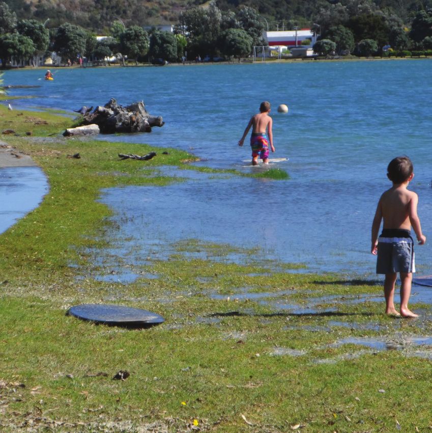
INTRODUCTION
    HE KUPU WHAKATAKI

    1.1 PURPOSE
    The Coromandel Zone Plan (the zone plan) provides the          underpinned by a number of existing, and to be developed,
    broad direction for the implementation of Waikato Regional     harbour and catchment management plans, which provide
    Council’s (the council) Integrated Catchment Management        more detailed direction on implementation actions identified
    directorate (ICM) activities within the Coromandel Zone (the   in this plan.
    zone).
                                                                   The Coromandel zone contains a range of unique
    The zone plan includes:                                        environments of significant natural, economic, social and
    •   an overall vision for the zone                             cultural value. An ongoing challenge for the council over the
                                                                   life of this plan will be to target limited resources into areas
    •   30 year goals for the zone
                                                                   of greatest priority. This challenge has been identified as a
    •   implementation actions for the next 10 year period to      key focus area for the implementation of this plan.
        meet the goals identified
    •   processes (and measures) for monitoring and reviewing      Achieving the plan goals will also rely on ongoing and
        the plan.                                                  successful collaboration with a range of stakeholders in the
                                                                   zone, and this is also a key focus area for implementation.
    The implementation actions proposed within the plan give       Greater integration and effective advocacy across a range of
    effect to aspects of the Waikato Regional Policy Statement,    council business areas will also be important in delivering
    the council’s Strategic Direction 2016-2019 and The            the actions within the plan.
    Peninsula Project, and also assists with the implementation
    of the council’s non-regulatory responsibilities under a
    variety of other statutes. The Coromandel Zone Plan is

    “WELL MANAGED CATCHMENTS THAT ENHANCE ECONOMIC AND
    ENVIRONMENTAL SUSTAINABILITY, RECOGNISE COMMUNITY AND
    CULTURAL ASPIRATIONS, WHILE MITIGATING NATURAL RISKS.”
              - CO R OM A N D E L ZO N E V I S I O N

4   CO R OMA N D E L Z O N E P L A N
1.2 STRATEGIC FIT
The zone plan supports the wider council mandate of
protecting the region’s water, soil, air, geothermal areas and
coastal areas. The ICM directorate is one of five directorates
in the council that work together to achieve a range of
outcomes for communities within the zone as follows:

1.   Community and Services – leads, enables and helps
     deliver community partnerships, customer services,
     education programmes, organisational excellence and
     internal support functions.

2.   Finance – council’s financial management, regional
     public transport responsibilities, our corporate
     buildings, facilities and property, and corporate
     planning (including the annual and long term plans).

3.   ICM – focuses on catchment management (including
     land management, biosecurity and biodiversity),
     river and flood management and natural hazard
     management.

4.   Resource Use – consenting and compliance
     responsibilities and navigation safety functions.

5.   Science and Strategy – gathers and communicates
     information on Waikato’s natural resources and
     stressors, community and economy in order to achieve
     positive regional outcomes. The directorate is also
     responsible for policy making and consistent delivery
     of high quality policy advice.

The ICM directorate is focused on delivery of a range of
of activities in the areas of catchment management, flood
control and protection, biodiversity, biosecurity, sustainable
land management and hazard/emergency management.

The directorate provides services that achieve multiple and
significant benefits for the regional community.

ICM manages the provision of its services on a regional basis
and through geographic areas known as catchment zones.
There are eight zones in the region, each with its own Zone
Manager responsible for oversight of operational budgets,
relationships, planning and priorities to deliver on agreed
community level of services.

                               “Well managed catchments that enhance economic and environmental sustainability, recognise community and
                                                                                      cultural aspirations, while mitigating natural risks.”   5
1.3 SCOPE
    The Coromandel Zone Plan is one of eight zone plans that are part of the strategic framework
    for the delivery of ICM activities within the zone.

    Figure 1 illustrates the overall scope of the activities           health within the zone. Iwi, district councils, government
    undertaken within the zone. The activities that are the            departments, industry, community groups and individual
    primary focus of the zone plan are shown in dark green,            landowners are all active in implementing initiatives to
    alongside the supporting activities which are delivered            improve catchment health. The intention of the zone plan is
    regionally (light green).                                          to complement and support the work of these other agencies
                                                                       and individuals, and align programmes where opportunities
    The Coromandel Catchment Committee holds budgetary
                                                                       arise.
    power or considerable influence in determining the work
    programme for primary focus areas of the zone plan.                Other key areas of work Waikato Regional Council is carrying
    Regarding supporting activities, the role of the catchment         out, not within the scope of this zone plan, include:
    committee is to provide local feedback to inform the regional      •   implementing and monitoring compliance with the
    programme with the intention of raising the effectiveness of           council’s rules under the current Waikato Regional
    the programme.                                                         Plan, including those resource consents that are held to
    The implementation of the zone plan will be monitored by               undertake work within the scope of this plan
    the Coromandel Catchment Committee, and therefore the              •   monitoring and investigations of the state of the
    primary focus of the plan is on activities that are funded             environment
    directly through the Coromandel Zone. In addition to               •   developing and implementing new resource
    physical works, this may include environmental monitoring              management policies and rules to address environmental
    to assess the outcomes achieved and monitoring the                     issues.
    compliance of resource consents held within the zone.

    In relation to the implementation of this plan, the council is
    one of many organisations working to improve catchment

                                                                Land
                                                             Management
                                                              Advisory
                                                               Services

                                                                  Asset
                                                              management
                                                                     +
                                Hazard                  Flood control programmes             Biodiversity
                            management and                           +                       and natural
                            community safety
                                                         Harbour and catchment                 heritage
                                                               management                    operations
                               activities                            +
                                                               River system
                                                              management

                                                               Biosecurity
                                                               operations

                                           FIGURE 1 - Coromandel Zone Plan - Scope of Activities

6   CO R OMA N D E L Z O N E P L A N
“Well managed catchments that enhance economic and environmental sustainability, recognise community and
                                                       cultural aspirations, while mitigating natural risks.”   7
COROMANDEL
    ZONE DESCRIPTION
    NGĀ KŌRERO MŌ TE ROHE O COROMANDEL

    2.1 ZONE OVERVIEW
    The Coromandel Zone covers the majority of the Coromandel Peninsula, and has a total
    geographic area of approximately 193,000ha – some 6 per cent of the Waikato region
    (refer Figure 2). The zone includes all land within the Thames-Coromandel District Council
    boundary, except Kauaeranga, Tararu and catchments flowing into Thames town which
    are included in the Waihou Piako Zone. The zone also includes part of the Hauraki District
    Council area between Whangamatā and Waihi.

    Since the 1800s, significant changes in land use have              The zone is split into management areas for the purpose
    occurred within the zone, including kauri logging, mining,         of harbour, river and catchment management. These
    farming and forestry. Nevertheless, 63 per cent of the zone        areas include Northern Coromandel, Colville/Waikawau,
    is still covered with native vegetation (including scrub), while   Whitianga/Mercury Bay, Thames Coast, Kennedy Bay,
    farming and forestry respectively use 19 per cent and 15 per       Whangapoua, Coromandel/Manaia, Tairua, Wharekawa,
    cent of the land.                                                  Whangamatā, and Otahu/Whiritoa. These catchments consist
                                                                       of almost 3900km of perennial rivers and streams, which are
    The development of small settlements on river flood plains
                                                                       generally short and steep except for the Tairua River.
    has also led to significant risks from flooding.
                                                                       The zone contains more than 500km of coastline. The
    Whilst there are no major cities within the Coromandel zone,
                                                                       Hauraki Gulf and Firth of Thames are occupied on the west
    it is home to over 50 diverse coastal settlements and rural
                                                                       coast of the peninsula, whilst the east coast extends from
    communities, and serviced by three main centres: Whitianga,
                                                                       Cape Colville to the border of the Bay of Plenty region just
    Whangamatā and Coromandel township.
                                                                       north of Waihi. The east coast contains more open and
    The zone is considered a popular holiday destination. This         exposed coastline than the western half.
    is emphasised by the zone’s small population (5 per cent of
                                                                       Large estuaries are frequent throughout the peninsula’s
    the region’s population) and nearly half of zone dwellings
                                                                       coast, which support an array of habitats and ecosystems.
    comprising non-resident holiday homes.

8   CO R OMA N D E L Z O N E P L A N
FIGURE 2 – Coromandel Zone
“Well managed catchments that enhance economic and environmental sustainability, recognise community and
cultural aspirations, while mitigating natural risks.” 92.2 KEY FEATURES
The Coromandel Zone contains a range of unique natural habitats, landscapes, ecosystems,
infrastructure and social, cultural and economic values. A summary of these key features
is set out below to provide context for the key matters identified in Section 4 of this plan.
It is noted that the below summary is not exhaustive, rather the intention is to provide a
“snapshot” of the complex operating environment of the zone.
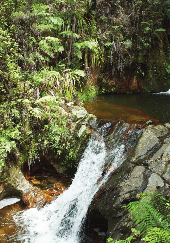
COASTAL ENVIRONMENT MOUNTAIN RANGES
The coastal environment of the Coromandel area can be A dominant feature of the zone is the Coromandel Range,
divided into three parts: part of the Firth of Thames, western a chain of rugged hills that run the length of the peninsula.
Coromandel and eastern Coromandel. Containing over The highest point is Mount Moehau, which rises to 892m
500km of coastline, coastal landforms along the Coromandel within the Moehau Range, at the northern end of the
Peninsula consist generally of short beaches and bays peninsula. Throughout the zone there are numerous other
separated by rocky cliffs. peaks that reach over 600m high. The Pinnacles, located
in the Kauaeranga Valley, is one of the most popular
The west coast of the Coromandel Peninsula contains a
mountainous destinations in the zone. Due to their location,
number of gravel beaches, sandy beaches, estuaries, river
orientation and height, the mountain ranges are subject to
mouth deltas and rocky shore habitats. The peninsula is
very high annual rainfall and severe storms which can result
characterised by steep rocky coastlines and a relatively
in flash flooding.
narrow continental shelf. Sand dunes on the east coast have
been altered to some extent by human modification, such as
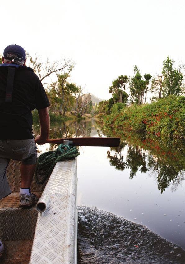
RIVERS AND STREAMS
introduction of exotic species, coastal subdivision, grazing
and pine plantation (Waikato Regional Council, 2011). Both The Coromandel Zone has an estimated 3900km of rivers
the east and west coast of the peninsula contain a number of and streams, which flow from the hills to the estuaries or
areas of significant conservation value (ASCV) (refer Regional open coast. Management of these rivers and associated land
Coastal Plan). use is vital to minimising catchment erosion and maintaining
flood protection. The Coromandel Zone has the highest
ESTUARIES annual rainfall of any zone in the region, and the short, steep
catchments of the rivers and streams result in short duration
There are 10 estuaries that are more than 200ha in size: the
but damaging floods during heavy rain events.
Firth of Thames, Coromandel Harbour, Whitianga Harbour,
Whangapoua Harbour, Manaia Harbour, Tairua Harbour, Port
BIODIVERSITY
Charles, Colville Bay, Whangamatā Harbour and Te Kouma
Harbour. As rivers and streams flow into the sea, a mixture Twenty per cent of the region’s native vegetation is located
of fresh and salt water provides unique environments for a in the Coromandel Zone, providing habitats for indigenous
range of plant and animal species. Estuaries not only play biodiversity to flourish. Many threatened plants and animals
important environmental roles throughout the zone, but also rely on the specific environmental conditions found on the
contribute economic and recreation uses. peninsula, such as estuaries, streams and rivers.
Over a third of the zone area is public conservation land,
TE WHANGANUI A HEI MARINE RESERVE and accordingly contains high conservation values. These
The Coromandel Zone is home to the region’s only marine ecosystems support a wide range of species, some at risk
reserve, located offshore of Hahei’s Cathedral Cove. Te of extinction, such as Archey’s frog (Leiopelma archeyi) – a
Whanganui A Hei (Cathedral Cove) Marine Reserve covers nationally critical species. The Coromandel is a stronghold for
an area of 849ha, comprising sandflats, reefs, boulders and Archey’s frog, which has undergone significant population
the habitats that support an array of rich and varied species. decline through habitat loss and predation. The Coromandel
Reefs of hard rock, soft sediment, intricate caves and Peninsula also contains the world’s only population of
underwater arches provide homes for complex communities Coromandel striped gecko, Moehau stag beetle (Geodorcus)
of plants, crustaceans, molluscs and fish. The reserve is a and Middle Island tusked wētā (Motuweta isolata). The zone’s
popular tourist destination offering good snorkelling, with offshore islands are the only location in the region where
excellent opportunities to view large rock lobster, snapper tuatara are found (Thames-Coromandel District Council,
and other coastal species up close (Ryer, et al., 2016). 2008). Other examples of threatened fauna and flora in the
10 CO R OMA N D E L Z O N E P L A Nzone are Hochstetter’s frog (Leiopelma hochstetteri), Northern islands provide predator free habitats for a number of
New Zealand dotterel, North Island brown kiwi (Apteryx species.
mantelli), and Cook's scurvy grass (Lepidium oleraceum).
GEOLOGY
The coastal margins, marine area and islands of the zone
are also rich in life and include many species of seabirds, The underlying geology of the peninsula comprises of
mammals, fish and diverse invertebrates such as epifauna, volcanic remnants of the Coromandel volcanic zone, which
infauna and cryptofauna (Bouma, 2016). A range of became active 18 million years ago. Volcanic activity
threatened species, such as Northern New Zealand dotterel ceased around 2 million years ago. However, Mayor Island
and Cook's scurvy grass are found in coastal areas. – located 25km east in the peninsula – was recently active
(approximately 6500 years ago). Geothermal activity is still
Foredunes and reardunes on Coromandel beaches contain present in the peninsula, with hot springs in several places
communities of coastal terrestrial vegetation, featuring – notably at Hot Water Beach, on the central east coast
species such as sand daphne (Pimelia arenaria) and sand between Whitianga and Tairua (Waikato Regional Council,
coprosma (Coprosma acerosa), both threatened species that 2012a).
specialise in coastal conditions (Waikato Regional Council,
2011). Pōhutukawa trees (Metrosideros excelsa) are a key CULTURAL HERITAGE
native terrestrial feature of the Coromandel coastline and the
The Coromandel has a rich cultural heritage extending back
zone’s main highways.
to around 900AD. The peninsula has been a stronghold for
Māori, providing an abundance of natural resources from
OFFSHORE ISLANDS
both the land and the sea. Key iwi within the Coromandel
The Coromandel Peninsula is surrounded by various offshore Zone are Ngāti Hako, Ngāti Paoa, Ngāti Tamaterā, Ngāti Tara-
islands, including the Mercury Islands, Cuvier Island and Tokanui, Ngāti Porou ki Hauraki, Ngāti Whanaunga, Ngāti
Aldermen Islands. Many of these islands hold spectacular Hei, Ngāti Maru, Ngāti Pukenga, Te Patukirikiri and Ngāi Tai
and distinctive features such as the basalt exposures on ki Tāmaki Ngā Rahiri Tumutumu (Hauraki Collective iwi), as
Red Mercury Island caused by changes in sea level through well as Ngāti Huarere and Ngāti Pū. Each has rohe within the
glacial and fluvial activity (Ryer et al., 2016). Managed by zone and significant ongoing interests in maintaining and
the Department of Conservation (DOC), the zone’s coastal restoring the health of the Coromandel Peninsula.
“Well managed catchments that enhance economic and environmental sustainability, recognise community and
cultural aspirations, while mitigating natural risks.” 11LEGISLATION AND
POLICY FRAMEWORK
TE TURE ME TE KAUPAPAHERE
This section outlines the legislative and policy (both statutory and non-statutory) framework
that has informed the goals, focus areas and implementation actions set out in this zone
plan.
Figure 3 provides an overall summary of the key legislative and policy framework for the zone plan, along with the key
areas where the zone plan informs council plans and policies.
Resource Management Act 1991, Biosecurity Act 1993, Local Government Act 2002, Rating Act 2002, Soil Conservation and
Legislative
Rivers Control Act 1941, Land Drainage Act 1908, Land Transport Management Act 1998, Civil Defence Emergency Management
Requirements
Act 2002, Waikato Raupatu Claims Settlement Act 1995, Waikato Tainui Raupatu Claims (Waikato River) Settlement Act 2010
National Policy
Vision & Strategy Policy directive –
National policy Statement for
for the Waikato take into account
directive Freshwater
River
Management
Can inform
Regional Pest
Regional policy Regional Policy
Management
directive Statement
Plan
Iwi environmental Treaty
Iwi policy
management plans Settlements
Long term plans
Hauraki Gulf Marine
Spatial Plan
Waikato Regional Plan, (Sea Change)
Regional Coastal Plan
Regional and COROMANDEL
and district plans
local policy Funding policies
ZONE PLAN
District Regional
rules rules Peninsula Project
Habour and
Implementation Regional Asset Programmes/ Operations and
catchment
plans Management Plan actions maintenance manual
management plan
FIGURE 3 - Key linkages between the zone plan and other key legislative and policy requirements.
12 CO R OMA N D E L Z O N E P L A N3.1 LEGISLATION AND STATUTORY PLANS
The key statutory documents of most relevance to the activities set out within this zone
plan are summarised below. It is noted that this plan also takes account and assists the
implementation of a number of Waikato Regional Council’s non-regulatory responsibilities
under the Resource Management Act 1991, Soil Conservation and River Controls Act 1941,
Local Government Act 2002 and other Acts.
REGIONAL POLICY STATEMENT REGIONAL PLAN CHANGE 1 (WAIKATO
The Regional Policy Statement (RPS) has objectives for WAIPĀ HEALTHY RIVERS/WAI ORA)
managing fresh water (3.14), riparian area and wetlands The council has notified and is in the process of
(3.16), ecological integrity and indigenous biodiversity implementing Healthy Rivers/Wai Ora: Proposed Plan
(3.19), natural hazards (3.24), and values of soils (3.25). It Change 1. The plan change seeks to achieve reduction, over
also has new policies regarding managing coastal marine time, of sediment, microbial pathogens and nitrogen and
areas (Chapter 7), fresh water bodies (Chapter 8), indigenous phosphorus entering waterbodies (including groundwater) in
biodiversity (Chapter 11), natural hazards (Chapter 13) and the Waikato and Waipā river catchments.
soils (Chapter 14). These objectives and policies are relevant
Although this plan change process does not include the
to the implementation actions set out within this plan.
Coromandel Zone (being outside the Waikato/Waipā river
WAIKATO REGIONAL PLAN (2007) AND catchments), it will inform wider council direction around
initiatives to improve water quality within the region.
REGIONAL COASTAL PLAN (2014)
The Waikato Regional Plan (WRP) applies across the The development of Regional Plan Change (Hauraki/
whole Waikato region (except for the coastal marine Coromandel – Healthy Rivers/Wai Ora) in the next few years
area), and provides the regulatory framework for resource will directly affect the zone. This review will address the
management. The WRP implements the RPS, relevant issue of water quality in the Hauraki Plains and Coromandel
National Direction, and Treaty settlement legislation. The Peninsula, with possibility of a broader scope.
Waikato Regional Coastal Plan (WRCP) contains policies
and methods to manage the allocation and use of coastal REGIONAL PEST MANAGEMENT PLAN
resources in the coastal marine area (the sea area below The Waikato Regional Pest Management Plan (RPMP) sets
mean high water spring tide out to the 12 nautical miles). out the strategic and statutory framework for managing
The WRCP implements the RPS, the New Zealand Coastal plant and animal pests in the Waikato region. Objectives
Policy Statement, and other relevant legislation (e.g. parts of and the management approach for specific plant and animal
the Marine and Coastal Area Act). pests present within the zone are contained in the plan.
The council is currently planning a full review of the WRCP It is noted that the RPMP review is planned to commence in
and WRP. Ultimately, the two plans will be combined and late 2017 starting with the release of a discussion document
replaced by one: the Waikato Resource Management Plan. in early 2018. The actions in the zone plan can inform this
Notification of the first phase of the plan review (most of the process.
current coastal plan and priority topics for the regional plan)
is expected in 2019/20, with adoption of the revised plan
programmed for 2025.
“Well managed catchments that enhance economic and environmental sustainability, recognise community and
cultural aspirations, while mitigating natural risks.” 13NATIONAL DIRECTION HAURAKI TREATY SETTLEMENT
Central government, through the Ministry for the In 2009, the Hauraki Collective was formed for the purpose
Environment, has a programme of work that seeks to provide of receiving redress in the Hauraki region where iwi have
national direction and consistency around management of shared interests. The Pare Hauraki Collective recognises the
natural resources. This involves development or review of cultural importance of Tikapa Moana (The Hauraki Gulf), Te
national environment standards, national policy statements, Tai Tamahine (east coast of the Coromandel Peninsula), Te
and national regulation. Aroha and Moehau maunga and the Waihou and Piako rivers.
Key national directions that will affect catchment A Collective Redress Deed was initialled on 22 December
management in this zone (and all zones) include the 2016 by the Crown and iwi of Hauraki, signalling the end
National Policy Statement for Freshwater Management of negotiations. The initialled deed of settlement is subject
(2011), national regulation around stock access to water to a vote (ratification) by members of the iwi. If the deed is
and swimmability standards, the Proposed National ratified, the deed will be signed by the Crown and the iwi.
Environmental Standard for Plantation Forestry (2017), The Crown will then introduce legislation to Parliament to
and the New Zealand Coastal Policy Statement (2010). This give effect to the settlement.
zone plan would need to be amended to give effect to any
national direction which requires implementation through
catchment management.
14 CO R OMA N D E L Z O N E P L A N3.2 KEY NON-STATUTORY POLICIES AND PLANS
WAIKATO REGIONAL COUNCIL STRATEGIC DIRECTION 2016-2019
Waikato Regional Council’s strategic direction1 guides work and sets priorities for the council’s work out to 2019. It also reflects
community desires and needs, and identifies key factors that will determine whether the council is successful in achieving its
strategic direction.
Priorities under the council’s strategic direction are:
• Support communities to take action on agreed outcomes.
• Forge and strengthen partnerships to achieve positive outcomes for the region.
• Positively influence future land use choices to ensure long term sustainability.
• Manage fresh water more effectively to maximise regional benefit.
• Increase communities’ understanding of risks and resilience to change.
• Enhance the value of the region’s coasts and marine area.
• Shape the development of the region so it supports our quality of life.
The zone plan will assist the council in delivering its strategic direction. The key connections from the zone plan to the strategic
direction are summarised in Table 1 below.
REGIONAL PRIORITIES
√ PRIMARY CONTRIBUTION
Communities
development
Partnerships
Fresh water
Coastal and
resilience
Risks and
√ SECONDARY CONTRIBUTION
Regional
marine
Land
Protect people, property and essential
1
services from flooding.
√ √ √ √ √ n/a √
ZONE PLAN GOALS
Protect and improve water quality by
2
enhancing and stabilising catchments.
√ √ √ √ √ √
Improve the diversity and habitat for
3
indigenous plants and animals.
√ √ √ √ √ √
Enhance and protect coastal environments
4
in the zone.
√ √ √ √ √ √
Collaborate and strengthen partnerships
5
with mana whenua and community.
√ √ √ √ √ √ √
TABLE 1 – Coromandel Zone Plan connections with the strategic direction
1
Download at waikatoregion.govt.nz/strategy
“Well managed catchments that enhance economic and environmental sustainability, recognise community and
cultural aspirations, while mitigating natural risks.” 1516 CO R OMA N D E L Z O N E P L A N
SEA CHANGE TAI TIMU PARI (HAURAKI                                            HARBOUR AND CATCHMENT
                          2
GULF MARINE SPATIAL PLAN)                                                    MANAGEMENT PLANS
The Hauraki Gulf Marine Spatial Plan (2017) recognises the                   Harbour and catchment management plans (HCMP) provide
significant natural environment and national importance                      an overarching strategy and non-statutory policy direction
of the Hauraki Gulf Marine Park. This non-statutory plan                     for priority issues within the harbour and catchment area,
is a collaborative effort between mana whenua, local and                     and provide more specific implementation actions that
central government agencies, local communities and interest                  would be subsequently undertaken.
groups, and includes principles, proposals and initiatives to
manage and protect the marine park.                                          Guiding principles in the development of HCMPs include:
                                                                             •   promotion of best practice techniques
The geographical area covered by the Hauraki Gulf Marine
Spatial Plan aligns with the Hauraki Gulf Marine Park                        •   focus on sustainability – economic, social, cultural and
(established under legislation), and covers the catchments                       environmental
feeding into the coastal marine area.                                        •   recognition of the importance of partnerships, both
                                                                                 between agencies, iwi and with communities
The Hauraki Gulf Spatial Plan includes 16 key themes that
                                                                             •   enable the collaboration of resources to maximise
feed into a number of recommended actions, some of which
                                                                                 outcomes.
directly relate to catchment management of this zone.
Where there is alignment, those actions will be implemented                  The process of developing HCMPs aims to:
through this zone plan and the associated programme of                       •   encourage partnerships between community, key
works.                                                                           agencies and stakeholders
                                                                             •   create a proactive community working towards resolving
THE PENINSULA PROJECT
                                                                                 identified issues
The Peninsula Project was adopted in 2004 as a step towards
                                                                             •   support sound economic, social, environmental and
a whole catchment approach to address river and catchment
                                                                                 cultural outcomes.
problems in the zone. This project was primarily triggered
by the 2002 weather bomb which devastated a number of                        In the Coromandel Zone, HCMPs have been developed
the peninsula’s west coast communities. It is a collaborative                for Whangamatā, Whangapoua, Wharekawa and Tairua,
project between council, TCDC, DOC and Hauraki Māori                         and have been identified for Whitianga/Mercury Bay and
Trust Board. The Peninsula Project provides an overarching                   Coromandel/Manaia. The actions contained within these
framework for river and catchment works within the zone.                     plans have been integrated where relevant into this zone
The four key implementation areas for the framework                          plan, and help inform the annual work programmes and
include:                                                                     priorities.
•      river and catchment management
                                                                             WAIKATO FRESHWATER STRATEGY
•      flood protection
                                                                             The Waikato Freshwater Strategy 2017 identifies a
•      animal pest management
                                                                             programme of actions to achieve the best use of fresh
•      coastal marine area works and services.                               water through time via better allocation systems using new
The principles behind the Peninsula Project led to the                       methods based on better information. It recognises that
development of the first Coromandel Zone Plan and                            fresh water management is a complex problem that has
subsequent harbour and catchment management plans                            not been addressed in an integrated manner. The current
around the peninsula.                                                        state of the region’s fresh water is the result of ad hoc
                                                                             management in response to disparate directions from central
                                                                             government and a preference for economic development
                                                                             that competes with an incomplete understanding of site
                                                                             specific environmental limits.

2
    Download at http://www.seachange.org.nz/Read-the-Plan/

                                      “Well managed catchments that enhance economic and environmental sustainability, recognise community and
                                                                                             cultural aspirations, while mitigating natural risks.”   17
COROMANDEL PENINSULA BLUEPRINT
The Coromandel Peninsula Blueprint is the strategic
framework for managing growth and sustainable
development with Thames-Coromandel District Council.
This blueprint was developed with recognition of the
increasing pressures of growth on the district’s water, land,
coast and marine uses, which need to be managed in an
integrated manner. Whilst this document is non-statutory, its
information and direction has and will help guide statutory
policies and plans.
ADDRESSING NEW ZEALAND’S
BIODIVERSITY CHALLENGE
The Willis Report is a regional council led report on the
future of biodiversity management in New Zealand. The
report has a focus on the role and work of regional councils
in biodiversity management. It establishes that biodiversity
maintenance is a core function of regional councils, but
acknowledges that biodiversity nevertheless continues to
decline (Willis, 2017). This report includes recommendations
for halting the continued decline in biodiversity, comprising
the:
• need for strong leadership and clarity of roles and
responsibilities
• need for positive action, building on our existing active
plant and animal pest management
• need for agreement on where we should focus our
efforts at national, regional and local level
• need to understand what success looks like, and how to
measure it
• importance of a plan and delivering joined-up action
across all players
• need for modern, fit-for-purpose frameworks, including
legislation, to help achieve our goals.
3.3 IWI MANAGEMENT
PLANS
Whaia te Mahere Taiao o Hauraki – Hauraki Iwi
Environmental Plan and Ngāti Porou Ki Hauraki – Marine
and Coastal Plan are two iwi management plans relative to
the Coromandel Zone. Whaia te Mahere Taiao o Hauraki is a
strategy in place to sustain mauri of the natural environment
and cultural heritage of the Hauraki rohe over the next 50
years. The Ngāti Porou Ki Hauraki plan is designed to protect
the customary rights and assert the custodial obligations
of Ngāti Porou ki Hauraki regarding the marine and coastal
area.
18 CO R OMA N D E L Z O N E P L A NKEY MATTERS FOR THE ZONE
NGĀ KAUPAPA MATUA I TE ROHE
The following section sets out the key matters for the zone that have informed the
development of the goals and implementation actions within the plan. Key matters have
been identified through the process of developing this zone plan and take account of the
policy context outlined in Section 3 alongside wider social, economic, environmental and
cultural considerations within the zone.
4.1 THE CHALLENGE OF ADDRESSING
DECLINING FRESHWATER QUALITY IN SOME
PARTS OF THE ZONE
In comparison to other parts of the region, many of run off from stock is still impacting water quality. Fencing
the zone’s rivers and streams are of a good quality and and exclusion of stock from riparian (and harbour) margins
swimmable standard. However, freshwater quality in the has been identified as one of the highest priorities for the
zone has been impacted by land use changes and many of health of the zone’s waterways. Stock exclusion from riparian
the larger streams in the zone, such as the Tairua River, are margins and wetlands can minimise bank erosion, urine
slowly degrading (O’Donnell, 2011). and faeces inputs, vegetation removal, the spread of weeds
and sediment run off, which can contribute to healthier
Run off from land greatly affects water quality. Sediments
waterways.
from natural forest slips, plantation forestry activities,
roading and infrastructure, stock in and around waterways, Urban expansion of the zone’s small coastal settlements
and stream bank erosion are the main contributors to is also occurring, consisting of a mixture of permanent
sediment in streams, rivers and estuaries. Such impacts residency and holiday homes. The main concern regarding
result in turbidity and higher nutrient levels, increased water urban expansion is capability of the zone’s infrastructure
temperature and increases in bed levels. Contaminants to provide for growth. Other pressures include an increase
that cause the greatest concern and can cause declining in local stormwater disposal, demand for water supply, the
water quality include bacteria, sediment, nutrients (mainly coastal environment and recreational use of river margins.
nitrogen and phosphorus), and heavy metals and chemicals Accordingly, stormwater discharges, spills and rubbish can
(Lewis, 2015). contribute to water contamination (Lewis, 2015). Onsite
wastewater systems are also used extensively by private
Dairy farming is limited and less intensified in comparison to
property owners throughout the zone, where reticulated
other zones in the Waikato region. The majority of pastoral
waste water systems are not available. If not designed,
land in the zone is used for dry stock, whilst dairy farms are
operated or maintained properly, onsite wastewater can pose
dispersed in small pockets throughout the zone, for example
risk to ground and surface water quality (Lewis, 2015).
at Hikuai and Whangamatā. Although less intensive, nutrient
“Well managed catchments that enhance economic and environmental sustainability, recognise community and
cultural aspirations, while mitigating natural risks.” 194.2 REALISING GREATER OPPORTUNITIES
FOR SUSTAINABLE LAND MANAGEMENT
AND IMPLEMENTATION OF CATCHMENT
MANAGEMENT ACTIVITIES
Vegetation clearance and land use practices have led to Forestry production is a contributor to sedimentation in
the acceleration of erosion and sedimentation within the the zone. Fifteen per cent of the zone area is utilised by
zone. Susceptibility to soil erosion is a result of complex production forestry. While there are a number of forests on
interactions between soil type, climate, vegetation cover, private land, the largest forest consists of Crown land leased
terrain characteristics and land management practices. Land to Ernslaw One and Matariki Forests. Sediment run off from
use changes such as farming, introduction of pests, forestry, forestry blocks is elevated during logging and reforesting
road construction and urban development accelerate operations, with much of the sediment run off arising from
erosion and sedimentation. Unfortunately, once erosion has roads constructed to service forest blocks. As with river
occurred, it is difficult to return soil productivity to its former bank erosion, sedimentation caused by forestry production
state. Some land practices also effect soil health, versatility impacts the zone’s freshwater quality (as well as estuaries
and productivity by compaction and reducing fertility. and embayments), threatening the ecological values of these
environments.
Hill country and the banks of rivers tend to be more
susceptible to erosion. Watercourses with high stream bank As coastal settlements in the zones expand and intensify,
instability are more prone to erosion and sedimentation, and further land clearance may occur. The National Policy
this is often accelerated during storm events. Accordingly, Statement for Urban Development Capacity (2016)
water quality is often impacted by sedimentation. Climate requires territorial authorities to provide land capacity
change is expected to result in more frequent extreme for intensification and new development of housing
rainfall events, further exacerbating erosion, sedimentation and businesses. This development is to be supported by
and soil conservation issues. appropriate infrastructure, and the management of the
effects of urban intensification and growth will need to be
managed collaboratively between regional and territorial
authorities.
4.3 PROTECTING AND ENHANCING COASTAL
ENVIRONMENTS
The Coromandel Zone contains more than 500km of activities and land use practices further upstream causing
coastline. The coastal areas of the Coromandel Zone are things such as sedimentation infill. Activities occurring in the
included in its entirety within the Hauraki Gulf Marine zone’s estuaries can also result in changes to water quality,
Park. The healthy functioning of coastal ecosystems is impacting estuarine systems and ecology (O’Donnell, 2011).
fundamentally important to the environmental, economic,
Various catchments in the zone feed freshwater run off
social and cultural wellbeing of the zone. Sea Change – Tai
from small streams into the coastal marine area. The most
Timu Tai Pari (2017) is a key document driving improvement
common causes of coastal water quality degradation trace
of the Hauraki Gulf Marine Park. Key issues such as declining
back to contaminants washed from the land into the coastal
biodiversity, increased need for habitat restoration and
marine area through freshwater run off (Wilson, 2016).
increased sedimentation are included within Sea Change.
Contaminants in freshwater run off include sediment,
Water quality is of high interest in the Hauraki Gulf Marine nutrients, heavy metals and microbial pathogens. As a result
Park. Estuaries throughout the zone are unique features of increased sediment discharged from the land over the
that contain a mixture of fresh and salt water, as rivers flow past 25 years, expansion of mangrove habitats in the zone’s
into the sea. Estuaries support a wide range of aquatic life estuaries has occurred (Waikato Regional Council, 2016a;
and are often popular swimming locations. The crossover of Ryer et al., 2016).
freshwater and marine environments provides environments
Research and information on coastal water quality in the
for a range of plants and species, which can be impacted by
20 CO R OMA N D E L Z O N E P L A Nzone is limited. However, a water quality testing study on These results show that water quality at Coromandel beaches
Coromandel river mouths, using ANZEEC3 guideline values, is generally high but can vary following heavy rainfall events
showed that turbidity was typically low, indicating overall due to containments from urban and rural land being flushed
water clarity in the stream mouths were good (Wilson, into waterways and making their way to the coast.
2016). Whilst some sites exceeded nutrient concentration
Maintaining good water quality is important for retaining
guideline values, there may not necessarily be any adverse
all uses and values associated with the zone’s coastal
environmental effects and instead may trigger the need
environments. Methods such as preparing HCMPs (through
for further investigation to better understand if there is a
prioritisation of catchments) and sediment management
problem. Water quality testing is also undertaken by the
(e.g. sediment load limits, increasing sediment traps in
council each summer to determine suitability of the water
waterways, addressing sediment in the coastal marine area,
for recreation purposes, such as swimming and fishing.4
review of forestry) will assist in protecting and enhancing
coastal environments.
4.4 PROMOTING AND SUPPORTING INDIGENOUS
BIODIVERSITY ENHANCEMENT AND EFFECTIVE
PEST MANAGEMENT
The Coromandel Peninsula is a hot spot for indigenous The Coromandel stands out from most other areas in the
biodiversity, being of both regional and national significance. Waikato for having a diverse and unique array of fauna and
Factors such as climate change, browsing, predation and flora species. A total of 107 nationally threatened species,
land use change contribute to biodiversity degradation. comprising 51 flora species and 56 fauna species, are
Some of the issues associated with modifications to the present within the peninsula (including offshore islands),
natural environment include: including kauri, kākā, tuatara, wētā, frogs, kiwi, long tail
• an increased threat from animal and plant pests bats and seabirds. Whilst many of these threatened species
are found solely within the Mercury Islands, diverse and
• reduction, fragmentation and isolation of indigenous
abundant threatened fauna are located on the mainland
ecosystems and habitats
(Kessels Associates, 2010).
• loss of corridors or connections linking indigenous
ecosystems and habitats Throughout the zone there are a range of animal and plant
• loss or disruption to migratory pathways in water, land pests that threaten indigenous species and habitats. The
or air effects and severity of each pest varies throughout the zone
depending on the location and the values at the site that
• the difficulty of restoring indigenous forest and other
require protection.
ecosystems once they have been lost
• effects of changes to water flows, levels and quantity on One pest plant (disease) in particular that has potential for
ecosystems devastating impacts on the zone is kauri dieback, which
has killed thousands of kauri throughout New Zealand. The
• water quality degradation by sediment and other
disease has been identified in four sites in the Coromandel
contaminants
Peninsula, and it has the potential to kill more kauri trees
• loss of cultural values, amenity values and recreational if not maintained sufficiently. With no known treatment
opportunities. available for kauri dieback, the only way to save the zone’s
Whilst the zone consists of a smaller proportion of the kauri forests is to contain the disease in existing locations
region’s population and land area, the Coromandel Peninsula and stop the spread into healthy areas through measures
contains a substantial 20 per cent of the region’s native such as staying within tracks and cleaning gear (Ministry for
vegetation. Indigenous vegetation covers 63 per cent of the Primary Industries, 2016). The devastating impacts of kauri
zone area, alongside a smaller 19 per cent of pastoral land dieback is just one example of the need for effective pest
and 15 per cent forestry. Coromandel catchments contain control in the zone (Lewis, 2015).
highly significant ecosystems. These significant ecosystems
include freshwater streams, wetlands, native bush, estuaries,
and coastal and marine ecosystems.
3
Download at https://www.waikatoregion.govt.nz/environment/natural-resources/coast/coastal-water-quality/coastal-recreational-water-quality/
4
Australian and New Zealand Guidelines for Fresh and Marine Water Quality
“Well managed catchments that enhance economic and environmental sustainability, recognise community and
cultural aspirations, while mitigating natural risks.” 21Myrtle rust is another disease that is a significant biosecurity This is likely due to significant cover of indigenous bush and
threat to the zone and is currently under surveillance (by scrubland and a later entry of mammalian pests to the areas.
DOC) on the Coromandel Peninsula. It is known to impact a
Indigenous biodiversity management seeks to protect and
range of species, including rātā and pōhutukawa. As of late
enhance significant flora and fauna. Protection includes
2017, myrtle rust as not been detected within the zone.
enhancing buffers and recreating corridors by replanting,
Despite the presence of invasive exotic species, the fencing fragments from stock, and pest control to remove
peninsula still provides habitat for a broad range of exotic animals and plants that consume and compete with
indigenous species. Many species that have survived in the native species.
peninsula are now extinct in other parts of the Waikato.
4.5 THE ONGOING NEED TO MANAGE NATURAL
HAZARD RISK
The Coromandel is susceptible to multiple inland and coastal Tsunami hazards also pose a risk to the Coromandel Zone,
hazards, including river flooding, debris flows, cliff erosion particularly to the northern and eastern faces of the
and instability, coastal inundation, earthquakes, tsunami peninsula. Whilst the risk of a tsunami is still relatively
and storm surges. In particular, river flooding has posed low, the impact could be potentially significant, especially
considerable risk to the Coromandel Zone in the past and is when considering the effects of the devastating Japan
the most frequent natural hazard in the zone. tsunami in 2011. In the Coromandel Peninsula, a distant
sourced tsunami could occur from a large earthquake in
The Coromandel Range attracts high intensity rainfall on
South America, whilst a near source tsunami would likely
a regular basis, making the zone vulnerable to flooding
be caused by a large earthquake event along the Tonga-
(Munro, 2007). Severe weather events and associated river
Kermadec Trench, northeast of New Zealand (Waikato
flooding have been common throughout the zone, with more
Regional Council, 2017). Ongoing work of the Eastern
than 10 significant flood events recorded since 1873. The
Coromandel Tsunami Strategy5 outlines the management of
Thames Coast is especially vulnerable, containing streams
tsunami risk to multiple eastern Coromandel communities,
that can be volatile in heavy rainfall. The short, steep
including Mercury Bay, Whitianga, Cooks Beach, Hahei and
catchments and high sediment load in rivers and streams
Hot Water Beach, alongside others.
cause flash flooding with short warning times. Sedimentation
and river congestion consisting of vegetation debris has The peninsula has one faultline – the Hauraki Faultline –
proven to exacerbate flooding when high rainfall events which runs down the west side of the Coromandel Peninsula.
occur over localised areas. Movement of this faultline created both the mountains to
its east and the basin to its west. This faultline poses seismic
State Highway 25 has many high risk flooding points
risk to the zone also.
near Whangamatā, Wharekawa, Tairua, Whitianga and
Manaia, posing the risk of community isolation when roads
become inaccessible. The weather events of June 2002,
February 2014 and March 2017 illustrated the devastating
effects storm events have on the peninsula, with high
winds damaging roofs and cutting power, and torrential
rain causing flooding, forcing evacuations and isolating
communities.
Severe storm events have also been known to cause cyclonic
winds, notably on the western side of the Coromandel
Range. Strong winds can cause considerable damage and
possible injury to people. The east Coromandel coastline
is prone to erosion associated with episodic storms from
the north and east. In quieter periods between storms, the
sand generally returns onshore, resulting in beach and dune
recovery (Dahm, 2009).
5
Download at https://www.waikatoregion.govt.nz/services/regional-services/regional-hazards-and-emergency-management/coastal-hazards/tsunami/eastern-
coromandel-tsunami-strategy
22 CO R OMA N D E L Z O N E P L A N4.6 FORGE AND STRENGTHEN PARTNERSHIPS
WITH MANA WHENUA, STAKEHOLDERS AND
COMMUNITY GROUPS
Coromandel Peninsula communities are reliant on the Ngāti Hei, Ngāti Maru, Ngāti Pukenga, Te Patukirikiri and
healthy functioning of the natural and physical resources Ngāi Tai ki Tāmaki Ngā Rahiri Tumutumu (Hauraki Collective
of the Coromandel Zone for their social, economic, cultural iwi), as well as Ngāti Huarere and Ngāti Pū. Council values
and environmental wellbeing. However, given that the and will continue to sustain its partnerships with these iwi.
Coromandel Zone comprises a relatively small rating base Continuing proactive iwi, hapū and marae engagement,
of 23,500 rateable properties, the level of funding does not both within formal agreements and more informally, will be
always match desired community outcomes for catchment, important to building enduring partnerships and ensuring
river, coastal and flood works. the goals of this zone plan are met.
This means that in order to achieve desired community It is important that the council continues to engage with
outcomes the council must partner with other councils, community sectors to identify opportunities to work
community groups, businesses, individual landowners, together, to avoid duplication and therefore add significant
central government, iwi/hapū and non-governmental value where priorities are aligned. Good examples of
organisations. partnering (and co-funding) with various groups to
undertake community projects throughout the zone include
Treaty-based partnerships with Hauraki iwi/hapū are
those undertaken with DOC and Beachcare. This type of
particularly vital to achieve step change for our environment,
collaborative approach is a challenge, but assists in focusing
economy and communities. Key iwi within the Coromandel
resources into priority areas, where the biggest gains can be
zone are Ngāti Hako, Ngāti Paoa, Ngāti Tamaterā, Ngāti
achieved.
Tara-Tokanui, Ngāti Porou ki Hauraki, Ngāti Whanaunga,
“Well managed catchments that enhance economic and environmental sustainability, recognise community and
cultural aspirations, while mitigating natural risks.” 23You can also read