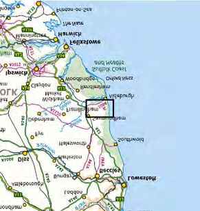
East Anglia ONE North Offshore Windfarm Outline Access Management Plan
←
→
Page content transcription
If your browser does not render page correctly, please read the page content below
East Anglia ONE North
Offshore Windfarm

Outline Access
Management Plan

Applicant: East Anglia ONE North Limited
Document Reference: 8.10 Tracked
SPR Reference: EA1N-DWF-ENV-REP-IBR-000392 Rev 0506

Author: Royal HaskoningDHV
Date: 15th April7th June 2021
Revision: Version 0506

                                Applicable to
                           East Anglia ONE North
Outline Access Management Plan
15th April7th June 2021

                                        Revision Summary

   Rev          Date             Prepared by              Checked by              Approved by

   001     08/10/2019            Paolo Pizzolla            Julia Bolton            Helen Walker

   002     15/12/2020            Paolo Pizzolla            Ian Mackay               Rich Morris

   003     24/02/2021            Paolo Pizzolla            Ian Mackay               Rich Morris

   004     25/03/2021            Paolo Pizzolla            Ian Mackay               Rich Morris

   005     15/04/2021            Paolo Pizzolla            Ian Mackay               Rich Morris

   006     07/06/2021            Paolo Pizzolla            Ian Mackay               Rich Morris

                                    Description of Revisions

  Rev    Page          Section                                Description

  001     n/a            n/a                              Final for Submission

  002     n/a            n/a                      Updated for submission at Deadline 3

  003     n/a            n/a                      Updated for submission at Deadline 6

  004     n/a            n/a                       Final for submission at Deadline 8

  005     n/a            n/a                       Final for submission at Deadline 9

  006     n/a            n/a                       Final for submission at Deadline 11

Applicable to East Anglia ONE North                                                         Page i
Outline Access Management Plan
15th April7th June 2021

Table of Contents
1         Introduction                                      1
1.1       Background                                        1
1.2       OAMP Scope                                        2
1.3       Planning Performance Agreement                    3

2         Access Design                                      5
2.1       Access Strategy                                    5
2.2       Access Design                                      9
2.3       Crossing Design                                   13
2.4       Road Safety                                       14
2.5       Technical Approval                                15

3         Traffic Management                                17
3.1       Traffic Management – Road Works                   17
3.2       Traffic Management – Sizewell Gap                 19
3.3       Onshore Preparation Works Traffic Controls        20
3.4       Access 13 Operational Traffic Controls            22

4         References                                        23

Annex 1: Suffolk – Lorry Route Network (extract)

Annex 2: Proposed Preliminary Access Concepts

Annex 3: Stage 1 Road Safety Audit and Designers Response

Applicable to East Anglia ONE North                         Page ii
Outline Access Management Plan
15th April7th June 2021

The Outline Access Management Plan is supported by one figure, listed in the table
below.

 Figure number   Title

 Figure 1        Access Locations and Associated Onshore Infrastructure

Applicable to East Anglia ONE North                                        Page iii
Outline Access Management Plan
15th April7th June 2021

Glossary of Acronyms

 AIL             Abnormal Indivisible Load

 CCS             Construction Consolidation Site

 DCO             Development Consent Order

 DMRB            Design Manual for Roads and Bridges

 ES              Environmental Statement

 HDD             Horizontal Directional Drill

 HGV             Heavy Goods Vehicle

 OAMP            Outline Access Management Plan

 OTP             Outline Travel Plan

 OCTMP           Outline Construction Traffic Management Plan

 OPCTMTP         Outline Port Construction Traffic Management and Travel Plan

 RSA             Road Safety Audit

Applicable to East Anglia ONE North                                             Page iv

Outline Access Management Plan
15th April7th June 2021

Glossary of Terminology

 Applicant                East Anglia ONE North Limited.

 Construction             Compounds associated with the onshore works which may include
 consolidation sites      elements such as hard standings, lay down and storage areas for
                          construction materials and equipment, areas for vehicular parking, welfare
                          facilities, wheel washing facilities, workshop facilities and temporary fencing
                          or other means of enclosure.

 Contractor               An individual or business in charge of carrying out construction work.

 East Anglia ONE          The proposed project consisting of up to 67 wind turbines, up to four
 North project            offshore electrical platforms, up to one construction, operation and
                          maintenance platform, inter-array cables, platform link cables, up to one
                          operational meteorological mast, up to two offshore export cables, fibre
                          optic cables, landfall infrastructure, onshore cables and ducts, onshore
                          substation, and National Grid infrastructure.

 Horizontal directional   A method of cable installation where the cable is drilled beneath a feature
 drilling (HDD)           without the need for trenching.

 Jointing bay             Underground structures constructed at intervals along the onshore cable
                          route to join sections of cable and facilitate installation of the cables into the
                          buried ducts.

 Landfall                 The area (from Mean Low Water Springs) where the offshore export cables
                          would make contact with land, and connect to the onshore cables.

 National Grid            A National Grid substation, cable sealing end compounds, cable sealing
 infrastructure           end (with circuit breaker) compound, underground cabling and National Grid
                          overhead line realignment works to facilitate connection to the national
                          electricity grid, all of which will be consented as part of the proposed East
                          Anglia ONE North project Development Consent Order but will be National
                          Grid owned assets.

 National Grid            The substation (including all of the electrical equipment within it) necessary
 substation               to connect the electricity generated by the proposed East Anglia ONE North
                          project to the national electricity grid which will be owned by National Grid
                          but is being consented as part of the proposed East Anglia ONE North
                          project Development Consent Order.

 Onshore cable route      This is the construction swathe within the onshore cable corridor which
                          would contain onshore cables as well as temporary ground required for
                          construction which includes cable trenches, haul road and spoil storage
                          areas.

 Onshore cables           The cables which would bring electricity from landfall to the onshore
                          substation. The onshore cable is comprised of up to six power cables
                          (which may be laid directly within a trench, or laid in cable ducts or
                          protective covers), up to two fibre optic cables and up to two distributed
                          temperature sensing cables.

 Onshore infrastructure   The combined name for all of the onshore infrastructure associated with the
                          proposed East Anglia ONE North project from landfall to the connection to
                          the national electricity grid.

Applicable to East Anglia ONE North                                                                  Page v
Outline Access Management Plan
15th April7th June 2021

 Onshore preparation   Activities to be undertaken prior to formal commencement of onshore
 works                 construction such as pre–planting of landscaping works, archaeological
                       investigations, environmental and engineering surveys, diversion and laying
                       of services, and highway alterations.

 Onshore substation    The East Anglia ONE North substation and all of the electrical equipment
                       within the onshore substation and connecting to the National Grid
                       infrastructure.

 Transition bay        Underground structures at the landfall that house the joints between the
                       offshore export cables and the onshore cables.

Applicable to East Anglia ONE North                                                        Page vi
Outline Access Management Plan
15th April7th June 2021

Outline Access Management Plan
1 Introduction
1.1     Background
1.      This Outline Access Management Plan (OAMP) relates to the onshore
        infrastructure of the proposed East Anglia ONE North project.

2.      The OAMP forms part of a set of documents that supports the Environmental
        Statement (ES) (document reference 6.1) submitted by the Applicant as part of
        the Development Consent Order (DCO) application.

3.      A final detailed Access Management Plan (AMP) will be produced post-consent,
        prior to onshore construction of the proposed East Anglia ONE North project and
        will be in line with this OAMP. Once contractors 1 have been appointed, the final
        AMP measures would be further developed in consultation with Suffolk County
        Council (as the Local Highway Authority).

4.      Prior to the commencement of works, the final AMP would need to be approved
        by Suffolk County Council (SCC) in consultation with the relevant planning
        authority.

5.      EDF Energy Nuclear Generation Limited will be consulted in the development of
        the final CTMP to the extent that the plan relates to Works Nos. 10 and 15.

6.      The final AMP will provide a key mechanism, enforceable through the DCO,
        through which the location, frontage, general layout, visibility and embedded
        mitigation measures for points of access to the onshore infrastructure would be
        agreed with the relevant regulators.

7.      This OAMP reinforces commitments made in the ES (document reference 6.1)
        and presents the requirements and standards that will be incorporated into the
        final access designs.

8.      In respect to traffic and transport, the certified plans referred to in the DCO, which
        support the AMP, are outlined below:

1
  The term contractor is used throughout this document. The term ‘contractor’ in relation to contractor
responsibilities relates to either a Principal Contractor(s) or sub-contractors(s) and will be defined within
the final OAMP.

Applicable to East Anglia ONE North                                                                Page 1
Outline Access Management Plan
15th April7th June 2021

      •   Outline Construction Traffic Management Plan (OCTMP): The OCTMP sets
          out the standards and procedures for managing the impact of Heavy Goods
          Vehicle (HGV) traffic during the construction period, including localised road
          improvements necessary to facilitate the safe use of the existing road
          network;
      •   Outline Travel Plan (OTP): The OTP sets out how construction personnel
          traffic would be managed and controlled; and
      •   Outline Port Construction Traffic Management and Travel Plan (OPCTMTP)):
          The OPCTMTP serves to capture a framework of measures and commitments
          to manage the port construction and operation traffic generated by the
          offshore development area. The port locations are to be determined and the
          need for these plans will be established in consultation with the relevant
          planning authority for the selected construction port(s) or operation port(s).

1.2   OAMP Scope
9.    Activities within the scope of this OAMP relate to works undertaken from the point
      of commencement of the onshore preparation works of the proposed East Anglia
      ONE North project. Onshore infrastructure as defined within the DCO or as
      permitted as onshore preparation works in line with the provisions set out within
      the DCO include:

      •   Export cable installation from the landfall location to the transition bays,
          including Horizontal Directional Drilling (HDD);
      •   Temporary works associated with landfall HDD and transition bay excavation;
      •   Onshore cable installation along the onshore cable route including jointing
          bays and potential HDD;
      •   Temporary works associated with the onshore cable route and onshore
          substation including establishment of a haul road for the entire cable route,
          Construction Consolidation Sites (CCSs) and temporary working areas;
      •   Onshore substation, and access;
      •   National Grid infrastructure;
      •   Reinstatement and mitigation works enacted during the construction phase;
          and
      •   Highways enabling works include the construction of five public highway
          accesses, four haul road crossings and off-site highway improvements.

10.   The East Anglia TWO project is also in the Examination phase. The East Anglia
      TWO project has a separate DCO which has been submitted at the same time as
      the East Anglia ONE North project. The two projects share the same landfall

Applicable to East Anglia ONE North                                             Page 2
Outline Access Management Plan
15th April7th June 2021

        location and onshore cable route and the two onshore substations are co-located,
        and connect into the same National Grid substation.

11.     The traffic and transport impact assessment presented in the ES considers the
        proposed East Anglia ONE North project and the proposed East Anglia TWO
        project under two construction scenarios:

        •   Scenario 1 - the proposed East Anglia TWO project and proposed East Anglia
            ONE North project are built simultaneously; and
        •   Scenario 2 - the proposed East Anglia TWO project and the proposed East
            Anglia ONE North project are built sequentially with a construction gap.

12.     The scope of this OAMP applies to both scenario 1 and scenario 2.

1.3     Planning Performance Agreement
13.     The Applicant will not undertake any works to any highway or highway asset that
        is the responsibility of SCC until a Planning Performance Agreement (PPA) has
        been agreed with SCC (both parties acting reasonably and in good faith) which
        will allow SCC to recover reasonable costs including but not limited to:

        •   Additional costs of routine, cyclic and emergency highway maintenance
            resulting from the Applicants’ occupation or use of the highway 2;
        •   Visual and structural condition surveys of the highway (A1094, B1069, B1122,
            Lovers Lane, Sizewell Gap and parts of A12) and contributions towards
            structural repairs;
        •   Surveys and assessment of highway structures to facilitate AIL movements;
        •   Damage to the highway (in accordance with the provisions of Section 59
            Highways Act 1980);
        •   Creation of temporary traffic regulation orders (including SCC consultation
            and issue of permits);
        •   Relocating / removing street furniture and all other highway infrastructure to
            facilitate AIL movements;
        •   Technical approval and inspection of highway accesses (Requirement 16),
            Work No 35, Work No 37, Church Road Friston traffic management and cable
            crossings as detailed in the approved Construction Traffic Management Plan;
            and

2
  This could include activities on delivery routes such as clearing visibility splays on critical junctions,
refreshing road markings and sign cleaning that would be in addition to SCCs cyclic maintenance regimes.

Applicable to East Anglia ONE North                                                                Page 3
Outline Access Management Plan
15th April7th June 2021
• Review of submitted materials for monitoring the final management plans
(such as CTMP/ Travel Plan / PRoW Strategy etc).
14. In undertaking works on the public highway, the Applicants shall ensure through
appropriate agreements and approvals that:
• The areas of the public highway occupied pursuant to Articles 12, 13 or 15 of
the DCO are maintained to the standards defined in SCC’s Highway
Operational Management Plan (SCC, July 2019) (taking account of the
category of highway asset) during that period of occupation.
• The Applicants shall ensure that the periods and physical extents of
occupation are defined, and that SCC is protected against third party claims
caused by the Applicants' occupation of the public highway pursuant to Article
12, 13 or 15 of the DCO.
• In seeking to temporarily stop up, alter, divert or use as a temporary working
site a street to which Article 12(5)(c) of the DCO applies, the Applicants shall
allow a reasonable advance notice period in line with the New Roads and
Street Works Act (Department for Transport 1991) and the Statutory
Guidance for highway authority permit schemes (Department for Transport
2019), which directs three months’ notice for Major Works, 10 days for
Standard Works and three days for Minor Works).
• Notwithstanding the above, SCC is not unreasonably refused access to
inspect or maintain the highway in accordance with its duties under the
Highways Act 1980.
15. Any dispute or difference arising in connection with the terms of the proposed
PPA between the Applicant and SCC, shall be referred to arbitration in
accordance with Article 37 of the draft DCO.
Applicable to East Anglia ONE North Page 4Outline Access Management Plan
15th April7th June 2021
2 Access Design
2.1 Access Strategy
16. The onshore infrastructure includes works at the following seven discrete sites
(which are shown on Figure 1 of this OAMP):
• Landfall location;
• Onshore cable route section 1;
• Onshore cable route section 2;
• Onshore cable route section 3;
• Onshore cable route section 4;
• Onshore substation; and
• National Grid Infrastructure.
17. In order to access these seven discrete sites an access strategy has been
developed. The ‘basis of design’ for the access strategy has been informed by
engagement with SCC and refined following feedback from public consultation
(full details are set out in ES Chapter 26 Traffic and Transport (document
reference 6.1.26)).
18. The access strategy applies a hierarchical approach (informed by the SCC HGV
route hierarchy) to selecting routes and where possible, seeks to reduce the
impact of HGV traffic upon the most sensitive communities. A copy of the SCC
HGV route hierarchy plan is provided in Annex 1 Suffolk – Lorry Route
Network (extract).
19. To allow construction vehicles to be routed away from the most sensitive
communities, the Applicant has committed to the implementation of a temporary
haul road for the length of onshore cable route. The use of the haul road allows:
• All construction traffic wishing to access the landfall location to do so via
Sizewell Gap rather than travelling via the B1122 from Aldeburgh and B1353
towards Thorpeness;
• All construction traffic to the onshore substation and National Grid Substation
to avoid travelling via Friston or Sternfield by accessing from the B1069 (south
of Knodishall/ Coldfair Green) and travelling along the temporary haul road
and crossing over Grove Road; and
• All construction traffic wishing to access all onshore cable route section 2 to
the south of the B1353 to do so via Sizewell Gap rather than travelling via the
B1122 from Aldeburgh and B1353 towards Thorpeness.
Applicable to East Anglia ONE North Page 5Outline Access Management Plan
15th April7th June 2021
20. The use of the haul route has allowed the Applicant to commit the following
access strategy:
• All HGV traffic would be required to travel via the A1094 or B1122 from the
A12, no HGV traffic would be permitted to travel via alternative routes, such
as the B1121 or B1119;
• No HGV traffic would be permitted to travel though Leiston or Coldfair Green
/ Knodishall;
• No HGV traffic would be permitted to travel via the B1121 through Friston,
Sternfield or Benhall-Green; and
• No HGV traffic would be permitted to travel via the B1353 towards
Thorpeness.
21. The access strategy includes both accesses and crossings. The accesses
provide for access and egress to and from the existing public highway, whilst
crossings would only permit construction traffic to cross from one side of the
existing public highway to the other. No construction access or egress would be
permitted from the crossing points.
Applicable to East Anglia ONE North Page 6¯
1
2
13
3
12
11 4
10 6 5
9 8 7
Legend
East Anglia ONE North
Onshore Development Area
National Grid Substation
Western Substation
Eastern Substation
Access ID
Crossing ID
Landfall
Section 1
Section 2
Section 3
Section 4
Onshore Substations and
National Grid Infrastructure
East Anglia ONE North
4 04/06/2021 AB Fourth Issue. 1:30,000 Km Drg No EA1N-DEV-DRG-IBR-000957
Rev
3 14/12/2020 AB Third Issue. Prepared: Scale @ A3 0 0.5 1 Coordinate
AB 4
2 30/08/2019 AB Second Issue. Checked: BD Source: © Crown copyright and database rights 2021. Ordnance Survey 0100031673. Access Locations and Associated Onshore Date 04/06/21
System:
BNG
This map has been produced to the latest known information at the time of issue, and has been produced for your information only.
Infrastructure Datum:
Figure
Please consult with the SPR Onshore GIS team to ensure the content is still current before using the information contained on this map.
Rev Date By Comment 1 OSGB36
To the fullest extent permitted by law, we accept no responsibility or liability (whether in contract, tort (including negligence) or otherwise in respect of any
Approved: FM errors or omissions in the information contained in the map and shall not be liable for any loss, damage or expense caused by such errors or omissions.
D:\Box Sync\PB4842 EA 1N and 2\PB4842 EA 1N and 2 Team\E. TECHNICAL DATA\E03 GIS\EA1N_EA2_Examination\Figures\Traffic_And_Transport\Outline_Travel_Plan\Fig_1_EA1N_AccessLocations_RH_20210604.mxdOutline Access Management Plan
15th April7th June 2021
22. The following Table 2.1 describes the proposed access strategy, the location of
the proposed accesses and crossings and associated onshore infrastructure
which the access serves. This information is also depicted graphically within
Figure 1.
Table 2.1 Proposed East Anglia ONE North Accesses and Associated Infrastructure Components
Infrastructure component Access Route
Landfall 1 (Sizewell Vehicles to travel from the A12 via the B1122 and
Gap) Lover’s Lane / Sizewell Gap.
Onshore cable route 1 (Sizewell Vehicles to travel from the A12 via the B1122 and
section 1 Gap) Lover’s Lane / Sizewell Gap.
Onshore cable route 2 (Sizewell Vehicles to travel from the A12 via the B1122 and
section 2 Gap) Lover’s Lane / Sizewell Gap. Vehicles wishing to
access south of B1353 would cross the B1353 at
access 3 and 4.
Onshore cable route 10 (B1069 Vehicles to travel from the A12 via the A1094 before
section 3 Snape Road) heading north on the B1069 to the CCS via access 10.
From the CCS vehicles would then cross over the
B1069 from access 10 to 9 to access section 3 of the
onshore cable route.
Works to the east of Sloe Lane to the B1122 would
cross Sloe Lane at access 7 and 8. Works to the east
of the B1122 to the Hundred River would cross the
B1122 at access 5 and 6.
Onshore cable route 10 (B1069 Vehicles to travel from the A12 via the A1094 before
section 4 Snape Road) heading north to access 10 on the B1069. Works to
the west of Grove Road would cross Grove Road at
access 11 and 12.
East Anglia ONE North 10 (B1069 Vehicles to travel from the A12 via the A1094 before
Substation Snape Road) heading north to access 10 on the B1069, vehicles
would then travel via the haul road and crossing Grove
National Grid Substation Road at access 11 and 12.
and Infrastructure
East Anglia ONE North 13 (B1121 Access 13 would provide a permanent access to the
Substation Saxmundham East Anglia ONE North and National Grid substations
Road) following completion of construction. During
National Grid Substation construction the access would only be used for
and Infrastructure Abnormal Indivisible Load (AIL) deliveries associated
with the delivery of transformers and National Grid
employees.
23. There is a small part of section 3 of the onshore cable route (section 3B) that is
located either side of the B1122 to the south of Aldringham (Figure 1).
24. HGV demand through the Aldeburgh junction accessing section 3B (westward of
the Hundred River) would be limited to a maximum of 10 movements per day at
Applicable to East Anglia ONE North Page 8Outline Access Management Plan
15th April7th June 2021
times where the temporary haul road from access 9 (located off the B1069) is not
available. Vehicles would travel east along the temporary haul road to reach
section 3B (westward of the Hundred River). To reach the part of section 3B
located east of the B1122 and west of the Hundred River, vehicles would cross
over the road at a signalised crossing. No construction traffic would be permitted
to access or egress from access 5 and 6 when the temporary haul road from
access 9 is available.
25. At times when the temporary haul road is not available, Temporary, part-time four
-way signals would be employed at accesses 5 and 6 to eliminate vehicle
conflicts.
26. No deliveries will be permitted via the B1122 when the haul road from access 9
to section 3B is available and accesses 5 and 6 would be converted to a signal
controlled crossing with the B1122 signals resting on green. The OCTMP
provides further details of how HGV movements would be managed through
Aldeburgh.
27. After construction, temporary accesses (access 1 to 12) will be reinstated, unless
otherwise agreed with SCC and relevant landowner.
28. Access 13 would provide a permanent access to the onshore substation and
National Grid substation and would therefore remain for the operational life of the
proposed East Anglia ONE North project. It is anticipated that the proposed East
Anglia TWO project would use access 13 as permanent access to the East Anglia
TWO onshore substation.
2.2 Access Design
29. Accesses 1, 2, 9, 10 and 13 have been designed as simple priority junctions, with
geometry in accordance with the requirements of the Design Manual for Roads
and Bridges (DMRB) standards for major/ minor priority junctions.
30. Accesses 5 and 6 would only be used at times when the temporary haul road is
not available from access 9). The Applicant has therefore sought to reduce the
footprint of these accesses through the use of temporary, part-time traffic signal
control. This strategy allows the accesses to have a smaller footprint (as vehicles
can sweep out into the oncoming lane to make the turns in and out without
conflicting) and facilitates quicker conversion to a crossing.
31. General arrangement drawings (with details of visibility splays, signage and road
markings), of all accesses are provided in Annex 2.
32. In order to ensure that HGVs can enter and exit each access in forward gear,
swept path analysis has been undertaken for each access. This swept path
Applicable to East Anglia ONE North Page 9Outline Access Management Plan
15th April7th June 2021
analysis (presented within Annex 2) has been undertaken using a maximum
legal articulated vehicle and a rigid body tipper. These vehicle types are
considered to provide a representation of the largest standard vehicles that would
use the accesses.
33. The ES identifies that the construction of the onshore substation would require
the delivery of up to two transformers for the proposed East Anglia ONE North
project. Each transformer delivery would be classified as a Special Order 3
Abnormal Indivisible Load (AIL) delivery due to the size of the vehicle and would
access via access 13.
34. Access 13 (presented within Annex 2) has therefore been designed to
encompass an overrun area to allow the AIL deliveries to turn from the B1121
into Access 13.
35. There would also be a requirement for abnormal load movements associated with
the delivery of plant and cable drums to accesses, 1, 2, 9 and 10. The accesses
have been designed such that these abnormal loads can access and egress,
albeit the vehicle may need to straddle both entry and exit lanes under pilot
vehicle escort. The Onshore Preparation Works Management Plan will contain
a method statement for how these movements are safely managed.
36. A summary of the drawings provided within Annex 2 and content are provided in
Table 2.2.
Table 2.2 Access Design Drawing Summary
Access ID General Arrangement drawing Swept path analysis drawings
1 TP-PB4842-DR001 Rev D0.6 TP-PB4842-DR002 Rev D0.3
2 TP-PB4842-DR003 Rev D0.4 TP-PB4842-DR004 Rev D0.3
5 and 6 TP-PB4842-DR008 Rev D0.7 TP-PB4842-DR009 Rev D0.4 and
TP-PB4842-DR010 Rev D0.4
9 TP-PB4842-DR011 Rev D0.5 TP-PB4842-DR012 Rev D0.4
10 TP-PB4842-DR011 Rev D0.5 TP-PB4842-DR013 Rev D0.4
13 (construction phase TP-PB4842-DR020 Rev D0.3 TP-PB4842-DR022 Rev D0.3
for AILs and National
Grid employees only)
13 (operational phase) TP-PB4842-DR021 Rev D0.3 TP-PB4842-DR022 Rev D0.3
3
The Road Vehicles (Authorisation of Special Types) (General) Order 2003 (SI 1998) limits gross weight
of an AIL to 150 tonnes, axle weight to 16,500kg, length to 30m and/or width to 6.1m, above which a
Special Order is required from Highways England.
Applicable to East Anglia ONE North Page 10Outline Access Management Plan
15th April7th June 2021
37. The general guiding principle for the access design is to keep engineering works
to a minimum to reduce the environmental impact of the proposed East Anglia
ONE North project and ensure timely reinstatement of baseline conditions. This
has entailed minimising vegetation that needs to be removed to provide forward
visibility.
38. Table 2.3 provides a summary of the required visibility splay for each access in
accordance with the measured 85th percentile speeds (the speed at which 85
percent of all vehicles are observed to travel) and the achievable splays. It has
been agreed with SCC that 85th percentile speeds should be used rather than
average speeds as this would provide a worst case for determining visibility
splays as higher speeds result in a requirement for longer visibility splays.
39. Where the visibility splays cannot be achieved, measures are proposed to
temporality reduce the speed limit and consequently the required visibility splay.
Table 2.3 Access Visibility Requirements
Access Measured Required Achievable visbility Visibility Further Notes
ID * 85th visbility achievable traffic
percentile for 85th control
speeds percetile measures
(mph) speed
1 57.1 215m 380m 295m Yes Temporary Whilst
reduction visibility is
in the acheiveable,
speed limit a reduction
from 60 to in speed limit
40mph is proposed
as best
practice.
2 57.1 215m 195m 215m No Temporary The visbility
reduction to the east is
in the 20m shorter
speed limit than
from 60 to required for
40mph a design
speed of
100kph
(62.5mph). It
is therefore
proposed to
temporarily
reduce the
speed limit
to 40mph.
5 ** 44.7 120m 120m 120m Yes Speed Whilst
limit forward
Applicable to East Anglia ONE North Page 11Outline Access Management Plan
15th April7th June 2021
Access Measured Required Achievable visbility Visibility Further Notes
ID * 85th visbility achievable traffic
percentile for 85th control
speeds percetile measures
(mph) speed
reduced visibility to
from 40 to the signal
30mph heads is
acheiveable,
a reduction
in speed limit
is proposed
as best
practice.
6 ** 44.7 120m 120m 120m Yes Speed Whilst
limit forward
reduced visibility to
from 40 to the signal
30mph heads is
acheiveable,
a reduction
in speed limit
is proposed
as best
practice.
9 39.4 120m 50m 95m No Extenstion It is
of the proposed to
existing extend the
40mh existing
speed limit 40mph
south speed limit
along the further south
B1069. along to
reduce the
speed of
vehciles on
the approach
to access 9.
In addtion,
existing
vegitation
will be
removed/ cut
back to
ensure a
visbility splay
of 120m can
be achieved
in both
directions.
10 39.4 120m 120m 268m Yes Extenstion Whilst
of the visibility is
existing acheiveable,
40mh an extention
Applicable to East Anglia ONE North Page 12Outline Access Management Plan
15th April7th June 2021
Access Measured Required Achievable visbility Visibility Further Notes
ID * 85th visbility achievable traffic
percentile for 85th control
speeds percetile measures
(mph) speed
speed limit of the the
south 40mph
along the speed limit is
B1069. required for
access 9
located
opposite
access 10
on the
B1069.
13 43.8 160m 247m 161m Yes Temporary Speed limit
reduction reduction to
in the be applied
speed limit for
from 60 to construction
40mph only. Upon
completion
of the
construction
the
temporary
speed limit
would be
removed.
Notes:
* Acceses 3, 4, 7, 8, 11 and 12 are considered seperatly in Section 2.3 because at these locations
construction traffic would only be able cross the public highway.
** Visibility for accesses 5 and 6 is quoted as the forward visbility to the traffic signal head
2.3 Crossing Design
40. Where the haul road crosses the public highway at the B1353 (access 3 and 4),
B1122 (access 5 and 6), Sloe Lane (access 7 and 8) and Grove Road (access
11 and 12), formalised crossings are proposed.
41. The crossing points at Grove Road and Sloe Lane are located at sections of the
highway where existing traffic flows and speeds are low. It is proposed therefore
that construction vehicles would give-way to traffic on the public highway and
cross in gaps in traffic when safe to do so.
42. The crossing points at the B1353 and B1122 are located at sections of the
highway where traffic flows and speeds are higher, it is therefore proposed that
construction vehicles cross the public highway under traffic signal control. Under
Applicable to East Anglia ONE North Page 13Outline Access Management Plan
15th April7th June 2021
traffic signal control, the traffic signals would rest on red on the haul road and
would only change to green when demanded by vehicles on the haul road.
43. Each of the crossings have been designed to ensure that vehicles cannot turn off
or on to the public highway from the haul road. To prevent dirt being tracked
across the public highway at least 20m of carriageway construction (concrete or
asphalt) are provided either side of the entry point. Further measures to prevent
dirt being tracked across the public highway are detailed within the Outline Code
of Construction Practice (OCoCP) submitted with the DCO application.
44. General Arrangement drawings (with details of signs, road markings and visibility
drawings are provided in Annex 2 and a summary of the drawings and content
are provided in Table 2.4.
Table 2.4 Crossing Design Drawing Summary
Access ID General Arrangement drawing
3 and 4 TP-PB4842-DR007 Rev D0.4
5 and 6 TP-PB4842-DR030 Rev D0.1
7 and 8 TP-PB4842-DR027 Rev D0.1
11 and 12 TP-PB4842-DR014 Rev D0.3
2.4 Road Safety
45. The following mitigation measures have been developed to reduce the risk to the
travelling public and construction personnel and are applied to each access and
crossing (where applicable):
• Temporary direction and warning signs to advise of turning vehicles would be
provided for all accesses. This signage would highlight the proposed
accesses to construction personnel traffic to avoid late breaking manoeuvres
and highlight to the travelling public the potential for turning vehicles;
• Temporary warning signs to advise of crossing vehicles would be provided for
all crossings. This signage would highlight to the travelling public the potential
for crossing vehicles;
• All accesses constructed to facilitate two-way HGV movements to prevent
vehicles having to give way on the highway;
• All crossings constructed to prevent access from the highway, ensuring
vehicles do not attempt to access or egress at these locations;
• All accesses and crossings provided with appropriate visibility splays to allow
vehicles to safely access and exit from the junctions. These splays will be
maintained by the Contractor for the duration of use of the access;
Applicable to East Anglia ONE North Page 14Outline Access Management Plan
15th April7th June 2021
• All accesses and crossings to incorporate a bound (concrete or asphalt)
surface to prevent dust and dirt being tracked on to the highway; and
• Temporary reduction in the existing speed limit in the vicinity of all accesses
and crossings to reduce the speed of vehicles in the vicinity of these locations
(all temporary speed restrictions will be raised by SCC using their statutory
powers).
46. In addition to the applied road safety measures, each access and crossing have
been subject to an independent Stage 1 Road Safety Audit (RSA) (preliminary
design). A copy of the independent Stage 1 RSA is provided within Annex 3.
47. The Stage 1 RSA has identified a total of 10 problems 4 with the access designs
as presented and provides recommendations for how to address these problems
as the designs are developed. A Designers response is also provided within
Annex 3 this includes confirmation of the acceptance of each of the problems
and also the auditor’s recommendations for how to address these problems.
2.5 Technical Approval
48. Once a Contractor has been appointed, the technical approvals for the access,
crossing designs and speed limit modifications will be submitted to and agreed
with SCC in accordance with the provisions of DCO Requirement 16.
49. The technical approval process will include submission of finalised drawings,
showing full details of access and crossing improvements, including drainage,
lighting, signing, and standard construction details.
50. Apart from Access 13, all accesses and crossing points are temporary and
following completion of construction would be reinstated to their former state
unless otherwise agreed with SCC and the relevant landowner.
51. All temporary speed limit changes associated with the access and crossing
strategy will be implemented by SCC (at the Applicants cost) using their statutory
powers.
2.5.1 Road Safety Audit
52. The Applicant will comply with the RSA process (as outlined within the Design
Manual for Roads and Bridges GG 119 (Highways England January 2020)) for
all accesses and crossings. The RSA process comprises of a systematic process
for the independent review of highway schemes. The purpose of the RSA process
4
The term ‘problem’ is a formal road safety audit term that identifies an issue with the design as present
that need to be addressed.
Applicable to East Anglia ONE North Page 15Outline Access Management Plan
15th April7th June 2021
is to minimise the future occurrences and severity of collisions once a scheme
has been built.
53. Stage 1 of the RSA process (Preliminary Design) has been completed and is
detailed in Annex 3. As the Project lifecycle develops, the Applicant will apply the
following three RSA stages:
• The technical approval documentation will include a Stage 2 RSA (detailed
design) and designer’s response. This stage will seek to identify and eliminate
issues prior to the commencement of construction;
• A Stage 3 RSA (completion of construction) will be undertaken prior to, or just
after opening and identify any issues requiring remedial works; and
• Stage 4 RSA (post opening monitoring) will be undertaken 12 months after
opening and comprise of a review of the collision records (pre and post
opening) to understand if there are emerging issues that could warrant
intervention.
Applicable to East Anglia ONE North Page 16Outline Access Management Plan
15th April7th June 2021
3 Traffic Management
54. In order to construct each of the accesses and crossings, temporary traffic
management will be implemented to maintain highway safety and to ensure
minimal delays to existing road users.
55. In addition, to minimise the impacts of construction traffic on the wider highway
associated with the construction of the accesses and crossings, wider control
measures proportionate to the scale of the proposed works are detailed below.
3.1 Traffic Management – Road Works
56. The form of traffic management to be employed at each access and crossing
location depends on the characteristics at the site (traffic volume, speed, visibility
etc). In locations where traffic flows are very low and forward visibility is good,
shuttle working could be controlled manually with the use of STOP/GO signs. In
most cases however, it is expected that alternate one-way traffic (shuttle working)
would be traffic signal controlled. Indicative working arrangements extracted
from Safety at Street Works and Road Works: a code of practice 2013, are shown
in Plate 3.1 - Plate 3.3.
Plate 3.1 Indicative Temporary Traffic Management Arrangements (Stop/Go)
Applicable to East Anglia ONE North Page 17Outline Access Management Plan
15th April7th June 2021
Plate 3.2 Indicative Temporary Traffic Management Arrangements (Traffic Signals)
Plate 3.3 Indicative Temporary Traffic Management Arrangements (footway diversion into the
carriageway)
57. Where the construction of the accesses and crossings would impact upon an
existing footpath, the traffic management would incorporate a segregated area
where pedestrians can safely walk through the works area. However, should the
existing road width not safely permit such an arrangement then land within the
Applicable to East Anglia ONE North Page 18Outline Access Management Plan
15th April7th June 2021
order limits will be utilised to ensure that a minimum highway lane of 3.0m,
footway of 1.0 - 1.5m and a lateral safety clearance of 0.5m is maintained.
58. The detailed design of traffic management at accesses and crossings will be
undertaken prior to construction and agreed with SCC and notified in accordance
with the provisions within the Traffic Management Act 2004, the New Road and
Street Works Act 1991 (and other relevant highways legislation where applicable)
and draft DCO (Part 3).
59. For highway safety reasons, reductions in the posted speed limit to 30mph would
be required for the duration of construction and reinstatement (where required)
of all accesses and crossings. Additionally, Table 2.3 provides a summary of the
proposed speed limit changes for the duration of the proposed East Anglia ONE
North projects construction phase.
60. All temporary speed restrictions will be raised by SCC (at the Applicants cost)
using their statutory powers.
3.2 Traffic Management – Sizewell Gap
61. The Applicant has developed an outline Sizewell Gap Construction Method
Statement that details the works to be undertaken on Sizewell Gap and the
associated mitigation measures to ensure emergency access to/from the
Sizewell B Nuclear Power Station is maintained at all times.
62. The outline Sizewell Gap Construction Method Statement is included within the
Code of Construction Practice and is secured by Requirement 22 of the draft
DCO.
63. Pertinent to this OAMP is the impact of the construction of the access to works
from Sizewell Gap. The construction and removal of accesses 1 and 2 would
require the use of traffic management measures on Sizewell Gap.
64. These construction activities will be largely completed from within the order limits
(i.e. off the public highway) and there would therefore be no requirement to close
the highway at Sizewell Gap. However, there would be a requirement to
undertake minimal tie-in works to the existing highway and shared use footway/
cycleway which would require the temporary closure of one lane with traffic
controlled through the use of temporary traffic signals.
65. Prior to commencement of the access works, the contractor will be required to
engage with EDF Energy and the Suffolk Resilience Forum to provide relevant
contact details. In the event that the contractor is made aware of an incident at
the Sizewell Power station site (that requires unfettered access), the access
Applicable to East Anglia ONE North Page 19Outline Access Management Plan
15th April7th June 2021
works would be suspended, the working area made safe and the traffic signals
removed.
3.3 Onshore Preparation Works Traffic Controls
66. An Onshore Preparation Works Management Plan (OPWMP) will be prepared.
67. This section of the OAMP provides an outline of measures that would be
implemented post-consent (within the OPWMP) to control traffic movements
during the construction of the accesses and crossings, proportionate to the low
level of demand likely to be generated during this activity.
3.3.1 Reporting
68. Contact details for the Contractors representative will be submitted to SCC for
their records prior to commencement of the onshore preparation works. Should
the name or contact details change, revised details will be provided to SCC.
3.3.2 Timings
69. In accordance with the OCoCP submitted as part of the DCO application, the
standard construction working hours for the proposed East Anglia ONE North
project and any construction-related traffic movements will be between the
following hours:
• 07:00 – 19:00 Monday to Friday; and
• 07:00 – 13:00 on Saturday.
70. There may be times where construction would need to occur outside of the hours
stated above; these would be agreed with the relevant planning authority prior to
any such works being undertaken. In the event of an emergency, the relevant
planning authority would be notified as soon as is practicable.
3.3.3 Delivery Routes
71. Prior to the commencement of construction of the accesses and crossings, the
Contractor will submit details to SCC and agree the routes to be used by traffic
constructing the accesses and crossings.
72. To ensure compliance with the agreed delivery routes, the following measures
are proposed:
• Direction signing for the identified delivery routes would be implemented. This
would direct construction traffic from the A12 to the respective accesses and
crossings along the agreed delivery routes;
Applicable to East Anglia ONE North Page 20Outline Access Management Plan
15th April7th June 2021
• Information signs will be erected in the vicinity of the accesses, which will
include a telephone number for the public to report concerns;
• The delivery route instructions would be communicated by the Contractor to
all companies and/or drivers involved in the transport of materials and plant
in advance of access activities;
• The registration numbers for all HGVs making deliveries would be recorded
by the Contractor. This would allow for checking and enforcement associated
with any reported breaches of the agreed delivery routes; and
• The Contractor will provide all companies and/or drivers involved in the
transport of materials and plant details of a unique identifier (e.g. the
Contractor’s logo) that that can be placed in the window of their vehicle. This
will enable residents to identify if a HGV is engaged on work on the proposed
East Anglia ONE North project.
73. A method statement will be provided for the safe access and egress of Non-
Special Order abnormal loads.
3.3.4 Control of Deposits on the Highway
74. To manage the potential for the deposition of detritus on the public highway, the
Contractor will ensure:
• Regular inspections of the public highway in the vicinity of the accesses and
crossing are undertaken to ensure it is free of detritus;
• A road sweeper is available on call to clear any detritus and other material
from the public highway;
• A stiff brush / jet wash is available (at each access/ crossing) to allow drivers
to clean vehicles prior to entering the public highway; and
• Any loaded vehicles entering and leaving are covered to prevent escape of
materials during transport.
3.3.5 Enforcement and Corrective Measures
75. If the Contractor is made aware of a potential breach of the agreed delivery routes
or operating hours (except where otherwise agreed with the relevant planning
authority or in the event of an emergency), the Contractor will be required to
investigate the circumstances and compile a report for the highway authority. The
highway authority will then review the information, request further clarifications (if
required) and confirm to the Contractor if a material breach has occurred.
76. If the breach is found to be material the following three stage process will be
followed:
Applicable to East Anglia ONE North Page 21Outline Access Management Plan
15th April7th June 2021
• Stage One – The highway authority confirms a breach and requests that the
Contractor reviews the data and concerns. The highway authority and the
Contractor would then agree the extent of the breach of controls and agree
any action to be taken. This is likely to be a Contractor warning at this stage;
• Stage Two – If a further material breach is identified, the Contractor would be
given a further warning and required to produce an action plan to outline how
the issue would be rectified and any additional mitigation measures to be
implemented; and
• Stage Three – Should further breaches occur the Contractor would be
required to remove the relevant party from site and the Contractor / supplier
would receive a formal warning. Any continued breaches by individuals of the
Contractor / supplier may be dealt with by the formal dispute procedures of
the contract.
77. Individual employee breaches would be addressed through UK employment law
whereby the three-stage process outlined above would form the basis for
disciplinary proceedings.
3.4 Access 13 Operational Traffic Controls
78. Access 13 would provide an operational access to the onshore substation and
National Grid substation and would therefore remain for the operational life of the
proposed East Anglia ONE North project.
79. The ES identifies that the proposed onshore substation and National Grid
substation would not normally be staffed and that during the operational phase,
vehicle movements would therefore be limited to occasional repair, maintenance
and inspection visits at the substation.
80. It is noted that the left turn from the A1094 to the B1121 is restricted due to the
angle of the junction and that existing HGV movements via this junction must
therefore pass to the opposite side of the road.
81. In order not to exacerbate this existing situation the Applicant will ensure that all
suppliers are issued with delivery instructions directing HGV drivers to approach
from the south on the A1094 only (accessing from the B1069 via Leiston)
following the SCC HGV lorry route network (Annex 1). This routing strategy
would ensure that drivers can right turn from the A1094 to B1121, thereby
avoiding the need to make the tight left turn.
Applicable to East Anglia ONE North Page 22Outline Access Management Plan 15th April7th June 2021 4 References Department for Transport (2013). Safety at street works and road works: a code of practice 2013 Department for Transport (2009). Traffic Signs Manual - Chapter 8 - Traffic Safety measures and Signs for Road Works and Temporary Situations, London: TSO Department for Transport (2007). Manual for Streets, London: Thomas Telford Publishing Highways England (August 2020). Design Manual for Roads and Bridges (DMRB) CD 123 - Geometric design of at-grade priority and signal controlled jucntions Highways England (January 2020). Design Manual for Roads and Bridges (DMRB) GG119 – Road Safety Audit Applicable to East Anglia ONE North Page 23
Outline Access Management Plan
15th April7th June 2021

   Annex 1: Suffolk – Lorry Route
   Network (extract)
   Suffolk County Council, 2017. Lorry Route Map. Available online:
   https://www.suffolk.gov.uk/assets/Roads-and-transport/lorry-management/Lorry-
   Route-Map-Amended-MAY-17.pdf

Applicable to East Anglia ONE North                                     Page 24
Gt Yarmouth
SUFFOLK - A12
LORRY ROUTE NETWORK A1117
Weight restriction applies: A143
HGV's can travel Weight restriction applies:
A134 EASTBOUND ONLY. HGV's can travel Beccles
A146
Bungay
A1065
NORWICH NORTHBOUND ONLY.
LOWESTOFT
B1067
A11
NORFOLK B1062 Ellough
Brandon
A144
B1112 A12
A1101 B1106
THETFORD A143 A145
Lakenheath
A1066 A140
A1065 A1066 DISS B1123
B1124
A1101
HALESWORTH
C633 Holton
B1113 A143
A1088 A145
A11 B1118 B1116
B1106 B1077 A1095
B1077
Mildenhall Southwold
Stradbroke
A144
B1102 B1117 Laxfield
A134 EYE B1117
Tuddenham A143 Stanton
B1113 B1387
Ixworth B1077
B1106 B1116
Walsahm
A1101
A11 le Willows Bedingfield
CAMBRIDGE AND A1088
Worlington A1120
Mendlesham
A14 A140
THE MIDLANDS A14
B1122 LEISTON
B1506 NEWMARKET B1116
A14 Elmswell
B1119 B1119
B1085 BURY
ST EDMUNDS Woolpit Sizewell
A1120 B1116
A1120 Saxmundham
CAMBRIDGESHIRE STOWMARKET
A1120 Coddenham (B1078):
< Westbound Route
A12
B1063 A143 > Eastbound Route
Aldeburgh
Rattlesden Clopton Debach
B1115 Needham
A1141 A1152
Market
B1078
B1061 B1078
B1084 B1084
A143
Lavenham
Gt Blakenham
B1063 A134 Orford
A1141 Woodbridge Woodbridge
Haverhill A1092 B1115 A14 Airfield
B1113
B1061 A1141
Clopton/Debach area:
B1115 ^ Northbound route to
A1141 A1071
A1092 B1083 industrial estate
Clare Sudbury IPSWICH A12
A1017 v Southbound route return to A12
Hadleigh
A1017 A131 A134 Bucklesham
Key A1071 Alderton
Strategic Lorry Routes ( ) - all movements crossing Suffolk B1070
should use these, with those starting or ending in the county using 18 Reydon A14
B1058 A137 B1456
them in preference to local lorry routes A12
Zone distributor routes ( ) – roads within a zone serving B1068 Note:
Ager Fen
as a route directly to a location or as a route to local access routes 24.5 FELIXSTOWE
( ) which are roads or parts of roads serving as access to A131
B1070 B1080 At some locations such as Clare, Lavenham,
a specific location Coddenham, Stoke by Nayland, Nayland
Weight restrictions on designated lorry route ( ) A134 and Benton Street, Hadleigh routes pass
Weight restrictions – all 7.5T except where shown ( ) PORT OF
A12 through historic villages where drivers should
A137 FELIXSTOWE take extra care and where possible avoid
ESSEX
This map is based upon Ordanance Survey witht he permission of Ordnance Survey on behalf of the Controller of Her
Majesty's Stationery Office Crown copyright. Unathorised reproduction infridges Crown copyright and may lead to
COLCHESTER/LONDON prosecution or civil proceedings. Suffolk County County Licence No. LA076864 2000Outline Access Management Plan 15th April7th June 2021 Annex 2: Proposed Preliminary Access Concepts Applicable to East Anglia ONE North Page 25
DRAWING No.
NOTES
TP-PB4842-DR001
an not guarentee the accuracy of data.
Road markings and signs
3. All road markings and signage to conform with the `Traffic Signs
DIAG No: 506.1 DIAG No: 7301 Regulation and General Directions 2016 and Chapter 8.
'D' DISTANCE: 180m 'D' DISTANCE: 180m 4. 'D' distance is the siting distance of temporary road signs from the
m
SIGN SIZE: 1200mm X HEIGHT: 100mm
x 215 closest haul road crossing point/access location.
2.4m
Visibility
5. X-distance - the set back from the nearest edge of the carriageway from
which the access will be taken
6. Y-Distance - the SSD measured along the nearest edge of the
carriageway to its intersection with the centreline of the access.
7. SSD- Stopping Sight Distance for design speed of the road.
8. All vegetation to be cleared/trimmed within identified visibility envelope.
DIAG No: 670
'D' DISTANCE: 230m
SIGN SIZE: 900mm
KEY
DIAG No: 671
'D' DISTANCE: 230m
ORDER LIMITS
SIGN SIZE: 900mm
PROPOSED EXTENDED CYCLEWAY
PROPOSED ACCESS BOUNDARY/ROAD MARKINGS
VISIBILITY SPLAY (SEE VISIBILITY TABLE)
PROPOSED TEMPORARY ROAD SIGN
DIAG No: 506.1 DIAG No: 7301
'D' DISTANCE: 180m 'D' DISTANCE: 180m
SIGN SIZE: 1200mm X HEIGHT: 100mm
FULL DEPTH CARRIAGEWAY CONSTRUCTION WITH
BOUND SURFACE
TACTILE PAVING
ACCESS 1
ACCESS 1 - SIZEWELL GAP VISIBILITY
EAST WEST
Posted Speed Limit (PSL) (mph) 60
DIAG No: 501 Required Y-distance SSD for PSL (m) 215
6m
5m x 19 'D' DISTANCE: 6m Required Y-distance SSD achievable? Yes Yes
x 21 2.4m 85th percentile speed (mph)
2.4m SIGN SIZE: 600mm 57.1
95m
VISIBILITY DETAILS
SCALE - 1:2000
D0.6 24.07.19 PAGE SIZE CHANGED FROM A3 TO A1 JI SKT SKT
D0.5 07.06.19 ORDER LIMITS, ACCESS LOCATION UPDATED JI SKT SKT
D0.4 11.04.19 ACCESS LOCATION AMENDED JI SKT SKT
D0.3 11.04.19 ACCESS LOCATION AMENDED JI SKT SKT
D0.2 16.11.18 ORDER LIMITS UPDATED JI SKT ADR
D.01 FIRST ISSUE
REV DATE DESCRIPTION BY CHK APP
REVISIONS
CLIENT
ACCESS 1
This drawing has been based upon survey information supplied by.................,
and the Denis Wilson can not guarantee the accuracy of data.
PROJECT
EAST ANGLIA ONE NORTH
TITLE
ACCESS 1
SIZEWELL GAP
Enterprise House,
Delta Way, Egham,
Surrey, TW20 8RX
Tel +44(0)1932 569566
www.royalhaskoningdhv.com
DRAWN CHECKED APPROVED
JI ST ADR
DATE SCALE AT A3 AUTOCAD REF.
09.10.18 VARIES
ACCESS DETAILS
DRAWING No.
TP-PB4842-DR001 REVISION
SCALE - 1:500 c HaskoningDHV UK Ltd.
CLIENT DWG No. D0.6DRAWING No.
NOTES
TP-PB4842-DR002
an not guarentee the accuracy of data.
KEY
ORDER LIMITS
PROPOSED EXTENDED CYCLEWAY
PROPOSED ACCESS BOUNDARY/ROAD MARKINGS
FULL DEPTH CARRIAGEWAY CONSTRUCTION WITH
BOUND SURFACE
TACTILE PAVING
VEHICLE TRACKING
VEHICLE BODY SWEPT PATH (FORWARD GEAR)
VEHICLE CHASIS SWEPT PATH
D0.3 24.07.19 DRAWING TITLE AMENDED JI SKT SKT
D0.2 10.06.19 ORDER LIMITS, ACCESS LOCATION UPDATED JI SKT SKT
D.01 FIRST ISSUE
REV DATE DESCRIPTION BY CHK APP
REVISIONS
CLIENT
This drawing has been based upon survey information supplied by.................,
and the Denis Wilson can not guarantee the accuracy of data.
PROJECT
EAST ANGLIA ONE NORTH
TITLE
ACCESS 1
SIZEWELL GAP
MAX ARTICULATED HGV
SWEPT PATH ANALYSIS
(RIGHT TURN IN / LEFT TURN OUT)
Enterprise House,
Delta Way, Egham,
Surrey, TW20 8RX
Tel +44(0)1932 569566
www.royalhaskoningdhv.com
DRAWN CHECKED APPROVED
JI SKT ADR
DATE SCALE AT A3 AUTOCAD REF.
09.10.18 1:200
SIZEWELL GAP - ACCESS 1 DRAWING No.
TP-PB4842-DR002 REVISION
SCALE - 1:200 c HaskoningDHV UK Ltd.
CLIENT DWG No. D0.3DRAWING No.
NOTES
TP-PB4842-DR003
an not guarentee the accuracy of data.
Road markings and signs
3. All road markings and signage to conform with the `Traffic Signs
Regulation and General Directions 2016 and Chapter 8.
4. 'D' distance is the siting distance of temporary road signs from the
closest haul road crossing point/access location.
DIAG No: 671
'D' DISTANCE: 230m Visibility
SIGN SIZE: 900mm 5. X-distance - the set back from the nearest edge of the carriageway from
which the access will be taken
6. Y-Distance - the SSD measured along the nearest edge of the
carriageway to its intersection with the centreline of the access.
DIAG No: 670 7. SSD- Stopping Sight Distance for design speed of the road.
'D' DISTANCE: 230m 8. All vegetation to be cleared/trimmed within identified visibility envelope.
SIGN SIZE: 900mm
DIAG No: 670
DIAG No: 506.1 DIAG No: 7301 'D' DISTANCE: 230m
'D' DISTANCE: 180m 'D' DISTANCE: 180m SIGN SIZE: 600mm KEY
2.4m SIGN SIZE: 1200mm X HEIGHT: 100mm
x 215m ORDER LIMITS
DIAG No: 506.1 DIAG No: 7301 PROPOSED EXTENDED CYCLEWAY
'D' DISTANCE: 180m 'D' DISTANCE: 180m
SIGN SIZE: 1200mm X HEIGHT: 100mm PROPOSED ACCESS BOUNDARY/ROAD MARKINGS
VISIBILITY SPLAY (SEE VISIBILITY TABLE)
PROPOSED TEMPORARY ROAD SIGN
2.4m x 195m
FULL DEPTH CARRIAGEWAY CONSTRUCTION WITH
BOUND SURFACE
TACTILE PAVING
ACCESS 2 - SIZEWELL GAP VISIBILITY
DIAG No: 501 EAST WEST
'D' DISTANCE: 7.5m Posted Speed Limit (PSL) (mph) 60
SIGN SIZE: 600mm Required Y-distance SSD for PSL (m) 215
ACCESS 2 Existing achievable Y-distance SSD 1 (m)
Required Y-distance SSD achievable?
195
No
215
Yes
85th percentile speed (mph) 57.1
DIAG No: 670 Required Y-distance SSD for 85th percentile speed (m) 215
'D' DISTANCE: 50m Existing Y-distance SSD suitable for 85th percentile speeds No Yes
SIGN SIZE: 600mm Proposed Reduced Speed Limit (RSL) (mph) 40
VISIBILITY DETAILS Assumed design speed (mph)
Required Y-distance SSD for design speed (m)
40
120
SCALE - 1:2000 Required Y-distance SSD acheivable? Yes Yes
Traffic control measures required Yes
1
Distances measured on site.
D0.4 24.07.19 PAGE SIZE CHANGED FROM A3 TO A1 JI SKT SKT
D0.3 10.06.19 ORDER LIMITS UPDATED JI SKT SKT
D0.2 16.11.18 ORDER LIMITS UPDATED JI SKT ADR
D.01 FIRST ISSUE
REV DATE DESCRIPTION BY CHK APP
REVISIONS
CLIENT
This drawing has been based upon survey information supplied by.................,
and the Denis Wilson can not guarantee the accuracy of data.
PROJECT
EAST ANGLIA ONE NORTH
TITLE
ACCESS 2
SIZEWELL GAP
Enterprise House,
Delta Way, Egham,
Surrey, TW20 8RX
ACCESS 2 Tel +44(0)1932 569566
www.royalhaskoningdhv.com
DRAWN CHECKED APPROVED
JI ST ADR
DATE SCALE AT A3 AUTOCAD REF.
09.10.18 VARIES
ACCESS DETAILS
DRAWING No.
TP-PB4842-DR003 REVISION
SCALE - 1:500 c HaskoningDHV UK Ltd.
CLIENT DWG No. D0.4You can also read