ENGINEERING ASSESSMENT PROPOSED SUMMERSET RETIREMENT VILLAGE 60, 80, 100 AND 102 LAURENT ROAD, CAMBRIDGE
←
→
Page content transcription
If your browser does not render page correctly, please read the page content below
ENGINEERING ASSESSMENT
PROPOSED SUMMERSET
RETIREMENT VILLAGE
60, 80, 100 AND 102 LAURENT ROAD,
CAMBRIDGE

      Engineers and Geologists
RILEY CONSULTANTS LTD            AUCKLAND                                       CHRISTCHURCH
 New Zealand                      4 Fred Thomas Drive, Takapuna, Auckland 0622   22 Moorhouse Avenue, Addington, Christchurch 8011
 Email: riley@riley.co.nz
 Email: rileychch@riley.co.nz     PO Box 100253, North Shore, Auckland 0745      PO Box 4355, Christchurch 8140
 Web: www.riley.co.nz             Tel: +64 9 489 7872 Fax: +64 9 489 7873        Tel: +64 3 379 4402 Fax: +64 3 379 4403

                                           ENGINEERING ASSESSMENT
                                 PROPOSED SUMMERSET RETIREMENT VILLAGE
                                60, 80, 100 AND 102 LAURENT ROAD, CAMBRIDGE

             Report prepared for:                                     Summerset Villages (Cambridge) Ltd

             Report prepared by:                                      Luke Gordon, Senior Civil Engineer, CPEng

                                                                      …………………………..

             Report reviewed and                                      Steven James, Project Director, CPEng
             approved for issue by:

                                                                      …………………………..

           Reference:                                                 180171-J (Issue 2.0)

           Date:                                                      29 July 2021

           Copies to:                                                 Summerset Villages (Cambridge) Ltd                        Electronic copy

                                                                      Riley Consultants Ltd                                     Electronic copy

             Revision                Details:                                                                  Date:
                  1.0                Final                                                                     26 November 2020
                  2.0                Final with Revised Master Plan                                            29 July 2021

GEOTECHNICAL ENVIRONMENTAL CIVIL WATER RESOURCES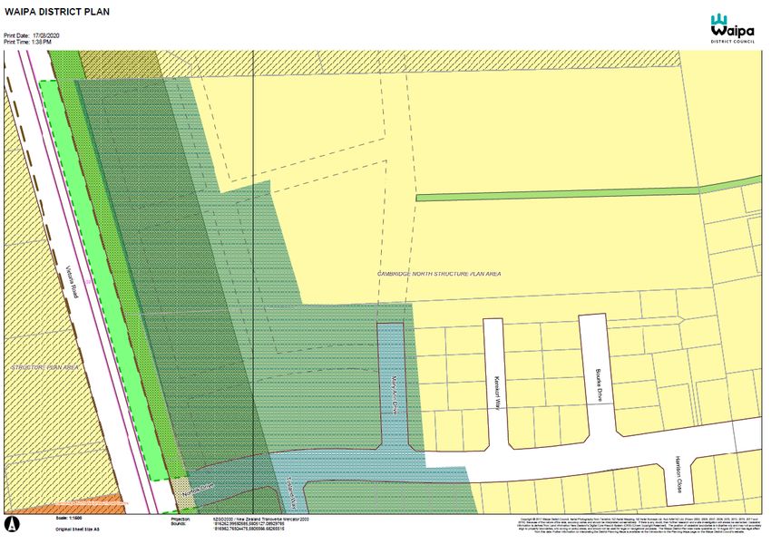
Contents
1.0   Introduction ................................................................................................................ 1
2.0   Site Description and Proposed Retirement Village ..................................................... 1
  2.1    Background and Site Description ............................................................................ 1
  2.2    Proposed Retirement Village .................................................................................. 2
  2.3    Adjacent Development ............................................................................................ 2
  2.4    Geology and Soil Conditions ................................................................................... 2
3.0   Proposed Engineering Works ..................................................................................... 3
  3.1    Earthwork Activities................................................................................................. 3
  3.2    Roading .................................................................................................................. 3
  3.3    Retaining Walls ....................................................................................................... 3
  3.4    Stormwater Assessment and Management ............................................................. 3
    3.4.1    Existing (Greenfield) Site Stormwater .............................................................. 3
    3.4.2    Stormwater Management Overview ................................................................. 4
    3.4.3    Assessment of Proposed Site Activities ........................................................... 4
    3.4.4    Assessment of Stormwater Runoff ................................................................... 5
    3.4.5    Stormwater Runoff Assessment ....................................................................... 6
    3.4.6    Primary Reticulation Assessment..................................................................... 6
    3.4.7    Stormwater Soakage Assessment ................................................................... 8
    3.4.8    Secondary Overland Flow Assessment and Flooding ...................................... 9
    3.4.9    Stormwater Quality ........................................................................................ 10
    3.4.10 Operation and Maintenance ........................................................................... 10
  3.5    Wastewater ........................................................................................................... 11
    3.5.1    Existing Site and Adjacent Public Infrastructure ............................................. 11
    3.5.2    Design Wastewater Production ...................................................................... 11
    3.5.3    Wastewater Discharge Flows ......................................................................... 12
    3.5.4    Proposed Reticulation .................................................................................... 13
  3.6    Water Supply ........................................................................................................ 13
    3.6.1    Existing Water Supply and Adjacent Public Infrastructure .............................. 13
    3.6.2    Water Demand............................................................................................... 13
    3.6.3    Fire-Fighting Supply ....................................................................................... 14
    3.6.4    Proposed Reticulation .................................................................................... 14
    3.6.5    Required Servicing from Public Water Main ................................................... 14
    3.6.6    Irrigation and Water Bore Supply ................................................................... 15
4.0   Waipa District Council Section 92 Queries and Responses ...................................... 16
5.0   Summary .................................................................................................................. 18
6.0   Limitation .................................................................................................................. 18

Appendices
Appendix A:          Summerset Cambridge Village Master Plan
Appendix B:          Stormwater Assessment Calculations
Appendix C:          Wastewater and Water Supply Design Calculations
Appendix D:          Hydrant Flow Test Results
Appendix E:          RILEY Dwgs: RIL-CMB-SW-CW-120 to -131
RILEY CONSULTANTS LTD            AUCKLAND                                       CHRISTCHURCH
 New Zealand                      4 Fred Thomas Drive, Takapuna, Auckland 0622   22 Moorhouse Avenue, Addington, Christchurch 8011
 Email: riley@riley.co.nz
 Email: rileychch@riley.co.nz     PO Box 100253, North Shore, Auckland 0745      PO Box 4355, Christchurch 8140
 Web: www.riley.co.nz             Tel: +64 9 489 7872 Fax: +64 9 489 7873        Tel: +64 3 379 4402 Fax: +64 3 379 4403

                                           ENGINEERING ASSESSMENT
                                 PROPOSED SUMMERSET RETIREMENT VILLAGE
                                60, 80, 100 AND 102 LAURENT ROAD, CAMBRIDGE

           1.0          Introduction
           The following report has been prepared by Riley Consultants Ltd (RILEY) at the request of
           Summerset Villages (Cambridge) Ltd (Summerset). It presents the results of a civil
           engineering assessment to support the resource consent application for a proposed retirement
           village at the above site. The civil engineering assessment specifically addresses finished
           ground profiles and associated retaining, as well as the provision of stormwater, wastewater,
           and water supply services for the proposed retirement village.

           RILEY has prepared Preliminary and Detailed Site Investigation reports (RILEY
           Refs: 180171-B and H); Geotechnical Assessment (RILEY Ref: 180171-K), and an
           Earthworks and Sediment Control Assessment (RILEY Ref: 180171-I). Our assessment has
           been based on the layout prepared by Summerset, as shown on the appended plan
           (Cambridge Village Master Plan RC.011 Rev B). See Appendix A.

           2.0          Site Description and Proposed Retirement Village
           2.1          Background and Site Description

           The site comprises part of 60 Laurent Road, part of 80 Laurent Road (Lot 4 DPS 74868 [being
           the future Lot 2 LT 547050]), 100 Laurent Road (Lot 1, DP 381032) and 102 Laurent Road
           (Lot 2, DP 381032) in Cambridge, Waikato. Construction of residential dwellings has recently
           been completed to the south of the property as part of the Norfolk Drive subdivision. The site
           is bounded on the western side by Victoria Road, and connects to the Waikato Expressway
           500m to the north of the site.

           The land has historically been used for grassland farming. Most of the site is currently grassed
           and several farm fences, gates, and water troughs are in place. Between 2015 and 2017, a
           stormwater detention/retention pond (in the order of 5,000m2 and up to approximately 3m deep)
           was formed at 60 Laurent Road, along with two large stockpiles (in the order of 1,000m2 and
           3,500m2 and up to approximately 7m high). Within the same period, an archaeological
           investigation formed a number of trenches, minor excavations, and small stockpiles of spoil
           material across 80 Laurent Road. Besides these recent features, the site contour is
           predominantly gentle to flat. Two existing dwellings are located on the 100 Laurent Road.
           102 Laurent Road is vacant and is presently used as pastoral land. Both 100 and 102 Laurent
           Road are accessed via Laurent Road, which runs parallel to Victoria Road.

           A topographical survey of the site has been produced by Cogswell Surveyor Limited,
           January 2019. This shows a typically flat site with minimal elevation variation (typically
           RL 66.8m along the eastern boundary to RL 65.0m near the south western corner of the site).

           The mid and southern portions of the site are zoned residential, and the northern portion is
           zoned deferred residential within the Waipa District Council (WDC) District Plan.

GEOTECHNICAL ENVIRONMENTAL CIVIL WATER RESOURCES
Engineering Assessment, Proposed Summerset Retirement Village – 60, 80, 100 and 102 Laurent Road, Cambridge
RILEY Ref: 180171-J (Issue 2.0)                                                                             Page 2

The available information relating to stormwater management, flooding, wastewater, and
water supply issues in the area have been reviewed.            This review includes the
Cambridge North Structure Plan, WDC GIS portals and a review of the reports prepared by
Opus (now WSP) ‘Resource Consent Application and Assessment of Environmental Effects’
(February 2018) and Golovin ‘Stormwater Disposal Design, Trinity Green Estate Cambridge’
(June 2016). Discussions have also been held with WDC.

Earthworks will be carried out to satisfy the WDC District Plan provisions (in relation to site
gradients, overland flow paths, future building platform levels, roads, etc.) for proposed use of
the site. The earthworks to be carried out on-site, to achieve the desired finished ground
profile, will be undertaken in accordance with the design and engineering specifications
prepared by RILEY and the Waikato Local Authority ‘Regional Infrastructure Technical
Specifications’ (RITS).

2.2       Proposed Retirement Village

The proposed village will be made up of a main building containing administrative, ancillary
and shared amenities, assisted living and memory care suites. Surrounding this building, will
be shared outdoor activity areas. The remainder of the site is to contain single and duplex
villas and cottages. The retirement village will include new private access roads, drainage,
services, and landscaping.

It is envisaged that the construction of the village will be undertaken in following three Phases:

      •   Phase 1: 60/80 Laurent Road
      •   Phase 2: 102 Laurent Road
      •   Phase 3: 100 Laurent Road

The construction and servicing of the Phases have been assessed in sequence. Therefore,
Phase 1 can operate independently without relying on Phase 2, similarly Phase 2 can operate
without relying on Phase 3.

2.3       Adjacent Development

The existing site is bounded by residential subdivisions to the south and to the east. These
subdivisions are serviced by municipal stormwater (runoff from roads is directed to stormwater
reticulation along Norfolk Drive and discharges into the Victoria Road swale and a temporary
pond within the site), water supply (fed from mains along Norfolk Drive), and a sewer system
(flows directed to a public pump station located on Tosland Way, south of the site).

2.4       Geology and Soil Conditions

The 1:250,000 published geological map (GNS Science: 2005) of the Waikato region, indicates
the site is underlain by alluvial deposits of the Hinuera Formation. The Hinuera Formation
typically comprises cross-bedded pumice sand, silt, and gravel with interbedded peat.

Reference should be made to the RILEY Geotechnical Assessment (RILEY Ref: 180171-K)
for further detail.

29 July 2021
Riley Consultants Ltd
Engineering Assessment, Proposed Summerset Retirement Village – 60, 80, 100 and 102 Laurent Road, Cambridge
RILEY Ref: 180171-J (Issue 2.0)                                                                             Page 3

3.0          Proposed Engineering Works
The following sections outline the proposed engineering works to be undertaken in relation to
the retirement village and include a consideration of the following:

       i)     Earthworks.
      ii)     Roading.
      iii)    Retaining Walls.
      iv)     Water Management.
              a) Stormwater.
              b) Wastewater.
              c) Water Supply.

Engineering works have been designed to be in accordance with the RITS.

3.1          Earthwork Activities

An assessment of the Bulk Earthworks has been undertaken by RILEY (Earthworks and
Sediment Control Assessment Report, referenced 180171-I). These works will provide
finished ground profiles, which satisfy the District Plan requirements (in relation to site
gradients, overland flow paths (OLFP), future building platform levels, roads, etc.) for the
proposed use of the site. The site levels and provision for the proposed finished floor levels
of the buildings will mitigate the risk of flooding during the 50-year annual recurrence internal
(ARI) event. This management approach has been discussed and agreed with WDC.

3.2          Roading

The retirement village site entrance will be from Mary Ann Drive. Internal private roads will be
constructed to form the village roading network and will vary in width dependant on hierarchy
and vehicle movements. Typical internal private roads widths range between 4.5m to 6.5m.
Driveways and off-street parking spaces will be provided for each villa/cottage. Visitor parking
is proposed at various locations throughout the site.

The minimum longitudinal gradient of internal roads is 0.4% (1 in 250). Roads will be formed
to a flexible pavement in accordance with the WDC adopted RITS.

3.3          Retaining Walls

Due to the level nature of the site, no significant retaining structures are necessary. Minor
retaining structures (i.e. maximum 0.9m high) are proposed along parts of the site boundaries
to provide for level building platforms and manage and maintain overland flows within the
adjoining road network.

3.4          Stormwater Assessment and Management

3.4.1 Existing (Greenfield) Site Stormwater

The site is generally flat with minimal elevation variation (typically RL 66.8m along the eastern
boundary to RL 65.0m near the south western corner of the site). Existing topographical
survey information indicates there is a localised depression near the south-east corner of
102 Laurent Road.

29 July 2021
Riley Consultants Ltd
Engineering Assessment, Proposed Summerset Retirement Village – 60, 80, 100 and 102 Laurent Road, Cambridge
RILEY Ref: 180171-J (Issue 2.0) Page 4
Site contours indicate that ground levels drop to approximately RL 65.0m at this location and
rise to the west to approximately RL 65.4m before grading down to RL 65.2m on the north-
west boundary of 100 Laurent Road. Based on limited topographical survey and the
Council GIS information, ground levels rise again in the north to approximately RL 65.8m.
These levels would indicate that localised ponding would occur during extreme storm events.
However, there are no known flooding issues in this area. This suggests that runoff infiltrates
into the ground via soakage.
Review of WDC GIS information reveals that there is existing council infrastructure located along
the length of Norfolk Drive directly to the south of the site but is not intended to service the site.
However, this reticulation currently drains to a temporary detention pond located within the
southern portion of the site. We understand that the temporary pond is not to be backfilled until
the proposed swale and pond systems along Victoria Road are in full operation. It is envisaged
that the swale and pond system will be in operation by 2025 or earlier. The volume of the pond
to existing ground level is approximately 11,200m3 over an area of 5,400m2.
3.4.2 Stormwater Management Overview
WSP undertook a stormwater catchment management plan assessment that provides a
framework for recommended stormwater infrastructure/management within the
Cambridge North area. This report, Resource Consent Application and Assessment of
Environmental Effects (February 2018) outlines the proposed development (construction of
both the swale and the detention pond) and the effects it will have in ensuring stormwater
generated from future residential developments within the catchment areas are adequately
treated and/or dispersed. This swale and detention pond arrangement has been designed
based on the zoning provisions within the Cambridge North Structure Plan area.
The design recommendations, within the Cambridge North Structure Plan (Appendix S2), for
this site indicate that stormwater runoff is either discharged into the ground via soakage or
into the proposed swale west of the site via piped reticulation. From discussions with WDC
(refer WDC letter, dated 25 September 2020, appended), the stormwater management for a
retirement village at the site should consider the following:
• Primary flows (1 in 10-year event, including climate change).
• Secondary flows (1 in 50-year event, including climate change).
• Soakage to be designed for the 1 in 10-year event for roof areas only, where overflow
is directed into the roads.
We note that under Clause 2.4.2.15 of the District Plan that on-site soakage shall be provided
for every building in the Cambridge North Structure Plan Area to take all runoff from a two-year
annual recurrence interval (ARI) rainfall event. For the purposes of this assessment, soakage
systems have been assessed to cater for the 10-year event.
3.4.3 Assessment of Proposed Site Activities
The composition of site coverages based on the master plan of the proposed retirement village
are as the follows:
29 July 2021
Riley Consultants LtdEngineering Assessment, Proposed Summerset Retirement Village – 60, 80, 100 and 102 Laurent Road, Cambridge
RILEY Ref: 180171-J (Issue 2.0) Page 5
Table 1: Retirement Village Site Coverage
Phase 1 Phase 2 Phase 3 Total
Cover Description
Area (m2) Area (m2) Area (m2) Area (m2)
Impervious 50,407 7,127 3,971 61,505
Roof 26,493 3,819 2,146 32,458
Paved Surfaces 23,914 3,308 1,825 29,047
Pervious
Landscaped areas 29,244 4,873 3,271 37,388
Total Area 79,651 12,000 7,242 98,893
Based on the total proposed site coverage, the average ratio of total impervious area to site
area for the retirement village will be 62.2%.
As previously outlined, the existing sites are currently zoned Residential (60/80 Laurent Road)
and Deferred Residential (100 and 102 Laurent Road). Within these zones there is Compact
Housing area overlay, which is approximately 3.96ha of the total village site where the balance
(approximately 5.93ha) is residential.
Composite rational run-off coefficients have been used for stormwater assessments to
compare the stormwater runoff from the proposed village with that of a possible residential
subdivision based on District Plan provisions and parameters outlined in Table 4.8 of the RITS.
Further detail is outlined in the sections below.
3.4.4 Assessment of Stormwater Runoff
Methodologies used to assess stormwater runoff from the site and surrounding areas for the
primary and secondary events are based on the WDC adopted RITS. The Rational Method
was used to assess stormwater runoff based on the following key parameters:
Runoff Coefficients
Run-off coefficients used for stormwater assessments of possible subdivisions scenarios at
the site have been based on Table 4.8 of the RITS and are outlined below.
Table 2: Runoff Coefficients (taken from Table 4-8 of RITS)
Zoning Runoff Coefficients
General Residential (excluding HCC) 0.65
Residential Medium/High Density 0.80
A site-specific runoff coefficient for the Summerset Village of 0.65 has been determined based
on the impervious coverage of the proposed retirement village (refer to calculation appended).
For the purposes of this assessment, a time of concentration of 10 minutes has been assumed
for all sub-catchments. This is considered to be conservative.
Intensity
Design rainfall intensities were obtained from HIRDS v4 where RCP8.5 for period 2081 to
2100 has been adopted for modelling. This scenario accounts for climate change, therefore,
no further increase has been applied.
29 July 2021
Riley Consultants LtdEngineering Assessment, Proposed Summerset Retirement Village – 60, 80, 100 and 102 Laurent Road, Cambridge
RILEY Ref: 180171-J (Issue 2.0) Page 6
Table 3: Rainfall Intensities
Average Recurrence Interval Design Rainfall Intensity - Climate Change Adjusted
(ARI) (Year) (10 min duration, mm/hr)
10 121
50 173
3.4.5 Stormwater Runoff Assessment
Stormwater runoff from the site has been assessed based on the proposed retirement village
or an example of a residential subdivision based on the current zoning under the WDC District
Plan provisions. Surface water runoff has been assessed using the Rational Method, the
above parameters and in accordance with RITS. A summary of the results is outlined below.
Table 4: Stormwater Runoff from Possible Scenarios
10-year ARI Flow Rate 50-year ARI Flow Rate
Scenario
(m3/sec) (m3/sec)
Possible residential subdivision assuming
2.360 3.374
Compact and Residential Housing zoning
Proposed retirement village 2.161 3.089
As the results show, stormwater runoff generated from proposed retirement village during storm
events would be less than that generated from a comparable residential subdivision at the site.
3.4.6 Primary Reticulation Assessment
It is proposed that stormwater runoff from the road areas within the retirement village will be
collected and directed via conventional gravity piped reticulation and ultimately discharging
into the Victoria Road swale to the west of the site. It is envisaged that three new outlet
connections will be formed within the swale to service the site.
New public stormwater pipe reticulation will need to be extended through the northern and
central portions of the Summerset site to provide service connections to the neighbouring sites
east of 102 and 80 Laurent Road.
The northern pipeline will be sized to convey stormwater runoff generated from a localised
catchment east of 102 Laurent Road for events up to the 50-year. This pipeline will also be
used to service the village site area located within 100 and 102 Laurent Road for up to a
10-year storm event. Further details on stormwater overland flow conditions is outlined in
Section 3.4.8 of this report.
The central pipeline will be extended through 80 Laurent Road to the eastern boundary. This
pipeline has been sized to provide a service connection for a further subdivision east of the site.
These public pipelines will be subject to an easement and have been located within proposed
internal roads of the village and clear of buildings. The stormwater reticulation servicing the
retirement village site or connecting to the proposed public stormwater network will be private.
Stormwater modelling has been undertaken on the proposed main northern, central and
southern stormwater pipelines to assess and confirm pipe capacity, servicing extent and pipe
cover. The RITS requires the primary stormwater network to be designed to pass the 10-year
design flow.
29 July 2021
Riley Consultants LtdEngineering Assessment, Proposed Summerset Retirement Village – 60, 80, 100 and 102 Laurent Road, Cambridge
RILEY Ref: 180171-J (Issue 2.0) Page 7
For the purposes of this assessment, the proposed public reticulation has been assessed to
pass the 10-year design flow from the village and 50-year design flow for upstream catchments
(northern sub-catchment only) including roof areas.
As the reticulation network will discharge to the proposed swale running along the western
site boundary, reticulation design will need to consider tailwater effects. The tailwater levels
below have been assumed for each storm event.
Table 5: Tailwater Levels within Swale at Chainage 660m
Average Recurrence Tailwater Level
Note
Interval (ARI) (m)
No tailwater conditions has been modelled for a
2-year - 2-year event. Pipe has been sized for no
surcharge. To be confirmed in detailed design
10-year 64.35 Assumed, to be confirmed in detailed design
50-year 64.85 Based on WDC/WSP supplied levels
As outlined in the District Plan, stormwater runoff generated from roof areas during the
two-year storm event should be directed to soakage within the site. However, based on advice
from Council, soakage systems have been assessed to cater for up to the 10-year event. For
the purposes of this assessment, stormwater runoff flows from roof areas have not been
removed while assessing the primary reticulation. This should be considered as conservative.
Assessments show that reticulation will be surcharged during a 10-year storm event.
However, this is based on the tailwater effects and including stormwater runoff from roof areas
within the catchment. A sensitivity analysis was undertaken for the two-year storm event. This
assessment shows no surcharging of the pipe network based on no tailwater effects.
The hydrological analysis (based on the envisaged contributing catchments) indicates that the
primary peak flows at the proposed outlet service points within the swale are as follows:
Table 6: Preliminary Design Flows for Primary Reticulation from Site to Swale
Catchment Area 10-year ARI Flow Rate
Discharge Point
(ha) (m3/sec)
Northern Outlet (1,350mm-dia.*)
4.11 1.100
Public reticulation
Central Outlet (1,200mm-dia.)
8.17 1.786
Public reticulation
Southern Outlet (750mm-dia.)
1.87 0.409
Private reticulation
*Note that reticulation has been sized to pass stormwater generated from the upslope catchment for up to the 50-year event.
Outlets into the swale will be constructed in accordance with the RITS and provide adequate
measures to disperse flows and minimise erosion. However, it should be noted that the outlets
will likely be submerged during the larger events.
Calculations are appended for reference, which also outline methodologies and assumptions
including sensitivity assessments. New public and private reticulation will be designed and
constructed in accordance with the RITS and the New Zealand Building Code (NZBC). The
proposed layout of the stormwater reticulation, conveyance and outlets are shown on
RILEY Dwg: RIL-CMB-SW-CW-124.
29 July 2021
Riley Consultants LtdEngineering Assessment, Proposed Summerset Retirement Village – 60, 80, 100 and 102 Laurent Road, Cambridge
RILEY Ref: 180171-J (Issue 2.0) Page 8
3.4.7 Stormwater Soakage Assessment
Stormwater runoff generated from roof areas during the two-year storm event should be
directed on-site soakage areas in accordance with the District Plan. However, guidance
provided by WDC has indicated that these primary systems should be designed for a 10-year
event. Overflow from the soakage areas will be directed to the private and public stormwater
reticulation within the site.
Two soakage tests were carried out at the site and within boreholes augered during the
geotechnical subsurface investigations. Testing was concentrated on the shallow sand layers
encountered within the boreholes and above groundwater levels. Falling head tests, in
accordance with the Auckland Soakage Manual, were undertaken to confirm the soakage
potential. Whilst good soakage was achieved at the site, we understand from review of
technical reports that soakage at the site is variable. As a result, a minimum soakage rate of
150mm/hour has been applied in accordance with the RITS.
Preliminary assessment of the proposed stormwater soakage system at the site has been
assessed to service the roof areas only (approximately 3.25ha), and to satisfy WDC
requirements. The assessment was carried out in accordance with RITS and E1/VM1 of the
NZBC assuming a combination of likely soakage systems. As outlined in NZBC, soakage pits
have been assessed on rainfall intensity (mm/hr) based on one-hour duration of an event
having occurred. The soakage pits have also been assessed against a nested 10-year storm
event. Three types of soakage systems were assessed and consist of the following:
• Type 1: Formation of an aggregate filled soakage trench wrapped with filter fabric. It is
then proposed to be filled with clean drainage metal. These would be located within
landscaped areas.
• Type 2 and 3: Buried storage chambers (Cirtex Triton Chambers [Type 2] or Graf Eco
bloc/Cirtex Rainsmart Crates [Type 3]) within designated and located soakage areas
within the site. This device will provide a localised soakage area and will likely be
placed beneath proposed roads/car parks and bowling green.
• Type 4: Buried storage chambers (Graf Ecobloc/Cirtex Rainsmart Crates) within
designated and located soakage areas within the site. These devices provide greater
and more efficient storage than the Type 1 devices. These would be located within
landscaped areas.
Typical details of the above types of soakage systems are shown on RILEY
Dwgs: RIL-CMB-SW-CW-125 to -128. Based on the potential stormwater soakage areas as
shown on RILEY Dwg: RIL-CMB-SW-CW-124 and assuming the above type of devices, the
available capacity assessed at the site is as follows:
Table 7: Available Soakage Systems within the Site
Dimensions
Roof Area
Soakage System Type Length Width Depth Area Volume
Serviced
(with assumed void ratio) (m) (m) (m) (m2) (m3)
(ha)
Type 1: 990
990 1.0 1.0 990 0.99
(Rockfilled Trenches - 0.38) (376)
Type 2: 988
494 2.0 1.0 988 1.33
(Cirtex Chambers – 0.65) (642)
Type 3: 383
- 1.0 383 0.66
(Cirtex or Eco bloc crates – 0.95) (364)
29 July 2021
Riley Consultants LtdEngineering Assessment, Proposed Summerset Retirement Village – 60, 80, 100 and 102 Laurent Road, Cambridge
RILEY Ref: 180171-J (Issue 2.0) Page 9
Dimensions
Roof Area
Soakage System Type Length Width Depth Area Volume
Serviced
(with assumed void ratio) (m) (m) (m) (m2) (m3)
(ha)
Type 4: 784
490 1.6 1.0 784 1.35
(Cirtex or Eco bloc crates – 0.95) (745)
3145
Total 3145 4.24
(2127)
Preliminary assessment of available areas for stormwater soakage systems shows adequate
capacity to service roof areas within the retirement village site. The extent of soakage will be
further refined during the detailed design phase.
Calculations are appended for reference, which also outline assumptions. Soakage systems
will be designed and constructed in accordance with the RITS and the NZBC. Specific
soakage testing will be carried out at proposed locations to confirm soakage rates where it is
envisaged that the extent of soakage systems will further reduce.
3.4.8 Secondary Overland Flow Assessment and Flooding
Consideration has been given to maintaining secondary overland flow to cater for higher
intensity rainfall events in the event of blockages or exceedances of the primary reticulation
system. Secondary overland flow from the site will be directed to the Victoria Road swale
located to the west of the site. WDC requirements outline that secondary flow paths should
be capable of handling up to, and including, the 2% Annual Exceedance Probability event
(i.e. 50-year event). Secondary overland flow paths will be aligned and kept within proposed
internal private roads and exit between building platforms along the western boundary.
The Stormwater Disposal Design report dated June 2016 and prepared by Golovin for a
proposed residential subdivision at the site indicated that stormwater runoff generated by the
50-year event would be directed into the proposed subdivision roads. These assessments
showed that the water depths within the roads will be approximately 100mm, and therefore,
be contained within the road reserve. The Golovin report also allowed a longitudinal gradient
of 0.4% for the road through the site in an east-to-west alignment. A similar approach has
been adopted within the village where overland flow will be directed to the internal roads and
roads have a minimum longitudinal gradient of 0.4% towards the Council swale along the
western boundary of the site.
Existing topographical survey information indicates that ground levels near the south-east corner
of 102 Laurent Road are approximately RL 65.0m, where the ground levels rise to the west to
approximately RL 65.4m. These levels would indicate that localised ponding would occur during
extreme storm events. Furthermore, the envisaged 50-year flood levels within the Council swale
adjacent to the Summerset western boundary is approximately 64.83m. As a result, finished
ground levels will need to be raised within 102 Laurent Road to achieve building freeboard
requirements relative the 50-year flood levels within the Council swale and ensure overland flow
within the site is safely directed to the western boundary. In order to eliminate ponding on
neighbouring land beyond pre-development levels and to maintain overland flow conditions for
up to the 50-year storm event within the limited catchment area of the neighbouring site, a
proposed pipeline and intake structure will be constructed to collect and convey surface
stormwater runoff to the proposed Council swale. Specific assessments of the proposed
stormwater pipeline are outlined Section 3.4.6 of this report. For the purposes of this assessment,
it has been assumed that overland flow conditions through Phases 2 and 3 of the Summerset
sites will also need to consider this limited neighbouring contributing catchment.
29 July 2021
Riley Consultants LtdEngineering Assessment, Proposed Summerset Retirement Village – 60, 80, 100 and 102 Laurent Road, Cambridge RILEY Ref: 180171-J (Issue 2.0) Page 10 For the purposes of this assessment, it has been assumed that overland flow conditions from the full contributing catchments east of the 80 and 102 Laurent Road pass through the Summerset site. However, it should be noted that based on existing and potential neighbouring subdivisions, residential lots will likely be backing onto the Summerset northern and eastern site boundaries where site levels would be graded to future internal road reserves. Therefore, this assumed catchment boundary is conservative. The southern boundary of the site (and a short section of boundary along Mary Ann Drive) back onto or are near existing public road reserves, which are currently used to direct overland flow to the Norfolk Drive and Victoria Road intersection. This will create a catchment boundary condition along these boundaries. An assessment has been undertaken to assess the overland flow paths through the proposed retirement village site. This assessment has been based on the proposed finished ground surface, envisaged catchment boundaries, 50-year storm event (with climate change) and outlet points along the western boundary adjacent to the proposed swale. This assessment shows that overland flow during a 50-year storm event can be safely directed through the site and within the road channels to the western boundary while maintaining 150mm freeboard to the finished floor levels within the site. WDC/WSP has also indicated the maximum 50-year water surface level for the swale at chainage 660m to be 64.83m (which is generally consistent over the length of the western boundary). This point in the swale is at approximately mid-way along the Summerset western boundary. The invert of the swale at this location, based on design details provided by WSP, is approximately RL 62.0m, where the invert at northern and southern extents of the Summerset site are approximately RL 61.90m and RL 62.10m, respectively. As outlined in the Cambridge North Structure, 500mm freeboard shall be provided for buildings adjacent to an open drain (i.e. swale along the western boundary) or the top of kerb levels along Norfolk Drive and Mary Ann Drive. Minimum floor levels have been set along the western and southern boundaries to ensure that adequate freeboard requirements can be achieved. These details are shown on RILEY Dwg: RIL-CMB-SW-CW-122. 3.4.9 Stormwater Quality With regard to water quality impacts, the proposed retirement village can be considered as being similar to a residential land use. This land use is on the lower end of contaminant production for development. In particular, retirement villages generally have much lower vehicle movements (both in number and speed of the vehicle) than similar residential areas, reducing contaminant generation. As outlined earlier, the WSP reporting for the proposed public stormwater swale and pond servicing the Cambridge North catchment is to ensure stormwater generated from future residential developments within the catchment areas are adequately treated and/or dispersed. The proposed retirement village will be in keeping with the design intensions of the swale and pond system, and therefore, it is not proposed to provide stormwater treatment measures for the site. 3.4.10 Operation and Maintenance Interception, collection, and conveyance of stormwater runoff generated from the retirement village will be achieved by conventional piped reticulation methods. Disposal of stormwater runoff from roof areas will be to ground soakage. The stormwater reticulation and soakage systems located within the property will be privately owned, operated and maintained by Summerset. 29 July 2021 Riley Consultants Ltd
Engineering Assessment, Proposed Summerset Retirement Village – 60, 80, 100 and 102 Laurent Road, Cambridge
RILEY Ref: 180171-J (Issue 2.0)                                                                             Page 11

The frequency of maintenance services will be reviewed at the completion of each service and
modified if deemed necessary. A detailed stormwater operation and maintenance manual will
be prepared as part of the retirement village and will be followed by the Summerset
maintenance team.

3.5       Wastewater

3.5.1 Existing Site and Adjacent Public Infrastructure

There is existing public wastewater reticulation within Norfolk Drive, directly to the south of the
site. Catchment plans provided by WDC indicate that this existing public reticulation is
intended to service the majority of 60/80 Laurent Road site and drains into the public
wastewater pump station (WDC reference Pump Station G (PSG)) located on Tosland Way
(refer to appended plan for catchment boundaries). The catchment plan provided, and
discussions with WDC, indicate that the northern portions of 80 Laurent Road were not allowed
for when designing and sizing the public wastewater pump station. Sites north of this
catchment area are intended to be serviced by future gravity reticulation, which drains north
to a new public pump station (PSI).

Based on the current zoning, the equivalent population for a possible subdivision within the
contributing catchment of the site is 523 people. This was based on the following parameters:

Table 8: Contributing Wastewater Catchment – Possible Residential Subdivision Scenario
 Item                                                                  Parameters
 Total Parcel Area within Summerset site contributing to
                                                                       6.082ha
 PSG
 Assumed Compact Housing Area                                          3.326ha
 Assumed General Residential Area                                      2.756ha
 Population Equivalent – General Residential, Medium
                                                                       45 persons per hectare, or not less
 Density Residential, Temple View, Special Heritage,
                                                                       than 2.7 persons per dwelling
 Special Residential Zones
 Population Equivalent – Residential Intensification Zone              120 persons per hectare

The catchment plan provided by WDC also shows an indicative public wastewater arrangement,
which extends through the Summerset site to service eastern portions of the catchment.

Preliminary assessment of as-built information indicates that public reticulation at the end of
Bourke Drive could be extended to service this area as indicated in the catchment plan.
This would limit the need to extend public wastewater reticulation through the Summerset site.

RILEY has liaised with WDC to determine the preferred discharge point from the site into the
public system. It is proposed to utilise an existing 150mm lead from the public gravity
wastewater system that extends into the site on the southern boundary from Norfolk Drive
(opposite to Tosland Way).

3.5.2 Design Wastewater Production

Site Occupancy

Based on information provided by Summerset, the following approach has been used to
design the wastewater system:

      •   The independent living units have an average design occupancy of 1.3 person per unit.

29 July 2021
Riley Consultants Ltd
Engineering Assessment, Proposed Summerset Retirement Village – 60, 80, 100 and 102 Laurent Road, Cambridge
RILEY Ref: 180171-J (Issue 2.0) Page 12
• All assisted living and memory care suites have an occupancy of 1 person per unit/bed.
• An allowance for staff of 25 staff has been assumed.
Per Capita Flow Allowances
The site will be supplied by municipal reticulated water.
Design per capita allowances for the site are based on the RITS. These are as follows:
• Per capita (resident) average dry weather flow allowance of 200 litres per day (L/p/d)
• Per capita (staff) average dry weather flow allowance of 50 litres per day (L/p/d)
• Infiltration allowance of 2,250L/ha/day
• Surface water ingress is 16,500L/ha/day
• Total site area is 9.89ha
Wastewater Volumes
The design wastewater volumes based on anticipated occupancy for the completed retirement
village are as follows:
Table 9: Design Wastewater Volumes – Completed Village Site
Number Per Capita Total Wastewater
Occupancy
of Units Flows (L/p/d) Production (m3/d)
Villas and Cottages – Phase 1 207 270 200 54.00
Villas and Cottages – Phase 2 35 46 200 9.20
Villas and Cottages – Phase 3 18 24 200 4.80
Care/assisted living apartments
116 116 200 23.20
and beds – Phase 1
Staff 25 50 1.25
Total Daily Wastewater Flow 92.45m3/day
3.5.3 Wastewater Discharge Flows
The proposed wastewater flows for the retirement village have been calculated in accordance
with the RITS. Average Daily Flows (ADF), Peak Daily Flow (PDF) and Peak Wet Weather
Flows (PWWF) from each discharge point are as follows:
Table 10: Wastewater Discharge Flows – Complete Village Site
Peak Wet
Discharge Catchment Average Daily Peak Daily Flow
Weather Flow
Points Area (ha) Flow (m3/day) (L/sec)
(L/sec)
Norfolk Drive 9.89 114.70 3.84 5.73
The ADF, PDF, and PWWF from a possible subdivision within the site and within the
contributing catchment of PSG (based on the parameters outlined in Table 8) are 118m3/day,
4.15L/sec and 5.32L/sec, respectively. Whilst the average wastewater daily flows from the
completed retirement village is less than the intended demands, the peak wet weather
wastewater flows are slightly higher within the catchment contributing to PSG. This is only
due to the catchment area being larger (i.e. infiltration is based on catchment area).
29 July 2021
Riley Consultants LtdEngineering Assessment, Proposed Summerset Retirement Village – 60, 80, 100 and 102 Laurent Road, Cambridge
RILEY Ref: 180171-J (Issue 2.0) Page 13
However, the PWWF demands for Phases 2 and 3 along is 0.95L/sec. These Phases of the
village are intended to be serviced by private wastewater pump stations (as discussed below),
which will provide emergency storage within the chambers. If required, the private pump
stations could be staggered to off peak times, utilising storage within the chambers and
reducing peak flow demands on the downstream public PSG.
3.5.4 Proposed Reticulation
Due to the invert depth of the proposed connections to the existing public wastewater network,
relatively flat site gradients and potential clash points with stormwater reticulation, the site
cannot be fully serviced with a gravity reticulation network. Areas, which cannot be reticulated
directly to the gravity system, will drain to a series of pump stations, from where pressure
mains will convey the wastewater to the gravity system.
The chamber for the pump stations will be sized to provide adequate storage in accordance
with the RITS (i.e. a minimum emergency storage capacity of nine hours average dry weather
flow). Furthermore, the operation of the private pump stations could be staggered to off peak
times, utilising storage within the chambers and reducing peak flow demands on the
downstream public PSG. However, as noted above, the demands from the village is only
slightly above that of a compliant subdivision within the catchment of PSG.
New private reticulation will be designed and constructed in accordance with the RITS and the
NZBC to provide each unit with a connection. The gravity reticulation will consist of
150mm-diameter mains and will be constructed within the internal roading network.
The proposed layout of the wastewater reticulation is shown on RILEY Dwg:
RIL-CMB-SW-CW-129. This drawing shows the extent of the gravity reticulation and locations
of the pump stations where the site cannot be serviced by conventional means. The
wastewater reticulation within the site will remain private and be managed by Summerset. Full
design and detailing of the wastewater system will be provided at engineering approval and
building consent stages.
3.6 Water Supply
3.6.1 Existing Water Supply and Adjacent Public Infrastructure
RILEY has liaised with the WDC to determine the preferred supply points from the public
system. Two connections will be made to the public network in order to provide additional
resilience of supply. The proposed connection points are as follows:
• Existing 150mm-diameter water main on Norfolk Drive (opposite to Tosland Way).
This connection will provide potable and fire supply connections.
• Existing 150mm-diameter public watermain on Mary Ann Drive. This connection will
provide the secondary potable water supply.
The location of the proposed connections to the public network and arrangements are shown
on RILEY Dwg: RIL-CMB-SW-CW-131. From discussions with WDC, all meters will need to
be located within the public road reserves and backflow and valve arrangements within private
property in accordance with the RITS.
3.6.2 Water Demand
The average daily potable water demand for the retirement village has been calculated based
on a domestic demand of 260L/p/d and with peak factors in accordance with the RITS.
29 July 2021
Riley Consultants LtdEngineering Assessment, Proposed Summerset Retirement Village – 60, 80, 100 and 102 Laurent Road, Cambridge
RILEY Ref: 180171-J (Issue 2.0) Page 14
Based on the occupancy numbers provided in Table 9, the average daily demand and peak
daily flow are as follows:
Table 11: Daily and Peak Water Demands – (RITS method)
Average Daily Demand Peak Daily Flow
Supply Point
(L/sec) (L/sec)
150mm-diameter main off Norfolk Drive, plus
1.38 6.90
150mm-diameter main off Mary Ann Drive
3.6.3 Fire-Fighting Supply
RILEY has undertaken a preliminary investigation into the fire-fighting requirements for the
proposed retirement village. The required fire-fighting flows have been determined in
accordance with SNZ PAS 4509:2008 (Tables 1, 2, and C1), and based on a fire classification
of FW2, the required fire-fighting flow is 12.5L/sec from a hydrant within 135m with another
12.5L/sec from a hydrant within 270m, residual pressure greater than 100kPa.
The proposed main building at the retirement village will require sprinkler fire systems.
An independent fire main will be reticulated from the Victoria Road connection point to the
main building to service the sprinkler system. This has been discussed and agreed in principle
with WDC.
A detailed design of the fire-fighting requirements of the retirement village will be undertaken
by a suitable fire engineer and in consultation with the New Zealand Fire Service.
3.6.4 Proposed Reticulation
The proposed layout of the internal domestic water reticulation is shown on
RILEY Dwg: RIL-CMB-SW-CW-131, appended. A 150mm-diameter ring main system is
proposed, with mains located on all primary internal roads, with a 50mm dead end main
servicing dwellings on the secondary dead-end roads. Fire hydrants will provide the
fire-fighting requirements for the retirement village and these will be fitted to the 150mm water
main. Hydrants will be located to provide a minimum 12.5L/sec of flow within 135m of any
dwelling, plus an additional 12.5L/sec within 270m (as per SNZ PAS 4509:2008 Table 2).
3.6.5 Required Servicing from Public Water Main
Fire hydrant pressure and flow testing was been carried out on the existing 150mm-diameter
public water mains within Norfolk Drive and Mary Ann Drive adjacent to the site. The test was
carried out on 26 March 2021 at 7:00am to 7:25am. This test was carried out to confirm the
available flow and pressure in the system to assess whether it is sufficient to service the
retirement village in terms of potable supply and fire-fighting supply.
Table 12: Existing Water Supply Hydrant Flow and Pressure
Flow Pressure
0L/s 390kPa
60.5L/s 200kPa
We have carried out a preliminary hydraulic analysis of the village watermain system using
EPANET software, based on a dual connection to the public supply and hydrant flow test
results as described above. Two scenarios have been modelled, peak domestic supply, and
FW2 fire flow with 60% village peak domestic demand.
29 July 2021
Riley Consultants LtdEngineering Assessment, Proposed Summerset Retirement Village – 60, 80, 100 and 102 Laurent Road, Cambridge
RILEY Ref: 180171-J (Issue 2.0) Page 15
For the purposes of the model, the peak domestic demand for the village has been calculated
based on simultaneous demand calculation from AS/NZS 3500.1:2003 (which results in
significantly higher flows compared with RITS peaking factors and values presented in
Table 11). Results of the modelling are presented in Table 13, and calculations are included
in Appendix C.
Table 13: Water Flow and Pressure (NZS 3500.1:2003 Method)
Minimum Pressure
Scenario Peak Flow
in Village Main
Peak Domestic 13.8L/s 179kPa
FW2 Flow, 60% Peak Domestic(1) 33.3L/s(1) 108kPa
(1) Excludes Main Building Sprinkler Supply
The minimum resultant pressures are largely governed by the head loss through the boundary
backflow devices where a 98kPa loss has been allowed for (based on data collected from
existing village sites).
The hydraulic analysis suggests the following:
• The public water supply can meet the peak domestic demand of the village.
• The minimum residual pressure of 100kPa for FW2 flow should be able to be achieved.
We note that recent upgrades have been undertaken on the public water supply network to
improve supply and pressure. While further hydrant testing of the public network has been
completed showing improved pressure results (compared to the original hydrant testing in 2020
detailed in revision 1 of this document), the testing of the larger watermain on Mary Ann Drive
verses Kerekori Way, will likely result in more favourable results. This main should be tested
simultaneously with the main on Norfolk Drive (i.e. multi hydrant test) to simulate the proposed
dual public watermain connection setup. Further testing would be carried out ahead of building
consent application, and to confirm water supply design for the village.
It is noted that based on the latest hydrant testing and preliminary hydraulic analysis results,
specific booster pumping of the domestic supply to the multi-storey main building is likely
required (where typically 300kPa to 400kPa pressure is required at ground level), and for the
sprinkler supply to the main building (to be specified by the fire engineer).
3.6.6 Irrigation and Water Bore Supply
The landscaped areas of the site will require an irrigation supply. Demands during peak
periods typically require 5mm/m2/day of landscaped areas. Approximately 34,650m2 of the
site is landscaped, therefore, the water demand will be approximately 173m3/day. Irrigation is
undertaken during the night and off-peak periods.
Irrigation supply is proposed to be serviced from the public water supply. Connections to the
public network for irrigation will need separate backflow prevention. Location and
arrangement for irrigation supply is shown on RILEY Dwg: RIL-CMB-SW-CW-131.
In addition to above, private water bore options have been reviewed to investigate and confirm
if supply could be provided to satisfy or supplement irrigation demands. This option is on hold.
29 July 2021
Riley Consultants LtdEngineering Assessment, Proposed Summerset Retirement Village – 60, 80, 100 and 102 Laurent Road, Cambridge
RILEY Ref: 180171-J (Issue 2.0) Page 16
4.0 Waipa District Council Section 92 Queries and Responses
Section 92 queries on the initial application were received from WDC and responded by
Bentleys on 8 March 2021. The relevant infrastructure queries raised and corresponding
responses are outlined below for reference. Further comments have been added where
necessary based on the revised Master Plan and are shown in italics. Please note that the
approach to service the village site has remained the same from previous assessments.
Table 14: WDC Section 92 Queries and Responses
WDC S92 Item Response
7. Water supply: The proposed water reticulation The investigation work for a bore is on hold and
has identified several items that need further the applicant is not in a position to provide
clarification. The application has made claims that details on the size and scope of the water
bore supply is being investigated to supply the supply, which this may provide for. No
sites irrigation which has been identified as being application has been lodged with WDC.
173m³/day. Clarification is sought on the size and Therefore, for the purpose of this application,
scope of this bore water being investigated, as water supply is reliant on connectivity to the
well and whether it will service the full reticulated network.
developments irrigation requirements, or only
partially.
Note: Consent for the bore arrangement would
create a third separate reticulation layout, to
ensure no cross contamination with the other
systems. The bore supply is endorsed by Council
as it looks to alleviate potential demand issues on
the wider network, but the information is needed
at the application phase to enable appropriate
conditions to be drafted should they be required.
8. Water supply: The application mentions a water Noted. It is appropriate for the detail of these
supply connection from Victoria Road for matters to be subject to conditions of consent,
firefighting purposes. Council has not agreed in and subsequent Engineering Plans approval
principle to this connection and further information processes.
is necessary for any pump arrangement required Further Response: Updated hydrant testing was
to service the development. undertaken on the public water supply reticulation.
Clarification needs to provide mitigation Connections are proposed off Norfolk Drive and
components such as break tanks to ensure the Mary Ann Drive.
effects on the wider network are appropriate
before the connection in principle is accepted.
9. Stormwater: The stormwater assessment The northern and central pipelines are proposed
included with the application has provided a public stormwater lines. The southern pipeline
modelled stormwater system that conveys to the will be private reticulation and will be addressed
Council swale which is yet to be fully constructed. under NZBC.
This aligns with the overarching stormwater The northern pipeline has been assessed to
discharge consents and stormwater management pass the 50-year event based on maximum
plan for the area which conveys primary flows to predicted water levels within the Council swale
the swale. When reviewing the detail related to (i.e. 500mm freeboard to building platforms and
the stormwater model, it has been identified that maintaining a flood free site). As outlined on the
the 10‐year events (10% AEP) have the hydraulic RILEY drawings, the upstream manhole is
grade line and water levels high within the proposed to be a drop structure (with a scruffy
manholes (both including and excluding roofs). dome inlet) to convey the stormwater runoff
Development Engineering have concerns with generated from upstream for the 50-year event.
these outcomes due to the implications of The maximum water levels in manholes within
pressure build up and the potential risk of the village are typically greater than 0.5m below
manhole lids popping off. More information is lid levels.
required to mitigate this potential issue.
29 July 2021
Riley Consultants LtdEngineering Assessment, Proposed Summerset Retirement Village – 60, 80, 100 and 102 Laurent Road, Cambridge
RILEY Ref: 180171-J (Issue 2.0) Page 17
In regard to the central (and southern) pipeline,
the assumed water level within the swale is
0.5m below the 50-year level provided by
Council. Council were not able to confirm water
levels within the swale for smaller duration storm
events (less than the 50-year event). As a
result, a conservative tail water level was
assumed for the 10-year event.
Modelling the reticulation to the swale assumes
instantaneous flows from the site and assuming
maximum water levels have been reached
within the swale. Based on earlier modelling
results of the NW Pond provided by Council
indicated water levels peak within the pond (and
associated swales) will occur after a long
duration. This indicated that the peak runoff
from the site will likely occur before peak water
levels are reached within the swale.
As provided within the Engineering Assessment
(dated 26 November 2020 and prepared by
Riley Consultants) the Preliminary modelling of
the central pipeline indicates that there is
approximately 0.5m freeboard within the
manholes based on the assumed tailwater
effects of the swale. Following discussions with
Council, we have also undertaken assessments
of the two-year storm, which shows no
surcharging of the manholes. These
assessments clearly show that reticulation can
be designed and constructed to service the
contributing catchment based on conservative
parameters. Furthermore, we would expect
Council to provide details of operational water
levels of various storm events to enable specific
designs of reticulation to be undertaken at
Engineering Approval and Building Consent
stages. This has yet to be provided. Once this
information is provided, further assessments
can be undertaken to confirm if there is a
potential risk of pressure build up within the
manholes.
Preliminary assessments have indicated that
increasing the size of reticulation will further
improve water levels within manholes, but not
significantly. Hydraulic grade lines are
controlled by the water levels within the swale.
We note that this will also affect existing
reticulation that will be directed from
Norfolk Drive to the swale.
Further Response: Assessments undertaken as
part of the revised Master plan and associated
stormwater management show similar outcomes
to previous assessments.
29 July 2021
Riley Consultants LtdYou can also read