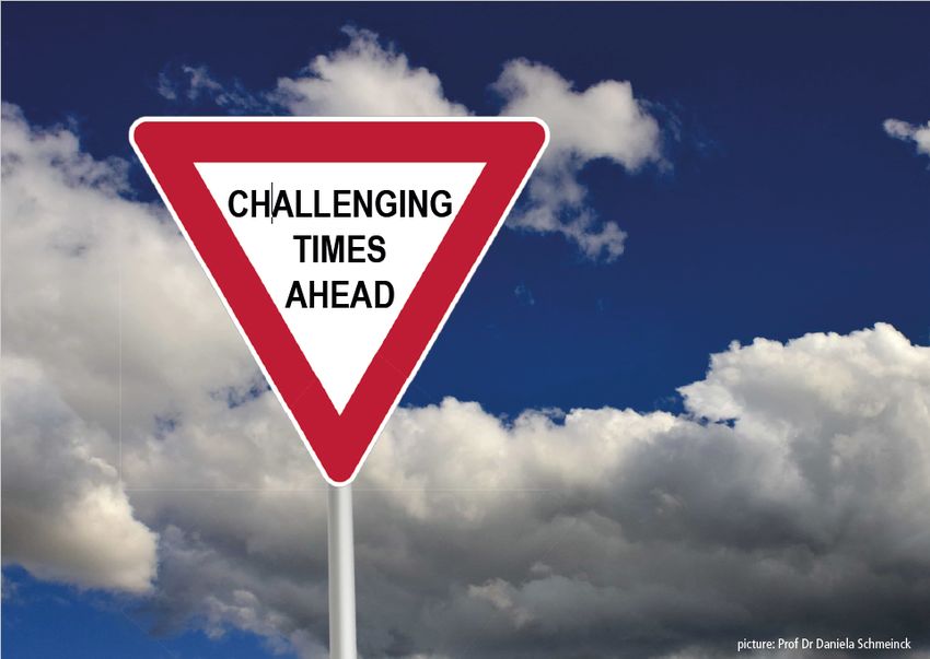
EUROGEO conference 2019, Paris
Teaching Geography in challenging times
←
→
Page content transcription
If your browser does not render page correctly, please read the page content below
EUROGEO conference 2019, Paris Teaching Geography in challenging times
2 – EUROGEO 2019 conference, Paris

CONTENT

1       CONFERENCE PROGRAM OVERVIEW ....................................................................................... 3
2       KEYNOTES ............................................................................................................................... 4
    2.1     RESEARCH IN GEOGRAPHY EDUCATION: SETTING NEW PRIORITIES TO ADDRESS GLOBAL CHALLENGES ........ 4
    2.2     LEARNING GEOGRAPHY IN CHALLENGING TIMES – LEARNING TO KNOW, LEARNING TO DO, LEARNING TO LIVE
    TOGETHER AND LEARNING TO BE. ................................................................................................................. 5

3       SESSIONS BY AUTHOR ............................................................................................................. 6
4       SESSIONS ................................................................................................................................ 8
5       PAPER ABSTRACTS ................................................................................................................ 11
6       WORKSHOPS ......................................................................................................................... 38
7       POSTERS ............................................................................................................................... 39
8       NEXT CONFERENCES .............................................................................................................. 43
    8.1         EUROGEO 2019 SLOVENIA HIDDEN GEOGRAPHIES ...................................................................... 43
    8.2         EUROGEO 2020 CONFERENCE MADRID ..................................................................................... 44
3 – EUROGEO 2019 conference, Paris

1 Conference Program overview
  14 March     session                room 1                    room 2                       room 3                    room 4
 14.00        Welcome        keynote 1: Sarah and Bob Bednarz
                             Setting New Priorities to Address Global Challenges
 15.15        session 1      Trends in Geography        Human Geography          Politics, identity,        Teaching and learning 1
                             Assessment                                          democracy 1
 16.30        coffee
 17.00        session 2      Rural Geography            Powerful Geography        Politics, identity,       Practical Geography /
                                                                                  democracy 2               Sustainable Development
 19.00        AGM            Annual meeting,
                             elections
 20.30        dinner

  15 March      session               room 1                    room 2                      room 3                    room 4
 08.30        session 3      Physical Geography,        GIS, remote sensing       Position of Geography     Workshop: Trends in
                             climate                                                                        Geography Assessment
 10.00        coffee
 10.30        Plenary        keynote 2: Chew Hung Chang
                             Learning in Challenging Times
 11.30        session 4      Higher education           Digital Geography         Teaching and learning 2   Workshop: Critical heritage
                                                                                                            using serious game-based
                                                                                                            learning
4 – EUROGEO 2019 conference, Paris

2 KEYNOTES

2.1 Research in Geography Education: Setting New Priorities to Address
    Global Challenges
Sarah Witham Bednarz and Robert S. Bednarz, Professors Emeritus, Texas A&M
University, College
Station, Texas; s-bednarz@tamu.edu; r-bednarz@tamu.edu

Abstract:
The recent publication Geography education for global understanding (Demirici, de Miguel,
and Bednarz 2018) highlighted many of the complex, grand challenges facing our planet and
provided cogent arguments for the role of geography education in addressing these issues.
However, only sparse and fragmented research exists concerning how education generally,
and global-understanding education specifically, can prepare individuals for a complex and
difficult future. Although educators agree on the role geography should play in this
important endeavor, little empirical evidence of how to accomplish this cognitively, socially,
or emotionally exists.

Two publications focused on geography education research, the International Declaration on
Research in Geography Education (2015) and the United States-focused Road Map for Large-
Scale          Improvement            of         K-12            Geography           Education
(https://www.nationalgeographic.org/education/programs/road-map-project/) concur that
geography education research is limited by scarce resources, by small numbers of
researchers, and by a lack of “substantive foci,” that is, a clear, prioritized agenda to guide
investigations. Each document provided suggestions about how to move forward. This paper
will review these recommendations in light of new understandings of how learning happens,
as captured in the view of the United States National Commission on Social, Emotional, and
Academic Development (2019), which argues that to be effective, education must consider
three distinct but related needs: social, emotional, and academic needs. The goal for
geography education researchers must be to attend to the myriad requirements of learners
to enable them to gain the significant knowledge, skills, and practices that will prepare them
to be resilient and function successfully in challenging times. What research is needed?
Where should we focus our limited resources? What needs immediate attention and what
might we strategically postpone? Is this a critical turning point or simply a continuation of
age-old structural issues?
5 – EUROGEO 2019 conference, Paris

2.2 Learning Geography in Challenging Times – learning to know, learning to
    do, learning to live together and learning to be.
Chew-Hung Chang, National Institute of Education, Nanyang Technological
University, Singapore. chewhung.chang@nie.edu.sg
Abstract
Teaching geography has never been more challenging. The United Nations Educational,
Scientific and Cultural Organization (UNESCO) seventeen Sustainable Development Goals
(SDG) for 2030, outline the aspirations of a better world “of the people, by the people and
for the people” (UNESCO, 2015). Unfortunately the aspiration for these 17 goals also
describe some of the key challenges to humanity today. Set against rapidly evolving and
uncertain issues in environment, economy and society, geography educators have to
understand the needs of our learners in order to teach them well. Geography is concerned
with asking questions of “Where is it?”, “What is it like?”, “Why is it there?”, “How did it
happen?”, “What impact does it have?” and “How should it be managed for the mutual
benefit of humanity and the natural environment?” (Commission on Geographical
Education, 1992 p. 5). Indeed, school geography curricula have been keeping abreast with
these fastchanging issues that affect humankind. These include increased focus on topics
such as environmental change and globalisation. But education is not just about teaching
knowledge.
The 'Delors Report' of 1996 to UNESCO of the International Commission on Education for
the 21st century was premised on a holistic and integrated vision of education based on the
four pillars of learning to know, learning to do, learning to be and learning to live together.
This vision resonates with the aspirations of geographical education for the 21st century as
outlined in the 2016 International Charter on Geographical Education. Good teaching and
learning of Geography should consider the dimensions of curriculum design, instructional
design and resource provision, as well as assessment for such learning activities. The speaker
will use various examples from his encounters as a teacher in the classroom, geography
education researcher, editor of a geographical education journal and a leader in a
geographical association to illustrate how geographical education should and can prepare
children in learning to know, learning to do, learning to be and learning to live together for
challenging times ahead.

References
Commission on Geographical Education (1992). International charter on            geographical
education. International     Geographical Union, Commission on                   Geographical
Education.

UNESCO. (2015). UNESCO and Sustainable Development               Goals. Retrieved from
UNESCO: https://en.unesco.org/sdgs
6 – EUROGEO 2019 conference, Paris
3 Sessions by author
First name(s) Family name session Room Topic
Leda Almeida session 3 2 GIS/remote sensing
Yilmaz Ari session 1 3 Politics, identity and democracy
Yilmaz Ari session 2 3 Politics, identity and democracy
Georgi Bardarov session 3 2 GIS/remote sensing
Erik Bijsterbosch session 1 1 TIGAS
Glorianne Borg Axisa session 3 3 Position of Geography
Terri Bourke session 1 1 TIGAS
Practical Geography / Sustainable
Tereza Češková session 2 4 Development
Physical Geography / climate
Massimo De Marchi session 3 1 change
Stelian Dimitrov session 3 2 GIS/remote sensing
Karl Donert session 2 2 Powerful Geography
Karl Donert session 1 4 Teaching and learning 1
Maria Helena Esteves session 3 3 Position of Geography
Practical Geography / Sustainable
Gregor Constans Falk session 2 4 Development
Emanuela Gamberoni session 3 3 Position of Geography
Physical Geography / climate
Sumita Gayen session 3 1 change
Jesus Granados Sanchez session 4 1 Higher education
Sayed Rafee Hashemi session 1 3 Politics, identity and democracy
Lenka Havelková session 3 2 GIS/remote sensing
Ryo Iizuka session 1 2 Human Geography
Johann Nikolaus Janssen session 2 1 Rural Geography
Johann Nikolaus Janssen session 4 3 Teaching and learning 2
Thomas Jekel session 4 2 Digital Geography
Injeong Jo session 1 1 TIGAS
Injeong Jo session 4 3 Teaching and learning 2
Viola Karsai session 1 2 Human Geography
Toshio Kikuchi session 2 1 Rural Geography
Kostis Koutsopoulos session 2 3 Politics, identity and democracy
Practical Geography / Sustainable
Nati Kranot session 2 4 Development
Rod Lane session 1 1 TIGAS
Practical Geography / Sustainable
María Luisa de Lázaro y Torres session 2 4 Development
María Luisa de Lázaro y Torres session 3 2 GIS/remote sensing
Physical Geography / climate
Michael Leuchner session 3 1 change
Physical Geography / climate
Claudia Lindner session 3 1 change
Michaela Lindner-Fally session 2 2 Powerful Geography
Veit Maier session 2 3 Politics, identity and democracy
Practical Geography / Sustainable
Ramón Martínez-Medina session 2 4 Development7 – EUROGEO 2019 conference, Paris
Kitti Masinka session 2 1 Rural Geography
Rafael Miguel Gonzalez session 1 4 Teaching and learning 1
Rafael Miguel Gonzalez session 2 2 Powerful Geography
Practical Geography / Sustainable
Darina Mísařová session 2 4 Development
Brice Mora session 3 2 GIS/remote sensing
Kliment Naydenov session 3 2 GIS/remote sensing
Rahman Nurković session 3 3 Position of Geography
Gerry O'Reilly session 1 3 Politics, identity and democracy
Gerry O'Reilly session 2 3 Politics, identity and democracy
Judit Péterfi session 1 2 Human Geography
Guy Martin Robinson session 4 2 Digital Geography
Julius Mitkevich-Dalechis session 4 1 Higher education
Julius Mitkevich-Dalechis session 4 1 Higher education
Teresa Sadoń-Osowiecka session 1 4 Teaching and learning 1
Physical Geography / climate
Mareike Schauss session 3 1 change
Nina Scholten session 1 4 Teaching and learning 1
Sebastian Seidel session 4 2 Digital Geography
Dmitrii Sidorov session 4 2 Digital Geography
Michael Solem session 1 1 TIGAS
Michael Solem session 2 2 Powerful Geography
Dubravka Spevec session 3 3 Position of Geography
An Steegen session 1 4 Teaching and learning 1
Joseph Stoltman session 1 1 TIGAS
Dávid Sümeghy session 1 3 Politics, identity and democracy
Bruce Tamagno session 2 2 Powerful Geography
Jaroslav Vávra session 4 3 Teaching and learning 2
Ruzica Vuk session 3 3 Position of Geography
Ivana Vyslúžilová session 1 2 Human Geography
Tal Yaar session 1 4 Teaching and learning 1
Taiyo Yagasaki session 2 2 Powerful Geography
Okkyong Yoon session 1 1 TIGAS
Okkyong Yoon session 4 3 Teaching and learning 2
Dimitar Zhelev session 3 2 GIS/remote sensing
Luc Zwartjes session 2 1 Rural Geography
Luc Zwartjes session 4 1 Higher education8 – EUROGEO 2019 conference, Paris
4 Sessions
session Room Name Paper title
session 1 1 Michael Solem Trends in International Geography Assessment Study:
Methodology
session 1 1 Rod Lane, Terri Trends in International Geography Assessment Study:
Bourke Assessment Framework
session 1 1 Okkyong Yoon, National Assessment of Educational Achievement
Injeong Jo (NAEA) of South Korea (Okkyong Yoon, Injeong Jo - co
presentation)
session 1 1 Joseph Stoltman Trends in International Geography Assessment Study
(TIGAS): Building a Consensus
session 1 1 Erik Bijsterbosch Trends in International Geography Assessment Study:
Methodology
session 1 2 Judit Péterfi Castle Utilization in tourism and settlement
development – primary impact assessment of Somogy
County's castle hotels
session 1 2 Viola Karsai Dual interpretation of urbanization in Hungary and in
East Central Europe
session 1 2 Ivana Vyslúžilová New Paradigm of the European Urban Area due to
Economic Globalization and Technological Revolution
session 1 2 Ryo Iizuka The potential of education in tourism geography: A
case study of the development and preservation of
rurality in food tourism in the Westhoek region,
Belgium
session 1 3 Dávid Sümeghy Social cohesion and the radical right in Skåne
session 1 3 Sayed Rafee Hashemi The migration of Afghans in the last decade and its
challenges
session 1 3 Gerry O'Reilly Facing Challenges: Aligning Geography, Geopolitics
and Humanitarian Action
session 1 3 Yilmaz Ari Commemorations and Identity: Cultural Geographies
of Gallipoli Commemorations
session 1 4 Tal Yaar Bordering on the impossible: Teaching (geographical)
boundaries in the Israeli education system
session 1 4 Nina Scholten Geography Teacher Noticing During Instruction:
differences between novices and expert teachers
session 1 4 An Steegen Fostering students geographic systems thinking by
enriching causal diagrams with scale
session 1 4 Teresa Sadoń- To better understanding the world - a value
Osowiecka humanistic approach to school geography
session 1 4 Rafael de Miguel Key challenges in Geography. EUROGEO Book Series at
Gonzalez Springer
session 1 4 Karl Donert Story Mapping: practical geography to reduce early
school leaving
session 2 1 Kitti Masinka Segregation and rural slums in Hungary - opportunities
to reduce inequalities
session 2 1 Toshio Kikuchi Commodification of Rural Spaces with the
Development of Urban Farming in the Vancouver
Metropolitan Area, British Colombia, CANADA
session 2 1 Luc Zwartjes SEED: Smart Entrepreneurial Education and training in
Digital farming
session 2 1 Johann Nikolaus Investigations of the Development and Importance of
Janssen the Marine Salt Production in Sicily
session 2 2 Michaela Lindner- GI-Learner: Creating a learning line on spatial thinking9 – EUROGEO 2019 conference, Paris
Fally
session Room Name Paper title
session 2 2 Rafael Miguel Gonzalez Geography education and competences-based
curriculum
session 2 2 Michael Solem Powerful Geography
session 2 2 Taiyo Yagasaki The Role of School District in the Reconstruction
Process of Coastal Communities after the Great
East Japan Earthquake: A Case Study of Urashima
of Kesennuma City, Miyagi Prefecture, Japan
session 2 2 Bruce Tamagno Geography Teachers and Gaia:
Shock troops of conservation or harbingers of
gloom?
session 2 2 Karl Donert GeoCapabilities 3: a project developing capabilities
for social justice in the Geography classroom
session 2 3 Gerry O'Reilly Geographical Perspectives: Spaces of Memory -
Memorialization and Democratization
session 2 3 Yilmaz Ari Using Gallipoli Commemorations in
(re)constructing collective identity in schools: The
case of Balıkesir High School
session 2 3 Veit Maier Vive le débat – spatial planning in geography
lessons and its contribution to democracy
session 2 3 Kostis Koutsopoulos FOSTER: Foster, Multiply and Connect Adult
Education Project
session 2 4 Gregor Constans Falk Working with the Geowindow - A critical reflection
session 2 4 Nati Kranot the Annual Field Trip in Israel- The Role and Place
of Geography Teachers and Geographical
Education in the 21st Century
session 2 4 Tereza Češková, Darina The conceptions of the geographical fieldwork at
Mísařová primary and lower secondary school
session 2 4 María Luisa de Lázaro y Geographical Education and Sustainable
Torres Development Goals
session 2 4 Ramón Martínez- Sustainability in Spanish school geography: an
Medina analysis of primary education textbooks
session 3 1 Mareike Schauss Epistemological beliefs in climate change
education – initial evaluation of a school project
session 3 1 Claudia Lindner Geography is STEM! Augmenting Reality to Convey
Physical Geography and Remote Sensing in Class
session 3 1 Massimo De Marchi Geovisualization of the energy transition: climate
change, unburnable fossil fuels and geographical
challenges
session 3 1 Michael Leuchner An 'in-depth' analysis of drop size distribution in
forest canopies
session 3 1 Sumita Gayen Seismic Hazard Scenario of Malaga Province, Spain
session 3 2 María Luisa de Lázaro y The TPACK model enhances GIS as a transversal
Torres subject in teaching Geography (MYGEO project)
session 3 2 Lenka Havelková Eye-tracking in geography education research: a
case study of students’ strategies during an
analysis of thematic maps
session 3 2 Brice Mora The RUS Service: supporting Sentinel users with
free resources.
session 3 2 Stelian Dimitrov, Kliment New geospatial technologies require new skills and
Naydenov, Dimitar knowledge: the need of upgrade of geography10 – EUROGEO 2019 conference, Paris
Zhelev, Georgi Bardarov curricula
session Room Name Paper title
session 3 2 Leda Almeida Use of geotechnologies and territorial
representation by the pedagogical residence in
basic education.
session 3 3 Rahman Nurković STEM Education in teaching Geography in Bosnia
and Herzegovina
session 3 3 Maria Helena Esteves What about Geography textbooks? Portuguese
teachers's views and actions
session 3 3 Glorianne Borg Axisa The State of School Geography in Malta:
Challenges and Prospects
session 3 3 Dubravka Spevec, Ruzica Does geography education in Croatia responds to
Vuk needs of contemporary society?
session 3 3 Emanuela Gamberoni Primary school and Citizenship education in Italy
session 4 1 Jesus Granados Sanchez Scales of commitment: academics and their
contributions to the SDGs
session 4 1 Julius Mitkevich-Dalechis Aspects of Cartographic Materials Use in Teaching
World Industry Development Trends at Universities
session 4 1 Julius Mitkevich-Dalechis Methods of collecting and analyzing statistics on
cross-country energy export and import
session 4 1 Luc Zwartjes MyGeo: fostering the employability of students in
higher education through promoting the
acquisition of key skills related to the use GIS-tools
session 4 2 Sebastian Seidel Experiencing political-geographical concepts in
everyday life: pupils and their border experiences
and concepts while playing video games
session 4 2 Dmitrii Sidorov Online geography courses: learning the students
session 4 2 Thomas Jekel Geomedia Contributions to Holocaust Education: a
preliminary evaluation
session 4 2 Guy Martin Robinson Using games in geographical teaching: Computers,
boards and role-play
session 4 3 Okkyong Yoon Teaching methodologies for a population unit in US
APHG class
session 4 3 Injeong Jo The Knowledge Base for Geography Teaching
(GeoKBT): A Preliminary Model
session 4 3 Johann Nikolaus Janssen Teaching Geography in challenging times from
students perspectives
session 4 3 Jaroslav Vávra Teaching and learning geography through the
concept of place, Liberec approach, Czechia11 – EUROGEO 2019 conference, Paris
5 Paper Abstracts
Family Institution Paper title Paper abstract
name
Almeida Sao Paulo Use of Presenting less and less investment both in school structures and in teacher training, the pedagogical residency
State geotechnologies and program was launched. The objective of this program is to improve the training of undergraduate students of
University - territorial teaching courses, developing a relationship between the theory seen in the university and the professional
UNESP representation by practice, directly in the school environment. Recognizing the deficiencies and qualities of the school, it can be
the pedagogical verified a need for elucidation of regional aspects and close to the reality of the student that aim to assist in
residence in basic understanding the space as a whole. The objective is to use the model as an aid in the teaching of Geography,
education. aiming to bring the reality of the student to the classroom using practical examples and close to the reality of
each one on the river of the lived region.
Ari Bandirma Using Gallipoli The Gallipoli War has been instrumental in constructing identities in several countries. Multiple nations have held
Onyedi Eylül Commemorations in commemorative activities in different continents. Each of the countries has used the historical event for various
University (re)constructing purposes in different countries in different times. Commemorating the Gallipoli War in Turkey has served for
collective identity in different purposes over time, reflecting various ideologies and agendas of the commemorators. The
schools: The case of remembrance activities in Turkey started in 1916 just after a year of the War in the Gallipoli Peninsula. However,
Balıkesir High School commemorations have not confined to the peninsula only, spreading out starting from 1916. This research deals
with the reflection and use of the commemorations in schools and school textbooks. The case of Balıkesir High
School was used to investigate the effects of commemorations in building collective identity. Balıkesir High School
had no graduates in records in 1915 because all the final year students went to Gallipoli and never returned. This
is one of the most significant events in the 135 years history of the school. How and to what purpose the
particular linkage with the Gallipoli War has been used to (re)construct identity over the years in school. It is
important to understand how this event is used to create an ideology and to inherit by the new generation of
students in those schools and in the communities at large.
ARI Bandirma Commemorations Places of commemorations are important in terms of social, political and cultural values and realities. Studying
Onyedi Eylül and Identity: Cultural the commemoration practices is a multidisciplinary endeavour and geographers are interested in the locational,
University Geographies of spatial and material aspect of commemorations. This research deals with how the discourses of the past are
Gallipoli constructed socially and expressed materially in Gallipoli commemorations with a cultural geographic perspective.
Commemorations Gallipoli is a place where multiple nations have commemorated antagonistic histories in the same place for many
years. The sanctity of several sites has been reinforced over the years by the construction of additional
monuments and memorials at the peninsula. However, commemorations have not confined to the peninsula
only, spreading out starting from 1916. Multiple nations have held commemorative activities in different12 – EUROGEO 2019 conference, Paris
continents. This research deals with the spatial aspect of the commemorations throughout Turkey historically to
understand the purposes the commemorations have served through the time by looking at the intensity of
commemorations in different places and times. This requires an understanding of the origins of and processes
through which the commemoration activities have diffused in the country. The published research, memorials,
and archival materials were examined to determine the spatial dimension of the commemorations. The
commemorative activities in different cities and times were examined to determine the significance of the events
for the local communities and beyond. Particular emphasis was given to the schools that have no graduates in
records in 1915 because all the final year students went to Gallipoli and never returned. It is important to
understand how this event is used to create an ideology and to inherit by the new generation of students in those
schools and in the communities at large.
Keywords: Gallipoli, Commemorations, place and identity, cultural geography, WWI
Bijsterbos Windesheim TIGAS framework For the past two years, a framework for an international geography assessment in lower secondary education has
ch University of and feasibility of test been designed (the TIGAS-framework). As part of the validation process of this assessment framework, prototype
Applied items test items from several national and provincial assessments were selected. These prototype test items are
Sciences supposed to be in line with the content domains and distinct cognitive levels of the assessment framework. In
this workshop some of the selected examples of test items will be presented. Practitioners will be asked to give
their opinion on these test items; e.g. if these examples are in line with the framework and if these items match
with the expected difficulty for the target group. Another issue that will be adressed in this workshop is how
these items could be judged and scored. What is the expected level of performance? How practical and feasible is
a model to judge and score these items?
Borg Axisa University of The State of School Geography is a core entitlement to students throughout compulsory schooling (MEDE 2012) in Malta. However,
Malta Geography in Malta: as in many European countries the presence of Geography in schools is threatened (Donert, 2007, Uhlenwinkel et
Challenges and al, 2017) considering also that in several instances, locally the relevance of a subject in school is often equated to
Prospects employability opportunities rather than to its broader educational value. Several reforms within the education
system over the past decade have affected directly school Geography including the reduction in the number of
lessons per week and the change in policy regarding the language of instruction. This reflects that policy-makers
may have a traditional view of Geography and do not see its potential.
The evaluation of the state of school geography within the Maltese context is not considered only in terms of the
numerous barriers identified by teachers of geography due to the imposing structured system they have to
operate in, but also in terms of the teachers’ understanding of Geography education. This underpins the teachers’
role as ‘curriculum makers’ as s/he decides where to take the learners. The students’ engagement with
geographical knowledge depends on the teachers’ pedagogic choices and approach, whether it will reinforce the
traditional perception towards the subject as infallible knowledge based on recall or whether to involve the
students in the teaching-learning process through ‘geographical thinking’.
The challenges and affordances for Geography within the school context in Malta were researched through a13 – EUROGEO 2019 conference, Paris
multi-method approach among teachers of geography in State Schools namely; surveys, interviews and focus
group discussions. Overall, teachers feel helpless at the challenges raised by the system itself. However when it
comes to the teaching-strategies to adopt in class, their positions vary.
References:
Donert, K., 2007. Aspects of the state of Geography in European higher Education. Liverpool, HERODOT Network
for geography in higher education.
Ministry For Education and Employment, 2012. A National Curriculum Framework for All 2012, Malta: MEDE.
Jackson, P., 2006. Thinking Geographically. Geography, 91(3), pp. 199-204.
Lambert, D. and Morgan, J., 2010. Teaching Geography 11-18, A Conceptual Approach. s.l.:Open University Press.
Uhlenwinkel,A., Béneker, T., Bladh,G., Tani, S & Lambert, D. (2017) GeoCapabilities and curriculum leadership:
balancing the priorities of aim-based and knowledge-led curriculum thinking in schools, International Research in
Geographical and Environmental Education, 26 (4), pp 327-341.
Češková, Masaryk The conceptions of During the past 50 years, the forms of fieldwork have developed from conventional field excursions through field
Mísařová University, the geographical research based on hypotheses testing to inquiry-based education. Fieldwork contributes to the development of all
Faculty of fieldwork at primary pupils’ key competences, to linking theoretical knowledge and practice as well as to the development of natural
Education, and lower secondary physical activity and healthy lifestyle.
Dep. of school If the fieldwork should work, it is necessary for a school to have a coherent system – a conception which would
Geography take into account the specifics of the school surroundings, its specialization and type. The conception should also
allow for the continuity with regards to the curriculum and its progression, for the interconnection of the indoor
and school instruction, and for linking of current topics with fieldwork in the actual surroundings.
The aim of the paper is to present the optimal (i.e. comprehensive and coherent) conception of fieldwork in
geographical curriculum for primary and lower secondary school. The procedure of designing the conception of
fieldwork as well as concrete examples of arranging the fieldwork into geographical curriculum at primary and
lower secondary school will be presented. This paper introduces partial results of applied research project
supported by TACR.
Chang Nanyang Keynote: Learning Teaching geography has never been more challenging. The United Nations Educational, Scientific and Cultural
Technological Geography in Organization (UNESCO) seventeen Sustainable Development Goals (SDG) for 2030, outline the aspirations of a
University, Challenging Times – better world “of the people, by the people and for the people” (UNESCO, 2015). Unfortunately the aspiration for
National learning to know, these 17 goals also describe some of the key challenges to humanity today. Set against rapidly evolving and
Institute of learning to do, uncertain issues in environment, economy and society, geography educators have to understand the needs of our
Education, learning to live learners in order to teach them well. Geography is concerned with asking questions of “Where is it?”, “What is it
Singapore together and learning like?”, “Why is it there?”, “How did it happen?”, “What impact does it have?” and “How should it be managed for
to be. the mutual benefit of humanity and the natural environment?” (Commission on Geographical Education, 1992 p.
5). Indeed, school geography curricula have been keeping abreast with these fast-changing issues that affect
humankind. These include increased focus on topics such as environmental change and globalisation. But14 – EUROGEO 2019 conference, Paris
education is not just about teaching knowledge. The 'Delors Report' of 1996 to UNESCO of the International
Commission on Education for the 21st century was premised on a holistic and integrated vision of education
based on the four pillars of learning to know, learning to do, learning to be and learning to live together. This
vision resonates with the aspirations of geographical education for the 21st century as outlined in the 2016
International Charter on Geographical Education. Good teaching and learning of Geography should consider the
dimensions of curriculum design, instructional design and resource provision, as well as assessment for such
learning activities. The speaker will use various examples from his encounters as a teacher in the classroom,
geography education researcher, editor of a geographical education journal and a leader in a geographical
association to illustrate how geographical education should and can prepare children in learning to know, learning
to do, learning to be and learning to live together for challenging times ahead.
De Marchi University of Geovisualization of Climate change is the biggest challenge for current and future generations in the area of sustainability, as
Padova - the energy transition: reaffirmed in the 13th objective of the Sustainable Development Agenda 2030.
Master climate change, Ensuring access to affordable, reliable, sustainable and modern energy for all (objective 7 of the 2030 Agenda)
GIScience unburnable fossil means overcoming the current energy system that contributes 60% of total greenhouse gas emissions (UN, 2017).
fuels and McGlade and Ekins (2015), in an article in Nature in 2015, estimate that, to limit the temperature increase to 2 ° C,
geographical over 80% of coal, 50% of gas and 30% of reserves of oil should remain stored in the subsoil; they also show how
challenges the use of all available hydrocarbon reserves would produce emissions of 11,000 Gt, well above the estimated
range of 870-1,240 Gt for the period 2011-2050.
Globally, only one political experiment was carried out, between 2007 and 2013, in the Yasuní National Park
(Ecuador), to leave the hydrocarbons underground, with the simultaneous creation of an international
compensation fund. Although the initiative, called Yasuní-ITT, was then abandoned, the idea is still the subject of
reflection by the scientific community and civil society who created the neologism Yasunisación.
Leaving fossil fuel underground by combining different points of view: from a geographical perspective in defining
criteria to choose "where" to leave fossil fuels underground; to policies and initiatives aimed at reducing the
production of fossil fuels; to the economic dimension capable of highlighting the total costs of hydrocarbon
production and the costs necessary for the energy transition.
Dimitrov, Sofia New geospatial The development of geospatial technologies has always been one of the main drivers of the development and
Naydenov, University "St. technologies require diversification of geographic knowledge. However, during the last 10 years, this has become particularly intense,
Zhelev, Kliment new skills and with the introduction of technologies such as online GIS, unmanned aerial systems and mobile GIS applications,
Bardarov Ohridski" knowledge: the need requiring more and more expansion of technical and technological skills of professional geographers. On the other
of upgrade of hand, the development of these technologies ensures like never before access to adequate data and information
geography curricula resources, while allowing research to focus on micro-spatial levels, which in turn leads to the enhancement of the
practical aspects of geographic science.
This article aims to present and open discussion about the necessary changes in geographic university education
in view of the rapid and accelerated development of geo-spatial technologies. The opportunities for professional15 – EUROGEO 2019 conference, Paris
realization of the graduates of geographic programs are related not only to the development of geospatial
technologies but also to the needs of solving the everyday societal problems, requiring the "delivery" of
geographic knowledge and information in a certain volume and quality.
Donert EUROGEO GeoCapabilities 3: a A capabilities approach repositions the contribution of the discipline (geography) to the education of young
project developing people within a capabilities framework. It derives from the original work of Amatya Sen and Martha Nussbaum on
capabilities for social welfare economics and is an attempt to take capability principles and locate them within a geography education
justice in the context.
Geography classroom Powerful disciplinary knowledge (PDK) is fundamental to the GeoCapabilities approach, yet teachers in more
challenging schools have been found to be constrained in their ability to enact a ‘powerful’ curriculum which may
transform young people’s lives (see Mitchell, 2015).
This presentation will look at the intention of GeoCapabilities 3, which is to support teachers in developing their
curriculum making capacity and in so doing enable them to engage with important curriculum questions such as
what kinds of geographical knowledge are taught in schools, who decides and why, and what kinds of pedagogies
are needed to teach powerful disciplinary knowledge (PDK) to students.
Subject leadership is a key principle of GeoCapabilities and the project aims to develop the associate teachers as
curriculum leaders who will support other geography teachers in similar contexts in their countries to use
GeoCapabilities to enhance their geography teaching. Through developing curriculum leadership the project will
generate a sustainable momentum, which will carry forward as the associate teachers work with other teachers in
future, disseminating the GeoCapabilities approach.
Donert EUROGEO Story Mapping: This paper describes the role of Storytelling with Maps in supporting young people who are at risk of leaving
practical geography school early. It discusses the Tell Your Story and My Storymap Projects and the impact of encouraging storytelling
to reduce early of secondary students
school leaving
Esteves Universidade What about This research aims at understanding how Portuguese Geography teachers use textbooks in the classroom and
de Lisboa, Geography how they perceive their importance for students. It was also important to research how textbooks should adapt
Instituto de textbooks? to new challenges related to School Geography in Portugal.
Geografia e Portuguese
Ordenamento teachers's views and
do Território actions
Falk University of Working with the The aim of the GeoWindow project was to develop such a device for teaching “applied” Geography. It
Education Geowindow - A offers a general infrastructure to create models in geographic contexts come to life easily and quickly. It is a “test
Freiburg critical reflection tube” for visualization, not only of static images but also to display processes in the Earth system. The paper will
analyse didactical pros and cons of the practical implementation of the Geowindow. Eventually, we will provide a
short demonstration of how to use the device. Gregor C. Falk and Mathias Faller
Gamberoni University of Primary school and This paper discusses the relationship between geography education and citizenship education in Italian primary16 – EUROGEO 2019 conference, Paris
Verona Citizenship education school. In particular, an analysis of the meaning of the concept of citizenship will be carried out considering both
in Italy the Italian national guidelines and the new emerging sceneries in order to understand the implications of the
education to the global citizenship. This will be pursued by analyzing how geographical education could be a
useful tool to face this topic. Some examples will be provided.
Gayen Universidad Seismic Hazard Earthquakes are generally concentrated in the edge regions of plate of the whole world. Spain is considered as a
de Sevilla Scenario of Malaga country of moderate seismic activity compared to other Mediterranean countries. The seismic activity is more
Province, Spain intense in the south-east part of Spain. Malaga province is situated in the south-east part of Spain and near the
boundary between the African and Eurasian plates. Malaga has experienced many earthquakes in the past and
suffered severe damage by strong earthquakes. To measure the effect of an earthquake on the ground ´´peak
ground acceleration (PGA)´´ is commonly used. The PGA is the largest increase in velocity recorded by a particular
station during an earthquake. The purpose of this work is to create seismic zone map of Malaga province
depending on PGA (return period of 475 years), which is important for assessing the hazard and urban regional
planning in earthquake areas. The result shows that vulnerability of earthquake in the province increases from
west to east.
Key words: Earthquake, peak ground acceleration, seismic zone
Sumita Gayen(1), Dr. Ismael Vallejo Villalta (1), Dr. Sk. Mafizul Haque (2)
(1) Departamento de Geografía Física y Análisis Geográfico Regional, Universidad de Sevilla, Spain
(2) Department of Geography, University of Calcutta, India
Granados University of Scales of The aim of the paper is to present the results of a research study about the contribution of a group of university
Sanchez Girona commitment: teachers and professors to the sustainable development goals (SDGs). The research asked the participants to
academics and their identify their contribution to the SDGs in six different scales: personal actions in the ordinary life; professional
contributions to the actions at classroom level (curriculum and pedagogy); professional actions as a member of the Faculty and the
SDGs University (how do you contribute to the SDGs in you institution, as part of the staff?); the personal commitment
with the community; the role of the univesity, as institution, to bring the SDGs into the university life (for
students, staff and others, on campus); the university engagement with its community (how the university as
institution is contributing to the SDGs in its community).
Hashemi Marmara The migration of Geopolitical factors are the migration of Afghans, one of the public issues in the world. And now, the
University Afghans in the last phenomenon of migration has become one of the problems in the world. It forces the boundaries of nations. And
decade and its under what conditions are the countries considered to be intentional or unintentional at the high level of
challenges immigration. Is this migration a tight link to the issues of ethnic texture at national level? Why relatives
Why do Afghan tribes migrate to ethnic, neighboring, regional and regional regions? On this occasion, I wanted to
examine the migration in terms of geopolitical factors.
Havelková Centre for Eye-tracking in As a consequence of the wide availability of GISs and the large volume of data, there has been an increase in the
Geographical geography education use of maps, thematic maps in particular, for the depiction of spatial information. Even though significant
and research: a case progress has been made in research into map work over the last decades, there is still a need for an investigation17 – EUROGEO 2019 conference, Paris
Environmental study of students’ into the cognitive mechanisms which underlie map work, specifically the strategies used when working with
Education, strategies during an maps.
Faculty of analysis of thematic Therefore, the presented study has been focused on the strategies used during an analysis of four types of
Science, maps thematic maps on the basis of the use of eye-tracking technology. Even though there are various methodological
Charles approaches for investigating students’ strategies, it is the eye-tracking that is becoming more and more
University frequently used for identifying them.
The results of the experiment have helped to supplement and expand current understanding of students’ process
of solving tasks requiring the map analysis. It is apparent that the strategies selected when analysing maps are
highly individualised. Furthermore, they are distinguished by frequent flitting of the eyes between the individual
parts of the task. On the other hand, it is apparent from the results of the eye-tracking experiment that the
participants’ strategy efficiency increased during the testing. At the same time, the most frequently utilised
sequence was: task instruction → map → (scale/north arrow) → (legend) → possible answers.
Iizuka Shumei The potential of For the last several decades, tourist interests have diversified, and ruralities derived from traditional cultures and
University, education in tourism lifestyles are valued as tourism resources with authenticity. For food tourism depending on such rural resources,
Japan geography: A case how ruralities commodify directly affects the quality of tourism itself. Moreover, in the field of tourism geography
study of the education, practices of food tourism are seen as case studies for understanding local areas. Thus, this paper
development and explores the progress of the commodification of ruralities through the development of food tourism using
preservation of traditional culture and life in West-Flanders in the Westhoek region, a rural touristic area in Belgium. The
rurality in food application of the case study for education in tourism geography is subsequently discussed. Specifically, the
tourism in the development process of promotions and programmes for food tourism in the Westhoek region is outlined, and
Westhoek region, the expressions of the commodification of rurality in public materials, brochures and homepages are reviewed.
Belgium Further, the means of offering rurality as a commodity are captured from interviews with related actors.
Consequently, in the Westhoek region, the commodification of rurality at each stage of the food supply chain
from producer to food service industry is taken and consumed by tourists. That situation makes the region a
strong and sophisticated food-tourist area and is illustrative for tourism geography education.
Janssen EGEA - Investigations of the The production of sea salt from seawater is the oldest way of salt production in the world. It has been and is still
European Development and very common along the coasts of the Mediterranean Sea. The Phoenicians were the first to construct ponds for
Geography Importance of the the sea salt production at the western coast of Sicily, a few centuries before Christ. The production expanded
Association Marine Salt around the whole island of Sicily, but nowadays there are just a few salt works left, which still produce sea salt.
for Students Production in Sicily What happened to most of the salt works? How are the remaining salt works used? Which importance has the
and Young production of sea salt nowadays? What other ecosystem services do the salt works provide and how will they
Geographers develop in the future?
The research gives answers to those questions by concentrating on the development of the salt works of Trapani
and Marsala at the west coast of Sicily in the last thirty years and their importance for the region and the people
today.18 – EUROGEO 2019 conference, Paris
References:
JANSSEN, J. N. (2018): Untersuchungen zur Entwicklung und Bedeutung der Meersalzgewinnung auf Sizilien.
Hannover, S. 33
BERGIER J.-F. (1989): Die Geschichte vom Salz. Frankfurt/M., 255 S.
BUFALINO G. (1988): Saline di Sicilia. Palermo, 204 S.
D’ALÌ STAITI, G. (2015): La salicoltura e il suo paesaggio: una risorsa economica, naturalistica e un’opportunita per
un turismo sostenibile. In: ROTARY CLUB MARSALA LILIBEO - ISOLE EGADI (Hrsg.): Lo Stagnone di Marsala. Risorsa
Naturale e Paesaggistica per un’Economia Sostenibile. Marsala.
MANAGUERRA M. (2013): Saline e Salinai. Marsala, 135 S.
MANUGUERRA, G. B. (1996): Le saline di Paceco. Palermo, 127 S.
MONDINI, G. (1999): Le Saline della Provincia di Trapani. Trapani, 60 S.
Janssen EGEA - Teaching Geography As a student and member of EGEA - European Geography Association for Students and Young Geographers I
European in challenging times would also like to contribute to the main theme of the conference "Teaching Geography in challenging times".
Geography from students Being also chairman of GeoDACH - Vertretung Deutschsprachiger Geographiestudierender e.V. (official
Association perspectives representation of german speaking students in Germany, Austria and Switzerland) I am constantly dealing with
for Students questions about the future of Geography in general and especially at universities. As an association we recently
and Young published a policy paper on what Geography should do to improve its impact on society.
Geographers "Geographie has to...
...take responsibility
...be shaped actively
...work interdisciplinary
...work inclusive
...scrutinize critically
...emphasize environmental and climatic aspects
...underline its relevance as a school subject
...sharpen the awareness for man-environment relationships
...participate actively in public debates
...support open-minded and tolerant discourses"
Source: http://geodach.org/wp-content/uploads/2018/12/GeoDACH-Beschluss-Positionspapier-Kiel-ist-tot-Lang-
lebe-Kiel.pdf
In addition to this, EGEA enables me regular exchanges with students from all over Europe. Through those I get
insights on very different challenges, Geography and especially teaching Geography faces today. I would be more
than happy to participate and share my experiences as a student in panels, discussions or other sessions which
directly refer to "Teaching Geography in challenging times".
Jekel University of Thomas Jekel & A variety of geomedia-based platforms have recently been developed which make specific aspects of the19 – EUROGEO 2019 conference, Paris
Salzburg Katharina Wöhs, holocaust accessible on handheld devices. These include simple databases, as in the case of Memento Vienna
Geomedia (Schellenbacher 2017), that relay cartographic access to users, as well as pedagogically more elaborate concepts
Contributions to which include the re-writing the history of places (Wöhs et al. 2018; Gordon, Elwood & Mitchell 2016).
Holocaust Education: However, few of these learning environments include an evaluation of the student experience. This presentation
a preliminary encompasses two conceptions of geomedia-based holocaust education in the cities of Vienna and Salzburg, which
evaluation combine geo-databases with wikis. It reports an exploratory evaluation of these places of remembrance in a
practical application of a local field course and on qualitative interviews with secondary students.
Jo Texas State The Knowledge Base Funded by the National Center for Research in Geography Education, this study investigated the nature of the
University for Geography knowledge needed for geography teaching. Informed by existing research about science and mathematics
Teaching (GeoKBT): A teachers’ pedagogical content knowledge (PCK), the research group developed a conceptual model of the
Preliminary Model knowledge base for geography teaching, identifying its six key components. The conceptual model was refined
and revised according to the results of case studies of four expert geography teachers. The resulting preliminary
model (GeoKBT) is offered to the geography education community to inform both geography teacher education
and further research on geography-related pedagogical knowledge.
Karsai University of Dual interpretation Obviously, the whole world is urbanizing, having a different pace and character in both time and space. East-
Pécs of urbanization in Central Europe can also be characterised by a specific urbanisation due to its social, economic and historic
Hungary and in East background. Urbanisation took place in this region in a delayed and distorted form, and the centrally planned
Central Europe post-war period did not help to reduce the lag in that respect. Looking at the figures, Hungary is highly urbanised,
comparable to the west of the continent; however, the urban quality (e. g. built in environment or life quality) is
far from the desired developed countries’ attributes. Having a town or city rank is less and less important in the
west, while in the Eastern part of the continent we still experience a higher prestige of the rank, people think that
a town or city would offer better qualities. The fast-paced urbanization, which took place in this special situation
and its two interpretations give rise to tensions at many points: "urban" and "villager" living together in a
settlement which is still developing between the two extremes. The aim of the research is to present the
contradictions of two aspects of urbanization in Hungary, which are generated in part by the special associations
regarding the meaning of the term ”urban”.
Kikuchi Tokyo Commodification of This study aimed to clarify the commodification of rural spaces in relation to the development of urban farming,
Metropolitan Rural Spaces with the focusing on the concept of community gardens in the Vancouver metropolitan area in the district of British
University Development of Columbia in Canada. Urban agriculture in the Vancouver metropolitan area differed from suburban agriculture, as
Urban Farming in the the emphasis was placed on maintaining green spaces and leisure spaces as community gardens rather than as
Vancouver spaces to produce agricultural products for food supply. Consequently, the existence of community gardens has
Metropolitan Area, become a node that connects urbanity (urban likeness) and rurality (rural distinctiveness) in the suburbs of the
British Colombia, metropolitan area, particularly the community gardens of Richmond.
CANADA
Koutsopou EUROGEO FOSTER: Foster, EUROGEO is a partner in the FOSTER Project which aims to encourage democratic engagement of adults through20 – EUROGEO 2019 conference, Paris
los Multiply and Connect establishing a catalogue of best practices in digital education. This presentation introduces the project, its aims
Adult Education objectives and outcomes.
Project
Kranot University of The Annual Field Trip "Once a year, every class will take a long field trip, the goal of which is to know the land in an experiential way"
Haifa in Israel- The Role (The Israeli official curriculum in Geography, 1959).
and Place of The Annual Field Trip in Israel is a unique educational phenomenon, being an obligatory outdoor event in the
Geography Teachers public educational system from 1st to 12th grades. It was created and molded more than a century ago, by
and Geographical teachers who aspired to implement Natural Pedagogy, teach in the field and inculcate in their students a sense of
Education in the 21st personal attachment to the land.
Century After four decades during which field trips were initiated and executed by teachers, they became
institutionalized. Thus, The Annual Field Trip demonstrates an educational event that was born bottom-up, and
then became directed and supervised by the state. Over the years, there was a shift in the priorities of the stated
goals of the Annual Field Trip: In its beginning, the Field Trip served mainly pedagogical goals, using the landscape
as means to demonstrate Geographical Phenomena. Later on, since the 1940's, national education became the
dominant goal, thus making the landscape both the objective ("To know and to love the land") and the means to
reach it.
Today, more than a century later, it may be asked how does (and how should) Geography, as an educational
discipline, deal with this unique form of outdoor education in changing, challenging times? How effective are
field-trips as a means of education? What is the role and the place of teachers, who originally created the Annual
Field Trips, in this complex arena?
The presentation is based on my PhD research, on which I examine the gap between the goals of the Annual Field
Trip and their Fulfillment. The research, which is based on field observations and interviews, focuses on
Geography teachers, their role definition and role perception and their actions during Annual Field Trips.
I will present preliminary findings and compare them to the Annual Field Trip at its beginning in the early 20th
century, as described by the first teachers. This comparison emphasizes the importance of teachers in fulfilling
the goals of Geographical Education in the field, especially in a digital era of information flooding.
Lane, Macquarie Trends in This provides a progress report on the National Center for Research in Geography Education's research initiative
Bourke University, International to design and develop a Trends in
Queensland Geography International Geography Assessment Study (TIGAS). The session examines the development and validation of the
University of Assessment Study: framework for the assessment which is designed to provide educators and policymakers with international
Technology Assessment comparative data on geography education and advance knowledge of factors influencing the geographic literacy
Framework of students in lower secondary education. Feedback from a range of international stakeholders is discussed along
with the implications for further refinement of the framework.
Lázaro y Universidad Geographical Education in Sustainable Development Goals (SDGs) is an important task in training teachers. It is easy to relate
Torres Nacional de Education and geographic issues such as the natural environment, socioeconomic topics, and the population or cities which linkYou can also read