GARMIN HANDHELD GPS DEVICES - ENHANCE YOUR OUTDOOR ADVENTURES

Page created by Carrie Reyes
 
CONTINUE READING
GARMIN HANDHELD GPS DEVICES - ENHANCE YOUR OUTDOOR ADVENTURES
GARMIN HANDHELD GPS DEVICES
ENHANCE YOUR OUTDOOR ADVENTURES
GARMIN HANDHELD GPS DEVICES - ENHANCE YOUR OUTDOOR ADVENTURES
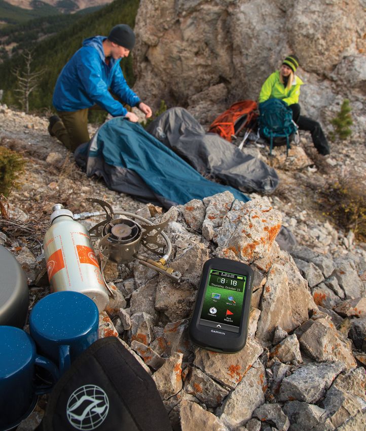
From pocket-sized units that let you mark points and
return to them later, to navigators with built-in maps
and high-sensitivity GPS/GLONASS receivers, Garmin
has a handheld GPS unit for you. With a Garmin GPS,
you always know where you are, where you’ve been
and where you’re going.
GARMIN HANDHELD GPS DEVICES - ENHANCE YOUR OUTDOOR ADVENTURES
Montana™ Series
Go anywhere and do anything with the Montana
series. Its touchscreen display and array of available
mounts make it our most versatile handheld yet. Put
it in your boat, car or ATV and easily access portrait
or landscape mode. Use BirdsEye™ Satellite Imagery
(1-year subscription included) for a lifelike depiction of
your surroundings, TOPO U.S. 24K maps for detail on
the trail, or BlueChart® g2 maps for navigation on the
water. Even get spoken turn-by-turn driving directions
with optional City Navigator® maps.

  MONTANA 610                  MONTANA 610t Camo                         MONTANA 680                                           MONTANA 680t
  4-inch dual-orientation,     Preloaded TOPO U.S.                       8MP autofocus camera;                                 Preloaded TOPO U.S.
  glove-friendly touchscreen   100K map                                  automatically geotags                                 100K map
  display                                                                photos
                               Tracks both GPS and                                                                             8MP autofocus camera;
  Tracks both GPS and          GLONASS satellites                        Tracks both GPS and                                   automatically geotags photos
  GLONASS satellites                                                     GLONASS
                                                             *Within Montana’s            satellites
                                                                               preloaded map areas. Additional maps available for purchase.
GARMIN HANDHELD GPS DEVICES - ENHANCE YOUR OUTDOOR ADVENTURES
Oregon™ 700 Series
Thanks to a redesigned antenna for better satellite
reception, the Oregon 700 series GPS/GLONASS
handhelds put even more of the great outdoors at
your fingertips. All models feature multilink wireless
connectivity (Wi-Fi, Bluetooth and ANT+), Active Weather
support with animated radar overlays, a 1-year BirdsEye™
Satellite Imagery subscription and a built-in 3-axis
compass with barometric altimeter.

 OREGON® 700                OREGON® 750                    OREGON® 750t
 3” sunlight-readable       8MP autofocus camera that      Preloaded U.S. TOPO 100K map
 touchscreen display        automatically geotags photos
 with dual orientation                                     8MP autofocus camera that
                            LiveTrack lets you share       automatically geotags photos
 Live geocaching with       your location data
 automatic updates
                                                           Wi-Fi® is a registered trademark of the Wi-Fi Alliance
                                                           The Bluetooth® word mark and logos are owned by the Bluetooth SIG, Inc. and any use
                                                           of such marks by Garmin is under license.
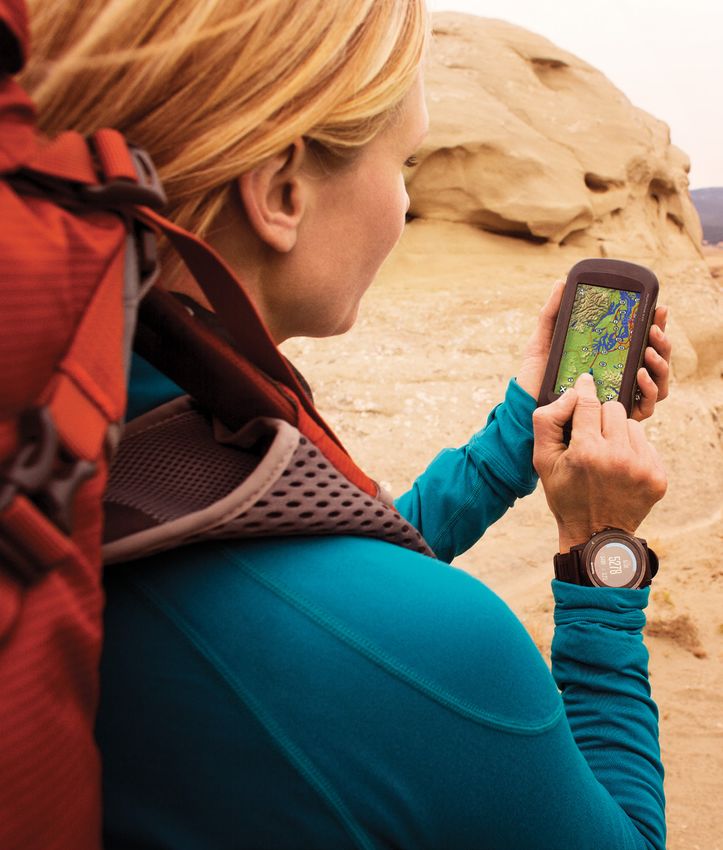
GARMIN HANDHELD GPS DEVICES - ENHANCE YOUR OUTDOOR ADVENTURES
eTrex® Touch Series
The Garmin eTrex Touch series features a sunlight-
readable, 2.6” color touchscreen, a 3-axis electronic
compass, 250,000 preloaded geocaches, and extra
built-in memory to hold more maps. These rugged
handhelds come with dual GPS/GLONASS tracking
for accurate positioning under the most challenging
conditions. A more intuitive user interface and
redesigned multi-activity menu makes it easier
than ever to get the fun underway.

   See Videos

  eTrex Touch 25              etrex Touch 35            eTrex Touch 35t
  3-axis tilt-compensated     Share your waypoints,     Share your waypoints,
  compass                     tracks, routes and        tracks, routes and
                              geocaches wirelessly      geocaches wirelessly
  250,000 preloaded
  geocaches from              4 GB memory to            Preloaded TOPO U.S. 100K
  Geocaching.com              hold more maps            map with extra internal
                                                        memory to hold more maps
GARMIN HANDHELD GPS DEVICES - ENHANCE YOUR OUTDOOR ADVENTURES
GPSMAP® 64 Series
These rugged and water-rated1 handhelds are built for
full-featured navigation on or off the trail. The GPSMAP
64 series has a 2.6” sunlight-readable screen some
models feature a 3-axis compass, rechargeable battery
with up to 16 hour battery life, paperless geocaching and
support for Garmin Custom Maps, TOPO 24K mapping
and photo navigation. The 64 series employs a powerful
quad-helix GPS/GLONASS antenna for exceptional
performance in any environment, including heavy
tree cover and canyons.

        GPSMAP 64                                        GPSMAP 64s                      GPSMAP 64st                                 GPSMAP 64sc
        Preloaded with shaded                            Smart notifications2            Preloaded TOPO 100K map                     8MP autofocus camera that
        relief basemap and                               let you receive emails,         with shaded relief basemap                  automatically geotags photos
        worldwide basemap                                texts and alerts                and worldwide basemap
                                                                                                                                     Built-in worldwide basemap
        Advanced Elevation                               1-year trial subscription       1-year trial subscription                   with shaded relief
        Plot allows zooming                              to BirdsEye Satellite Imagery   to BirdsEye Satellite Imagery
        capability on tracks

1
    Water rating IPX7: Withstands incidental exposure to water of up to 1 meter          2
                                                                                             See Garmin.com/ble for compatibility.
    for up to 30 minutes. See Garmin.com/waterrating for more details.
GARMIN HANDHELD GPS DEVICES - ENHANCE YOUR OUTDOOR ADVENTURES
Rino® Series
Each Rino series device brings confidence to your outdoor
adventures with map-guided trail navigation and 2-way
radio communication. Devices feature a powerful 5 W FRS/
GMRS radio and dual GPS/GLONASS satellite reception.
The dual-orientation, 3-inch color touchscreens are glove
friendly and easy to read, even in bright sunlight. You
can send unit-to-unit text messages to other Rino users
in your area and share your waypoints, tracks, routes
and geocaches wirelessly with other compatible Garmin
handheld devices.

   See Videos

       Rino 750                   Rino 755t
       Active Weather forecasts   Preloaded TOPO U.S. 100K
       and animated weather       map with 1-year BirdsEye
       radar tracking             Satellite Imagery
                                  subscription
       Emergency alerts with
       position reporting         8MP autofocus camera
                                  with LED flash/torch
GARMIN HANDHELD GPS DEVICES - ENHANCE YOUR OUTDOOR ADVENTURES
Mapping Data   From terrain contours and lakes to navaids and coastlines,
               you’ll find the map detail you need on the complete line of
               Garmin MapSource ® software (sold separately). You can
               purchase BirdsEye™ Satellite Imagery1          to download
               satellite images or use Garmin Custom Maps to transform,
               draw and then download paper maps to your unit. Also
               get preprogrammed microSD™ cards that plug into your
               compatible GPS. With Paperless Geocaching,              store key
               information including location, terrain, difficulty, hints and
               descriptions. No more manually entering coordinates and
               no more paper print outs.

                                              TOPO U.S. 24K

                      TOPO U.S. 24K        maps offer the highest
                      level of topographic detail for terrain contours,
                      elevation information, roads, trails, and
                      summits in six mapping regions. Comparable
                      to 1:24,000 scale USGS maps, easily loadable
                      to your device via microSD cards.

                                         1
                                          Subscription sold seperately for BirdsEye Satellite Imagery.
                                 For a complete selection of available maps, visit www.garmin.com
GARMIN HANDHELD GPS DEVICES - ENHANCE YOUR OUTDOOR ADVENTURES
HuntView Maps      Garmin HuntView features exclusive BirdsEye™ Satellite
                   Imagery and TOPO 24K mapping. Preloaded microSD™ cards
                   offer a seamless hunting map solution for compatible Garmin
                   handheld GPS devices. Map data is collected from multiple
                   sources, providing full state-by-state coverage in many states1
                   with routable road data, trails, public/private land types and
                   boundaries (BLM, National Wildlife Refuges, National Parks,
                   WPA, WMA), food/fuel locations, and more.

                   Plus, states with landowner information include landowner
                   names, public and private land types and boundaries.

                                                                   Click on arrows to see more

                        WA
                                                  MT                  ND
                                                                                      MN
                                                                       SD                           WI
                        OR
                                        ID             WY
                                                                        NE               IA
                CA-North                                                                             IL
                                 NV                                                                        IN
                                             UT             CO               KS             MO

                             CA-South                   NM                     OK             AR
                                             AZ
                                                                                                    MS    AL
                                                                 TX-West          TX-East     LA

                                                                                                                FL

                                             Imagery included with both portions of state
                                             Without Land Owner Data                               With Land Owner Data

                    1
                        Each state sold separately.
GARMIN HANDHELD GPS DEVICES - ENHANCE YOUR OUTDOOR ADVENTURES
Comparison
                            eTrex Touch 25         eTrex Touch 35       eTrex Touch 35t        GPSMAP 64            GPSMAP 64s           GPSMAP 64sc      GPSMAP 64st     GPSMAP 276cx
Touchscreen                       yes                   yes                  yes                    no                   no                    no             no                no

GPS/GLONASS                       yes                   yes                  yes                   yes                   yes                   yes            yes              yes

Waypoints                        4000                  4000                  4000                 5000                  5000                  5000           5000             10000

Routes                            200                   200                  200                   200                   200                  200             200              250

Auto routing                      yes                   yes                  yes                   yes                   yes                   yes            yes              yes

                           Worldwide with        Worldwide with        Worldwide with       Worldwide with        Worldwide with        Worldwide with   Worldwide with   Worldwide with
Basemap
                            shaded relief         shaded relief         shaded relief        shaded relief         shaded relief         shaded relief    shaded relief    shaded relief

Map data                    accepts maps          accepts maps              TOPO             accepts maps          accepts maps         accepts maps         TOPO         accepts maps

                               4 GB /                4 GB /                8 GB /                4 GB /               4 GB /                4 GB /          8 GB /           8 GB /
User memory
                             expandable            expandable            expandable            expandable           expandable            expandable      expandable       expandable

Memory card type               microSD               microSD               microSD              microSD               microSD               microSD         microSD          microSD

                                                                                                                                                                          16 hrs (li-ion),
Battery life (up to)            16 hrs                16 hrs                16 hrs                16 hrs               16 hrs                16 hrs          16 hrs
                                                                                                                                                                             8 (AAs)

Weight (ounces)                   5.6                   5.6                   5.6                  8.1                   8.1                   8.1            8.1              15.9

Display                           2.6"                  2.6"                 2.6”                  2.6"                  2.6"                 2.6"            2.6"              5”

Water rating1                    IPX7                  IPX7                  IPX7                 IPX7                  IPX7                  IPX7           IPX7              IPX7

Wireless transfer                  no                   yes                  yes                    no                   yes                   yes            yes              yes

Smart
                                   no                   yes                   no                    no                   yes                   yes            yes              yes
Notifications2

Area calculation                  yes                   yes                  yes                   yes                   yes                   yes            yes              yes

Electronic
                                  yes                   yes                  yes                    no                   yes                   yes            yes              yes
compass

Barometric
                                   no                   yes                  yes                    no                   yes                   yes            yes              yes
altimeter

Camera                             no                   no                    no                    no                   no                   8MP             no                no

Preloaded
                                  yes                   yes                  yes                   yes                   yes                   yes            yes               no
geocaches
Paperless
                                  yes                   yes                  yes                   yes                   yes                   yes            yes               no
geocaching

1
    Water rating IPX7: Withstands incidental exposure to water of up to 1 meter for up to 30 minutes. See Garmin.com/waterrating for more details.
2
    When paired with compatible smartphone. See Garmin.com/ble for details.
Comparison
                         Montana 610 Montana 610t Camo Montana 680 Montana 680t                            Oregon 700          Oregon 750         Oregon 750t     Rino 750           Rino 755t

Touchscreen                   yes                  yes                   yes                yes                 yes                yes                  yes          yes                yes

GPS/GLONASS                   yes                  yes                   yes                yes                 yes                yes                  yes          yes                yes

Waypoints                    4000                  4000                 4000               4000               10,000             10,000               10,000       10,000             10,000

Routes                        200                  200                  200                 200                250                 250                 250           250                250

Auto routing                  yes                  yes                   yes                yes                 yes                yes                  yes          yes                yes

                         Worldwide             Worldwide            Worldwide          Worldwide           Worldwide          Worldwide           Worldwide     Worldwide          Worldwide
Basemap                  with shaded           with shaded          with shaded        with shaded         with shaded        with shaded         with shaded   with shaded        with shaded
                             relief                relief               relief             relief              relief             relief              relief        relief             relief

Map data                accepts maps              TOPO             accepts maps            TOPO           Accepts maps            TOPO                 TOPO     accepts maps           TOPO

                            4 GB /               8 GB /               4 GB /              8 GB /             4 GB /              4 GB /             8 GB /         4 GB /             8 GB /
User memory
                          expandable           expandable           expandable          expandable         expandable          expandable         expandable     expandable         expandable

Memory card
                           microSD               microSD              microSD            microSD             microSD            microSD               microSD     microSD            microSD
type

Battery life             16 hrs (li-ion),     16 hrs (li-ion),     16 hrs (li-ion),   16 hrs (li-ion),                                                          14 hrs (li-ion),   14 hrs (li-ion),
                                                                                                              16 hrs              16 hrs              16 hrs
(up to)                    22 (AAs)             22 (AAs)             22 (AAs)           22 (AAs)                                                                  18 (AAs)           18 (AAs)

Weight (ounces)               11.7                 10.2                 10.2                10.2                7.4                7.4                  7.4          12.3               12.3

Display                        4"                   4"                   4"                  4"                  3”                 3”                  3”            3”                 3”

Water-rating1                 IPX7                 IPX7                 IPX7               IPX7                IPX7                IPX7                IPX7          IPX7               IPX7

Wireless
                              yes                  yes                   yes                yes                 yes                yes                  yes          yes                yes
transfer

Smart
                               no                   no                   no                  no                 yes                yes                  yes          yes                yes
Notifications2

Area calculation              yes                  yes                   yes                yes                 yes                yes                  yes          yes                yes

Electronic
                              yes                  yes                   yes                yes                 yes                yes                  yes          yes                yes
compass

Barometric
                              yes                  yes                   yes                yes                 yes                yes                  yes          yes                yes
altimeter

Camera                       8 MP                   no                  8 MP               8 MP                 no                8 MP                 8 MP           no               8 MP

Preloaded
                              yes                  yes                   yes                yes                Live                Live                Live          Live               Live
geocaches

Paperless
                              yes                  yes                   yes                yes                 yes                yes                  yes          yes                yes
geocaching

 1
     Water rating IPX7: Withstands incidental exposure to water of up to 1 meter for up to 30 minutes. See Garmin.com/waterrating for more details.
 2
     When paired with compatible smartphone. See Garmin.com/ble for details.
You can also read