HAMILTON-WAIKATO METROPOLITAN SPATIAL PLAN - Future Proof
←
→
Page content transcription
If your browser does not render page correctly, please read the page content below
HAMILTON-
WAIKATO
METROPOLITAN
SPATIAL PLAN
This document presents version 1 of the
                                                Document information
Hamilton-Waikato Metropolitan Spatial
Plan. This document has been prepared                Document Title      Hamilton Waikato Metropolitan Spatial Plan
with every effort to map, understand,
consider and record all constraints and                     File Name    20200910_MSP_Final.pdf
opportunities. Much of the data is available
at a regional level. What is proposed is                   Date Issued   10 September 2020
subject to further investigation, analysis
and business case development as well as
stakeholder engagement and consultation.        Revision                 Date Issued             Details
                                                       Final Draft_v1    22 May 2020             Draft for Steering Group Consideration

                                                       Final Draft_v2    25 May 2020             Draft for CEAG

                                                       FPIC Draft_v1     28 May 2020             Draft for FPIC

                                                       FPIC Draft_v2     2 June 2020             Draft for FPIC

                                                  FPIC Final Draft_v1    19 June 2020            Draft for Steering Group Review (FPIC)

                                                  FPIC Final Draft_v2    25 June 2020            Draft for Steering Group Review (FPIC)

                                                     FPIC Final Draft    26 June 2020            Final Draft for FPIC 03.07.2020

                                                Steering Group Draft     27 July 2020            Draft for Steering Group Review

                                                Steering Group Draft     03 August 2020          Draft for Steering Group Review
                                                Steering Group Draft     18 August 2020          Draft for Steering Group Review
                                                 Final Draft for CEAG    24 August 2020          Final Draft for For CEAG

                                                Final Draft for CEAG_    25 August 2020          Final Draft for For CEAG
                                                                   v2
                                                  Final Draft for FPIC   03 September 2020       Final Draft for FPIC

                                                                 Final   10 September 2020       Final Approved by FPIC

                                               Note: This document is intended to be read as a double page spread.
Contents

Executive Summary                                     4    Figures                                                           Tables
Part 1 - Context, Challenges and Opportunities              Figure 1: Metro spatial plan map					                        6    Table 1: Urban growth context					                               8
1.1    The metropolitan area in context               8    Figure 2: Metro area context map					                        8    Table 2: Growth management performance			                        8
1.2    Challenges and opportunities                   10   Figure 3: H2A corridor map						                             8    Table 3: Current and future urban growth areas                 32
Part 2 - Desired Future State                               Figure 4: Extent of the Waikato River				                    9    Table 4: Urban Growth Programme - Tier One Implementation
                                                                                                                              Initiatives40
2.1    The growth scenario                            12   Figure 5: Waahi toituu map                                 19
                                                                                                                              Table 5: Priority development areas - Northern corridor        41
2.2    Objectives and outcomes                        13   Figure 6: Blue-green network map                           21
                                                                                                                              Table 6: Priority development areas - Central corridor         41
2.3    People, place and community                    14   Figure 7: Public transport schematic                       23
                                                                                                                              Table 7: Priority development areas - Ruakura-Central City-Te Rapa-
2.4    Growth management approach and directives      15   Figure 8: Strategic transport corridors map                24    Horotiu Economic Corridor                                       41
Part 3 - The Spatial Plan                                   Figure 9: Centres map						                                 25    Table 8: Priority development areas - Southern corridor        41
3.1    Waahi toituu                                   19   Figure 10: Indicative Metro Centre development			           26    Table 9: Definitions                                           43
3.2    Waikato River and blue-green 		           			        Figure 11: Indicative Greenfield Town Centre development    26
       network                                        21
                                                            Figure 12: Indicative Business Centre development		         27
3.3    Transport                                      23
                                                            Figure 13: Indicative Town Centre TOD development		         27
3.4    Centres                                        25
                                                            Figure 14: Metropolitan economic corridor                  28
3.5    Growing jobs and an economic corridor          28
                                                            Figure 15: Three waters, community and other infrastructure
3.6    Three waters infrastructure                    30   map31
3.7    Community and other infrastructure             31   Figure 16: Current and future urban areas map              33
3.8    Current and future urban areas                 32   Figure 17: Envisioned housing growth intensity across the metro
                                                            area									 34
3.9    Rural areas                                    36
                                                            Figure 18: Future growth areas map                         35
Part 4 - The Implementation Plan
                                                            Figure 19: Envisioned future employment priority areas     35
4.1    Implementing the MSP                           38
                                                            Figure 20: Rural areas map                                 36
4.2    Urban Growth Programme                         39
                                                            Figure 21: Priority development areas map                  41
4.3    References                                     42
4.4    Definitions                                    43
Executive Summary

Introduction                                           Why is this plan being prepared?                        out and the National Policy Statement on Urban        •   A radical transport shift - a multimodal
The Hamilton Waikato Metropolitan Spatial              The MSP is a tool to shape how Hamilton City            Development 2020. It supports the Hamilton-               transport network, connecting the metro area
Plan (MSP) is a vision and framework for how           and the neighbouring communities within Waipā           Auckland Corridor (H2A) connecting two of                 and facilitating a radical shift to using public
Hamilton City and the neighbouring communities         and Waikato districts grow and develop in the           New Zealand fastest growing cities and ensuring           transport through the establishment of a rapid
within Waipā and Waikato districts will grow and       long-term. It will help us address the current and      well-functioning urban areas for all people,              and frequent public transport network shaped
develop over the next 100 + years creating one of      future challenges faced by the metro area from          communities and future generations.                       around where and how our communities will
the most liveable places in New Zealand.               declining water quality in the Waikato River and its                                                              grow.
                                                       major tributary the Waipā River, to environmental       Key features of the MSP
The Hamilton-Waikato metro area is an urban sub-       deterioration, increasing housing costs and             The MSP enables iwi aspirations through               •   A vibrant metro core and lively
region of the Waikato. Hamilton is at the core of      demands placed on our infrastructure including          focussing on the Waikato River and supporting             metropolitan centres - growing Hamilton
this metropolitan area which extends from Taupiri      from the number of cars on our roads to our             the ongoing recognition of the strategic                  central city as our civic, administrative, cultural
in the north to Te Awamutu and Cambridge in the        public transport options.                               economic and housing centres at Ruakura and               and commercial metro core, alongside lively
south.                                                                                                         Hopuhopu. It also includes the development of             metropolitan centres, well connected by
                                                       Carefully planning how our metropolitan core            marae.                                                    public transport and safe walking and cycling
The MSP sets out how and where Hamilton City           and its centres grow means we can ensure a                                                                        networks, where people can afford to live,
and the neighbouring communities within Waipā          population scale and distribution that supports         Important environmental attributes or constraints         work and play.
and Waikato districts should grow, develop and         the delivery of transformative infrastructure for our   and hazards (waahi toituu) are identified so
move around long-term to ensure our social,            area from metro-scale wastewater management             development can be directed away from them            •   A strong and productive economic corridor
economic and environmental prosperity.                 solutions to a high-quality public transport            and a blue-green network is introduced with               - establishing an economic corridor that links
                                                       network planned around where and how and how            the Waikato River at its heart providing for              the highly productive employment areas
It celebrates a healthy Waikato River at its heart,                                                            environmental, recreational and place-making              between Ruakura, Hamilton central city and
connected to a vibrant metro core in Hamilton          our communities will grow. Carefully managed
                                                       growth will also limit negative outcomes including      benefits, influencing the shape of future urban           north to Horotiu.
city and lively metropolitan centres all serviced by                                                           development in the metro area.
rapid and frequent public transport. It plans for      further environmental deterioration, increasing                                                               •   Iwi aspirations - enhancing the environmental
a place where our natural and built environment        housing costs and CO2 emissions from transport,         Development is shaped around a multi-modal                health and wellbeing of the Waikato River
coexist in harmony and our people thrive with          and will contribute to restoring the health and         rapid and frequent transport network and the              in accordance with the Te Ture Whaimana o
easy access to recreational spaces, employment,        well-being of the River and the environment             MSP identifies a range of opportunities for both          Te Awa o Waikato – Vision and Strategy for
education, health facilities and affordable homes.     The MSP targets future population growth areas          urban intensification and expansion, providing for        the Waikato River, while supporting iwi in
                                                       suitable for medium to high density housing             population growth and development that is both            embracing social and economic opportunities
Strategically located at the heart of the upper                                                                up and out, addressing housing affordability and          within the metro area with a specific emphasis
North Island our area is the third fastest growing     and mixed-use areas. These are purposefully
                                                       located alongside current and future transport          housing choice.                                           on Hopuhopu and Ruakura.
urban centre in New Zealand. Over the next
50-100 years, the population of the metro area         infrastructure that can provide a high-quality          Centres for growth and a core economic corridor       •   Thriving communities and neighbourhoods
is expected to nearly double. Most people will         transport network whether that be walking,              at the heart of the metro area support economic           - enabling quality denser housing options
live in Hamilton, but significant growth will also     cycling or by rapid and frequent public transport       development and jobs while also recognising               that allow our natural and built environments
happen in Ngaaruawaahia, Cambridge and Te              connections.                                            important business areas such as Te Rapa, Horotiu,        to coexist in harmony increasing housing
Awamutu.                                               For the MSP’s vision to be realised we need             Ruakura, Taupiri, Hautapu and Hamilton Airport.           affordability and choice to meet the needs of
                                                       reliable transport options that move people,                                                                      growing and changing communities.
The MSP is delivered through the Future Proof                                                                  Transformational Moves
partnership between Waikato-Tainui, Tainui Waka        goods and services efficiently to and through our                                                             Implementing the MSP - making it real
                                                                                                               There are six transformational moves for change:
Alliance, taangata whenua, Central Government,         area and a successful public transport network                                                                The MSP will be brought to life through a
Waikato District Council, Waipā District Council,      that is used by many people.                            •   Waikato River - celebrating the Waikato River     comprehensive implementation approach
Hamilton City Council and Waikato Regional                                                                         as the defining ecological feature connecting     which consists of an urban growth programme
                                                       The MSP will also deliver on objectives outlined in
Council and ensures we are prepared for this                                                                       the metro area to the heart of a blue-green       of priority actions designed to achieve
                                                       the Government’s Urban Growth Agenda (UGA)
growth.                                                                                                            network supporting environmental and              transformational change. A further detailed
                                                       designed to remove barriers to the supply of land
                                                                                                                   recreational use and creating a sense of place.   programme of action will be agreed, updated and
                                                       and infrastructure and allow cities to grow up and
                                                                                                                                                                     monitored through the Future Proof partnership.

4 | Hamilton-Waikato Metropolitan Spatial Plan
Hamilton-Waikato Metropolitan Spatial Plan

The MSP is made up of a series of layers, as shown in the maps below. More detail on each of these
layers can be found in Part 3.

Waahi toituu - Part 3.1                                Strategic transport corridors - Part 3.3               Centres - Part 3.4              Three waters, community and other           Rural areas - Part 3.7
                                                                                                                                              infrastructure - Part 3.7
Note
Waahi Toituu, further defined in Part 3.1, are areas
to protect / proceed with the greatest care.

Blue-green network - Part 3.2                          Public transport network scheme - Part 3.3             Growing jobs and an ecconomic   Current and future urban areas - Part 3.8
                                                                                                              corridor - Part 3.5
                                                       Note:
                                                       Public transport shown is a concept service diagram
                                                       only, showing connections between future growth
                                                       nodes. Further work will be required to define mode,
                                                       operational requirements, and identify the most
                                                       appropriate corridor for both the rapid and frequent
                                                       networks.
                                                       IMPORTANT: No modal options have been
                                                       discounted at this stage.

                                                                                                                                                                                                                   Hamilton-Waikato Metropolitan Spatial Plan | 5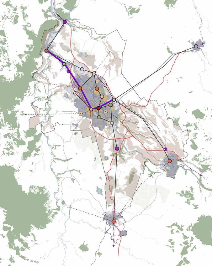
Hamilton-Waikato Metropolitan Spatial Plan
Taupiri
Figure 1 provides the summary MSP map. Key
features of the MSP are:
• Enabling iwi aspirations through focussing on
the Waikato River and supporting iwi housing Ngaaruawaahia/
and economic priorities within the metro area. Hopuhopu
• Providing clarity on the location and nature
of waahi toituu areas that have influenced the Horotiu
location of future growth areas so that new
HT1
development is directed away from valued Rototuna
natural areas, environmental constraints,
hazards and risks, now and in the future. R2
Te Rapa
• The inclusion of an extensive blue-green Metro Area Boundary Rotokauri
Chartwell
network to assist in improving the quality Regional centre Fairfield
Ruakura
and quantity of public spaces and support Proposed metro centre
Central University
numerous environmental outcomes. Business centre City Area
Frankton
Specialised centre
• An urban form shaped around a multi-modal Hospital
rapid and frequent transport network and Existing town centre
the objective of a radical mode shift to public Proposed town centre
Peacocke
transport and active transport modes. This will Rail Corridor
support reduced carbon emissions, increased Nationally Strategic Routes
housing choice, more affordable housing
Metro Area Strategic Routes
and improved access to employment and key Airport
Hautapu
amenities. Metro Area Minor Routes
Key Routes Connecting to
• Enabling a wide range of urban development Location Outside of Hamilton Cambridge
opportunities to enhance competitive land City (RPTP)
markets. The MSP identifies opportunities for Frequent Public Transport Network
both urban expansion and intensification.
to Auckland Rapid Public Transport Network
Rapid Network
• The development of an economic corridor Future
Future Inter-regional
Interregional Network
Network
(Ruakura – Ngaaruawaahia) that will build
Frequent Network
on existing economic strengths in and drive Huntly
Future Urban Areas
higher value employment growth. Key interchange
Taupiri Urban Areas:
Major stops
Zoned Urban/ Developed Land
Ngaruawahia HT1 Awa:
Te Awamutu
Lakes, Rivers, Wetlands,
to Tauranga
Horotiu
Rototuna Floodzones, Swamps
Chartwell Existing Green Areas:
The Base
R2
Reserves, Parks, DoC Land,
Rotokauri
Frankton
Significant Natural Areas
Ruakura
Town
Centre Proposed Green Areas:
Dinsdale CBD Future Green Space
Uni
Hospital
Peacocke Waahi Toituu Areas
Airport
Figure 1: Metro spatial plan map
Cambridge
6 | Hamilton-Waikato Metropolitan Spatial Plan
Te Awamutu
Part 1
Context,
Challenges and
Opportunities
Part 1 of the MSP discusses the present
state, highlights the importance of iwi
within the metro area and identifies key
opportunities and challenges addressed by
the MSP.
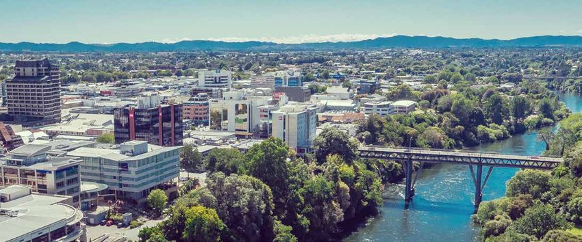
1.1 The metropolitan area in context
Regional context GOING FORWARD
What growth are we planning for? The MSP has been developed to proactively plan Table 1: Urban growth context
The metro area plays an important role in the The metro area’s strategic location in the heart for and manage this future growth in a way that Urban Growth Context
prosperity and productivity of New Zealand. It of the upper North Island means that growth has will deliver on the Government’s Urban Growth
Size (hectares) 76,515
is strongly linked to Auckland, Bay of Plenty, and historically been strong, and this trend is expected Agenda (UGA), that aims to remove barriers to the
the wider Waikato region, as shown in Figure 2. It
provides significant economic functions in terms of THE FIVE-PART
to continue. Hamilton, Ngaaruawaahia, Cambridge,
Te Awamutu and the villages and rural communities
supply of land and infrastructure, and the Hamilton
ONE: STRONGER
to Auckland CORRIDOR
Corridor CONNECTIONS
(H2A) objectives guiding
Population (2018) 212,949
HOUSING &
education, port and logistics, health, professional in between form the third fastest growing urban development between two of New Zealand’s fastest % Maaori 23.69%
Direct and (re)shape future urban growth along the
and technical services supporting the wider region. area in New Zealand. The population of this area is growing cities. significantly strengthened green open
corridor through % 65+ 11.75%
The metro area sits at the southern end of the expected to double in the next 50-100 years.
Over theURBAN
next 50-100years,GROWTH
space and mass
Current transit
urban networks.
growth performance Median age 32.2
Hamilton to Auckland corridor as shown on Figure 3.
the population of the Existing urban growth context parameters are GDP/capita (2018) $64,059
metro area is expected to nearly double. Most
PROGRAMME
shown in Tables 1 and 2. These parameters
people will live in Hamilton, but significant growth TWO: THE PAPAKURA-POKENO CORRIDOR Deprivation index (10
6.1
indicated that: highest)
will also happen in Ngaaruawaahia, Cambridge and
Supporting
• This metroand unlocking, where
area is the thirdappropriate, the
least affordable Median dwelling price (2019) $542,000
Te Awamutu
significant
housingresidential
marketand employment
in New Zealand. development
Infrastructure
Population growth (average
potential and iwifuture
is limiting aspirations forcapacity.
supply this string of well- last 5 years)
2.44%
defined,
• Therail-linked
transportsettlements through integrated
system is underperforming Population growth (average
growthwith New Zealand’s highestfinancing
management, funding and and key
private vehicle last 20 years)
1.84%
Te Kauwhata
transformational
dependency projects.
and poor safety outcomes for
Table 2: Growth management performance
cyclists and pedestrians.
Growth Management Performance
Hamilton to • There
THREE: THEare challenges
RIVER across the housing
COMMUNITIES
Auckland spectrum – from homelessness, to the rental Mean dwelling price/mean
Housing affordability 5.2
Corridor To Tauranga Supporting
market, community and iwi-led for
and opportunities revitalisation
first homeand household income
and Bay of targeted growth that will realise the full value of the
buyers. % 1 and 2 bedroom
Housing choice 22%
Plenty natural, transport, marae and recreational networks dwellings
Huntly that braid the area together as an asset for its people Public transports share of
Transport choice 1%
and many others who can visit and travel through. trips (2014-2018)
Morrinsville Access to Estimated % of HH
Importance of iwi in the metropolitan area
Taahuhu Koorero / history headquarters of the Kiingitanga movement located In 1998 the Waikato-Tainui Deed of Settlement for partnerships. There is a significant Maaori asset
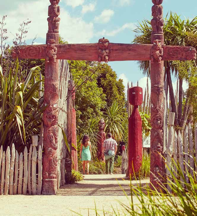
Tangata whenua within the metro area descended at Tuurangawaewae Marae in Ngaaruawaahia, on the Waikato River was signed, and it received royal base in the metro area including collectively-owned
from the Tainui waka, tracing their ancestry back the eastern banks of the Waikato River. It is the assent in 2010. The Waikato-Tainui Raupatu Claims assets in trusts, incorporations and other Maaori
800 years. The metro area contains significant official residence of the current Maaori King, Tuheitia (Waikato River) Settlement Act 2010 established entities. Spatial priorities for iwi include Ruakura, the
landmarks, including the sacred Taupiri mountain Pootatau Te Wherowhero VII. the Waikato River Authority and gave statutory central city area, and Hopuhopu/Taupiri.
and the Waikato River. It is said that Taupiri lived recognition to Te Ture Whaimana o Te Awa o
near Tongariro until her marriage to the mountain The British troops breached the Kiingitanga border Waikato – Vision and Strategy for the Waikato River. While wishing to develop land in a way that sustains
chief Pirongia brought her to her new home near that the second Maaori King Taawhiao had declared their economic capacity and provides opportunities
Ngaaruawaahia. The legend is that she then became to be an aukati (a boundary not to be crossed), Iwi aspirations for iwi members, retaining their historical role as
ill and sent a message asking Tongariro to deliver which started the New Zealand Land Wars in 1863. There are seven significant iwi/hapuu groupings: kaitiaki of the environment is a primary aspiration
THE AREA SUBJECT TO THE VISION AND STRATEGY
healing waters. Tongariro sent a faithful dog to cut a Ngaati Maahanga, Ngaati Hauaa, Ngaati Korokii- of taangata whenua in the area. Taangata whenua
Upon losing the final battle in 1865, Maaori were envision a collective approach to sustainable
pathway between Tongariro and Taupiri – said to be Kahukura, Ngaati Tamainupo, Ngaati Mahuta and
As the Waikato River is important to all the people of the region, the driven into exile in the King Country for 20 years. land use which allows the mauri of ancestral land,
the origin of the Waikato River. Taupiri recovered Waikato-Tainui within the metro area boundaries.
ultimate measure of this Vision and Strategy will be that the Waikato River The Crown proceeded to confiscate 1.2million acres waters, cultural sites, and taonga to be restored and
once she was able to drink the healing waters. The southern towns of Cambridge and Te Awamutu
will be safe for people to swim in and take food from over its entire length. (approx. 500,000 hectares) of Waikato-Tainui tribal enhanced.
also includes additional mana whenua Ngaati
In 1858 thethat
Kiingitanga movement land (raupatu). Throughout the post-war period the
The area the Vision and Strategy applies tooriginated in from
is the Waikato River Maniapoto, Raukawa, Ngaati Apakura, Ngaati
the Waikato issue of raupatu dominated dealings between the
Huka Falls toregion
Te Puuahaunder
o Waikatothe first
and the Maaori
length KingRiver to its
of the Waipa Hikairo, and Paretekawa.
Pootatau
junctionTe Wherowhero
with toshown
the Waikato River as unite iwimap
in the and halt
below. Theland
Vision
Kiingitanga and the New Zealand Government.
sales.and
The movement
Strategy continues
also applies to tothethis
the activities in day with
catchments thethe
affecting A key driver of the MSP is to achieve the aspirations
Waikato-Tainui began searching for redress in 1884
Waikato River. of taangata whenua. Importantly, this means
when Taawhiao led a party to England to petition
enhancing the environmental health of the Waikato
Queen Victoria for a Maaori parliament and an
River in accordance with the Te Ture Whaimana o Te
independent inquiry into the land confiscations.
Awa o Waikato – Vision and Strategy for the Waikato
However, his petition was referred back to the New
River, while supporting iwi in embracing social and
Zealand Government who dismissed it. Nonetheless
economic opportunities within the metro area.
Taawhiao continued to help Maaori address their
concerns and petition the government. He founded
Te Puuaha o Waikato
Marae are the social, cultural and political hearts
the Maaori parliament, Te Kauhanganui. Mahuta of Maaori communities and are considered waahi
succeeded his father Taawhiao as the third Maaori tapu. At marae, taangata whenua hold traditional
Lower
Waikato king and leader of Te Kauhanganui. ceremonies, have intertribal encounters, debate
significant issues and commemorate the deceased.
Agreeing to a partial settlement in 1946, Mahuta’s
They are the heart of Maaori communities and
cousin Te Puea Heerangi accepted Prime Minister
therefore a waahi tapu. Today, marae are often used
Peter Fraser’s offer of £5,000 per year in perpetuity.
for civil defence purposes and serve as a place
The settlement would be administered by the newly
to care for those experiencing hardship. Thirteen
established Tainui Maaori Trust Board. Although it
marae are located within the metro area and play a
was an inadequate settlement of people’s losses,
vital role in their communities, particularly in times
she considered it to be a vindication and the best
Waipa
of crisis, hardship, debate or celebration. The MSP
deal available at the time. The Trust Board invested
Upper Waikato
recognises marae as an important cultural spatial
the money in education which was its priority.
element for the metro area.
In 1993 Hopuhopu and Te Rapa were returned to
Maaori play a significant role in the Waikato
Waikato-Tainui. On 22 May 1995 the historic Deed
economy through participation in the workforce,
of Settlement was signed, and the Waikato Raupatu
Legend contribution to GDP, and ownership of assets.
Huka Falls
Claims Settlement Act gained royal assent on 3
Lower Waikato-Area A
The Maaori economy is one of the key pillars of
Upper Waikato-Area B November 1995. The settlement package totalled
Waipa-Area C the region’s prosperity. Maaori play a significant
$170 million.
role in the Waikato economy through economic
Waikato River and Waipa River
Major lakes in the Waikato region
Figure 4: Extent of the Waikato River
8
Hamilton-Waikato Metropolitan Spatial Plan | 9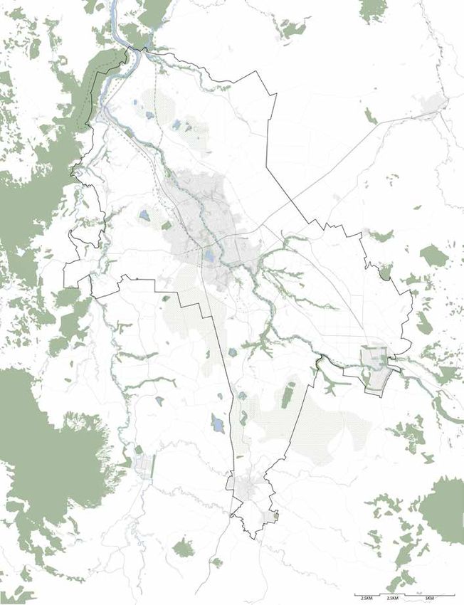
1.2             Challenges and opportunities

The MSP responds to the metro area’s present state - existing settlement patterns, environmental
deterioration and growth pressures. These have been identified as critical areas that need to be
addressed for the metro area to reach its full potential and for the MSP vision to be realised.
               Challenges                                         Opportunities
                                                                                                       Planning for a transformative future                  Through spatial planning, the MSP seeks to
                                                                                                                                                             ensure growth is well-planned, compact and
   Challenge: ongoing environmental,                  There is an opportunity to embrace the           To embrace the opportunities and address the          connected. Experience from around the world
   economic, social and cultural impacts.             Waikato River and ecological areas as the        challenges identified, the metro area needs a         indicates that planning for this type of growth can
   The Waikato River is already significantly         heart of the metro area.                         transformational shift in the approach to urban       contribute to:
   degraded and valuable ecological assets are                                                         development and infrastructure planning, and the
                                                      Through providing for growth in a way that                                                             •   Higher value economic sectors and increased
   being depleted.                                                                                     mix of instruments and levers available.
                                                      protects and enhances valued water bodies;                                                                 productivity for businesses as a result of
   Lack of action to protect and restore the          elevates the consideration of three waters       A shift in urban development planning outlined            grouping activities.
   river’s ecological resources constrains            infrastructure and restores and enhances         in the Government’s Urban Growth Agenda and           •   Better access to amenities and services
   growth and impacts community wellbeing.            ecological resources.                            National Policy Statement on Urban Development,           and reduced economic costs of time spent
                                                                                                       puts spatial planning at the centre of successful         travelling.
                                                                                                       urban growth management. Well-planned and
                                                                                                       managed urban growth should result in improved        •   More efficient use of existing infrastructure
                                                                                                       environmental, employment, transport and                  and improved viability of public transport
  Challenge: poor housing affordability                                                                housing outcomes.                                         services.
                                                      There is an opportunity to harness growth to
  and inequitable high transport costs                                                                                                                       •   Improved health outcomes through more
                                                      make our urban areas more affordable and         The benefits of spatial planning include:
                                                      attractive.                                                                                                walking and cycling and less use of cars
  Housing in the metro area continues to be                                                            •   Better co-ordination between planning and             leading to greater physical activity and health
  unaffordable for many. People lack choice in                                                             funding agencies to identify and respond to
                                                      Through providing for a quality, vibrant metro                                                             benefits.
  the types of housing and its location.                                                                   the planning challenges impacting the metro
                                                      area where communities have choices and easy
                                                                                                           area.                                             •   Enhanced competitive land markets and the
  Poor access to opportunities imposes                connections to jobs, affordable homes and
                                                                                                                                                                 preservation of green spaces within urban
  additional transport costs on households.           recreational opportunities.                      •   Provides a combined case for investment to all        development.
                                                                                                           levels of Government and the private sector.
                                                                                                                                                             •   Cost savings due to reduced land,
                                                                                                       •   Provides better guidance for infrastructure           infrastructure, and energy demands and more
                                                                                                           investment to enable long-term growth.                efficient use of urban land, reducing the need
  Challenge: lack of integrated transport             There is an opportunity to improve our           •   Provides a coherent story and prospectus              to grow into greenfield areas.
  and landuse planning impacts the design             transport choices and the success of our             to the outside world to optimise external         •   Concentrations of knowledge and innovative
  and delivery of infrastructure and the              urban environment.                                   investment and jobs.                                  activity in the core of the city.
  shape of our urban areas
                                                      Through the delivery of infrastructure,          •   Creates a long-term approach to growth to         •   Greater social connectedness and vitality,
  Delivery of infrastructure, transport and           transport and services in a way that supports        avoid changes to policy from one electoral            lower crime and greater safety.
  services currently follows the market               liveable neighbourhoods, community                   cycle to another, deterring private investment.
                                                                                                                                                             •   Reduced runoff from vehicles to water
  demand for growth. This results in an               wellbeing and targeted increased density and                                                               and emissions to the air and atmosphere
  inability to plan growth in a way that              high-quality urban environments.                                                                           (though air emissions may be more locally
  supports infrastructure, density and high-
                                                                                                                                                                 concentrated).
  quality urban environments.
                                                                                                                                                             •   Greater access to housing and jobs where
  Opportunities for economic productivity                                                                                                                        demand is high, in locations with good access
  gains are missed as growth is constrained                                                                                                                      and amenities.
  due to infrastructure or land supply.

10 | Hamilton-Waikato Metropolitan Spatial Plan
Part 2 Desired Future State Part 2 of the MSP covers future growth as well as the objectives, outcomes and indicators in order to take advantage of opportunities. Importantly there is a strong focus on people, place and community.
2.1             The growth scenario

A growing metro area                                     Components of the growth scenario
The MSP uses a growth scenario where the                 The MSP proposes an urban environment that is
population of the metropolitan area is expected to       a mix of higher density growth primarily around
double to 500,000 people. While there is uncertainty     centres, and growth along key public transport
as to when, how and at what rate the metro area          corridors, with increasing densities in greenfield
could reach this population figure, the MSP provides     areas.
for an urban structure that could accommodate this
population size. It is important to note this is not a   Approximately 70 percent of growth will be
growth target.                                           focussed in Hamilton, with around 30 percent of
                                                         growth in key townships in the Waikato and Waipā
The MSP growth scenario has been developed               districts. Of this growth, around 50 percent will be
recognising that the metro area is one urban system      provided through infill or intensification of existing
where development and resources are connected            urban areas. While the MSP directs growth to these
and are not limited by local government boundaries.      areas it is important to note that the plan assumes a
                                                         limited amount of ongoing growth will occur outside
                                                         of these identified areas, in line with district growth
                                                         strategies and Future Proof.

                                                         Employment areas will be focussed on corridors
                                                         that can be easily accessed for the movement of
                                                         people and goods, with most employment focussed
                                                         on existing centres, job corridors and identified
                                                         greenfield industrial areas.

12 | Hamilton-Waikato Metropolitan Spatial Plan
2.2 Objectives and outcomes
The objectives of the MSP reflect the How do we know if we are successful?
Government’s Urban Growth Agenda (UGA) that Indicators for the MSP are outlined below. Monitoring progress towards achieving these targets is
aims to remove barriers to the supply of land and important not only for understanding the effectiveness of the MSP but also to inform the Government’s
infrastructure - making room for cities to grow Urban Growth Agenda. The indicators provide success areas the MSP will be measured against.
up and out. Also at the core is the Hamilton to Refining the indicators below and developing and agreeing targets will be necessary to understand if
Auckland (H2A) Corridor, guiding development we are being successful. This will be an implementation action for the MSP.
between two of New Zealand’s fastest growing
cities.
The project objectives are:
Environment Transport emissions in the metro area are
• Improve choices for the location and type of reducing per capita.
housing.
• Improve access to employment, education
and services. The health and wellbeing of the Waikato River
and its catchment within the metro area is
• Assist emission reductions and build climate improving year on year.
resilience.
• Enable quality-built environments, whilst
avoiding unnecessary urban sprawl.
Housing Housing affordability (as measured by the ratio
• Improving housing affordability and choices. of average income to average dwelling purchase
price / rent) in the metro area is improving.
• Enhancing the quality of the natural and built
environments and the vitality of Auckland
and Hamilton and the communities within the
corridor. There is an increasing range of housing sizes
and types within the metro area.
• Improving access to employment, public
services and amenities.
• Creating employment opportunities in the
corridor. Accessibility The proportion of the metro area population
living within 30 minutes of work, education and
• Piloting new finance and funding tools to pay other services is increasing by using a range of
for infrastructure. modes.
• Trialling new urban planning tools to
coordinate growth development. The proportion of trips being made by public
transport and active modes (walking and cycling)
• Planning in an integrated way based on is increasing.
communities of interest rather than existing
council boundaries.
Hamilton-Waikato Metropolitan Spatial Plan | 132.3 People, place and community
The MSP sets out critical spatial elements that green network, with the Waikato River at its Affordable housing can be provided through
will help to create well-functioning, ‘liveable’ core, supporting both environmental and a range of types including private, public,
urban environments where people want to live, recreational use and creating a sense of community, and emergency housing.
work and play, and where they have easy access place for communities.
to recreational spaces, employment, education, Enabling papakaainga housing and other
health facilities and affordable homes. • Planning for a future where all new housing options that enable Maaori to express
developments are focussed around their cultural traditions and norms is another key
Liveability and placemaking walking and cycling and access to frequent element in providing for housing choice which
“The liveability of urban areas stems from unique and rapid public transport providing aligns with the National Policy Statement on
combinations of amenity values (open space, design choice and access to jobs, services and Urban Development.
features and urban vegetation); historic and cultural amenities.
heritage; location; and intangibles such as character, MSP approach to housing affordability and
landscape, and ‘sense of place’.” 12 • Ensuring waahi toituu areas (areas to choice
protect or proceed with the greatest The MSP will contribute towards reducing
Liveable urban areas can make a major of care) are considered in all new the cost of supplying housing and increasing
contribution towards people’s quality of life. Well- development – as a way of creating housing affordability and choice. The plan
planned urban development can meet housing resilient communities where the risk primarily addresses housing affordabilty
needs, provide affordable housing choices, of hazards is reduced and where local through land supply and housing
improve access to employment, education and context – such as culturally and historically development in the appropraite places. In
services, and support healthy, connected and important features, is respected. summary, the key elements of this approach
cohesive communities. Liveable areas are resilient include:
and can adapt to changes over time. • Placing the Waikato River at the heart of
planning for the sub-region, enhancing • Enabling a range of locations for housing,
Placemaking contributes to liveability by creating the health and well-being of the River and at a range of densities, which will provide
great places which strengthen local character people’s connection with the river as a key the opportunity for a diverse range of
and diversity and help develop a sense of place aspect of placemaking in the metro area. housing types.
for each area. This is done through prioritising
people-friendly open spaces and walkable Housing affordability and choice • Providing opportunities for housing and
neighbourhoods and improving access to social Housing for all people will be critical to creating lifestyle choice, including papakaainga,
infrastructure and amenities. Placemaking applies a liveable metro area. This includes meeting within defined locations, with greater
as much to enhancing existing communities as it people’s housing needs and providing for emphasis on good urban design.
does to developing new ones. affordable housing choices.
• Identifying a range of urban development
At present, there is a lack of sufficient housing
MSP approach to liveability and opportunities to enhance competitive land
choice and diversity, in the right locations.
placemaking markets which can contribute to more
Demographic changes, such as projected
The MSP seeks to ensure that new urban affordable housing.
increases in numbers of single-person
development contributes to liveability and
households, mean that housing needs will change • Social housing will continue to be explored
placemaking through implementing the
over time. through the already established Waikato
spatial planning layers in Part 3 and the growth
principles and spatial planning directions in Housing Initiative.
Enabling a range of locations for housing, at a
Part 4.2. In summary, the key elements of this range of densities and providing for different
approach include: housing types, is an important direction of the
MSP to improve housing outcomes. This also
• Providing high-quality settings for
builds on the Waikato Plan’s Regional Housing
community life using open spaces as a
Initiative vision for every person and every
core spatial feature – including the blue-
family in the Waikato region to be well-housed.
14 | Hamilton-Waikato Metropolitan Spatial Plan2.4 Growth management approach and directives
The growth managment approach sets the Spatial Plan directives for the MSP. The directives integrate a
variety of spatial elements including blue-green, transport and centres. They shape the future of the metro
area to achieve the desired environmental, social, cultural and economic outcomes.
Waahi toituu Waikato River and blue-green network Transport
The location and nature of waahi toituu areas influences The blue-green directives aim to provide an approach The provision of rapid and frequent public transport networks
the location of future growth areas, with new development to designate, restore, enhance, connect and improve the offers viable and attractive alternatives to private vehicles,
directed away from constraints, minimising hazards and risks environment and open public space within the Hamilton- encourages mode-shift away from private vehicle use,
and protecting assets now and for the future. Waikato metro area that meets the needs of a growing supports the diversity and vibrancy of activities within centres,
population and promotes healthy communities. and enhances the safety and wellbeing of residents and the
Growth is managed so that waahi toituu areas, including
culturally important sites, are safeguarded and their values Spatial plan directives: environment.
enhanced. Spatial plan directives:
• Connect, protect, enhance and integrate the natural
Spatial plan directives: environment in new urban development, promoting • Optimise the use of existing transport infrastructure, by
positive biodiversity outcomes. aligning land use and development.
• Identifying and planning future growth areas to ensure that
they avoid waahi toituu areas. • Utilise methods such as Water Sensitive Urban Design, • Plan and protect efficient freight network operations and
Low Impact Design and integrated catchment planning inter-regional corridors.
• Protect existing waahi toituu areas from urban to promote clean and sustainable water outcomes in
development. masterplanning and urban design. • Connect transport and resident hubs, linking major growth
• Avoid areas which are, in the foreseeable future, either centres by public transport and active modes.
• Recognise and respect mana whenua values in
infeasible or undesirable for urban development. masterplanning and urban design, upholding and fostering • Plan and design neighbourhoods to make public transport
• Culturally important sites will be safeguarded and their kaitiakitanga and custodianship of urban ecosystems. use, walking and cycling easy and attractive.
values enhanced. • Apply regenerative, sustainable design techniques and
principles in urban and residential developments.
• Promote healthy communities in corridor and network
planning and management, supproting active travel in
blue-green corridors and maintaining and enhancing public
access to regional and local open space assets.
Source: Landcare Trust Source: NZ Geographic Source: Te Awa Source: Stuff
Hayes Peat Lakes, Waikato Waikato River Flooding (1998), Waikato Te Awa River Ride, Waikato Public bus, Hamilton
Source: Stuff Source: Waikato Biodiversity Source: RNZ Source: Stuff Source: DCN Source: Hamilton.co.nz
Landslip, Waikato Wetlands, Waikato Waikato River, Hamilton Waikato River, Waikato POAL Freight Hub, Waikato Pedestrian shopping street, Hamilton
Hamilton-Waikato Metropolitan Spatial Plan | 15Growth management approach and directives
Centres Growing jobs and economic corridor Three waters
Development in growth centres and higher densities on multi- By focussing on established sectors in the economic corridor, Investment in three waters infrastructure and services supports
modal corridors supports and enables a more diverse urban within the metro area, a concentration of economic activity can sustainable development and growth within the metro area.
form across the metro area, and enables the provision of be supported enabling higher value employment growth. This Understanding that provision of infrastructure is fundamental to
rapid and frequent public transport services, and diversity and will enable ongoing growth, supported by enhanced road and community and environmental wellbeing.
vibrancy of activities. rail connectivity within the region and to the wider North Island.
Supporting innovative, timely and responsive infrastructure
Spatial plan directives: Spatial plan directives: solutions that lead to positive environmental outcomes within
the catchment by taking a strong, collaborative approach
• Promote an urban form that can be more easily accessed by • Strengthen connections between business services and
will give effect to Te Ture Whaimana o Te Awa o Waikato –
a variety of modes of transport including walking, cycling industries within the economic corridor to support the
Vision and Strategy for the Waikato River , while meeting and
and frequent and rapid public transport options. efficient movement of people, goods and services to and
supporting current and future needs, and unlocking economic
through the metro area.
• Encourage people away from private vehicle use, potential across the metro area, delivering value for investment.
supporting the diversity and vibrancy of activities within • Maintain the effectiveness of the wider transport network
Spatial plan directives:
centres. ensuring an adequate supply of land to service business
and industry needs. • Application of water sensitive city design principles that
• Concentrate jobs and services at accessible locations in
support and enable population growth and deliver positive
urban areas to provide greater choice and accessibility to • Promote and support the ongoing intensification of jobs,
environmental and cultural outcomes by taking account of
opportunities, amenities and facilities. education and economic activity along the Ngaaruawaahia
the three waters infrastructure investment and operational
to Ruakura economic corridor.
• Meet the needs of residential and employment growth requirements in assessing and planning development.
through higher density development and land use.
• Ensure environmentally integrated and water sensitive
planning and design principles are considered at all scales.
• Collaborate to give effect to Te Ture Whaimana o Te Awa o
Waikato – Vision and Strategy for the Waikato River.
• Seek responsive solutions that lead to positive
environmental outcomes within the catchment.
Source: ISENZ Source: WBN Source: WIPLTD Source: WIPLTD
Garden Place, Hamilton Proposed Te Awa Lakes Development, Horotiu Te Awa The Base, Hamilton Waikato Innovation Park, Hamilton
Source: Property Council Source: Wintec Source: WIPLTD Source: Stuff Source: HCC Source: West Construction
Victoria on the Green, Hamilton Wintec Rotokauri Campus, Rotokauri Meade Building Waikato Hospital, Hamilton Hamilton City Centre, Hamilton Wastewater treatment plant, Hamilton Water pipeline, Hamilton
16 | Hamilton-Waikato Metropolitan Spatial PlanGrowth management approach and directives
Community and other infrastructure Current and future urban areas Rural areas
The provision of community infrastructure is linked with and Future growth areas are located where current and future Protect the ability of high-quality soils to be used for productive
serviced by general infrastructure and utilities. Planning for transport infrastructure can provide increased accessibility purposes, ensuring there is a clear delineation between
large-scale community facilities and services is undertaken on via rapid and frequent public transport networks, as well as urban and rural land within the metro area. This will support
a metro area scale to avoid duplication of resources. Access to effective road and walking and cycling connections. Compact the significant role primary industries play in the metro
community, education and employment opportunities will be urban form and increased densities will be enabled in a way area’s economy whilst providing for development at a scale
enhanced across the metro area. All major health, education that accommodates long-term growth and provides high consistent with existing rural and village developments.
and health facilities are connected to and supported by rapid quality social, cultural, economic and environmental outcomes.
and frequent public transport networks, as well as effective Growth will be supported by a variety of development types Spatial plan directives:
road and walking and cycling connections. and housing types including papakaainga. • Protect high quality soils from development in the rural
Spatial plan directives: Spatial plan directives: environment for productive uses.
• Support urban development across the metro area, focused • Value, maintain and enhance rural amenity and character
• Fully integrate land use, community and network
on priority development areas, enhancing competitive land across the metro area.
infrastructure planning at all levels.
markets through a range of development opportunities.
• Optimise access to and use of resources and facilities • Limit rural residential growth opportunities contained within
• Build upon and strengthen local characteristics to create a clearly defined boundaries.
across the metro area. sense of place.
• Ensure community benefits are at the heart of planning for • Build on existing growth patterns, achieving a more
the provision of large-scale facilities and services. compact and concentrated urban form over time, with the
provision of high-quality, high-amenity built environments.
• Marae will be recognised as a critical cultural and spatial
element in future planning. • Locate communities and jobs around existing and new
centres, supported by rapid and frequent public and active
transport connections.
• Meet the diverse needs of residents of the metro area
through a range of housing types and safe and inclusive
urban design.
• Provide local employment and educational opportunities,
access to green space and community facilities alongside
Source: Hamilton Pools Source: Māori Maps housing, and enable high-density development around Source: Stuff Source: WRC
Gallagher Aquatic Centre, Hamilton Ōmaero marae, Ōmaero Productive soils, Waikato Soil testing, Waikato
access to these opportunities.
Source: University of Waikato Source: Te Awa Source: Cambridge Homes Source: Our Hamilton Source: Ray White Source: Stuff
University of Waikato, Hamilton AvantiDrome, Cambridge Housing, Cambridge Parana Park, Hamilton Rural property and amenity, Horotiu Dairy farming, Waikato
Hamilton-Waikato Metropolitan Spatial Plan | 17Part 3
The Spatial Plan
Part 3 sets out the spatial approach for the
metro area. It recognises existing uses and
identifies areas for growth, development
and improvement including uses and
activities, transport, blue-green network
and infrastructure.
This document has been prepared as version one of the MSP. What is
proposed is subject to further investigation, analysis and business case
18 | Hamilton-Waikato Metropolitan Spatial Plan development particularly surrounding land use and transport investigation
as well as stakeholder and community consultation.3.1 Waahi toituu
Taupiri
Introduction to ensure it is directed away from waahi toituu
The MSP identifies important environmental areas and that protected areas, such as those
attributes or constraints and hazards (waahi toituu) with natural significance, reserves, cultural and
in its base layer, so development can be directed heritage sites are safeguarded, and their values Ngaaruawaahia/
Hopuhopu
away from them. Waahi toituu areas are made up enhanced.
of:
Future growth areas have been identified
Horotiu
• Existing protected areas: areas currently, regarding the extent that they avoid waahi toituu
planned, or intended to be protected from areas (excluding areas where substantial planning HT1
Rototuna
urban development. These are often areas and investment has already been committed).
with intrinsic environmental values, which offer R2
ecosystem services or natural capital, or reflect Te Rapa
important historic or cultural values. Rotokauri
Chartwell
Spatial plan directives Fairfield
Ruakura
• Constraint areas: areas where hazards, risks • Identifying and planning future growth areas
or other aspects are deemed to make future to ensure that they avoid waahi toituu areas.
Central
City Area
University
Frankton
urban development in the foreseeable future
Hospital
either infeasible and/or undesirable, such • Protect existing waahi toituu areas from urban
as high-risk flood zones or areas with land development.
instability risk.
• Avoid areas which are, in the foreseeable Peacocke
Background future, either infeasible or undesirable for
The Future Proof partners have been urban development.
implementing the Future Proof Strategy • Culturally important sites will be safeguarded Airport
in the metro area since 2009. Despite this and their values enhanced.
sound integrated land use and infrastructure Cambridge
planning approach the metro area faces some / Hautapu
long-term challenges. This includes declining
water quality, environmental deterioration
and infrastructure demands. These challenges
are likely to be exacerbated by population
and economic growth in the long- term. The
MSP responds proactively to challenges faced
by the metro area, enabling protection and
enhancement of waahi toituu areas including
environmental, cultural and historical assets Te Awamutu
along with avoiding development in higher Waahi Toituu Areas
High Risk Flood Zones, Instability Risk, Significant
risk or constrained locations. Natural Areas, Wetlands, Heritage Sites, Reserves, DoC
Land, QEII Trust Covenants, Infrastructure Corridors,
MSP approach Outstanding Natural Features, Steep Slopes, Elite Soils
The most extensive constraints and values that (LUC 1), Peat Soil(>3m), Peat Lake
make up the waahi toituu areas in the metro area Note:
Existing Urban Areas
are high quality soils, flood zones, and peat soils. Waahi Toiora Areas (not shown) Already developed sites
Development in the metro area will be managed Moderate Slopes, Prime Soils (LUC 2 and 3), Peat
Soils (Waahi toituu
These layers form the basis
of the MSP constraints and
opportunities.
High risk flood zones Significant Natural Areas and gullies Existing Urban Areas Instability Risk
Steep Slopes
Reserves and Doc Land Heritage sites Elite Soils (LUC 1) Peat Soil(>3m) Infrastructure Corridors
20 | Hamilton-Waikato Metropolitan Spatial Plan3.2 Waikato River and blue-green
network Taupiri
Introduction best use of. Water capacity is already constraining
The Waikato River (and its major tributary, the growth. In August 2019 there were 280 non-
Waipā River) is the defining ecological feature of residential applications in the allocation queue for Ngaaruawaahia/
the MSP connecting the metro area to the heart of surface water takes in the Waikato region. These Hopuhopu
a blue-green network supporting environmental applications for water take are all on a ‘first in,
and recreational use, creating a sense of place first served’ wait list and are on hold as they will
Horotiu
and shaping the growth and development of the exceed the allocation limits for catchments in the
metro area. region. Addressing the challenge of water use and HT1
Rototuna
availability through a collaborative and integrated
The area is characterised by low rolling hills, flat approach to land, water and community planning
alluvial plains, gullies and lakes. will be critical to the sustainable development and
R2
Te Rapa
The primary direction for the health and wellbeing growth of the metro area. Rotokauri
Chartwell
Fairfield
of the Waikato River is established through Te MSP approach
Ruakura
Ture Whaimana o te Awa o Waikato - Vision and The MSP introduces a blue-green network, with Central University
City Area
Strategy for the Waikato River, to achieve its the Waikato River at its heart, as a defining and
Frankton
restoration and protection for future generations. unique spatial concept that aims to restore,
Hospital
Background enhance, connect and improve the natural
There is significant evidence that the Waikato environment within the metro area. The network Peacocke
River and its catchment is degraded across much includes regional and local scale landscape
of its length. In an urban context, the way that features, open space, rivers, gullies and their
wastewater and stormwater are managed as well margins as well as and areas of ecological and
as the allocation of water is inextricably linked conservation value across the entire metro Airport
to the health and wellbeing of the river. Taking area. These networks shape the existing metro
a collective and integrated approach to the area and will direct and influence future urban
Cambridge/
management of three waters and its linkage with development. Hautapu
land-use, development and transport planning
and policy is critical to improving the health and
wellbeing of the river.
Across the metro area the natural ecosystems
have been almost completely cleared or drained
and much of the original vegetation cover has
been removed. In contrast, most of the peat
lakes remain, although their water quality is
generally poor. The peat lakes and catchments Te Awamutu
offer valuable opportunities for enhancement. Ngaa Wai:
The banks of the Waikato and Waipā rivers are Lakes, Rivers, Wetlands, Floodzones
together the best current option for restoration, Existing Green Areas:
providing a continuous urban forest across the Reserves, Parks, DoC Land, Significant Natural Areas,
Gullies
metro area
Potential Future Green Areas:
The Waikato River is now regarded as being over- Future Green Space
allocated during low flow summer conditions Major Cycleways and Walkways
and it is clear this resource is not being made the
Figure 6: Blue-green network map
Hamilton-Waikato Metropolitan Spatial Plan | 21Waikato River and blue-green network
Spatial planning direction for the existing blue-green corridor Spatial plan directives
The blue-green spatial plan directives aim to provide an approach to restore, enhance
• Connect, protect, enhance and integrate
and improve the environment within the metro area. The following outlines key moves
the natural environment in new urban
to ensure urban development maximises the benefit at all scales.
development, promoting positive biodiversity
outcomes.
• Utilise methods such as Water Sensitive Urban
Design, Low Impact Design and integrated
catchment planning to promote clean and
sustainable water outcomes in masterplanning
and urban design.
• Recognise and respect mana whenua values in
masterplanning and urban design, upholding
and fostering kaitiakitanga and custodianship
of urban ecosystems.
• Apply regenerative, sustainable design
techniques and principles in urban and
Regional Sub-regional residential developments.
Enhance the wider established natural Restore and enhance the Waikato River,
• Promote healthy communities in corridor
areas and draw them into the metro area to tributaries and gullies to improve water
and network planning and management,
complement and connect ecosystems. quality, riparian ecosystems and re-establish
supproting active travel in blue-green
the Waikato River as the heart of the region
corridors and maintaining and enhancing
through integrated catchment management.
public access to regional and local open space
assets.
Local Human
Recognise and enhance green public space Establish a green network of walking and
and areas of native bush to shape the cycling connections, using best practice
identity and liveability of the urban areas. urban design to treat stormwater and
Provide regular, accessible, high quality reintroduce ecology into the city through an
public space that meets the needs of a urban forest programme.
growing population.
22 | Hamilton-Waikato Metropolitan Spatial PlanYou can also read