INDIGENOUS MAPPING WORKSHOP - 2018 MONTRÉAL, QUÉBEC INDIGENOUSMAPS.COM
←
→
Page content transcription
If your browser does not render page correctly, please read the page content below
2018
INDIGENOUS
MAPPING
WORKSHOP
AUGUST 20-23, 2018
MONTRÉAL, QUÉBEC
INDIGENOUSMAPS.COM
2018                                                     04   INTRODUCTION
                                                                                    Indigenous community mapping

          INDIGENOUS

                                                            TABLE OF CONTENT
                                                                               06   OUR MISSION
                                                                                    Road map to geospatial capacity building

                                                                               08   PLANNING COMMITTEE
                                                                                    Passionate about maps

            MAPPING                                                            10
                                                                               12
                                                                                    OUR HISTORY
                                                                                    Mapping with Indigenous communities

                                                                                    PARTNERSHIPS

          WORKSHOP
                                                                                    Past partners and sponsors

                                                                                    PAST WORKSHOPS
                                                                               14   A glance at past events

                                                                               16   2018IMW

               MONTRÉAL, QUÉBEC                                                     Montreal, Quebec

                                       INDIGENOUSMAPS.COM                      19   AGENDA
                                                                                    2018IMW schedule

2   2018 INDIGENOUS MAPPING WORKSHOP                                                                                  2018 INDIGENOUS MAPPING WORKSHOP   3
INTRODUCTION
INDIGENOUS COMMUNITY MAPPING
The Firelight Group and its partners are proud to present the Indigenous Mapping Workshop,
the largest international geospatial conference for Indigenous-led geospatial research.
The Indigenous Mapping Workshop is an annual 4-day event that provides geospatial
training and opportunities for Indigenous communities. During the workshop, over 200
participants from 100 Indigenous Nations learn and share geospatial tools and work lows
to collect, host, visualize, share, and publish community-generated spatial data. Sessions
explore current and relevant themes, such as traditional land use and occupancy studies,
environmental monitoring, community planning, negotiations, health, inter-generational
knowledge transfer, and reconciliation.

GEOSPATIAL                                        CAPACITY BUILDING
                                                  TO EMPOWERMENT

CAPACITY                                          At the Indigenous Mapping Workshop, we support
                                                  geospatial capacity building to promote Indigenous
                                                  Peoples’ ability to collect, analyze, and visualize

BUILDING
                                                  community-based geospatial information. The
                                                  Indigenous Mapping Workshop provides geospatial
                                                  opportunities to bring culturally relevant and
                                                  appropriate earth observation technologies to
                                                  Indigenous communities to support Indigenous
                                                  rights and interests. Our Guiding Principles are to:

                                                       Promote international technical support and advisory
                                                       services for Indigenous mapping projects and programs

                                                       Facilitate capacity building and knowledge exchange
                                                       between Indigenous leadership, agencies, and
                                                       communities

                                                       Support mapping projects to promote Indigenous
                                                       rights and interests

                                                       Encourage Indigenous communities to undertake
                                                       geospatial capacity building initiatives

                                                       Develop culturally appropriate and ethical geospatial
                                                       outreach programs and curriculum

                                                       Promote awareness of cartographic issues and
                                                       resources

4   2018 INDIGENOUS MAPPING WORKSHOP                                                                           2018 INDIGENOUS MAPPING WORKSHOP   5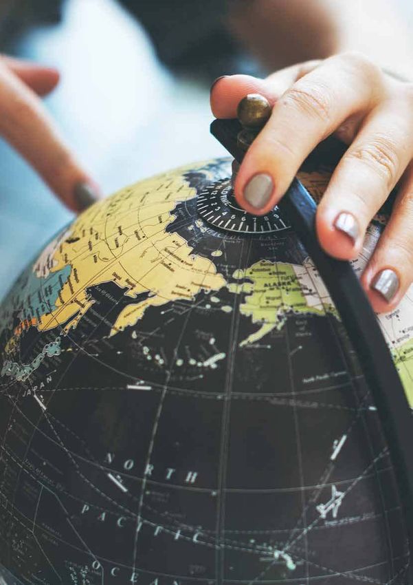
OUR
MISSION
    ROAD MAP:
    GEOSPATIAL CAPACITY BUILDING
    The Indigenous Mapping Workshop is dedicated to the development
    and advancement of culturally appropriate and inclusive geospatial                VISION                                   MANDATE                                      OBJECTIVE
    technologies for Indigenous communities. Our work focuses on         To promote and encourage Indigenous          To provide direction and allocate            To advocate for Indigenous pedagogical
    the generation and dissemination of decolonized resources in         self-determination and sovereignty by
                                                                         providing the necessary geospatial
                                                                                                                      resources in support of the enhancement
                                                                                                                      of geospatial training and capacity
                                                                                                                                                                   geospatial practices that support
                                                                                                                                                                   Indigenous capacity development in
    Geographical Information Sciences and Satellite Remote Sensing,      training, tools, and network opportunities   building for Indigenous communities.         Geographical Information Sciences. We
                                                                         to support Indigenous rights and             We strategically partner with technology
    their integration and application, to preserve and promote           interests. We are committed to supporting    providers, Indigenous leadership, agencies
                                                                                                                                                                   aim to enable and accelerate Indigenous
                                                                                                                                                                   innovations in geospatial technologies,
                                                                         geospatial technologies and practices        and communities, universities, not-for-
    Indigenous land stewardship practices.                               to ensure that Indigenous communities        proits, and researchers to promote           supporting investment in geospatial
                                                                         control the collection, analysis, and        best practices for Indigenous geospatial     programming that translate into the
                                                                         visualization of community-generated         programs and practices.                      advancement of Indigenous rights and
                                                                         spatial data.                                                                             interests.

6   2018 INDIGENOUS MAPPING WORKSHOP                                                                                                                                  2018 INDIGENOUS MAPPING WORKSHOP       7
OUR HISTORY
MAPPING WITH INDIGENOUS COMMUNITIES
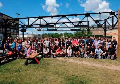
Since the inception of the Indigenous Mapping Workshop in 2014, the Indigenous Mapping
Workshop remains a collaborative project. Our ability to promote and support Indigenous
geospatial capacity building needs is a result of generous and involved organizations
dedicated to promoting Indigenous rights and interests. As we adapt and expand to the
geospatial needs of Indigenous communities, the Indigenous Mapping Workshop continues
to provided a pertinent forum for Indigenous communities to exchange knowledge,
experiences, and technologies in the geospatial ield.
2014 2016 2017
VICTORIA, BC VANCOUVER, BC WINNIPEG, MB
The irst Indigenous Mapping Workshop hosts The Firelight Group, Musqueam, Google, Esri The Firelight Group, Brokenhead Ojibway Nation,
over 100 mapping practitioners in Victoria, BC, Canada, Squamish Nation, Inlailawatash, and Nanaandawewigamig, PEKE, Google, and Esri
co-hosted by The Firelight Group, Union of BC NALMA bring together 225 Indigenous mapping Canada welcome 250 Indigenous mappers to
Indian Chiefs, Google, University of Victoria practitioners to Vancouver, BC Winnipeg, MB
2015 2017 2018
WATERLOO, ON HAMILTON, NZ MONTREAL, QC
The 2015 Indigenous Mapping Workshop, The Firelight Group joins Digital Navigators Inc. Join us in Montreal, QC where we will host
co-hosted by The Firelight Group, Google, and to support the 4th annual Indigenous Mapping over 300 mapping practitioners at the largest
Chiefs of Ontario, brings together 150 Indigenous Waananga in Kirikiriroa, New Zealand, bringing international Indigenous geospatial training event
mapping practitioners to Waterloo, ON together over 100 Māori community mappers
8 2018 INDIGENOUS MAPPING WORKSHOP 2018 INDIGENOUS MAPPING WORKSHOP 9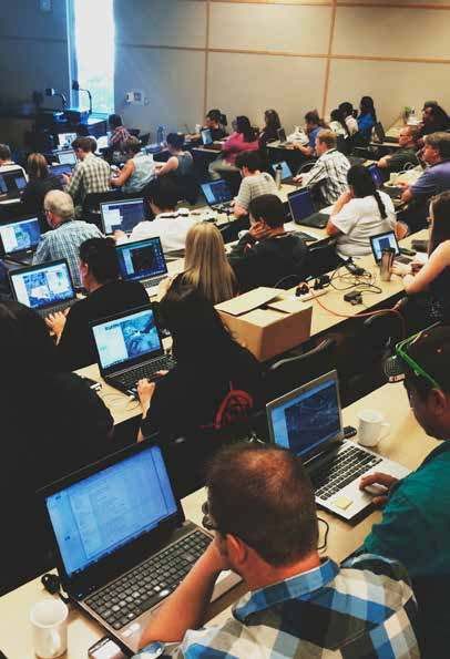
PARTNERSHIPS
Promote your organization as a leader committed to activities that beneit Indigenous
communities. The 2018IMW is an opportunity for your organization to connect with the                   DRONES
largest Indigenous Geospatial Network. The event promotes organizations, ensuring wide
exposure for sponsors and their commitment to geospatial technologies and Indigenous
communities.
                                                                                                                 MAPS

                                                                                               NETWORKS

                                                                                         SPATIAL ANALYSIS

                                                                                         REMOTE SENSING

                                                                                         VIRTUAL REALITY

                                                                                           PARTICIPATORY

                                                                                            OPEN SOURCE

                                                                                               PLANNING

10   2018 INDIGENOUS MAPPING WORKSHOP                                                           2018 INDIGENOUS MAPPING WORKSHOP   11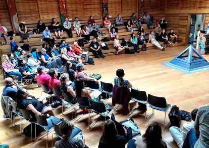
PAST WORKSHOPS
A GLANCE AT PAST EVENTS
Since 2014, the Indigenous Mapping Workshop has trained over 1000 Indigenous
community mappers on emerging geospatial tools and technologies. With the
dedication of our partners and sponsors, the Indigenous Mapping Workshop has
become the largest global Indigenous geospatial network.

12   2018 INDIGENOUS MAPPING WORKSHOP                                          2018 INDIGENOUS MAPPING WORKSHOP   13
2018IMW                                                                                                2018
MONTREAL, QUEBEC | AUGUST 19-24, 2018
The 2018 Indigenous Mapping Workshop will host over 300 participants from August
                                                                                              INDIGENOUS
19-24, 2018 in Montreal, Quebec. The four-day workshop will involve a dynamic mix
of presentations by community members, leading experts, academics, and students,                MAPPING
hands-on geospatial training to support Indigenous rights and interests, and knowledge
exchanges between communities.                                                                 WORKSHOP
                                                                                                     Le Wesin
                                                                                             270 Rue St. Antoine Ouest
                                                                                         Montreal, QC H2Y 0A3, Canada

                            Geospaial Training
     01                     Train Indigenous communiies to use accessible geospaial
                            technologies to support various needs and circumstances

                            Empowerment
     02                     Build knowledge and develop specialized resources in
                            Indigenous communiies to support rights and interests

                            Community
     03                     Work towards creaing knowledge exchanges between
                            Indigenous communiies, organizaions, and governments

14   2018 INDIGENOUS MAPPING WORKSHOP                                                       2018 INDIGENOUS MAPPING WORKSHOP   15
2018
        IMW
       Agenda
16   2018 INDIGENOUS MAPPING WORKSHOP   2018 INDIGENOUS MAPPING WORKSHOP   17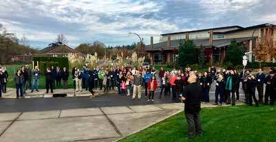
01                         MONDAY
                             20.08.2018

DAY 1                                                                                                                             DAY 1

07:30 - 08:30             Breakfast                                                                                               10:00 - 10:30             Health Break
Grande Place, 8th Floor                                                                                                           Grande Place, 8th Floor

                                                                                                                                  10:30 - 11:15             Panel: Indigenous Environmental Monitoring with Land and Water Defenders
07:30 - 08:30             Registration                                                                                            Montréal, 11th Floor
Grande Place, 8th Floor                                                                                                                                     The Indigenous Environmental Monitoring: Land and Water Defenders panel will present
                                                                                                                                                            Indigenous community led actions against extractive industries, unwanted development, and
                                                                                                                                                            climate change.
08:30 - 8:45              Opening Prayer
Montréal, 11th Floor
                                                                                                                                  11:15 - 12:00             Panel: Methods, Theory, and Action for Indigenous Counter-Mapping
                                                                                                                                  Montréal, 11th Floor
08:45 - 09:00             2018 Indigenous Mapping Workshop: Welcome                                                                                         The Indigenous Counter-Mapping: Methods, Theory, and Action panel will discuss different
Montréal, 11th Floor                                                                                                                                        approaches Indigenous nations us geospatial technologies to promote sovereignty and self-
                                                                                                                                                            determination.

09:00 - 09:30             Government to Government Tribal Consultation
Montréal, 11th Floor      Speaker: Angela D. Garcia-Lewis, Salt River Pima-Maricopa Indian Community                              12:00 - 13:00             Lunch
                                                                                                                                  Grande Place, 8th Floor
                          Successful tribal cultural resource consultation is vital concern for many Native American tribes
                          in the United States. The Salt River Pima-Maricopa Indian Community has been working on                 13:00 - 14:30             Training Modules
                          several strategies for preserving the landscape and the natural and cultural resources associated
                          with their people. This presentation will discuss the reasoning for developing an online Arizona
                          Government to Government Tribal Consultation Toolkit, as well as other strategies for preservation.     Ramezay, 8th Floor        Put Your Community on the Map with ArcGIS Online
                                                                                                                                                            Trainer: Susie Saliola, Esri Canada

09:30 - 10:00             Mapping the Displacement of 60’s Scoop Survivors                                                                                  Connect community, location, and information using ArcGIS Online. ArcGIS Online is a collaborative
Montréal, 11th Floor      Speakers: Colleen Hele-Cardinal, National Indigenous Survivors of Child Welfare Network and Dale                                  Web GIS that allows you to create and share interactive maps and apps. You can explore the free,
                          Spencer, Carleton University                                                                                                      ready-made data that you can add to your maps, or learn to add your own content to a map such as
                                                                                                                                                            signiicant locations in your community, food harvesting areas, potential development sites, and
                          The National Indigenous Survivors of Child Welfare Network ‘theNetwork’ has collaborated with                                     more. Most of the Esri’s Web tools, including Survey123, Collector, Story Maps, and Web AppBuilder,
                          the Dr. Raven Sinclair’s (University of Regina) Pe-kīwēwin Project (Social Science and Humanities                                 are all integrated with ArcGIS Online. Come to this session to get an introduction to ArcGIS Online or
                          Research Council Insight Grant – 5 year) to create a GIS (Geographic Information System) Adoptee                                  to learn some new tips and tricks!
                          Diaspora Mapping program to create an innovative and interactive online platform to support 60’s
                          scoop survivors to share their stories, visualize collective displacements, collect data on where       Viger, 8th Floor          Become an ArcGIS Pro
                          survivors were taken from and displaced too, ind family members, and identify resources in                                        Trainer: Jonathan Van Dusen, Esri Canada
                          different territories. The mapping project is participatory and interactive, with survivors inputting
                          their own information. Visually, the Diaspora Mapping will be stunning and will show Adoptee                                      Create high-quality maps on your computer using ArcGIS Pro, Esri’s premier desktop GIS application
                          displacement globally. It will also give researchers preliminary data on how many children were                                   (provided freely to you through the IMW ArcGIS Online Organization). You'll learn how to discover
                          taken and where too.                                                                                                              and save different sources of map data, and use analysis tools to create state-of-the-art, printable
                                                                                                                                                            maps that you can share in meetings or publications. This is a great opportunity to learn the same
                                                                                                                                                            mapping application used widely in industry, academic research, and the public sector.

18    2018 INDIGENOUS MAPPING WORKSHOP                                                                                                                                                                                      2018 INDIGENOUS MAPPING WORKSHOP       19
01 MONDAY
20.08.2018
DAY 1 DAY 1
Palais, 8th Floor Building a Collaborative Map with your Team using Google My Maps and My Maps Mobile stories, and epistemologies differently, and to promote the development of spatial representations
(Basics) that emerge from members of Indigenous communities. Participants can join us for either 1, 2, 3 or 4
Trainer: Dr. Cynthia Annett, Kansas State University and University of Alaska days of these sessions.
This session will cover how to create quick and easy maps with My Maps, a simple tool for creating McGill, 8th loor Ideation Process, Identifying Problems RightMesh Can Solve
interactive and collaborative maps on the web. You’ll also learn how to continue working on your Trainers: Daniel Gillis, University of Guelph and Inez Shiwak, the 'My Word': Storytelling and Digital
maps with your mobile device, both online and oline. You can choose to share your map with your Media Lab
ield team only or to the public or even embed it on your website.
Learn about the eNuk application and how it sprung from the community needs within Rigolet. Next,
Beaver Hall, 8th Floor A Google Mapping Warm Up: Quick My Maps and Easy Tour Builder Stories (Accelerated) we will discuss how to identify problems within their own communities and workshop potential
Trainers: Raleigh Seamster, Google Earth Outreach and Moka Apiti, Digital Navigators Ltd. solution, be it through RightMesh, or alternative means.
This session will cover tools for easy content creation & storytelling. You’ll learn how to tell Montréal, 11th Floor Open Data Sources and Portals in QGIS: Finding, Downloading and Understanding Data
engaging stories about places of cultural and environmental importance using Tour Builder and by Trainers: Lauren Tekano and Boyd Barrett, The Firelight Group
using virtual lyovers and tours in Google Earth. You’ll also learn how to use My Maps, a simple tool
for creating interactive and embeddable maps on the web. This session will provide a starting point This session will cover the basics of QGIS, and how it differs from other geospatial softwares. We will
for people who may not be familiar with Google mapping tools but have some mapping experience, discuss how to access, download and interpret open data sources in QGIS. We will also learn how to
that will allow them to enter the Google stream at an accelerated pace. add layers to QGIS, explore the GUI, discuss some useful QGIS plugins, and add and use basemaps.
Ste-Hélène, 8th Floor Navigating the World of Open Source and Open Data Mapping Tools 14:30 - 15:00 Health Break
Trainers: Marena Brinkhurst, Mapbox and Julia Conzon, Employment and Social Development Grande Place, 8th Floor
Canada, and Aliya Ryan, Gregor MacLennan, and Jen Castro, Digital Democracy
15:00 - 16:30 Training Modules
The world of mapping tools is big - and when using open source tools and open data, it’s not
always easy to see how all the different tools can it together to meet your needs. Come discuss Ramezay, 8th Floor This was My Family’s Cabin: Share Community Knowledge with Esri Story Maps
your projects with our open source and open data trainers to learn more about what tools could Trainer: Jeff Hackett, The Firelight Group
be useful and how they it together. We’ll provide overview presentations about OpenStreetMap,
Mapbox, QGIS, Mapeo, ODK, and more. Then we’ll break out into discussion tables for you to share If a map could tell a story, what would it say? Esri Story Maps allows you to combine maps, text,
and get feedback on your use cases and help you to plan which sessions to check out over the rest videos, sound, and photos into a narrative. You can share results of a community project, showcase
of the workshop. traditional knowledge and oral histories, and many more types of stories. A story map is an excellent
way to engage and communicate with your community, administrators, and Band decision makers.
St. Paul, 8th Floor MappingBack: Designing Alternative Indigenous Maps Learn how to build your own Story Maps in this session.
Trainers: Annita Lucchesi, University of Lethbridge, Sébastien Caquard, and Tom McGurk, Concordia
University
During these sessions, participants will be invited to think about how they see their territory and to
work with pencils, paper, painting, fabric, clay, scissors, computers and any other material to create
maps that relect their visions. The creation of these maps will be facilitated by Indigenous and
non-indigenous mapmakers with experience in alternative forms of cartography. The overall goal of
these sessions is to expose participants to the endless possibilities of representing territories,
20 2018 INDIGENOUS MAPPING WORKSHOP 2018 INDIGENOUS MAPPING WORKSHOP 2101 MONDAY
20.08.2018
DAY 1 DAY 1
Viger, 8th Floor Create and Use Interactive Surveys. It's as Easy as 'Survey123' St. Paul, 8th Floor MappingBack: Designing Alternative Indigenous Maps
Trainer: Steve DeRoy, The Firelight Group Trainer: Annita Lucchesi, University of Lethbridge, Sébastien Caquard, and Tom McGurk, Concordia
University
When you need a way to ask questions of community members, collect answers, and make use
this information to inform decisions, Survey123 is the tool for you. The app is designed for people During these sessions, participants will be invited to think about how they see their territory and to
without GIS expertise to create and distribute interactive surveys just nothing more than a Web work with pencils, paper, painting, fabric, clay, scissors, computers and any other material to create
browser. With Survey123 you can also track the status of projects, perform resource inventories, maps that relect their visions. The creation of these maps will be facilitated by Indigenous and non-
and other applications. Learn how to create your own surveys, gather information, and watch as the indigenous mapmakers with experience in alternative forms of cartography. The overall goal of these
results are updated on a Web map in ArcGIS Online. sessions is to expose participants to the endless possibilities of representing territories, stories, and
epistemologies differently, and to promote the development of spatial representations that emerge
from members of Indigenous communities. Participants can join us for either 1, 2, 3 or 4 days of these
sessions.
Palais, 8th Floor Community Surveys with G Suite and My Maps (Basics)
Trainer: Dr. Cynthia Annett, Kansas State University and University of Alaska
Looking for a set of tools to improve communication with your community? In this session, we will
explore ways to use Google Forms to create surveys that can be sent through email or embedded
in your website. Survey responses are automatically sent to an online spreadsheet and can be
mapped using My Maps. You can eiciently manage the entire project (your survey form, response
data and maps) using Google Drive, which uses passwords to protect your data and allows you to
collaborate with colleagues.
Beaver Hall, 8th Floor Imagery from Space to Sky to Ground
Trainers: Raleigh Seamster, Google Earth Outreach and Moka Apiti, Digital Navigators Ltd.
Google Maps & Earth make a vast amount of imagery freely available to the public. In this session,
you will get an overview of the tools and processes available for updating and adding to the satellite
imagery in Google Earth and Maps. You’ll also learn how to collect your own 360-degree Street
View imagery to include these virtual panoramas in your own maps and stories. Lastly, we’ll explore
emerging techniques for collecting your own imagery with drones.
Ste-Hélène, 8th Floor Ooh, Colours! Make Custom Styled Maps in Mapbox Studio
Trainers: Marena Brinkhurst, Mapbox and Julia Conzon, Employment and Social Development
Canada, and Aliya Ryan, Digital Democracy
Create a free Mapbox Studio account and work through a hands-on exercise to make a custom
styled map. Learn about how to change the look of your map by changing colours, labels, and
layers. We’ll upload a dataset (extracted from OpenStreetMap, iNaturalist, or Mapeo) and learn how
to edit and style the new data layer. We’ll also go through how to add custom icons. Everyone will
complete a custom map style that you can share and use in other projects!
22 2018 INDIGENOUS MAPPING WORKSHOP 2018 INDIGENOUS MAPPING WORKSHOP 2302 TUESDAY
21.08.2018
DAY 2 DAY 2
07:30 - 08:30 Breakfast 10:00 - 10:30 Health Break
Grande Place, 8th Floor Grande Place, 8th Floor
08:30 - 8:45 Opening Prayer
Montréal, 11th Floor 10:30 - 11:15 Panel: Mapping the Future: Open Data, Drones, and Internet of Things
Montréal, 11th Floor
08:45 - 09:00 Daily Overview The Mapping the Future: Open Data, Drones, and Internet of Things panel discusses how new
Montréal, 11th Floor technologies are supporting Indigenous cartography.
09:00 - 09:30 MappingBack: (Re)Mapping Indigenous Counter-Maps through Alternative Design
Montréal, 11th Floor Speakers: Annita Lucchesi, University of Lethbridge, Sébastien Caquard, and Tom McGurk, 11:15 - 12:00 Panel: Indigenous Cartography as Inter-Generational Knowledge Transfer
Concordia University Montréal, 11th Floor
The Indigenous Cartography as Inter-Generational Knowledge Transfer panel discusses how
Territory is the central ield of engagement between First Nations and the state and corporate geospatial technologies are used to promote knowledge exchange and storytelling.
actors that organize resource extraction projects. The territories in play, however, are not singular.
They have multiple dimensions whose shape and signiicance vary enormously and indeed, are 12:00 - 13:00 Lunch
often in opposition. For Indigenous peoples these are homelands, spaces of living relations. Grande Place, 8th Floor
For states and capitals, they are coded as unproductive wastelands whose only possible path
to development depends on the extraction of their resources. Given the centrality of territory in 13:00 - 14:30 Training Modules
resource conlicts it is of little surprise that cartography is one of the privileged representational
technologies in play.
Ramezay, 8th Floor Put Your Community on the Map with ArcGIS Online
09:30 - 10:00 Inspired by the Amazon: Co-Development of Tools and Methods for Community Mapping Trainer: Susie Saliola, Esri Canada
Montréal, 11th Floor and Monitoring
Speakers: Aliya Ryan, Gregor MacLennan, and Jen Castro, Digital Democracy Connect community, location, and information using ArcGIS Online. ArcGIS Online is a collaborative
Web GIS that allows you to create and share interactive maps and apps. You can explore the free,
Community mapping and monitoring programmes often arise out of local decisions to document ready-made data that you can add to your maps, or learn to add your own content to a map such as
what is happening on the land and in one’s territory. Recent technological advances have increased signiicant locations in your community, food harvesting areas, potential development sites, and
the number of tools available to help these processes, however how can communities ind the best more. Most of the Esri’s Web tools, including Survey123, Collector, Story Maps, and Web AppBuilder,
ones for their particular needs, and remain in control of the data collected? are all integrated with ArcGIS Online. Come to this session to get an introduction to ArcGIS Online or
Digital Democracy has been partnering with indigenous communities in the Amazon Basin for to learn some new tips and tricks!
ive years, providing support to navigate through the range of tools available and developing
open source tools that are accessible, customisable, work fully in oline environments and Viger, 8th Floor Become an ArcGIS Pro
facilitate team collaboration and local autonomy. We will discuss the Waorani of Ecuador’s Trainer: Jonathan Van Dusen, Esri Canada
detailed ethnocartography of a million hectares of ancestral territory, the monitoring of illegal gold
mining and land invasions in Wapichan territory in Guyana and the Achuar peoples’ mapping and Create high-quality maps on your computer using ArcGIS Pro, Esri’s premier desktop GIS application
monitoring of the impacts of decades of oil extraction activities in Northern Peru. We will share how (provided freely to you through the IMW ArcGIS Online Organization). You'll learn how to discover and
we have used OpenDataKit, QGIS, Mapbox, and the new open-source Mapeo Platform for collecting, save different sources of map data, and use analysis tools to create state-of-the-art, printable maps
managing, and publishing mapping and monitoring data. that you can share in meetings or publications. This is a great opportunity to learn the same mapping
application used widely in industry, academic research, and the public sector.
24 2018 INDIGENOUS MAPPING WORKSHOP 2018 INDIGENOUS MAPPING WORKSHOP 2502 TUESDAY
21.08.2018
DAY 2 DAY 2
Palais, 8th Floor Create and Share Stories About our World using Google Tour Builder (Basics) McGill, 8th Floor Oline, Collaborative Monitoring with Mapeo Mobile
Trainer: Dr. Cynthia Annett, Kansas State University and University of Alaska Trainers: Aliya Ryan, Gregor MacLennan, and Jen Castro, Digital Democracy
This session will cover how to tell engaging stories about places of cultural and environmental In this session, we will introduce the main features of Mapeo Mobile, a new, free, open-source mobile
importance that you can easily share online. Tour Builder can also be used as an engaging app for collaboratively gathering monitoring and mapping data. It is easy to use and is built around
presentation tool, whether your audience is your community, school children, or an oicial meeting. community-led processes and local data management. Mapeo Mobile works fully in oline, remote
environments, but should also work in central Montreal! (Note: Mapeo Mobile is only available for
Beaver Hall, 8th Floor Mashing up Datasets with Google Earth Pro (Accelerated) Android devices - but we’ll have some loaner devices if you use an iPhone.)
Trainers: Moka Apiti, Digital Navigators Ltd. and Guy Polden, The Firelight Group
We will get everyone set up with Mapeo Mobile and do some data collection together outside, taking
In this session participants will learn how to bring different types of datasets into Google Earth Pro GPS points, photos and notes about things you observe. We will then come back together to discuss
which will help in understanding your community, such as historical maps, GIS shapeiles, and GPS what you can do with the data once you’ve collected it; how to collaborate with others on your team;
data. how the app can be customised to your communities’ particular needs for data collection; and how it
can integrate with other tools you might already be using. We will also share some of the upcoming
Ste-Hélène, 8th Floor QGIS as a Data Processing Tool new features for the app which are in development and learn from you about what would be most
Trainer: Vincent Sarago, Mapbox useful for your uses, and what challenges you have with current tools. Join us to learn more about
how to manage, edit and publish the data in our second session: Managing Monitoring Data with
Learn how to use QGIS to visualize, process and create dataset. QGIS (formerly known as Quantum Mapeo Desktop.
GIS) is a popular open-source GIS with advanced capabilities (e.g custom scripts in python, R …).
In this workshop, we will guide you through some QGIS basic and advanced features to make a
dataset reveal its information and prepare datasets for use in other tools, like Mapbox Studio. 14:30 - 15:00 Health Break
Grande Place, 8th Floor
St. Paul, 8th Floor MappingBack: Designing Alternative Indigenous Maps
Trainer: Annita Lucchesi, University of Lethbridge, Sébastien Caquard, and Tom McGurk, Concordia 15:00 - 16:30 Training Modules
University
During these sessions, participants will be invited to think about how they see their territory and to Ramezay, 8th Floor Create and Use Interactive Surveys. It's as Easy as 'Survey123'
work with pencils, paper, painting, fabric, clay, scissors, computers and any other material to create Trainer: Steve DeRoy, The Firelight Group
maps that relect their visions. The creation of these maps will be facilitated by Indigenous and
non-indigenous mapmakers with experience in alternative forms of cartography. The overall goal When you need a way to ask questions of community members, collect answers, and make use this
of these sessions is to expose participants to the endless possibilities of representing territories, information to inform decisions, Survey123 is the tool for you. The app is designed for people without
stories, and epistemologies differently, and to promote the development of spatial representations GIS expertise to create and distribute interactive surveys just nothing more than a Web browser.
that emerge from members of Indigenous communities. Participants can join us for either 1, 2, 3 or With Survey123 you can also track the status of projects, perform resource inventories, and other
4 days of these sessions. applications. Learn how to create your own surveys, gather information, and watch as the results are
updated on a Web map in ArcGIS Online.
26 2018 INDIGENOUS MAPPING WORKSHOP 2018 INDIGENOUS MAPPING WORKSHOP 2702 TUESDAY
21.08.2018
DAY 2 DAY 2
Viger, 8th Floor Collect Field Data with the Collector for ArcGIS Mobile App St. Paul, 8th Floor MappingBack: Designing Alternative Indigenous Maps
Trainer: Jonathan Van Dusen, Esri Canada Trainer: Annita Lucchesi, University of Lethbridge, Sébastien Caquard, and Tom McGurk, Concordia
University
Use the GPS in your smartphone or tablet to map locational data collected with Collector, one of
Esri’s most popular mobile apps. You’ll learn how to create map layers to store points, lines, or During these sessions, participants will be invited to think about how they see their territory and to
areas, and then add these to a map that you can edit on your device. You'll also learn how to add work with pencils, paper, painting, fabric, clay, scissors, computers and any other material to create
descriptions and photos to the locations you collect. Collector connects to a mobile network or maps that relect their visions. The creation of these maps will be facilitated by Indigenous and non-
Wi-Fi, or works completely oline when no network connection is available, making it incredibly indigenous mapmakers with experience in alternative forms of cartography. The overall goal of these
useful in remote areas where there is no wireless or mobile service. sessions is to expose participants to the endless possibilities of representing territories, stories, and
epistemologies differently, and to promote the development of spatial representations that emerge
Palais, 8th Floor Create VR tours with Tour Creator from members of Indigenous communities. Participants can join us for either 1, 2, 3 or 4 days of these
Trainer: Courtney Hampson, Google AR & VR sessions.
Learn how to use 360 cameras and Street View imagery to build immersive 360 degree tours with McGill, 8th Floor Ideation Process, Identifying Problems RightMesh Can Solve
Google’s Tour Creator. Once you create your tour, you can publish it to the web for people to see on Trainers: Daniel Gillis, University of Guelph, Inez Shiwak, the 'My Word': Storytelling and Digital Media
their phone, computer, or in a VR viewer. Lab
Beaver Hall, 8th Floor Direct to Digital Mapping with Google Earth Pro (Accelerated) Learn about the eNuk application and how it sprung from the community needs within Rigolet. Next,
Trainer: Moka Apiti, Digital Navigators Ltd. and Guy Polden, The Firelight Group we will discuss how to identify problems within their own communities and workshop potential
solution, be it through RightMesh, or alternative means.
In this session, we’ll start with a quick overview of the Direct-to-Digital method using Google Earth
Pro. Then we’ll focus on the challenge of maintaining data collected during ield interviews and Montréal, 11th Floor Making a Map in QGIS (I): Basic Analysis, Styling and Labeling
demonstrate methods in ArcGIS for designing and managing data tables linked to a Google Earth Trainers: Lauren Tekano and Boyd Barrett, The Firelight Group
KML. Finally, we’ll discuss methods of sharing your map with others.
In this session, we will introduce and explore some important spatial analysis tools that you will likely
encounter when working on a project. We will also learn how to apply symbology and labels to your
Ste-Hélène, 8th Floor OpenStreetMap - A Free, Collaborative Map for Everyone! maps in order to convey your message and tell your story.
Trainers: Marena Brinkhurst, Mapbox and Julia Conzon, Employment and Social Development
Canada, and Aliya Ryan, Gregor MacLennan, and Jen Castro, Digital Democracy 18:00 - 20:00 Welcome Feast
Fortiications, 9th Floor
Learn about OpenStreetMap and the global community that creates and maintains it, and how you Join us for dinner at the Welcome Feast with dancing, drummers, and singers.
can be involved. You’ll create an account with OpenStreetMap and learn how to start adding to
the map using iD Editor. We’ll cover how to create all the basic feature types and we will practice
examples of adding roads, buildings, and points of interests (like schools, stores etc.). If we have
time we can help you start doing some real mapping in your communities. We’ll also discuss ways
to extract and use data once it is in OSM. Make sure your community is on the map!
28 2018 INDIGENOUS MAPPING WORKSHOP 2018 INDIGENOUS MAPPING WORKSHOP 2903 WEDNESDAY
22.08.2018
DAY 3 DAY 3
07:30 - 08:30 Breakfast 10:00 - 10:30 Health Break
Grande Place, 8th Floor Grande Place, 8th Floor
08:30 - 8:45 Opening Prayer
Montréal, 11th Floor 10:30 - 11:15 Panel: Alternative Indigenous Cartography Through Arts-Based Theory and Methods
Montréal, 11th Floor
08:45 - 09:00 Daily Overview The Alternative Indigenous Cartographers: Arts-Based Theory and Methods panel will discuss new
Montréal, 11th Floor ways of thinking and doing cartography. The systematic use of the artistic process, whether through
drawing, painting, augmented reality, as a primary way of understanding and examining community-
09:00 - 09:30 eNuk: Using Mesh Technology to Support Climate Change Monitoring based spatial experiences through collective and collaborative arts-based theory and methods.
Montréal, 11th Floor Speakers: Daniel Gillis, University of Guelph and Inez Shiwak, ‘My Word’: Storytelling and Digital
Media Lab
11:15 - 11:45 Indigenous Vision Interactive mAPP
The eNuk Program is an integrated environment and health monitoring program designed by, with, Montréal, 11th Floor Speakers: Souta Calling Last and Tyler Walls, Indigenous Vision
and for Inuit in Rigolet, Nunatsiavut Labrador. Building on the community’s collective history,
knowledge, and experience with monitoring, the goal of the eNuk Program is to streamline and The Indigenous Vision Interactive Map and App is centered on empowering the Indigenous identity
incorporate the community’s existing research efforts into a comprehensive strategy for monitoring through virtual reclamation of traditional territories and asserting the Indigenous right and beneit of
and responding to environmental and health indicators of climate change. Monitoring environment- environmental stewardship. The resource will empower leaders, community members, and activists
and health-related observations will help Inuit adapt to and plan for current and future changes. with a tool grounded in Tribal Ecological Knowledge (TEK) and reinforced by western science. The
For example, environmental conditions are changing so rapidly in and around Rigolet that certain virtual reclamation of our landscape narrative will be achieved through the science of Indigenous
paths known to be safe in the past may now present unexpected dangers. In response, community geography and map making technology that includes virtual reality experiences. TEK explains
members are actively inding ways to track changes in the environment and share timely, accurate characteristics of the landscape and eyewitness accounts of climate change marking the coming
information with each other regarding when and where it is safe to travel on the land. The eNuk and going of various species. The Interactive Map and App is a revolutionary networking resource
Program will support these existing efforts to track and respond to environmental changes, and educational tool that provides a platform to learn about history, culture, environmental science
and through the ongoing collection of environmental information will also help improve the and efforts of protection. The project will allow for a large support network of native and non-native
understanding of, and preparation for, future climate and environmental changes in Rigolet in ways alike to educate and assist in the protection of land and water. Mapping layers focus on the risks and
that also enhance and promote Inuit health. challenges to Indigenous stewardship and the close proximity of damaging industries and expansion
of modern development.
Mapping Eeyou Istchee: The Cree Nation Government’s Place Name Program
09:30 - 10:00 Speaker: John Bishop, Cree Nation Government
Montréal, 11th Floor 11:45 - 13:00 Lunch: Birds of a Feather: Geospatial Networking Luncheon
The Crees of Northern Quebec are lucky in that they have beneitted from over 40 years of Grande Place, 8th Floor
intermittent, but often intensive, place name research. Because of this work, the Cree Nation Birds of a Feather: Geospatial Networking Sessions is an informal gatherings of like-minded
Government’s Place Names PostGIS database today has well over 14,000 Cree-language place individuals who wish to discuss a certain topic without a pre-planned agenda. Birds of a Feather allow
names and is continuing to grow. This presentation will provide a brief overview of this history, and groups to meet and discuss issues relating to regular conference sessions and talk out common
then discuss the challenges that confronted the Cree Nation Government when they renewed their problems facing the community. The session provides participants with an inclusive, information
place names program in 2013. In particular, the presentation will focus on the choices made in order environment to share ideas freely. Grab your lunch and meet someone new. Learn, share, and explore!
to integrate a large body of already existing research, and the choices relating to the development
of the lexical components of the place-names database.
30 2018 INDIGENOUS MAPPING WORKSHOP 2018 INDIGENOUS MAPPING WORKSHOP 3103 WEDNESDAY
22.08.2018
DAY 3 DAY 3
13:00 - 14:30 Training Modules St. Paul, 8th Floor MappingBack: Designing Alternative Indigenous Maps
Trainer: Annita Lucchesi, University of Lethbridge, Sébastien Caquard, and Tom McGurk, Concordia
Ramezay, 8th Floor Find Patterns and Make Decisions with ArcGIS Online University
Trainer: Susie Saliola, Esri Canada
During these sessions, participants will be invited to think about how they see their territory and to
If you need to do more than place points on a map, ArcGIS Online's easy-to-use and powerful work with pencils, paper, painting, fabric, clay, scissors, computers and any other material to create
analysis tools allow you to answer questions and make important decisions that go beyond simply maps that relect their visions. The creation of these maps will be facilitated by Indigenous and non-
recording spatial data. These tasks are especially useful for many aspects of land management indigenous mapmakers with experience in alternative forms of cartography. The overall goal of these
and for visualizing data. Learn how your map produced from some straightforward spatial analysis sessions is to expose participants to the endless possibilities of representing territories, stories, and
can answer questions such as what is the best location for a new community building? What are epistemologies differently, and to promote the development of spatial representations that emerge
the possible environmental impacts associated with a project? What are the potential impacts of from members of Indigenous communities. Participants can join us for either 1, 2, 3 or 4 days of these
development on nearby signiicant sites? sessions.
Viger, 8th Floor This was My Family’s Cabin: Share Community Knowledge with Esri Story Maps Ste-Hélène, 8th Floor Managing Monitoring Data with Mapeo Desktop
Trainer: Jeff Hackett, The Firelight Group Trainers: Aliya Ryan, Gregor MacLennan, and Jen Castro, Digital Democracy
If a map could tell a story, what would it say? Esri Story Maps allows you to combine maps, text, In this session, we will introduce the main features of Mapeo Desktop, a tool for managing mapping
videos, sound, and photos into a narrative. You can share results of a community project, showcase and monitoring data. Mapeo Desktop facilitates teams to collaborate on data collection, keeps all
traditional knowledge and oral histories, and many more types of stories. A story map is an your data private, locally owned and managed, and works fully in oline environments. You do not
excellent way to engage and communicate with your community, administrators, and Band decision need internet to transfer data from Mapeo Mobile to Mapeo Desktop.
makers. Learn how to build your own Story Maps in this session. You will learn how to import data from Mapeo Mobile; how to visualise, edit and ilter the data and
how to create a report showing a selection of your indings including photos, GPS points and text. You
will also learn how to use Mapeo Desktop’s features in conjunction with tools, such as a GPS or with
Palais, 8th Floor Direct to Digital Mapping with Google Earth Pro (Basic) ODK. We will inally look at how to export the data from Mapeo Desktop to a geojson or excel ile, for
Trainer: Raleigh Seamster, Google Earth Outreach and Steve DeRoy, The Firelight Group you to use with other programmes.
Learn how to use Google Earth to map places of cultural and environmental importance discussed McGill, 8th Floor Open Maps: A Public Platform to Search, Discover, and Visualize Governmental Geospatial
during a ield interview. We’ll cover the basics of how to create all the feature types – points, lines, Data
and polygons – for mapping Indigenous knowledge and traditional land use using the Direct-to- Trainers: Josée-Anne Langlois and Sonia Trentin, Natural Resources Canada
Digital method. You’ll also learn how to add further detail to mapped sites using text and images.
Finally, we’ll discuss methods of sharing your map with others. This training module will give participants a better understanding of the tools and geospatial datasets
available on the Government of Canada’s Open Maps website. Through a use case, participants will
search for data, visualize them on the Open Maps viewer and add geospatial data from an external
Beaver Hall, 8th Floor Presentation & Animation Techniques for Your Maps (Accelerated) source in order to address a speciic issue.
Trainer: Moka Apiti, Digital Navigators Ltd.
14:30 - 15:00 Health Break
This session will share presentation & animation techniques to explore lands and maps in an Grande Place, 8th Floor
engaging way. You will learn how to use Google Earth Pro to build virtual lyovers and tours to guide
your audience through the landscape you’re discussing. You’ll look at Tour Builder as an alternative 15:00 - 16:30 Training Modules
presentation tool to Google Earth Pro.
32 2018 INDIGENOUS MAPPING WORKSHOP 2018 INDIGENOUS MAPPING WORKSHOP 3303 WEDNESDAY
22.08.2018
DAY 3 DAY 3
Ramezay, 8th Floor No Coding, No Worries! Create a Web App for Processing Land Referrals account with Mapbox and Github and then create a simple web page using Github and edit some
Trainer: Susie Saliola, Esri Canada Javascript code in Sublime Text to create a simple web map using Mapbox GL JS (a Javascript library)
and styles from Mapbox Studio. We’ll work through adding various front-end elements (like a title
Create consistency and eiciency when responding to land referrals by developing a Web app and legend) and interactive elements like pop-up textboxes and a basemap toggle. We’ll work with a
customized for your community, all without writing a single line of code. Web AppBuilder for ArcGIS wildlife reporting dataset from iNaturalist. The goal is to complete a live web map online that you can
is user-friendly, lexible, and full of GIS functionality. Built into ArcGIS Online, it allows you to use share! We’ll also show you how to ind more learning resources and other tutorials to expand your web
your own maps and data to keep track of land referrals, overlay project footprints with signiicant map skills.
sites, and assess the potential impact on your community according to criteria that you decide are
important.
St. Paul, 8th Floor MappingBack: Designing Alternative Indigenous Maps
Viger, 8th Floor Automate it! Simplify Time-Consuming tasks with ModelBuilder and Python in ArcGIS Trainer: Annita Lucchesi, University of Lethbridge, Sébastien Caquard, and Tom McGurk, Concordia
Pro University
Trainer: Jonathan Van Dusen, Esri Canada
During these sessions, participants will be invited to think about how they see their territory and to
Trim down the time required to do repetitive tasks by learning how to use the drag-and-drop work with pencils, paper, painting, fabric, clay, scissors, computers and any other material to create
ModelBuilder tool in ArcGIS Pro. You can use this to automate worklows, repeat them, and run maps that relect their visions. The creation of these maps will be facilitated by Indigenous and non-
them again later, without writing a line of code. You'll also learn how to take this further and use indigenous mapmakers with experience in alternative forms of cartography. The overall goal of these
the Python programming language with ArcGIS Pro, which is useful for creating entirely custom sessions is to expose participants to the endless possibilities of representing territories, stories, and
worklows. epistemologies differently, and to promote the development of spatial representations that emerge
from members of Indigenous communities. Participants can join us for either 1, 2, 3 or 4 days of
Palais, 8th Floor these sessions.
Mashing up datasets with Google Earth Pro (Basic)
Trainers: Raleigh Seamster, Google Earth Outreach and Dr. Cynthia Annett, Kansas State University
and University of Alaska McGill, 8th Floor Next-Level OSM Editing with JOSM
Trainer: Julia Conzon, Employment and Social Development Canada
In this session, participants will learn how to bring different types of datasets into Google Earth
Pro which will help in understanding your community, such as historical maps, GIS shapeiles, and Learn about JOSM, a graphical user interface for leveraging OSM data. JOSM allows the user to
GPS data. use existing OSM data, as well as add new OSM data, without directly uploading the data into the
public/open OSM database. In this session you’ll install JOSM and learn how to import OSM data,
manipulate the OSM data (e.g., add your own data, edit existing data), and then export the data for
Beaver Hall, 8th Floor Create VR tours with Tour Creator local use. We’ll cover how to create all the basic feature types and we will practice examples of
Trainer: Courtney Hampson, Google AR & VR adding roads, buildings, and points of interests using JOSM’s add-on tools.
Learn how to use 360 cameras and Street View imagery to build immersive 360 degree tours with
Google’s Tour Creator. Once you create your tour, you can publish it to the web for people to see on 18:00-20:00 Mapathon: Mappers Unite!
their phone, computer, or in a VR viewer. Geographic Information
Centre, McGill The Mapathon is hosted in conjunction with the Indigenous Mapping Workshop and McGill’s
University, 5th Floor, Geographic Information Centre. The Mapathon is collaborative after-hours session between
Ste-Hélène, 8th Floor Coding is Cool! Make Interactive Web Maps with Mapbox (II) Burnside Hall communities, researchers, and technology companies to build publicly accessible databases
Trainer: Marena Brinkhurst, Mapbox of valuable information of our communities and cities. The Mapathon will give participants the
experience to learn and share about crowdsourced public knowledge via OpenStreetMaps. The
Learn about how to make interactive web maps and why you might want to use them. We’ll set up Mapathon is a great opportunity for people to connect, share, and learn about open geospatial data.
34 2018 INDIGENOUS MAPPING WORKSHOP 2018 INDIGENOUS MAPPING WORKSHOP 3504 THURSDAY
23.08.2018
DAY 4 DAY 4
07:30 - 08:30 Breakfast 10:00 - 10:30 Health Break
Grande Place, 8th Floor Grande Place, 8th Floor
08:30 - 8:45 Opening Prayer
Montréal, 11th Floor 10:30 - 11:15 Panel: The Role of Geospatial Technologies in Land Referrals
Montréal, 11th Floor
08:45 - 09:00 Daily Overview The Role of Geospatial Technologies in Land Referrals panel will discuss various geospatial
Montréal, 11th Floor technologies used to support land referrals within the context of resource development.
09:00 - 09:30 From Defense to Territorial Development: Santa Catarina Lxtahuacán Case Study
Montréal, 11th Floor Speaker: Edgar Selvin Pérez, San Carlos University 11:15 - 12:00 Panel: Recognizing Indigenous Rights Through Land-Use Planning
Montréal, 11th Floor
Access to land in Guatemala currently relects one of the most unequal (Gini: 0.559) countries The recognition of Indigenous Rights Through Land-Use Planning panel will discuss how land-use
in the world (UNDP, 2005). Access to land in the seventeenth and nineteenth centuries was an planning has become a powerful approach for Indigenous communities to promote sovereignty and
indicator of wealth and exclusion that marked the great differences between rich and poor. Today, self-determination over traditional territory and resources.
this gap is becoming increasingly wide, with severe consequences in terms of the possibilities for
a sustainable development. This review tries to explain from a case study, how some communities
of indigenous peoples even having access to land could not develop as societies because they 12:00 - 13:00 Lunch
were historically excluded from state policies, markets and development possibilities. Poverty and Grande Place, 8th Floor
underdevelopment can be two inter-related variables that could be caused by: the action of the
State and its development policies, the intentional exclusion from political action, discrimination 13:00 - 14:30 Training Modules
and the usurpation of lands managed by indigenous peoples and local communities.
09:30 - 10:00 Constraints and Opportunities of Diffusing GIS Technology Throughout your Organization: Ramezay, 8th Floor Empower Youth and Enrich Student Learning with GIS in your Community's Schools
Montréal, 11th Floor A Case Example of the Mohawk Council of Kahnawake Trainer: Susie Saliola, Esri Canada
Speaker: Bradford Dean, Mohawk Council of Kahnawake
Use the skills you've learned this week to engage the youth in your community’s school(s). ArcGIS
Operating within the framework’s visions outlined in the 2017/2018-2021/2022 Strategic Plan and Online, ArcGIS Pro, Survey123, Story Maps, Collector, and more, are freely available for use in K-12
the GIS strategic plan of 2013, our mandate is to deploy GIS as a service that will enable access to education. See examples of how educators and students have been using GIS for land-based learning
data and information, improve work processes, promote innovative solutions and help serve and and to preserve and record culture and traditional knowledge. Learn what you can do to support your
support identity and prosperity of our community. Based on our experience of deploying GIS to our local students and to help to create opportunities for technical skills development in your community.
organization this presentation will highlight both the constraints and opportunities of introducing
GIS technology to our work lows and the opportunities that were encountered from the unique Viger, 8th Floor Use Direct-to-Digital Esri (D2De) Data Collection in ArcGIS Pro
collaboration between back end IT personnel and GIS administrators. The IT/GIS architecture’s Trainer: Jonathan Van Dusen, Esri Canada, Jeff Hackett, The Firelight Group
foundation enabled an unexpected lourishing of content arising from units and from front end
users representing diverse interests in government, academia, industry and traditional ecological Build collections of quickly generated data for your community using Firelight's D2D method adapted
knowledge. This goal of this presentation is to provide a rough framework and inspiration to help for use in ArcGIS Pro. You’ll learn how to use the new ArcGIS Pro D2De tool to draw points, lines, and
guide a successful integration of GIS architecture into your organization. areas on-screen and add information about each location. You’ll also learn how to anonymize the
locations you collect and how to share these locations in printed maps or ArcGIS Online maps. This is
a great way to collect data directly on your device, without needing a printed map, and to collect it on
your own or with other community members.
36 2018 INDIGENOUS MAPPING WORKSHOP 2018 INDIGENOUS MAPPING WORKSHOP 3704 THURSDAY
23.08.2018
DAY 4 DAY 4
Palais, 8th Floor Presentation & Animation Techniques for Your Maps (Basic) stories, and epistemologies differently, and to promote the development of spatial representations
Trainer: Moka Apiti, Digital Navigators Ltd. that emerge from members of Indigenous communities. Participants can join us for either 1, 2, 3 or 4
days of these sessions.
This session will share presentation & animation techniques to explore lands and maps in an
engaging way. You will learn how to use Google Earth Pro to build virtual lyovers and tours to guide McGill, 8th Floor Making a Map in QGIS (II): Using Managing Print Composer
your audience through the landscape you’re discussing. You’ll look at Tour Builder as an alternative Trainers: Lauren Tekano and Boyd Barrett, The Firelight Group
presentation tool to Google Earth Pro and you will learn how to use the satellite images in Google
Earth Engine’s Timelapse to show your audience change over time in the areas you care about. In this inal QGIS session, we will continue to make our maps by using the QGIS Managing Print
Composer. We will learn how to properly format a map, and add standard map elements, while also
Beaver Hall, 8th Floor Field Surveys & Data Collection with Open Data Kit (Accelerated) getting creative and allowing your map to tell your story.
Trainer: Raleigh Seamster, Google Earth Outreach
This session will cover how to collect Traditional Ecological Knowledge and other information while 14:30 - 15:00 Health Break
oline in the ield and sync it to a map, using Android mobile devices and Open Data Kit, an open Grande Place, 8th Floor
source platform. Participants will learn how to collect, host and view information in a spreadsheet
and on a map. You’ll also learn to build and deploy the survey forms, that can include questions,
GPS readings, photos, audio and more. 15:00 - 16:30 Training Modules
Ste-Hélène, 8th Floor Coding is Cool! Make Interactive Web Maps with Mapbox GL JS
Trainer: Marena Brinkhurst, Mapbox, Gregor MacLennan, Digital Democracy, and Julia Conzon, Ramezay, 8th Floor Track Land-Use Changes in Your Community Over Time
Employment and Social Development Canada Trainers: Jonathan Van Dusen, Esri Canada and James Villeneuve, Deimos Imaging, an UrtheCast
Company
Learn about how to make interactive web maps and why you might want to use them. We’ll set up
account with Mapbox and Github and then create a simple web page using Github and edit some Satellite imagery allows you to view changes in land cover and land use in your community, such as
Javascript code in Sublime Text to create a simple web map using Mapbox GL JS (a Javascript deforestation, resource extraction, and urbanization. Without needing to download any software,
library) and styles from Mapbox Studio. We’ll work through adding various front-end elements (like you’ll learn how to ind and analyze free satellite imagery, and how to compare images to view
a title and legend) and interactive elements like pop-up textboxes and a basemap toggle. We’ll work changes in the landscape over time. You’ll also learn how to save imagery layers to your ArcGIS Online
with a wildlife reporting dataset from iNaturalist. The goal is to complete a live web map online account so that you can share your indings with your community, such as by creating Story Maps.
that you can share! We’ll also show you how to ind more learning resources and other tutorials to Finally, you’ll learn how to use a Kanvas Origin portal from Deimos Imaging, an UrtheCast company, to
expand your web map skills. (Beginners welcome - it’s okay if you’ve never worked with code before. view and analyze imagery for a particular community.
If you have used Javascript, come learn about how to use it with Mapbox maps!).
Viger, 8th Floor No Coding, No Worries! Create a Web App for Processing Land Referrals
St. Paul, 8th Floor MappingBack: Designing Alternative Indigenous Maps Trainer: Susie Saliola, Esri Canada
Trainers: Annita Lucchesi, University of Lethbridge, Sébastien Caquard, and Tom McGurk, Concordia
University Create consistency and eiciency when responding to land referrals by developing a Web app
customized for your community, all without writing a single line of code. Web AppBuilder for ArcGIS
During these sessions, participants will be invited to think about how they see their territory and to is user-friendly, lexible, and full of GIS functionality. Built into ArcGIS Online, it allows you to use your
work with pencils, paper, painting, fabric, clay, scissors, computers and any other material to create own maps and data to keep track of land referrals, overlay project footprints with signiicant sites, and
maps that relect their visions. The creation of these maps will be facilitated by Indigenous and assess the potential impact on your community according to criteria that you decide are important.
non-indigenous mapmakers with experience in alternative forms of cartography. The overall goal of
these sessions is to expose participants to the endless possibilities of representing territories,
38 2018 INDIGENOUS MAPPING WORKSHOP 2018 INDIGENOUS MAPPING WORKSHOP 39You can also read