INDO-BURMA RAMSAR REGIONAL INITIATIVE (IBRRI) - Strategic Plan 2019 2024 - IUCN
←
→
Page content transcription
If your browser does not render page correctly, please read the page content below
INDO-BURMA RAMSAR
REGIONAL INITIATIVE
(IBRRI)
Strategic Plan 2019 – 2024

The designation of geographical entities in this book, and the presentation of the material, do not imply the
expression of any opinion whatsoever on the part of IUCN and the IBRRI secretariat concerning the legal status
of any country, territory, or area, or of its authorities, or concerning the delimitation of its frontiers or
boundaries.

The views expressed in this publication do not necessarily reflect those of IUCN and the IBRRI secretariat.

This report has been made possible in part by funding from the Ramsar Convention Secretariat and the BMUB -
Federal Ministry for the Environment, Nature Conservation, and Nuclear Safety, under Mekong WET.

Published by:     IUCN, Bangkok, Thailand

Copyright:        © 2019 IUCN, International Union for Conservation of Nature and Natural Resources

                  Reproduction of this publication for educational or other non-commercial purposes is
                  authorised without prior written permission from the copyright holder provided the source is
                  fully acknowledged.

                  Reproduction of this publication for resale or other commercial purposes is prohibited without
                  prior written permission of the copyright holder.

Citation:         Indo-Burma Ramsar Regional Initiative (IBRRI) Strategic Plan 2019 – 2024. Bangkok,
                  Thailand: IUCN.

Cover photo:      © IUCN

Available from: IUCN (International Union for Conservation of Nature)
                Asia Regional Office
                Water and Wetlands Programme
                63 Sukhumvit Soi 39
                Wattana, 10110 Bangkok
                Thailand
                Tel +66 2 662 4029
                Fax +66 2 662 4387
                asia@iucn.org

IBRRI Strategic Plan                                                                                  ii | P a g e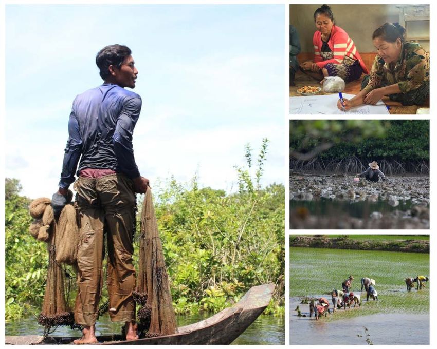
Contents

1. Situation Analysis
1.     Introduction ........................................................................................................................................................... 1
       1.1.       Ramsar Regional Initiatives ................................................................................................................ 1
       1.2.       The Indo-Burma Ramsar Regional Initiative (IBRRI)............................................................... 2
       1.3.       IBRRI Secretariat ..................................................................................................................................... 3
2.     Wetlands of the Indo-Burma Region............................................................................................................ 3
       2.1.       Wetland values ......................................................................................................................................... 3
       2.2.       Wetland threats ........................................................................................................................................ 9
       2.3.       Ramsar sites ............................................................................................................................................ 12
3.     Information and data review ........................................................................................................................15
       3.1.       National reporting ................................................................................................................................ 15
                  Analytical approach ..................................................................................................................................... 15
                  Results and discussion ................................................................................................................................. 16
       3.2.       Reporting from the Inception Workshop ................................................................................... 19
                  Results and discussion ................................................................................................................................. 19
       3.3.       Potential regional synergies............................................................................................................. 20
                  Ramsar Regional Centre - East Asia ..................................................................................................... 21
                  East Asian-Australasian Flyway Partnership ................................................................................... 21
                  ASEAN Centre for Biodiversity................................................................................................................. 23
                  ASEAN Working Group on Water Resources Management ....................................................... 24
                  Mekong River Commission ........................................................................................................................ 25
                  Lancang-Mekong Cooperation ................................................................................................................ 26
                  International dialogue partners ............................................................................................................. 27
                  Links with other conventions and international frameworks .................................................. 28
                  Mangroves for the Future .......................................................................................................................... 28
                  Mekong WET.................................................................................................................................................... 29
                  Other project-based opportunities ........................................................................................................ 29
4.     Situation analysis ............................................................................................................................................... 31
       4.1.       Developing strategic objectives ...................................................................................................... 31
       4.1.       Informing the strategic plan............................................................................................................. 32
       4.2.       Setting strategic objectives ............................................................................................................... 34

IBRRI Strategic Plan                                                                                                                                            iii | P a g e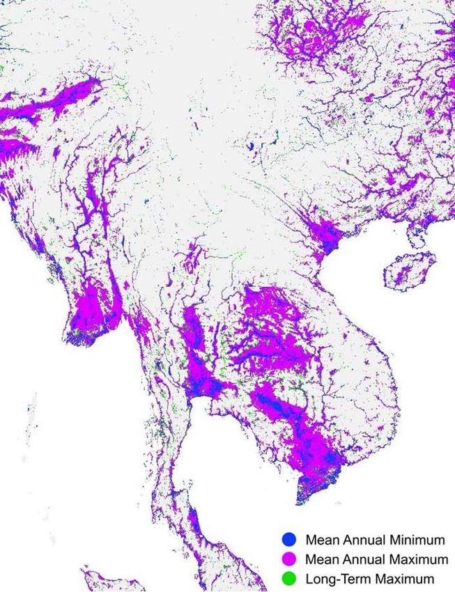
2.       Strategic Plan

1.     Objectives, targets and activities ................................................................................................................. 37
2.     Implementation strategy ................................................................................................................................ 38

3.       Annexes

Annex 1          IBRRI Contracting Party implementation analyses .................................................................55
Annex 2          Outputs from the IBRRI Inception Workshop ...........................................................................83
Annex 3          Draft budget ............................................................................................................................................. 88

IBRRI Strategic Plan                                                                                                                                        iv | P a g e
1
         SITUATION ANALYSIS

1. Introduction

    1.1.         Ramsar Regional Initiatives

                 The Convention on Wetlands, called the Ramsar Convention, is the
                 intergovernmental treaty that provides the framework for the conservation and
                 wise use of wetlands and their resources. The Convention’s regional initiatives
                 support cooperation and capacity building on wetland-related issues in specific
                 regions or sub-regions and improve the overall visibility of the Convention.

                 The Administrative Authorities responsible for implementing the Convention in
                 their countries drive the development and activities of regional initiatives.
                 Initiatives give them – and often their ministers – a platform for collaborating
                 with technical experts and representatives of intergovernmental bodies, Ramsar
                 International Organisation Partners (IOPs), non-governmental organisations
                 (NGOs), local communities and private companies.

                 Regional initiatives are endorsed by the Conference of Contracting Parties (COP)
                 and by the Standing Committee (SC) in between meetings of the COP. To be
                 formally recognised, they must conform to the Operational Guidelines for Ramsar
                 Regional Initiatives to support the implementation of the Convention 1. They are

1 http://www.ramsar.org/sites/default/files/documents/library/sc52-22_draft_revised_opguidelines_e.pdf
IBRRI Strategic Plan                                                                                 1|P a g e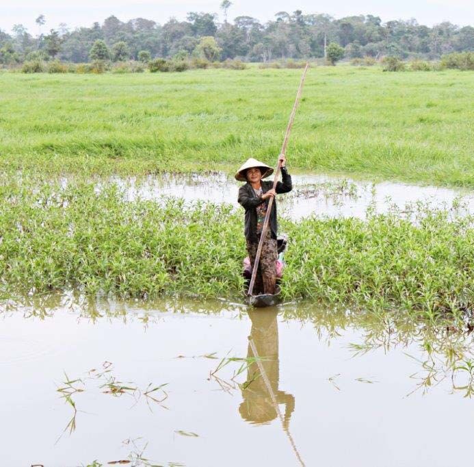
independently governed and are not authorised to speak or act on the
                Convention’s behalf, but they work in close contact with the Secretariat. Some
                initiatives receive start-up financial assistance from the Secretariat’s core
                budget.

    1.2.        The Indo-Burma Ramsar Regional Initiative (IBRRI)

                Decision SC52-20 of the Standing Committee of the Ramsar Convention endorsed
                the Indo-Burma Ramsar Regional Initiative (IBRRI) in June 2016 2. Details of the
                initiative are described in document SC52-12, June 2016.

                The concept for IBRRI was developed jointly by the Ramsar National Focal Points
                (NFPs) of the five Contracting Parties: Cambodia, Lao People’s Democratic
                Republic (PDR), Myanmar, Thailand and Viet Nam (Fig. 1) and IUCN’s Asia
                Regional Office. The initiative was based on specific needs identified in these
                countries. The initial objective of IBRRI was to support the effective
                implementation of the Ramsar Convention among the five Contracting Parties
                (CPs) by coordinating implementation of the objectives of the 4th Strategic Plan
                2016–2024.

        Figure 1. IBRRI Contracting Parties and approximate locations of Ramsar Sites (yellow stars).

2https://www.ramsar.org/document/decisions-of-the-52nd-meeting-of-the-standing-committee-sc52
IBRRI Strategic Plan                                                                            2|P a g e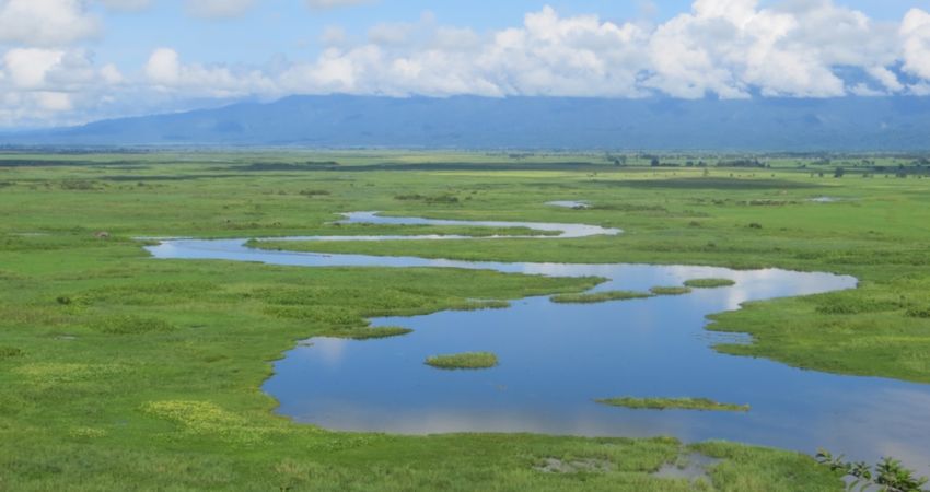
The Inception Workshop of the IBRRI was held in Bangkok, Thailand, on 30th
March 2017. The principal aims of the Inception Workshop were: a) to share the
objectives of IBRRI with a wider community working on wetlands in the region;
b) to discuss the priorities that should be included in a sub-regional Ramsar
strategic plan; and c) to explore linkages with existing Ramsar-related
programmes and initiatives in the Indo-Burma Region.
The workshop was attended by the Ramsar NFPs (or their representatives) from
Cambodia, Lao PDR, Myanmar, Thailand and Viet Nam; Ramsar Scientific and
Technical Review Panel (STRP) focal points; Ramsar Communications,
Education, Participation and Awareness (CEPA) focal points from both NGOs and
governments; and representatives from other Ramsar Regional Initiatives as
well as IOPs, academia, NGOs, and other development partners.
1.3. IBRRI Secretariat
IBRRI is supported by IUCN, which acts as the Secretariat through its Asia
Regional Office in Bangkok, Thailand, and its country offices in Cambodia, Lao
PDR, Myanmar, Thailand and Viet Nam.
2. Wetlands of the Indo-Burma region
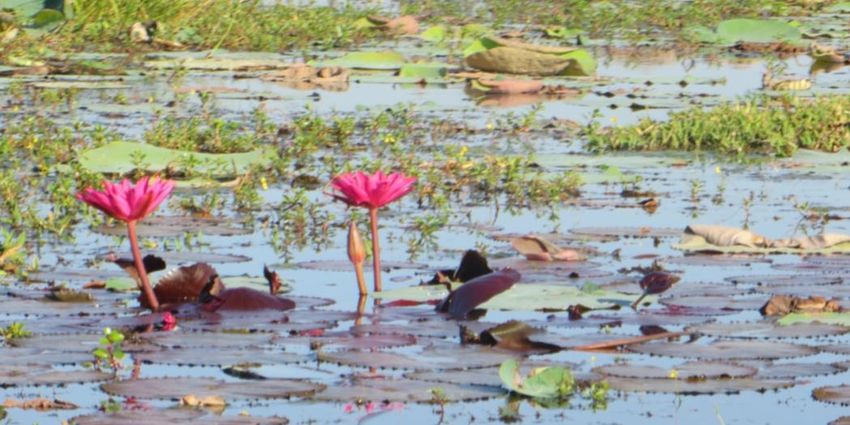
2.1. Wetland values
The Indo-Burma Region is a geographically diverse landscape. Extending from
the coral reefs in the Gulf of Thailand and the Bay of Bengal to the peak of
Hkakabo Razi in Myanmar at almost 6,000 metres above sea level, the region is a
known hotspot for biodiversity. Wetlands are extensive across this diverse
region (Fig. 2). Many different wetland types are present: from coral reefs,
coastal mangrove forests, extensive tidal flats, river and floodplain systems,
extensive delta systems, seasonally flooded swamp forests, lake, subterranean
karstic systems, and a plethora of human-made wetlands such as rice paddies,
fishing ponds and irrigation tanks.
These wetlands are home to some of the planet’s most endangered and
charismatic species including tigers (Panthera tigris), Asian elephants (Elephas
maximus), Siamese crocodiles (Crocodylus siamensis), Mekong and Irrawaddy
(Ayeyarwady) River dolphins (Orcaella brevirostris), and giant catfish
(Pangasianodon gigas). The rivers of the region, such as the Mekong, Chao
Phraya, Irrawaddy and Salween (Thanlwin), have some of the highest numbers
of endemic freshwater fish species recorded anywhere on the planet.
Located along the East Asian-Australian flyway, the region is also critical to a
diversity of migratory and resident waterbirds. Many of these waterbirds are
globally threatened, such as Baer’s Pochard (Aythya baeri) and the Spoon-billed
Sandpiper (Calidris pygmaea). Some waterbirds, such as the Sarus Crane
IBRRI Strategic Plan 3|P a g e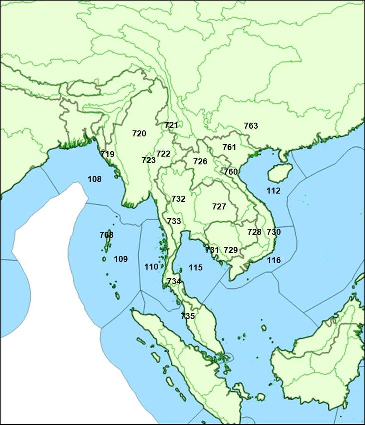
(Antigone antigone), are also important to communities because of their cultural
                  value.

                     Figure 2. Inundation areas of the Indo-Burma Region. (Source: Fluet-Chouinard et al.
                                                           (2015) 3).

                  The global categorisation of the Freshwater Ecoregions of the World (FEOWs 4)
                  represents a useful approach for developing strategic large-scale conservation
                  strategies, particularly for addressing threatened freshwater ecosystems. While
                  the Indo-Burma area is dominated by three river systems (the Irrawady, Salween
                  and Mekong) the freshwater regions extend beyond, and are sub-divided within,
                  these main basins. The region comprises 19 (FEOWs) many of which also extend
                  beyond the national geographical borders of the IBRRI Contracting Parties into

3 Fluet-Chouinard E., Lehner B., Rebelo L.M., Papa F., Hamilton S.K. (2015): Development of a global inundation map

at high spatial resolution from topographic downscaling of coarse-scale remote sensing data, Remote Sensing of
Environment. 158: 348-361.
4 http://www.feow.org/

IBRRI Strategic Plan                                                                                       4|P a g e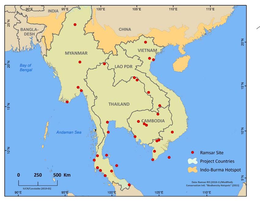
neighbouring states such as India, Bangladesh, China and Malaysia (Fig, 3 and
                  Table 1).

                       Reference
                                     Freshwater Ecoregion                                       Area (km2)
                       number
                       719           Chin Hills - Arakan Coast                                     115,639
                       720           Sitang - Irawaddy                                             460,941
                       721           Upper Salween                                                 142,241
                       722           Lower and Middle Salween                                      201,211
                       723           Inle Lake                                                        688
                       726           Lower Lancang (Mekong)                                        195,481
                       727           Khorat Plateau (Mekong)                                       223,518
                       728           Kratie - Stung Treng (Mekong)                                 108,965
                       729           Mekong Delta                                                  185,822
                       730           Southern Annam                                                 71,729
                       731           Eastern Gulf of Thailand Drainages                             34,076
                       732           Chao Phraya                                                   168,640
                       733           Mae Khlong                                                     51,028
                       734           Malay Peninsula Eastern Slope                                 149,640
                       735           Northern Central Sumatra - Western Malaysia                    97,718
                       761           Song Hong                                                     201,572
                       760           Northern Annam                                                 37,260
                       763           Xi Yiang                                                      517,090
                       768           Andaman Islands                                                 6,533

                                     Table 1. Freshwater Ecoregions of the Indo-Burma Region.

                  The Marine Ecoregions of the World (MEOWs 5) provide a global context for
                  large-scale patterns of species and communities on coastal and nearshore
                  marine shelf areas for the purpose of strategic conservation planning. The
                  diversity of the marine system around the Indo-Burma Region is demonstrated
                  by the classification into four provinces and six MEOWs (Fig. 3 and Table 2).
                  Within these MEOWs there is a diversity of wetland habitats, including
                  mangroves, tidal flats, seagrass beds, coral reefs and rocky shores.

                                                 Reference
                       Province                                  Marine Ecoregion
                                                  number
                       Bay of Bengal                108          Northern Bay of Bengal
                       Andaman                      109          Andaman and Nicobar Islands
                       Andaman                      110          Andaman Sea Coral Coast
                       Sunda Shelf                  115          Gulf of Thailand
                       Sunda Shelf                  116          Southern Viet Nam
                       South China Sea              112          Gulf of Tonkin
                                        Table 2. Marine Ecoregions of the Indo-Burma Region.

5 https://www.worldwildlife.org/publications/marine-ecoregions-of-the-world-a-bioregionalization-of-

coastal-and-shelf-areas
IBRRI Strategic Plan                                                                             5|P a g e
Figure 3. Freshwater Ecoregions (FEOWs, in green) and Marine Ecoregions (MEOWs, in
                                             blue) of the Indo-Burma Region.

                  The wetlands of the region are not only important for supporting a vast diversity
                  of fauna and flora; they are also crucial to the well-being of millions of people.
                  Across the region, the diverse wetlands provide human society with multiple
                  benefits: providing food, natural medicinal products, building materials, and
                  protection from storms and floods; as well as regulating water flows and
                  improving water quality.

                  Wetlands are crucial across the region for feeding Indo-Burma’s vast population.
                  For instance, the Lower Mekong Delta supports the world’s most productive
                  inland fisheries, valued at around USD 3 billion per annum. These fisheries
                  support the well-being of millions of people and provide local communities with
                  up to 80% of their animal protein consumption. Similarly, the fisheries
IBRRI Strategic Plan                                                                        6|P a g e
associated with Tonle Sap make up some 60% of the total inland catch in
Cambodia. The coastlines of Cambodia, Myanmar, Thailand and Viet Nam
support more than 896,000 hectares of mangroves which provide millions of
people with food as well as a variety of other benefits including fuel wood, storm
protection and building materials 6.
The Mekong Delta is the most important rice production region in Viet Nam,
significantly contributing to the food security of the nation. The government of
Viet Nam has projected an annual rice yield of 23 million tons from this region
alone, for both domestic consumption and foreign export 7. However, the
intensification of rice production can compromise other ecosystem services,
such as water quality, aesthetic values, and habitat for wildlife, especially aquatic
fauna, all of which have serious implications for human health, well being and
wider livelihoods in the Delta area7.
Across Lao PDR, more than 70% of the population are engaged in fishing-related
livelihoods, with a large proportion of fish catches being consumed within
households 8. Fishing is often one of a diversity of livelihood strategies, which
also include rice production, livestock rearing, and collection of other aquatic
resources. This shows how communities surrounding wetlands are heavily
dependent on these ecosystems for the resources and services they provide.
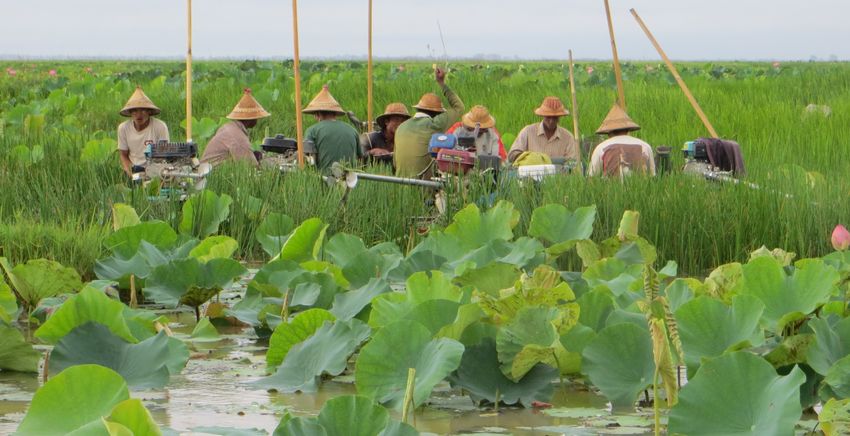
Similar mixed wetland-related livelihood strategies are observed at Moeyungyi
Wetland Wildlife Sanctuary Ramsar Site in Myanmar where fishing activities are
often complemented by other activities such as collection of insects, trapping of
snakes, harvesting of lotus stems for fibre, or collection of lotus pollen9. It can
therefore be concluded that many of the provisioning services provided by
wetlands within the Indo-Burma Region play a key role in wider livelihood and
poverty management strategies at the household level.
Aside from being crucial for livelihoods, the wetlands of Indo-Burma provide a
range of natural regulating services that maintain conditions for human life not
just within the region, but also across the globe. The coastal mangroves that
fringe the shoreline of Myanmar, Thailand, Cambodia and Viet Nam act as
significant carbon sinks and hence help mitigate the impacts of climate change.
Studies have shown that over 90% of the carbon locked up in the mangroves of
the Mekong Delta is belowground in the sediments and soils 10. Conservation
6 Brander, L. M., Wagtendonk, A. J., Hussain, S. S., McVittie, A., Verburg, P. H., de Groot, R. S., & van der Ploeg, S. (2012).
Ecosystem service values for mangroves in Southeast Asia: A meta-analysis and value transfer application. Ecosystem
Services, 1(1), 62-69
7 Berg, H., Söderholm, A. E., Söderström, A. S., & Tam, N. T. (2017). Recognizing wetland ecosystem services for
sustainable rice farming in the Mekong Delta, Vietnam. Sustainability Science, 12(1), 137-154.
8 Martin, S. M., Lorenzen, K., & Bunnefeld, N. (2013). Fishing farmers: fishing, livelihood diversification and poverty in
rural Laos. Human Ecology, 41(5), 737-747.
9 Merriman, J.C. & Murata, N., (2016) Guide for Rapid Economic Valuation of Wetland Ecosystem Services. BirdLife
International Tokyo, Japan. 61pp.
10 Nam, V. N., Sasmito, S. D., Murdiyarso, D., Purbopuspito, J., & MacKenzie, R. A. (2016). Carbon stocks in artificially
and naturally regenerated mangrove ecosystems in the Mekong Delta. Wetlands ecology and management, 24(2), 231-
244.
IBRRI Strategic Plan 7|P a g eefforts should focus on maintaining these stocks while also focussing on
replanting and regenerating lost mangrove systems so that improved
aboveground biomass productivity can catalyse future carbon storage.
The river systems of Indo-Burma are predominantly characterised by a flood-
pulsed hydrology. The natural floodplain wetlands of these rivers have the
capacity to store water and buffer downstream impacts on communities and
infrastructure. However, decades of poor land-use planning, and structural
interventions, such as channel modification, diversions and dam construction,
have profoundly influenced vulnerabilities to flood events, from the household to
the scale of the regional economy 11. Future risk management strategies need to
consider the potential role of wetlands, not just in the physical attenuation of
flooding, but also (as in the case of parts of the Mekong Delta) in combination
with other livelihood activities, such as aquaculture or jute production. The
development of such integrated strategies have the potential to address wider
issues such as disaster risk reduction and food security.
The seasonal flooding of wetlands across the region, which accompanies the
monsoon, also plays a vital role in recharging groundwater. In Cambodia, the
Mekong, Tonle Sap and Bassac Rivers inundate their floodplains on an annual
basis. Modelling has demonstrated that the slow infiltration through the
wetlands of these river systems during times of flooding is a crucial mechanism
for recharging groundwater and maintaining the viability of groundwater
resources throughout the dry season 12. Similar scenarios are known from Beung
Kiat Ngong Wetlands, Lao PDR, where a strong interconnection between surface
and groundwater systems leads to seasonal recharging of groundwater sources
as the wetland refills during the wet season. 13
Culturally, the wetlands of the Indo-Burma Region are integral to many belief
systems. Many temples are intrinsically linked with wetlands. For instance,
Shwemyitzu Pagoda in Indawgyi, Myanmar, hosts some 80,000 visitors annually
as part of a pilgrimage to the shrine said to contain hair from the Buddha. At Inle
Lake, Myanmar, the Buddhist belief in nats (animist spirits) has led to the
creation of a shrine and the subsequent protection of a small island nature
reserve where people are reluctant to damage the plants for fear of harming
these spirits 14.
The iconic Sarus crane, which is widespread across the Indo-Burma Region, is
embedded in the culture of many communities. The term Sarus is derived from
11 Lebel, L., Sinh, B., Garden, P., Hien, B. V., Subsin, N., Tuan, L. A., & Vinh, N. T. P. (2009). Risk reduction or
redistribution? Flood management in the Mekong region. Asian Journal of Environment and Disaster Management,
1(1), 23-39.
12 May, R., Jinno, K., & Tsutsumi, A. (2011). Influence of flooding on groundwater flow in central Cambodia.
Environmental Earth Sciences, 63(1), 151-161.
13 Lacombe, G., Pavelic, P., McCartney, M., Phommavong, and K., Viossanges, M., 2017, International Water
Management Institute. Hydrological assessment of the Xe Champone and Beung Kiat Ngong wetlands - Final Report,
CAWA Project.
14 Nardi, D. (2005). The Green Monks of Burma: The Role of Monks and Buddhist Civil Society in Environmental
Conservation in Burma.‖. The Georgetown University Journal of the Environment, 7, 5-14.
IBRRI Strategic Plan 8|P a g ethe Sanskrit term sarasa, which means ‘bird of the lake’. There are multiple
myths and legends associated with the bird, particularly as an eternal symbol of
unconditional love, devotion and good fortune 15. The stylised image of the Sarus
crane can be found in many temples in Viet Nam and the Vietnamese have a
traditional saying that “birds only stay in good lands”, demonstrating the link
between wetlands and human cultural identity.
It is clear that there is much more to the wetlands of the Indo-Burma Region
than their ability to support nature conservation. Through appropriate
management and stewardship, wetlands can make positive contributions to a
range of broader agendas. The ability of wetlands to store and sequester carbon
makes their protection and restoration valuable strategies for Nationally
Determined Contributions to achieve the goals of the Paris Agreement within the
United Nations Framework Convention on Climate Change.
The critical role that wetlands can play in buffering storms, reducing impacts of
flooding and providing greater resilience to communities against other hazards
makes them integral to achieving objectives within the Sendai Framework for
Disaster Risk Reduction. The wise use of wetlands forms a vital element of
several of the United Nations’ Sustainable Development Goals (SDGs). Under
Goal 6, the restoration of wetlands is considered essential in order to ensure
availability and sustainable management of water and sanitation for all.
Similarly, under Goal 15 the protection and restoration of wetlands is a key
component to promote sustainable use of ecosystems, combat desertification,
and halt and reverse land degradation and biodiversity loss.
2.2. Wetland threats
The establishment of IBRRI is considered very timely as the wetlands within the
region currently face a range of threats and challenges. It has been estimated
that around 80% of the region’s wetlands are threatened with conversion to
agricultural land or development 16. The hydrology of the region is set to change
widely: more dams are planned for construction in Indo-Burma than in any other
region in the world 17. Although considered a potential source of renewable
energy, dams can result in irreversible changes to wetlands, threatening
biodiversity and undermining rural economies and livelihoods.
Forest loss, including drainage and conversion of peat swamp forests and coastal
mangroves, is one of the major drivers of impacts on wetlands. The loss of
natural forested wetlands to pulp and paper, rubber and palm oil plantations
drives the clearances and accelerates wetland degradation and loss. Estimates
15Adesh, K., & Amita, K. (2017). Sarus Crane in Indian Mythology and Culture. Int. J. of Life Sciences, 5(3), 465-470.
16Conklin, J.R., Y.I. Verkuil & B.R. Smith. 2014. Prioritizing Migratory Shorebirds for Conservation Action on the East
Asian-Australasian Flyway. WWF-Hong Kong, Hong Kong. 128pp.
17Zarfl, C., Lumsdon, A. E., Berlekamp, J., Tydecks, L., & Tockner, K. 2015. A global boom in hydropower dam
construction. Aquatic Sciences, 77(1), 161-170.
IBRRI Strategic Plan 9|P a g esuggest that only 35% of the historical peat swamp forest area in some parts of
Asia remains 18.
Human population is growing rapidly across the region. This has resulted in
growing demands on agriculture and food production, and a subsequent physical
conversion of natural wetlands into farmed land, as well as increased use of
pesticides, herbicides and fertilisers which impact aquatic ecosystems.
Additionally, the expansion of aquaculture in coastal areas has resulted in risks
to the environment, human health and wider fisheries 19.
Many invasive alien species threaten the region’s biodiversity20. The
introduction, whether intentional or unintentional, of invasive plant and animal
species is resulting in a range of impacts, including the displacement of native
species, the ecological and physical modification of ecosystems, and
hybridisation and genetic dilution, resulting in economic losses to local
communities.
Dense mats of the invasive, non-native water hyacinth (Eichhornia crassipes) can
choke watercourses, deplete oxygen and outcompete and shade out native flora.
As a consequence, the pernicious presence of water hyacinth can impact upon
local livelihoods, especially fisheries. At Inle Lake, Myanmar, water hyacinth was
introduced in the 1960s as an ornamental species. However today it has become
a serious management challenge, especially since it obstructs waterways 21. In Xe
Champhone Wetlands, Lao PDR, water hyacinth is threatening important
habitats of the critically endangered Siamese crocodile (C. siamensis).
The golden apple snail (Pomacea canaliculata) is believed to have been
introduced to the Indo-Burma Region in the 1980s or 1990s. The snails are
voracious herbivores and can cause significant damage to aquatic plants and rice
production. A snail with a shell height of 3.5 centimetres can eat up to 12 rice
seedlings per day, which can equate to as much as 50% crop loss when snail
population densities are high. The snail is also the host of the rat lungworm
parasite (Angiostrongylus cantonensis) that causes eosinophilic meningitis in
humans if the snail is consumed without appropriately thorough cooking 22.
18 Posa, M. R. C., Wijedasa, L. S., & Corlett, R. T. (2011). Biodiversity and conservation of tropical peat swamp forests.
BioScience, 61(1), 49-57.
19 Gräslund, S., & Bengtsson, B. E. (2001). Chemicals and biological products used in south-east Asian shrimp farming,
and their potential impact on the environment—a review. Science of the Total Environment, 280(1), 93-131.
20 Peh, K. S. H. (2010). Invasive species in Southeast Asia: the knowledge so far. Biodiversity and Conservation, 19(4),
1083-1099.
21 Lansdown, R. V. (2012). The conservation of aquatic and wetland plants in the Indo-Burma region. Allen DJ, Smith
KG, Darwall WRT, compilers. The status and distribution of freshwater biodiversity in Indo-Burma. Cambridge, UK and
Gland, Switzerland: IUCN, 117-133.
22 Joshi, R. C. (2007). Problems with the management of the golden apple snail Pomacea canaliculata: an important
exotic pest of rice in Asia. In Area-wide control of insect pests (pp. 257-264). Springer, Dordrecht.
IBRRI Strategic Plan 10 | P a g eClimatic variations and changes across the region are impacting wetlands 23.
Rising annual mean temperatures are altering hydrological functions, such as
accelerating snow melt and modifying river dynamics. Monsoonal precipitation
is demonstrating increased temporal and spatial variability, often marked by a
shorter period but with more extreme rainfall events. Across the coastline of the
region, sea level rise in combination with rapid urbanisation is squeezing coastal
wetlands and increasing threats to human society. The Mekong Delta is expected
to become highly vulnerable to more intense storm events, as well as increasing
risks of saltwater intrusion and erosion as a result of rising sea levels 24.
Elsewhere in the Indo-Burma Region, predicted changes in the distribution and
amount of monsoonal rainfall will manifest themselves in increases in discharge
in the Salween River beyond 2040 25.
Pollution of both inland and coastal aquatic systems continues to increase across
the Indo-Burma Region. Increased nutrient loads from agriculture and human
wastewater is resulting in widespread eutrophication of surface waters.
Chemical and industrial pollution is increasing as development, and particularly
urbanisation, is expanding as economies grow 26. Mining activities are
contributing to the pollution of wetlands through increased sediment loads and
contamination by associated metals and pH alterations. For instance, at
Indawgyi, Myanmar, traditional artisanal gold mining has resulted in
contamination of the lake and river environments by mercury used in the mining
process. In some localities, artisanal methods have been supplanted by intense,
industrial mining activities resulting in even greater contamination and impacts
on the environment as well as human health 27.
Many wetland resources are subject to overexploitation across the region. Fish
species are threatened by overfishing resulting in population declines of more
than 80% recorded over the last 20 years. These declines are manifested in
endemic and endangered species such as the Mekong giant catfish
(Pangasianodon gigas), as well as in smaller migratory species, such as the small-
scale croaker (Boesemania microlepis), which has experienced an 80% decrease
in population size in Lao PDR, despite a law prohibiting their capture during the
breeding season 28.
23 Junk, W. J., An, S., Finlayson, C. M., Gopal, B., Květ, J., Mitchell, S. A., Mitsch, W.J. & Robarts, R. D. (2013). Current state
of knowledge regarding the world’s wetlands and their future under global climate change: a synthesis. Aquatic
sciences, 75(1), 151-167.
24 Cruz, R.V., Harasawa, H., Lal, M., Wu, S., Anokhin, Y., Punsalmaa, B., Honda, Y., Jafari, M., Li, C. and Huu Ninh, N. 2007.
Asia. In M.L. Parry, O.F. Canziani, J.P. Palutikof, P.J. van der Linden, P.J. and C.E. Hanson (eds.), Climate Change 2007:
Impacts, Adaptation and Vulnerability. Contribution of Working Group II to the Fourth Assessment Report of the
Intergovernmental Panel on Climate Change, pp. 469–506. Cambridge University Press, Cambridge, UK
25 Xu, J., Grumbine, R. E., Shrestha, A., Eriksson, M., Yang, X., Wang, Y. and Wilkes, A. 2009. The melting Himalayas:
cascading effects of climate change on water, biodiversity, and livelihoods. Conservation Biology 23:520–530.
26 Dudgeon, D., Choowaew, S. and Ho, S.C. 2000. River conservation in Southeast Asia. In: Boon, P.J., G.E. Petts and B.R.
Davies (eds.). Global Perspectives on River Conservation: Science, Policy and Practice, pp. 279– 308. John Wiley and
Sons, Chichester, UK.
27 Osawa, T., & Hatsukawa, Y. (2015). Artisanal and small-scale gold mining in Myanmar. International Journal of
Human Culture Studies, 2015(25), 221-230.
28 Dudgeon, D. (2012). Threats to freshwater biodiversity globally and in the Indo-Burma Biodiversity Hotspot. The
Status and Distribution of Freshwater Biodiversity in Indo-Burma, 1-28.
IBRRI Strategic Plan 11 | P a g eTo conclude, despite the multiple values that the Indo-Burma wetlands provide
to human populations within and beyond the region, many threats remain to be
addressed. Through IBRRI, there is the potential to develop and implement
measures to sustainably address these threats and to stem the loss and
degradation of wetlands and the species they support.
2.3. Ramsar Sites
There are 32 designated Ramsar Sites across the IBRRI countries (as of April
2018) (Fig. 1). These Ramsar Sites together cover some 759,000 hectares, or
approximately 0.4% of the surface area of the five IBRRI countries. Almost half
(n=14) of the region’s Ramsar Sites (equating to more than half of the surface
area) are located within Thailand (Fig. 4). Viet Nam has designated eight Ramsar
Sites, while Cambodia, Myanmar and Lao PDR have designated four, four and
two respectively.
Figure 4. Distribution of Ramsar Sites across the Indo-Burma Region. (Areas are shown
in hectares).
Eighteen (or 56%) of the Ramsar Sites are inland wetlands, and 14 (44%) are
classified as coastal sites. Across the network of sites, a diversity of wetland
types are represented (Fig. 5). Inland systems include permanent freshwater
marshes and pools; shrub-dominated wetlands; freshwater, tree-dominated
wetlands; seasonal or intermittent freshwater marshes and pools on inorganic
soils; permanent, seasonal or intermittent rivers, streams or creeks;
subterranean karst systems; and human-made wetlands, including ponds,
irrigated land, and seasonally flooded agricultural land. Coastal Ramsar Sites are
characterised by permanent shallow marine waters; sand, shingle or pebble
shores; subtidal aquatic beds; rocky shores; coastal brackish or saline lagoons;
intertidal mud, sand or salt flats; intertidal forested wetlands; and estuarine
waters.
Although the Ramsar Sites in the region represent a relatively comprehensive
and diverse network of wetland types, there are eleven wetland types of the
Ramsar wetland classification that are not represented, including coastal
IBRRI Strategic Plan 12 | P a g efreshwater lagoons, seasonally or intermittent saline lakes and pools, non-
forested peatlands, alpine wetlands, tundra wetlands, freshwater springs,
geothermal wetlands, salt exploitation sites, excavations and wastewater
treatment areas (Fig. 5). While it is likely that some of these wetland types may
not exist within the Indo-Burma Region, attempts should be made to assess the
potential to designate future Ramsar Sites in order to address the under-
represented types.
Figure 5. Frequency of wetland types recorded from the 32 Ramsar Sites in the Indo-
Burma Region. (Blue=Coastal; Green=Inland; Orange=Human-made).
Additionally, the spatial distribution of Ramsar Sites (Fig. 1) shows that there are
many unrepresented ecoregions, especially the FEOWs (Fig. 3). In order to
develop a coherent network of sites across the region, further consideration
should be given to the distribution and representativeness of sites within the
broader biogeographical context. Such considerations will ensure that both
wetland types and the wider spatial conservation context are addressed in the
plans for future Ramsar Site designation.
The number of Ramsar Sites in the region has been steadily increasing since the
accession of Viet Nam on 20th January 1989 (Fig. 6). The accession of Thailand
IBRRI Strategic Plan 13 | P a g e(13th September 1998) and Cambodia (23rd October 1999) instigated a stepped
increase in the number of Ramsar Sites in the region over the early 2000s, with a
marked increase in the area of coverage in 2002 as a result of the designation of
the Kaper Estuary - Laemson Marine National Park - Kraburi Estuary Ramsar
Site in Thailand which covers more than 122,000 hectares. Since the early 2000s
the number of Ramsar Sites designated each year has slowly increased as
Myanmar (accession on 17th March 2005) and Lao PDR (accession on 28th
September 2010) acceded to the Convention. Since 2010 there has been a steady
and increasing number of designations and a growing area of coverage across
the region.
Figure 6. Number and area of Ramsar Sites in the Indo-Burma Region since 1998. (Red
line=number of Ramsar Sites; blue line= total area of Ramsar Sites).
Ramsar Sites across the region have been designated for a variety of the nine
designation Criteria (Fig. 7). Criterion 2 (supports vulnerable, endangered, or
critically endangered species or threatened ecological communities) has been
applied to all 32 Ramsar Sites across the region. Criterion 1 (contains a
representative, rare, or unique example of a natural or near-natural wetland type
found within the appropriate biogeographic region) has been applied to more
than 70% of the Ramsar Sites, and for both of the designated Sites in Lao PDR.
The Contracting Parties in all five countries have designated Sites based on
Criterion 4 (supports plant and/or animal species at a critical stage in their life
cycles, or provides refuge during adverse conditions) and Criterion 8 (an
important source of food for fishes, spawning ground, nursery and/or migration
path on which fish stocks, either within the wetland or elsewhere, depend). This
demonstrates the significant importance wetlands play in the region in
supporting fisheries. In Lao PDR, these two criteria have been applied to both
designated Sites in the country, but in the other four countries, only subsets of
the Sites qualify under these Criteria.
IBRRI Strategic Plan 14 | P a g eFigure 7. Percentage of Ramsar Sites in each of the IBRRI countries qualifying under the
nine designation criteria.
The specific Criteria based on waterbirds (Criteria 5 and 6) have not been
applied in Lao PDR. In Thailand, Criterion 6 (1% of the individuals in a
population on one species or subspecies of waterbird) has not been applied, and
Criterion 5 (regularly supports 20,000 or more waterbirds) has only been
applied at one Site. However, in Myanmar all four Ramsar Sites have applicability
under Criterion 6, while Criterion 5 is applicable to three.
3. Information and data review
3.1. National reporting
Analytical approach
The extent of Ramsar Convention Strategic Plan implementation by the five
Contracting Parties (CPs) covered by the geographical scope of the IBRRI can be
investigated based on the National Reports (NRs) submitted to COP12. These
reports were compiled and submitted by all five IBRRI Parties mostly during
2015. COP12 and COP11 NRs are also available for all IBRRI CPs, and these have
been used to assess progress in implementation extent between COP11 and
COP12 reporting. The analyses of COP11 and COP12 NRs use 74 selected NR
indicator questions that apply to all CPs.
The Strategic Plan Goals and actions in most parts of this situation analysis are
those of the Ramsar Strategic Plan 2009–2015, since the implementation
reported by Parties in their COP12 NRs concern implementation of this Strategic
Plan. The four goals of the Strategic Plan 2009–2015 were: a) Wise use; b)
Ramsar Sites; c) International cooperation; and d) Implementation capacity.
Based on the indicator questions under each of the goals it is possible to derive a
percentage implementation for different goals, CPs or regions. The full analysis
of the NRs is provided in Annex 1.
IBRRI Strategic Plan 15 | P a g eCOP13 NRs submitted by all five IBRRI Contracting Parties became available late
in the timeline of preparing this analysis, but it has been possible to include
some limited further analysis of these in relation to the COP12 NRs. This includes
a) implementation extent, under the four new Goals of the Ramsar Strategic Plan
2016–2024; and b) the main difficulties in implementation, and future priorities
for implementation, reported by IBRRI CPs. Note that only 68 of the 74 COP12
indicator questions were included in the NR format for COP13, so the results
from the COP13 NR analyses are not directly comparable with those from
previous NRs. For assessment of changes in the extent of implementation
between COP12 and COP13, the analyses are presented for the 68 NR indicators
common to the two sets of reports, presented under the four Goals of the
Strategic Plan 2016–2024: a) Goal 1: Addressing the drivers of wetland loss and
degradation; b) Goal 2: Effectively conserving and managing the Ramsar Site
network; c) Goal 3: Wisely using all wetlands; and d) Goal 4: Enhancing
implementation.
Results and discussion
This assessment of the NRs is cognisant that the veracity of the information
included must be taken at face value. While discussions with NFPs have
highlighted potential ambiguities and misunderstanding in reporting, the NRs
remain as the only official reporting mechanism and therefore the information
provided is considered in good faith.
Overall the percentage implementation by IBRRI Contracting Parties is similar to
the average for all Asia CPs. It is encouraging that comparison between the
extent of Ramsar implementation reported to COP11 (2012) and COP12 (2015)
indicates that four IBRRI CPs reported increased implementation extent to
COP12: Thailand (+21%), Viet Nam (+18%), Myanmar (+11%), and Lao PDR
(+10%). However, it is a concern that Cambodia reported much less
implementation (-27%) to COP12 than to COP11. Cambodia reported less
implementation under each of the four Strategic Plan Goals. In addition,
Myanmar reported less Goal 1 (Wise use) implementation. The reasons
underlying this reported reduced implementation capacity are not clear and
would benefit from further investigation.
In contrast to implementation extent changes between COP11 and COP12, for
implementation extent reported to COP13 four IBRRI Parties reported reduced
implementation: Lao PDR (-17%), Myanmar (-16%), Thailand (-18%) and Viet
Nam (-6%). But encouragingly, the IBRRI CP with the lowest COP12
implementation extent, Cambodia, reported a 27% increase in implementation
to COP13 (Fig. 8). Nevertheless, it is of particular concern that all five IBRRI
Parties reported to COP13 a reduction in implementation of Strategic Plan Goal 4
(Enhancing implementation) suggesting within-country implementation capacity
may be decreasing.
IBRRI Strategic Plan 16 | P a g eFigure 8. Percentage implementation for COP12 (dark columns) and COP13 (light
columns). Percentage implementation values shown.
The overall extent of Strategic Plan implementation differs greatly across all Asia
CPs, and between the five Indo-Burma CPs (Fig. 9). Viet Nam reported the
highest implementation extent (84%) of any Asia CP, with Thailand also
reporting extensive implementation (70%). In contrast, Myanmar, Lao PDR and
Cambodia each reported to COP12 less than 40% implementation, well below
the regional average of 51%, with Cambodia reporting the least implementation
(27%).
Figure 9. COP12 implementation of Goals 1 to 4 for all Asian CPs.
The relative implementation extent reported to COP13 across IBRRI Parties is
similar to that reported to COP12, with Cambodia and Lao PDR reporting least
implementation (Analysis of progress on the 74 individual actions under the four Goals reported
to COP12 highlights possible gaps in implementation and potential needs for
capacity building and targeted activities under the IBRRI. The Goal-by-Goal
analyses identified 20 actions as potential high priorities for consideration by
IBRRI for future Ramsar implementation support to CPs, since attention to these
actions would deliver most widespread capacity support to IBRRI CPs. In
summary, these 20 actions cover:
• Establishing a National Wetland Policy;
• Undertaking research on agriculture/wetland interactions;
• Ensuring water resource management treats wetlands as natural water
infrastructure;
• Implementing wetland restoration programmes/projects;
• Encouraging private sector activities/actions for wise use: Ramsar Sites
and all wetlands;
• Incentive measures: actions to implement positive incentives, and
removal of perverse incentives;
• Undertaking comprehensive national wetland inventory;
• Establishing management planning for future Ramsar Sites;
• Undertaking management effectiveness assessments for Ramsar Sites;
• Ensuring mechanisms are in place for reporting all Article 3.2 cases (of
human-induced negative change to Ramsar Site ecological character);
• Establishing cross-sectoral management committees for Ramsar Sites;
• Establishing networks for knowledge-sharing and training for wetlands;
• Identifying all transboundary wetland systems;
• Developing CEPA Action Plans at national, sub-national and
catchment/basin levels;
• Assessing national and local training needs;
• Establishing mechanisms for sharing Ramsar implementation guidelines
and other information between the Administrative Authority and Ramsar
Site managers.
Providing capacity support for these 20 actions would support IBRRI CPs as
follows:
• Cambodia: 18 actions
• Lao PDR: 18 actions
• Myanmar: 13 actions
• Thailand: 6 actions
• Viet Nam: 3 actions
CPs are required to report on their greatest difficulties in implementing the
Ramsar Convention in their NRs to the COP. Through this process, IBRRI CPs
reported a wide range of implementation difficulties as a consequence of a lack
of capacity, resources, knowledge and institutional frameworks and mechanisms.
IBRRI Strategic Plan 18 | P a g eDespite the presence of several well-funded initiatives within the region, lack of
funding was reported by all five IBRRI CPs. Lack of wetland/spatial planning
laws and regulations was reported by four CPs (Lao PDR, Myanmar, Thailand
and Viet Nam), while a general lack of implementation capacity and assistance
with addressing conversion of wetlands due to urban and industrial
developments were reported by three CPs (Cambodia, Thailand and Viet Nam).
The NRs for COP12 and COP13 also request that CPs report on their priorities for
future implementation. The most frequently reported future implementation
priorities, as reported by four out of five of the IBRRI CPs, were wetland
inventories, national wetland policy/strategies, Ramsar Site management
planning and implementation, participatory management and wetland manager
training and capacity building. Three IBRRI CPs reported future implementation
of national legislation, Ramsar Site designation, and general CEPA activities.
Because CPs in their COP12 NRs listed their future priorities and difficulties in
only broad, general terms (e.g. cultural values, wetland restoration,
research/monitoring) and not against specific Strategic Plan implementation
actions, it is difficult to directly compare how well these reflect the
implementation gaps identified in this situation analysis.
Despite all five IBRRI CPs in their COP12 NRs identifying lack of funding for
implementation as one of their greatest implementation difficulties, no IBRRI CP
identified accessing increased funding as a future priority. Excluding the funding
issue, neither is there a link between implementation issues reported as
difficulties and those identified as future priorities for implementation. Notably,
two issues (Ramsar Site designation, general CEPA) not reported as being a
difficulty were identified for future priority action by two or three of the IBRRI
Contracting Parties. However, some other implementation difficulties recognised
by two or three IBRRI CPs were also recognised as future priorities: legislative
amendments for delivering Ramsar commitments, and wetland/Ramsar Site
management planning.
3.2. Reporting from the Inception Workshop
Group discussions were held at the Inception Workshop for the IBRRI. The
discussions focussed on the four strategic and operational goals of the Ramsar
Strategic Plan 2016–2024 in order to identify, using the targets as guidance,
specific operational objectives and activities for the regional initiative.
The discussions also highlighted a range of related programmes, projects and
activities that the CPs were currently implementing either on their own or in
partnership with other countries or partners. A summary of the key findings of
the Inception Workshop is provided in Annex 2.
Results and discussion
Discussions held at the Inception Workshop summarised a range of activities and
ideas that could be incorporated into a strategic plan for the IBRRI. Some of the
IBRRI Strategic Plan 19 | P a g esuggestions were broad and generic; others were more targeted in relation to
implementation of specific aspects of the Convention. The synthesis presented
below attempts to summarise the outputs from the Workshop.
The language used in the Workshop report complicates the strength of
conclusions that can be drawn from the discussions. Many actions are couched in
the terms that the IBRRI ‘could’ do or ‘provide’ something, such as the IBRRI
‘could produce maps of wetlands’ or ‘provide support for national wetland
committees’.
It is also clear that there are some distinct ambiguities in the aspirations listed.
These may possibly stem from a clear lack of understanding or a dominance of
perception of need over reality of need. For instance, there is a specific
suggestion for the development of guidance on applying Ramsar Site designation
Criteria, and specifically Criterion 8 as it is considered to be an ‘overlooked’
Criterion. However, as is shown in Fig. 7, the Criterion is already being widely
applied to Ramsar Site designation in all countries of the region. Therefore,
despite this specific recommendation, the analysis of the actual Criteria used for
Ramsar Site designation suggest that guidance on the application of Criteria 3, 7
and 9 may be more useful.
While the Inception Workshop generated a broad list of possible activities, there
are very limited clear or precise recommendations. Only three activities or
actions are presented with a clear emphasis on being a priority or need. These
three are:
• The priority is to ensure that management plans can be implemented
effectively;
• Funding is a key element of sustainability for management plans; and
• There is a need to develop an inventory and better understanding of the
impacts of invasive alien species.
Rationalising and prioritising the list of possible activities recorded at the
Inception Workshop will require a further round of consultation. While there is
some correlation with the outputs from the synthesis of the NRs, with the
exception of a need for greater financing, there is limited consistency in the
summary points generated from the Inception Workshop and the
implementation gaps and future priorities reported in the NRs to COP12 and
COP13.
3.3. Potential regional synergies
There are several other regional or sub-regional activities, projects and
organisations, which have the potential to provide synergies with the IBRRI.
There is potential for these synergies to be explored and for mutual benefits to
accrue. Several particular opportunities are highlighted.
IBRRI Strategic Plan 20 | P a g eRamsar Regional Centre-East Asia
The 40th Meeting of the Standing Committee in May 2009 approved the
formation of the Ramsar Regional Centre - East Asia (RRC-EA) as a new regional
initiative. As of August 2017, the RRC-EA works with 17 countries that are
Contracting Parties (CPs) of the Ramsar Convention (Bangladesh, Bhutan,
Cambodia, China, India, Indonesia, Japan, Republic of Korea, Lao PDR, Malaysia,
Mongolia, Myanmar, Nepal, Philippines, Sri Lanka, Thailand, and Viet Nam). The
five CPs of the IBRRI all belong to the South Eastern Asia sub-region of the RRC-
EA.
The Memorandum of Understanding (MoU) signed by CPs in December 2015
states the objective for the Centre is to:
“enhance the implementation of the Ramsar Convention primarily in East but also
in Southeast Asia through, inter alia, capacity building, awareness raising,
enhancing cooperation and networking, and providing technical and financial
support.”
With a primary focus on capacity building, RRC-EA programmes its activities
based on three pillars of work: a) support to the implementation of CEPA
programmes; b) the provision of small grants to partners to implement projects
on the wise use of Ramsar Sites; and c) the strengthening of networking
approaches among Ramsar Administrative Authorities (AAs) and site managers
in Asia.
The RRC-EA has provided a series of training sessions and supported the
development of draft resolutions for the Ramsar COPs on the use of techniques
and tools to enhance conservation and monitoring of Ramsar Sites (e.g. Ramsar
Site Management Effectiveness Tracking Tool [R-METT], and Rapid Assessment
of Wetland Ecosystem Services).
The main challenges for the RRC-EA have been the development of sustainable
funding, and the multiple languages present across the region. The RRC-EA is
also developing an approach focusing on sub-regional interventions including
the Bay of Bengal, the Yellow Sea Region and the Lower Mekong Region (or Indo-
Burma Region).
Potential areas of cooperation with the IBRRI have been identified, including the
development of joint training projects and programmes, and the development
and delivery of Ramsar guidance. RRC-EA have recommended that the first step
for the development of cooperation with IBRRI should include a joint review of
respective work plans and identification of co-funding opportunities for key
activities in the Indo-Burma Region.
East Asian-Australasian Flyway Partnership
The East Asian-Australasian Flyway Partnership (EAAFP) is an informal and
voluntary partnership launched in November 2006, which aims to protect
IBRRI Strategic Plan 21 | P a g emigratory waterbirds, their habitat, and the livelihoods of people dependent
upon them. As of June 2018, there are 35 Partners, including 17 countries, six
intergovernmental agencies, 11 international NGOs, and one international
private enterprise. Four of the IBRRI CPs are partners. Lao PDR is currently not a
partner. The EAAFP is a formally recognised regional initiative under the Ramsar
Convention.
The purpose of the EAAFP is:
“to provide a flyway wide framework to promote dialogue, cooperation and
collaboration between a range of stakeholders including all levels of governments,
multilateral environment site managers, agreements, technical institutions, UN
agencies, development agencies, industrial and private sector, academe, non-
government organisations, community groups and local people, to conserve
migratory waterbirds and their habitats.” 29
The activities of the EAAFP are centred around five areas:
• Working Groups which provide advice and implementation support
across the partnership and address different groups of waterbirds as well
as CEPA and Avian Influenza issues;
• Task Forces which are established to address specific issues raised
during the Meetings of the Partners (MoP), such as concerns regarding
specific species or geographical regions;
• Campaigns which are usually topical and aimed at raising awareness of
particular issues across different stakeholder groups, such as local
communities, schools and individuals;
• World Migratory Bird Day-related activities during the annual
celebration of migratory birds; and
• Asian Waterbird Census (AWC), which is coordinated by Wetlands
International but is supported by the EAAFP within the region.
The EAAFP Strategic Plan 2019–2028 provides the framework for
operationalisation by the Partners, the Secretariat, EAAFP bodies and other
relevant stakeholders in order to conserve migratory waterbirds and their
habitats in the EAAF. The EAAFP Strategic Plan 2019–2028 sets out the following
five clear objectives:
• Develop the Flyway Network of sites of international importance for the
conservation of migratory waterbirds, building on the achievements of
the Asia-Pacific Migratory Waterbird Conservation Strategy, with the
ultimate goal of establishing a sufficient and efficient network of sites
with sustainable management.
• Enhance communication, education, and public awareness of the values
of migratory waterbirds and their habitats.
29East Asian - Australasian Flyway Partnership (EAAFP), Partnership Document – version 13.
http://www.eaaflyway.net/documents/key/eaafp-partnership-doc-v13.pdf
IBRRI Strategic Plan 22 | P a g eYou can also read