PILOT CASE STUDY CURRENT RIVER MANAGEMENT PROCESSES SWITZERLAND 2015
←
→
Page content transcription
If your browser does not render page correctly, please read the page content below
INN
PILOT CASE STUDY
CURRENT RIVER MANAGEMENT PROCESSES
SWITZERLAND 2015 | 2018
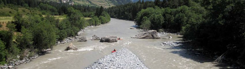
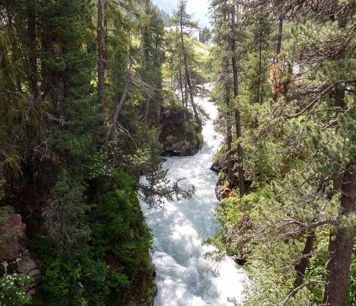
INNERALPINE
LANDSCAPE &
MORPHOLOGY
The Inn River basin is situated in
an inner-alpine dry valley.

The valley floor is based on an altitude
between 1800 m in Upper Engadine
and 1000 m in Lower Engadine.

The Upper Engadine is a broad
valley with altitudes up to 4049 m
and the Lower Engadine is a narrow,
asymmetric V-shaped valley with the
highest peak at 3411 m.
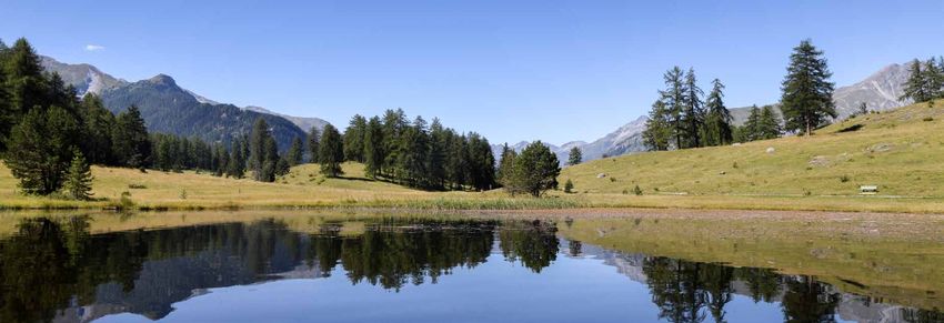
WATER LINES
  Water is always visible as a landscape
 element. In Upper Engadine the lakes
  on the valley floor form a magnificant
   landscape. In Lower Engadine only a
few lakes exist on the valley floor, some
                   of which are artificial.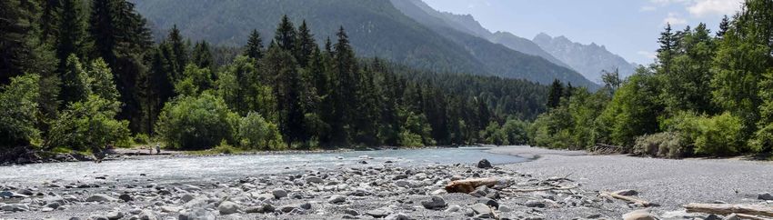
HYDROMORPHOLOGY
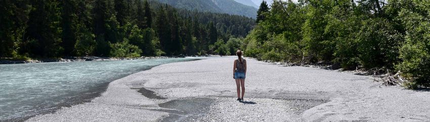
In Upper Engadine the Inn River
flows along a plain, whereas in Lower
Engadine steep slopes are frequent.
Floodplains of the main river are
becoming more and more inactive
because of the low residual flow
and its consequences.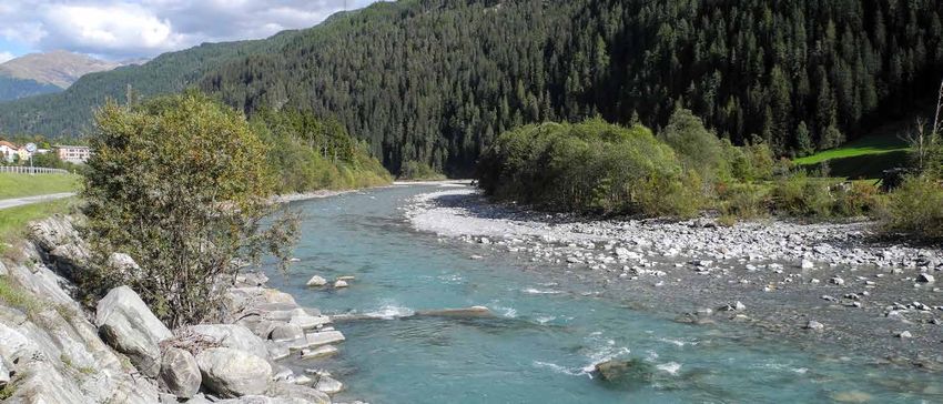
GLACIERS
 Glaciers cover approximately 4% of the
   total surface of the catchment area
(1945 km2). With climate change glacier
   melt is occurring at a high rate and
 until the end of the 21st century only a
      residual surface (less than 1%)
              will be covered.
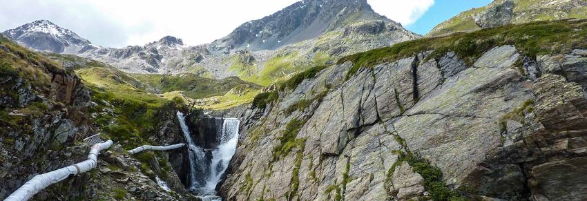
RIVER NETWORKS
 Tributaries are often on steep slopes.
Natural water bodies have a high range
  of discharge and a huge sediment
  transport, which can be the reason
   for floods in stormy periods. Many
 tributaries are used for hydropower.
HYDROPOWER
          EXPLOITATION
    Hydropower is one of the oldest
         uses of rivers in Engadine.

In the beginning of the 20th century
     the first hydropower plants were
      established in Upper Engadine.

The biggest hydropower plant dates
      back to 1960. Nowadays, small
  hydropower plants are being built
              in may tributary rivers.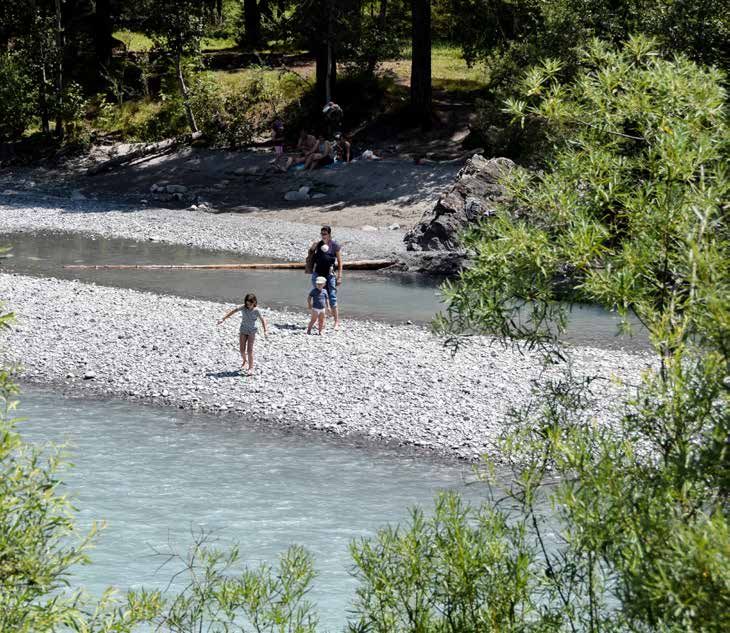
WINTER TOURISM
Tourism is the most important
economic sector in Engadine. Winter
tourism is more prominant than
summer tourism. Large events, such
as the Engadine Ski Marathon, require
water resources and are dependent on
the development of climate change.

WATER
FOR SNOW
Artificial snow making for alpine
and cross country skiing is increasing
steadily.
SUMMER
              TOURISM
During the summer, the Upper
Engadine lakes are commonly
         used for wind surfing.
AGRICULTURAL WATER WITHDRAWALS Agriculture also represents a main economic sector in the catchment area. Livestock farming is more common than dairy farming and, due to local climate conditions, water use for irrigation is higher in Lower Engadine than in Upper Engadine. The historical irrigation system with irrigation canals has been replaced by modern irrigation systems (sprinkler plants).
WATER CULTURE
      People usually perceive water as
something pleasant and the region has
      many springs for drinking water.
      In some places old Inn channels
         contain water only seasonally.
COMMUNICATION
AND EDUCATION
Awareness raising and educational
projects are also available for the water
sector.RIVER
RESTORATION
Revitilization projects are increasing
and are often related to flood
protection measures.RISK MITIGATION Risk mitigation measures are often artificial barriers or obstacles. In the past, canal building was also a common measure in the region to increase flood protection.
PARTICIPATION NEED
      Stakeholder involvement in water
       management processes was not
common in the past. Now, a large-scale
  participatory process is under way for
   integrated river basin management.
PUBLIC INTEREST Public interest in river protection and revitilization projects is increasing. These processes are now being developed with stakeholder involvement.
SPARE

INFO & CONTACTS
Angelika ABDERHALDEN
Pro Terra Engiadina
a.abderhalden@arinas.ch

Susanne MUHAR
BOKU University
susanne.muhar@boku.ac.at

Copyright © PTE
You can also read