LAND USE PLAN 100 years. 2018-2118 - TSLEIL-WAUTUTH NATION
←
→
Page content transcription
If your browser does not render page correctly, please read the page content below
T S L E I L-WAU T U T H N AT I O N

LAND
USE
PLAN
A plan to guide the use and development of
Tsleil-Waututh reserve land over the next
100 years.
           2018-2118
T S L E I L -WA U T U T H N AT I O N
                                                                                              1
                                             DECLARATION
                                     We are the Tsleil-Waututh First Nation, the People of the Inlet.
                                      We have lived in and along our Inlet since time out of mind.
                                      We have been here since the Creator transformed the Wolf
                                             into that first Tsleil-Wautt, and made the Wolf
                                                        responsible for this land.

                                            We have always been here and we will always be here.
                                             Our people are here to care for our land and water.
                                                     It is our obligation and birthright
                                              To be the caretakers and protectors of our Inlet.

                      Our people descended from powerful Hereditary leaders, Waut-salk and Sla-holt
                                  We know where we come from and we know who we are
                                              We respect our heritage and
                                      Nothing can change our history and our truth.

                          Our people travelled far and wide on our traditional territory, they paddled
                                           Our waters and climbed our mountains.
                           They understood the richness that our traditional territory held, and in
                                           Understanding this, they knew our land.
                          Our ancestors were responsible for our rivers, streams, beaches and forests
                                                  Of our traditional territory.
                           Our people knew our land well because it was for the benefit of everyone.

                                        Our Tsleil-Waututh Nation is moving into our future.
                                              Our children and our land are our future.
                                   Our future will bring enough for our children’s children to thrive.
                                                        We are looking forward,
                                              We are ready to meet the next millennium.

                           Therefore, be it known far and wide that our Tsleil-Waututh Nation, the
                         People of the Inlet, are responsible for and belong to our traditional territory.
                            Let it be known that our Tsleil-Waututh Nation is a Nation unto itself,
                                           Holding traditional territory for its people.

1
    Taken from the Tsleil-Waututh Nation Constitution (1997)
TABLE of CONTENTS
 Acknowledgements ................................................................. 4                    Community Safety........................................................... 42
 Glossary of Terms ..................................................................... 6                  Objectives ...................................................................... 42
1.0 Introduction................................................................................ 8          Policies ............................................................................ 42
    About Tsleil-Waututh Nation and                                                                      Climate Change ............................................................... 44
    Sleil-Waututh ...................................................................... 8                  Objectives ...................................................................... 44
    Purpose of the Plan .......................................................... 9                        Policies ............................................................................ 44
    Mandate ............................................................................... 10           Infrastructure .................................................................... 46
    Vision .................................................................................... 10          Objectives ...................................................................... 46
    Principles ............................................................................. 12             Policies ............................................................................ 46
2.0 Background & Planning Context ................................ 14                                5.0 Land Uses ..................................................................................... 48
    Our History ........................................................................ 14              Housing (Low Density).................................................. 48
    Planning History.............................................................. 18                       Objectives ...................................................................... 48
    Environment and Geography ..................................... 20                                      Policies ............................................................................ 48
    Population and Demographics .................................. 22                                    Housing (Multi-Family) ................................................ 50
    Housing................................................................................ 24              Objectives ...................................................................... 50
    Transportation .................................................................. 25                    Policies ............................................................................ 50
    Neighbouring Jurisdictions ........................................ 26                               Leasehold Housing ......................................................... 52
       District of North Vancouver (DNV) ................... 26                                             Objectives ...................................................................... 52
       Port Metro Vancouver .............................................. 26                               Policies ............................................................................ 52
       Metro Vancouver ........................................................ 26                       Community Space ........................................................... 54
       Province of British Columbia ................................ 26                                     Objectives ...................................................................... 54
       Government of Canada ............................................ 26                                 Policies ............................................................................ 54
       Utility Companies ...................................................... 26                       Neighbourhood Commercial ...................................... 58
    Alignment with existing plans ................................... 28                                    Objectives ...................................................................... 58
       Comprehensive Community Plan (CCP) ......... 28                                                      Policies ............................................................................ 58
       2009 Stewardship Policy ......................................... 28                              Park ....................................................................................... 60
       Burrard Inlet Action Plan........................................ 28                                 Objectives ...................................................................... 60
3.0 Planning Framework ........................................................... 29                       Policies ............................................................................ 60
    Methodology...................................................................... 29                 tə təməxʷs ƛ̓ smən̓e:m
       Community Engagement ........................................ 29                                  (The Land for the Descendants) ............................... 62
       Community Engagement in Numbers .............. 29                                                    Objectives ...................................................................... 63
       Engagement Activities ............................................ 30                                Policies ............................................................................ 63
    Research and Studies ...................................................... 31                       Protected Area .................................................................. 64
4.0 Objectives and Policies for Future Land Use ..... 32                                                    Objectives ...................................................................... 64
    General ................................................................................. 32            Policies ............................................................................ 65
    Archaeological .................................................................. 34             6.0 Implementation ....................................................................... 66
       Objectives ...................................................................... 34              Monitoring and Evaluation ......................................... 66
       Policies ............................................................................ 34
    Food Security ..................................................................... 36                   Appendix 1 – Land Use Plan Map ............................ 68
       Objectives ...................................................................... 36                  Appendix 2 – Community Engagement ............... 70
       Policies ............................................................................ 36              Appendix 3 – Reference Maps .................................. 72
    Foreshore ............................................................................. 38
       Objectives ...................................................................... 38
       Policies ............................................................................ 38
    Culture & Spirituality ..................................................... 40
       Objectives ...................................................................... 40
       Policies ............................................................................ 40

                                                                                                                           L A N D U S E P L A N 2018 -2 1 18 Tsleil-Waututh Nation                           3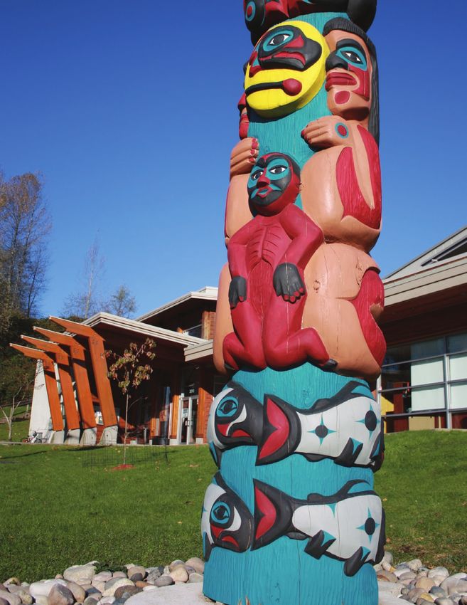
ACKNOWLEDGEMENTS
    This land use plan would not have been possible without the work, ideas, and
    collaboration of a number of people. Hay ce:p q̓ə si:y̓em̓ to the following people:

    Tsleil-Waututh Nation (TWN) Council:                 TWN’s Lands Advisory Committee:
        » Chief Maureen Thomas                             » Dan Herrick
        » Councillor Liana Martin                          » Ernest (Iggy) George
        » Councillor Deanna B. George                      » Councillor Jen Thomas
        » Councillor Charlene Aleck                        » Maureen Thomas
        » Councillor Jen Thomas                            » Quanah Weedon
        » Councillor Michelle R. George                    » Michelle R. George
        » Councillor Travis George                         » Luke Thomas

    TWN’s Land Use Planning Working Group members:       TWN Elders who participated in Elders workshops
      » Gordon Dick , Artist & LUP Logo Designer         to inform the plan:
      » Christine George                                      » Bonita J. Angel
      » Margaret R. George                                    » Terry Francis
      » Amanda George-Thomas                                  » Debbie George
      » Leah George- Wilson                                   » Dee George
      » Vanessa Gonzalez                                      » Ernest (Iggy) George
      » Dan Herrick                                           » Gord George
      » Cody LaRock                                           » Margaret George
      » Roderick Louis                                        » Delores Jim
      » Heidi Martin                                          » Doreen Parnell
      » Councillor Liana Martin                               » Alice Thomas
      » Mike O’Neill                                          » Pat Thomas
      » Debbie Sisson
      » John Sisson
      » Cassandra Smith

4
TWN Staff who participated in meetings and assisted   Raven Woods residents who responded to the land use
in reviewing the plan:                                planning survey (402 households).
     » Mattias Boon
     » Lisa Cyr                                       North Shore planners and residents who gave us tours
     » Bridget Doyle                                  of their communities and homes:
     » Emma Fineblit                                       » Gary Penway (City of North Vancouver)
     » Alison George                                       » Karen Rendek (District of North Vancouver)
     » Angela George                                       » Kathy McGrenera, Patrick Berard, Peter Burch
     » Kalila George-Wilson                                  and Camilla Amundsen from Quayside
     » Victor Guerin                                         Co-housing
     » Amy Hodgins                                         » Karen and Sandy from Burrardview
     » Fiona Huang                                           Housing Co-op
     » Allison Hunt
     » Hillary Hyland                                 Dillon Johnson who edited the final draft of the plan
     » Amanda King                                    and Topshelf Creative who designed this final version.
     » Dave Ko
     » Dale Komanchuk                                 Most importantly, all the members of the TWN com-
     » John Konovsky                                  munity who participated in land use planning events
     » Ocean Luo                                      and discussions, responded to surveys and shared their
     » Liana Martin                                   input in a variety of different ways.
     » Jackie Nelson
     » Lindsey Ogston                                 We gratefully acknowledge the support of the following
     » Deanna B. George                               organizations who made this land use planning process
     » Ernie George                                   possible:
     » Gabriel George
     » Michael George
     » Michelle P. George
     » Nick George
     » Kevin O’Neill
     » Tanya O’Neill
     » Gerald Schlesiger
     » Cassandra Smith
     » Kathrine Stegner
     » Carleen Thomas
     » Deidre Thomas
     » Luke Thomas
     » Matt Thomas
     » Ginevra Toniello
     » Andrew Van Eden
     » Melanie Walker

                                                                 L A N D U S E P L A N 2018 -2 1 18 Tsleil-Waututh Nation   5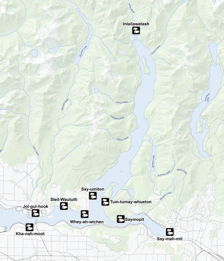
GLOSSARY of TERMS

    Allotments – the Tsleil-Waututh Land Code defines          Estuary – where the mouth of a river or creek meets the
    an allotment as lawful possession of a part of TWN         tide. On IR#3, estuaries are where the creeks on reserve
    reserve land held by a TWN member. The TWN Land            flow into Burrard Inlet providing important fish habitat.
    Code (2007) states that no new Allotments of TWN
    reserve lands will be granted until a Tsleil-Waututh       Explore (opportunities) – this language is used for
    Law has been passed to establish policy, procedure and     land use Policies and Objectives that require further
    criteria for granting Allotments. TWN Members might        research and/or engagement before a decision can
    currently hold an allotment to TWN land as a Certifi-      be made. “Opportunities” are ideas that have been
    cate of Possession (CP), Notice of Entitlement (NE) or     suggested throughout the land use planning process
    No Evidence of Title Issued (NETI) which was estab-        by Community Members or staff, but for which no clear
    lished before the Land Code came into effect.              consensus has emerged yet as to whether or not they
                                                               should be pursued.
    Amenities – anything that improves the quality of life
    in an area, beyond the bare essentials for health and      Feasibility – the extent to which something can be
    safety. Community amenities could include community        easily done.
    buildings (like a gym or health centre), commercial
    businesses (like a grocery store or hair salon), or out-   Invasive Species – Species of plants or animals that
    door spaces (like trails or parks).                        are not native to the local territory. Sometimes, invasive
                                                               species can threaten local species by taking over hab-
    Coastal Inundation – the temporary or permanent            itat, like when Himalayan blackberries take over areas
    flooding of a portion of land within the coastal zone.     of the forest so other local berries cannot grow. Invasive
                                                               species are also sometimes dangerous, such as Giant
    Community Members – refers to anyone who lives             Hogweed which can give people bad rashes or burns.
    within the Tsleil-Waututh “village,” including TWN
    Members and their families who may not be Members,         IR#3 Residents – refers to everyone who resides on
    but are part of the community, participating in commu-     TWN reserve land, including TWN Members, Commu-
    nity activities, using community facilities, etc.          nity Members, Leaseholders, and renters, who make
                                                               their home on IR#3.
    Culvert – a tunnel carrying a stream or open drain
    under a road. For example, on IR#3 there are culverts      Leasehold – Land or a building for which a registered
    carrying water from George, Thomas, and Big John           lease agreement has been entered into, for a known
    Creek under Dollarton Highway to Burrard Inlet.            amount of time. On reserve, land cannot be bought or
                                                               sold by non-TWN Members. However, TWN Members
    Density – when referring to housing, this is a descrip-    and non-Members alike can purchase Leasehold prop-
    tion of how many housing units are allowed in a certain    erty. On IR#3, Raven Woods has housing developments
    area, or lot. For example, low density might be a house    for which 99 year leases were granted for each devel-
    or duplex, meaning only one or two housing units on a      opment, and subleases were entered into for each unit.
    lot, while high density would be a high-rise apartment     Leaseholders can sublease their unit for the remainder
    building with dozens of units on the lot.                  of the term of their lease.

6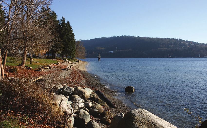
Mitigate – to make something less severe or harmful.          Sleil-Waututh – the traditional name for the historical
In the case of climate change, we can mitigate climate        Tsleil-Waututh village site where Burrard Inlet IR#3 is
change by reducing emissions, preserving forest, etc.         located.
While we mitigate climate change by reducing its caus-
es, we also have to adapt to climate change impacts as        Secondary Suites – A secondary suite is a separate
they are already occurring.                                   dwelling unit within a property. A house might have
                                                              one or more secondary suites, for example a basement
Mixed use – refers to a development or building that          suite, or coach house in addition to the main unit. Sec-
contains different types of land uses. When the uses          ondary suites are intended for rental housing.
are compatible (e.g. they do not create conflict for each
other due to noise, traffic, etc.) they can be a convenient   Shoreline Hardening – This is the process of chang-
and efficient use of space. For example, an apartment         ing shoreline, by adding structures such as seawalls
building might have a grocery store on the main floor         or jetties. Hardened shorelines can cause erosion and
that would give residents convenient access to                shrinkage of habitats.
shopping.
                                                              Stewardship – Stewardship is the value of being a care-
Objective – In this land use plan, Objectives are goals,      taker. Tsleil-Waututh people have always been stewards
or descriptions of what TWN hopes to achieve in               of the lands, waters, air, plants and animals in TWN’s
certain areas or categories. For example, an Objective        territory. Environmental stewardship is the duty to pro-
of Neighbourhood Commercial land use might be to              tect the environment of TWN’s territory and to work to
create employment for TWN Members.                            restore it where it has been damaged.

Policy – what action will be taken and what guidelines        Subsidized – to be partially supported (helped out)
will be followed to achieve any given Objective. For          financially. For example, TWN social housing units are
example, an Objective of the Neighbourhood Commer-            subsidized so that TWN covers part of the cost of rent
cial land use is to employ TWN Members, so a Policy is        to make the home more affordable.
to give priority for new developments which will create
employment opportunities.                                     tə təməxʷs ƛ̓ smən̓e:m – A hən̓q̓əmin̓əm̓ sentence that is
                                                              being used to describe a land use under this Land Use
Proactive – causing something to happen rather than           Plan and which, roughly translated, means “The land
responding to it after it has happened.                       for the descendants”. In this definition, descendants
                                                              includes all past, present and future generations of
Resilience – the ability to withstand, and/or recover         Tsleil-Waututh People.
quickly from something. For example, infrastructure is
resilient to climate change impacts if it built to with-      TWN Members – refers to legal Members of the
stand sea level rise.                                         Tsleil-Waututh Nation under the TWN Membership
                                                              Code, who (at the age of 18) have voting rights within
Row Houses, Townhouses – These are types of me-               the Nation and have an interest in Tsleil-Waututh
dium-density housing in which each unit has its own           Nation reserve lands and resources.
door to the outside, but units share a common wall
between them and often look similar. They are usually         (Dwelling) Unit – A dwelling, or housing unit, is a
2-3 stories and may include shared green space,               self-contained home for one individual or family, with
parking lot, etc.                                             its own entrance from the street or a common corridor
                                                              and including a washroom, kitchen, sleeping and
                                                              living space.

                                                                         L A N D U S E P L A N 2018 -2 1 18 Tsleil-Waututh Nation   7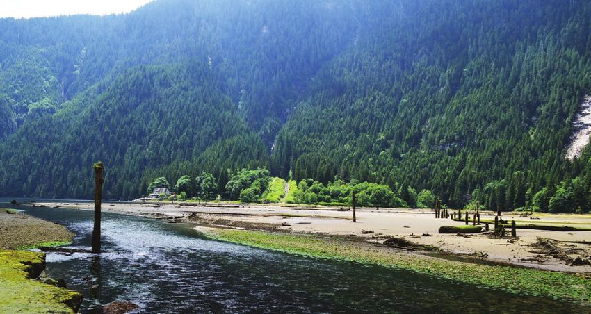
1.0 INTRODUCTION

    ABOUT TSLEIL-WAUTUTH NATION & SLEIL-WAUTUTH
    The Tsleil-Waututh people have lived along the                          and located on the North Shore of the Burrard Inlet
    shores of Burrard Inlet since time out of mind. The                     west of Indian Arm. Inlailawatash IR #4 and IR#4A are
    name Tsleil-Waututh means People of the Inlet in our                    located at the north end of Indian Arm and are approxi-
    hən̓q̓əmin̓əm̓ language. Our ancestors, who numbered                    mately 6 acres in total.
    in the many thousands, maintained villages around                            This land use plan applies to Burrard Inlet IR#3 or
    what is now called the Burrard Inlet. Tsleil-Waututh                    Sleil-Waututh, and the Inlailawatash reserves (IR#4 and
    Nation has a long-held legal obligation to steward the                  IR#4A). However, Tsleil-Waututh Nation’s territory is
    water, land, and air throughout the territory, especially               much larger, as we have never ceded rights and title to
    around Burrard Inlet, according to our protocols for use                our territory. Furthermore, Tsleil-Waututh Nation now
    and management of resources.                                            owns a growing number of parcels within our territory
         In 1869, Canada carved out the Tsleil-Waututh                      as fee-simple lands, as sole owner or in partnerships.
    Nation reserves from our territory; Burrard Inlet IR#3                  Without prejudice to the above rights, this Land Use
    at Sleil-Waututh is the largest, and home to the current                Plan has been developed under the mandate of the
    Tsleil-Waututh village. Inlailawatash IR#4 and Inlail-                  Tsleil-Waututh Nation Land Code (2007), which applies
    awatash IR#4A are small and currently uninhabited.2                     only to TWN reserve lands.
    Burrard Inlet IR#3, Sleil-Waututh, is 276 acres in size

    2
        See Appendix 3 for reference map of Inlailawatash IR#4 and IR#4A.

                         Ernest N. George on the Indian River
                                                                                                      photo courtesy of Sunrays Collection

8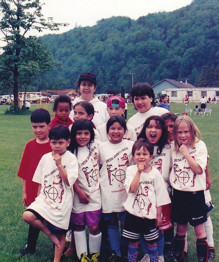
P EOPLE of the I N LET
                            since time out of mind

         PURPOSE of the PLAN
         The purpose of this plan is to provide the vision, princi-        The plan is intended to be a living document,
         ples, and guidelines for how land use and development         which will be revisited and amended on a regular
         will occur on Tsleil-Waututh Nation reserve lands over        basis to respond to the changing needs and wants of
         the next 100 years. The 100 year timeframe was cho-           the Tsleil-Waututh Nation. Future amendments to the
         sen to reflect the long-term impacts of decisions made        TWN Land Use Plan may undergo a similar planning
         today – for example, land leases on TWN reserve land          process as the one that created this plan, including
         have historically been 99 years in length, and full reme-     community engagement, staff, Council, and technical
         diation to restore the health of Burrard Inlet will take at   expert input, to eventually be adopted as TWN’s new
         least several decades.                                        Land Use Plan by TWN Council.
              This plan will be used as a tool by TWN Council,
         staff, Community Members and other parties, to guide
         decision-making. It aims to ensure that land use deci-
         sions reflect the Tsleil-Waututh community’s values
         and priorities, and responsibly consider current and
         future constraints and opportunities on Tsleil-Waututh
         lands.

Eugene Guss & Ernest “Iggy” George
at Whey-ah-wichen

                                                                                                                                                    photo by Nancy Bleck

                                                                                 L A N D U S E P L A N 2 0 1 8 - 2 1 18 Tsleil-Waututh Nation   9
MANDATE
     Tsleil-Waututh Nation, as stewards of our territory, have been planning
     for and managing the lands, waters, air, and resources of our territory
     since time out of mind. Although our ability to govern our lands was
     interrupted over the past 150 years by colonialism, the reserve system
     and the Indian Act, the adoption of the Tsleil-Waututh Nation Land
     Code³ in 2007 allowed TWN to resume management of our reserve
     lands, by opting out of the lands sections of the Indian Act.
           The TWN Land Code gave the mandate for a land use plan to be
     developed for the reserves, and this mandate was reinforced by TWN’s
     Comprehensive Community Plan (CCP) 4, and other planning and policy
     documents. In 2015, TWN’s Council gave the go-ahead to embark on a
     community-driven land use planning process.

     VISION
     Tsleil-Waututh are stewards of the lands, waters, and air—protecting
     and cleaning up the environment. We respect our culture and laws, while
     providing opportunities for economic development, public spaces, and
     affordable housing so future generations of Tsleil-Waututh people can
     live and thrive in our community.

 3
     The Tsleil-Waututh Land Code (2007) can be accessed by visiting the TWN Administration Office or the website at twnation.ca.
 4
     The TWN Comprehensive Community Plan (2010) can be accessed by visiting the TWN Administration Office.

10
ABOVE: A word cloud showing all the words Community Members used in activities at community meetings and surveys to describe
our community 100 years in the future. The size of the words indicates the how often they were used.
L A N D U S E P L A N 2018 -2 1 18 Tsleil-Waututh Nation 11photo courtesy of Sunrays Collection
Single canoes on Burrard Inlet circa 1930s
PRINCIPLES TWN LUP Community Meeting
All land use decisions for TWN reserve lands will be The principles that guide our approach to stewardship
made in keeping with Tsleil-Waututh values. Through are built from teachings passed on by our Elders, our
a community-led planning process, Community Mem- relationship to the land, and our Aboriginal rights,
bers were asked what values are important to them in title, and interests. Stewardship is key to preserving
the use and governance of their reserve lands. These Tsleil-Waututh lands and waters for future generations.
values were summarized and grouped by themes.
They echo many of the values expressed in the CCP » Connection to nature
process and other TWN policies and documents. The The Tsleil-Waututh people have a deep connec-
Tsleil-Waututh community’s principles below will serve tion to the land and water around us. One of the
as guidelines for land use decision-making, and will be greatest strengths of TWN reserve land is that it
found throughout the land use plan. allows the community to stay connected to nature—
whether by spending time in the forest, or harvest-
RESPECT ing food from the waters or forests. Future devel-
All land use decisions will be guided by respect: for opment will maintain this connection to nature for
each other, for the land, and for all life. the benefit of future generations of TWN Members,
wherever possible. Part of maintaining the commu-
TSLEIL-WAUTUTH LAND nity’s connection to land includes Elders teaching
Tsleil-Waututh land is the home of the Tsleil-Waututh younger generations about our land and its value.
Nation—past, present, and future generations. Use of
Tsleil-Waututh reserve lands will prioritize the needs » Eco-friendly development
of TWN Members and land uses will serve TWN needs Development on TWN reserve land will strive to
first and foremost. achieve a high standard of environmental sustain-
ability, following or exceeding Canadian environ-
COMMUNITY INPUT & PARTICIPATION mental law, including use of eco-friendly materials
Major land use decisions will be made in an open, and building practices, energy efficiency, use of
participatory, democratic way. This includes informing renewable energy, and responsible waste manage-
the community of potential issues and opportunities, ment.
incorporating member input, and, where mandated by
the Land Code, bringing land use decisions to the TWN » Preservation of ecological values
Membership through special Membership meetings or Future development will use land respectfully and
referenda. carefully, and will strive for overall environmental
improvement for all major developments on TWN
ENVIRONMENTAL STEWARDSHIP: lands. In some cases, this may mean that if some
The Tsleil-Waututh people have always held the role of amount of environmental destruction is required for
caretakers of our territory. Just as the lands and waters a project, an equal or greater positive environmental
have sustained us since time out of mind, it is our sa- project will be carried out to make up for it. This
cred trust to not only care for them in return, but to re- may include preservation, restoration and manage-
store the health of the environment. The Tsleil-Waututh ment of the forest, wildlife habitat, creeks, foreshore,
people have a deep understanding of what the health Burrard Inlet, and water and air quality.
of our environment means to the lives of our Members.
12Under 10 TWN Soccer Team
Burrard Inlet
FAMILY ECONOMIC DEVELOPMENT
One of the biggest strengths of our community is the Tsleil-Waututh lands have been essential to the
closeness between family and Community Members. Nation’s economic development. It is important that
People come together for events and activities, and to business activities on Tsleil-Waututh lands generate
support each other in times of need. Land use decisions profits, as well as create opportunities for employ-
will make an effort to preserve and support this strong ment, in order to contribute as much as possible to
sense of community, creating spaces and opportunities the well-being of the community.
for the community to come together.
WELLNESS
CULTURE Land use decisions will prioritize the health and
It is important that future land uses respect Tsleil-Wau- wellness of the community.
tuth culture and traditions, and allow for the continu-
ation of traditional practices by future generations of BEAUTY
Tsleil-Waututh people. Future land uses should maintain the natural beauty of
Tsleil-Waututh lands and waters, keep the community
EQUITY & GOVERNANCE clean and, where possible, preserve the landscape for
All TWN Members and families should be treated future generations to enjoy.
equitably, with fair and transparent decision-making in
all areas. SELF-RELIANCE
The Nation will strive to be self-sufficient in its land
SAFETY management, governance and service delivery wher-
We feel safe in our community at Sleil-Waututh (IR#3). ever possible. Strategic partnerships will support the
Going forward, land use decisions will aim to preserve Nation’s capacity and will bridge gaps where
and enhance this safety, particularly in traffic concerns necessary.
and emergency preparedness.
L A N D U S E P L A N 2018 -2 1 18 Tsleil-Waututh Nation 132.0 BACKGROUND &
PLANNING CONTEXT
OUR HISTORY
Prior to contact, our oral history has taught us there were over ten thousand Tsleil-Waututh
using the territory. Our ancestors’ survival was dependent on cycles of hunting, harvesting
and preserving foods, and on trade, using our land and water transportation networks and
relying on protocols we had with our neighbors.
Our people had what is called a “seasonal round” which pink and chum salmon. Most of the catch was dried or
involved a complex cycle of food gathering, hunting, smoked for winter use or for trade. By December, fam-
and spiritual and cultural activities, which formed the ilies returned to their winter villages with the goods
heart of our culture, economy and political structure. In collected throughout the year, and the yearly cycle
the winter, the community would group in large villag- began again.
es typically located in sheltered bays. Shed-style cedar Our Elders tell us that when Europeans began to
plank houses up to several hundred feet in length were arrive, a significant portion of our population was lost
divided into individual family dwellings. During the to disease. There are also many stories that tell of how
winter, our people added to our diet with stored dried our people survived other difficult times — colonialism,
foods gathered and processed earlier in the year. Our the reserve system, and residential schools. Through-
winter activities included wood carving, weaving blan- out these hard times and despite these obstacles, our
kets of mountain-goat wool, participating in spiritual people helped to build Vancouver and North Vancou-
ceremonies, and renewing friendships and alliances. ver, persevered in our stewardship of the lands and
In the late spring, families would leave to set up waters of our territory, and continued practicing and
base camps on nearly every beach and protected cove passing down our language and culture however we
in Tsleil-Waututh territory. Planks from the winter could. We found our way through the change that was
houses were transported by canoe and used to con- happening in the world around us.
struct the smaller summer structures. Using these In the 1850’s, after significant losses to the
camps as a base of operations, our ancestors made trips Tsleil-Waututh population, our main village site was
to hunting, fishing and gathering locations as resources relocated from Tum-tamay-whueton (Belcarra) to the
became seasonally available. Some of these resources present site of north shore of Burrard Inlet. In 1869,
were used immediately, while others were processed Governor Douglas set aside Burrard Inlet IR#3 at
and stored for use during the winter. Sleil-Waututh, and in 1876 Canada passed the Indian
In mid-July or early August, most of the Act.
Tsleil-Waututh, as well as other Coast Salish groups, Since the 1850’s, the lands at Sleil-Waututh (IR#3)
travelled to the Fraser River to catch and dry the most have seen a variety of different uses. The forest was
favoured type of salmon: sockeye. During this time, hand-logged, and the timber dragged by horses to Bur-
people would visit, exchange news of relatives and con- rard Inlet for sale to the mills or used to build commu-
firm alliances. Large volumes of many kinds of berries nity houses. The reserve has seen different agricultural
and meats were also harvested and dried during the uses over the years, including chicken farming, pig
summer months. farming and fruit orchards. Whatever was not needed
After the Fraser River run finished in the fall, locally was sold or traded regionally for other com-
Tsleil-Waututh families would gather in camps on the modities. Abundant food was also hunted, fished and
Indian, Capilano, Seymour and other rivers to fish for gathered on the reserve and in the broader territory,
14Tsleil-Waututh Nation reserves were created: First Nations Land TWN Comprehensive TWN Zoning Bylaw
IR#3 (sʔəθnəc), IR#4 + IR#4a (Indian River) Management Act Community Plan (CCP) Amendment in process
1869 1999 2010 2017
1876 1992 2007 2015
Indian Act put in place laws TWN Zoning Bylaw TWN Land Code TWN Land Use
governing reserve lands Planning in Process
including crabs, clams, mussels, oysters, fish, duck, to be hidden when traditional spiritual practices were
deer, bear, elk, pheasant, berries, and other food and outlawed by the Indian Agency from 1885-1927.
medicine plants (for more detail, see the TWN Tradi- In the late 1980s, the community began to exert
tional Use Study). economic independence and developed a solid vision
Community gatherings took place for many years for economic development. The Takaya Golf Centre
at the old Community Hall, and after it burned down in was built to create jobs and wealth for the community.
1981, it was replaced by the current TWN Community Then construction began on the Raven Woods and
Centre in 2002. The community Church was completed Legends projects, and over time many other market
in the 1950s, and for many years the basement was used housing projects have been built and leased out on the
for workshops, daycare, classes and a variety of other eastern portion of the reserve. Money from these devel-
purposes. The Gathering Place restaurant was another opments has funded many programs and services for
community hub for many years; and when the Commu- TWN Members, such as health, education and social
nity Centre was built, it was moved up to Takaya Golf programs. This development has also funded construc-
Centre. The Smoke Shop, which had been attached, was tion of the TWN Community Centre, the Child and
relocated to its own space next to the Administration Family Development Centre, the upcoming Adminis-
Building and became the Burrard General Store. tration & Health Centre and community housing6.
The canoe tradition has been a constant in the Bur- Our community population has regrown from a low
rard Inlet, and Tsleil-Waututh people have participated of around 13-35 after the epidemics in the early 1800’s
in the annual cycle of canoe festivals since they began to approximately 510 at the end of 2016, with about 270
in the 1920s. Ceremonies and cultural practices have all of those TWN Members living on Sleil-Waututh (IR#3)
taken place at Sleil-Waututh (IR#3), although they had in 114 homes.
6
See Appendix 3 for reference map of Sleil-Waututh (IR#3).
L A N D U S E P L A N 2018 -2 1 18 Tsleil-Waututh Nation 15VILLAGE SITES
ASSOCIATED WITH
TWN ORAL HISTORIES
Tsleil-Waututh Major Village
16L A N D U S E P L A N 2018 -2 1 18 Tsleil-Waututh Nation 17
PLANNING HISTORY
     Under the Indian Act, the government of Canada seized      were intended to reflect the views and interests of the
     control of decision-making power over reserve lands.       community, but in reality, they were mainly the ideas of
     Decisions for our community were made under the            outside engineers. In 1997, consultants from a company
     oversight of the Indian Agent, with little regard to our   called UMA prepared the last of these Physical Devel-
     people’s needs and wants or our own ways of govern-        opment Plans. That plan set out a development pattern
     ing. For example, in the 1930s, Canada gave British        somewhat reflective of what exists today. It also includ-
     Columbia approximately 8 acres of land from IR#3 to        ed residential development north of the lacrosse box,
     construct Dollarton Highway with no compensation for       and a sports field on the site of the new Administration
     the land. To this day, Dollarton Highway separates the     and Health Centre building. After the 1997 plan, Indian
     majority of the reserve from the waterfront area, and      Affairs stopped funding physical planning on reserves
     the specific claim for the land has been settled.          in BC. A look back at those plans shows that while they
          In the early 1970s, TWN began to discuss ways to      guided development patterns, plans are living docu-
     generate revenues from IR#3 lands. Consultants from        ments that evolve and change over time.
     P.S. Ross were hired by the Indian Agent on behalf of          In 2007, Tsleil-Waututh Nation signed a Frame-
     TWN to prepare a Development Plan for the reserve.         work Agreement with Canada, enacted under the First
     That plan showed a commercial marina along the             Nation Land Management Act. In keeping with that
     majority of the waterfront area of the reserve. It also    agreement, the Tsleil-Waututh community ratified our
     showed a diversion of Dollarton Highway to a more          Land Code, which was approved by a referendum and
     northerly route bisecting the reserve, and included        came into effect on June 6, 2007. This agreement trans-
     more community housing and a school. Roads were            ferred control of our reserve lands back to TWN. The
     planned to connect to adjacent roads in the District       Land Code sets out Tsleil-Waututh Nation’s law-making
     of North Vancouver (DNV) at Ghum-Lye, Takaya, and          processes for reassuming responsibility for managing
     Spa-ath. Ultimately, these plans were dropped, and         the Nation’s reserve lands. One of the requirements in
     the road connections were all blocked off until TWN        the Land Code was for the community to create a Land
     opened the Spa-ath connection around 2012.                 Use Plan for the reserves. This is that plan.
          Starting in the late 1980s, Indian Affairs began to
     develop “Physical Development Plans” for IR#3. These

18
The Land Code sets out Tsleil-Waututh Nation’s law-making
processes for reassuming responsibility for managing the
Nation’s reserve lands. One of the requirements in the Land
Code was for the community to create a Land Use Plan for
the reserves. This is that plan.
photo courtesy of
The Herbert George Collection
TWN LUP Community Meeting Herbert “Paddy” George, canoe builder circa 1960s
Little Planners
photo courtesy of Sunrays Collection
Alfred George at Burrard Inlet circa 1930s
L A N D U S E P L A N 2018 -2 1 18 Tsleil-Waututh Nation 19ENVIRONMENT & GEOGRAPHY
Sleil-Waututh (IR#3) is located on the North Shore of a community centre, a daycare, the Catholic Church,
the Burrard Inlet. It is 276 acres in size, surrounded canoe shed, lacrosse box and cemetery. The eastern
on the West, North and East by the District of North end of the reserve has been developed over the past 25+
Vancouver (DNV), and on the south by the Burrard years as market housing on 99-year Leaseholds, known
Inlet. Dollarton Highway runs across the southern end as the Raven Woods developments. This area continues
of the reserve, and is currently owned by the provincial to be developed with Seymour Village, which was ap-
government and managed by the DNV. proved for development by a referendum in December
There are three creeks that run through Sleil-Wau- of 2013. The eastern neighbourhood currently includes
tuth (IR#3)—from west to east they are George Creek, 1041 dwelling units, with the potential for another 600-
Thomas Creek, and Big John Creek. The District of 1000 dwelling units in Seymour Village (and potential-
North Vancouver refers to George Creek as Range ly more in the coming years), in an area covering about
Creek and to Big John Creek as Taylor Creek, but in 50 acres.
this plan, the Tsleil-Waututh names will be used. Flanking the northern boundary of the reserve,
The reserve land slopes moderately up from the between Thomas and Big John Creeks, is the Takaya
foreshore, with some areas of the reserve, especially Golf Centre driving range. The majority of the remain-
on the north side of Dollarton Highway and surround- ing land between George Creek and Raven Woods is
ing the two eastern creeks steeply sloped (12+%). This currently undeveloped forested land.
complicates prospects for future development in these The forest is second or third growth, as the area
areas. was hand-logged right up until the development of
The western part of the reserve has largely been Dollarton Highway (after which logs could no longer
developed for TWN Membership use, including com- be skidded to the Inlet). It is generally characterized by
munity housing, a park, the administrative buildings, forest typical of the Coastal Western Hemlock Biogeo-
20climatic BEC Zone, consisting generally of hemlock, fecal coliform concentrations above federal guidelines
with numerous big leaf maple and Western red cedar, for drinking and recreational water quality in George,
and sparse red alder and Douglas fir. There is a healthy Thomas and Big John Creeks 7. A major source of water
understory of native plants, including salmonberry, contamination in Big John Creek is suspected to be
huckleberry, bracken and sworn ferns, and vine maple. around Garibaldi Drive (possibly from a damaged
A fish study completed in 2015 found that Big John sanitary sewer line north of the reserve that crosses
Creek is still fish-bearing. While no fish were found in Big John Creek in this area, or from dogs or waterfowl
George or Thomas creeks (due to human influences in the park upstream of this location). Further moni-
and resulting changes in water conditions), the pos- toring of the water quality in the creeks, and sourcing
sibility could not be ruled out that there may still be additional data from the District of North Vancouver
some fish in those creeks. was recommended to confirm findings and get closer
A drainage study done for TWN in 2011 showed to identifying the source(s) of contamination.
that existing drainage systems on reserve are inad- Foreshore erosion is also a growing concern due
equate to prevent flooding during peak storm water to loss of land and threat to cultural heritage sites.
events. Surface water from the surrounding neighbour- Community Members who swam and harvested in the
hoods in the District of North Vancouver to the north Inlet in the past are noticing that areas that used to be
have increased the flow levels in the creeks running on land are now under water. Further study is needed
though the reserve to the point where they are not to find ways to reduce this erosion, which appears to be
able to accept much more water. With climate change caused by climate influences and increased traffic by
underway, further study is needed to ensure that these ever-larger boats travelling in the Inlet.
creeks do not pose long-term risks to TWN lands. For more on the local environmental context, refer
Furthermore, water quality testing has identified to the TWN Environmental Management Plan (2012).
7
Tsleil -Waututh Nation – Surface Water Quality Monitoring Program (2016/2017),” prepared by Teranis Consulting Ltd. and Tsleil-Waututh Nation, dated June 2017;
“Tsleil-Waututh Nation – Surface Water Quality Monitoring Program (2010/2011),” prepared by Teranis Consulting Ltd. and Tsleil-Waututh Nation, dated June 2011;
Health Canada Guidelines for Recreational Water Quality, Third Edition, date September 2009.
L A N D U S E P L A N 2018 -2 1 18 Tsleil-Waututh Nation 21POPULATION & DEMOGRAPHICS
The Tsleil-Waututh Nation population is growing, presenting increased demand for land,
homes, services, and revenues. Even in the past 7 years since the TWN Comprehensive
Community Plan was approved in 2010, the member population has grown from 449 in
2010 to 510 at the end of 2016, with just over half of the membership living on-reserve.
A recent study commissioned by TWN looked at a acres of residential lands. This model estimates a need
number of factors including historic birth and death for an additional 400 housing units on reserve over the
rates, net in-migration and new TWN Members added, next 100 years. In the shorter term, the model predicts
to estimate TWN’s overall population over the next a need for an additional 2-3 homes every year over the
100 years. The preliminary projection would see the next 45 years and then an increase to 4-7 new homes
Tsleil-Waututh population grow from 510 Members in every year after 2061.
2016 to 2,263 by the year 2116. Due to a relatively small sample size, it is difficult
Population estimates are significant for land use to report accurate statistics on other demographic
planning for a number of reasons, including the plan- factors such as family structure, income, education,
ning of transportation, servicing, economic develop- and employment. However, TWN recently completed
ment, programs and recreation. However perhaps most a Health Survey in 2016 in which 95 TWN Members
useful is the ability to predict future housing demand responded. Some highlights from the responses to
on-reserve. The population model looked at the propor- the survey are listed on the following page.
tion of what were called ‘primary household maintain-
ers’ and the historical split between on-and off-reserve
Membership, and predicted that by 2116, there would
be 898 total Tsleil-Waututh households, with 514 of
those households living on-reserve.
At present (2017), there is a current housing stock
of 114 member homes on reserve on approximately 33
22EDUCATION HOUSEHOLD INCOME
41% Made less than $20,000 per year
60%
23% Made between $20,000-39,999
COMPLETED
Grade 8-12
16% Made between $40,000 to $59,999
29%
12% Made between $60,000 to $79,999
COMPLETED
Post-Secondary Degree
8% Made over $80,000 per year
10%
COMPLETED
Trade or Vocational
Qualification LANGUAGE
100% indicated that English is the language
EMPLOYMENT they use most in daily life
60% said that they cannot speak
51% their main activity is working
29% can speak a few words
for pay or profit
12% are caring for family
9% can say basic phrases
8% are self-employed
2% can speak at an intermediate level
11% are going to school 0% consider themselves fluent speakers
12% are recovering from illness or disability
HOUSEHOLD STRUCTURE
39% said they had no children living with them
38% said two adults lived within the household
28% have two children
24% have three adults
23% have one child
13% have four adults
12% said they lived alone
12% have 5 or more adults living in the household
9% have 3 children
1% have 4 or more children living with them
Data Source: 2016 TWN Health Survey L A N D U S E P L A N 2018 -2 1 18 Tsleil-Waututh Nation 23HOUSING
Housing was the biggest topic on the minds of many Although there has not been a definitive survey
TWN members throughout the land use planning (like the Health Survey) that addresses housing needs,
process. They expressed strong desire to have adequate there are currently 61 applications on file for Members
housing on-reserve for themselves, their children, seeking on reserve housing, but 21 of those applicants
and future generations of TWN members. There are already live on the reserve.
currently 114 occupied TWN Member housing units on Planning is underway on a new neighbourhood for
IR#3. These homes were built using different forms of member housing in the area north of the lacrosse box.
funding and are managed in different ways: A new creek crossing to this area was completed in
» 20 units were built by TWN Members using 2016, and the area is expected to provide enough build-
individual mortgages, and those Members are ing sites to meet TWN housing needs for the next 20
responsible to insure and maintain the units years. Construction of this neighbourhood is expected
themselves. to begin in 2018.
» 13 units are older homes built using Indian
Affairs grants or personal funds, and the
Members in those homes are responsible to
insure and maintain the units themselves.
» 46 units are currently CMHC social housing
units. These are rental units, owned, maintained
and insured by TWN. All receive partial rental
subsidies from CMHC while the 25 year mort-
gage is in effect. CMHC did not approve any of
these subsidized units between 1993 and 2009.
Most of these CMHC social housing units were
built after matters were cleared up with CMHC
in 2009.
» 35 units were formerly CMHC social housing
units.
24TRANSPORTATION
In 2011, a Transportation Planning Review completed e) Have an electrical engineer review street
by R.F. Binnie & Associates made several recommen- lighting requirements for the reserve.
dations to improve transportation access and safety
on-reserve including: In 2015, Urban Systems conducted further trans-
a) Provide a second access route to the Raven portation planning to determine the reserve’s traffic
Woods neighbourhood via Roche Point Drive. carrying capacity as part of a preliminary Master Ser-
The current gravel path connecting Roche Point vicing Plan. The proposed road network in that plan is
to Raven Woods Drive is not adequate even as shown in the map above.
a secondary emergency access route. However, Among other things, Urban Systems recommended
this recommendation cannot be implemented planning for a main connection between Mount Sey-
without support from the District of North Van- mour Parkway and Dollarton Highway at Apex Drive to
couver to allow TWN to connect to Roche Point enable potential transit service through the reserve in
Drive. To date, the DNV has said that it will not the future, and expanded on many of the improvements
allow this connection. proposed in the Binnie study.
b) Conduct a functional design study to address In addition to planning for better connectivity and
safety concerns at the intersection of Dollarton potential improved public transit service to the com-
and Raven Woods Drive. This intersection may munity, TWN will continue to explore other transporta-
be reaching its capacity as a non-signalized tion options, such as car sharing, electric vehicles, and
intersection due to continued development in active transportation infrastructure.
Raven Woods and the lack of a secondary access Transportation is a major factor in the land use
route. plan for connectivity, safety, convenience, privacy,
c) Improve pedestrian access by adopting a design economic development opportunities, walkability,
standard to provide sidewalks on both sides of and sense of place in one’s community.
proposed roadways.
d) Upgrade trails through the reserve.
L A N D U S E P L A N 2018 -2 1 18 Tsleil-Waututh Nation 25NEIGHBOURING JURISDICTIONS
Tsleil-Waututh Nation has lived in our territory since time out of mind, and will continue to
do so. TWN acknowledges that our neighbours are also here to stay and seeks to maintain
respectful and open dialogue and work in partnership on a government-to-government
level with other jurisdictions operating within our territory to benefit all parties involved.
DISTRICT OF NORTH VANCOUVER (DNV) ment on the reserve to help pay for new sewage treat-
Burrard Inlet IR#3 is surrounded on 3 sides by the ment facilities.
District of North Vancouver (DNV) (and on one side More broadly, TWN’s Treaty, Lands and Resourc-
by the Burrard Inlet). TWN has an agreement with es Department is working with Metro Vancouver
the DNV to provide services to IR#3 including util- to address impacts to Aboriginal rights from Metro
ities such as water, sewer, and drainage, as well as Vancouver projects, and will continue work to establish
municipal-type services such as fire protection, road a working relationship to address any opportunities as
maintenance, garbage and recycling, policing, libraries, they arise.
parks and recreational opportunities. The agreement
includes payment for delivery of these services, though PROVINCE OF BRITISH COLUMBIA
some of these costs are reduced as TWN provides more The majority of Provincial laws do not apply to reserve
services to residents of Sleil-Waututh (IR#3), such as land, but there are some areas of law that interface,
parks, trails and recreational opportunities. The latest including the Provincial Motor Vehicle Act, and laws
five-year agreement also includes payments from TWN and regulations related to worker safety, streams, the
to the DNV for impacts that new TWN developments environment, childcare and areas of family law. Appli-
have on their roads, pipes and other infrastructure. The cable provincial laws, along with the Criminal Code of
current agreement lasts until December 31, 2020, and Canada, are enforced on TWN reserve land through
has rolling renewable 5 year terms to ensure relevance. general RCMP services provided by the DNV, as well as
an enhanced policing agreement signed in 2008 with
PORT METRO VANCOUVER the Province, Canada, the Squamish Nation, and the
Although Sleil-Waututh (IR#3) officially extends into District of West Vancouver.
the Burrard Inlet, management of the marine portion
of the reserve was transferred by Canada to the Port GOVERNMENT OF CANADA
Authority at the turn of the 20th century. So Port Metro Although TWN manages its own land under its Land
has jurisdiction over all of the marine areas fronting Code, many federal programs are key for the imple-
Sleil-Waututh (IR#3), and TWN needs to cooperate mentation of TWN land uses including funding to
with them on any works in this area. As part of the build, operate, maintain and replace some infrastruc-
federal transfer, any profits from economic activities ture and some buildings. Canada Mortgage and Hous-
carried out by Port Metro in the TWN water lot direct- ing Corporation (CMHC) also provides rent subsidies
ly fronting the reserve must be shared annually on related to social housing and mortgage insurance on
a 50/50 basis with TWN. This generally amounts to Leasehold units. The land survey system and land
about $5,000/year in revenue to TWN. titles systems must comply with Federal statutes.
METRO VANCOUVER UTILITY COMPANIES
Metro Vancouver was developed to pool services Several utility companies, including BC Hydro, Fortis-
needed by all municipalities in the Lower Mainland, BC (formerly known as Terasen), Telus and Shaw have
including water and sewer treatment, regional parks, permits to use TWN reserve land in order to provide
regional transportation and air quality. So far, Metro’s services to TWN lands and beyond. These permits
direct impact on TWN is limited to the Greater Van- are registered in the First Nations Land Registry. In
couver Sewage & Drainage District sewer trunk line addition, BC Hydro has a power distribution right-of-
that runs through the reserve along Dollarton Highway way along the western boundary and a portion of the
and governance of the lands adjacent to IR#4 and 4A. northern boundary, and pays rent to TWN for the use
In addition, under the latest DNV service agreement, of this land every 20 years.
TWN must now pay Metro a fee for all new develop-
26L A N D U S E P L A N 2018 -2 1 18 Tsleil-Waututh Nation 27
ALIGNMENT WITH EXISTING PLANS
     COMPREHENSIVE COMMUNITY PLAN (CCP)                                             BURRARD INLET ACTION PLAN
     In 2010, TWN adopted a CCP. This plan sets out broad                           The Burrard Inlet Action Plan was published in 2015
     values and objectives for the Nation, ranging from                             as a starting point to developing a wide consensus
     economic development, to governance, to health and                             on strategic environmental stewardship actions for
     wellness, to infrastructure. The CCP also identified a                         the Burrard Inlet. The action plan visualizes a sci-
     strong interest from the Tsleil-Waututh community                              ence-based, First Nations-led initiative to improve
     to participate in land use decision-making, and thus                           the health and integrity of Burrard Inlet by 2025. The
     provides part of the mandate for the community-driven                          Sleil-Waututh (IR#3) foreshore is significant for hab-
     land use planning process.                                                     itat, food harvesting, transportation, and recreational
         In 2015, a process was undertaken to update TWN’s                          and cultural activities.
     CCP, and many of the values remained the same as in                                 TWN has been working diligently to protect,
     the 2010 CCP. The CCP serves as a starting point for                           monitor and restore the health of the lands and wa-
     the land use plan, and many of the values and goals in                         ters. In addition to other Tsleil-Waututh stewardship
     the CCP underlie those in this land use plan.                                  initiatives, TWN is leading or actively participating in
                                                                                    several ecosystem restoration initiatives throughout
     2009 STEWARDSHIP POLICY                                                        Burrard Inlet, including Indian River, Maplewood Mud-
     In 2009, the TWN Stewardship Policy8 came into force.                          flats, Seymour River, and the Lynn Creek estuary.
     The 2009 Stewardship Policy invites all governments,                                A significant priority of this land use plan is to
     individuals and organizations holding land, water or                           continue to improve the health and stability of the fore-
     resource interests within Tsleil-Waututh territory, or                         shore, as well as the health of the Burrard Inlet through
     planning to use the area, to participate in land and                           improvement of the water quality and flows running
     resource stewardship. The 2009 Stewardship Policy                              through the reserve and into the Inlet, while adapting
     represents part of TWN’s work to resume our steward-                           to changing conditions resulting from climate change.
     ship role for the lands and resources of our territory. It
     allows the Nation to work together with proponents in
     the territory to ensure that projects are consistent with
     our role as stewards for the lands, waters, air, and re-
     sources in the territory, and that they do not jeopardize
     Aboriginal rights, title, and interests.
          As described in TWN’s CCP,
     implementation of this land use plan
     will include an adaptation of the 2009
     Stewardship Policy for projects taking
     place on reserve, so that any individual
     or organization will be held to the same
     standards and expectations for steward-                                                                              2015 | Ts
                                                                                                                                   leil-W
     ship on reserve as TWN expects in the                                                                              COMPR aututh Nation
                                                                                                                        COMMUEHENSIVE
     broader territory.                                                                                                      NIT Y PL
                                                                                                                                          AN

 8
     The 2009 Tsleil-Waututh Nation Stewardship Policy can be accessed through the TWN Treaty, Lands and Resources Department or at www.twnation.ca.

28
You can also read