Landscapes, at your service - IUCN Portal
←
→
Page content transcription
If your browser does not render page correctly, please read the page content below

Landscapes, at your service
  Applications of the Restoration Opportunities
  Optimization Tool (ROOT)
  Craig R. Beatty, Leander Raes, Adrian L. Vogl, Peter L. Hawthorne,
  Miguel Moraes, Javier L. Saborio and Kelly Meza Prado
  First edition

IUCN GLOBAL FOREST AND CLIMATE CHANGE PROGRAMME


Landscapes, at your service:
Applications of the Restoration Opportunities
Optimization Tool (ROOT)
Craig R. Beatty, Leander Raes, Adrian L. Vogl, Peter L. Hawthorne,
Miguel Moraes, Javier L. Saborio and Kelly Meza Prado
First edition
The designation of geographical entities in this book, and the presentation of the material, do not imply the expression of any opinion
whatsoever on the part of IUCN or The Natural Capital Project concerning the legal status of any country, territory, or area, or of its
authorities, or concerning the delimitation of its frontiers or boundaries.

The views expressed in this publication do not necessarily reflect those of IUCN or the Natural Capital Project.
This publication has been made possible in part by funding from UK AID

Published by:      IUCN, Gland, Switzerland

Copyright: © 2018 IUCN, International Union for Conservation of Nature and Natural Resources

		         Reproduction of this publication for educational or other non-commercial purposes is authorised
		         without prior written permission from the copyright holder provided the source is fully acknowledged.

		         Reproduction of this publication for resale or other commercial purposes is prohibited without prior
		         written permission of the copyright holder.

Citation: Beatty, C.R., Raes, L., Vogl, A.L., Hawthorne, P.L., Moraes, M., Saborio, J.L. and Meza Prado, K.
		(2018). Landscapes, at your service: Applications of the Restoration Opportunities Optimization Tool
		(ROOT). Gland, Switzerland: IUCN, vi + 74pp.

ISBN:		            978-2-8317-1925-2 (PDF)

DOI:		             https://doi.org/10.2305/IUCN.CH.2018.17.en

Cover photo:       Iguaçu Falls National Park, Argentina/Brazil. Craig R. Beatty/IUCN

Layout by:         Ngoc Tram Creative [ngoctram89@gmail.com]

Available from: IUCN (International Union for Conservation of Nature)
		              Global Forest and Climate Change Programme
		              Rue Mauverney 28
		1196 Gland
		Switzerland
		              Tel +41 22 999 0000
		              Fax +41 22 999 0002
		Craig.Beatty@iucn.org
		www.iucn.org/resources/publications
CONTENTS
Key messages iv
Acknowledgements v
Executive summary vi
Introduction 1
Brazil: Espirito Santo State 7
Drought and coffee: planning restoration in Espirito Santo, Brazil
Malawi 15
Maize, power and gender: balancing restoration decisions in Malawi
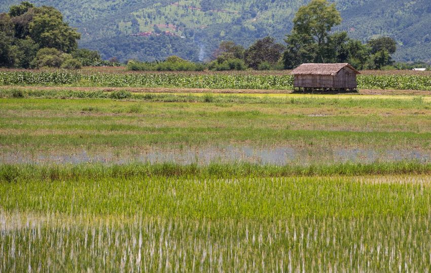
Myanmar 28
A landscape approach to reducing disaster risk and improving
livelihoods in Myanmar
Colombia 37
Water for cities: optimising the delivery of water resources based on
forest landscape restoration in Colombia
Costa Rica 46
Restoration of coffee and pasture for optimised social, climate and
ecological results in Costa Rica
Synthesis 58
References 60
Appendix 65
© Pefro Szekely
iii Landscapes, at your service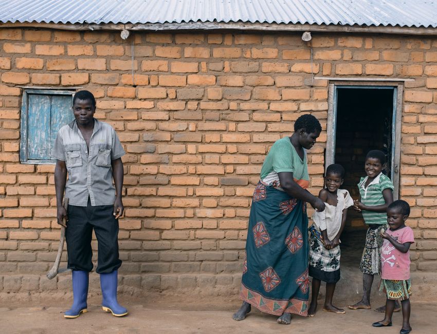
Key messages
     Ecosystem services and their impacts      ROOT builds support for forest
     on livelihoods can be helpful in          landscape restoration and facilitates
     justifying large-scale investments in     the mobilisation and direction of
     landscape restoration.                    funding; it helps people visualise
                                               potential landscape benefits and
                                               define recommendations.
     ROOT provides an assessment of
     ecosystem service trade-offs and
     facilitates the effective communication   Investments in restoration have the
     of this information to decision makers.   potential to be optimised such that
                                               relatively small interventions can have
                                               large and compounding benefits
     Knowing where restoration can             across landscapes.
     have the greatest impact on
     multiple ecosystem services for
     multiple beneficiaries can help make      ROOT can demonstrate how
     restoration more cost-effective and       restoration generates multiple benefits
     increase its success.                     beyond just the biophysical realm—it
                                               connects those services and their
                                               provision to people and restoration
                                               processes in specific places.

© Marissa Strniste/flickr.com

iv Landscapes, at your service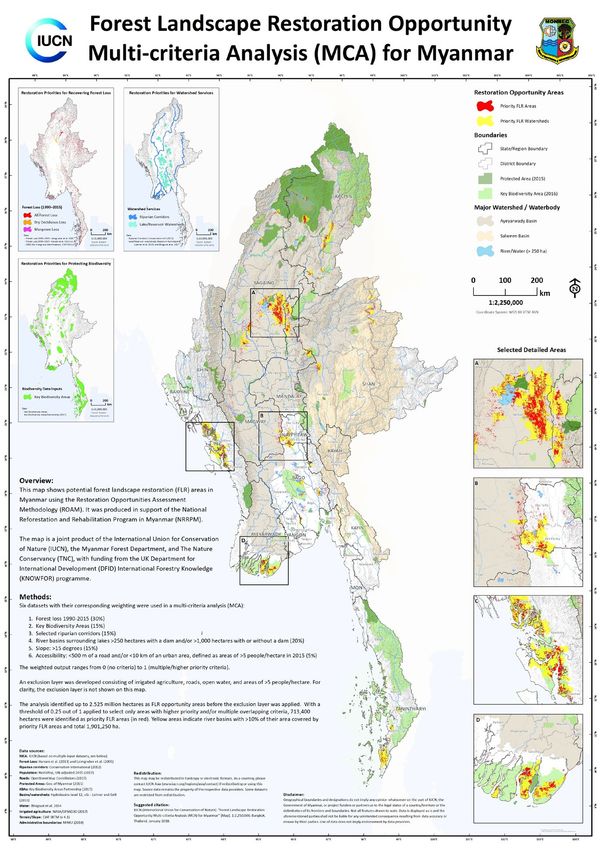
Acknowledgements
The development of the Restoration Opportunities Optimization      Support on the development and implementation of ROOT
Tool is the product of a two-phase partnership between             since its inception in 2015 was provided by Miguel Calmon,
International Union for Conservation of Nature and The             Bonnie Keeler, Mirjam Kuzee, Chetan Kumar, Michael Verdone,
Natural Capital Project — specifically, a collaboration with the   Orli Handmaker and Jesse Gourevitch. More broadly, we would
University of Minnesota and Stanford University. Funding for the   like to thank the champions of forest landscape restoration who
development and implementation of ROOT was provided from           provide the direction and opportunity for tools such as ROOT
a grant to IUCN by UK aid from the UK government through           to be employed in guiding restoration strategies and decision-
their Improving the Way Knowledge on Forests is Understood         making all over the world.
and Used Internationally (KNOWFOR) programme.
                                                                   This document benefited from constructive and honest review
The application of ROOT in the following case studies relied       by three reviewers.
heavily on information, knowledge and stakeholders within
landscape restoration processes, especially those utilising        Special thanks are also due to the IUCN Executive Publications
the Restoration Opportunities Assessment Methodology. For          Committee, including Inger Andersen, Thomas Brooks, Juha
the provision of spatial data and guidance on the applicability    Siikamaki, Ricardo Tejada and Stewart Maginnis for their
of ROOT we would like to thank the Government of Espirito          specific suggestions. Additionally, Swati Hingorani, Corbett
Santo State, Marcos Sossai, and Marcelo Matsumoto; The             Nash, Carole Saint-Laurent and Sarina van der Ploeg provided
Department of Forestry in the Malawi Ministry of Natural           exceptional guidance through the IUCN publications process.
Resources, Energy and Mining, Tangu Tumeo, and Joseph
Njue. Myanmar Ministry of Natural Resources and Environment        Two final acknowledgements. First to the ecosystem services
with guidance provided by Jake Brunner, Dan Constable, and         community who constantly innovate to help find, describe and
Li Jia ; Jorge Eduardo León Sarmiento, Mauricio Echeverry, and     model how we depend on species, and finally to Tom Lovejoy,
Silvia Benitez of The Nature Conservancy, and the Technical        who once quipped, “If you don’t put a value on nature then its
Committee for Land Restoration in Costa Rica.                      value is zero.”

v Landscapes, at your service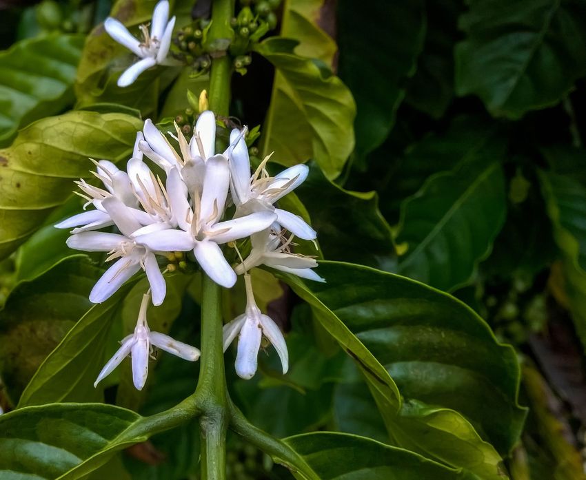
Executive summary
The Restoration Opportunities Optimization Tool (ROOT) was            interest, and a concern for optimal solutions. The process will
developed out of a need to more efficiently and effectively           require someone familiar with geographic information science
communicate the importance of ecosystem services to                   and people knowledgeable about the biophysical, social, and
decision makers. IUCN’s collective experience working to              economic considerations within the target landscape. These
increase ecological productivity and improve human well-being         have generally been provided within ROAM processes at
through forest landscape restoration (FLR) demonstrated               national or subnational scales in the case studies that follow,
that although stakeholders were interested in generating              but could be generated by any interested committee of
ecosystem services from proposed restoration activities, the          technical and non-technical restoration practitioners.
many services and their interactions with each other were often
too complicated to communicate clearly. Furthermore, as a             Still relatively new, ROOT has undergone extensive testing and
social process, decision makers working towards restoration           refinement prior to its release in 2017. However, there are some
were interested in more than just the biophysical gains from          limitations to its applicability. ROOT should be used in situations
restoration for different services; they wanted evidence for          where an optimal solution is desired or warranted. It requires
how restoration might benefit agricultural production, access         not only that ecosystem services information be available,
to jobs or different sources of income, and how investments in        but that projected changes in ecosystem services from a
restoration might help underserved or marginalized groups.            restoration scenario be calculated as well. In many cases this
                                                                      is not possible or practical. Additionally, optimisation results are
ROOT was developed as the cornerstone of a three-year                 aggregated based on ‘decision units’, and the size of these
collaboration with The Natural Capital Project to support             units is limited by the processing power of desktop computers.
ecosystem services decision-making in forest landscape                Therefore, results may be demonstrated at a resolution that is
restoration. It is intended to help translate the technical details   too coarse for specific local planning, though they may still be
of ecosystem services analysis into elegant outputs that can          useful to guide decision making.
easily communicate the potential impact of nature-based
restoration solutions on people’s lives. Critically, ROOT also        Finally, each of these applications of ROOT exist within
provides the underlying data and analysis that permits technical      assessments of forest landscape restoration opportunity, not
experts to evaluate ecosystem service trade-offs and the              the implementation of restoration itself. The results presented in
aggregation of quantifiable ecosystem service benefits within a       these case studies cannot yet be validated due to the duration
landscape or jurisdiction.                                            of restoration interventions within large landscapes; it may take
                                                                      some time to effectively validate these results and demonstrate
The following case studies demonstrate examples of the                that restoration has produced the estimated changes in
practical applicability of ROOT in different contexts, using          ecosystem services and increased cost-effectiveness. That
ROOT in several different ways. Each of the case studies              said, ROOT has established the baseline for ecosystem
illustrate one technical component of a large, inclusive process      services provision in these areas, and calculating changes in
under the Restoration Opportunities Assessment Methodology            the provision of these services or the livelihoods of beneficiaries
(ROAM), which is a flexible, iterative and inter-sectoral approach    will be an ongoing process embedded in IUCN’s approach to
taken by stakeholders to identify the best places to restore          forest landscape restoration for years to come.
degraded landscapes (IUCN & WRI, 2014). As such, the
data used in these cases has already been verified by diverse         While designed to support FLR assessments at national or
groups of national and international stakeholders in FLR.             subnational scales, the applicability of ROOT beyond these
                                                                      assessments and at different scales is an exciting frontier. Many
The case studies were chosen based on ongoing FLR                     landscape challenges exist where optimisation can help deliver
assessments as well as the existence of ecosystem services            impactful investments for intended benefits. Future applications
data, and are intended to demonstrate the applicability of            of ROOT will include economic assessments, including
ROOT to both technical and non-technical audiences. An                opportunity costs and trade-offs in net present values. ROOT
additional requirement was the inclusion of a restoration             can conceivably be used by the private sector to direct capital
scenario upon which projected changes in ecosystem services           investments to areas that may streamline sustainable supply
from restoration actions could be modelled. In each case,             chains or provide increases in natural resources while also
ecosystem services have been modelled using the Integrated            demonstrating the environmental and social responsibility that
Valuation of Ecosystem Services and Trade-offs (InVEST) suite         consumers increasingly demand. Finally, as a relatively simple
of ecosystem service modelling tools. It is, however, important
                                                                      tool, ROOT has the capacity to facilitate a broader integration of
to note that ROOT is agnostic to the source of ecosystem
                                                                      ecosystem services analysis beyond an inventory of services to
services data. Any number of ecosystem service modelling
                                                                      better include the social, cultural, and economic considerations
tools are available and any that produce spatially explicit
                                                                      within functioning landscapes.
ecosystem service values can be a source for ROOT analysis.
Running ROOT requires spatial data on ecosystem services,
an area of interest or priority for restoration, spatial data on
whom or what restoration is intended to benefit (ecologically or
socially), a monetary or geographic constraint within the area of

vi Landscapes, at your service
Introduction
                                                                     remain few available tools for the spatial prioritisation of
                                                                     landscape interventions to support benefits from multiple
                                                                     concurrent and interacting ecosystem services that can
                                                                     be weighed by how these services may support specific
Ecosystem services are a framework for understanding the             beneficiaries (Nelson et al., 2009; Birch et al., 2010), and none
ecological interactions among people and their environments.         that do so by optimising spatially explicit ecosystem service
This framework helps quantify large and dispersed natural            delivery from projected restoration actions to support identified
processes in terms of how they contribute to human prosperity        beneficiaries.
and well-being. Landscape and policy decisions that have
direct and indirect bearing on species increasingly rely on          What current prioritisation approaches also struggle to achieve
ecosystem services information. As a result, ecosystem               is an efficient method of communicating optimal solutions
services are becoming a critical component of landscape              among the underlying complexities of landscape restoration.
planning and management and now form a cornerstone for               Where time and funding are limited to assess, decide and
how decision makers assess the productivity and potential of         implement landscape restoration actions, the capacity of
landscapes.                                                          decision makers to know the technical details and variations in
                                                                     the economic, social and ecological components of proposed
For places suffering from landscape degradation, ecosystem           restoration actions is also limited. What decision makers seek is
service analysis and forecasting can inform decision makers          clear and understandable decision support that allows them to
both about the current ecosystem services that flow through          visualize the results of an ecosystem service assessment that
a landscape and about the potential for how different                includes the ecological and social returns that can help them
management and restoration activities may increase these             make the best decisions.
services. Where people are experiencing drought, ecosystem
                                                                     Decision makers within restoration always look for low-cost and
services information can provide a window into where and
                                                                     effective solutions to the impacts that landscape degradation
how the effects of drought may be mitigated or reversed; for
                                                                     has on their constituents. Through decades of research and
carbon sequestration it can provide figures for the potential of
                                                                     analysis, the ability to measure ecosystem services and provide
landscapes to store carbon; and, for areas abnormally affected
                                                                     recommendations on how to improve landscapes to increase
by sedimentation of rivers, streams and reservoirs, ecosystem
                                                                     ecosystem services is now relatively strong. Furthermore, in
services analysis can demonstrate where this sediment                assessing the opportunities for landscape restoration, as IUCN
originates and can provide clues for where investments could         has facilitated in well over 40 jurisdictions so far using ROAM
be made to reduce sedimentation.                                     (IUCN & WRI, 2014), ecosystem services are often one of the
                                                                     main analytical requests of policy-makers and stakeholders in
There are many ways to approach utilising ecosystem services         these assessments.
in a restoration assessment or implementation context. For
example, in addition to biophysical ecosystem service benefits,      Despite the wealth of knowledge on how to model ecosystem
decision makers can also prioritise restoration based on             services, a curious thing happens, when decision makers
projected economic returns (Birch et al., 2010), non-market          are asked which ecosystem services are most important to
benefits of ecological restoration (Martin-Lopez et al., 2014), or   them. Instead of selecting one ecosystem service to focus
measures of improved social resilience (Reyers et al., 2013).        on (e.g. water provision or cleanliness, sedimentation of
However, these attempts to prioritise restoration based on           waterways, etc.) the typical answer is “all of them.” Most current
benefits to ecosystem services have generally considered             ecosystem services models are designed specifically to solve
one service at a time or tend not to include more than two           an ecosystem service problem or to generate a value for one
interacting services. In practice, ecosystem services are often      ecosystem service at a time. While this information remains
assessed individually and then qualitatively evaluated to identify   critical for ROOT, what interested decision makers was an
ecosystem service ‘hotspots’, which are then overlaid with           ecosystem services solution that included as many ecosystem
other ecosystem services to show where high priority areas           services as possible. They were understandably keen to make
                                                                     sure that the investment of their limited funds for landscape
overlap with each other (review in: Trabucchi et al., 2014).
                                                                     restoration would achieve the most impact for the least cost.
Alternatively, some studies have attempted to group ecosystem
services to demonstrate trade-offs in provision of services
                                                                     The long-term and sustainable delivery of ecosystem services
based on different scenarios (e.g. Bryan & Crossman, 2013;
                                                                     from restored landscapes is the ultimate objective in many
Willemen et al., 2017), yet, by necessity these approaches
                                                                     places. Ecosystem services generated from restoration remain
ultimately use qualitative classifications of ecosystem service      one of the few quantitative ways of measuring restoration
distributions (high to low) instead of quantitative data.            success; these assessments, especially when combined with
                                                                     socio-economic attributes, bring strong evidence for the utility
                                                                     of restoration for competing land parcels (Wortley et al., 2013).
Integrating ecosystem                                                One of the primary considerations faced by decision makers in

services in policy                                                   allocating effort and resources to restoration is a quantification
                                                                     of the projected economic, ecological, or social returns
De Groot et al. (2010) have outlined some of the challenges          from political and economic investments in forest landscape
of integrating ecosystem services information in landscape           restoration. Landscape-scale choices today will have lasting
planning and note that “at the landscape level, the main             consequences for ecosystem services and will ultimately
challenge is how to decide on the optimal allocation and             involve trade-offs in the restoration of ecosystem services
management of the many different land use options.” There            (MEA, 2005; Raudsepp-Hearne et al., 2010).

1 Landscapes, at your service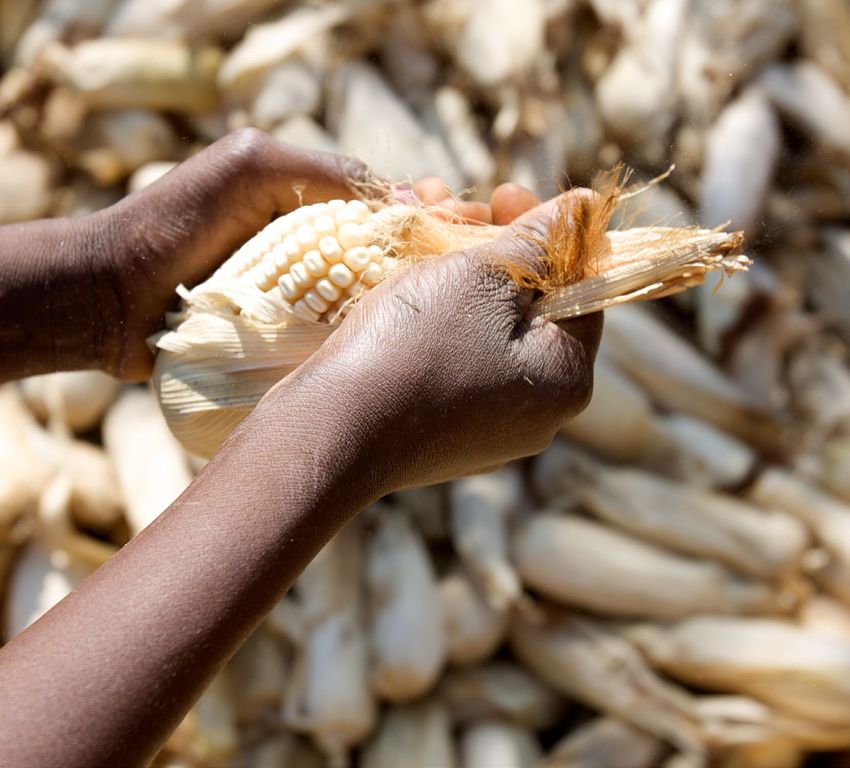
In FLR assessments, a significant amount of spatial data
The development of ROOT                                               is gathered and generated to provide guidance on where
                                                                      restoration might be feasible and what it is intended to achieve.
To address this issue, IUCN and The Natural Capital Project           Within this process it is possible to include prioritisations based
formalized a partnership to explore how an ecosystem                  on the thematic goals of restoration, but these are relatively
services decision-support tool could be integrated into the FLR       simple and additive. Priorities are based on the inclusion or
assessment process. The overarching goal was to provide a             exclusion of static spatial data layers. For instance, if the goal
tool for restoration practitioners working on the assessment of       of restoration is to increase the quality of water by decreasing
multiple ecosystem services that could be quickly understood          erosion, priority could be given in planning restoration actions to
by decision makers. Specifically, the result was intended             areas where erosion is having a negative effect on water quality
to provide an easily communicable map that integrated                 — typically areas of high slope with little vegetative cover. For
ecosystem services and human livelihoods. In its current form,        example, restoration in these areas would conceivably mitigate
ROOT is a decision-support tool that demonstrates ecosystem           poor water quality.
service trade-offs among a number of ecosystem services;
ROOT then optimises the delivery of these ecosystem services          While basic prioritisation will remain a part of restoration
for their biophysical benefits as well as for their benefits to the   assessments due to its relative ease and ability to target
people who are of interest to decision makers.                        specific issues, what this prioritisation cannot accomplish is
                                                                      a broader assessment of where landscape interventions can
ROOT moves beyond analysing scenarios and presenting                  be identified that will lead to increases in multiple ecosystem
results to decision makers based on the three typical                 services. The opportunity cost for ecosystem services of
scenario tracks (i.e. business as usual, partial intervention, full   prioritising one area over another for restoration and the effect
intervention) to provide suites of optimised restoration portfolios   of this prioritisation on the ecosystem services generated is not
based on the direct input of stakeholders and decision makers         only key in planning restoration actions, but also important for
into the ecosystem service value chain. Placed within a               estimating the benefits that restoration may have for people.
decision context such as an FLR assessment, ROOT allows
a multi-stakeholder process to define which ecosystem                 Due to variation in how ecosystem services respond to
services are important across many sectors, where and how             restoration in different areas, there are trade-offs between the
landscapes are degraded, and who should benefit from the              benefits provided by different types of restoration activities
augmentation of ecosystem services.                                   and the value of the ecosystem services that flow from
                                                                      implementation decisions. ROOT uses these trade-offs to
ROOT has emerged as a demand-driven solution to a need                model where practitioners might invest in restoration within their
of stakeholders in FLR assessments to translate ecosystem             priority areas in order to maximise the procurement of two or
services information into a format that is easy for decision          more ecosystem services. ROOT builds a body of knowledge
makers to gauge and modify based on iterative consultation            regarding the interaction among the benefits or costs of
with stakeholders. ROOT does not replace the ecosystem                restoration for ecosystem services such that a decision-maker
service analysis process through any of the dozens of spatially-      is not required to choose between, for example, restoring for
explicit ecosystem service modelling tools available. It was          carbon sequestration or water yield.
designed to specifically support the restoration decision-making
process within the context of forest landscape restoration to
support the generation of ecosystem services from restoration         Communicating the results
for intended beneficiaries. It provides decision makers with
concise and clear figures, maps, and baseline data to generate        of ROOT
confidence in the landscape restoration decisions that will           One of the primary outputs of ROOT is a map that distils
optimise human and economic investments in restoration.               the trade-offs among two or more ecosystem services and
                                                                      provides a clear and understandable index of these trade-offs.
                                                                      This ‘agreement map’ demonstrates the frequency with which
Making landscape trade-                                               the model selects a specific area among the multiple iterations
                                                                      of the model. Areas that are selected 100% of the time indicate
offs more explicit                                                    that no matter the parameters of the optimisation model, these
                                                                      areas are consistently selected as important for ecosystem
Formerly, there were several barriers to this approach, not
                                                                      services and their delivery to beneficiaries. Alternatively, areas
least of which was a lack of opportunity for decision makers
                                                                      that are not selected in any of the optimisation scenarios
to collect, assess and weigh information to decide how their
                                                                      display little or no potential for an increase in ecosystem
sector’s landscape context would benefit from the restoration         services that would flow to beneficiaries.
of ecosystem services in a particular area — a ‘silo mentality’.
This is not necessarily a lack of capacity with regard to             While the inputs of ROOT are grounded in spatial analysis and
understanding of the importance of ecosystem services, but a          geographic information science, and require such expertise
difficulty in weighing landscape choices, based on the inherent       to employ, the outputs are designed to provide decision
opportunity costs of restoration and the number of other              makers with information that is easy to translate into policy
available landscape choices. In other words, forestry sectors         recommendations. ROOT provides practitioners with the
tend to identify forestry solutions, agricultural sectors tend to     capacity to optimise trade-offs in multiple spatially explicit
identify agricultural solutions, and water sectors tend to identify   ecosystem service benefits, opportunity costs, or quantified
water solutions. Each sector tends to view ecosystem service          social benefits within a user-defined decision context. This
information as either supporting the aims of their sector or          analysis generates multiple optimised solutions based on
imposing opportunity costs that compete with their goals.             randomized variations in input data, a summary table containing
                                                                      all totals for all solutions, and an aggregation map that displays

2 Landscapes, at your service
where in the projected restoration landscape the multiple factors, 4) activity masks, 5) objectives, and 6) targets.
randomized optimisations agree on optimal selection for
ecosystem services and beneficiaries.
1. Impact potential rasters of marginal ecosystem service
values represent differences in biophysical processes between
a baseline and restored landscape scenario. Depending on
The following case studies demonstrate the first applications
context, users could consider the theoretical maximum of each
of ROOT in five different geographies, each with different
potential ecosystem process change (e.g. when all degraded
combinations of services and beneficiaries. ROOT can go
land is restored to native ecosystem), or they may consider
beyond the prioritisation inherent in assessing the opportunities
incremental ecosystem process changes based on adaptation
for landscape restoration to provide optimal locations to begin
within a land use class (e.g. the sediment retention potential of
restoration. More than an analysis of how ecosystem services
agroforestry as a restoration practice).
could be improved, ROOT provides decision makers with
actionable information on where restoration could benefit
multiple ecosystem services and beneficiaries.
2. Ecosystem servicesheds are the spatial data (polygons)
that capture which areas of the landscape are more or less
Technical details of ROOT important for providing services to potential beneficiaries of
the ecosystem services measured. For water-related services,
ROOT applies linear programming optimisation to identify these could be the catchments of identified points of interest.
optimal areas for restoration. It allows the user to specify
multiple objectives of interest, combining expected changes in 3. Composite factors allow the user to specify the
biophysical values and maps of ecosystem service demand, combinations of impact potential rasters and servicesheds that
and generates a range of activity allocations by performing connect the biophysical supply and beneficiaries to form the
many optimisations varying the weight placed on each ecosystem services of interest.
objective. ROOT synthesizes the results of these separate
analyses with an agreement map that identifies areas that are 4. Activity masks are rasters that represent areas where the
a high priority for intervention across the range of potential restoration activities could be implemented. These are the
priority weights. These are the key landscape locations for the areas that ROOT will decide among in the optimisations (as
provision of multiple ecosystem services. ROOT has been aggregated in the spatial decision unit maps).
designed to be scale-independent and to appeal to users
within the environmental, agricultural, economic and business 5. Objectives allow the user to specify which composite
sectors. factors to include as objectives in the analysis and whether
optimal values should be minimized or maximized. For instance,
ROOT utilises a series of input tables which contain pathways users would generally maximize a value calculated as sediment
to GIS rasters and shapefiles. Within the optimisation, ROOT retention, but minimise the related value calculated as sediment
orchestrates an integrated linear optimisation algorithm that export.
randomly assigns weights to each objective for each model
iteration using a multivariate normal distribution, which is then 6. Targets allow the user to specify constraints that the
normalised so the weight vectors equal 1. ROOT requires six optimised solutions must meet. For instance, Bonn Challenge
main inputs: 1) impact potential rasters of marginal ecosystem commitments for a given area of restoration can be captured as
service values, 2) ecosystem servicesheds, 3) composite a target, as well as targets for particular services or budget limits.
Figure 1 shows the graphical user interface of
ROOT. Though developed with the same look
and feel of InVEST, ROOT does not require that
ecosystem service values be calculated in the
InVEST suite of tools; ROOT can use any spatial
ecosystem services information in raster form from
any spatially explicit ecosystem services model.
3 Landscapes, at your serviceFigure 2 provides an example of the data
inputs for ROOT. The values represented
in each table can be used as objectives
in the optimisation. The composite factor
table, though, combines the results of
the impact potential raster data with
spatial weights for different beneficiaries
to capture the full service value. There
are three composite factors in this figure,
though only the components of one is
highlighted for clarity. The ‘delta_carbon_
Composite’ factor is a combination of the
marginal increases in carbon sequestration
combined with spatial weights for gender,
hydroelectric/irrigation potential and poverty
level. As indicated in the Objectives Table,
ROOT will optimise to achieve areas where
the maximum values for this composite are
achieved within the map.
The user must also decide what the spatial decision unit will be. These can be defined as hexagons or squares within the area of
interest, or the user may include a file path to a shapefile (.shp) for political, watershed or other boundaries. The user may also select
the area of each of the decision units (squares or hexagons). The ROOT workflow is divided into two distinct steps: pre-processing
and optimisation. This division allows the user to use the same input data to run multiple optimisations using different objectives,
targets, or the number of times the model iterates using different randomised objective weights.
The result of the analysis will demonstrate the decision units that are most optimal for improving multiple ecosystem services for the
specified beneficiaries based on ‘agreement’ among the model iterations. ROOT will decide for each iteration whether a decision unit
is an optimal location for restoration based on the ecosystem services gains and the randomised beneficiary weights. The frequency
with which a decision unit is chosen as optimal can then be expressed in a map.
Additionally, ROOT provides data tables for each model iteration that quantify the ecosystem service results for that specific optimized
activity allocation. This allows analysts to explore the mechanics of ROOTs optimisation process and examine the ecosystem service
provision to particular beneficiaries among different iterations.
Applications of ROOT
The following case studies demonstrate several ROOT affected agricultural production, especially coffee. This drought
applications and explore several contexts where optimisation led to economic hardship for many of the people of Espirito
was helpful and where trade-offs were predicted, to illustrate Santo, and the State worked with IUCN and its members
how decisions utilising ecosystem services information were to develop an FLR assessment using ROAM. Following the
made. These cases cover examples from Brazil, Malawi, identification of approximately 120,000 hectares of opportunity
Myanmar, Colombia and Costa Rica, and they demonstrate area in the State (40,000 hectares more than its Bonn
both the explanatory and predictive capabilities of ROOT in Challenge commitment), the State was interested in identifying
FLR assessments using spatially explicit models to show what where within this opportunity area restoration could optimally
decision makers and landowners might expect regarding support more retention of water and reductions in sediment
both ecosystem service benefits and how those benefits are delivery to streams. Additionally, it was important to implement
distributed to people. These cases also cover examples of restoration actions in areas that supported these services
where governments have expressed specific interest in ROOT’s in priority watersheds and in municipalities where incomes
ability to optimise restoration investments for established were low. ROOT was used to calculate the areas for optimal
actions or programmes that are primed for implementation investment in restoration to support these objectives within
as well as exploratory analyses of the optimal trade-offs in identified restoration opportunities.
ecosystem services for different social priorities where the
specific restoration activities have not yet been defined. Malawi
In 2016, Malawi began a national FLR assessment to
Brazil: Espirito Santo State
determine the political, financial, geographical, social and
The Espirito Santo case revolves around a subnational FLR economic rationale for a national strategy for restoration. This
assessment that was undertaken 2015–2017. The State had commitment was elevated to the international level at the IUCN
been suffering from significant drought that had drastically World Conservation Congress, where Malawi announced
4 Landscapes, at your servicea 4.5 million hectare commitment to the Bonn Challenge. To support and finance FLR activities, The Nature Conservancy
This commitment was intended to support the restoration of suggested the implementation of a collaborative finance
Malawi’s deforested and degraded lands. Malawi’s objectives and governance mechanism that connects downstream
for restoration fell into three broad categories: food security, beneficiaries of water purification and habitat restoration
resilience and biodiversity. The national FLR assessment services to upstream landholders who provide those services
identified both general restoration intervention activities and — a water fund. Because water funds often need to allocate
priority areas for the implementation of these activities. limited budgets to restoration activities while achieving specific
ecosystem services targets, ROOT was applied to optimise
The ROOT analysis completed for Malawi uses high priority the locations of four types of interventions (agricultural best
areas identified through the National Forest Landscape management practices, forest restoration, riparian restoration,
Restoration Assessment along with ecosystem services and protection of native vegetation) in the source watersheds
assessments of actual evapotranspiration, carbon of six of the largest cities in the country (population >500,000)
sequestration, and sediment retention to determine where
to reach targeted changes in ecosystem services, including
investments could be made in restoration to support these
sediment retention, nitrogen retention and carbon storage.
ecosystem services in areas where there are proportionally
more women, in water resource units that have high poverty
Costa Rica
levels, and in areas important for hydropower generation and
irrigation. To support Costa Rica in achieving its one million hectare
commitment to the Bonn Challenge, IUCN facilitated the
Myanmar implementation of a ROAM assessment with government and
other stakeholders in August 2014. As part of the process a
In 2016, Myanmar completed a national assessment of several
technical committee of restoration experts was established.
key ecosystem services led by WWF and the Natural Capital
This technical committee made a first proposal of restoration
Project (Mandle et al., 2017). This analysis, the first of its kind
actions and targets related to those actions. The proposal
in Myanmar, resulted in several key recommendations that
was based on unifying existing programmes in Costa Rica
included recognising the importance of natural ecosystems in
that have a restoration component, specifically Costa Rica’s
water quality, the availability of water based on forest regulation
national Payments for Ecosystem Services Program (PPSA for
of flow, the reduction in flood risk through the existence of
its abbreviation in Spanish), the Nationally Appropriate Mitigation
natural ecosystems, and the protection of coastal infrastructure
Actions (NAMAs), and the programmes for the implementation
and people through intact coastal ecosystems like mangroves.
of Good Agricultural Practices (GAP).
It also demonstrated important overlaps in ‘high-value’
ecosystem service areas and areas important for biodiversity.
ROOT was used to optimise areas for the implementation
These analyses provided the baseline ecosystem service
of each of the restoration actions within these existing
information that IUCN and the Natural Capital Project would use
programmes, to consider the impact on ecosystem service
to model the optimal areas for restoration in Myanmar using
provision, and to ensure the activities would have positive
ROOT.
benefits for potential beneficiaries. This use of ROOT included
national scale ecosystem services assessments of nutrient
The ROOT analysis for Myanmar used the results from a
export and sediment export, and assessments of the impact
national forest landscape opportunities assessment map,
potential of restoration actions within each of these ecosystem
developed in collaboration among IUCN, The Myanmar
services. These ecosystem service benefits were then
Ministry of Natural Resources and Environmental Conservation
considered for hydropower production, drinking water supply,
— Forest Department, and The Nature Conservancy. The
wetlands and biological corridors.
objective of ROOT was to maximise the ecosystem services
of sediment retention in municipalities most affected by the
The following examples demonstrate the utility of ROOT
2015 flooding, and in areas with high unemployment and heavy
in answering landscape-scale questions, which can help
reliance on fuelwood.
direct decision makers towards options that are grounded by
empirical analysis and help them optimise decisions to achieve
Colombia
both ecosystem service and livelihood goals of restoration
Colombia is facing rapid urbanisation, with current projections activities.
showing that nearly 84% of Colombians will be living in urban
areas by 2050 (United Nations, 2014). Ongoing urban growth
presents significant challenges to providing services and
funding investments in infrastructure to ensure sustainable
incomes, food, water, energy and shelter for all citizens, 27.8%
of whom remain in poverty (World Bank, 2015). Colombia’s
2015 National Development Plan (NDP) and additional
legislative and institutional mandates such as Regional
Autonomous Corporations (CARs) support investments
and payments to landowners for ecosystem services and
include requirements for hydropower companies to transfer
a percentage of their earnings from energy production to
municipalities and CARs for watershed protection.
5 Landscapes, at your serviceTable 1: The primary ecosystem services, opportunity area, beneficiary objectives and constraints for each of the five ROOT case
studies.
Identified area
Main ecosystem of restoration
Beneficiary objectives Constraints
services opportunity or
priority
Groundwater recharge,
Land use type (pasture/
Espirito Sediment retention and 120,000 ha FLR payments for environmental
macega), 80,000 Bonn
Santo, Brazil water yield opportunity area services, income generation,
Challenge Pledge
watershed risk management
Sediment retention, actual Hydropower generation,
100,000 ha highly 50,000 ha to begin
Malawi evapotranspiration, carbon poverty alleviation, gender-
degraded land restoration project
sequestration responsive restoration
Flood mitigation, job creation,
713,400 ha of forest reduction in reliance on 25,000 ha to begin
Myanmar Sediment export
loss unsustainable natural restoration
resources
Sediment delivery ratio
model (‘sediment’), nutrient
88,000 ha restoration
delivery ratio model Watershed protection for Monetary/budget
Colombia potential surrounding six
(‘nutrient’), forest carbon urban area water sources constraints
urban areas
edge effect (‘carbon’),
seasonal water yield
Increased agricultural
25,000 ha for coffee
production and carbon
Sediment export, nitrogen 1 million ha of degraded restoration, 70,000 ha
Costa Rica sequestration, potable water,
export, phosphorus export and deforested land for plantations outside
wetlands, hydroelectricity,
livestock areas
biodiversity corridors
© Steffen Korn
6 Landscapes, at your serviceBRAZIL
BOLIVIA
PARAQUAY
AGENTINA
Brazil:
Espirito Santo
© Allan Cancian Marquez (top) and Hélia VannucchiDrought and coffee: planning restoration in
Espirito Santo, Brazil
Craig R. Beatty1 and Miguel Moraes2
South-eastern Brazil has recently experienced the most severe However, this approach was not entirely clear in terms of
droughts in living memory (NPR, 2016). Usually receiving helping decision makers prioritise areas based on their own
ample rain to support a large agricultural sector, Espirito Santo evaluation and comparisons of ecosystem service gains. What
experienced extreme flooding and damage in 2013 followed they needed to know was, “Which areas should be considered
by reductions in rainfall throughout south-eastern Brazil of for restoration in order to obtain optimal results for both water
up to 70% below average values (Nobre et al., 2016). This, yield and sediment retention simultaneously?” With this specific
combined with record high temperatures, devastated many of focus, ROOT was employed by IUCN to optimise the trade-
the State’s farmers along with the cities that rely on rural water offs between these two ecosystem services to help determine
sources. Within south-eastern Brazil, this caused a water crisis where the proposed PES systems would have the highest
for over 40 million people. Steep declines in coffee production impact.
led farmers to either accept their losses or shift to other crops
such as pepper. Many coffee producers went bankrupt and Improving water quality and quantity remains one of the main
were required to close their facilities, some of which had challenges for ensuring long-term productivity in landscapes.
existed for generations. COOABRIL, a coffee cooperative within In this context, efforts are being undertaken to invest in
Espirito Santo, explains that while drought may be a natural reductions to surface runoff in water recharge areas. These
phenomenon, deforestation and landscape degradation, areas are normally marked by rugged slopes and decades
especially on hilltops, have prohibited the infiltration of water into of unsustainable agricultural activities. Years of severe rainfall
the ground (NPR, 2016). Furthermore, the impacts of climate on these degraded areas have led to high sediment delivery
change make seasonal rainfall predictions less accurate, and indices and water yields, especially in areas where the native
new research indicates that it may no longer be possible to vegetation cover has been significantly altered, such as
grow coffee in Espirito Santo by the end of this century (Bunn degraded grassy weed areas (macega) and pasture lands.
et al., 2015; Bragança et al., 2016). Beyond the technical assumptions that led to a focus
on two specific land uses (macega and pasture land), a
To combat the immediate effects of drought, Espirito Santo’s strategic rational was carefully developed to unite divergent
State Sanitation Company (CESAN) instituted strict water stakeholders and develop landscape cooperation and
conservation activities that helped to reduce water use. compromise. As normally occurs in subnational governmental
However, an unpredictable climate and some of the more agencies, each sector was concerned mainly about its own
dire forecasts have led the State government to seek long- attributions, namely water supply, biodiversity loss, silting,
term solutions to what may be increasingly frequent and food production and income generation, among others. In this
unpredictable drought events. In 2015, Espirito Santo enlisted sense, FLR was framed as a convergent solution that could
the help of IUCN to undertake an FLR assessment using provide cost-effective results for different problems, bringing
ROAM (IUCN & WRI, 2014). Forest landscape restoration together key stakeholders under a positive agenda. Moreover,
represents one of the most economically feasible pathways communication and engagement has focused on the water
for generating multiple benefits for people and ecosystems crisis, taking advantage of government attention to propose
to explore nature-based solutions3 to many of the landscape nature-based solutions that could tackle problems while putting
challenges faced by the people of Espirito Santo. the state of Espirito Santo in the vanguard of United Nations’
2030 agenda.
Within the broader FLR assessment process and to help
assess solutions to long-term drought, IUCN initially facilitated At the political level, the aforementioned rationales were
a spatial analysis of water yield and sediment delivery using the used to underpin initial dialogues with state-level decision
Integrated Valuation of Ecosystem Services and Trade-offs Tool
(InVEST). These ecosystem service models helped to quantify
the current delivery of two important ecosystem services
and were then instrumental in helping to model the projected
delivery of these services under a restored scenario. The
analyses looked at different scenarios of resource allocation in
Espirito Santo to help define priority areas for investment in FLR
activities. The results of these analyses are the foundation for
amplifying the existing Payments for Ecosystem Services (PES)
program, since they provided the basis for prioritizing areas
where FLR can deliver ecosystem service gains for each of the
services, considered separately.
© leRoc/flickr.com
1
International Union for Conservation of Nature, Washington D.C.
2
Formerly, International Union for Conservation of Nature, Brazil. Currently, Conservation International,
Brazil.
3
IUCN defines Nature-based solutions (NbS) as actions to protect, sustainably manage, and
restore natural or modified ecosystems, that address societal challenges effectively and adaptively,
simultaneously providing human well-being and biodiversity benefits.
8 Landscapes, at your servicemakers to ensure a coherent message that could provide the benefits through FLR. In addition to a clear definition of political
political support needed to carry out a comprehensive FLR strategies that orient efforts to maintain and improve ecosystem
assessment. At the technical level, stakeholders decided that services related to resilience to drought and agricultural
land uses currently classified as degraded pasture or macega productivity, there is an underlying priority for supporting social
would be the most opportune areas to implement restoration groups more impacted by the current drought. As a result, the
activities, since these land uses were already accounted analysis of ecosystem service potential focused on alternative
as unproductive and the political attention was focused on restoration models that could increase income for rural
reduction of sediment delivery and water yield. To quantify households. This is especially the case for identifying areas
the maximum potential ecosystem services that could be where families affected by the drought could participate in a
generated, these land uses were transformed within a GIS PES programme that would provide monetary benefits for their
to native forest, of significant interest due to Espirito Santo’s conservation or restoration efforts.
commitment to the restoration of the Atlantic Forest, through
the Atlantic Forest Restoration Pact (PACTO). Using the same The following case provides an overview of how InVEST
input values for both InVEST models (SDR and Water Yield), and ROOT were used to support the Espirito Santo state
the models were re-run with the modified land use land cover government in building a comprehensive FLR framework. Since
layer to show where within the landscape FLR activities might IUCN worked to facilitate the participation of key stakeholders
have the largest potential benefits for proposed restoration. within a participatory process, the final results of these analyses
The result is a maximum potential impact map of increases are owned by local organisations that are working to guarantee
in ecosystem services within the land uses identified for political uptake and unlock investments to scale up action. This
restoration activities. section will also present the ROOT methodological framework,
main results and conclusions. The material hereby presented
Though baseline ecosystem service information is helpful, the may help others interested in analytical tools that can change
analysis of ecosystem service scenarios is intended to make perspective, while fostering stakeholders’ engagement and
the case for investments in areas that could produce multiple scaled-up action.
Methods
The outputs of InVEST sediment delivery and water yield analyses were used as inputs for ROOT. (For detailed information on InVEST
please see the Appendix.) Herein focus will shift to how ROOT was applied to define scenarios that optimise results for specific target
audiences
Figure 3 shows the ecosystem service values for sediment delivery ratio (left) and water yield (right) used in a preliminary
assessment of ecosystem services in Esprito Santo State, Brazil. These values were used to inform the development of a potential
PES scheme in the State.
9 Landscapes, at your serviceThe purpose of using ROOT in Espirito Santo was to demonstrate where restoration interventions could be made that would decrease
water yield (i.e. more water is retained in each pixel) and increase sediment retention (i.e. lower the amount of sediment exported from
a pixel). Interventions in these areas have a high potential for generating the landscape-scale benefits desired by Espirito Santo.
Table 2: ROOT requires six main inputs: 1) impact potential rasters with marginal ecosystem service values, 2) ecosystem
servicesheds, 3) composite factors, 4) activity mask, 5) objectives, and 6) targets. ROOT input categories
ROOT input categories Espirito Santo details
Impact potential maps (marginal values
Sediment Retention (Mg/ha/year)
of ecosystem services resulting from
Water Yield (m3/ha/year)
restoration activities)
Watershed risk (watersheds of high priority due to drought)
Servicesheds Average income by municipality
Sediment retention and income average
Water yield and income average
Composite factors
Sediment retention and watershed risk
Water yield and watershed risk
120,000 ha of forest landscape restoration opportunity within the State that had been
Activity mask
identified and validated as ‘high priority’ areas for FLR through the ROAM.
Objectives
Maximize sediment retention and income average
(must account for positive or negative
Minimize water yield and income average
input values since objectives are
Maximize sediment retention and watershed risk
multiplied in the analysis)
Minimize water yield and watershed risk
Targets Espirito Santo Bonn Challenge target of 80,000 ha
To generate additional confidence in the agreement patterns indicated in the ROOT agreement map, we performed an optimised
hotspot analysis and cluster and outlier analysis. The hotspot analysis uses the Getis Ord Gi* algorithm (Getis & Ord, 1992) to
calculate the optimal fixed distance band threshold for the analysis of spatial clusters. In this case, the optimal fixed distance band for
the ROOT analysis of Espirito Santo was calculated to be 14,417 m. This figure was rounded to 15,000 m for subsequent analysis.
This figure was then used as the distance threshold in a cluster and outlier analysis algorithm (Anselin, 1995) to determine the degree
to which agreement values were significantly different from neighbourhood values. The outputs of this analysis are a cluster and outlier
analysis that can be seen in Figure 5, below.
Results and discussion
ROOT generates results for each of the individual optimisations. These values are indicated in a summary table output that provides
a solution value for each optimisation in case stakeholders are interested in exploring quantitative differences among optimisation
solutions. The model also produces a table that outlines the randomised weights applied in each of the optimisation runs. Finally,
ROOT generates a map that demonstrates the frequency of agreement among all of the individual iterations of the model (Figure 4).
This agreement map can help stakeholders visualize ROOT results and can be used to help develop key recommendations as part of
an FLR assessment.
10 Landscapes, at your serviceFigure 4 shows the results of the ecosystem services optimization using ROOT for Espirito Santo State, Brazil. One of the many outputs of ROOT is a spatial agreement map. This map demonstrates the frequency with which a spatial decision unit (e.g. hexagon) is chosen among multiple simultaneous executions of the optimisation model. Generally, some units are chosen as optimal for ecosystem services and their benefits in nearly every model run (very high agreement) and some spatial decision units never contain optimal areas (no agreement). Areas that show higher agreement are indicative of areas where restorative actions would provide optimal benefits in ecosystem services. 11 Landscapes, at your service
Figure 5: Anselin Local Moran’s I cluster and outlier analysis of ROOT results. This figure demonstrates the significance of optimal restoration
clusters. In the previous map, many areas were identified as being optimal in a high proportion of model iterations, and this analysis demonstrates the
confidence possible in whether adjacent areas are optimal as well. This should assist in determining the extent to which restoration strategies should
seek to take a wide or smaller landscape approach in each of these clusters.

12 Landscapes, at your service
Table 3 displays the total hectares of FLR opportunity area identified for each municipality that were calculated as optimal by ROOT. These
include areas of high and very high model agreement. This represents the FLR area in these municipalities that would contribute the most to
ecosystem services provision.

              NAME                       ha                      NAME                      ha                     NAME                        ha

 Aracruz                               5,465        João Neiva                            1,320        Nova Venécia                           521

 São José do Calçado                   5,011        Vila Velha                            1,266        Itarana                                500

 Pedro Canário                         4,988        Guarapari                             1,251        Alto Rio Novo                          499

 Rio Novo do Sul                       4,761        Ibitirama                             1,151        Mantenópolis                           454

 Conceição da Barra                    4,592        Guaçuí                                1,135        Colatina                               435

 Muniz Freire                          4,405        Apiacá                                1,115        Serra                                  431

 Ecoporanga                            4,042        Fundão                                1,058        Vila Pavão                             409

 Alegre                                2,696        Montanha                              1,037        Jerônimo Monteiro                      158

 Mimoso do Sul                         2,680        Baixo Guandu                           994         Santa Maria de Jetibá                  153

 Iconha                                2,192        Pancas                                 944         Domingos Martins                       90

 Pinheiros                             1,897        Divino de São Lourenço                 925         Santa Leopoldina                       70

 Viana                                 1,800        Cachoeiro de Itapemirim                877         Iúna                                   39

 Piúma                                 1,598        São Roque do Canaã                     866         Alfredo Chaves                         25

 Boa Esperança                         1,552        Muqui                                  862         Castelo                                25

 Afonso Cláudio                        1,514        Bom Jesus do Norte                     827         Vitória                                13

 Ponto Belo                            1,492        Santa Teresa                           761         Água Doce do Norte                     11

 Anchieta                              1,479        Vargem Alta                            726         Conceição do Castelo                    6

 Cariacica                             1,372        Barra de São Francisco                 580         Águia Branca                            1

 Itapemirim                            1,345        Linhares                               577          Total ha ‘very high’ and ‘high’
 São Mateus                            1,327        Atilio Vivacqua                        577          agreement: 78,903

The cluster analysis identifies 42,173 hectares of FLR opportunity that occur in high-high cluster areas. This indicates that at least
half of Espirito Santo’s Bonn Challenge commitment of 80,000 hectares can be implemented in areas that are highly optimal for
ecosystem service provision and clustered with similar high priority areas. Conversely, since contiguity is not a requirement in
ROOT, restoration opportunities have the potential to be widely distributed. The cluster analysis shows that over 50% of the optimal
restoration opportunity occurs in high value clusters. This lends itself well to intervention actions and investment scenarios that can
be tailored to these high value clusters. It also provides municipalities with confidence in the design and implementation of restoration
strategies.

Also interesting is that ROOT has identified nearly 80,000 hectares of FLR opportunity area that is in high or very high agreement for
ecosystem service optimisation, including the hectare totals of this opportunity by municipality. If implemented, this would achieve
Espirito Santo’s commitment to the Bonn Challenge and do so in a manner that most optimally increased ecosystem services within
the State, especially for low-income people in priority watersheds.

13 Landscapes, at your service
You can also read