LOCAL PLAN BACKGROUND PAPER: BUILT ENVIRONMENT - August 2014
←
→
Page content transcription
If your browser does not render page correctly, please read the page content below
LOCAL PLAN BACKGROUND PAPER:

     BUILT ENVIRONMENT
          August 2014
CONTENTS

1. Introduction                                3

2. Legislative and Policy Context              5

3. Soundness                                   10

4. Responding to place                         12

5. Designing residential schemes               16

6. Requiring inclusive design                  18

7. Protecting key views                        21

8. Proposals for tall buildings                28

9. Protecting archaeological interest          31

10. Designing residential extensions           33

11. Designing advertisements                   36

12. Preserving and enhancing heritage assets   38

Appendix 1: Growth Borough Policies            40

Appendix 2: Bibliography                       41

                                                    2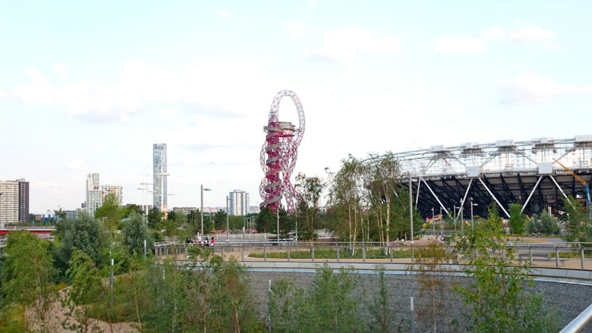
1.    INTRODUCTION

      The Local Plan

1.1   The Legacy Development Corporation became the Local Planning Authority for its
      area on 1st October 2012. As a result it is required to prepare a Local Plan, which
      when adopted will become the statutory development plan for its area, and set out
      the policies and proposals that will be used to guide and determine applications for
      development.

1.2   The National Planning Policy Framework, 2012 (NPPF) requires that local planning
      authorities set out the priorities for their area including policies to deliver:

      •     The homes and jobs needed in the area;
      •     The provision of retail, leisure and other commercial development;
      •     The provision of infrastructure for transport, telecommunications, waste
            management, water supply, waste water, flood risk and energy;
      •     The provision of health, security, community and cultural infrastructure and
            other local facilities; and
      •     Climate change mitigation and adaptation, conservation and enhancement of
            the natural and historic environment, including landscape.

      Purpose of this Background Paper

1.3   The NPPF requires that Local Plans are prepared using a proportionate, adequate,
      up-to-date and relevant evidence base “about the economic, social and
      environmental characteristics of the area”. This background paper draws together
      and summarises the approach that has been considered in developing policies of the
      Local Plan that have regard to the built environment.

1.4   The Local Plan draws on the content of the plans that were adopted by each of the
      four Boroughs covering its area prior to 1st October 2012, (Hackney, Newham,
      Tower Hamlets and Waltham Forest), as well as the evidence underpinning them.
      The Legacy Corporation has reviewed the approach taken by these, and where
      necessary, updated the evidence that relates to its area, when preparing its own
      Local Plan. This paper sets out the approach to the Local Plan in the context of
      legislative requirements, statutory instruments, national planning policy, strategic
      policies and strategy set out in the London Plan, and the extant planning policy within
      the adopted borough plans applying to the Legacy Corporation area.

1.5   This background paper is one of several that have been prepared in order to show
      that the policies within the Local Plan are Justified (i.e. supported by evidence)
      Effective (i.e. able to be delivered) and Consistent (i.e. in line with national planning
      policy).

                                                                                                  3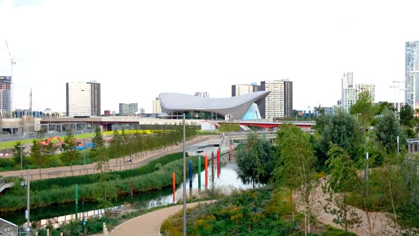
Background to the Legacy Corporation

1.6    In February 2012 the Mayor of London announced his formal decision to create a
       Mayoral Development Corporation to be responsible for the regeneration legacy from
       the 2012 Olympic Games. The Legacy Corporation came into being on 9th March
       2012.

1.7    On 1st October 2012, the London Legacy Development Corporation (Planning
       Functions) Order 2012 came into force giving the Legacy Corporation a range of
       planning functions that would normally only be available to a Local Planning
       Authority, including plan making powers.

1.8    The Legacy Corporation also has powers which allow it to become a Community
       Infrastructure Levy (CIL) charging authority. In becoming a Local Planning Authority
       the Legacy Corporation has subsumed the planning functions of the Olympic Delivery
       Authority (ODA), the London Thames Gateway Development Corporation and the
       London Boroughs of Hackney, Newham, Tower Hamlets and Waltham Forest for the
       land within its area.

1.9    The purpose of the Mayoral Development Corporation is: “To promote and deliver
       physical, social, economic and environmental regeneration in the Olympic Park and
       surrounding area, in particular by maximising the legacy of the 2012 Olympic and
       Paralympic Games, by securing high-quality sustainable development and
       investment, ensuring the long-term success of the facilities and assets within its
       direct control and supporting and promoting the aim of convergence”.

1.10   The Legacy Corporation aims to achieve its goals by:

       •   Working in partnership with the Mayor of London and the Greater London
           Authority, Central Government, the Growth Boroughs, residents in neighbouring
           local communities, local organisations, businesses and regeneration agencies,
           and other partners in both the public and private sector, including national and
           international sporting, cultural and leisure organisations;
       •   Leveraging our public assets to attract and secure private investment for the
           development of the Park;
       •   Setting and maintaining standards for quality of design, construction and urban
           planning, to ensure a sustainable and enduring legacy for Queen Elizabeth
           Olympic Park.

1.11   Four priority themes have been developed that reflect the purpose of the Legacy
       Corporation. These are:

       •   Promoting convergence and community participation;
       •   Championing equalities and inclusion;
       •   Ensuring high quality design; and
       •   Ensuring environmental sustainability.

                                                                                            4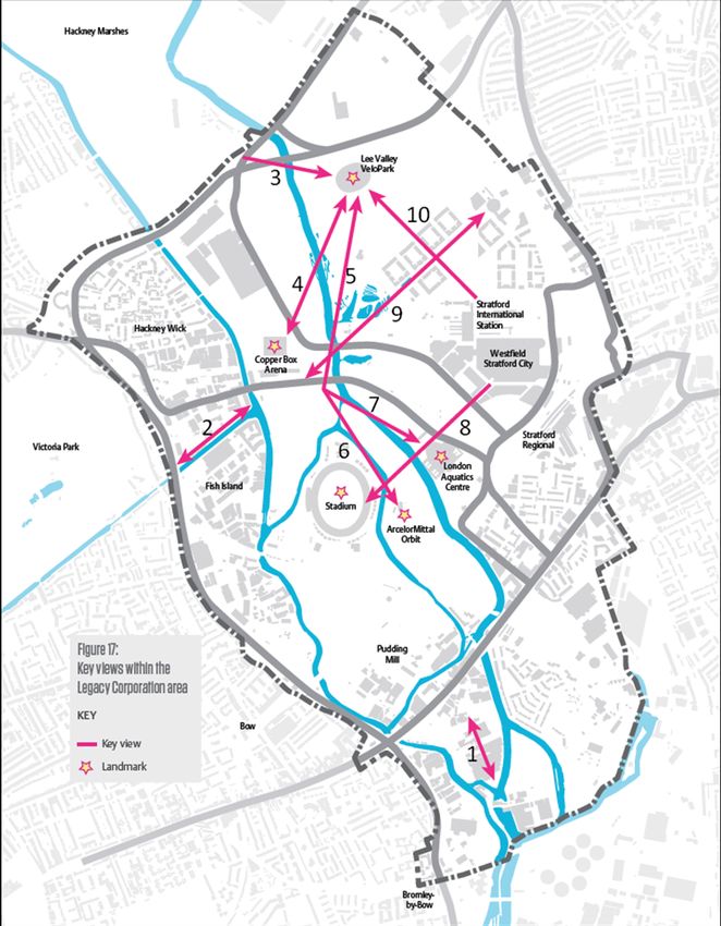
2.    LEGISLATIVE AND POLICY CONTEXT

      Legislation and Statutory Instruments

2.1   The Legacy Corporation’s planning related powers and responsibilities are primarily
      drawn from the following Legislation and Statutory Instruments:

      •    Town and Country Planning Act 1990 (as amended)
      •    Planning and Compulsory Purchase Act 2004 (as amended)
      •    The Planning Act 2008 (as amended)
      •    Town and Country Planning (Local Planning) (England) Regulations 2012
      •    Town and Country Planning (Development Management Procedure) (England)
           Order 2010 (as amended) and other statutory instruments made under Part III
           of the 1990 Act
      •    Localism Act 2011
      •    London Legacy Development Corporation (Planning Functions) Order 2012
      •    The Community Infrastructure Levy Regulations 2010 (as amended)
      •    Planning (Listed Buildings and Conservation Areas) Act 1990

2.2   With regard to the built environment, the 2008 Planning Act (Section 183) states that
      bodies that exercise any function in relation to local development documents ‘must
      have regard to the desirability of achieving good design’.

2.3   The primary sources of policy that have influenced the development of the Local Plan
      with regard to the built environment are outlined below.

      National Planning Policy Framework

2.4   The National Planning Policy Framework sets out the Government’s Planning
      Policies for England and how it expects these to be applied. The National Planning
      Policy Framework (NPPF) is a key part of the government’s reforms to make the
      planning system less complex and more accessible and acts as guidance for Local
      Planning Authorities and decision-takers, both in drawing up plans and making
      decisions about planning applications.

2.5   In essence the NPPF requires that Local Planning Authorities (LPAs) prepare design
      policies that are based on an understanding of the characteristics of their area, the
      objectives for its future, and what is expected in terms of the quality of development.
      Local Planning Authorities can also have regard to other planning practice guidance;
      this is referenced from paragraph 2.27 onwards.

2.6   The Government attaches great importance to the design of the built environment,
      and considers it to be a key aspect of sustainable development that is indivisible from
      good planning; contributing positively to making places better for people.

2.7   In achieving this form of sustainable development the NPPF requires LPAs to plan
      positively for the achievement of high quality and inclusive design for all
      development, including individual buildings, public and private spaces and wider area
      development schemes.

2.8   In terms of addressing Design in Local Plans, the NPPF states that Local Planning
      Authorities ‘Should develop robust and comprehensive policies that set out the

                                                                                            5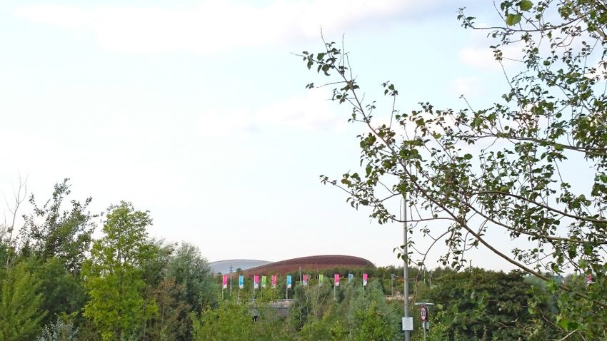
quality of development that will be expected’ and that ‘policies should be based on
       stated objectives for the future of the area and an understanding and evaluation of its
       defining characteristics’.

2.9    Furthermore, it states that planning policies and decisions should aim to ensure that
       developments:

       ● will function well and add to the overall quality of the area, not just for the short
       term but over the lifetime of the development;

       ● establish a strong sense of place, using streetscapes and buildings to create
       attractive and comfortable places to live, work and visit;

       ● optimise the potential of the site to accommodate development, create and sustain
       an appropriate mix of uses (including incorporation of green and other public space
       as part of developments) and support local facilities and transport networks;

       ● respond to local character and history, and reflect the identity of local surroundings
       and materials, while not preventing or discouraging appropriate innovation;

       ● create safe and accessible environments where crime and disorder, and the fear of
       crime, do not undermine quality of life or community cohesion; and

       ● are visually attractive as a result of good architecture and appropriate landscaping.

2.10   The NPPF encourages the use of design codes ‘where they could help deliver high
       quality outcomes’, however makes it clear that:

       ● Design policies should avoid unnecessary prescription or detail and should
       concentrate on guiding the overall scale, density, massing, height, landscape, layout,
       materials and access of new development in relation to neighbouring buildings and
       the local area more generally.

       ● Planning policies and decisions should not attempt to impose architectural styles or
       particular tastes and they should not stifle innovation, originality or initiative through
       unsubstantiated requirements to conform to certain development forms or styles.

2.11   Conversely, the NPPF also states that:

       ● It is, however, proper to seek to promote or reinforce local distinctiveness, and
       although;

       ● Visual appearance and the architecture of individual buildings are very important
       factors, securing high quality and inclusive design goes beyond aesthetic
       considerations.

2.12   With regard to the Historic Environment, the NPPF requires LPAs to set out in their
       Local Plan ‘a positive strategy for the conservation and enjoyment of the historic
       environment, including heritage assets most at risk through neglect, decay or other
       threats’; ‘recognising that heritage assets are an irreplaceable resource’, to be
       conserved ‘in a manner appropriate to their significance’. In developing this strategy,
       LPAs should take into account:

                                                                                                 6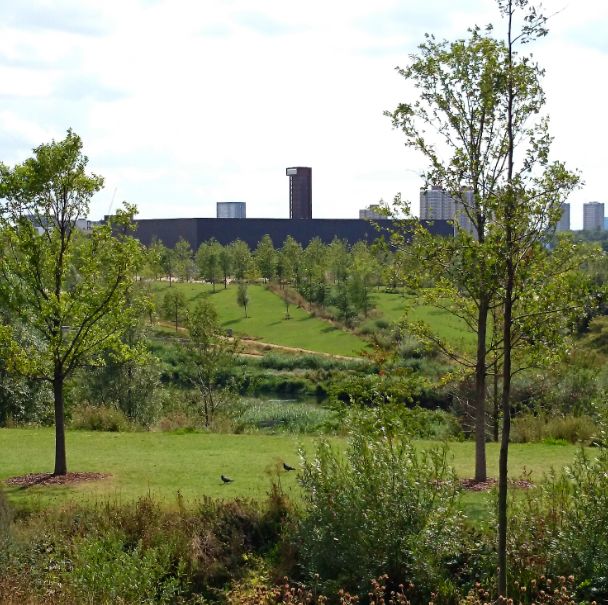
● The desirability of sustaining and enhancing the significance of heritage assets and
       putting them to viable uses consistent with their conservation;

       ● The wider social, cultural, economic and environmental benefits that conservation
       of the historic environment can bring;

       ● The desirability of new development making a positive contribution to local
       character and distinctiveness; and

       ● Opportunities to draw on the contribution made by the historic environment to the
       character of a place.

2.13   Overall, the NPPF requires that planning policies address the connections between
       people and places, specifically the integration of new development into the natural,
       built and historic environment.

       London Plan and Supplementary Planning Guidance

2.14   The London Plan, 2011, including Revised Early Minor Alterations, 2013 and Draft
       Further Alterations to the London Plan, 2014 (including the Schedule of Suggested
       Changes, 2014) and its associated Supplementary Planning Guidance forms the
       overall strategic plan for London, and sets out an integrated economic,
       environmental, transport and social framework for the development of the capital to
       2036. The Legacy Corporation’s Local Plan needs to be in general conformity with
       the London Plan, as its policies guide decisions on planning applications by London
       LPAs and the Mayor.

2.15   London Plan policies on place shaping emphasise the need for neighbourhoods to
       provide a clear character that is easy to understand and relate to, and that in
       planning for those neighbourhoods, development should have regard to the existing
       form, function and structure of an area, including the scale and mass and orientation
       of surrounding buildings. They also encourage boroughs to identify suitable locations
       for tall and large-scale buildings, and use of lifetime neighbourhood principles to help
       create places where people will be able to live at different stages in their lives. The
       London Plan outlines how good urban design can provide people with better access
       to goods, services and employment opportunities, and improve public safety and
       health.

2.16   Supplementary Planning Guidance (SPG) documents provide further detail on
       particular policies in the London Plan.

2.17   Supplementary guidance can be useful where: The level of detail is inappropriate for
       a development plan, for example development briefs, design guides and master
       plans for areas of intensive change where there is a need for an urgent policy
       response to an emerging issue.

2.18   Supplementary guidance is used to support statutory development plans, not as an
       alternative. It cannot be used to make new policies. Statements made in
       supplementary guidance carry less weight than those in development plans when
       determining planning applications and appeals, but may still be considerations.

2.19   For example, the Mayors ‘Olympic Legacy Supplementary Planning Guidance’ was
       published in July 2012 and seeks to supplement and apply London Plan policy for the
       area that includes the Legacy Corporation’s area at its heart; and sets out the

                                                                                              7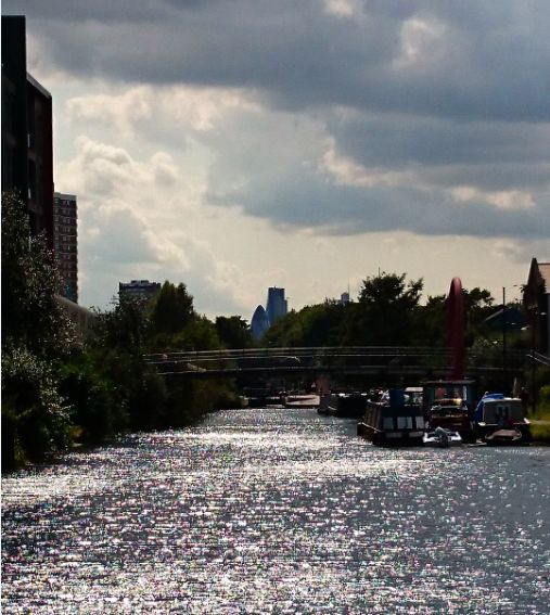
Mayor’s strategic priorities and long term vision for the Queen Elizabeth Olympic
       Park and its surrounding areas.

2.20   Information regarding SPG can be found here:
       http://www.london.gov.uk/priorities/planning/supplementary-planning-guidance

       Olympic Legacy Supplementary Planning Guidance (OLSPG)

2.21   This sets out a series of development principles designed to address the key
       strategic planning issues GLA officers and members of the Steering Group identified
       as applying to the OLSPG area.

2.22   Principle 5 of the OLSPG relates to urban form and states: ‘Use the area’s unique
       open spaces, waterways, character, sporting facilities, heritage buildings and
       contemporary city scale architecture, to create a network of new linked, inclusively
       designed and revitalised lifetime neighbourhoods’.

2.23   The London Plan and adopted and emerging borough planning documents formed
       the starting point for the OLSPG. However it is not a simple amalgamation of existing
       and emerging planning policies, but rather the culmination of a comprehensive
       analysis and review in light of the scale of the opportunities the 2012 Games offer
       east London. Overall it sets out the Mayor’s preferred strategic direction for the
       OLSPG area over the next 20 years.

2.24   The OLSPG has sought to synthesise these emerging and adopted plans to give a
       clear sense of the wider strategic picture across the OLSPG area and to illustrate the
       fit between borough and strategic aspirations. Figure 2.D.1 of the OLSPG sets out
       the existing urban form context within the OLSPG area. This provides the basis from
       which new plans should be derived, such as the Legacy Corporation’s Local Plan.

       Borough Plans

2.25   These are the adopted planning policy documents that were in place before 1st
       October 2012 and remain the relevant local planning policy until such time as the
       Legacy Development Corporation Local Plan is adopted:

       •   London Borough of    Newham Core Strategy (2012)
       •   London Borough of    Hackney Core Strategy (2010)
       •   London Borough of    Hackney, Hackney Wick Area Action Plan (2012)
       •   London Borough of    Tower Hamlets Core Strategy (2010)
       •   London Borough of    Tower Hamlets, Fish Island Area Action Plan (2012)
       •   London Borough of    Waltham Forest Core Strategy (2012)

       These documents all contain policies relevant to this Background Paper. Links to
       these are provided in Appendix 1.

2.26   These policy documents have been reviewed to inform the policies within the Legacy
       Corporation’s Draft Local Plan.

                                                                                              8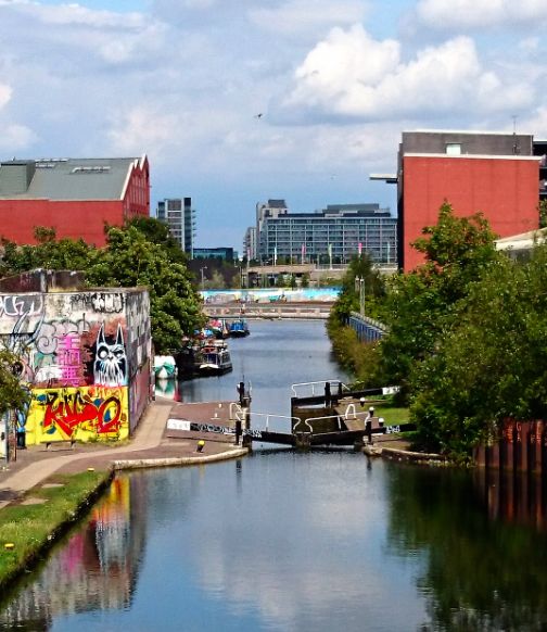
Planning Guidance

2.27   By Design: Urban Design in the Planning System - towards better practice
       (DETR, 2000). This guide is intended as a companion to planning policy guidance
       and subsequent planning policy statements and aims to encourage better design and
       stimulate thinking about urban design. This guide is relevant to all aspects of the built
       environment, from the design of buildings, spaces and landscapes, to planning for
       development at every scale.

2.28   The Urban Design Compendium First Edition (English Partnerships, 2000). This
       was originally prepared by Llewelyn Davies Yeang in association with Alan Baxter
       and Associates, and published by English Partnerships in August 2000. Since that
       time it has become an internationally renowned text for those engaged with the world
       of urban design. The purpose is to help equip all those involved in the delivery of
       places with guidance on achieving and assessing the quality of urban design in
       developing and restoring urban areas. It is intended that the guidance be used by
       anyone to improve the quality of the places being delivered, from local residents and
       businesses who want to improve their areas to local authority planners, house
       builders, urban designers and architects.

2.29   World Class Places (HM Government, 2009). This publication lays out the
       Government’s approach to improving quality of place – the way the places where we
       live and work are planned, designed, developed and maintained – and the steps that
       will be taken to build on recent progress.

2.30   Manual for Streets 1 & 2 (DCLG & DfT, 2007/CIHT, 2010). Manual for Streets
       emphasises that streets should be places in which people want to live and spend
       time in, and not just transport corridors. In particular, it aims to reduce the impact of
       vehicles on residential streets by asking practitioners to plan street design
       intelligently and proactively, and gives a high priority to the needs of pedestrians,
       cyclists and users of public transport. Manual for Streets 2 builds on the philosophies
       set out in Manual for Streets 1 and demonstrates through guidance and case studies
       how they can be extended beyond residential streets to encompass both urban and
       rural situations.

2.31   Planning for the Historic Environment Planning Practice Guide (English
       Heritage, 2010). Following the publication of the National Planning Policy
       Framework, PPS5 was deleted. However the Practice Guide remains a valid and
       Government endorsed document pending a further review into guidance supporting
       national planning policy. The references in the document to PPS5 policies are
       obviously now redundant, but the policies in the NPPF are very similar and the intent
       is the same, hence the Practice Guide remains almost entirely relevant and useful in
       the application of the NPPF.

2.32   Design Quality Policy (London Legacy Development Corporation, 2012). The
       design quality policy identifies design principles and actions to facilitate and embed
       high standards of design throughout Queen Elizabeth Olympic Park and the wider
       London Legacy Development Corporation Area. Architectural, urban and landscape
       design will be essential elements for creating places within Queen Elizabeth Olympic
       Park and the wider Legacy Corporation area that are engaging, safe, usable and
       beautiful, and which create and maintain value over the long term.

                                                                                               9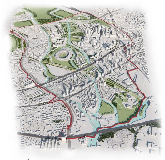
3.    SOUNDNESS

3.1   In order to be considered sound, policies relating to the built environment need to be:

      Positively Prepared: Policies should be based on a strategy which seeks to meet
      objectively assessed development and infrastructure requirements, including unmet
      requirements from neighbouring authorities where it is reasonable to do so and
      consistent with achieving sustainable development. In relation to the built
      environment this means:

             ● Developing robust and comprehensive policies that set out the quality of
             development that will be expected for the area (NPPF, Paragraphs 58, 59 and
             61) and which seek to increase the quality of development through the
             principles set out in the NPPF, linked to the vision for the area and specific
             local issues.

             ● Preparing a positive strategy for the conservation and enjoyment of the
             historic environment, including heritage assets most at risk (NPPF, Paragraph
             126) and which is based on a clear understanding of the cultural assets in the
             plan area and includes policy or policies which promote new development
             that will make a positive contribution to character and distinctiveness.

      Justified: Overall the policies should form the most appropriate strategy, when
      considered against other reasonable alternatives, based on proportionate evidence.
      In relation to the built environment this means:

             ● Founded on a robust and credible evidence base involving: research / fact
             finding demonstrating how the choices made in the plan are backed up by
             facts; and evidence of participation of the local community and others having
             a stake in the area.

             ● The most appropriate policies when considered against reasonable
             alternatives.

      Effective: The plan should be deliverable over its period and based on effective joint
      working on cross-boundary strategic priorities. In relation to the built environment this
      means:

             ● The policies having no regulatory or national planning barriers to their
             delivery.

             ● Being coherent with the strategies of neighbouring authorities.

             ● Informed through the Duty to Co-operate.

             ● Flexible.

             ● Able to be monitored.

                                                                                            10
Consistent with National and Regional Policy; In relation to the built environment
this means Sections 7, 11 and 12 of the NPPF, and Chapter 7 of the London Plan
(2011) / Further Alterations to the London Plan (2014), and:
● Not contradicting or ignoring national policy, and where there is a policy
departure, providing clear and convincing reasoning to justify the approach
taken.
● Adding to existing National and Regional Guidance. As the Legacy
Corporation falls under jurisdiction of the Mayor, it should apply the London
Plan and it associated Supplementary Planning Guidance and should not
include anything within its Local Plan that doesn’t add to this policy and
guidance.
3.2 The justification outlined in Section 4 demonstrates that the built environment policies
are consistent with the NPPF, in general conformity with the London Plan, and meet
the tests of soundness.
114. RESPONDING TO PLACE
4.1 Policy BN.1 is a design-based policy that seeks to improve the quality of places
within the Legacy Corporation area. The policy approach has been formulated by
converting well-established design principles into a set of criteria that can be used to
address a range of issues which are pertinent to the Legacy Corporation area. Policy
BN.1 represents a shift away from generic design policy and is tailored to utilise
development as a means to reinforce local distinctiveness and alleviate severance.
4.2 Criterion 1 requires development to relate well to the unique interplay of waterways
and landscapes that are present within the Legacy Corporation area. This is
necessary to ensure that it adapts to its landscape context and engages with natural
features wherever possible. This will maximise the amenity value of new
development and mean that built and natural elements are as interwoven as they can
be. The River Lea, Lee Navigation, Hertford Union Canal and Bow Back Rivers,
(including their surrounding landscapes) provide a unique physical backdrop that
structures the Legacy Corporation area and defines its character. These natural and
man-made features have engendered a sense of place that should be respected and
enriched through new sustainable and innovative forms of development.
4.3 Criterion 2 and 3 derive from a selection of well-established design principles that are
reflected within government endorsed publications such as ‘By Design’ (DETR, 2000)
and the ‘Urban Design Compendium’ (HCA, 2000). These have been included within
Policy BN.1 because of their fundamental importance to guiding new development
within areas such as Hackney Wick, Fish Island, Pudding Mill and Bromley-by-Bow.
Overall Policy BN.1 is structured to ensure that proposals respond to the existing
physical fabric of the Legacy Corporation area, particularly with respect to scale,
grain and architectural style. Although these considerations are somewhat self-
evident, it is nevertheless necessary to draw attention to their relative importance.
The Legacy Corporation has produced a range of material to help applicants inform
their proposals, such as the Hackney Wick and Fish Island Design and Planning
Guidance and the Pudding Mill Land Use and Design Framework. These
complement existing character studies undertaken by the host boroughs and which
also apply to the Legacy Corporation area (e.g. the Newham Character Study, (2011)
and the Tower Hamlets Urban Structure and Characterisation Study, (2009).
124.4 Criterion 4 underlines the need to link new development with existing movement
networks, but more importantly, for development to act as a medium for new routes
and as a mechanism to fund improvements. Although strategic connections to the
Legacy Corporation area are unrivalled, connections within the area itself need to be
improved, as there are a number of physical barriers to movement, particularly for
cyclists and pedestrians. Criterion 4 recognises this and the potential that
development has to effect positive change. Potential improvements are outlined
within a range of evidence base studies, primarily the ‘Infrastructure Delivery Plan’
(Legacy Corporation, 2014), but also within more locally focussed studies such as the
‘Hackney Wick Fish Island Strategic Connectivity Study’, (Atkins, 2013). These
studies highlight a range of prospective projects that would improve local connectivity
and which development could facilitate the delivery of through section 106
agreements or CIL. This includes making specific provision for pedestrians and
cyclists on existing routes and improving access to/from strategic road and rail links.
A number of these improvements are identified as development principles within the
Local Plan’s site allocations. Criterion 4 also aims to improve the quality of
connections within the area, particularly in terms of their safety, legibility and overall
permeability (see Local Plan Figure 24). From a safety perspective it is important that
development improves natural surveillance by being orientated to overlook routes,
especially where these provide access to residential uses. Criterion 4 seeks to
ensure that improvements to existing routes are considered from the outset, and that
new routes offer a more legible and direct path than existing ones. This relates
closely to Criterion 5, which highlights that applicants should consider whether
existing physical infrastructure could be utilised or re-engineered to improve
connectivity. The Northern Outfall Sewer, or rather the Greenway, is a good example
of this.
4.5 Criterion 6 is centred on the need to make provision for residential uses that are
introduced within a non-residential context. This is a key consideration given the
number of homes anticipated to be delivered in areas that are predominately in
employment use, i.e. sub areas 1 and 4. These areas are currently tailored towards
serving the needs of business and industry and therefore it’s crucial that
consideration is given to how residential development can be designed to mitigate
exposure to uses that are likely to generate smells/dust/noise/fumes etc and which
may impinge upon residential amenity. Practical arrangements in relation to access
and servicing must be resolved at application stage.
4.6 Furthermore it is important that development clearly distinguishes between the public
and private spaces it incorporates, and preferably conceals those of a private nature
from public view by maintaining a continuous building line. Boundary treatments in
keeping with the local streetscape should be used to delineate the boundary between
public and private space.
134.7 Criterion 7 is concerned with the provision and protection of daylight, sunlight and
privacy. Although these are necessities of daily life they are often compromised to an
unacceptable degree within dense urban environments. Criterion 7 will ensure that
this isn’t the case within the Legacy Corporation area. In order to satisfy this criterion
proposals for development should be designed in accordance with the Building
Research Establishment’s (BRE) ‘Site Layout Planning for Daylight and Sunlight’
guidance, specifically in relation to Average Daylight Factor (ADF). ADF is the
average level of indoor illuminace expressed as a percentage of unobstructed
outdoor illuminance. A space with a mean daylight factor between 2% and 5% is
considered well lit and requires little or no additional lighting during the daytime. A
space with a daylight factor of less than 2% appears dimly lit. The ADF target values
set out in the BRE Guidelines are 2% for kitchens, 1.5% for living rooms and 1% for
bedrooms. New development should be designed to achieve these target values.
4.8 A 25-degree test should also be undertaken to identify impacts upon surrounding
properties. In order to establish if there is any impact upon daylight, and what the
significance of this impact is, two methods can be used to test levels, the Average
Daylight Factor (ADF) and the Vertical Sky Component (VSC). The VSC calculates
the amount of daylight reaching the outside face of the window. In considering the
impact upon sunlight, the test is based upon a calculation of annual probable sunlight
hours (APSH), which is an annual average based upon probability. The sunlight test
only needs to be carried out if there is an obstruction within the 25-degree line, and
the window face affected is within 90 degrees due south of the development. Overall
development should be orientated to maximise the availability of both sunlight and
daylight, and should not give rise to unacceptable adverse impacts in relation to
either. This includes not impacting upon the probable annual and winter sunlight
conditions to surrounding properties or overshadowing green spaces.
4.9 Privacy is also an important consideration and Criterion 7 aims to address this by
ensuring that development is designed so that there is no direct overlooking between
habitable rooms. The siting of development, arrangement of dwellings and disposition
of windows in individual units should result in satisfactory levels of privacy both within
a development and surrounding buildings. There should be no significantly adverse
impacts upon surrounding occupiers’ privacy as a result of development.
4.10 Overall Policy BN.1 aims to ensure that development creates successful places. This
means places that have their own identity (i.e. a character that responds to and
reinforces locally distinctive patterns of development), places with continuity and
enclosure (i.e. which use buildings to distinguish between public and private spaces),
places with quality public realm (i.e. active spaces that are safe, durable and
attractive), places which are easy to move around (i.e. walkable, accessible and
which prioritise pedestrians and cyclists), places that are legible (i.e. easy to find with
recognisable routes and memorable landmarks), places which are adaptable (i.e.
flexible enough to meet changing social, technological, economic and climatic
conditions), and places that are diverse (i.e. which offer a variety of uses that work
together).
14Policy BN.1: Responding to place
Proposals will be considered acceptable where they respond to place in accordance with
the principles outlined below:
1. Landscape and water: relate well to the local area’s defining natural and man-made
landscape features, in particular the linear form of the waterways and parklands
2. Urban fabric: respect existing typologies, and draw design cues from the form of the
area in terms of its layout (urban structure and grain) and scale (height and massing)
3. Architectural context: enhance the architectural setting within which development is
proposed. Careful consideration should be given to architectural style, materials,
fenestration, colour, building orientation, datums and overall appearance
4. Connectivity: ensure that new and existing places link to route networks and facilitate
movement along direct, permeable, safe and legible pedestrian and cycle routes. Routes
should cater for the requirements of all users. Opportunities to connect areas to strategic
road, rail, bus and cycle networks must be utilised
5. Infrastructure: make use of existing physical infrastructure to help overcome barriers
to integration and to create new links and routes
6. Mix: consider how proposed uses integrate with, and relate to, both public and private
space. Where new residential uses are introduced within a non-residential context,
consideration must be given to layout, access, servicing and amenity
7. Amenity and wellbeing: minimise impact within proposed and upon existing development,
by preventing overshadowing, and an unacceptable provision/loss of sunlight, daylight or
privacy.
Cross-reference to policies: SP.3; BN.2; BN.3; BN.4; BN.7; BN.9; BN.10; BN.16; T.6
London Plan policies: 7.1; 7.3; 7.4; 7.5; 7.6
155. DESIGNING RESIDENTIAL SCHEMES
5.1 Policy BN.4 amplifies the approach alluded to above, but solely in relation to the
design of development with a residential component. Policy BN.4 requires that the
residential elements of new development meet the ‘Baseline Quality and Design
Standards’ outlined within Annex 1 of the Mayor of London’s Housing Supplementary
Planning Guidance. The ‘Baseline Quality and Design Standards’ are identified here
(page 176 onwards):
http://www.london.gov.uk/sites/default/files/Housing%20SPG%20FINAL%20Low%20
Resolution_0.pdf
5.2 The baseline standards have been formulated to address issues of particular
strategic concern in relation to the quality of development in Greater London. The
Legacy Corporation therefore considers them one of the most effective tools for
ensuring that high quality development is delivered within the Legacy Corporation
area at both the neighbourhood and individual dwelling scale. This is particularly
important given that a further 4000 residential units are likely to be permitted between
2015/16 and 2030/31 within the Legacy Corporation area.
5.3 The Legacy Corporation has chosen to apply the Mayors housing standards rather
than devise its own. This is for a number of reasons, firstly because they are more
comprehensive and substantive than any which could be practicably outlined through
policy wording; secondly because as a Mayoral Development Corporation the Legacy
Corporation should be leading by example in encouraging the application of the
Mayors Supplementary Planning Guidance, and thirdly because they are
supplementary to adopted London Plan policy, and thereby consistent with regional
policy. The justification outlined above in relation to Policy BN.1 also applies to
Criterion 1 to 5 of BN.4. These criterions have been included and amplified in Policy
BN.4 to reinforce the importance of considering privacy, sunlight, and daylight when
designing residential schemes.
16Policy BN.4: Designing residential schemes
Proposals will be considered acceptable where residential elements meet the ‘Baseline’
Quality and Design Standards outlined within Annex 1 of the Mayor of London’s Housing
Supplementary Planning Guidance (November 2012), including any future revisions or
superseding guidance.
Proposals for residential development must also:
1. Contribute towards the creation of distinctive, integrated, legible, connected
and sustainable places
2. Exhibit the principles of good design, by incorporating high-quality landscape
and architectural design, including high-quality materials, finishes and details
3. Minimise impact upon existing surrounding development and not result in an
unacceptable loss of privacy or an unreasonable degree of overlooking towards habitable
rooms and private amenity spaces within or around existing development
4. Demonstrate that the scheme will receive adequate levels of daylight and sunlight,
and that existing surrounding development will not experience an unacceptable loss
of sunlight and daylight in accordance with Site Layout Planning for Daylight and
Sunlight (Building Research Establishment, 2011), including any future revisions
or superseding guidance
5. Ensure surrounding open spaces receive adequate levels of daylight and sunlight.
Cross-reference to policies: H.1; BN.1; BN.5; BN.9; BN.10; BN.14; S.2; S.3; S.4; S.5;
S.7; S.8
London Plan policies: 3.5; 3.7; Mayor of London’s Housing Supplementary
Planning Guidance
176. REQUIRING INCLUSIVE DESIGN
6.1 Policy BN.5 identifies the need for all development to be inclusive, which means able
to be accessed and enjoyed regardless of disability, age, gender, sexual orientation,
race or faith.
6.2 Inclusive design aims to achieve solutions that create safe and accessible
environments for all members of the community. An inclusive design approach also
benefits other groups including; older people, people with temporary impairments,
large families, parents with young children and babies, people from diverse faith
groups and different cultures, people that speak different languages, and a
combination of all of the above.
6.3 Policy BN.5 is underpinned by Paragraph 3.114 of the ‘Further Alterations to the
London Plan, (2014)’ which states that ‘the Legacy Corporation’s Inclusive Design
Standards can be used as a model of good practice to be followed in all
developments outside the Queen Elizabeth Olympic Park’.
6.4 The original Olympic Delivery Authority Inclusive Design Standards (IDS) were
written specifically with sports venues on the Olympic Park in mind. However, while
the Olympic and Paralympic Games are unique events, the design standards are still
relevant to the design of other buildings and landscapes outside the park boundary
(as a new section on residential buildings has been added). In keeping with the
existing IDS, the standards on residential buildings are based on existing good
practice guidance.
6.5 The Legacy Corporation’s IDS are currently applicable to all projects that the Legacy
Corporation is directly responsible for delivering within its area. The procedures,
guidance and standards described in the IDS set out the Legacy Corporation’s
expectations for the delivery of inclusive design and are intended to complement and
assist implementing the requirements of Policy BN.5. Sections of the IDS can inform
the building of retail, commercial and leisure/community uses, however in some
cases more specific guidance may also be applicable to particular types of buildings
and facilities. In such cases, it is recommended that design teams seek specialist
access advice and refer to building regulations for further guidance.
6.6 In order to be meet Policy BN.5 applicants will be expected to incorporate all the
applicable elements of the IDS by following the procedures set out within them and
the standards of design they describe. Applicants should document and explain the
approaches they have adopted, including any alternative options considered.
Applicants are also expected to present their proposals to the relevant consultation
and technical forums including the Built Environment Access Panel (BEAP) where
necessary. The BEAP was originally established by the Olympic Delivery Authority
and has now been formally adopted by the Legacy Corporation to provide expert
strategic and technical inclusive design advice. BEAP have been consulted during
the preparation of Local Plan, specifically in relation to the wording of Policy BN.5.
6.7 Applicants may need to formally consult the BEAP as part of the planning process
and where necessary it is recommended to involve the group during the pre-
application stage. The BEAP may also need to be consulted where a design deviates
considerably from the IDS as they have considerable experience working
collaboratively with design teams to help develop unique and innovative inclusive
design solutions.
186.8 Applicants should keep a record of the issues raised in consultation with BEAP and
describe how they have sought to address the comments made in the Design and
Access Statements submitted as part of a planning application.
6.9 Any deviation necessary from the guidance set out in the IDS must be clearly set out
in access statements.
6.10 A typical access statement will contain:
• Statement of compliance with the principles and guidance contained in the IDS;
• Philosophy and approach to inclusive design;
• Key issues of the scheme and identified constraints;
• Sources of advice and guidance;
• Consultation with disabled people in the local community (including the BEAP),
including feedback and how this has been or will be included in the design process;
• Principles of inclusive design, maintenance and management;
• Demonstration of inclusive access to the site and facilities including relevant plan
and section drawings/diagrams;
• Comprehensive list of inclusive design standards and guidance used.
6.11 Each inclusive design standard within the IDS publication includes two sections, the
design intent and the inclusive design guidelines. The design intent section gives
some background and context while the inclusive design guidelines set out good
practice that the Legacy Corporation expect will deliver accessible and inclusive
environments.
6.12 As a Mayoral Development Corporation and public body, the Legacy Corporation is
legally obliged under the public sector equality duty, established under the Equality
Act 2010, to establish and promote equality and to be transparent about how it does
so.
6.13 The IDS can be viewed here:
http://queenelizabetholympicpark.co.uk/~/media/LLDC/Policies/LLDCInclusiveDesign
StandardsMarch2013.pdf
19Policy BN.5: Requiring inclusive design
Proposals will be considered acceptable where they respond to the needs of all users, and
provide an accessible and inclusive environment by incorporating all applicable elements of
the Legacy Corporation’s Inclusive Design Standards.
Cross-reference to policies: H.3; BN.4
London Plan policies: 7.1; 7.2; 3.5; Mayor of London’s Housing Supplementary
Planning Guidance
207. PROTECTING KEY VIEWS
7.1 The London Plan states that the principles of Policy 7.12 (i.e. that development should
not harm, and where possible should make a positive contribution to, the characteristics
and composition of views and their landmark elements) can be used for the designation
and management of local views. Policy BN.9 has been formulated in response to this
and the need to preserve or enhance viewers’ ability to recognise and appreciate the
landmarks and views that characterise the Legacy Corporation area. These landmarks
and views are identified in Figure 17 within the Local Plan.
7.2 A landmark can be defined as a visual reference with defining characteristics that set it
apart from its surroundings. The significance of a landmark depends on two factors, its
visibility and its recognisability. A landmarks visibility is primarily determined by its
location, where as its recognisability can be determined by many factors, including its
colour, shape, or historic associations.
7.3 Figure 17 identifies the Stadium, London Aquatics Centre, Lee Valley VeloPark, Copper
Box Arena and the ArcelorMittal Orbit as landmarks. This is on account of their visual
prominence, unique architectural form, and symbolic associations with the London 2012
Olympic Games.
7.4 Figure 17 identifies the following key views:
1. THREE MILLS LANE: Vista along THREE MILLS LANE to/from the Clock and House
Mills and the Sugar House Yard buildings. The House Mill is a grade I listed building of
national importance and is a rare and distinguished example of a highly graded listed
industrial building in London. The Clock Mill is grade II listed. The Sugar House Lane
buildings are a tight-knit group of locally listed buildings off Sugar House Lane, two and
three storeys in height, built with red brick with characteristic industrial detailing. Three
Mills Lane has been identified as a key view because it provides a visual link between
the Three Mills and Sugar House Lane Conservation Areas, and specifically the listed
buildings that bridge the Three Mills Wall River.
212. HERTFORD UNION CANAL: Vista along the Hertford Union Canal to/from Wansbeck
Road, along the canal towpath and the River Lee Navigation. Hertford Union Canal has
been identified as a key view because it encompasses the special historic and
architectural interest of the canal and the heritage assets along it (i.e. the lock and
McGrath outbuildings immediately to the north of the canal).
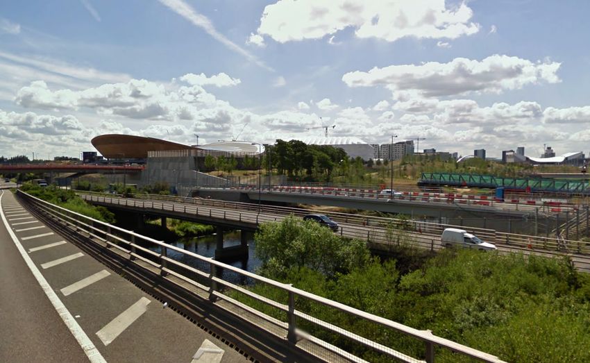
3. A12 TO LEE VALLEY VELOPARK: View from the A12 (from the point at which it
traverses Eastway) to the VeloPark. A12 – VeloPark is identified as a key view because
it is the point at which Queen Elizabeth Park becomes most visible along the A12 road.
This view offers a fleeting glimpse of the Park (as it is visible whilst travelling along the
A12) generating a sense of place and helping people locate themselves within the wider
London context. This view is also critical in promoting a positive image of Queen
Elizabeth Olympic Park to anyone travelling to or from London along this key transport
corridor.
224. COPPER BOX – LEE VALLEY VELOPARK: View to/from the Copper Box Arena and
the VeloPark. This is identified as a key view because it provides a visual link between
these venues and a sense of orientation to visitors as they navigate through Queen
Elizabeth Olympic Park.
5. CARPENTERS LOCK TO LEE VALLEY VELOPARK: This is identified as a key view
because it is an important visual link from the South to the North of the Park and
contributes to a sense of place by capturing the Parklands and the VeloPark.
6. CARPENTERS LOCK TO ARCELORMITTAL ORBIT: This is identified as a key view
because it is an important visual link that contributes to a sense of place by capturing
the City Mill River, Stadium Island, the South of the Park and the ArcelorMittal Orbit.
237. CARPENTERS LOCK TO LONDON AQUATICS CENTRE: This is identified as a key
view because it is an important visual link that contributes to a sense of place by
capturing the Waterworks River, Stratford Waterfront and the London Aquatics Centre.
8. WESTFIELD STRATFORD CITY TO STADIUM: The view from Chestnut Plaza to the
Stadium is identified as a key view because it captures two major landmarks within
Queen Elizabeth Olympic Park (the Stadium and the London Aquatics Centre) and is
the primary route, entry point and desire line between the Park, Westfield Stratford City
and Stratford Regional/International Stations. The legibility of Queen Elizabeth Olympic
Park and how it relates to Stratford City would be compromised if this sightline were
adversely impacted to an unreasonable degree.
9. MANDEVILLE PLACE – CHOBHAM ACADEMY: This is identified as a key view
because it is an important vista along a significant green infrastructure corridor that
includes the Wetlands, Portland Lakes and Victory Park. It also provides a visual link
between Queen Elizabeth Olympic Park and East Village and a sense of orientation to
visitors as they navigate the area. It also helps define the Park’s relationship with
Stratford City.
2410. CELEBRATION AVENUE TO LEE VALLEY VELOPARK: This is identified as a key
view because it is the only visual link between East Village and the former London 2012
Venues. The principle of the view has been established and reinforced through the
approved Legacy Communities Scheme Zonal Masterplan for Chobham Manor and the
now established street pattern and urban form at East Village.
7.5 A planning application for a proposal that could impact a key view should be
accompanied by an analysis that explains, evaluates and justifies any visual impact on
that view. The analysis should consider the likely significance, scale and magnitude of
effect caused by the proposal’s size, shape or design with reference to the Local Plan
policies that are cross-referenced with Policy BN.9.
7.6 The assessment should form part of the Design and Access Statement or Townscape
and Visual Impact assessment submitted with a planning application. It should use
clearly defined terminology, be as concise, impartial and objective as possible, and
draw upon the advice and opinion of other bodies including English Heritage. Applicants
should acknowledge any potential harm to the view from the proposed development.
257.7 Applicants should also undertake further analysis of the key view to establish the view’s
composition, including the skyline and the elements that contribute to and detract from
it. This should provide confirmation of:
• What is distinctive, characteristic, aesthetically or culturally important in the view,
and its benefit to the Legacy Corporation area;
• Any existing constraints, or opportunities to enhance the view and its setting,
(e.g. any relevant designations, local policies and consented schemes that have
not yet been implemented);
• Conditions relevant to the assessment of the view including the effect of
atmospheric conditions, distance and weather or seasonal change, building
works that could block or harm views on a temporary basis and/or night-time
appearance.
7.8 This background paper describes the general features and characteristics of each of the
key views identified within Figure 17. Applicants will be expected to complement and
expand upon this description when preparing an analysis of how their proposal impacts
a key view. Furthermore, that analysis will need to contain sufficient information to
describe the proposed development, its precise location, setting, height, scale, design,
external appearance and visual relationship to identified landmarks. The analysis of
impacts on key views should also refer to the obstruction of existing views and any loss
of views to the landmarks identified in Figure 17.
Policy BN.9: Protecting key views
Proposals for development that impact a key view will only be considered acceptable when
the development makes a positive contribution to the characteristics and composition of
that view. Key views are identified in Figure 17.
Cross-reference to policies: BN.1; BN.4; BN.10; BN.16
Sub Area Policies: 1.2; 1.4; 4.4
London Plan policies: 7.11; 7.12
2627
8.    PROPOSALS FOR TALL BUILDINGS

8.1   The Local Plan includes a computer-generated image (page 12) of how the Legacy
      Corporation area will look once all current planning consents have been implemented.
      This serves to illustrate the number of tall buildings permitted around Queen Elizabeth
      Olympic Park and is indicative of the development densities that are likely to be
      proposed during the Plan period. As a result of this the Legacy Corporation considers it
      necessary to include a tall buildings policy (BN.10) within its Local Plan to ensure that
      future proposals continue to exhibit the highest standards of sustainability and design.

8.2   In defining what constitutes a tall building the Legacy Corporation has followed the
      London Plan definition, i.e. ‘those that are substantially taller than their surroundings’. In
      order to apply this principle the height of those ‘surroundings’ had to be defined within
      each sub area context. This is referred to as ‘prevailing height’ within the Local Plan and
      is based on the general level of building heights across an area rather than the tallest
      built elements.

8.3   The prevailing height of sub area 1 is 20 metres, this is extrapolated from the maximum
      building height thresholds expressed within the Hackney Wick and Fish Island Area
      Action Plans (i.e. 4-6 storeys) and existing building heights within sub area 1. The
      prevailing height of sub area 2 ranges from 20 – 30 metres and is based upon existing
      planning permissions that cover the vast majority of developable land within that area.
      The prevailing height of sub area 3 is 27 metres within the Stratford High Street Policy
      Area and 30 metres elsewhere. This is derived from the existing building heights along
      Stratford High Street (not the tallest elements) and is a reflection of the threshold size
      set for the referral of planning applications to the Mayor within the Legacy Corporation
      area. The prevailing height of sub area 4 is again 27 metres within the Stratford High
      Street Policy Area and is set at 18 metres within Bromley-by-Bow, 21 metres in Pudding
      Mill and 10 metres elsewhere. This approach reflects the variety of building heights
      across sub area 4 and the need for new development within the site allocations to
      respond to the existing low-rise development outside those allocation boundaries.
      Prevailing heights have been expressed in metres rather than storeys. This is a more
      accurate means of prescribing building heights given that there can be a substantial
      difference in floor to ceiling heights between proposals (see Local Plan Figure 18).

8.4   The criteria of Policy BN.10 are underpinned by a need to ensure that only tall buildings
      of the highest quality are granted planning permission. There are many benefits that tall
      buildings can bring and the policy highlights these in Criterions 1 – 10. Together these
      represent what all tall buildings should do and what distinguishes a good tall building
      from a bad one. Hence in order for a tall building proposal to be considered acceptable
      in planning terms it must perform well in relation to each of those Criterions. Criterions
      11 and 12 are included in response to the problems that tall buildings have been known
      to cause. Essentially if a proposal would result in a significant adverse impact upon
      either micro-climatic conditions or amenity (that cannot be mitigated through design
      measures) then it is too tall and unacceptable under Policy BN.10. The height of a
      proposal should be a product of a design process that is set within the parameters of,
      and driven by a need to meet, Criterions 1 – 13. The outcome of this process might be a
      building proposal that is below an area’s prevailing height; therefore highlighting that a
      ‘tall’ building proposal is unsuitable for the location in question.

                                                                                                 28
8.5 Policy BN.10 requires that all tall buildings (as defined by the Plan) should be located in
the Centre Boundaries. The reasons for this are outlined within Local Plan paragraph
6.32.
Policy BN.10: Proposals for tall buildings
Proposals for tall buildings will be considered acceptable where they:
1. Exhibit outstanding architecture and incorporate high-quality materials, finishes
and details
2. Respect the scale and grain of their context
3. Relate well to street widths and make a positive contribution to the streetscape
4. Generate an active street frontage
5. Provide accessible public space within their cartilage
6. Incorporate sufficient communal space
7. Contribute to defining public routes and spaces
8. Promote legibility
9. Create new or enhance existing views, vistas and sightlines
10. Preserve or enhance heritage assets and the views to/from these, and contribute
positively to the setting of heritage assets, including conservation areas.
Proposals for tall buildings that are likely to have a significant adverse impact on one or
more of the following will be refused:
11. Micro-climatic conditions (specifically down-draughts and lateral winds over
public spaces)
12. Amenity: impacts to the surrounding area (including open spaces and other buildings)
that relate to:
• Overlooking
• Daylight
• Overshadowing
• Light spill/reflection
13. Existing views of landmarks, parkland, heritage assets, waterways, and views along
street corridors (in accordance with the policy on Protecting Key Views).
Tall buildings should be located within the Centre boundaries outlined within this Local Plan.
In order of hierarchy, these are:
• Stratford Town Centre Extension
• Bromley-by-Bow District Centre
• Hackney Wick Neighbourhood Centre
• Pudding Mill Local Centre
• East Village Local Centre.
29You can also read


