MAIN GANGA CANAL SYSTEM - MASSCOTE UTTAR PRADESH-INDIA MEERUT September 2008 Modernization Strategy for Irrigation Management
←
→
Page content transcription
If your browser does not render page correctly, please read the page content below
MASSCOTE
           MEERUT September 2008

Modernization Strategy for Irrigation Management

          UTTAR PRADESH- INDIA

MAIN GANGA CANAL SYSTEM

                                                   1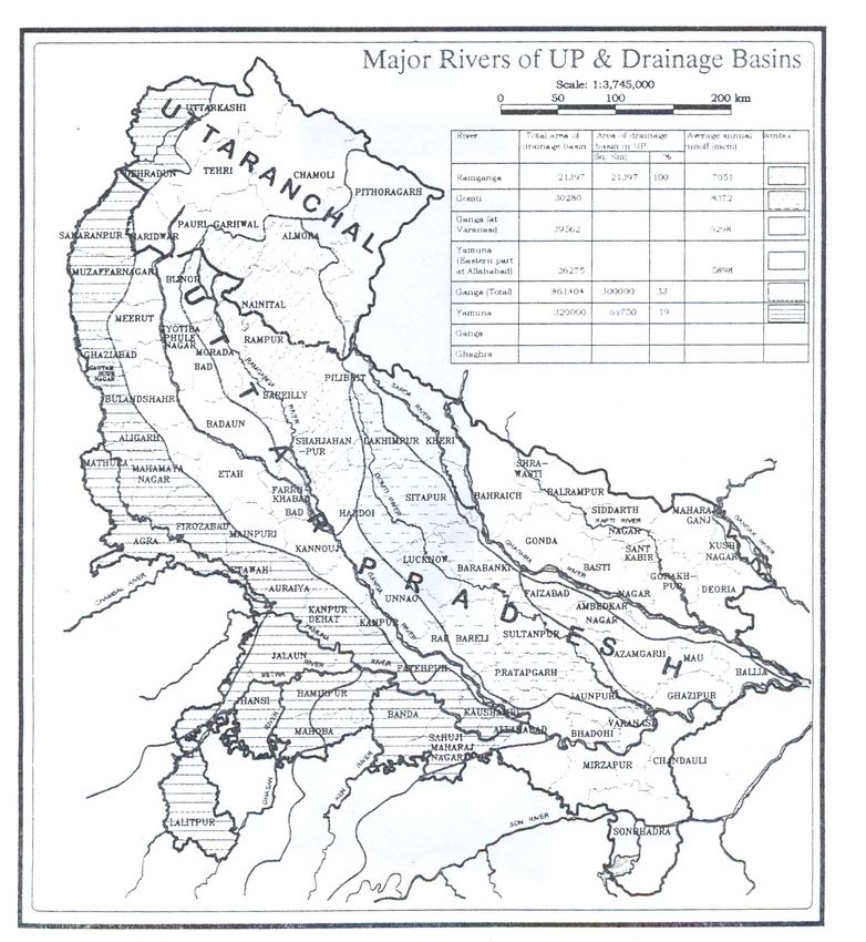
CURRENCY EQUIVALENTS

                                  Currency Unit = Indian Rupee (Rs)
                                        US$1.0 = 39.46 INR

                              MEASURES AND EQUIVALENTS

1 meter                           =     3.28 feet
1 ha                              =     2.47 acres
1 km                              =     0.620 miles
1 cubic meter (m3)                =     35.310 cubic feet
1 million acre foot (MAF)         =      1.234 Billion cubic meter (Bm3)
1 cubic feet per second (cusec)   =     28.5 litre per second (l/s) = 0.0285 cubic meter per second
(m3/s)
TMC                               =     Thousand Million Cubic Feet     = 28.3 Million Cubic Meters
MCM                               =     Million Cubic Meter

                            ABBREVIATIONS AND ACRONYMS

CA              Command Area
CCA             Culturable Command Area
CR              Cross regulator
DO              Direct outlet
FAO             Food and Agriculture Organization
FO              Farmer Organization
GCA             Gross Command Area
GOUP-ID         Government of Uttar Pradesh Irrigation Department
ITRC            Irrigation Training and Research Centre (California Polytechnic University)
LMA             Local Management Agency
MAF             Million Acre Feet
MASSCOTE        MApping System and Service for Canal Operation TEchnique
M&E             Monitoring and Evaluation
NCA             Net Command Area (irrigable)
NRLW            Land and Water Division of FAO Natural Resources Department
O&M             Operations and Maintenance
OFWM            On-Farm Water Management
RAP             Rapid Appraisal Procedure
UGC             Upper Ganga Canal
WUA             Water Users Association

                                                                                                      2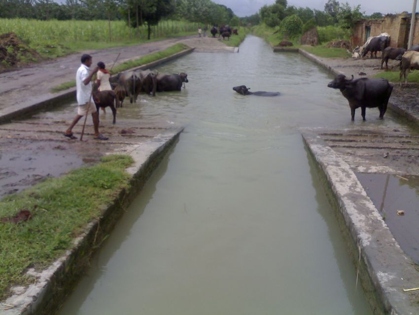
Executive summary .................................................................................................................... 4
Introduction and Background..................................................................................................... 6
1. THE MASSCOTE APPROACH ........................................................................................... 8
   Presentation of the methodology............................................................................................ 8
2. The Upper Ganga Canal System .......................................................................................... 10
   Project Description ............................................................................................................... 10
3. MASSCOTE in UGC Main Canal and Bholal Division distributaries ................................ 14
   Step 1. RAPID DIAGNOSIS: RAP ................................................................................... 14
     RAP Methodology ........................................................................................................... 14
     RAP in Upper Ganga Canal and Bhola Distributaries ..................................................... 16
     External indicators ........................................................................................................... 16
     Internal Performance Indicators ....................................................................................... 18
     Features about the Service ............................................................................................... 18
     WUA ................................................................................................................................ 20
   Step 2. SYSTEM CAPACITY AND SENSITIVITY.......................................................... 22
     Step 2 Capacity ................................................................................................................ 22
   STEP 2 SENSITIVITY OF THE IRRIGATION STRUCTURES ...................................... 23
   STEP 3: THE PERTURBATIONS ................................................................................... 23
   Step 4 MAPPING WATER NETWORKS & WATER BALANCE/ACCOUNTING........ 24
     WATER ACCOUNTING ................................................................................................ 24
   Step 5 MAPPING THE COST of OPERATION................................................................. 25
     Cost of Management Operation and Maintenance........................................................... 25
   Step 6 SERVICE to USERS................................................................................................. 26
     USES & USERS: ............................................................................................................. 26
     OTHER USES:................................................................................................................. 26
     Allocation ......................................................................................................................... 27
     Scheduling........................................................................................................................ 27
     Delivery to farmers .......................................................................................................... 27
     The vision......................................................................................................................... 27
   Step 7 PARTITIONING IN MANAGEMENT UNITS....................................................... 28
     The management vision ................................................................................................... 28
   Step 8 MAPPING THE DEMAND FOR CANAL OPERATION ...................................... 28
   Step 9 CANAL OPERATION IMPROVEMENTS............................................................. 29
     STORAGE: Recharge for ground water .......................................................................... 29
     SEEPAGE / CANAL: ...................................................................................................... 29
     PROPORTIONAL SERVICE.......................................................................................... 29
     IRRIGATION AGENCY................................................................................................. 29
   Step 10 AGGREGATING AND CONSOLIDATING MANAGEMENT .......................... 30
   Step 11 PLAN FOR MODERNIZATION ........................................................................... 30
     Recommendations for short term ..................................................................................... 30
Appendix I RAP Internal Indicators for UGC ...................................................................... 31

                                                                                                                                          3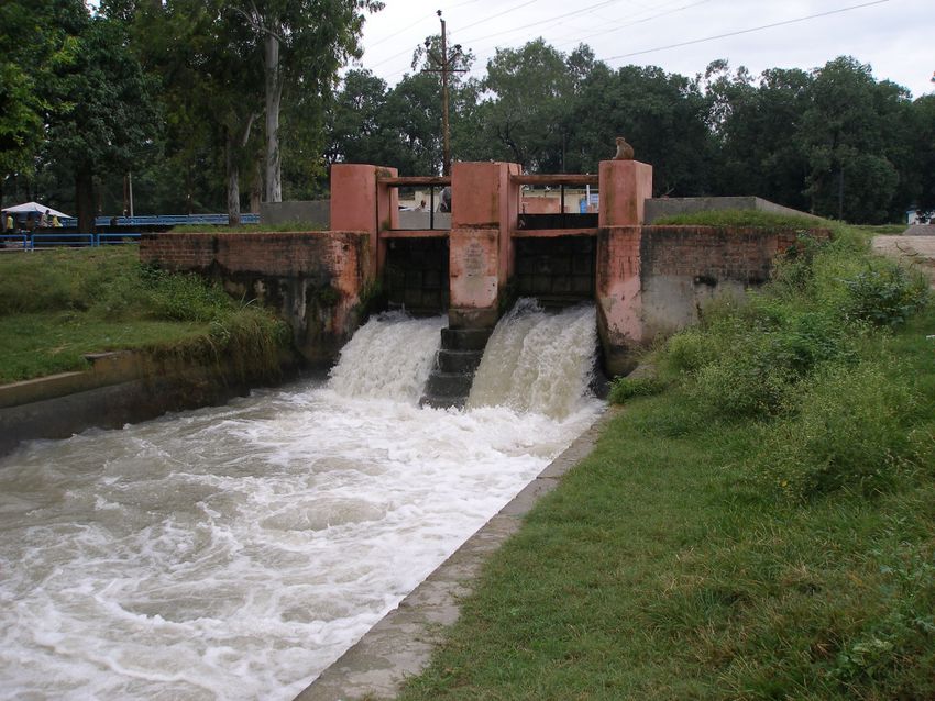
Executive summary
A Masscote training workshop was organised in Meerut Uttar Pradesh from 16th to 25th
September 2008 for 40 engineers and managers as part of a collaborative program between
the Government of Uttar Pradesh and FAO.

The Rapid Appraisal of Performance was carried out by 5 groups in the command area of the
Upper Ganga Canal North-West of Uttar Pradesh. More specifically the study focussed on the
5 distributaries of the Meerut Division offtaking at the Bhola regulator and for a special team
on the UGC main canal upstream and downstream of Bhola.

The estimated external indicators of performance per are is US$ 1500/ha while productivity of
water amounts to US $ 0.10/m3. With respects to national and international standards,
productivity of land is on the high side whereas productivity of water is on the low side. This
is the result of a cropping pattern largely oriented for towards sugarcane and the water
abundance in the system.

The social order and the actual service to farm units in UGC are ranked low respectively 1.3
and 1.5 on a 0-4 scale. The service from main to second canal is reasonably good (2.3) but it
deteriorates along the secondary and tertiary canals. The proportional principle which runs the
distribution below the secondary headworks is not warranted. Many illegal outlets and over
withdrawals are tempering the distribution leading to high fluctuations of the water profile,
there is no level control, and inequity in water supply. Some minors watered only at 50% of
their length. Measurement is practiced at head of disty only but some are poorly located &
calibrated. Distributories are often cc-lined made for water savings. Urbanization is impacting
seriously the system: 2 minors abandoned, serving thirsty towns within and large outside
major cities Delhi and Agra. Multiple Uses of Water is an important feature of the system:
Domestic, hydropower but also cattle in the CA.

The system capacity is generally fine: minor problems are noticed related to maintenance (silt
and vegetation). Measurements should be done more regularly and with an increased accuracy
(calibration). Safety and communication are adequate. Sensitivity of gated structure (offtake
and cross-regulator) is low but proportionality of division structure is in some cases
questionable: a survey of proportionality should be carried out along secondary and minors.
The main perturbations are the illegal outlets and overdrawals in the upstream reaches of the
secondary and tertiary canals.

Water is abundant in the system: total inputs into the command area is 9752 MCM (3737 of
rainfall and 5835 of irrigation water) whereas evapotranspiration at field level is estimated at
2700 MCM, i.e. 46 % of irrigation input and 28 % of the total.

Budget is insufficient (spending 929 INR/ha) to cover normal management operation and
maintenance. Agriculture revenue is only 300 IRs /ha while the total revenue reaches 1574
IRs/ha the bulk of the revenue is provided by domestic water sold to cities.

The vision crafted by participants during the workshop:

 “A sustainable agriculture system based on high intensity and high yielding crops, partly
engaged into corporate and contract farming, generating increased revenues to farmers
and, in a context of labour shortage and urban attraction, supporting rural development”

                                                                                                   4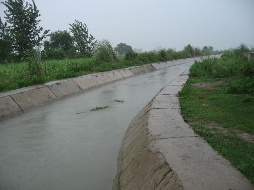
which then is turn into a vision of the management:

“A water agency engaged into irrigation and multiple uses of water with efficient, well trained
and motivated professional staff, operating at optimum cost, partnering with farmers to
improve field techniques efficiency, dealing with multiple and conjunctive uses of water, and
balancing the accounts at 10 years horizon. ”

The following short term recommendations were discussed and adopted for immediate
applications to improve management efficiency and prepare for a modernization plan.

   1. Careful assessment of seepage, lining and groundwater
   2. Mapping the groundwater recharge (capacity to store and the inputs per crops and
      canals)
   3. Careful assessment of proportional structure along distributaries and minors
   4. Investigate how to get farmers more participating to management and to control of
      illegal outlets as well as to adopt improved techniques at field level.

                                                                                             5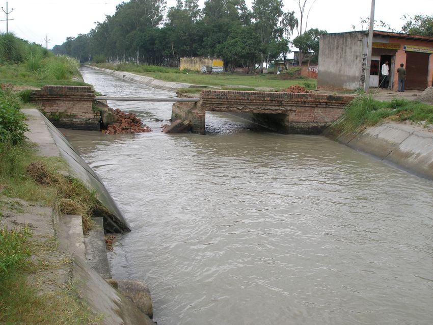
Introduction and Background

A FAO mission1 visited Uttar Pradesh India to carry out a MASSCOTE training workshop in
Meerut Uttar Pradesh from 16th to 25th September 2008 as part of a collaborative program
between the Government of Uttar Pradesh and FAO aiming at developing the capacity in
modernization of irrigation management.

This mission consist of the second MASSCOTE exercise organised by FAO for GOUP
focussing on the Upper Ganga Canal. The first workshop was carried out in December 2007
in Sultanpur South East Uttar Pradesh.

The mission organized in Meerut a training workshop on modernization of irrigation
management for 38 participants, field approach was made on Upper Ganga Canal for main
canal and focussed on Canal Bholal Division for distributaries and below.

The conclusions and proposals presented here are still under a process of refinement and
validation by the UP-ID and FAO, what is proposed here is reflecting the outcomes of the
working group sessions at this workshop (RAP–MASSCOTE), no further investigations has
been incorporated.

This MASSCOTE draft report serves several purposes:
   • produce food for thought for decision-makers of GOUP before engaging in investment
      plans, particularly on how to ensure that diagnosis and solutions are investigated
      properly in modernization projects;
   • suggest some specific strategies to managers of Upper Ganga Canal on how they
      should plan for modernization investment.
   • lay the foundations of follow up interventions on modernization of irrigation
      management in other sections of the CA.

FAO involvement in irrigation management modernization

Since the mid 90s FAO has contributed a lot to the promotion of modernization in irrigation
management particularly in Asia through the Bangkok regional Office and FAO HQ. To name
a few activities, in 1996 and 1998 FAO organized key International workshops on
Modernization, respectively in Bangkok and in Aurangabad (India).

For FAO modernization means not only modern techniques but institutional reform and
implementation of service oriented management. FAO 1997 Definition of Modernization: A
process of technical and managerial upgrading (as opposed to mere rehabilitation) of
irrigation schemes with the objective to improve resource utilization (labor, water,
economics, environmental) and water delivery service to farms.

1
            The FAO mission consisted of D. Renault, (Senior Irrigation Management Officer, NRLW FAO HQ
Rome), and P.S. Rao (Senior Officer of India FAO Bureau Delhi), together with two resource persons from
KNNL Karnataka Mrs Mahesh, assisted by Mrs Baldar and Manohar V. Rotte.

                                                                                                     6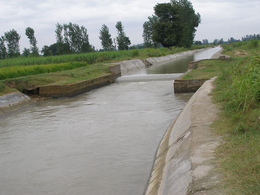
During the last decade FAO activities on modernization has led to progressively produce key
tools and methodologies to assess and benchmark the performance or irrigation system, and to
develop consistent strategy for modernizing the management and the operation of the
irrigation systems. The latest developed tool is MASSCOTE for Mapping System and Service
for Canal Operation Technique, which complements previous and has been largely field tested
in Karnataka State in 2006 and 2007.

In support to country members FAO advises developing strategy on management
modernization with a multifold and multiscale dimension:
       • the irrigation project dimension is obviously the major entry point to come up
           with realistic and practical solutions, through working on projects we are able to
           come up with practical solutions and at the same time we raise the capacity of
           engineers in handling modernization
       • a national or state strategy for modernization is then the next logical step, on
           the basis of few representative projects, together with an approach of typology of
           irrigation systems, this allow building up the technical capacity as well as
           organizing the capacity development at national level aiming at capitalising
           knowledge.
       • today the concept of Integrated Water Resource Management (IWRM) must
           be taken on board in the process of irrigation management as irrigation systems
           are often the unique permanent water source within the command areas.
       • lastly the professionalizing of irrigation management which is instrumental to
           achieve high efficiency in irrigation management, needs to be sought for at 3
           levels: project level through good governance and technical capacity at WUAs,
           and the national and public level in which Public bodies such as the Department
           of Irrigation have to undertake a complete re-engineering and renewal of their
           mandate and modus operandi, the private sector (civil society and private firms)
           which is called to play an increasing role in technical support of irrigation
           management through the design of modernization projects and or through the
           capacity developments.

                                                                                           7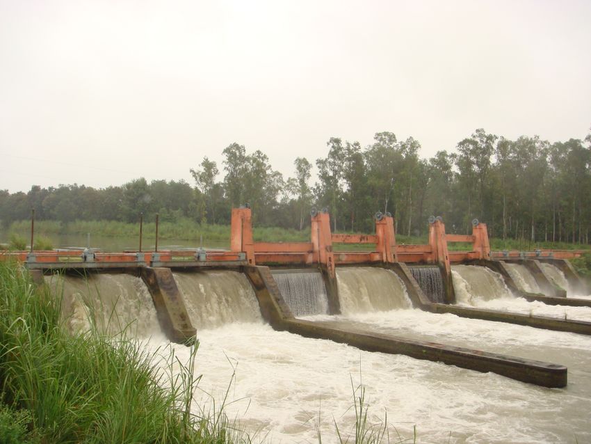
1. THE MASSCOTE APPROACH
The methodology used in the study is called Mapping System and Services for Canal
Operation Techniques (MASSCOTE). It has been developed by the Land and Water Division
(NRLW) of FAO on the basis of its experience in modernizing irrigation management in
Asia. MASSCOTE integrates/complements tools such as the rapid appraisal procedure (RAP)
and Benchmarking to enable a complete sequence of diagnosis of external and internal
performance indicators and the design of practical solutions for improved management and
operation of the system.

MASSCOTE is a methodology aiming at the evaluation of current processes and performance
of irrigation systems and the development of a project for modernization of Canal Operation.

Operation is a complex task involving key activities of irrigation management which implies
numerous aspects which have to be combined in a consistent manner. These aspects are:
   • service to users
   • cost of producing the services
   • performance M& E
   • Constraints and opportunities on Water resources
   • Constraints and opportunities of the physical systems

MASSCOTE aims to organize project development into a stepwise revolving frame
including:
    •      mapping the system characteristics, the water context and all factors affecting
    management;
    •      delimiting manageable subunits;
    •      defining the strategy for service and operation for each unit;
    •      aggregating and consolidating the canal operation strategy at the main system
    level.

MASSCOTE is an iterative process based on ten successive steps, but more than one round is
required in order to determine a consistent plan. Some steps need to be rediscussed and
refined several times before achieving a satisfactory level of consistency.

Presentation of the methodology

The first steps of MASSCOTE are conducted for the entire command area with the goal of
identifying homogeneous managerial units for which specific options for canal operation are
further sought by running the various steps of MASSCOTE for each unit taken separately.
Then, aggregation and consolidation is carried out at the main system level. Thus, the
methodology uses a back-and-forth or up-and-down approach for the different nested levels of
management.

                                                                                              8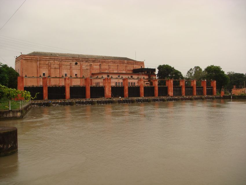
MAPPING....         1. PHASE A              BASELINE INFORMATION
1. THE PERFORMANCE        Initial rapid system diagnosis and performance assessment through
                          the RAP: the primary objective of the RAP is to allow qualified
 RAPID APPRAISAL          personnel to systematically and quickly determine key indicators of
  PROCESS (RAP)           the system in order to identify and prioritize modernization
                          improvements. The second objective is to start mobilizing the
                          energy of the actors (managers and users) for modernization. The
                          third objective is to generate a baseline assessment, against which
                          progress can be measured.
   2 THE CAPACITY         The assessment of the physical capacity of irrigation structures to
  AND SENSITIVITY of      perform their function of conveyance, control, measurement, etc.
      the SYSTEM          Assessing the sensitivity of irrigation structures (offtakes and cross-
                          regulators), identification of singular points. Mapping the
                          sensitivity of the system.
        3 THE             Perturbations analysis: causes, magnitudes, frequency and options
    PERTURBATIONS         for coping with
  4 THE NETWORKS &        This entails assessing the hierarchical structure and the main
   WATER BALANCES         features of the irrigation and drainage networks, on the basis of
                          which partition of the system into subsystems will be made.
                          Water accounting should be undertaken, considering both surface
                          water and groundwater, and mapping the opportunities and
                          constraints related to them.
  5 THE COST of O&M       Mapping the costs associated with current operational techniques
                          and resulting services, disaggregating the different cost elements;
                          cost analysis of options for various level of services with current
                          techniques and with improved techniques.
                                  2. PHASE B IMPROVING CANAL OPERATION
                                 MATURING SERVICE ORIENTED MANAGEMENT
   6 THE SERVICE to       Mapping and economic analysis of the potential range of services
       USERS              to be provided to users at various levels of the systems. The
                          services should be based on a compromise between the water
                          management strategies, the agriculture objectives and the
                          willingness to pay by users.
   7 PARTITIONING         The irrigation system management should be partitioned into few
 INTO MANAGEMENT          level of management and the command area should be divided and
      SUB-UNITS           subunits (subsystems and/or subcommand areas) that are held
                          homogeneous and/or separate from one another by a singular point
                          or a particular borderline.
   8 ASSESSING THE        Assessing the resources, opportunity and demand for improved
     DEMAND FOR           canal operation at the different levels of management and within
      OPERATION           the local management units.
    9 IDENTIFYING         Identifying improvement options (service and economic feasibility)
  CANAL OPERATION         for each management unit for (i) water management, (ii) water
   IMPROVEMENTS           control, and (iii) canal operation)
   10 INTEGRATING         Integration of the preferred options at the system level, and
         AND              functional cohesiveness check.
   CONSOLIDATING          Consolidation and design of an overall information management
    MANAGEMENT            system for supporting operation
      A PLAN FOR          Finalizing a modernization strategy and progressive capacity
   MODERNIZATION          development
       AND M&E            Select/choose/decide/phasing the options for improvements
                          Plan for M&E of the project inputs and outcomes.
                       Table 1. The 10 Steps of MASSCOTE

                                                                                                9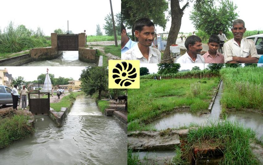
2. The Upper Ganga Canal System
The project is located in the North-West part of the State. The main canal is 290 km long and
covers a gross command area of about 900 000 ha and a cultivable irrigated area of 393 000
ha.

         Figure 1. Uttar Pradesh map with the location of the Upper Ganga System.

Project Description

        The Upper Ganga Canal System is the largest perennial and oldest irrigation system of
India. The planning of this system was started in 1838 and the feasibility report was approved
by a committee of engineers in 1842 .The construction of this system was started in 1848 after
approval of the project by Lord Hording, the Governor General and was completed in 1854, in
a record time of 6 years. The canal was commissioned on 8th April 1854 and the irrigation was
started in 1st May 1855 after trial running and necessary improvement. This project was

                                                                                           10
constructed under the guidance of Eminent British engineer Colonel Sir Probey Cautley. The
Ganga canal off takes from the right bank of river Ganga at Haridwar, presently in the state of
Uttrakhand. The last branches of this system - Kanpur and Itawa branches outfall in river
Ganga and Yamuna in district Kanpur. This canal provides irrigation facility to the districts
Haridwar in the state of Uttrakhand and district Saharanpur, Muzaffernager, Meerut,
Ghaziabad, Bullandshahr, Gautambudh Nager , Aligarh, Hathras ,Mathura, Agra, Etwa and
Firozabad in the state of Uttar Pradesh.
The river Ganga is a perennial river connected to several glaciers in the Himalayan
mountain. In its initial course the river Alakhnanda and Bhagirathi meet at Dev Prayag and
after their confluence, the resulting river is known as Ganga. The Dev Prayag is
approximately 70.0 Km along from Haridwar - the off taking point of the Ganga canal. The
contribution of Alaknanda is approximately 66% and river Bharigathi is 34% in the river
Ganges. The total catchment area of the river Ganga above Haridwar is approximate
20,000.00 Sq Km in Himalayan mountains. The river Ganga flows through the plains of U.P.
from the north west end to south east end portion of the state of Uttar Pradesh. This river is
the life line of large fertile agricultural track of the adjoining districts on its both banks. The
economy of the inhabiting farmers mainly depends on the irrigation water which is supplied
from the river Ganga . The oldest culture of India also developed in the river Gangatic plains.
Originally the Canal was designed with a head discharge of 6750 cusecs capacity (192
m3/s), which later on in 1938, was increased to 8500 cusecs (242 m3/s) and in 1951-1952 it
was again increased to 10,500 cusecs (300 m3/s). Presently its design head discharge capacity
is 10,500 cusecs. In the beginning the water from the river Ganga was diverted in the Ganga
canal with the help of temporary bunds constructed every year after the end of the monsoon.
Later on, in 1920, a pucca weir was constructed at Bhimgoda across river Ganga and the weir
was replaced by a barrage in the year 1986 to meet out the regulation requirement of the
Ganga canal. The current details of the main canal, branches, distributaries, minors and the
escapes of the system are as follows.
Sr.No Details Length(Km)
1 Main Canal 291.96
2 Branches 562.36
3 Distributeries 3299.95
4 Minors 2427.95
Total 6582.22
Table 2. Canal length in UGC
The main beauty of the Ganga Canal System is that the canal which was planned about
154 year ago is still able to cater to the current needs of the population of the Ganga canal
command area, where the current population has increased several times the population of
1840. After construction of Tehri Dam Project on river Bhagirathi, major part of the year, the
river Ganga will have having water more than the capacity of the Ganga Canal i.e 10,500.00
cusec.
The water in the Ganga canal is full of natural ingredients (silt in particular). One
important aspect is that all the agricultural fields where the Ganga Canal water is applied for
irrigation, normally no growth/infestation of white ants/termite occur. This is an additional
11advantage to the farmers of the Ganga canal command. In other canal system’s command
areas, farmers are using pesticides for stopping the growth of the white ants.
The Ganga canal water is also used for drinking purposes mainly by Delhi, Noida,
Ghaziabad, Merrut, Greater Noida e.t.c and for industrial purposes by the so many thermal
and atomic power plants. There is huge demand of water from different districts for drinking
purposes.
Total Culturable Command Area (CCA) of the Ganga Canal System is 907,690
hectares. The Proposed Protected Area (PPA) for Rabi is 404,353 Hectares and for Kharif
429,612 hectares. Out of which the maximum area irrigated in the Rabi is 425,141 hectares
and in Kharif it is 451,046 hectares.
The sample distributaries selected for studies in this workshop are offtaking from a
place named Bhola regulation point at 135.670 Km on the Upper Ganga Canal. These
distributaries cover irrigation in the district Merrut and Ghaziabad. These canals are lined in
considerable length in head reaches. The details of these distributaries are given below.
The details of the crop irrigated in this area in these five distributaries in Rabi and
Kharif Fasli are given below .The areas are given in hectares.
Sr Name of the CCA PPA 1413 1414 1415
No Dys (Hect) (Hect) Fasli Fasli Fasli
/Mrs Khar Rabi Khar Rabi Kharif Rabi Khari Rabi
if if f
1 Pooth Dy 11242 7420 4609 4473 3125 4588 3219 4784 3650
2 Left Bhola Dy 10793 7125 4466 3071 2016 3082 2138 3273 2118
3 Jalalabad Dy 7367 4862 3020 2601 1434 2681 1748 2712 1764
4 Right Bhola 9124 6023 3841 5116 3461 5135 3491 5213 3520
Dy
5 Tikri Dy 13685 8978 5611 4848 3073 4861 3163 5021 3266
Table 3. Information on Disributaries offtaking at Bholal regulator
There are large differences between area proposed and actually irrigated as a result of:
(i) Urbanization and industrialization of the irrigated area
(ii) Damage of the irrigation guls due to the land disputes between the farmers and
in consolidation process.
(iii) Increased consumption of water as the number of crop per year are increased
as planned at the time of planning and construction of the canal in 1850s.
(iv) The PPA is designed as the 3 core week. This means that the area in the
command of one outlet will get water in a span of 3 weeks. But this concept is
not acceptable to the farmers of the head reaches of the canal. They try to
irrigate the crop in all the three week of the canal running by unlawful means,
which creates water scarcity in the tail portion of the distributaries/minors.
(v) The farmers are using hybrid varieties of crops and chemical fertilizers,
resulting in increased water requirement many fold.
(vi) The farmers are mostly growing sugarcane in the command of the canal system
.They are not following the crop rotation system and growing the sugarcane
regularly. This has also increased the consumption of water and reduced the
fertility and caused damages to the over all wealth of the land in the command.
12These systems are being maintained by the U. P State Irrigation Department from its
construction time. In the current socio-political net work the maintenance officers are facing
following problems in maintenance of the channels are as follows:
(1) The farmers do not want to go to the fields for irrigating the fields during night hours
due to poor law & order situation and large risk to the safety.
(2) They do not agree to practice crop rotation as suggested by the agricultural department
especially due to problems in availability of quality seeds and financial return of the
produce.
(3) They opt for unlawful means such as cutting of banks, increasing the size of outlet
over sanctioned size, using the pipe as siphon, putting obstruction in the canal for
raising the F.S. L. to increase discharge in outlet and to irrigate the higher fields, e.t.c.,
disturbing the availability of proposed water supply.
(4) Withdrawing water by installing unauthorized outlets at their liking place and
damaging the outlet gul for the balance command.
(5) Damage of the outlet guls due to mutual rivalry and in the process of the consolidation
ignoring the established rules of distribution and use of irrigation water.
(6) Encroachment of the canal banks by the adjoining farmers resulting the thinning of the
bank resulting into chances of frequent breaches..
(7) The domestic animals (Cows and the Buffalos) of the farmers enter in to the canal for
drinking and bathing damaging the earthen canal banks at these locations .Due to this
reason, the running of canal get disturbed due to frequent breaches.
(8) The misconception of the paddy growers of the area, to replace standing water in the
fields with fresh water every week arguing that fresh cool water will increase the yield.
This has also increased the water consumption during kharif and over use of water
may result into loss of production.
This year the area of the sugarcane is reduced by 10-15% because the sugar mill did
not pay the cost of sugar cane to the farmers in time .So the farmers have increased the paddy
crop this year.
North
Figure 2 Index Map of the UGC project and Bholal division (central)
133. MASSCOTE in UGC Main Canal and Bholal Division
distributaries
The Masscote exercise has been carried out comprehensively for the command area of the 5
distributaries of Bhola Division as well as for the entire main canal of UGC.
Step 1. RAPID DIAGNOSIS: RAP
A RAP (Rapid Appraisal Procedure) was carried out as part of the first step of the exercise
during the September 2008 workshop. The following sections is the RAP executive summary.
RAP Methodology
The RAP is a quick and focused examination of irrigation systems and projects that can give a
reasonably accurate and pragmatic description of the status of irrigation performance and
provide a basis for making specific recommendations related to hardware and management
practices. The first step in evaluating irrigation performance, whether at the farm level or an
entire irrigation project, is to perform a rapid appraisal (RAP) of the system as it is being
operated.
The RAP can be described as follows:
The Rapid Appraisal Process (RAP) for irrigation projects is a 1-2 week
process of collection and analysis of data both in the office and in the field.
The process examines external inputs such as water supplies, and outputs such
as water destinations (ET, surface runoff, etc.). It provides a systematic
examination of the hardware and processes used to convey and distribute water
internally to all levels within the project (from the source to the fields).
External indicators and internal indicators are developed to provide (i) a
baseline of information for comparison against future performance after
modernization, (ii) benchmarking for comparison against other irrigation
projects, and (iii) a basis for making specific recommendations for
modernization and improvement of water delivery service.
Use of a systematic RAP for irrigation projects was introduced in a joint FAO/IPTRID/World
Bank publication entitled Water Reports 19 (FAO) – Modern Water Control and Management
Practices in Irrigation – Impact on Performance (Burt and Styles 1999). That publication
provides an explanation of the RAP approach and gives the results from RAPs the authors
conducted at 16 international irrigation projects. Refer to Water Report 19 for further background
to the RAP approach, available directly from FAO (http://www.fao.org/icatalog/inter-e.htm).
RAP is now fully integrated as the STEP 1 or the foundation of the new approach developed
by FAO for modernization strategy and plans which is called MASSCOTE.
A key component of the successful application of the RAP and MASSCOTE approaches is
the knowledge and experience of qualified technical experts that can make proper design and
modernization decisions. It is critical that MASSCOTE-RAPs are conducted by irrigation
14professionals with an extensive understanding of the issues related to modern water control.
This technical capacity building will be addressed initially through training workshops that
are going to be held by the FAO. In addition to making proper recommendations for
modernization, evaluators using the RAP approach must have the ability to synthesize the
technical details of a project with the concepts of water delivery service into a functional
design that is easy-to-use and efficient.
Key performance indicators from the RAP help to organize perceptions and facts, thereby
facilitating the further development of a modernization plan through the different steps of
MASSCOTE. From the RAP we have already some good indications on:
• Further investigations that should be carried out for the development of the
modernization plan.
• Specific actions that can be taken to improve project performance
• Specific weakness in project operation, management, resources, and hardware
• The potential for water conservation within a project
Broad goals of modernization are to achieve improved irrigation efficiency, better crop yields,
less canal damage from uncontrolled water levels, more efficient labor, improved social
harmony, and an improved environment by reducing a project’s diversions or increasing the
quality of its return flows. In general, these goals can only be achieved by paying attention to
internal details, or the internal indicators. The RAP addresses these specific internal details to
evaluate how to improve water control throughout the project, and how to improve the water
delivery service to the users.
Looking at different management levels
When one analyzes a project by “levels” (office, main canal, second level canal, third level
canal, distributaries, field), a huge project can be understood in simple terms. The operators
of the main canal only have one objective – everything they do should be done to provide
good water delivery service to their customers, the distributary/minor canals (and perhaps a
few direct outlets from the main canal). This “service concept” must be understood and
accepted by everyone, from the chief engineer to the lowest gate operator. Once it is
accepted, then the system management becomes very simple. Personnel on each level are
only responsible for that level’s performance.
An important step of MASSCOTE is precisely to start from this diagnosis and re-organize the
management of the system into units which are functional, responsible and responsive and
consistent with the main features diagnosed in the gross command areas.
Main canal operators do not need to understand the details of that day’s flow rate
requirements for all the individual fields. Of course, in order to subscribe to the service
concept, operators generally need to know that their ultimate customer is the farmer. But the
details of day-to-day flow rates do not need to be known at all levels. Rather, the main canal
operators have one task to accomplish – to deliver flow rates at specific turnouts (offtakes)
with a high degree of service.
15RAP in Upper Ganga Canal and Bhola Distributaries
A Rapid Appraisal Procedure was carried out in Upper Ganga Canal and Bholal Distributaries
The objective was to identify the key factors related to water control, measurement and
communications in the system as well as to the social organisations. The completed results of
the RAP including those for the main canal, secondary and tertiary canals, and final deliveries
are contained in excel files attached to this report.
Participants were divided into 5 groups:
– Group 1: Pooth Distributary
– Group 2: Left Bhola Distributary
– Group 3: Jalalabad Distributary
– Group 4: Right Bhola distributary
– Group 5: Tikri distributary
–
Two extra groups were formed to assess the Upstream & downstream part of the Upper
Ganga Canal.
They spent 1.5 days on the field and gave ratings to all internal indicators. During a plenary
session rating were reviewed and finalized.
External indicators
The external indicators compare input and output of an irrigation system to describe overall
performance. These indicators are expressions of various forms of efficiency, for example
water use efficiency, crop yield, and budget. But they do not provide any detail on what
internal processes lead to these outputs and what should be done to improve the performance.
They, however, could be used for comparing the performance of different irrigation projects,
nationally or internationally. Once these external indicators are computed, they are used as a
benchmark for monitoring the impacts of modernization on improvements in overall
performance.
A first estimation of the external indicators has been carried out during the workshop. It has
led to the estimated value per ha of US$ 1500/ha while productivity of water amounts to
US $ 0.10/m3. With respects to national and international standards, productivity of land is on
the high side ( Figure 3), not far away from best value found in Karnataka in GLBC, whereas
productivity of water is on the low side (Figure 4).
16Figure 3 Productivity of Land US $ per ha (comparison with other projects)
Figure 4 Productivity of Water US $ per m3 (comparison with other projects)
17Internal Performance Indicators
The internal indicators quantitatively assess the internal processes (inputs - resources used and
the outputs - services to downstream users) of an irrigation project, in this case the planned
procedures. Internal indicators are related to operational procedures, management and
institutional set-up, hardware of the system, water delivery service etc. These indicators are
necessary in order to have comprehensive understanding of the processes that influence water
delivery service and overall performance of a system. Thus they provide insight into what
could or must be done to improve water delivery service and overall performance (the
external indicators).
The values of the primary internal indicators reflect an evaluation of the key factors related to
water control and service throughout the command area. The internal indicators and their
sub-indicators at each level of the system are assigned values from 0 to 4 (0 indicating least
desirable and 4 indicating most desirable). The complete set of internal indicators ranked by
each group is given in appendix 2.
Features about the Service
Social Order
Social "Order" in the Canal System operated by paid
employees 1.3
Degree to which deliveries are NOT taken when not
allowed, or at flow rates greater than allowed 2
Noticeable non-existence of unauthorized turnouts from
canals. 0
Lack of vandalism of structures. 1
Table 4. Social Order indicators
The social order in UGC is ranked low 1.3.
Service to farmers
Actual Water Delivery Service to Individual
Ownership Units (e.g., field or farm) 1.5
Measurement of volumes 0
Flexibility 2
Reliability 2
Apparent equity. 1
Table5. Service to farm units
18The actual service to farm units is ranked very low [1.5] below average when compare to
others system worldwide (Figure 5).
Figure 5. Actual and Stated Service to farm units.
Service by main canal to second level canal
Actual Stated
Actual Water Delivery Service by Main
Canal to the Second Level Canals 2.3 2.9
Flexibility 1.5 1
Reliability 2 3
Equity 3 3
Control of flow rates to the submain as
stated 2.5 4
Table 6. Service from main to secondary canals
19The gap between what managers think they are doing in terms of delivery services from main
to second and the actual estimated on the ground is narrow. The highest difference is recorded
for the control of flow rate, in particular on the accuracy with which measures are made.
Service proportional below second level canal
Below the headwork of secondary canals the service is by design proportional. Actually it is
difficult to know whether proportionality is obtained or not. The structure are not made of the
classical partitioning structure with overshot flow shared as a function of stream width. The
structure are sometimes equipped with a gate which is used ON and OFF only when it works,
many are rusty and left fully opened.
As the conditions are not straightforwardly warranted, there are many minors which are silted
up hence modifying the conditions of proportionality as a result of raising the water level. It
is thus recommended to investigate this point rapidly to check whether they are functioning
fine or not. In case they are not, then interventions on canal structures should be planned.
WUA
The ranking obtained for WUA is almost nil as no association are operative. According to
managers efforts were made to generate associations and fuelled cooperation among farmers
but with little success, they have been abandoned. It would be worthwhile to have a thorough
survey on the needs of farmers and their opinions about associative management. The
distribution of canal water is plagued with huge head-tail inequity due to numerous illegal
outlets in the upstream reaches of the secondary and tertiary canals. Of course groundwater
abundance allows users to compensate for canal water shortage but still one should look at
ways to reduce inequity by involving more the farmers themselves in operation and checking
of the canal water flows.
Main features of UGC reported from field visit
Beyond the indicators of RAP the main features reported by the groups are as follows:
1. Water is Abundant but high inequity in surface water deliveries (compensated by wells in
the downstream reaches)
2. Agriculture fairly good: high intensity (2 to 3 crops/year) Cash crops is dominant
(Sugarcane 70% Rice 20% Others 10%)
3. No operation below head of Disty: gates blocked opened.
4. No water level control along disty & minors
5. Some minors watered only at 50% of their length.
6. Measurement at head of disty only (some poorly located & calibrated)
7. Distributories cc-lined for water savings.
8. Urbanization toll: 2 minors abandoned.
9. Multiple Uses of Water: serving thirsty towns within and large outside major cities Delhi
Agra.
10. MUS: Importance of cattle in the CA
11. Power production at many UGC drops
12. Major water feeder to Agra irrigation canals
20Plate 1. Cross regulator on the main canal Plate 2. Hydropower station on main canal at
(Adjustable weir type) Bhola
Plate 3. Cattle ghat along a distributary Plate 4. lack of maintenance and repair (bridge)
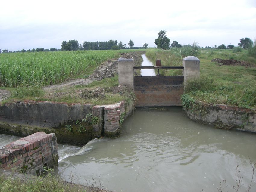
Plate 5. Division structure with uncertainty on Plate 6. Typical distributory offtaking
proportional property. headworks (Low sensitive structure)
21Plate 7. Flume for flow measurement Plate 8. typical CC lined distributary
Step 2. SYSTEM CAPACITY AND SENSITIVITY.
Objective: Assessing the physical capacity of irrigation structures to perform their function
of transport, control, measurement, etc.
Assessing the sensitivity of Irrigation Structures (offtakes and regulators), identification of
singular points. Mapping the sensitivity.
Step 2 Capacity
The capacity issues have been examined by participants, and key functions are analysed
below considering successively various levels of the system.
Storage : No storage in all Levels of canal
Conveyance:
Minors are silted up and lot of vegetation growth, irregular canal shapes
Main canal freeboard encroached
Vegetation growth on Main canal providing protection to canal banks
Main canal sand deposition on bed & sides & silt deposition in Second & lower levels
Water is eroding canal banks in Rabi & providing deposits in Khariff season
Water level control:
No Cross Regulator’s below disty heads: distribution is designed to be “free proportional
flow”.
Distribution:
Designed for free proportional flow.
22Siltation in minors has decreased the discharge carrying capacity, hence proportionality
distribution is not guaranteed and should be thoroughly checked.
Measurements :
At offtaking headworks of distribuary flow is measured with rated section or flumes.
Flow measuring devices are not being properly utilized.
Measurements at proportional structures should be carried out using portable devices.
Safety:
Escapes on main canal are adequate, 15 Nos for a length of 229 Km
Lack of escapes on distributaries and no escapes on Minor.
Transmission & communication:
No problem at all levels.
STEP 2 SENSITIVITY OF THE IRRIGATION STRUCTURES
Main canal CR’s are low sensitive (Overshot flow S = h/alpha = 0.50 / 1.50 = 0.33 ).
Low sensitivity of distributary head offtakes (Undershot flow S = alpha/h = 0.50 / 1.0 = 0.5).
Sensitivity for Minors and watercourse not meaningful !
Along disty and minors what matters is the proportionality indicator.
STEP 3: THE PERTURBATIONS
Objective: Identifying and characterizing positive and negative perturbations, their
dimensions, origin, frequency and timing, location, size and amplitude and options
for coping with.
The following points were reported for perturbations:
Spillages on banks i.e overtopping at distributary i.e second levels (Conveyance capacity).
Unauthorized outlets: this phenomenon is important, on one distributary 7out 25 OL’s
appears to be illegal.
Filling of ponds or tanks is also being done through illegal direct outlets (Vandalism of
structures i.e canal embankments). This is a quasi permanent phenomenon.
Obstruction to flows in Distry’s & OL’s for ensuring adequate/essential head to drive the
offtake.
Pumping & siphoning from Main canal & Distry’s.
Recirculating of Distry water into another Distry
Rainfall runoff entering the main canal are marginal & significant for Distry’s & OL’s
Sewage water entering the canal i.e marginal in quantity, but not marginal in quality.
Power house functioning may affect the stability, certainty & accuracy of flow
Deterioration of banks by domestic and wild animals.
23Step 4 MAPPING WATER NETWORKS & WATER
BALANCE/ACCOUNTING
Objective: The objective here is to map the nature and structure of all the streams and flows
that affected and are influenced by the command area. It includes assessing the hierarchical
structure and the main features of the Irrigation and drainage networks, natural surface
streams and groundwater, and the mapping of the opportunities and constraints including
drainage and recycling facilities.
WATER ACCOUNTING
Water accounting is a fundamental exercise of irrigation water management as well as operation
of the canal infrastructure. It is observed that no water accounting is being done for the UGC and
it is strongly suggested to conduct water accounting studies for UGC for evolving appropriate
strategies at various levels for water management as well as for modernization planning, including
real evaluation of canal lining impacts on seepages, as well as estimation of distributed volume
and checking of proportionality of divisional structures.
UGC Project
Water balance for UGC
Annual average water inputs into the command area amount to 9752 MCM, with about 40 %
from precipitation and 60 % by canal water (see figure 7). Average precipitation in the CA is
about 1000 mm per year.
Figure 7. Outputs in the Water balance in UGC
24The use of water by irrigated crops within the command area is estimated considering crops
are well fed and thus evapotranspiration is at maximum:
ETo amounts to 1434 mm 2700 MCM/year are consumed by irrigated crops. Thus the crop
consumption represents at maximum 30 % of the total water inputs into the CA.
Step 5 MAPPING THE COST of OPERATION
Objective: the objective is to gather as much as possible elements of costs entering into the
operation of the system in order to identify where possible gains should be sought for with the
current service and operational set up, and what would the cost of implementing improved
service. This step thus focus on mapping the cost for current operation techniques and
services, disaggregating the elements entering into the cost, costing options for various level
of services with current techniques and with improved techniques.
Cost of Management Operation and Maintenance
Budget analysis has been made for the entire system (see figure 8) and for Meerut division
(figure 9).
As far as the revenue is concerned it is noteworthy to look at the 3 figures reported in figure 9
which shows that agriculture revenue is only 300 IRs /ha while the total revenue reaches 1574
IRs/ha meaning that agriculture does not even contribute to 20% of the revenue (the bulk of
the revenue is provided by domestic water sold to cities).
The cost with the current operation and maintenance organisation has been estimated to be at
929 INT/ha, significantly below the revenue which means that there are room to improve the
management, the operation and maintenance within the limits of the revenue.
Figure 8. Budget of UGC
25Breakdown of O&M Cost in Meerut Dn
(in Percentage of Total)
F.Y. 2007-08
Communication,
0.03
Electricity, 0.25 Misc., 0.03
T& P, 2.30
Maintenance, Stationary, 0.01
13.32
84.07
Cost of Service 929 INR/ha
Revenue (Irrig.+non-Agri) 1574 INR/ha
Agricultural Revenue 299 INR/ha
Figure 9. Breakdown of the budget for MOM at Meerut division
Step 6 SERVICE to USERS
Objective: Mapping existing and possible options for services to Users with consideration to
Farmers and Crops as well as to Other Users of water.
USES & USERS:
Agriculture use: Farmers
Industrial use - Hydro power stations, thermal power stations, Industries 3 Power stations
(continuous) + 1 station (New) generating during peak hours only.
Domestic use: Drinking water supply (Delhi – 500 cusecs + towns of Uttar Pradesh – 200
cusecs =700 cusecs)
Village ponds: 1000 ponds for cattle in villages
Drinking water: villages supplied from hand pumps (indirect link with canal water )
OTHER USES:
• Recharge of groundwater: a figure of 6 cusecs per million sq ft of wetted perimeter of
unlined canal + percolation from fields is used to calculate the recharge.
• Religious use - For taking holy bath ( non-consumptive use) (Tourism/ Pilgrims)
November to January 1000 cusecs
26• Environmental flow – The Agra canal in South UP is fed by water from UGC, this
water is transported through the river that crosses Delhi and thus has an effect on the
dilution of pollution generated by the capital city. Although this impact was not
purposely made this environmental service for Delhi cannot be ignored as the river
situation without this additional water would have been terrible. The bad side of this is
that irrigation of the Agra canal is somehow polluted.
• Fishing - Canal and ponds (Marginal use)
• Navigation – It has existed in past (locks are still there at key regulators) and there are
ideas of redeveloping it along the main canal.
• There is a strong policy which specifies that other uses have to be generated from
savings made in agriculture water.
Allocation
Sufficient during kharif - Insufficient for rabi
Initial design Kharif (66% of CCA) (April to September) & Rabi (40% of CCA) (November
to March). However practices have deviated a lot from this pattern.
Scheduling
Roster at distributary level based on availability of water during previous year. For KHARIF:
3 weeks ON & 1 week OFF; and for RABI 2 weeks ON & 2 weeks OFF. Depending on the
distribution of water when canal is ON, theses sort of rotation can induce long period without
irrigation (3 to 4 weeks) and as such they are somehow contributing to the disorganization of
the system as farmers tend to withdraw water when they are not supposed to thus depriving
downstream reaches of water.
Delivery to farmers
Proportional system
Deliveries of discharge in distributaries (based on ratio of land) and proportional sharing
along disty and minors.
The vision
The Service Oriented Management strategy maps out the VISION underlining the future of
the system! It conditions to a large extent underlies the further steps of development service
and modernization plans, this VISION discussed during the workshop is as follows:
“A sustainable agriculture system based on high intensity and high yielding crops, partly
engaged into corporate and contract farming, generating increased revenues to farmers
and, in a context of labour shortage and urban attraction, supporting rural development”
27Step 7 PARTITIONING IN MANAGEMENT UNITS
The irrigation system management should be partitioned into few level of management and the
command area should be divided and subunits (subsystems and/or subcommand areas) that are held
homogeneous and/or separate from one another by a singular point or a particular borderline.
The management vision
A vision of the management was developed to complement previous one done for the overall
system. This management vision is:
“A water agency engaged into irrigation and multiple uses of water with efficient, well trained
and motivated professional staff, operating at optimum cost, partnering with farmers to
improve field techniques efficiency, dealing with multiple and conjunctive uses of water, and
balancing the accounts at 10 years horizon. ”
Main management
Main canal 5 divisions: Departmental staff manages the canal network up to minor level
Local management
An option of having WUA at disty levels to regulate (illegal outlets) and maintain disty and
minors with volumetric charging at disty head has been considered but not retained by
participants. Below minor level, i.e., kulaba/gul (field channels) are managed by farmers.
Step 8 MAPPING THE DEMAND FOR CANAL OPERATION
Objective: Assessing Means, opportunity & demand for Canal Operation
A spatial analysis of the entire command areas, with preliminary identification of Sub-
Command Areas (Management, service,..)
The mapping of the demand for operation is based on 3 main criteria: service, perturbations
and sensitivity. Conceptually the demand can be seized through the following formula:
DEMAND for Operation = SERVICE x PERTURBATIONS x SENSITIVITY
The higher the service the higher the demand; the greater the perturbations, the higher the
demand; the higher the structures sensitivity the higher the demand for operation.
The demand expresses the requirements to achieve a given targets with due consideration on
the constraints it also reflects the efforts needed to operate the system to perform as
targeted. In some areas little efforts are sufficient whereas in other more efforts are needed to
achieve the same objective.
In the UGC command area canal operation is limited to the head of distributaries and is
evenly distributed along the main canal. There is no area more demanding than others. Below
the head of distributaries distribution is proportional, no gates are operated. Operation is then
reduces to checking the flows along the canal network. Proportionality should also be checked
at the nodes of the system.
28Step 9 CANAL OPERATION IMPROVEMENTS
Objective: Identifying improvement options (service and economic feasibility) for each
management unit for (i) water management, (ii) water control, and (iii) canal operation)
STORAGE: Recharge for ground water
•Recharging by artificial wells not efficient enough & is being rapidly clogged up by
silt.•Creation of ponds or use of existing minors to recharge ground water.•Mapping the
recharge pattern in the command area, i.e soil characteristics, contribution of crops & seepage.
•Monitoring levels of Ground water, Direct ground water recharge should be avoided in order
to maintain the quality of water. Quality of surface water is low as per inference of
discussions
SEEPAGE / CANAL:
Measurement of seepage by ponding method should be carried out for various canal
situations: lined and non lined, immediately and several years after lining.
To assess how much Canal lining minimizes seepage, help in feeding tail enders, reduces cost
of pumping water OR in saving water for other uses.
A conflict exists between groundwater recharge and canal lining and the resolution of this
conflict must be made on solid grounds, that is reliable and accurate measurement of
seepages, recharge and watertable monitoring.
PROPORTIONAL SERVICE
The service to users is by designed proportional when water is “on” in a particular canal.
“Share of water”, “time”. Assessment & monitoring of services by Dept. personnel & farmers
should be carried out regularly, and a measurement campaign should be made to check the
working conditions of the canal and structure for proportionality.
IRRIGATION AGENCY
As far as the agency is concerned the following measures are proposed for consideration:
5 divisions remain, decreasing staff & higher capacity (viz. performance oriented)
Participation of farmers in monitoring management, i.e monitoring of illegal outlets by
WUA’s, ensuring equity of distribution)
Staff to reduced by 30 % in 5 years
Water rates to be increased by 100%`in 5 years period
Maintenance budget to be increased by 300 %
Minimum charges for irrigated non-command area
Stringent law and order.
29You can also read