Major Incidents Report 2020-21 - Australian Disaster Resilience ...
←
→
Page content transcription
If your browser does not render page correctly, please read the page content below
Major
Incidents
Report
2020-21

  Department of Home Affairs
AIDR is the National Institute for disaster risk reduction and      Attribution
resilience. We collaborate across sectors to strengthen the
resilience of Australian communities to disasters.                  This report was compiled by Tony Murphy AFSM, former Chief
                                                                    Fire Officer of the Metropolitan Fire Brigade, Victoria, and
AIDR creates, grows, and supports a range of networks; provides
                                                                    Deputy Emergency Management Commissioner at Emergency
opportunities for learning, development, and innovation; shares
                                                                    Management Victoria.
knowledge and resources to enable informed decision making
and action; and facilitates thought leadership through national     Where material from this publication is used for any purpose,
conversations.                                                      it is to be attributed to the developer as follows: Source: Major
                                                                    Incidents Report 2020–21 (AIDR 2021).
AIDR is a consortium managed by AFAC as a business unit and
supported by its partners: the Australian Government National
Recovery and Resilience Agency and the Australian Red Cross.
                                                                    Contact
Published by the Australian Institute for Disaster Resilience       Enquiries regarding the content, licence and any use of this
on behalf of Emergency Management Australia, Australian             document are welcome at:
Government Department of Home Affairs.                              Australian Institute for Disaster Resilience
© Australian Institute for Disaster Resilience 2021                 Level 1, 340 Albert St, East Melbourne VIC 3002
                                                                    Telephone: +61 (0)3 9419 2388
                                                                    Email: enquiries@aidr.org.au

                                                                    Disclaimer
                                                                    The Australian Institute for Disaster Resilience, in consultation
Copyright                                                           with subject matter experts, exercises care in the compilation
The Australian Institute for Disaster Resilience (AIDR)             and drafting of this publication. However, the document
encourages the dissemination of information provided in this        and related graphics could include technical inaccuracies
publication. AIDR owns the copyright for all material contained     or typographical errors and the information may not be
in this publication unless otherwise noted.                         appropriate to all situations. In no event shall the Australian
                                                                    Institute for Disaster Resilience be liable for any damages
Where this publication includes intellectual property with
                                                                    whatsoever, whether in an action of contract, negligence or
copyright owned by third parties, the Australian Institute for
                                                                    other tortious action, arising out of or in connection with the
Disaster Resilience has made all reasonable efforts to clearly
                                                                    use of or reliance on any of the information in this publication.
label material where the copyright is owned by a third party.
Wherever a third party holds copyright in material presented
in this publication, the copyright remains with that party. Their
permission is required to use the material.
All material presented in this publication is provided under a
Creative Commons Attribution 4.0 International Public License,
with the exception of:
▪    the Commonwealth Coat of Arms
▪    registered trademarks, including the Department of
     Home Affairs logo and the Australian Institute for Disaster
     Resilience logo
▪    materials specifically mentioned as not being provided
     under a Creative Commons Attribution 4.0 International
     Public License
▪    content supplied by third parties.
Front and back cover images: NSW SES, DFES WA and QFES.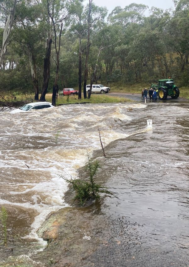
The Australian Institute for Disaster Resilience acknowledges the
Traditional Owners of Country throughout Australia and recognises
       their continuing connection to land, waters and culture.
    We pay our respects to elders past, present and emerging.
ii Image: NSW SES
MAJOR INCIDENTS REPORT 2020-21

Foreword
“How do we best prepare for the future?                               2020-21 was a challenging period for the fire and emergency
                                                                      services due to the complexity of consecutive, concurrent
                                                                      and compounding events. The report provides an overview of
Achieving an effective national approach to                           major storm and flood events in New South Wales, Queensland
natural disasters requires a clear, robust and                        and Victoria that demonstrate the persistent nature of the La
accountable system capable of both providing                          Niña weather pattern, its impacts and the extraordinary efforts
                                                                      from across the emergency management sector at state and
a comprehensive understanding of, and
                                                                      national levels. The report includes significant bushfire events
responding to, the aggregated risks associated                        in K’gari, the World Heritage listed sand island off the coast of
with mitigation, preparation for, response to and                     Queensland, and Wooroloo in the Perth Hills. It captures the
recovery from natural disasters”.                                     impact of Tropical Cyclone Seroja, a rare event for communities
                                                                      on the central west coast of Western Australia, and the tsunami
                                                                      warning issued for Norfolk Island following a 7.9 magnitude
Air Chief Marshal Mark Binskin AC (Retd)                              earthquake near the Kermadec Islands region, north-east of
Chair, Royal Commission into National Natural Disaster                New Zealand.
Arrangements Report, 28 October 2020                                  The report highlights the interoperability of the national
                                                                      emergency management system, the work of volunteers in
                                                                      communities under stress, and the diverse range of readily
This is the fifth Major Incidents Report commissioned by              portable skills within these areas of the community.
Emergency Management Australia and published by the
                                                                      I would like to acknowledge AIDR and the contribution of
Australian Institute for Disaster Resilience. This edition provides
                                                                      Tony Murphy AFSM in the development of this report, as
an authoritative overview of eight major incidents regarded
                                                                      well as the guidance and input provided by jurisdictional
as nationally significant by the emergency management
                                                                      representatives from emergency service organisations and
sector, across the 2020-21 financial year. The report provides
                                                                      the Bureau of Meteorology who formed the Major Incidents
background information about each incident, the impact, the
                                                                      Report Steering Committee.
response to it and, where identified, observations to assist the
emergency management and disaster resilience sectors identify
key themes for improvement in practice at a national level,           Joe Buffone
across all hazards and jurisdictions.
                                                                      Director General
The report also provides a contextual snapshot of the novel
environment the fire and emergency services have operated
                                                                      Emergency Management Australia
within during the COVID 19 pandemic period, in addition to
the La Niña climate phenomena that delivered above average
rainfall and erratic weather conditions across many parts of
eastern Australia and other locations.

                                                                                                                                          1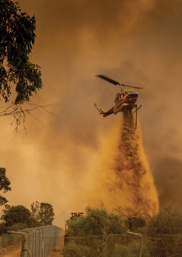
Contents
1                         4                              8
Foreword                  National overview              Map of major incidents
                                                         in this report

10                        14                             16
La Niña 2020–21           COVID-19                       Hailstorm
                                                         SOUTH-EAST QUEENSLAND,
                                                         31 OCTOBER 2020

18                        20                             24
Bushfire                  Bushfire                       Tsunami
K’GARI (FRASER ISLAND),   WOOROLOO (PERTH HILLS),        NORFOLK ISLAND,
QUEENSLAND,               WESTERN AUSTRALIA,             5 MARCH 2021
14 OCTOBER 2020           1 FEBRUARY 2021

27                        33                             34
Flood                     Interstate flood response      Tropical cyclone
NEW SOUTH WALES,          QUEENSLAND RESOURCES           TROPICAL CYCLONE SEROJA,
18 MARCH - 1 JUNE 2021    DEPLOYED TO NEW SOUTH WALES,   WESTERN AUSTRALIA,
                          MARCH 2021                     11-12 APRIL 2021

38
Storm and flood
SOUTH-EAST AUSTRALIA,
7-11 JUNE 2021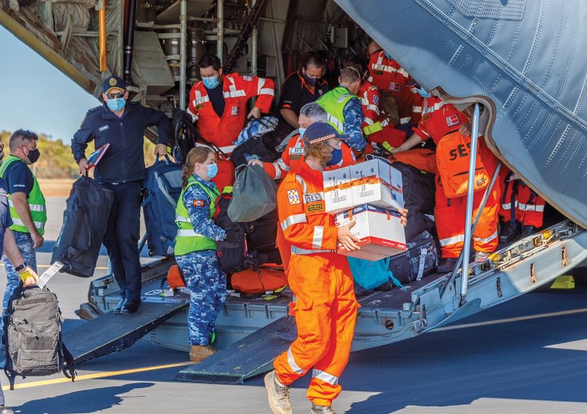
List of Tables

15   Table 1: Interstate deployments 2020–21

19   Table 2: K’gari bushfire event scale, 14 October – 28 December 2020

28   Table 3: Rainfall records – March 2021

29   Table 4: Significant flood peaks during the event

List of Figures

11   Figure 1: Rainfall deciles for March 2021 compared to historical observations from 1900

11   Figure 2: Root-zone soil moisture decile maps for February 2021 (left)
     and January 2020 (right) compared to historical observations from 1911

28   Figure 3: Weekly rainfall totals, week ending 28 March 2021

28   Figure 4: Rainfall deciles for March 2021 compared to historical observations from 1900

30   Figure 5: Rapid Damage Assessment Dashboard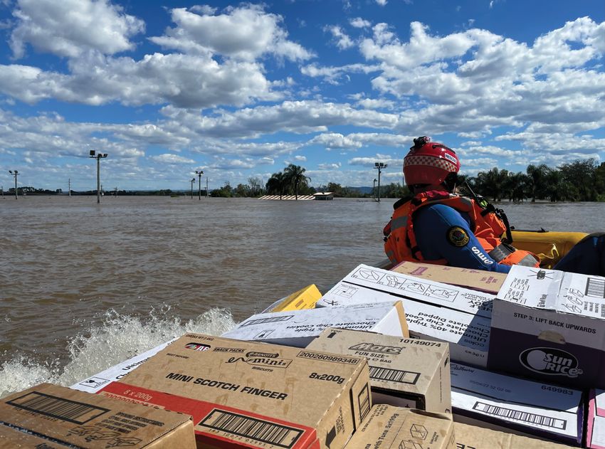
National overview

    The impact of COVID-19 on frontline emergency operation and disaster recovery services has
    brought unprecedented challenges. The deployment of personnel and resources at short notice must
    now factor in COVID-19 prevention requirements and measures. These circumstances have forced us
    to adopt different ways to communicate, share and work. Importantly, this has also driven new ideas
    and the development of protocols and prioritisations for sharing personnel and resources in times
    of emergency.

    The 2020–21 financial year (July 2020 to June 2021) was the               heatwave conditions were observed along the Western
    coolest and wettest for Australia since 2016–17, after three              Australia west coast in early 2021, with sea surface
    exceptionally warm and dry years.                                         temperatures up to 3°C above average; there was no
    ▪   A weak La Niña contributed to the third-wettest December              significant coral bleaching observed.
        on record and the wettest northern wet season (October to        ▪    As at the end of July, root-zone soil moisture was generally
        April) since 2016–17.                                                 average to above average across Australia.
    ▪   La Niña developed relatively late, not being declared by the     ▪    2021 saw Australia’s coolest January to June period
        Bureau of Meteorology until 29 September 2020; it was                 since 2012.
        officially declared as finished in late March 2021, with its     ▪    Spring 2020 saw the highest overnight temperatures
        peak strength observed during January 2021.                           ever recorded during spring in Australia; the mean spring
    ▪   Eight tropical cyclones were observed across the Australian           temperature was slightly more than 2°C above the long-
        region, slightly less than the average since 2000 of nine             term average.
        per financial year. Three tropical cyclones reached severe       ▪    Australia had its hottest November on record in 2020, with
        (Category 3) strength.                                                a mean temperature 2.47°C above the long-term average.
    ▪   Two tropical cyclones made landfall on the Australian            ▪    Australian annual mean temperature has increased by
        mainland – Imogen and Seroja; Tropical Cyclone Seroja                 around 1.4°C since 1910. Australian Government activity
        crossed the Western Australian central coast at Category         The Australian Government, through Emergency Management
        3 strength in April 2020 with wind gusts of 170 km/h             Australia (EMA), coordinates support, collaborates with and
        recorded at Kalbarri.                                            assists the states and territories to improve the overall resilience
    ▪   Extreme rainfall totals caused significant flooding along        of Australia, Australians and the things that Australians value.
        the New South Wales coast in March 2021 and in the               The Australian Government Crisis Coordination Centre (CCC),
        Gippsland region of Victoria in June 2021.                       now the National Situation Room (NSR) provided stakeholders
    ▪   Improved rainfall conditions resulted in average to above        verbal and written notification on domestic and international
        average annual stream flows across large parts of the            security and emergency management events, where the event
        country, particularly in northern Australia and coastal          poses potential risk to the Australian community or Australian
        catchments in the south-east.                                    interests overseas.
    ▪   Although water storage levels have improved in many parts        During the period of 1 July 2020 to 30 June 2021 (2020–21),
        of the country, significant follow-up rainfall is still needed   the CCC issued more than 900 incident notifications to key
        to fill the storages and increase water availability.            stakeholders in Australian Government and state and territory
    ▪   Groundwater levels were mostly below average but are             government agencies. The CCC regularly notified stakeholders of
        showing signs of recovery.                                       and coordinated whole-of-Australian Government responses to
    ▪   Associated with the 2020–21 La Niña event, marine                a range of significant incidents including:

4                                                                                                             Image: Lewis van Bommel, DFES WA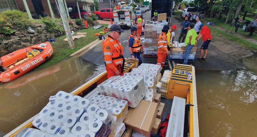
MAJOR INCIDENTS REPORT 2020-21
▪ K’Gari (Fraser Island) bushfires, Queensland – October to - The Australian Government declared many parts
December 2020 of the east coast a natural disaster zone after
- Significant fire which burned approx. 85,000 hectares flooding and severe weather forced 18,000 people
(more than half of the island). Aerial assets from other to evacuate, in addition to over 1,000 flood rescues.
jurisdictions were utilised to support Queensland Fire - Three people died and it was estimated that the cost
and Emergency Services. of damage would exceed $1 billion.
▪ Wooroloo (Perth Hills) bushfire, Western Australia - EMA liaison officers were deployed into the New
– 1 February 2021 South Wales State Emergency Service Operations
- Significant fire which burned approx. 10,900 hectares. Centre to support any requests for Australian
86 houses were destroyed. Government non-financial assistance.
- The Australian Government Disaster Response Plan ▪ Victorian flooding event – commencing 9 June 2021
2020 (COMDISPLAN) was activated on 2 February - An extensive severe weather system resulted in
to provide non-financial assistance in relation to the significant damage and widespread flash flooding,
bushfires. largely across the Dandenong Ranges and Gippsland
- The Australian Government Disaster Recovery areas. Over 160,000 properties lost power, many for
Payments (AGDRP) and the Disaster Recovery over a week. Damage assessments identified at least
Allowance (DRA) were activated in response to the 110 properties as uninhabitable.
Wooroloo bushfire. - Two deaths were reported and many communities
- An EMA liaison officer was deployed to the Western remained in communications isolation for a number
Australia State Operations Centre to assist with of days.
information flow and to support requests for - Assistance under the Australian Government
Australian Government non-financial assistance. Disaster Recovery Funding Arrangements was made
- Geoscience Australia, on behalf of EMA and the available to 37 impacted local government areas. The
Australian Government, requested the assistance Department of Home Affairs Critical Infrastructure
of the Copernicus Emergency Management Service Centre consulted with the Trusted Information
to provide on demand mapping to assist with the Sharing Network to canvass requests for assistance
response. across industry.
▪ Kermadec Islands earthquake resulting in Norfolk Island - The EMA CCC reported twice daily throughout both
tsunami warning – 5 March 2021 the response and recovery phases of this event to
- A 7.9 magnitude earthquake north of New Zealand inform stakeholders and support decision making.
resulted in a tsunami warning for Norfolk Island. A - An EMA liaison officer was deployed to the Victorian
64 cm tsunami wave was observed at the island, but State Control Centre to support any requests for
there were no injuries reported. Australian Government non-financial assistance.
- The CCC verbally notified and provided updates to a A Crisis Coordination Team (CCT) was established on seven
range of stakeholders to advise of the earthquake, occasions for a total of 330 days to support the centralised
tsunami warning and impact. approach of the Australian Government when a National
- The CCC maintained contact with Geoscience Plan was activated. In the reporting period, the COMDISPLAN
Australia and the Bureau of Meteorology regarding was activated on five occasions. The Australian Government
the magnitude of the earthquake and tsunami coordinated 13 requests for assistance from states and
forecasts. territories. In addition, the Australian Government Overseas
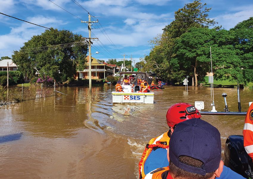
▪ New South Wales/Queensland flooding event – Assistance Plan (AUSASSISTPLAN) was activated six times
commencing 10 March 2021 and the Australian Government Space Re-entry Debris Plan
- Extreme rainfall on the east coast (AUSSPREDPLAN) was activated twice.
of Australia, beginning on 18 March 2021, led The Australian Government Crisis Committee (AGCC) and
to widespread flooding in New South Wales, Australian Government Disaster Recovery Committee (AGDRC)
affecting regions from the North Coast to met on 11 occasions during 2020–21. The National Crisis
the Sydney metropolitan area in the south. Committee (NCC) did not convene during this period.
- Suburbs of Sydney experienced their worst flooding The National Security Hotline received over 27,500 contacts,
in 60 years. Far-south-eastern communities assisting state and territory law enforcement and intelligence
in Queensland were also affected by flooding and agencies.
heavy rainfall, though to a lesser extent than those in
New South Wales.
Image: NSW SES 5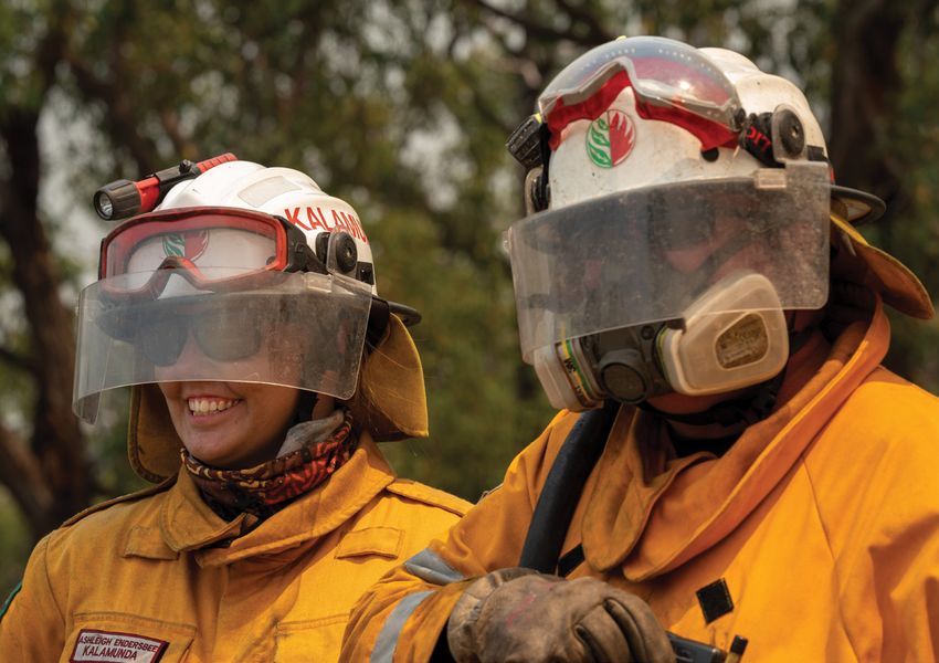
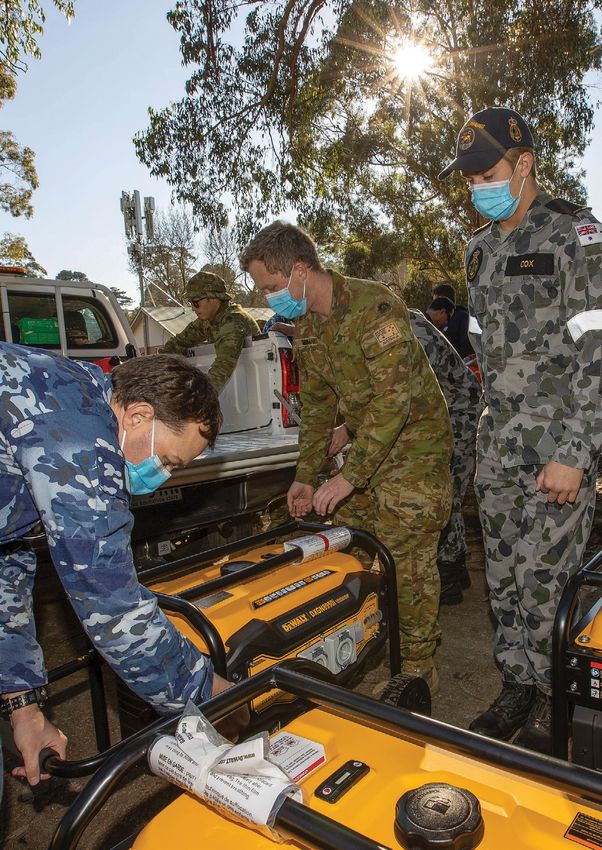
Department of Defence contribution                                    non-health issues related to COVID-19. The NCM was supported
                                                                          by coordination nodes within the Department of Home Affairs
    During 2020–21, in response to requests for Commonwealth              that included representatives from key agencies that covered
    Assistance under the Commonwealth Disaster Response Plan,             domain-specific issues, and the capabilities available to address
    the Department of Defence (Defence) provided substantial              challenges. The nodes also brought together crisis planners from
    contributions to emergency response and recovery efforts              Australian Government agencies including the Department of
    across the nation. Not only has Defence provided personnel            Home Affairs and Defence. The NCM coordinated 157 domain-
    in every state and territory, their scope of support included         specific sector meetings during 2020–21.
    providing quarantine compliance management, port safety and
                                                                          EMA, through the NCM, facilitated engagement between the
    security, border control, contact tracing, planning, and logistical
                                                                          Vaccination Task Force and industry groups and separately
    support for the response to COVID-19.
                                                                          coordinated with the Department of Health and the Department
    Of note, in February, Defence transported essential fire              of Infrastructure, Transport, Regional Development and
    retardant stocks to Western Australia for the Wooroloo                Communications to review the freight code and protocol after
    bushfires, for use by aerial firefighting aircraft. In March, over    the outbreak of the Delta variant and consequent imposition of
    900 Defence personnel supported the flood response efforts            new restrictions in states and territories.
    in New South Wales through search and rescue operations,
                                                                          When requested by the Australian Government, agencies
    recovery operations and providing essential re-supply to
                                                                          such as Defence and the Australian Public Service Commission
    Lord Howe Island. After the impact of Tropical Cyclone Seroja
                                                                          deploy personnel and resources to provide customised support
    in Western Australia, Defence personnel assisted the relief
                                                                          to all state and territory authorities to reinforce, amplify and
    efforts through providing ground transport, logistics and field
                                                                          expand state and territory capacity to deal with the impacts of
    engineering support and airlift of emergency service personnel
                                                                          COVID-19. To date EMA has received 211 COVID-19 requests
    and equipment. In June, Defence assisted the response efforts
                                                                          for assistance from states and territories and 73 COVID-19
    to the Victorian severe weather event, by providing over 150
                                                                          requests for assistance from Australian Government agencies
    personnel for engineering and logistical support.
                                                                          or departments. Over 17,000 Australian Government personnel
                                                                          have been involved in the response to COVID-19 nationally.
    Western Australia Tropical Cyclone Seroja                             The tasks have ranged from, but not limited to, quarantine
    The CCC and by extension the CCT coordinated the Australian           compliance, quarantine facility management, port safety and
    Government’s response to the tropical cyclone between                 security, border control, reception arrangements, contact
    11 April and 5 May. The Director General EMA activated                tracing, planning, logistic support and providing support to the
    COMDISPLAN on 11 April and 5 May for the cyclone impact               Department of Health Vaccine Program.
    as it crossed the Western Australia coast between Kalbarri            In response to a request for Australian Government assistance
    and Geraldton as a Category 3 severe tropical cyclone. The            in managing COVID-19 in the Pacific, and Australia’s broader
    Australian Government coordinated six requests for assistance         region, the Director General EMA authorised AUSASSISTPLAN
    related directly to the response.                                     activations for:
    The CCC coordinated and disseminated more than 6                      ▪    COVID-19 Support to Papua New Guinea (July 2020 to
    notifications and 15 detailed incident briefs. Three liaison               October 2020) – the Australian Government deployed two
    officers were deployed for a total of 15 days into the Western             Australian Medical Assistance Teams (AUSMAT) to assist
    Australian State Operations Centre in support of timely, efficient         the Papua New Guinean Government to assess medical
    and effective advice about Australian Government assistance.               needs for COVID-19 response.
    To aid in situational awareness and decision making across            ▪    COVID-19 Support to Papua New Guinea (March 2021 to
    the Australian Government, the joint AGCC and AGDRC met                    May 2021) – the Australian Government deployed two
    five times. The Commissioners and Chief Officers Strategic                 AUSMATs to assist the Papua New Guinean Government
    Committee met four times.                                                  to assess medical needs for COVID-19 response. EMA
    At the request of the Western Australian Government, and under             deployed a liaison officer to support the security and safety
    the direction of the Australian Government, Defence provided               of AUSMAT.
    substantial contributions to emergency response and recovery          ▪    COVID-19 Support to Timor-Leste (April 2021 to June 2021)
    efforts for the impact of Tropical Cyclone Seroja. Significantly,          – the Australian Government deployed an AUSMAT to
    Defence transported State Emergency Service vehicles – including           assist the Timor-Leste Government response to COVID-19
    trucks and four-wheel drives – from Melbourne to Geraldton on              outbreak.
    a C-17A Globemaster III. In addition, a Defence C-130J provided       ▪    COVID-19 Support to Fiji (June 2021) – the Australian
    support to emergency services through the movement of                      Government deployed an AUSMAT to assist the Fijian
    personnel and supplies to the affected communities in need,                Government response to COVID-19 outbreak.
    including food, water and generators.
                                                                          Disaster recovery funding
    Novel Coronavirus (COVID-19)                                          During 2020–21, the jointly funded Commonwealth-state/
    In anticipation of a response by the Australian Government            territory Disaster Recovery Funding Arrangements (DRFA) was
    to COVID-19, the Director General EMA authorised a national           activated in response to 43 domestic disaster events (13 in New
    COMDISPLAN activation.                                                South Wales, 2 in Northern Territory, 11 in Queensland, 1 in South
                                                                          Australia, 2 in Tasmania, 5 in Victoria and 9 in Western Australia).
    To support the unprecedented national coordination
    requirements across all areas of the Australian Government,           There were 356 DRFA local government area activations. In
    state and territory governments and the commercial and                addition, the Australian Government provided over $250 million
    private sector, the Prime Minister announced the activation           directly to disaster affected individuals and families through the
    of the National Coordination Mechanism (NCM) to respond to            Australian Government Disaster Recovery Payment and Disaster
                                                                          Recovery Allowance.

6
CPL David Cotton, ADF
Map of major incidents in this report

                                   JA
                                ERO
                               S
                            NE
                         CLO
                   L   CY
               ICA
            ROP
           T

                                             NT

                                        WA

                                                  SA

8
MAJOR INCIDENTS REPORT 2020-21
Index of like-hazard summaries in this report
Incident type Location Page
QLD 18
Bushfire
WA 20
NSW 27
Flood
QLD 33
Storm VIC 38
Hailstorm QLD 16
Cyclone WA 34
Tsunami Warning NORFOLK ISLAND 24
QLD
NORFOLK
ISLAND
NSW FLOODS
JULY 2020
NSW
AUG 2020
DEC 2020
VIC
FEB 2021
MAR - MAY 2021
ACT
TAS
NZ
9La Niña 2020–21
The Bureau of Meteorology (BOM) declared Climate drivers during the 2020-21 season:
Australia was in a La Niña weather pattern on ▪ The 2020–21 La Niña increased the likelihood of rain
bearing weather patterns over eastern Australia and it
29 September 2020. The phenomena resulted reduced evaporation due to increased cloudiness and
in spring and summer receiving above-average reduced temperatures. These conditions resulted in an
rainfall in most of northern and eastern Australia increase in soil moisture during the spring and summer,
and persisted at weak to moderate levels into meaning any heavy rainfall on the wet catchments saw less
water soaked up by the ground and a tendency for rivers to
early Autumn 2021. This is typical of La Niña respond more quickly and reach higher levels compared to
systems, which generally bring wetter spring dry catchments.
and summer conditions for eastern Australia. ▪ The Southern Annular Mode (SAM) was in its positive
phase for most of summer, although it was neutral in
The weather pattern experienced during the 2020–21 period March. A positive SAM phase in summer is typically
provided a number of complex, continued and compounding associated with enhanced easterly flow over eastern
challenges to emergency response and emergency management Australia and is favourable for above-average seasonal
agencies. During this period, many flood and storm events rainfall in most of New South Wales. The positive SAM
extended across Australia requiring response from emergency reinforced the La Niña impacts and wetting of the
responders and recovery agencies to support communities. catchments prior to the rainfall event of March 2021.
The incidents ranged from localised to magnitudes needing ▪ The Madden–Julian Oscillation was well outside the
capability from interstate and the Commonwealth. Australian region during the second half of March 2021,
A number of localised and continued events are included in the while the monsoon was also relatively inactive during
Major Incidents Report to demonstrate the frequency of these this period. However, relatively warm waters off northern
weather events, their impact on communities and response Australia, and the lingering influence of the La Niña pattern
efforts by emergency services agencies. A number of these across the Pacific, is likely to have added extra moisture to
events preceded the March flood event that impacted large the tropical atmosphere, which then moved over central
parts of New South Wales and Southern Queensland. and eastern Australia during this event.
The increase in rain reduced the fire risk over most of the Much of the region affected by the March 2021 rainfall event
nation, which was a welcome relief given the protracted experienced severe drought in 2019 and preceding years. Whilst
bushfire season across several jurisdictions in 2019–20. La Niña above-average rainfall over most of eastern New South Wales
also contributed to an increased risk of flooding as seen in the eliminated short-term rainfall deficiencies, substantial long-term
flood events through Queensland and New South Wales during deficits remained in inland areas of northern New South Wales
March 2021. and southern Queensland. This was reflected in water storages,
with storage levels in the northern Murray–Darling Basin
In addition to La Niña, secondary climate drivers influenced
increasing from 27.9% on 17 March to 46.0% on 28 March,
the weather and climate of eastern Australia in the months
reaching 47.1% of capacity at the end of March. This included
preceding flooding events in 2021. These drivers provide
the highest and third highest daily increases in combined
additional clarity and understanding of the impacts associated
storage volumes since 1993.
with above average rainfall even as La Niña receded. During
this time the BOM continued to inform the community of these
drivers urging communities to remain vigilant when extreme
weather was forecast.
10 Image: NSW SESMAJOR INCIDENTS REPORT 2020-21
These natural climate drivers were set against the La Niña at a glance:
background of long-term climate change trends. As
the climate warms, Australia’s heavy rainfall events • La Niña and other secondary climate drivers
are expected to become more intense as moisture in produced significant rainfall across Australia
the atmosphere increases by about 7% per degree of compared to recent drier than average years,
warming. Rainfall changes in specific locations, especially notably since 2016 when a negative Indian Ocean
areas with complex topography such as coastal New Dipole was active.
South Wales, will have a higher level of uncertainty due • September 2020 to March 2021 was the wettest
to changes in the occurrence, strength, and position of across Australia since 2016.
synoptic weather systems. For the Australian continent, • The 2020–21 flooding events were less significant to
there is evidence that a higher proportion of total annual the previous period of La Niña in 2011–12.
rainfall has come from heavy rainfall days in recent
• The wet conditions in 2020–21 contributed to a
decades. Refer to the State of the Climate 2020 (BOM and
major drop off in widespread fire activity compared
CSIRO 2020) for further details.
to recent years.
• Australia’s rainfall during September 2020 to March
2021 was the 15th highest on record.
Figures 1 and 2 represent the rainfall parts of Australia received • New South Wales’ rainfall during September 2020 to
during the 2020-21 period and the impact on soil moisture March 2021 was the 10th highest on record.
across the nation. • New South Wales experienced its second highest
A series of localised flooding events experienced in New South March rainfall on record (only behind March 1956).
Wales also demonstrate the compounding and consistent nature • The Murray–Darling Basin had its fourth highest
of the flooding that challenged the emergency management rainfall on record for March.
system during the 2020–21 period.
• In December 2020, Australia, Western Australia
and the Northern Territory experienced their third
highest December rainfall on record.
Figure 1: Rainfall deciles for March 2021 compared to historical observations from 1900
Figure 2: Root-zone soil moisture decile maps for February 2021 (left)
and January 2020 (right) compared to historical observations from 1911
11Localised storms and floods in New South Wales
A series of localised storm and flood events in New South Wales between July and December 2020 provide a snapshot of the many
weather-related events the emergency service and emergency management organisations responded to and managed throughout
2020–21. These events demonstrate how the La Niña weather pattern and other secondary climatic factors influenced disasters
during this 12-month period. 2020–21 was a challenging period due to the complexity, consistency, and compounding nature of these
events. The events summarised below precede the March floods in New South Wales that required extraordinary efforts from across
the response and emergency management sector at state and national levels.
Event statistics
NSW 25 July 2020 NSW 5 August 2020 onwards
STORMS AND FLOODS STORMS AND FLOODS
Bega Valley, Eurobodalla, Goulburn-
Bega Valley, Central Coast, Mulwaree, Hilltops, Kiama, Liverpool,
Eurobodalla, Kiama, Newcastle, Orange, Queanbeyan-Palerang,
Shellharbour, Shoalhaven, Shellharbour, Shoalhaven, Snowy
Wingecarribee Monaro, Sutherland, Upper Lachlan,
Wingecarribee, Wollongong, Yass Valley
A low-pressure system brought localised heavy rain, damaging A complex low-pressure system made its way south-west
winds and damaging surf to the eastern seaboard of New South across New South Wales, bringing widespread rain and windy
Wales, from the Hunter Coast to the South Coast. conditions. Minor to moderate flooding was predicted along
The New South Wales State Emergency Service (NSW SES) the South Coast and the Queanbeyan River. A total of 209 mm
received 2,488 requests for assistance during this event. This rainfall was recorded in Nowra in the 24-hour period between
figure included 33 flood rescue activations. 3.30 pm on 7 August 2020 and 3.30 pm 8 August 2020.
The NSW SES received 4,644 calls at the State Operations Centre The NSW SES received 2,289 requests for assistance during
during this event. this event, including 41 flood rescue activations. The greatest
impact occurred in several areas across the Sydney metropolitan
Impact occurred along coastal New South Wales, with the area (961 requests for assistance) and the South Coast from
area from Wollongong to the Victorian border experiencing Wollongong to the border (937 requests for assistance).
the highest impact resulting in 1,226 requests for assistance.
Communities with greatest impact included Erowal Bay, The NSW SES received 3743 calls into the State Operations
Sanctuary Point and Sussex Inlet on the South Coast. Centre during this event.
Up to 20 properties in low lying areas of Sussex Inlet on the Localised flooding resulted in several evacuation orders being
South Coast were issued with an evacuation order. This was due issued on the South Coast including Moruya, Sussex Inlet and
to flooding caused by heavy rain and high tides. The evacuation parts of Terara, Worrigee and East and North Nowra. Other
order was in place for four days. communities including Gerringong on the South Coast and
areas in the Southern Highlands experienced short periods of
Across the South Coast, 90 residential and commercial localised flash flooding and road closures.
properties were damaged by storm and flood, with 17 of these
properties assessed as uninhabitable. Two air assets were stationed at Moruya, Bega and Nowra over
the duration of the event, supported by an Airbase Manager in
NSW SES response activities were assisted by teams from Fire and Moruya.
Rescue NSW (FRNSW) and the NSW Rural Fire Service (NSW RFS).
Damage assessments in the South Coast identified 86 residential
and commercial properties as damaged from flood and/or storm.
12MAJOR INCIDENTS REPORT 2020-21
NSW 10 December 2020 onwards NSW 19 February 2021
STORMS AND FLOODS STORMS AND FLOODS
Armidale, Ballina, Bellingen, Byron Bay,
Clarence Valley, Coffs Harbour, Glen Innes North Coast: Clarence Valley,
Severn, Gwydir, Inverell, Kempsey, Kyogle, Coffs Harbour, Kyogle, Lismore,
Lismore, Moree Plains, Nambucca, Port Nambucca, Port Macquarie-Hastings,
Macquarie-Hastings, Richmond Valley, Richmond Valley
Tamworth, Tenterfield, Tweed Heads
A coastal trough caused periods of widespread prolonged A trough sitting just offshore on the New South Wales coastline
rainfall and thunderstorm activity in the northern coastal brought heavy rainfall to the northern half of the coast.
districts of New South Wales. This resulted in flooding across
Flooding occurred along the Wilsons, Richmond, and Bellinger
several river systems.
Rivers in the north of the state. There was also minor flooding
The NSW SES received 2,801 requests for assistance during along the Paroo River in the northwest of the state.
this event, including 67 flood rescue activations. Localities The NSW SES received a total of 266 requests for assistance
of greatest impact included Tweed Heads, Lismore, and during this event, including 5 flood rescue activations. The impact
Coffs Harbour. was felt from the Queensland border through to metropolitan
The NSW SES received 6887 calls into the State Operations Sydney, with greatest impact in the north of the state.
Centre during this event. The NSW SES received 647 calls at the State Operations Centre
NSW SES deployed 105 members out of area to assist with during this event.
this event. The community of Green Pigeon in the north of the state was
NSW RFS provided four helicopters to use during this event. isolated for a short period when a bridge was washed away by
NSW RFS and FRNSW provided support in the field to NSW floods. The local council quickly coordinated construction of a
SES teams. temporary bridge to provide access to the township.
Image: NSW SES 13COVID-19
COVID-19 interstate (fire, emergency and other
essential services) deployment protocol
2020–21 was a challenging period for emergency The protocol considers responding personnel when deployed
in a team, unit, or module, to be managed through collective
management across Australia. In addition to the administration and exemptions.
La Niña weather pattern, agencies were faced Key elements of the protocol include governance arrangements,
with the complexity of responding to events in a roles and responsibilities and guiding principles in giving effect
COVID-19 environment. to deployments. The protocol also features a mechanism for
adapting plans from learnings.
This novel challenge required fire and emergency services The protocol is intended to support the safe and rapid response
agencies to develop strict policies, procedures, and protocols to to emergency response situations during complex times
operate safely without infection transmission, in collaboration following requests between states and territories. It specifies
with health department officials. These localised COVID-19 the minimum responsibilities of sending jurisdictions, receiving
operating protocols supported day-to-day business, which jurisdictions, transiting jurisdictions, and emergency personnel.
included the continuance of day-to-day localised mutual aid Relevant COVID-safe plans may be modified or create additional
responses across interstate borders. responsibilities.
With growing confidence that a La Niña presence could As COVID-19 is dynamic, a consistent, risk-based approach is
influence higher rainfalls and cyclonic activity, it was anticipated applied across Australia to reduce the complexity of interstate
that interstate assistance from state and Commonwealth movement for emergency personnel and ensure compliance,
agencies would be needed to respond and support recovery whilst minimising potential vectors for transmission of
during this period. Bushfire risk was also increasing in specific COVID-19.
areas of Australia experiencing rainfall deficit. In this context,
the AFAC National Resource Sharing Centre (NRSC) convened The protocol highlights the importance of ongoing regular
Commonwealth, state and territory representatives to develop communication between Emergency Management Australia,
a national COVID-19 protocol for deploying resources across states and territories, emergency service agencies, the
Australia during the 2020–21 period. Australian Defence Force (ADF), police, health agencies or
any other personnel required to be deployed to provide
The protocol development team acknowledged that each state emergency assistance in each jurisdiction. This process was
and territory had nuanced COVID-safe plans in place to meet critical to ensure the currency and smooth implementation of
specific requirements. They focused on developing a national the protocol.
COVID-19 protocol that would support jurisdictional plans and
enable interstate and Commonwealth capability to assist in The COVID-19 protocol was harmonised with existing plans for
providing operational assistance. interstate assistance, aviation deployment plans, associated
operational plans and jurisdictional COVID-safe plans. There
The AFAC NRSC accessed learnings from jurisdictions in the was a requirement for the receiving jurisdiction to provide the
Northern Hemisphere on their experiences with sharing deploying jurisdiction with a copy of their jurisdictional COVID-
resources and capability across various states when COVID-19 was safe plan when a resource request was issued to commence
active. This rich information assisted the protocol team in their preparedness and briefing processes for transparency and
deliberations and framing of the Australian national protocol. readiness purposes.
The protocol was developed through a collaborative approach The protocol applies to emergency personnel who perform
and endorsed by the Commissioners and Chief Officers Strategic volunteer or paid duties deployed by a sending jurisdiction
Committee. It was also approved by the Australian Health to a receiving jurisdiction for the purposes of emergency
Principal Protection Committee. management and activities for the protection of life, property,
and the environment.
14MAJOR INCIDENTS REPORT 2020-21
Emergency personnel included deployments made by the The list contained in the protocol was extensive and focused
ADF and aerial resources contracted by the National Aerial on ensuring people deployed were not infected or suspected
Firefighting Centre (including air and ground crew responsible of being infected in travelling to the receiving and transiting
for the provision of aerial firefighting or emergency support). jurisdictions.
Emergency personnel also included any personnel deployed A risk-management approach was taken and compliance with
to assist relief and recovery activities such as personnel from quarantine restrictions was required when personnel were
Services Australia and recognised charity organisations. To returning to their home state.
streamline deployments, emergency personnel covered by this
protocol were required to ensure they carry relevant and valid A method to make any relevant changes is outlined in the
official identification or evidence that confirmed their identity protocol and requires consultation with other governments
and emergency response duties. using the national coordination mechanism before any changes
are made to the protocol.
The protocol adopted several guiding principles to support
deployments of emergency and essential support personnel. The protocol was applied extensively throughout the 2020–21
The protocol was designed to support COVID-safe plans period in supporting the deployment of emergency response,
developed by receiving jurisdictions, with enforcement support, and ADF personnel along with specialised assets to
activities by individual jurisdictions to the extent provided in any manage floods, suppress fires and clean-up following storms
applicable public health orders and emergency management and cyclones. Assistance was provided to Western Australia,
directions. An expectation of all personnel taking responsibility New South Wales, Queensland, and Victoria during the
for infection prevention and control through common sense, 2020–21 period.
vigilance, in an environment promoting hand hygiene, physical These deployments utilised the National Emergency
distancing and correct use of COVID-specific personal protective Management Arrangements and the Australian Interstate
equipment. Appropriate measures for tracking and tracing of all Agreement, Arrangement for Interstate Assistance – Fire and
personnel if required was another key element of the protocol. Emergency Services.
There were several responsibilities of the sending, receiving The protocol will continue to inform and support capability
and transiting jurisdictions and the emergency personnel in deployments across Australia to assist in responding to
any interstate deployment to prevent infection. These were emergencies during COVID-19 impacted times.
associated with accessibility of deployed personnel details and
From a practical perspective the protocol was applied
confirming arrangements for crossing and returning home were
throughout 2020–21 period where several requests were made
detailed. The protocol ensured any deployed personnel had
of jurisdictions to support major incidents. Table 1 represents
been COVID-19 tested and had received clear operational and
the events, the jurisdictions and the numbers who lent support.
medical COVID-19 specific briefings.
The data demonstrates the agility, and the ability to strengthen
the resilience of the response and recovery system and operate
across borders during COVID-19.
Queensland storms - October/November 2020
The resources provided in these events performed a range of
roles including assistance on the ground, clean up, incident
SA NSW TOTAL
management and community reassurance and connection.
21 81 102 Furthermore, the resilience of the system during the 2020–21
period was further fortified accessing additional resources from
New South Wales floods - March 2021 the ADF along with specialised aviation assets and operators
from the National Aerial Firefighting Centre to work in a range of
SA VIC TAS QLD ACT WA NRSC TOTAL jurisdictions challenged by fires, floods, and storms.
51 82 1 200 6 2 2 344
Western Australia Tropical Cyclone Seroja - April 2021
SA VIC NSW TOTAL
31 75 99 205
Table 1: Interstate deployments 2020–21
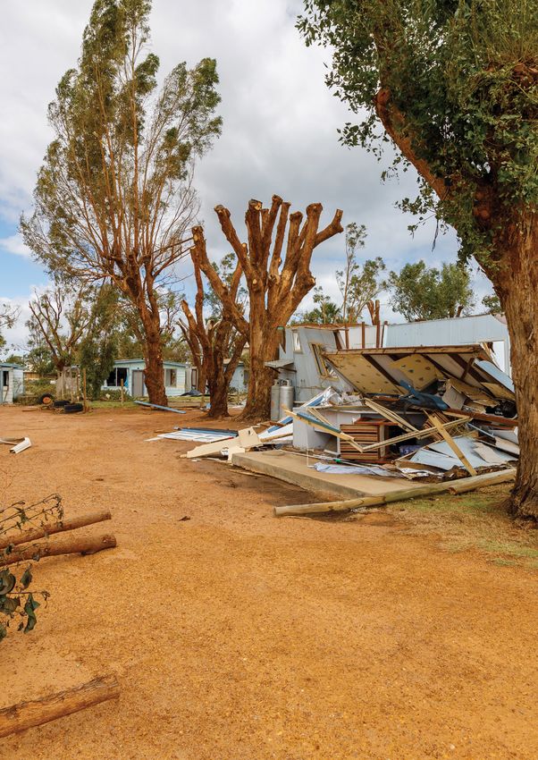
Images: CFA VIC 15Hailstorm
South-east Queensland, 31 October 2020
The erratic weather experienced across Australia forecasted to bring destructive winds and giant hail. Another
emergency alert was issued for parts of the Gold Coast and
in 2020-21 is evident in the major incident Logan, namely Woodridge, Beenleigh, Southport and Coomera
referred to as the Halloween thunderstorms, as the dangerous storms tracked over the city.
which took place on 31 October, 2020. Overall, there were 296,000 lightning strikes across south-east
Queensland during this event, demonstrating the violent and
Widespread thunderstorms affected central and south-east powerful nature of the storms. Emergency services reported
Queensland between 24 and 29 October. Thunderstorms an increase in requests for assistance mainly relating to trees
affected Brisbane on 24 and 25 October, and again on 27 and falling down and roofs being damaged. Three people were
28 October, bringing heavy rainfall to some sites, flash flooding trapped inside a Springfield Lakes residence after a tree
and strong wind gusts. Thunderstorms produced large hail, collapsed onto the roof. No injuries were reported. The storms
with reports of up to 6 cm hail in diameter south of Gayndah, caused the election polling booths to be shut down, with the
fallen power lines in the Caboolture area, and localised flash Electoral Commission of Queensland confirming a polling booth
flooding on 28 October. Severe thunderstorms impacted much in Ipswich had been shut down after a hailstorm lashed the
of south-east Queensland on the afternoon of 31 October. The electorate. Trains were suspended on the Beenleigh and Gold
main impacts were giant hail up to 14 cm in diameter along a Coast lines between Helensvale and Kuraby due to the overhead
path from Amberley to the northern suburbs of Logan, giant powerlines being down, prompting delays of up to 60 minutes.
hail up to 7 cm in the Gympie area, and wind damage from
Following the aftermath of the storms, there were 95,000
Redcliffe to Kingston with gusts over 100 km/h recorded around
homes without power and the Queensland State Emergency
Moreton Bay. Giant hail up to 14 cm in diameter was reported at
Service (SES) received more than 2,900 requests for assistance
Forestdale, south of Brisbane, and hail up to 13cm in diameter
in the Ipswich and Logan council areas. Queensland Fire and
was reported at Hillcrest. Some other reports included giant
Emergency Services (QFES) crews conducted more than 2,000
hail up to 9.5 cm in diameter at Amberley, 8 cm in diameter
damage assessments, including more than 500 instances of
at Springfield, 7 cm in diameter around Gatton, and 5 cm in
major damage.
diameter at Seventeen Mile Rocks.
Within 24 hours of 31 October, the Insurance Council of
As parts of south-east Queensland were being pummelled by
Australia declared the natural disaster a catastrophe with the
a series of very dangerous and life-threatening thunderstorms,
damage bill currently at $980 million. Insurers have received
the Bureau of Meteorology (BOM) issued warnings for people
more than 42,000 claims as at 23 June 2021. Personal hardship
in parts of Queensland’s Wide Bay, Burnett, Darling Downs and
financial assistance was activated for some communities
Granite Belt regions. BOM also warned the situation was volatile
including defined localities within the Ipswich City Council
and continuing to change quickly. The path of damage was
area; Greater Springfield (Springfield and Springfield Lakes);
forecast to hit from the Queensland border to the north of the
Rosewood and Willowbank; suburbs of Logan City Council;
Sunshine Coast and communities further inland. BOM continued
Boronia Heights; defined localities within Greenbank.
to issue warnings for dangerous thunderstorms throughout
Saturday afternoon and into Saturday evening for south-east QFES worked collectively with the Ipswich City Council, Local
Queensland. It was also revealed that wind gusts of 115 km/h Disaster Management Group and key stakeholders to assist
were recorded at Cape Moreton which is located on Moreton those community members most severely affected. A multi-
Island 40 kms off Brisbane. There were nine super cell storms in service approach to recovery operations was implemented,
the designated warning area issued by the BOM. exemplifying the effectiveness of interoperability. Assistance
was also provided by SES personnel from New South Wales and
West of the city, the State Disaster Coordination Centre issued
South Australia.
an emergency alert for Lockyer Valley, Ipswich, Jimboomba
and Amberley residents when the severe thunderstorms were
16MAJOR INCIDENTS REPORT 2020-21
Following the incident, opportunities for Observations
improvement were identified, including: A series of observations were identified as delivering
• Solar panels added complexity to completing positive outcomes, including:
requests for assistance. Given the nature of the ▪ A multi-service approach to completing requests for
damage, safety measures were taken including assistance, community welfare checks, including the
isolation of power, tarping internally and having engagement of chaplains to assist volunteers, and
exclusion zones around any solar on a property. the provision of public information.
Further clarity is required for personnel working on
roofs with solar panels, including curriculum and ▪ Assistance of interstate teams supported by interstate
better equipment to test and isolate. liaison officers. The support from interstate personnel
from South Australia and New South Wales was not
• The need for more Working Safely at Heights trained only invaluable, it provided Queensland SES personnel
personnel. The tarping system used was resource with learnings and different processes and options for
intensive, and anchor points in new subdivisions temporary repairs.
proved difficult with houses constructed so close
together. ▪ Support provided to the Local Disaster Management
Group and utilisation of a data collection link.
Images: QFES 17Bushfire
K’gari (Fraser Island), Queensland, 14 October 2020
The K’gari (Fraser Island) fire provides an insight crews assisted QPWS and BAC in responding to fires through
both ground and air responses. Aerial reconnaissance flights
into the ecosystems and environments of a World commenced on 15 October with water bombing commencing
Heritage listed sand island, that was under threat on 9 November.
from a bushfire that commenced on 14 October. At 8 am on 24 November, QFES North Coast Regional Operations
Centre, based in Maryborough, was activated to support the
K’gari is the Traditional land of the Butchulla people. It is listed QPWS response, maintain active oversight of fire activities on
as having World Heritage values and is located off the coast of K’gari and the wider region and coordinate with the relevant
Hervey Bay, Queensland. It is 122 km long and is the largest disaster management partners. QPWS established an Incident
sand island in the world. Majestic remnants of tall rainforest Control Centre (ICC) at its Rainbow Beach depot on 24
growing on sand and half the world’s perched freshwater dune November, with a Divisional Command Point remaining on the
lakes are found inland from the beach. The combination of island. A joint Incident Management Team (IMT) consisting of
shifting sand dunes, tropical rainforests and lakes makes it an members from QFES, QPWS and the BAC was established within
exceptional site. Importantly, the island is the site of numerous the ICC.
places of cultural significance to the Butchulla people, with
The fires on K’gari, burning predominantly in inaccessible
many of these sites known only to local Elders.
terrain, were transferred to QFES control on 27 November, from
In October, the Bureau of Meteorology (BOM) reported that the previous lead agency, QPWS. This was done after a detailed
mean maximum temperatures were above average in the assessment of the conditions by the departments which
east. Rainfall was below average across most of Queensland included the predicted weather conditions and the threat to life
for November, which marked the second-warmest November and assets on the Island. On 27 November, the ICC moved to the
on record for Queensland in terms of mean, maximum and Rainbow Beach Community Centre to accommodate increased
minimum temperatures. A low- to severe-intensity heatwave IMT personnel and on 5 December, the ICC relocated to QFES
affected much of north-west to south-east Queensland from Maryborough ICC, located at the QFES Complex in Howard.
15-17 November. The QFES ICC incorporated representatives from BAC, cultural
A fire was reported on 14 October, in a camping area at the liaison officers and a number of fire behaviour analysts to inform
northern end of the island. Over a two-month period, this decision making.
fire burnt out over 85,000 hectares of bushland and posed a On 7 December, the Happy Valley township on the eastern
significant threat to several communities and assets on the island. side of the island and three properties at Yidney Rocks were
The source of the fire was determined to be an illegally lit threatened by fire. Firefighters conducted structural protection
campfire that was not properly extinguished. Queensland Parks resulting in no loss of life or property. There were multiple
and Wildlife Service (QPWS) responded as soon as the fire was fire fronts and significant QFES, QPWS, and BAC resources
reported and assumed the role of Incident Controller. Due to dry responded to these fires. Among many others on the island,
conditions, vegetation, strong winds and inaccessible terrain, it three sensitive cultural sites have been identified in the ‘Valley
was deemed that a direct attack on the fire was not feasible. of the Giants’ by the Butchulla people. QFES and QPWS worked
closely with the Butchulla people in protecting these culturally
Queensland Fire and Emergency Services (QFES), QPWS, the significant assets.
Butchulla Aboriginal Corporation (BAC), Queensland Police
Service (QPS), Queensland Ambulance Service (QAS) and Fraser Favourable conditions and rainfall contained the fire and QFES
Coast Regional Council (FCRC) worked closely together during handed back control to QPWS at midday on 13 December. Table
all phases of the K’gari fire event to contain and extinguish the 2 demonstrates the scale of the event.
fire, preserve life and protect property, culturally significant
sites, historic structures and the natural flora and fauna. QFES
18MAJOR INCIDENTS REPORT 2020-21
Following the incident, opportunities for
Event scale
improvement were identified, including:
14 October - 28 December 2020 • Agencies would benefit from further development of
multi-agency debriefing and shared learnings from
joint operations.
85,300 hectares burnt • There are opportunities to enhance integration
(approximately 50% of the island’s total area) of communications, logistics and community
engagement.
• Collaboration and proactive assessment of
multi-agency capability and capacity will improve
367 personnel deployed resource availability and address risk
(including 8 QPS and 13 QPWS personnel) in management of fatigue.
144 appliances Observations
(671 responses and 18,979 vehicle hours) A series of observations were identified as delivering
positive outcomes, including:
▪ Embedding the BAC within the ICC to support
decision making around culturally sensitive assets
1 emergency alert campaign is considered a best practice approach and key to
(1,220 text messages delivered successfully) future firefighting strategy.
▪ Early and proactive collaboration between the
Happy Valley Community Association Inc, Area Fire
Management Groups, Happy Valley Brigade and
30 aircraft utilised agencies. This engagement resulted in a prepared
community through the development and execution
(1,630 hours)
of the Happy Valley Hazard Reduction and Fire
Management Plan. Evident benefit of this planning
was the communities’ awareness of their risk and
confidence in executing their bushfire survival plans,
13,306,800 litres dropped
providing an example of resilience achieved through
(freshwater, saltwater and mixed gel additive) a community-led risk reduction and planning. This
approach would benefit other isolated communities.
▪ Development of predictive services capabilities
based on the increasing risks associated with
114 predictive services products bushfire frequency, severity and duration. The
issued officers deployed to support the K’gari bushfire were
crucial to informing incident management strategies,
including key suppression tactics and timings.
Experienced officers adapted systems settings based
82 bushfire community warnings on local knowledge of QPWS and BAC staff, to allow
for the unique fuel types on K’gari enabling improved
issued accuracy in predictions.
Table 2: K’gari bushfire event scale, 14 October On 2 December, the Premier and Minister for Trade announced
– 28 December 2020 a review of the event by the Inspector General Emergency
Management (IGEM). The IGEM review was tabled in Parliament
The Minister for Police and Corrective Services and Minister on 27 May 2021 and publicly released on the IGEM website
for Fire and Emergency Services approved the activation of the (www.igem.qld.gov.au/kgari-bushfire-review). The report
Disaster Recovery Funding Arrangements on 2 December. contains 38 recommendations that have been supported or
supported in principle.
Images: QFES 19You can also read