Margaret River, Wilyabrup Brook, Cowaramup Brook and Chapman Brook Issue Scoping Report
←
→
Page content transcription
If your browser does not render page correctly, please read the page content below
Margaret River, Wilyabrup Brook,
Cowaramup Brook and Chapman Brook

          Issue Scoping Report

   Beckwith Environmental Planning Pty Ltd
                 Prepared for

           Department of Water
      Government of Western Australia

                February 2007
Acknowledgements
The authors would like to thank all of the individuals and organisations who generously
agreed to meet and share with us their knowledge and insights on the Margaret River,
Wilyabrup Brook, Cowaramup Brook, Chapman Brook and the surface water management
planning process.

The funding and support of the South West Catchments Council and both the Perth and
Bunbury Offices of the Department of Water are appreciated. We extend a special thank
you to Rob Donohue and Katherine Bennett for their assistance with this study.

Sincerely,

Jo Ann Beckwith PhD
Director
Beckwith Environmental Planning Pty Ltd
www.beckwith-associates.com

Report authorship
This document is the property of Beckwith Environmental Planning Pty Ltd. The opinions
and recommendations in this report are those of the authors and do not necessarily reflect
Department of Water policy or positions. Any questions or comments regarding this report
should be directed to Dr Jo Ann Beckwith, Director, Beckwith Environmental Planning
Pty Ltd via email jbeckwit@bigpond.net.au or phone (08) 9450 8711.

The Department of Water intends to publish a follow-up report that will address issues
raised by stakeholders during the scoping exercise and set forth its public involvement
process for subsequent stages of the water resource management planning process. Any
questions regarding the Department’s work in relation to the Margaret River, Wilyabrup
Brook, Cowaramup Brook and Chapman Brook should be directed to Mr. Rob Donohue,
Programme Manager, email robert.donohue@water.wa.gov.au or phone (08) 6364 6500.
Executive Summary
Background
With funding from the South West Catchments Council, the Department of Water has
commenced development of management plans for selected surface water resources in the
South West. This includes four catchments in the Margaret River area: the Margaret River,
Wilyabrup Brook, Cowaramup Brook and Chapman Brook.
As a first stage of the surface water planning process, the Department of Water
commissioned an issue scoping exercise to:
Gain an understanding of and document stakeholder issues and concerns regarding
surface water resource management in these four catchments
Provide advice regarding public involvement activities to complement subsequent
stages in the surface water planning processes for these water resources.
The scoping exercise included interviews with representatives of a range of stakeholder
interests. This included representatives of local governments, state government agencies,
local landholders, environmental groups, the agriculture sector and Aboriginal interests.
The Margaret River catchment is the only one of the four in which the use of surface water
is licensed by the Department of Water. The other three catchments are unproclaimed.
Thus, surface water use is not licensed and the Department does not manage the resources.
However, the Department of Water has advertised its intention to proclaim these three
catchments in 2007.
Key Issues
Reduced streamflows and the prospect of further reductions (new on-stream dams,
reduced rainfall and climate change) dominated discussions with stakeholders. In all four
catchments there are concerns about the ability of the surface water resources to support
the increasing demand for consumptive use. The Ten Mile Brook Dam provides drinking
water for the Margaret River Town Water Supply Scheme. There are concerns that this
source will not have the capacity to meet the needs of future population growth in the area.
There is strong support for wastewater reuse initiatives as a means of reducing the
pressure on water resources to meet consumptive demand.
In recent years, Wilyabrup Brook and Chapman Brook have experienced significant
growth in the number of on-stream dams as local landowners use the surface water to
support agricultural activities including vineyards. Not only the number but also the size
of private dams and reservoirs is an issue. There is the perception that many dams are
storing more surface water than needed for agricultural activities such as vineyards.
The retention of access water is attributed to landowners wanting an aesthetically pleasing
water feature on their properties. Most of those interviewed view the private use of water
for aesthetic purposes as a low priority use of water when compared to maintaining
ecological values or economic activities such as agriculture.
i
With respect to the three unproclaimed catchments, the majority of stakeholders welcome
the prospect of proclamation and the introduction of water use licensing. They are anxious
to know how the Department of Water will determine which water uses are allocated
water and how individual licence applications will be evaluated.

Compliance and enforcement is another key issue. In the case of the Margaret River,
illegal pumping of river water by landowners without riparian rights is the major
compliance and enforcement issue. In all catchments, there are questions regarding
whether or not owners of in-stream dams are capturing too much water or failing to apply
best management practices (e.g. opening of by-pass values).

Reduced streamflow has been the source of conflict between some neighbours,
particularly along the unproclaimed Wilyabrup and Chapman Brooks. Disputes arise when
a downstream water user believes an upstream neighbour is taking more water than usual
or failing to open the by-pass valve on their dam. In unproclaimed catchments, these
downstream water users feel they have no avenue of recourse.

Without a strong enforcement presence some water users will not comply with good water
management practices. Examples of overuse in the unproclaimed catchments were given,
to support the argument that expecting compliance without enforcement is not realistic.
While some water users voluntarily adopt best practices without regulations being in
place, too many others need clear regulations backed up by enforcement.

Most of those interviewed had extensive previous involvement in water planning
exercises. However, the small number who had no or little experience were largely
unfamiliar with the efforts of the Department of Water and other parties (e.g. state
government agencies, the Whicher Water Resource Management Committee) in surface
water planning and resource management. This is an indication that many in the local
community are likely not well informed about water planning in their catchment. The
Whicher Water Resource Management Committee could play an important role in public
engagement provided the community profile of the Committee and its working
relationship with the Department of Water is increased. The issue of intellectual property
rights is a potential barrier to Aboriginal engagement in surface water planning processes.

                                                                                         ii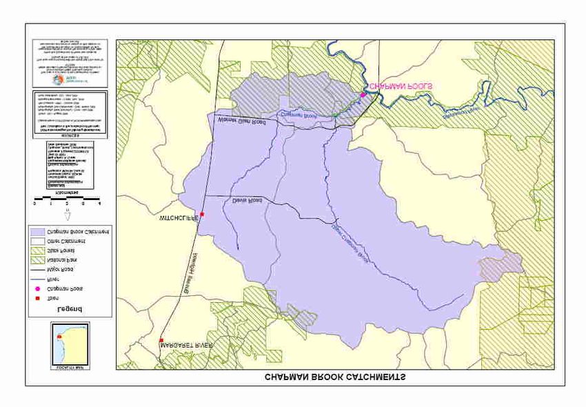
Table of Contents
1      Introduction ...............................................................................................................1
    1.1     Background........................................................................................................... 1
    1.2     Issue scoping ........................................................................................................ 1
    1.3     The catchments..................................................................................................... 3

2      The Need for Water Management ...........................................................................9
    2.1    Proclamation and licensing................................................................................... 9
    2.2    Streamflows........................................................................................................ 10
    2.3    Source of conflict ............................................................................................... 11
    2.4    Scientific understanding ..................................................................................... 11
    2.5    Population growth and drinking water ............................................................... 11
    2.6    Water quality ...................................................................................................... 13

3      In-Stream Values .....................................................................................................15
    3.1     Environmental flows .......................................................................................... 15
    3.2     Riparian zone management ................................................................................ 15
    3.3     Native fauna........................................................................................................ 16
    3.4     Social values....................................................................................................... 18

4      Water Allocation......................................................................................................22
    4.1   Existing Conditions ............................................................................................ 22
    4.2   Water allocation and licensing ........................................................................... 23
    4.3   Compliance and enforcement ............................................................................. 27

5      Public Engagement..................................................................................................29
    5.1    Dominant stakeholder messages......................................................................... 29
    5.2    The Whicher Water Resource Management Committee .................................... 29
    5.3    Local community awareness .............................................................................. 31
    5.4    Surface water planning timeline ......................................................................... 32
    5.5    Aboriginal intellectual property and consultation .............................................. 36
    5.6    Types of information .......................................................................................... 38
    5.7    Information mechanisms .................................................................................... 39
    5.8    Plan and monitor................................................................................................. 41

References ........................................................................................................................42
Appendix A – Background Materials ............................................................................44
Appendix B – Stakeholders Interviewed .......................................................................48
Appendix C ─ Public Engagement Techniques ............................................................49

                                                                                                                                   iii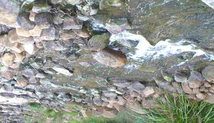
1 Introduction
1.1 Background
The Department of Water (DoW) is the State Government agency responsible for water
resource planning in Western Australia. With funding from the South West Catchments
Council, the Department has commenced development of management plans for selected
surface water resources in the South West. It has identified four catchments in the
Margaret River area as priorities for surface water management. These are the Margaret
River, Wilyabrup Brook, Cowaramup Brook and the Chapman Brook catchments.
Boundaries for the four catchments are shown on Map 1. Similar surface water planning
processes are ongoing for the Capel River, Brunswick River and Lefroy Brook
catchments.
The DoW’s surface water planning process will establish, for each surface water resource,
the sustainable water yield and set limits on abstraction. The planning process includes:
Determining the values associated with water resources including environmental,
social and economic values
Identifying current consumption and predicting future demand for surface water
resources
Gaining an improved understanding of the hydrologic relationships between ground
and surface water resources
Assessing the quantity of water needed to support the natural environment and the
amount that can be diverted to consumptive uses.
The surface water management plans will guide the Department’s approval of future
licences to take and use water for purposes such as irrigation. This will prevent the
resource from over allocation and allow it to continue to meet multiple uses
(environmental, economic and social). It will also protect individual entitlements and the
economic viability of licensed users.
1.2 Issue scoping
Public involvement is an integral component of water resource management. As a first
stage of the surface water planning process, the Department of Water commissioned the
issue scoping exercise documented in this report. The objectives of the scoping exercise
were to:
Gain an understanding of and document stakeholder issues and concerns about
surface water resource management for the Margaret River, Wilyabrup Brook,
Cowaramup Brook and Chapman Brook catchments
Provide advice regarding public involvement activities to complement the
subsequent stages of the surface water planning processes for these water resources.
1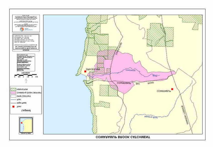
Map 1 Margaret River area catchments in the study

                                                    2
The scoping exercise included individual interviews with representatives of a range of
stakeholders. With the assistance of the Department’s Bunbury Office, stakeholder
representatives from the various catchments were identified for interviews. This included
representatives of local governments, state government agencies, local landholders,
environmental groups, the agriculture sectors and Aboriginal interests.

Prospective interviewees were contacted by telephone and email to request their
participation and arrange a convenient date and location for an interview. A brief
background document was sent to all study participants in advance of the interviews. It
described both the DoW water planning and issue scoping processes (Appendix A).

Individual in-depth face-to-face interviews examined the surface water management issues
of the Margaret River, Wilyabrup Brook, Cowaramup Brook and Chapman Brook. In
total, 31 interviews were conducted between 21 September 2006 and 9 January 2007
(Appendix B). One stakeholder provided comment via email rather than an interview. All
those who participated in the scoping exercise will receive a copy of the scoping report.

The interviews identified a broad range of issues and topics. These are discussed in
subsequent chapters of this report as key themes. The final chapter includes suggestions
and recommendations regarding public involvement in the subsequent stages of the DoW
surface water planning processes for the Margaret River, Wilyabrup Brook, Cowaramup
Brook and Chapman Brook.

Due to the proximity of the four catchments and a significant overlap in stakeholder
interests and issues, all four Margaret River area catchments are described in this report.

1.3     The catchments
Margaret River Catchment

The 470 km2 Margaret River catchment is located in the Shire of Augusta-Margaret River
(Map 2). The River is approximately 60 km in length. The headwaters of the Margaret
River are in State Forest on the Blackwood Plateau. From the State Forest the River flows
westward, passing through agricultural areas (e.g. dairies, vineyards and olive groves), the
Margaret River townsite, lifestyle properties before reaching the Indian Ocean.

The Margaret River was proclaimed in 1947 under the Rights in Water and Irrigation Act
1914 (RIWIA). Water users in the Margaret River catchment require water licenses from
the Department of Water, except when water is used for domestic 1 and stock purposes.

Water supply for the Margaret River Town Water Supply Scheme comes from the Water
Corporation’s Ten Mile Brook Dam. The Scheme provides public water supply to the
townsites of Margaret River, Prevelly, Gnarabup and Cowaramup.

1
  Under the s9 of the Rights in Water and Irrigation Act 1914 Water can be taken for stock or domestic
purposes by landholders with land through which the River passes or by landholders holding land contiguous
to the River.

                                                                                                        3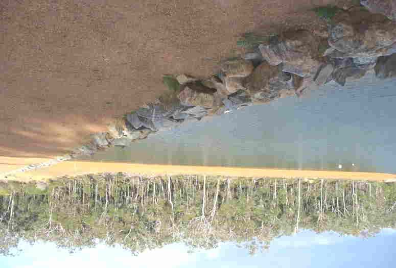
Map 2 Margaret River

                       4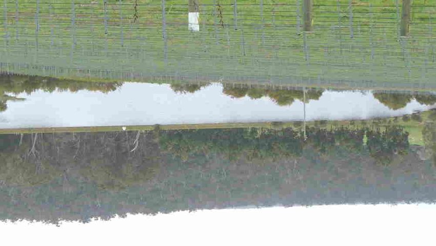
Wilyabrup Brook Catchment

The Wilyabrup Brook, Cowaramup Brook and Chapman Brook catchments are
unproclaimed water catchments and thus private water use is not licensed by the
Department of Water.

The Wilyabrup Brook catchment is 89 km2. The Brook is almost 20 km in length. It runs
through both the Shire of Busselton and the Shire of Augusta-Margaret River (Map 3).
The main branch of the Wilyabrup Brook starts east of the Cowaramup townsite and flows
in a north-westerly direction. The north branch and the main branch meet east of Caves
Road. The Brook then flows westward to the Indian Ocean.

The Brook flows through an area dominated by agriculture (84% of the catchment). This
includes viticulture, olive groves, grazing and pasture, and dairies. There is a small portion
still covered by native remanent vegetation (12%). Only 4% of the land in the catchment is
residential (Cape to Cape Catchments Group 2006).

Water users in both the Wilyabrup and Cowaramup Brook catchments are heavily reliant
on surface water for private supply. West of the Bussell Highway little groundwater is
available for use; east of the highway groundwater is more readily available.

Cowaramup Brook Catchment

The unproclaimed Cowaramup Brook starts south of the Cowaramup townsite and flows
westward. It passes through areas used for agriculture (e.g. dairies and vineyards), lifestyle
blocks, residential development and the Leeuwin Naturaliste National Park. The Brook
meets the Indian Ocean at Cowaramup Bay, near Gracetown (Map 4).

Chapman Brook Catchment

The Chapman Brook is composed of two branches. One branch starts south of the
Witchcliffe townsite and the second starts south east of Rosa Brook. The two branches
flow southward towards the Blackwood River and meet approximately 3 km north of the
River. From this meeting point the branches flow as one system into the Blackwood River
(Map 5).

The 183 km2 catchment is unproclaimed and dominated by agricultural land uses including
dairy, viticulture, olive groves and tree plantations. Other land uses include lifestyle
properties, State forest and National Park. The Chapman Pools located at the Warner Glen
Recreational Site are part of the Blackwood National Park (Map 5).

                                                                                            5
Map 3 Wilyabrup Catchment
6Map 4 Cowaramup Brook Catchment
7Map 5 Chapman Brook Catchment
82 The Need for Water Management
2.1 Proclamation and licensing
Some stakeholder representatives were unfamiliar with the concept of proclamation and
its need before the Department of Water can licence and manage the water resources of
an area. The Margaret River was proclaimed in 1947 under the Rights in Water and
Irrigation Act 1914 (RIWIA). This gave the Department of Water the power to licence
water users, except when water is used for domestic 2 and stock3 purposes.
The Wilyabrup Brook, Cowaramup Brook and Chapman Brook catchments are
unproclaimed catchments and thus surface water use is not currently licensed.
However, in December 2006, the Department advertised its intentions to proclaim these
catchments. The Department expects proclamation to occur within the first half of
2007.
A large majority of stakeholder representatives want the Wilyabrup Brook, Cowaramup
Brook and Chapman Brook catchments ‘actively managed’ by the Department of
Water. Various stakeholders applied the term ‘active management’ when they referred
to the licensing of water users, license enforcement, and other resource management
activities (e.g. riparian zone management).
Interviewees were generally supportive of proclamation as a necessary first step in the
water management process. Several stakeholders expressed concern that proclamation
could stall the management process. They recognise its necessity as an administrative
step, but do not want the Department of Water to ‘get hung up’ on this step.
Many of those interviewed want the Department to commence ‘active management’ in
these catchments as quickly as possible following proclamation. Some commented that
in the absence of active management there had been a proliferation of private on-stream
dams along the Wilyabrup Brook and the Chapman Brook and some environmental
degradation in the Cowaramup Brook catchment.
Several self-suppliers of water in the unproclaimed catchments were a little
apprehensive of the prospect of water licensing, preferring to “go about their business”
without a third party “looking over their shoulder”. However, they did see value in
having an independent party (i.e. DoW) to resolve water resource problems and water
user conflicts within a catchment.
2
Under the s9 of the Rights in Water and Irrigation Act 1914 Water can be taken for stock or domestic
purposes by landholders with land through which the River passes or by landholders holding land
contiguous to the River.
3
This excludes stock being raised under intensive conditions. Under the s21(4) Rights in Water and
Irrigation Act 1914 intensive conditions: “are confined to an area smaller than that required for grazing
under normal conditions and are usually fed by hand or by mechanical means”.
92.2 Streamflows
Most stakeholders believe streamflows have decreased in all four catchments. They
attribute this to a combination of factors: reduced rainfall, climate change and the
number of private on-stream dams. Many were unsure of the extent to which these
factors individually contribute to the reductions. There is concern that further
diminishment of streamflows would result in the water resources not being able to meet
the demand for consumptive use or the needs of the natural environment.
A number of stakeholders identified climate change as a threat to long-term water
availability in all four catchments. They want climate change scenarios taken into
account in water resource decision-making, including water allocation decisions. Most
did not suggest specific ways in which this might be achieved. Some proposed that
resource managers make conservative water allocations as an a pplication of the
precautionary principle. Others suggested periodic reviews of water plans to allow
appropriate management actions as the impacts of climate change become clearer.
Those interviewed identified the growth in the number of private on-stream dams as a
significant concern, particularly in the Wilyabrup Brook and Chapman Brook
catchments. The growth in the number and size of on-stream dams is perceived as
unsustainable. Many commented that some private on-stream dams and reservoirs are
unnecessarily large, capturing more water than needed. One stakeholder commented,
“Some of the dams look more like lakes than dams”.
Those interviewed frequently noted the need for better management of releases from
private on-stream dams (e.g. opening of by-pass valves) to support streamflows.
However, some indicated that additional actions should be taken to alleviate the
streamflow problems attributed to private on-stream dams. Some indicated that the
owners of unnecessarily large dams and reservoirs should be required by the
Department of Water to scale back their use. However, due the complexities involved
10and political factors, they were sceptical that this would happen when licensing is
introduced in the unproclaimed catchments. Others argued that existing levels of water
use (historic use) via in-stream dams should be guaranteed when licenses are
introduced.
Some stakeholders recommended a moratorium on new on-stream dams in the
unproclaimed catchments. If conditions warranted, the moratorium could be lifted once
the water resource is being managed (e.g. proclaimed, licensed, scientific studies
completed) by the Department of Water.
2.3 Source of conflict
Several local landowners noted that reduced streamflow has been the source of conflict
between some neighbours, particularly along the unproclaimed Wilyabrup Brook and
Chapman Brook. The disputes typically stem from a downstream water user believing
their upstream neighbour is taking more water than usual or failing to open the by-pass
valve on their dam and thereby reducing the streamflow for downstream water users.
If the water users involved in the conflict cannot come to a mutually agreeable solution
on their own, there is little recourse in unproclaimed catchments to resolve such
disputes. One individual commented that when he/she had a dispute with their upstream
neighbour over streamflow, the Department of Water indicated it could not take action
because the catchment is unproclaimed. At that point, the individual did not know
where to turn for assistance. The individual hoped the Department of Water would be
able to assist in resolving such conflicts once the catchment is proclaimed.
Until proclamation occurs, self-supply water users would like more information about
their rights as water users and in particular where to seek assistance when problems
arise over streamflow.
2.4 Scientific understanding
Many stakeholders indicated that there is not a strong scientific understanding of the
surface water resources, especially those in the three unproclaimed catchments.
Groundwater and surface water interactions and ecological water requirements were
identified as key areas for investigation. A strong scientific understanding of the water
resources is viewed as a keystone to an effective water resource management program.
Interviewees also wanted to see monitoring of surface water quality and flows and
asked the extent to which this was already occurring. Measurement of actual
consumptive use was also identified as important information to support resource
management decisions. Some of those interviewed suspect that licensed water users
may be taking more water than their allocation.
2.5 Population growth and drinking water
Surface water stored at the Water Corporation’s Ten Mile Brook Dam supplies public
drinking water to the townsites of Margaret River, Prevelly, Gnarabup and Cowaramup
through the Margaret River Town Water Supply Scheme. When the reservoir does not
11have enough water to meet demand, water levels are augmented by a pumpback on the
Margaret River (Map 1). Residents located outside the townsites rely primarily on
rainwater tanks for their domestic supply. A few stakeholders noted that when their
rainwater tanks run low they top up their tanks with water from the Margaret River.
A number of stakeholders expressed concern that the area’s surface water resources
may not be able to support the expected population growth in the area. Of particular
concern is public water supply in the longer term for the town sites served by the
Margaret River Town Water Supply Scheme.
Significant population growth is predicted for the Shire of Augusta-Margaret River.
Growth projections by the Western Australian Planning Commission (WAPC, 2005)
indicate the population will increase by 39.5% between in the period 2006-2021 (Table
1). On average, this would be an increase of 2.6% per year. Some of those interviewed
believe the WAPC’s projections are too conservative and greater population growth
will occur.
Table 1. Augusta-Margaret River population projections
Year Population
2006 11,900
2011 13,400
2016 15,000
2021 16,600
Source: WAPC 2006
Some stakeholders questioned whether the existing water supply scheme has the
capacity to accommodate the predicted population growth at the town sites. According
to the Shire of Augusta-Margaret River Town Planning Scheme (Department for
Planning and Infrastructure 2004), most of the predicted population growth is likely to
occur at the Cowaramup town site and on the eastern side of the Margaret River town
site. Both areas are zoned for residential use but have not reached their development
capacity. In the case of the new Margaret River development, the developer and Shire
are examining options to reduce reliance on scheme water including the use of treated
wastewater on green spaces.
The Water Corporation is evaluating the possible use of local groundwater aquifers,
such as the Leederville Aquifer, as supplementary sources of drinking water. If
adequate amounts of local groundwater are found, the Water Corporation would likely
raise the Ten Mile Brook Dam and pump water from the aquifer into the reservoir.
Several other stakeholders believe additional water for public supply would come from
the proposed Water Corporation pipeline to transport water from the Yarragadee
aquifer. An amount of water would be diverted from the pipeline for the Integrated
Water Supply System (IWSS) to the Ten Mile Brook Dam and reservoir.
One stakeholder was concerned about any proposal that would involve raising the
height of the existing Ten Mile Brook Dam to increase the reservoir’s storage capacity.
They feared the inundation of riparian vegetation would diminish ecological values.
12Another stakeholder sought assurance that local surface water resources, such as
Cowaramup Brook, would not be used to supplement water levels in the Water
Corporation’s Ten Mile Brook reservoir.
Groundwater Investigations
The Department of Water is currently investigating groundwater resources across Western
Australia. The program aims to improve the scientific understanding of the State’s
groundwater resources, including distribution and quality of water, to improve planning and
management. For the first three years of this program, starting in 2005, the focus is on
metropolitan areas and horticultural districts, including Cowaramup. During 2006, 14 new
monitoring bores were installed in the Cowaramup area. Initial assessments indicate there
may be potential new groundwater resources in the Cowaramup area (Department of Water
2006). Further assessment is required.
2.6 Water quality
Nutrients, toxins and bacteria
A number of stakeholders expressed concerns about the potential impact of rural land
uses on catchment water quality and public health. Most of these were associated with
agricultural activities.
Fertiliser and pesticide run-off from agricultural activities were identified as threats to
waterway health. Several stakeholders called for greater effort by State Government
departments to help farmers reduce their reliance on fertilisers as well as pesticides.
Others indicated information on best management practices for fertilisers are available
to those willing to seek out the information.
Dairy waste runoff was also a frequently mentioned source of potential contaminants.
Rich in nutrients, bacteria and microbes, it can be a significant source of contamination
of watercourses. It increases the risk of Cryptosporidium and Giardia entering water
supplies (DoE 2005). Several stakeholders recommended that State Government offer
subsidies to dairy operations to encourage the implementation of new effluent reducing
technologies by helping reduce the high costs to farmers. There was some recognition
of efforts to promote information about best management practices in the dairy sector 4.
Better fencing was also encouraged to limit stock access to waterways and prevent
erosion of streambanks.
Several stakeholders identified the wine industry as a source of nutrients requiring
further study to determine its impacts on water quality. The new WineWatch
wastewater project was identified as a step in the right direction. The collaborative
project will examine the constituents found in wine industry waste and determine better
ways to manage the waste. Participants in the WineWatch wastewater project include
Curtin University, the Cape to Cape Catchments Group, and members of the wine
industry.
4
The Department of Agriculture in conjunction with the Department of Environment and the Dairy
Industry of WA produced the Environmental Management Guidelines for Animal-based Industries –
Dairy Farm Effluent (1988).
13Concern was expressed about bacterial levels in swimming areas along the Margaret
River including the weirs and the River mouth. The primary season of concern is the
summer, when the flow is low and slow moving. The Shire has initiated a project to
determine if there is a bacterial contamination problem in the River. Water samples will
be collected from early spring until the end of summer to monitor the River’s bacterial
levels.
Drinking Water Source Protection Plan
Catchment protection of water sources is considered a fundamental part of ensuring the
provision of a safe drinking water supply. The Margaret River Town Water Supply
Scheme catchment was proclaimed under the Country Areas Water Supply Act 1947.
The Margaret River Catchment Area (including Ten Mile Brook Catchment) Drinking
Water Source Protection Plan seeks to ensure water from the catchment meets the
national drinking water quality standards by appropriately managing the catchment area
(Map 6) (DoE 2005).
Generally, recreation activities in Ten
Mile Brook Catchment are restricted to an
area downstream of the dam wall with
only bushwalking permitted in the
catchment. All water based activities are
prohibited in the Ten Mile Brook and the
intake pool (pumpback) on the Margaret
River. Swimming in the State forest area
is allowed at existing designated sites
such as Canebreak Pool.
Many stakeholders are aware that
management measures are in place to
reduce the risk to the area’s primary
drinking water source, the Ten Mile
Brook reservoir. Several interviewees
identified agricultural operations
(dairying) upstream of Ten Mile Brook as
a possible threat to water quality. The
Water Corporation has been working with
interested dairy farmers to adopt industry best management practices and systems.
Stormwater
Several stakeholders expressed concern about urban stormwater run-off to the Margaret
River and its impact on water quality. Stormwater can pick up contaminants (e.g. oil)
from roads, petrol stations and urban land uses and transport them to waterways such as
the Margaret River. The Cape to Cape Catchments Group has partnered with the Shire
of Augusta-Margaret river and the South West Catchments Council on a project to
reduce the impact of urban stormwater. This will include mechanisms such as
retrofitting drains and bio-filtration mechanisms such as reed beds.
143 In-Stream Values
3.1 Environmental flows
There was general support for the concept of ensuring that ecological water needs are
met as part of the water allocation process. However, overall, stakeholders commented
to a lesser extent on maintenance of dependent ecological values than they did on
meeting the demand for consumptive uses of surface water.
During interviews, stakeholders indicated the importance of ecological values or their
level of concern in a variety of ways. There were comments about the relationship
between streamflow and ecological values. Reduced streamflow was interpreted as a
sign of an unhealthy ecosystem. There were observations regarding the value of healthy
riparian vegetation as habitat and/or its role in water quality management. In several
interviews, the high biodiversity rating of the region (e.g. a ‘hotspot’) was highlighted
as an indication of the value of the natural environment. An interviewee noted that the
Cowaramup Brook area has high ecological value as it lies between two distinct
vegetation areas. The value of river pools in summer as a drought refuge for animals,
such as turtles and waterbirds, was also highlighted.
Some stakeholders suggested ways in which streamflow could be increased and thereby
sustain dependent ecological values. This included adoption of best management
practices in the operation of in-stream dams and reducing the amount of water currently
captured for consumptive uses.
It was noted by some that, even if there is no reduction due to consumptive use,
streamflows may diminish further as a result of climate change. It was recommended
that the Department of Water err on the side of caution when determining
environmental flow regimes.
Self-suppliers of water were particularly sensitive of the tension between meeting the
water requirements of ecosystems and those of consumptive users (e.g. irrigators).
Although they want to see the natural environment protected, they expressed concern
that maintaining ecological flows would come at the cost of less water for consumptive
users and in turn negative economic impacts for landowners. Wilyabrup Brook and
Chapman Brook were identified as the resources where this tension is greatest.
A number of stakeholders wanted additional information regarding how environmental
flows will be determined and managed. Few stakeholders offered advice on how
environmental flow regimes should be determined. In identifying areas of ecological
value requiring flows, several stakeholders referenced the work done by local
catchment groups in developing the River Action Plans.
3.2 Riparian zone management
Riparian zone: The zone along or surrounding a water body where the
vegetation and natural ecosystems benefit from and are influenced by the
passage and storage of water (Water and Rivers Commission 2000).
15Some stakeholders identified areas along the Margaret River, Cowaramup Brook and
Chapman Brook where riparian vegetation has suffered. This was attributed to either
reduced streamflows, trampling by stock or agricultural land clearing.
Efforts to rehabilitate and protect riparian areas along the Margaret River, Chapman
Brook and Cowaramup Brook were acknowledged. Catchment groups have prepared
River Action Plans for both the Margaret River and the Chapman Brook. These plans
focus on the health and maintenance of riparian vegetation. The Cape to Cape
Catchments Group is currently preparing river action plans for the Wilyabrup Brook
and Cowaramup Brook.
Fencing of streamlines was identified as a primary tool for management of riparian
zones. Stakeholders noted that increased fencing could prevent uncontrolled access of
stock to waterways. Benefits of fencing identified by stakeholders included: reduced
trampling of riparian vegetation, less erosion of stream banks and reduced nutrient and
bacteria levels (e.g. animal waste).
Some stakeholders pointed to specific examples of fencing projects. The Lower
Blackwood Landcare Conservation District Committee has worked with landholders in
the Chapman Brook area to increase the amount of fencing along the waterway. This
has included offering fencing subsidies as an incentive. As a result, a number of
landholders have fenced their streamlines and constructed watering troughs as an
alternative water source for their stock. The project has also been successful in raising
community awareness of the need for fencing.
Fencing projects have occurred on the Margaret River with the help of the Cape to
Cape Catchments Group and the Water Corporation. The Margaret River Action Plan
reported that 20% of the length of the river had been fenced and an additional 25.5%
required fencing (Cape to Cape Catchments Group 2003).
Stakeholders involved with the fencing projects believe more landholders would fence
riparian areas if the subsidies were “more realistic”. The current subsidies are
considered too small in relation to the cost of fencing. The cost of fencing should
include the expense of replacing river access with an alternative water source for stock
such as troughs.
Little comment was made about the riparian zones of the Wilyabrup Brook. This does
not mean there are not issues but in the absence of public access to these areas most
stakeholders were unaware of the condition of these riparian areas and thus not in a
position to comment.
3.3 Native fauna
A number of stakeholders commented on the dependency of some native fauna on
surface water resources. One species commonly mentioned was the white bellied frog
(Geocrinia alba) found in the Chapman Brook catchment. The frog is listed under the
Environment Protection and Biodiversity Conservation Act 1999 as an endangered
16species5 (Department of Environment and Heritage 2006). Decreasing water quality
and habitat destruction are threats to the survival of the white-bellied frog in the
Chapman Brook catchment. This includes fertilizer contamination from adjoining
agricultural land, increased salinity levels and siltation resulting from soil disturbance.
It also includes changes in surface and sub-surface streamflow which can damage or
flood their habitat (CALM 1995).
Infrastructure to impound water such as dams and weirs can be a major impediment to
the movement upstream of some aquatic species. Several stakeholders applauded the
construction of fish ladders at the weirs on the Margaret River. These facilitate the
movement of native fish and lamprey past these structures. This is particularly
important for the pouched lamprey (Geotria australis). The lamprey is born in a river
but spends most of its adult life in the ocean. When the lamprey is ready to breed it
must make its way back upstream.
A number of stakeholders discussed efforts to protect the hairy marron (Cherax
tenuimanus) in the Margaret River. There are two marron species found in WA.
Smooth marron (Cherax cainii) are widespread, found in most rivers and dams of the
South West, and are the farmed aquaculture species. Hairy marron are found almost
exclusively in the upper reaches of the Margaret River.
Both the smooth marron and the hairy marron have been found in the Margaret River.
The hairy marron appear to be out-competed by the smooth marron, which grow faster
and produce more young. The number of hairy marron dropped dramatically after the
introduction of smooth marron in the early 1980s. The Department of Fisheries is
undertaking work to assist the recovery of the hairy marron. The upper reaches of the
Margaret River are now closed to recreational fishing of marron.
5
Endangered species is defined in Section 178 of the Environment Protection and Biodiversity
Conservation Act 1999 as a species with “a very high risk of extinction in the wild in the near future”.
17Table 2 Native fauna observed along the Margaret River
Common name Scientific Name
Water rat Hydromys chrysogaster
Brushtail possum Trichosurus vulpecular
Western grey kangaroo Macropus fuliginosus
Southern brown bandicoot or quenda Isoodon obesulus
Lock-necked or oblong turtle Chelodina oblonga
Marron Cherax teniumanus
Dusky morrhen Gallinula tenebrosa
Grey teal duck Anas gracilis
Pacific black duck Anas superciliosa
White-faced heron Egretta novaehollandiae
Cormorant Phalacrocorax spp.
Source: Cape to Cape Catchments Group 2003
3.4 Social values
In-stream social values include recreation, Aboriginal cultural values and aesthetic
values.
Recreation
The highest proportion of water-related recreational activities occurs on or near the
Margaret River. On the Chapman Brook, recreation is limited to the Chapman Pools.
There are no known recreational activities along the Wilyabrup Brook.
The Margaret River is popular for canoeing. There are two commercial canoe
operations located on the River. One operator takes tourists along the River via canoe
and incorporates environmental education in the tour. The second operator rents out
canoes to individuals or small groups. The canoeing businesses are reliant on the
Margaret River having sufficient flows year round.
There are several popular
swimming spots along the river,
including the Wilmot Farm Weir
and the Margaret River town weir
(Map 2). Prior to the development
of the Ten Mile Brook Dam in the
mid-1990s, public supply for the
Margaret River townsite was
sourced from the Margaret River
town weir. However, the weirs are
popular spots for swimming. The
weirs also provide river crossing
points for walkers and cyclists.
The camping site at Canebreak
Pool offers river access and water
based activities such as swimming and canoeing. Land based recreation such as
bushwalking and four wheel driving occurs throughout the forested areas of the
18catchment. There is an extensive network of walking and biking trails that stretches
along the lower Margaret River and east of Ten Mile Brook Dam.
The Margaret River provides opportunities for recreational fishing pursuits, primarily
marroning. Marroning is permitted east of the Ten Mile Brook Source Protection Zone.
There are signs along the Margaret River to assist anglers in identifying the marroning
zones. The season typically runs for several weeks in January/February each year. The
2007 season will last for 23 days – noon, 12 January to noon 4 February 2007. A
licence from the Department of Fisheries is required to catch marron.
The Margaret River is not one of the primary rivers for recreational fishing in the South
West. This is because it is not stocked with trout and the native fish species are too
small to attract the attention of many anglers.
One stakeholder indicated that bodyboarders dig out the mouth of the Margaret River
so they can ride the backwash into the ocean. This has raised concerns about the
potential detrimental effect of this practice on water quality and riparian vegetation near
the mouth of the River. The Department of Water is undertaking a 12-month study of
the Margaret River mouth (Augusta-Margaret River Mail 2006). The study includes
fortnightly water quality monitoring and phytoplankton sampling. The results will help
determine what impact the digging practice is having on the River.
The Chapman Pools is a popular recreation area at the confluence of the Chapman
Brook and the Blackwood River (Map 5). Water based activities include canoeing and
swimming. The confluence is adjacent to the Warner Glen Recreation Site, which is
managed by the Department of Environment and Conservation (DEC).
Due to erosion on the riverbanks, cultural sensitivities and the safety risk to swimmers
and canoeists, the DEC is seeking to make the Warner Glen Recreation boat ramp
accessible only to non-powered boats. The DEC has already moved four campsites away
from the riverbank to reduce erosion. Recreation failcities in the area have been
19upgraded including hardening of camping, picnicking and river viewing facilities. The
DEC's actions had the support of the local Noongar community.
The primary water related recreational
activities near the Cowaramup Brook
are walk trails along the waterway.
The Gracetown Progress Association
is working with the Shire of Augusta-
Margaret River to protect additional
land along the Cowaramup Brook.
They are seeking to include the small
portion of land that lies between the
national park and Ocean along the
Brook (Map 4), in the ‘land for
wildlife’ programme6. This will
further extend walking opportunities
along the Brook and help protect flora and fauna.
Aboriginal cultural values
The Aboriginal Heritage Information System 7 of the Department of Indigenous Affairs
(DIA) is the repository of information on Aboriginal sites in Western Australia. The
Margaret River is identified on the register as a mythological site (Site ID 4495). This
site includes the entire length of the Margaret River. As part of its surface water
planning, the DoW is currently evaluating Aboriginal cultural values of the Margaret
River, Wilyabrup Brook and Cowaramup Brook and the water requirements to sustain
those values.
Aesthetic values
The river and pools provide an aesthetically pleasing backdrop to a number of
bushwalking and biking trails and a setting for community facilities (e.g. Rotary Park).
The Margaret River is the focal point of Rotary Park at the northern entrance to the
townsite. It features a steam engine and other historic memorabilia and is a memorial to
the pioneers of the timber industry in the district. Rotary Park includes picnic and
barbecue facilities, shaded areas, playground equipment, toilet facilities and
information boards.
There is a bridge over the Margaret River which takes visitors from Rotary Park to the
Old Settlement Historical Museum. Privately owned, it is a monument to the Group
Settlement farms of the area.
Rotary Park is the start point for three heritage trails along the river. The Margaret
River Heritage Trail is part of a state-wide network of heritage trails that were a
6
The program is administered by the Department of Environment and Conservation. It is a voluntary
scheme which seeks to assist landholders in providing habitat for wildlife
7
Not all Aboriginal sites may have been identified by previous heritage surveys but they remain
protected under the Aboriginal Heritage Act 1972. The DIA recommends consultation with relevant
Aboriginal communities and native title claimants to identify any additional Aboriginal Sites.
20Bicentennial Project in 1988 of the Heritage Council. The River Walk heads south from
the bridge at the Settlement Group and does a 2 km circuit. The Karri Walk is a 1.5 km
walk through bushland. The 3 km Bridge Walk passes by the old town swimming hole
used by early settlers.
Many of the farms and vineyards in each of the catchments use their irrigation
reservoirs as water features on their properties (see Section 4.2).
214 Water Allocation
4.1 Existing Conditions
The Margaret River catchment is the only one of the four study catchments in which
water users are currently required to have a water licence. There are 49 licensed surface
water users in the catchment, including the Water Corporation. Collectively, they can
take just over 3.0 GL a year of surface water from the Margaret River and its
tributaries.
The Water Corporation is licensed to take 1.0 GL per year to provide drinking water
quality supply to the Margaret River Town Water Supply Scheme. This water is
sourced from the Ten Mile Brook Dam (photo).
Twenty private water users
pump directly from the
Margaret River and are
licensed to take 0.5 GL8
per year. The other 28
licence holders are located
on tributaries within the
catchment. They include
both direct pumpers and
on-stream farm dam
owners. Licensed to take
1.5 GL9 per year, many use
the water for agricultural
purposes.
A number of incidences of illegal river pumping have been identified near the townsite.
A few residents who live close to but not on properties adjacent to the River’s riparian
zone are pumping from the river. The issue has been whether or not these users fall
within the definition of riparian rights. Under s9 of the Rights in Water and Irrigation
Act 1914 water can be taken for stock 10 or domestic purposes by landholders with land
through which the river passes or landholders holding land contiguous to the river. The
Department of Water and the Shire of Augusta-Margaret River are currently
investigating these cases.
During summer, parts of the upper Margaret River dry out leaving only river pools.
These pools are used by some direct river pumpers to meet their water needs. Several
stakeholders expressed concern that this practice may be damaging ecological values.
They noted that these pools provide an important environmental service in providing
drought refuge for animals, such as turtles and waterbirds. The Department of Water
8
A total of 556,075kL
9
A total of 1,543,725kL
10
This excludes stock being raised under intensive conditions. Under the s21(4) Rights in Water and
Irrigation Act 1914 intensive conditions: “are confined to an area smaller than that required for grazing
under normal conditions and are usually fed by hand or by mechanical means”.
22has discouraged new water users from pumping from the river pools in the summer.
Historical11 users continue to pump from the pools under their water licences.
4.2 Water allocation and licensing
Stakeholders are very aware that the demand for consumptive use is growing in each of
the catchments. In the case of Wilyabrup Brook, many believe consumptive use is
nearing or already at the sustainable yield of the resource. Stakeholders located in the
three unproclaimed catchments are anxious to know how the Department of Water will
set the limits for individual water licences once the catchments are proclaimed.
Priorities among water uses
Many stakeholders noted that, as the amount of available water decreases, it will
necessitate setting priorities on the uses of the resource.
Some stakeholders expressed the view that meeting the water needs to sustain
ecological values should be given the highest priority. They cited examples of where
they believe reduced streamflows have diminished riparian zone habitat along the
Cowaramup Brook. These stakeholders were particularly concerned that the
environment might lose out in favour of consumptive uses. Interestingly, most of these
stakeholders made a point of mentioning that they did not want to see agriculturalists
hurt in the water allocation process.
Other stakeholders, mostly self-suppliers, are concerned that consumptive uses may
receive smaller than needed allocations in order to meet the needs of the environment.
These stakeholders do not want to see businesses, particularly those with already small
profit margins, fail due to insufficient water. They recognise the environment is an
important user but if not all use can be accommodated by the available water; they do
not want to see economic hardship.
Other stakeholders believe all water uses should be given the same priority if
reductions are needed to ensure the sustainability of a water resource. Each use,
including maintenance of ecological values, would receive a proportionally equivalent
reduction. A critical assumption is that all water users are efficient.
Several stakeholders indicated that higher use priority should be given to recreational
uses and Aboriginal cultural values in favour of using water for aesthetic purposes on
private properties. It was argued that recreation and Aboriginal cultural values provide
more benefit to the wider community.
One stakeholder was particularly concerned about the use of a ‘first come first serve’
philosophy to water licensing when a water resource is nearing its sustainable yield
(e.g. Wilyabrup Brook). He/she noted if the water resource is fully allocated and
licensed, it would be hard for a landowner to change their land use or sell to a new
landowner whose water needs may be higher.
11
Historical refers to the amount of water being pumped at the time of proclamation.
23Dam approvals and water allocation
A landowner wanting to construct a dam on their property is required under the town
planning scheme to seek approval from the local Shire. To help assess dam
applications, the Shire of Busselton and the Shire of Augusta-Margaret River have
prepared dam policies. The policies outline application requirements and assessment
criteria. The Shires consider issues such as the potential impacts of excavation, the
restoration of riparian vegetation and the potential to interrupt landscape values.
In proclaimed catchments (e.g. Margaret River catchment), obtaining approval to
construct an on-stream dam on a private property is a two-step process. First,
landowners need to obtain from the Department of Water a licence to ‘take’ water. The
second step is applying to the local Shire for approval to construct the dam. The dam
policies of both the Shire of Busselton and the Shire of Augusta-Margaret identify the
need for those proposing on-stream dams to obtain a water licence from the Department
of Water.
In unproclaimed catchments, landowners do not need to apply for a water licence as
part of the dam approval process. In the past, through informal arrangements, the Shires
consulted with the Department of Water regarding whether the size (capacity) of a
proposed dam was suitable from a water management perspective. This informal
process no longer occurs. When local governments approve construction of an on-
stream dam they are effectively making de facto water allocation decisions. Local
governments would rather not be in this position, as water resource management is
outside their regulatory responsibilities and is not a criterion they apply when
evaluating applications for new dams.
Several stakeholders would like to see the Department of Water and the Shires working
together when approving dam applications. It was noted that the Whicher Water
Resource Management Committee has been working with the Department of Water and
local governments to work toward a common dam policy (see Section 5.2).
Drought proofing
Some stakeholders contend that the Department of Water should give consideration to
the need for drought proofing when assessing water licence applications. Some farmers
have taken to setting aside an amount of water as a safeguard against a dry year. This
may take the form of constructing a dam slightly larger than necessary or topping off a
reservoir during the shoulder seasons. These water users view this as a prudent business
practice and good risk management.
In the unproclaimed catchments, there is some concern on the part of self-suppliers that
the water they currently set aside for drought proofing will not be included when water
licensing is introduced. This reflects a fear that as water resources come under
increasing demand, the Department, in an effort to accommodate as many water uses
and users as possible, will leave self-suppliers with too little water to survive drought
years.
Recouping of water
The recouping of water involves the Department of Water taking back unused water
from a licensed user. The licence is then adjusted accordingly. Most of those who had
24You can also read