Marine Spatial Planning - October 20, 2009 - Aberdeen, WA Bishop Center for the Performing Arts, Grays Harbor College 9:30 a.m - 4:30 p.m. Co ...
←
→
Page content transcription
If your browser does not render page correctly, please read the page content below
WASHINGTON FORUM ON
Marine Spatial Planning
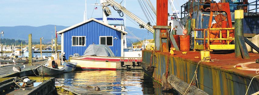
October 20, 2009 – Aberdeen, WA
Bishop Center for the Performing Arts, Grays Harbor College
9:30 a.m. – 4:30 p.m.
Co sponsored by:
Washington Forum on Marine Spatial Planning                                                                                            Washington Forum on Marine Spatial Planning

Acknowledgements:
Washington Forum on Marine Spatial Planning                                                                               Contents
Special thanks to the Forum steering committee members,     Speakers
event co-sponsors, speakers, and others who made this       Please see Appendix B for a Participants List with speakers   Executive Summary . . . . . . . . . . . . . . . . . . . . . . . . . . . . . . . .1
event possible:                                             noted.

Steering Committee                                          Facilitation and Note Taking                                  Background . . . . . . . . . . . . . . . . . . . . . . . . . . . . . . . . . . . . . . .3
                                                            Margen Carlson (facilitator) and Jenna Norman, WA Dept.
Grays Harbor Marine Resources Committee Members
                                                            of Fish and Wildlife
(and interest represented)
                                                            David Fulton, The Nature Conservancy
Bob Burkle (Scientific)                                                                                                   Session 1: Welcome and Introductions . . . . . . . . . . . . . . .4
                                                            Gabriela Goldfarb, Consultant (report author)
Birdie Davenport (State)
Eric Delvin (Conservation & Environmental)
                                                            For information about this event please contact:
Kathy Greer (Recreational)
                                                                                                                          Session 2: What is Marine Spatial Planning? . . . . . . . . .5
Arthur D. "RD" Grunbaum, (Local Citizens)
                                                            Eric Delvin, Community Conservation Coordinator
Don Harders (Aquaculture)
                                                            The Nature Conservancy of Washington
Robin Leraas (Economic)
                                                            120 East Union Ave Suite 214                                  Session 3: MSP Examples and Decision-Support Tools . . .9
Harv Lillegard (Business)
                                                            Olympia, WA 98501
Lorena Marchant (Educational)
                                                            (360) 280-2460
Don Samuelson (Commercial Fishing)
                                                            edelvin@tnc.org
Joe Schumacker (Tribal)                                                                                                   Session 4: Existing MSP Components in WA . . . . . . . . .12
Ray Toste (Commercial Fishing)
                                                            Jena Carter, Regional Marine Director
                                                            The Nature Conservancy – Western Division
Community Volunteers
                                                            821 SE 14th Avenue                                            Session 5: Local Perspectives . . . . . . . . . . . . . . . . . . . . .17
Holly and Mark Plackett, Ocean Shores, WA
                                                            Portland, OR 97214
                                                            (503) 802-8114
Staff
                                                            jcarter@tnc.org                                               Session 6: Participant Input and Perspectives . . . . . . .21
Garrett Dalan, Grays Harbor County
Brie Van Cleve, WA Dept. of Fish and Wildlife
                                                            Funding
Co-Sponsoring Organizations                                 The Nature Conservancy thanks The David and Lucile Packard    Session 7: Summary and Next Steps . . . . . . . . . . . . . . .22
                                                            Foundation for their generous support for this workshop.
Friends of Grays Harbor
Grays Harbor County
Grays Harbor College                                                                                                      Appendix A: Group Discussions . . . . . . . . . . . . . . . . . . . .24
Port of Grays Harbor
Quinault Indian Nation
Surfrider Foundation                                                                                                      Appendix B: Forum Participant List . . . . . . . . . . . . . . . . .28
The Nature Conservancy
WA Dept. of Natural Resources
WA Dept. of Fish and Wildlife
WA Dungeness Crab Fishermen’s Association
Westport Charterboat Association
Washington Forum on Marine Spatial Planning Washington Forum on Marine Spatial Planning
Association is essential to an effective planning process. Participants
Executive Summary • Marco Pinchot, Taylor Shellfish Farms called for ground-truthing existing and new data and maps,
increasing socioeconomic and natural resource information,
• Dick Sheldon, Northern Oyster Company
and ensuring good access to information resources.
• Mark Cedergreen, Westport Charterboat Association
• Improving resource agency coordination and
• LeRoy Tipton, Grays Harbor Chamber of Commerce collaboration. Participants noted the large number of
• Gary Nelson, Port of Grays Harbor agencies, authorities, and programs at all levels of government
that would have to put aside turf issues, pool resources,
• Jody Kennedy, Surfrider Foundation
and develop mechanisms for successful coordination and
• Lorena Marchant, Grays Harbor College collaboration in order to develop and implement an
effective plan.
After these presentations audience members formed three • Building upon existing authorities and programs.
groups for a discussion of the same question. Common Speakers and audience members acknowledged the need to
themes arose both in the leaders’ presentations and the coordinate and integrate a marine spatial planning process
group discussions. These included: with the many existing authorities, programs, and plans
that already address ocean uses.
• Engaging broad participation. All attendees agreed it is
• Questioning the appropriateness of renewable ocean
vitally important to reach beyond those who typically
energy. Many participants expressed unease towards
participate in policy discussions to make sure that all
renewable ocean energy (wind, wave, tidal) as a threat to
interests are represented at the table, including the
traditional uses of the ocean (fishing, shellfish farming,
general public.
recreation) and marine life.
• Ensuring a locally-driven process. Many participants
felt planning initiatives in state and federal waters were
On October 20, 2009 the Grays Harbor Marine Resources organization’s Pacific Northwest Marine Ecoregional Al Carter, Grays Harbor County Commissioner and Jacques
inevitable and that vigorous participation by community
Committee hosted the Washington Forum on Marine Spatial Assessment. Kathy Taylor of the Washington Department White of The Nature Conservancy concluded the Forum
members would be critical to ensuring such processes
Planning. The event was held at Grays Harbor College in of Ecology reviewed the features and uses of the Washington by highlighting many of these points in a final session and
address locally relevant issues and are locally driven.
Aberdeen, Washington and attracted more than 80 attendees Coastal Atlas. Jennifer Hennessey of the Washington thanking the attendees for their time and valuable input.
representing the general public, sport and commercial fishing, Department of Ecology concluded the general presentations • Prioritizing traditional users. Many attendees expressed
shellfish farming, recreation, tourism, higher education, and with an examination of the statutes, frameworks, and concerns that marine spatial planning could be used as a
local, state, tribal and federal governments. regulations already in place in Washington that could mechanism to displace fishermen and shellfish farmers, and
support marine spatial planning. that any process must place a higher priority on protecting
After a welcome from Grays Harbor County Commissioner those uses than accommodating new uses like renewable
Al Carter and Grays Harbor College President Ed Brewster, The remainder of the Forum provided a platform for local ocean energy.
attendees heard a number of presentations about marine perspectives to be expressed and discussed. Attendees first • Using the marine resources committees (MRCs) as a
spatial planning. Joe Schumacher of the Quinault Indian heard short presentations from leaders of different stakeholder principal conduit of information. Most people agreed
Nation and Jena Carter of The Nature Conservancy each groups who were asked to address the question: “What MRCs, especially the Grays Harbor Marine Resources
delivered presentations explaining what marine spatial challenges and opportunities exist from your perspective for Committee, are well positioned to engage, educate, and
planning is and what is driving the marine spatial planning marine spatial planning?” The speakers were: inform the public about marine spatial planning, and to
dialogue at the national, regional, and state levels. represent their perspectives and priorities.
• Terry Willis, Grays Harbor County • Securing financial resources. There was general
Three speakers then described decision-support tools that • Brian Blake, Washington State House of Representatives agreement on the need for adequate funding for data
can contribute information and spatial data to support gathering and decision support tools, outreach, the
• Maurice Hill, Minerals Management Service
marine spatial planning in Washington. Maurice Hill of the planning process, and plan implementation.
federal Minerals Management Service presented information • Brie VanCleve, WA Department of Fish and Wildlife
on the Multipurpose Marine Cadastre now being developed. • Obtaining good quality data and maps. Another point
• Rick Lovely, Grays Harbor Public Utility District
Jo Smith of The Nature Conservancy discussed her of universal agreement was that good quality information
• Ray Toste, Washington Dungeness Crab Fishermen’s
1 2
Washington Forum on Marine Spatial Planning                                                                                                       Washington Forum on Marine Spatial Planning

Background                                                                                                                                                       Session 1: Welcome and Introductions

In March, 2009 Grays Harbor County established the Grays                                   local marine ecosystem.2 The MRCs are charged with                    Al Carter, Grays Harbor County Commissioner opened the               Grays Harbor College President Ed Brewster also welcomed
Harbor Marine Resources Committee (Grays Harbor MRC)1                                      carrying out projects and recommending measures to                    meeting by welcoming participants and explaining that                attendees to the College and acknowledged the elected
with a vision to:                                                                          enhance stewardship, restoration, and protection of marine            the Grays Harbor MRC is the first to be established on               officials in the audience: County Commissioners Al Carter
• Educate and promote citizen involvement in coastal                                       resources. The Washington Department of Fish and Wildlife’s           Washington’s ocean coast, and that it is taking a ground-up          and Terry Willis, and Washington House of Representative
  marine issues;                                                                           Coastal MRC Program coordinates and provides funding to               approach to engaging the community on ocean issues. To               District 19 members Brian Blake and Dean Takko. Mr.
• Close gaps in scientific data about local marine resources;                              support MRCs in coastal counties.3                                    plan for the next 50-100 years requires an organic approach          Brewster described Grays Harbor College as a “commons”
                                                                                                                                                                 that should support locally-driven projects, such as gear            for the community, a place for discourse and disagreements
• Implement practical projects to benefit local marine resources
                                                                                           As one of its first actions, the Grays Harbor MRC voted to            removal, stream restoration, and other restoration efforts.          to be aired, where people should come together for discussion
  and coastal communities;
                                                                                           convene the October 20, 2009 Washington Forum on Marine               There needs to be an evaluation of whether new uses such             and decide how to move forward. The college is deeply involved
• Guide state and federal public policies that affect local marine                         Spatial Planning.4 More than 80 attendees representing the            as wave or tidal energy are desirable, and if so, where is           in coastal, water, and other natural resources management issues
  resources;                                                                               general public, sport and commercial fishing, shellfish farming,      appropriate to site such projects. He observed there are             in its academic programs, including a model watershed, a lake,
• Identify community priorities for marine resources;                                      recreation, tourism, higher education, and local, state, tribal and   many competing interests on the ocean coast, and those               and a fish hatchery all on campus. Key college staff include
                                                                                           federal governments participated in the day-long session. (See        interests need to work together to ensure ocean resources            Lorena Marchant, who will be in involved in any marine
• Ensure public safety for coastal citizens; and
                                                                                           Appendix B for a list of all participants).                           are healthy and available for use. He further noted all of the       spatial planning efforts, Janel Spaulding, who is involved in
• Promote sustainable coastal communities through use of                                                                                                         uses represented in the audience – shellfish farmers, sport          the Chehalis watershed initiative, and art teacher Eric Sandbren
  marine resources.                                                                        This report summarizes the presentations and discussions              and commercial fishermen, gear retailers, the public utility         who is organizing a series of events on the region’s wetlands.
                                                                                           which took place at the Forum. After each set of speakers             district, and many others – are interconnected with the
The Washington State Legislature authorized and provided                                   concluded, they fielded questions from the audience; those            interests of others who are not in attendance at this Forum.         Forum facilitator Margen Carlson of the Washington
funding for the establishment of outer coast marine resources                              exchanges are also included. The PowerPoint slides that               He called upon today’s meeting participants to “bring a              Department of Fish and Wildlife acknowledged the steering
committees (MRCs) in 2008 legislation in order to support                                  accompanied many of the presentations can be accessed via             friend” and persuade nontraditional partners to participant          committee members who helped organize the Forum. (See
counties in using sound science to address the needs of the                                the internet at the Grays Harbor MRC website.5                        in future meetings on marine spatial planning                        list at inside cover of this report.)

1   See http://www.co.grays-harbor.wa.us/info/pub_svcs/MRC/index.html
2   See Revised Code of Washington 36.125.020 at http://apps.leg.wa.gov/rcw/default.aspx?cite=36.125.020.
3   See http://wdfw.wa.gov/about/volunteer/mrc/.
4   The Forum was co-sponsored by The Nature Conservancy with generous financial support from the David and Lucille Packard Foundation.
5   See http://www.co.grays-harbor.wa.us/info/pub_svcs/MRC/index.html and click on “Information Links.”

                                                                                       3                                                                                                                                          4
Washington Forum on Marine Spatial Planning Washington Forum on Marine Spatial Planning
the ocean surface, in the water column, on the sea bed and instead of stopping at the state 3 nautical mile boundary.
Session 2: What is Marine Spatial Planning? over time.
Ms. Carter described and showed slides of some of the
• Analyzing – This entails pulling together existing data
and conducting research to address gaps in knowledge technical aspects of the Ocean SAMP process, including the
about, for example, socio-economic uses and marine creation of gridded maps and overlays that identify exclusion
habitats and species. It is essential to put this information zones (e.g., navigation lanes and precautionary areas, disposal
into a spatial format at the appropriate scale. Often research sites, military areas, marine protected areas, airport buffer
exists in small scales (localized) but for some spatial zones, cable areas, etc.), geological features like terminal
planning there will be a need for data at the statewide or moraines that make construction difficult, wind resources,
even regional scales. shore visual analysis, and more. Out of all these overlays, the
Ocean SAMP identified preliminary options for siting wind
• Objectives – Marine spatial planning is a way to integrate
energy facilities, and set priorities for researching living
ecological, economic, and social objectives. The specific
marine resources (e.g., marine mammals and turtles, avian
objectives are typically determined through a political
and bat species, fish and fish habitat, endangered species),
process.
other resources (e.g., water and air quality, historical and
cultural) and socioeconomic uses (e.g., recreational, fixed
The UNESCO Initiative on gear, and other fishing effort via cooperative interviews with
Marine Spatial Planning definition: fishermen, aquaculture, recreational boating, conservation).
Marine spatial planning is a public process of analyzing After use and resource zone maps are completed, the Ocean
and allocating the spatial and temporal distribution of SAMP will move to develop objectives, boundaries, and
human activities in marine areas to achieve ecological, chapters for each use, then adopt a plan at the state level and
economic and social objectives that have been specified incorporate it into the state’s federally approved coastal
through a political process. management plan.8
Jena Carter, The Nature Conservancy. Ms. Carter opened Ms. Carter stated a principal motivation for marine spatial
by noting her organization’s long history of work in marine planning is to develop a comprehensive vision for future There are a number of other marine spatial planning
waters, including the development of marine ecoregional marine uses. Humans depend on coasts and oceans for food, Ms. Carter made the point that marine spatial planning is not initiatives around the country that are of interest. The State
assessments. She said this Forum is the fourth workshop recreation, transport, and a variety of ecosystem services. necessarily analogous to ocean zoning. Marine space has long of Oregon is also developing a policy and plan for siting
on marine spatial planning The Nature Conservancy has Renewable energy, offshore oil and gas exploitation, been zoned for individual human uses (e.g. geographically- ocean renewable energy in response to wave energy proposals
sponsored or co-sponsored in the last 12 weeks; the others aquaculture, commercial fishing, recreational use, and based fishery closures, shipping lanes, oil and gas leases, etc.). off its coastline. The State of Massachusetts chose to do
were held on the East Coast, California, Oregon, and shipping all need ocean spaces. These activities occur While zoning can be a tool to implement spatial planning, comprehensive mapping for multiple uses. The West Coast
another Washington event in Seattle. This summer, alongside whales, sea turtles, sea birds, fish, and the habitats other tools and solutions can be employed. Oregon, for Governors’ Agreement (a joint initiative of the Governors of
The Nature Conservancy also published a paper on best they too need for survival. example, expressed in its Territorial Sea Plan a priority on Washington, Oregon, and California) is also contemplating
practices for marine spatial planning.6 Ms. Carter expressed living renewable ocean resources and vets all ocean proposals marine spatial planning; a workshop held two weeks ago in
her appreciation for the strong interest in the topic as She examined a few of the components of the UNESCO against that priority. Seattle launched a process to identify priority sites for renewable
shown by the many people in attendance at this Forum. definition of marine spatial planning as follows: ocean energy all along the West Coast. At the national level,
She then highlighted several aspects of the State of Rhode National Oceanic and Atmospheric Administration head
Ms. Carter highlighted the UNESCO Initiative on Marine • Planning – Planning is focused on the future. It is Island’s evolving Ocean Special Area Management Plan Jane Lubchenco said marine spatial planning is one of
Spatial Planning as a significant source of information about visionary in that it identifies where or how existing and (Ocean SAMP) process. With offshore wind energy her top priorities. On June 12th President Obama issued a
marine spatial planning. On its website, the Initiative offers future marine uses should occur. It is a process that involves proposals as a major driver, in August 2008, Rhode Island memorandum to federal agencies to develop recommendations
descriptions of marine spatial planning efforts around the robust citizen participation and helps a community prepare launched a two-year planning process to site offshore for a national ocean policy and a framework for carrying
world, a paper on what constitutes “good” practices, a step- for change, rather than react to it. renewable energy development. The effort is being out coastal and marine spatial planning; the latter set of
by-step handbook explaining ten steps of marine spatial underwritten by the wind energy company selected by the recommendations will be issued
• Spatial and temporal distribution of human activities –
planning, and a definition of marine spatial planning.7 state as the project developer. A particularly innovative in mid-December, 2009.
This means looking at ocean uses in four dimensions - on
feature of the Ocean SAMP is that the state entered into a
memorandum of understanding with the federal government Ms. Carter closed by noting that each state will have to
to allow the state plan to apply 40 nautical miles offshore decide what marine spatial planning means in its state
6 Available at http://www.nature.org/initiatives/marine/files/msp_best_practices.pdf
7 See http://www.unesco-ioc-marinesp.be/. 8 Information is available at http://seagrant.gso.uri.edu/oceansamp/.
5 6
Washington Forum on Marine Spatial Planning                                                                                          Washington Forum on Marine Spatial Planning

waters. The federal government will decide in federal waters,               by the slides, is the California Ocean Uses Atlas, which is         better defined with clear paths specified to achieve it. Mr.
but there is an opportunity to partner and carry out integrated             collecting geospatial information on nearly 30 different            Schumacker encouraged workshop attendees to demand
planning that transcends state, federal, and even local                     human uses of the ocean off the state of California. Part of        transparency and to actively participate in any marine spatial
jurisdictional boundaries. How that might happen is still an                the information was gathered in a series of four workshops          planning process that emerges.
emerging story.                                                             conducted throughout the state. The atlas data provide
                                                                            baseline information regarding the location and extent to           Questions and Answers. Mr. Schumacker was asked: If a
Joe Schumacker, Quinault Indian Nation. Mr. Schumacker,                     which the ocean environment is used for non-consumptive,            nongovernmental organization is doing mapping, what do
the Quinault Nation’s marine resources scientist, gave a                    industrial, military, and fishing uses.9                            you do about actual or perceived bias? He responded that
presentation titled “Marine Spatial Planning and You.” He                                                                                       the key is participation. Once maps are made, they can take
noted Grays Harbor County’s significant connections to                      After mapping comes planning - the “real meat” of the               on life of their own. All interested parties need to be at
ocean resources. He identified the main impetus for today’s                 process. The planning effort will result in recommendations         table. The extensive list of participants in Rhode Island is a
Forum as the Presidential proclamation and the anticipated                  for the purposes noted above (e.g., siting offshore energy          good example. Ms. Carter responded that nongovernmental
guidance on marine spatial planning that will be issued in                  developments, informing ecosystem based management,                 organizations may not be the source of information, just the
mid-December by the President’s ocean policy task force.                    establishing conservation set-asides, and planning for future       integrator. That is the case with respect to The Nature
Mr. Schumacker reported he will be speaking about marine                    marine uses). Planning sets the stage for potential regulatory      Conservancy’s ecoregional assessments that stitch together
spatial planning later in the week with the White House                     action by appropriate agencies to enact those                       data from many different sources. Ms. Carter was asked:
Council on Environmental Quality, which oversees the                        recommendations.                                                    How long did the Rhode Island process take? She replied
ocean policy task force and that he testified about ocean                                                                                       that it is still underway, with only Phase I completed. The
policy generally before the task force the previous month in                Mr. Schumacker identified the Pacific Northwest Marine              second phase is scheduled to conclude in August 2010.
San Francisco.                                                              Ecoregional Assessment prepared by The Nature Conservancy
                                                                            as another example of marine spatial planning-related activities.
Mr. Schumacker described marine spatial planning as a                       This work illustrates that some nongovernmental organizations
process for:                                                                are better equipped than government to undertake mapping,
                                                                            and these organizations are key players as marine spatial
• Siting offshore energy developments,                                      planning progresses. Mr. Schumacker noted it is important
• Informing ecosystem based management,                                     for NGOs and communities to work collaboratively to vet
                                                                            data and maps.
• Establishing conservation set-asides, and
• Planning for future marine uses.                                          Mr. Schumacker offered as a cautionary tale the effort by the
                                                                            Olympic Coast National Marine Sanctuary to map and zone
He focused on the initial steps needed to launch marine                     intertidal marine areas. The tribes participated in all steps
spatial planning initiatives, starting with forums like today’s             until a final technical panel meeting; the tribes were not
that gather the people of the coast and get the word out that               invited to that meeting, and the Sanctuary produced a map
this type of initiative is coming and that it will potentially              that proposed no-take areas on tribal lands, leading to a deep
affect how the ocean is governed. Early funding is essential                rift between tribes and the Sanctuary that took many years
to compile existing data and support public participation                   to heal. The mistake set that particular process back but
and input; in Grays Harbor, just about everybody should be                  ultimately led to the creation of the Intergovernmental
interested.                                                                 Policy Council (IPC) that now advises the Sanctuary. The
                                                                            IPC works hard to prevent similar situations from
As the Rhode Island example showed, mapping is an                           reoccurring in the future.
important initial exercise. Geographic information system
(GIS) technology allows the layering of key information                     He noted that a 2008 Tribal/State Ocean Ecosystem
including uses, species, habitats, and seasonality. Some maps               Initiative Briefing document is currently being updated to
will be created with existing data, and later modified with                 reflect high resolution mapping, habitat characterization,
new input and data. An example of mapping, as illustrated                   and identification of species distribution as high priorities.
                                                                            Tribes support ecosystem based management so long as it is

9 See http://mpa.gov/science_analysis/atlas.html

                                                                        7                                                                                                                                        8
Washington Forum on Marine Spatial Planning Washington Forum on Marine Spatial Planning
number of themes including geology and seafloor, marine collected by different parties is in different formats, and asked
Session 3: MSP Examples and Decision-Support Tools habitat and biodiversity, and human uses (fishing, military, etc.). how the data is being integrated. Mr. Hill acknowledged it is
a major challenge to incorporate data from varying sources,
At present, the NOAA Coastal Services Center regularly and MMS is starting to fund studies to address that issue.
harvests data from agencies – the authoritative sources –
and provides access to the data and map-making capabilities Jo Smith, The Nature Conservancy. Ms. Smith discussed
via the Marine Boundary Working Group’s portal, which is The Nature Conservancy’s Pacific Northwest Marine
accessible at http://www.csc.noaa.gov/mmc. The “case Ecoregional Assessment: what it is, how it can be used, and
studies” currently being developed include: examples of its use. The Assessments identify ecologically
• Mapping applications to support MMS’ energy planning, significant areas that, if protected, represent regional
regulations, and permit review; biodiversity and frame a regional-scale context for
• Mapping hydrokinetic projects and critical habitat data for conservation efforts. Those efforts can encompass a wide
NOAA Fisheries Habitat Conservation Division; and range of strategies such as incentives for private landowners,
promoting the adoption of best management practices,
• Working with the State of California to provide web map
ecosystem restoration projects, and conservation easements.
services for state ocean planning and wave energy studies.
TNC’s Ecoregional Assessments are not regulatory,
prescriptive, or perfect.
Federal initiatives on the West Coast that are focal points
for the Cadastre include geospatial tools and services provided The Assessment’s strongest attributes are that they result
by the West Coast Regional Office of the NOAA Coastal from rigorous quantitative analysis and offer a way to present
Services Center, the NOAA Marine Protected Area Center’s physical and biological features and other information in a
work to develop a framework for a national system of marine spatially explicit way; they also provide consistency across a
protected areas, the California Ocean Uses Atlas Project, the region, build credibility among partners, and illuminate future
In this session speakers highlighted tools that can contribute Continental Shelf and state waters. The vision for the activities of the National Marine Sanctuaries, and NOAA data needs. Assessments incorporate extensive expert review,
information and spatial data to support marine spatial Cadastre is a tool that provides authoritative data needed Fisheries’ Essential Fish Habitat Mapper, Fisheries GIS and are the most comprehensive and current efforts to set
planning in Washington. Maurice Hill of the federal to support ocean planning and management in an easily Portal, and Hydrokinetic Mapping Project. conservation priorities at a regional scale.
Minerals Management Service presented information about accessible format so that end users can visualize and access
the Multipurpose Marine Cadastre. Jo Smith of The Nature data for their specific needs. Mr. Hill summarized by saying the Cadastre is issue driven, These assessments also have weaknesses. The scale is often
Conservancy described her organization’s Ecoregional gaining momentum through case studies and partnerships, coarse and local sites of importance may be difficult to
Assessments. Kathy Taylor of the Washington Department Development of the Multipurpose Marine Cadastre was and scalable and transferrable. The Cadastre’s products and identify. Assessments depend on available data that suffer
of Ecology discussed the Washington Coastal Atlas. propelled by the need to site renewable ocean energy projects. support include: from significant gaps, verification methods are inadequate,
However, it will be relevant to all ocean planning issues and and assumptions regarding goals may be somewhat arbitrary.
Maurice Hill, Minerals Management Service. Mr. Hill an important tool for achieving coordinated data and • Authoritative marine boundary and supporting data Integration between freshwater, terrestrial, and marine areas
explained that he was making the presentation about the decision making, updating boundaries, incorporating new • Stand-alone and customizable data viewers is imperfect. However, no one has ever tried to create this
Multipurpose Marine Cadastre on behalf of MMS’ Christine data, and reducing costs to states and other organizations. As kind of tool before, and Assessments are expected to be
• Templates for developing map viewers
Taylor, who couldn’t attend due to her work for the Presidential the Cadastre is built, governmental and nongovernmental revised and improved over time.
task force on marine spatial planning; she and Brian Smith entities such as the Washington Department of Ecology can • Support on a case-by-case basis
of the NOAA Coastal Services Center are leading development also work with MMS to incorporate appropriate data. Several TNC Assessments have been done along the West
of the Cadastre. Mr. Hill’s presentation covered four points: Questions and Answers. Mr. Hill was asked if the Coast from Alaska to Baja California. Collaborators on the
an overview of the Cadastre, the partnerships involved in its Mr. Hill explained that in the terrestrial context a cadastre is constituent data layers and shape files would be available to Washington the Assessment include The Nature Conservancy,
development, information about the data and viewers, and a survey of land ownership. The marine cadastre is different; download; he responded he thought it was necessary to use Washington Department of Fish and Wildlife, Washington
the case studies currently being developed. it does not show ownership per se, but rather jurisdictions the viewer. Joe Schumacker commented that in the Pacific Department of Natural Resources, and many other partners.
and uses of marine and coastal waters. He illustrated his Northwest it was essential to take into account tribal
Mandated by the Energy Policy Act of 2005, the Multipurpose points with slides of maps of the Channel Islands with jurisdiction and work collaboratively with the tribes; Mr. Ms. Smith’s slides summarized the elements of the Ecoregional
Marine Cadastre is a marine information system that overlays highlighting various data themes, such as marine Hill responded that he would follow up with Mr. Schumacker. Assessment approach, including: identifying targets; setting
provides a data framework for decision making on the Outer infrastructure and navigation. Significant data gaps exist in a A final questioner raised the concern that information conservation goals for species, habitats, and communities;
9 10
Washington Forum on Marine Spatial Planning                                                                                                              Washington Forum on Marine Spatial Planning

compiling data; assessing threats and limiting factors; and            • Regulated Features – Commercial Shellfish, Flood Zone,
modeling via a software program called Marxan. Data come
from a wide array of state, federal, and academic institutions,
                                                                         Drinking Water Wells, Category Water (5, 4C, 4B, 4A, 2,
                                                                         1)
                                                                                                                                          Session 4: Existing MSP Components in WA
and are organized using the Minerals Management Service                • Modifications – Piers and Docks, Shore Modification
“grid system” of 1 mile square blocks in state waters and 3
                                                                       • Jurisdictional Delineations - Watershed (WRIA)
mile square blocks in federal waters. Currently, the Pacific
                                                                         Boundaries, Sub Basins, Counties, Cities,
Northwest Marine Ecoregional Assessment has progressed
                                                                         Township/Range/Section
through a number of the planning phases and is now
conducting preliminary runs of the data using Marxan. The              • Transportation Features – Major Roads, Streets,
data and results will continue to be peer reviewed by the                Railroads
data sources and stakeholders.                                         • Background Imagery – USGS Topo Maps, Aerial
                                                                         Imagery, Hillshade, Nautical Charts
Questions and Answers. A participant asked whether The
                                                                       • Satellite Imagery – Land Use/Land Cover 1991, 1996,
Nature Conservancy’s development of the Ecoregional
                                                                         2001
Assessments was an insinuation that managers are not
managing the resources properly. Ms. Smith responded it                • Other Imagery – Oblique shoreline photos 1976-77,
was not her intent to insinuate that managers are not                    1992-’97, 2000-02, 2006
managing their resources properly; Assessments are a tool
to help them do their jobs.                                            Ms. Taylor then paged through a series of slides demonstrating
                                                                       the Atlas’ features, noting in particular the ability to display
Kathy Taylor, Washington Department of Ecology. Ms.                    information relating to changes in forest cover and impervious
Taylor began with a series of slides explaining the Atlas’s            surfaces using NOAA’s coastal change analysis program
development in coordination with multiple state, tribal,               data, and the usefulness of the oblique aerial photos of the
federal, and nongovernmental agencies in Washington and                shoreline. More layers of data can easily be added when they       In this session, Jennifer Hennessey of the Washington                                      managers of marine resources. The Pew Oceans Commission
elsewhere, and described its purpose “to make relevant                 become available, such as data layers from the Multipurpose        Department of Ecology examined the statutes, frameworks,                                   and U.S. Commission on Ocean Policy issued reports
information easily available for use in coastal and shoreline          Marine Cadastre and from an initiative to incorporate public       and regulations already in place in Washington that could be                               recognizing that fragmented, sector-by-sector approaches
resource planning and management.” This is a very broad                access and user survey information. Other current priorities       applied towards marine spatial planning. Ms. Hennessey                                     to managing our ocean and coast have hindered efforts to
purpose that is compatible with marine spatial planning.               are redesigning the Atlas to be more information rich and          explained her role working on ocean policy issues for the                                  address problems and promote sustainable ocean ecosystems.11
The primary audiences for the Atlas are local governments              less cartographic centered, increasing cooperative efforts         Department of Ecology and coordinating the State                                           The Washington Ocean Action Plan recognizes a need for
implementing the Washington coastal zone management                    with other state agencies, and improving interoperability          Ocean Caucus, an interagency team of state agencies. She                                   moving toward an ecosystem-based approach to managing
program and state agencies that regulate or manage activities          with other coastal atlases on the West Coast through the           acknowledged her presentation would not be an exhaustive                                   ocean and coastal resources with the following recommended
on the shorelines and tidelands of Washington. Other                   International Coastal Atlas Network. The Washington                survey of every Washington law or regulation that may be                                   actions: 1) assess the health and trends of the ocean
important audiences are tribal and federal government                  Coastal Atlas is available at                                      relevant to marine spatial planning, but would highlight: 1)                               ecosystem, develop key indicators and performance
agencies, nongovernmental organizations, real estate                   http://www.ecy.wa.gov/programs/sea/sma/atlas_home.html.            key coastal management authorities applied in the context                                  measures, and evaluate progress toward ecosystem health
professionals, and private citizens.                                                                                                      of single projects; 2) laws and regulations used to conduct                                and 2) develop tools for managing impacts to coastal and
                                                                       Questions and answers. A participant asked who takes               area-based or multi-use management for coastal areas and                                   ocean resources through a collaborative process.11 At the
The Atlas’ geographic extent includes the marine shoreline             photos. Ms. Taylor responded that a contract photographer          resources; and 3) some considerations for any future marine                                same time, there are continuing mandates to administer
of Washington’s outer coast, the shoreline and waters of               takes them every 5-6 years, depending on funding. Another          spatial planning efforts.                                                                  existing authorities.
Puget Sound, the estuarine portion of the Columbia River,              participant asked how the Department of Ecology defined
and upland information for all counties with marine or                 “coastal” for purposes of the Atlas (i.e., how far inland). Ms.    She began by stating that planning for the use of marine                                   Ms. Hennessey defined two terms used in her presentation:
estuarine shorelines. The available data include:                      Taylor responded that the Atlas includes information for the       resources is not new. State regulations already apply to                                   area-based management and multi-use planning. She
                                                                       entirety of coastal counties.                                      managing these resources, although they might not work                                     defined area based management as decision making for a
• Biological/Habitat Features – Wetlands, Historic                                                                                        perfectly. It is important to draw lessons from these                                      discrete location and typically for single uses, although a
  Estuary Maps, Pocket Estuaries, Dunegrass, Surfgrass, Kelp,                                                                             experiences and build on what already exists.                                              smaller site may be the focus of multiple uses. Multi-use
  Eelgrass, Salt Marsh, Low Marsh                                                                                                                                                                                                    planning refers to planning for multiple uses in a larger
• Physical Features – Drift Cells, Slope Stability, Water                                                                                 Ms. Hennessey noted the criticism that there are too many                                  geographic area.
  Bodies (100k), Water Courses (100k)
                                                                                                                                          10   See http://www.pewtrusts.org/our_work_detail.aspx?id=130 and http://oceancommission.gov/.
                                                                                                                                          11   See http://www.ecy.wa.gov/programs/sea/ocean/.

                                                                  11                                                                                                                                                            12
Washington Forum on Marine Spatial Planning Washington Forum on Marine Spatial Planning
Beyond state authorities and frameworks, many others • Hydraulic project approval by WDFW
would play an important role in a marine spatial planning • Aquatic land lease by DNR
process. There are federally-managed areas such as the
Olympic Coast National Marine Sanctuary, National Parks,
• Shoreline permits from local governments or Department Area-Based Management in Marine Waters
of Ecology
and U.S. Fish and Wildlife Refuges. In Puget Sound, there is
the Padilla Bay National Estuarine Research Reserve. These • Water quality permits from Department of Ecology State waters
areas all have discrete management plans that are important • State Environmental Policy Act implementation by the
Washington Dept. of
Sets:
to consider when thinking about aligning decision-making lead agency Fish and Wildlife • Harvest restrictions
and looking at how the whole ecosystem is functioning. The
• Other applicable permits such as health, safety, etc. • Species and habitat protection measures (e.g., gear type prohibitions, specific
many tribes in the state also co-manage marine resources
and any planning process requires tribal participation and measures for nearshore rockfish, groundfish and halibut, salmon, forage fish,
government-to-government consultation. The table to the left summarizes the information presented and sharks)
in Ms. Hennessey’s slides highlighting the principal mechanisms
used by state agencies and the Pacific Fishery Management Federal waters
A question is how best to align various state, federal, local
Council (a federally-designated entity) to carry out area- Administers:
and tribal authorities to achieve overall goals. Key state
based management of activities in ocean waters and the • Harvest restrictions for Dungeness crab
agencies and the authorities they administer related to
managing coastal resources include: adjacent shoreline. • Management measures for all species not managed by PFMC (e.g., pollock,
spot prawns, chum salmon, sockeye salmon).
• Washington Department of Fish and Wildlife (WDFW) Ms. Hennessey explained the primary relevant multi-use
planning frameworks in Washington State are the state
o Co-managed fisheries (state, tribes, federal)
Ocean Resources Management Act (ORMA) and the
Pacific Fishery State and federal waters
o Species and associated habitat management Management Council Designates:
Shoreline Master Programs. The table below describes the
• Rockfish Conservation Area
key features of these frameworks.
• Essential Fish Habitat area closures
• Washington Departments of Natural Resources (DNR) &
Washington State Parks • Prohibitions on krill harvest and dredge gear
o Land management • Protected species measures (e.g., sea turtles, seabirds, marine mammals).
Is developing:
• Washington Department of Ecology • Ecosystem Fishery Management Plan.
o Shoreline Management
o Water Quality
Washington State Parks • Manages the Seashore Conservation Areas (which includes recreation
management plans for ocean beaches)
o State Coastal Program and federal projects
Washington Dept. of • Manages all state owned aquatic lands to encourage direct public use and
Other key players to keep in mind include the Pacific Fisheries access, foster water-dependent uses, ensure environmental protection, and
Management Council (PFMC), which has authority in both Natural Resources utilize renewable resources.
state and federal waters to issue harvest restrictions for • Designates Aquatic Reserves that seek to protect water-dependent uses and
managed species. In federal waters, the Council may protect the environment as primary goals while balancing multiple other uses
implement provisions to close areas, protect essential fish to maximize overall public benefits.12
habitat, and monitor species.
As an example of the complex regulatory regime facing spatial
planning, Ms. Hennessey offered an example of how a single
project can trigger requirements for approvals from numerous
agencies, such as:
12 See http://www.dnr.wa.gov/AboutDNR/Divisions/ARD/Pages/home.aspx
13 14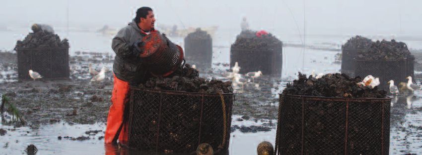
Washington Forum on Marine Spatial Planning                                                                                            Washington Forum on Marine Spatial Planning

                                                                                                                                                       of the budget for these types of initiatives. However, funding
                                                                                                                                                       is also needed to conduct effective planning processes and
          Multi-use Planning Frameworks in Marine Waters                                                                                               implementation of the plan.

                                                                                                                                                       Questions and answers. A participant commented that the
       Washington Dept. of                                    • Conducts bay-wide planning to inform the decision making of all entities               Navy has been doing research along coast and asked whether
                                                                managing a given location (e.g., Mystery Bay planning effort).                         there was any thought of using that information, particularly
       Natural Resources                                      • Is developing an Aquatic Lands Habitat Conservation Plan to meet federal               for mapping. Ms. Hennessey responded that the Governor
                                                                Endangered Species Act requirements.                                                   sent a letter to the Navy and NOAA to get mapping
                                                                                                                                                       information released. NOAA was able to release its info, but
                                                                                                                                                       the Navy declined to further release classified information
                                                              • Sets broad policies and specific permitting criteria for uses other than fishing       and also indicated that their classified information may not
       Ocean Resources                                          and recreation.                                                                        be useful anyway. Another participant noted all the different
       Management Act                                         • Guides development of local Shoreline Master Programs.                                 state and federal agencies and their areas of responsibility,
                                                                                                                                                       and asked whether it was possible to coordinate all of them
       (ORMA)                                                 • Supposed to apply to “all federal, state or local permits or approvals for
                                                                                                                                                       in a coastal team to work together at the local level. Ms.
                                                                activities that will adversely impact renewable marine resources and existing
                                                                coastal and ocean uses.”                                                               Hennessey replied that the State Ocean Caucus currently
                                                                                                                                                       coordinates across the state agencies and would be a good
                                                              • ORMA and other state laws making up the federally-approved Washington                  place continue coordinating.
                                                                coastal zone management program are the basis for evaluating consistency of
                                                                federal activities with state policies.

                                                              • In practice, Shoreline Management regulations and federal consistency
                                                                determinations are the main implementation mechanisms for ORMA.
       Shoreline Master                                       • Developed in partnership between state and local governments.13
       Programs                                               • Part of the state’s federally-approved coastal zone management program.
                                                              • For ocean counties, must address ocean management criteria that apply out
                                                                to 3 miles and encourage a regional perspective.

Ms. Hennessey noted that the state’s coastal zone                                     Ms. Hennessey closed with considerations for marine spatial
management program already has the authority to develop                               planning going forward. They include the need to acknowledge
special area management plans (SAMPs). Rhode Island is                                existing authorities and frameworks, identify gaps, and
using the SAMP authority to develop their ocean plan. In                              incorporate processes already under way like habitat
1986, Washington used this tool to develop the Grays                                  conservation plans under the Endangered Species Act. Data
Harbor Estuary Management Program,14 which has been                                   availability is another key consideration, including the
subsequently incorporated into local, state, and federal                              following questions: Are data available for a comprehensive
decision-making. Washington would need additional                                     planning process? If not, what is needed? What is the capacity
resources, but not authorities, to develop a SAMP for                                 to manage and share data effectively? Ms. Hennessey also
the ocean. The Washington State Environmental Policy                                  indicated the importance of clearly articulating goals and
Act (SEPA) is another possible planning framework;                                    objectives at the outset and determining how to measure
Massachusetts is using its state environmental policy act                             progress towards those goals. Finally, she stated the need to
for its ocean plan development and implementation.                                    allocate adequate financial resources for marine spatial
                                                                                      planning. For example, data costs have easily constituted 50%
13   See http://www.ecy.wa.gov/programs/sea/SMA/index.html.
14   See http://www.co.grays-harbor.wa.us/info/pub_svcs/EstuaryPlan.htm.

                                                                                 15                                                                                                                                     16
Washington Forum on Marine Spatial Planning Washington Forum on Marine Spatial Planning
Questions and Answers. An audience member expressed strategies, and verify results. The challenge to management
Session 5: Local Perspectives concern that marine spatial planning is a first step in cordoning
off the ocean for special interest uses, like ocean ranching and
agencies of engaging the spectrum of resource users could be
alleviated in part by working systematically with the local
windmills offshore. Mr. Blake answered that he was never MRC to engage MRC members themselves and the broader
supportive of ocean ranching. There are interests that want community. MRCs provide a means for outreach and give
to do things that will displace existing users, but he believes communities a channel for providing feedback. Ms. Van
vibrant commercial and sport fishing industries shouldn’t be Cleve closed with her hope that MRC members today come
pushed aside for these potential future opportunities. away with a good understanding of marine spatial planning,
and that agencies will look at MRCs as an excellent
Maurice Hill, Minerals Management Service. Mr. Hill mechanism for engaging stakeholders.
explained he works as the agency’s West Coast program
coordinator for offshore renewable energy (wind, current, Rick Lovely, Grays Harbor Public Utility District. Mr.
wave), and that MMS has jurisdiction only on the outer Lovely explained the public utility district (PUD) is interested
continental shelf (OCS) while sharing authority for in marine spatial planning because of renewable energy
regulating wave and tidal current energy with the Federal possibilities. The PUD partnered with consultants from
Energy Regulatory Commission (FERC). MMS issues Electric Power Research Institute, Golder & Associates, the
leases, FERC issues licenses. The federal Energy Policy Act Bonneville Power Administration, Department of Ecology
of 2005 also gave MMS responsibility to lead development and WDNR to assess the feasibility of tidal energy and in-
of the Multipurpose Marine Cadastre for use as planning stream energy conversion projects. Sites need to be evaluated
tool for siting renewable energy projects. The agency also for both power potential and environmental considerations.
co-chairs the West Coast Governors’ Agreement on Ocean The PUD has completed Phase I of evaluating the opportunity
Health (WCGA) Renewable Energy Action Coordination for tidal energy, and initial studies indicate there is some
Team which is developing a coastal siting report for renewable potential. The PUD is now into Phase II, which is to get
Leaders of different government, tribal, and stakeholder she urged the audience not to let it become a deterrent. She energy on the West Coast. A recent workshop in Seattle FERC permits to look closely at the environmental impacts.
groups expressed their perspectives on the challenges and closed by promising to remain engaged in the next steps. focused on the coastal siting report and other WCGA action The machines need to go where maximum flow is, but that’s
opportunities that exist for marine spatial planning. Due to a scheduling conflict Ms. Willis was unable to stay for a question teams are also interested in pursuing marine spatial planning. also where ships and fish go. Mr. Lovely expressed reservations
and answer session after her presentation. A key challenge in moving forward is funding. The upcoming about wave and wind energy, citing serious technical
Terry Willis, Grays Harbor County. Ms. Willis described Presidential Ocean Policy Task Force report on marine spatial difficulties in tying into onshore transmission facilities.
her experience of involvement in two other processes similar Brian Blake, Washington State House of Representatives. planning and its implementation may be an avenue to
to marine spatial planning: watershed planning for the Chehalis Mr. Blake explained that his legislative district stretches Congressional funding. Ray Toste, Washington Dungeness Crab Fishermen’s
basin, and planning for a flood authority for the basin. The from Aberdeen to the mouth of the Columbia River, and Association. Mr. Toste introduced himself as the general
flood authority takes in the whole basin and all its activities, east to Longview/Kelso. He views marine spatial planning Brie Van Cleve, Washington Department of Fish and manager of the Association based in Westport. He noted his
as does the Chehalis Basin Partnership management plan. The as a huge opportunity. Planning for uses in the ocean can Wildlife. Ms. Van Cleve focused on Marine Resource counterpart Dale Beasley from the Columbia River Crab
thought of doing a complementary process for the marine reduce problems associated with siting those uses. Good Committees (MRCs) as a model for local engagement on Fisherman’s Association was also in attendance. Mr. Toste
environment is exciting. Earlier, Commissioner Al Carter quality maps of the ocean floor are needed and could be cross-cutting marine issues. The challenge is how such locally provided examples of the management measures (e.g., sex,
said everybody must be invited to participate and be in the developed for relatively little money. A significant challenge focused groups can productively engage in big processes like size, and season harvest criteria, buoy cameras, limited entry)
room. This is important. Previous efforts have been derailed is the perception among many people that marine spatial marine spatial planning, and how that work can reflect both that WDFW and industry together have implemented to
by not getting the right representation. A good process will planning is window dressing for imposing “no-go” zones for national and local concerns. Ms. Van Cleve commended make the crab fishery the successful in Washington.
result in a document that protects all activities – shipping the public, creating marine protected areas that exclude Grays Harbor MRC for convening this event and noted that Overcapitalization is not the doing of industry or WDFW;
lanes, special fishing areas, recreation, wildlife habitat, and all people. Promoting dialogue is very important. Mr. Blake because marine spatial planning is new to everyone there is a crab populations are cyclical. The industry and WDFW are
other aspects of concern. Ms. Willis expressed her view that questioned the wisdom of NOAA proposing a no-fishing tremendous opportunity for MRCs to broker conversations working collaboratively to get relief for the fishery, help
a group coming together around marine spatial planning will zone in Puget Sound just as efforts to launch a marine spatial on this topic. The collection of accurate biological, bathymetric, industry take up less space in the ocean, and put together
provide a missing link to other processes started in the county. planning process on the ocean coast are starting. He closed and ocean use data is paramount and must engage local funding for gear retrieval. He asserted he was misquoted in
She observed there were lots of familiar faces in the room, by underscoring the importance of people participating in a entities in order to ensure accuracy and a supported process. the past saying that wave and wind energy doesn’t work.
lots of talent and education, and encouraged attendees to marine spatial planning effort to make it as good as it can be. MRCs provide a unique, broadly representative, and readily What he said was that it works in Europe where electricity
move forward. The need for financing is always an issue, but accessible forum to identify local data gaps, discuss collection prices are extremely high, and to take up ocean space for that
17 18Washington Forum on Marine Spatial Planning Washington Forum on Marine Spatial Planning
use here – where prices are low - is ludicrous. Therefore, at (surface, water column, sea floor, and season). The Like the tribes and commercial fisheries, the recreational Coordination and communication among all the entities is
this point, the Association is opposed to wave and wind geographical extent includes: from the beach out to over fishing industry believes it has a historical and cultural right key, but it is hard to do efficiently. An event like this one
energy. He reminded the audience Washington is the largest sixty miles offshore, from the Queets River in the north to in the fishing grounds off Washington state. Given a seat at helps ensure we do this work efficiently using scarce resources.
employer of fishing people in the nation, and Westport is the mouth of the Columbia River in the south, near the the table, recreational fishery representatives will be responsible A plan is like a budget, a snapshot in time. The ocean is a
consistently ranked a top port. He closed by commending surface for salmon and tuna, and on the sea bottom for participants in the process of planning for future uses in very diverse, dynamic resource; we need to get a good
the tribes, legislature, elected officials, and all the participants groundfish and halibut. Recreational fishing occurs in the addition to maintaining the viability and prosperity of understanding of the resource before we can plan, but by the
for gathering for this event. entire water column across 4,000 square miles of ocean. historical ones. Mr. Cedergreen closed by saying he hoped all time we do it will change again. The port has had 50 to 60
Recreational fisheries are governed primarily by WDFW in the players will be at the table; when you leave someone out, vessel calls in past years; that number is likely to go up to
Marco Pinchot, Taylor Shellfish Farms. Mr. Pinchot co-management with the coastal tribes, the Pacific Fishery it causes problems. 100 before too long. Planning is not for a static event; it is
expressed his appreciation for including a shellfish farmer Management Council, and the U.S. Coast Guard. Ocean for a context that is always changing.
among the speakers. He noted shellfish farming is WA’s recreational fishing developed as a result of available fishing LeRoy Tipton, Grays Harbor Chamber of Commerce.
oldest industry with exports dating to the 1800s, long before opportunities, watercraft technology, and public demand for Mr. Tipton spoke about the travel industry in Grays Harbor Jody Kennedy, Surfrider Foundation. Ms. Kennedy
logs. He made the argument that the legislature, at the turn recreation and food. They were not planned by government County, saying tourism in Washington state accounts for described Surfrider Foundation as a grassroots nonprofit
of the last century, engaged in marine spatial planning when but were developed by private enterprise subject to government $150 billion in spending annually, with $270 million of that dedicated to the stewardship and enjoyment of ocean
it sold tidelands for the purpose of farming shellfish. In regulation. The word “planning” is neutral. Poor planning spent in Grays Harbor County. The County’s total taxable and coastal resources. The organization’s members are
other states farmers do not own their tidelands. Ownership often results in major disruptions of fisheries and economic retail sales exceed $800 million, and about 30% of that can predominantly surfers and swimmers, but also some fishermen.
is the basis for a sustainable industry in Washington. In losses. Good planning can minimize these problems and be attributed to travelers. Travelers only spend 20% of their No one has a good handle on the economic value of these
Puget Sound, pollution and population growth have eroded enhance the economic and social success of private enterprise. tourism dollars on accommodations; 80% of their spending forms of recreation, but recreators make up a good proportion
growing lands. Shellfish farmers have no control over what The challenges of marine spatial planning from a recreational goes to other things: food, beverage, transportation, and of local tourism, contributing perhaps 30% of Westport jobs
happens in the upland. Marine spatial planning could be an fishing perspective include: general retail sales. That spending translates to 5,000 jobs in and 20% of users. Recreators share the ocean resource with
opportunity to find more protection from these pollution- Grays Harbor (compared to 150,000 tourism-related jobs cargo ships, navy training facilities, fishing, and other users.
generating upland activities that affect shellfish farming • Maintaining current fishing grounds from being rendered statewide) and $84 million in wages. From a tourism Now alternative ocean energy may be a future use. That
because oysters are so intolerant of environmental degradation. unavailable or unusable for fishing. perspective, the goal must be to retain the beauty that increases the need to share, and planning is a good way to
In Puget Sound the conflicts arise when upland farms are • Defending recreational fishing as a “best use” of our attracts tourists. Everything that happens in the County make such sharing happen. One challenge is a lack of data
converted to housing, leading to conflict with remaining current area. Not necessarily the only use, but a best use. affects the tourist industry. It is necessary to ensure that about where recreational users go. Surfrider is sponsoring
upland farms and shellfish farmers. Proper planning can facilitate cohesive multiple uses. tourism is protected as the Grays Harbor region plans a project to collect this kind of data on non-extractive
for new uses. recreational uses in Oregon, and hopes to initiate a similar
• Protecting our area from uses that are harmful to
Dick Sheldon, Northern Oyster Company. Mr. Sheldon project in Washington. Because ocean energy hasn’t
sustainable fisheries (both explicitly and through the “law
spoke in response to Mr. Lovely’s comments, noting that Gary Nelson, Port of Grays Harbor. Mr. Nelson happened in Washington yet, recreators and others have
of unintended consequences”).
shellfish farmers will be adversely affected if currents are commented that preserving access to and use of marine an opportunity to get involved early and shape the goals,
changed by tidal or any other types of ocean energy projects, • Countering attempts to circumvent the Pacific Fishery resources off the coast is the port’s priority because it objectives, and process of marine spatial planning. Surfrider
and will be opposed to development in Willapa Bay. Management Council and/or state and tribal fishery protects a way of life. As part of municipal government, the encourages everyone to get involved.
management entities by non-fishery management entities. port is responsible for economic development. The Port has
Mark Cedergreen, Westport Charterboat Association. two functions that are of greatest interest in the marine Lorena Marchant, Grays Harbor College. Ms. Marchant
Mr. Cedergreen introduced himself as the Executive Director The opportunities of marine spatial planning from a spatial planning context. One is its role in providing expressed the college’s appreciation for the opportunity to
of the Westport Charterboat Association, a member of the recreational perspective include: important access to ocean resources for the local economy be involved. She urged participants to keep in mind that
Pacific Fishery Management Council since 2002, and and serving as the operator of the boat basin (the largest many people won’t know what marine spatial planning is, so
resident of Westport since 1956. He is presenting a • Creating & maintaining a “seat at the table” for landing south of Dutch Harbor, Alaska). The other role is it will be very important to inform and educate the public.
recreational fishing perspective on marine spatial planning for recreational fishing in the planning process. ensuring safe ingress and egress to the ocean resources. This can be an exciting process, but it will require significant
the coast; someone else would have to comment on behalf From a transportation standpoint international trade has the financial resources.
• Working with other current ocean users to develop
of estuary fishing. “Marine” to the recreational fishing biggest financial impact. Grays Harbor is the only deepwater
consensus on best use.
industry includes: recreational salt water fisheries for salmon, port north of San Francisco that has a four-lane highway and
groundfish, halibut, and albacore tuna, whale watching trips in • Working with potential new ocean spatial users to find good connections. Grays Harbor has a unique opportunity to
the spring, and associated navigational, ecological, and mutually acceptable solutions for best use/least conflict continue to be an important trading partner with the rest of
safety issues. “Spatial” implies the geography in which the projects and activities. the West Coast and the Pacific Rim.
recreational fishing industry works, in four dimensions
19 20You can also read