Maynooth Local Area Plan 2013-2019 - Plean Cheantar Aitiuil Mháigh Nuad - Kildare.ie
←
→
Page content transcription
If your browser does not render page correctly, please read the page content below
Maynooth
Local Area Plan
2013–2019
Plean Cheantar Aitiuil Mháigh Nuad
26th August 2013
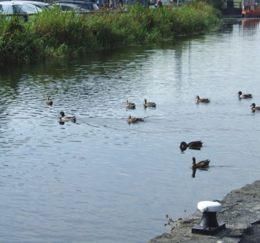
Table of Contents

PART A                                                  PART B
Introduction and Context                                Policies and Objectives
1.0 Introduction                                   5    7.0 Introduction                           24
1.1   Local Area Plans Status and Process           6   7.1   Housing Units                        24
1.2 Strategic Environmental Assessment              6   7.2 Economic Development                   27
1.3 Appropriate Assessment                          7   7.3   Retail                               32
1.4 Strategic Flood Risk Assessment (SFRA)          7   7.4   Town Centre                          35
2.0 Maynooth Historic Development                       7.5   Movement and Transport               56
    and Urban Context                              7
                                                        7.6   Water and Drainage                   63
2.1 Maynooth in a National Context                  8
                                                        7.7   Environmental Services               69
2.2 Maynooth in a Regional Context                 10
                                                        7.8   Energy and Communications            70
3.0 Town Function and Role                         12
                                                        7.9   Education, Community and Cultural    71
3.1   Population                                   13
                                                        7.10 Architectural, Archaeological and
3.2 Household Size and Profile                     14        Natural Heritage                      73
3.3 Age profile of Maynooth                        15   7.11 Recreation, Amenity and Open Spaces   87
3.4 Residential Profile & New Unit Target          16
3.5 Economy                                        18
3.6 Town centre                                    19   PART C
                                                        Specific Objectives
3.7 Transportation                                 19
3.8 Environment and Recreation                     19   8.0 Land Use Zoning Objectives             90

3.9 Education                                      19   8.1 Zoning Matrix                          94

4.0 Key challenges facing the town                 20   8.2 Application of Zoning Policy           94

5.0 SEA Assessment of Alternative Plan Scenarios   20   8.3 Definition of Terms                    94

6.0 Future Development Strategy                    21
List of Tables
Table 1: Maynooth Population and Rate of Change                                                              13
Table 2: Household Size and Profile                                                                          14
Table 3: Age Profile of Maynooth. Source Census 2011                                                         15
Table 4: Maynooth Housing Unit Allocation 2006–2019                                                          16
Table 5: Maynooth Housing Unit Requirements                                                                  17
Table 6: Residential Development Sites                                                                       17
Table 7: Labour Force Breakdown (Census 2011)                                                                18
Table 8: Maynooth Employment Break down (Source: Census 2011)                                                18
Table 9: Profile of existing schools in Maynooth (Source: Department of Education and Skills Website, 2012   22
Table 10: Maynooth Housing Unit Projections                                                                  24
Table 11: Additional New Residential zoned sites                                                             25
Table 12: Indicative Residential Densities (Source CDP 2011–2017)                                            25
Table 13: Maynooth New Floorspace (m 2) 2005–2009                                                            32
Table 14: Record of Protected Structures in Maynooth                                                         74
Table 15: Sites and Monuments Record                                                                         77
Table 16: Land Use Zoning Objectives Table                                                                   91
Table 17: Land Use Zoning Matrix                                                                             95

List of Maps
Map 1: Roads Objectives                                                                                      61
Map 1(a): Roads Objectives                                                                                   62
Map 2: Strategic Flood Risk Assessment                                                                       67
Map 3: Built Heritage                                                                                        75
Map 3(a): Built Heritage                                                                                     76
Map 4: Natural and Archaeological Heritage                                                                   79
Map 4(a): Natural and Archaeological Heritage                                                                80
Map 5: Green Infrastructure                                                                                  85
Map 6: Land Use Zoning Objectives                                                                            97

List of Figures
Figure 1: National Spatial Strategy                                                                           9
Figure 2: Settlement Strategy for the Greater Dublin Area 2010–2022                                          11
Figure 3: Maynooth Population Growth. Source: CSO Small Area Population Statistics –
Towns with population over 1,000                                                                             13
Figure 4: Maynooth Household profile.                                                                        14
Figure 5: Maynooth Age Profile                                                                               15
Figure 6: Maynooth Core Retail Area                                                                          34
Figure 7: Main Street Ground Floor Uses February 2011                                                        37
Figure 8: Urban Design Strategy                                                                              39
Figure 9: Urban Design Framework Plan                                                                        40
Figure 10: Urban Design Framework, Consolidation of the Laneways                                             45
Figure 11: Urban Design Framework Plan, Expansion Area                                                       53
Figure 12: Indicative Layout                                                                                 54
Figure 13: Indicative Courtyard Development                                                                  55
Part A Introduction and Context
                                  Introduction and Context
                         Part A
Aim: To build on Maynooth’s strengths and to provide a focused approach
to planning for future growth in a coherent sustainable, spatial fashion. The
Plan aims to achieve a more consolidated urban form that facilitates a
sustainable economic base and creates sustainable and integrated
communities while balancing future development with the conservation and
enhancement of the town’s natural and built environment.

                                                                                                                    Part A Introduction and Context
1.0 Introduction                                      Part A: Introduction and Context
                                                      Outlines the social, economic and planning context
The Maynooth Local Area Plan 2013–2019 has been
                                                      for the town, setting the framework for the plans
prepared in accordance with the requirements and
                                                      policies and objectives.
provisions of the Planning and Development Act 2000
as amended. It sets out an overall strategy for the
proper planning and sustainable development of        Part B: Policies and Objectives
Maynooth in the context of the Kildare County         Sets out specific policies and objectives for the plan
Development Plan 2011–2017 and the Regional           relating to housing, economic development, retail,
Planning Guidelines for the Greater Dublin Area       tourism, urban design, etc.
2010–2022. It is also informed by Ministerial
Guidelines published pursuant to Section 28 of the
                                                      Part C: Mapped Objectives
Planning and Development Act 2000 as amended
together with EU requirements regarding Strategic     Sets out objectives in the plan which can be mapped
Environmental Assessment and Appropriate              including land use zoning, site specific objectives for
Assessment.                                           road improvements, natural and built heritage,
                                                      protected views, design briefs, etc.
This Plan is set out in a written statement with
accompanying maps.                                    The written statement shall take precedence over the
                                                      maps should any discrepancy arise between them. In
                                                      the full interpretation of all objectives for Maynooth,
                                                      it is essential that both the County Development Plan
                                                      (CDP) and the Local Area Plan (LAP) are read in
                                                      tandem. Where conflicting objectives arise between
                                                      the CDP and the LAP, the objectives of the CDP shall
                                                      take precedence. It should be noted that the general
                                                      development management standards applicable to the
                                                      Plan are contained in the County Development Plan.

                                                                            Part A: Introduction and Context    5
1.2    Strategic Environmental Assessment
                                                               Strategic Environmental Assessment (SEA) is the
                                                               formal systematic evaluation of the likely significant
                                                               environmental effects of implementing a plan or
                                                               programme before a decision is made to adopt the
                                                               plan or programme. The SEA Directive (2001/42/EC),
                                                               was transposed into Irish Law through the European
                                                               Communities (Environmental Assessment of Certain
                                                               Plans and Programmes) Regulations 2004 (SI No 435
                                                               of 2004) as amended by the European Communities
                                                               (Environmental Assessment of Certain Plans and
                                                               Programmes) (Amendment) Regulations 2011 (S.I No.
                                                               200 of 2011) and the Planning and Development
                                                               (Strategic Environmental Assessment) Regulations
    1.1      Local Area Plans Status and Process
                                                               2004 (SI No 436 of 2004) as amended by the Planning
    Sections 18–20 of the Planning and Development Act         and Development (Strategic Environmental
    2000, as amended, provide that a Local Area Plan           Assessment) (Amendment) Regulations 2011 (S.I. No.
    (LAP) may be prepared in respect of any area which a       201 of 2011).
    Planning Authority considers suitable, in particular for
                                                               Mandatory SEA of a Local Area Plan is required
    areas which require economic, physical and social
                                                               where the population or target population of the town
    renewal and for areas likely to be the subject of
                                                               is over 5,000 persons, or where the area covered by
    large-scale development within the lifetime of the plan.
                                                               the plan is greater than 50 square kilometres, or
    A Local Area Plan shall be made in respect of an area      where the Local Area Plan is being prepared for a
    which:                                                     town and its wider environs. The SEA was prepared
                                                               in parallel to the plan, informing the plan making
    • Is designated as a town in the most recent census of     process of the likely environmental impacts of
      population, other than a town designated as a
                                                               alternative actions and contributes to the integration
      suburb or environs in that census
                                                               of environmental considerations into the plan making
    • Has a population in excess of 5,000 and                  process.

    • Is situated within the functional area of a Planning     In accordance with Article 13D of the Planning and
      Authority which is a county Council                      Development (Strategic Environmental Assessment)
    • The 2011 census indicated that Maynooth had a            Regulations 2004, a Scoping Assessment was
      total population of 12,510 persons. A LAP is             prepared for the Maynooth Local Area Plan and sent
      therefore required for Maynooth. This LAP was            to the Environmental Authorities. The findings of the
      adopted at the Council Meeting on 29 July 2013
                                              th               SEA are set out in the Environmental Report, which,
      and takes effect from the 26th August 2013. This         while constituting part of the Plan documentation, is
      plan shall cease to have effect at the expiration of     presented as a separate document. The
      six years from that date unless this period is           Environmental Report was prepared in conjunction
      extended by resolution in accordance with section        with the preparation of the Plan and the Plan has been
      12 (d) to (f) of the Planning and Development            informed by the environmental considerations of the
      (Amendment) Act 2010                                     Environmental Report. The likely environmental
                                                               effects of the Plan (and the alternative development

6   // Maynooth Town Local Area Plan
scenarios considered) are predicted in the plan making process. The Draft Strategic Flood Risk
Environmental Report and their significance is Assessment (SFRA) carried out for Maynooth is an
evaluated with reference to the area’s environmental assessment of flood risk in the town to inform
baseline. The Environmental Report therefore strategic land-use decisions with the purpose of
provides a clear understanding of the likely ensuring that flood risk management is fully
environmental consequences of decisions regarding integrated into the Local Area Plan.
the location of development in the Plan area. The
The SFRA has recommended that development
mitigation measures needed to offset the potential
proposals for the areas identified as being at risk of
adverse effects of the Plan and future monitoring
Part A Introduction and Context
flooding outlined on Map 2 in section 7.6.5 Flood Risk
proposals have been transposed from the
Management of this Plan be subject to a site specific
Environmental Report into the Plan.
flood risk assessment. Some of these areas have been
the subject of more detailed investigation and this
1.3 Appropriate Assessment information is available in the Draft Strategic Flood
The purpose of Appropriate Assessment (AA) of land Risk Assessment Report.
use plans is to ensure that protection of the integrity
of European sites is a part of the planning process at a
regional and local level. The requirement for AA of 2.0 Maynooth Historic
plans or projects is outlined in Article 6(3) and (4) of
the European Communities (1992) Council Directive
Development and Urban Context
92/43/EEC on the conservation of natural habitats
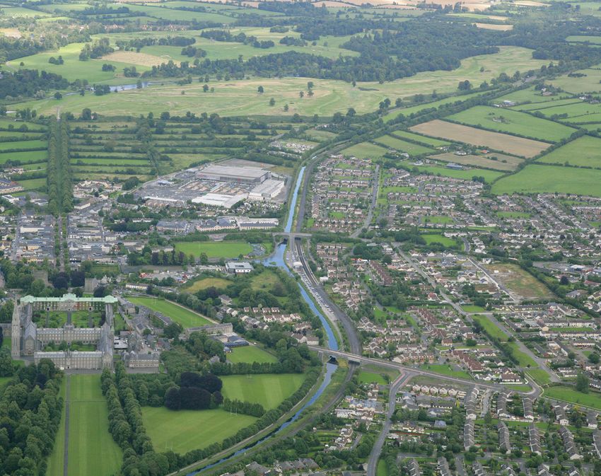
Maynooth has developed in a number of separate
and of wild fauna and flora (“Habitats Directive”).
stages, which are clearly evident in the town’s
Local Area Plans are screened for any potential
structure. The town dates from the original
impact on areas designated as Natura 2000 sites. In
settlement around the Castle in the 12th century,
any case where, following screening, it is found that
around which St Patrick’s College later developed.
the plan may have an impact, a full Appropriate
The next significant development was the laying out
Assessment must be carried out.
of Main Street by the Dukes of Leinster, of Carton
The Maynooth Local Area Plan 2013–2019 was House. The axis from St. Patrick’s College to the
screened for AA. This screening found that effects on Carton estate is one of the finest examples of 18th
the integrity of the Rye Water Valley / Carton Special century urban and landscape design in the country.
Area of Conservation, (Site Code 002162), arising from The next significant step in the evolution of the town
the Local Area Plan were not likely, and therefore full was the arrival of the canal and later, the railway.
Appropriate Assessment was not warranted. However While these developments improved communication,
the recommendations of that screening document they also had the effect of forming a southern
have been incorporated into the plan. boundary to the town, which was not significantly
breached until late in the 20th century.
1.4 Strategic Flood Risk Assessment (SFRA) Today, Maynooth is a busy and vibrant university
town with many students living in and travelling to
Under Section 28 of the Planning and Development
the town to attend NUI Maynooth. Much of the
Act 2000, as amended guidelines entitled “The
recent residential development in the town has been
Planning System and Flood Risk Management
south of the railway with Newtown Hall on the
Guidelines for Planning Authorities” were published
Rathcoffey Road and Griffin Rath Manor on the
by the DoEHLG (November 2009). These guidelines
Celbridge Road being two of the most recent
require planning authorities to introduce flood risk
developments. The other location where residential
assessment as an integral and leading element of the
Part A: Introduction and Context 7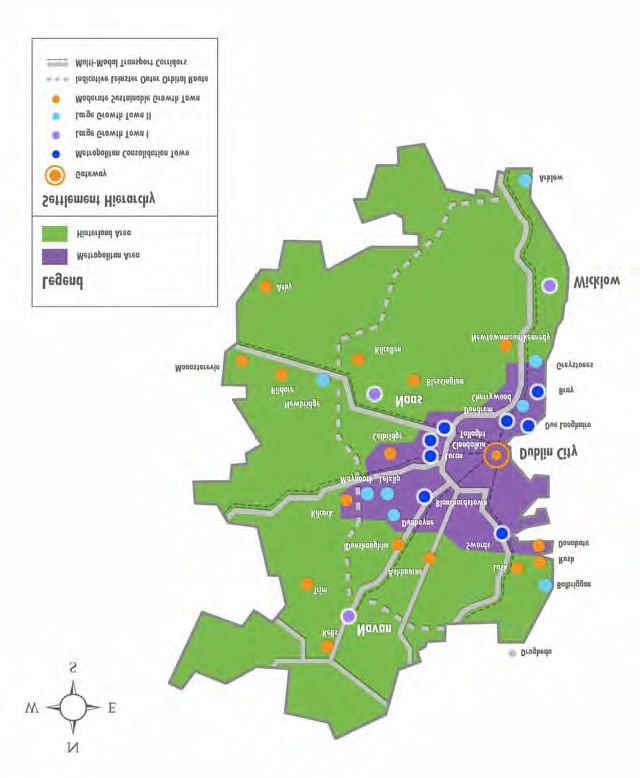
development has occurred is the continuing                demesne landscape of Carton are important tourist
    development along the Moyglare Road. The Maynooth         attractions in the town. The continued sustainable
    Business Park is located south of the M4 motorway on      development of these facilities is recognised in this
    the Clane road and it is one of the main employment       Plan.
    areas in the town.

    A number of services and facilities associated with the   2.1     Maynooth in a National Context
    student population have developed in the town in          The National Spatial Strategy (NSS) was published in
    recent years. With the development of the town and        December 2002 and outlines a 20-year planning
    general commuter traffic road infrastructure in the       framework designed to achieve a better balance of
    town is under pressure and this Plan incorporates         social, economic, physical development and
    objectives which will seek to address current             population growth between centres.
    deficiencies and alleviate pressure on the road
    network. The University, the Canal and the nearby         Under the NSS Maynooth is categorised as a town
                                                              with a population of over 5,000 people. In the context
                                                              of the NSS, towns of this size will act as ‘local capitals’
                                                              and provide a range of services and opportunities for
                                                              employment.

8   // Maynooth Town Local Area Plan
Figure 1: National Spatial Strategy
Dublin and Mid East Regions
(Greater Dublin Area)
Part A Introduction and Context
Maynooth
Part A: Introduction and Context 92.2 Maynooth in a Regional Context and proximity to the Intel and Hewlett Packard
campuses. The focus of economic development in the
The Regional Planning Guidelines for the Greater
area is on maintaining and improving the established
Dublin Area 2010–2022 set out the planned direction
synergy between the education sector and the major
for growth within the Greater Dublin Area up to 2022
employers in the high tech / bio tech, research and
by giving regional effect to national planning policy
development, ICT and manufacturing sectors
under the National Spatial Strategy (NSS). The RPGs
have designated Maynooth as a Large Growth Town Meath County Council adopted the Maynooth
II situated in the Dublin Metropolitan Area. Environs Local Area Plan in April 2009, which zones
Maynooth’s role as a Large Growth Town II is to act lands at Moygaddy to the north east of Maynooth. The
as an important self sustaining regional economic plan mainly provides for science and technology
driver for the GDA, capitalising on its international development with ancillary residential, educational
connectivity and high quality connections to Dublin and neighbourhood centre development. The
City Centre, whilst also supporting and servicing a servicing of these lands requires the cooperation of
wider local economy. Kildare County Council in relation to water and
wastewater infrastructure. The Meath County
Maynooth is also identified as a primary economic
Development Plan 2013–2019 seeks to develop a
growth town prioritised for local and regional
Strategic Employment zone within the Maynooth
enterprise. Critical mass is a core objective, supported
Environs LAP and also requires a variation of the
by density levels which foster competitiveness,
Meath CDP within one year of adoption to provide
sustainability and create opportunities for economies
development and zoning objectives for Maynooth
of scale to justify strategic infrastructure provision.
Environs (refer to www.meath.ie).
Maynooth, together with Leixlip, is defined as a Core
Economic Area and has many locational strengths
including improving rail and national road networks
10 // Maynooth Town Local Area PlanFigure 2: Settlement Strategy for the Greater Dublin Area 2010–2022
Part A Introduction and Context
Part A: Introduction and Context 112.3 Maynooth in a County Context 3.0 Town Function and Role
The Kildare County Development Plan sets out the
overall strategy for the proper planning and Maynooth is well recognised both nationally and
sustainable development of Kildare County over the internationally as a university town. St Patrick’s
period 2011–2017. The Plan has a critical role to play in College was established in 1795 educating candidates
ensuring that the needs of future population growth for the priesthood. In 1910 St Patrick’s became a
are planned for. The Plan aims to direct population recognised college of the National University of
growth into the main urban centres with significant Ireland and in 1966 the college began accepting non
growth focussed upon the metropolitan towns of clerical students. Many students live in Maynooth
Maynooth, Celbridge, Leixlip and Kilcock. It also adding to the vibrancy and atmosphere in the town
promotes significant new economic development while others in close proximity commute daily. The
within defined economic clusters like the town also acts as a retail and service centre for north
metropolitan towns mentioned above. The Plan also Kildare. The Manor Mills and Carton Park retail
emphasises the need to protect the built heritage, developments attract many shoppers from the
unique landscape, natural heritage and biodiversity of surrounding towns and hinterland. Maynooth also
the county for their intrinsic value and as a resource has excellent transport links namely the M4
for the tourist economy of the future. motorway and the Dublin and Sligo railway line.
The designation of Maynooth as a Large Growth
Town II in the RPGs is reinforced in the county
settlement strategy. Large Growth Towns II are
designated to act as important self sustaining regional
economic drivers, accommodating significant
investment in transport, housing, economic and
commercial activity with high quality transport links
to Dublin and other large towns. The CDP recognises
that Maynooth should take advantage of the presence
of NUI Maynooth and the close proximity of the Intel
and Hewlett Packard campuses. Therefore it is
envisaged that the town would be promoted as being
strategically located in the ‘Knowledge Valley’ where
the focus would be on the development of hi tech / bio
tech sectors, research and development, ICT and
manufacturing.
12 // Maynooth Town Local Area Plan3.1 Population
The population of Maynooth has risen steadily since the 1970s. The greatest rate of population change took
place between 1996 and 2002 reflecting the growth in residential development in the town at that time. The 2011
census indicated that Maynooth had a total population of 12,510 persons representing a 16% increase since 2006.
Figure 3: Maynooth Population Growth. Source: CSO Small Area Population Statistics – Towns with popula-
tion over 1,000.
14,000
Part A Introduction and Context
12,000
10,000
8,000
4,000
Population
6,000
4,000
2,000
0
1981 1986 1991 1996 2002 2006 2011
Census Year
Table 1: Maynooth Population and Rate of Change
Census Population Percentage Growth
1981 3,388 6%
1986 4,768 40%
1991 6,027 26%
1996 8,528 41%
2002 10,151 19%
2006 10,715 6%
2011 12,510 16%
Part A: Introduction and Context 133.2 Household Size and Profile
4,211 households were recorded in the 2011 census in Maynooth. The town’s average household size of 2.83
persons is higher than the national average of 2.73 persons. A break down of the family unit size shows
Maynooth is predominantly made up of two and three person families. These figures are greater than the
national average and suggest that a lot of young families reside in the town.
Figure 4: Maynooth Household profile.
Source: Census 2011
Maynooth National Average
35%
30%
25%
% of Total Households
20%
15%
10%
5%
0%
1 2 3 4 5 6+
Household Size
Table 2: Household Size and Profile
Source: 2011 Census
Household unit size 1 2 3 4 5 6+ Total
Total No. of Households 793 1,256 822 763 422 155 4,211
% of Total Households Maynooth 19% 30% 19% 18% 10% 4% 100%
National Average (%) 24% 29% 18% 16% 9% 4% 100%
14 // Maynooth Town Local Area Plan3.3 Age profile of Maynooth
Maynooth traditionally has a very young population. The 1996 census indicated that almost 30% of the town’s
population was aged between 20 and 29 years compared to 15% for the state as a whole. The 2002 census
revealed a similar trend with 25.51% of the population in the 15–24 bracket compared to the 16.38% average for
the state. Table 3 below reveals that this trend is also evident in the 2011 census results. The student population
of the town is a big factor in the high proportion of young adults in the town. In general, the population of
Maynooth is quite young.
Table 3: Age Profile of Maynooth. Source Census 2011
Part A Introduction and Context
Age bracket Population % of total population National Average 2011 %
0–14 2,369 18.9% 21%
15–24 2,835 22.7% 12%
25–44 4,450 35.6% 32%
45–64 2,220 17.7% 23%
65+ 636 5.1% 12%
Total 12,510
Figure 5: Maynooth Age Profile
Source: Census 2011 CSO
Maynooth National Average
40%
35%
30%
% of Total Population
25%
20%
15%
10%
5%
0%
0-14 15-24 25-44 45-64 65+
Age Categories
Part A: Introduction and Context 153.4 Residential Profile & New Unit Target In line with the town’s position in the County
Settlement Strategy and the Regional Planning
Residential provision in Maynooth is largely
Guidelines, the residential unit allocation for
concentrated to the south of the town centre and the
Maynooth over the lifetime of the CDP 2006–2017 is
railway line along the Rathcoffey, Straffan and
2,364 units (table 4). This figure has been projected
Celbridge roads. In recent years there has been some
forward to cover the period 2013–2019 (the likely plan
residential development along the Moyglare road and
period) for Maynooth requiring 2,888 units over the
the Dunboyne road to the north of the town centre.
period of this Local Area Plan. Maynooth is projected
The type of residential development varies from
to accommodate 8.4% of the residential unit growth
detached houses on the outskirts of the town, to
allocated in the RPGs in the period 2016–2022. The
ribbon development along the approach roads, to
county total is 3,122 units per year therefore 8.4%
housing estates of varying designs and densities
equates to an additional 262 units per year which is
around the historic core.
added to the 2017 housing unit target.
Table 4: Maynooth Housing Unit Allocation 2006–2019
Percentage of
2006 2011 2017 2019 Allocated Growth
Settlement Pop Pop Pop 2017 Housing Housing for Maynooth in the
Type Towns Census Census Target Units Target Units Target County 2006–2019
Large Maynooth 10,715 12,510 15,897 2,364 2,888 8.4%
Growth
Town II
16 // Maynooth Town Local Area PlanThe 2019 Housing Unit target is based on the will provide for significant residential growth during
provision of 2,888 residential units over the period the plan period. In addition to the residential zoned
2006–2019. It is estimated that 643 residential units land in the plan appropriate intensification of
have been constructed over the period 2006–2012 residential uses in existing residential areas and the
resulting in remaining unit target of 2,245. Additional town centre will be encouraged. Also a certain
residential units required to meet the 2019 residential quantum of residential development may be
unit target will be largely provided for on new facilitated as an ancillary use in the area identified for
residential zoned land on green field sites. It is research and technology development on the Kilcock
considered that the appropriately zoned land with Road. This zoning provides for an opportunity to
Part A Introduction and Context
existing planning permissions (1,417 units) and the create ‘work-live’ arrangements.
newly zoned residential land identified in this Plan
Table 5: Maynooth Housing Unit Requirements
Timeframe Unit Target Calculation Details
2006–2017 2,364 = 8.4 % of the overall county unit target 2006–2017 ( being 27,982 units)*
2017–2019 524 = 8.4 % of the annual county target for the period of 2016–2022 (being 8.4% of
3,122 units = 262 * 2 years)
2006–2019 2,888 = The 2006–2017 unit target + the 2017–2019 target
2013–2019 2,245** = 2,888 units (2006–2019 unit target) - 643 units (total units built from 2006–
2012)
* = Please refer to Chapter 3 and Table 3.3 of the Kildare CDP This plan will make provision for the delivery of an
2011–2017 additional 1,022 residential units on 29.2ha of New
** = 2006–2019 Residential unit target excluding units already Residential zoned land. Table 6 outlines the sites
built. This figure excludes any element of overzoning which is which are proposed to be zoned for residential
required under the Development Plan Guidelines, Guidelines for purposes for the first time in this Plan. It is envisaged
Local Authorities 2007
that a quantum of residential units will be provided
Unit Target = 2,245 units through brownfield residential development in the
LAP residential unit potential on appropriately zoned lands = town centre and the possible development of ‘work
2,671 units (1,022 (new zoned land provision) + 1,417 (existing live’ units on the research and technology zoned land
planning permissions) + 232 (uncommitted residential land on the Kilcock Road.
zoned in the 2002 Development Plan))
Table 6: Residential Development Sites
Site Reference Zoning Designation Site Area (ha) Density
Mariavilla C 11.5 35 units per ha
Dunboyne Road C 2.1 35 units per ha
Dunboyne Road Roundabout C 5.2 35 units per ha
Dublin Road C 0.9 35 units per ha
Greenfield Drive C 0.4 35 units per ha
Celbridge Road C 9.1 35 units per ha
Total C 29.2
Part A: Introduction and Context 173.5 Economy It has been noted that Maynooth has a large
proportion of its population of working age. It also has
The 2002 and the 2006 census indicated that
a number of locational advantages such as close
approximately half of the town’s population was at
proximity to large employers like NUI Maynooth,
work (5,016 persons in 2002 and 5,694 persons in
Intel and Hewlett Packard and excellent transport
2006). This number has increased by the time of the
links to Dublin. It is evident from Table 8 that a large
2011 Census with 5,187 persons considered to be at
proportion of the workforce in Maynooth are
work. However the number of unemployed has more
employed in high skilled jobs in the trade, commerce
than doubled with 734 people out of work in 2011 in
and public service sectors.
comparison to the low levels of unemployment,
recorded at 288 persons in 2002 and 295 persons in
2006. Table 7 illustrates the labour force breakdown
for Maynooth. It is important to note that the large
student population probably has an effect on the
employment levels of the town as a whole.
Table 7: Labour Force Breakdown (Census 2011)
Unable
to work
Looking Looking due to
Total for first after permanent
Labour At regular home/ sickness/
Location Force work job Unemployed Student family Retired disability Other
Maynooth 10,141 5,187 81 734 2,663 584 595 270 27
% 100% 51.1% 0.8% 7.2% 26.2% 5.8% 5.9% 2.7% 0.3%
Table 8: Maynooth Employment Break down (Source: Census 2011)
Employment Type 2011 No 2011 % National Avg %
Agriculture, Forestry and Fishing 32 1% 5%
Building and Construction 220 4% 5%
Manufacturing 513 10% 12%
Commerce and Trade 1,366 26% 25%
Transport and Communications 428 8% 8%
Public Administration 417 8% 6%
Public Services 1,485 29% 24%
Other 726 14% 15%
18 // Maynooth Town Local Area PlanPart A Introduction and Context
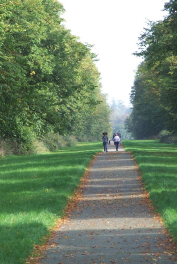
3.6 Town centre 3.8 Environment and Recreation
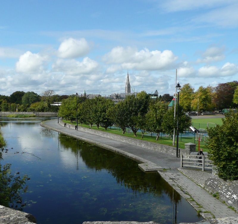
Since the previous Maynooth Development Plan in The Royal Canal is one of the town’s prime
2002, progress has been made with regard to the recreational and environmental assets, the
re-development of redundant industrial lands through maintenance of the environmental quality of the
the opening of the Manor Mills Shopping Centre and canal and the development of amenity facilities for
residential development. There are further walking and cycling is vital. The development of the
underutilised backland sites capable of re- Harbour field as a key piece of green infrastructure in
development particularly in the Canal Harbour area. the town centre will greatly benefit the amenity of the
town centre as a whole as will the maintenance and
improvement of Carton Avenue.
3.7 Transportation
Traffic congestion is a major problem in Maynooth
3.9 Education
and the delivery of the Maynooth Outer Orbital route
illustrated on Map 1 is vital for the economic Maynooth is recognised as an education centre as a
development and quality of life of all Maynooth’s result of the presence of the National University of
residents and visitors. The upgrade of access to the Ireland Maynooth and St Patrick’s Seminary. There is
M4 Motorway and the provision of an additional also a secondary school and four primary schools in
access may also be necessary to facilitate ease of the town. Some of the school facilities are currently
access to the national road network. Pedestrian and inadequate.
cycling facilities will be developed throughout the
Maynooth has a very highly skilled labour force with
town particularly from new development areas back
31.78% of the population in 2002 having third level
to the town centre and NUI Maynooth. The
degrees compared to the then national average of
upgrading and intensification of use of the railway
19.86%. In 2006 this figure had risen further to
will take place over the next few years and the
33.37% compared with a national average of 22.42%.
development of ancillary facilities such as car parking
These figures are a direct result of the presence of the
will be required.
university and therefore Maynooth is well suited to
attracting high skilled employment in the future. It is
anticipated that the University will be a driving force
in the development of research and development
employment opportunities in the region.
Part A: Introduction and Context 194.0 Key challenges facing the 5.0 SEA Assessment of
town Alternative Plan Scenarios
The Maynooth Local Area Plan has a critical role to Five alternative plan scenarios were provided by the
play in ensuring that the needs of the future planning authority to the Council’s environmental
population are planned for. However there are a planning consultants (ARUP) as part of the SEA
number of key challenges that need to be addressed process in order to assess different visions of how the
including: future development of Maynooth might occur. The
five plan scenarios are outlined in Appendix I. A
(i) Ensuring that the planning framework in the
comparative evaluation of the likely environmental
town is established so that Maynooth can
effects of each of the five scenarios was carried out.
accommodate its population target in order for
the town to be a driver of balanced development An evaluation of the five SEA alternatives concluded
within the county and the region. that ‘Alternative Scenario 2: redevelopment of the
Canal Harbour / employment to the west of the college
(ii) Promoting Maynooth as an Economic Growth
/ new residential at Mariavilla is the most sustainable
Town by encouraging and supporting significant
option. This preferred alternative seeks to facilitate
new economic development in the town and
this targeted population growth of the town by
facilitating the development of research and
focusing on the following three key development areas:
development based enterprises.
(iii) Ensuring the availability of local employment (i) Consolidation of the existing town centre by
opportunities, community and commercial encouraging the development of the Canal
services, recreation and amenity facilities for the harbour and the reinvigoration of the Main
existing and future population of Maynooth. Street and the surrounding side streets in a
sensitive and appropriate manner.
(iv) Facilitating the upgrading of water and
wastewater infrastructure in the area thereby (ii) Creation of a new residential area at Marivilla,
facilitating the development of the economy, accessed from the Moyglare and Dunboyne
educational facilities and residential development. roads. These lands provide the opportunity to
provide appropriate residential development
(v) Delivering strategic transport improvements
including a range of different dwelling types in
particularly the upgrading of the railway line
close proximity to the town centre, educational
and the completion of the Maynooth Outer
facilities and recreational areas.
Orbital Route.
(iii) Creation of a new employment campus to the
(vi) Facilitating the development of educational
west of the University. This development shall
facilities for an expanding population.
be primarily for the development of knowledge
(vii) Protecting the unique character of Maynooth as a based enterprises, however other ancillary uses
University town steeped in history and heritage. may be deemed acceptable following the
completion of a detailed masterplan.
(viii) Retaining its separate physical identity, and
avoiding coalescence with nearby towns and
villages.
(ix) Supporting the re-use of land and buildings,
particularly through backland development and
regeneration of town centre sites.
20 // Maynooth Town Local Area Plan6.0 Future Development
Strategy
The strategy for the future development of Maynooth
is based on the principles established in the Maynooth
Development Plan 2002, the framework provided by
the Regional Planning Guidelines 2010–2022 and the
Kildare County Development Plan 2011–2017. This Plan
Part A Introduction and Context
establishes the framework to guide the development of
Maynooth for the next six years. The forthcoming
Strategic Land Use and Transportation study of North
East Kildare will address the development framework
for the Kildare metropolitan area up to 2030 and will
inform the future development of Maynooth beyond
the period of this Plan.
It is envisaged that Maynooth will continue to grow
over the short to medium term to achieve a critical
mass which will support competitiveness,
sustainability and create opportunities for economies
2) Planning for Residential Expansion
of scale. Its development will be complemented with a
The plan ensures the supply of suitably zoned
range of employment, recreational, cultural, retail
serviced land to accommodate the future growth of
and educational facilities appropriate for a town of its
Maynooth in line with its designation in the Regional
size. It is envisaged that the National University of
Planning Guidelines. The majority of areas designated
Ireland Maynooth will continue to grow and develop
for residential growth are near the town centre, at the
its facilities while also creating the environment
Canal Harbour and the new residential zoning
required to develop further research based
between the Moyglare road and the Dunboyne road
employment opportunities in the town.
and on the Celbridge road. The latter is bisected by a
The strategic direction for the future development of green lung of amenity lands and the river Lyreen.
Maynooth will focus on: These lands have the advantage of being in close
proximity to the town centre, educational facilities
1) Economic Development
and amenity facilities.
The consolidation and enhancement of Maynooth’s
role as a primary economic growth town. This includes 3) Canal Harbour
the zoning of lands on the Kilcock Road adjacent to The plan also provides for the expansion of the town
NUI Maynooth for Research and Technology based centre in a sustainable manner by utilising backland
employment generating uses and related educational areas, in particular the Harbour Area which is located
uses. The existence of the University will allow for spin along the Royal Canal and to the east of the College.
off industries and enterprises to be developed based on Through an urban design framework the plan aims to
the knowledge economy. The lands are in a good develop in an integrated manner the Harbour Area
position to take advantage of its excellent location within the town in order to provide a sustainable
adjacent to the University, the town centre and new urban expansion area, increasing permeability and
and existing residential areas. Maynooth also has a lot strengthening the linkage between the town core and
to offer a new workforce including vibrant retail, the train station, through well designed urban
cultural and amenity resources. development.
Part A: Introduction and Context 214) Education the town in tandem with the ancillary employment
The plan aims to facilitate the appropriate opportunities it generates. An educational campus on
development of educational facilities at NUI the Moyglare Road has been identified which is
Maynooth and promote the development of spin off suitable for state of the art primary and secondary
research and development based enterprises in the school facilities. There is one post primary school and
town. The expansion of educational activities in the four primary schools in Maynooth. These are listed in
university is vital for the continued development of the table 9.
Table 9: Profile of existing schools in Maynooth (Source: Department of Education and Skills Website, 2012
Name Enrolment Site Size
Primary Maynooth Boys National School 465 1.2ha
Presentation Girls Primary School 475 1.5ha
Scoil Uí Fhiach 474 0.6ha
Maynooth Educate Together National School 92 1.1ha
Post-Primary Maynooth Post Primary School 1,015 2.1ha
5) Transportation 6) Heritage
The improvement of sustainable transport The plan also seeks to protect and enhance the unique
infrastructure is required to facilitate the development architectural and archaeological heritage of the town
of high-density employment areas, expanded including the St Patrick’s College campus the Main
educational facilities and to serve existing retail areas Street and Carton Avenue. The retention of vernacular
and residential areas.. Upgrades in transportation buildings on the Main Street and its side streets will
include expanded rail services including additional car ensure the character of the town remains intact.
parking, improved bus frequencies and facilities and Maynooth can realise its potential as a heritage town
the completion of a ring road around Maynooth. The and associated tourist destination by referencing its
enhancement of the linkages between Maynooth and heritage associated with significant periods of Irish
the nearby towns in the metropolitan area and the history.
movement into and out of Maynooth from these towns
and the remainder of the Greater Dublin Area will
ensure the sustainable development of the town. The
development of new vehicular, pedestrian and cycling
routes and the enhancement and maintenance of
existing routes will ensure safe and convenient
circulation around the town.
22 // Maynooth Town Local Area PlanYou can also read