NEW FRONTIERS IN OCEAN EXPLORATION - The E/V Nautilus, NOAA Ship Okeanos Explorer, and R/V Falkor 2020 Field Season - The ...
←
→
Page content transcription
If your browser does not render page correctly, please read the page content below
NEW FRONTIERS IN
OCEAN EXPLORATION
                           The E/V Nautilus, NOAA Ship Okeanos Explorer,
                                 and R/V Falkor 2020 Field Season

GUEST EDITORS                                                                         OCEANOGRAPHY
Nicole A. Raineault, Joanne Flanders, and Eric Niiler            Vol. 34, No. 1, Supplement, March 2021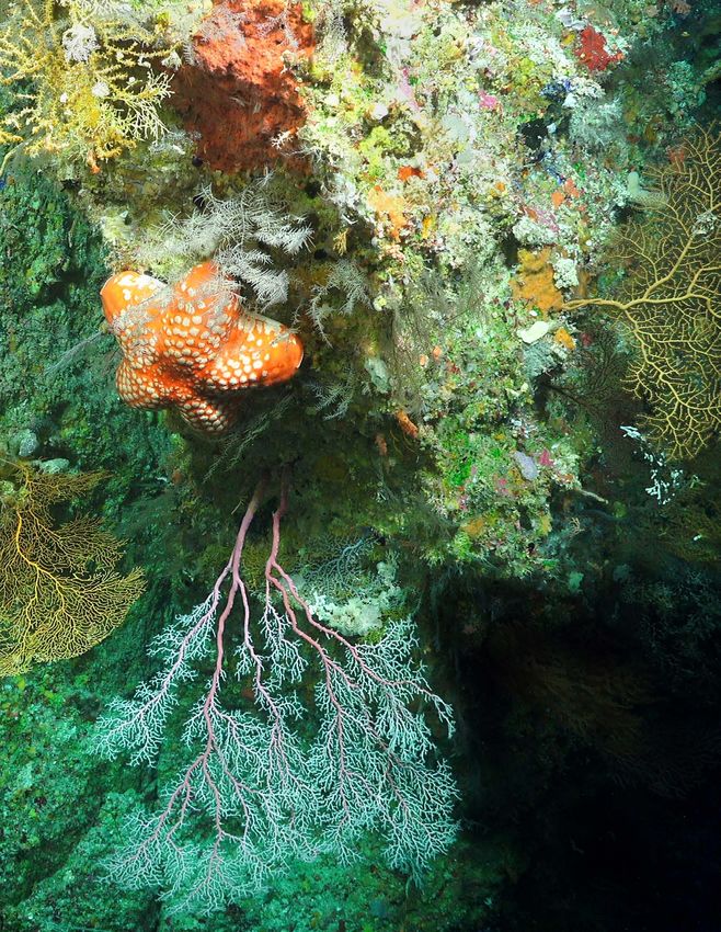
A variety of life, including corals and a very
rare Astrosarkus (commonly called a "pumpkin
star"), cling to a scarp face at 120 m depth found
during one of Schmidt Ocean Institute's expe-
ditions near Lihou Reef in the Coral Sea Marine
Park. This occurrence of the pumpkin star is a
substantial range extension to what has been
known. Image credit: Schmidt Ocean Institute

          ON THE COVER. A team aboard E/V Nautilus
          recovers ROV Hercules after a dive in the
          Southern California Borderland in November
          2020 (NA124). Image credit: Ocean Exploration
          Trust/Nautilus Live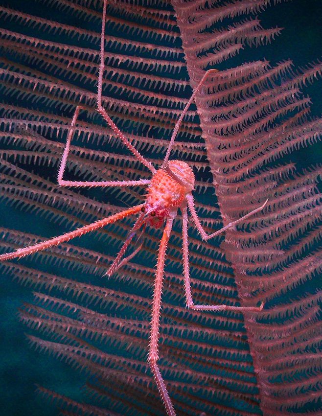
CONTENTS
INTRODUCTION............................................................................................................................................................................................................................................................... 1
Inner Space Center Media Production in the Cloud: Adapting Ocean Science Communication for the 21st Century..................... 4
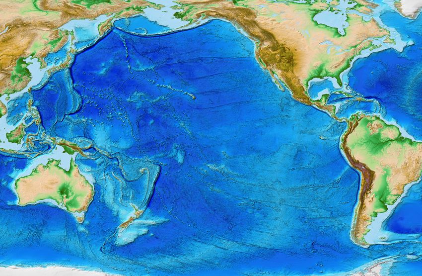
2020 Expedition Overview Map............................................................................................................................................................................................................................... 6
PART 1. OCEAN EXPLORATION TRUST – E/V NAUTILUS.............................................................................................................................................. 8
Technology.............................................................................................................................................................................................................................................................................10
Microbes to Microplastics: E/V Nautilus Expedition Samples in 2020....................................................................................................................................18
Bringing the Ocean to a Remote Learning World: Innovating with Telepresence......................................................................................................20
Nautilus Field Season Overview............................................................................................................................................................................................................................24
• Telepresence Closes the Distance in E/V Nautilus 2020 Field Season................................................................................................................................26
• Expanding Seabed Mapping: Supporting the US National Ocean Exploration and Characterization Efforts
in the US West Coast Exclusive Economic Zone..................................................................................................................................................................................28
• Ocean Networks Canada: Advancing Ocean Observing Technology and Science................................................................................................30
• Olympic Coast National Marine Sanctuary and Gradients of Blue Economic Seep Resources....................................................................32
• Exploring Monterey Bay National Marine Sanctuary......................................................................................................................................................................34
• California Streaming: Exploring Deep-Sea Coral and Sponge Assemblages in Sunny Southern California.....................................36
• Biodiversity Baselines and Biopharmaceutical Potential for the Borderland..............................................................................................................38
• Updates from the NOAA Ocean Exploration Cooperative Institute....................................................................................................................................40
PART 2. NOAA OFFICE OF OCEAN EXPLORATION AND RESEARCH.............................................................................................................44
Introduction: Looking Back and Looking Forward with the National Strategy for Mapping, Exploring,
and Characterizing the US Exclusive Economic Zone.........................................................................................................................................................................46
Harnessing the Blue Economy by Expanding Ocean Exploration............................................................................................................................................48
Exploring and Characterizing the Ocean.......................................................................................................................................................................................................51
Engaging Educators and the Public with Virtual Tools.......................................................................................................................................................................53
OER Partnerships Lead to New Exploration Technologies..............................................................................................................................................................55
Overcoming Challenges While Looking Ahead to 2021...................................................................................................................................................................57
PART 3. SCHMIDT OCEAN INSTITUTE – R/V FALKOR.....................................................................................................................................................58
Exploration Down Under: The Schmidt Ocean Institute 2020 Field Season....................................................................................................................60
WHAT’S NEXT: OVERCOMING A TUMULTUOUS YEAR..................................................................................................................................................68
Authors.......................................................................................................................................................................................................................................................................................70
Acknowledgments...........................................................................................................................................................................................................................................................72
References...............................................................................................................................................................................................................................................................................77
Acronyms.................................................................................................................................................................................................................................................................................78
PREFERRED CITATION
Raineault, N.A., J. Flanders, and E. Niiler, eds. 2021. New frontiers in ocean exploration: The E/V Nautilus,
NOAA Ship Okeanos Explorer, and R/V Falkor 2020 field season. Oceanography 34(1), supplement, 78 pp.,
https://doi.org/10.5670/oceanog.2021.supplement.01.
In the deep dark ocean, life seems to
attract other life. This small crusta-
cean clings happily to a black coral
where it sifts through the food that
the water movement delivers, both for
the coral and the crustacean. Image
credit: Schmidt Ocean Institute
INTRODUCTION
                                                                 By Nicole A. Raineault, Genene Fisher, and Carlie Wiener

This eleventh installment of the annual ocean exploration
supplement to Oceanography, the official magazine of
The Oceanography Society, highlights the work of three
vessels that contribute to exploring the world ocean:           ROV dives along the California Borderland and the Cascadia
the Ocean Exploration Trust’s (OET's) E/V Nautilus, NOAA        margin, supporting research into the biopharmaceutical/
Ship Okeanos Explorer, and Schmidt Ocean Institute’s            biotechnological possibilities of the deep sea and the
(SOI's) R/V Falkor.                                             broader importance of these areas (pages 32–33 and
   Although the global COVID-19 pandemic impacted the           38–39). Finally, the NOAA Ocean Exploration Cooperative
2020 programs, it did not prevent the execution of signif-      Institute (OECI) hired a director, Adam Soule, who started
icant ocean exploration work, both at sea and on shore.         work at the University of Rhode Island’s Graduate School
R/V Falkor and E/V Nautilus took to the seas for modified       of Oceanography in January. The institutions involved in
programs. NOAA paused at-sea operations for Okeanos             this venture have formalized working groups organized
Explorer, with the NOAA Office of Ocean Exploration and         to catalyze collaborations in key areas such as science and
Research (OER) instead focusing on development of               technology, data management and usability, telepresence
universal exploration products and enhancement of its           technologies, and education and branding. Technologies
virtual engagement efforts. The pages that follow contain       that will improve our ability to explore the ocean were
summaries of the 2020 expeditions, including initial results;   modified, acquired, or tested and will feature in the Nautilus
highlights of new programs and initiatives, many of which       2021 field season and beyond (pages 40–43).
were catalyzed by the pandemic; and information on future          The second section focuses on the 2020 activities of the
exploration plans.                                              NOAA Office of Ocean Exploration and Research. It opens
   The first section highlights OET and E/V Nautilus pro-       with an overview of the US strategy for ocean exploration
grams. The pandemic delayed the start of the season, as         that led to OER’s creation (page 46–47) and then intro-
the shipyard work to replace the engine was slowed. New         duces the new White House National Strategy for Mapping,
mobile control vans and an integrated studio van were also      Exploring, and Characterizing the United States Exclusive
installed and tested before the season got underway in          Economic Zone (NOMEC, 2020) and describes how OER’s
August. The shipboard team size was limited, which meant        mission fits within its blueprint (pages 46–47). The section
many dives and entire expeditions were led from shore.          discusses an underlying objective of the National Ocean
OET conducted cabled observatory work in partnership            Mapping, Exploration, and Characterization (NOMEC)
with Ocean Networks Canada and the University of Victoria       Council to expand the US blue economy (pages 48–50),
(pages 30–31). Olympic Coast, Greater Farallones, Monterey      provides examples of OER’s grant-supported projects that
Bay, and Channel Islands National Marine Sanctuaries and        are tied to the blue economy in the areas of bioprospect-
sites within the proposed Chumash Heritage National             ing (page 49) and deep-sea methane seeps (page 49), and
Marine Sanctuary were mapped and characterized                  describes development plans for a long-duration sensor
with remotely operated vehicles (ROVs; pages 32–37).            platform (page 50). OER then summarizes work that sup-
Expeditions focusing on the US blue economy featured            ports the NOMEC blueprint for exploration and characteri-
                                                                zation of the US Exclusive Economic Zone (EEZ) and provides
                                                                examples of the deep-sea products, exploration models,
                                                                and strategies (pages 51–52) that can be utilized by the

                                                                                                                            1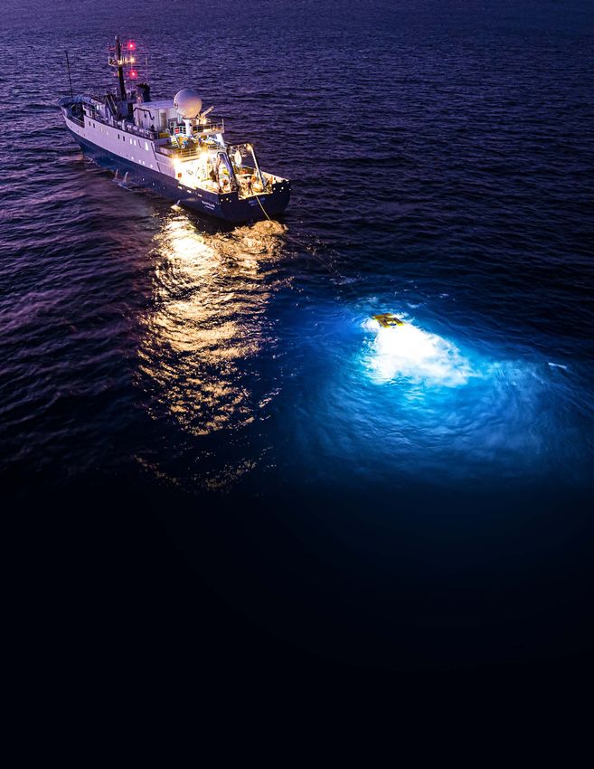
broader community. This section also describes a mapping
survey conducted in partnership with a commercial firm
and designed to accelerate mapping of the EEZ (page 52);
its success filled a significant gap in EEZ coverage while      with surprising new species, achievements, and discover-
advancing objectives of the Atlantic Seafloor Partnership       ies, including a 500 m tall detached reef in the Great Barrier
for Integrated Research and Exploration (ASPIRE). OER           Reef—the first discovered in this area in the last 120 years.
then discusses the NOMEC objective to build public and             Exploration in 2021 will capitalize on the groundwork laid
private partnerships and inspire and involve the public         this past year by the NOAA Ocean Exploration Cooperative
through such efforts as a matrixed educational program,         Institute as we apply new technologies and concepts of
new professional development offerings for educators, and       operation to our expeditions. As this publication went
an expanded internship program (pages 53–54). Next, OER         to press, OER welcomed aboard its new Cooperative
highlights the OER-supported NOMEC objective to develop         Institute Manager who will work closely with the OECI
new and emerging science and mapping technologies and           host University of Rhode Island and partnership institu-
features advancements in telepresence, remote mapping,          tions at the University of New Hampshire, the University
and autonomous vessel technologies (pages 55–57). This          of Southern Mississippi, the Woods Hole Oceanographic
section closes with a quick look at 2021 plans for Okeanos      Institution, and the not-for-profit Ocean Exploration Trust.
Explorer. After a series of shakedowns and sea trials for new   Nautilus will explore the waters between the US West
mission systems that were installed during the winter repair    Coast and Canada and then move west to continue explo-
period, the ship will conduct a technology demonstration        ration within the Papahānaumokuākea Marine National
as part of OER's commitment to advancing ocean technol-         Monument and other waters off Hawai‘i. Okeanos Explorer
ogies, explore seamounts off New England in support of          will conduct a technology demonstration expedition,
ASPIRE priorities, and focus on deep-sea mapping offshore       explore the New England and Corner Rise Seamounts that
the southeastern United States (page 57).                       formed when the North American Plate moved over the
   The year 2020 held surprises and discoveries for Schmidt     Great Meteor hotspot about 75 million years ago, and close
Ocean Institute, as R/V Falkor undertook a year-long initia-    gaps in the bathymetric coverage of waters offshore the
tive in waters off Australia. Eight expeditions with inter-     southeastern United States. An objective of the demonstra-
disciplinary teams of scientists from Australia and around      tion is to validate and develop the use of Terrain Relative
the world allowed for some of the first visualizations of       Navigation with respect to full ocean depth (11,000 m)
the continent's deep-sea environments (pages 58–67).            capable autonomous underwater vehicles. Schmidt Ocean
The collected imagery, samples, and data have important         Institute will continue to brave new frontiers in the ocean,
implications for future management decisions within the         pursuing work in Australian waters and the Pacific Ocean
Coral Sea, Gascoyne, and Great Barrier Reef Marine Parks.       with skilled research, community participation, and inter-
Along with the underwater surveys, Falkor’s mapping effort      disciplinary collaborations. SOI, OET, and OER are partner-
will help scientists better understand the Australian conti-    ing with large-scale international initiatives such as the
nent’s formation, history, and how its ecosystems have          UN Decade of Ocean Science for Sustainable Development
responded to climatic shifts and tectonic movement in the       and the Nippon Foundation-GEBCO Seabed 2030 Project.
geologic past. This section highlights the expeditions filled   These global campaigns are good examples of how collab-
                                                                oration can lead to broader understanding of our ocean.
                                                                We are committed to this collaborative work and extremely
                                                                hopeful about the future.

2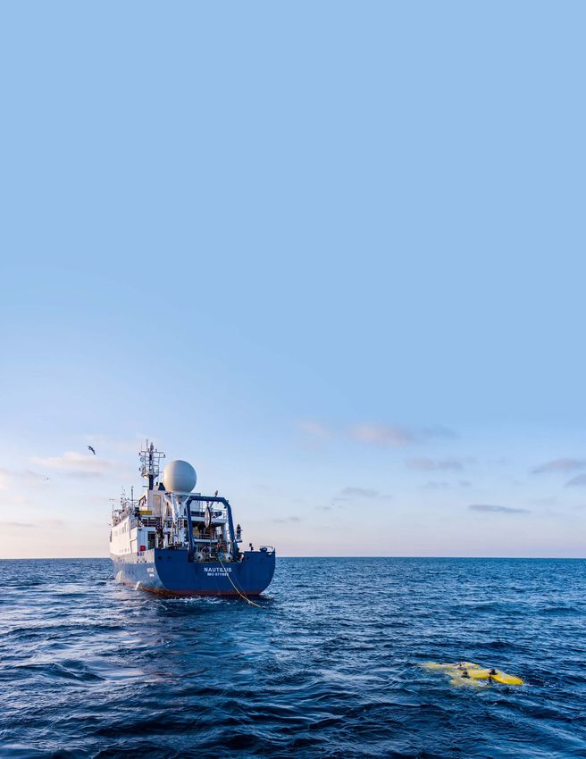
During an expedition in the Coral Sea, Schmidt
Ocean Institute uses ROV SuBastian to sample
sea life in the water column for Dhugal Lindsay,
a collaborator following remotely from the Japan
Agency for Marine-Earth Science and Technology.
Image credit: Schmidt Ocean Institute

                                             3
Inner Space Center Media Production in the Cloud
Adapting Ocean Science Communication for the 21st Century
By Holly Morin, Alex DeCiccio, Ryan Campos, Jessica Kaelblein, Derek Sutcliffe, and Dwight F. Coleman
The Inner Space Center (ISC) is a leader in using cutting- efforts of the NSF-funded Northwest Passage Project
edge telepresence technologies to support live ocean (Figure 1). It received over 3,600 views and was awarded a
exploration and connect scientists and other audiences on “Presenter’s Choice” medal during the Showcase.
shore with ocean science activities at sea. During a standard To further media and production efforts during the pan-
ocean exploration season, the ISC provides telepresence demic, the team connected with existing partners to talk
engineering and media production support for vessels such about engagement priorities and remote programming
as NOAA Ship Okeanos Explorer and E/V Nautilus to facilitate, considerations. Members of the media and communica-
capture, produce, and promote underwater exploration in tions industry were also contacted to better understand
real time. Although 2020 was a nontraditional exploration the production tools and techniques they used for virtual
season in many ways, the ISC was well positioned to meet engagement. This initial research was key to developing
many of the challenges associated with remote networking effective processes for cloud-based media production. New
and ocean science engagement during the pandemic. ways of collaboration were realized, and IP-based tools were
However, without ship-based communicators to estab- identified and tested to broadly support the engagement
lish an engagement link, the ISC Media and Production activities of the ocean exploration community.
Team had to adapt the way in which audiences—science Software-based IP communications, which maintain
and nonscience—could use telepresence connections and content and media assets in the cloud, are less expensive
access oceanographic content. The team had to redefine and require less staff time to operate than traditional
production strategies while working from home and con- telepresence practices. These strategies free up resources
duct more virtual meetings in the cloud. for other purposes, such as creating targeted programming
Advancing Reach Through Telepresence Technology for specific audiences and achieving continuity across
(ARTT) was the team’s first successful demonstration of different communication platforms. However, shifting to a
remote media production. The highly produced video piece, more IP-based mode of communication and production is
fully created while team members worked entirely at home, a fundamental shift away from traditional ISC telepresence
was submitted to the US National Science Foundation’s models, which are built on broadband-based equipment
(NSF) STEM for All Video Showcase in May 2020. The video and signal flow as well as high-end broadcast hardware and
highlighted the ocean science research and communication hub-like facilities to support communication infrastructure.
The ISC tested and invested in multiple pieces of produc-
tion software to successfully produce engaging and inter-
active programming in the cloud. Mobile-friendly intercom
applications, like Unity Intercom, were utilized for remote
communications during live programs. The ease of the
modern, web-based, user-friendly platform StreamYard,
with an Internet connection as the only requirement,
allowed connection to activities with one click.
This more accessible, browser-based entry point
increased science communication opportunities with
ocean and engineering professionals while not burdening
FIGURE 1. Almost a year after successful completion of the Northwest them with the unnecessary weight of managing produc-
Passage Project, the ISC participated in the NSF STEM for All Video tion elements. Collecting and formatting images and
Showcase to share the project’s research, student engagement, and
science communication techniques with others in the STEM com-
video, building a specific brand for each series or program,
munity. Advancing Reach Through Telepresence Technology was displaying and transitioning media during live programs,
entirely produced by the ISC Team while working from home. monitoring audio, tracking audience questions and
4
FIGURE 2. Remotely operated vehicle pilot and engineer, Jessica
Sandoval, speaks as a content expert in a Deep Sea Dialogues video FIGURE 3. Hosted by Samantha Wishnak, Communications Manager
on underwater robotics. In addition to being a stand-alone media for the Ocean Exploration Trust, this Next on Nautilus: Channel
piece, the video is also a supporting resource to NOAA OER’s virtual Islands National Marine Sanctuary and Santa Lucia Bank episode
professional development programs (supported by the ISC). featured the new ship broadcast studio and remote participants,
creating a “watch-party” environment between ship and shore.
comments in real time, and sharing questions with hosts
and experts during live broadcasts were the responsibility A few noteworthy lessons were learned during the ISC’s
of ISC staff working remotely from home. This enhanced dive into IP-based media production from home. The team
the impact of each program by allowing presenters to developed a renewed awareness of the importance of
focus on telling their stories and engaging with hosts and workforce dynamics such as patience, respect, and flexi-
audiences. Broadcast format transitioned from a more bility. At the same time, effective and consistent commu-
standard, single speaker/presentation style to one that was nication—both internally and externally—remained a top
more interactive and conversation-based (Figure 2). priority. Each ISC Media and Production project began with
Guests and hosts alike noted the seamlessness of these a dialogue that focused within a single, shared document.
programs and appreciated the ease of discussion that These documents became the framework that guided the
took place. The comfort level of teleconferencing helped development of each program. They also formed the back-
accelerate the early adoption of these programs in terms of bone for a new, collaborative process for efficient media
connecting with subject matter experts and sharing their production, one that embraces uncertainty and new ideas
stories from home. as well as the free flow of communication.
An IP-based approach to interactive programming also Although the year 2020 was challenging, the adjustment
allowed ship-based feeds to be incorporated into the same to working in a virtual environment offered an opportunity
browser-based broadcast studio. This created a unique to reflect on best practices and improve efficiencies. A new
opportunity for an enhanced “watch-party” environment sense of place and potential paradigm shift for ocean explo-
with video and audio that included select shore-based ration media production was recognized in the cloud envi-
observers and ship personnel (Figure 3). As IP-based com- ronment. It is nimble and accessible and highlights the ISC’s
munications replaced certain components of the traditional efforts to embrace modern approaches to communicating
broadcast environment, ISC production members could science and enabling future capacities for the way people
also “hot-swap” their roles and responsibilities, even during connect to the world of ocean science and exploration.
live programming. Such flexibility allowed for expanded
training opportunities for producers and communicators,
including those outside the ISC team.
From April through December 2020, the ISC produced
and/or hosted over 40 virtual and interactive programs,
including 17 Ocean Classroom Live episodes in collabora-
tion with the University of Rhode Island’s Graduate School
of Oceanography (URI/GSO) (Figure 4). The programs
covered topics such as ocean careers, shark behavior and
biology, and hurricanes; they aired through outlets such as
YouTube and Facebook Live; and they have been archived
to these social media platforms as well as the URI/GSO
website with associated resources. As of December 2020,
the videos have received nearly 10,000 cumulative views FIGURE 4. During the 16th episode of the URI/GSO’s Ocean Classroom
Live, the ISC’s Alex DeCicco fields audience questions live, with
on Facebook and over 1,400 views on YouTube.
Colleen Peters and Kylie Pasternak of URI/GSO. The focus of this
episode was ship-based career stories.
5
Page 28
                                                        Page 34
                       Expanding Seabed Mapping
                   1                                4   Exploring Monterey Bay
                       in the US West Coast
                                                        National Marine Sanctuary
                       Exclusive Economic Zone

                       Page 30                          Page 36
                       Ocean Networks Canada:           Exploring Deep-Sea Coral
                   2   Advancing Ocean Observing
                                                    5   and Sponge Assemblages in
                       Technology and Science           Southern California
    E/V NAUTILUS
    EXPEDITIONS        Page 32
                                                        Page 38
                       Olympic Coast National
                                                        Biodiversity Baselines
                   3   Marine Sanctuary and         6   and Biopharmaceutical
                       Gradients of Blue Economic
                                                        Potential for the Borderland
                       Seep Resources

                                                            R/V FALKOR EXPEDITIONS

                                                                       Page 61
                                                                       The Great Australian
                                                        1
                                                                       Deep-Sea Coral and
                                                                       Canyon Adventure

                                                                       Page 62
                                                                       Illuminating the
                                                        2              Biodiversity of the
                       5                                               Ningaloo Canyons

                           4                                           Page 63
                               3
                                                        3              Visioning the Coral Sea
                                                                       Marine Park
2                                  6
                                       7
                                                                       Page 64
                                                        4              Seamounts, Canyons, and
                                                                       Reefs of the Coral Sea

         1
                                                                       Page 65
                                                        5              Northern Depths of
                                                                       the Great Barrier Reef

                                                                       Page 66
                                                        6              Ice Age Geology of
                                                                       the Great Barrier Reef

                                                                       Page 67
                                                        7              Pinging in the New Year

     6
2020 EXPEDITION
2
3
OVERVIEW MAP
4
1
5
1 6 G 6
5
3 4
2
NOAA OFFICE OF OCEAN
EXPLORATION AND RESEARCH
Page 49
Page 50
Bioprospecting
1 Exploring 4 in an Ancient
Wimble Shoals
Submarine Forest
Southeastern
Exploring
2 5 US Deep-Sea
Blue Holes
Exploration *
Page 52
Paleolandscapes
Fugro
3 of the Gulf 6
Hydrographic
of Mexico
Survey *
*
E/V Nautilus Expeditions
NOAA OER also provided support for two
2020 E/V Nautilus expeditions to explore
6 Blue Economic Seep Resources and Mineral-
Rich Marine Biomes.
3
7Note: All images in the Nautilus section of this publication are copyright Ocean Exploration Trust Inc. unless otherwise indicated. 8
PART 1
Ocean Exploration Trust
         – E/V Nautilus

                      9
TECHNOLOGY RANGE. 24,000 kilometers (13,000 nautical miles)
at 10 knots
ENDURANCE. 40 days at sea
SPEED. 10 knots service, 12 knots maximum
E/V Nautilus FUEL CAPACITY. 330 cubic meters
Exploration Vessel (E/V) Nautilus is an efficient 64-meter PROPULSION. Single 1,285 kilowatt (1,700 hp)
ship, with berthing for 17 permanent crew members in controllable pitch main thruster; 280 kW bow tunnel
addition to 31 berths for members of the rotating Corps of thruster; 300 kW jet pump stern thruster
Exploration. Nautilus is equipped with a Kongsberg EM 302 SHIP SERVICE GENERATORS. Two 585 kVA generators,
multibeam echosounder and two remotely operated vehi- one 350 kVA generator
cles (ROVs), Hercules and Argus. The ship has a data lab and PORTABLE VAN SPACE. Three 6.1-meter (20-foot) vans
newly renovated wet lab for processing digital data and
physical samples. As part of the Ocean Exploration Trust’s COMPLEMENT. 17 crew; 31 science and operations
effort to share expeditions with students, public audi- FLAG. St. Vincent and the Grenadines
ences, and colleagues, we utilize telepresence technology
ADDITIONAL EQUIPMENT
to stream live video from the ROVs and various locations
aboard the ship in real time to the Nautilus Live website
• Dynacon 369i ROV winch with 4,500 meters (14,800 feet)
of 1.73 centimeter (0.681 inch) diameter electro-optic
(https://nautiluslive.org). Rochester cable
• DT Marine 210 winch
GENERAL
• Bonfiglioli knuckle-boom crane, 2–6 ton capacity,
two extensions
BUILT. 1967, Rostock, Germany • Two airtuggers, SWL 900 lbs each
LENGTH. 64.23 meters (211 feet) • A-frame, SWL 8 tonnes
• Two rescue boats; davit with SWL 0.9 mtn
BEAM. 10.5 meters (34.5 feet) • Oceanscience UCTD 10-400 profiling system;
DRAFT. 4.9 meters (14.75 feet) max depth 1,000 meters (3,280 feet)
TONNAGE. 1,249 gross, 374 net
TELEPRESENCE TECHNOLOGY
VSAT. 2.4 meter stabilized Sea Tel 9711 antenna capable
of C- and Ku-band operation of up to 20 Mbps (C-band
circular or linear)
REAL-TIME VIDEO STREAMING. Six Haivison Makito X
encoders streaming live video via satellite to the Inner
Space Center ashore (including spares)
10CAMERAS. 21 high-definition cameras: aft port, amid REFRIGERATION
and starboard (pan/zoom/tilt), transom, bow, Command • Panasonic MDF-C8V1 ULT –80°C/–86°C scientific freezer,
Center (7), wet lab, ROV hangar, winch hold (6) 0.085 cubic meters (3 cubic feet)
COMMUNICATIONS • Two scientific refrigerators, approximately
• Ship-wide RTS Odin intercom system for shipboard 0.57 cubic meters (20 cubic feet) each
communications and connection with shoreside • Two –20°C scientific freezers, 0.14 cubic meters and
participants 0.20 cubic meters (5 cubic feet and 7 cubic feet)
• Software audio connection for global participants using HAZMAT
VLink multi-platform intercom client (Mac, Windows, • Fume hood
Android, iOS); telephone interface is available through • Two HAZMAT lockers for chemical and waste storage
a Rhode Island exchange for real-time collaboration • Carry-on, carry-off chemical policy
between scientists ashore and on the ship
• Full Internet connectivity from shipboard LAN and wifi ROV HANGAR
• KVH TracPhone-v7 for redundant bridge
AREA. 24 square meters (258.3 square feet)
communication, providing telephone and IP service
POWER. 110/60 Hz and 220/50 Hz available
DATA PROCESSING & VISUALIZATION LAB PERSONAL PROTECTIVE EQUIPMENT. Hard hats, PFDs,
AREA. 44.5 square meters (480 square feet) high voltage gloves
WORKSTATIONS. Seven workstations for science LIFTS. 2 × 2-ton overhead manual chainfall lifts
managers, data loggers, navigators, educators, data STORAGE. Storage for spares and other equipment
engineers, satellite engineer, video engineer; seafloor
mapping data processing; flexible bench space ROV WORKSHOP
AREA. 18 square meters (193.8 square feet)
RACK ROOM
TOOLS. Complete set of hand tools, cordless tools,
AREA. 17.3 square meters (185 square feet)
electrical and fiber optic test equipment, mill-drill
DATA STORAGE. 29 TB onboard storage for non-video combination machine
data; 150 TB disk storage for video data
STORAGE. Storage for spares and other equipment
EMERGENCY COMMUNICATIONS. Iridium phone,
KVH phone CONTROL, COMMAND, & OUTREACH VANS
ELECTRONICS WORKBENCH. 2.3 cubic meters (80 cubic
AREA. 43 square meters (476 square feet)
feet) of storage
WORKSTATIONS. Twelve; typical configuration for ROV
operations: two to three scientists, data logger, pilot and
PRODUCTION STUDIO
copilot, navigator, video engineer, educator
AREA. 12 square meters (130 square feet)
VIDEO RECORDING AND STORAGE. Two Cinedeck
CAMERA. Remote controllable high-definition Sony ZX85 4K/HD video recorders that capture ROV footage
BRC-H700 in studio, Canon FX-305 for live deck television in two simultaneous codecs, two Blackmagic Hyperdeck
broadcasts uncompressed 4K recorders, two AJA KiPro Go recorders,
PRODUCTION. 8-input video production switcher for 2x LTO-6 archive media drives, 2x LTO-8 archive
live-produced interactions; mobile laptop unit for ship media drives
workspace interactions
WET LAB
AREA. 19 square meters (204.5 square feet) with
5.3-meter-long (17.5-foot) stainless steel bench and
2.3-meter-long (7.6-foot) worktop
11Acoustic Systems
KONGSBERG EM 302 MULTIBEAM KNUDSEN SUB-BOTTOM PROFILER
ECHOSOUNDER AND ECHOSOUNDER
The EM 302 is a hull-mounted 30 kHz multibeam echo- The Knudsen 3260 is a sub-bottom echosounder mounted
sounder composed of two long transducer arrays mounted inside the hull of Nautilus. It operates at low frequencies
in a T-shape on the hull of Nautilus. It was installed on the (3.5/15 kHz) so that the sound it emits can penetrate layers
ship between 2012 and 2013 to collect bathymetric, back- of sediment to about 100 m below the surface. The sound
scatter, and water column data. This information is useful that bounces back from each layer is captured by the system,
for identifying areas or features of interest, including gas creating a cross section of the seafloor. Scientists can use
seeps, and creating bathymetric maps for ROV dive plan- the data to identify subsurface geological structures such as
ning and situational awareness. The EM 302 can map the faults and ancient channels and levees. The Knudsen 3260
seafloor in water depths from 10 meters to 7,000 meters can operate in full ocean depths. The Knudsen system also
(33 feet to 22,965 feet) at ship speeds up to 12 knots. collects 15 kHz single-beam echosounding data.
FREQUENCY. 30 kHz PROFILER. Knudsen 3260 Chirp sub-bottom profiler
and echosounder
DEPTH RANGE. 10–7,000 meters (33–22,966 feet)
OPERATING FREQUENCY. Dual frequency,
PULSE FORMS. CW and FM chirp
3.5 kHz and 15 kHz
BEAMWIDTH. 1° × 1°
POWER. 4 kW on Channel 1 and up to 2 kW on Channel 2
APPROXIMATE SWATH WIDTH. 3–5 times water depth,
RANGE. 50–5,000 meters (164–16,404 feet)
up to 8 kilometers (5 miles)
APPROXIMATE GRID RESOLUTION. 10% water
depth (e.g., 10 meters [33 feet] at 1,000 meters ULTRA-SHORT BASELINE
[3,281 feet] depth) NAVIGATION SYSTEM
SYSTEM. TrackLink 5000MA
system for USBL tracking of
ROVs Hercules and Argus
RANGE. Up to 5,000 meters
(16,404 feet)
POSITIONING ACCURACY.
1° (~2% of slant range)
OPERATIONAL BEAMWIDTH.
120°
OPERATING FREQUENCY.
14.2–19.8 kHz
TARGETS TRACKED. Hercules,
Argus, and two additional
transponders are available. With
more transponders, up to eight
targets including the ROVs can
be tracked.
12Remotely Operated Vehicle (Towsled) Argus
ROV Argus was first launched in 2000 as a deep-tow system VEHICLE SENSORS & NAVIGATION
capable of diving to 6,000 meters. Argus is mainly used in
SYSTEM. NavEst integrated navigation system solution
tandem with ROV Hercules, where it hovers several meters
above in order to provide a bird’s-eye view of Hercules USBL NAVIGATION. TrackLink 5000 system, acoustically
working on the seafloor. Argus is also capable of oper- triggered
ating as a stand-alone system for large-scale deepwater PRIMARY HEADING. Crossbow high-resolution magnetic
survey missions. motion and attitude sensor
SECONDARY HEADING. Lord Microstrain 3DM-GX5-25
GENERAL Attitude and Heading Reference System (AHRS)
DEPTH CAPABILITY. 6,000 meters (19,685 feet), PRESSURE SENSOR. Paroscientific Digiquartz 8CB series
currently limited to 4,000 meters (13,123 feet)
ALTIMETER. Benthos PSA-916
CABLE. 4,500 meters (14,764 feet), 0.681 electro-optical,
3x #11 conductors, 3x SM fibers FORWARD-LOOKING SONAR. Mesotech 1071, 675 kHz,
0.5–100 meter (1.6–328.1 foot) range typical
SIZE. 3.8 meters long × 1.2 meters wide × 1.3 meters high
(12.5 feet long × 3.9 feet wide × 4.3 feet tall) SUB-BOTTOM PROFILING SONAR. TriTech SeaKing
Parametric Sub-bottom Profiler (10–30 kHz)
WEIGHT. 2,100 kilograms (4,700 pounds) in air,
1,360 kilograms (3,000 pounds) in water SIDE-SCAN SONAR. EdgeTech 4200 MP (300/600 kHz)
MAXIMUM TRANSIT SPEED. 2 knots
SCIENTIFIC INSTRUMENT SUPPORT
ASCENT/DESCENT RATE. 30 meters/minute
(98 feet/minute) max POWER. 110 V 60 Hz AC, 24 VDC and 12 VDC
power options
PROPULSION. Two Tecnadyne Model 1020 thrusters
for heading control DIGITAL DATA CHANNELS. Ethernet
IMAGING & LIGHTING
CAMERAS
• One Insite Pacific Zeus Plus high-definition camera
with Ikegami HDL-45A head and Fujinon HA
10 × 5.2 lens, 1080i SMPTE 292M output format,
2 MP still image capable on tilt platform
• Three utility cameras (fixed mounted) 480 line
NTSC format
• One DeepSea Power & Light Wide-i SeaCam, downward-
looking standard definition camera (fixed mounted)
LIGHTING
• Three CathX Aphos 16 LED lampheads,
28,000 lumens each
• Two DeepSea Power & Light 250 Watt
incandescent lights
13Remotely Operated
Vehicle Hercules
Since it was first launched in 2003, ROV Hercules has
been working in tandem with ROV Argus to explore the
geology, biology, archaeology, and chemistry of the deep
sea. Hercules is equipped with a high-definition video
camera, several LED lights, two manipulator arms, and a
variety of oceanographic sensors and samplers. A suite of
high-resolution mapping tools is available for use upon
request. Hercules can deliver up to 113 kg (250 lbs) of
samples or tools to and from the seafloor.
GENERAL VEHICLE SENSORS & NAVIGATION
DEPTH CAPABILITY. 4,000 meters (13,123 feet) SYSTEM. NavEst integrated navigation system solution
TETHER. 30–45 meters (98.4–147.6 feet), 20 millimeters HEADING AND ATTITUDE
(0.79 inches) diameter, neutrally buoyant • Primary Heading – IXSEA Octans III north-seeking
fiber-optic gyrocompass (0.1° secant latitude accuracy
SIZE. 3.9 meters long × 1.9 meters wide × 2.2 meters tall
with 0.01° resolution)
(12.8 feet long × 6.2 feet wide × 7.2 feet tall)
• Secondary Heading – TCM2 solid state fluxgate
MASS. ~ 2,500 kilograms (5,500 pound) mass in air compass
PAYLOAD. Up to 113 kilograms (250 pounds) PRESSURE SENSOR. Paroscientific Digiquartz 8CB series
MAXIMUM VEHICLE SPEED. 0.77 meters/second CTD. Sea-Bird FastCAT 49
(1.5 knots) forward, 0.25 meters/second (0.5 knots)
OXYGEN OPTODE. Aanderaa 3830
lateral, 0.5 meters/second (1 knot) vertical (on site,
within tether range) TEMPERATURE PROBE. WHOI high-temperature probe
(0°–450°C, 0.1°C resolution)
MAXIMUM TRANSIT SPEED. 1 meter/second (2 knots),
no sampling, in layback mode DOPPLER NAVIGATION & ALTITUDE. RDI Workhorse
Navigator Doppler Velocity Log 600 kHz, 0.7–90 meter
MAXIMUM ON-BOTTOM TRANSIT SPEED
range (2.3–295.3 feet)
0.5 meters/second (1 knot), no sampling
FORWARD-LOOKING SONARS
MAXIMUM SAMPLING TRANSIT SPEED
0.25 meters/second (0.5 knots) on flat seafloor; • Kongsberg Mesotech 1071 scanning sonar, 300 kHz,
1–200 meter (3–656 feet) range typical• Three Insite Pacific NOVA utility cameras, mounted • Starboard sample drawer: 65 cm × 50 cm × 30 cm
to view the starboard sample box, port rail, and aft (25.5 inches × 19.7 inches × 11.8 inches)
region 480 line NTSC format • Payload: Up to 113 kilograms (250 pounds) depending
• One Insite Pacific Aurora utility camera to view the on sensor package
eight-jar suction sampler, NTSC format • Custom configuration of boxes, crates, and containers
• One DeepSea Power & Light Wide-i-SeaCam to view
starboard side sample box, NTSC format
SCIENTIFIC INSTRUMENT SUPPORT
LIGHTING
SWITCHED POWER
• Two DeepSea Power & Light Matrix-3 LED lamps, • 110 V, 60 Hz AC
20,000 lumens, forward mounted
• Six to twelve DeepSea Power & Light SeaLite Sphere
• 24 VDC
LED lights, 6,000 lumens, mounting configurable
• 12 VDC
DIGITAL DATA CHANNELS
SCALING. Two green DeepSea Power & Light Micro
Sea-Lasers, mounted 10 cm (3.94 inches) apart,
• RS-232: 115 Kbauds
HD camera only
• RS-485/422: 2.5 Mbauds
• Ethernet: 10/100/1,000 Mbps links available
HIGH-RESOLUTION MAPPING SUITE • TTL: one TTL link
• Available for nonstandard mapping products HYDRAULIC. Proportional and solenoid hydraulic
• Typical configuration is downward looking; forward- functions:
looking configuration possible
• Two stereo Prosilica GT 2750 still cameras, one black &
• 1,150 psi at 5 GPM
white, one color; 2,750 × 2,200 pixels; 29° × 39° field of
• 1,850 psi at 5 GPM
view; 2–4 meter (6.5–13 feet) range; 200 watt-second
• 3,000 psi at 5 GPM (advance notice needed)
strobe lighting at one image every three seconds
• Structured light laser system with a dedicated Prosilica EXAMPLES OF USER-INSTALLED
GC 1380 still camera; runs concurrently with stereo TECHNOLOGY
imaging; 532 nanometer, 100 mW coherent laser; Advance notice is required for custom solutions to
45° line generating head engineering integration of user-provided sensors
• System also supports Norbit WBMS sonar – forward or and equipment.
downward facing • In situ mass and laser spectrometers
• Fluorometer, pH sensor, eH sensor
MANIPULATORS AND SAMPLING • Kongsberg M3 multibeam sonar
• 18 MP Ethernet connected digital still camera
MANIPULATORS
• Low-light camera
• Kraft Predator: Hydraulic, seven function spatially • Modular soft grippers
correspondent, force feedback, 200 lb lift
• ISE Magnum: Hydraulic, seven function, 300 lbs lift
SUCTION SYSTEMS
• Suction sampling system, eight 3-liter discrete
samples
• Venturi dredge excavation system
SAMPLING TOOLS. Mission configurable:
• Up to eight 6.35 centimeter (2.5 inch) inner diameter,
28 centimeter (11 inch) long push cores
• Up to six 5-liter Niskin bottles, manually triggered
• Custom tools and sensors can be integrated
SAMPLE STORAGE
• Forward sample tray (inboard): 45 cm × 33 cm × 25 cm
(17.7 inches × 13 inches × 9.8 inches)
• Forward sample tray (outboard): 68 cm × 35 cm ×
30 cm (26.8 inches × 13.8 inches × 11.8 inches)
15Remotely Operated Vehicle
(Towsled) Atalanta
IMAGING & LIGHTING
CAMERAS
• One Insite Pacific Mini Zeus high-definition camera
• Two mini utility cameras (fixed mounted) 480 line
NTSC format
LIGHTING
• Eight DeepSea Power & Light (LED) SeaLite LSL-1000
sphere lights
Atalanta was first launched in 2019 and is a smaller version
of Argus. It is used in tandem with ROVs Little Hercules or
VEHICLE SENSORS & NAVIGATION
Hercules, hovering several meters above in order to provide HEADING. Lord Microstrain 3DM-GX5-25 Attitude and
a bird’s-eye view of the ROV working on the seafloor. Heading Reference System (AHRS)
Atalanta is also capable of operating as a stand-alone
PRESSURE SENSOR. Paroscientific Digiquartz 8CB series
system for wider-scale deepwater survey missions.
ALTIMETER. Valeport VA500 500Khz Altimeter
GENERAL FORWARD-LOOKING SONAR. Mesotech 1071, 675 kHz,
0.5–100 meter range typical
DEPTH CAPABILITY. 6,000 meters (19,685 feet)
SIDE-SCAN SONAR. Edgetech 2205, 75/410 kHz
SIZE. 2.16 meters long × 1.0 meters wide × 1.2 meters tall
WEIGHT. 1,000 kg (2,200 pounds) in air;
1,700 pounds in water SCIENTIFIC INSTRUMENT SUPPORT
POWER. 110 V 60 Hz AC, 24 VDC and 12 VDC
MAXIMUM TRANSIT SPEED. 2 knots
power options
ASCENT/DESCENT RATE. 20–30 meters/minute
DIGITAL DATA CHANNELS. Ethernet, RS-232
(65–98 feet/minute) max
PROPULSION. Two Tecnadyne Model 1020 1 HP thrusters
for heading control
2020 TECHNOLOGY COLLABORATIONS
• OREGON STATE UNIVERSITY. Sexton still camera
• MBARI. Oxygen optode wand
• UNIVERSITY OF RHODE ISLAND. Deepi camera,
squishy fingers
• UNIVERSITY OF RHODE ISLAND AND
UNIVERSITY OF NEW HAMPSHIRE. Norbit WBMS sonar
• UNIVERSITY OF WASHINGTON. Biogeochemical
Argo floats
16Remotely Operated Vehicle
Little Hercules
ROV Little Hercules is a smaller sister to Hercules, designed IMAGING & LIGHTING
to function similarly with Argus or Atalanta but with a focus
CAMERAS
on gathering high-quality video imagery. Little Hercules is
equipped with a high-definition or 4K video camera, LED
• High definition or ultra high definition
lights, and basic sensors for navigation and situational
• Two mini utility cameras (fixed mounted) 480 line
NTSC format
awareness. Little Hercules was originally built in 2000, and
was extensively refurbished and upgraded to 6,000-meter LIGHTING
capability in 2019. • Four Deepsea Power & Light LED sphere lights
GENERAL VEHICLE SENSORS & NAVIGATION
DEPTH CAPABILITY. 6,000 meters (19,685 feet) HEADING. Lord Microstrain 3DM-GX5-25 Attitude and
Heading Reference System (AHRS)
TETHER. 30–45 meters (98.4–147.6 feet), 20 millimeters
(0.79 inches) diameter, neutrally buoyant PRESSURE SENSOR. Paroscientific Digiquartz 8CB series
SIZE. 1.4 meters long × 1.0 meters wide × 1.2 meters tall ALTIMETER. Valeport VA500 500Khz altimeter
WEIGHT. 400 kilograms (900 pounds) in air; FORWARD-LOOKING SONAR. TriTech Super SeaPrince
100 lbs payload 675 kHz, 50 meter (164 feet) range
MAXIMUM TRANSIT SPEED. 2 knots
ASCENT/DESCENT RATE. 20–30 meters/minute, SCIENTIFIC INSTRUMENT SUPPORT
(65–98 feet/minute) max POWER. 110 V 60 Hz AC, 24 VDC and 12 VDC power options
PROPULSION. Four Tecnadyne Model 1020 thrusters for DIGITAL DATA CHANNELS
heading control • RS-232 serial
• Ethernet: 10/100/1,000 mbps links available
ROV POSITIONING
The ROV systems are outfitted with an ultrashort baseline
(USBL) navigation system compatible with the operational
platform and scientific requirements.
USBL NAVIGATION. Sonardyne Ranger II or TrackLink 5000
17MICROBES TO MICROPLASTICS
E/V Nautilus Expedition Samples in 2020
By Nicole A. Raineault, Kate Kucharzyk, Taylorann Smith, Daniel Geiger, and Greg Rouse
Extraordinary collaboration and organization resulted in greater sampling outcomes in 2020 despite pandemic-related
shipboard staffing restrictions. Five ROV expeditions accommodated requests for over 600 specimens as well as a
wider variety of samples for several expeditions. The scientific community’s requests were organized into a single West-
Coast-wide sample list so that progress could be tracked for each cruise. Meredith Everett, a shoreside watch lead, and
Steve Auscavitch, science manager aboard Nautilus, coordinated the list, which included images of various fauna in situ to
guide the watchstanders. Scientists requesting ocean acidification and particulate organic matter samples sent detailed
protocols or videos to aid in the shipboard sample preparation. Other researchers sent gear and preservatives, which were
generously shared across different research groups. We accommodated two new types of sampling requests—one for
coral and sponge samples to be used in food web analysis and another for live and fossilized cup coral for use in climate
studies—along with standard geological and biological vouchers, DNA, and eDNA specimens. Some new research based
on 2020 collections is highlighted below.
MICROPLASTIC POLLUTANTS IN DEEP-SEA NATIONAL MARINE SANCTUARIES
– Taylorann Smith and Kate Kucharzyk
The presence of microplastics in the deep ocean creates risk The second program focused on microbial life and its
to ecosystem health mainly through ingestion. To support capability to degrade microplastics. This study is a part of
two research initiatives that are seeking to understand plas- a larger Circular Plastics Campaign at Battelle Memorial
tics pollution, water, sediment, and organism samples were Institute and will help scientists validate a unified platform
collected across the Channel Islands, Monterey Bay, and the to determine markers of microplastics and hydrocarbon
proposed Chumash Heritage National Marine Sanctuaries. degradation in the deep ocean using a suite of analytical
The first program observed drift kelp on the seafloor tools. Molecular diagnostics will help answer questions
and collected samples as an extension of Smith’s master’s on microbial identity and capability to degrade plastics in
research studying microplastics in kelp forest ecosystems. the ocean, and Raman spectroscopy will help assess the
Because the structure of the kelp Macrocystis pyrifera is spatial resolution of microplastics in sediment. These tools
thick, textured, and covered in mucus, it may accumulate allow robust characterization of microbial activities and
and serve as a vector for microplastics throughout marine may reveal new microorganisms or metabolites/enzymes
systems (Figure 1). To identify the concentrations and types involved in plastics biodegradation. Resulting evidence
of microplastics associated with different water mass prop- of microorganismal ability to degrade microplastics and
erties, water samples were collected at different depths. plastics-adsorbed pollutants will inform modeling of the
Organisms utilizing various feeding mechanisms, includ- persistence of hydrocarbons and plastics, as well as the
ing sea pens and sea urchins, were collected to identify bioaccumulation risks associated with microplastics, in
the concentrations and types of microplastics ingested. deep ocean benthos.
Sediment cores and Niskin bottle samples were collected
to compare the types of microplastics present in the envi-
ronment to those within the organisms. Organic material
will be removed from organisms, and tissues will be filtered
and viewed under a dissecting microscope to count the
microplastics. Micro-FTIR will be used to determine the
types of plastics. This interdisciplinary work will provide
information that could help policymakers implement solu-
tions to the now widely recognized plastics problem.
FIGURE 1. Sea urchins feeding on
18 Macrocystis pyrifera drift kelp.MICROINVERTEBRATES FROM SEDIMENT SAMPLES – Daniel Geiger
Deep-sea microinvertebrates are even less well understood than their larger counter-
parts, as they frequently fall through collection nets. Seventeen sediment samples
were collected with scoop, core, or slurp, yielding 26 quart jars of material. Some
larger specimens of special interest to Santa Barbara Museum of Natural History
researchers were also gathered, including three lots of Brachiopoda, larger snails
(Bathybembix bairdii, Neptunea amianta, Calliostoma variegatum), large clams (Acesta
sphonii), and a mystery brachiopod/bivalve specimen, unidentifiable from video
footage, that turned out to be the clam Dimya californiana. From video footage, the
Brachiopoda appeared to be Laqueus californicus, but upon closer inspection turned out
to be very finely sculptured Terebratulina crossei and T. kiiensis, as identified by our brachio-
FIGURE 2. Terebratulina kiiensis pod expert Vanessa Delnavaz (Figure 2). We have started the long and laborious process of
(Dall & Pilsbry, 1891) (SBMNH sorting the sand samples, prioritizing the deepest sample from 3,500 m. Six bivalve species
650639, NA123-131) from off of
southeast Santa Cruz Island,
were recovered (one providing a new shallowest record for the species), one small snail
809 m depth. Image credit: of unknown identity, and surprisingly even one (maybe two) caprellid isopods on mud
Vanessa Delnavaz bottom. Foraminifera were the most diverse, with an estimated dozen species in a relatively
small sample, plus a good number of amphipods. Thus far, 53 lots have been catalogued,
which is but a very small fraction of the ultimate number of lots to be incorporated. All
those specimens will be accessible through the Santa Barbara Museum of Natural History
online data portal (http://www.sbizcollections.org/iz/) as well as through the iDigBio portal
(https://www.idigbio.org/portal/search).
WHALEBONE-EATING WORMS – Greg Rouse
With the permission of NOAA’s National Marine Fisheries Service, slurp samples of friable
bone pieces and a whole bone, likely a humerus, were collected from a whale fall discov-
ered on cruise NA117 in 2019. The mature minke whale skeleton had significantly degraded
b
in the year since the initial visit, likely in part owing to the action of bone-eating annelid
Crown
worms of the genus Osedax. Osedax access the collagen matrix of the bone by secreting
acid from root-like tissues. They then consume the collagen with the aid of symbiotic bac-
teria. This softening and opening up of the bone means the skeleton will break down much
faster. Eighteen species of Osedax have been named from California to date. On the initial
Trunk
visit, some bone pieces with large Osedax had been preserved in ethanol, and they proved,
via DNA analysis, to be a new species. Initial study
of some bone pieces from the 2020 cruise sug-
gests there are two other Osedax species that may a
also be new because this whale fall is the deep- Roots
(broken)
est to be studied to date in the eastern Pacific
(Figure 3). DNA sequencing is underway to assess Tube
this possibility. Several other annelid worms were .5 mm
Trunk and
also collected and will be studied. The humerus, crown in tube
still covered with the large species of Osedax, was Bone
deep frozen and awaits thawing and dissection
to remove them before sending the bone to the
California Academy of Sciences.
Roots and
FIGURE 3. (a) Osedax specimen partially dissected from ovary
the whale bone. The bone was placed in ethanol so most
color has been lost. (b) Osedax specimen dissected from
the bone. Most of the “roots” were detached in this case.
1 mm 19BRINGING THE
OCEAN TO A REMOTE
LEARNING WORLD
Innovating with Telepresence
By Samantha Wishnak, Megan Cook, Kelly Moran,
Jonathan Fiely, Megan Lubetkin, Emily Ballard,
Madison Dapcevich, and Allison Fundis
Building from a foundation of pioneering telepresence technol-
ogy that connects global audiences to the deep sea, the OET
Education & Outreach team continued to innovate during the
COVID-19 pandemic by quickly adapting to changes in travel
and teaching landscapes. During this period, our Nautilus Live
streaming platform and education resources were critical in
offering real-time access to shipboard and remote scientists
and engineers participating in expeditions, as well as stu-
dents, educators, and the general public who were following
along from home.
As part of COVID-19 mitigation protocols, staffing during
expeditions aboard E/V Nautilus was significantly reduced
and, in a difficult decision, our signature education programs
were postponed. Accepted participants for the 2020 Science
Communication Fellowship, a program immersing formal
and informal educators in the Nautilus Corps of Exploration
as expedition communicators, and the Science & Engineering
Internship Program, a program providing hands-on workforce
development training and mentorship for community college
students, undergraduates, and recent graduate STEM students,
were deferred to the 2021 expedition season. Participants were
encouraged to engage in exploration via telepresence and in
other virtual opportunities throughout the year. Strengthened
by over a decade of experience with virtually connecting learn-
ers all over the world to seagoing expeditions and explorers in
real time, OET was uniquely positioned to lead impactful learn-
ing experiences during this period when remote learning and
working became a necessity.
NEW WEBSITE LAUNCH
In early 2020, we successfully launched a completely refreshed
NautilusLive.org that now provides extensive situational aware-
ness and resources for a range of audiences, including scientists,
students, educators, and the general public (Figure 1). This fully
responsive website is designed for use on a range of devices
FIGURE 1. Development continues on the redesigned NautilusLive.org
website as the central portal into OET expeditions for students, educators,
scientists, and the general public who all remotely explore along with us.
20and contains the latest expedition content, social media
updates, and four live-streaming channels that offer real-
time access to expedition operations.
With reduced shipboard staffing and our resulting expe-
dition outreach paced more asynchronously, we optimized
several features of the new website to support this new
paradigm. Dedicated expedition pages serve as archives for
all related team members and featured content, and a new
Expedition posts section allows social media posts to be
permanently linked in order to feature personal perspec- 2019
tives and storytelling from cruise participants both on ship
and ashore. Expanding across seasons, a decade of Nautilus
2020
expeditions is now searchable by map location, year, region,
and topic for more in-depth exploration. Highlighting our FIGURE 2. The top social media highlight of this year’s expedition
Education Resources page, an #InspiredByNautilusLive compared the noticeable decomposition of a whale fall surveyed in
2019 and 2020 at Davidson Seamount.
section highlights social media posts from members of our
growing community and their use of our lessons, programs,
and live streams in their learning spaces at home, at school,
and in the community. streams and channel-wide highlight videos, with the same
As many expedition participants and Scientists Ashore level of live stream minutes watched in just three months
engaged remotely from home offices, several features of as compared to our entire 2019 expedition season, which
our website were further developed to support partners was nearly twice as long. Similarly, engagement levels
exploring with us via telepresence. The “on watch” website with our content across Facebook, Instagram, and Twitter
roster expanded to feature all shoreside participants along exceeded those of our 2019 season despite the shorter
with at-sea watchstanders to improve situational aware- operating period. A highlight video comparing our 2020
ness for viewers. A new Data Management page provided and 2019 surveys of a decomposing whale fall at Davidson
information for the public and researchers to efficiently Seamount within Monterey Bay National Marine Sanctuary
access our data and samples through publicly available captured the attention of the public with over 2 million
repositories or OET request forms. As science teams require views across our platforms (Figure 2).
access to additional resources to successfully conduct Our increased viewership levels and the appreciative
dives from shore, we plan to build out our Scientists Ashore comments we received from viewers on our social media
portal to streamline remote operations. platforms reflected pandemic policies that kept people
around the world at home and connected through various
EXPEDITION OUTREACH AND devices. Viewer comments ranged from education settings,
ONLINE VIEWERSHIP with a college professor writing in, “We viewed the live-
Expedition outreach this season was designed to oper- stream during class today to highlight the national marine
ate from shore, independent from at-sea operations—a sanctuaries off the California coast,” to home quarantines
departure from our signature outreach model offering with a viewer sharing, “Just wanted to tell you that watch-
audiences the immersive experience of interacting with ing Nautilus videos has been added to my self-care routine.”
the team members in ship spaces at sea. Without Science Shipboard quarantine restrictions prevented press
Communication Fellows, Communications Leads, or Docu- events while in port, but ongoing research involving data
mentarians aboard Nautilus, the pace of our expedition collected aboard Nautilus continued to be featured in
outreach became more asynchronous, with most web online news publications, including Scripps Institution of
and social media content facilitated and created by team Oceanography research coverage in Wired (Niiler, 2020),
members off ship. Due to staffing limitations, our 24/7 live Charles Darwin Foundation’s announcement of 30+ new
streams could not support round-the-clock moderating species discovered in the Galápagos Islands (Grijalva, 2020),
of viewer comments and questions. Instead, we used pre- and Hakai Magazine’s feature on seamounts of British
scheduled special Q&A sessions facilitated by shoreside Columbia (Lavoie, 2020). Since spring 2020, we have also
staff and partners. seen a jump in footage requests from online media outlets,
Despite these changes, we observed higher levels of as well as from documentary productions for Smithsonian
viewership and engagement across our live stream and Channel, BBC Natural History Unit, and other national and
social media platforms this season. The Nautilus Live international media production companies.
YouTube channel received over 20 million views of the live
21You can also read


