Plan for Fylde - Plan for the Future - Economic Development Strategy and Action Plan
←
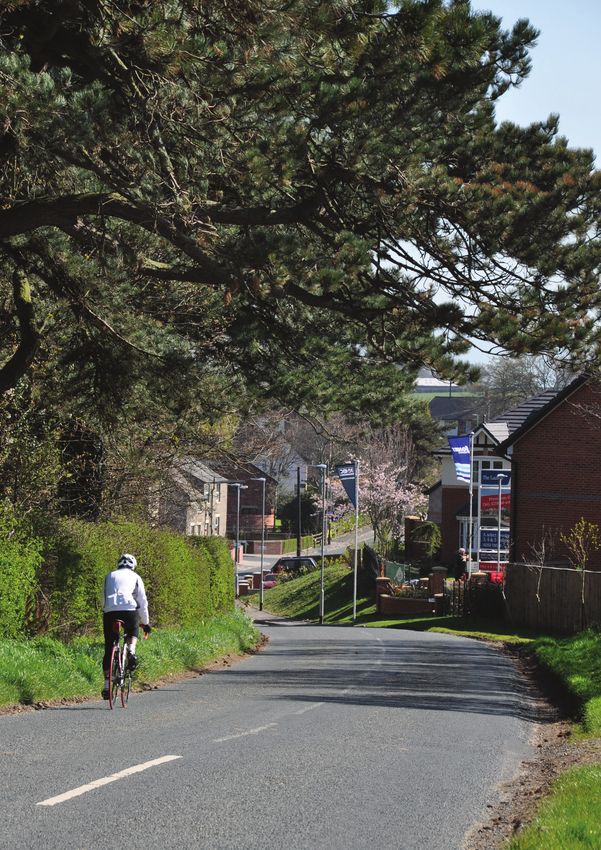
→
Page content transcription
If your browser does not render page correctly, please read the page content below
Plan for Fylde - Plan for the Future

                    Fylde Council
The Infrastructure Delivery PlanEc
                                 to 2032
                                      Str
                             August 2016
CONTENTS

The Infrastructure Delivery Plan (IDP) to 2032

Introduction		1

Chapter 1:   Introduction 								2

Physical Infrastructure		                                9

Chapter 2 : Transport								10
Chapter 3 : Utilities									22
Chapter 4 : Waste Management							36
Chapter 5 : Flood Risk and Coastal Defence						37

Social (Community) Infrastructure		                      41

Chapter 6 : Education								42
Chapter 7 : Health and Social Care							50
Chapter 8 : Emergency Services							54
Chapter 9 : Neighbourhood and Community Facilities				   56

Green Infrastructure		                                   65

Chapter 10 :
             Green Infrastructure							66

Governance Arrangements		                                73

Chapter 11 :
             Governance Arrangements						74

Appendices		77

Appendix 1 : Infrastructure Delivery Agencies					78
Appendix 2 : Infrastructure Delivery Schedule 					82
3

                               LIST OF TABLES

 The Infrastructure Delivery Plan (IDP) to 2032

Table 1 :       Strategic Pumping Station						31
Table 2 :       School Place Bed Yield							45
Table 3 :       Surplus Primary School Places, January 2016				                  46
Table 4 :       Surplus Secondary School Places, January 2016			                 46
Table 5 :       Headline Shortfalls from the Playing Pitch Assessment Report		   57

The Infrastructure Delivery Plan (IDP) to 2032
4

    The Infrastructure
      The              Delivery
          Infrastructure        Plan
                         Delivery Plan(August
                                       (IDP) to2016)
                                                2032
1

Introduction

Chapter 1 : Introduction

2   Introduction

         Chapter 1:
         Introduction

         Introduction

         1.1   The new Fylde Local Plan will guide development up to the year 2032, and will eventually
               replace the current adopted Fylde Borough Local Plan (As Altered: October 2005). The
               new Local Plan contains a Vision and a Development Strategy that sets out how the
               council would like Fylde to develop up to 2032. The Local Plan sets out plans and policies
               which provide for the needs of the area, addressing climate change and achieving high
               quality design, good accessibility and community involvement.

         1.2   The Infrastructure Delivery Plan, hereinafter referred to as the IDP will seek to
               establish what additional infrastructure and service needs are required to support and
               accommodate the quantum and distribution of development proposed in the Fylde
               Local Plan. Fylde Council is planning to provide land for the delivery of a minimum of
               7,768 new homes between 2011 and 2032, together with approximately 60.6 Ha of
               employment land (gross requirement) over the same period of time. The Development
               Strategy in the Local Plan identifies four Strategic Locations for Development:

                   ▪▪ Lytham and St Annes;
                   ▪▪ Fylde-Blackpool Periphery;
                   ▪▪ Warton; and
                   ▪▪ Kirkham and Wesham,

         		    which together will accommodate the majority of the planned new development.

         1.3   This IDP has been developed as a result of extensive dialogue and consultation with
               infrastructure and service providers. The IDP will help ensure that the additional
               infrastructure and services that are needed are identified and delivered in a timely, co-
               ordinated and sustainable way. It will be a mechanism for improving delivery of facilities
               and services for the benefit of local communities and will provide a robust framework
               that will support bids for funding and assist decision making.

         1.4   Infrastructure can take many forms – it can be defined in physical, green and community
               terms and is essential to support objectives of increased housing provision, economic
               growth, improving access and connectivity, mitigating climate change, and of creating
               thriving and sustainable communities. In addition to housing and job opportunities,

                                                              The Infrastructure Delivery Plan (August 2016)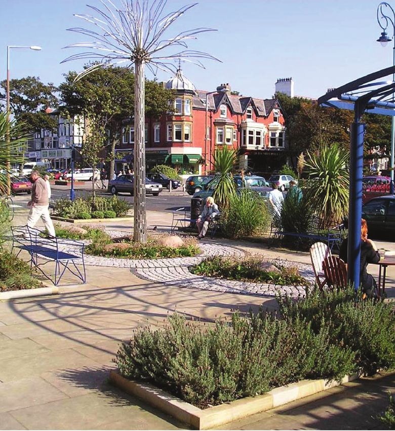
Introduction      3

        supporting infrastructure including green energy, utility services, transport, schools, open
        space, community, health and leisure services, are all needed.

What is infrastructure?

1.5     This IDP uses the term ‘infrastructure’ in its broadest sense to mean any service or facility
        that supports Fylde and its population. It includes, but is not restricted to the following:

         ▪▪ Transport: highways, air travel, rail, trams, bus, cycling, pedestrian, coach parking and
            park and ride.
         ▪▪ Education: nursery and pre-school, primary, secondary, further, higher, and adult
            education.
         ▪▪ Energy: gas and electricity generation and provision.
         ▪▪ Water: supply, wastewater and surface water drainage, flood
            defences and flood risk management.
         ▪▪ Information and communications technology:
            telecommunications, broadband and cable television.
         ▪▪ Health: hospitals, health centres/GP surgeries, dental
            practices, pharmacies and hospices.
         ▪▪ Green Infrastructure network: open space, parks,
            children’s play areas, sports pitches and courts, country
            parks and accessible natural green space, allotments and
            burial facilities.
         ▪▪ Emergency services: police, fire service, ambulance and HM
            coast guard.
         ▪▪ Community services: libraries, community centres, youth services,
            social services, older peoples support, special needs and disability and places of
            worship.
         ▪▪ Affordable housing
         ▪▪ Culture and leisure: museums and galleries, performance venues, sports and fitness
            centres.
         ▪▪ Public realm
         ▪▪ Waste management: refuse collection and disposal, recycling.

1.6     While the term infrastructure is very broadly defined, this does not mean that this
        IDP seeks to cover in detail all of the above items. That would make the process
        unmanageable. This IDP seeks to give a broad overview of the way certain infrastructure
        is planned and the agencies involved in its delivery. It also looks in more detail at costs
        and likely funding mechanisms for some items of infrastructure, in particular those that
        are critical to delivering the new Fylde Local Plan.

1.7     A Delivery Schedule of key infrastructure projects is included in Appendix 2 of this
        IDP. The key infrastructure projects are those required to accommodate the quantum
        and distribution of development that is being proposed in the Local Plan. The schedule

The Infrastructure Delivery Plan (August 2016)
4   Introduction

                 highlights uncertainties surrounding funding and delivery, and will therefore impact upon
                 the amount, distribution and phasing of development in the Local Plan. The schedule will
                 also inform the development of the Regulation 123 List which will comprise part of the
                 Community Infrastructure Levy - hereinafter referred to as the CIL.

         Policy Context

         1.8     The National Planning Policy Framework (the Framework) sets out a ‘presumption in
                 favour of sustainable development’ and the government is committed to ensuring that
                 the planning system supports sustainable economic growth. This means that the planning
                 system should encourage, not act as an impediment to, sustainable growth.

         Planning Positively for Infrastructure

         1.9     It is crucial that the Local Plan and the IDP are written positively so as to enable the
                 quantum and distribution of development and infrastructure required in the borough
                 to meet the objectives, principles and policies of the Framework. One of the core
                 planning principles set out in paragraph 17 of the Framework is that planning should
                 drive and support sustainable economic development, and this includes the delivery of
                 infrastructure. Paragraph 21 requires that planning policies should recognise and seek to
                 address potential barriers to investment, including any lack of infrastructure.

         1.10    Specifically, Local Plans should include strategic policies for the provision of transport
                 infrastructure, telecommunications, waste management, water supply, wastewater,
                 flood risk and coastal change management and the provision of minerals and energy.
                 The council should work with other authorities and infrastructure and service providers
                 to assess the quality and capacity of this infrastructure and take account of the need for
                 strategic infrastructure, including nationally significant infrastructure within their areas.

         1.11    Paragraph 156 of the Framework also requires strategic policies for the provision of
                 health, security, community and cultural infrastructure and other local facilities. To deliver
                 these facilities, paragraph 70 of the Framework says that planning policies and decisions
                 should plan positively for the provision of shared community facilities and other local
                 services to enhance the sustainability of communities and residential environments.

         Collaborative Working

         1.12    For a Local Plan to be considered ‘sound’ at examination, the Plan should be positively
                 prepared and based on a strategy that seeks to meet objectively assessed development
                 and infrastructure requirements, including unmet requirements from neighbouring
                 authorities where it is reasonable to do so. The Plan must also be effective, which
                 includes that it should be based on effective joint working on cross-boundary strategic
                 priorities (the Framework, paragraph 182).

         1.13    The Framework emphasises the requirement to plan strategically across local boundaries.
                 For example, paragraph 31 says that councils should work with neighbouring authorities
                 and transport providers to develop strategies for the provision of viable infrastructure
                 necessary to support sustainable development and paragraph 180 says that councils

                                                                 The Infrastructure Delivery Plan (August 2016)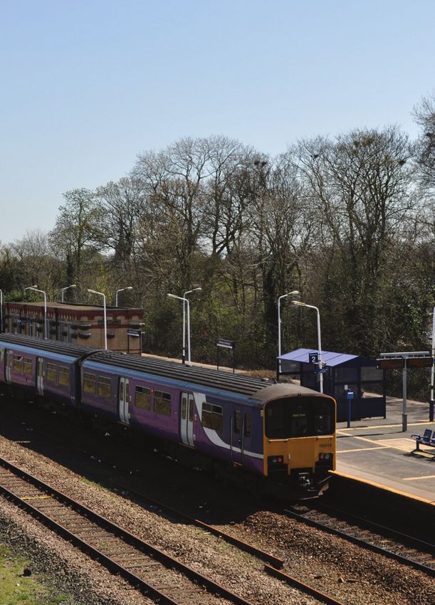
Introduction      5

        should work collaboratively with utility and infrastructure and service providers. Paragraph
        181 states that councils will be expected to demonstrate evidence of having effectively
        co-operated to plan for issues with cross boundary impacts, in order that the Local Plan
        will be able to provide the land and infrastructure necessary to support current projected
        future levels of development.

Delivery of Infrastructure

1.14    For a Local Plan to be considered ‘sound’ at examination, the Plan must be effective,
        which includes that it should be deliverable over its period. Councils should ensure
        that there is a reasonable prospect that planned infrastructure is deliverable in a timely
        fashion. This requires that the council understands district-wide development costs at the
        time the Local Plan is drawn up. For this reason, infrastructure and development policies
        should be addressed concurrently (the Framework, paragraph 177).

1.15    To achieve sustainable development, paragraph 173 of the Framework requires careful
        attention to viability and costs. To ensure viability, the costs of any requirements likely
        to be applied to development, including requirements for contributions towards the
        provision of infrastructure, should provide competitive returns to the land owner and
        developer to enable the development to be deliverable.

Methodology

1.16    Engagement with infrastructure and service providers began at an early stage in the Local
        Plan process, so that major infrastructure issues (that could affect the way the borough is
        developed in the future) could be identified at an early stage. In doing this, the council has
        been able to proactively prepare the Local Plan in accord with infrastructure needs and
        provision.

1.17    In 2010, the council held meetings with various infrastructure providers, and these
        meetings centred on the deliverability of sites identified in the Strategic Housing
        Land Availability Assessment (SHLAA). In respect of these sites, the council sought to
        understand infrastructure issues, including whether there are significant infrastructure
        deficits in the borough and whether the sites identified in the SHLAA could be
        accommodated in line with existing or planned provision of infrastructure.

1.18    Engagement with infrastructure and service providers has continued as the Local Plan has
        developed. Following the Issues and Options consultation on the Local Plan in June-July
        2012, the council began to identify strategic sites for housing, employment and mixed-use
        development. In November 2012, an informal consultation took place with infrastructure
        and service providers, who were informed of potential strategic sites that could be
        included in the Local Plan: Preferred Option. A further round of consultations with the
        infrastructure and service providers took place in summer 2015 on the strategic and non-
        strategic sites that comprised the council’s Revised Preferred Option for development
        over the lifetime of the Local Plan to 2032. During the two rounds of consultations, the
        council requested that infrastructure and service providers supplied information for each
        site in relation to the following questions:

The Infrastructure Delivery Plan (August 2016)
6   Introduction

                   ▪▪ Can each site be accommodated within your existing or planned provision?
                   ▪▪ Can each site be accommodated with appropriate upgrading of infrastructure? If so,
                      what infrastructure would be required, what would be the financial cost and how
                      could this be met? Over what timescale, could the infrastructure be delivered?

         1.19   The information obtained from these two rounds of consultation assisted the council
                in sequentially assessing which sites should be included and be carried forward in the
                Publication version of the Local Plan, so that the proposed quantum and distribution
                of development, including new homes, jobs and other commercial, retail, leisure
                development proposed for the borough could be met.

         1.20   A new Playing Pitch Strategy has been prepared jointly by the council and KKP
                consultants, together with a Built Facilities Review and an Open Space Study Update. The
                Open Space Study Update, 2016 sets out a number of recommendations for the provision
                of new or improved parks and gardens, greenspaces, play areas, allotments and burial
                grounds. The outcome of all three pieces of work reveal a need for further sporting and
                recreation facilities and improvements to existing sites. Consequently, the infrastructure
                requirements in this IDP and Infrastructure Delivery Schedule (the IDS) at Appendix 2 in
                this document have been updated.

         Community Infrastructure Levy

         1.21   The Community Infrastructure Levy (CIL) is the Government’s response to the need for
                development to contribute to the provision of infrastructure either directly or indirectly
                related to the development in question; and the view that the planning obligations
                (Section 106) provisions provided only a partial and variable response to capturing
                funding contributions for infrastructure. To enable the funding and delivery of future
                infrastructure in Fylde, to overcome existing shortfalls in provision and to accommodate
                the quantum of development identified in the emerging Local Plan, the council approved
                the principle of adopting a community infrastructure levy (the CIL), alongside the Local
                Plan, in February 2015. The Preliminary Draft Charging Schedule (the PDCS) is currently
                out for consultation alongside the Publication version of the Local Plan, following an
                assessment by consultants Keppie Massie, in conjunction with White Young Green (WYG)
                of the extent to which a CIL could be introduced in Fylde without prejudicing future
                development. The assessment concluded that the evidence of the research and results of
                the viability appraisals identified significant differences in the values, costs and therefore
                viability, between residential and non-residential developments. It recommended that
                Fylde Council, as Charging Authority, should consider introducing CIL on the basis of
                varying its charge by use, as a minimum between the broad categories of residential
                and non-residential development, and to introduce a single charge for new residential
                development. The levy will be charged at a rate of pounds per square metre, based on
                the net additional internal floor-space of any given development for used identified in the
                charging schedule. The CIL will comprise an adopted charging schedule and a Regulation
                123 List of infrastructure projects.

         1.22   Under the CIL, Councils are empowered (but not required) to set a charge for most
                developments, through a formula related to the scale and type of the scheme. The monies
                must be spent on local and sub-regional infrastructure which supports the development
                of the area. CIL differs from previous Section 106 regimes in that:

                                                                The Infrastructure Delivery Plan (August 2016)
Introduction 7
▪▪ it will capture a much wider range of development thereby sharing the burden,
whereas Section 106 had tended to focus mainly on larger schemes; and
▪▪ it breaks the direct link between the obligation and the development, so that
infrastructure spending can be managed at a strategic level. Planning Obligations
through Section 106 agreements will still continue alongside CIL, but they will only be
available for a restricted number of purposes.
1.23 Whilst CIL is expected to provide significant additional monies for infrastructure, it will
not replace existing mainstream funding. Core public funding will continue to bear the
main burden, and councils will need to utilise CIL alongside other funding streams to
deliver infrastructure plans locally, including Section 106 planning obligations. Section 106
planning obligations are a key delivery tool, providing the opportunity to secure financial
contributions which mitigate against the localised impacts of development which would
otherwise render the proposal unacceptable in planning terms. The CIL and Section 106
planning obligations, along with other funding streams will be vital in supporting the
delivery of infrastructure in Fylde borough.
How the Infrastructure Delivery Plan should be used
1.24 This IDP is based upon information accumulated from infrastructure and service
providers throughout the plan preparation process. The council requires up-to-date
information on the infrastructure that is required to support the quantum and distribution
of development that is set out in the Publication version of the Local Plan.Information
received from infrastructure and service providers during this consultation into the IDP
will ensure that is up-to-date and robust prior to the EiP into the Local Plan, which is
scheduled to take place early in 2017.
Next Steps
1.25 The submission of detailed, up-to-date information from infrastructure and service
providers will enable the council to identify the principal infrastructure that is required
to support development proposed in the Local Plan. This infrastructure, along with other
major infrastructure projects that are planned within the plan period up to the year 2032,
are identified in the Infrastructure Delivery Schedule (the IDS), set out in Appendix 2 of
this IDP.
The Infrastructure Delivery Plan (August 2016)8 Physical Infrastructure
The Infrastructure Delivery Plan (August 2016)9 Physical Infrastructure Chapter 2 : Transport Chapter 3 : Utilities Chapter 4 : Waste Management Chapter 5 : Flood Risk and Coastal Defence
10   Physical Infrastructure

          Chapter 2 :
          Transport
          Highways

          2.1    Highways England is responsible for operating, maintaining and improving the strategic
                 road network in England on behalf of the Secretary of State for Transport. The strategic
                 road network in Fylde consists of the M55 motorway and its junctions and the A585(T)
                 north of the M55. The council needs to demonstrate that the proposals in the Local Plan
                 will not have a significant detrimental impact on the strategic road network.

          2.2    Lancashire County Council (LCC) is the Highway and Transport Authority for Fylde and
                 is responsible for the local highway network, the production of the Local Transport Plan
                 (LTP) and its Implementation Plan. In July 2015, LCC adopted the Fylde Coast Highways
                 and Transport Masterplan, which had been issued for consultation during January and
                 February 2015. The Masterplan sets out an evidence based highways and transport
                 strategy and the basis for future decisions on transport infrastructure planning and
                 strategic priorities for the area. The IDP and the Infrastructure Delivery Schedule refer to
                 all of the highway and public transport schemes and initiatives that are proposed in the
                 Fylde Coast Highways and Transport Masterplan.

          2.3    Central Government funding processes for local transport infrastructure changed with
                 effect from April 2015 and are likely to change further. The Local Growth Fund includes
                 a significant amount of local transport funding from the outset. In addition to funding for
                 local major transport schemes, over 40% of the Integrated Transport Block grant funding
                 currently received directly by local transport authorities will be included, thereby reducing
                 the amount of guaranteed funding going forward. Access to the Local Growth Fund is
                 competitive and secured through a Growth Deal negotiated between the Government and
                 the Local Enterprise Partnership.

          The M55 to Heyhouses (St Annes) Link Road

          2.4    The M55 to Heyhouses Link Road has planning permission as part of the development
                 of 1,150 homes at Queensway, St Annes. This Link Road is identified on the Policies Map
                 which accompanies the Publication version of the Local Plan, will improve access to and
                 from Junction 4 of the M55 from St Annes, accommodate the additional traffic generated
                 by the Queensway development (site HSS1) and improve access to the Royal Lytham and

                                                                 The Infrastructure Delivery Plan (August 2016)
Physical Infrastructure 11
St Annes Golf Club. The northern section of the road, just south of Junction 4 (M55), has
been constructed as part of a retail development and a section to the south has also
been completed. The estimated cost of the Link Road is £16.84 million, which will be
funded through Highways England’s Growth and Housing Fund. An east-west road will
also be provided as part of the Queensway development in order to provide access to the
housing scheme.
2.5 The new link road will provide a direct route between the M55 at Junction 4 and the
A583 Preston New Road to the B5261 Blackpool Road in St Annes. It will give better
access to development sites, including Whitehills and Blackpool Airport Enterprise Zone,
to new housing at Heyhouses and for tourism. Development of the M55 (Junction 4) to
Heyhouses Link Road is required to overcome existing congestion between Junction 4 of
the M55 and St Annes and to accommodate the residential development identified for the
Lytham and St Annes Strategic Location for Development. The scheme will also provide
some congestion relief and allow Wild Lane to be used as a sustainable transport link by
pedestrians, cyclists and equestrians.
The M55 to Fleetwood Corridor improvements (formerly known as the Blue
Route)
2.6 There is significant traffic congestion on the A585(T) at peak times and increasingly at
other times of the day and at weekends, and development proposed in the emerging
Wyre Local Plan and Wyre’s adopted Fleetwood-Thornton Area Action plan will place
additional pressure on this route. There is a long standing aspiration to build a dual
carriageway road to connect a new junction on the M55 east of Peel Hill to the Victoria
Road roundabout on the A585(T) between Thornton and Cleveleys. This scheme, known
as the ‘Blue Route’ would alleviate traffic congestion and improve north-south road links
north of the M55 and enhance accessibility to and from Fleetwood. Fleetwood
is still officially classified as a port and has commercial sailings linked to the
offshore energy sector.
2.7 The southern section of the ‘Blue Route’, which lies within Fylde,
would link the A586 Garstang Road East with the M55 between
Junctions 3 and 4. This section would comprise a new junction on
the M55 to the east of Junction 4 at Peel Hill and a new 7.5km
dual carriageway link to the A586 Garstang Road East to the
west of Little Singleton. Funding for the Blue Route is uncertain;
its cost is estimated to be around £150 million at 2012 prices
but this could rise to over £200 million, taking account of
inflation. If the ‘Blue Route’ were to go ahead, funding could not
be secured within the lifetime of the Local Plan. Nevertheless,
the Local Plan should show the route as a protected line, at least
until the M55 to Fleetwood Corridor Study presents its findings.
This study will consider the scale and scope of the problems on the
A585(T) and wider issues that are intrinsically linked to the operation
of the A585(T) and access onto the M55 at Junction 3, north of Kirkham
and Wesham.
The Infrastructure Delivery Plan (August 2016)12 Physical Infrastructure
The A585 Skippool – Windy Harbour Improvements
2.8 This Highways England scheme is likely to comprise a new offline bypass of Little
Singleton. The scheme would remove the current pinch point at Five Lane Ends and
provide the opportunity to improve the A585(T) Mains Lane / A588 Shard Road junction. It
could also remove rat-running traffic from Singleton. Work on developing this scheme is
at a very early stage of option development, so as yet the form the scheme could take is
not known. A Preferred Option will be put to a public consultation during 2016, before the
formal consultation process to seek a Development Consent Order begins in 2017. At this
stage, it is anticipated that construction work would begin in 2019/20 and be completed
in 2021/22, well within the Local Plan period.
Preston Western Distributor Road
2.9 The Preston Western Distributor Road is a proposed dual carriageway road linking the
M55 near Bartle, through the construction of a new junction (Junction 2), with the A583
east of Clifton, as identified in the adopted Central Lancashire Highways and Transport
Masterplan, 2013. In addition to the Distributor Road there will be an East-West Link
Road through the North West Preston strategic housing area, north of Cottam, together
with a Cottam Link Road to the Preston Western Distributor Road. The construction of
the Preston Western Distributor Road will improve road access to the Enterprise Zone at
BAE Systems, Warton, to the wider Fylde Coast and serve new housing on land in north-
west Preston (Central Lancashire). The adopted route for the Preston Western Distributor
Road and the Cottam Link Road is shown on the Policies Map, which accompanies the
Publication version of the Local Plan.
2.10 The delivery of the new Preston Western Distributor Road between the M55 and the A583
will:
▪▪ Improve access from the motorway network to the Enterprise Zone at BAE Systems,
Warton.
▪▪ Give easier access westwards without having to use narrow country lanes.
▪▪ Provide options to avoid Preston city centre for east-west journeys.
▪▪ Give access to the motorway network without using M55 Junction 1 at Broughton,
which is still busy after its redesign in 2013.
▪▪ Enable provision of a new rail station west of Cottam (i.e. Cottam Parkway), to serve
new housing development and act as a Park and Ride station.
▪▪ Allow bus priority measures, public realm enhancements and improvements to
prioritise and promote walking and cycling along the B5411 Tag Lane / Woodplumpton
Road and A583 Riversway corridors and in Lane Ends local centre (all within Preston).
2.11 The relationship of the proposed new distributor road to the North-West Preston strategic
housing area (at Higher Bartle) will be critical to ensuring that the new road is fully and
properly utilised.
The Infrastructure Delivery Plan (August 2016)Physical Infrastructure 13
2.12 The construction costs of the road and motorway junction are estimated to be £92
million. The funding sources are as follows:
▪▪ Growth Deal: £58 million
▪▪ Highways England: £25 million
▪▪ LCC: £9 million
2.13 The latest estimates from LCC are that the East-West Link Road through the North
West Preston strategic housing area will open by spring 2017. Works on the Preston
Western Distributor Road and Cottam Link Road are timetabled to begin in 2017, with
the roads opening in 2019.
M55 Junctions
2.14 Works at Junction 32 of the M6, have improved the northbound link between the
M6 and the M55, by forming a five lane carriageway over a limited stretch of the
road. Highways England has confirmed that significant development in the vicinity of
Junction 4 of the M55 (i.e. the Fylde-Blackpool Strategic Location for Development)
would not have a major significant impact on Junction 1 at Broughton. Highways
England has requested the submission of evidence to confirm the level of impact on
the strategic road network at Junction 3 of the M55 and that such impacts can be
appropriately accommodated.
2.15 In terms of highways, it is anticipated that improvements will need to be made to
Junction 4 of the M55 in order to accommodate the development of the strategic sites
in this area. New or improved signalised junctions and public transport will be required
for good access, including associated highways infrastructure, such as cycling and
pedestrian access.
Warton
2.16 It is anticipated that Warton will expand its role to a Local Service Centre during the
lifetime of the Plan, when development identified in the Local Plan in the Warton
Strategic Location for Development has been delivered, including the development
of a local retail centre. In view of this, the council will continue to work with LCC to
determine the potential increase in traffic through Warton that would be generated
from the development of the committed strategic sites in this location.
Next steps
2.17 The council will approach Highways England and LCC to present detailed modelling
to understand the impact of the proposed strategic sites on both the strategic and
local road networks, as well as to define what infrastructure upgrades are required.
Highways England will assist the council in understanding, defining and agreeing these
impacts and infrastructure requirements.
The Infrastructure Delivery Plan (August 2016)14 Physical Infrastructure
Bus Services
2.18 LCC works with local bus operators to provide bus services in the county. Lancashire has
an extensive network of services, from high frequency services serving urban areas, to
rural services providing a vital community link.
2.19 LCC’s bus service subsidies ceased on 2 April 2016. These local bus services are
registered with the North Western Traffic Commissioner. It will be for the operator
to either deregister the services with the Traffic Commissioner after 2 April 2016 or
determine whether they could continue to provide some service in the area, without
any level of subsidy from Lancashire County Council. When information about potential
service coverage is known, LCC will forward details of those services, whole or sections,
which LCC are anticipating not to be provided, to other operators to establish if there
are alternative commercial opportunities to maintain some level of service in an area.
Following these discussions with bus operators, LCC would then be in a position to
advise residents where conventional bus services would no longer operate and what,
if any, mitigating action that can be taken to access or develop any potential Parish or
Community Bus or Community Transport based transport schemes.
Bus Services and Future Development in Fylde
2.20 In terms of future development, bus services are easier to upgrade than rail services, and
would be relatively quick to implement. LCC aim for bus services to be in operation before
a development is completed, in order to influence how people use public transport.
However, this is dependent on the developer paying Section 106 contributions at an early
stage. There may not be a bus service in the future if that service would subsequently
require subsidy. More imaginative solutions will be pursued. Public transport connections
to new development will be an essential requirement both for sustainability and to
manage traffic growth. Moving forward, there will be a need to ensure that any form of
public transport provided to enable development can be self-supporting in the long
term without requiring further public subsidy.
Lytham and St Annes
2.21 Bus services in Lytham and St Annes are most frequent towards the
coast, particularly to and from Blackpool. Bus services further inland are
generally less frequent and bus services to other settlements, particularly
Kirkham, Wesham and the rural settlements are also infrequent.
2.22 Site HSS1 (Queensway, St Annes) is situated on the northern edge of
St Annes where bus services are infrequent.
2.23 Site MUS4 (Heyhouses Lane, St Annes) is better integrated into the
settlement and is close to a frequent bus service along Church Road in St
Annes.
The Infrastructure Delivery Plan (August 2016)Physical Infrastructure 15
Fylde-Blackpool Periphery
2.24 The nearest bus service for site MUS1 (Cropper Road East, Whitehills) is at Lytham St
Annes Way, south of the site. This, along with the bus service that would serve site
MUS2 (Whyndyke Garden Village, Preston New Road, Whitehills), is a half hourly service
that connects to Blackpool, Kirkham and Wesham, but not to Lytham or St Annes. Rail
accessibility is poor for sites around Junction 4 of the M55 at Whitehills.
2.25 Sites HSS4 (Coastal Dunes, Clifton Drive North, Blackpool Airport Corridor) and ES5
(Blackpool Airport, Squires Gate Lane, Blackpool Airport Corridor) are more accessible by
bus, with frequent services into Lytham, St Annes and Blackpool. However, Kirkham and
Wesham are not easily accessible by bus from these sites. Squires Gate railway station
lies within the Blackpool Airport Corridor and is accessible to sites HSS4 and ES5; and the
Blackpool tramway can be accessed at nearby Starr Gate.
Warton
2.26 Warton is accessible by bus to and from Blackpool, Lytham, St Annes, Freckleton and
Preston. However, access to Kirkham, Wesham and the Tier 1 and Tier 2 rural settlements
is poor. Measures should be considered, such as the creation of green routes for
pedestrians and cyclists in Warton to Lytham Road, where there are bus services.
2.27 Site HSS7 (Highgate Park, Lytham Road, Warton) and site HSS2 (Blackfield End Farm) are
well integrated into the settlement and has good access to the frequent bus service along
Lytham Road.
Kirkham and Wesham
2.28 Bus services to and from Kirkham and Wesham from Blackpool, Lytham, St Annes, Warton,
Freckleton and most of the borough’s rural settlements are infrequent. However, Preston
and the rural settlements of Newton and Clifton are significantly more accessible by bus
to and from Kirkham and Wesham, with frequent services.
2.29 In light of the electrification of the Blackpool to Preston railway line, LCC will work with
local bus operators to improve public transport connectivity with this improved service
and improve links along the Blackpool-St Annes-Preston corridor, as stated in the Local
Transport Plan (LTP3) Implementation Plan.
Next steps
2.30 The council will liaise with LCC to determine what infrastructure upgrades could be
facilitated through developer funding and other measures so that the proposed strategic
and non-strategic sites have appropriate access to sustainable transport.
The Infrastructure Delivery Plan (August 2016)16 Physical Infrastructure
Rail Services
2.31 Network Rail own and operate Britain’s rail infrastructure, and have an obligation to
maintain and enhance the network. Network Rail does not own passenger or commercial
freight rolling stock. Although it owns over 2,500 railway stations, most are managed
by train operating companies. Enhancements to rail infrastructure are not determined
by Network Rail, but are solutions offered by Network Rail to outputs specified by the
Government, unless the enhancement is performance related to meet targets.
2.32 Network Rail operates under five-year control periods. Network Rail is planning for the
next Control Period (CP6) 2019-2024.
Electrification
2.33 Electrification of parts of the rail network is currently underway in the North West, and
is included in Network Rail’s delivery plan for CP5. Electrification of the Blackpool North
to Preston line is scheduled to be completed within the plan period. When completed in
May 2018, most of the rolling stock will be able to run at 90mph, compared to the current
maximum of 75mph, thus reducing journey times. The new Northern Franchise has
resulted in brand new rolling stock that will operate Northern Connect services between
Blackpool North and Manchester Airport. Trains will be able to accelerate faster, brake
faster, cause less track damage and will also be more economical to run.
2.34 Electrification will bring greater service reliability with increased capacity and improved
links to Manchester, Manchester Airport and Liverpool. To electrify, Network Rail need
to co-ordinate track renewals and replace signalling in order to deliver modern day
standards. The track, signalling and electrification structures at Blackpool North Station
are all subject to the electrification and enhancement scheme, and it is likely to have two
platforms extended to accommodate the longer ‘Pendolino’ class trains.
2.35 Electrification is being delivered by Network Rail in partnership with train operating
companies and other stakeholders. The cost of electrification in the North West is
being funded from the £1.3 billion allocated by government for Network Rail’s network
electrification programme.
Direct London - Blackpool Service
2.36 A direct London to Blackpool service, operated by Virgin Rail, started in December 2014.
The service stops at Poulton-le-Fylde and Preston railway stations.
South Fylde Line
2.37 The Fylde Coast Highways and Transport Masterplan identifies the South Fylde Line
(Blackpool South to Kirkham and Preston via Lytham St Annes) as a key weakness in the
Fylde Coast public transport network. The potential of the line could increase significantly
if possible connections with the Blackpool Tramway are considered. Lancashire County
The Infrastructure Delivery Plan (August 2016)Physical Infrastructure 17
Council is a partner in the European SINTROPHER (Sustainable Integrated Tram-based
Transport Options for Peripheral European Regions) project. The Council secured
funding to investigate the best way of enhancing the role of the South Fylde
Line in providing a southern gateway to Blackpool and to establish what
the most viable and cost-effective way of linking the South Fylde Line
and the Blackpool Tramway might be and what benefits such a link
might deliver. The study reported in September 2015. It considered
a number of options for developing the route and for encouraging
economic growth in the South Fylde and regeneration, particularly
in parts of south Blackpool. Two potential high value for money
interventions have been identified and the County Council is now
considering how these could be taken forward.
North Fylde Line
2.38 Electrification of the Blackpool North line will result in changes to a
number of stations. The layout of Kirkham Station will change, enabling
through trains to be able to travel faster past the station. An Access for
All scheme could provide compliant disabled access at Kirkham station, if an
option for a new platform is progressed as part of the electrification scheme. There
is also potential to increase car parking capacity at the station, through the provision
of a park and ride - giving it a far greater potential to attract users among residents and
businesses in the surrounding area. The smaller stations on the Fylde Coast also have the
potential to serve greater markets than they do at the moment. In order to establish just
what potential these stations have, LCC will undertake a a Fylde Coast Study. The study
will look at potential users and also how LCC can work with other agencies to improve
the attractiveness of the stations, particularly as part of an integrated, door-to-door
sustainable travel network.
Cottam Parkway
2.39 The new parkway rail station, which will be located west of Cottam, will be accessed off
the Preston Western Distributor and it is planned to be completed in 2022/23. The station
will offer a parkway service for the Fylde Coast. The potential for through services via the
South Fylde Line could make the parkway even more attractive to visitors. The Blackpool
South to Preston / Colne service may well call at Cottam Parkway.
Rail access at the Strategic Locations for Development
Lytham and St Annes
2.40 There are three railway stations within the Lytham and St Annes strategic location. These
are located at St Annes, Ansdell and Lytham, and are situated on the South Fylde Line that
links Kirkham and Wesham to Blackpool South. Whilst the strategic location is well-served
by railway stations, the train service is infrequent and unreliable and it is a single track.
However, as stated above, there could be scope to increase the capacity of this line.
The Infrastructure Delivery Plan (August 2016)18 Physical Infrastructure
Fylde-Blackpool Periphery
2.41 Sites MUS1 (Cropper Road East, Whitehills) and MUS2 (Whyndyke Garden Village, Preston
New Road, Whitehills) do not have rail access, although there could be scope to improve
and / or create bus services to access railway stations at Blackpool from these sites. Sites
HSS4 (Coastal Dunes, Clifton Drive North, Blackpool Airport Corridor) and ES5 (Blackpool
Airport, Squires Gate Lane, Blackpool Airport Corridor) are situated in close proximity to
Squires Gate station on the South Fylde Line, and are also close to light rail (tram) access
into Blackpool.
Warton
2.42 Warton has no rail access.
Kirkham and Wesham
2.43 Kirkham and Wesham railway station has the best and most frequent rail service in the
borough. The development of the strategic sites at Kirkham and Wesham could provide
opportunities to provide improved pedestrian, cycling and public transport access to and
from the station.
Next Steps
2.44 The council will continue to liaise with LCC and Network Rail in the development of the
Viability Study.
Blackpool Airport
2.45 Blackpool Airport was proposed as an Enterprise Zone in March 2015 and following the
submission of a business case it was designated in April 2016. The Enterprise Zone fronts
Squires Gate Lane and currently comprises a mix of airport hangars, long stay surface car
parking and sports pitches. Planning permission for the flagship Lancashire Energy HQ has
already been granted on the site.
2.46 Fylde Council supports the sustainable development of Blackpool Airport. Enabling
development comprises a 10.9 Ha strategic employment site (ES5 – Blackpool Airport,
Squires Gate Lane, Blackpool Airport Corridor) on the north side of the airport. The
development of this site will be essential for the long term future viability of the airport.
2.47 Generally, developments at the airport will be self-financing but some funding may
be sought from public sources. Blackpool Airport is keen to ensure that funds will be
available through the CIL for road infrastructure and other surface access improvements.
2.48 With no masterplan in place at the moment, this IDP cannot be specific about what
measures may be needed in the future to support the Enterprise Zone. However the
site develops though, effective, sustainable transport links will be a key consideration, as
The Infrastructure Delivery Plan (August 2016)Physical Infrastructure 19
travel to the site other than by car is currently difficult. In particular, access from rail
or tram is very limited. However, proposals in the adopted Fylde Coast Highways
and Transport Masterplan, especially for the South Fylde Line, have the
potential to make access very much easier. A Surface Access Strategy is
required to enable improved public transport to and from the airport.
Next steps
2.49 The council will work with other agencies to ensure that
improvements are made to surface access (public transport) to
Blackpool Airport from surrounding areas and other transport nodes.
Cycling Infrastructure
2.50 Cycling helps reduce congestion and carbon emissions, is good for health
and wellbeing; importantly, it can also provide a low cost means of transport
for access to employment and to education and is an important leisure pursuit.
Cycle tourism also contributes to the economy, both directly and indirectly. The
improvement of cycling infrastructure will therefore have multiple benefits.
2.51 Perceived highway safety is a major reason why people do not cycle. Cycling needs to
be safe, attractive and convenient for residents and visitors to make every day journeys
by bicycle in Fylde, and current infrastructure must be good enough to encourage more
people to cycle. The provision of off-road cycle routes is one means of increasing the
number of cyclists in the borough. However, there is currently only 13 km of off-road cycle
routes in Fylde.
2.52 Current cycling infrastructure has the potential to only achieve a slight increase in cycle
use. Some areas of Fylde are particularly unattractive for cyclists, for example the area
south of the M55 at Peel Hill has poor links to Blackpool and St Annes.
2.53 The Fylde Coast Highways and Transport Masterplan proposes the creation of a Fylde
Coast Cycle Network which will build on work already undertaken between Fleetwood
and Starr Gate and in Lytham and St Annes; as well as the Blackpool Explorer routes and
initiatives that are underway such as Blackpool Green Corridor initiatives.
▪▪ Key to the Network will be the completion of the Fylde Coastal Way, which will
ultimately be part of a high standard multi-user route linking the Guild Wheel to the
Morecambe Bay Cycle Way, which is partly dependent on retention of the Knott End
Ferry. Whilst much of this route is already off-road, LCC will work towards ensuring
that the whole length of the Way is a family-friendly, long distance route, suitable for
all users. The Coastal Way will serve Warton Enterprise Zone.
▪▪ LCC will also work to improve the towpaths of the Lancaster Canal to provide a long
distance circular route that links Lancaster, Preston and the Fylde Coast. By linking
with the minor road network, the canal also provides a route from Preston to Salwick
and Kirkham.
The Infrastructure Delivery Plan (August 2016)20 Physical Infrastructure
▪▪ The Coastal Way will form the spine of the wider network. Links in this network will
provide one of two types of cycle route:
▪▪ Explorer Mini-wheels, as the name suggests, will build on LCC’s experience in
delivering the Guild Wheel and the Explorer routes; the routes will be family friendly,
multi-user, circular routes aimed at the leisure and tourist market. They will be
designed to bring the maximum economic return to the area and will generally link to
the Coastal Way or to the Lancaster Canal.
▪▪ Green Spokes will build on the Green Corridors; LCC will seek to ensure that key
employment destinations are accessible by cycle on safe routes that commuters feel
comfortable using throughout the year. These routes will generally be linked to the
Coastal Way, but may also radiate off Explorer Wheels.
2.54 LCC want to see improvements to cycle connections through the development of the
Fylde Coast Cycle Network. Within Lytham and St Annes, measures will be carried out on
the A584 and B5261 corridors to make them attractive to cycle on. Improvements will
be made to the minor road network and to link cycle paths to make it more attractive to
cycle from residential areas to town centres, shops, schools, colleges and the seafront. A
key link is from the Queensway development (site HSS1) to the coastal cycle route.
2.55 Developments on the west side of Kirkham are likely to result in improvements for
cyclists on the A585 (Kirkham Bypass West) including a cycle path along the bypass and
crossing facilities linking the development with the town. There is a need to continue
the cycle network along the A583 south and to improve cycle links between Kirkham and
Warton. There is an opportunity to develop Kirkham railway station as a hub for cycle/
rail journeys. Building a cycle path along the A583 would link Kirkham with Preston and
the Guild Wheel. Minor roads to the north, together with the canal towpath represent
an alternative cycle route from Kirkham to Preston via Cottam. The provision of a cycle/
bridleway alongside the proposed M55 to Heyhouses Link Road will offer a high quality
cycle route from Lytham and St Annes to Peel. Developments in the Fylde – Blackpool
Periphery Strategic Location for Development should result in improvements to the
network enabling cyclists to continue their journey to the east side of Blackpool.
Improvements for cyclists on the A585 north of the M55 are likely to be carried out as
part of Highway England’s programme of improving cycle facilities on trunk roads.
Next Steps
2.56 The council is engaging with LCC and its consultants Jacobs, in the development of
a 10 year Lancashire Cycling and Walking Investment Strategy, which will be aligned
to the Fylde Coast Highways and Transport Masterplan. This will position the county
and borough councils favourably for future government investment and in shaping the
proposed Fylde Coast Cycle Network. The development of this strategy will increase
cycling and walking numbers which will have real benefits in terms of health, air quality,
congestion, employment and skills, social deprivation and cohesion. The council is also
working with LCC to establish in greater detail the cycling requirements in connection
with the proposed quantum and distribution of development identified in the Local Plan.
The Infrastructure Delivery Plan (August 2016)Physical Infrastructure 21
Public Rights of Way, Footpaths and Bridleways
2.57 LCC is responsible for a network of 5,544km of public rights of way in Lancashire,
including bridleways. There are 128km of public rights of way in Fylde including 18km
of bridleways. There is scope to expand footpath and bridleway provision in Fylde
as identified in the Lancashire Rights of Way Improvement Plan, especially along
the coast. Fylde Council is working with LCC on the creation of a coastal path from
Starr Gate to Freckleton, further details of which are outlined in the Coastal Strategy.
This would be part of the national footpath around the English coast. The bridleway
network around Lytham Moss provides an opportunity to develop multi-user paths
with the potential to link Lytham Hall Park and Park View Playing Fields at Lytham, or
to link-up with paths in the north towards Blackpool.
The Infrastructure Delivery Plan (August 2016)22 Physical Infrastructure
Chapter 3 :
Utilities
Electricity
Electricity Transmission
3.1 National Grid is the operator of the high voltage electricity transmission system for Great
Britain and its offshore waters, and the owner of the high voltage transmission system
in England and Wales. National Grid is required to provide an efficient, economic and co-
ordinated transmission system.
3.2 Currently, National Grid’s high voltage electricity transmission lines within Fylde consist
of the 400kV line that runs from Stanah substation in Wyre district, running south west
through Fylde to the west of Kirkham, through to the Penwortham substation in South
Ribble.
3.3 National Grid has stated that quantum and distribution of development in Fylde is unlikely
to have a significant effect upon National Grid’s electricity transmission infrastructure,
given the scale of the electricity transmission network.
3.4 A substantial amount of new electricity generation is planned to connect to the system in
the North West region over the next few years. The key projects are:
▪▪ Moorside Power Station – A new 3.4 Gigawatt (GW), nuclear power station proposed
near Sellafield in West Cumbria. National Grid is required to connect this power
station to the transmission system by 2022, and to export power from the station by
2023.
▪▪ Windfarm projects – A number of offshore windfarm projects are contracted for the
North West to connect to Heysham Power Station. National Grid is required to export
power from these wind farms, which will total 2.1GW capacity.
3.5 In order to meet these and other new connection requirements and to maintain
sufficient levels of electricity generation to the region, major transmission infrastructure
developments are required. The purpose of the North West Coast Connections project is
to find the best way to reinforce the national electricity transmission system to provide
the required new connections.
3.6 National Grid has selected the route corridor to provide a complete connection for
Moorside, which is made up of two parts including:
The Infrastructure Delivery Plan (August 2016)Physical Infrastructure 23
▪▪ a route going onshore north from Moorside to a point on the existing grid network at
Harker, near Carlisle; and
▪▪ a route going onshore south from Moorside across the Furness peninsula then under
Morecambe Bay through a tunnel which comes up near Heysham and connects into
the existing network at the proposed new Middleton substation in Lancashire.
3.7 The route going onshore south with tunnel under Morecambe Bay would result in no
significant infrastructure implications for Fylde. The route corridor that National Grid has
decided to progress will, in the main, follow the path of existing pylon lines owned and
operated by Electricity North West (ENW). The project is expected to be delivered early in
the next decade and is anticipated to cost in the region of £500 million. The project aligns
with Britain’s Energy Coast, which is a £2 billion package of regeneration projects that
aims to establish West Cumbria as a major national hub for low carbon and renewable
energy generation.
Electricity Distribution
3.8 Whilst National Grid operates the electricity transmission network, it does not distribute
electricity to individual premises. In the Fylde area, this is the role of Electricity North
West, who is the electricity distribution company for the region. Electricity North West
takes supply from the National Grid and delivers it to 2.3 million customers.
3.9 Electricity North West requires detailed information in relation to types of heating systems
and use of renewable energy for new development before it can provide a response in
relation to the capacity of the network, as such considerations can have a significant
impact on the capacity of the network. It is not possible to provide this level of detail in
the Local Plan. However, the council will work with Electricity North West with the aim
of establishing an indication of what infrastructure reinforcements will be required to
support the quantum and distribution of development proposed in the Local Plan.
3.10 Electricity North West (ENW) has confirmed, based on certain assumptions, that the
electricity infrastructure in the vicinity of the proposed allocations in the Local Plan has
sufficient capacity without the need to upgrade or reinforce the local electricity network.
The electricity network will need refining, but detailed information will be required in
order to determine what refinements will be required: i.e. the number and type/size of
homes (large/small detached, terraced etc); heating requirements of the homes (gas/
electric/other); domestic generation capability (Solar PV cells); and employment land
usage (offices, leisure, industrial).
Next Steps
3.11 The council will continue to be kept informed of the progress of the North West Coast
Connections through the workshops held by the National Grid Project team.
3.12 As outlined above, the council will seek to engage further with Electricity North West
to establish what infrastructure is required to support the proposed quantum and
distribution of development identified in the Local Plan.
The Infrastructure Delivery Plan (August 2016)24 Physical Infrastructure
Gas
Gas Transmission
3.13 National Grid owns and operates the high pressure gas transmission system in England,
Scotland and Wales. There are two high pressure gas transmission pipelines within Fylde,
and these are situated east of Kirkham.
3.14 National Grid has stated that quantum and distribution of development within Fylde is
unlikely to have a significant effect upon National Grid’s gas transmission infrastructure,
given the scale of the gas transmission network.
Gas Distribution
3.15 National Grid Gas Distribution owns and operates the local gas distribution network in
the Fylde borough. Within the gas distribution system there are sections that operate at
different pressures. Generally, the closer the gas gets to a customer, the smaller the pipe
diameter and the lower the pressure.
3.16 The Distribution System consists of three pressure tiers:
i. Intermediate pressure, operating between 7 bar11 and 2 bar
ii. Medium pressure, operating between 2 bar and 75 megabar; and
iii. Low pressure, operating below 75 megabar
3.17 Reinforcements and developments of the local distribution network are generally as a
result of overall demand in a region, rather than site specific developments. Nevertheless,
National Grid Gas Distribution has undertaken a basic analysis for the council which
indicates for each individual strategic site whether reinforcements would be required
to the low pressure gas distribution network. It also indicates whether a medium or
intermediate pressure connection may be available.
3.18 National Grid’s distribution system is dynamic and changes throughout the year.
Therefore, the information provided does not guarantee that the capacity will be available
when requests for gas connections are received, but it does give an indication of the
availability of gas on the network based upon their Year 5 planning horizon as the network
currently stands. The analysis also assesses sites individually rather than cumulatively.
3.19 National Grid Gas Distribution analysis indicates that reinforcement may be required
before the estimated load generated by the development of each of the following
strategic sites can be taken. The brackets indicate whether a medium pressure (MP) or
intermediate pressure (IP) connection could be possible.
▪▪ HSS1 Queensway, St Annes (MP)
▪▪ HSS4 Coastal Dunes, Clifton Drive North, Blackpool Airport Corridor (MP)
1 ‘Bar’ is a unit of pressure.
The Infrastructure Delivery Plan (August 2016)You can also read