Port Augusta Structure Plan - A section of the Far North Region Plan - July 2010 - SA.GOV.AU
←
→
Page content transcription
If your browser does not render page correctly, please read the page content below

Port Augusta
Structure Plan
A section of the Far North Region Plan

July 2010


Port Augusta
Structure Plan
A section of the Far North Region Plan

                   This document is the Port Augusta Structure Plan: A section
                   of the Far North Region Plan.
                   The document has been prepared by the South Australian
                   Government, through the Department of Planning and Local
                   Government, and is part of the South Australian Planning
                   Strategy pursuant to section 22 of the Development Act 1993
                   and is subject to change.

                   For further information
                   Please visit www.dplg.sa.gov.au or telephone the Department
                   of Planning and Local Government on 08 8303 0600.

                   Disclaimer
                   While every reasonable effort has been made to ensure that this document
                   is correct at the time of publication, the Minister for Urban Development
                   and Planning, the State of South Australia, its agencies, instrumentalities,
                   employees and contractors disclaim any and all liability to any person in
                   respect to anything or the consequence of anything done or omitted to be
                   done in reliance upon the whole or any part of this document.

                   © Government of South Australia. Published 2010. All rights reserved.

                   ISBN 978-0-7590-0180-0
                   FIS 23027

                                                                                                  iii
Map 1           Location of Port Augusta

                                                                                      Quorn

                                                                       Port Augusta

                                                                Whyalla
          Kimba
                                                                Port Pirie
                                                                                                 Jamestown
                                                                                                   Gladstone

                                                                           Crystal Brook

                                                            Port Broughton

             Cleve                  Cowell

                                                                                                         Clare

                                                   Wallaroo
                                                                  Kadina

                                                   Moonta

                                                                                                    Balaklava
                                                                     Port Wakefield
                            Spencer Gulf

     Tumby Bay
                                                     Maitland
                                                                             Ardrossan

                                                                                                            Gawler
                                                                                                Virginia

                                                 Minlaton                     Gulf St Vincent

                                                                     Stansbury
                                                                                           Adelaide
                                                Yorketown                                                Stirling
                                                                                                         Mount Barker

                                                                                                           McLaren Vale
                                                                                              Willunga

iv
TABLE OF CONTENTS

Part 1         INTRODUCTION  .                       .         .         .          .              .              .              .          .         .           .               .               .              .          .           .                   .                   .                   .               .              . 1
               The role of the Port Augusta Structure Plan  .                                                                               .         .          .           .               .              .          .          .          .                   .                   .               .              .          .    1
               Alignment with state government policies  .                                                                             .         .         .           .               .               .          .          .          .               .                  .               .              .              .          2
               Planning for change in Port Augusta  .                                                                  .          .         .         .          .           .               .              .          .          .          .                   .                   .               .              .          .    2

Part 2         THE CONTEXT FOR THE PORT AUGUSTA STRUCTURE PLAN  .                                                                                                                                                                                      .                   .                   .               .              .     5
               Port Augusta at a glance  .   .   .   .   .   .   .   .   .   .   .   .   .   .   .   .   .   .   .   .   .  5
               Key issues for Port Augusta  .   .   .   .   .   .   .   .   .   .   .   .   .   .   .   .   .   .   .   .  5

Part 3         A VISION FOR THE GROWTH AND DEVELOPMENT OF PORT AUGUSTA  .                                                                                                                                                                                                                                           .              . 7
               An integrated approach  .                            .         .          .              .              .          .         .         .          .           .               .              .          .          .          .                   .                   .               .              .          .    7

Part 4         PRINCIPLES AND POLICIES  .                                                          .              .              .          .         .           .               .               .              .          .           .                   .                   .                   .               .              . 9
               Sustainability and climate change resilience .   .   .   .   .   .   .   .   .   .   .   .   .   .                                                                                                                                                                                                                  10
               Economic development and employment growth  .                                                                                                     .           .               .              .          .          .          .                   .                   .               .              .          . 18
               Commercial, retail and services supply and demand  .   .   .   .   .   .   .   .   .   .   .                                                                                                                                                                                                                        27
               Housing and residential land supply for sustainable growth  .   .   .   .   .   .   .   .   .  38

Part 5         INFRASTRUCTURE AND SERVICE PROVISION  .                                                                                                                            .               .              .          .           .                   .                   .                   .               .              51

APPENDICES      .    .      .    .    .    .    .         .         .          .              .              .              .          .         .          .           .                   .               .          .           .              .                   .                   .               .              . 55
               Appendix A            How the Port Augusta Structure Plan was developed  .                                                                                                                                               .               .                  .               .              .              . 55
               Appendix B            Background information about Port Augusta’s infrastructure and services 56
               Appendix C Desk-top assessment of native vegetation  .   .   .   .   .   .   .   .   .   .                                                                                                                                                                                                                          61
               Appendix D Related reports and studies  .   .   .   .   .   .   .   .   .   .   .   .   .   .   . 65

List of maps
               1         Location of Port Augusta  .                                     .              .              .          .         .         .          .           .               .              .          .          .          .                   .                   .               .              .          . iv
               2         An integrated vision for the growth and development of Port Augusta  .                                                                                                                                                                                      .               .              .          .    8

                                                                                                                                                                                                                                                                                                                                         v
vi
INTRODUCTION

                                       Part 1

Port Augusta and the other cities of the Upper           The role of the Port Augusta
Spencer Gulf—Port Pirie and Whyalla—are poised
for growth. Their location at the hub of South           Structure Plan
Australia’s mineral-rich far north and western regions
                                                         The Port Augusta Structure Plan (the Plan) has been
enables them to capitalise on the expansion of
                                                         developed by the South Australian Government
and increase in expenditure on mineral exploration
                                                         (through the Department of Planning and Local
and defence activities. They offer high-quality
                                                         Government, which provided project management)
infrastructure, established industry clusters and
                                                         in collaboration with the Port Augusta City Council
growing retail and services sectors, as well as
                                                         and the Northern Regional Development Board via
coastal living opportunities and proximity to the
                                                         consultation during 2007–2009.
scenic Flinders Ranges.
                                                         The Plan aims to ensure that Port Augusta will
A growing number of businesses, individuals and
                                                         have a supply of well-located, market-ready and
families are moving to this dynamic area, and
                                                         affordable industrial, commercial and residential
private investment in the area is increasing.
                                                         land available when needed, thereby providing the
In response to these trends, the State Government        city with a competitive advantage as an investment
is working with the Port Augusta, Port Pirie and         destination.
Whyalla councils to prepare Structure Plans that will
                                                         The Plan outlines a blueprint for growth based
guide the cities’ growth and development.
                                                         on an assessment of existing infrastructure and
The Structure Plans will ensure that Port Augusta,       environmental assets, future trends and principles
Port Pirie and Whyalla are sustainable and well-         of good urban planning. This growth will be
positioned to meet the needs of industry and             achieved in accordance with the vision set out in
communities during the next 15 to 30 years. The          Map 2, which shows the availability of vacant land
plans will also help the cities achieve key targets      and the locations for growth and future land uses.
of South Australia’s Strategic Plan (2007).
                                                         While the Plan does not forecast the future
                                                         population or growth rate of Port Augusta, it does
                                                         provide a robust framework for a range of population
                                                         growth scenarios and identifies suitable locations to
                                                         accommodate substantial growth if it eventuates.
                                                         The Port Augusta Structure Plan is a volume of the
                                                         South Australian Planning Strategy; it therefore
                                                         provides statutory guidance to the Port Augusta
                                                         City Council as the council undertakes its Strategic
                                                         Management Plan and reviews and amends its
                                                         Development Plan.

                                                                                                                 1
The Development Act 1993 requires councils to ensure       Relationship to South Australia’s Strategic Plan
Part 1 INTRODUCTION

                      that their Development Plans are consistent with the
                                                                                 Figure 1 shows the relationship of the Port Augusta
                      land-use policies and directions of the relevant volume
                                                                                 Structure Plan with South Australia’s Strategic Plan
                      of the Planning Strategy. Development Plans contain
                                                                                 (SASP) and its targets, as well as the links to several
                      the zones, maps and explicit rules that specify what
                                                                                 state policy initiatives.
                      can and cannot be done with land in the council area.
                      All Development Plans must be amended through
                      the Development Plan Amendment process, which
                      involves mandatory public consultation.                    Planning for change in Port Augusta
                      The South Australian Planning Strategy is a                The Port Augusta Structure Plan sets out land-use
                      requirement of section 22 of the Development Act.          policies to manage the changes that are forecast to
                      The Minister for Urban Development and Planning is         occur in the Upper Spencer Gulf and the Far North
                      responsible for its preparation on behalf of the State     region of the state and which are likely to affect the
                      Government and for reporting to parliament annually        city. Of particular concern are changes in population
                      on its implementation. Each volume of the strategy         and climate, which are having and will continue to
                      must be reviewed at least every five years.                have significant effects on demands for services
                                                                                 and infrastructure, the natural environment, and the
                                                                                 character and economic prosperity of the city.
                      Alignment with state government
                      policies                                                   Population Change
                                                                                 Between 2001 and 2006 Port Augusta’s population
                      Structure Plans provide a ‘bridge’ between broad           grew an average of 0.8 per cent a year, reversing a
                      state-wide planning aims and council-specific              sustained period of population decline and resulting
                      planning needs, which ensures a consistent approach        in a population of 13,874 people by 2006.1
                      to land use and development across the state.
                                                                                 The demographic profile of Port Augusta is similar
                      Structure Plans achieve this by working with key state     to the South Australian average: about 42 per cent
                      policies. Firstly, they support the achievement of a       of the population consists of people of working
                      range of social, economic and environmental targets        age (25–54 years) and 15 per cent consists of
                      in South Australia’s Strategic Plan (SASP). Second,        school-aged children; however, the city has a larger
                      they feed into the state’s Strategic Infrastructure        than average Aboriginal population (17 per cent,
                      Plan (2005) by identifying the infrastructure priorities   compared with the state average of 2 per cent). The
                      needed to support economic and population growth.          number of people approaching or over the age of 65
                      Third, they tie in with the Housing Plan for South         is increasing as people retire from outback pastoral
                      Australia (2005), Water for Good—A Plan to Ensure          areas, with projections indicating that the number of
                      our Water Future to 2050 (2009), the Economic              people over 65 could double within just 15 years.
                      Statement (2009), the State Natural Resources
                      Management Plan (2006), the Plan for Accelerating
                      Exploration (PACE) Program (April 2004), and South
                      Australia’s Waste Strategy (2005).
                                                                                 1   Australian Bureau of Statistics (ABS), Census of Population and Housing,
                                                                                     various years.

                 2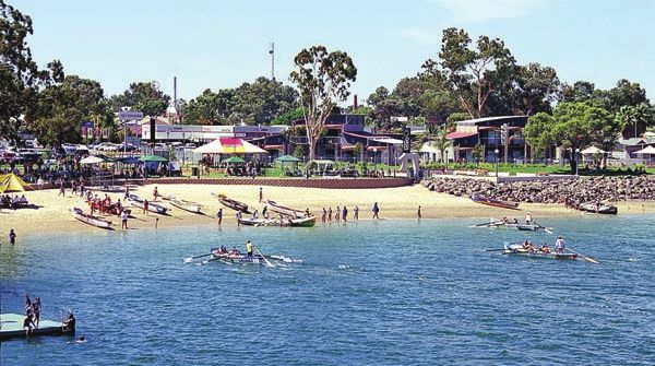
Figure 1 – SA Planning Context

                                                        South Australia’s Strategic Plan

              Growing                  Improving                 Attaining              Fostering            Building             Expanding
             prosperity                wellbeing               sustainability         creativity and       communities           opportunity
                                                                                       innovation

                                                      S P A T I A L                 S T R A T E G Y
    SASP OBJECTIVES                                                                                                             SASP OBJECTIVES

                                                                Far North Region Plan
    STATE POLICY INITIATIVES                                                                                             STATE POLICY INITIATIVES
                                                                   Port Augusta Structure Plan

                    Water for Good –                                        State Natural            Strategic
                                                  Greenhouse                                                          Skills Strategy
                    A Plan to Ensure                                          Resource            Infrastructure
                                                   Strategy                                                                  for
                    our Water Future                                        Management               Plan for
                                                                                                                     South Australia
                        to 2050                                                  Plan            South Australia

                                   Information,                  Population            Economic               Planning
                                  Communication                    Policy              Statement               Reform
                                  and Technology

An ageing strategy2 commissioned by the Port Augusta                                 In addition, Port Augusta has a large and growing
City Council anticipates an increase in the working age                              number of temporary residents and visitors, which
population due to two trends: more people are migrating                              include contractors servicing the mining sector,
to the city to take advantage of new employment                                      defence personnel based at Cultana, tourists,
opportunities; and young people are choosing to remain                               service sector employees on short-term contracts,
in the city—also to take advantage of employment                                     transitory Aboriginal people, and visitors from
opportunities—reversing a previous trend.                                            throughout the region coming to access services.
                                                                                     Continual monitoring of population growth rates and
                                                                                     demographics over time will be critical to inform
2   Urban and Regional Planning Solutions (2007) Port Augusta City Council           planning for additional housing and services in the city.
    Ageing Strategy 2007-2012: Making Port Augusta a better place to grow older.

                                                                                                                                                    3
Climate Change                                        In addition, state and local governments continue
Part 1 INTRODUCTION

                                                                            to investigate ways to organise land use such that it
                      The potential impacts of climate change on Port
                                                                            supports renewable and clean energy technologies.
                      Augusta range from threats to water supply,
                                                                            These opportunities will give South Australia a
                      increased risk of seawater inundation and
                                                                            competitive advantage in the carbon-constrained
                      fragmentation of native habitats to health issues
                                                                            economy. Investment in infrastructure will be critical
                      among older, more vulnerable people and the
                                                                            in order to realise such opportunities.
                      subsequent pressure on health care services.
                                                                            These water and energy initiatives will extend the
                      The State Government believes it is critical to
                                                                            life and reliability of our supplies and allow the
                      intervene now to help South Australians prepare
                                                                            population and the economy to grow without placing
                      for and adapt to long-term climate change. Securing
                                                                            unsustainable demands on our natural resources.
                      water and energy supplies is fundamental to
                      economic, social and environmental wellbeing in       Our understanding of climate change and its
                      the face of such change.                              ramifications are evolving rapidly. It is critical that
                                                                            policies and decisions are based on the best
                      In recent years, state and local government and
                                                                            current information, and are able to be adjusted
                      regional communities have been acting to improve
                                                                            in the future if required.
                      water security through augmentation of supply, the
                      introduction of permanent water conservation, and
                      measures such as wastewater reuse and stormwater
                      harvesting. Increased housing density, improved
                      water efficiency of buildings and the incorporation
                      of water-sensitive urban design principles in the
                      development process will lead to more efficient
                      water consumption for town populations. State and
                      local governments are also developing regional
                      demand and supply plans, as outlined in Water for
                      Good—A Plan to Ensure our Water Future to 2050,
                      for the eight natural resources management regions
                      across the state by 2014, as well as investigating
                      how regional communities can diversify their water
                      supply sources.

                 4
THE CONTEXT FOR
THE PORT AUGUSTA
STRUCTURE PLAN
Part 2
Port Augusta at a glance Economic development and employment
growth
The city:
attracting and retaining a skilled and flexible
had a population of 13,874 at the 2006 census, workforce to strengthen the city’s economic base
which represented an increase since the 2001
census, ending a long period of population attracting new industries that can be located in
decline areas with infrastructure capacity for growth
has a strong economy, extensive infrastructure positioning the city to capitalise on the expansion
and a wide range of educational, retail and of mining activities in the region
commercial facilities and services, which enables providing greater employment, recreation and
the city to accommodate further population other opportunities to retain young people
growth
valuing the strong sense of community spirit
has a growing tourism industry and several and identity.
popular tourist and holiday coastal attractions
is adjacent to rich environmental assets, including Housing and residential land supply
coastal environments, national parks and
conservation areas. discouraging residential development outside
the city
maintaining the city’s character and heritage
Key issues for Port Augusta ensuring a development-ready supply of
residential land.
The following issues were identified as critical
to the city’s future by local government, industry
groups and communities during the 2007–2009 Infrastructure and services provision
consultation. The issues are grouped under four
expanding the capacity of water and wastewater
themes, which are explored in greater detail in the
infrastructure to support the growth of population,
following pages.
tourism and industry, including the re-use of
stormwater and wastewater
Sustainability and climate change resilience
investing in infrastructure to support economic
ensuring a high quality water supply and and population growth
reducing per-household demand by developing
strategies to re-use stormwater and wastewater making the best use of existing and planned
road and rail infrastructure.
supporting carbon trading
ensuring development is appropriately located
and not in environmentally significant areas
or scenic landscapes that may be adversely
affected.
56 Part 2 THE CONTEX T FOR THE PORT AUGUSTA STRUCTURE PL AN
A VISION FOR THE
GROWTH AND
DEVELOPMENT OF
PORT AUGUSTA
Part 3
An integrated approach The aims of the vision are to:
promote industrial, commercial and residential
The Port Augusta Structure Plan provides a growth in designated areas
coordinated and integrated vision for land use and
development and identifies the planning priorities manage growth to protect natural and industry
necessary to achieve that vision. assets
The Plan allows Port Augusta to develop and grow assist industry to adapt to increasing variations
by enabling the city to sustainably meet short- and in climate and water availability and so become
long-term demand for industrial, commercial and more sustainable
residential land. It also seeks to retain the city’s
strengthen the role of Port Augusta as the major
special qualities while balancing the needs of
regional city servicing the Far North region
people today with the needs of future generations.
support emerging industries, including the
renewable energy sector
attract and retain a skilled and flexible workforce
to ensure a stronger economic base
ensure an adequate supply of residential land
for development
encourage greater employment, recreation and
other opportunities to retain young people.
7Map 2 An integrated vision for the growth and development of Port Augusta
"Yorkeys
Crossing"
Yo
r
ke
!
ys
C
ro
ss
Yorkeys Crossing Road
in
g
R
oa
d
!
y
wa
a il
kR
re e
hC
eig
STUART
ay
-L
HWY
in Rai lw
?
ESTATE
sta
Part 3 A VISION FOR THE GROW TH AND DE VELOPMENT OF PORT AUGUSTA
ST
gu
DIRT
To Coober Pedy, UA BIKE
RT
Au
arw
H CLUB
Roxby Downs & IG
HW
Pt
Darwin AY
de - D
Adel ai
SA
WATER
ARID LANDS
BONTANICAL
GARDENS
Dempsey
Lake ay
lw
ai
R
ta
us
ug EUREKA
tA ESTATE
!
!
A
!
H
Po
r
!
S CC
al
la
-
PORT !
! DAVENPORT
COMMUNITY
W
hy
SA
WATER
AUGUSTA A
WEST
! SPENCER
TRANSPORT GOLF JUNCTION
SA COURSE
!
!
!
!
EYRE
! CC
YORKEYS
HIGHWAY
!
S
!S CC
!CC
CAMEL
ESTATE
! FLAT
!
!
A
A
A
A
!
S
AY
HW
! CENTRAL
G !H
!CC
RE
HI
!
!
!
!
!H
!HC
OVAL
PRECINCT TROTTING
EY To Whyalla,
!
!
!
!
!
H
C
TRACK
!
A CITY
! !!
S
!!
Port Lincoln
!
A CENTRE
!CTC
!
CC
A.
!
SS
? H
H !
! CC
RACE
WASTE
DEPOT
AUGUSTA COURSE
PORT
AUGUSTA
RAILWAY
WORKSHOPS !
A PARK
! !
AIRPORT S
A Pichi Richi Railw ay
!
A
CC WWTP
!
!
SS FOOTNER ROAD -
HIGHWAY ONE ESTATE
! ! CC
SN2.
H
BUSINESS
PARK
!
H
H
!
H
WILLSDEN
SN1.
!
S
!
! STIRLING
NORTH
Bird ! CC
Lake
PO
RT
SN3.
r
pu AU
lS G
ai US
SPENCER
R
TA
on
-P
ati
O
RT
St
MANGROVES
GULF W
er
AK
w
Po
EF
PORT AUGUSTA
POWER STATION
IE
LD
!
!
" RO
CULTANA DEFENCE " SUB
STATION
To Port Pirie,
Adelaide
AD
TRAINING AREA
?
Map 2: A Vision for the
Facilities Residential Industry Infrastructure
!
A Aged Care Potential Residential Potential Industrial National Road Network
!
H Health service
Residential Zone Industrial Zone Main Road Growth and Development
Airport
of Port Augusta
Existing Residential Local Road
!
CC
Child Care
Maintain Very Low Density Inner Noise Contour Railway
!
S School
Investigation Area Indicative Airport High KV Powerline
!
T Investigation Area
±
Tertiary Davenport Community
Other NOTE:
!
! Caravan Park Commercial
Strategic Assets Buffer
Native vegetation remains largely uncleared on
undeveloped land within and surrounding the
! Heritage Site Potential Commercial
Environmental Assets city of Port Augusta. For more information 0 0.5 1 1.5 Km
Commercial Zone regarding native vegetation mapping, please
Subject to Innundation refer to; http://maps.deh.sa.gov.au DPLG ID: 3387
8PRINCIPLES AND
POLICIES
Part 4
This section of the Plan outlines the principles and The principles are:
policies that are required to realise the vision for Port
Augusta, which are set under four themes: 1 Recognise, protect and restore the city’s
Sustainability and climate change resilience environmental assets
Economic development and employment growth 2 Protect people, property and the environment
from exposure to hazards
Housing and residential land supply
3 Identify and protect places of heritage and
Infrastructure and services provision. cultural significance, and desired town
character
Under each theme the Plan identifies:
4 Create the conditions for Port Augusta to
principles to guide land-use planning and become resilient to the impacts of climate
development change
planning-related policies that provide ongoing 5 Provide and protect serviced and well-sited
directions to the council and which must be industrial land to meet projected demand
reflected in the council’s Development Plan.
6 Ensure commercial development is well sited
While the policies and priorities of the Port Augusta and designed to support the city’s role and
Structure Plan may change over time, the principles function
will be a constant driving force for future generations 7 Strategically plan and manage growth of the city
to ensure the city is competitive, livable, sustainable
and resilient to climate change. 8 Provide residential land for a diverse, affordable
and sustainable housing to meet the needs of
current and future residents and visitors
9Sustainability and climate change Several more specific studies further guide
Part 4 PRINCIPLES AND POLICIES
management of environmental resources in the
resilience Port Augusta area, including heritage surveys,
the Conservation Assessment of the Northern and
Yorke Coast (2007), and the Biodiversity Plan for the
Overview
Northern Agriculture Districts of South Australia (2001).
The natural environment and cultural assets of the
The Port Augusta City Council should take these
Port Augusta area play essential roles in guiding the
various plans and studies into account when they
city’s future development. Settlements and industry
review and update the city’s Development Plan.
are inextricably dependent upon climate and water
resources, as well as land- and water-dependent The Port Augusta Structure Plan contains land-use
eco-systems. As well, heritage sites and structures principles and policies that aim to complement
of significance provide a sense of identity and these documents and guide development in a
connection with place. manner that:
The design, siting and management of development protects biodiversity and areas of environmental
must prevent adverse impacts on these critical sensitivity, including coastal areas
assets and minimise the exposure of people, supports the management of Port Augusta’s
property and the environment to danger from natural natural resources
hazards such as floods and bushfires.
prepares the city for the impacts of climate
Achieving sustainable levels of demand for water
change
and energy is also essential, particularly considering
the effects of climate change. ensures that development appropriately
Several state government policies, plans and responds to hazards and risks
programs provide guidance on the management helps preserve the region’s heritage, including
of the environment, including state and regional Aboriginal heritage.
natural resource management (NRM) plans;
Environment Protection Authority policies, codes
of practice and guidelines; Coast Protection Board
policies; the Living Coast Strategy; the Marine
Planning Framework for South Australia; Native
Vegetation Council legislation; No Species Loss—A
Biodiversity Strategy for South Australia 2006–2016;
and Tackling Climate Change: South Australia’s
Greenhouse Strategy 2007–2020.
10Planning-related priorities for the Port Augusta Areas in Port Augusta that are unsuitable for
City Council development due to their environmental and/
or cultural significance, or require measures to
Incorporate information from environmental
minimise the impacts of development, include:
studies (for example, on biodiversity and climate
change) to help identify areas of high biodiversity the coastal and estuarine areas of the Spencer
value to be protected and buffered, and to inform Gulf, which are valued by residents and visitors,
the review and updating of the Development Plan. have high environmental significance, and are
culturally important
Develop and maintain a local heritage register
and identify heritage-listed sites in the the Australian Arid Lands Botanic Gardens
Development Plan. areas subject to hazards (both naturally
Further understanding of the impact of climate occurring and human-induced), including: floods;
change on natural resources and habitats in order disturbance of acid sulfate soils; bushfires;
to inform strategic planning for development and erosion; salinity; water, air and noise pollution;
land use. site contamination; and the potential impacts of
climate change
Identify coastal areas of high scenic value and
other landscapes with amenity significance in areas of Indigenous and non-Indigenous
order that they can be protected. heritage importance
Identify and map areas that will be subject to areas with scenic views of the Flinders Ranges
risks and hazards. and the Gulf (including from tourist routes)
areas with potential for development as appealing
entrances to the city
areas that support native vegetation deemed
to be in good condition and species/plant
communities listed as rare, threatened, or
significant remnants.
11Principle 1 Box 1—Water-sensitive urban design (WSUD)
Part 4 PRINCIPLES AND POLICIES
Recognise, protect and restore the city’s
environmental assets WSUD techniques help to improve water quality
and quantity, and reduce flood risk in urban
Water areas, while enhancing biodiversity. They can be
incorporated into development projects across
Water ecosystems play a critical role in the Port a range of types and scales, including homes,
Augusta area, providing flood mitigation and scenic streets, parking areas, subdivisions and multi-
amenity, and supporting biodiversity. Land-use and units, commercial and industrial developments,
development decisions must support the ongoing and public land. The techniques include:
health of these ecosystems by preventing any
adverse effects, retaining natural drainage patterns, permeable paving of footpaths, common
and—where ecologically appropriate—enabling the areas and parking spaces above underground
recharge of water resources with treated stormwater. water storage facilities
The combination of diminished rainfall due to water efficient fittings and appliances
climate change and population growth will increase maintaining fixtures (for example, stopping
competition for available water. More efficient water leaks and drips from plumbing and taps)
use and recycling of stormwater and wastewater are
green roofs and living walls (that is,
required in future planning. The State Government
plantings on roofs and down walls)
is working with regional communities to develop
regional water supply and demand plans, as appropriate landscaping (for example,
outlined in Water for Good, and to incorporate efficient irrigation, mulching, wind and sun
water-sensitive urban design (WSUD) principles protection, minimising lawn area, selection
in the development process (see Box 1). of suitable plants)
wetlands to capture and treat run-off water
Policies
the capture and storage of rainwater and
1.1 Protect the quality and function of water stormwater for residential re-use, or to irrigate
ecosystems by preventing the adverse impacts parks, sporting fields and other open space
of land use and development (such as the
the capture, treatment, and re-use of
overuse of resources, impeded surface and
wastewater.
subsurface water flows, increases in acid
sulfate soils, erosion, land degradation and More information about WSUD principles and
clearing, and pollution). techniques can be found in the WSUD Technical
1.2 Ensure development retains natural Manual for Greater Adelaide, available at
watercourses and drainage patterns through . Although
appropriate buffers and WSUD. the manual focuses on Greater Adelaide, many
WSUD techniques can be applied in Port Augusta.
1.3 Encourage water harvesting initiatives where
ecologically appropriate.
121.4 Pursue best practice water use efficiency in sustainability of future development and use of
the built form at both house and town level, the marine environment. These guidelines will
drawing upon WSUD techniques to reduce complement The Port Augusta Structure Plan
reliance on the River Murray. and must be taken into account in the review and
updating of the Development Plan.
Coastal estuarine and marine environment Developments such as marinas, port facilities and
desalination plants should be considered major
The Upper Spencer Gulf wetland system, which
projects that require detailed study, including
is included in the Directory of Important Wetlands
environmental impact assessments.
in Australia3, acts as a fish nursery and provides
physical protection from coastal waters. The
extensive saltmarshes at the head of the gulf have Policies
been identified as having the highest priority for 1.5 Avoid or minimise the adverse impacts of
conservation among all the coastal areas of the development on the ecological health of
Northern and Yorke Coast.4 As saltmarsh complexes coastal, estuarine and marine environments.
are particularly vulnerable to sea level rise,
1.6 Limit development in coastal areas of high
adequate land is required to support important fish
conservation, landscape and environmental
nursery habitats, which will be endangered as the
value, unless the proposal has a neutral or
tide levels rise.
beneficial effect (refer Eyre Peninsula Coastal
The South Australian Government is establishing the Development Strategy5 ).
Gulf as a marine park to conserve representative
examples of marine ecosystems while minimising 1.7 Protect coastal, marine and estuarine
impacts on fishing, aquaculture and other local areas of high conservation, landscape and
activities. It is part of a network of 19 marine parks environmental significance by avoiding
being developed in the state. development in these areas. In limited
circumstances the development may
While the Gulf’s scenic views and access to the require such a location—such as a tourist
coast make it attractive for development, it is development of state significance—in which
important that important marine environments and case the social and economic benefits
habitats are retained. Poorly located and designed must be demonstrated to outweigh the
coastal developments in areas prone to natural environmental and amenity impacts.
processes, such as erosion, floods, acid sulfate
soils and sand drift, can put people, property, 1.8 Provide buffer areas of sufficient width to
infrastructure and the environment at risk. separate new development from the foreshore
and sensitive coastal features, and to
Environmental capability guidelines are being accommodate long-term physical processes
developed to provide direction and ensure the that may result in the movement of the coastline.
3 Environment Australia. A Directory of Important Wetlands in Australia, Third
Edition, Environment Australia, Canberra, 2001. .
5 Peninsula Local Government Association, Eyre Peninsula Coastal
4 Conservation Assessment of the Northern and Yorke Coast (January 2007) Development Strategy, 2007.
13Biodiversity Policies
Part 4 PRINCIPLES AND POLICIES
Native vegetation remains on several sites 1.9 Recognise areas of high biodiversity value,
surrounding Port Augusta and on vacant land in and locate and design development to
the city. These environments provide important prevent the further loss, degradation and/or
habitats for a range of species, including fragmentation of native vegetation and any loss
nationally threatened species listed under the of species and/or ecological communities.
Commonwealth’s Environment Protection and 1.10 Provide for environmental connections to link
Biodiversity Conservation Act 1999 (EPBC Act) 6. areas of high biodiversity value, and create
Retention and management of native vegetation/ buffers as a means of managing the interface
habitats on both private and public land helps with conservation areas.
reverse the long-term decline in the extent and
1.11 Avoid any impact on biodiversity, where
quality of the state’s native vegetation cover; it
possible. If impact is unavoidable, it should be
also contributes to the achievement of the ‘no
minimised and offset. A comprehensive offset
species loss’ SASP target. Maintaining remnant
scheme, based on existing offset provisions
native vegetation is part of the State Government’s
and drawing on models such as bio-banking,
commitment to environmental sustainability and it is
will be developed to provide for a net gain to
among a suite of initiatives to tackle climate change.
biodiversity through flexible offsets. The offsets
Native vegetation is protected by law. Clearances could be made across regions or by funding
can occur only where permitted under the Native designated rehabilitation programs. The
Vegetation Regulations, and/or after formal scheme will also encourage carbon offsets.
assessment of the quality and significance of the
vegetation and approval from the Native Vegetation 1.12 Identify new areas of conservation significance
Council. South Australia’s native vegetation and ensure their protection.
legislation7 sets out the assessment framework for
vegetation clearances (see ).
To protect the city’s biodiversity, development
should be located and designed to minimise further
loss, degradation and fragmentation of native
vegetation, and to provide buffers and linkages
between areas of biological significance. As well,
ecological investigations and impact assessments
should be conducted in areas that are proposed
for rezoning or development.
6
7 Native Vegetation Act 1991, Native Vegetation Regulations 2003.
14Scenic landscapes Principle 2
Attention should be given to the planning and
design of development to ensure significant
Protect people, property and the
landscapes and associated views—both from the environment from exposure to hazards
land and the sea—are retained. The incremental
approval of individual developments, including Hazards can occur naturally or result from
minor additions and maintenance activities, has development activity. Inappropriately located or
resulted in the degradation of scenic resources in designed development and land uses can increase
the past. It is important that the Development Plan the exposure to and impact of hazards, including
reassesses landscapes and associated views and floods, erosion, disturbance of acid sulfate soils,
devises measures to ensure their protection. bushfires, erosion, salinity, land slides, as well as
water, air and noise pollution and site contamination.
Policies The potential impacts of climate change, such as
1.13 Acknowledge, protect and manage areas sea level rise, storm surges and extreme weather
of significant landscape and amenity value, events, are likely to increase the risk of hazards
including landscapes that form attractive in affected locations. While better development
backgrounds or entrances to the city and planning and control measures cannot eliminate risks
tourist developments. and hazards, they can contribute to reducing them.
1.14 Avoid development in areas with significant Contamination can adversely affect human health
landscapes that can be viewed from tourist and the environment both at the site and at adjoining
routes, walking trails, the beach or the sea, and nearby sites. The planning authority has a
unless the development requires such a responsibility to consider site contamination during
location, such as a development of state rezoning and development of land to ensure that the
significance, in which case the scale, height site is suitable for the intended purpose and will not
and design of buildings must: result in adverse impacts. Failure to do so may result
in significant liabilities.
`` protect views to, from and along the ocean
The review of site contamination and remediation
and scenic coastal areas
must be incorporated into all structure planning and
`` minimise the alteration of natural land forms Development Plan Amendments, in accordance with
the requirements set out in Planning SA’s Advisory
`` be visually compatible with the character of
Note 20 Site Contamination (December 2001) and
surrounding areas
National Environment Protection (Assessment of Site
`` restore and enhance visual quality in visually Contamination) Measure (NEPM) 1999.
degraded areas, where feasible.
1.15 Avoid adverse impacts of development on
landscapes through site selection and design
alternatives that reduce the height or bulk of
structures. Note that landscape screening to
mitigate the visual impacts of development is
not a substitute for re-siting or re-design.
15Policies `` protect human health and the environment
Part 4 PRINCIPLES AND POLICIES
2.1 Design and plan development to prevent the where contamination has occurred
creation of hazards and to avoid naturally `` adopt appropriate processes and methods
occurring hazards. to remediate contaminated land and ensure
2.2 Locate and design development and its suitability for any proposed zoning
infrastructure to minimise the threat and impact `` address risk, hazard and emergency
of bushfires on life and property, including management issues in structure and
creation of buffers around city areas adjacent precinct planning for new and existing
to native bushland. urban areas.
2.3 Develop other policies to minimise the impact 2.6 Protect people, property and the environment
of extreme bushfires in line with the findings from exposure to hazards (including coastal
of the 2009 Bushfires Royal Commission. flooding, erosion, dune drift and acid
2.4 Develop partnerships and agreements sulfate soils) by designing and planning for
between state and local government development in accordance with the following
(particularly with regard to emergency service principles:
agencies) to address identified risks and `` protection—establish works to protect
hazards and protect the health and wellbeing existing development or facilitate major
of the community. development (including stormwater
2.5 Integrate adaptation to climate change and discharge management to accommodate
disaster risk reduction and hazard avoidance higher tide levels)
policies, standards and actions into the `` adaptation—design buildings and
council’s Strategic Plan and Development infrastructure to minimise risk in the long
Plan policies and development assessment term
processes, using best practice models to:
`` avoidance—avoid permanent development
`` reduce the social, environmental and in and adjacent to areas at unacceptable
economic effects of extreme events risk from hazards.
`` achieve more consistent and rigorous 2.7 Identify and rehabilitate areas and sites where
decision-making for long-term land-use land is contaminated as a part of development
planning aimed at reducing emergency processes.
and hazard risks
2.8 Ensure new development is appropriately
`` enhance protection of critical infrastructure sited in relation to existing landfills to minimise
`` develop building standards and urban the risk to people and property from gas
design approaches that create resilient emissions. Continue to monitor gas emissions
environments for the future from landfill sites to ensure development is not
placed at unnecessary risk.
`` reduce risks and protect natural areas
and biodiversity
16Principle 3 Principle 4
Identify and protect places of heritage Create the conditions for Port Augusta
and cultural significance, and desired to become resilient to the impacts of
town character climate change
Port Augusta’s heritage and cultural buildings and Reducing carbon emissions and adapting to climate
places provide the city with a distinct character change are two of the most significant challenges
linked to the attitudes and values that have shaped facing South Australian cities and regions.
South Australian history. Identification and careful Urban form and building design must assist
management of these sites help engender a sense Port Augusta to become a climate-resilient and
of identity and provide a useful link with the past. sustainable city, as well as support South Australia
It is essential that heritage places be protected and in achieving the SASP target of a 60 per cent
preserved in a way that retains their value. Acts reduction in greenhouse gas emissions (based on
that identify and protect places of heritage and 1990 levels) by 2050. All developments and land
cultural significance include the Heritage Places Act divisions must incorporate efficient energy use
1993 and the Shipwrecks Act 1981. In addition, the into their planning and design, and maximise on-
Aboriginal Heritage Act 1988 prohibits any damage, site water capture, treatment, storage and re-use
disturbance or interference with Aboriginal sites, practices.
objects and remains without an authorisation by the The potential impacts of climate change, such as
Minister for Aboriginal Affairs and Reconciliation. increased extreme weather events, storm surges
Aboriginal people and the South Australian and sea level rise, are likely to increase the risk of
Government’s Aboriginal Affairs and Reconciliation hazards in affected locations. In particular, the very
Division should be involved early in the planning or low gradients on coastal areas at the head of the
development process to help identify and protect Spencer Gulf mean that even very small sea level
sites of cultural significance. changes may significantly increase the exposure of
developments to floods.
Policies
It is therefore critical that infrastructure and
3.1 Identify and protect places of heritage and development are sited to reduce the risk of flooding
cultural significance. associated with sea level rise, and to provide for the
3.2 Identify the desired character for the city and retreat of marine and estuarine habitats, particularly
ensure the design of buildings and public among mangrove and saltmarsh communities.
places, such as streetscapes and entrances, The Port Augusta Structure Plan gives priority
supports the desired character. to ensuring South Australia’s water resources
3.3 Identify and protect sites that have Aboriginal are managed within sustainable limits and that
cultural significance and provide a guidance greenhouse gas emissions are reduced. The
role in relation to native title and Indigenous city must support walking, cycling and the use
Land Use Agreements. of public transport.
17Policies Economic development and
Part 4 PRINCIPLES AND POLICIES
4.1 Promote carbon sequestration and greenhouse employment growth
gas mitigation through appropriate land-use
and management practices (for example, Overview
reintroducing vegetation and restoring habitat),
taking into account climate and soil suitability Economic development plays a key role in
and species characteristics. facilitating population growth through the
provision of employment opportunities. Creation of
4.2 Provide buffer areas of sufficient width to employment depends on an adequate supply of
separate development from the foreshore and land for development and adequate infrastructure.
coastal features and to accommodate long-
term physical coastal processes. Port Augusta’s potential for significant industrial
growth stems from its location at the crossroads
4.3 Provide for town- and settlement-level energy of major road and rail networks linking the nation’s
efficiency by promoting alternative energy markets. The city also has a long association with
supplies (such as embedded generation). industry, a range of established firms that provide
4.4 Provide for development of alternative and support services, and close proximity to expanding
innovative energy generation (such as marine, mining and defence activities in the Far North region.
biomass and geothermal technologies) and Growth in commercial and retail activity is
water supply facilities, including guidance on reinvigorating Port Augusta’s central business
environmental assessment requirements. district and strengthening the city’s role as a major
regional service centre.
4.5 Provide for the incorporation of sustainable
energy and water supply, conservation and Tourism is another key industry and economic driver
efficiencies into the design of residential, as the city and the surrounding region provide a
commercial and industrial developments and number of attractions for visitors.
subdivisions (for example, stormwater re-use, In addition to supportive Development Plan policies,
wind and solar technologies, green buffers, investment in infrastructure, expansion of local
WSUD, building orientation to maximise solar training opportunities and attraction of skilled
access, and shaded areas). labour are critical to realising the city’s economic
4.6 Increase the energy efficiency of buildings development potential.
through building standards and design
guidelines intended to create more carbon-
efficient structures.
18The Port Augusta Structure Plan has principles land ownership and withholding issues—the
and policies aimed at ensuring that: availability of privately-owned sites largely
there is a supply of well located land suitable depends on decisions by landowners, not all
for industrial, commercial and residential of whom choose to sell or develop their land in
development the short term
commercial growth occurs according to the rezoning—the Development Plan is subject to
city’s role and function as a service centre regular review by council (through the section
for the region 30 review process) and periodic amendment to
zoning via the Development Plan Amendment
existing industries are protected and (DPA) process
strengthened
best use of land—tight zoning policies for
opportunities for new and emerging industries industrial estates prevent encroachment of
are supported. non-industrial uses (for example, retail/showroom
and places of worship)
Land available for development falls into two
categories: land use efficiency—better site utilisation can
lead to less land needed to meet demand,
broadacre—large parcels of land (more than effectively increasing the amount of available
4000 square metres) appropriately zoned (or land; this ensures best use of infrastructure and
identified for rezoning) and undeveloped enables economic and residential expansion
redevelopment or infill—land that is appropriately without expanding the city’s footprint
zoned (or identified for rezoning) and is currently interface issues—including residential
underutilised or vacant and hence has the development near industrial activities or
potential for development or redevelopment. strategic infrastructure assets, or industrial
activities near retail hubs, which could lead
The analysis of land supply undertaken to inform to conflict between uses and, in some cases,
The Port Augusta Structure Plan considered a the relocation of industries; it is vital therefore
number of factors affecting land supply, including: to consider surrounding land uses when
physical attributes—such as topography, planning land supply and to provide adequate
biodiversity assets (including quality and separation between incompatible uses as per the
significance of native vegetation), soil types Environment Protection Authority Guidelines for
and contamination Separation Distances 2007 (for example, barriers
between residences and transport corridors to
infrastructure issues—such as access to major reduce noise and biodiversity buffers to separate
utilities, services and adequate transport incompatible land uses and biodiversity assets).
infrastructure
19Principle 5 Transport industry hub
Part 4 PRINCIPLES AND POLICIES
Port Augusta is a natural hub for transport and
Provide and protect serviced and distribution services crossing Australia. Spencer
well-sited industrial land to meet Junction, the busiest inland rail junction in the
projected demand nation, handles 123 services a week linking the
north and west of Australia with the major population
centres of south-eastern Australia. A triple road train
Industrial land consolidation centre is located on the northern side
of the city.
Policies Companies such as Downer EDI, Pacific National,
Transfield Services and Linfox have large engineering,
5.1 Ensure a 200-hectare rolling land supply
freight distribution and logistics operations in the city
of development-ready industrial land to
and provide a significant amount of employment. It is
accommodate a range of demands.
anticipated that the freight transport industry will expand
5.2 Focus industrial development in estates on as mining and defence activities grow. Opportunities
the north-western and southern perimeters for the development of a road-rail intermodal facility
of the city, in close proximity to major road have been identified at Port Augusta.
and rail corridors.
Industrial sites that are strategically located on road
and rail routes are likely to be in high demand as
Demand analysis industries dependent on access to freight corridors
Port Augusta has considerable industrial growth and companies servicing the resources sector seek
potential and its location makes it the natural a presence in the Upper Spencer Gulf.
regional centre to service the growing mining and
As part of the proposed expansion of Olympic Dam,
defence industries.
BHP Billiton intends to barge heavy equipment up
During 2005–2007, 30 developments were the Spencer Gulf to Port Augusta for assembly.
approved for industrial land uses, primarily (The proposal has gone through the Development
workshops and warehouses. The average annual Assessment process involving detailed assessment
consumption rate of industrial land in Port Augusta of social, economic and environmental impacts and
during this period was 14 hectares (ha), with a public consultation).
median site area of 1.3 ha. Several warehouse and
The Port Augusta airport provides a base for
workshop developments required larger sites up to
regular services to Adelaide and charter flights to
four ha.
mines and outback towns, as well as an operations
centre for the Royal Flying Doctor Service (in 2007
the RFDS base received a $3 million upgrade).
The Airport Master Plan informs future investment
and management to ensure aviation requirements
can be met. Vacant land adjacent to the airport is
earmarked for development as a business park.
20Light manufacturing, trade services and utilities Port Augusta is also the preferred location for many
Port Augusta has an established cluster of metal government services and private utility providers,
fabricators and engineering firms, complemented including ETSA Utilities, Telstra and Department
by trades servicing residents, mining companies, of Energy and Infrastructure, which will continue to
and pastoralists across the Far North region. The require industrial land for workshops and depots.
city also has established rail and heavy machinery
maintenance companies.
Supply analysis
Table 1 shows the land, location and access
Opportunities are emerging to strengthen the base
requirements for activities likely to place demand
of companies providing services such as catering
on industrial land in Port Augusta.
and laundering for an expanding defence training
facility at Cultana, various mining companies in the
region, and local aged-care facilities and serviced
apartments.
Table 1 – Land, location and access requirements for industrial activities in Port Augusta
Activity type Land requirement Location/acccess
Light manufacturing • small to large sites • access to freight routes, including
(including general • flat land double road train routes
engineering, metal • access to supply chain/labour/
• small to medium separation buffers
fabrication, machinery repair) customers
from residential uses
• provision of utilities and information
communications and technology (ICT)
• industry/mixed zoning
• competitively priced land
Transport/warehousing • large sites • triple road train staging points
• flat land adjacent Stuart Highway
• industry zoning • access to freight routes, including
double road train routes
• competitively priced land
• direct access to ports/rail/intermodals
• ready site access/egress
• proximity to customers/labour
• advanced ICT
• buffered from residential areas to
enable 24-hour operation
21Short-term supply Long-term supply
Part 4 PRINCIPLES AND POLICIES
Approximately 280 hectares of vacant land are Long-term supply of industrial land should be
available for development in Port Augusta. The located close to existing industrial areas. Two sites
main industrial areas are Eureka Estate and Footner have been identified for further investigation:
Road–Highway One Estate, complemented by the The site labelled ‘Eyre Highway’ on Map 2
smaller Yorkeys Estate and Stuart Highway Estate. provides a logical extension to the western
Structure Plans have been developed for Footner industrial area and is located between the
Road–Highway One Estate and Eureka Estate; both National Land Transport Network and National
offer flexible land assembly and access to transport Rail Network corridors. Some of this land may
and other services. be required for a haul road as part of BHP
This estimation takes into account the potential Billiton’s proposed expansion of the Olympic
land uses already identified, including suitable Dam Mine. SA Water has reserved a portion for
buffers between existing transmission lines and the expansion of the wastewater treatment plant,
industrial buildings and property boundary fences should it be necessary in future.
through allotments in the Footner Road–Highway Land north of the Footner Road–Highway One
One Estate. It also considers the BHP Billiton Estate has been identified by SA Water for the
Environmental Impact Statement and identifies possible relocation of the Port Augusta East
the need for an additional powerline alongside the Waste Water Treatment Plant. The remainder of
Davenport to Olympic Dam powerline, should the this area could be investigated for industrial use.
Olympic Dam Mine expansion proceed.
A supplementary source of land supply could derive The State Government, Port Augusta City Council
from the re-use of existing sites, including through and the Northern Regional Development Board
the relocation of commercial/retail uses to alternative continue to plan for future industrial land to ensure
locations. a supply that meets future requirements. A key
element of this planning will be to protect and assist
the growth of strategic industrial sites to maximise
investment. These sites can be protected through
appropriate zoning provisions and the prevention of
development on adjoining land that may impact on
future industrial use.
Table 2 shows the sites identified for the short- and
long-term supply of industrial land. It provides site-
specific information on the status of Development
Plan policy and structure planning and the capacity
and future requirements of infrastructure and services.
22Table 2 – Indicative supply of vacant industrial land8
Area Development Plan Zone Services and infrastructure capacity
Sites
(ha) and Structure Plan and requirements
Short-term supply
Stuart Highway Estate 10 Industrial Transport: Only use existing junctions with
Activity types envisaged: Stuart Highway.
transport, warehousing,
manufacturing
Yorkeys Estate 24 Partly zoned industrial. Electricity: 11kV & 33kV Infrastructure exists in
Activity types envisaged: Abuts residential areas, the delineated area for proposed development.
light manufacturing, requires appropriate Existing 11kV feeder load (PA02) supplying this
utilities, trade services, buffers/separation area is at 65 per cent capacity.
transport/warehousing distances Transport: Access by way of Yorkeys Crossing
bypass route (that is, avoiding residential
areas). Junction with Port Augusta–Port
Wakefield Road may need improvement.
Table continues on the following page
8 This table provides an example of how the identified land matches the
activity types likely to be established in Port Augusta (as identified through
the structure planning process) and is not intended as an exhaustive list.
23Part 4 PRINCIPLES AND POLICIES
Eureka Estate 75 Industrial Structure Wastewater: Significant development would
Activity types envisaged: plan prepared, including require expansion/augmentation of the Port
transport, warehousing, potential for an intermodal Augusta West wastewater treatment plant
manufacturing facility (WWTP) and network. Area surrounding the
WWTP must be left undeveloped to ensure
sufficient buffer distances.
Electricity: 11kV & 33kV infrastructure exists on
the south-eastern side of the site (Madlands
Road). Existing 11kV feeder load (PA07)
supplying this area is at 60 per cent capacity.
Development demand in excess of 2 MVA could
warrant dedicated substation or a further
upgrade of the Port Augusta West Substation
with additional feeder exits. An alternative
supply to support the Port Augusta West
Substation would require consideration.
Transport: Use existing junctions with Stuart
Highway and Eyre Highway only. Junctions
may need to be improved. Consider intermodal
activity in conjunction with proposed Eyre
Highway Estate. Access to cater for b-triples.
Footner Road–Highway 170 Industrial, some Public Electricity: 11kV infrastructure exists approx.
One Estate Purpose. Partly structure 700 m along Footner Road from Highway One.
Activity types envisaged: planned—buffer from Existing 11kV feeder load (PA04) supplying this
light manufacturing, proposed residential areas area is at 61 per cent capacity. Development
utilities, trade services, in Stirling North. demand in excess of 2 MVA could warrant
transport/warehousing Ensure design layouts of dedicated substation, requiring land to
industrial land divisions locate substation. Voltage regulation may be
involve ElectraNet’s applicable.
advice to ensure Transport: No direct property access to Port
functional efficiency of Augusta–Port Wakefield Road. All property
land is not compromised access is to be by way of service roads. The
by transmission lines location and nature of local road junction
easement encroachment points needs to be considered in the context
and inappropriately located of maintaining current road performance
buildings and steel fencing. (including speed zone). This may require
consideration of grade separated junction (in
conjunction with commercial area). Consider
intermodal activity. Access to cater for b-triples.
Table continues on the following page
24You can also read