Positioning the UK in the fast lane - GOV.UK
←
→
Page content transcription
If your browser does not render page correctly, please read the page content below
Positioning the UK in the fast lane
Location data opportunities for better UK transport 02

Table of
           02    Table of Contents
           03    Foreword by Commissioner Dr Steve Unger
           04    Executive Summary

contents
           06    01 Introduction
           07    The Transport Location Data Opportunity
           08    Our Approach

            11   02 Common Themes
           12    Treating mobility as an interconnected system
           15    Promoting data interoperability and standardisation
           17    Making data more findable and accessible
           19    Improving data reuse
           21    Enabling greener modes of transport
           23    Unlocking the potential for data-driven innovation in transport

           24    03 Deep Dive: Six transport opportunities
           26    Roads
           29    Road & Rail haulage
           32    Route optimisation
           35    Electric vehicles
           38    Connected and Autonomous Vehicles
           41    Drones and Unmanned Aircraft Systems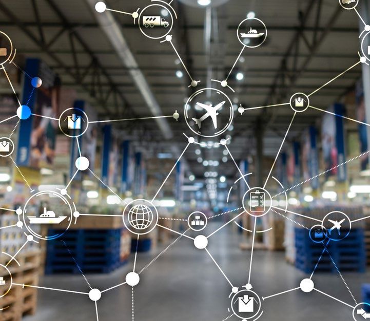
Location data opportunities for better UK transport 03

Foreword by                                                          Today’s publication sets out some of the evidence            • It can be used to make the use of charge-points
                                                                     we have gathered on the opportunities to do so. I              more convenient for drivers, providing them with

Commissioner
                                                                     have had the privilege to chair a Transport Location           information on availability, and perhaps even making
                                                                     Data Taskforce, and a series of roundtables, bringing          it possible to reserve a slot.
                                                                     together a diverse set of industry voices. We have
                                                                                                                                  • It can be used to increase the range of electric

Dr Steve Unger
                                                                     joined up with other relevant parts of the public sector
                                                                     and have run a Transport Location Data Competition,            vehicles, by enabling satellite navigation systems to
                                                                     which has provided funding to help develop some of             select the optimum route, and by maximising the use
                                                                     these ideas. And we have reached out to the academic           of ‘regenerative braking’.
                                                                     community, interviewing experts in many aspects of
                                                                     transport policy.                                            I am optimistic about what can be achieved with better
           Data plays a critical role in all our lives,                                                                           use of location data. The reason for that optimism is
                                                                     I have been enormously encouraged by some of the             that much of the data required to develop innovative
           powering many of the services that we
                                                                     ideas I have heard. These range from using data to           new mobility services already exists. Exploiting it
           expect from a modern digital economy.
                                                                     aggregate deliveries to city centres, thereby reducing       requires us to reduce technical barriers to the sharing
           Nowhere can this be seen more clearly than                                                                             of data, and to develop appropriate commercial
                                                                     the environmental impact of existing transport
           the transport sector and its use of location                                                                           models: in the world of data, the whole is greater than
                                                                     networks, to designing completely new delivery
           data. From the detailed Ordnance Survey                   networks based on drones.
                                                                                                                                  the sum of the parts. If we can translate that principle
           maps, which have been used by generations                                                                              into action, then we can shift the UK into the fast lane
                                                                                                                                  for a greener, more sustainable transport network.
           of walkers, to the satellite navigation                   A particularly important set of opportunities is created
           systems embedded in most modern vehicles,                 by the transition from internal combustion to electric
                                                                                                                                  My special thanks to all of those who have engaged
           location data has always been fundamental                 vehicles. As is well-known, this is central to our ability
                                                                                                                                  with our policy development process, including
           to mobility.                                              to hit net zero. Large investments are already being
                                                                                                                                  members of our transport location data taskforce;
                                                                     made to achieve this goal, by the automotive industry,
                                                                                                                                  government and industry representatives that
           But the transport sector is changing, driven by an        and by the various retail and tourism destinations for
                                                                                                                                  attended our policy roundtables, including from the
           urgent need for transport networks to become more         whom charge-points are now a core offering. Location         Devolved Administrations; the Open Innovation Team
           efficient, greener, safer and healthier - the sector is   data can help make these investments more effective.         and the academics they consulted; and Innovate UK for
           responsible for 27% of greenhouse gas emissions1.                                                                      their partnership in delivering our Transport Location
           The future of our society depends on us making the        • It can be used to optimise the location of charge-         Data Competition.
           transition to new modes of transport, and location          points, ensuring, for example, that they are readily
           data can help spur the innovation required to deliver       available to those who are unable to charge vehicles
           on this ambition.                                           at home.

                                                                                                                                  Dr Steve Unger, Commissioner
Location data opportunities for better UK transport 04

Executive
            Location data and technologies are critical      • Treating mobility as an interconnected
            for the improved operation of transport            system: We will need to have a common
            services and the delivery of new networks          location data framework for defining our

Summary
            and transport corridors. They enable the           transport networks.
            efficient connection of people with the jobs
            they need, the goods and services they want,     • Data interoperability and standards:
            and the places they want to go. Location data      Standards must be implemented in the
            is fundamental to delivering new electric          way that transport location data is collected,
            vehicle charging infrastructure and enabling       stored and managed.
            drones to navigate their environment. Location
            data can support our journeys to be safer and
                                                             • Making data more findable and accessible:
            more pleasant, whilst minimising the impacts
                                                               Data must be made more discoverable and
            on our environment.
                                                               easier to access.

            Transport was identified as a key opportunity
            area within the UK Geospatial Strategy.
                                                             • Improving data reuse: Data is rarely useful
                                                               for a singular purpose and must be made
            Geospatial data, products and services play
                                                               available for reuse where possible.
            a fundamental and enabling role in the
            transport sector and, as the sector evolves,
                                                               Enabling greener modes of transport: We
            the opportunities for location data will
                                                               will need to transform the sector in order to
            continue to grow. Better use of location data
                                                               meet the UK’s commitments around
            in the transport sector could unlock up to
                                                               achieving net zero by 2050.
            £2 billion per annum of economic value2.

            This report summarises the evidence gathered     • Unlocking the potential for data-driven
            by the Geospatial Commission through               innovation in transport: Organisations will
            extensive engagement across the transport          need access to capital, skills and ideas,
            and geospatial ecosystems. The report              as well as a smart and stable regulatory
            highlights key common themes and cross-            framework to support data-driven
            cutting challenges, based on six transport         innovation.
            use cases, where geospatial product and
            services could unlock greatest benefit.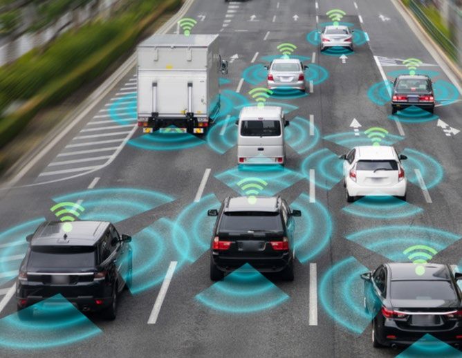
Unlocking the potential of location data in the transport ecosystem                                                                                          Location data opportunities for better UK transport 05

Themes         1. Treating mobility as an interconnected system
               2. Promoting data interoperability and standards
               3. Making data more findable and accessible
               4. Improving data reuse
               5. Enabling greener modes of transport
               6. Unlocking the potential for data-driven innovation in transport

Use Cases

              Roads                         Road & Rail haulage         Route optimisation             Electric vehicles             Connected and                      Drones and Unmanned
                                                                                                                                     Autonomous Vehicles                Aircraft Systems

              • Improving data reuse        • Encouraging adoption of   • Investing in bespoke         • Planning new charging       • Generation and exchange          • Improving navigation and
Opportunity     and exchange in planning,     vehicle telematics          operational route planning     infrastructure                of high definition                 positioning systems
Areas           construction and 			                                      systems                                                      mapping data
                maintenance                 • Developing common 		                                     • Enabling bespoke                                               • Managing flight paths and
                                              standards of vehicle      • Supporting the 				            electric vehicles routing   • Investing in incremental           airspace
              • Managing streetworks          telematics                  development of strategic       applications                  vehicle-to-everything trials
                more effectively                                          route planning systems                                       and testing                      • Creating digital testing and
                                            • Modelling freight                                        • Managing grid capacity                                           simulation environments
              • Optimising traffic 			        networks
                management systems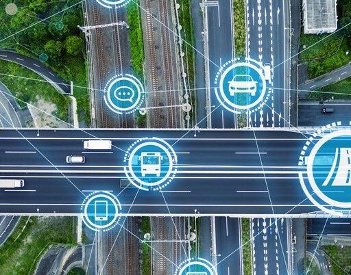
01
Annual Plan 2021/2022                                                06

                        Introduction
                        1. The Transport Location Data Opportunity

                        2. Our Approach
Location data opportunities for better UK transport 07

The Transport
                Location data has always been fundamental              to achieving net zero by 2050, but the transport
                to mobility, whether that is in its most               sector remains the largest emitting sector in
                traditional form - maps - as a means of getting        the UK5. Actions needed to decarbonise the
                from one place to another, or the satellite            UK’s transport system are set out in the recent

Location Data
                navigation systems embedded in most modern             Transport Decarbonisation Plan6. These changes
                vehicles. The transport sector is changing             are also happening at a time when our future
                rapidly, spurred on by digital and technological       need for transport infrastructure is being shaped
                developments, as well as changes to our lifestyles     by the Covid-19 pandemic and our departure

Opportunity
                and working patterns brought on by the Covid-19        from the European Union.
                pandemic. New applications for location data will
                correspondingly help to support the transition         This report seeks to build on the transport
                to more efficient, greener and safer modes of          strategies the government is implementing,
                transport.                                             and analyse how transport is changing as a
                                                                       sector, to illustrate the crucial role of location
                Innovate UK have outlined a 2050 vision for UK         data in enabling and accelerating this change.
                Transport that demonstrates the scale of change        Smarter mobility solutions, underpinned by
                needed across the ecosystem, bringing both             location data, will enable us to make the most
                challenges and opportunities. The government’s         of our transport networks by boosting capacity,
                2019 Future of Mobility: Urban strategy3               reducing environmental impacts and decreasing
                highlights the significant opportunities that new      travel times.
                technologies offer to accelerate future transport
                networks - from autonomous transport and zero
                emission vehicles, to the use of smartphones and
                the internet to plan journeys. The forthcoming
                Future of Mobility: Rural strategy4 will set out the
                potential to revolutionise travel within our towns,
                villages and more remote areas.

                Change is being driven by an awareness that our
                approach to economic growth must also protect
                the environment. The government has committed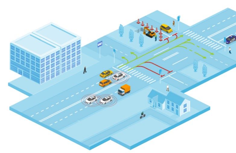
Location data opportunities for better UK transport 08

Our Approach
                                                                        The UK Geospatial Strategy7 develops a                We have already undertaken some work in this
What is location data?
                                                9 Location              vision for a coherent national location data
                                                                        framework by 2025. Future technologies
                                                                                                                              space. As part of the Geospatial Commission’s
                                                                                                                              Public Sector Geospatial Agreement (PSGA) with
Location data, or ‘geospatial data’, is the
record of what we do and where we do it.
                                                Data Opportunities      will be underpinned by data about events              Ordnance Survey (OS) we already ensure access
                                                                        occurring at a time and place. Location data          to core transport network data to support routing,
It tells us where people and objects are in
                                                                        will be the unifying connection between               scheduling and tracking activities. In addition, and
relation to a particular geographic location,
                                                                        things, systems, people and the environment.          following significant user engagement, OS will
whether in the air, on the ground, at sea or
under our feet.
                                                   Infrastructure       The Geospatial Commission has been charged            also be capturing new data which will enhance the
                                                                        with delivering this transformative vision to         transport network data; this will be made available
                                                   Housing              unlock the power of location data.                    to all OS public and private sector customers as
                                                                                                                              part of the Public Sector Geospatial Agreement
                                                   Transport            The UK Geospatial Strategy outlines four missions     from 2022/23.
                                                                        to tackle challenges in the geospatial policy
                                                   Public Health        landscape and maximise the opportunities.             We identified a need to go further to ensure the
                                                                        Transport was identified as one of nine               power of location data is fully supporting the
                                                   Emergency response   opportunity areas on the basis of responses to the    future of mobility and next generation transport

                                                   Environment          Geospatial Commission’s Call for Evidence8, and
                                                                        analysis undertaken in 2017, which found that the
                                                                                                                              networks in the UK.

                                                   Finance              better use of location data in the transport sector
                                                                        could realise up to £2 billion of economic value9.

                                                   Ocean economy        To deliver Mission 2: Improve access to location
                                                                        data10, we included a commitment to assess how

                                                   Retail               location data can support the future of mobility
                                                                        and next generation transport networks.
Our Engagement                                                                               Location data opportunities for better UK transport 09

17
                           CREATED A TRANSPORT LOCATION DATA TASKFORCE

     Transport Taskforce   Launched in August 2020, the Transport Location Data Taskforce brought together a group of 17
                           geospatial experts across the public and private sectors, as well as the Devolved Administrations, to help

     Organisations
                           shape the Commission’s policy towards improving the use of location data in the transport sector. The
                           taskforce concluded with a final meeting to discuss the findings in this report.

28
                           LAUNCHED A TRANSPORT LOCATION DATA COMPETITION
                           Technology in the transport sector is developing rapidly and there is a real need to be alert to change,

     Feasibility           iterate through new ideas and monitor impacts through pilots. The first phase of the Transport Location
                           Data Competition provided 28 projects with funding and the opportunity to develop novel concepts

     Studies Funded        that have provided first hand insight into how transport challenges and opportunities can be navigated.
                           Following the completion of Phase 1 , we reviewed the project closure reports, which identified a spread of
                           benefits, and some overlapping challenges and barriers to innovation.

24
                           CONSULTED OVER 20 ACADEMIC EXPERTS

     Academics             We commissioned the cross-government Open Innovation Team11 to conduct a review of the challenges
                           and opportunities relating to the use of geospatial data in the transport and mobility sector. For this, they

     Consulted             interviewed 24 academics focusing on our six high value use cases.

07
                           HELD A SERIES OF STAKEHOLDER ROUNDTABLES

     Policy                We held seven roundtables with 48 transport sector representatives from across industry, government
                           departments and civil society sectors. The roundtables focused on the high value use cases identified

     Roundtables           by the Commission.

48   Transport Sector
     Representatives
Transport Location Data Competition                                                                                                                          Location data opportunities for better UK transport 10

Technology in the transport sector is developing rapidly and there is a real need to       The first phase of the Transport Location Data Competition received nearly 200 applications, with 28
be alert to change, iterate through new ideas and monitor impacts.                         projects awarded funding to develop novel concepts through feasibility studies. These studies have
                                                                                           provided first hand insight into how transport challenges and opportunities can be navigated.

                                                                                           Following the completion of Phase 1 we reviewed the findings, which identified a spread of benefits and
The Geospatial Commission’s Transport Location Data Competition brings
                                                                                           some overlapping challenges and barriers to innovation. Winning the competition and securing funding
together transport data challenges and innovators in order to deliver novel
                                                                                           has provided many benefits for innovators, including close working with public sector partners to hone
solutions, investing £5 million across two phases and working with Innovate UK12.
                                                                                           proposals and demonstrate their ideas. Many of the innovators have successfully grown interest in their
Phase 1 was launched in September 2020 and Phase 2 was launched in May 2021.
The Small Business Research Initiative ‘SBRI’ competition focuses on solutions for four    proposed products or services through their association with the competition.
thematic challenge areas:

• Mobility as a service - Overcoming siloed transport networks by enabling more
  seamless and accessible integration of transport modes.                                     Winning projects awarded phase 2 funding

• Active travel - Mitigating safety risks to promote active travel.                           • Maritime ANalyTics Intelligence System (MANTIS), Emu Analytics Ltd: AI visualisation tool
                                                                                                to identify evolving ship patterns of movement to inform the planning of future offshore wind
• Supply chains - Tackling logistical challenges, such as planning distribution networks        farms.
  and routing, optimising storage and warehousing, and last-mile delivery to reduce           • Digital Active Travel Augmentation (DATA), Ngenius Ltd: Software using anonymised
  freight transport costs.                                                                      location data from CCTV cameras to help Local Authorities manage active travel routes.
                                                                                              • Optimising Geofencing, Ricardo UK Ltd: Geofencing optimisation to increase the usage and
• Increasing capacity - Managing over-capacity to increase efficiency of our transport          effectiveness of low emissions zones for air quality improvements.
  networks without compromising safety.                                                       • National Freight Model, City Science Corporation Ltd: Advanced modelling to improve the
                                                                                                understanding of freight movements within the UK.
                                                                                              • ZERO, Dynamon Ltd: An AI tool to help commercial fleets adopt the optimum zero-emission
Throughout the competition, the development of innovative ideas has been closely                vehicles and charging infrastructure.
                                                                                              • Digital twin of the rail network, Hack Partners Ltd: Using track circuit sensor and location to
aligned with the future needs of the public sector. Competition entrants have
                                                                                                increase capacity and efficiency of the rail network without compromising safety.
partnered with public sector challenge owners, such as local authorities, regional
                                                                                              • Automated Rail Geospatial Observation System (ARGOS), Thales Ground Transportation
transport authorities and national bodies, like Network Rail and the General
                                                                                                Systems UK Ltd: Utilise train location and sensor data to understand track geometry
Lighthouse Authority.
                                                                                                characteristics and detect underlying track faults.

                                                                                              The additional funding awarded in Phase 2 will enable the development and pilot of solutions,
                                                                                              supporting innovators to further progress towards bringing these ideas to market.
02
Annual Plan 2021/2022 11
6 Common
Themes
1. Treating mobility as an interconnected system
2. Promoting data interoperability and
standardisation
3. Making data more findable and accessible
4. Improving data reuse
5. Enabling greener modes of transport
6. Unlocking the potential for data-driven
innovation in transportLocation data opportunities for better UK transport 12
Common Themes
Our evidence has highlighted a number of • Findability: To be used, data has to be • (Re)usable: Data is rarely useful for a
The Geospatial Commission’s Q-FAIR
common themes and cross-cutting challenges. findable. Data should be easy to find for singular purpose, and ensuring that
Approach to Geospatial Data
Many echo our conclusions about location data both humans and computers, and able datasets are created in a way to both
supporting other sectors, and necessarily call The Geospatial Commission has adopted to be integrated easily with other data maximise ease of use and reuse is critical
for a system-wide approach. Here, we illustrate Quality, Findability, Accessibility, to draw insights. Findability is crucial in to unlocking additional value.
how these themes relate to some of the key Interoperability and Reusability (Q-FAIR) as providing users an awareness of what
findings from our evidence. principles to define good geospatial data13. data exists and where, thereby reducing
In the Geospatial Commission’s Annual Plan search times and the risk of reproducing
2021/202214, we set out our plans to extend data that already exists.
the ambition of this approach as a means
of assessing, appraising and implementing • Accessibility: Once found, users should
options for the improvement of the UK’s be able to easily access and use that
foundational geospatial data. Many of the data. This means that the financial cost of
themes outlined in this report on transport accessing that data should be reasonably
location data relate to the five principles: minimised, and any conditions for access
(e.g. licences) should be simplified as far
• Quality: Data should be fit for its intended as possible.
purpose, based on appropriate collection
and management methods, and should • Interoperability: Overlaying, linking,
not be materially misleading. There are or exchanging content from disparate
many factors that can be used to measure datasets is often required. Ensuring
data quality, such as its accuracy, precision, systems can make use of datasets in
timeliness, coherence and completeness15. combination with one another is critical
to ensuring their wider impact and value
through higher quality insights.Location data opportunities for better UK transport 13
Theme 1: New data-driven transport technologies
Treating
Intelligent Transportation Services (ITS): 5G and Vehicle-to-Everything (V2X)
connectivity:
ITS is the integration of people, processes
and technology to automate and advance The V2X ecosystem, bolstered by future low-
transport networks, providing a more cost- latency 5G networks, will enable rapid two-
mobility as an
way communication between vehicles and a
effective, reliable and faster service16. One
broad range of transport and traffic-related
example of this is the Split Cycle and Offset
systems, including vehicle to vehicle (V2V)
Optimisation Technique (SCOOT) system
and vehicle to infrastructure (V2I). It will allow
developed in the UK and in use at many vehicles to make complex manoeuvres and
interconnected
traffic lights across the country that uses behave as groups rather than individuals20.
live vehicle detectors to adjust traffic signal Green Light Optimal Speed Advisory (GLOSA),
settings, resulting in traffic delay reductions for instance, is a V2I system that aims to
of up to 15%17. reduce traffic congestion by providing drivers
with more detailed traffic light information,
system
such as warning times to traffic light changes
Mobility as a service (MaaS): and speed recommendations, allowing for a
An example of ITS18, MaaS is the integration more planned approach to traffic, smoothing
of various modes of transport along with traffic flows and improving fuel consumption
information and payment functions into a and journey times. The Department for
single platform, creating a single point of Transport (DfT) sponsored a project trialling
transaction for the user. It has the potential GLOSA on a 6km stretch of the A45 Coventry
Technology is improving our ability to take a systems level view of transport and mobility. The to promote the use of mass transit and Road in Birmingham, demonstrating a 7%
advent of Intelligent Transportation Services (ITS), Mobility as a Service (MaaS), and 5G and more sustainable travel, with greater reduction in journey times21.
Vehicle-to-Everything (V2X) connectivity means we can start assessing journeys considering value for money and an improved journey
all possible modes of transport to make the most of existing capacity. However, to fully experience for consumers19.
enable these technologies we need to have a common location data standard or framework
for defining different travel options, networks, and the relative positions of key infrastructure
and vehicles - whether by land, sea or air.Annual Plan 2021/2022 Location data opportunities for better UK transport 14
CASE STUDY
Optimising Last Mile Delivery
CASE STUDY
Last mile delivery22 could be further • There was significant overlap between drivers
optimised by taking a systems approach and from the same company and competing
considering multiple modes of transport operators.
for a journey, including through smarter
and innovative use of telematics and fleet • Vans were stationary on average 65% of the
management data, local freight consolidation time; whilst drivers walked to make
centres, customer pick-up centres and foot or deliveries. Drivers could often walk up to
cycling porter services. It could also be optimised 10km a day.
by enabling delivery to be grouped from a user
perspective: if users chose a single delivery day • The route optimisation softwares commonly
for all their deliveries, this could significantly used did not account for multi-modal options,
reduce the number of trips. The opportunity for
financial efficiencies and realising environmental
Their research provides support for ideas,
benefits could be significant, because although
such as portering (using foot or cycle delivery
last-mile distribution accounts for a small
staff to collect and deliver packages from a van
percentage of the total distance travelled, it
and deliver across a given area). Consolidation
accounts for around 41% of total supply chain
centres, operated by a third party, have been
costs23 and is one of the highest polluting
successful in the construction sector26 and in
segments of the supply chain24.
trials in London27.
The Freight Traffic Control 205025 project
studied last mile delivery in central London.
Using a range of data sources, including delivery
manifest data (covering routes and deliveries)
from different operators, it observed that:Location data opportunities for better UK transport 15
Theme 2:
Promoting data
interoperability and
standardisation
The future of mobility will require technologies and solutions that can scale across the
UK. However, currently a great deal of public sector transport data is collected, stored and
managed in silos. This siloed approach has led to inconsistencies in the application of existing
standards across the mobility system, an issue identified by the DfT28. This can make it
challenging for innovators to develop scalable solutions without incurring inefficiencies and
duplication of effort.Annual Plan 2021/2022 Location data opportunities for better UK transport 16
CASE STUDY
Integrating Fleet Telematics Data
CASE STUDY
During our roundtable engagement, it was
noted that for multiple organisations and
systems to utilise the same data, technical
standards and effective implementation of
those standards is critical. The existence of
standards does not guarantee their adoption
or use; the main challenge for stakeholders is
efficiently applying standards in a way that is
beneficial to both the wider stakeholder group
and end-user.
There are challenges in integrating fleet
telematics data - the digital blueprint of every
aspect of a vehicle’s operation. Generated
by multiple logistics providers in different
ways, fleet telematics data can be difficult to
integrate due to the use of different routing
systems and intervals for time-stamped
location data. Standardising such data could
help support better logistics analysis to optimise
operations involving multiple operators, such
as at a busy port. However, interoperability is
further complicated by changing technologies
and new ways of working.Location data opportunities for better UK transport 17
Theme 3:
Making data
more findable
and accessible
While there is an abundance of data, especially in the public sector, there is often a lack
of awareness of what data exists, where, and for what purpose it can be used. Although
the Ordnance Survey, for instance, produces highly detailed geospatial datasets with wide
transport applicability, a huge amount of potentially valuable data is collected by DfT and
its sponsor agencies, as well as by Local Authorities - data that is often not easily findable
or accessible. Where that data is findable, there are often licensing or other accessibility
constraints that make it difficult or impossible to access. DfT’s Find Transport Data29 project
aims to help address some of these problems and enable the reuse of transport data.Annual Plan 2021/2022 Location data opportunities for better UK transport 18
CASE STUDY
Competition Findings -
CASE STUDY
Data Access Barriers
Barriers to data access were found by Data sharing agreements have been established
a number of projects in the Geospatial for trailing new modes of transport, such as
Commission’s Transport Location Data micro-mobility.
Competition, for example, in relation to CCTV
footage, maritime data, infrastructure location
data and specific rail datasets, such as speed
restriction spreadsheets. Barriers included legal
barriers and complex data sharing agreements,
as well as governance and ownership challenges,
such as safety, ethics, and conflicts of interest.
In some instances, there were complex and time
intensive approval processes which resulted
in significant delays to receiving access or no
access at all. Access issues were also found
in relation to private sector datasets with
commercial sensitivities, this was particularly
prevalent in the highly competitive EV, e-mobility
and CAV sectors where organisations were
reluctant to share proprietary data.
In emerging transport modes there is a
balance between the mode itself and its
use of the transport system. Data exchange
between the two is essential. For collective
innovation, data on how the transport system
is being used could be shared to support
advancements and innovation in the wider
transport ecosystem.Location data opportunities for better UK transport 19
Theme 4:
Improving
data reuse
The quality of data for reuse was often cited as an issue among stakeholders. Local Authority
data, as one example, is often collected and managed on different software, to different
standards, for different needs. The result is that while data may be fit for purpose from an
operational perspective, it can be a challenge for third parties to aggregate and analyse
data from multiple Local Authorities, to provide value add services. This is due to a lack
of consistency across local authority systems and approach to standards in digital data
management.Annual Plan 2021/2022 Location data opportunities for better UK transport 20
CASE STUDY
Local Authority Data and Low Traffic
CASE STUDY
Neighbourhoods
Researchers seeking to understand the
impact of Low Traffic Neighbourhoods30
(LTNs) have highlighted issues with the
quality of local authority road data.
Longitudinal studies by Westminster University
on the impact of LTN implementation in London
found that car ownership decreased whilst active
travel increased31. However, their research was
hindered by a number of issues, most notably a
lack of ready-made national or regional datasets
covering LTNs. Location, boundaries and even
the scope of LTNs were poorly recorded, in part
due to the individual implementation by local
authorities and their rapid rollouts in response
to the Covid-19 pandemic.Location data opportunities for better UK transport 21
Theme 5:
Enabling
greener modes
of transport
The transport sector remains the largest emitting sector in the UK, despite reductions in
carbon dioxide emissions due to the Covid-19 pandemic32. The UK’s ambition to be net zero by
2050 means that we must encourage greener and cleaner transport options, such as active
travel, electric vehicles (such as scooters, bikes, cars and buses), hydrogen-powered vehicles,
and shared mobility schemes and services. Drones and Unmanned Aircraft Systems (UAS)
could also play a role in delivery networks, removing the need to send a van to deliver a
parcel to a single house, or enable the rapid delivery of medical supplies. Location data will
play an important role in enabling our pathway to net zero transport in the UK.Annual Plan 2021/2022 Location data opportunities for better UK transport 22
CASE STUDY
CASE STUDY
Active Travel
Active travel, which is the transport of people Council and Belfast City Council, on this project
or goods by human based physical activity, to ensure the system is designed with local
can improve everyday life for us all, not just authority needs in mind.
through reducing carbon dioxide emissions,
but also by improving air quality, health
and wellbeing, addressing inequalities, and
tackling congestion and noise pollution on
our roads33. The government is supporting
active travel through £2 billion of new funding to
deliver its ‘Gear Change’ vision, which includes a
target that half of all journeys in towns and cities
will be cycled or walked by 203034.
Funded through the Geospatial Commission’s
Transport Location Data Competition, the
Digital Active Travel Augmentation (DATA)
platform has been developed by ngenius.ai35
to convert local authority CCTV camera data
into a network of smart sensors, which can
be used to identify cyclist and pedestrian
numbers, key paths of movement, and
average speed and wait times. This enables
local authorities to make data-driven decisions
about planning active travel routes, monitoring
the safety of cyclists and informing planning at
busy junctions. Ngenius.ai are working closely
with ten UK local authorities, including Norfolk
County Council, Coventry City Council, MedwayLocation data opportunities for better UK transport 23
Theme 6:
Unlocking the potential for
data-driven innovation in
transport
There are many barriers to innovation, particularly in the transport sector, and these barriers
can be grouped under a few categories: lack of clarity regarding the potential benefits of
new technology; lack of funding due to uncertainty on return on investment; resistance to
change; and regulatory barriers that prevent the adoption of new technology. Organisations
need access to capital, skills and ideas, as well as a smart and stable regulatory framework
to support data-driven innovation. Data skills in particular continue to be a persistent gap;
according to recent research commissioned by The Department for Digital, Culture, Media
and Sport (DCMS), almost half of businesses (48%) are recruiting for roles that require hard or
technical data skills, and a similar amount of businesses (46%) have struggled to recruit for
these roles over the last two years36.Annual Plan 2021/2022 Location data opportunities for better UK transport 24
CASE STUDY
Barriers to Innovation
CASE STUDY
Regulatory barriers affected a number of currently in place for a considerable portion of
projects developing innovative solutions in drone operations do not permit drones to be
our Transport Location Data Competition. flown beyond visual line of sight and thereby
The speed of technological innovation has limit their current use.
been rapid and regulatory change can be slow
to adapt. Some projects from the competition • Multiple projects on CAVs - Projects
highlighted that this issue was particularly focusing on CAVs experienced similar issues
acute in the drone and Connected Autonomous when exploring the commercial potential
Vehicle (CAV) markets. for their innovative solutions. Location data
products and services will be fundamental to
Both the drone and CAV markets are seeing a the safe usage of CAVs, however, innovation
large amount of research, development and is currently hampered by the need for
innovation, including through the use of location regulations to enable wider usage of CAVs,
data for applications, such as last-mile delivery such as in how liabilities affect self-driving
and high definition 3D mapping. However, vehicles. In addition, the commercialisation
the successful commercialisation of these of innovative location data products for the
technologies relies on overcoming current safety CAV sector will be heavily influenced by the
risks. We saw examples of these barriers in willingness of automotive manufacturers to
some of our £5 million Transport Location Data adopt CAV technology.
Competition projects:
• Project on combining various types of
location data to determine safe potential
landing zones for drones in the context of
last mile delivery - Using drones for last mile
delivery will help to reduce emissions from
commercial delivery fleets, reduce congestion
on our roads, and potentially decrease
delivery times for consumers. Whilst the
location data solutions and technology exist to
enable last mile delivery, safety regulations03
Annual Plan 2021/2022 25
Deep Dive:
Six transport
opportunities
01. Roads
02. Road & Rail haulage
03. Route optimisation
04. Electric vehicles
05. Connected and Autonomous Vehicles
06. Drones and Unmanned Aircraft SystemsTransport opportunity 1: Location data opportunities for better UK transport 26
Roads
Regional, as well as national, connectivity is vital to uniting the UK. Roads provide the spine
and the arteries of the UK’s transport network, and the government has announced significant
The value of our road networks
investment in both strategic and local road networks37.
The Department for Transport has different classification systems for UK roads
Opportunity Areas: - the Strategic Road Network (SRN) managed by Highways England, the Primary
Route Network (PRN), and roads classification systems managed by local highways
1. Improving the use and exchange of data in planning, design, construction, and authorities42.
maintenance - Geospatial data collected over the course of an infrastructure project lifecycle is
often not shared between stakeholders involved at different stages, resulting in inefficiencies where • Strategic Road Networks: Made up of motorways and ‘trunk roads’, the SRN
data from site investigations is not being reused. Possible reasons include a lack of interoperable data represents 2% of all roads in England by length, but carries one third of all traffic by
formats and systems, a liability risk for how data is used by third parties, and there is also a potential mileage, and two thirds of all heavy goods vehicle mileage in England43. DfT project
duplication of stored data. Local Authorities currently maintain multiple versions of the road network, an increase of 24 - 72% in driving on the SRN by 204044, and the government has
which are not interoperable, such as the Local Street Gazetteer (LSG) for street works data, and UK announced £27.5 billion over this parliament, to ensure that SRNs serve all road
Pavement Management System (UKPMS) for road condition data, and Local Authorities can often be users into the future.45
inconsistent in their approach to updating local road data.
• Local Road Networks: Local roads make up 98% of the network and are used in
2. Managing streetworks and maintenance processes more effectively - Roads are almost every journey. They were estimated to be worth over £400 billion in 2013
dynamic assets, and their usage and condition changes over time. Geospatial data could be more – making them one of the UK’s most valuable public assets46. The government is
effectively used in the management of streetworks, the communication of said works to road users investing £1.7 billion in local roads in 2021-2247.
and SatNav systems, and in routing traffic accordingly. A number of initiatives exist to better plan and
manage streetworks, such as DfT’s StreetManager38 and one.network39.
3. Optimising traffic management systems - A range of Geographic Information System (GIS)
solutions exist to monitor road usage and assist with traffic and incident management systems by
different providers, such as Esri40 and Hexagon41. Highways England are currently developing a spatial
portal to provide a single central view of the road network in order to enable more proactive decision-
making and view both real time and near time data and leverage data insights to predict potential
pinch points on the network.Location data opportunities for better UK transport 27
Roads:
The data landscape
Good data is generally available on We generally lack good geospatial data on
National road networks: Planning and construction:
This is well mapped and is accessible Details of new developments are not
from the Ordnance Survey, as well usually available in formats compatible
as other open sources. with other GIS spatial data, making it
difficult to use. Additionally, data is often
not shared between stakeholders involved
in a typical infrastructure project.
Movement of people and goods:
Traffic flows:
Origin/destination data on these
Data on traffic flow and density, collected
journeys can be difficult to access,
by Highways England, is important for
which can make planning or updating
assessing where new road infrastructure
road infrastructure challenging. Some
is needed and modelling interventions.
mobility data may be available from
telecommunication and mobile
application providers.Annual Plan 2021/2022 Location data opportunities for better UK transport 28
CASE STUDY
Modelling Road Networks
CASE STUDY
Improvements in the modelling of transport
networks can help us understand the impact
of improving, changing or building road
infrastructure.
Modelling road networks is important for
helping to plan and maintain infrastructure.
The Infrastructure Transition Research
Consortium (ITRC)48, a collaboration between
seven UK universities, developed a model
(NISMOD), which has been used in collaboration
with the National Infrastructure Commission and
relevant local authorities in projects, such as the
Oxford/Cambridge Arc.
They took a two-tiered approach to modelling.
One part focused on modelling national travel
patterns to help forecast demand for new
road infrastructure and simulate traffic on
major roads. A different approach was used to
understand requirements for maintenance and
road upgrades at the local level.
Multiple spatial referencing systems used
in different datasets made integration
difficult — much of the data they relied on had
Results from the NISMOD road transport model, showing route sets for fastest trips between the to be converted and checked before it could be
centres of Milton Keynes and Oxford (blue), and Cambridge and Oxford (yellow). It shows that the
layered. This is a laborious and time-consuming
new proposed expressway (brown) gives the fastest route between Oxford and Cambridge - traffic
process that could be tackled through
no longer has to negotiate roads in and around Milton Keynes, and travel times are reduced by
standardisation and implementing a universal
15-20 minutes compared with Baseline journeys. However, for journeys between central Milton
Keynes and Oxford, there are several existing routes which provide similar or faster travel times in database, which would allow cross-referencing
uncongested conditions. of classification systems.Transport opportunity 2: Location data opportunities for better UK transport 29
Road & Rail haulage
The UK’s logistics networks represent a significant contributor to the UK economy, ensuring both
consumers and businesses have access to the goods and services they need. Location data is widely
used in the logistics sector to manage fleets, plan routes and provide up to date traffic information49.
Opportunity Areas:
1. Encouraging greater adoption of 3. Modelling freight networks - Although
vehicle telematics systems - Vehicle there is generally good data available on freight Rail Freight
telematics systems are a useful way to plan moving in and out of the country (such as at
and manage delivery fleets, saving journey ports and key terminals), there is little data With the right access to data, e-commerce and delivery companies could be
times, reducing fuel emissions and promoting available on how freight moves within the UK, helped to make better use of the rail network, reducing pressure on congested
safe driving. However, such systems are under- such as its location, type and path of cargo, and roads. Large quantities of goods are transported long-distance across the road network
utilised by many companies, particularly SMEs. across multiple modes of freight transportation. in the UK. Much of this travels across similar and predictable routes, which could be
Better data about the UK’s freight network rationalised and transferred to the rail network with the right combination of data,
2. Developing common standards for could enable a range of policy and planning facilities and brokers.
telematics routing systems - Data collected interventions, such as enabling freight
from vehicle telematics systems is often not consolidation and modal shift away from road- At present, individual e-commerce and grocery companies generally do not transport
standardised, generating time-stamped location based transport. DfT has recently completed enough to make efficient use of entire trains, requiring greater coordination
data at differing intervals. This can make the a freight data hub discoverability project51 to between companies. Competition law may limit direct data sharing between the
integration of data across multiple telematics explore the potential to improve freight data e-commerce firms, preventing them from making optimal use of less congested and
systems difficult and time consuming, for accessibility and use. environmentally friendly railways.
example to analyse traffic patterns at a busy
port or transport hub. Further vehicle data However, with the right access to data, third-party companies could identify popular
communication standards, such as SAE J193950, common road haulage routes and offer affordable and efficient consolidated rail freight
which is used widely along diesel-powered alternatives, while remaining within competition law.
vehicles, could be developed and adopted
further.Location data opportunities for better UK transport 30
Road & Rail Haulage:
The data landscape
Good data is generally available on We generally lack good geospatial data on
Railway mapping and timetables: Accurate aggregated delivery
This is well mapped and is accessible numbers:
from the Ordnance Survey, as well The rapid increase in e-commerce and
as other open sources. multiple operators means logistics
requirements are underestimated.
Distribution centre locations:
These tend to be published by large
distribution companies.
National delivery route data:
Last-mile delivery:
Delivery route data is generally
held by the operator and/or external Increasingly performed by gig-economy
monitoring companies, such drivers with their own or rented vans.
as Microlise.Annual Plan 2021/2022 Location data opportunities for better UK transport 31
CASE STUDY
Freight Modelling
CASE STUDY
Through our Transport Location Data
Competition, the Geospatial Commission is
funding the development of a National Freight
Model by City Science. Bringing together
geospatial data and models from a wide
range of sources, the National Freight Model
aims to enable analysis at sufficient scale to
provide a range of insights. By making freight
data accessible and available through APIs, the
model makes this data findable and usable.
Enabling users to make data-driven decisions
will ultimately improve the efficiency and
sustainability of the UK’s freight network.
The model aims to improve the efficiency
of freight movement through consolidation,
enable last mile delivery services and
support the identification of local alternative
suppliers. It could also be used to understand
the carbon impact of freight and support
customer information, such as through carbon
footprinting or enable pricing strategies based
on carbon emissions. Infrastructure planning
could benefit through the identification of
charge points, facilities and warehousing space.
City Science are working in collaboration with
Somerset County Council, England’s Economic
Heartland, and Transport for the North on this
project.Location data opportunities for better UK transport 32
Transport opportunity 3:
Route optimisation
Better location data can help determine Opportunity Areas:
the most cost-efficient route, taking into
account all the relevant factors. This might
include consideration of: 1. Investing in more bespoke operational
route planning systems - Most current route Route optimisation can be divided into two
• Multi-modal travel: such as public planning systems are designed to enable distinct categories:
transport routes with multiple changes. users to get from one point to another using
• Speed, cost or emissions of the trip. the shortest, quickest, and/or cheapest route 1. Operational: the route planning an individual
• User needs: for example, wheelchair users possible. However, there is considerable scope to or company would use to determine how to get
might require a dropped curb. develop more bespoke route planning systems between two places, or deliver goods or services,
• Scheduling: the time dimension of route to reflect additional user preferences. Examples most efficiently. This usually draws on mapping
planning also needs to be considered. include pedestrian or cycling routing systems data (local and national maps) and real time or
given local crime statistics and the presence of historic data about traffic conditions.
Both operational and strategic route street lighting, pavements/cycle lanes and other
optimisation would benefit from more real- infrastructure, and including carbon footprint 2. Strategic: this is about better understanding
time, dynamic data on events like traffic estimates to identify clean modes of travel. optimal routes at the strategic level, often for
jams and roadworks. planning purposes, for example, where a local
2. Supporting the development of strategic authority should build cyclepaths for optimal
route planning tools - Geospatial solutions use. This relies on usage data (such as historic
can help support the development of strategic traffic flows), multi-model travel data and
planning tools to determine the optimal routes sometimes very detailed map data, such as the
for certain types of traffic, such as school bus exact width of roads.
routes, and to support the development of new
infrastructure.Location data opportunities for better UK transport 33
Route Optimisation:
The data landscape
Good data is generally available on We generally lack good geospatial data on
Origin/Destination data:
National road networks: About regular trips (e.g. commuting habits)
This is well mapped and is accessible from is often out-of-date, highly aggregated, or
prohibitively expensive. Some mobility data
the Ordnance Survey, as well as other open
may be available from telecommunication
sources.
and mobile application providers.
Traffic speeds:
Ordnance Survey is intending to make road
speed data available through the PSGA from
April 2023. DfT also publish data in stats series
Average traffic flows: form on average speeds along the Strategic
Road Network and A roads by month.
For time-specific route planning.
Dynamic road conditions:
Real time data on traffic conditions, including
jams and collisions.Annual Plan 2021/2022 Location data opportunities for better UK transport 34
CASE STUDY
Propensity to Cycle Tool
CASE STUDY
The Propensity to Cycle Tool, built by
a team of UK academics52, allows local
authorities and DfT to test different
cycling uptake scenarios and plan
cycle infrastructure.
It identifies potential cycle lane routes by
combining data about levels of cycling by area
with data on roads and other infrastructure, and
topographical data. The data has been available
for some time, but effective integration and
visualisation in an easy-to-use tool was needed
to make it usable.
The current approach has limitations due
to available data. Commuting data is largely
drawn from the 2011 census and the routes
PCT identify may sometimes be out-of-date.
Other data which is not easily accessible to the
researchers but would improve such a model
include:
• Detailed origin-destination data: this would
help identify where cycle lanes could have the
greatest impact.
• Speed limits: speeds of vehicles in practice
would help identify safe and less safe routes.
• Road width data: can be used to determine
whether a road is wide enough to install a
cycle lane.Location data opportunities for better UK transport 35
Transport opportunity 4:
Electric vehicles
Accelerating the shift to electric vehicles Opportunity Areas:
(EVs) is important to achieving net zero and
the UK government’s ambition to end the
sale of petrol and diesel vehicles by 2030. 1. Planning new charging infrastructure - To inform where to 3. Managing grid capacity - The UK’s
Cars and vans were responsible for almost a build new EV chargepoint infrastructure, a range of location-based electricity transmission network is expected to
fifth (19%) of the UK’s total domestic greenhouse information is often considered. Knowing exactly where the nearest cope with an influx of EVs, however, localised
gas emissions in 201953. The Society of Motor electricity line is can help to minimise connection costs. Location data distribution networks are at risk of being
Manufacturers and Traders (SMMT) responded on parking spaces, shopping outlets, leisure centres, and other areas overwhelmed in the short-medium term.
to the government’s 2030 target by stressing where users are likely to leave their car unattended for a portion Increasing population levels and EV uptake
vehicle manufacturers’ willingness to “work of time can also provide insight into where best to build a charge mean that energy demand could increase by
with government on the detail of this plan, point. Critically, however, the data needed to support EV charging 9 - 26% from 2018 to 203058, although this may
which must be delivered at pace to achieve a infrastructure must be made interoperable; and there is currently no be offset somewhat by continued efficiency
rapid transition that benefits all of society, and authoritative data on EV usage and infrastructure nationally. improvements to the UK’s electricity networks.
safeguards UK automotive manufacturing and Geospatial data about the UK’s electricity
jobs.”54 2. Enabling bespoke EV routing applications - EV users will networks could be used to identify stress points
have bespoke requirements when it comes to planning routes of in the network, enable targeted investment, and
While the market for electric vehicles is travel. As well as information about the type, speed and availability support the development of smart charging
immature, it is growing and a number of of the nearest chargepoint, road gradient and outside temperature schemes. In February 2021, the Energy Networks
vehicle manufacturers have announced can have a significant impact on the effective battery range of an EV. Association announced its intention to develop
changes to the types of vehicles that they Some steps are being taken to develop bespoke EV routing solutions; a digital proof of concept of the UK’s energy
will produce to meet the 2030 target.55 Tesla for example, Zap-Map’s Route Planner takes into account EV model system, including network assets, generators
continues to produce record numbers of EVs, and chargepoint accessibility57. and energy-intensive users, in collaboration with
announcing over 200,000 vehicles built and the Ordnance Survey and 1Spatial, to increase
delivered in the second quarter of 2021, and visibility of the Energy System infrastructure and
$1.1 billion in net income for the first time.56 assets, enable optimisation of investment and
inform the creation of new markets59.Location data opportunities for better UK transport 36
Electric Vehicles:
The data landscape
Good data is generally available on We generally lack good geospatial data on
Latent demand:
We do not currently have good,
granular data on who and where people
Existing EV charging infrastructure: are buying / using EVs (other than
DVLA data on where the vehicles are
The location of existing charge points
registered), which could help local
data is available via services such as Zap-
councils anticipate charging demand.
Map. However more granular data, such
as their availability / reliability at a given
time, is difficult to obtain from charge
point operators.
Parking:
Electricity grid:
There is limited data on home parking access
Data about the underlying grid connection, such (for example, on-street versus shared carparks
as the location of existing electricity networks, low versus driveways) — particularly important
voltage networks, and substations, is often needed for planning where public EV and on-street
to minimise connection costs and manage electrical residential charging points should go, where
capacity but this data is often difficult to obtain. home charging will not be possible.Annual Plan 2021/2022 Location data opportunities for better UK transport 37
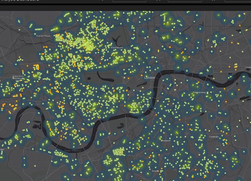
CASE STUDY
Electric Vehicle Chargepoint Data:
CASE STUDY
Creating a pan-London view
Location data can facilitate insight into the London’s EV infrastructure. Dynamic EV charge
optimal locations for new charge points to point usage data, as well as location, was already
help support the rollout of electric vehicles provided by GULCS charge point operators, but
(EVs), however, there are data challenges there were two main barriers to a transparent
that must be overcome on this journey - as pan-London picture:
was found by the London Office of Technology
and Innovation (LOTI). 1. Varying data quality and different datasets
provided by operators made cross-borough
LOTI60, in collaboration with London Councils, analysis a time-consuming process; and
the Greater London Authority (GLA), and other
partners, has developed a dynamic dashboard 2. Differing mechanisms used for providing
showing the location and patterns of usage for data by different operators meant that analysis
EV charge points in London, for use by highway was largely a manual process, involving the
and transport officers. This project is intended combining of multiple spreadsheets every
to enable informed strategic infrastructure quarter.
planning decisions on future EV deployments
locally, by bringing together data on usage To fix the barriers, LOTI used the London
and location of EV charge points across Datastore61 as a central point for sharing all EV
boroughs to show a pan-London view. charge point data, and developed common data
and API standards to automate and improve this
To build this dashboard, their starting point was process.
data generated by EV points implemented by the
boroughs via the TfL Electric Vehicle Charging
Infrastructure Framework, funded through Go
Ultra Low City Scheme (GULCS) or On-Street
Residential Charging point Scheme (ORCS),
accounting for approximately two-thirds of
Heatmap showing chargepoint utilisation in London, GLA Dashboard 2021You can also read