PROCESS MANUAL FOR ODF PLUS BASELINE 2020-21 - Guidance note for Districts and Field teams - Swachh ...
←
→
Page content transcription
If your browser does not render page correctly, please read the page content below
PROCESS MANUAL FOR
    ODF PLUS BASELINE 2020-21
         Guidance note for Districts and Field teams

Department of Drinking Water and Sanitation, Ministry of Jal Shakti

                                                                      1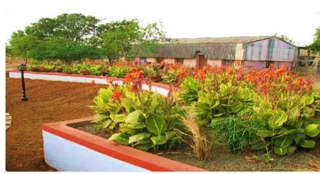
Summary of ODF Plus Baseline Assessment Process
To ascertain the current status of ODF Plus in rural India, Department of Drinking Water and
Sanitation (DDWS) aims to conduct a baseline assessment across all villages during the current
financial year. The baseline assessment is proposed to be carried out in all districts of India
from June 15,2020 to August 31, 2020 to determine the current status of Solid and Liquid
Waste Management (SLWM) and ODF Sustainability.
Formation of Field teams
To implement baseline assessment, Districts may constitute a resource pool of 50 or more
team members as per the requirements of the district. The resource pool may consist of
District or Block officials/ Registered Swachhagrahis (data available on IMIS) /District or Block
or Cluster Coordinators/Anganwadi or ASHA workers/ NGO members/ any other suitable
group identified by the State/District. Within this resource pool, field teams with 1-4 members
in each team may be constituted at the District level for a village as per the number of HHs in
the village as per SBM-G IMIS. The field team members will be registered in IMIS through M10
module to download and use the ODF plus mobile app for reporting data for baseline
assessment.
All the team members in the district resource pool are required to be trained for one day in
District/Block headquarters regarding the baseline data collection process, formats and the
ODF Plus mobile app.
Data collection and Baseline assessment methodology (what to do in a village?)
Field team members are required to follow a 4-step approach for carrying out baseline
assessment in a village
   1. Formation of hamlets, drawing of a village map and gathering basic village
      information regarding the number of households, population, number of HHs having
      cattle, hamlet details etc. through the key informants in the village.
   2. Mapping of community assets in the hamlets related to ODF plus indicators
      performed through interactions with key informants in the hamlets and geotagging
      of community assets such community soak pits, community compost pits etc.
   3. Assessing HH level indicators on SLWM through observations/minimum interactions
      with the 5 households in each hamlet selected through a systematic sampling
      process
   4. Compiling the hamlet and HH level data collected on ODF plus indicators and
      aggregating it to the village level to be reported in ODF plus mobile app
Quality assurance and reporting
To ensure the quality of data being collected by field teams, it is recommended that District
coordinators/officials will undertake back checks in 2% of villages. In case of discrepancies
observed during back checks, the details of backcheck reports be shared with District
administration for necessary action.

                                                                                               2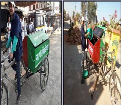
CONTENTS
1     Objectives........................................................................................................................................ 4
2     Design of the baseline ..................................................................................................................... 4
3     METHODOLOGY FOR THE BASELINE ............................................................................................... 5
    3.1      Field Team Formation ............................................................................................................. 5
    3.2      Training of Field Team............................................................................................................. 6
    3.3      Timelines ................................................................................................................................. 6
    3.4      Target respondents ................................................................................................................. 6
    3.5      Data Collection and Baseline assessment Methodology ........................................................ 7
      3.5.1          Step 01: Gathering village information and hamlet formation ...................................... 7
      3.5.2          Step 02: Hamlet visit, mapping and geotagging of community assets .......................... 8
      3.5.3          Step 03: Mapping HH level ODF Plus indicators ............................................................. 9
      3.5.4          Step 04: Data compilation and reporting........................................................................ 9
      3.5.5          DISTRICT INFORMATION FOR FSM, Plastics and GOBARDHAN ...................................... 9
4     ODF Plus Mobile app ..................................................................................................................... 10
5     Overall Guidance for the field team ............................................................................................. 10
6     Quality Assurance and reporting .................................................................................................. 11
7     Annexures ..................................................................................................................................... 12
    7.1      Annexure I: Formats being developed to capture information through ODF Plus mobile app
             12
    7.2      Annexure-II: Description of key community assets to be captured ..................................... 17

                                                                                                                                                        3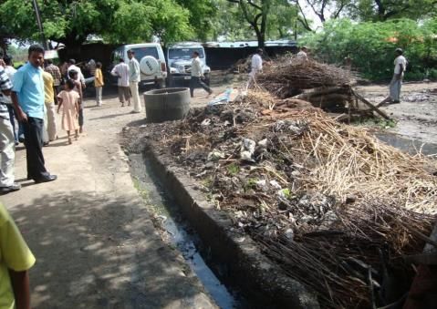
1 OBJECTIVES
With all States, Districts and Villages in India having declared themselves Open Defecation
Free, the Department of Drinking Water and Sanitation now aims to ensure that all villages in
the country become ODF Plus during Phase II of Swachh Bharat Mission - Grameen. To
ascertain the current status of ODF Plus in rural India, DDWS plans to conduct a baseline
assessment across all villages during the current financial year.
ODF plus village is defined as “a village which sustains its Open Defecation Free (ODF) status,
ensures solid and liquid waste management and is visually clean.” This includes ensuring that
all households in a village, as well as the Primary School, Panchayat Ghar and Anganwadi
Centre, have access to a toilet and that all public places and at least 80% of households
effectively manage their solid and liquid waste and have a minimal litter and minimal stagnant
water.

2 DESIGN OF THE BASELINE
The baseline assessment is proposed to be carried out in all districts of India to determine the
current status of Solid and Liquid Waste Management (SLWM) and ODF Sustainability. The
baseline assessment will focus on capturing the following key indicators and geo-tagging all
community assets in each village:

                                                        1. Access to
                                                        • FSM arrangements through
                                            1               FSTPs/STPs/Trenches/Drying Beds
                         706                            • No. of GOBARDHAN plants
                       Districts

                                                                  2. Access to
                        7000 Blocks               2               • Plastic Waste Management Units

                                                                   3. No. of ODF Plus components in village
                                                                  • Community Sanitary Complexes (CSCs)
                                                                  • Community/HH level Compost Pits, Bio-gas plants
                         6 lac villages
                                                          3       • Community/HH level Soak Pits/Leach Pits/Magic Pits/WSP
                                                                       /DEWATS etc
                                                                  • Waste collection and segregation sheds
                                                                  • Tricycles/ collection and transportation vehicles

                        ~ 200 million rural                               4. No. of Households in Village having access to
                        Households                                 4      • CSCs
                                                                          • Solid and Liquid waste arrangements

                                   Figure 1: Indicators to be captured during Baseline

The data for the above-mentioned indicators should be collected and recorded through the
ODF Plus mobile application developed by DDWS. The mobile app can be downloaded from
the link here. The detailed information formats being captured through the mobile app at
various levels are attached in Annexure I.

                                                                                                                             4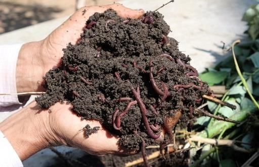
3 METHODOLOGY FOR THE BASELINE

3.1 FIELD TEAM FORMATION
Baseline assessment should be completed in all villages from June 15, 2020 to August 31,
2020. This exercise is to be carried out under the guidance and supervision of Senior District
Officials in charge of SBM-G program at District level such as CEO ZP/ CDO/DDO etc. To
implement baseline assessment, Districts may constitute a resource pool of 50 or more team
members as per the requirements of the district. The resource pool may consist of District or
Block officials/ Registered Swachhagrahis (data available on IMIS) /District or Block or Cluster
Coordinators/Anganwadi or ASHA workers/ NGO members/ any other suitable group
identified by the State/District. Districts may ensure to have 10% more members in the
resource pool than required to carry out the baseline assessment in all villages.
Within this resource pool, field teams with 1-4 members in each team may be constituted at
the District level for a village as per the number of HHs in the village as per SBM-G IMIS. After
completion of the baseline assessment in one village, the same team can move towards the
next village for collecting baseline data. The field team size and the number of days required
for each village may be decided based on the no. of hamlets/ no. of HHs in the village referring
Table 1 below. In case of teams having more than one team member, one of the team
members may be assigned the responsibility of entering data through the ODF Plus mobile
app for a village. While forming teams, it is to be ensured that field team members performing
baseline assessment in a village are not residents/office-bearers of the same village.
For large villages, the villages are to be further divided into several sub-divisions, may be
called as hamlet-groups based on population (approximate present population) criteria. For
example, a village with 1000 or more households (HHs) may be divided into five hamlets
groups with an approximate population of 200 households in each hamlet groups. After
reaching the village, team members may assign themselves to different hamlets for
conducting the baseline assessment in each hamlet.
Each team member in District resource pool will be mapped to villages identified by the
District teams. Accordingly, one field team member per village is to be registered by
district/block administration in IMIS module number M10 to download and use the mobile
app. Only registered and authorized users by the district/block administration will be able to
upload data through the mobile app.

                     Table 1: Team and hamlet formation process for each village
           Villages with No. of       Number of      Number of team          Number of days
               Households*              hamlets         members           required per village
          Households below 200             1                  1                     1
        Households from 201- 500           2                  1                     2
       Households from 501-1000           3-5                 2                     2
       Households from 1001-2000          5-10                3                     2
       Households more than 2000       10 or more             4                     3
                                                                                                 5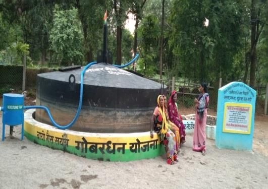
3.2 TRAINING OF FIELD TEAM
All the team members in the district resource pool are required to be trained for one day in
District/Block headquarters regarding the baseline data collection process, formats and the
ODF Plus mobile app. DDWS will conduct an interactive presentation-based training of State
level trainers (Training of Trainers) through VC on the process of baseline assessment to be
carried out. State level trainers will in-turn train the District Coordinators, DTMU team
members, other officials nominated by the district who will subsequently train the field team
members. For training purposes, the ODF Plus Baseline process manual, interactive
presentations, videos and ODF Plus mobile app user manual are to be referred.

3.3 TIMELINES
Baseline assessment should be completed in all villages from June 15, 2020 to August 31,
2020. The duration of the baseline assessment in each village will depend upon the number
of HHs and number of field team members in the village. But on an average, the baseline
assessment of 1000 HH village should be completed in maximum 2 days by a two-member
team as indicated in Table 1.

3.4 TARGET RESPONDENTS
Key informants in the village - This exercise will primarily cater to gathering basic information
of the village, the formation of hamlets and collecting expenditure details for community
assets related to ODF Plus indicators. The key informants for this assessment may be the
following:
o   Sarpanch/ Pradhan/ Village head/ Gaon Burah
o   Gram Panchayat (GP) secretary
o   Village Water and Sanitation Committee (VWSCs) members
o   Anganwadi (AWW)/ASHA/ANM workers,
o   School Teachers
o   Any other prominent person in the village person who is well versed with the village
    conditions and preferably living in the same village for a long time.
It is suggested that field team members have interactions with a minimum of two key
informants per village to collect the basic village information.
Key informants in the hamlet - This exercise will primarily cater to the mapping of community
infrastructure available in the hamlet for SLWM. It is suggested to gather this information
based on interactions with a minimum of two key informants per hamlet. The key informants
for this assessment will be the following:
o   Gram Panchayat (GP) secretary
o   Ward members, and/or elected PRIs from the same hamlet
o   Village Water and Sanitation Committee (VWSCs) members staying in the hamlet
o   Anganwadi (AWW)/ASHA/ANM workers
o   Any other prominent person in the hamlet who is well versed with the hamlet conditions
    and preferably from the same hamlet for which data is being collected

                                                                                               6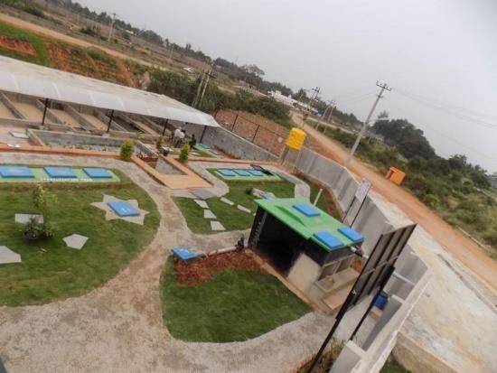
3.5 DATA COLLECTION AND BASELINE ASSESSMENT METHODOLOGY

           STEP 01                        STEP 02                         STEP 03                             STEP 04
  Gathering village                   Hamlet visit,               Mapping HH level                       Data compilation
   information and                    mapping and                ODF Plus indicators                      and reporting
  hamlet formation                    geotagging of
                                    community assets

  •     Gathering basic         •    Gathering information       •   Selecting 5 households          •    Data captured from various
        village information          about ODF Plus indicators       through systematic                   hamlets by different team
        such as population,          through key informants in       sampling which represents            members to be compiled
        no. of HHs with the          the assigned hamlets            the sub-division (hamlets) of        and entered in IMIS through
        help of key             •    Mapping the Community           the village                          ODF Plus mobile app
        informants                   assets in their assigned    •   Performing quick                •    In case, there is wide
  •     Formation of hamlets         hamlets including CSC,          assessment of these                  variation in the observed
        based on population          Compost pits, Soak pits,        households to determine              data and data received
        (approximate present         WSPs, drainage etc. along       ODF plus household                   through village key
        population) criteria.        with required details and       indicators                           informants, the matter
                                     geotagging it through the   •   Collecting data based on HH          should be discussed within
                                     ODF Plus mobile app             observations/minimum                 team again and necessary
                                                                     interactions and discussions         compilations may be made if
                                                                     with key informants in the           required
                                                                     particular hamlet

                                Figure 2: Data Collection and Baseline assessment Methodology

3.5.1       Step 01: Gathering village information and hamlet formation
Since village size varies considerably within each state and to have uniformity in
operation/implementation of data collection, hamlet formation exercise will be used.
The team will approach key informants (list mentioned above in 3.4) such as
Sarpanch/Pradhan/Mukhiya, Panchayat Secretary, School Teacher, Anganwadi workers,
ASHA and ANM workers etc. Key informants identified should be able to respond on
information related to a most of the indicators of ODF Plus. Field team members will also
capture the name and mobile number of key informants being interviewed for the village.
The basic village information regarding the number of households, population, number of
HHs having cattle, hamlet details etc. should be obtained as the first step and reported
through the mobile app. This information may be gathered with the assistance of key
informants.
Based on discussion with key informants and population of the village, hamlets will be formed
by the team members. For large villages having more than 500 HHs, team members will assign
themselves to different hamlets for further assessment on ODF Plus indicators. As a part of
this exercise, the team will list out and map all types of settlements in the identified villages.
This shall cover the village geographically (main village/ hamlets/ satellite settlements etc.)
and by socio-economic background.

                                                                                                                                        7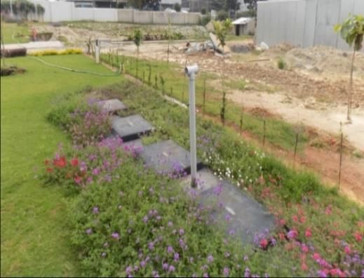
Figure 3: Village settlement map

A rough map of the entire village as indicated in Figure 3 will be drawn with the help of key
informants. Based on the number of HHs, as per table 1 above, hamlets in each village will
be mapped out. The team members will split themselves into different hamlets for
performing the community asset mapping and household level observations. However, the
field team may also decide to form hamlets and draw maps according to the field situation.
Based on the map drawn of the village, the location of all community assets will be marked in
the village. All details related to financial expenditure, capacity and location etc. be obtained
with the assistance of Panchayat Secretary and Sarpanch/Pradhan/Mukhiya/Village head.
Reference formats to be filled from Annexure 6.1 during this step.
1 Village Basic Information

3.5.2   Step 02: Hamlet visit, mapping and geotagging of community assets
Once the basic village level necessary information has been obtained through village key
informants, team members will move to their assigned hamlets to map and geotag all
community assets in the hamlets. Mapping of community assets related to ODF plus
indicators hamlet is to be performed through interactions with key informants present in
hamlet and based on observation of households as well.
The number of HH having individual assets such as HH level soak pits, HH level compost pits,
HH level biogas plants should also be captured however their geotagging and other details
are not required. These observations recorded for each hamlet are required to be aggregated
at the village level to determine the number of HHs having access to community SLWM assets.
For a very large village for aggregation of ODF plus indicators for the village, one of the field
team members may go one day in advance and stay back in the same village for an extra day
after completing the entire data collection.
Reference formats to be filled from Annexure 6.1 during this step. Illustrative pictures and
details in Annexure-II for various components of these formats may be referred.
1 CSC information
2 Information on Solid Waste
3 Information on Liquid Waste

                                                                                               8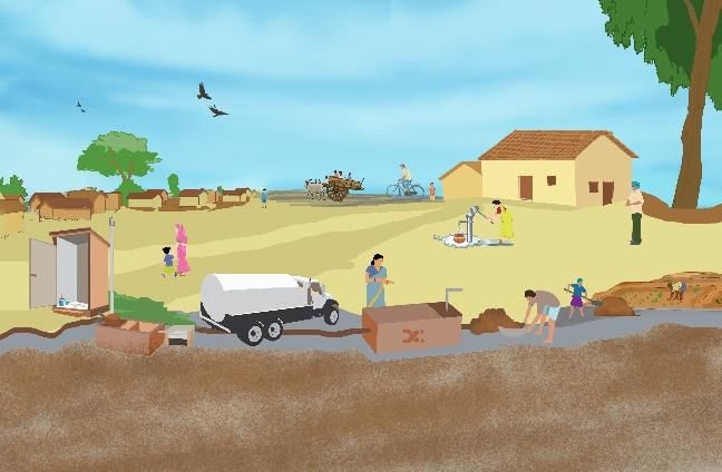
3.5.3   Step 03: Mapping HH level ODF Plus indicators
With the assistance of key informants, the team should identify 5 households from each
hamlet through systematic sampling (illustrated below) for assessing the ground reality with
respect to household SLWM access. The household data on SLWM may be collected based on
direct observations of the household and minimum interactions with the household members
while maintaining appropriate social distancing. The data from these household observations
are to be recorded in the mobile app as well.
Household selection based on systematic sampling
Systematic sampling will be used to identify the five households to be observed in each
hamlet. In case of any hamlet, every N/5 th household moving from Northwest corner from
the hamlet must be observed, where N is the total number of the households residing in that
hamlet.
Example: The numbering of households will start from the northwest corner of the hamlet
which will be counted as the first household. If a hamlet has 180 households then N=180 and
hence (N/5th) 36th,72nd, 108th, 144th and 180th households are to be observed. In case 72nd
household is locked/unavailable then 73rd household is to be included in observation.
Reference formats to be filled from Annexure 6.1 during this step
1 Household information format – 5 HHs per hamlet

3.5.4   Step 04: Data compilation and reporting
Once each team member has collected information from their respective hamlets then they
should gather together to compile the information at the village level to be reported in the
ODF plus mobile app. Following steps are to be undertaken while compiling and reporting
data:
   •    Data captured from various hamlets by different team members to is to be compiled
        at village level and be entered through ODF Plus mobile app after completion of
        assessment in all hamlets of the village
   •    All community asset details should be reported through ODF plus mobile app for the
        village by the field team.
   •    All community assets should be geotagged and number of HHs being served should
        also be captured through the mobile app.
   •    In case, there is wide variation in the observed data and data received through village
        key informants, the matter should be discussed within the team and data observed
        during baseline assessment to be entered
   •    Only one person in the field team registered under the M10 module in IMIS will be
        responsible for entering all the data in the mobile app for a village

3.5.5   DISTRICT INFORMATION FOR FSM, Plastics and GOBARDHAN
Information regarding STPs, FSTPs, Plastic Waste Management Units and GOBARDHAN plants
in the District also needs to be captured. This information may be collected from SBM/ other

                                                                                             9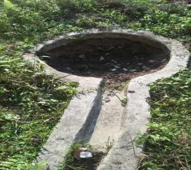
departments through ODF Plus mobile app and will be the responsibility of District SBM
Coordinator/Block Coordinators in each district. District level users are to be registered
separately in the mobile app to capture this information.
Reference formats to be filled from Annexure 6.1 during this step
FSM, Plastic and GOBARDHAN - District/Block level

4 ODF PLUS MOBILE APP
Department of Drinking Water & Sanitation, Ministry of Jal Shakti, Government of India, is
the nodal Department for monitoring progress under the Swachh Bharat Mission, at the
central level. The ODF plus Baseline application has been developed by the Department in
technical collaboration with NIC. The primary focus of this app is to update the data
captured during baseline assessment for ODF Plus indicators and images of community
assets under the Village Basic Information, Baseline Abstract Data, Baseline Details, HH
observation and CSCs sections in the mobile app. NIC has also developed a detailed user
manual for using the mobile app which can also be downloaded from Link here.

5 OVERALL GUIDANCE FOR THE FIELD TEAM
During baseline assessment in each village, the team will ensure to undertake the following
activities:
The team should gather basic information related to the number of households, population
and number of HHs having SLWM arrangement in the village with the support of key
informants such as Pradhan, Panchayat Secretary, School Headmaster, Anganwadi workers,
ASHA and ANM workers.

•   The team should map the location of existing community SLWM assets and CSCs
•   All HHs being served by community assets in the village should be mapped in the mobile
    app based on hamlet and household observations
•   All households having individual SLWM assets should also be mapped and reported
•   Baseline assessment of each village should be completed maximum in 2-3 days and data
    of all indicators mentioned above for each village must be uploaded on the IMIS through
    the ODF Plus mobile app
•   All existing community assets should be mandatorily geotagged by the team through the
    ODF Plus mobile app. The registered user for ODF plus mobile app may be given the
    responsibility to capture community asset details and geotag them.
•   Source of funding for community assets also to obtained from Panchayat
    Secretary/Sarpanch/ Block office and be reported in the mobile app
•   During interacting with key informants and villagers, all safety guidelines such as wearing
    masks, frequent handwashing, social distancing to be observed by the field team
    members.

                                                                                             10
6 QUALITY ASSURANCE AND REPORTING
As complying with the Govt. Of India guidelines, District SBM Coordinator/District
Development Officer / Director, District Rural Development Agency/ District Panchayati Raj
Officer would be appointed as District nodal officer for accurate reporting and entering of
baseline data of all villages in IMIS through the mobile app. The data reported by team
members in a block needs to be approved in IMIS by the concerned District authorities under
existing District login. Ensure adherence to the timelines mentioned by the Government of
India regarding the baseline assessment
In addition to this, District coordinators/officials will undertake back checks in 2% of villages
to ensure high quality of data. In case of discrepancies observed during back checks, the
details of backcheck reports be shared with District administration for necessary action.
The District team will be responsible to ensure the following:
1. Quality of the data collected
2. The efficiency of the training and field management of resource pool
3. Efficiency and skills of the manpower after the training
4. Overall responsiveness of the field teams
5. Transparency and flexibility
6. Timelines of activity completion
117 ANNEXURES
7.1 ANNEXURE I: FORMATS BEING DEVELOPED TO CAPTURE INFORMATION THROUGH ODF
PLUS MOBILE APP
1. Village Information
Basic Village Data
Sl.No General Information Units in Numbers
1 No of HHs
2 Population
3 Number of Hamlets in the village
No.of Households with toilet technology type
(If exact numbers not available then
approximate numbers may be indicated)
(Multiple selection)
4
a. Septic tanks toilets with soak pits
b. Septic tank toilets without soak pits
c twin pit toilets
d single pit toilets
e.others
Average Total Quantity of solid waste
generated daily (in kg)
(If exact numbers not available then
5
approximate numbers may be indicated)
a. Biodegradable Quantity in kg
b. Non-biodegradable including plastics
Quantity in kg
Average Quantity of Grey Water generated in
village per day
(in KLD - One KLD is equal to average 100
6 buckets/10 litres of water)
(If exact numbers not available then
approximate numbers may be indicated)
7 No of HHs having cattle
No of HHs having door to door waste
8
collection
Rough map of the village with hamlets and important landmarks details to be collected and
uploaded in photo form
122. CSC Information
CSCs -Village level Detailed Information to be captured for each unit
S.N0 Units in Number of Number of Water Divyang Managed by Number Source of Total Geocoordi Image
numbers toilets toilets seats - facility friendly of HHs Funding* - Expenditu nates
seats -Male Female available accessing Multiple re
CSC selection
a. Gram Panchayat
b. NGO/private agency
Community
c. SHG
1 Sanitary Complexes Yes/No Yes/No
d. VWSC
(CSCs)
(Single selection)
3. Information on Solid Waste Management
Solid Waste Management Components -Village Level Detailed Information to be captured for each unit
S.N. Solid Waste Management (SWM) Technology type Units in numbers Capacity Number of HHs connected Source of Funding* - Total Expenditure Asset details/live location Geocoordinates Image
To be calculated by Multiple selection
(length x breadth x height)
1 Community Compost Pits X Cubic metres (1 cubic metres
is equal to 1000 litres)
2 Community Bio Gas plants - under other X Cubic metres (1 cubic metres
schemes is equal to 1000 litres)
3 Individual HH Level Compost Pits X X X X X X X X
4 Individual HH level Bio gas plants X X X X X X X X
5 Vehicles for collection & transporation of a. Tricycles X X X
waste b. Push carts
c. Tractors
d. Battery operated vehicles
(Multiple selection)
6 Waste collection and segregation sheds X X
in the village
134. Information on Grey Water Management
Grey Water Management Components -Village Level Detailed Information to be captured for each unit
S.N. Grey Water Technology type Treatment source only Units in Capacity Number of HHs Source of Funding* - Total Asset Geocoordi Image
Management (GWM) from drains numbers connected Multiple selection Expenditu details/live nates
re location
1 Community Soak X X KLD
Pits/Leach Pits/Magic
Pits
2 HH level Soak X X X X X X X X X
Pits/Leach Pits/Magic
Pits
3 HH level kitchen X X X X X X X X X
gardens
4 Drainage facility If yes then select type Disposal of drainage Length in
available in village a. Underground pipes water (drain terminates metres
(Yes/No) b. Covered pakka at)
c. Open pucca a) Open low land areas
d. Open katcha b) Ponds
c) Nearby rivers
(Multiple selection) d) Agricultural field
f) Treatment systems
such as WSP,DEWATS etc
(Single selection)
5 Other Community a Waste Stablization X KLD
Grey Water Pond - 3 pond system
Treatment options b. Waste Stablization
Pond - 5 pond system
c. DEWATS
d. Phytorid
e. Constructed
wetlands
f. Duckweed pond
g. Others
(Multiple selection)
145. HH information format - Based on direct observation/minimum interactions (5 HHs per hamlet)
Basic household details to be captured Based on direct observations and minimum interactions with HHs while maintaining appropriate social distancing
S No. of Name of Number of Name of the Gender Is there any garbage or litter How is usually solid waste How is usually non- Is there stagnant waste water Is HH connected to Where is waste water
the the hamlet HHs in the head of piled up or dumped within the disposed by the HH? - biodegradable including within the premise of the drains being disposed
hamlet hamlet household premise of the house? plastic waste being house? usually?
managed?
Is there any garbage or litter 1. Safely disposed within 1. Door to door collection (Waste water means –grey Yes/No 1. Flows into a
piled up or dumped within the HH through individual 2. Collected in community water common system
premise of the house? compost pits/bio-gas bins generated by households through drains
(any kind of garbage has kept as plants etc. 3. Littered/dumped near stagnant at the time of survey. It 2. Kitchen garden
temporally should not be 2. Safely disposed through the house would not include accumulated 3. Soak pits
considered as piled /dumped up) common systems 4. Littered/dumped into rain water or permanent 4. Flows into
3. Littered/dumped near drains homestead ponds within the roadside/open space
the house house premises.) (Single selection)
(Yes/No) 4. Littered/dumped into (Single selection)
drains (Yes/No)
(Single selection)
156. FSM, Plastic and GOBARDHAN - District/Block level
FSM, Plastic and GOBARDHAN - District/Block level Detailed Information to be captured for each unit
S.N. Activity Type Technology type Units in numbers Capacity Number of Source of Total Expenditure Asset details/live Geocoordinates Image
Villages Funding* - location
connected Multiple selection
a. FSTP
b. Co-treatment with
STP
c. Trenches
1 FSM (Multiple selection) KLD
Quantity of
plastic waste
X
Plastic Waste processed per day
2 Management Units (in KG)
Cubic metres
(1 cubic metres is
X X
equal to 1000
3 GOBARDHAN plants litres)
X Not to be
captured
* Key Source of Funding
1. SBM –G
2. 15th/14th Finance Commission
3. MGNREGS
4. State Finance Commission
5. MPLADS/MLALADS
6. District Mineral Funds
7. CSR/ NGO contribution
8. GP Funds
9. Others/ Please specify
167.2 ANNEXURE-II: DESCRIPTION OF KEY COMMUNITY ASSETS TO BE CAPTURED
Solid Waste Management Components -Village Level
S.No. Type of Assets/ Description Photo
Technology
1. Community Pit Composting- Community compost pits are for treating the
compost pits biodegradable waste generated in the villages. Based on the quantity of
biodegradable waste generated, the number and size of the pit vary.
Community compost pits may help to treat waste generated from
minimum 50-150 households.
Vermi composting- Composting using earthworms is called vermi
composting. The number and size of community vermicompost pits vary
with the quantity of biodegradable waste generated in the village.
172. Community Community Biogas plants are used to treat biodegradable waste
Bio-gas Plants generated in the village including cow dung, agriculture waste etc. The
waste is treated in digester resulting in biogas and bioslurry which can be
utilized further. The data needs to be captured for community biogas
plants under other MNRE Scheme.
3. Waste The waste collection sheds, or the material collection facility is the place
collection where the waste collected from the village is bought and segregated to
centres / Sheds different categories. The shed is also known as the collection and transfer
centre. This shed is used for segregation, and after that, the degradable
waste can be used for composting in the village and non-degradable
waste can be sent to Block or District centres for shredding and baling
4. Vehicle for For door to collection of waste, most of the villages use tricycles/ push
collection & carts or battery-operated vehicles. One tricycle covers 150 households in
transportation a day by taking 2 trips.
of waste
185. Individual Pit Composting- Every household with space in villages usually treat the
Household- degradable waste by pit composting method. A set of small compost pit is
level Compost dug in the backyard of the house to treat the degradable waste generated
pits in a house of 5-6 members. It may be circular/ square/rectangular.
Liquid waste management
S.No. Type of technique Description Photo
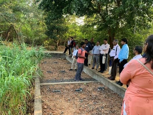
1. Community Soak/ Soak Pit - Dug out pits used for treating the grey water
Leach/ Magic pits generated from Kitchen, bathrooms and washing platforms of a
group of minimum 25- 50 households in a village. Community
Soak pits will have filter media like stones, pebbles of different
sizes.
19Leach Pit – Leach Pit is a brick-lined pit constructed in
honeycomb masonry having a volume of about 0.75 cubic
meters. No filter media
Magic Pit - A Magic pit, is a covered, porous-walled chamber
that allows water to slowly soak into the ground. Pre-settled
effluent from a collection tank is discharged to the underground
chamber.
2. Waste stabilization Waste stabilization ponds (WSP) are shallow man-made basin
ponds into which wastewater flows and from which, after a retention
time of a few days a well-treated effluent is discharged. Waste
stabilization ponds have a minimum of 3 ponds connected. 5
Pond systems are also constructed in certain villages
203. Constructed Horizontal subsurface flow constructed wetland is large gravel
Wetland- and sand-filled channel that is planted with aquatic vegetation.
As wastewater flows horizontally through the channel, the
filter material filters out particles and microorganisms degrade
organics.
4. Decentralized DEWATS is a proven nature-based treatment technology
Wastewater suitable for wastewater treatment including greywater
Treatment System DEWATS treatment systems will be mainly constructed in
(DEWATS)- Institutions and villages with more than 2000 population.
5. Phytorid Phytorid is a scientifically developed systematic treatment
technology- methodology for wastewater. Phytorid treatment technologies
are mainly constructed at Institutional level.
216. Duckweed Pond A pond in a village where Duck weeds are used to treat the
wastewater reaching it. Duck weed is a water plant which
helps in treating the waste water.
7. Drains Drains are the conveyance system (collection and
transportation) of wastewater generated in a village. The
drains may be covered/ open/ underground pipes. Need to
check the number of households draining out grey water into
these drains.
22FSM - District/Block level
S.No. Type of technique Description Photo
1. Deep row This option may be adopted for a cluster of villages where less
entrenchment quantity of faecal sludge is collected. This technology is not
(Trenches) appropriate for villages close to water bodies (rivers, lakes and
coastal areas) and where the ground water level is high.
4. Faecal Sludge FSTP is the plant in which transport, and treatment of fecal
Treatment plant sludge from pit latrines, septic tanks or other onsite sanitation
systems.
235. Sewage Treatment The STP is based on Cyclic Activated Sludge Technology. For co- NA
plants (STP)- treatment, the following element was added: Decanting
Station: A decanting station has been created at the
Tonca STP to allow desludging trucks to discharge septage. The
decanting station is located just outside the plant and has a high
boundary wall.
GOBARDHAN Plants - District/Block level
S.No. Type of technique Description Photo
1. Biogas Biogas, the most common form of bio-fuel, is a clean form of
energy and can be obtained from cattle dung, poultry
droppings, crop residue, kitchen waste, etc.
Plastic Waste Management Units
S.No. Type of technique Description Photo
1. Plastic A materials recovery facility, materials reclamation facility,
Management Unit materials recycling facility or Multi re-use facility is a
specialized plant that receives, segregates, and recyclable
materials which may be marketed to end-user manufacturers.
24CSCs -Village level
S.No. Type of Complexes Description Photo
1. CSCs A sanitary toilet complex is an infrastructure for the use of
the community and/or floating population. Such CSCs consist
of an appropriate number of toilet seats, bathing cubicles,
washing platforms, wash basins, etc.
25You can also read


