REGIONAL MODE SHIFT PLAN WELLINGTON - Focusing our regional effort on mode shift
←
→
Page content transcription
If your browser does not render page correctly, please read the page content below

Regional mode shift plans WELLINGTON 2020   1

REGIONAL MODE SHIFT PLAN
WELLINGTON
Focusing our regional effort on mode shift

2 Regional mode shift plans WELLINGTON 2020
Regional mode shift plans WELLINGTON 2020   3

CONTENTS

SUMMARY							4
INTRODUCTION						8
DEVELOPING THE PLAN				18
THE PLAN							23
IMPLEMENTATION					32
APPENDIX: WELLINGTON MODE SHIFT
FOCUS AREAS AND ACTIVITIES		           36

Published September 2020 | 20-228
Copyright: September 2020
Waka Kotahi NZ Transport Agency

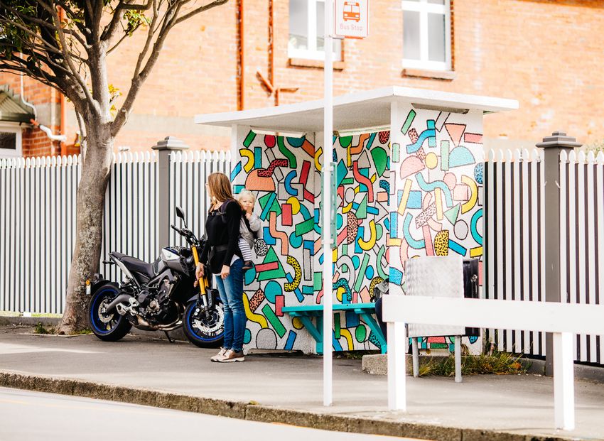
4                           Regional mode shift plans WELLINGTON 2020

SUMMARY

The Wellington mode shift plan sets out how the region will make
progress over the short-medium term to increase the share of travel by
public transport, walking, and cycling1 (what we call ‘mode shift’).
The Wellington region has constrained and challenging topography that has shaped urban
development and resulted in two main-north-south urban development and movement
corridors – with limited east-west connections. The region’s transport system is strained as a
result of increasing numbers of vehicles on the roads, along with capacity and reliability issues
on buses and trains and network resilience issues, which presents both access and resilience
challenges, particularly for the many commuters travelling into Wellington central city.
The region has the highest combined active mode and public transport mode share across
New Zealand with 31% of all regional journey to work trips made using these modes and half
of the 82,000 people that travel into central Wellington every morning using public transport,
walking or cycling.
The region is making progress with increased public transport and active mode usage,
but there is potential to move faster. The region’s success depends on building on recent
progress by delivering the activities identified in this plan to enable better travel options for
communities, and chasing the liveability, health, environmental, and economic benefits that
come from increasing active and public transport mode share.
Rail patronage has grown substantially over the last decade, reflecting both population growth
in the region and investments to improve infrastructure, rolling stock and services. Whilst
improvements are being made as part of the Wellington Metro Rail Upgrade, much greater
investment will be required to meet forecast demand. Increasing development around stations
can enable a greater proportion of future trips to be made by rail, supported by improved
multi-modal access and facilities and integrated ticketing to make it easier for more people to
use shared and active modes for a wider variety of trips.
The bus network plays a critical role in moving large numbers of people in the largest urban
centre Wellington City, particularly at peak times, and in connecting people to rail and other
facilities around the wider region. The bus network is currently the only public transport option
for much of Wellington City (apart from the northern suburbs). Buses will be increasingly
important to support public transport mode share in key growth areas in Wellington City,
including the northern suburbs, and in other parts of the region where bus mode share is
currently low, and to support improved east-west regional access.
Cycling is increasing but from a low base. Newly completed cycle facilities around the region
have increased people’s ability to cycle safely, but here are still significant gaps in the network
that impact on use of active modes (especially for commuting). Latent demand for cycling
could be realised with continued progress with both transformational projects (eg, Te Ara
Tupua) and other potential separated facilities to create a connected regional cycling network.
The growing popularly of e-bikes and bikes on buses are also increasing the number of cyclists
and cycle trips in the region, and shared e-scooter and bike schemes are an emerging way of
getting around.

1. When we use the word cycling in this report, unless otherwise specified, it will usually also include low-powered
vehicles (often referred to as micro-mobility), especially when discussing mode share in general.
Regional mode shift plans WELLINGTON 2020   5

Wellington is New Zealand’s most walkable city, however, issues with footpath crowding and
severance as a result of busy roads remain in Wellington City. In other parts of the region,
a greater focus on walking and place-making within city and town centres and along key
corridors is emerging.
COVID-19 has had major social and economic impacts; it also changed how people travelled
and the extent of travel. Land transport revenue from public transport fares, road user charges
and fuel excise duty (as well as local government rates) have all been impacted. Many
people rediscovered and explored their communities by foot or bike during lockdown. There
is an opportunity to build on this increase in walking and cycling to help shift social licence
for change, especially to support conversations where the trade-offs associated with the
reallocation of road space are more acute.
This plan outlines focus areas under the following three levers: shaping urban form; making
shared and active modes more attractive; and influencing travel demand and transport choice.
These areas aim to integrate transport policies with land use change so the benefits of each
can be combined for an even greater impact on mode shift and emission reduction than these
changes would enable on their own.
The focus areas are outlined in the table below.
6                      Regional mode shift plans WELLINGTON 2020

    LEVERS          FOCUS AREA

    Shaping urban   • Increase development density near rail stations and major bus hubs and
    form              significantly improve multi-modal connections to stations/hubs.
                    • Ensure the location, layout, and design of greenfield growth areas encourages
                      people to travel by shared and active modes.
                    • Intensification and place-making in Wellington City, particularly near future mass
                      rapid transit and public transport corridors.
                    • Implement urban development projects (eg, Eastern Porirua including East-
                      Porirua to City-Centre multi-modal transport corridor) to improve liveability and
                      multi-modal access.

    Making shared   • Improve rail safety, capacity and resilience by upgrading rolling stock,
    and active        infrastructure and services, and purchasing additional trains to address
                      overcrowding, provide for future growth and enable higher service frequencies.
    modes more
                    • Continue and accelerate where possible Let’s Get Wellington Moving, including
    attractive        early delivery activities and City Streets and delivery of mass rapid transit.
                    • Progress Bus Network Action Plan and the review of the network across the
                      region to deliver various initiatives including bus layovers, increases in frequency,
                      span of service and changes routes (extensions and simplifications), to reduce
                      overcrowding and improve reliability and access.
                    • Implement integrated ticketing and improve multi-modal access including bike
                      parking and park and ride management.
                    • Revitalise town centres in the region with a focus on walking and biking for
                      shorter trips, through permanent changes or temporary/trial interventions
                      through Innovating Streets for People projects across the region.
                    • Make walking and cycling more attractive for getting to school by stepping-up
                      implementation of the Bikes in Schools and Movin’ March programmes and
                      delivering lower speeds around schools.
                    • Establish a connected regional cycling network by eliminating pinch points on the
                      network and delivering transformational projects to improve access.
                    • Promote e-bike uptake and careful management by councils of rental e-scooter
                      schemes (along with bike schemes).

    Influencing     • Progress the Let’s Get Wellington Moving (LGWM) Travel Behaviour Change and
    travel demand     Parking Levy investigations.
    and transport   • Further develop and implement targeted workplace travel plans for hospitals and
                      other large workplaces.
    choices
                    • Use public transport fare structures alongside integrated ticketing to encourage
                      public transport use including inter-peak and off-peak travel.
                    • Develop Journey to Work and travel option and cost information throughout
                      region especially on key corridors building on the Best Time to Travel campaign
                      and Greater Wellington Regional Council (GWRC) Mobility as a Service trial.
                    • Facilitate availability of technology and apps as enablers for increased use of
                      shared or active mobility choices.
                    • Update/implement parking policies to discourage long-stay on-street commuter
                      parking and enable reallocation of road space.
Regional mode shift plans WELLINGTON 2020 7
This plan has been developed by Waka Kotahi, councils across the Wellington region, and
KiwiRail. The Regional Transport Committee has endorsed the strategic direction and focus
areas outlined in the plan.
WELLINGTON REGIONAL TRANSPORT COMMITTEE
Endorsed mode shift plan direction and focus areas
Mode shift plan developed by:
• Waka Kotahi (lead) • Hutt City Council • Upper Hutt City Council • Masterton District
• Greater Wellington • South Wairarapa • Kapiti Coast District Council
Regional Council District Council Council • KiwiRail
• Porirua City Council • Wellington City Council • Carterton District Council
This plan has been developed alongside the Regional Land Transport Plan (RLTP) and is
being used to inform the identification of activities for inclusion in the RLTP 2021 and future
investment plans.
Significant investment is already being planned in both public transport and walking and
cycling infrastructure through commitments from the National Land Transport Fund, the
NZ Upgrade Programme, through the economic stimulus package, and the commitment to
LGWM in the draft Government Policy Statement (GPS). The ability of councils across the
region to fund the local share of new transport improvements is likely to be impacted by both
a reduction in revenue streams associated with COVID-19 and additional costs.
Consequently, from a mode shift perspective, it will be important to focus on the wider
system levers, particularly those relating to urban form, as decisions made now have a
major impact on how people travel for years to come. This means identifying opportunities
for complementary investment in other areas, such as housing and water infrastructure,
and partnering to enable growth that is equitable, multi-modal, resilient, and provides for a
transition to a low-carbon future.8 Regional mode shift plans WELLINGTON 2020 INTRODUCTION The Wellington mode shift plan sets out how the region can increase the share of travel by public transport, walking and cycling. It supports the national mode shift plan ‘Keeping Cities Moving’ developed by Waka Kotahi NZ Transport Agency and is intended to be read alongside the five other regional mode shift plans developed with local government for Auckland, Hamilton, Tauranga, Christchurch and Queenstown. It is a non-statutory document but has been developed alongside and to inform the draft Regional Land Transport Plan (RLTP) 2021 and other processes and projects underway regionally, such as the Wellington Regional Growth Framework and Let’s Get Wellington Moving (LGWM). The development of this plan has been led by Waka Kotahi but it is a joint plan developed collaboratively with councils across the region and with KiwiRail. Unless otherwise stated, data and trends discussed in this report are pre-COVID-19. THE IMPORTANCE OF MODE SHIFT The Wellington region has always recognised the importance of public transport and active modes for the regional transport system to function, and it is reflected throughout the existing regional transport plans and business cases, and place-based plans in development. The Wellington region’s constrained and challenging topography has shaped urban development patterns and resulted in two main-north-south urban development and movement corridors – with limited east-west connections. Its transport system is strained as a result of increasing numbers of vehicles on the roads, along with capacity and reliability issues on buses and trains and network resilience issues, which presents both access and resilience challenges particularly for the significant number of commuters travelling into Wellington central city. There is limited space for cars in the key destination of Wellington central city, so focus is needed to make travel across the region by public transport and active modes more attractive and to develop an urban form that makes those journeys easier. This will require improved rail infrastructure and multi-modal connections, but also improved parking management. Timing of large investments in rail ahead of demand changes associated with more transit orientated design and other step changes such as mass rapid transit will enable mode shift opportunities to leverage from each other. Mode shift is central to the LGWM programme aiming to move more people with fewer vehicles. Mass transit is a core element of the programme as well as giving greater priority for public transport, walking, cycling, and placemaking. This is a significant programme of investment of $6.4 billion to be delivered over the next 30 years. Improving mode shift will assist those councils around the region that have strategies and plans in place to reduce emissions and deliver on their city-wide and/or organisational targets (and other commitments as part of declaring a climate emergency). Some other councils in the region are now recognising mode shift as an area of priority, such as in the Draft Sustainable Transport Strategy for the Kapiti Coast. The strategic front end of the draft Regional Land Transport Plan 2021 signals the change that is sought across the region to tackle mode shift with two ambitious targets: • 30% reduction in transport generated carbon emissions in the region by 2030 • 40% increase in active travel and public transport mode share by 2030 (equivalent to a 45% mode share
Regional mode shift plans WELLINGTON 2020               9

Regional emissions profile
Mode shift has a key role to play in reducing regional emissions. Land transport makes up 28%
of the region’s greenhouse gas emissions. Carbon dioxide emissions from road transport in the
region increased by 8% over the past ten years, with emissions from petrol reducing by 7%
but emissions from diesel increasing by 50%. During the same period, the population rose by
20% and GDP rose by 48%.
The proportion of emissions that is attributable to land transport is the highest in Porirua with
Kapiti and Upper Hutt the second highest. Wellington City and Lower Hutt are broadly similar.
Wellington City and Upper Hutt’s emissions from road transport reduced between 2001 and
2019 despite overall population and economic growth. While vehicle kilometres travelled
increased by less than 1% in Wellington City and by 12% in Upper Hutt City it is likely that the
overall reduction in transport emissions are related to the improved performance of emissions
from vehicle engines.
TABLE 1: WELLINGTON REGION LAND TRANSPORT EMISSIONS 2019: ANALYSIS OF CHANGE IN EMISSIONS
SINCE 2001

                         WGTN        WGTN          PORIRUA          KAPITI         LOWER            UPPER        WAI-
                         REGION      CITY                                          HUTT             HUTT         RARAPA

 Total gross             4,190,050   1,061,383     304,431         351,245         532,339         206,331       1,434,320
 emissions tCO2e
 (excl. forestry)
 % of region’s gross     100%        25%           7%              8%              13%             5%            41%
 emissions
 % of district’s gross   35%         35%           51%             42%             36%             42%           11%
 emissions that is
 road transport
 Increase in road        8%          -6%           41%             48%             4%              -17%          24%
 transport emissions
 between 2001-
 2019 within district
 GDP growth in           48%         59%           63%             67%             11%             27%           42%
 district
 Population growth       20%         24%           20%             30%             10%             22%           22%
 in district

 Note: Road transport emissions appear to be approximated by petrol and diesel use. In some districts, this includes
 some off-road use of diesel. It also excludes electricity use by EVs and electric buses.

In recognition of climate change as our most significant environmental challenge that will
affect everyone in the region, Greater Wellington Regional Council (GWRC) declared a
climate emergency in August 2019 and released a Regional Climate Emergency Action Plan
established a target for GWRC as an organisation to become ‘carbon neutral’ by 2030.
One of the Action Plan initiatives to reduce emissions is to accelerate the decarbonisation
of GWRC’s public transport bus fleet. In June 2020 plans were announced to increase the
electric bus fleet from 10 to 108 between now and December 2023. This will significantly
reduce GWRC emissions and take it a step closer to reaching its 2030 carbon neutrality goal.
10 Regional mode shift plans WELLINGTON 2020 Most other councils in the region have also declared a climate emergency including Kapiti Coast District Council in May and Wellington City Council in June 2019. To ensure mode shift can support the greatest reduction in emissions, investment decisions to increase public transport capacity should take into account the emissions profile of new infrastructure, and electric vehicle ownership should be supported. Currently there are a number of electric vehicles in use in the region for public transport and private use: • 83 two-car Matangi electric trains in service that operate on all lines except the Wairarapa • ten electric double-deckers are in service with a further 98 electric buses joining the fleet in the between 2021 and 2023 taking the proportion of electric buses in the fleet from 2% to 22% which is high by international standards.2 A new electric harbour ferry is expected to join the fleet in early 2021 • there are approximately 2200 electric vehicles (light or heavy) registered within the Wellington region. The Zero Carbon Act sets a net zero emissions target by 2050 for New Zealand. It also established a system of emissions budgets for each five-year period between 2022 and 2050 to act as stepping stones towards the long-term target3 , and need to be set by the end of 2021. The draft RLTP 2021 includes a target for a 30% reduction in transport generated carbon emissions by 2030. The region will need to change business as usual if we are to make a dramatic reduction in per capita road transport emissions and achieve the 2030 RLTP target and the Zero Carbon Act 2050 target. Health impacts of transport The other key transport challenge to tackle with mode shift is improving public health. Health issues associated with the transport task include road safety, harmful emissions, noise and low physical activity. To reduce emissions and improve health outcomes associated with transport we can avoid or reduce the need to travel, shift to shared or active modes and improve the transport options by making them lower carbon and quiet.4 REGIONAL CONTEXT There are over 527,000 people in the Wellington region, up from almost 400,000 in 2006. All parts of the Wellington region are growing, including regional towns, many of which experienced long periods with little growth in recent decades. Work on the Wellington Regional Growth Framework indicates we need to provide for between 91,000 and 151,000 additional people in the region by 2050.5 In addition, as the population ages, the need for accessible transport modes will increase. Much of the region has a constrained and challenging topography. This has shaped urban development patterns and resulted in two main-north-south urban development and movement corridors – with limited east-west connections. 2. Other than China which is the market leader. https://www.metlink.org.nz/news/metlink-to-boost-electric- buses-from-2-to-22-per-cent-of-its-fleet-to-meet-climate-change-goals-and-passenger-growth/ 3. Fourth Biennial Report Snapshot, Ministry for the Environment, December 2019. 4. Electric vehicle (including trains) are quieter than their petrol and diesel counterparts. 5, The Wellington Regional Growth Framework also includes Horowhenua District with the WRGF region and has considered a scenario of 200,000 additional people.
Regional mode shift plans WELLINGTON 2020           11

The region’s transport system is strained as a result of increasing numbers of vehicles on the
roads along with capacity and reliability issues on buses and trains and network resilience
issues are straining the regional transport system may not result in the necessary transport
system shifts the region is seeking – such as improving safety and access, reducing emissions,
and reducing reliance on private vehicle travel.
The concentration of regional employment in central Wellington, and the dominance of the
knowledge-based sector working conventional hours means that a large number of people
who want to travel into and out of central Wellington at the same time, which results in sharp
travel peaks.
These combined factors mean that Wellington region has comparatively higher public
transport use for trips to the Wellington CBD, than other cities in New Zealand. It also means
that Wellington’s transport system is less able to handle increased road use. Unless there is
more investment in new and existing rapid transit and improvements to make public transport
more attractive, then transport into and around the region will become more time consuming
and costly for our economy, environment and Wellington central city and other centres will
lose social vibrancy.

MODE SHIFT – WHAT IS THE ‘CURRENT SITUATION’?
For travel to work, the pre-COVID-19 mode split around the region is 58% by car, 30% by
shared or active modes, 9% of people work from home, and 3% fall into the ‘other’ category.
TABLE 2: WELLINGTON REGIONAL MODE SHARE FOR TRAVEL TO WORK IN 2018 BY LOCAL COUNCIL6

                   TOTAL           TRAIN       BUS        BIKE        WALKING              SHARED             WORK     OTHER
                   VEHICLES                                                                AND                FROM
                                                                                           ACTIVE             HOME

  Kapiti Coast     68%             13%         1%         2%          3%                   19%                13%      1%
  District

  Porirua City     72%             14%         2%         1%          2%                   19%                8%       1%

  Upper Hutt       71%             13%         2%         1%          3%                   19%                8%       1%
  City

  Lower Hutt       66%             14%         6%         2%          4%                   26%                7%       1%
  City

  Wellington       45%             4%          17%        4%          19%                  44%                8%       3%
  City

  Wairarapa        71%             7%          0%         1%          4%                   12%                18%      1%
  councils

  Wellington       58%             9%          9%         2%          10%                  31%                9%       3%
  Region
  Mode Share

6. 2018 Census, main means of travel to work by usual residence address.
12 Regional mode shift plans WELLINGTON 2020
The share of different modes varies across the region. The highest ‘shared and active mode7’
share is in Wellington City at 44% followed by Hutt City at 26%. As to be expected given
the distance from the main employment hub of Wellington CBD and its rural nature, the
Wairarapa has the highest number of people working from home8, and the lowest public
transport mode share, yet the third highest active mode share across the region. For trips to
education, half are by walking, cycling or public transport, and 42% by car (although a third of
these are passengers), and 6% of people study mostly from home.
People travelling into the Wellington CBD
Over 82,000 people travel into the CBD on typical weekday morning between 7am and 9am.
These are people travelling for work, to work and to education and for other reasons. Of these,
about half are motor vehicle occupants and the other half are walking, cycling or using public
transport.
18% are rail passengers which mostly come from the north, 16% are bus passengers with the
greatest share of these coming from the east, 14% are pedestrians with the greatest share of
these coming in from the west and 2% are cyclists.
Despite increasing numbers of people travelling into the CBD since 20019, the absolute
number of motor vehicle occupants has reduced between 2000 and 2017, whereas the
number of people using public transport and especially rail has, increased. People arriving on
foot or on bike have increased, with cyclist numbers having almost doubled (from a low base).
Morning peak transport by area of origin by mode 2019
WEST NORTH NORTH
& REST OF REGION
41% 48% Car
occupants
18% 8% Bus
passengers
0% 41% Rail
passengers
38% 2% Pedestrians
3% WEST 1% Cyclists
SOUTH EAST
50% Wellington CBD 56% Car
occupants
24% EAST
26% Bus
passengers
0% SOUTH 0% Rail
passengers
22% 15% Pedestrians
5% 3% Cyclists
7. ‘Shared and active modes’ refers to public transport, walking and cycling.
8. Includes farmers.
9. Wellington CBD cordon survey.Regional mode shift plans WELLINGTON 2020 13 Some trends stand out: the highest car mode share is of people travelling from the east, with the second highest being people travelling from the north and the lowest share of cyclists is from the north. When looking at journeys to work for all destinations around the region, Wellington’s CBD is the dominant destination for journey to work trips within Wellington city, with over 66,000 journeys for work from around the region. South Wellington is the second largest destination with 9,500 trips. For journeys to work within the Wellington CBD, walking accounts for 85% of journeys to work . Travel by car has the highest share of travel for journey to work trips outside of the Wellington CBD, and walking is the second most used mode. Road use is up, congestion is getting worse and public transport has capacity constraints As Wellington continues to grow, the region’s transport network does not manage demand during peak hours. Continued growth is exacerbating this situation and the peak period is spreading with roads congested earlier and longer. Wellington’s roads are the second most congested in New Zealand after Auckland. In 2019, on average, drivers in Wellington City spent about 29 percent10 more time travelling then they would if there were no traffic on the road. This means, on average at any time of day, trips take an extra 9 minutes for every half hour trip without congestion. During peak hours, congestion rises to around 70% on most days, which means trips take almost an extra 20 minutes for every half hour trip. Weekend congestion is also an issue in Wellington city. Between the hours of 11 and 5 , there is at least 20% congestion, which adds 6 minutes to every half hour trip. Although Wellington has one of the lowest average light vehicle ownership rates at about 67%, compared to the national average of 80% in 2018, vehicle ownership rates in Wellington and across New Zealand have been increasing since 2012.11 Rail patronage has grown substantially over the last decade, with an increase of 21%. The 2018/19 year saw a jump in the rate of growth with a 5.7% increase. This reflects population growth on the corridors that the lines serve, and improvements in infrastructure, rolling stock and services that have improved service quality, frequency and reliability (including the complete replacement of the previous obsolete electric fleet by the new Matangi fleet between 2010-16). Continued growth means seated capacity and park and ride capacity are generally reached on the mainlines around 7am from Waterloo on the Hutt Valley Line and from Porirua on the Kapiti Line. Already, some potential passengers are deterred from using rail because trains are full. Bus passenger trips are at almost 25 million per year regionally, and grew at a rate of 1% p/a from 2003-2018 and saw a 5% increase in 2018/19. Off-peak bus patronage is 47% of regional patronage (2018/19). Wellington City has the highest rate of bus patronage per capita at about 80 boardings per capita between 2013 and 2018, followed by Lower Hutt at about 40, Porirua at about 20 and Kapiti and the Wairarapa at about 10. Wellington City also shows a higher portion of bus mode share at 17% in 2018, with Lower Hutt at 6% and other parts of the region with a much lower bus mode share of between 2% and 1%. The current public transport network gets people to city and town centres for work and education on weekdays, but access to other key destinations (eg, to healthcare facilities) is more challenging especially if they are across city centres. 10. https://www.tomtom.com/en_gb/traffic-index/wellington-traffic/ 11. NZ Vehicle Fleet Report 2018.
14                          Regional mode shift plans WELLINGTON 2020

Metlink Harbour Ferries provide services between Days Bay, Seatoun and Queens Wharf.
Although these only make up about 1% of the public transport patronage, the ferries are an
important niche service for the locations they serve.

Initiatives that enable flexible, multi-mode trips are valuable to enable mode shift
The public transport system has traditionally functioned well for single mode trips, but
initiatives that enable more flexibility between modes will be key to enable making it easier for
more people to use shared and active modes for a wider variety of trips, rather than just the
traditional journey to work or school. Such initiatives include integrated ticketing, bike racks on
buses, bike parking.
Bike racks (recently introduced) make it easier for people to use their bikes and the bus for
hilly locations and to mitigate weather worries. Bikes cannot be taken on trains during peak
hours due to crowding on trains. A focus on providing secure bike parking at stations and
more flexible travel times will help (although it is a challenge for those travelling in the peak
and wishing to use their bike at either end of train journeys). Since 2008, Snapper has been
in use on most buses as a contactless electronic ticketing card. With the new bus system in
2018, Snapper can now be used on all buses (other than the Airport Bus, which continues to
be a commercial bus service). Implementation of integrated ticketing as part of the national
ticketing system will greatly assist flexibility between modes.

Trips by active modes are increasing but we need to continue making it easier and safer
In some parts of the region, particularly Wellington City, we see strong use of active modes.
We need to continue building on this and improve the experience in places where it is less safe
or attractive to travel by foot, bike or scooter.
People in the Wellington region commute on foot well above the New Zealand average, and
within Wellington City the walking mode share is 19% and within the Wellington CBD it is
85%. This reflects Wellington’s ‘compactness’ and that it has the highest population and
employment density in the region, as well as a growing inner city and inner-city suburbs as
well as investment in the central city over time. Yet there are still issues with crowding on
footpaths, especially in high traffic areas during peak hours, severance issues with physical
barriers such fast busy roads, topography challenges and conflict with other road users.
While there are projects in progress or recently completed for pedestrians in Wellington City,
Porirua and the Wairarapa, other places throughout the region would benefit from pedestrian
improvements such as safe crossing points, footpath widths, slower speeds and signal
changes. Walking mode share in other parts of the region are much lower than Wellington City
with the Wairarapa and Lower Hutt at 4% and other areas at 3% or less.
Numbers of people cycling are steadily increasing but from a low base.12 Broadly the number
of cyclists between 2000 and 2017 entering the Wellington CBD has doubled from a relatively
low base, from 700 to 1,600 (with a high of 2,100 in 2015). Although over half of existing
Wellington region’s cyclists report that the level of service for cycling is poor or very poor, in
2019, an increased number, 27% rate it as good. This would indicate some improvement of
service that benefits some cyclists, consistent with recent progress on facilities such as the
Kapiti Expressway Cycleway, Wainuiomata Shared Path and the Oriental Bay cycleway.

12. The Wellington region is just ahead of the New Zealand average of 2%, at 2.5% for main mode of travel to work,
yet for education, the region is behind the New Zealand average at 2.9% compared to 3.6% for all New Zealanders .
This may be partly to do with our challenging topography and frequently windy weather.
Regional mode shift plans WELLINGTON 2020   15

However, there are gaps in the network that impact on the use of active modes, especially for
commuting. For example, in Kapiti, there is a growing network of trails along the expressways,
river banks and through seaside parks, but connections from these paths to key town centre
destinations needs to be improved.
Only a third of people in the Wellington region agree that their town/city has a well-connected
cycle network – well below the national average. Safety is still a major concern for people
that want to bike. Providing infrastructure significantly improves perceptions of cycling safety.
Improvements such as 30km/hr zones and painted cycle lanes both increase more than
double perceived safety. Separation, and off-road paths increase this still further.
The number of women cycling is often considered an indicator for how safe a city is to cycle
in.13 In Wellington like many other New Zealand and overseas cities outside of Europe the
proportion of women cycling is about 1/4 to 1/3. The gender breakdown in a 2019 count in
Christchurch shows that 41 per cent of cyclists were women.14 This is a significant increase
from the 32 per cent of women cyclists counted in Christchurch in 2016 when the Council
started building a network of major cycle routes around the city and reveals that when a city
becomes safer for cycling then more women are more likely to get on their bikes. Looking
beyond commuting trips to consider trips to shops, education, social and health related
venues is essential as is designing for all ages and abilities.
E-bikes are popular, it appears e-bike sales in New Zealand are increasing steadily, with
estimated imports into New Zealand of 37,000 in 2019 more than double the number
imported in 2016. This level of growth is in alignment with a high growth scenario predicted by
Via Strada in 2016.
Shared e-scooters are in Wellington City and have been in Hutt City but are currently
suspended. They have been both popular and controversial. Research in Auckland and
Christchurch indicates that rental e-scooters have a positive impact on mode shift, with 30%
of users taking less car trips.

There are opportunities to improve mode share of walking and cycling to schools
Bikes in Schools and speed limits and crossing infrastructure are key initiatives that help
with walking and cycling to schools. Current speed limits outside many schools do not make
walking and cycling an appealing mode of transport. Many jurisdictions around the world,
and some road controlling authorities in New Zealand, have implemented safer speed limits
outside schools, which generally have strong public support, good levels of compliance and
positive safety outcomes.
In the Wellington Region, 15% of primary and intermediate schools have taken up Bikes in
Schools. This is likely to go up to 22% during the next four years.

13. https://www.scientificamerican.com/article/getting-more-bicyclists-on-the-road/
14. https://newsline.ccc.govt.nz/news/story/christchurch-cyclists-change-up-a-gear
16                          Regional mode shift plans WELLINGTON 2020

Parking policy (both public and private) can have a significant impact on private vehicle
use
Demand for parking within Wellington City is increasing due to population growth (both
within the city and in region), urban development, increased car ownership and many
Wellington residents, commuters and visitors still rely on driving to get around. There is a
tension between parking supply, availability, the use of public space and parking affordability.
WCC is reviewing its Parking Policy 200715, and public consultation on proposed changes
has recently concluded. Demand for council parking is increasing while supply is decreasing
both as a result of loss of parking buildings that are earthquake damaged or prone16 and the
reallocation of on-street road space to support electric-vehicle charging stations, car share
and micro-mobility parking. In other large and medium-sized centres free or very low cost)
and easily available parking can work against mode shift goals – and can undermine the
viability of local bus services for example, which then leads to lower bus levels of service.
In Wellington City, off-street parking, managed through rules and standards in the district
plan, has a higher proportion of zones and areas not requiring parking spaces or requiring
fewer parking spaces per dwelling mainly for the central city and inner wellington suburbs.
Hutt councils and Porirua have a broadly similar approach to parking management within
their areas. Off-street parking is not required for activities within the city centres or other
areas such as Petone. Besides these areas, off-street parking is required for developments and
activities. On-street parking is offered in city centres and suburban centres at a very low cost –
either for free and time-limited, or for a few dollars per hour. The reasons for providing parking
is to provide access and promote services and entertainment within each city. Opportunities
to utilise restrictions or costs for parking to effect mode shift could be further investigated.
In Kapiti and Wairarapa, off-street parking rules through the district plans are permissive,
though note that there is recognition of requirements of older residents and the potential for
them to size down into small/more dense units closer to centres. Town centres have some
managed on-street parking to ensure easy access.
Parking at key train stations around the region is under pressure, such as Waikanae and
Paraparaumu on the Kapiti Line. As park and ride areas have been built to help manage
parking, they tend to fill up and this will be exacerbated with future growth. Waikanae is
particularly under pressure as people living to the north use it to access more frequent
services at Waikanae.
Aside from parking, there are no wider price instruments in the Wellington Region, or
Wellington City (eg, a congestion charge). While such tools may be useful to consider in the
future, the Government has indicated that improvements to public transport, cycling and
walking are needed before these could be considered.

The impact of COVID-19
COVID-19 has had a significant impact on our transport system. Around the world, public
transport patronage has dropped in line with local rates of infection and social distancing
practices or requirements. In some cities there has been as much as a 90% decline in
patronage. In New Zealand, the COVID-19 higher alert levels lasted for 2 and a half months

15. The Mobility Parking Policy 2005 and the Car Share Policy 2016 are also being reviewed.
16. For example, the car park at the Michael Fowler Centre has been repurposed to temporarily locate the Royal
New Zealand Ballet whilst the St James Theatre is earthquake strengthened.
Regional mode shift plans WELLINGTON 2020   17

with work and travel restrictions in place and physical distancing requirements, and public
transport patronage reducing by as much as 95%.
Some of the main transport impacts of the crisis were land transport revenue decline, public
transport farebox revenue decline, and a shift to active modes and working from home.
Modelling the transport impact of people working from home, even for one or two days per
week will be a major consideration in any future transport planning. Flexible hours would
enable employees to travel off- peak, and take the time needed to walk or bike with their
children to school. These potential scenarios will not only inform mode shift planning, but also
any major investments in infrastructure.
The ability of councils across the region to fund the local share of new transport improvements
is likely to be impacted by both a reduction in revenue streams associated with COVID-19 and
additional costs. In addition to managing the financial and operational implications of these
changes, there is an opportunity to prepare for the return to long term trends and to create a
transport system that is in alignment with our strategic objectives rather than recreating pre-
COVID-19 patterns.
18                      Regional mode shift plans WELLINGTON 2020

DEVELOPING THE PLAN

STRATEGIC DIRECTION
This mode shift plan for the Wellington region is influenced by both national strategic
direction and work emerging out of other regional processes and programmes, particularly
the developing Regional Land Transport Plan (RLTP) 2021, the Wellington Regional Growth
Framework, the Let’s Get Wellington Moving (LGWM) programme, the Regional Rail Plan and
the Regional Public Transport Plan.

National strategic direction
The national strategic direction for this plan comes from the Ministry for Transport Outcomes
Framework, the Government Policy Statement on Land Transport (GPS), as well as Arataki and
Keeping Cities Moving (the national mode shift plan).
Ministry of Transport Outcomes Framework makes it clear what the government is aiming
to achieve through the transport system. The purpose of the transport system is to improve
people’s wellbeing, and the liveability of places, by contributing to five key outcomes: inclusive
access; healthy and safe people; environmental sustainability; resilience and security; and
economic prosperity.
GPS on Land Transport 2018 sets out the government’s priorities for expenditure from
the National Land Transport Fund over the next 10 years. The GPS 2018 made it clear that
transformation of the transport system was required, prioritising a safer transport system free
from death and injury, accessible and affordable transport, reduced emissions and value for
money (safety, access, environment, and value for money).
The draft GPS 2021 currently out for consultation by the Ministry of Transport builds on
the strategic direction of GPS 2018 by maintaining the priorities but updating them. The
government is proposing to prioritise safety, better transport options, improving freight
connections, and climate change.
Arataki is the Waka Kotahi 10- year view of what is needed to deliver on the government’s
current priorities and long-term outcomes for the land transport system. This identifies a
number of inter-related step changes, including Urban Mobility – which highlights the urgent
need to shift from our reliance on single occupancy vehicles to more sustainable transport
solutions for the movement of people and freight.
Toitū Te Taiao is the Sustainability Action Plan for Waka Kotahi, and is shaped by the Avoid
– Shift – Improve model: avoid/reduce reliance on private motor vehicles through integrated
land use and transport planning; shift the travel of people and freight to low-emission modes,
public transport, active and/or shared transport modes; and improve the energy efficiency of
the vehicle fleet.
Keeping Cities Moving is the Waka Kotahi overall national mode shift plan. It details a series
of actions for Waka Kotahi to pursue and outlines a best practice approach based around the
integrated use of three key levers outlined in the table below:
Regional mode shift plans WELLINGTON 2020   19

 Shaping urban form                 Making shared and active                Influencing travel demand
                                    modes more attractive                   and transport choices

 Encouraging good quality,          Improving the quality and               Changing behaviour may also
 compact, mixed-use urban           performance of public                   require a mix of incentives
 development will result in         transport, and facilities for           and disincentives (or ‘push’
 densities that can support         walking and cycling will                and ‘pull’ factors) to either
 rapid/frequent transit (and vice   enable more people to use               discourage use of private
 versa), shorter trips between      them. This can involve both             vehicles (by making them less
 home andwork/education/            optimising the existing system          attractive than other options) or
 leisure, and safe, healthy and     (eg, through reallocating road          making people better aware of
 attractive urban environments      space), investment in new               their options and incentivising
 to encourage more walking and      infrastructure and services, and        them to try something new.
 cycling.                           providing better connections            This may include parking
                                    between modes.                          policies, road pricing, travel
                                                                            planning and education.

Regional strategic direction
The regional strategic direction is taken from both existing plans and those in development,
where aspects of them have been agreed in principles by the relevant parties and/or partners.
Regional Land Transport Plan 2021 is in development (at August 2020), and the draft
strategic front end has a high focus on mode shift, including:
• vision: a connected region, with safe, accessible and liveable places – where people can
  easily, safely and sustainably access the things that matter to them – and where goods are
  moved efficiently, sustainably and reliably
• headline target: 30% reduction in transport generated carbon emissions by 2030; 40%
  increase in active travel and public transport mode share by 2030
• strategic objectives:
  – people in the Wellington region have access to good, affordable travel choices
  – transport and land use are integrated to support compact urban form, liveable places and
    a strong regional economy
  – the impact of transport and travel on the environment is minimised
• 10-year transport investment priorities:
  – Build capacity and reliability into Wellington Region’s rail network and into the Wellington
    City public transport including with additional mass rapid transit network within
    Wellington City to accommodate future demand
  – Make walking, cycling and public transport a safe, sustainable and attractive option for
    more trips throughout the region.
The Wellington Regional Growth Framework is a spatial plan (in development at August
2020) that will describe a long-term vision for how the region will grow, change and respond
to key urban development challenges and opportunities. It has considered a number of
scenarios and urban form options for how the region may grow. The Framework will identify
where housing, public transport and road, three waters infrastructure, businesses and jobs
are recommended in the context of climate change, resilience and natural hazards as well as
the aspirations of mana whenua. Its objectives are broader than transport but reinforce both
national direction and that emerging from the draft RLTP 2021. It is envisaged that changes
will be required to some planning settings to align with the Wellington Regional Growth
Framework and give effect to the National Policy Statement on Urban Development Capacity.
20 Regional mode shift plans WELLINGTON 2020 Wellington Regional Public Transport Plan sets out how public transport in the region will be developed, in line with the RLTP. The 2014 public transport plan is under review throughout 2020/21. Regional Rail Plan (RRP) aims to set out a prioritised 30-year programme of investments to support mode shift, sustainable urban growth, greater network resilience, improved safety and reduction in greenhouse gases. Let’s Get Wellington Moving (LGWM) also provides strategic direction through the Programme Business Case to guide investment in the Wellington transport system. LGWM is recognised in the draft GPS 2021 as a government commitment that has specific investment expectations. LGWM includes early delivery improvements and City Streets packages (which provide priority for buses and safe, shared streets for people walking and cycling), mid-term activities to make changes to city streets and better manage travel demand, and development of detailed business cases for the longer-term and larger investments such as mass rapid transit and strategic highway improvements at the Basin Reserve and through Mt Victoria. It is a challenging and important programme for mode shift as it creates the opportunity for a step change in the way people travel into, through and around Wellington City. The improvements in the LGWM programme are confined to the area between Ngauranga Gorge and Miramar and will need to be integrated and aligned with other regional investment in public transport and active modes. IDENTIFYING PRIORITY AREAS FOR MODE SHIFT Priority areas and actions for mode shift were identified through workshops and discussions with officers from across the councils and Waka Kotahi. This involved: • Gathering data on the performance of the network and identifying major constraints to more people travelling by public transport (eg, capacity) or more people using active modes (eg, lack of safe and connected infrastructure) • Understanding what is currently planned and identifying any obvious gaps in approach • Exploring barriers and opportunities • Identifying actions that may have a more significant impact on mode shift Areas and priorities identified through this process are outlined in the table below : • For trips from across the region into Wellington City – continuing with a programme of regional rail improvements, improving multi- modal access at stations/hubs linked to increases in density to enable new housing/mixed use development, optimising the approach to proposed lower-density greenfield developments, and improving journey planning information • For trips connecting other places across the region such as east-west between Porirua and the Hutt Valley– focus on accelerating integrated ticketing, enabling easier transfer between modes, improving public transport connections and delivering transformational projects and eliminating pinch points for the regional cycling network
Regional mode shift plans WELLINGTON 2020   21

• For trips within Wellington city and through it to regional destinations – continue and
  accelerate where possible LGWM early delivery and City Streets packages (which provide
  priority for buses and safe, shared streets for people walking and cycling), planning for mass
  rapid transit alongside adoption of Planning for Growth and changes to the District Plan,
  and multi-modal investments at the Basin Reserve and through Mt Victoria.
• For short local trips to urban centres, around neighbourhoods and to schools – bring
  forward ideas to reimagine urban streets to provide more spaces for people through the
  Innovating Streets for People programme, revitalise town centres.

AREAS OF FOCUS AROUND THE REGION
These areas of focus will have different emphasis in different parts of the region. Listed below
are the key opportunities for mode shift in different parts of the region and excluding the
region wide initiatives (such as bus and rail improvements and investments). The region will
benefit from public transport network improvements across the region, with the bus review
having a focus on more frequency, span of service and improved connections between bus and
rail.
22                     Regional mode shift plans WELLINGTON 2020

These areas of focus will have
different emphasis in different parts
of the region. We list below the
key opportunities for mode shift in                                                                                       Tararua
different parts of the region, and
excluding the region wide initiatives
(such as bus and rail improvements                                 Kapiti
and investments).
                                                                                                       Masterton
The region will benefit from public
transport network improvement
across the region, with the bus
                                              Porirua              Upper
review having a focus on more                                       Hutt
frequency, span of service and                                                            Carterton
improved connections between
bus and rail.
                                                        Lower
                             Wellington
                                                         Hutt
Kapiti Coast
                                                                               South
• Higher density centre development.                                          Wairarapa
• Nodal development and improved
  multi-modal access to train stations, rail
  improvements.
• Walking/cycling improvements in Paraparaumu,
  Kapiti Road, Rimu Road, town centres.
                                                                      • Bus network improvements as part of GWRC review.
• Expressway cycle routes.
                                                                      • Potential access improvements to reduce severance
Porirua                                                                 (eg Totara Park).
• Nodal development/ improved multi-modal access                      Hutt City
  to train stations.
                                                                      • Progress RiverLink.
• Optimising significant greenfield developments.
                                                                      • Fast-tracked Crown investment in Te Ara Tupua
• Eastern Porirua regeneration and improved urban                       (Petone to Melling underway).
  form and access to city centre.
                                                                      • Build on success of Wainuiomata shared path
• Access Porirua PBC improvements (eg Kenepuru,                         and continue with cycling network (Eastern Bays,
  Titahi Bay shared path, Wi Neera-Onepoto cycleways).                  Beltway) and multi-modal cross-valley connections.
Wairarapa                                                             • Possible Innovating Streets for People investment.
• Increased density in nodal, centre and greenfield                   • Nodal development and improved multi-modal
  development (eg Carterton East) and ensure safe                       access to stations.
  multi-modal access to rail.                                         • Bus review, including preparations for double-decker
• Development of walking and cycling networks (eg                       buses on network.
  Five Towns Trail, Carterton rail trail corridor) and
                                                                      Wellington City
  ongoing crossing improvements in town centres.
                                                                      • Let’s Get Wellington Moving.
• Bikes in Schools.
                                                                      • Bus improvements by adding capacity (by increasing
Upper Hutt                                                              frequency, fleet (eg more buses, and use of double
• Make the town centre more vibrant and easier to                       deckers) and route refinement.
  walk around.                                                        • Continued progress with wider cycle network.
• Improve getting to rail stations by bus, bike and on                • Innovating Streets (name project once it can be
  foot.                                                                 announced).
• Complete cycleways beside rail lines and upgrades/                  • Parking policy update.
  links to Hutt River Trail.
Regional mode shift plans WELLINGTON 2020 23
THE PLAN
This section of the mode shift plan sets out the focus areas in more detail as they relate to each of the three
levers articulated in Keeping Cities Moving:
• Shaping urban form
• Making shared and active modes more attractive
• Influencing travel demand
LEVERS FOCUS AREAS
Shaping urban • Increase development density near rail stations and major bus hubs and significantly
form improve multi-modal connections to stations/hubs.
• Ensure the location, layout, and design of greenfield growth areas encourages people
to travel by shared and active modes.
• Intensification and place-making in Wellington City, particularly along the mass rapid
transit corridor.
• Implement urban development projects (eg, Eastern Porirua including East-Porirua to
City-Centre multi-modal transport corridor) to improve liveability and multi-modal
access.
Making shared • Improve rail safety, capacity and resilience by upgrading rolling stock, infrastructure
and active and services, and purchasing additional trains to address overcrowding, provide for
future growth and enable higher service frequencies.
modes more
• Continue and accelerate where possible Let’s Get Wellington Moving (LGWM),
attractive including early delivery activities and City Streets and delivery of mass rapid transit.
• Progress Bus Network Action Plan and the review of the network across the region
to deliver various initiatives including bus layovers, increases in frequency, span of
service and changes routes (extensions and simplifications), to reduce overcrowding
and improve reliability and access.
• Implement integrated ticketing and improve multi-modal access including bike
parking and park and ride management.
• Revitalise town centres in the region with a focus on walking and biking for shorter
trips, through permanent changes or temporary/trial interventions through
Innovating Streets for People projects across the region.
• Make walking and cycling more attractive for getting to school by stepping-up
implementation of the Bikes in Schools and Movin’ March programmes and
delivering lower speeds around schools.
• Establish a connected regional cycling network by eliminating pinch points on the
network and delivering transformational projects to improve access.
• Promote e-bike uptake and careful management by councils of rental e-scooter
schemes (along with bike schemes).
Influencing • Progress the LGWM Travel Behaviour Change and Parking Levy investigations.
travel demand • Further develop and implement targeted workplace travel plans for hospitals and
and transport other large workplaces.
choices • Use public transport fare structures alongside integrated ticketing to encourage
public transport use including inter-peak, off-peak travel and on the weekends.
• Develop Journey to Work and travel option and cost information throughout region
especially on key corridors building on the Best Time to Travel campaign and Greater
Wellington Regional Council (GWRC) Mobility as a Service trial.
• Facilitate availability of technology and apps as enablers for increased use of shared
or active mobility choices.
• Update/implement parking policies to discourage long-stay on-street commuter
parking and enable reallocation of road space.24 Regional mode shift plans WELLINGTON 2020 A. SHAPING URBAN FORM The Wellington region is an interdependent network of cities, towns and rural areas. Much of the region has a constrained and challenging topography. This has shaped urban development patterns and resulted in two main, north-south urban development and movement corridors – with limited east-west connections. Large areas of the region are protected in Department of Conservation and Regional Council parkland. These provide for recreation and in many parts of the region they also contain and frame the region’s housing and urban development current and future footprint. The Wairarapa also contains important areas of highly productive land where the balance between primary production and urban development will need to be determined in the future. How the region is growing The region is anticipating an increase of between 91,000 and 151,000 people in the next 30 years, which will require between 52,000 and 66,000 homes. This is the equivalent of accommodating more than the population of another Hutt Valley within the geographical and other constraints the region has. The Wellington Regional Growth Framework (WRGF),being developed concurrently with the Regional Land Transport Plan and this mode shift plan. will identify where housing, public transport, major cycling routes, roads, three waters infrastructure, businesses and jobs are recommended in the context of issues such as climate change, resilience, natural hazards as well as mana whenua aspirations. The WRGF has considered options for accommodating this growth and agreed in principle a future urban form where 60-80% of growth is provided for within existing urban areas (centres and nodes) and 20-40% in new greenfield areas: • Major centres –major centres identified for higher density housing, employment and services (but with density in each location customised to recognise local circumstances and local constraints/hazards) • Nodal development – with higher density around nodes across the region, with most developing incrementally, but a subset identified for transformational shift in density and activity • Greenfield – further investigation to optimise multi-modal/other WRGF outcomes – large- scale greenfield already identified by councils/developers, and new greenfield opportunities Particular areas of focus for the mode shift plan in relation to shaping urban form are identified as follows: • Increase density near rail stations and major bus hubs and significantly improving multi- modal connections to stations/hubs • Ensure the location, layout and design of greenfield growth areas encourages people to travel by shared and active modes • Intensification and place-making in Wellington City, particularly along the mass rapid transit corridor. • Implement urban development projects (eg, Eastern Porirua including East-Porirua to City- Centre multi-modal transport corridor) to improve liveability and multi-modal access
You can also read