Satellites reveal a new view of Earth's water from space - Phys.org
←
→
Page content transcription
If your browser does not render page correctly, please read the page content below
Satellites reveal a new view of Earth's water
from space
13 February 2019, by Tamlin M. Pavelsky

                                                     network, along with similarly vast networks of
                                                     sensors measuring rainfall, soil moisture, snow
                                                     depth and other parts of the water cycle. These
                                                     tools help show how much water is available to
                                                     people and ecosystems and how that water moves
                                                     from place to place.

                                                     Moving to space

                                                     In the last 30 years, hydrology has run into a sticky
                                                     problem. There are simply not enough sensors for
                                                     the questions hydrologists want to answer.
Zambezi river delta, snapped by Landsat 8 in March
2018. Credit: NASA

In 1889, near the remote border town of Embudo,
New Mexico, John Wesley Powell, the famous
explorer of the Grand Canyon and second head of
the U.S. Geological Survey, started a quiet
scientific revolution.

He knew that water would be increasingly
important to the American West, but no one had
developed a way to figure out how much was
available. Powell set up a field camp with 14
students, three instructors, two laborers and a
cook, and tasked them with developing the first
gauge to measure how much water flows through a
U.S. river.

With their success, it was possible to know how
much water could be taken out of the Rio Grande
for irrigation without it becoming unnavigable or,
worse, drying up entirely.

More than a century later, the USGS operates
more than 10,000 stream gauges around the
country. They're remarkably similar to that first    A team member working on the Embudo stream gauge
Embudo gauge. Other countries operate                project in 1889. Credit: USGS
thousands more.

Today, hydrologists like me use the stream gauge

                                                                                                   1/4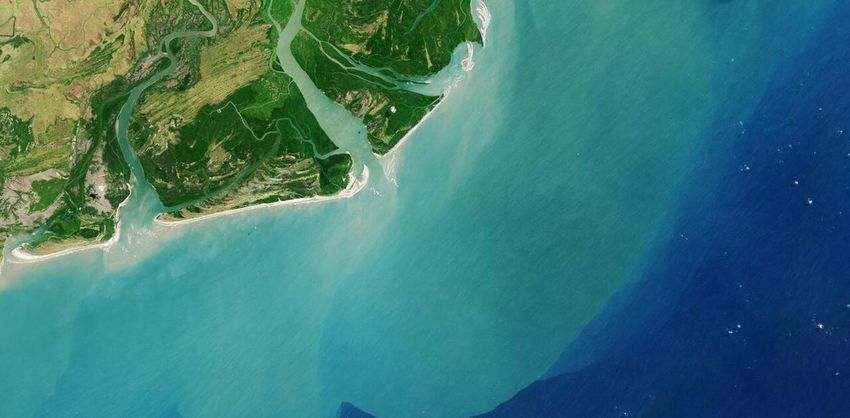
Try, for example, to measure how much snow is
stored in a mountain range like California's Sierra
Nevada. This water is a critical resource for the
state. The Sierra Nevada contains about 130 "snow
pillows" that measure the amount of water stored in
the snow directly above them. But the area
measured by the sensors is something like 2
millionths of a percent of the total area of the
Sierra.
If you try to figure out the total water stored in the
Sierras, you run into a methodological wall. There's
no good way to get there directly.
This kind of problem crops up all over hydrology,
from snow to soil moisture and rivers to reservoirs.
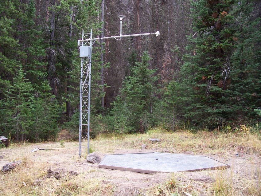
Although putting out more sensors is an option, A snow pillow. Credit: USDA Natural Resources
they are expensive to maintain, and it's impossible Conservation Service
to put out enough to measure an entire mountain
range. A better option would be to measure large "[GRACE] paints a compelling picture, because it
areas all at once. allows us to see the human fingerprint on water
availability, and the climate change impact on water
Starting about two decades ago, a small group of availability," Famiglietti told me. Some of his work
scientists suggested a new solution: What if they with GRACE has shown deep losses of
could measure the water cycle from space? groundwater in northern India, the Middle East and
other places that could be vulnerable to future
The University of Saskatchewan's Jay Famiglietti water shortages. The original pair of GRACE
was one of these scientists. Much of Famiglietti's satellites went offline in 2017, but a new pair
work has used the Gravity Recovery and Climate launched the following year.
Experiment (GRACE) mission, a pair of satellites
launched in 2002. The satellites, nicknamed Tom A golden age
and Jerry, chase each other around the planet and
use tiny variations in the the distance between Other satellites designed to measure specific parts
them to measure changes in Earth's gravity. Many of the water cycle came online at around the same
of these variations come from water moving time as GRACE, though they had some limitations.
around. GRACE tracks changes in total water
storage across groundwater, the surface and the IceSAT, active from 2003 to 2009, measured the
atmosphere. changing shape of glaciers and ice sheets, but its
lasers had some technical problems that limited its
lifetime. The Tropical Rainfall Measurement
Mission provided data on precipitation at low
latitudes, but it worked poorly for snow and regions
with strong thunderstorms. Scientists came up with
improved ways to use data from passive microwave
sensors, some of which were already in orbit, to
estimate soil moisture, but they provided data only
at relatively coarse scales.
Starting in 2014, a new generation of satellites has
offered improvements. The Global Precipitation
2/4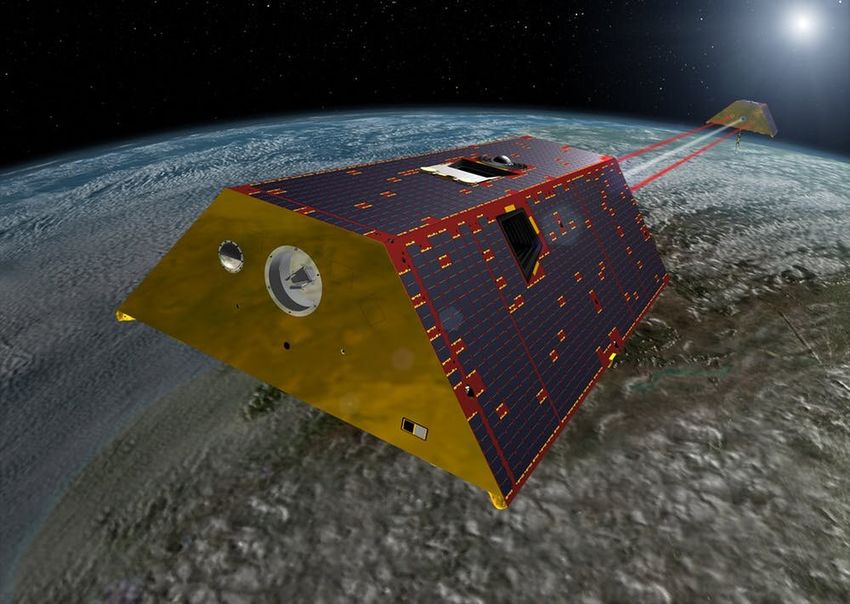
Mission, a constellation of satellites, has                  Together, these observations can help better
substantially improved on TRMM.IceSAT-2, which               predict drought, track floods and inform the world
NASA launched in 2018, has much better lasers                about how climate change is altering access to
than its forerunner. Dedicated soil moisture                 water resources. For example, a suite of satellites
missions launched by the European Space Agency               showed that the world's landlocked basins, already
and NASA offer more finely tuned measurements                among the driest places on Earth, most notably the
than past sensors could.                                     Aral Sea in Central Asia, are rapidly losing water.

                                                             This NASA animation shows how SWOT will collect data
                                                             over ocean and freshwater areas. Credit: NASA

Artist’s rendition of the GRACE follow-on mission. Credit:
NASA
                                                     Space agencies are also designing new missions to
                                                     cover parts of the water cycle that current satellites
                                                     can't yet adequately observe, like the snowpack in
I am part of an international team that will launch  the Sierra Nevada. Estimating evaporation also
the first project dedicated to measuring Earth's     remains a real challenge. Current methods produce
most readily accessible water resources: rivers and very different global patterns, and the path toward
lakes. The Surface Water and Ocean Topography new solutions for reliably estimating evaporation
(SWOT) mission is an active sensor that, starting in from space remains uncertain.
2021, will send radar pulses down to Earth and
measure how long they take to return to the          Satellites have gone from curios on the sidelines of
satellite. Through finely tuned algorithms, SWOT     hydrology to central players in understanding the
will measure changes in the amount of water stored global water cycle. When John Wesley Powell sent
in millions of lakes and reservoirs around the world 20-odd members of the new USGS to the banks of
and estimate, from space, the amount of water        the Rio Grande, he likely couldn't have imagined
flowing through most of the world's major rivers.    that, 130 years later, water scientists like me would
                                                        be following in his footsteps using satellites orbiting
With all these satellites, hydrologists will be able to hundreds of miles overhead.
track many individual parts of the water cycle using
observations from space. The next challenge will        This article is republished from The Conversation
be putting all of those measurements together in a under a Creative Commons license. Read the
coherent way. Each satellite has its own
idiosyncrasies. Scientists are working to integrate
all of their past and present data with computer
simulations of Earth's water cycle.

                                                                                                          3/4
Provided by The Conversation
                                   APA citation: Satellites reveal a new view of Earth's water from space (2019, February 13) retrieved 3
                                   June 2019 from https://phys.org/news/2019-02-satellites-reveal-view-earth-space.html

                                   This document is subject to copyright. Apart from any fair dealing for the purpose of private study or research, no
                                   part may be reproduced without the written permission. The content is provided for information purposes only.

                                                                                                                                                4/4

Powered by TCPDF (www.tcpdf.org)
You can also read