SEA CHANGE Rallying coastal communities to tackle sea-level rise - OCTOBER 2018 - NIWA
←
→
Page content transcription
If your browser does not render page correctly, please read the page content below
OCTOBER 2018

REDUCING SEDIMENTATION     FUTURE FIELDS             SHARK SURVIVAL            SNOW LINE
Solutions for 'soiled'     Science driving farming   How to free sharks from   Photographic evidence
waterways                  innovation                tuna nets                 of glacier retreat

                                     SEA CHANGE
                  Rallying coastal communities to tackle sea-level rise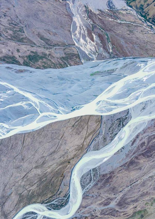
October 2018
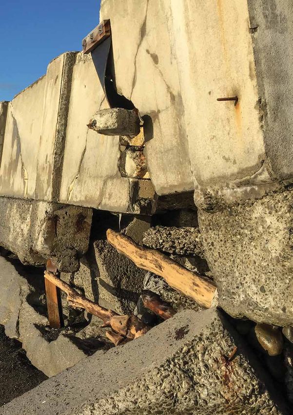
Cover: Storm damage along the Esplanade,
Owhiro Bay, Wellington in 2013. (Dave Allen)
Water & Atmosphere is published by NIWA.
It is available online at www.niwa.co.nz/pubs/wa
Enquiries to:
The Editor
4 In brief
Unidentified sounds in Cook Strait, clarity at
Water & Atmosphere
NIWA Te Waikoropupū Springs, lake tsunamis, Kiwi
Private Bag 14901 scientists help map world's seafloor, tackling climate
Kilbirnie change with seaweed, southern right whales return
Wellington 6241
to the Capital
New Zealand
email: wa-editor@niwa.co.nz 6 News
©National Institute of Water & Atmospheric Research Ltd SHAPE OF THINGS TO COME: Understanding the
ISSN 1172-1014 dynamics of submarine canyons
Water & Atmosphere team: A SHARK'S (SURVIVAL) TALE: Measuring survival
Editor: Mark Blackham rates of sharks caught by tuna fishers
Production: NIWA Communications and Marketing Team
Editorial Advisory Board: Geoff Baird, Mark Blackham, 30 Gallery: 2018 glacier survey
Bryce Cooper, Sarah Fraser, Barb Hayden, Rob Murdoch NIWA's Dave Allen documents the latest
Follow us on: photographic survey in a forty year study of
mountain snow lines.
34 Q&A: Burning issues
Fired up about wood burners
facebook.com/nzniwa 36 Profile: Juliet Milne
Work and life in all about perspective
twitter.com/niwa_nz
40 Solutions: Early warning
niwa_science Building resilience in flood-prone areas of
Papua New Guinea
www.niwa.co.nz
Water & Atmosphere is produced using vegetable-based inks on
paper made from FSC certifed mixed-source fibres under the ISO
14001 environmental management system.
2 Water & Atmosphere October 2018 www.niwa.co.nz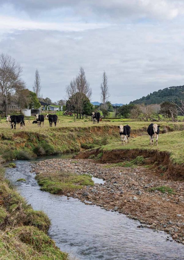
8
A say on the seashore
Coastal communities around New Zealand
are having their say on dealing with the
impacts of rising sea levels

                                           16
                                           2018 NIWA
                                           Photography
                                           Awards
                                           A selection from the annual
                                           competition provides a
                                           glimpse of the environment
                                           we work in

                                                                         20
                                                                         Reducing
                                                                         sedimentation
                                                                         New Zealand is a land of
                                                                         erosion. Where does it come
                                                                         from and go to, and can we
                                                                         reduce it?

                                           26
                                           Having a Fielday
                                           How science is
                                           transforming
                                           New Zealand's
                                           agricultural sector

www.niwa.co.nz                                                              Water & Atmosphere         October 2018   3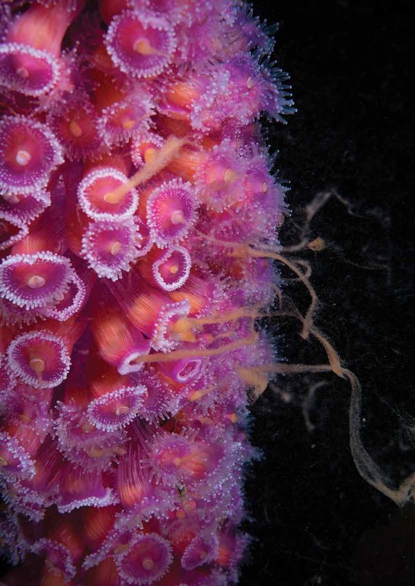
IN BRIEF

                                                   Te Waikoropupū Springs. (Mark Gall)

                                                   Exceptional clarity at Te Waikoropupū Springs
                                                   A three-month monitoring project recently finished by NIWA for the Tasman
                                                   District Council has confirmed that Te Waikoropupū Springs in Golden Bay
                                                   has some of the clearest water ever measured. Researchers found that visual
                                                   water clarity at the springs in Golden Bay is about 76m – although at times
                                                   has approached 81m – which is just short of the theoretical maximum of pure
                                                   water at about 83m.
                                                   NIWA used measuring instruments hung from a submerged line near one of
                                                   the main vents, as well as a GoPro camera to film the deployment.
                                                   "The Te Waikoropupū Springs have exceptional visual clarity, at times close to
                                                   that of pure water." said NIWA Marine Ecosystems and Aquaculture Scientist
                                                   Mark Gall.
                                                   The springs are also the largest cold water springs in the Southern Hemisphere.

    Passive acoustic moorings, deployed from
    RV Tangaroa. (Hamish McCormick)

    Unidentified sounds in
    Cook Strait
    A NIWA-led research team has detected two
    yet-to-be identified species of beaked whale
    in a recent project conducted in the Cook
    Strait region.
                                                   NIWA research vessel Rukuwai on Lake Tekapo. (Susanne Woelz)
    Their presence was confirmed after the
    analysis of underwater acoustic data,
    which was collected during two, six-month
                                                   Tsunamis happen in lakes too
    deployments of passive acoustic moorings.      A pilot project led by NIWA marine geologist Dr Joshu Mountjoy has provided the
    The data revealed three distinct beaked        most advanced mapping of a New Zealand lake ever, after using multibeam sonar
    whale signals. However, two did not match      equipment to map the floor of Lake Tekapo, which subsequently revealed the
    any previous recordings of the species.        hazard to lakeside towns of tsunamis caused by landslides.
    Little is known about the beaked whale         Dr Mountjoy said they had modelled tsunami from slope failures within and into
    species, which makes this an important         the lake, based on the evidence for the size and location of past landslides. The
    find in understanding the population of the    results show that waves could exceed 5m at many of the lake’s shoreline locations.
    marine mammal in New Zealand waters.
                                                   “Most people think of tsunamis as ocean-based, but they are just as capable of
    The next step for the researchers is to        happening in lakes, although little work has been done on this worldwide,” he says.
    examine the rest of the collected data for
                                                   Researchers are hopeful that the Lake Tekapo study can be used as a basis for
    similar signals to determine how often the
                                                   research on tsunami hazard in other large New Zealand lakes, such as Wakatipu,
    sounds from the unidentified species were
                                                   Wanaka and Taupo.
    recorded.
4         Water & Atmosphere      October 2018                                                                        www.niwa.co.nz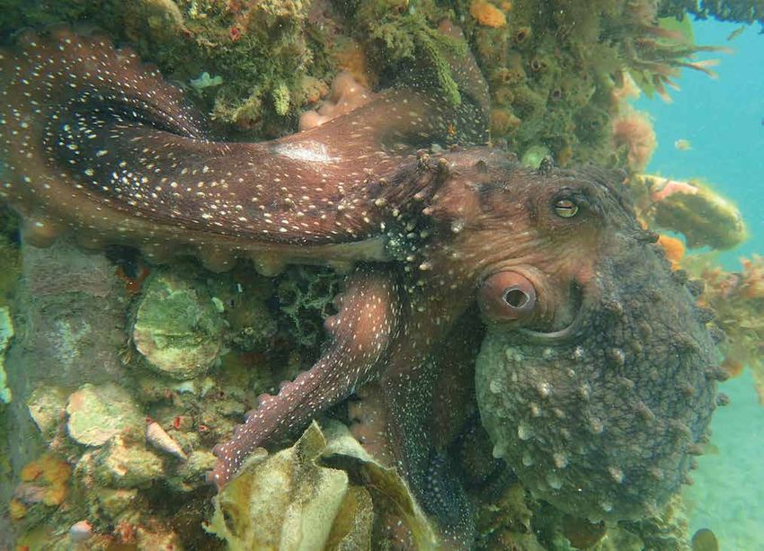
Southern right whales may
                                                                                      be returning to the capital
                                                                                      The southern right whale which spent
                                                                                      over a week in Wellington Harbour may
                                                                                      indicate the species returning to their
                                                                                      historic habitat, according to University
                                                                                      of Auckland marine science PhD student
                                                                                      Victoria Warren who helped analyse
                                                                                      data recorded by NIWA scientists.
                                                                                      Increasing numbers of southern right
                                                                                      whales have been congregating in
Dr Wendy Nelson. (Dave Allen)                                                         New Zealand waters. The species takes
                                                                                      annual migrations, swimming north
NIWA scientist tackles climate change with seaweed                                    from Antarctica, and is known to breed
                                                                                      around the Auckland Islands each year.
A paper co-written by NIWA marine biologist Dr Wendy Nelson has been
                                                                                      “It may be a sign of a recovering
named one of the 250 ground-breaking findings to help tackle climate change
                                                                                      population following the decimating
by Springer, a US-based academic publisher.
                                                                                      impacts of commercial and illegal
The paper explores the potential of commercial seaweed farming in mitigating          whaling during the 19th and 20th
global carbon dioxide levels, a key greenhouse gas responsible for man-made           centuries,” she said.
climate change.
Dr Nelson said the paper tackled the possibility of developing more seaweed
aquaculture to mitigate the impacts of ocean acidification and the potential for
converting their biomass to biofuel, which could reduce the use of fossil fuels
and provide renewable alternative fuels.
“We need to consider the fate of carbon being absorbed by marine systems.
How we protect the marine environment to maintain these ecosystems is an
exciting area of research,” she said.

                                                                                      Southern right whale with NIWA researchers in
                                                                                      Wellington Harbour. (Karl Halvorsen)

                                                                                      NIWA staff at Seabed 2030, Wellington,
                                                                                      June 2018. Left to right Dr Rob Murdoch;
                                                                                      Tilmann Steinmetz; Dr Geoffroy Lamarche; Arne
                                                                                      Pallentin; Dr Helen Neil; Patrick Hayes; Kevin
                                                                                      Mackay. (Dave Allen)

                                                                                      Australia, north of latitude 50°S to
                                                                                      10° north of the Equator, and the
                                                                                      western part of the Northern Pacific
                                                                                      Ocean to Japan.
NZ scientists to help map the world seafloor                                          The task requires close collaboration
                                                                                      and involvement of all coastal states
Scientists from NIWA, GNS Science          definitive map of the entire ocean floor   coordinated by the centre.
and Land Information New Zealand           in less than 12 years.
                                                                                      “Such information is critical to enable
have opened the new South and
                                           The centre, led by NIWA marine             coastal states to properly manage
West Pacific Ocean Regional Data
                                           geologist Dr Geoffroy Lamarche, will       and protect benthic (at and near the
Assembly and Coordination Centre at
                                           map out an area equivalent to a quarter    seafloor) environment from the coast to
NIWA Wellington, which is a part of
                                           of the world’s ocean which covers the      the greatest depths of the ocean,” said
the Seabed 2030 project to create a
                                           Pacific Ocean from South America to        Dr Lamarche.

www.niwa.co.nz                                                                            Water & Atmosphere           October 2018    5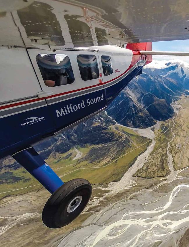
NEWS

    Kaikōura earthquake provides world-first insight
    into submarine canyons
    Research conducted after the 2016, 7.8 magnitude Kaikōura earthquake has provided
    scientists with an extremely rare opportunity to understand the processes that shape
    submarine canyons.

    Pre and post-earthquake seafloor video, bathymetry, and                impacts of a canyon-flushing event, giving us unique insight
    sediment core samples collected from NIWA’s research vessel            into this important global process,” says Dr Mountjoy.
    Tangaroa has shown that strong ground-shaking during the
                                                                           Results also indicate canyons may form at a much faster rate
    earthquake triggered widespread landslides in the Kaikōura
                                                                           than previously thought – as little as a hundred thousand
    Canyon, causing a powerful “canyon-flushing”. Canyon-
                                                                           years. Sediment flow generated by the quake carved into the
    flushing describes the process where high-energy currents
                                                                           rock underneath the canyon – deepening two main reaches
    transport sediment in the undersea canyon to the deep
                                                                           of the Kaikōura Canyon by up to 50m, and the middle-
    ocean.
                                                                           canyon region by 20–30m.
    Evidence showed the earthquake stripped over 850 million
                                                                           Despite devastating the ecosystem, subsequent NIWA surveys
    metric tonnes of sediment from the Kaikōura Canyon. It
                                                                           have confirmed the former biodiversity hotspot is slowly
    travelled more than 680km northeast along one of the
                                                                           recovering, with evidence of juvenile animals that once
    world’s longest deepsea channels – the Hikurangi Channel.
                                                                           dominated the head of the canyon beginning to re-colonise
    It’s the first time, globally, that the impact of a full canyon
                                                                           the seafloor.
    flushing event has been documented in such detail, providing
    scientists with an incredible benchmark to understand how              This study was part of a collaboration between NIWA,
    the process works, and how the undersea environment and                Victoria University of Wellington, GNS Science and
    ecosystem recovers over time.                                          international colleagues, funded by the Natural Hazards
                                                                           Research Platform and NWIA SSIF.
    Flushing of submarine canyons can be triggered by a range
    of events, including earthquakes, typhoons and extreme river
    discharges.
    “This study unequivocally
    demonstrates that
    earthquake-triggered canyon
    flushing is the primary process
    that carves out submarine
    canyons and delivers coastal
    sediment to the deep ocean,”
    says NIWA marine geologist
    Dr Joshu Mountjoy.
    “The impact has been
    extreme, delivering 850
    million metric tonnes of
    sediment to the deep ocean
    in one go – twice the annual
    sediment delivery of all New
    Zealand rivers.
    “These results have proven
    long-standing scientific
    hypotheses about how
    submarine canyons are
    shaped. For the first time
    we’ll be able to quantify the
    scale, timing and seafloor
                                      The NIWA study reveals how earthquakes trigger landslides in seabed canyons,
                                      'flushing' sediment into the deeper ocean. (NIWA)

6   Water & Atmosphere    October 2018                                                                                      www.niwa.co.nz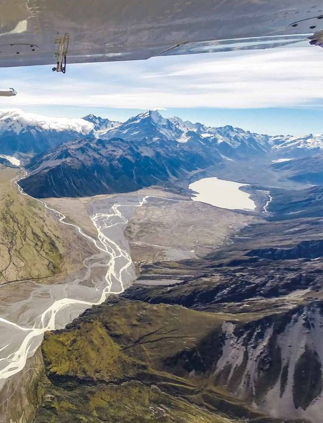
A silky shark. (Alex Chernikh)                                                    (Top) Warrick Lyon, NIWA fisheries technician. (Dave Allen)
                                                                                  A mako shark is tagged and released. (Matt Saunders)

Shark survival tale
As part of a Pacific-wide study, NIWA is measuring the survival rate of sharks
returned to the sea by commercial tuna fishers.
The Western and Central Pacific Fisheries Commission               “The fishers will bring the sharks to the side of their boat to
(WCPFC) is trying to determine whether the way sharks are          measure, sex and tag. Other than that, they will handle and
caught and released makes a difference to their survival.          release the sharks as they usually do.”
The study began in New Zealand waters in 2017–18, then             The tag measures the animal’s depth over the following
spread to Fiji, and is about to expand further into the Pacific.   two months. A steel attachment pin corrodes after 60 days,
Mako and silky sharks are the two species selected for the         allowing the tag to float to the surface. Once there it starts
study.                                                             broadcasting its data to the Argos satellite system.
The first stage in New Zealand found that only one of 34           Mako and silky sharks usually move actively up and down
mako sharks released from tuna longlines by commercial             in the water column. If the depth of the tag is constant
fishers died, indicating that they are relatively hardy. Fishers   for several days, the shark is almost certainly dead on the
bring sharks smaller than 1m long onto their boats to remove       seabed.
the hooks. Larger sharks are brought alongside the boat and
                                                                   NIWA scientists, in association with scientists from the South
the hook is removed or the trace is cut while it is still in the
                                                                   Pacific Commission (SPC), are training fishery observers in
water.
                                                                   New Caledonia and the Marshall Islands to deploy tags on
Warrick Lyon, a NIWA fisheries technician, says the study is       an initial 30 mako sharks and 30 silky sharks caught by tuna
heading to the Pacific to test survival rates for sharks treated   longliners.
differently – such as those where hooks are not removed
                                                                   The aim is to eventually tag 100 each of mako sharks and
and where long pieces of monofilament fishing line are left
                                                                   silky sharks. The data transmitted back by the tags will be
attached.
                                                                   collated and the analysis will be completed early in 2019.
“We want to assess whether the manner of catching
and releasing sharks, in addition to age and sex, makes a
difference to their chances of survival,” Lyon says.

www.niwa.co.nz                                                                                Water & Atmosphere             October 2018       7
A say on the
    sea shore
    Coastal communities around New Zealand are
    getting a say on how to respond to sea-level
    rise, and NIWA is helping them.

    Haumoana. (Rob Bell)

8   Water & Atmosphere     October 2018            www.niwa.co.nz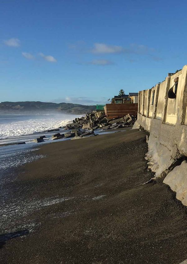
www.niwa.co.nz Water & Atmosphere October 2018 9
A say on the sea shore

     Discussions about the impact of sea-level                                 Scenario planning
     rise on our coast have revealed the deep                                  The Guidance provides four sea-level rise scenarios out to
     difficulties in communities agreeing on                                   the year 2150 which can be used to plan for fast, slow, or
                                                                               intermediate rates of sea-level rise.
     whether, and how, to respond to changes.
                                                                               At its heart is a 10-step decision-making approach, to plan
     There has been intense community resistance to local                      and adapt to rising seas. It addresses “What is happening?”,
     authorities identifying, labelling and controlling homes at risk          “What matters most?”, “What can we do about it?”, “How
     of flooding from rising sea levels.                                       can we implement the strategy?” and “How is it working?”
     Now though, moods are changing as new approaches are                      Dr Scott Stephens is a Coastal and Estuarine Physical
     taken to discuss the threats forecast from climate change.                Processes Scientist at NIWA, and one of the Guidance
                                                                               authors. He says the Guidance combines a step-by-step
     This shift was marked in December last year by the release
                                                                               approach to assessing, planning and managing the increasing
     of the Ministry for the Environment’s (MfE) ‘Coastal Hazards
                                                                               risks, with updated information, tools and techniques.
     and Climate Change – Guidance for Local Government in New
     Zealand’ in December 2017.                                                “The approach improves on previous guidance and current
                                                                               coastal hazard management practice in its treatment of
     The guidance recommended a “dynamic adaptive” approach
                                                                               uncertainty and the central role of community engagement in
     to planning. The approach is less severe and top-down,
                                                                               the decision-making process.
     and more consultative and consensus-based. This is less
     threatening to those who face the bulk of adaptations, and                “The new guidance is a major revision of the 2008 version.
     more accommodating of small, regular adjustments over a                   It includes updated sea-level rise projections, advances in
     longer period.                                                            hazard, risk and vulnerability assessments, collaborative
                                                                               approaches to community engagement and changes to
     A benefit of the approach is the decisions and investments
                                                                               statutory frameworks.”
     made now can accommodate future changes required by the
     still uncertain rate and scale of impacts from climate change.

     A king tide and large waves wreak havoc along Auckland's Tamaki Drive on 5 January 2018. (Stuart Mackay)

10   Water & Atmosphere      October 2018                                                                                       www.niwa.co.nz
Haumoana, a coastal town just south of the Tukituki River in Hawke's Bay, is prone to coastal erosion. The shoreline is retreating at a rate
between 0.3 and 0.7 metres per year. (Paula Blackett)
“The approach improves on
previous guidance and current
The local word
Hawke's Bay is one of the first regions to apply the 10-step
decision cycle in the MfE Guidance. The region has had its
coastal hazard management share of historical controversy and conflict as residents have
grappled with the implications of sea-level rise.
practice in its treatment of The latest efforts, focused on the development of the Clifton
uncertainty and the central role to Tangoio Coastal Strategy, have been more successful. This
has been facilitated by the combined councils of Hawke's Bay
of community engagement in the and a team from consultants Mitchell-Daysh.
”
Dr Paula Blackett is a NIWA Environmental Social Scientist
decision-making process and one of several social scientists on the interdisciplinary
team working on what Hawke's Bay has dubbed the ‘Living
at the Edge’ project.
Essentially this reflects an appreciation that sea levels are
rising, but the seriousness of impacts is still unknown. She says the format has enabled a decision cycle that was
“specially designed to work in situations of conflict where
“The Guidance provides methods that can be used for contested values and uncertainty dominate conversations”.
decision making under deeply uncertain conditions about the
future, such as how fast sea level will rise, or how community To support the Clifton to Tangoio Coastal Strategy
coping capacity and vulnerability will change,” says development, Blackett is acting as a ‘critical friend’ which she
Dr Stephens. describes in this case as “essentially an independent research
team providing supporting knowledge, ideas and thinking,
and constructively highlighting problems and dilemmas to be
resolved.”
www.niwa.co.nz Water & Atmosphere October 2018 11A say on the sea shore
A king tide combines with a nor-west wind in Wellington Harbour to create havoc along the only road in and out of Eastbourne. (Dave Allen)
She says the contribution of social scientists has been She notes that overall, the stepped process created time and
essential. the space for people to talk through the issues and conflicts,
to consider all the options and to think in a long-term,
“The purpose was to provide timely feedback that illustrated
strategic and dynamic way about the challenges ahead.
how the community participants perceived the process and
progress at each event or workshop, and to identify any “In short, it empowered them in a way which has not been
potential issues and challenges before they became more attempted previously.”
substantial issues.”
Chair of the strategy development process, Hawke's Bay Informed decisions
Regional Council Councillor Peter Bevan says that the The Deep South National Science Challenge is another
bottom-up approach was essential. initiative delivering valuable scientific knowledge
“Those who find themselves threatened by coastal hazards communities can use in their decision making. Part of the
need to be closely involved in any response strategy. That is NIWA research funded by the challenge is to estimate
why we adopted a bottom-up strategy in Hawke's Bay. storm-tide levels around the New Zealand coast based on a
one percent annual chance of these levels being reached or
“Any local body that adopts solutions that have not been exceeded.
extensively consulted will risk prolonged conflict and
argument.” Ryan Paulik, NIWA Hazards Analyst, explains that these levels
are projected onto land to create individual storm-tide hazard
Dr Blackett says that early engagement of the community is exposure maps for the present-day hazard, and future sea-
both possible and fundamental to developing climate change level rise scenarios, using increments of 0.1m up to 3m above
adaptation strategies. mean high water springs.
“This work has shown how the Guidance can succeed “This work extends an earlier project for the Parliamentary
in practice through a combination of well-thought-out Commissioner for the Environment in 2015 by including
processes, technical science support and attention to the storm-tide hazards in sea-level rise inundation maps,” he
social and economic aspects of coastal adaptation.” says.
12 Water & Atmosphere October 2018 www.niwa.co.nzThe floating Sea Scout hall
Based on the coastline of Wellington’s Evans Bay, the 23cm over the last 100 years in Wellington.
Britannia Sea Scouts are currently considering solutions
“I’ve noticed over the years I have been visiting NIWA's
for their hall, which has frequently flooded during king
Wellington campus at Greta Point that the tide reaches
tides and storms over the past six years.
the boatshed floor level more often.
The club’s chairperson Inger Deighton says the hall has
“The sea level is also rising faster in Wellington as the
sometimes been saturated by up to 30cm of sea water,
lower North Island is subsiding by 2–3mm per year due
which enters through the floor boards.
to seismic slow-slip of plates.”
“The latest casualty has been our gas oven after its pipes
NIWA have also found that the already risen sea level has
rusted from the frequent flooding. Other items we have
resulted in a change in frequency of 100-year storm-tides.
lost have been our water blaster and vacuum, as well as
really anything that has been on the floor of the hall. “For Wellington, it will only take a modest sea-level rise
of 30cm for this rare storm-tide level to be reached once
“One storm the hall was actually lifted off its pilings,
a year on average.”
which parents attempted to fix by strapping the piles to
the floor boards as a temporary solution,” she said. “This also means spring tides and smaller storm tides
will be higher and more often – as observed at the boat
The initial solution was to raise the hall by 30cm,
sheds,” said Dr Bell.
however consultations with NIWA have indicated that
this will only solve the issue temporarily as sea levels As the battle with Mother Nature continues, the Sea
continue to rise. Scouts are feeling under pressure to decide the fate of
their hall. The irony of one option has not escaped them;
According to NIWA Principal Scientist Dr Rob Bell, the
that the Sea Scouts will need to build a new hall further
frequency at which low-lying coastal areas are flooded is
away from the sea.
increasing as sea levels rise, which have already risen by
Built before sea-level rise was common knowledge – the Britannia Sea Scout' hall in Wellington's Evans Bay frequently floods during king
tides and storms. (Hamish McCormick)
www.niwa.co.nz Water & Atmosphere October 2018 13A say on the sea shore
“Universities and Crown Research
Institutes like NIWA provide
“Universities and Crown Research Institutes like NIWA
provide the capacity to develop new and innovative
modelling techniques to estimate New Zealand’s exposure
and vulnerability to future impacts from natural hazards.”
the capacity to develop new and
innovative modelling techniques Knowledge shared
Over the next few months MfE will hold workshops around
to estimate New Zealand’s the country with regional and local authority staff to help
exposure and vulnerability to them understand how to use the guidelines.
Dr Scott Stephens is part of the team facilitating the
future impacts from natural workshops.
hazards
” He says they will help “familiarise users with the Guidance,
explaining context, key features, how it interacts with the
statutory (legal) framework, advice on conducting sea-level
rise, hazard, risk and vulnerability assessments, and advice on
“The incremental sea-level rise scenarios enable these community engagement processes”.
maps to be matched to future sea-level rise projections.
This provides both spatial and temporal estimates for asset “The workshops will demonstrate the application of dynamic
exposure to inundation from sea level rise and storm-tide adaptive pathway planning methods, step-by-step and with
hazards in New Zealand.” exercises.”
Paulik considers that the relationships between research The workshops are another example of a shift in approach
institutes, such as NIWA, and academic and government that will help coastal communities become better prepared
organisations are critical to delivering robust science. for rising sea levels, and provide them knowledge they can
use to make practical adaptations.
Roads turn to rivers in South Dunedin as flood waters have nowhere to drain after a significant rainfall event in 2015. (Otago Daily Times)
14 Water & Atmosphere October 2018 www.niwa.co.nzLand elevation
0–50cm
50–100cm
100–150cm
Digital maps show flooding caused by rising groundwater combined with rainstorms and elevated storm-tide levels.
Mapping floods
Digital mapping of flood prone areas is enabling local In South Dunedin, a new multi-layered database is
communities to gain a clearer picture of vulnerabilities to producing digital maps showing how forecast sea-
flooding caused by a changing climate, and what to do level rise will cause flooding in the area from rising
about it. groundwater combined with rainstorms and elevated
storm-tide levels.
One fascinating study is mapping where flooded roads
could lead to floating cars. The maps are a collaborative effort by the University of
Otago’s Centre for Sustainability, the Dunedin City Council
Ryan Paulik, NIWA Hazards Analyst, was part of a NIWA
and the Otago Regional Council.
team reviewing international literature on vehicle stability
in flood flows. The maps allow better demonstration of the impact
because they combine details held by different agencies,
“Laboratory studies have demonstrated that hatchback or
such as demographics and house ages.
sedan models can float in water depths as little as 0.3m,
compared with 0.45m for SUVs.” Auckland Transport has used NIWA-developed inundation
maps to identify the replacement value of roads that
“With this information, we are able to use high resolution
could be exposed to coastal flood events under future
flood maps to identify roads and locations inundated by
sea-level rise scenarios.
flood waters that are dangerous for vehicle traffic.”
Auckland Council is working with Auckland Transport to
The open access software RiskScape, developed by
identify the most vulnerable assets and hot spots where
NIWA and GNS Science, provides a framework to
future planning and adaptation work can be targeted. The
estimate impacts and material losses, from floating cars
information has been made publicly available through the
to saturated houses. The team used the data from the
Auckland Council’s GeoMaps online mapping service.
Christchurch City flood event in March 2014 to identify
a prevention method that could reduce losses by 70% in
future events.
www.niwa.co.nz Water & Atmosphere October 2018 152018 NIWA Photography Awards
This year's NIWA staff photographic competition is a
testament to the extraordinary landscapes our staff work in.
Crispin Middleton
Spawning jewel anenome
Jewel anenomes spawn once a year,
and the event only lasts between
10 and 20 minutes. It is carefully
coordinated with the tide and the
cycle of the moon.
16 Water & Atmosphere October 2018 www.niwa.co.nzPeter Marriott Where the land meets the sea ice A rarely seen view of the sea ice and the critters that live among it. Taken under the sea ice in New Harbour, Antarctica while diving for an ecological research programme. Peter Marriott Biosecurity surveying NIWA diver Lily Prior Rodgers surveying wharf piles in Bluff for invasive species. www.niwa.co.nz Water & Atmosphere October 2018 17
2018 NIWA Photography Awards
Lily Prior Rodgers
Te Wheke
Taken under Tiwai Wharf in Bluff during the
summer Marine High Risk Site Surveillance,
massive and frequently encountered
octopuses are a highlight of this port.
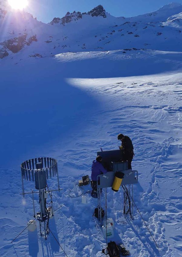
18 Water & Atmosphere October 2018 www.niwa.co.nzAndrew Willsman Alpine weather Servicing a solid precipitation gauge at Mt Larkins snow and climate station. www.niwa.co.nz Water & Atmosphere October 2018 19
Reducing sedimentation
     New Zealand is a land of erosion.

20   Water & Atmosphere   October 2018   www.niwa.co.nz
e’re losing about 192 million tonnes of soil a year, have increased New Zealand’s existing susceptibility to
according to the latest report Our Land 2018, from erosion.
the Ministry for the Environment and Statistics NZ.
Prior to human arrival, sedimentation rates in our estuaries
It says New Zealand is contributing about 1.7% percent of the
were typically much less than 1mm per year on average. As
sediment delivered to the world’s oceans annually due to soil
catchments were deforested, the average sedimentation rates
erosion, even though the country accounts for just 0.2% of
increased 10-fold.
global land area.
“Typical rates in upper North Island estuaries over the last
A lot of this lost soil comes from natural erosion. However,
century are in the order of 2–5mm per annum,” says Dr
over 40% of the soil entering our rivers comes from pasture.
Swales.
According to Dr Andrew Swales, an estuarine physical
The result of this accelerated sedimentation has been the
processes scientist who leads NIWA’s Catchments to
formation of intertidal mudflats in place of the sandflats
Estuaries programme, New Zealand is particularly susceptible
that characterised many estuaries prior to catchment
to erosion due to the country’s steep lands. They have more
deforestation.
erosion potential due to their slope, their geology, high
intensity rainfall and earthquakes. In upper North Island estuaries, these rapidly accreting
mudflats have been colonised by mangroves, where shellfish
It’s a potent mix: many places have highly erodible
previously lived.
sedimentary rocks, earthquakes destabilise hillslopes, and
rain triggers slope failure and landslides. “It’s a double whammy,” he says. “We’re losing productive
soils from the land, and these eroded soils are having adverse
While soil erosion and sedimentation are entirely natural
effects in estuaries.”
processes, the rates increased markedly due to loss of forest
landcover with the arrival of people in New Zealand, says Known as the “universal contaminant”, some of the most
Dr Swales. Deforestation and present-day land-use practices damaging effects of fine sediments accumulating in our
NIWA staff working with representatives from Manaaki Whenua, Auckland Council, Ngai Tai Ki Tamaki and the local residents association in the
Aroaro valley catchment near Clevedon. The catchment is useful to study because the land has a variety of purposes, such as livestock, orchards and
forestry, in a relatively small area. Water samples are gathered and processed using a mass spectrometer, and the sample’s isotopic signature is then
used to trace the source of fine sediment in the water. (Dave Allen)
www.niwa.co.nz Water & Atmosphere October 2018 21Reducing sedimentation
New Zealand is a land of erosion. We’re losing about 192 million tonnes of soil a year. (Hamish McCormick)
estuaries are related to clays that are less than 4 microns in periodic table. They have been used as a kind of natural
diameter. ecological recorder, to trace things like sources of water,
sources of various foods, and even tracking counterfeit
“They’re the most effective at decreasing sunlight … they
money.
reduce the visual clarity of the water. Many predatory species,
including fish and birds, are visual predators, using their eyes Dr Swales's colleague, emeritus scientist Dr Max Gibbs, was
to find their prey,” says Dr Swales. the first person to identify that compound-specific stable
isotopes (CSSI) and their isotopic signatures could be applied
Fine sediments carry other contaminants with them,
to tracing the sources of fine sediments. He published his
including heavy metals, organic contamination from
work on the CSSI sediment tracing method in 2008.
stormwater runoff, and microbes which are harmful to
human health. All organic life has fatty acids. All plants secrete their fatty
acids into the surrounding soil. The fatty acids of plants like
“A fraction of that contamination is conveyed by fine
native trees, forestry pine, grass and food crops typically have
sediments and deposited in estuaries,” says Swales. “In rural
different ratios of the two main isotopes of carbon, 12C and
settings the fine sediments carry phosphorus with them as
the slightly heavier 13C.
well.”
These isotopic signatures can still be found in sediment,
Erosion can be reduced by changing the type or scale of
which means you can label sediment by the land use from
land use or adopting practices to mitigate losses. But before
which it originated.
we can do that, we need to work out which land use is
responsible for the sediment. “When you collect sediment from an estuary, lake or river,
it’s going to come from a mixture of various sources,” says
Tracing sediment Dr Swales. “We analyse samples for their stable isotopic
signature, and use a model to unmix that mixture. That
Dr Swales says one way to trace the sources of fine sediments allows us to apportion the average contribution of different
is by using stable isotopes. These are non-radioactive forms plant communities, which gives an outline of the contribution
of atoms found in almost all of the first 80 elements in the of different land uses.”
22 Water & Atmosphere October 2018 www.niwa.co.nz“We're losing about 192 million
tonnes of soil a year ... about
cores as well as determining how land-use change influences
the isotopic signatures of soils. NIWA’s contribution to this
international study includes a case study that has measured
rates of change in soil isotopic signatures associated with a
1.7 percent of the sediment pine-to-dairy land-use change near Taupo that has occurred
since the 1980s.
delivered to the world's
”
In New Zealand, the Ministry for the Environment has
oceans annually been commissioning research into sediments, primarily the
effects of sediments in rivers. Dr Swales says it is likely that
in the future there will be more focus on estuaries, as well
Stable isotopes provide information on the sources of as setting limits for different contaminants, including fine
sedimentation. When combined with measurements from sediments.
radioisotopes, the rate of sedimentation can be determined. Separately, NIWA’s Managing Mud programme is providing
The CSSI method can analyse a dated sediment core taken new knowledge and tools to underpin better management of
from an estuary or a lake and provide information about how fine sediments and their effects.
sources have changed over time.
More sediment likely
Other studies Dr Swales warns that climate change will have a further
NIWA is participating in a study with the International impact on sedimentation. It is likely that New Zealand will
Atomic Energy Agency (IAEA) and the Food and Agricultural be subject to more of the high intensity and frequent rainfall
Organization (FAO). events that have massive erosion potential.
NIWA is bringing together the CSSI and radioisotope “There might be a need to modify the pattern of our land
methods to capture persistence information from sediment use. Potentially, that’s both in space and timing of what we
Planting along waterways lower in the catchment can reduce sedimentation and pollution as well as provide shade for the stream. (Dave Allen)
www.niwa.co.nz Water & Atmosphere October 2018 23Reducing sedimentation
grow, and where we do things to mitigate the effects,” he
says. Are trees the answer?
The solution is not necessarily as obvious or easy as planting Planting trees is one solution to the problem of
trees. Dr Swales notes that landslides from high intensity sedimentation.
rainfall events can even occur in regenerating native forests.
Trees change several processes in a catchment, according
“It’s taken us 150 years to get to this point. Trying to change to NIWA hydrologist Dr Christian Zammit.
the trajectory we’re on, or mitigate the effect, is going to take
some time and quite a lot of effort.” Firstly, the soil is anchored both by the tree roots and
organic matter generated under the tree. “Tree roots
grab the soil, which avoids soil being moved further
downstream”, says Dr Zammit, who is the Programme
Leader – Water Resources at NIWA.
How much can fish handle?
Trees can also slow water running off land surfaces during
Based on seven years of research, NIWA has
high rainfall events. “This will impact the velocity at
established turbidity limits to protect fish in New
which the soil is moved,” he says.
Zealand rivers.
Trees also intercept much more precipitation than grass.
Turbidity is the measure of cloudiness in water. It is
“This means there is less water received by the soil. Less
caused by tiny particles in the water, including fine
water means a bigger proportion infiltrates through the
sediments.
soil instead of creating direct runoff.”
The application of turbidity limits to protect fish
In addition, trees provide a path for water to go directly
depends on knowledge of both the distributions and
to the root system, and deeper into the soil. “Basically,
life history patterns of sensitive species. To help water
reducing the amount of surface flooding that could
managers apply turbidity limits, NIWA has developed
generate sediment runoff,” says Dr Zammit.
a decision support system (DSS).
He cautions that all that water-redirection and retention
The DSS has two parts: one for peak-flow (that is,
can have consequences when using trees for erosion
floods) and one for base-flow. In floods and other
control, as it typically reduces the amount of water
peak-flow conditions, extreme turbidity may kill fish.
available for uses such as water catchment.
Whereas in base-flow conditions, long-term exposure
to sublethal toxicities can reduce populations and Acknowledging that trees have many benefits (including
affect fish behaviour. an impact on soil erosion), the Government has
committed to planting one billion trees over the next ten
The DSS can be used for planning purposes,
years.
monitoring, and restoration, but only covers direct
effects of increased turbidity on common riverine fish. “Planting trees reduces erosion by helping to keep the
It does not address the potentially more insidious, soil on the land and improving pasture productivity and
indirect effects of settled solids on river or steam water quality,” Julie Collins, Head of Forestry, Ministry for
habitats. Current NIWA-led work for the Ministry for Primary Industries told Stuff in April.
the Environment is addressing both direct and indirect
The programme “will see us go from [planting] 55 million
effects.
trees this year, to 70 million a year in 2020, to 90 million
in 2021. From there we will be aiming for 110 million a
year over the next seven years,” said Forestry Minister
Shane Jones in a media release in February.
A billion trees over ten years doubles the current number
of trees being planted in New Zealand. At the moment,
there are 50 million trees planted each year, or 500
million over ten years.
At present it is unclear exactly how the one billion tree
programme will work. “I suspect sometime next financial
year, one of the funded projects will start looking at what
needs to be done, what type of trees need to be planted,
where, and at which density,” says Dr Zammit.
Some freshwater fish species such as eels can tolerate a Ms Collins echoes this. “An important focus is about
relatively high level of turbidity, while others such as inanga and
smelt tend to struggle in murky water. (Stuart Mackay)
24 Water & Atmosphere October 2018 www.niwa.co.nzPlanting the right trees in the right locations can reduce erosion by helping to keep the soil on the land. (Paul Sutherland)
planting the right tree, in the right place, for the right The Government is currently considering a proposed
purpose.” research strategy for the one billion tree programme,
including whether a model should be established to
According to Minister Jones, planting will include exotics
indicate the best position and density for the trees.
and natives and will focus on commercial crops as well
Minister Jones has said that he expects to make more
as environmental and regional gains. “We want to
announcements about where trees will be planted in
enable planting of a mix of permanent and harvestable
coming months.
forestry, using both exotic and native tree species on
private, public and Māori-owned land. Species include
radiata pine, redwood, tōtara, eucalyptus, Douglas fir and
mānuka,” he said in a statement.
Dr Zammit believes the programme is a “great
opportunity to redesign the New Zealand landscape to be
sustainable under climate change.”
To mitigate sedimentation, forest planting is usually
conducted at the top of a catchment where precipitation
falls the most. However, one of the ideas that could
be explored would be to “redesign land management
at a catchment scale by planting some forest further
downstream at a lower density,” he says. Planting along
waterways lower in the catchment would reduce the
amount of soil lost to streams, but at the same time
provide an ecological corridor and refuge under climate
change. It would also “provide shading for the stream, so
maintaining fish populations at a longer time span,” says (Dave Allen)
Dr Zammit.
www.niwa.co.nz Water & Atmosphere October 2018 25Fieldays – farming for
the future
Farmers visiting Fieldays at Mystery Creek in June could not have
missed the take-home message: that science and innovation are
key to their continued success.
26 Water & Atmosphere October 2018 www.niwa.co.nzwww.niwa.co.nz Water & Atmosphere October 2018 27
Fieldays – farming for the future

     Science featured strongly among displays,
     stalls and talks: from introducing dung
     beetles or growing plantain to reduce
     nitrogen leaching, to deer milking, take-
     home kits for laboratory soil testing,
     and robots that autonomously navigate
     kiwifruit orchards to capture fruit data.
     From a humble start in 1968 at the Te Rapa racecourse,
     Fieldays is now the largest agribusiness event in the Southern
     Hemisphere. It attracts more than 130,000 visitors from
     all over the world. In celebration of its 50th anniversary,
     this year’s theme was the “future of farming” – focusing on
     agricultural innovations and ideas. The organisers kicked off a
                                                                        Ari, Kalarni and Nikau Henman from Awakeri playing the Climate
     discussion on what New Zealand’s farming’s future will look
                                                                        Adaptation Challenge at NIWA Fieldays 2018. (Sarah Fraser)
     like.
     Understanding future farming scenarios is the focus of             “If we are to build a more resilient, better-prepared
     NIWA’s work on climate change adaptation for rural                 agricultural sector, we need to make decisions informed by
     communities. NIWA’s Fieldays site showcased a range of             good knowledge and science,” he says.
     climate-based services that help farmers and growers make
     confident and informed operational decisions, such as when         Dean says while farmers are known for their resilience and
     and where to irrigate, fertilise, spray, harvest and move stock.   adaptability, climate change will go beyond any previous
                                                                        experience they’ve had. It will increase the likelihood of
     NIWA’s Chief Scientist, Climate, Atmosphere and Hazards,           extreme weather events that cause flooding, drought, and
     Dr Sam Dean says that by making sound choices now, and in          erosion. These will affect almost all on-farm activities,
     the future, farmers can adapt, increase resilience, and reduce     including harvest times, crop choice, productivity, irrigation,
     risks and costs for themselves and future owners of their          groundwater recharge, and pasture growth.
     farms.
                                                                        “Climate change effects are accelerating. Farmers understand
                                                                        significant change is coming, and some of it is now inevitable
                                                                        – so planning how to adapt and thrive is a priority.
        What climate change will mean                                   “Optimising current farming practices, informed by good
        for farming:                                                    science, is one of the most effective adaptation strategies,”
        Some future scenarios predicted by NIWA's current               Dean says.
        climate modelling include:
        • A mean temperature increase throughout                        Computer games
          New Zealand                                                   Farmers visiting the NIWA site were able to find out what
        • Fewer frosts, meaning pests that cannot survive in            climate change might look like on their own farm, using
          cooler regions, may spread                                    highly detailed computer graphics.

        • Increasing hot days, particularly in the north and            An inventive table top board game helped them explore
          east, when temperatures will be higher than 25°C              different climate scenarios and pathways they could take to
                                                                        mitigate or realise potential opportunities from a changing
        • Changing rainfall patterns, with increased rainfall in        climate on their own farms.
          the west and south, and less in the east and north
                                                                        The ‘Climate Adaptation Challenge’ game works a bit like
        • Increased droughts, putting stress on water                   Monopoly. One version of the game was created for dairy
          resources and animal feed                                     farming and the other representing a dry stock farm. Using
        • More extreme rainfall events, resulting in flooding,          3D-printed pieces and specially-designed NIWA play money,
          slips, landslides and damage to infrastructure.               players were encouraged to make decisions about their
                                                                        own farming practices, in response to expected increases in
                                                                        extreme rainfall brought on by climate change.
                                                                        Each player rolled a 12-sided dice to simulate 10 years on
                                                                        the farm. Three sides of the dice represent 'severe flood', four

28   Water & Atmosphere    October 2018                                                                                       www.niwa.co.nz
Climate Change Minister James Shaw plays the Climate Adaptation Challenge with NIWA's Rob Bell, Paula Blackett, Susie Elcock,
Stephen FitzHerbert and Stu Mackay looking on. (Sarah Fraser)
'high flood' and five 'no event'. Players used the 'pathways “If we understand the climate projections, we are better
approach' to explore, develop and implement strategies to informed about what our choices might be. We can feel
address climate impacts, without compromising or shutting a real sense of opportunity about the future – what role
off other options. science can play, and how people can contribute.”
‘Pathways thinking’ is a strategic planning approach, giving
farmers a framework to consider many different options, how
long these might be effective for, and when it might be time WHAT IS HAPPENING?
to change tack. Now and in the future
“Serious gaming is now a well-regarded social science tool,
which enables conversations with scientists and between
partners, that they might otherwise be reluctant to have,”
HOW IS IT WORKING? WHAT IS IMPORTANT
says NIWA Senior Communications Advisor, Alex Fear. TO ME?
What can I measure?
“It’s been really interesting to see the conversations it has How will I know when (or my community)
to change?
kick-started between husbands and wives about what they
would do on their own farm. There’s been some rigorous
debate about what future actions or steps they might take.”
WHAT CHOICES DO
Climate Change Minister James Shaw also visited the NIWA WHAT ARE THE I HAVE?
PATHWAYS?
site and was impressed with how the game demonstrated What option in
Adaptation by protecting
that responding to climate change is about choices. or retreating
what order
“If we’re educated about what the risks are and what the
choices are, and how much money you’ve got available to
Farmers visiting the NIWA Fieldays site could pick up a 16-page
make those choices, I found that quite empowering.” workbook, showing them how to use pathways thinking to
develop their own farm business climate change strategy.
Dean says he wants those in the agribusiness sector to make
decisions based on good science, because although climate
change brings risks, it also offers new opportunities, such as
diversification and development of new crops.
www.niwa.co.nz Water & Atmosphere October 2018 29NIWA 2018 glacier survey 30 Water & Atmosphere October 2018 www.niwa.co.nz
Melt water flows swiftly down the Tasman River towards Lake Pukaki.
                        Water from this river is used for hydroelectric power generation,
                  irrigation and recreation. What happens when the contribution from
                 seasonal snow and ice melt changes in a warmer world? (Dave Allen)

www.niwa.co.nz                              Water & Atmosphere              October 2018    31
2018 glacier survey Aoraki/Mt Cook with Lake Pukaki in the
distance. (Dave Allen)
The end of summer snowline survey team from NIWA, Victoria University, Alpine and Polar Processes
Consultancy, and Milford Sound Flights. Left to right – Dr Huw Horgan, Dr Brian Anderson, Lauren Vargo,
Dr Andrew Lorrey, Andy Woods and Dr Trevor Chinn. (Dave Allen)
32 Water & Atmosphere October 2018 www.niwa.co.nzHigh above one of New Zealand's most famous glaciers - the Tasman. Since 1990 the ice has retreated an average of 180 metres per year. Tasman Lake at the terminus of the glacier is a result of the glacier's decline – before 1973 it did not exist. (Dave Allen) Safely harnessed into position, NIWA's Dr Andrew Lorrey points an FLIR T640 infrared camera out of the open cabin door towards the Tasman Glacier to gather thermal data on the glacier ice, meltwater and the debris cover. (Dave Allen) www.niwa.co.nz Water & Atmosphere October 2018 33
Q &A

     Burning wood – not as cosy as it
     seems
     As temperatures drop over winter months, many Kiwis turn to their fireplaces to heat
     their homes. However, most of us are not fully aware of the immense impact that
     wood burning can have on people and the environment.
     Dr Ian Longley, a NIWA Air Quality Scientist, discusses wood burning, smog and its
     impact on air quality.

     What are the rules for burning wood in winter?                    Extensive monitoring and research over the last two decades
                                                                       have shown that smoke from home heating (mainly wood,
     There are rules at a national level, but also more stringent      but also coal) is the largest single contributor to PM10 levels
     rules in certain regions and towns which have a worse air         across the country. In some smaller towns home heating
     quality record.                                                   contributes more than all other sources combined.
     At a national level, all new wood burners installed after 1
     September 2005 on properties of less than two hectares,           What weather conditions contribute to smog?
     must have a particle emission of less than 1.5 grams per          The weather conditions that lead to high levels of smoke
     kilogram of dry wood burnt. They must also have a thermal         are broadly the same as those that lead to fog – low
     efficiency of greater than 65%, and the burning of treated        temperatures, calm winds and clear skies. These conditions
     timber is forbidden. Open fires are outside the national rules;   provide a combination of high demand for heating (which
     however, a number of regional councils have rules about           may lead to people lighting fires early, or keeping them
     open fires in their regional plan.                                burning for longer, or using fires to supplement regular
     The Ministry for the Environment provides a national list of      heating) and poor dispersion of the smoke that is emitted.
     authorised wood burners that meet this standard. Whether          Clear skies allow heat to rapidly radiate away from the earth’s
     wood burners not meeting this standard are permitted              surface, causing an ‘inversion’ (where the normal gradient
     depends upon local and regional rules.                            of temperatures reducing with height is ‘inverted’) which
                                                                       suppresses the ventilation of damp or polluted air, keeping
     How does burning wood affect air quality?                         it trapped near the surface, leading to fog or a thick layer of
     Although wood is a very convenient source of fuel, it is not      smoke. In valleys and basins this can be worsened by extra
     a very pure or efficient one. Unlike fuel oil, or especially      sheltering from the wind, preventing the build-up from
     gas, much of the fuel isn’t burned properly and creates a         being released, and cool breezes flowing off the cold hills
     tremendous amount of smoke.                                       strengthening the inversion, further preventing the escape of
                                                                       pollutants.
     Smoke from a single agricultural fire can fill a whole valley.
     Smoke from home fires in winter can be smelt across our
                                                                       What are the unhealthy compounds in smog?
     towns, causing irritation and annoyance to some, reducing
     visibility, and frequently causing air quality to exceed the      Smoke generated from the burning of wood contains a
     National Environmental Standard.                                  complex cocktail of soot and organic compounds, some of
                                                                       which are toxic or carcinogenic. It also contains the odourless
     What is the main source of ‘smog’ in New                          gas carbon monoxide, which (at high levels) can cause
     Zealand?                                                          headaches and nausea.

     ‘Smog’ is a term describing the combination of smoke and          However, in addition to these specific compounds, many
     fog. Although we don’t monitor smog directly, the levels          people can have an adverse reaction to the particles
     of smoke are indicated by networks of air quality monitors        themselves, regardless of their chemical composition.
     operated by regional councils. The monitors measure levels of     Particles present in wood smoke have been known to trigger
     ‘PM10’, or ‘particulate matter smaller than 10 microns (one       asthmatic reactions, enter the bloodstream and worsen
     hundredth of a millimetre).                                       cardiovascular disease.

34   Water & Atmosphere     October 2018                                                                                 www.niwa.co.nz
Alexandra. (Stuart Mackay) When wood isn't burned properly it creates particle-filled smoke. (Gregory Dubus) www.niwa.co.nz Water & Atmosphere October 2018 35
PROFILE

     A different point of view
     As a child growing up in Dunedin, Juliet Milne was always a sporty, “outdoorsy” type.

     Summers were spent in the tiny Central Otago town of              Graduating with a Masters of Applied Science in Resource
     Naseby, a small settlement 10 minutes up the road from            Management, Juliet might have gone on to complete a
     Ranfurly.                                                         doctorate if not for a summer spent in Christchurch.
     “I’d swim in the dam, go for walks with my family and play        “My first summer job was racing around in a little car with
     tennis with my brother until the sun set. I’d also spend hours    a fellow student surveying the ecological health of streams
     exploring the Naseby forest and the tracks in it. I’d build       across Christchurch. At that time, and this is the late 90s,
     dams in the Hogburn (a tributary of the Taieri River).            the Christchurch City Council was the leading the way with
                                                                       its Waterway Enhancement Programme – re-examining the
     “I just loved being outside, and when I was younger I always
                                                                       traditional approach of ‘engineering’ urban streams, taking
     had that curiosity – where do these walking tracks go? Is
                                                                       out boxed culverts and reinstating more natural meandering
     there another view just around that next bend?”
                                                                       stream channels.
     Sitting in her office at NIWA’s Greta Point campus, one gets
                                                                       “My supervisor wanted me to go on and do a PhD. But that
     the impression that Juliet would love to be outside, working
                                                                       one summer, working as a stream ecologist on that waterway
     in the field. But the truth is that the resource management
                                                                       enhancement project in Christchurch, being out there
     scientist enjoys the balance of mostly inside work and
                                                                       gathering information that was going to improve how those
     outdoor pursuits.
                                                                       streams were managed, confirmed for me that I wanted to
     “I don’t get to do a lot of field work these days,” she says.     be in an applied role. I was impatient, wanting to get out
     “I call myself the ‘so what?’ person – part of my role as a       into the ‘real’ world.
     resource management scientist is looking at how our science
                                                                       “My Masters focused on the Avon–Heathcote Estuary. At the
     and research can be applied to improve the management
                                                                       time it was receiving treated wastewater from Christchurch
     of our fresh and coastal waters. I have input into a wide
                                                                       city. The city council needed to renew its resource consent
     range of interesting projects, and a lot of the time I find
                                                                       and wanted a study done on the effects of heavy metals in
     myself connecting dots between staff, projects and outside
                                                                       the discharge on sediment quality and mudflat snails in the
     organisations. I look to understand and draw on different
                                                                       estuary.
     perspectives.
                                                                       “I also had contact with Environment Canterbury at that
     “So most of time is spent here in the office, or in meetings.
                                                                       point, which sparked my interest and connection not only
     But it’s a privilege to work here at NIWA with some of the
                                                                       with issues around the management of resources, but also
     most talented and passionate scientists in New Zealand,
                                                                       the authorities responsible for resource management.
     contributing to the research that will help improve the
     management of our natural water resources.”                       “Working as a student in Christchurch also gave me my
                                                                       first connection with NIWA, because our stream survey
     Juliet’s interest in the environment as a potential career
                                                                       was developed by scientists in the Christchurch office. It
     began at high school, but not before she’d assessed all her
                                                                       was called USHA (urban stream habitat assessment). That’s
     options.
                                                                       now essentially SHMAK (Stream Health Monitoring and
     “I was the kid who wanted to study everything, and I              Assessment Kit), which is widely used by communities to
     had trouble narrowing my subjects down. I somehow put             monitor the ecological health of streams across the country.
     science, design and the environment together and came up
                                                                       “I would never have guessed back then that, 20 years on, I
     with landscape architecture, so at the end of seventh form
                                                                       would be working at NIWA.”
     I took myself off to Lincoln, which at the time was the only
     university that offered a landscape architecture degree.          During those two decades, Juliet worked with the
                                                                       Canterbury, Otago and Wellington regional councils in
     “By the end of my first year I’d discovered ecology and been
                                                                       scientific and regulatory roles. There was also a short stint
     exposed to a range of other disciplines, including engineering,
                                                                       of work for the Environment Agency in the United Kingdom,
     social science and environmental economics. I had the
                                                                       which gave her a base for exploring some of the outdoors on
     opportunity to take a few environmental monitoring papers,
                                                                       offer in the UK and Europe.
     which introduced me to fresh water. From there, I knew I
     wanted to assist with the management of fresh water and           “I mainly went on my OE to experience the history and
     especially in an applied science role.                            culture of Europe, but day walks in the mountains in places
                                                                       like Scotland and Switzerland remain a highlight.”

36   Water & Atmosphere    October 2018                                                                                 www.niwa.co.nz
You can also read