SOUTH EAST ARNHEM LAND INDIGENOUS PROTECTED AREA
←
→
Page content transcription
If your browser does not render page correctly, please read the page content below
1

SOUTH EAST ARNHEM
  LAND INDIGENOUS
   PROTECTED AREA
 Plan of Management 2016-2021
2
CONTENTS
Part 1 People & Place .............................................................................................. 3
Our Vision .................................................................................................................................. 4
Our Plan ..................................................................................................................................... 5
Our Country ............................................................................................................................... 6
South East Arnhem Land IPA ..................................................................................................10
Our Country’s Values................................................................................................................12
Environmental Values...............................................................................................................13
Cultural Values..........................................................................................................................17
Land and Sea Management ......................................................................................................19
Governance .............................................................................................................................. 22
Threats to Our Country............................................................................................................ 23
Part 2 Caring for Country & Culture .............................................................. 29
1. Culture &Youth .................................................................................................................... 30
2. Wildlife ..................................................................................................................................31
3. Sea Country .......................................................................................................................... 36
4. Freshwater ............................................................................................................................ 38
5. Fire ....................................................................................................................................... 40
6. Rangers & IPA ..................................................................................................................... 42
Part 3 Monitoring & Evaluation ..................................................................... 44
FIGURES
Figure 1: Traditional language areas of S E Arnhem Land ....................................................... 6
Figure 2: Location of the SE Arnhem Land IPA ......................................................................10
Figure 3: Varied habitats of the SE Arnhem Land IPA ............................................................16
Figure 4: Governance Structure for the SE Arnhem Land IPA ............................................... 22
Figure 5: Shared Management Areas within the SE Arnhem Land IPA ................................. 60
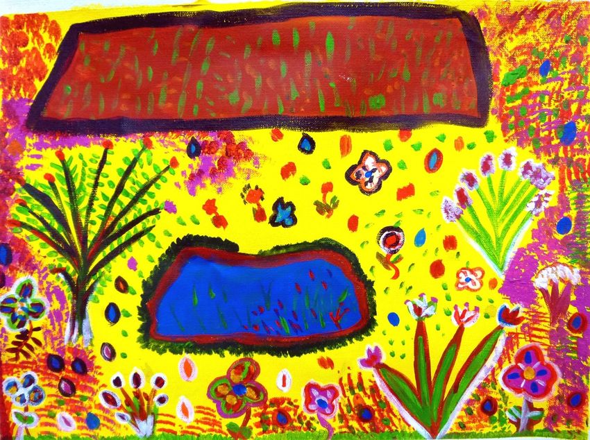
Cover Illustration Courtesy, Faith Thompson Nelson - Mi Gu La Billabong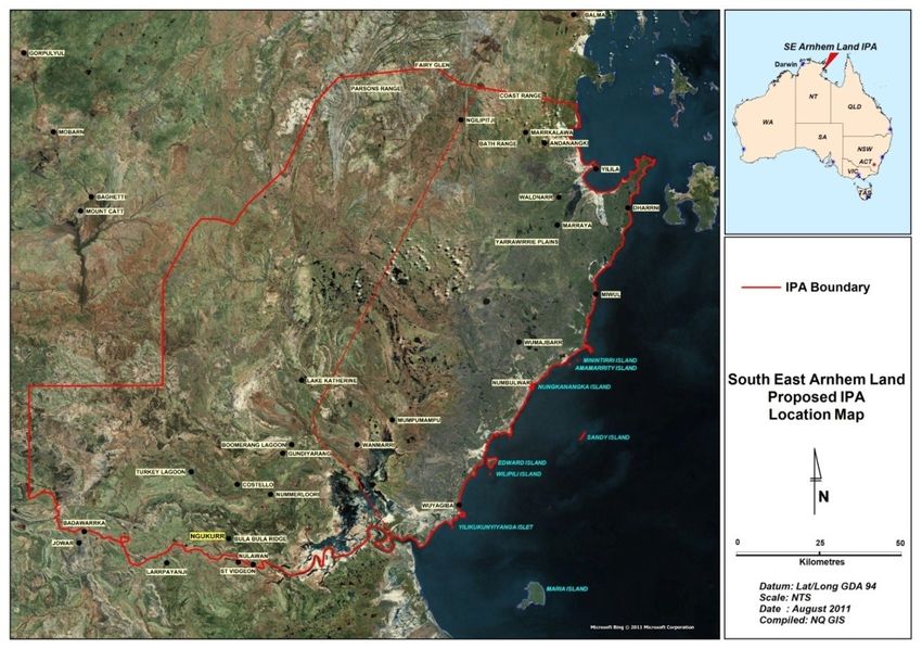
3

PART 1                  PEOPLE & PLACE
TRADITIONAL ABORIGINAL OWNERS OF SE ARNHEM LAND
“When we talk about all our countrymen and women in South East Arnhem Land we say
‘Yugul Mangi’. It’s a word for all our people, all our people coming together and speaking as
one.” (Cherry Daniels)

Senior Traditional Aboriginal owners
and managers for the SE Arnhem
Land IPA include: Alan Joshua (snr),
Alfred Numumurdirdi, Allan Wilfred,
Andrew Robertson, Andy Peters,
Annemarie Nundhirribala, Anthony
Daniels, Barry Rami, Benjamin
Wilfred, Betty Roberts, Bob Jawila,
Bobby Mirniyowan, Bobby
Nunggumajbarr, Brian Daniels, Bruce
Mangurra, Bugardi Nundhirribala,
Carmelina Ngalmi, Charlie Ngalmi,
Cherold Nundhirribala, Cherry
Daniels, Clarry Rogers, David
Murrungun, Davis Daniels, Donald
Blitner, Doreen Daniels, Edmond
Nundhirribala, Edwin Rami, Emery
                                        Cherry Daniels: Foundation Yugul Mangi Ranger
Joshua, Enda Roy, Ernest Daniels,
                                        and Senior Cultural Advisor to the IPA project.
Ernest Numumurdirdi, Ernie
Andrews, Eva Nunggumajbarr, Faye Mungurra, Floyd Rogers, Freyda Roberts, Galiliwa Nunggargalu,
Geoff Davey, Gerry Ashley, Gerry Nundhirribala, Gerold Sambo, Godfrey Blitner, Gordon John
Forest, Gorkin Markuri, Grace Daniels, Grandie Nundhirribala, Grant Nundhirribala, Henry
Huddleston, Henry Jurluba , Henry Nunggumajbarr, Hubert Numumurdirdi, Ivan Ngalmi, Jack
Huddleston, Jacob Lanson (dec), Jennifer Ngalmi, Jim Wilfred, Jijila Nundhirribala, John Mangurra,
John Murrungun, Johnathon Farrell, Julie Roy, Kathy Huddleston, Kelvin Rogers, Kevin Rogers,
Lachlan Harrison, Langayaina Clarence Rami, Mamuna Makuri, Michael Thompson, Mildred
Numumurdirdi, Mawungumay Nundhirribala, Moses Silver, Nathurin Markuri, Noel Mangurra,
Nelson Hall, Owen Turner, Paul Munurr, Peter Woods, Pollyanne Ponto, Priscilla Dixon, Ralph
Thingle, Raymond Mangurra, Reginald Numumurdirdi, Richard Sandy, Robert Roberts, Robin
Rogers, Rose Munur, Rose Anne Nundhirribala, Russell Numumurdirdi, Samson Ponto, Samuel
Duncan, Sena Roy, Simon Ponto, Trevor Mirnoywen, Valmae Roberts, Wally Wilfred, Walter Rogers,
William Hall, William Joshua, Winston Thompson.

Acknowledgements
Special thanks go to the following senior community members for their commitment to land and sea
management in South East Arnhem Land and their vital role in developing this IPA; Cherry Daniels,
Bobby Nunggumajbarr, Henry Nunggumajbarr, Walter Rogers, Kevin Rogers, Langayaina Rami and
Virginia Nundhirribala.
4

OUR VISION

  “Our Country staying as it has always been; healthy,
                  rich and strong.”
 “Our young people growing up to take responsibility,
      caring for their Country, as it has always been.”

 Copyright: Gwyneth Blitner, Untitled. Ngukurr Arts 2012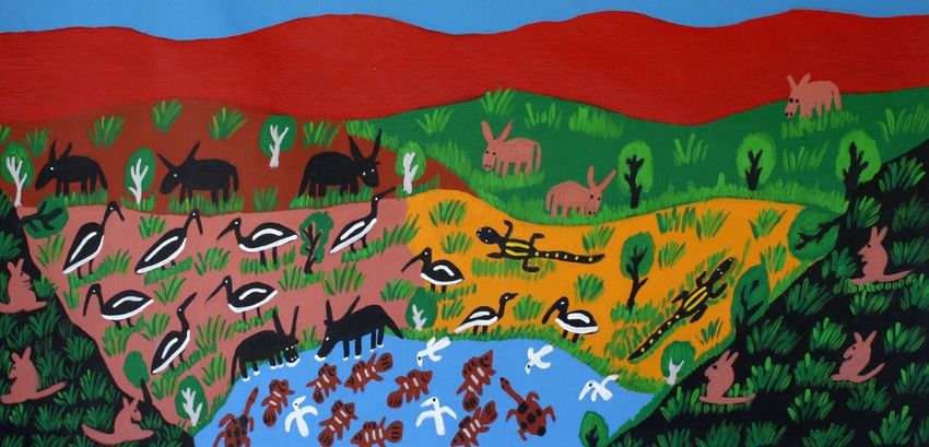
5

OUR PLAN
This plan captures our ideas, hopes and intentions for good management of our traditional lands. It is
a plan for an Indigenous Protected Area. It sets out how we will balance development in our region
with improved care of our country, wildlife and cultural heritage.

Our plan is for better management of fire, feral animals, weeds and trespass on our lands. It is a plan
to keep our culture strong and gain greater control over our land and sea country. This will ensure a
brighter future for all our country and our grandchildren who will inherit it.

    Yugul Mangi and Numbulwar Numburindi Rangers collaborated in planning the SE
    Arnhem Land IPA.

     Senior Traditional Owner Virginia Nundhirribala with Numburindi Rangers
     Samson Ngalmi and Reehan Nundhirribala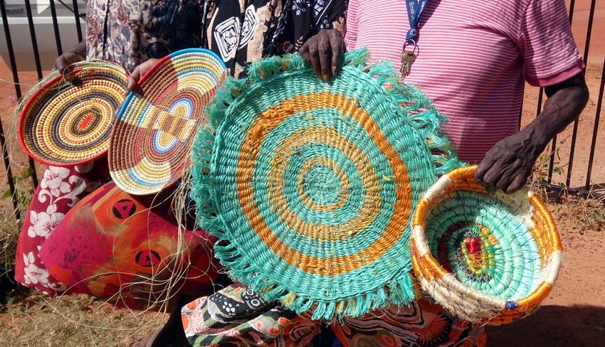
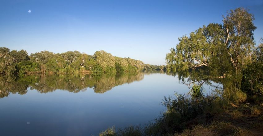
6

OUR COUNTRY

Burrungu (“Ruined City”). Image Courtesy: Antony Lynch 2012
From Blue Mud Bay to the Mouth of the Roper River, our country spans the far western Gulf of
Carpentaria. Tidal flats and vast coastal plains including the Roper Valley are backed by rugged
sandstone uplands. Rising in these weathered plateaux the Walker, Rose, Phelp, Wilton and Roper
Rivers descend through gorges, billabongs, wetlands and estuaries to join the shallow tidal waters of
the Gulf. Our ancestral coastal estates extend well out into the Gulf and include the near-shore
Yamarlburra (Edwards), Wilipili, Minintirri, Amamarrity, Nungkanangka and Miyaranga Islands, as
well as Yilikukunyiyanga and Yamarlburra (Low Rock) Islets, and Mayanyjiyanyji reef.

Land Ownership
Our country is divided into estates, each defined by the sacred sites and songlines that lie within or
pass through them. Traditional land ownership is a function of one’s relationship to these spiritual
features and these relationships are determined though decent. For each site or associated area of
land there are three types of ‘associates’. There are Mingirringgi whose cultural inheritance comes
through their father's father, Junggayi whose inheritance is through their mother's father, and Darlnyin

Figure 1: Traditional language areas of S E Arnhem Land
7

who are connected to country through their maternal grandmother. Each of these groupings has a
defined set of responsibilities. A simplified interpretation is that Mingirringgi are “boss for”, or owners
of a site or an area, while their Junggayi are the “policemen” or caretakers responsible for the practical
management of the site. Darlnyin are “helpers”, reminding Junggayi of their responsibilities and
supporting them in their ritual duties. These classifications are important to land and sea
management. Each classification compliments the other. This defines the makeup of our ranger
groups and the governance of our IPA. Mingirringgi, Junggayi and Darlnyin are all represented in our
ranger groups.

Languages
Traditional languages of the IPA are Ritharrngu, Rembarrnga and Nunggubuyu in the north, Ngalakgan
and Ngandi in the central areas, Yukgul in the south and Wandarrang along the coast from around
Numbulwar south to the Roper. Today many Marra speakers from coastal areas south of the Roper
River live in Ngukurr. Sadly many of these languages are in decline. Yukgul for instance has never
been recorded and is considered to have disappeared in the early 1900’s. First-language speakers of
Wandarrang no longer exist, and Ngalakgan and Ngandi only survive through less than a handful of
speakers. Ngukurr Kriol, a distinctive form of pidgin combining traditional languages with English, is
now the common language throughout our region.

OUR NEIGHBOURS
Laynhapuy IPA,
Laynhapuy IPA lies to the north of, and in some area’s overlaps, the SE Arnhem IPA. A shared
management area is being developed along this boundary to accommodate the continuum of
traditional land ownership across the two IPA. Laynhapuy IPA is managed by Yirralka Rangers based
in Yirrkala. An agreement between the two IPA is under development to enhance cooperation
between the ranger groups in the management of common issues such as feral animals, fire and
trespass. The substantive content of this agreement is provided at
Appendix 7.

Mimal Rangers
The Mimal Rangers (Bulman) neighbour our IPA to the west.
Their operational area reflects the vast extent of their fire
management activities the boundary of which is formalised
under a Section 19 Land Use Agreement underpinning the
Arnhem Land Fire Abatement Project. Traditionally known as
Wamana, this area of shared management is largely inaccessible
from the east. Accordingly, Yugul Mangi and Numbulwar
Numburindi Rangers are happy to support Mimal Rangers’
work in in this remote part of the IPA. An agreement between
Mimal Land Management Aboriginal Corporation and the IPA
is pending. It aims to enhance cooperation between the ranger
groups and clearly establish Mimal Ranger’s role with respect
to fire management the west of the IPA.
8

                                           Arafura Rangers
                                             To our north-west, beyond Parson’s Range, lies the
                                             operational area of the Arafura Rangers. This is a
                                             composite group including rangers from several
                                             communities in the Arafura Catchment. Their
                                             administrative centre is Ramingining. No overlap exists
                                             between this group’s operational area and that of the
                                             SE Arnhem Land IPA.

                                             Anindilyakwa IPA
                                             The Anindilyakwa Indigenous Protected Area (IPA) sits
                                          to the north east of the South East Arnhem Land IPA
taking in the Groote Eylandt Archipelago in the northern Gulf of Carpentaria. It is operated by the
Anindilyakwa Rangers who help protect its nearly 3,000 square kilometres of land and sea country.
This area also forms the administrative region of Anindilyakwa Land Council. Many Sea Country
issues including sea-bed mining, ghostnets and unwanted fishing are shared between the two groups
and future collaboration is important to strengthen indigenous interests across these areas.

Marra and Yutpundji-Djindiwirritj Land Trusts
Several separate Aboriginal Land Trusts adjoin the South East Arnhem Land IPA. Marra Land Trust
extends from the mouth of the Roper River south along Limmen Bight to the Limmen River mouth.
Yutpundji-Djindiwirritj Land Trust abuts McMinn Station and surrounds the popular Roper Bar store
and camping area. A small parcel of NT Enhanced Freehold land owned by Yupanalla Aboriginal
Corporation lies adjacent to the Urapunga ALT and includes the area of Rittarungu township.

Although there is considerable overlap between the Traditional Owners of the IPA and those of
adjacent land trusts, only areas within the Arnhem Land and Urapunga Aboriginal Land Trusts were
considered in this IPA consultation project. Size and socio-cultural complexity of the SE portion of
Arnhem Land precluded consideration of additional areas of Aboriginal Land.

Limmen National Park
Limmen National Park is a large reserve adjoining the IPA to the south. Following a lengthy
consideration of overlapping mining interests this park was finally declared in March 2012. Given the
area’s considerable cultural values and the unavoidable diminution of Native Title Rights stemming
from the necessary tenure change, the NT Government has indicated it will seek to establish joint
management of this reserve. This should provide Native Title holders with an executive role in park
management and potentially, significant opportunities for direct park employment, or development of
associated commercial enterprises. An adjunct declaration, the Limmen Marine Protected Area takes
in a large area of sea country extending from the intertidal zone of the Marra Land Trust to Maria
Island. Interestingly from a recreational fishing perspective this new marine park may be effectively
isolated, by landward inter-tidal zone of the Marra Land Trust and the pending ALRA grant of title
over the inter-tidal reef system adjoining Maria Island.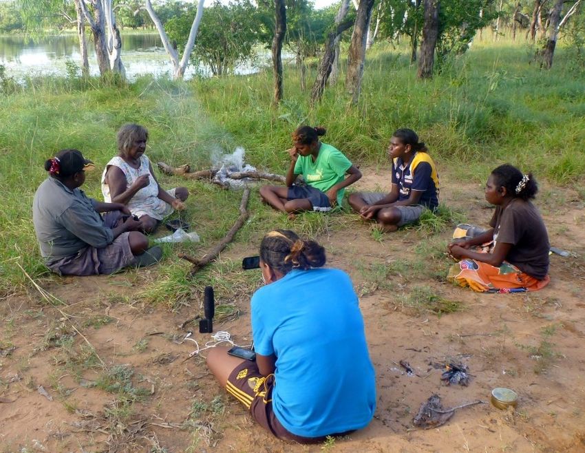
9

Wongalara Sanctuary, AWC
On the western edge of the IPA sits the
former Wongalara Pastoral Lease.
Wongalara is currently owned and
operated by the Australian Wildlife
Conservancy (AWC) as an independent
sanctuary. AWC are a non-profit conservation organisation with an increasingly large property
portfolio in Northern Australia. Though AWC’s charter is conservation specific, significant overlap
exists between their objectives at Wongalara and those of the SEAL IPA. This presents opportunities
for working in unison with AWC on activities such as fire management, weeds, feral animal control
and wildlife surveys (i.e. biodiversity of western Gulf sandstone massifs).

Kurrululinya (Maria) Island
Situated approximately 20km off the coast,
Kurrululinya, also known as Maria Island, is the
largest island in Limmen Bight. Kurrululinya is
an area of great importance to the Marra people
and affiliated groups but following an
unsuccessful land claim1 the bulk of it remained
as Crown Lease in Perpetuity (NT Portion
2373). The island was held by the Northern
Territory Land Corporation under this tenure
until only recently, when it was declared an NT
Reserve as part of the vast Limmen National
Park. However, the surrounding reef forming
the extensive inter-tidal zone (approximately 560
hectares) was recommended for grant under the
ALRA Act in a repeat claim. It now forms part
of the Marra ALT. There are indications that the      Kurrululinya (Maria) Island and surrounding
NT Government would consider including Maria          reef. Image: Google Earth
Island in an IPA should its Marra traditional
owners seek to establish a protected area over the
adjacent Marra Aboriginal Land Trust.
Kurrululinya was not considered in the South East
Arnhem Land IPA planning process.

Mining Interests
As this plan was being developed several new mining developments were proceeding or signalled in
the Roper Valley to the south of the IPA. The most significant are Western Desert Resources’
(WDR) Roper Bar Iron Ore Project and Sherwin Iron Limited’s Roper River Iron Ore Project. Both of these
projects have long predicted lifespans, large infrastructure requirements and vast tenements; the
combined projects covering upwards of 4,000 square kilometres.

1Maria Island (land above the inter-tidal zone) originally formed part of the Limmen Bight Land
Claim.
10

 SOUTH EAST ARNHEM LAND IPA
 Location
 South East Arnhem Land Indigenous Protected Area (SEAL IPA) is centred on the point 135.22100
 East of Greenwich and -14.16010 South of the equator and covers approximately 19,170 square
 kilometres of Aboriginal freehold land within the Arnhem Land and Urapunga Aboriginal Land
 Trusts.

 Description
 Positioned on the western edge of the Gulf of Carpentaria in the Northern Territory the SEAL IPA
 includes portions of Central Arnhem, Arnhem Coast, Gulf Coast and Gulf Fall and Uplands
 bioregions. It extends from the approximate northern watershed of the Walker River to the Roper
 River in the south. It includes intertidal marine areas and coastal islands from the Ranjugurr area of
 Blue Mud Bay to the mouth of the Roper River. The western boundary of the IPA follows the
 watershed of the Rose and Phelp Rivers and the cadastral boundary of Wongalara Conservation
 Reserve. The IPA encompasses all or part of the traditional estates of the Ngalakgan, Ngandi, Yugul
 and Wandarrang, Nunggubuyu and Ritharrngu language groups.

 Tenure of all land included in the SEAL is (Commonwealth) Aboriginal Freehold. Title is held by
 Arnhem Land Aboriginal Land Trust on behalf of the Traditional Aboriginal Owners to whom the
 land was granted in 1980 under Australian common law via the Aboriginal Land Rights (Northern
 Territory) Act 1976 (Cth).

Figure 2: Location of the SE Arnhem Land IPA
11
Dedication of the South East Arnhem Land IPA
SEAL IPA is dedicated by its Traditional Aboriginal Owners as a Category VI Managed Resource
Protected Area, consistent with the International Union of the Conservation of Nature (IUCN)
definition of; an “area containing predominantly unmodified natural systems, managed to
ensure long-term protection and maintenance of biological diversity, while providing at the
same time a sustainable flow of natural products and services to meet community needs ”.
Management of the SEAL IPA will also be consistent with the other objectives relevant to Category
VI protected areas, specifically:
To promote sustainable use of natural resources, considering ecological, economic and social
dimensions.
To promote social and economic benefits to local communities where relevant.
To facilitate intergenerational security for local communities’ livelihoods – therefore ensuring
that such livelihoods are sustainable.
To integrate other cultural approaches, belief systems and world-views within a range of social
and economic approaches to nature conservation.
To contribute to developing and/or maintaining a more balanced relationship between
humans and the rest of nature.
To contribute to sustainable development at national, regional and local level (in the last case
mainly to local communities and/or indigenous peoples depending on the protected natural
resources).
To facilitate scientific research and environmental monitoring, mainly related to the
conservation and sustainable use of natural resources.
To collaborate in the delivery of benefits to people, mostly local communities, living in or near
to the designated protected area.
To facilitate recreation and appropriate small-scale tourism.
SEAL IPA also qualifies for recognition as part of the National Reserve System (NRS), as it
meets the following accession criteria.
1. The land must contribute to the comprehensiveness, adequacy and representativeness
(CAR), of the National Reserve System and strategically enhance the protected area network.
i. Comprehensive: the inclusion in the NRS of examples of regional-scale ecosystems in each bioregion
ii. Adequate: the inclusion of sufficient levels of each ecosystem within the protected area network to
provide ecological viability and to maintain the integrity of populations, species and communities
iii. Representative: the inclusion of areas at a finer scale, to encompass the variability of habitat within
ecosystems
2. The land must be managed to protect and maintain biological diversity according to one of
six international classes developed by the IUCN. The six-level system classifies protected
areas according to their management objectives, which range from strict nature conservation
to multi-use reserves (objectives must not be inconsistent with the primary purpose which is
biodiversity conservation)12 OUR COUNTRY’S VALUES Copyright: Jill Daniels, Untitled: Ngukurr Arts 2012 Little known to the outside world, South East Arnhem Land is a vast and ecologically intact northern landscape. A biome fashioned and conserved by its traditional Aboriginal owners over tens of thousands of years, the western Gulf of Carpentaria is an exceptional area, with an abundance and diversity of wildlife far exceeding that of comparable regions in southern Australia. Tropical savanna woodlands, unspoiled rivers, a long and pristine coastline typify the western Gulf of Carpentaria, all held within an arc of remote sandstone uplands at the edge of the Arnhem Plateau. A rich patina of indigenous culture persists across this landscape; the area largely secured from the outside world through its early reinstatement to Aboriginal owners under Commonwealth Land Rights legislation. This corner of the greater Arnhem Land Aboriginal Land Trust is home to upwards of 2000 indigenous Australian’s whose traditional languages, knowledge, skills and culture it sustains. The area dedicated as the South East Arnhem Land Indigenous Protected Area borders the domains of Yanyuwa and Marra people of the southern Gulf, Bininj of western Arnhem Land and Yolŋu countrymen of the tropical Arnhem coast. Evidence of the IPA’s astounding cultural wealth can be seen in the diversity of traditional languages overlapping across its twenty thousand square kilometres; its ecological riches manifest in the convergence of four distinctive bioregions within this same precinct.
13

ENVIRONMENTAL VALUES
WILDLIFE
Though little surveyed, at
least three hundred and
forty (340) different species
of     native     (vertebrate)
animals are known from
South Eastern Arnhem
Land. These include 15
frogs, 76 reptiles, 219 birds,
31 mammals (three marine
mammals). Six non-native
(introduced) animals occur
here. This is a high tally in
comparison to other similar
areas in northern Australia;
Kakadu National Park (517 native vertebrate species), Nitmiluk National Park (367), Djelk IPA (310),
Laynhapuy IPA Stage 1 (277), and Limmen National Park (109).

This biodiversity reflects the large area covered by the IPA and the wide variety of habitats found
within it. These range from sandstone uplands through to rolling plains, freshwater floodplains, and
salt marshes to coastal islands. Our IPA sits across four bioregions and shares a unique wildlife
compliment from each of these.

At least eighteen (18) threatened animal species are recorded from the IPA. Though many of these
records are now quite old, we know that some do still occur here and that SE Arnhem Land is an
important area for conservation in general. Remote from some threatening processes, the IPA still
enjoys a high level of customary land use and care, the coastline is mostly inaccessible, uninhabited
and it includes several near-shore islands of high conservation value. Vast inter-tidal mudflats
between Wuyagiba and the lower Roper River are among the most important areas for migratory
shorebirds in the NT, while the broad adjacent freshwater floodplains support large numbers of
water-birds such as brolga, jabiru and magpie geese.

Near-shore Islands of the IPA are of particular importance for conservation management. Their
isolation from the mainland not only provides sanctuary for nesting turtles and seabirds, it also often
protects island wildlife from threats that are widespread on the mainland. Miyaranga (Sandy Island) is
considered a marine turtle rookery of national significance. Species like Brush-tailed Rabbit-rat and
Kultarr are remembered by our old people and may still exist on our islands. Certainly we know that
the northern brown bandicoot remains common on some. Threats such as cane toads, black rats,
feral cats, dogs, tramp ants, some weeds and diseases are often absent from islands. We would like to
survey these islands to find out what wildlife they have and how best to protect it.

There are many things we don’t know about our IPA. Although there are no formal records, we
believe threatened or rare species such as the crested shrike-tit, northern hopping mouse, hooded
parrot and red goshawk still occur here. We think that some of the specialist sandstone wildlife such
as the Arnhem rock-rat, Oenpelli python, jewelled velvet gecko, Kakadu dunnart and Kakadu pebble-
mound mouse might be found in the rugged sandstone country in the west and north west of our
IPA. We see these gaps in our knowledge as opportunities for us to get out on country and learn
more.
14

VEGETATION
 The vegetation of SE Arnhem Land is diverse, with over one thousand species of plants and 46
vegetation types (as recognised under the National Vegetation Information System) recorded from
the area. For the purposes of this plan these have been redefined into twelve greater habitat groups,
based on the vegetation, landscape form and soil
types. Distribution of these habitats across the IPA
is depicted in Appendix 6.

The southern half of the IPA has the most
complex vegetation pattern, a product of the area’s
diverse geology. Extensive saline flats flank the
lower Roper and Phelp Rivers eventually grading
to paperbark swamps and forests above the tidal

influence. Further inland,
self-mulching alluvial soils of the
broad Roper valley support
perennial grasslands interspersed
with open woodlands of coolibah,
gutta-percha and bauhinia.

These lowlands are bordered by
undulating rises supporting silver-
leaf box, or where soils are more
productive,        Darwin       box
woodlands. Where the rises
become hills the vegetation shifts
to a mosaic of woodlands growing on a
wide variety soil types. Here communities dominated by snappy gum, variable-barked bloodwood or
scarlet gum are the most common. Interspersed amongst these are distinctive and extensive
lancewood thickets.
15

In the northern half of the IPA deeper sandy soils predominate and the vegetation shifts to tall
eucalypt woodlands and open forests, typically a mix of Darwin stringybark and Darwin woollybutt.
Much of the northern IPA is above the 1000mm rainfall isohyet, and riparian and rainforest
communities are accordingly more common, better developed and more diverse. In the north and
north west, sandstone rises and outcrops support a variety of specialised communities including
heaths and mixed low acacia/grevillea shrublands. Along the coast monsoon vine thickets form a
near continuous barrier atop the dune systems while extensive and diverse mangrove communities
crowd mud flats and estuaries.

Only one threatened plant is recorded from the IPA, the Arenga Palm, listed as Vulnerable at a
National level and Data Deficient at NT level. SE Arnhem Land supports many plant species
considered endemic to the NT and several that are endemic to Arnhem Land. No plant communities
or ecosystems within the IPA are formally defined as threatened or at risk. However several Regional
Ecosystems considered threatened in the Queensland have equivalents here. These include river red-
gum riparian woodlands and swamp bloodwood woodland in sandstone springs.

Plant Use
Available records detail traditional use of over two hundred species of native plants, though this is
likely a large underestimate. Our old peoples’ knowledge and necessity would have extended to
virtually all of the 1000 or more species occurring in the region. Native plants were and continue to
be used for the manufacture of utensils such as fishing nets, baskets, mats and mosquito nets, spears,
canoes and rope. Dyes and pigments are extracted from a wide variety of plants as are medicines and
remedies for a vast array of ailments.

With harvesting being more predictable than hunting, plants formed the staple of traditional diets.
While elaborate preparations were needed to render cheeky yams (Dioscorea bulbifera) and poisonous
cycad seeds (Cycas arnhemica) into edible bulk food, many of the plants in our region could be eaten
raw or with minimal cooking. Knowing when and where to harvest particular plants was vital.
‘Calendar plants’ were used as a guide; a flowering gum in the sandstone might indicate the time to
harvest water chestnuts (Eleocharis spp.) from the drying floodplains.

                                                                                       Numbulwar weavers
                                                                                       mix traditional fibres
                                                                                       with contemporary
                                                                                       materials, in this
                                                                                       case fibre from
                                                                                       ghostnets, to
                                                                                       produce fine-weave
                                                                                       baskets.
16 Figure 3: Varied habitats of the SE Arnhem Land IPA Clockwise from top left: Mangrove forest, tall open stringybark forest, lancewood thicket, paperbark woodland, grassland, riparian forest, monsoon vine thicket.
17

CULTURAL VALUES

Arnhem Land sits as a
cultural domain, distinct
from the corpus of
modern, Europeanised
Australia. It is an
unmistakably Aboriginal
landscape, imbued with
the art, antiquity and
spirituality     of     its
indigenous owners. The
south eastern quarter is
the traditional home of
at least six distinct
language groups. This
area remains one of the
most       remote     and
culturally intact parts of
Australia.                       Dancers at the Barunga Festival. Image courtesy: Antony Lynch
SE Arnhem Land contains countless sacred cultural sites, is traversed by innumerable song-
lines and overlaid by the ancestral estates of clans that have lived within and shaped the country
for millennia. Today a network of outstations mantles the IPA, proclaiming familial tenure across
more than two dozen traditional homelands. Ancestral estates here may also stretch well beyond the
coastline to include the productive waters of the shallow western Gulf. In particular, Nunggubuyu and
Wandarrang speaking clans are saltwater people, with strong traditional connections to their sea
country and in the case of Nunggubuyu, close cultural affiliations with countrymen on
Anindilyakwa (Groote Eylandt) and Amakalyuwakba (Bickerton Island).

These communities, their culture, and their relationships to country are of enormous value to modern
Australia. Intrinsically, because they are unique, add diversity, and in many ways define our nation’s
identity and unity. Practically, because they sustain wisdom and ways that modern western society has
either failed to attain, or lost. Tangible examples include the profound and intricate ecological
knowledge that has supported sustainable use of northern ecosystems over eons. Or, the hyper-social
organisation of traditional law that correlates and inter-obligates every individual within the
community, and beyond.

Though concern for the demise of traditional knowledge and skills is valid, indigenous culture in SE
Arnhem Land is robust. Important ceremonies such as Gunapipi, Jabuduruwa and Aragundagunda
remain potent features of life here. Sacred ceremonies see roles and responsibilities tested and
reaffirmed through complex patterns of organisation and reciprocation. These long and rolling events
command attendance; ensure continuity of traditional law and reinforce many cultural and spiritual
aspects of society. All young men are initiated and ceremonies for this purpose are regular and
important occasions for the community to unite in the passage of their boys to adulthood.
18

   Cultural cohesion is also apparent in decision-making, underpinned by the communal nature
   of land ownership. For many years mining has been resolutely excluded from the area by traditional
   owners. The fight for rights to sea country also reveals a constant and courageous sense of
   sovereignty within these communities. SE Arnhem Land IPA takes in the southern arc of Blue Mud
   Bay, an area now synonymous with a landmark court case delivering ownership of more than 85 per
   cent of the NT intertidal coastline to Traditional Aboriginal Owners. This long legal battle was
   also significant for the exposure and acknowledgement it gave to indigenous viewpoints. As a
   result, the Blue Mud Bay decision has led to more respectful relationships between government,
   fishing interests and traditional owners. It is also likely to result in more considered and sustainable
   use of the NT’s marine resources; a key issue for a people with an intrinsic long-term outlook.

Senior Yugul Mangi Ranger Winston Thompson at Burrunju
cultural site. Image courtesy: Wayne Turner

Senior Ranger Julie Roy and
young women rangers work
with Elder Cherry Daniels
recording her knowledge of
the IPA’s history, cultural
geography     and     ethno-
ecology.
Image courtesy: Emilie Ens
19

LAND AND SEA MANAGEMENT
Two Indigenous Ranger groups manage the South East Arnhem Land IPA, one based in Ngukurr the
other Numbulwar. All the Rangers are employees of the Northern Land Council, via funding from
the Australian Government.

YUGUL MANGI LAND AND SEA RANGERS
Yugul Mangi Rangers came together in the late
1990’s working on feral pig, weed and dust
suppression projects. Today the rangers undertake a
broad range of land and sea management activities
and in doing so work with many government and
scientific agencies.

Yugul Mangi Rangers have a long history of
environmental weed control. With support from the
Northern Territory Weeds Management Branch they
have developed surveillance and response plans for
several Weeds of National Significance       (WONS)
including mimosa, parkinsonia, rubber vine and pond
apple. They also have extensive experience in
prescribed    burning having        participated since
2009 in regional greenhouse gas abatement projects. In partnership with the Aboriginal Areas
Protection Authority (AAPA) Yugul Mangi Rangers also assist in cultural heritage protection. They
recently took part in the survey, documentation and subsequent management of sacred sites in the
Roper and Wilton catchments and on near-coastal islands.

As Land and Sea rangers, Yugul Mangi are active on the waters of the Roper River and adjacent IPA
coast, north to Wuyagiba. In this capacity they contribute to research into recreational and
commercial fisheries, including a long-term telemetric study of fish population behaviour in the
Roper River. In addition they provide oversight of recreational and commercial fishing in their area
under contract to Department of Primary Industry and Fisheries NT.

Yugul Mangi Rangers have an enduring and productive partnership with researchers from the
Macquarie University. This multi-faceted ethno-ecology program has over the past five years
supported them to undertake flora
and fauna surveys, monitor
wetland health, complete fire-
plot monitoring, produce a
wealth of ethno-ecology
material    and     regularly
participate    in   scientific
conferences and symposia.

  Rangers Simon Ponto and Kelvin Rogers survey fire-sensitive wildlife, the rare and
  Leichardt’s Grasshopper. Image courtesy: Emilie Ens
20

NUMBULWAR NUMBURINDI AMALAHGAYAG INYUNG RANGERS
                                                       Based in Numbulwar, at the mouth of the
                                                       Rose River, Numburindi Rangers identify as
                                                       a ‘saltwater’ group. Numburindi Rangers
                                                       commenced operations over a decade ago
                                                       and have since maintained a strong interest in
                                                       marine activities. The rangers’ work typically
                                                       involves coastal surveillance for foreign
                                                       fishing vessels, irregular arrivals and illegal
                                                       fishing operations. They also monitor,
                                                       remove and incinerate ghost nets and other
                                                       marine debris littering the western Gulf
                                                       coastline between Blue Mud Bay and
                                                       Wuyagiba homelands.

                                                        Numbulwar         Numburindi         Rangers’
                                                        involvement in land-based activities is
expanding. In recent years they have participated in strategic control of weeds and feral animals. In
partnership with Yugul Mangi Rangers they participate in the Western Arnhem Land Fire Abatement
Stage 2 Project (WALFA2). WALFA2 is a commercial carbon farming initiative aimed at mitigating
wildfire and thereby reducing greenhouse gas emissions from savanna fires in Arnhem Land.

Both Numbulwar Numburindi and Yugul Mangi Rangers contribute to the Australian Government
Department        of Agriculture and Water Resources’ (DoAWR) North Australian biosecurity
program (formerly administered by AQIS). They are trained in feral pig autopsy for early detection of
exotic diseases and parasites and surveillance of feral stock for signs of commercially significant
diseases such as ‘foot and mouth’. They currently provide contract services including surveillance
and reporting on exotic vertebrate pests, marine debris and plant health.

Since their inception Numbulwar Numburindi Rangers have been disadvantaged by their remoteness
and limited facilities. The NLC continues to seek funding for a dedicated operational base and
accommodation for supporting staff for this group. Without these basic facilities they have struggled
to recruit and retain coordinators which has led to lengthy suspensions of the ranger group’s
operations.

Past Coordinator Keith
Cavalli and Numburindi
Ranger Adam Mangurra on
patrol in the Numbulwar
area, 2013.

Image: Numbulwar Numburindi
Rangers
21 Top: Yugul Mangi Ranger Edna Roy with Senior Cultural Advisor Cherry Daniels (foreground). Right: Yugul Mangi Rangers Kelvin Rogers & Winston Thompson. Below: Numbulwar Numburindi Ranger Esmond Numumurdirdi Images Courtesy: Yugul Mangi and Numbulwar Numburindi Rangers
22

GOVERNANCE
 To enhance local decision-making and ensure greater control of our land we have established the
 South East Arnhem Land IPA Advisory Committee. Our Advisory Committee consists of
 representatives (male and female) of the traditional landowning clans. The committee meets at
 least twice yearly and receives regular feedback from both of our Ranger groups. Committee
 members are predominately Minggirringi or Junggayi for the Land Trust. Senior rangers and a
 representative from the IPA funding body (DPM&C) are also invited to sit on this committee.

 Additional to our Advisory Committee, an annual general IPA meeting will be held to review,
 evaluate and contribute to the improvement of IPA operations. This general meeting will be open
 to the IPA board members, representatives from the Australian and NT Governments, Northern
 Land Council, partner agencies, and our neighbours. We hope that sharing ideas through this
 forum will ensure our IPA management methods remain best-practice and in step with regional
 initiatives on common issues such as wildfire, weeds and feral pests continues.

 Looking to the future, we are developing a Indigenous entity to locally host our IPA and ranger
 programs. The proposed SEAL IPA Aboriginal Corporation would allow us to accept and
 administer government grants and income generated through commercial initiatives such
 WALFA2 Carbon project.

Figure 4: Governance Structure for the SE Arnhem Land IPA

   Traditional Owners

                      SE Arnhem Land IPA Aboriginal Corporation
        NLC           (propsed)

                        SE Arnhem Land IPA Advisory Committe

        IPA                 Numbulwar Numburindi             Yugul Mangi Land and Sea
    Coordinator           Amalahgayag Inyung Rangers                 Rangers

  Traditional Owners govern the IPA through the IPA Advisory Committee, as
  Northern Land Council delegates and via their representation on the board of the
  proposed SEAL IPA Land & Sea Management Aboriginal Corporation. Both Ranger
  groups, also including Traditional Owners, are administered by the Northern Land
  Council with the direction from the IPA Advisory Committee.
23
THREATS TO OUR COUNTRY
Our country has always been a rich and abundant
landscape, sustaining our people through seasons
and epochs. But times have changed and the
land’s resilience is now tested by the
combined threats of introduced plants and
animals, changed fire regimes and the increasing
effects of climate change. Much is now spoilt.
This hasn’t happened gradually; many of the
changes we see are stark and have occurred in our
lifetimes. Sadly, the rise of these modern threats
corresponds with the passing of our elders and
much of the traditional ecological wisdom they
held.
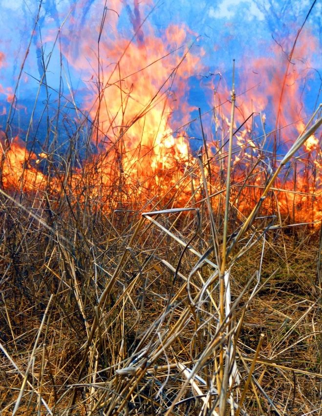
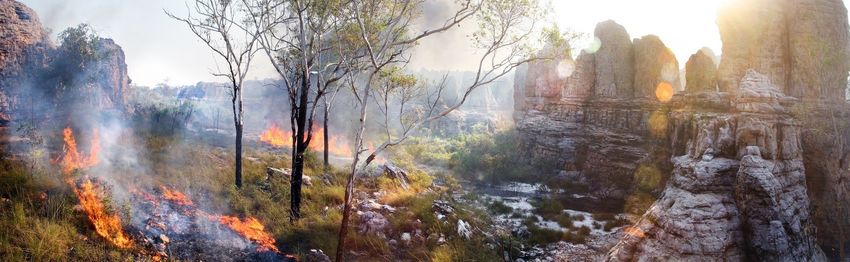
WILDFIRE
Fortunately much of our land has
been spared the worst of the
wildfires that have ravaged Central
Arnhem Land in recent decades.
Only the rugged sandstone
country in the far north west and
south west of the IPA have been
subject to frequent hot fires. This
is evidence of the effectiveness of
traditional owners’ and our
rangers’ annual fire work which
reduces fuel loads and so limits
the chance of late-season wildfires.
Uncontrolled fire affects the
health of our country, reducing its
richness, leaving behind dusty
soils, only the hardiest plants and
the toughest of animals. Many
native animals have gone from our
land; slowly disappearing as these
Image Courtesy A. Lynch 2012 hot fires have taken away their
food and shelter. In particular fire
is a threat to habitats like wetlands,
billabongs, springs and rainforest patches. These are special places in our country, valued for their
shade, coolness and the wealth of plants and animals we use from them. Many of these places are
now damaged by fire. Feral animals make this problem worse by opening up closed forests to grasses,
and in turn fire. Drier woodlands can also suffer from too much fire. In some places over- burning
has bit-by-bit stripped the woodlands of the fruit-bearing shrubs and useful grasses we knew so well.
These are valued traditional foods and medicines for us, as well as being important plants for our
wildlife.24
FERAL ANIMALS
Water Buffalo
Buffalo are common throughout
much of our country and they
are a growing problem. Their
numbers are greatest in and
around wetlands, floodplains
and paperbark woodlands. After
a few good wet seasons their
numbers can climb to as many
as 30 animals per square
kilometre. Each animal lives for
about 20 years and cows can
have a dozen or more calves in
their lifetime. They dig wallows,
overgraze and trample native
plants, pollute waterholes,
spread weeds, destroy stock
fences and generally spoil our country. They can be dangerous for people walking around and they
can carry serious diseases like brucellosis and bovine tuberculosis.
We hunt buffalo, less so now than in the past when rifles were easier to come by. These days we
mainly let others do the hunting. Commercial safari hunting has operated in SE Arnhem Land for
many years now and we occasionally licence pet-meat contractors to take large numbers of buffalo
and horses. But neither does much to reduce the number of animals infesting our country.
To get on top of this problem there isn’t one answer. We need to hunt more buffalo, muster and sell
them when there’s a market, support pet-meating in accessible areas and use helicopters to cull them
where there are no roads. Our Rangers are responsible for watching this problem and keeping land
owners and managers aware of what is happening, year in year out. Buffalo will never go away; they
are with us for the long run so we need to be smart about managing them.
Horses, Donkeys and Pigs
Brumbies are also common and widespread in our IPA, especially in the lowlands. Donkeys also
occur in high numbers, but in the stony foothills and upland creeks in the west of the IPA. Both
horses and donkeys have a big impact
on the health of our country. They
travel long distances through the
seasons, removing the native ground
cover, disturbing the soil and spread
weeds. Feral horses and donkeys will
be a big problem if we set up
commercial grazing or horticulture.
The cost of doing nothing with these
pest animals will be very clear when
we have no grass for our stock and
weeds infesting our crops.25
There are plenty of feral pigs throughout our country. They cause major damage to our wetlands.
They destroy our rich floodplains by rooting up our bushfoods and fouling billabongs. They now
threaten our sea turtles with their new habit of digging up nests and eating the eggs. These pests are
known to carry serious animal diseases like brucellosis. They threaten people’s safety and their
enjoyment of their country too.
Feral Cats
We rarely see signs of
hopping mice, bandicoots or
possum anymore. Almost all
of our small or medium sized
mammals seem to have
disappeared. Feral cats might
be the guilty one here. There
are so many of them in our
country now, in all types of
country, even on the beach!
Native animals are no match
for feral cats; they eat
anything, mammals, reptiles,
birds, frogs and insects, all the Common in northern Australia’s savannas, feral cats
same to cats. Scientists have impact heavily on native wildlife. Image courtesy Terry Mahney
told us that cats like to hunt in open country, where fire or grazing has taken away the grass, sticks
and shrubs. This makes sense as there’s nowhere left for the native animals to hide. So, wrong-way
fires, feral horses, pigs, buffalo and cats are all working together, against our native wildlife.
Cane Toads
Since they arrived here in the
early 1990’s, cane toads have
had a big effect on our native
wildlife. They quickly took
over our rivers and billabongs,
and as they did we saw our
freshwater turtles and
crocodiles, large snakes,
goannas and many of our
native frogs disappear. Cane
toads breed in huge numbers
each wet season. We see
thousands of toadlets leaving
the water and spreading out
across our land where they
displace and poison our native
wildlife. There’s no good way
to control cane toads. Luckily some animals, like sand goannas and water goannas are coming back,
slowly. It seems that over generations they learn to give cane toads a miss.26 WEEDS Plants that have come to our country from other places can be useful in the garden or for farming, but here, mostly we know them as weeds. We have a lot of different types of weeds growing on our country, at least fifty species are recorded from our IPA. Some we don’t notice, others like hyptis and Mossman River grass are a nuisance, but then there are a few that are a real worry for us, weeds like Mimosa and Parkinsonia. Mimosa has been found on the Phelp River floodout, while Parkinsonia is common from Yellow Water Grader Grass is as serious weed of savanna Billabong to Nullawan Creek. woodlands. It can easily be mistaken for native There’s also a group of weeds that kangaroo grass. are serious potential risks; rubber vine, pond apple, salvinia or cabomba could easily turn up here one day. Rubber vine is an enormous problem nearby in northern Queensland where it completely smothers native plants along rivers and creeks. As with the pond apple it is a prescribed Weed of National Significance (WONS) and though neither is yet confirmed present in the Northern Territory both pose a significant threat to our lands. Salvina, cabomba and olive hymenachne are highly invasive Rubber vine has badly infested many river systems water-weeds that could have a in Queensland’s Gulf country. Weed surveillance in devastating effect on our the IPA will guard against this Weed of National wetlands. Both have been found Significance. in the Top End and both could be spread by water birds such as magpie geese. We’ve recently noticed the spread and increase of ‘stranger’ grasses throughout our homelands. This is a big concern because grassy weeds are hard to manage and could change our country for the worse. We’ve noticed that in some areas they are changing the way our country burns. Many of these new grasses dry out late, burn hot and carry fire into special places like rainforest and paperbark forests. Some are starting to choke up our wetlands, spreading out over the water to block out the sun and stop us fishing.
27

LOSS OF LAW AND CULTURE
With the rapid passing of our old people our traditional
wisdom and cultural heritage is also receding. As we strive to
build our communities, create jobs and prosperity, we move
away from the lifestyles of our past. In our modern world
there are fewer and fewer occasions where we can use and
pass on customary skills and knowledge and so these parts of
our culture are being forgotten. They will be lost forever
unless we work to reclaim them. Similarly, traditional law is
eroding as new responsibilities take up our time and
resources. Western culture dilutes our traditions and draws
the attention of our youth. Fewer young people are now
involved in ceremony and we worry that without strong
interest less and less will be passed on. This knowledge, these
traditions have been the fabric of our lives for thousands of
years. Our culture provides us with unity as a people and
distinction in an increasingly globalised world.

Centralisation
Traditionally people lived on their country. Through Law they inherited their ancestral estate, took on
strict responsibilities of managing it and lived by its bounty. Homelands are a modern expression of
these immutable connections to country. In most cases they exist at a central site within a clan’s area
and fulfil a wide range of important functions for their owners and their extended families.

Homeland outstations are central to land owners’ ability to get out on and care for their country, both
in a physical and spiritual sense. Hunting, burning, holding ceremonies and raising children in a
healthy, natural and importantly, indigenous setting are just some of the benefits outstation life
brings. These days our homelands also serve as staging posts from which our rangers can safely and
efficiently carry out their duties. Unfortunately modern government policies driving more centralised
delivery of services like health and education have forced most people to move off their homelands
into town. With no residents and no effective government support our outstations are rapidly
becoming derelict.

      Wally Wilfred and Jill Daniels at their outstation          Image courtesy, A. Lynch 2012
28 Trespass Unwanted visitors, we call them ‘strays’, regularly come onto our land, both by road and by boat. The popularity of private four-wheel-drive tourism and recreational fishing in the Northern Territory brings a seasonal tide of tourists to our country. We must manage this problem because in it there is opportunity as well. Visitors to our country require a permit issued by the Northern Land Council and permitted tourists are welcome. We are building our capacity to cater for those who come to Arnhem Land with respect for indigenous people. But sadly there remain those who disrespect our ownership and authority over our land and sea. They come uninvited to fish our rich waters, to shoot in our homelands and exploit our cultural sites without our permission. We know them by the rubbish and desecration they leave behind. We worry for our country and we worry for their safety. Mining Mining can cause serious damage to our land and seas. Although there are no existing mines on the land trust, proposals for gas and oil extraction across the entire IPA and sea-bed mining along the coast are new and worrying developments. Marine mining particularly concerns us as we have little say over what happens in our ancestral sea country beyond the intertidal-zone. We believe sea bed mining will harm our fisheries and so our long-term livelihoods. We hope that our Native Title Rights to sea country will be respected and that we will be properly consulted about all mining proposals on our traditional country. Specifically, we expect to be fully informed and allowed adequate time to discuss and consider proposals as a community. Adjacent to our IPA but within our traditional lands there are three new mining ventures. These large operations will have significant impacts on our communities and our IPA, both good and bad. Our main concern is that these operations could result in a large increase the number of people accessing our land and sea country, and with this an increase in wildfire, weeds and trespass. We hope this isn’t the case, but if it is we will work with the mining companies to find solutions.
29

PART 2 CARING FOR COUNTRY & CULTURE

                                                                         Image courtesy: Antony Lynch

Target Areas
Target Areas are where our values lie and where our IPA work will be done. Our Plan of
Management focuses our resources and efforts on the things we think are important, and in the areas
we believe we can make a difference.
Goals are the outcomes we are aiming for. Goals in each of these areas generally overlap so that
improvements in one are also sees progress in others. For instance, investment in our youth will
ensure they understand and accept their cultural responsibilities for caring for country.
Actions are the things we will do to kick our goals. In many cases these will be part of our Rangers’
work programs. Other actions will require organisational input from the Traditional Owners, Yugul
Mangi DAC, the NLC, and supporting Government agencies.
Markers are the things we’ll be looking out for; clear signs that we are reaching our goals, or
indicators that we are not. Where we are failing to make a difference we will need to change actions,
do more work or do it differently. These are listed in table at action table at the end of this plan.

1. CULTURE & YOUTH                                 2. WILDLIFE

3. SEA COUNTRY                                     4. FRESHWATER

5. FIRE                                            6. RANGERS & IPA

7. BUSINESS
30
1. CULTURE &YOUTH
Our Youth are our future; they will take up
the land and law that have always been passed
down from generation to generation. Our
culture is still strong but munungka ways and
modern lifestyles are pulling against us as we
strive to pass on the traditional wisdom, skills
and responsibilities we ourselves have taken a
lifetime to gain.
Our young people and our country are our
main focus. Looking after our sites,
performing our ceremonies and at the same
time teaching our children who they are and
where they belong must all come together if
our vision is to be realised.
Goals
More young people working with the
Rangers
Greater protection of our Sacred Sites
Image courtesy: Antony Lynch
Greater involvement of young people in
caring for country
More opportunities for passing on traditional knowledge
Actions
1. Develop and run ‘Culture Camps’ out on country for children and young people
2. Establish an Ethno-ecology project to produce products suitable for use in our schools
3. Run “Right-way Fire Workshops” in the early dry season for students and unemployed youth
4. Continue work on a Cultural Values Map for the IPA, in partnership with the Ngukurr
Language Centre
5. In partnership with NT Sacred Sites Authority, develop Sacred Site Management Plans for
key areas such a Burunju
6. Install signs with Indigenous place names at outstations and other relevant locations
throughout the IPA
7. Install IPA and NLC signage throughout the IPA to remind visitors they are on Aboriginal
Land and require statutory entry permits31
2. WILDLIFE
Healthy native wildlife is important to us. In our lifetimes we’ve watched many plants and animals
become scarce then disappear from our country. We want to protect our native wildlife and ensure
our country’s health against the threats of feral pests, weeds and climate change. We want plenty of
good bush foods growing in our country; good fishing and good hunting. We need to be able to use
native plants to keep us healthy; bush medicines make us strong and cure us when we are sick.
It’s important that as a community we know what is happening out on our country. This is why
country visits and wildlife surveys are an important part of our plan. We also look to our rangers to
keep us informed about the health of our country and help us to enforce rules about things like
wrong-way fire and over-hunting.
Managing our wildlife is a complex task. So working with experts from outside our community,
scientists and researchers who can share their knowledge and help us solve problems is important. As
a result of our Rangers’ research partnerships to date this IPA plan is based on integrated adaptive
management, which simply means working on feral pests, weeds and fire all at the same time,
regularly checking on how our wildlife is responding to our efforts and adjusting our work over the
years in order to get the best results.
Goals
Healthy country for our wildlife Bring lost wildlife back
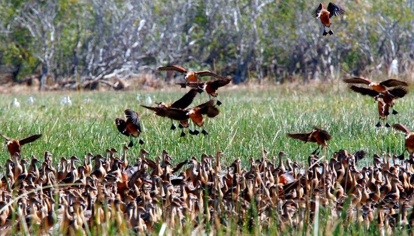
Plentiful bush foods Know more about our wildlife today32 Actions (Wildlife) 1. Habitat specific biodiversity surveys, i.e. for sandstone areas and islands 2. Targeted surveys for threatened species or other wildlife of conservation concern 3. Biodiversity monitoring at key locations, (i.e. wetlands, savanna and woodland sites) to monitor outcomes of prescribed burning 4. Monitoring the health of bush foods and medicines (diversity and density) in key locations 5. Opportunistic monitoring of traditionally hunted species such as turtle, kangaroo, emu, and bustard using Cybertracker or similar technology 6. Active information program for land owners and other community members including regular talks, posters or booklets on key land and sea management issues Rich coastal wetlands of the SE Arnhem Land support huge numbers of waterbirds and aquatic life. Traditionally the most productive ecosystem in the region, these floodplains are now degraded as a result of high numbers of feral buffalo, pigs and cane toads.
You can also read