Submission to the Draft NSW Future Transport Strategy 2056 - 1 December 2017
←
→
Page content transcription
If your browser does not render page correctly, please read the page content below
Submission to the
Draft NSW Future Transport Strategy
              2056

              1 December 2017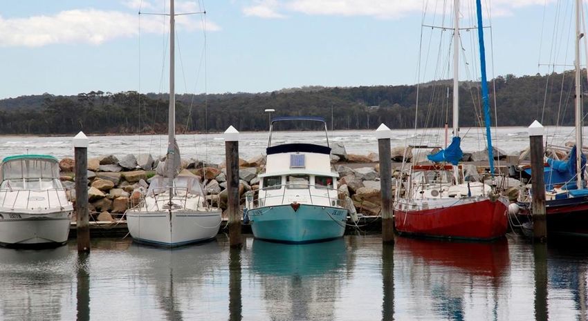
Contents
Executive Summary ........................................................................................................................................... 4
       Connecting Rural and Regional Customers ............................................................................................... 5
       Implementing Clever Vehicles and Smart Systems ................................................................................... 6
       Transport Infrastructure for Place Making ................................................................................................ 7
       Future Customer Service: government, business and community ........................................................... 8
A. Future Transport for Advancing Eurobodalla ................................................................................................ 9
B. Connecting Rural and Regional Customers ................................................................................................. 10
   Kings Highway.............................................................................................................................................. 11
   Kings and Princes Highway 26m B-double access ....................................................................................... 12
   Princes Highway .......................................................................................................................................... 13
       Princes Highway – National Highway ...................................................................................................... 13
       Princes Highway and Glenella Road (South Batemans Bay Link Road) ................................................... 13
       Batemans Bay Bridge ............................................................................................................................... 14
       Narooma Bridge Replacement ................................................................................................................ 15
       Princes Highway – Other Priorities .......................................................................................................... 16
       Princes Highway – Future By-passes ....................................................................................................... 16
       Princes Highway – Long Term.................................................................................................................. 17
   Principles for Freight Transport Infrastructure Planning............................................................................. 18
   Moruya Airport Development ..................................................................................................................... 19
   Marine Infrastructure .................................................................................................................................. 20
       Batemans Bay Marina.............................................................................................................................. 20
       Clyde River Wharf .................................................................................................................................... 21
       Waterway Dredging ................................................................................................................................. 21
       Eden Port ................................................................................................................................................. 22
C. Implementing Clever Vehicles and Smart Systems ..................................................................................... 23
D. Transport Infrastructure for Place Making ................................................................................................. 24
   Local road priorities ..................................................................................................................................... 25
       Beach Road .............................................................................................................................................. 25
       George Bass Drive.................................................................................................................................... 26
   Pathways ..................................................................................................................................................... 27
       Eurobodalla Pathways Strategy ............................................................................................................... 27
       Active Walking Program .......................................................................................................................... 29
                                                                                     Page 2 of 29 Eurobodalla Shire Council Submission to the
                                                                                                                    Future Transport Strategy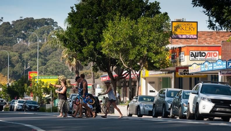
Subsidised Community and Public Bus Transport ....................................................................................... 29
E. Future Customer Service: government, business and community. ............................................................ 29
  Telecommunications ................................................................................................................................... 29

                                                                               Page 3 of 29 Eurobodalla Shire Council Submission to the
                                                                                                              Future Transport Strategy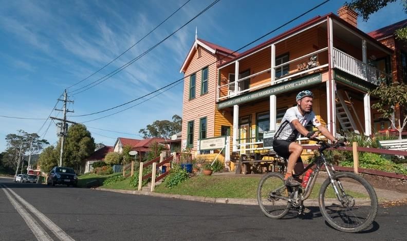
Executive Summary
The NSW Government has developed a Future Transport Strategy with the following components:

i)      draft Future Transport Strategy 2056
ii)     draft Regional NSW – Services and Infrastructure Plan
iii)    draft Road Safety Plan 2021
iv)     draft Tourism and Transport Plan – Supporting the Visitor Economy October 2017.

This document serves as the submission from Eurobodalla Shire Council to these draft plans noting that
Council has already made a separate submission to the Draft Road Safety Plan 2021 during the exhibition
period which can be found at the following link:

http://www.esc.nsw.gov.au/inside-council/project-and-exhibitions/advocacy/infrastructure-
priorities/Submission-to-Draft-NSW-Road-Safety-Plan-2021.pdf

Council’s submission to the draft Road Safety Plan 2021 highlights the fundamental need for the NSW
Government to better recognise the role Councils play in looking after 90% of the road network in New
South Wales and the need to implement a new NSW Government funding program to provide for
improved active transport for pedestrians. A specific funding program is required to provide for
pedestrian facilities, specifically footpaths. This funding program should be in addition to the existing
Active Transport Program which only addresses shared pedestrian/cycling pathways as compliant shared
pathways cannot reasonably be provided in many brownfield situations.

Eurobodalla is highly dependent on road, bus and air transport with no rail service south of Bomaderry.
Our gross domestic product is estimated at $1.3B per annum with $408M related to the visitor economy.
The vast majority of our visitors arrive via road, with the Kings and Princes Highways providing the critical
links to our region. Investment in transport infrastructure is essential to enable ongoing safe and effective
connectivity of the Far South Coast region with the rest of the State and the ACT.

The recognition of Canberra as a global city and the fundamental role Canberra international airport in
the draft transport plans is a welcome fundamental shift in the transport and economic planning for New
South Wales. The NSW Government and Transport for NSW are to be commended for this strategic and
common sense decision.

The proposed ‘hub and spoke’ model is to be commended as is the strong recognition throughout the
documents that the NSW Government must shift focus to provide vastly improved east-west linkages,
specifically upgrading of the Kings Highway.

Eurobodalla Shire Council has worked with the South East Australian Transport Strategy Inc. (SEATS) to
identify key infrastructure projects which when implemented, will have a marked impact on meeting the
current and future transport needs of Eurobodalla and our region, supporting an improved quality of life for
our residents and visitors. This will also help meet growing international trade, investment and tourism
markets that support current domestic and interstate activities.

This document contains recommended transport infrastructure priorities for our region. These priorities
cover both NSW Government infrastructure and key Eurobodalla specific projects where Government
support will be required to deliver economic, safety and social outcomes.

                                                         Page 4 of 29 Eurobodalla Shire Council Submission to the
                                                                                        Future Transport Strategy
The areas covered by the submission include:
Road transport (Kings and Princes Highways)
Moruya Regional Airport
Marine infrastructure
Key local road projects
Pathways
Bus transport.
We seek your support for funding the projects outlined herein on behalf of Eurobodalla residents and
business community to realise the NSW Government’s objective to drive the regional economy and
improve the social outcomes.
Connecting Rural and Regional Customers
Canberra is recognised as a global city with a high growth rate and is expected to grow by about half to
500,000 people by 2030.
Canberra is our key regional influence with growth in the city expected to drive unprecedented increases in
our visitor market and on our highways.
Canberra International Airport also provides significant opportunities to increase freight options, as well as
freighting high value regional products internationally. Passenger movements at Canberra airport are
expected to more than double by 2028-29 to almost 7,400,000, with international tourism and visitation
predicted to grow from zero in 2012-13 to over 800,000 in the same period. International destinations
already includes Singapore and New Zealand, with direct flights to the middle-east and 23 European cities
in February 2018.
Eurobodalla is the closest coastal centre to Canberra by a substantial distance and is working with Canberra
airport to secure international visitors who will travel to the Eurobodalla coast via the Kings Highway.
International visitors injected more than $500m into the ACT economy during 2016-17 alone.
Goulburn also provides a logistic hub for our region with significant transport coming from either Goulburn
or western Sydney via the Hume Highway and Kings Highway to the Eurobodalla coast. The large growth
proposed in south-western Sydney will inevitably increase activity within the Hume Highway corridor.
These factors will drive unprecedented growth in traffic on the Kings and Princes Highways in the short to
medium term and increase the challenges in delivering road transport outcomes. The Kings and Princes
Highways must be brought up to a level to meet these growing needs.
Ensuring the right solutions are developed for future of the Kings Highway requires the allocation of
funding to undertake more detailed planning inclusive of preliminary design work, particularly to resolve
challenges:
i) east of Braidwood to Batemans Bay
ii) to extend 26m HML B-double access to Eurobodalla
iii) and for the future by-passes of Bungendore and Braidwood
There are substantial costs that can be avoided and significant efficiencies that can be achieved by looking
at combinations of projects rather than single projects, due to the terrain. Additionally, with a clear overall
plan, all works undertaken by the Roads and Maritime Services’ assets group can be designed to better
work toward the final road alignment. This common sense approach requires a modest allocation of
specific funding for this preliminary design work and corridor acquisition.
Page 5 of 29 Eurobodalla Shire Council Submission to the
Future Transport Strategy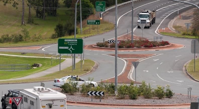
The standard approach of relying on a Corridor Strategy will not be sufficient for the section east of
Braidwood. Transport for NSW should recognise the nuance and avoid a ‘one size fits all’ approach on the
Kings Highway.

Eurobodalla Council seeks a progressive upgrading plan for the Kings Highway to be funded and rolled out
over the next five years to deliver meaningful upgrades that will deliver the future highway our region
needs.

In terms of effective freight transport, Eurobodalla is currently a ‘black hole’ in relation to the efficient
supply of goods and services due to the lack of higher productivity access to the region. This is a significant
disincentive to economic development within the region. Both the Kings Highway and the Princes
Highway should be upgraded to provide 26m HML B-double access. Upon completion of the Nelligen and
Batemans Bay bridges, there will be few remaining impediments to B-double access to the Eurobodalla
coast. Appropriate coupling/decoupling stations should be developed now to permit access from the
highway into urban, commercial and light industrial precincts.

For future air transport, the further development of the Moruya Airport has the potential to unlock
significant tourism, economic and employment opportunities. Council has developed an airport Master
Plan for Moruya airport and acknowledges the support of the NSW and Australian Governments in funding
stages one and three of the eight stage Master Plan. We urge the NSW Government to prioritise further
funding to support the completion of the Moruya Airport masterplan development. The web-site link to
the masterplan is http://www.esc.nsw.gov.au/inside-council/project-and-exhibitions/major-projects-and-
works/moruya-airport

The marine transport market is becoming an emerging market for the Eurobodalla economy. Eurobodalla
is already experiencing significant growth in tourism via ocean going marine vessels now coming into
Batemans Bay. With the establishment of Eden as a deep water port and cruise ship destination, there is
significant potential to grow our economy through appropriate marine infrastructure including the
development of Batemans Bay Marina and potentially a deep water marina off Batemans Bay. Effective
marine infrastructure must also be supported by ongoing maintenance dredging to ensure access via our
waterways.

Implementing Clever Vehicles and Smart Systems
Eurobodalla Shire Council is proposing that the Roads and Maritime Services integrates Smart City
technology into the proposed replacement of Batemans Bay bridge as the first initiative to make
Batemans Bay a pilot regional smart city.

Rapidly changing technology has many potential impacts on transport services and early investment in
supporting infrastructure is essential. This will need to support our visitor-based economy, with
infrastructure such as rapid charging stations strategically placed along the highway and in major towns, as
well as future transport requirements for freight.

Longer term possibilities for connected and automated vehicles for freight mean it is essential that the
Kings and Princes Highway upgrades provide the required service levels for future smart infrastructure
development. This will be critical to ensure continuity of transport of affordable commodities to the
region.

We also encourage the NSW Government to provide incentives to private enterprise to accelerate the
development of smart technology and supporting infrastructure.

We encourage the NSW Government to work with the Australian Government to develop a new funding
model for the provision of road funding as the fuel excise becomes a less viable funding source as the
market moves away from fossil fuels over time.
                                                          Page 6 of 29 Eurobodalla Shire Council Submission to the
                                                                                         Future Transport Strategy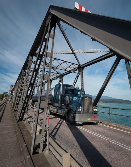
Transport Infrastructure for Place Making
Well-integrated transport and land use planning can improve safety, reduce congestion and help make our
communities better places to live.

The sustainability of local and regional road infrastructure remains a significant challenge across NSW
regional areas. The NSW Roads Congress Communique provides a blueprint for the NSW and Australian
Governments as to the actions required to better address this issue and should be considered in the Future
Transport Strategy. This will be vital from a road safety, economic development and social equity
perspective.

Transport for NSW has provided IPWEA NSW with funding to train road safety auditors in every Council by
the end of 2018-19. This universal training program is well ahead of schedule and will lead to the
development of formal road safety plans for every Council to deliberately focus on achieving the targets in
the NSW Road Safety Strategy of a 30% reduction in road accidents compared to the 2011 level and work
‘Towards Zero’.

The provision of formal off-road pathways is a key local transport option for community access within
and between villages. Eurobodalla Shire Council has developed a holistic pathways strategy covering both
footpaths and shared pathways across the entire Shire. This strategy includes $11.7m worth of works with
Council able to allocate $3.5m over the next ten years. Planned pathways are prioritised to best provide
connectivity between existing links to facilitate extensive safe, off-road transport options. Our strategy also
integrates with existing public bus transport to encourage greater utilisation of this mode to reduce use of
cars for short trips to our commercial and recreational precincts. NSW Government support to facilitate
the progression of these pathways is a wise investment in a safer and environmentally sustainable future
transport.

With pedestrians now representing 18% of all fatalities in NSW, we strongly urge the NSW Government to
introduce a new Active Walking Program to provide for pedestrian pathways, including appropriate
pedestrian crossing facilities. With only 23% of our urban road network having a pathway, a trend of
increasing pedestrian related injuries, an ageing population and limited public transport, retro-fitting
pedestrian pathways into our existing urban areas is essential to facilitate a connected and healthy
community.

We recommend that the NSW Government provide $50m per annum for this new Active Walking
Program to supplement the existing Active Transport Program.

To ensure community connectivity, we also need investment in subsidised, flexible and convenient bus
and community transport. With a higher than NSW regional average of population aged over 60, as well as
high numbers of unemployed youth and socially disadvantaged community members, this is becoming a
rapidly emerging future transport need. We believe the NSW Government can achieve significant
improvements by focussing on provision of subsidised bus transport especially between the main town
centres of Narooma, Moruya and Batemans Bay. We commend the proposed initiatives within the
transport plans to cap the cost of public transport in regional areas.

There are over 83,000km of unsealed roads across NSW. Many of these provide basic access that address
social equity and connectivity for rural communities. These roads often provide the only means of getting
agricultural product to domestic and international markets. Many rural Councils have insufficient income
from rates and rely heavily on the Federal Assistance Grants Scheme to sustain their communities. This
however is insufficient to deliver the required outcomes given the very long lengths of roads and the low
population density. Yet it is these same areas that provide the food for our city populations and export
product internationally.

                                                         Page 7 of 29 Eurobodalla Shire Council Submission to the
                                                                                        Future Transport Strategy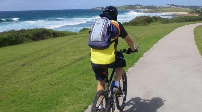
The NSW Government must work with the Australian Government to review the current distribution of
Federal Assistance Grants with a view to re-distributing further funds from the high density city areas to
low density regional areas where long lengths of road asset make delivering basic social equity more
challenging.

The current distribution of the FAGS – Roads Component is heavily biased to the city Councils resulting in a
far greater allocation per kilometre of road in the city compared to regional communities (as shown below).
This is despite the greater capacity of the city Councils to fund roads.

        Average Sydney Council - $2,817 per kilometre (Sydney City $4,020 per kilometre)

        Average regional NSW Council - $1254 per kilometre

        17 regional Councils < $1000 per kilometre

The NSW Government also has the ability to modify the current rating system for Councils in New South
Wales to allow Councils to rates to take account of the height of building instead of land value only. This
would allow city and urban Councils to achieve a reasonable rating income based on the number of
dwellings, rather than only the individual blocks of land. This would offer greater incentive to Councils to
plan for appropriately located medium to high density development along connected transport corridors
and allow Councils to achieve a reasonable income to permit delivery of integrated transport solutions.

Future Customer Service: government, business and community
We applaud the NSW Government for recognising the key role that transport infrastructure provision plays
in stimulating and sustaining the NSW economy, providing social wellbeing and equity for regional NSW.
We encourage the NSW Government to continue with a more proactive approach to planning transport
infrastructure and services and embed this culture within the responsible Government agencies.

There are significant opportunities to avoid unnecessary cost and social impacts through improved corridor
and specific route planning, such as that outlined for the Kings Highway above.

To provide the basis for future transport across all levels, telecommunications infrastructure must also be
developed to provide comparable levels of service to urban (city) levels. The Australian Government has
committed to provide four new mobile telephone towers along the Princes Highway and Kings Highway
routes within Eurobodalla. We encourage the NSW Government to advocate for the early completion of
the vital projects.

                        The changing mix of road users brings both benefits and challenges
                                                           Page 8 of 29 Eurobodalla Shire Council Submission to the
                                                                                          Future Transport Strategy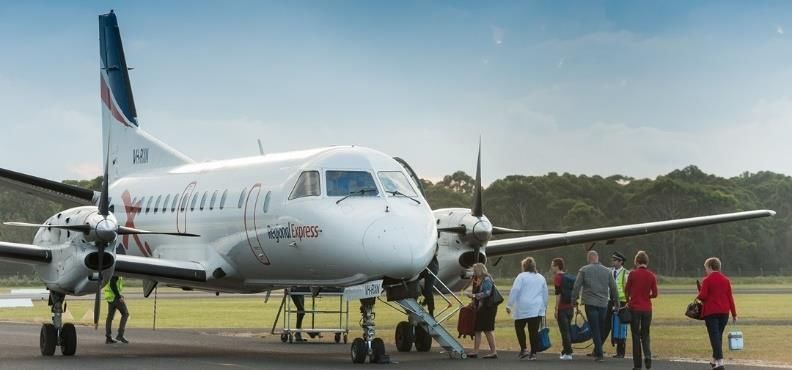
A. Future Transport for Advancing Eurobodalla
Eurobodalla Shire includes the main towns of Batemans Bay, Moruya and Narooma, with numerous
additional small villages nestled along the 110km coastline. The residential population of 37,000
understates the typical population within Eurobodalla which further detailed analysis shows to be 50,000
on any given day due to visitors and tourists. This population swells to over 140,000 in summer months as
Eurobodalla provides a recreational retreat for many, particularly coming from Canberra, Sydney and
western areas of NSW.

The Eurobodalla economy, originally built on dairying, forestry and fishing, is now more diverse and is
based around tourism, retail, health services, property services and a wide range of agricultural activities.
Our community is highly dependent on road, bus and air transport with no rail service south of Bomaderry.

Our gross domestic product is estimated at $1.3B per annum with $408M related to the visitor economy.
The vast majority of our visitors arrive via road, with the Kings and Princes Highways providing the critical
links to our region.

In 2015, 1.26 million visitors came to the region. Tourism is a key driver for our future transport
considerations with recent changes to Canberra international airport, the development of Moruya Regional
Airport and Batemans Bay Marina all likely to have significant influence on changing transport demands and
modes.

Planning for economic growth in Eurobodalla over the next 40 years will focus on strengthening the
qualities that attract people to live, visit, invest and work in the area. High quality tourism and recreation
opportunities, aquaculture exports (domestic and international), specialist manufacturing and agriculture,
food and rural tourism, and heritage, cultural and natural experiences all provide drivers of offer growth.
Building the transport infrastructure to support this will be essential.

The internet and telecommunications technologies, particularly reliable and fast broadband, are critically
important in laying the foundations for a more diverse economy for Eurobodalla, for two key reasons.
Firstly, to assist in leveraging existing sectors and businesses such as a tourism and its marketing and
systems. Secondly, as a foundation for future development in such areas as transport, business and
professional services. The current roll-out of the NBN will enhance the numbers of people currently
working from Eurobodalla across Australia and internationally.

Eurobodalla Shire Council has a continued to focus on identifying, planning and advocating for key
infrastructure improvements and major developments that enhance liveability in the region and can be a
catalyst for economic growth.

In planning for and facilitating economic growth, we need to ensure the right kind of growth and
development for Eurobodalla that reinforces and supports our values and capitalises on our strengths and
advantages. We recognise and appreciate NSW Government investment in many projects and works
throughout Eurobodalla, including Princes and Kings Highway upgrades, road safety programs and
investment in the new south Batemans Bay link road and now seek the support of the NSW Government to
ensure that we can provide the transport infrastructure to make future plans a reality.

The roads owned and maintained by National Parks and Forest NSW play a significant role in our tourism
and visitor markets, as well as in managing fire and other emergencies. The NSW Government should
ensure these roads are well maintained. The NSW Government should also explore private investment in
tourism facilities and infrastructure within our Forests and National Parks to help deliver nature based
experiences and derive additional income to help care for our forests and parks.

                                                          Page 9 of 29 Eurobodalla Shire Council Submission to the
                                                                                         Future Transport Strategy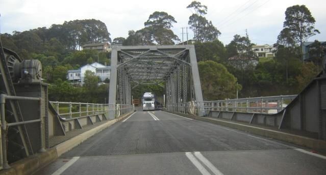
B. Connecting Rural and Regional Customers
Eurobodalla needs to ensure safe and effective connectivity to our region for visitors and freight transport
now and in the future. Service levels are insufficient for current requirements and anticipated growth will
place further pressure on our regional transport infrastructure.

Canberra is a key regional influence, with the population expected to grow from 350,000 to 500,000 in the
medium term. This will drive growth in our visitor market and in the volumes and mix of traffic on our
highways.

Additionally, in the short to medium term, Canberra International Airport will drive unprecedented growth
in traffic on the Kings Highway, and, once at Batemans Bay, the Princes Highway. This will increase the
challenges in delivering road outcomes, particularly with increased numbers of visitors and international
drivers unfamiliar with Australian road rules or driving conditions. In addition to ongoing increases in
freight requirements, Canberra International Airport will also provide significant opportunity to export
regional high value product internationally. The Kings and Princes Highways must be brought up to a level
to meet these growing needs.

The NSW Government is progressing major upgrade works to sections of the Princes Highway and Kings
Highway.

The RMS has developed a Princes Highway Corridor Strategy, published in August 2016. This strategy that
outlines priorities for the upgrade of the highway over the next twenty years from Yallah in the North to
the Victorian boarder in the South. Approximately 115 kilometres of the Princes Highway passes through
the Eurobodalla. This is about one quarter of the length of the highway covered within the Corridor
Strategy and a key priority for our region.

To secure the economic and social prosperity of our community in the short and long term, further
upgrades and excellent long term infrastructure planning for these highways, backed by the necessary
Government funding, is essential.

  Princes Highway/Kings Highway intersection constrains traffic moving from the west into Batemans Bay with long
                                    queues during shoulder and peak periods

                                                          Page 10 of 29 Eurobodalla Shire Council Submission to the
                                                                                          Future Transport Strategy
Kings Highway
The Kings Highway is the lifeblood of Eurobodalla Shire. It provides the key east-west link to/from our
region to Canberra, Queanbeyan, Goulburn and the Hume Highway to Sydney as well as other interstate
and regional linkages.
The Kings Highway provides a primary transport for the Eurobodalla coast to Sydney via Goulburn and the
Hume Highway. This already popular route is becoming increasingly important due to the many constraints
along the Princes Highway and the provision of major transport links and facilities in western Sydney. The
importance of the Kings Highway to Goulburn route will increase further with the Badgerys Creek airport
development, the growth predicted in western Sydney, and the industrial park/logistics hub in Goulburn.
With no rail service and only limited air transport, the wellbeing and transport needs of our community
depend on the Kings Highway. It is strategically a very important piece of infrastructure to the
Eurobodalla’s economy and for employment growth in the south coast region.
Ensuring the future of the Kings Highway requires the immediate allocation of funding to undertake more
detailed planning inclusive of preliminary design work, particularly east of Braidwood and for the provision
of by-passes of Bungendore and Braidwood. There are substantial costs that can be avoided and significant
efficiencies that can be achieved by looking at combinations of projects rather than single projects, due to
the terrain. The standard approach of relying on a Corridor Strategy will not be sufficient for the section
east of Braidwood.
The Kings Highway is vital to our economic and social wellbeing, yet it has an appalling road safety record
(much higher accident rates than the Princes Highway). The highway is not available to higher productivity
vehicles despite transport operators wishing to utilise it for this purpose (eg from Goulburn logistics centre
to the coast).
A clear strategy with adequate funding is needed to address the existing shortcomings on the Kings
Highway and provide for future growth. We urge the NSW Government to provide a rolling funding
program of a further $1M per annum from 2017-18 for the next four years to provide the necessary
planning, design and pre-planning activities (eg land acquisition, environmental reviews) to establish the
required road corridor for future works on the Kings Highway corridor.
It is essential that the road corridor is established now to avoid unnecessary costs which will otherwise
arise due to current conflict between proposed subdivision and development of rural lands along the Kings
Highway, particularly between Nelligen and the Western Distributor. There are also opportunities to
integrate projects to significantly reduce capital costs, and work with Forestry NSW to optimise outcomes.
Innovative arrangements are possible to maximise the outcomes for our community. An example of this
is the potential to extract granite rock to provide a new road alignment for the Kings Highway (from west
of Black Flat) for use in the proposed rock protection works at Casey’s Beach in Batemans Bay
Priorities include further reconstruction and realignment of sections of the Kings Highway between
Batemans Bay and west of Northangera Bridge (east of Braidwood). The desired outcome is the provision
of consistent lane widths of a minimum 3.5 metres with lane widening on curves for heavy transport
vehicles and sealed shoulders of widths 1.0 to 3.0 metres on both sides. Sufficient overtaking
opportunities are needed to better manage the use of the route by transport vehicles during normal and
peak times. Sub-standard curves need to be realigned to increase safety along this length of highway. In
some cases, the realignment will require the acquisition of land from private land holders as well as from
the Forests NSW and National Park to ensure these outcomes can be achieved.
Page 11 of 29 Eurobodalla Shire Council Submission to the
Future Transport StrategyThe normal traffic analysis for overtaking lanes is applicable to the Kings Highway only on weekdays. Each
Friday evening, Saturday morning and Sunday afternoon sees an extraordinary growth in the hourly traffic
volumes. This is a completely different pattern to the normal diurnal peaks in traffic flow experience in an
urban centre and requires more critical analysis to develop safe outcomes. This nuance in traffic results in
periods of congestion and higher risk to the community and a greater need for overtaking lanes on this
route.
This is exacerbated further during the long weekends and holiday periods leading to lengthy delays in getting
through to Batemans Bay and beyond.
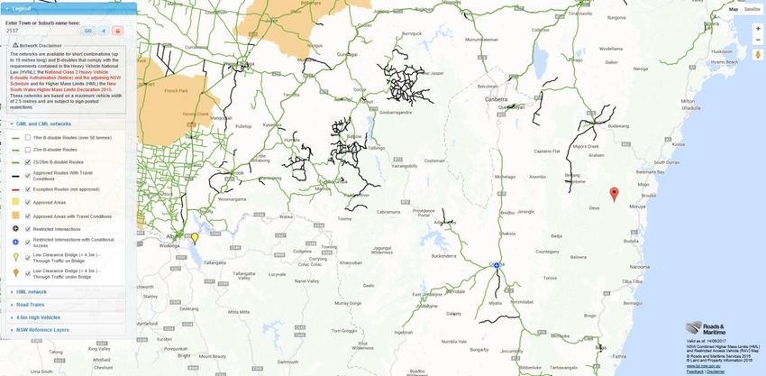
Kings and Princes Highway 26m B-double access
The key priority for bringing Eurobodalla transport infrastructure in line with current needs is ensuring full
B-double access on both the Princes and King Highways. There is currently no 26m B-double access to
Eurobodalla either via either of these routes.
We urge the Future Transport Strategy to prioritise the necessary works to:
extend the currently Gazetted Class 2B-double route south from BTU Road in South Nowra to
Batemans Bay, Moruya, Bodalla, Dalmeny and Narooma commercial and industrial precincts
undertake necessary works from Nowra to Narooma on select bridges, road alignments and overtaking
lanes to accommodate Class 2B-doubles
provide suitable combined truck rest stops and coupling/uncoupling areas at Batemans Bay, Moruya
and Narooma. The RMS should assess the suitability of the truck rest area at Waldrons Swamp at North
Moruya for this purpose
fund the assessment of existing industrial and commercial precincts within Eurobodalla for suitability of
Class 2B-doubles.
Extract from the RMS website showing the lack of efficient 26m B-double transport access to the region
on the Princes and Kings Highways
Page 12 of 29 Eurobodalla Shire Council Submission to the
Future Transport StrategyEurobodalla remains one of the few shires in the NSW without any access for 26m B-double transport
vehicles. This places Eurobodalla in a 'black hole' when potential business investors look to establish
commercial ventures.
It also results in higher than average prices for commodities such as food, fuel and the like, believed to be
some of the highest in coastal NSW. This situation combined with our high aged population means the cost
of these weekly basics are causing unnecessary strain on local families.
There are few impediments to B-double access along the Kings Highway. Goods and exports go to/from the
Eurobodalla coast via this key east-west link (eg from Goulburn logistics centre and Canberra International
Airport) and class 2B-double access already exists on the Kings Highway through to Braidwood.
Extending the B-double access along the Princes Highway will have significant positive regional impacts and
has the support of South East Australian Transport Strategy Inc (SEATS) together with Eurobodalla Shire and
Shoalhaven City Councils. Longer term Class 2B-double access must be extended along the entire length of
the Princes Highway through to Bega and Eden Port.
B-double access should be addressed as a matter of priority to overcome the current adverse impacts on
our economy, business investment, employment, existing business enterprises (eg agriculture) and the
basic cost of living. This is a readily achievable outcome that will boost the regional economy and take
advantage of regional and international trade and tourism opportunities.
Princes Highway
Princes Highway – National Highway
The NSW Government should advocate to the Australian Government to see the Princes Highway
recognised as a highway of national importance from Sydney to Melbourne. This highway services
approximately 10% of Australia’s population and its critical importance to Australia should be recognised,
as has the Pacific Highway.
Princes Highway and Glenella Road (South Batemans Bay Link Road)
It is now a matter of urgency that the NSW Government provide the funding to realignment the Princes
Highway at south Batemans Bay and provide the appropriate intersection treatment to connect to the
South Batemans Bay Link Road.
The Princes Highway between Berrima Parade, Surfside and the South Batemans Bay Link Road is the
busiest section of the highway on far south coast of NSW. The Northern Area of Eurobodalla Traffic Study
recommends four through lanes be provided along this section of the highway along with upgrades to
select intersections.
The section of highway immediately south of Batemans Bay, known locally as the ‘mad mile’, has a
devastating safety record. The RMS has undertaken some interim improvements, including a reduction in
the speed limit and the provision of a central median to reduce the severity of accidents. This however has
not reduced the frequency of accidents and when accidents do occur, it results in closure of the highway
due to the limited working space now available between the central concrete medians and the protective
fencing. There were another two serious crashes in this location in November 2017, bringing the total over
just a few hundred metres of the highway to 10 serious crashes including a fatality.
The South Batemans Bay Link Road comes off the Princes Highway immediately south of Batemans Bay and
will service an estimated $800m worth of development identified between Batehaven and Broulee along
the coastal route of George Bass Drive. This includes employment lands at Surf Beach.
Page 13 of 29 Eurobodalla Shire Council Submission to the
Future Transport StrategyThe Minister for Transport and Infrastructure, and Member for Bega, Hon Andrew Constance MP secured
$10 million from NSW Government for the South Batemans Bay Link Road project. The Minister is actively
pursuing the funding required by the NSW Roads and Maritime Service to complete the works on the
Princes Highway.
This Link Road has now been officially named Glenella Road.
To oversight this project, the NSW Roads and Maritime Services formed an alliance with Council with the
following responsibilities agreed:
i) Council to construct:
a) South Bateman Bay Link Road (Glenella Road) from George Bass Drive to a location
approximately 300m short of the Princes Highway (along the existing route of Ridge Road)
b) Works associated with connecting the Glenella Road to Heron Road urban precinct
c) The intersection between the Glenella Road and George Bass Drive
ii) The RMS to construct:
a) Realignment of the Princes Highway south from Cranbrook Road
b) Construction of the Princes Highway intersection and connecting road to Council’s end point
Council is well advanced with construction and has now sealed South Batemans Bay Link Road past
Heron Road to just short of Ridge Road. Council has placed a locked gate across the western end of the
by-pass road to prevent physical access to the highway until the RMS constructs an appropriate
intersection.
The $10m investment in the by-pass construction will only serve a useful purpose after the final connection
is made with the Princes Highway by the RMS.
The priorities for this section of the Princes Highway include:
upgrading the existing intersection on the Princes Highway with the existing Ridge Road to connect to
the new South Batemans Bay Link Road (Glenella Road).
widening and realigning the Princes Highway from Cranbrook Road to Glenella Road (distance 1.4km).
This length currently has one lane northbound and two lanes southbound on a poor alignment and
poor safety record including a fatality and a series of recent accidents immediately south of Council’s
Batemans Bay Depot entrance. The widening of the highway should allow for two lanes in both
directions plus a channelised right turn treatment at Council’s Batemans Bay Depot.
realignment of the length of Princes Highway from Glenella Road to Deep Creek Dam Road (distance
2km) to address the appalling safety record.
Batemans Bay Bridge
Council is excited at the announcement by the Minister for Transport and Infrastructure Hon. Andrew
Constance MP and Minister for Roads, Freight and Maritime Hon Melinda Pavey MP that the construction
of a new four lane bridge across the Clyde River will be fast tracked to completion.
This is a critical project to removing traffic congestion in Batemans Bay and on the Kings Highway and
Princes Highway. It also removes the disruption risks brought to reality over recent years when the lifting
mechanism has failed to return to road level, with dramatic consequence to our community and the region.
The project will have a marked impact on the urban design of Batemans Bay as the entrance way to the
Eurobodalla. We commend the NSW Government and the RMS for their level of engagement with Council
and there preparedness to engage fully with our community prior to making decisions on the preferred
solution.
Page 14 of 29 Eurobodalla Shire Council Submission to the
Future Transport StrategyCouncil accepts that the old bridge has significant on-going maintenance issues and costs, and that the
existing bridge will be removed as part of the project. This removal also offers significant opportunity to
further enhance the foreshore area of Batemans Bay CBD as part of the bridge project.
Council is working closely with the Roads and Maritime Services who has carriage of this project including
engagement with the community.
Narooma Bridge Replacement
To reinforce the critical nature of these priorities, further detail on the current Narooma Bridge illustrates
the current safety and freight impacts.
The northern approach on the bridge over Wagonga Inlet at Narooma causes trucks and buses to cross the
incorrect side of the road to get onto the bridge. This is unacceptable and poses a safety hazard to the
travelling public, a significant risk to the NSW Government and the Eurobodalla economy.
The bridge structure has already been damaged on a number of occasions after being hit by errant vehicles.
It is a known risk. There is no acceptable alternate route if the bridge structure were to be damaged and
the highway closed to traffic.
Normal semi-trailers regularly crossing the road centre-line to avoid hitting the bridge pylon
In 2016, Eurobodalla Shire Council submitted a proposal to the RMS draft Princes Highway Corridor
Strategy that longer term plans should be developed for this bridge replacement. The Corridor Strategy
correctly identifies the significant risk of catastrophic failure of the bridge due to impact of trucks into the
bridge structure. A short term action to realign the northern approach onto the bridge should be
implemented. The RMS has previously developed concept plans for this work.
The RMS advise that the existing bridge is unsuitable for higher productivity vehicles (or even concessional
mass limit (CML) vehicles), meaning the structure is no longer ‘fit for purpose’ as a highway bridge.
We note that the RMS has previously secured land on the north side of the bridge and prepared designs for
a new northern approach to the bridge, but it is now essential that this priority is acknowledged in the
Page 15 of 29 Eurobodalla Shire Council Submission to the
Future Transport StrategyFuture Transport Strategy to fund a new bridge crossing over Wagonga Inlet and address the poor
intersection at the Princes Highway/Centenary Drive intersection.
Princes Highway – Other Priorities
We congratulate the efforts of the NSW Government to upgrade the Princes Highway to an appropriate
highway standard between Gerrigong and Bomedary. The provision of a four lane highway an appropriate
by-pass at Berry is long overdue.
We also recognise the excellent work recently completed at Termeil and South Durras intersection, and
now underway at Burrill Lake and Digmans Creek.
In the short-medium term the RMS should continue to deliver upgrades to the existing Princes Highway.
The following is a preliminary list of works that should be addressed in the short term.
i) Princes Highway coupling/decoupling area & rest stop north of Batemans Bay
ii) Princes Highway/Old Highway, Batemans Bay – intersection upgrade & traffic lights
iii) Princes Highway, Mogo – pedestrian activated traffic lights
iv) Princes Highway, Mogo – bridge widening and intersection upgrade Tomakin Road
v) Princes Highway/Congo Road – intersection upgrade
vi) Princes Highway/Riverside Drive, Narooma – protected right hand turn intersection upgrade
vii) Princes Highway/Field Street, Narooma –traffic lights with pedestrian facilities
viii) Princes Highway bridge widening at Lemon Tree Creek, Middle Creek, Smarts Creek and Alsopps
(near Brogo Hall)
ix) Princes Highway – Mogo to Cullendulla (north of Batemans Bay) – road realignment with four
through lanes
x) Princes Highway – additional overtaking lane program (Ulladulla to Narooma $50m)
xi) Princes Highway - safety improvement program (Ulladulla to the Victorian border $50m)
xii) Princes Highway – new bridge Brogo River
xiii) Princes Highway – Digmans Creek to Bermagui turnoff – road realignment and widening
xiv) Princes Highway – other works as necessary to secure B-double access to Eurobodalla.
Should Eden be developed as a freight related port, this would require a full review of the requirements for
the Princes Highway between Eden and Batemans Bay. The highway would need to be upgraded to a much
higher standard with all B-double impediments removed.
Princes Highway – Future By-passes
In the medium to long term, by-passes will be required at Milton-Ulladulla, Mogo and Moruya. The RMS
should be funded to complete the necessary corridor assessment, planning and acquisition to secure future
by-pass corridors to ensure appropriate town planning. This should look at appropriate interim solutions so
that the high cost of providing by-pass roads is met when required. This is particularly critical at south east
Moruya which is now under-going urban residential growth which may impede a future by-pass route.
The timing of the by-pass at Mogo is anticipated to be medium to long term and will depend on the short
term solution provided to widen Mogo bridge and provision of a suitable intersection treatment at the
Princes Highway/Tomakin Road intersection.
Narooma already has an internal by-pass corridor reserved. This internal by-pass was previously assessed
by the RMS as offering a high benefit cost ratio due to the significant reduction in travel time and distance
travelled by avoiding the existing windy highway route. Whilst this internal by-pass is not required at this
time, it will require consideration in conjunction with the planning for the new bridge over Wagonga Inlet.
The majority of the internal by-pass route south of the bridge is relatively straight forward and can
Page 16 of 29 Eurobodalla Shire Council Submission to the
Future Transport Strategyintegrated into the urban landscape with ease. However, the section of the internal by-pass nearer Davison
Street is steep and would require careful design to provide a suitable urban design solution.
There is also a road corridor reserved north of the bridge at Narooma. This is far more challenging both
from a physical terrain, construction and environmental perspective. This section of work would not be
required to achieve the southern internal by-pass road, which could be delivered independently of the
northern section.
To this extent, a number of community representatives have suggested the RMS should investigate an
option to the west of Wagonga Inlet. This would be hugely costly exercise and would not be justified for
many decades.
Princes Highway – Long Term
Within the 40 year planning horizon of the NSW Transport Masterplan, it is inevitable that the standard of
highway south of Nowra to the Victorian border will need to move to freeway standard to service the
growth over time. That is, a standard similar to that being constructed now between Gerrigong and Berry
will be required.
For the highway to be effective long term, the RMS must work closely with Councils to provide integrated
transport solutions. The effectiveness of the current Princes Highway to perform as a primary transport
corridor is significantly hampered by strip development along the highway frontage at Albion Park, Nowra,
Wandandian, Milton-Ulladulla and other locations. Similarly, the alignment chosen for some past upgrades
has reflected a desire to provide an access road, rather than a primary transport corridor, as occurred at
Kiama.
Greater priority needs to be given to the long term needs of the Princes Highway to ensure the highway
performs its function as the primary transport route along the coast of NSW south of Sydney.
Page 17 of 29 Eurobodalla Shire Council Submission to the
Future Transport StrategyPrinciples for Freight Transport Infrastructure Planning
Eurobodalla Shire Council is a member of The South East Australian Transport Strategy Inc. (SEATS), which
advocates for transport network improvements in the region of south-eastern NSW, eastern Victoria and
the Australian Capital Territory. To ensure a strategic approach to the ongoing delivery of logistics and
freight, SEATS developed the following principles for the planning of the future freight transport network.
SEATS recommends that all levels of government should consider these principles when planning freight
transport infrastructure and we endorse them (as amended) for incorporation in the Future Transport
Strategy.
1. Promote economic and employment opportunities through a regionally based approach to transport
needs.
2. Integrate freight network plans and land use planning.
3. Maintain and improve existing and future business productivity, efficiency and viability in the safest
way possible.
4. Strategic planning is network based which then informs freight corridors, with detailed preliminary
design work on specific routes where required (such as the Braidwood to Batemans Bay section of the
Kings Highway) and priority infrastructure projects.
5. The transport strategy integrates all transport modes – rail, road, seaports and airports; including
suitable intermodal facilities, and caters for the need of pedestrians and cyclists.
6. Strategic priorities are based on area wide needs, and economic outcomes, and taking into take
account of social equity to deliver minimum service obligations and road safety outcomes across all
of NSW.
7. Freight network planning recognises environmental and climate change impacts.
8. Planning for freight infrastructure is carried out on a short, medium and long term basis as required by
economic, industry and community drivers.
9. Longer term plans of overall transport requirements must result in setting aside suitable transport
corridors at the earliest possible time. This is exactly the case for the section of the Kings Highway
between Braidwood and Batemans Bay.
10. Network strategic planning recognises Federal, State, local and industry policies and strategies.
11. Network strategic planning recognises cross border issues and influences from outside of the SEATS
region that impact on the region.
12. General, local and tourism traffic, together with behavioural issues, are considered in freight planning
in order to provide a safe outcome for all users including pedestrians and cyclists.
Page 18 of 29 Eurobodalla Shire Council Submission to the
Future Transport StrategyMoruya Airport Development
The Moruya Regional Airport is a priority for Eurobodalla’s future transport needs and ongoing investment
into will enable transport connectivity across regions and borders and facilitate related economic
development.
Moruya Airport is a key regional access point and seen as a driver for economic growth and tourism. It
provides an important transport option for business, tourism, private air travel, government, medical and
emergency and other services.
Eurobodalla Shire Council has adopted a Master Plan for redevelopment of Moruya Airport. The Master
Plan identifies the strategic direction for this critical transport infrastructure and potential aerodrome
redevelopment opportunities. The potential redevelopment opportunities include:
Provision for new commercial aviation businesses
Storage for private aircrafts
Aviation-related tourism development
A new aquaculture hatchery (for oysters and other aquaculture activities)
Development of a residential airpark
Eco-tourist accommodation and/or facilities
Tourism support businesses.
A business case based on the Master Plan identified that if all phases of the Master Plan are implemented,
there would be a positive net present value to Council of $9.3M, and approximately 256 full time jobs
would be created generating $42M to the regional economy.
To 2016, Council has been successful in attracting $7.1M from the NSW ($4.5M) and Australian ($2.6M)
Governments, to which Council will add $2.5M to commence redevelopment activities. These will include
runway upgrades, terminal improvements, improved passenger and aircraft parking facilities and general
aviation hangars. The terminal upgrade is now complete and other works are scheduled for
commencement in 2017-18 subject to finalisation of approvals.
This development will also increase the availability of commercial space for airport-related activities and
provide the necessary power, water and sewer infrastructure to open up a tourism accommodation
precinct. This, however, is only the start of the required development, funding stages one and three of the
eight stage Master Plan, for this essential transport infrastructure to enable it to grow and service the
region for the next 40 years.
Continued investment into the Moruya Regional Airport is essential for Eurobodalla’s future transport needs.
Page 19 of 29 Eurobodalla Shire Council Submission to the
Future Transport StrategyMarine Infrastructure
An emerging market for the Eurobodalla economy is the marine transport market and investment in this
area of future transport should be planned for in the short term to ensure the area is well-positioned for
future growth. Eurobodalla is already experiencing significant growth in tourism via ocean going marine
vessels now coming into Batemans Bay. With the growth of Eden as a deep water port, there is significant
potential to expand our economy through supportive marine infrastructure and to build on the cruise ship
market.
Batemans Bay remains the only coastal destination within the required distance of the global city of
Canberra for cruise ships to be able to deliver a practical tourism destination and experience.
Batemans Bay Marina
The Economic Development and Employment Lands Strategy (ESC 2011) identified the Batemans Bay
Marina as a critical piece of marine infrastructure for the Eurobodalla region, being the only significant
marina along the Eurobodalla coast. There is both the demand and the potential for an expansion of the
marina to increase the number of berths and improve the supporting infrastructure and activities, including
marine service industries, commercial activities and tourist facilities.
The Batemans Bay Marina is advancing to become a productive and active development. This includes
foreshore restaurants, oyster bar, businesses and office space. Continuing marina development will provide
a trigger for confident investment in other development activities within Eurobodalla and region.
Incentives should be provided to aid in the development of the Batemans Bay Marina for the broader
economic and employment benefits of the region.
The NSW Government should give consideration to low interest finance arrangements to an accelerated
delivery program, subject to agreement by the Marina lessee. This could be achieved through renegotiated
lease arrangements.
The NSW Government has already invested in collaboration with the Marina leasee to deepen the Clyde
River sand bar. This is already showing direct benefit with yachts and cruisers over the 30m length now
accessing Batemans Bay. The NSW Government must continue to monitor appropriate dredging to secure
boating access to the Clyde River.
Properly developed, the Batemans Bay Marina, with certainty of the level of passage across the bar, will
provide boating facilities for the longer term and complement other local boating facilities within the region
to enhance connectivity via our waterways.
We encourage the NSW Government to assess the potential to expand the Batemans Bay Marina lease area
to create additional capacity and land based commercial space on the western side of the marina to
maximise returns to the NSW Government and facilitate tourist related commercial development.
This would further reinforce Batemans Bay as a key tourism boating destination on the NSW coast
integrating perfectly with other coastal destinations including Sydney, Port Kembla, Shellharbour and Eden.
We further encourage the NSW Government to investigate the longer term potential to expand marina
facilities within Batemans Bay through private investment under NSW Government leasehold to activate
Batemans Bay as a regional boating mecca.
Page 20 of 29 Eurobodalla Shire Council Submission to the
Future Transport StrategyYou can also read