TACKLING TRANSPORT - TOWARDS 2020 INTEGRATED TRANSPORT PLAN SUMMARY
←
→
Page content transcription
If your browser does not render page correctly, please read the page content below
Tackling TransporT – Towards 2020
inTegraTed TransporT plan summary
Mayor’s message
                                              Welcome to the Integrated Transport
                                          Plan summary. This plan seeks to provide
                                            strategies and solutions that will allow
                                              our community to get out and about,
                                          access places and services, and maintain
                                                  social connectedness, community
                                                         wellbeing and good health.

                                           In this busy world we all need efficient
                                             and effective ways to get around and
                                            as climate change becomes a reality we must seek to ease the
                                          pressures on our environment by reducing our carbon footprint.

                                             This plan will guide Moonee Valley’s transport use until 2020,
                                           setting the Municipality on course for decreased use of private
                                                  cars and increased participation in sustainable transport
                                                     options such as walking, cycling and public transport.

                                                                                       Cr Paul Giuliano
                                                                      Mayor – Moonee Valley City Council

                                                                              Contents
                                                                                        introduction 2
                                                                                drivers of change 4
                                                                              aims and objectives 5
                                                                                 Transport themes 6
                                                                                                Walking 7
                                                                                                 Cycling 12
                                                                                    Public Transport 16
                                                                                Traffic and Parking 24
                                                                                   Land use and
                                                                             Community Transport 30

iii   Tackling Transport – Towards 2020                                         Integrated Transport Plan Summary   1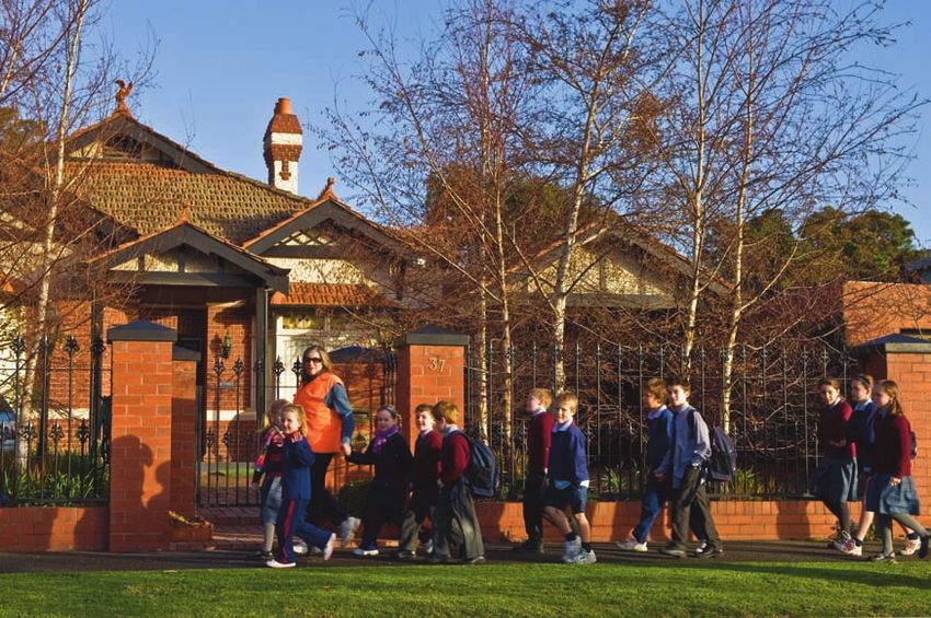
Introduction                                                                                                                                                                      The Integrated Transport Plan
                                                                                                                                                                                             was developed through
                                                                                                                                                                                          a consultation process to
                                                                                                                                                                                   ensure all issues and community
                                                                                                                                                                                          concerns were considered.
    Background
    The Moonee Valley Integrated Transport Plan (ITP) will transform the way people travel
    in and around our City. The plan addresses ways we as a community can provide
                                                                                             Process
    quality transport networks while meeting the future challenges of population growth,     The Integrated Transport Plan was developed            and the External Working Group made up of
    increasing congestion and freight, rising fuel costs, peak oil, climate changes, an      through a consultation process to ensure all           external stakeholders. A range of consultation
                                                                                             issues and community concerns were considered.         programs was undertaken separately with
    ageing population and health issues.                                                     The consultation involved the Moonee Valley            these groups.
                                                                                             community, Councillors, Council staff, VicRoads,
    The Integrated Transport Plan is focused on a 2020 horizon and takes a holistic          the Department of Transport, Yarra Trams, Connex,
                                                                                                                                                    A Steering Committee was also established to
                                                                                                                                                    provide direction in the development of the ITP,
    approach by considering issues and developing a range of initiatives including           bus companies and many more.
                                                                                                                                                    and included senior representatives from VicRoads,
                                                                                             Two separate consultation groups were formed to        the Department of Transport, the Department
    public transport, private vehicles, freight, cycling, walking and travel and transport   provide detailed input into the plan. These included   of Sustainability & Environment and Moonee
    networks and management.                                                                 the Internal Working Group of Council Officers,        Valley City Council.

        The plan addresses ways we
        as a community can provide
        good transport networks while
        meeting the future challenges…

2    Tackling Transport Towards 2020                                                                                                                                                             Integrated Transport Plan Summary   3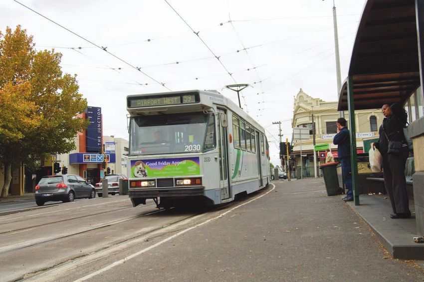
Drivers of change
                                                                                            Freight                                               The main objective of the Integrated Transport Plan is                                                   The plan aims to
                                                                                            The number of freight movements is expected to
                                                                                                                                                  to create choices for movement of people and goods                                                      manage transport
                                                                                            increase. Freight through the Port of Melbourne
                                                                                            is expected to increase 500 per cent by 2020 and      through our City while ensuring these choices provide                                                        and land use
                                                                                            truck traffic is forecast to double over the same
                                                                                                                                                  valuable, sustainable outcomes that contribute to our                                                          up to 2020.
                                                                                            period. As population and travel continues to
                                                                                            grow, the Moonee Valley transport network in its      citizens’ lifestyle.
                                                                                            current state will become increasingly congested.

                                                                                                                                                  The following desired outcomes have guided        • Improve Amenity: Improve the look and feel
                                                                                            Climate change                                        development of the ITP:                             of the City
                                                                                            Climate change has the potential to adversely
                                                                                                                                                  • Travel Demand: Reduce the need to travel,       • Safety: Improve transport safety
                                                                                            affect our environment, communities and
                                                                                                                                                    trip numbers and lengths
                                                                                            economy. In Victoria, transport was the second                                                          • Social Inclusion: Create a more inclusive society
                                                                                            largest contributor to greenhouse gas emissions       • Congestion: Reduce congestion and manage          that can undertake its activities and continually
                                                                                            in 2005, accounting for 16.9 per cent of the            movement of private and heavy vehicles            improve with ease. The ITP can assist by creating
                                                                                            State’s total emissions.                                                                                  an accessible and affordable transport system.
                                                                                                                                                  • Environmental Impact: Reduce
                                                                                            On-road private transport accounts for                  environmental impact through use of more
                                                                                            89 per cent of all transport-related greenhouse         environmentally sustainable transport options
                                                                                            gas emissions, placing increased importance on
                                                                                            cycling, walking and public transport.

On-road private
transport
accounts for
                                For Moonee Valley to remain a popular place to live
                                and work, it is critical that our citizens have access to
                                the transport they need to get around, remain socially
                                connected and live full lives. There are a number of
                                                                                            Peak oil and social
                                                                                            considerations
                                                                                            Peak oil is an issue increasingly in the public eye
                                                                                            and represents a significant challenge. Transport
                                                                                                                                                  Aims and objectives
                                factors affecting future transport needs in Moonee          is critical for social connectedness, community
89% of all                      Valley, and the ITP responds to the following:              wellbeing, maintaining good health, and linking
transport-related                                                                           people to places and services. Oil scarcity could
greenhouse gas                                                                              create barriers, social isolation and severely
                                Population growth                                           restrict the mobility of communities unless a more
emissions…                      Population in Moonee Valley is expected to                  sustainable transport network less dependent on
                                grow by 8.3 per cent over the next 25 years,                fossil fuel is introduced.
                                and neighbouring municipalities such as Hume,
                                Brimbank and Melton are expected to experience
                                even stronger growth. As a gateway between                  Ageing and health
                                Melbourne’s CBD and the metropolitan north and              An ageing population will create new
                                western hinterland, population growth in these              challenges for Moonee Valley, in particular
                                neighbouring municipalities will lead to increased          mobility of residents, and ensuring social
                                travel demand in corridors through Moonee Valley.           inclusion as they become older.
                                Local employment is also expected to rise and               Currently, health trends reveal obesity as
                                impact on local trip patterns, due to the success           a major health problem linked to transport
                                of Moonee Ponds being designated a Principal                choices. The provision of active transport
                                Activity Centre, and the development of Essendon            modes, such as walking, cycling and public
                                Fields, which is expected to create 15,000 new              transport, is key in providing the community
                                jobs. This development will have a significant              with links to sport and recreation activities
                                impact on local trip patterns given the lack of             to improve levels of physical activity.
                                public transport to Essendon Fields.

  4   Tackling Transport – Towards 2020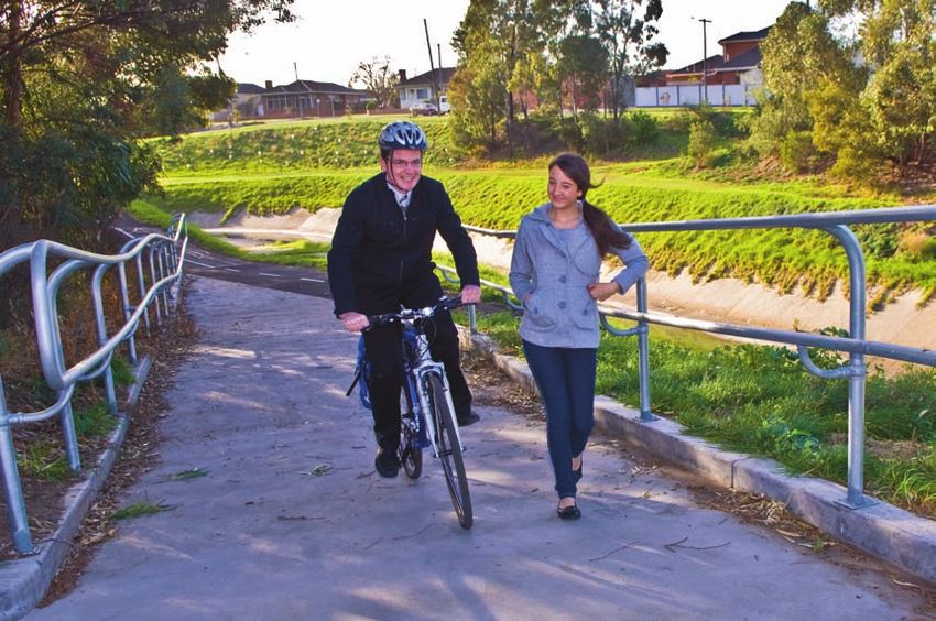
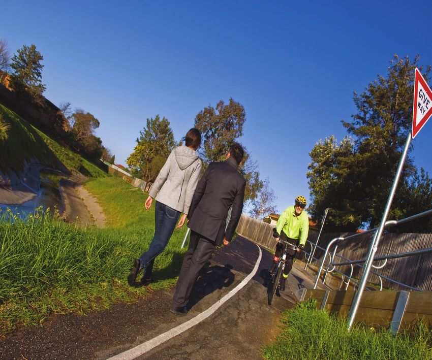
Transport                                                      Walking
                themes
                                                                             The ITP develops key directions and complements the initiatives outlined
                                                                             in the Moonee Valley Cycling and Walking Strategy to strengthen existing
                                                                             programs such as the Walking School Bus. The Cycling and Walking Strategy
                                                                             sets out a comprehensive set of actions to increase cycling and walking in
                                                                             the Municipality. These include network improvements and education and
                                                                             promotional programs to overcome barriers to these modes of transport.

                                                     • Walking               Improve pedestrian connectivity                       sections of the Tullamarine Freeway that lack
                                                                             to neighbouring municipalities                        pedestrian access between Essendon Airport and
                                                                                                                                   the surrounding community. This is a significant
                                                     • Cycling               Walking from Moonee Valley to neighbouring
                                                                                                                                   issue that needs to be addressed as more of
                                                                             municipalities is not easy. Boundaries such as
                                                                                                                                   Essendon Airport is developed.
                                                     • Public Transport      the Maribyrnong River to the east, Moonee
                                                                             Ponds Creek to the south and rail infrastructure      Other new developments include the former
                                                                                                                                   Explosives Factory in Maribyrnong, Melbourne
                    The Integrated Transport Plan    • Traffic and Parking   to the west represent barriers to these
                                                                             neighbouring municipalities.                          Airport development in Tullamarine and Valley
                      has been developed around      • Land Use and          Currently there are areas such as Avondale
                                                                                                                                   Lake in Keilor East. All of these developments
                                                                                                                                   should include new pedestrian access points
                       five transport themes that                            Heights, where there are no pedestrian links into
                                                                                                                                   across waterways, railways and freeways.
                     have stemmed from the wide        Community Transport   neighbouring municipalities. There are also several

                  range of transport issues facing
                                  the community.

6   Tackling Transport Towards 2020
Council will work
with VicRoads
to review
the number
and nature
of crossing
points along
busy roads…
Increase walking trips
to and from schools
The great majority of students in Moonee Valley
are driven to school, contributing significantly to
traffic congestion. Factors contributing to high car
use tend to be related to parents’ concern with the …these developments should
personal safety of young children travelling alone.
include new pedestrian access
Initiatives that educate students and their parents on
alternative transport modes are required so they can
points across waterways,
make sustainable choices as they grow older. railways and freeways.
Policy 2 – Council will require high quality pedestrian links in new developments.
Actions Targets
Policy 1 – New pedestrian links will reflect the density of activity in each area. A8. Seek support from all neighbouring councils for any developments along T7. Developers construct a bridge between Avondale Heights and the defence
municipal boundaries. site in Maribyrnong.
Actions Targets
A9. Include requirements for pedestrian links in conditions of approval/ T8. Developers to build an additional pedestrian link between Airport West
A1. Work with Brimbank City Council and other government agencies to investigate potential T1. Both Councils to agree on a potential support for all new developments. and Essendon Fields near Victory Road (Tram Stop 58).
locations (expected to be near Rhonda Street in Avondale Heights) for a new pedestrian and cycle link pedestrian/cyclist link location and submit for State
across the Maribyrnong River. funding by 2012.
A2. Investigate potential pedestrian and cyclist link along Steele Creek from Roberts Road to the T2. New pedestrian and cyclist link along Steele
Western Ring Road trail. Creek from Roberts Road to the Western Ring Road
trail built by 2012. Policy 3 – Students are encouraged to walk to school.
A3. Review the intersection of Mt Alexander Road and Puckle Street to provide significant
improvements to pedestrian space, as part of Access and Mobility Plan for Moonee Ponds. This should
also include the length of Mt Alexander Road, between Puckle Street and Taylor Street.
T3. Complete Mt Alexander Road-Gladstone Street
Link by 2009.
Actions Targets
A4. Construct a new pedestrian and one way vehicle link connecting Mt Alexander Road and T4. Construct tunnel for pedestrians and cyclists A10. Continue to encourage schools to enrol in the Walking School Bus program. Council will provide T9. By 2020 walking will account for 50% of all trips
Gladstone Street. under Buckley Street by 2009. incentives to schools with the highest participation in the program. to and from schools in Moonee Valley.
A5. Construct a new tunnel under Buckley Street for pedestrians and cyclists. T5. Construct shared path along Buckley Street A11. Continue to audit safe pedestrian routes to and from schools as required. T10. By 2012, 80% of schools will be involved in
by 2008. TravelSmart initiatives.
A6. Construct a new shared path along Buckley Street, between Dickson Street and Milleara Road. A12. Encourage schools to work with DOT to develop Green Travel Plans and get involved in the
T6. Pedestrian mode share for journeys to work TravelSmart education program. T11. By 2012 every school in Moonee Valley will have
A7. Work with Melbourne City Council to identify and promote the most suitable pedestrian links into by Moonee Valley residents working in the CBD at least one safe pedestrian route identified.
Melbourne’s CBD, particularly around the Flemington Road/Mt Alexander Road/Racecourse Road/ A13. Encourage schools to promote and teach traffic safety education within their community.
doubled by 2012. T12. Every local primary school booked-in to use
CityLink/Elliot Avenue intersection. A14. Continue to support Essendon Traffic School and encourage local schools to make use of it. Essendon Traffic School at least once in every year.
8 Tackling Transport – Towards 2020 Integrated Transport Plan Summary 9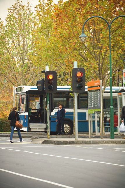
Improve pedestrian links and                                          Residents are also concerned with safety at                                           Pedestrian
                                        safety at activity centres                                            traffic lights, in particular along busy roads.
                                                                                                                                                                                                      safety in
                                                                                                              The number of crossing points and amount of
                                        Pedestrian safety in activity centres is of paramount
                                        importance. Residents are concerned with
                                                                                                              time provided to pedestrians on busy roads such                                          activity
                                                                                                              as Mt Alexander Road can be insufficient. Council
                                        pedestrian connectivity in activity centres, such
                                                                                                              will work with VicRoads to review the number and
                                                                                                                                                                                                  centres is of
                                        as navigation between the Moonee Ponds Rail
                                                                                                              nature of crossing points along busy roads that                                       paramount
                                        Station and Moonee Ponds Junction. Signage at
                                        public transport stations and stops will be improved
                                                                                                              are in Principal and Major Activity Centres such                                     importance.
                                                                                                              as Mt Alexander and Keilor Roads.
                                        to provide better direction to local activities.

      Policy 4 – Pedestrian safety is of paramount importance
       Actions                                                                                               Targets
       A15. Improve way-finding signage in all Principal and Major Activity Centres.                         T13. Way-finding signage installed in Moonee Ponds and
                                                                                                             Airport West Principal Activity Centres by 2009 and all other
       A16. Work with developers to ensure that quality pedestrian links are created in and provide          centres by 2012.
       access to Principal and Major Activity Centres.
                                                                                                             T14. Pedestrian casualty crashes in all Principal and Major
       A17. Work with VicRoads to investigate reducing speed limits (to 40km/h) in areas with                Activity Centres (including along Mt Alexander Road) reduced
       high pedestrian flow.                                                                                 by 20% over the period 2008-2012.
       A18. Work with State Government agencies such as VicRoads and DOT to introduce or                     T15. Increased pedestrian activity across the Municipality and
       upgrade pedestrian refuges, puffin and pelican crossings, and improve pedestrian access               in all Principal and Major Activity Centres over the period
       across major roads.                                                                                   2008–2012.
       A19. Assess priority outcomes from the Keilor Road and Moonee Ponds Walking Audits and                T16. Cost and prioritise pedestrian improvements in all
       opportunities for implementation.                                                                     Priority and Major Activity Centres by 2010.
       A20. Council will investigate the need for collecting data on the number of pedestrians in
       Major Activity Centres.
       A21. Undertake a feasibility study of extending Everage Street into Puckle Street, Moonee Ponds
       to improve overall permeability as part of the Moonee Ponds Activity Centre Structure Plan.
       Any future link must ensure priority is given to pedestrians and cyclists.
       A22. Continue to enforce and monitor Council’s Footpath Activity Policy 2006, and allow safe and
       secure access for all people along and across footpaths.
       A23. Work with VicRoads to ensure a pedestrian only traffic light phase is implemented at every
       controlled intersection near a station when the train is approaching, and explore possibilities for
       similar treatment to tram stops at intersections.
       A24. Monitor shared paths for any conflict between cycling and walking safety (such as on the
       Capital City Trail bridge over Flemington Road) and advocate for improvements.

Signage at public
transport stations and
stops will be improved
to provide better direction
to local activities.

 10   Tackling Transport Towards 2020                                                                                                                                         Integrated Transport Plan Summary   11
Improve cycling safety
                                                                                          There are concerns about cyclist safety,
                                                                                          particularly on busy roads and at roundabouts.
                                                                                          The Cycling and Walking Strategy recommends
                                                                                          that advance stop lines be introduced at
                                                                                          intersections to improve the safety of cyclists by
                                                                                          giving them priority and making their presence
                                                                                          obvious to motorists.
                                                                                          Council’s preferred approach is to line mark
                                                                                          cycle lanes up to and (in some cases) through
                                                                                          roundabouts, where the road surface is wide
                                                                                          enough to cater for both cars and bicycles.
                                                                                          Where a bicycle route traverses many
                                                                                          roundabouts, it may be preferable to select
                                                                                          a new route for cyclists.
                                                                                          VicRoads has designated a Principal Bicycle
                                                                                          Network (PBN) across Melbourne. Council will
                                                                                          continue to work with VicRoads to ensure PBN
                                                                                          links are constructed, particularly in conjunction
                                                                                          with other road works affecting the defined
                                                                                          PBN. Council also believes that existing transport
                                                                                          corridors such as train lines could provide space
                                                                                          for bicycle trails.
                                                                                          Signage on bicycle routes is also an important
                                                                                          element of safety and Council will address this
                                                            Cycling is a low cost         issue by implementing a cyclist signage strategy
                                                                                          to ensure that cyclists are less confused when
                                                            and sustainable form of       navigating around Moonee Valley.
                                                            transport that can help to
                                                            reduce traffic congestion.
                                                                                                                                                                                                               Signage on bicycle routes
                                                                                                                                                                                                                    is also an important
                                                                                                                                                                                                                     element of safety…
     Cycling                                                                              Policy 5 – Safer cycling routes are needed across the City.
     The ITP reinforces the directions set out in the Cycling and Walking Strategy, and    Actions                                                                                         Targets
     highlights the need to implement its recommendations, including promotion of          A25. Work with Council’s Cycling & Walking committee and other State Government                 T17. Complete the bicycle route implementation plan by 2020.
                                                                                           agencies such as VicRoads to continue implementation of Council’s Cycling and Walking
     cycling as a viable mode of transport and a ‘whole of trip’ approach to improving     Plan.                                                                                           T18. Complete the Principal Bicycle Network in Moonee Valley
                                                                                                                                                                                           by 2017.
                                                                                           A26. Review design standards and explore innovative designs to ensure that safe cycle paths
     the cycling experience. The plan also promotes change within the Municipality by      are provided through dangerous intersections such as roundabouts, and along dangerous           T19. Complete the remainder of the bicycle network by 2020.
                                                                                           stretches of roads.                                                                             T20. Update the Moonee Valley Bicycle Map annually.
     reducing physical barriers to cycling, such as the Maribyrnong River, Moonee Ponds    A27. Review existing roundabouts along bike routes to ensure cyclist safety is catered for.     T21. Funding for bicycle facilities will increase each year from
     Creek, CityLink and rail lines.                                                       Where this cannot be achieved alternative routes will be established.
                                                                                           A28. Where possible include cycle lanes and facilities as part of all future road
                                                                                                                                                                                           the 2009 financial year onwards.

                                                                                           improvements.
                                                                                           A29. Increase funding for bicycle facilities within Council’s transport capital works budget.

12   Tackling Transport – Towards 2020                                                                                                                                                                              Integrated Transport Plan Summary         13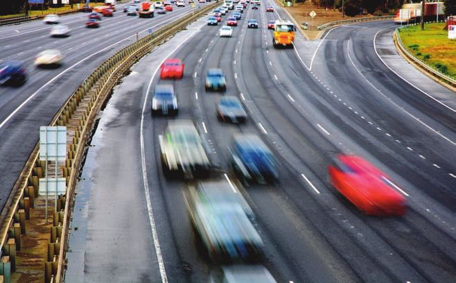
Council will seek to gain
private sector support
for bicycle stations that
will offer a full range of
end-of-trip facilities…
Increase provision of
bicycle facilities
Facilities at the start and end of trips, like There are activity centres with existing
storage and showers, are essential to making development where only limited bicycle facilities
cycling a viable form of transport for commuters. have been provided. In these centres, Council will
End-of-trip facilities need to be provided at provide bicycle racks at the same rate as that
major destinations, offices, shopping centres required in the planning scheme. In Principal
and rail stations. Activity Centres, Council will seek to gain private
sector support for bicycle stations that will offer
These facilities must be provided in all new
a full range of end-of-trip facilities, and may even
developments, and Council will ensure that
incorporate bicycle service and hire.
new developments provide the appropriate
end-of-trip facilities.
Policy 6 – Students are encouraged to cycle to school.
Actions Targets
A30. Liaise with all primary and secondary schools and T22. By 2012 every school in Moonee Valley will have at
encourage them to enrol in Bicycle Victoria’s Ride2School least one safe cyclist route identified.
program and identify safer cycling routes.
T23. By 2017, every school will have bicycle facilities
A31. Place higher priority on developing cyclist infrastructure including showers and changing facilities.
that improves safe cyclist access to schools.
T24. By 2020, 20% of all secondary students will ride to
A32. Advocate to the Department of Education to fund high and from school.
quality bicycle facilities at every school.
Policy 7 - ‘End-of-trip’ bicycle facilities will be provided in all Principal and Major
Activity Centres.
Encourage cycling to school Actions Targets
There has been a dramatic decrease in the number A33. Install designated bicycle parking facilities in every T25. Bike parking facilities at every Principal and Major
of students cycling to school. Childhood obesity, Principal and Major Activity Centre on the basis of 1 bike rack Activity Centre by 2011.
for every 20 car spaces.
diabetes and other health issues have grown
…the Ride2School program will due to decreasing exercise rates among children. A34. Ensure that ‘end-of-trip’ cycle facilities meet the
T26. Every development in Moonee Valley complies with
the Bicycle Facilities provisions of the planning scheme.
get children more physically active Providing safe cycling routes to schools and
requirements of Moonee Valley Planning Scheme.
A35. Advocate to State Government agencies to introduce
T27. Bicycle share scheme to be introduced in Moonee
Valley by 2012.
and improve their confidence, supporting initiatives such as the Ride2School a bicycle share scheme in Moonee Valley.
T28. Moonee Ponds and Airport West will have commercial
program will get children more physically active
independence and attitude and improve their confidence, independence and
A36. Work with bike stores and other commercial operators to
investigate the feasibility of bicycle stations in Moonee Ponds
bike stations (providing storage, sales and service,
changing facilities and bicycle hire) by 2020.
towards cycling later in life. attitude towards cycling later in life. and Airport West.
14 Tackling Transport – Towards 2020 Integrated Transport Plan Summary 15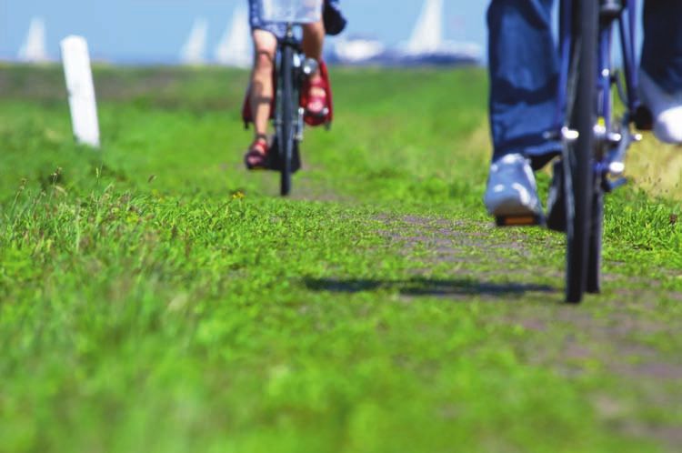
Public Transport Safety and ease of use is also a
core issue for public transport.
Moonee Valley is served by all major public transport networks. The ability of Moonee Valley is home to numerous schools, a heavy burden on logistics and consequently
and by improving access to public transport for the economy overall. There will also be significant
each service to attract patronage relies on geographic coverage, timelines, safety, students outside the Municipality it will reduce growth in travel demand from residential growth
congestion caused by students being driven to on the north-west fringe of Melbourne. This
ease of use, and awareness of the service. and from school. demand will compound existing congestion on
the rail and road networks. To ensure the corridor
Parts of Moonee Valley lack adequate public transport services, such as in new Melbourne’s north-west corridor is the key to
remains sustainable the Airport Rail Link needs
State economic competitiveness; connecting the
development areas like Valley Lake. Other gaps result from inefficient routes Airport with the CBD and Port of Melbourne.
to be constructed between Melbourne CBD and
Melbourne Airport.
through the existing road network. Future congestion in this corridor is likely to place
Equitable transport choices and access must be available to the community as
it is vital that public transport complies with the Disability Discrimination Act. Policy 8 – All residential areas should be within 400 metres of a public transport route.
Safety and ease of use are always core issues in public transport management. Actions Targets
A37. Advocate to State Government agencies for route improvements T29. Council’s comments included in the next Local Area Bus Review (expected
Council’s role includes advocating for improvements to the urban environment to fill coverage gaps in transport poor areas. to be 2009).
and surrounding land use that support public transport. A38. Amend the planning scheme to discourage increased housing
densities in areas not served or poorly serviced by public transport.
T30. Planning Scheme discourages infill residential development in areas poorly
served by public transport by 2011.
A39. Investigate creating new bus-only links to expand the bus network T31. A new bus service in Avondale East will be operational by 2012.
in an efficient manner.
A40. Continue to work with State Government agencies to introduce
a new bus service to Avondale East.
Policy 9 – Bus services should serve the needs of students from the regional catchments.
Actions Targets
Improving geographic coverage A41. Request Route 465 to be extended into Brimbank as part of the next
Local Area Bus Review.
T32. The needs of regional student populations assessed by 2010.
Moonee Valley is served by two train lines,
three tram routes and 29 bus routes. The rail
network is concentrated in the east of the
Municipality making access to the CBD much
slower from areas in the west. Bus routes provide Policy 10 – Tram routes in Melbourne’s west should be extended.
for local transport needs and feeder services to Actions Targets
the rail network.
A42. Advocate for State Government agencies to conduct a feasibility T33. Feasibility of Tram Routes 57 and 59 being extended completed by 2012.
Those parts of Moonee Valley that lack service study of extending Tram Route 57 to Avondale Heights and Route 59 to
Tullamarine. T34. Tram extensions provided for in the new operator franchise agreements.
coverage are relatively small; however, there
A43. Advocate for tram extensions in Melbourne’s west to be included in
are specific new developments that should new operator franchise agreements.
be provided with a higher level of service and
some areas in which route structure should
be improved.
Policy 11 – Council supports the State Government’s Melbourne Airport Rail Link project.
Actions Targets
Access must also A44. Request the State Government to study the feasibility of alternative T35. By 2012 a study into the feasibility of alternative options for the Melbourne
be available to options between Melbourne CBD and Melbourne Airport incorporating
extension of the Flemington Racecourse line, provision of future railway
Airport Rail Link will be complete.
the community stations in Highpoint, East Keilor and Airport West as well as possible
park and ride facilities.
regardless A45. Advocate to the State Government to include a station at East Keilor
of ability… and Airport West when the Melbourne Airport railway line is constructed.
16 Tackling Transport – Towards 2020 Integrated Transport Plan Summary 17Improving service timelines Council believes that public
Timelines of service include service span transport services should
(hours per day and days per week), frequency
and reliability. operate 18 hours every day
All bus and tram routes in Melbourne compete
of the week, with a maximum
with on-road, which results in slower travel headway of 15 minutes at
speeds for buses and trams. Metropolitan buses any time.
have an average speed of 23km/h and trams
16km/h compared to 43km/h for cars.
Bus bays only serve to provide priority to car
drivers and buses have trouble pulling back into
the stream of traffic. It is better to delay a few
cars rather than 60 people on a bus. VicRoads,
with Council’s support, is currently removing bays
from roads with speed limits less than 80km/h.
The location of tram and bus stops is also a
critical factor that affects the speed of services in
Moonee Valley. Council will work with operators
and DOT to review stop locations in order to
minimise vehicle travel times while maintaining Policy 14 The Craigieburn rail line should operate like a world class metro service.
reasonable access for the local community.
Actions Targets
Train services in Moonee Valley operate over
A48. Advocate for the Craigieburn line to be operated like a metro service, T38. Council will write to the Department of Transport before the train
15 hours per day with frequencies of around with no express services and a maximum ten-minute headway between franchise is re-tendered in 2008.
20 minutes outside peak hours (compared to trains at all times.
15 minutes in many other metropolitan areas). A49. Advocate for train services to operate all through Friday and
Council believes that public transport services Saturday nights.
should operate 18 hours every day of the week,
with a maximum headway of 15 minutes at any
time. The Craigieburn line should also operate
like a world-class “metro” line with a maximum Policy 15 – Council supports improving public transport service speed and reliability.
Council believes that all 15-minute frequency between trains at all times
and a regular stopping pattern. Actions Targets
bus and tram routes in
Melbourne need to compete A50. Council will work with State Government agencies to improve
reliability of bus and tram services at intersections.
T39. Strategy for accessible bus and tram stop construction completed
in 2010.
with on-road vehicles. A51. Continue to work with State Government in the construction of
accessible bus and tram stops to improve travel times and access.
Policy 16 – Increase bus and tram priority.
Policy 12 – Public transport services should operate 18 hours every day of the week. Actions Targets
Actions Targets A52. Work with State Government, VicRoads and Yarra Trams to accelerate
“Think Tram” and “SmartBus” works at key locations and ensure a holistic
T40. By 2012, all public transport routes will have priority signals at
complex intersections.
A46. Advocate for a minimum service standard of 18 hours every day of T36. 80% of public transport routes operating 18 hours per day, seven approach is applied.
T41. Congestion choke points requiring bus lanes will be identified by 2010.
the week. days per week by 2012. A53. As a pilot program, Council will work with DOT, VicRoads, Yarra Trams
and Bus Operators to implement morning clearways along Keilor Road,
allowing buses and trams to use the tram tracks.
Policy 13 – Public transport services should operate with a maximum headway of 15 minutes at A54. Council will not allow new indented bus bays except at a bus lay-over
any time. or interchange.
A55. Work with Victoria Police to improve enforcement of tram and bus
Actions Targets priority regulations.
A47. Advocate for a maximum 15 minute headway between public T37. 80% of public transport routes operating with headways of 15 A56. Work with local bus operators to identify congestion “choke points”
transport services on all main roads. minutes or less between services by 2011. and request State Government to introduce bus lanes as part of MOTC.
18 Tackling Transport – Towards 2020 Integrated Transport Plan Summary 19Recent results indicate that, Improving safety Improving ease of public regardless of ability. Council supports the intent
for trains and trams, value Public transport is traditionally perceived as transport use and milestones of the Disability Standards for
Accessible Public Transport.
unsafe. The Department of Transport (DOT) Value for money is an issue for public transport
for money and personal routinely surveys the satisfaction of users with users. Council will set up a MetLink Commuter Most stations in Moonee Valley have park and
safety rank lowest in terms the public transport system in Melbourne. Recent Club to provide cheaper public transport tickets ride facilities so travellers can access rail services
of customer satisfaction. results indicate that, for trains and trams, value
for money and personal safety rank lowest in
for staff, and will allow the cost to be paid by private vehicle and park at no cost. Anecdotal
evidence indicates that car parking supply is not
through salaries over a 12-month period. Council
terms of customer satisfaction. will also investigate expanding its commuter club meeting demand at locations such as Ascot Vale
to all ratepayers, with tickets being paid for at the and Moonee Ponds. However, simply increasing
same time as rate instalments. the supply of park and ride facilities will contribute
to traffic congestion within Moonee Valley due to
Moonee Valley benefits from having a number
an increased number of private vehicles accessing
of public transport interchanges where bus,
rail stations. Council encourages sustainable
rail and tram converge. These interchanges can
transport modes and therefore would like to see
be improved in several ways to ensure a more
more emphasis on local station access using active
seamless connection for passengers.
modes like walking and cycling or by tram and
Policy 17 – People should feel safe using public transport at any time of the day Providing timetable information at stops is bus. Council will advocate for more feeder bus
or week. a cost-effective way of improving the ease and services operating to meet the train timetable and
access to services, therefore timetable and route improved bicycle parking and pedestrian facilities.
Actions Targets information should be provided at every bus, tram
In addition Council will enhance policies in
A57. Real and perceived safety issues at public transport T42. Perceptions of safety on public transport improved over and train stop in Moonee Valley.
the Planning Scheme to enable higher density
nodes will be determined as part of Council’s annual the period
community satisfaction surveys. 2008–2017. Improvements to public transport stations and development around (including above) all
A58. Discuss with stakeholders the possibility of upgrading T43. Reduced reported crime at public transport infrastructure
stops must be accessible to all people, train stations.
the aesthetics and safety of rail stations, trams depots, bus in Moonee Valley over the period 2008–2017.
depots and underpasses so that they integrate with their
surroundings and provide a safe environment. T44. Safety aspects of ten facilities (including Essendon Tram
Depot and five stations) reviewed by 2009.
A59. Continue to inform operators about graffiti and ensure it
is removed in a timely manner. T45. Upgrade the aesthetics and safety around one facility Policy 18 – Council supports incentives for people to use public transport.
each year between
A60. Liaise with the Department of Transport and Connex 2009 and 2017. Actions Targets
to request designation of new premium stations at Moonee
Ponds and Newmarket and host stations at Strathmore and A62. Advocate for a reduction in off-peak public T46. Public transport fares reduced in real terms in
Glenbervie. transport fares. comparison to petrol prices over the period 2008–2012.
A61. Liaise with local police to encourage their presence A63. Investigate introduction of commuter club
around public transport infrastructure at key times. for ratepayers.
20 Tackling Transport – Towards 2020 Integrated Transport Plan Summary 21Policy 19 – Public transport infrastructure, including interchanges, must meet
changing needs of the community. Policy 20 – Awareness of public transport should be raised.
Actions Targets Actions Targets
A64. Work with the State Government to undertake Moonee T47. Moonee Ponds Access and Mobility Study completed A69. In conjunction with MetLink and DOT, Council will continue to T50. Public transport information will be provided to all ratepayers.
Ponds Modal Interchange Study in 2008. by 2008. provide public transport maps to residents.
A65. Work with State Government to improve Niddrie T48. Timetables provided by operators at all bus and tram
Interchange for pedestrians and users including potential stops by 2010.
development of nearby Council land for a mixed use
T49. By 2012, 60% of all bus and tram stop infrastructure will
development.
be DDA compliant and infrastructure will be 100% compliant Policy 21 – Private and public sector employers are encouraged to implement Green Travel Plans.
A66. Work with Metlink and other stakeholders to ensure by 2017.
provision of better information at bus, tram stops and Actions Targets
train stations.
A70. Council will continue to prepare and implement a Green Travel Plan T51. Council’s Green Travel Plan released and implemented from 2008.
A67. Work with State Government to ensure all bus, tram and for its staff.
train station facilities are accessible to all. T52. Two Green Travel Plans prepared by major public and private organisations
A71. Encourage public and private sector employers and schools to in the period 2009-2012.
A68. Ensure that park and ride development proposals develop Green Travel Plans.
respond appropriately to the local environment and minimise T53. The top 20 employers (by number of employees) identified and approached
local congestion and amenity impacts. A72. Council in partnership with the Moonee Valley Green Precinct will by 2009 to implement travel demand management.
develop a Green Travel Plan for the entire Green Precinct.
T54. Green Travel Plan for the entire Green Precinct will be completed by 2010.
A73. Council will require new developments expected to attract more than
100 journeys per day to produce a Green Travel Plan in conjunction with T55. 20% of Council staff getting to work using public transport by 2010.
occupiers as a condition of planning approval. T56. 10% of Council staff walking or cycling to work by 2010.
T57. 20% of Council staff getting to work using car pooling by 2010.
Improving awareness
of public transport
Unless people are aware of the public transport Valley and will continue to provide this support.
in their area, they cannot be expected to use it. Council will also encourage large employers
Council has developed
Typically information about public transport is and schools to consider implementing the a Green Travel Plan for
passed on by word of mouth or specifically sought program. Council has previously worked in its staff to inform all
by people who need to use it. This leaves many partnership with MetLink and DOT to produce
people who might benefit from public transport maps that highlight public transport routes. staff about sustainable
services out of the loop. These maps are generally updated on a yearly travel options…
basis and will continue to be distributed to
Travel demand management programs such as
all households through the Council’s regular
TravelSmart which involve workplaces and schools,
channels of correspondence.
have shown that a significant proportion of people
are interested in finding alternatives to car travel Council has developed a Green Travel Plan for its
and in trying to reduce the environmental impact staff to inform all staff about sustainable travel
and cost of their travel. options. This plan will guide Council’s policy on
employee travel behaviour, including travel for
Council has assisted the Department of Transport
work and travel to/from work.
(DOT) to implement these programs in Moonee
Unless people are aware
of the public transport in
their area, they cannot
be expected to use it.
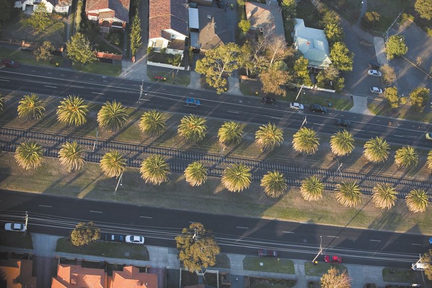
22 Tackling Transport Towards 2020 Integrated Transport Plan Summary 23Traffic and Parking
Moonee Valley City Council recognises that changed thinking is Moonee Valley recognises
required to reduce long-term traffic congestion, and Council is in that a paradigm shift is
a position to lead that shift in thinking. Moonee Valley has a mature required for long-term
though complex road network. As land use is well established, it is traffic congestion to
be reduced…
not feasible to simply create more space on the road.
Environmental impacts, health influences and congestion issues
identified in this plan indicate a need for more sustainable forms
of transport and a reduction in private vehicle travel. There is also
an increasing need to allocate road space for specific transport
modes, such as bike lanes, giving priority to public transport,
and increasing pedestrian space in Major Activity Centres.
While these efforts will improve the amenity of Moonee Valley Develop a hierarchy of road use
In an effort to encourage modal shifts from Where through routes are required for car
and improve safety and reliability of modes other than private private vehicles, suitable infrastructure needs movements alone, these will be designed to suit
cars, there will be increased traffic congestion in the short term to be provided to more sustainable forms of
transport. This can be achieved through more
the area in which they operate; however, Council
will continue to rely on the Freeway network to
as people get used to the changes. efficient use of current road space, such as provide for most long distance and some shorter
sharing road space with pedestrians, cyclists distance travel within the Municipality.
and public transport, as well as separation
Council will also investigate using its asset
of cars from public transport. This will
management register to audit the allocation
require comprehensive planning by Council
of local road space to cars, parking, cyclists
in conjunction with VicRoads to clarify the
and public transport. This will ensure
hierarchy of uses for its road network.
greater knowledge about how much space
On local roads Council will continue to construct is being allocated to various road users across
bicycle lanes across the Municipality and will work the Municipality.
with VicRoads to accelerate the completion of the
Principal Bicycle Network.
Policy 22 – Council supports a hierarchy of road space allocation based on modal efficiency:
1. Pedestrians 2. Cyclists 3. Public Transport 4. Freight 5. Private Vehicles
Actions Targets
A74. Liaise with VicRoads in determining the appropriate hierarchy of users T58. Hierarchy of roads signed off by Council and VicRoads in 2010.
for Moonee Valley’s road network.
T59. Audit of road space by user group completed by 2010.
A75. Audit the amount of road space allocated to each user group and
monitor changes. T60. Reduction in casualty crashes by 30% over the period 2008-2017.
A76. Work with VicRoads to increase provision of facilities for pedestrians,
cyclists and public transport on the existing road network.
A77. Work with State Government agencies to provide dedicated public
transport lanes where feasible to improve public transport reliability.
24 Tackling Transport – Towards 2020 Integrated Transport Plan Summary 25Road transport, in particular
passenger cars, accounts
for the great majority of
greenhouse gas emissions.
Reduce environmental impacts
of private vehicle use
Road transport, in particular passenger cars, leading by example through emissions reduction
accounts for the great majority of greenhouse with its vehicle fleet, not supporting unnecessary Council will monitor
gas emissions. Council can influence the impact road links, and creation of a local access road emissions of its vehicle
of private vehicle use through travel demand around Moonee Ponds to provide more pedestrian
management, community education, information space in the heart of the centre.
fleet and publish results
provision, supporting energy efficient vehicles and annually on its website.
Policy 23 – Travel demand management will be used to ease congestion and the impact of transport
on the environment. Policy 25 – No new road links into neighbouring municipalities.
Actions Targets Actions
A78. Advocate for peak and off-peak tolls to be applied on CityLink to reduce T61. By 2020, less than 30% of all students will use private cars for trips to A85. Council will carefully assess the traffic congestion impact of any T65. New road connections will be based around pedestrian, cyclist and
peak hour congestion. and from school. proposed new road links across the Maribyrnong River. public transport needs.
A79. Council will require developers seeking a reduction in car parking A86. Advocate for any new connections across the Maribyrnong River to be
provision to prepare an Integrated Transport Plan to demonstrate how the only accessible for pedestrians, cyclists and public transport.
development contributes to sustainable transport outcomes in Moonee Valley.
A80. Advocate for the Commonwealth to remove the FBT tax advantage
gained by private (company) car users.
Policy 26 – Creation of a local access road around Moonee Ponds to provide more pedestrian space in
the heart of the centre.
Actions Targets
Policy 24 – Use of energy efficient vehicles is encouraged. A87. Investigate the feasibility of a local access road around Moonee Ponds,
as part of the Access and Mobility Plan for Moonee Ponds Activity Centre.
T66. Investigation will be completed by 2008.
Actions Targets
A81. Council will monitor emissions of its vehicle fleet and publish results T62. Council’s fleet will be carbon neutral by 2015.
annually on its website.
T63. Car share programs set up in Moonee Ponds and Newmarket by 2011.
A82. Council’s fleet purchasing will focus on improving the fuel efficiency
of the fleet. T64. Car pooling scheme in place for employees in Moonee Ponds by 2010.
A83. Charges for parking permits will be based on vehicle fuel efficiency.
A84. Work with stakeholders to implement car-share and car-pooling
programs.
26 Tackling Transport – Towards 2020 Integrated Transport Plan Summary 27Initiatives to share road
space with other, non-
private vehicle users need
to be complemented by
measures to ensure that
existing road space
is managed efficiently.
Growth in car parking will
only cause a growth in
local congestion because
the capacity of surrounding
roads is finite.
Better use of clearways Review parking provision
While it is important to encourage shifts to on high volume arterial roads may be essential Parking is an issue across many parts of Moonee Encouraging school children to take public
more sustainable forms of transport, private to this effort; however, Council will generally Valley. Activity Centres require car parking to transport to school needs to be accompanied by
vehicles will remain a significant mode of travel. oppose clearways in retail strips where car survive and a significant proportion of people similar policies that cater for more pedestrian
Initiatives to share road space with other, non- parking provides a good buffer between will continue to travel to Activity Centres by and public transport movement around schools.
private vehicle users need to be complemented fast-moving vehicles and the amenity of the car. Growth in car parking will only cause a Council will therefore seek to increase the amount
by measures to ensure that existing road space retail environment. growth in local congestion because the capacity of kerb space allocated to clearways and bus
is managed efficiently. Better use of clearways of surrounding roads is finite. As other travel zones around schools so that the pedestrian
opportunities are improved Council will seek environment is improved.
to restrain car parking in Activity Centres and
encourage alternative transport modes.
Policy 27 – Better use of clearways on arterial roads. Policy 28 – Parking should be managed in a strategic way for the benefit of the whole community.
Actions Targets Actions Targets
A88. Work with VicRoads and relevant stakeholders to T67. Council will review clearways on public transport routes A89. Develop a Parking Strategy for the whole Municipality. T68. Complete the Moonee Valley Parking Strategy in 2008.
discuss appropriate use of clearways to increase priority for by 2011.
public transport. A90. Ensure that parking in Activity Centres is well designed, located and T69. Provision of disability permit parking will be reviewed by 2009.
managed to meet the broad needs of the community.
A91. Review the provision of parking for drivers with disability permits
particularly in Principal and Major Activity Centres.
A92. Provide disability permit parking commensurate with the proportion
of permits issued to car owners.
A93. Where necessary Council will actively intervene in the parking market
to ensure that congestion is managed and parking is provided efficiently.
28 Tackling Transport – Towards 2020 Integrated Transport Plan Summary 29Land Use and The Essendon Fields
Community Transport development is expected to
become Melbourne’s largest
business community.
Moonee Valley has a number of opportunities to consolidate
activity around existing nodes and public transport hubs. This
will make public transport trips more attractive and will support
provision of increased service levels. The growing population Investigate feasibility of Investigate possibility
in Moonee Valley will present new challenges in ensuring that development over rail corridors of river transport
The Craigieburn railway line currently runs above The Maribyrnong River links to the Yarra River and
land is available to cater for the various transport needs in the ground through the eastern side of Moonee Valley. Melbourne CBD, which presents an opportunity
Municipality. As Moonee Valley is mature in its land use and A number of Activity Centres exist along this rail for private and chartered river transport between
line, in particular the Principal Activity Centre at the Municipality and the CBD.
development, innovative measures are needed to maintain and Moonee Ponds. The opportunity exists to place
At present, river transport operates during special
develop land and transport networks in the future. the railway serving this area underground,
events, and the opportunity exists for Council
creating additional land for residential, retail
to work with Parks Victoria to investigate the
and business purposes.
community benefit to be gained from providing
Create a transport hub at Combined with the Airport West Activity Centre, additional boat landings along the Maribyrnong
Airport West/Essendon Fields the Essendon Fields development will generate River. Any investigation must include research into
Development a significant increase in trips within Moonee the capacity of the Maribyrnong River, and that its
Valley. This represents an opportunity to create environmental values are not compromised.
The Essendon Fields development is expected to
a public transport oriented development through
become Melbourne’s largest business community.
creation of a transport hub at the northern end
It is projected to generate 15,000 new jobs and an
of Essendon Fields, integrated with the current
estimated $300 million in investments over the
Airport West Activity Centre.
next decade.
Policy 29 – Airport West and Essendon Fields should be developed into a Transit City and public
transport hub.
Actions Targets
A94. Work with the Airport West and Essendon Fields developers to create a T70. By 2012 Essendon Fields and Airport West will have a single integrated
transport hub at Airport West. public transport interchange with good pedestrian access to both sites.
A95. Advocate for State Government agencies to introduce a quality bus T71. By 2011 a study into the feasibility of a quality bus service will
service along CityLink and Tullamarine Freeway, linking Melbourne CBD and be complete
Melbourne Airport with appropriate park and ride facilities.
Policy 30 – Craigieburn rail line should be put underground.
Actions Targets
A96. Advocate for the State Government to conduct a feasibility study T72. Completion of the feasibility study to underground sections of the
into putting the Craigieburn line underground through a section of Craigieburn line as part of the Moonee Ponds Access and Mobility Plan
Moonee Valley. by 2008.
A97. Support high level development along the railway line and around T73. The Planning Scheme will encourage higher density development around
stations to offset the underground construction costs. railway stations by 2012.
A98. Council will require a high quality open space link as part of a high level
development along the railway line.
Policy 31 – The Maribyrnong River will be protected from the impact of river-based transport.
Actions Targets
A99. Work with Parks Victoria to investigate the community benefit T74. Discussions held with Parks Victoria by 2012.
to be gained from providing additional boat landings along the
Maribyrnong River.
30 Tackling Transport Towards 2020 Integrated Transport Plan Summary 31Council will review
the location of taxi
zones with support
from operators…
Increase provision
of community transport
Moonee Valley currently provides community As mobility trends and technology change,
transport services to residents who are unable to the community is using an increasing number
use public transport because they are aged, frail or of mobility aids. These aids vary significantly in
have disabilities. Two buses are fitted with a hoist size, weight and power. Council needs to monitor
for wheelchair access and a car is also available mobility trends and develop policies that address
to transport individuals to medical appointments. the issues associated with mobility aids into
There is also a wide range of other transport the future.
services provided by specialist groups within the
community and government departments.
Policy 32 – Transport services for people with disabilities are supported.
Actions Targets To download the full Integrated Transport Plan
A100. Work with the Department of Education (DoE) and relevant T75. Discussions held with the Department of Education prior to 2010 school visit mvcc.vic.gov.au
stakeholders to ensure transport services for school children with disabilities year.
are provided.
T76. Audit of the extent of school access problems in the second term
A101. Assist DoE to audit the extent of access problems. of 2010. For more information on this plan, please contact
A102. Work with DoE and schools to prepare a plan of service improvements. T77. Plan of service improvements agreed by 2010. Council’s Transport and Major Projects Department
A103. Monitor transport mobility trends in the community and develop T78. Undertake an annual resident mobility survey from 2010 onwards.
improvements in consultation with stakeholders. on 9243 8888.
T79. Investigation for the need of a Council Policy relating to the use of
A104. Investigate the need for Council Policy relating to the use of electric mobility aids will be completed by 2010.
mobility aids on footpaths.
Policy 33 – Taxi services and infrastructure should reflect
local needs. Review provision of taxi services
The majority of taxi ranks in Moonee Valley are
Actions Targets
located around the Moonee Valley Racecourse,
A105. Review the provision of taxi T80. Taxi zones provided in all Principal making them unsuitable for everyday taxi use,
zones, particularly in Principal and Major and Major Activity Centres by 2010.
Activity Centres. while other taxi ranks are often difficult to
T81. “Safe City Taxi Rank” provided
A106. Work with the taxi industry to in Moonee Ponds by 2012. find. Council will review the location of taxi
inform residents about wheelchair zones with support from operators, users and
accessible taxi availability.
other stakeholders, and will consider the most
A107. Develop a “Safe City Taxi Rank” in appropriate location for each taxi rank and other
Moonee Ponds.
issues such as safety.
32 Tackling Transport – Towards 2020 Integrated Transport Plan Summary 33Moonee Valley City Council
9 Kellaway Avenue, Moonee Ponds, Victoria, Australia 3039
Telephone: 03 9243 8888 • Facsimile: 03 9377 2100
mvcc.vic.gov.auYou can also read