This historic Prairie Plains Resource Institute Prairie Plains Journal article also appears
←
→
Page content transcription
If your browser does not render page correctly, please read the page content below
Sheet1

This historic Prairie Plains Resource Institute
Prairie Plains Journal article also appears at
http://www.plattecorridor.org/
The GRAND ISLAND TO COLUMBUS PLATTE RIVER
CORRIDOR INITIATIVE
The Grand Island to Columbus Platte River
Corridor Initiative
                          By Bill Whitney

               From Prairie Plains Journal #14, 1999

WHAT A DIFFERENCE A RIVER MAKES!
         Some of my earliest and strongest memories in life are
about the Platte River along the northern edge of Hamilton
County. I remember seeing goldfish, a form of glorified carp, in a
sandpit near what is locally called Marquette Park. I drank right
out of the river on a hunting trip with my father, and sneaked a first
horrible taste of a beer at a river cookout and trail ride. Prior to
becoming a swimmer, I remember falling headlong into the water
off of the bank of Hord Lake sandpit near Central City.

        On most weekends - often both days - in the summers
before 1963 learned there to respect the treachery of sandpit
swimming, how to spin cast for largemouth bass, and some basic
sail boating and canoeing skills in the boats I helped build in our
basement. I definitely got more thrills than I bargained for ate age
eight or nine when a violent May squall suddenly tipped our
sailboat enough to take in about five gallons of water.

                                                            Page 1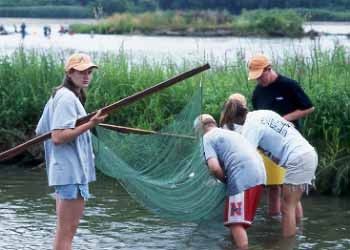
Sheet1

     A family weekend at Hord Lake, a popular public sandpit.

        When I was a fifth grader, in 1963, the folks were able to
buy a cabin at a sparsely developed sandpit lake north of Hordville.
Our cabin was by no means luxurious (having been created by
previous owners from a couple of old chicken houses) and was in
the most wild of locations, hidden back in a nook at one end of the
lake near a cattail marsh. The sign of wildness for us at the time
was the occasional flight over the cabin of the prehistoric-looking
great blue heron that lived in the area. We had never seen herons
before.

        Summer weekends were spent fishing for bass, or spear
fishing for carp and gizzard shad. Once a foot-long gizzard shad
even jumped into the boat! Endless days were spent swimming,
and eating wonderful meals cooked on the old cook stove used as
an outdoor grill. Fourth of July was always memorable for the
fireworks. Once I made a firecracker cannon to shoot marbles out
into the lake, consisting of a drum Majorette's baton stuck in the
sand. I'd light a two-inch firecracker, drop it into the pipe and put a
marble on top. Future archeologists may dig deep in the Platte
River sands some day and find one of the hundreds I shot - maybe
an emerald cat's eye, or a dark red purey – and wonder how it got
there.

                                                             Page 2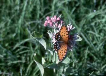
Sheet1

The historic Prairie Island wooden bridge near Hord Lake (burned
                     down in November 1999).

        As a teenager I remember trips with friends up to the Platte
west of Marquette after Legion baseball games, to a place called
Gerloff's Landing. We'd spear carp there for hours. Later outings
would include jeeping to the bluffs shortly after blizzards to hike or
sled in a crystalline wonderland.

        In college I became interested in natural science. Finally I
could begin to satisfy my curiosity about the cabin sandpit, the
plants, fish, and birds, as well as the Platte's channels. After
learning the birds at Lake Itasca in Minnesota I returned to the area
to test my knowledge and to see what Nebraska had to offer. My
first new-bird discovery was three nighthawks swooping over our
canoe while we fished at the cabin. My first plant collection was
weedy prairie plants collected from the beat-up lowland pasture
that the cabin lane winds through and along the river near the
wooden bridge by Hord Lake. In graduate school my major was
limnology, the study of freshwater ecosystems. During one
summer I took samples at the cabin lake to check for dissolved
oxygen, temperature, and depth and to inventory the lake's
plankton.

                                                            Page 3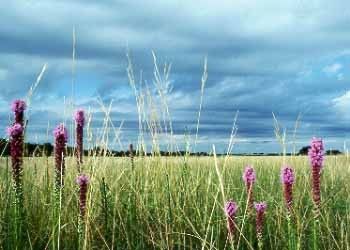
Sheet1

                     The Platte at Bader Park.

      The environs of the Platte have always had an important place
in the life of our family. Over the years there have been numerous
family cookouts, fishing trips, parties, and kids' activities. Jan and
I were married on the old cabin boat dock in 1974, and had our
tenth and twentieth anniversary parties there. Every time I yell at
our kids not to swim out too far in the sandpit I can hear my mom
yelling the same things at me thirty-some years ago (as a Grandma
she's most likely there too, scolding along with us).

        Both of our daughters have had formative experiences at
SOAR in various Platte River spots such as Bader Park, Pence's
Lake Mary sandpit, and Griffith's Pasture, as well as at the cabin.
They are learning, as I did at Hord Lake, how to canoe and swim
confidently in dark and deep lake water. With SOAR as part of the
family's normal summer routine, it's only natural that we have our
own family "nature camp" in the small south channel of the Platte
that now runs just behind the cabin, feeling for mussels with our
toes, and finding crawdads, minnows, and aquatic insects galore.

                                                            Page 4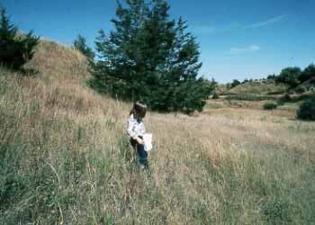
Sheet1

                     River activities at SOAR.

        Because of our personal familiarity with this landscape, it
has always been important in the organizational life of PPRI. As
the most scenic country in our immediate vicinity, and as the main
locale with substantial amounts of remnant native grasslands and
wildlife, it was a natural PPRI focus. Our first PPRI annual
meeting included a visit to a scenic bluff prairie, followed by the
gathering afterward at the cabin. In our first Prairie Plains Journal
(No. 1, 1981) we published a short article on Hamilton County
prairies with pictures of a Platte hay meadow and that same bluffs
prairie. Later on, in 1987, we fantasized about a Platte River
greenway project from Grand Island to somewhere beyond
Fremont.

        Since 1980 I have spent considerable time along the bluffs
and the lowlands near Prairie Island north of Hordville, and along
the bluffs southwest of Central City, frequenting about fifteen
miles of county roads. These roads contain in their ditches many
species of prairie grasses and wildflowers from which I have
gathered seeds. Many of these seeds went into the establishment of
Lincoln Creek prairie restorations, which now flourish.
Subsequently, many of the seeds from these creek plantings made
their way back to Platte River lands planted since 1992 in PPRI's
large prairie restoration projects.

                                                            Page 5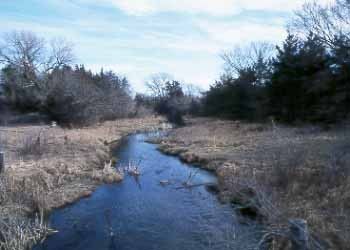
Sheet1

          The Platte Bluffs - rugged loess hill grasslands.

         On many gravel (Platte River gravel, of course!) road trips
with PPRI board member, fishing friend and landscape painter,
Ernie Ochsner, we have marveled at the beauty of the clouds, hills
and birds, and most everything else along the river. At the same
time we've always questioned why the farms were going to pot,
why so much of the bluffs pasture looked so beaten down, and why
so many people thought Nebraska was ugly or inferior to
mountains and forests. We have always tangled with ideas about
how important this river corridor is to the area, and about what
might be done to protect its unique values from the ravages of
people who don't care about the land or who unwittingly would
love it to death. We haven't yet come to any profound conclusions,
but vignettes of those trips are now recorded in more than a few of
Ernie's best paintings.

        PPRI's project history in this corridor area includes an
association with Gene (Mert) and Gwen Griffith and their pasture,
one of the best Platte River prairie natural areas in the county. We
have worked together on SOAR and rangeland burning. Gene
stores our fire equipment during the winter, we burn in the spring,
and SOAR kids converge on the land for a few days at least every
other year.

                                                              Page 6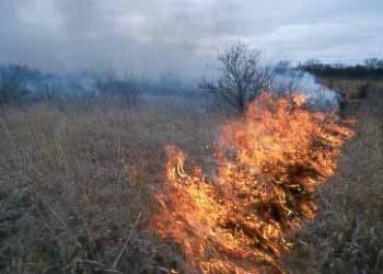
Sheet1

    Prescribed burning - a necessary tool to restore native Platte
                  grasslands and remove cedars.

        PPRI has been enjoying other private land and education
partnership with the Zeilinger family and their land near the Clarks
Bridge (see "The Dexter Farm, Pawnee Hill and Village" in
Prairie Plains Journal #13). The Dexter Farm and its surrounding
area have great potential as a large educational preserve containing
river, wetlands, and bluff and lowland prairie. In addition, the
locale is a rich archaeological area of recent Pawnee times.

        Bud and Mary Ann Pence have similarly offered their Lake
Mary site near Central City for many SOAR summers. This site
inspired us to add such activities as fishing and canoeing to the
curriculum.

         Finally, but certainly not least, the Bader Memorial Park
Natural Area has been the anchor site for SOAR as well as for
continuing activities throughout the year since 1982. Bader Park is
a vital area, the only major Platte River park between Grand Island
and Columbus. Its value as a recreational and an educational
resource cannot be overstated.

        In fact, the people living along the Platte east of Grand
Island are very lucky to still have the river and its wildness. If this
were the eastern part of the United States, these Platte River lands
would have been completely built up with recreational and
residential housing long ago; the rural agricultural setting, as well
as the prairies and wildlife, would most likely have disappeared
decades ago all along the corridor. Could what has come to pass
elsewhere be our future on the central Platte? I am deeply
concerned about the future of land along the river from Grand
Island to the Columbus Area.

                                                              Page 7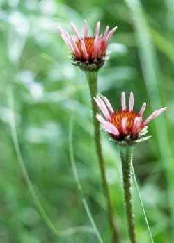
Sheet1
CHANGES COMING IN THE CORRIDOR?
In the past, under private ownership, the Platte Valley
landscape has been maintained as an open agricultural area – a
combination of river channel mixed with cropland, native
rangeland, and hay meadows. Under this land use regime there
was also recreational use by the public at bridge crossings, a few
public sandpits, and on private lands depending on farmers and
ranchers granting friends and acquaintances access.
Recent times have brought about major changes in the
valley that are accelerating. The population is increasing - a trend
projected to continue - especially in the larger towns of Grand
Island, Kearney, and Columbus. People are more mobile, therefore
more willing to live away from towns. Access to most of the area
from Lincoln and Omaha is only one to two hours by car. Many
are able to afford new homes in scenic surroundings. Land values
are rising as more single home acreages sprout up; the number of
people looking for river lands is increasing. These facts imply that
development pressures on open space and natural land will
inevitably escalate in the next decade. This has already created a
market momentum that has driven land away from agricultural
buyers toward small acreage residential buyers.
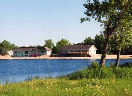
High-density building development on a sandpit.
Page 8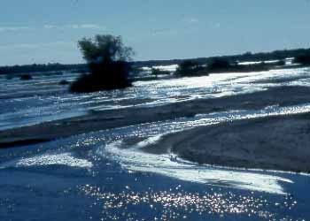
Sheet1
         A similar market trend exists regarding privately owned
hunting and cabin lands along the river. This parallels a rising
public demand for many different types of recreational
opportunities. There is no effective conservation-based policy or
institutional focus (neither conservation organizations nor
government agencies) on land protection for public purposes in this
section of the river, including river access sites, parks, and public
hunting, hiking, and fishing lands. A pertinent community
economic development question that growing towns up and down
this segment of the river may soon ask is: "What recreational
activities are available locally to our new residents?" It will
become increasingly difficult to provide such opportunities for a
growing population in light of increasing competition for land.
[There are only three small public access areas between the Grand
Island Highway 34 bridge and Columbus: Bader Park near
Chapman and Tooley Park near Marquette; Hord Lake is now a
private area.]

         Finally, demographic and economic changes in agriculture
are in many areas contributing to a marginalization of lands that
generate less revenue than crops, i.e., the native grasslands. A
growing red cedar tree problem is getting worse on both upland and
lowland prairie sites. It is not deemed worth the effort or expense
to reclaim the prairie, and landowners may not know the best way
to do it. To many of these landowners it will no doubt be more
desirable at some point to cash in this declining resource base for
home sites. In addition, as lands sell at elevated prices for
recreational use or home building, the adjacent land becomes taxed
at a higher level - often cutting significantly into the agricultural
profitability of the land.

                                                           Page 9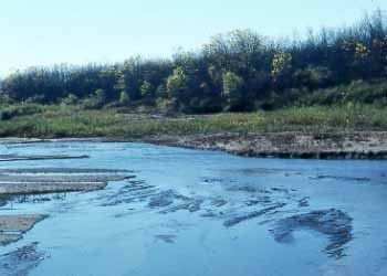
Sheet1

WHAT IS MEANT BY A RIVER CORRIDOR'S
PUBLIC VALUES?

       A strong chord resonating in American culture is that rivers represent a wellspring of esthetic, economic, natural, and recreational val
people, not a select few. The problem comes in determining how to apportion these bounties fairly and how to do it in a way that protects a
the often-fragile natural resource.
       In a general sense we may tend to think of public and private resources along the Platte River corridor as simply defined by ownership
criteria most of the land is now cropland, pasture, river channel and accretion forest in private ownership. A few relatively small county-ow
exist specifically for public use; people also gain access to the main Platte channel on public road rights-of-way near bridges.
       However, the term public value has little to do with who actually owns title to this land. Public value refers to aspects of the land that
appreciate, and use as members of a greater society or community. We all know it is important to keep our water clean. If a piece of Platte
lowland prairie acts as a water filtration and groundwater recharge area, and as a place to locate municipal water supply wells, then this pra
significant health value to the public. The same is true of wildlife habitat. It provides for the needs of creatures that do not abide by human
boundaries and that can be enjoyed by the hiker, motorist, or hunter. Below is a list of Platte River corridor items that are important to us al
therefore represent public values related to the Platte Corridor.
__________

>>> Scenic landscape vistas

>>> Unique educational sites (such as the SOAR Program requires)

>>> Recreational areas

>>> Our natural heritage of native prairie, forest, and wetland plants and wildlife

>>> Archeological and historical landmarks

>>> A sustainable no-input agricultural rangeland resource (i.e., native prairie) that also acts as a water purification and erosion control sys
area, and a wildlife habitat

>>> Ecosystem services provided by grasslands and riparian woodlands, including water filtration and groundwater recharge, erosion contr
retention and absorption

>>> Sustainable economic development opportunities as the community benefits from corridor protection
__________

      A final note on public values: Land is a source of production whether for wildlife, agricultural product, or recreational opportunities.
argue that building developments are a form of production as well, but we contend that when land is built upon a productive landscape is m
replaced by a non-productive, or consumptive, use. What is the public value of maintaining a unique river landscape in a productive state?

        If present trends continue, society's response to the
attendant environmental problems created by rapid, poorly planned
development - water quality degradation, ecological fragmentation
caused by breaking the landscape into small-acreage ownerships,
congested roads, disputes over land and river access, etc. - will
become reactive, even crisis-oriented. This will mean more
government regulation, among other things. Eventually, the
qualities that attract people to the river land will be gone.

                                                           Page 10
Sheet1
No one can be blamed for wanting to live in an area rich in
scenic beauty, wildlife, and recreational opportunities. The trouble
is that there is not enough land to serve unlimited individual
desires, and to protect public values and agricultural land, without
encountering serious problems down the road. One of these future
concerns, for example, is the strain that unlimited moderate- and
high-density development may create on rural tax-supported public
services. At some point many of the best things about the corridor
will be negatively impacted by the consequences of unplanned
development. It's happening all around the country and can happen
here very quickly - perhaps within a decade.
Again, if these trends continue, we will see the future river
valley still in the hands of private landowners, but the nature of
ownership and land use will be vastly different. The rural character
of the corridor will become more urban. There will be more
landowners with smaller parcels, followed by more houses,
driveways and roads, yard and street lights, more and larger sandpit
complexes with high-density residential construction, more weedy
tree growth concurrent with a loss of native grasslands. Eventually
the native plant and animal diversity of the area will dwindle
away. Water quality problems in the corridor related to roads,
runoff erosion and septic systems will become common. As the
corridor becomes more urbanized there will be less river land
accessible to the public, less agricultural use of the area, and more
demand for services that might not be covered except by higher
property taxation. Along with these changes we will see less
opportunity and potential for the public to enjoy prairie and river
lands close to home, and there will be less variety and abundance
of many species of plants and wildlife. Agricultural rangeland will
become even more marginal.
SUBDIVISION, BUILDING DEVELOPMENT, AND
CHANGING LAND USES ALONG THE PLATTE - TWO
CHOICES
Building development in this Platte River corridor is
going to happen one way or another. It is not necessarily bad,
and we are not against it, per se. But it matters a great deal
how building development and land subdivision is done. If
planned carefully, and in context with the natural qualities of
the land, the built human environment can be complementary
to other land uses such as farming or ranching, and scenic or
natural area preservation.
Page 11Sheet1
There are two public policy choices; one is pro-active and the other is policy by inaction:
1) By creating a task force made up of interested individuals, businesses, local government agencies, and organizations we can work to
define the various aspects of the river corridor that have public value; b) determine threshold limits for protecting and restoring the natural
the corridor; c) attempt to orchestrate Platte corridor building development accordingly through a sensible on-going planning process; d) wo
establish sustainable economic development projects based on natural resource stewardship of corridor lands; e) involve our communities i
leadership, and a visioning process for all, but especially for the youth, that integrates natural resources, economic opportunity, and quality
-OR-
2) By doing nothing, we can allow free reign to individuals and market forces to dictate for the mass of local citizens the corridor's fut
to develop cooperative ventures as described above, and to choose not to see the opportunity in looking at what our area natural river landsc
offer in addition to agricultural commodities and scenic building locations.
The first option gives us the opportunity to protect the
unique features of the corridor, protect important water-related
functions of the river system, plan for more public availability of
the corridor's natural resources, and still allow development in the
built environment.
The second option will undoubtedly create some good
places for people to live, but ultimately at a greater public cost if
this one use of the land becomes the dominant use. It will have a
profound effect on the Platte's natural ecosystem. Future
landowners, natural resource managers, and policy makers will be
forced to deal in a crisis-oriented way with more intense land
resource conflicts, and a variety of inevitable negative
environmental consequences.
Prairie Plains Resource Institute stands behind the first
option. There are many unique features of the Platte Valley
Corridor that are part of the public trust. They should be protected,
restored, and maintained for the benefit of future generations.
Protection of this public trust can best be accomplished if we
maintain the rural openness of the landscape, if we maintain the
native grasslands, forests, and river frontage in large tracts, and if
we educate people about natural resources, agriculture, water,
nature, and local history so that they care about and understand this
valuable cultural and natural resource. This option will also create
local economic development opportunities that will benefit from
protection of the rural scenic and natural corridor.
Page 12Sheet1
WHY PLATTE RIVER ECOSYSTEM PROTECTION
AND RESTORATION?
Native prairie grassland is, by nature's design, the most effective system that exists for purposes of groundwater recharge, runoff contr
water filtration, domestic well field buffering, floodwater retention and naturally regulated water return to the stream. The Platte's native pr
habitat for countless native plants and wildlife, and if managed slightly differently could be a potentially enormous source of recreational en
the area's population and visitors alike. In addition the most scenic and many of the most historic sites of the corridor are contained in the g
and floodplains of this section of the Platte Valley.
In conjunction with the prairies, and also having important roles in water recharge and regulation as well as wildlife, the riparian, or r
cottonwood and willow forest (the forest on accretion land or islands) is a vital habitat. Together, the riparian forests and prairies make up
diverse natural system composed of up to 300 species of birds, more than 300 species of plants, abundant game and fish animals, and place
retreat to and enjoy.
Corridor planning that includes protection and restoration of large tracts of native grasslands managed for ranching and biodiversity, a
of riparian zones and islands, with extensive river channel frontage and forest/shrub plant communities can provide for a large array of pub
purposes. Unplanned urban-type building development on these lands will incrementally sacrifice - irreplaceably – an important public res
benefits of relatively few individuals. On the other hand, innovative planning gives us the opportunity to protect the area and still have app
located and designed building developments. It would be a win/win situation for the corridor community.
THE CORRIDOR INITIATIVE PROJECT'S BEGINNINGS
My memories and experiences along the river have
intersected in the last two decades with the ideas and dreams of
others. Some of these ideas were introduced in this publication
over a decade ago. I cannot forget the first mention by a friend,
John Jasnowski, more than two decades ago that the bluffs of
Hamilton County are a special place that should be preserved as a
big prairie - perhaps someday with a wandering herd of bison!
(They're already on the bluffs at the Gale Stevens family farm near
Hordville.) - and as a place for people to enjoy the river and
wildlife.
Past PPRI board member Norris Alfred often wrote about
the Platte in his Polk Progress editorials and birding columns
during the 1980s. The lowlands, river, and bluffs were the subject
of many of his sketches and paintings as well. The cover of our
first issue of Prairie Plains Journal (1981) was graced by one of his
bluffs sketches. To Norris, river land was a refuge from the weekly
grind of writing and publishing the Progress on antiquated
letterpress machinery, and a refuge for the wildlife he went looking
for ("Tribute to Norris Alfred," PPJ, No. 11, 1995). His weekly
birding column was the result of travels on Platte River Birding
Road (which is actually Prairie Island Road from near the Central
City Bridge to the Clarks Bridge), and Swedenburg Road past
Pawnee Hill ("Dexter Farm - Pawnee Hill and Village," PPJ, No.
14, 1998) to the Havens Bridge.
Page 13Sheet1
Emiel Christenson's writings are another deep well of
inspiration pertaining to this corridor (we have highlighted Emiel
in past Prairie Plains Journals: PPJ, No. 5, 1983, and No. 7, 1989).
An architect and planner from Columbus, Emiel is often
remembered for developing the Nebraska Community
Improvement program and for the design of Schyler's Oak
Ballroom, now on the National Historic Register, among a long
lifetime of other accomplishments. The following thoughts by
Emiel reflect the intended spirit of this Corridor Initiative with
regard to recreation and cooperative community efforts. They were
posted inside one of the shelters constructed at PaWiTo, Emiel's
family Platte River Bluff refuge near Shelby.
contact or intimacy with such features of the landscape as a
sweeping coastline, woody slopes, grassy prairies, or
undulating sand dunes knows what majestic views can mean to
the inner consciousness of man. We need such experiences to
evoke the diversity of moods and responses so essential to the
broader understanding and clearer perceptivity required to
continue the upward and onward march of mankind.
Inspiring leisure is just as necessary to the intellectual and
spiritual growth as is invigorating exercise to physical well
being.
"Although our national, state, and local park and wilderness
programs are, in many cases, commendable, they are woefully
inadequate from the standpoint of building up citizen
enlightenment and stimulating unity in creative use of leisure
time.
"Local, private, and corporate efforts are much needed, not
only to supplement the public effort, but even more to guide its
further development."
On a visit to PaWiTo in 1982, Emiel, then 88 years old,
explained how he and his sons began 30 years earlier to develop
the overgrazed bluff pasture into a cohesively designed system of
trails, shelters, and forest. He recounted a neighboring farmer
saying he should have started doing this when he was a young man
and beautified the whole system of abused bluffs. We sensed that
Emiel wished it could have been so.
Page 14Sheet1
Emiel Christenson at his family retreat, PaWiTo.
Emiel was a social visionary. He lived to tell of the horrors
of trench warfare in World War I, but he believed in things that
reflected the virtues of humanity. He was far ahead of his time in
thinking about the value to local people and communities of a
dream like restoring the Platte bluffs. We were lucky in 1987 to
see Emiel again at a PPRI Annual Meeting at Lou and Geri
Gilbert's Pahuk area north of Cedar Bluffs. The topic of discussion
was how to develop a greenway plan for the Platte River. It was
again a pleasure to hear Emiel, now 93 years old, explaining his
views about people and their relationship to the Platte River
landscape.
WHAT DOES A PRAIRIE AND RIVER CONSERVATION PROJECT HAVE TO DO WITH COMMUNITY ECONOMIC DEVELOPM
Economic development encompasses many things. A land project such as this does not provide a visible factory we can point to and
number of jobs created. Over time it can create a number of sustainable small-scale family service businesses related to tourism, and perha
things not yet conceived. The greatest economic benefits will be related to how people appreciate and understand where they live, how the
young, and how they develop community leaders.
This project represents a sustainable diversification of the land-based economy. It involves development of a local partnering process
business leaders, government, and organizations. The process is about knowledge, about integration of new ideas to rural areas, and about
spark of life to rural people. Ultimately economic development occurs from a motivated community of concerned citizens.
Page 15Sheet1
So, here we are almost 20 years later. It is time to begin the
process of transforming dreams into reality. Presently the stretch
of the Platte from Grand Island to Columbus seems to be largely
unnoticed by conservationists and resource agencies, and is
somewhat taken for granted by local people as nothing too
extraordinary. However, a few others and we disagree with this
outlook. We value it mightily because it is an extraordinary place!
Moreover, we are concerned that land use trends occurring in other
sections of the Platte may work their way into this river segment,
harming many of the qualities that make it special. Trends that we
believe are negative cannot be changed unless we offer a better
alternative.
Late summer and fall of 1998 was a critical time to pull
together many of the things PPRI does in central Nebraska into a
geographically focused new project. We were desperate for
significant funding to continue PPRI's work, and wanted to capture
the imagination of potential donors. As a result the Grand Island to
Columbus Platte River Corridor Initiative was born. It took its
initial form as a PPRI grant proposal describing a cogent and
visionary project - an attempt to create that better alternative by
protecting the Platte River ecosystem and promoting a planning
process to guide future stewardship and development. It is
fundamentally a marriage between 1) PPRI's existing projects and
areas of expertise (such as SOAR, Olson Nature Preserve
educational developments, and prairie land management and
restoration), and 2) regional planning and community development
concepts, applied along the entire 60-mile corridor between Grand
Island and Columbus.
For the corridor scenario to succeed, a consortium, or task
force, of participants needs to be organized. This group of
dedicated people needs to apply imagination and initiative, locate
funding, and go about the task of creating a master vision for the
corridor. This will involve collaboration among institutions such
as local city and county governments, local economic development
corporations, local, state and federal agencies, farm organizations,
civic service groups, sportsmen's groups, educational institutions,
and private businesses and industry. It will also require an
effective partnership with many individuals, especially with private
landowners.
PPRI's mission is to play a leadership role in establishing
such a task force, then continue its educational activities to increase
awareness of the corridor and the Initiative, to protect land with
unique natural, historic, and educational resources, and to restore
productive parts of the ecosystem. In so doing we intend to carry
forth and build upon dreams such as Emiel's.
Page 16Sheet1
WHAT IS LAND PROTECTION?
DOES PPRI WANT TO OWN THE LAND?
HOW WILL IT BE MANAGED?
It would be ideal if all individual landowners were good land stewards, passing their land ethic on to the next generation. Such is not
unfortunately. These days many landowners do not even live close to their land, and economics is dictating changes that may not be in the
of conservation or agriculture. However, if the goal is to keep the natural and rural qualities of the landscape intact, there are ways that org
government agencies, and individuals can work together to reach the goal.
Land protection refers to placing land under some type of conserving ownership or conservation easement to be held in trust by a pub
supported conservation organization, that prevents it from being used for another purpose or restricting the level of a certain use. In the Pla
this could mean protection from excessive housing subdivision of a gravel mining operation occurring on some privately owned areas from
or lack of cedar management. Many private grasslands are being lost (this can be a temporary situation because these prairies are restorable
stands of red cedar because of the way some landowners manage pasture.
On a large-scale land protection is not a matter of a land trust entity buying out all private interests. Most land trusts such as PPRI do
money to do that. A large-scale protected landscape as envisioned here would probably be a combination of private and public ownership.
or rancher-owned tracts can be conserved by conservation easements. Easements represent partial ownership in land interests; they have a
and are bought, sold, or donated just like full ownership interests. Each is a tailor-made agreement between the buyer and seller or donor/d
lands in private ownership can be conserved by individuals who are good stewards, and with incentive assistance from USDA or state wild
Land trust-owned lands can comprise another component of conservation land (all property taxes will paid on PPRI land). Finally there cou
county or state-owned lands, too. All lands would be acquired on a willing-seller basis.
Large-scale natural land protection also does not mean locking the resource up with no economic use. A prairie preserve is not left al
unused. Almost all protected prairie land will be incorporated into a grazing or haying rotation system designed to provide excellent livesto
to protect the native ecosystem with its multitudes of plant and animal species. Under this scenario the potential protected landscape of the
corridor will essentially become a long ranch with multiple owners. On a sizeable preserve income from grazing leases with neighboring li
growers can provide significant resources to fund educational program development.
If PPRI is able to purchase land it can then under some circumstances be re-sold with a conservation easement attached to the deed (th
held by PPRI). The lands will most likely sell at an agricultural price since development rights will be restricted by the easement.
Depending on the particulars of each area, it will be possible to add uses to the conservation lands in addition to livestock grazing. Th
include education programs, agricultural and scientific research, compatible types of public recreation such as hiking, biking, camping, hun
equestrian use, river access, limited private and public-use cabin developments, etc. Recreation areas will become ever more important in t
community economic development plans of local towns.
*************************************************
***
THE MISSION
of the
GRAND ISLAND TO COLUMBUS
PLATTE RIVER CORRIDOR INITIATIVE
*************************************************
***
The purpose of this Initiative is to create a visionary
program for ecological protection, restoration, and future
management, as well as sustainable community educational,
recreational, and economic development of the Platte River
Corridor between Grand Island and Columbus. Its goals and
objectives are as follows:
Page 17Sheet1
1. GOAL: Knowledge of what is there
OBJECTIVE:
To conduct a resource inventory in the corridor to identify, describe, and classify ecological, historic, archaeological, cultural, esthetic, and
resources - public and private.
__________
2. GOAL: A protected and maintained Platte River Ecosystem
OBJECTIVE:
To preserve, restore, and manage Platte River corridor lands necessary to maintain a continuous Platte River ecosystem consisting of native
wetlands, river channels, and riparian woodlands.
__________
3. GOAL: Protected cultural resources
OBJECTIVE:
To preserve significant historical, cultural, archaeological, and local interest sites.
__________
4. GOAL: Managed growth that minimizes negative human impacts on the river corridor native grasslands and riparian zones, scenic area
agricultural open space.
OBJECTIVE:
To establish a set of corridor land use and development guidelines that will outline to planners, developers, and the public their land use op
Guidelines must operate within the limiting context of natural resource protection and sustainability, and be developed through an open dec
process.
__________
5. GOAL: Public appreciation and understanding about Platte River natural history and land stewardship.
OBJECTIVE:
To create and maintain education and leadership training programs, with an emphasis on youth, so that all people can learn about, understan
appreciate the Platte River corridor's diverse natural resources and their important relationships to people and communities.
__________
6. GOAL: Integration of the corridor into the lives of citizens
OBJECTIVE:
To integrate into community life the recreational, educational, and economic opportunities and benefits resulting from protecting what is un
corridor.
THE CORRIDOR INITIATIVE'S TWO COMPONENTS:
- 1) PPRI's specific organizational focus on land and education,
- 2) A corridor task force to lead community visioning, planning,
and development processes.
Page 18Sheet1
This project has two components: One is PPRI's specific
conservation plan detailed below. The other concerns aspects of
corridor protection and community development that fall outside of
PPRI's specific mission. The two components complement each
other. Various private and public community projects can result
from land trust efforts; resource protection cannot occur without
community and local government involvement and support.
In practice we hope to prove that a grassroots non-profit
organization, local governments, and citizens' groups can
accomplish broad goals if they work together. Under this scenario
the Corridor Initiative will involve many different players. It is
vital that potential participants see in such a concept the
opportunity to benefit themselves and their communities. We hope
that the Corridor Task Force becomes a catalyst spawning new
projects as diverse as the participants, including government and
private actions to manage building developments in the corridor
and to create sustainable community economic development
projects. Some projects may be very closely related to PPRI's
mission, perhaps involving PPRI directly. But others, particularly
economic development spin-offs, could evolve in a multitude of
directions.
PPRI'S PLAN:
A LAND BASE AND EDUCATIONAL CENTER ON THE
PLATTE
Our Platte Corridor mission, as practiced on all PPRI lands,
involves ecosystem preservation, restoration, and education. Land
resource protection will create the foundation for everything else
that eventually results from the Initiative. Part of comprehensive
resource protection in the corridor will include action by PPRI to
identify, acquire, restore, and manage unique corridor land through
the methods outlined below.
Page 19Sheet1
Collecting prairie seeds for restoration activities on the Bluffs.
By January of 2000 we will create and unveil to the public a
plan detailing PPRI's primary mission in the corridor - land and
educational goals and objectives to be met over the ensuing five
years. Briefly, it will include creation of a land base along the
Platte (probably scattered sites within the corridor) to protect some
of the best natural areas remaining. We will then develop and
restore these lands as stewardship laboratories" exhibiting
ecological restoration and management as well as agricultural
activities, as intern training grounds, as educational preserves for
schools and the general public, and as controlled-access
recreational lands. This is very similar to what takes place, for
example, on the Olson Nature Preserve in Boone County.
The plan will also include creation of an actual "campus,"
or retreat center consisting of a modest building or two. It will
serve an educational function by providing a meeting space and
overnight accommodations for students of all ages. It will also be
the research and educational base for corridor conservation
activities as well as PPRI activities in the entire Platte and Loup
Basins.
Page 20Sheet1
The objectives and strategies available to PPRI
to carry out this plan include:
Resource Inventory
Geographic Information System (GIS). Using computerized aerial photos and information from corridor ground surveys, PPRI will c
database that can be used to store resource and management information and to produce high-quality maps. GIS maps will enable us to ide
prioritize, and plan protection strategies for different landscape components in the valley. Such classifications might include rangeland qua
recreational potential, excellent outdoor education sites, the most desirable sites for planned building developments or sandpits, or areas mo
to water quality degradation. GIS maps are also excellent communication tools for presentations and educational activities.
Acquisition of interests in land to protect specific land features
Conservation Easement Acquisition. A conservation easement is a tailor-made agreement between a landowner and a conservation o
whereby the landowner conveys specified interests in land to the organization while retaining primary ownership. Normally an easement o
elements of a property that are being protected, the management and development activities that are acceptable, and those that are explicitly
Easement interests are acquired by purchase or gift. If conveyed by gift or bargain sale (sale below appraised value), an easement that prote
containing significant public value may qualify the donor for a charitable tax deduction with IRS. Easements require ongoing monitoring a
legal enforcement by the holding organization.
Fee Simple Land Acquisition. To accomplish PPRI organizational goals where considerable control and oversight on the land are nec
also be necessary to acquire full ownership, or fee simple, rights to some properties. Fee simple acquisition may be obtained by full-marke
from a willing seller, acquisition by gift, or by a bargain sale (as with easements a full or partial gift to a land trust may qualify for tax dedu
depending on the tax and estate situation of seller/donor).
Fee Acquisition and Re-sale with an attached conservation easement. To make conservation funds extend farther, PPRI can acquire p
re-sell it to a conservation-minded buyer with a conservation easement attached to the deed (and held by PPRI). Money from re-sale can be
purchase of another piece of land. In addition, during the land trust ownership period improvements can be made (wells, fences, etc.) and t
productivity restored; then sold in excellent condition.
Leases. Leases offer a flexible tool for long- and short-term land protection; although not as desirable in many cases as easements or
ownership, they are useful in attaining some conservation goals.
Land Restoration and Management
Information and Technical Assistance Outreach. Much like Cooperative Extension outreach, PPRI works with landowners such as fa
hunters, and small acreage owners to provide information about their land resources and to offer assistance in prairie restoration and manag
efforts within the corridor will include information about how their lands fit into an overall corridor conservation scheme. Specific types o
might include Holistic Resource Management (HRM) training, locating conservation funding assistance and government landowner option
Wildlife Habitat Incentives Program (WHIP), Environmental Quality Incentives Program (EQUIP), Wetland Reserve Program (WRP), and
Reserve Program (CRP).
Prescribed Fire/Timber Removal. This category is partly contained by the preceding landowner assistance category above, but is so im
deserves its own section. Removal of invasive woody vegetation growth, predominantly eastern red cedar, is necessary to reclaim native gr
Platte lowlands and bluffs. We will increase fire management and cedar removal assistance to private landowners, including easement part
High-diversity Prairie Restoration. Lands such as marginal sandy or wet croplands and abused rangeland can and in many cases shou
back to high-diversity prairie. As restored prairies, they will serve multiple purposes, such as groundwater infiltration, native plant and wil
conservation, rangeland production, and specified recreational uses.
Infrastructure Improvements. In order to make lands self- supporting regarding upkeep and taxes, and allowing rangeland renters a pr
and management flexibility, PPRI will make infrastructure improvements on its land, e.g., windmills, and fences.
Rangeland Bank/Grazing Coop. A rangeland bank or grazing coop offers management flexibility to participating landowners. Land i
can be used to take use pressure off of lands that need some time to recover from over-use, or it can become a grazing safety valve during d
Education Programs
Long-term land stewardship of the corridor depends on educating present and future generations about the area. Programs such as SO
Orientation About Rivers) and educational preserves such as the Olson Nature Preserve near Albion that is used by many Boone County sch
civic groups are good examples. Other options include creating educator workshops, starting a nature and agriculture science camp, develo
resource-based economic development leadership program, a summer intern program for college and high school students, and other agricu
natural resource programs in conjunction with Cooperative Extension and local schools.
Land Use Guidelines and Economic Development Projects
Sharing of Resource Inventory and Locating Pertinent Technical Information. PPRI is not a zoning or economic development organiz
however we can be a conduit for information and referralsPage 21 in the know about resource, planning, and sustainable economic develo
to people
issues. PPRI will also share with government and public entities the extensive information gathered in the resource inventory, and work wi
develop guidelines and new projects.Sheet1
MORE BACKGROUND: BRIEF ECOLOGICAL
OVERVIEW OF THE CORRIDOR
The Grand Island to Columbus Platte River Corridor
Initiative focuses on bluff and lowland native grasslands and
wetlands, and the main channel of the Platte River within a valley
corridor from about the Highway 34 Platte River Bridge near
Grand Island to roughly the mouth of the Loup River near
Columbus. A most notable area within this stretch is Prairie Island,
a large historic island roughly from Central City to Clarks. Prairie
Island is defined by one of the small ancestral south channels of the
Platte and contains grasslands and wetlands of exceptional
ecological, educational, and recreational value.
There is a large gap in general awareness about the Platte
River because this stretch of the river is most often left out of
discussions about the watershed. In Nebraska most of the resource
attention for two decades has focused on the Big Bend reach of the
Central Platte from Overton to Grand Island – much of it due to
intense conflicts regarding migratory birds, endangered species,
irrigation and river flows.
The Lower Platte corridor in eastern Nebraska also receives
a great deal of attention because there are a variety of serious urban
development issues surrounding it. Fremont, Lincoln, and Omaha
are growing rapidly and this is creating a large demand for land.
The land use conflicts in the Lower Platte relate to the vast
acreages of small-lot sub-divisions, a proliferation of acreages on
scenic river lands and away from the city, a demand for
commercial properties along the interstate corridor, and land to
serve a growing demand for recreation, wild land, and open space
protection. All of these issues represent major and sometimes
unpleasant changes in what was, until recently, a rural agricultural
area.
Although it is understandable why these other segments of
the Platte River have captured all the attention, we should not fail
to recognize the value of the unique segment of the river located in
between. This overlooked section from Grand Island to Columbus
offers great opportunity if we act now to prevent some of the
problems plaguing other stretches of the river. Furthermore, and
most importantly, the residents along the corridor can ultimately
benefit from any action that places the conservation of river lands
as a priority. But this corridor's potential as a linear grassland
preserve system serving multiple ecological and societal purposes
has as of yet only been recognized by a few.
Page 22Sheet1
The corridor is not presently politicized by the issues that
have made conservation protection on other parts of the Platte
River so challenging. Because of this, a well-designed grassroots
initiative has great potential to succeed here. It must be carried out
in a way so that people can see opportunity and benefit for
themselves and their communities.
PLATTE RIVER PRAIRIES
From Grand Island extending eastward past Columbus, the
Platte Valley is flanked on the south side by a nearly continuous
system of bluffs. The bluffs contain a few high quality examples of
native prairie, and many degraded prairies that can be relatively
easily restored through improved management and species
enrichment. This resource of hilly grasslands is nearly unbroken
east-to-west from Grand Island to Columbus, and encompasses
more than 25,000 acres.
Purple coneflower on bluff prairies.
Page 23Sheet1
With a little imagination it is possible to envision a 60-mile
linear grassland preserve along the bluffs system. This system of
upland prairie has tremendous potential as a recreational corridor,
as a historic corridor for protection of Pawnee archeology sites,
settlement era landmarks, and westward migration trails, and as a
wonderfully diverse natural area. Such a concept may at first seem
threatening to agricultural landowners; however, a prairie preserve
of this type will also be classified as an excellent rangeland, and be
managed by grazing and prescribed fire. Recreational uses can be
developed and managed within the context of this type of land
management.
In the entire Grand Island to Columbus stretch there are
also extensive lowland native meadows that are ecologically
important for their biological diversity and as aquifer protection
and infiltration zones. One such sub-irrigated meadow system west
of the Chapman Bridge and Bader Park already contains two
municipal water wells and may in the future contain more. For this
reason, this entire Chapman meadow system should be maintained
as a groundwater source protection area. Under such a designation
the only appropriate uses are for wildlife, passive types of
recreation, and agricultural grazing or hay production. Unbroken
native lowland prairies encompass upwards of 30,000 acres in the
60-mile corridor stretch.
Between Central City and Clarks is Prairie Island, a long
and narrow piece of land defined on the north by the Platte's main
channel and on the south by one of the many south channels of the
Platte. Between Silver Creek and Columbus there are two more
small streams draining into the Platte from the south, another so-
called south channel, and Clear Creek. These streams and sloughs
are surrounded by considerable acreages of native lowland
meadows in some areas, and in a few locations by slightly higher
sandhill-type rangelands.
Page 24Sheet1
South Channel near Hordville.
All Platte River grasslands are important for containing
runoff, groundwater filtration and percolation. Their highest and
best uses may ultimately be as groundwater protection zones and
multiple use rangelands. These upland and lowland prairies are
now mostly in a state of ecological and agricultural decline.
Invasive cedar trees are increasing their hold, much like what is
happening in rangeland (non-sandhills) areas in Buffalo, Custer and
Loup Counties. Along the Platte many landowners are primarily
crop producers with less time to devote to pasture management and
improvement. They do not as a rule use fire for cedar control, and
many have an inadequate understanding of the fundamentals of
sustainable native rangeland management. Consequently, much of
the land has become marginal pasture, and in many places the
cedars are becoming dense stands. Once a pasture reaches a certain
point of decline there is little to no economic incentive to improve
management. The result is loss of species diversity, loss of
rangeland economic potential, and a decrease in the area's habitat
value for most species of wildlife.
PRAIRIE ISLAND
(view a GIS Map of Prairie Island)
Prairie Island has already been mentioned, but it deserves
special attention. The south channel of the Platte that defines
Prairie Island from Central City to Clarks is a small stream;
however, it has a number of wetland sloughs and side channels that
are wet during much of the year. Many grasslands along this South
Channel require drastic restorative management, but they also have
excellent potential to become high-quality diverse native grasslands
for education, wildlife, and sustainable rangeland use. In addition,
they comprise the largest single area of connected grasslands in the
corridor.
Page 25Sheet1
Tall gayfeather on a Prairie Island native hay meadow
Regal Fritillary butterfly on showy milkweed.
Prairie Island stands out on the map as the centerpiece of
the corridor project, being physically located in the middle and
having the greatest grassland resource. It stands out in other ways,
also. The island was a significant Pawnee cultural site, one of the
locations of their sacred ceremonial lodges. At the east end of
Prairie Island is the Pawnee Village and Burial Hill on the Dexter
Farm (see PPJ #13, "Dexter Farm, Pawnee Hill and Village"), also
know as the Clarks Site in archeological circles.
Page 26Sheet1
The greatest threats to the Prairie Island lowland ecosystem
are a combination of red cedar infestation combined with poor
rangeland management, the potential for rapid and ill-conceived
sandpit development followed by high-density recreational cabin or
second home development, and small acreage developments.
There are areas along the south channel that contain old sandpits
with low-density cabin development. These areas have maintained
much of their natural character as well, and illustrate that some
human uses are not at odds with ecological protection if
moderation and planning are practiced.
PLATTE RIVER MAIN CHANNEL
The Platte River main channel and its associated riparian
zone (the pre-1940s river channel was wider and mostly treeless;
what used to be part of the main river channel is now dominated by
cottonwoods, willow, and dogwood) is an outstanding scenic and
ecological resource. While natural resource managers might argue
over the values of the riparian forest versus the relatively treeless
historic prairie condition of the river, the fact remains that the river
and its immediate riparian zone is very diverse in native plants and
wildlife when compared to most of the agricultural landscape
outside of the Platte Valley. People generally find this component
of the corridor most attractive.
The Platte's very nature is defined by disturbances caused
from flooding. As such, the riparian area is a very resilient system;
it has the capacity to absorb a tremendous amount of public use if
that use is managed properly. The riparian zone could potentially
become an ever-greater public recreation area with little impact on
surrounding land uses.
A wide braided Platte River channel.
A FEW PLATTE VALLEY CORRIDOR OPTIONS
Page 27Sheet1
*** Clustering building developments at strategically
planned sites along the corridor may be more desirable than using a
zoning acreage limitation that gradually chops the landscape up
into small parcels. Such developments should be limited to those
places that are not the most scenic, that are not the largest grassland
tracts, and are not unique archeological or historic areas (i.e.,
protect the unique sites). Yet, they can occur near enough to these
unique areas to enjoy the benefits from them.
*** PPRI would like to establish a number of preserves
dedicated to the memory of significant individuals who have
supported PPRI's Platte River vision - Norris Alfred, and Jim and
Alice Wilson from Polk, Emiel Christenson, and Naomi Brill (see
the tribute to Naomi in this issue) - and devoted to educational use
(such as PPRI's Olson Nature Preserve or Bader Natural Area)
between Grand Island and Columbus. Each of these will be a
potential location for the SOAR Program, places for local schools
to run their own similar programs for students, and a site to train
educators about natural resources, and teach about science, nature,
local history, land management, and agriculture. Some sites should
include farmland in addition to prairie, river, wetlands, and
woodlands, making the sites valuable technical training and
leadership development sites for youth entering all natural resource
fields, including agriculture. Each would involve volunteers and
educators in ongoing stewardship activities, and act as
demonstration areas for prairie restoration and management.
*** Very marginal too-sandy or too-wet croplands in the
corridor should be restored back to prairie. These lands are
perhaps more important for water quality (filtration, recharge, flood
retention, etc.) and biodiversity concerns. They can still be
managed as rangeland.
*** The invasion of trees in the existing native grasslands
should be reversed. The best wildlife habitat potential of these
areas is as well-managed prairie. People, particularly small acreage
residents, are mistaken about the wildlife value of letting trees take
over the rangeland or planting more trees for wildlife on their
acreage. The best wildlife lands will be the big, open grasslands
adjacent to the bottomland forests. If grassland tracts include as
little as 5-10% tree cover existing as island-type stands within the
prairie, and if the prairie is managed to maintain residual grass
cover throughout the winter, this is conducive to large game
populations; also, if these sites contain a lot of prairie plant
diversity many more animal species will be attracted to the area.
*** PPRI would like to restore native diversity of this
rangeland through interseeding of plant species, the use of fire,
appropriate sustainable grazing intensities, and haying or grazing
rotations. Diversity will improve nutritional quality of the range as
well as wildlife diversity and abundance.
Page 28You can also read