Town of Ledyard Plan of Conservation & Development 2/27/2020
←
→
Page content transcription
If your browser does not render page correctly, please read the page content below
2/27/2020

            Town of Ledyard
            Plan of Conservation & Development

            Approved by the Ledyard Planning & Zoning Commission on 2/13/2020
            Effective Date: 2/27/2020

                  Planning & Zoning Commission
                  TOWN OF LEDYARD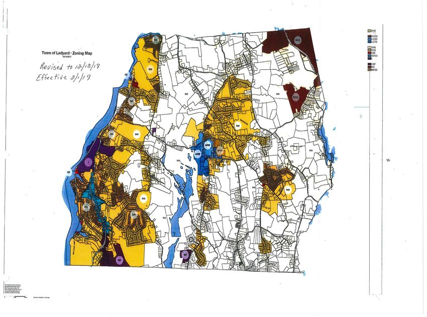
Ledyard Plan of Conservation & Development

Table of Contents
  I.    Introduction ..................................................................................... 1
  II.    Conditions and Trends .................................................................... 5
  III. Executive Summaries ..................................................................... 9
  IV. Housing......................................................................................... 16
  V.     Utilities ......................................................................................... 21
  VI. Transportation and Roads ............................................................ 30
  VII. Economic Development ............................................................... 37
  VIII. Community Resources ................................................................. 42
  IX. Business Districts ......................................................................... 62
  X.     Land Use ...................................................................................... 69

                                                     -i-                                              2/27/2020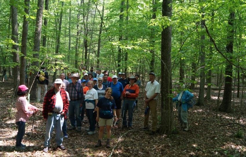
Ledyard Plan of Conservation & Development

Table of Contents - Figures
FIGURE 1:              Excerpt – Connecticut General Statutes 8-23-Plan of
                       Conservation & Development
FIGURE 2:              Riverside Mall, Gales Ferry
FIGURE 3:              Red-Backed Salamander
FIGURE 4:              Apple Tree
FIGURE 5:              Ledyard Housing Authority
FIGURE 6:              Highlands WWTP Equipment
FIGURE 7:              Erickson Park
FIGURE 8:              Ledyard Police Department
FIGURE 9:              Ledyard Bill Library
FIGURE 10:             Gales Ferry Schoolhouse
FIGURE 11:             Up-Down Sawmill
FIGURE 12:             Community Hike
FIGURE 13:             Ledyard Center Business District (Blue Outline)
FIGURE 14:             Ledyard Center School
FIGURE 15:             Gales Ferry Business District (Blue Outline)
FIGURE 16:             Example of an open space cluster subdivision
FIGURE 17:             Aquifer Protection Overlay Areas – Ledyard, CT
FIGURE 18:             Mill Cove from Military Highway

                                              -ii-                           2/27/2020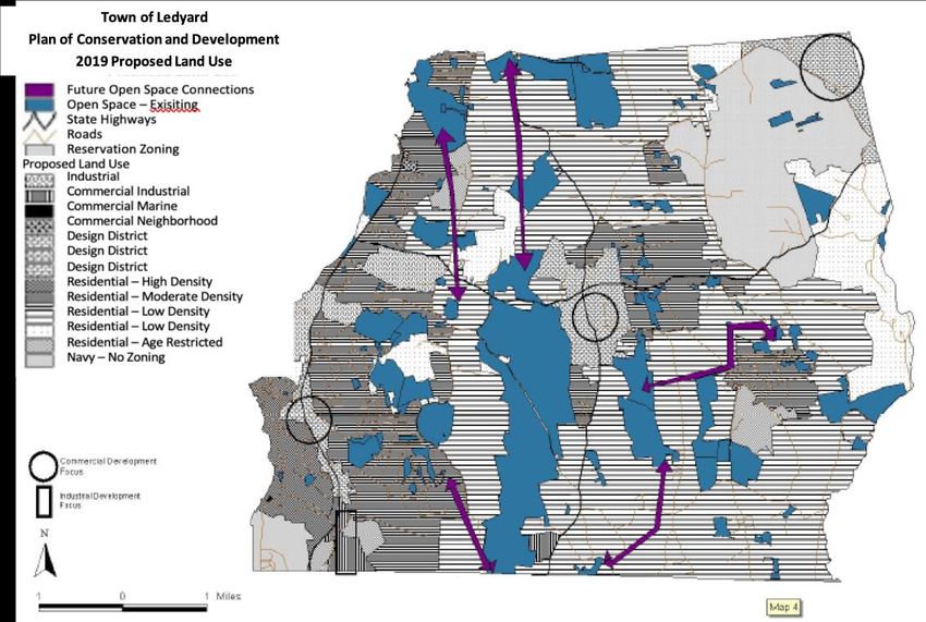
Ledyard Plan of Conservation & Development

                                ACKNOWLEDGMENTS

In adopting this Plan, the members of Ledyard's Planning & Zoning Commission reviewed and
evaluated written and oral comments from Ledyard residents and comments from the following:
Ledyard’s Conservation, Historic District, & Economic Development Commissions, Water
Pollution Control Authority, Town Council, Southeastern Connecticut Council of Governments,
Tri-Town Trail Committee and Town Staff.

                           PLANNING & ZONING COMMISSION
                                    Nate Woody, Chairman
                                 Jeffrey Kulo, Vice-Chairman
                                    Marty Wood, Secretary
                                        Thomas Baudro
                                        Michael Cherry
                                       Ernest Disco (Alt.)
                                      Hilary Evans (Alt.)
                                      Katie Scanlon (Alt.)
                             Edward Lynch (Former Reg. Member)
                              Paul Maugle (Former Alt. Member)

                                             MAYOR
                                         Fred B. Allyn, III

                                       TOWN COUNCIL
                                    Linda C. Davis, Chairman
                                       Kevin Dombrowski
                                          Andra Ingalls
                                        Thomas Malone
                                         John Marshall
                                       Mary K. McGrattan
                                       Anthony Sabilia, Jr.
                                         William Saums
                                      Michael Washington

                                            STAFF
                     Elizabeth J. Burdick, Director of Land Use & Planning
                      Kyle J. Faulise, Zoning, Wetlands & Blight Official
                             Deborah Dobson, Land Use Assistant

                                                -iii-                                2/27/2020
Ledyard Plan of Conservation & Development

               Introduction
“City by city, town by town, and region by region, we need guiding frameworks for the land use
and infrastructure decisions that local officials make every day – the little decisions that, when
taken as a whole, can have as much or more of an impact than decisions we often think of as
big.”
                                                      Lucy Allen, Chair, NLC Advisory Council
                                                      Mayor, Louisburg, North Carolina

A viable community is dynamic, exhibiting a continuum of growth and change. This growth and
change exert pressure on land, roads, transit systems, water, sewer and housing that must be
anticipated and accommodated in any land use decisions. The Plan of Conservation and
Development (Plan) is a guiding framework for the future conservation and development of the
community and is an important tool in the land use decision making process. The Plan is
required under Connecticut General Statutes Section 8-23 and, according to the statutes, is to
show “the Commission’s recommendation for the most desirable use of the land within the
municipality… and for the most desirable density of population.…” It is an advisory document
utilized by the Planning and Zoning Commissions as well as all other town boards and
commissions. The requirements for the Plan are excerpted in Figure 1.

This Plan builds on previous plans adopted in 1965, 1972, 1982, 1993, and 2010 and considers
input from the public, members of the Planning and Zoning Commission, Conservation
Commission, Historic District Commission, Water Pollution Control Authority and Inland
Wetlands and Watercourse Commission. It is intended to continue the tradition of guided
growth, land use and development within the town of Ledyard.

Plan Authority, Application and Implementation

Policies contained in this document should guide planning and decision-making processes of
local government. Section 8-23 of the Connecticut General Statutes says: “The Plan shall be
designed to promote with the greatest efficiency and economy, the coordinated development of
the municipality and the general welfare and prosperity of its people.”

                                                -1-                                        2/27/2020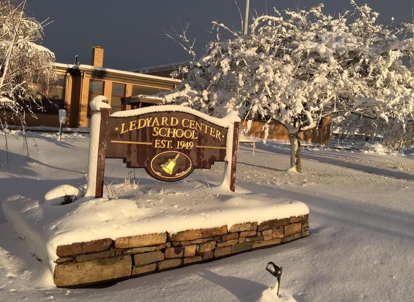
Ledyard Plan of Conservation & Development
This Plan has a strong land-use and growth
Figure 1
management component. Section 8-3(a) of the
Excerpt - Connecticut General Statutes 8-23
General Statutes requires the Planning Commission
to determine whether a proposed zoning district The Commission shall:
Prepare, adopt and amend a plan of conservation
boundary change or amendment to the zoning
and development…
regulations is consistent with the Plan. Review the plan of conservation and development
at least once every ten years…
Adopt such amendments to the plan or parts of the
Section 8-24 of the General Statutes and Chapter VII plan…as the commission deems necessary to
(3)(c) of the Town Charter call for the Planning update the plan.
Commission to review municipal improvements The Plan Shall:
proposed by various Town agencies and Be a statement of policies, goals and standards for
the physical and economic development of the
departments. This Commission will use this Plan to
municipality…
evaluate such proposals. Show the commission’s recommendation for the
most desirable use of land within the municipality
for residential, recreational, commercial, industrial
The Planning Commission approves all subdivision and other purposes and for the most desirable
of land (Section 8-25 of the General Statutes). It is density of population…
Be consistent with coastal program
the Commission's intent that proposed subdivisions requirements…
and/or changes to the subdivision regulations further Be made with reasonable consideration for
restoration and protection of the ecosystem and
the objectives of this Plan. habitat of Long Island Sound…
Reduce hypoxia, pathogens, toxic contaminants
Finally, this Plan can be used to support and justify and floatable debris in Long Island Sound…
Make provision for the development of housing
funding requests and grant applications to the state opportunities, including opportunities for multi-
and federal governments. Certain categorical grants family dwellings consistent with soil types, terrain
and infrastructure capacity…
require that projects be compatible with this Plan. Promote housing choice and economic diversity in
housing including housing for both low- and
moderate-income households and encourage the
Plan Consistency development of housing, which will meet housing
needs…
Take into account the State Plan of Conservation
This Plan was compared with the Locational Guide and Development…and note any inconsistencies it
Map in the 2013-2018 State Plan of Conservation may have with said plan.
Consider the use of cluster development to the
and Development. It was found to be generally
extent consistent with soil types and terrain and
consistent with that Plan. In addition, this Plan was infrastructure capacity.
compared with and guided by the 2017 Conservation
and Development Policy Guide prepared by the Southeastern Connecticut Council of
Governments and found to be generally consistent with that Plan.
Any inconsistencies can be generally attributed to:
⬧ Differences in definitions of desirable uses or development densities
⬧ Local (as opposed to Regional or State) desires about how Ledyard should grow and change
in the coming years
-2- 2/27/2020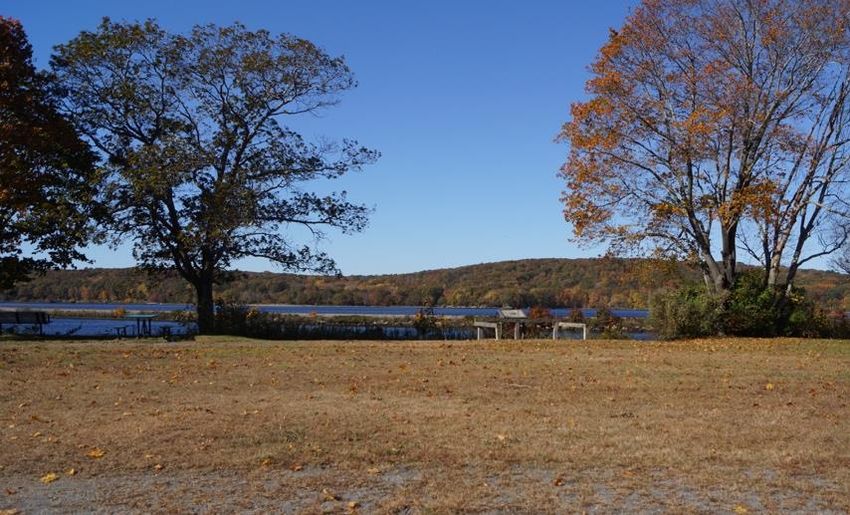
Ledyard Plan of Conservation & Development

⬧ The fact that the State Plan and the Regional Plan make policy recommendations for land use
   intensity and environmental sensitivity while this Plan suggests specific land use types.

Ledyard History

Our future planning for Ledyard is guided as much by the context of our history as it is by our
future goals. A continuous link between the past, present and future is needed in order to ensure
that our proposed changes help the town evolve, based on its actual strengths and weaknesses,
rather than on a universal plan. Ledyard evolved from a small agricultural town to a suburban
community in a short twenty-year period that changed the town permanently.

During the 1940s, the Town Fathers wanted to end the one room schools and have a consolidated
school but could not start until the end of World War II. Buildings that did not support the war
effort could not be constructed while the war was in progress and so it was not until September
1949 that the Ledyard Consolidated School opened with six classrooms and an auditorium. Juliet
W. Long was principal and taught the eighth grade. The school was to serve the needs of
Ledyard for twenty years. Its auditorium also provided a place to hold the town meetings, which
had been previously held in the basement of the Ledyard Congregational Church.

In 1946 the Town started paving the roads. In 1945, Route 12 came to Town making a trip from
Groton to Norwich much easier because the existing roads traveled around ledge outcroppings
and coves of the Thames River.

The Town Fathers could not have foreseen the phone call that would alter the course of
Ledyard’s history. Hyman G. Rickover, then a Navy Captain, discussed building an innovative
new submarine with the shipyard commander at Portsmouth Naval Shipyard in Kittery Maine.
The commander was not particularly interested in Rickover’s project. Captain Rickover
borrowed the Admiral’s phone and called O. P Robinson, President and General Manager of
Electric Boat Company. Robinson was very interested and invited the captain down to discuss
his project. The ensuing handshake at their meeting settled the site of a birth called Nautilus, the
first nuclear powered submarine. Additional nuclear submarines were designed and built at the
shipyard in Groton. This was followed by the missile firing submarine, also designed and many
built in Groton. Additionally, Charles Pfizer Corporation in Groton increased its labor force
during that period and Dow Chemical opened its plant at Allyn’s Point in 1954. Dow was given
tax free status in Ledyard for ten years. At the end of the ten years, Dow became Ledyard’s
biggest taxpayer.

The great rise in employment opportunities caused a great increase in the needs for goods,
services and all forms of commercial activities. The population of Ledyard had been less than

                                                 -3-                                         2/27/2020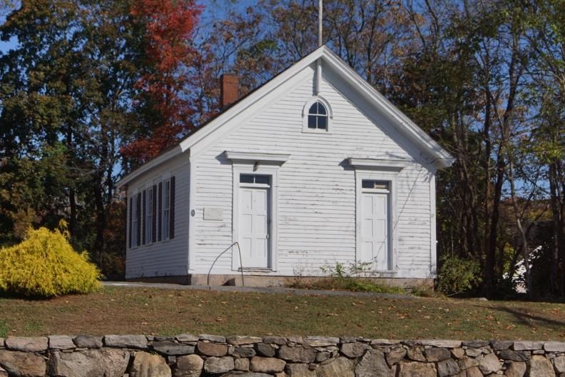
Ledyard Plan of Conservation & Development

2,000 up to 1950. The commercial events described caused the population of Ledyard to
explode. For a period of time in the 1950s and 1960s, Ledyard was the fastest growing town in
Connecticut.

In 1952, the first addition to the Ledyard Consolidated School had begun. In 1955, Gales Ferry
School opened, and the Ledyard Consolidated School became Ledyard Center School. During
the high growth years, while schools were being added on to, classes were held in the fire house
in Ledyard center. In 1956, the first phase of the current Town Hall was built replacing the
earlier town hall which was built in the 1930s and currently is used as the Ledyard Food Pantry.

In the following years, several additions to the Town Hall have taken place. High School
students from Ledyard had gone to The Norwich Free Academy in the past. However, the
population’s increase was too much for the academy, so Ledyard had to build its own high
school. It opened in 1960. This was followed by a middle school, Gallup Hill School and Juliet
Long School. Ledyard’s high rate of growth plateaued in 1970 and the population has remained
at that approximately level at the present. The twenty years between 1950 and 1970 changed
Ledyard from an agricultural community to the suburban residential community it is now.

                                               -4-                                       2/27/2020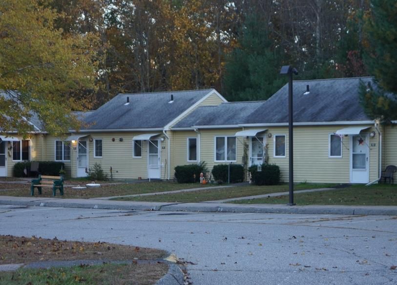
Ledyard Plan of Conservation & Development

               Conditions and Trends
Ledyard is a suburban town in southeastern Connecticut that covers 38.2 square miles, with a
population of 14,926 for a density of 390.5 people per square mile. Ledyard is bordered on the
west by the Thames River and by the Towns of Preston to the north, North Stonington,
Stonington and Groton to the East and South, and hosts within its boundaries the first federally
recognized Indian tribe in Connecticut, the Mashantucket Pequot Tribal Nation.

Ledyard was first settled in 1653 as part of the New London Colony, then as part of the
independent Town of Groton. The Town was incorporated from Groton in 1836. The Town has
a rich cultural history and its historical and ongoing relationship with Native Americans,
particularly the Pequot Tribe, has played an important role in the development of the Town.

Ledyard’s development pattern has been influenced by a number of factors, with the most
notable recent being its location. During the 1950s and 1960s, Ledyard was one of the fastest
growing communities in Connecticut, attributable in large part to a national growth in population
and the substantial increase in defense manufacturing jobs located in Groton and New London.
Ledyard served as a residential community and saw significant residential growth, but relatively
little commercial or industrial development. This trend continues as residents commute locally to
Groton, New London, the reservations and even further to Hartford and Providence.

Major employers within the community include Foxwoods Resort and Casino, Ledyard Board of
Education, Town of Ledyard, and US Dept. of the Navy. Although there are a large number of
people who commute into Ledyard daily for employment with the Board of Education and
Foxwoods, most Town residents rely on other employers in the region such as General Dynamics
Electric Boat, Pfizer and Mohegan Sun Casino & Resort for their job base and a majority of
Ledyard’s working population continues to commute to businesses outside the Town. The
SCCOG Regional POCD 2017 (Regional Plan) states employment in the region continues to be
concentrated in casino gambling and defense-related businesses.

Although characterized as a suburban community, the Town continues to retain a strong rural
character. The presence of significant wetlands and ledge combined with a lack of public
infrastructure limits the density of development in large portions of the town, which contributes
to a more rural characteristic that residents express a desire to protect and preserve. One of the
most significant trends is the growth in land preserved as open space or agricultural land. Efforts
should be made to ensure this trend continues and that future open space acquisition and

                                                -5-                                        2/27/2020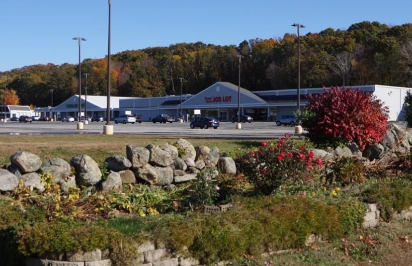
Ledyard Plan of Conservation & Development

preservation is planned in order to protect natural resources, the environment and the Town’s
quality of life. A robust effort to conserve open space for agricultural, recreational, watershed,
and habitat has seen concrete gains in recent years. This growth is driven by active land trusts,
public/private partnerships with these organizations, and the implementation of Conservation and
Open Space Subdivision Zoning Regulations. The large areas of undeveloped land that remain
in town provide an opportunity for holistic planning of interconnected greenways that promote
healthy living, watersheds and promote property values.

Residential land use dominates all other land use categories in Ledyard with about 22,600 acres
of the Town’s 24,000 acres zoned primarily for residential use. Less than 1% of land in Ledyard
is occupied by industrial or commercial uses. Attention should be paid to economic development
policies and zoning regulations to make sure the town is encouraging appropriate commercial
uses. However, the lack of water and sewer infrastructure in Ledyard, the supply of available
industrially and commercially zoned land with infrastructure in nearby towns and the lack of
population density, suggests these numbers are unlikely to change substantially. However, a
slow increase in light commercial (primarily retail) uses in the towns business districts is visible.
Increasing residential density near these business districts will help make these areas more
viable.

Ledyard’s population at the 1950 census was 1,749, but it rose drastically in the mid-twentieth
century; between 1960 and 1970 the population grew from 5,250 to 11,649. In 2017, the US
Census Bureau American Community Survey (ACS 2017) estimated the population of Ledyard
as 14,926, down about 1% from the 2010 Census and is projected to decline further to 14,704.
Ledyard has experienced a significant decline in the population of school aged children over the
last 10 years, which is expected to total 24% through 2025. This decrease in school-aged
population mirrors the expected statewide decline of 10% and the regional decline of 15%.

Ledyard is also aging. The percentage of its population aged 65 and older continues to grow.
The median age of the Ledyard population of 40.5 (ACS 2017), which has increased by about 13
years since 1980, reflects this demographic shift. This trend is echoed regionally and nationally
and is expected to continue. This significant growth is seen in all 65+ age groups as well as the
25-44 age groups. These correspond to the large boomer and millennial generations age groups.
Importantly, the 65+ households do not represent an influx into the area but aging in place by
retiree’s trying to stay in the area.

In addition to the aging population, the number and percentage of elderly households made up of
single persons has grown. The aging of the Ledyard population and the increasing number of
those who live alone has housing and service implications that must be considered in future
capital planning. Such implications include impacts on education and parks & recreation

                                                 -6-                                         2/27/2020
Ledyard Plan of Conservation & Development
budgets, as well as a potential increase in social services, health care services and senior
activities, along with the growing demand for more affordable & smaller housing units, age-
restricted developments, and assisted living, nursing & congregate care facilities.
The majority (82%) of Ledyard is White, about 10% higher than the rate in New London County.
It was estimated that 2% are Black/African American, 2% Native American ,2% Asian5, %
Mixed and 6% Hispanic/Latino origin. With the exception of a significant population of Native
Americans, these rates are approximately half those found in New London County (ACS 2017).
Ledyard currently enjoys a poverty rate well below the state and county averages at 4.9%,
compared with 9.9% for NL County and 10.1% for CT (ACS2017). Additionally, The Town’s
unemployment rate of 3.0% (Labor Force 8,220, Employed 7,971, Unemployed 249) is below
the state (3.6%) and county (3.5%) averages (CT DOL Labor Market Information 2019). The
median household income was $88,163, 25% which is 20% higher than for NL County at
$69,411 and for CT at $73,781 (ACS2017).
The majority of Ledyard is made up of single-family housing, agriculture, and other open spaces.
Residential land use continues to dominate all other land use in Ledyard. There are two business
districts, Ledyard Center and Gales Ferry Village and there has been little commercial or
industrial development in Town.
According to SECCOG report “Housing a Region in Transition: An Analysis of Housing Needs
in Southeastern Connecticut,” the Southeastern Connecticut region is facing a serious affordable
housing shortage. The report estimates the region will need an additional 7,200 housing units
between 2015 and 2030, which is a 6.3% increase for the 22-town area. It is expected that half
of these new units will need to be rental units (as compared to the current rental rate of 35%).
The need for rental units is also seen by looking at the projection that ~55% of the 7,200
additional households will earn less than $50,000, which is the approximate threshold for a two-
person household to qualify as “low-income.” Ledyard currently has ~4% housing that meets the
8-30g Affordability standard. With approximately 6,000 housing units in town, this means an
additional ~400 exclusively affordable housing units need to be built to achieve the 10% 8-30g
target, which it is unlikely to be able to achieve.
Each year the Mayor prepares a Capital Improvement Program (CIP). This document is the
multi-year, future scheduling of public physical improvements. It is prepared with the input of
town departments, reviewed and approved by the Planning Commission and adopted by the
Town Council. The CIP serves as a fiscal planning tool but does not commit the Town Council
or taxpayers to specific projects or specific financial obligations. The following are areas of
focus for future long-range capital expenditures:
-7- 2/27/2020Ledyard Plan of Conservation & Development
Water Pollution Control Authority. Improving the provisions of water and sewer service
is an important component for the long-range capital goals of the Town. Areas of focus for water
mains include Aljen Heights and creating interconnections with other existing community and
public water systems, such as Groton and Norwich Public Utilities. Sewer service areas should
concentrate on Ledyard Center and the Route 12 area of Gales Ferry. Other areas may be
appropriate to abate existing or anticipated abatements from septic system failures. Due to the
limited existing treatment capacity of the Ledyard plant sewer main extensions may have to be
accompanied by increases in treatment capacities. Intermunicipal connections should also be
considered as a solution to expanding treatment capacity and main extensions.
Facilities. The Director of Public Works maintains a Capital Facilities Plan, which
encompasses all town buildings and properties, with the exception of school, and should
continue to be followed and funded.
Public Schools. Consider implementation of a plan for renovation of Juliet W. Long
Elementary School in Gales Ferry.
-8- 2/27/2020Ledyard Plan of Conservation & Development
Executive Summaries
Town Centers
Conditions and Trends:
Ledyard has two primary commercial districts that
front on the two major state roads through town.
Ledyard Center hosts the major town municipal
facilities and has long been targeted for higher-
density residential and mixed-use development.
Gales Ferry is more commercial in nature and will
require more redevelopment to site higher-density
residential development.
Goals: FIGURE 2
1 RIVERSIDE MALL
Creation of a walkable town green – The sale of the Ledyard Center School has created an
opportunity to create a compact, accessible area that should be developed as a primary site for
community events.
Improve Streetscapes- While a significant portion of streetscape was completed in 2018 in
Ledyard Center and has made it a much more walkable area, Route 12 remains very difficult to
walk in. Similarly, the streetscape in Ledyard Center needs to be extended to nearby areas.
Infrastructure – Development in both commercial districts will be enhanced by improved
infrastructure.
Implementation:
Grant Funding Streetscapes and walkability are only likely to be
addressable through grant applications. Without state
or federal funding, it is unlikely the conditions around
Route 12 can be fixed.
Infrastructure Pursue realignment of water service areas to increase
utility access to Ledyard Center.
Encourage Development Examine public-private partnerships to encourage the
desired development in both commercial areas.
-9- 2/27/2020Ledyard Plan of Conservation & Development
Land Use Regulations
Conditions and Trends:
A comprehensive revision of the zoning regulations and map (Map 1) was approved in 2018,
effective 2/1/19. This followed a multi-year process starting with a Town Council sponsored ad-
hoc committee in 2015. The ad-hoc committee was tasked with simplifying the regulations and
providing more streamlined application process for commercial and industrial applications. The
subdivision regulations have not been updated since 2012. Challenges such as balancing the
needs for a variety of housing with watershed and open space protection require a continued
evolution in land use regulation to keep with the changing needs and desires of Ledyard’s
population.
Goals:
Manage Development - Support and manage the growth and development of Ledyard in order
to maximize both the environmental and functional quality of life. Regulations must carefully
protect the character of Ledyard while providing the flexibility needed to continue to attract new
residents and new businesses.
Maintain Regulations - Maintain suitable subdivision and zoning regulations that reflect the
development pressures on the town and that maximize compatible uses, maintain property
values, minimize the impact of new development on natural resources and manage the growth of
public services and maintenance costs.
Support the POCD - Revise zoning, inland wetlands and subdivision regulations as necessary to
implement the goals and strategies of the Plan of Conservation and Development and promote
consistency between the Plan of Conservation and Development, regulations, and policies of all
land use boards.
Implementation:
Zoning Regulations Accessory dwelling units, changing definitions of families,
and the need for alternative and affordable housing will
require regulation for the town to evolve.
Subdivision The subdivision regulations were last updated in 2012 and
Regulations need to be updated to improve alignment with the zoning regs
and to ensure consistency with the POCD.
Aquifer/Watershed Updated Zoning regulations and discussions with WPCA will
Protection be needed in order to implement effective aquifer and
watershed protection.
-10- 2/27/2020Ledyard Plan of Conservation & Development
Open Space
Conditions and Trends:
Ledyard’s undeveloped land is critical in
shaping the town’s character as a rural
suburb. The presence of wetlands, ledge,
and lack of infrastructure limits the density
of development in many parts of the town,
which contributes to a rural characteristic
that residents express a desire to protect and
preserve. Undeveloped land is vulnerable to
development pressures coupled with the
continued lack of a cohesive open space
policy has led to significant fragmentation of
FIGURE 3 RED-BACKED SALAMANDER
open and protected spaces.
Goals:
Preserve Open Space - Acquisition and protection of high value open space to protect and sustain
habitats, natural resources, and recreation areas
Promote Connections - Develop a town-wide and inter-town network of trails and open space.
Facilitate and encourage the acquisition of open space which will provide connectivity between
open-space parcels.
Protect Water Resources - Protect wetlands, watercourses, and vernal pools from pollution and
minimize the impact of impervious surfaces which accelerate run-off and pollution.
Implementation:
Create Space Inventory Unused or inaccessible open space discourages continued ongoing
preservation. Easy digital access will promote usage.
Pursue Designations Raise the profile of open space through participation in regional and
state programs. Encourage use of by residents and visitors alike.
Encourage Education Strengthen the education and outreach efforts so all Ledyard children
should be aware of the natural resources in our town.
-11- 2/27/2020Ledyard Plan of Conservation & Development
Agriculture
Conditions and Trends:
Farming and agriculture have long been
important parts of Ledyard’s history and is
an important component of our economic
diversity. Proper municipal planning and
support is necessary for farming and
agriculture to remain contributors to our
economy and land use. Maintaining and
growing Ledyard’s agricultural base
contributes to public health and happiness,
provides jobs and agritourism opportunities,
and contributes to the pastoral vistas that
residents have come to associate with our
community. FIGURE 4 APPLE TREE
Goals:
Encourage Agriculture - Encourage continued use of land and aquatic based agriculture as both
a historic and future land use through advocacy of farm activities for the current and future
generations.
Promote Agribusiness – Consider what land use facilities can be used to enable agribusiness.
Examine whether common accessory uses and agriculture building structures are currently
allowed by zoning regulations
Encourage Watershed Protection – Encourage participation in NRCS and other programs that
ensure agriculture works to protect and not damage our wetlands and watersheds.
Implementation:
Create Ag Inventory The identification of the agriculture products allows this town-wide inventory of
farm products to be made available to the community at large.
Staff Ag Commission Proper support and advocacy of agriculture in town requires a group with the skills
and energy to act as an interface between farmers and town commissions.
Encourage Citizen Examine support and allowances for expanding and supporting home husbandry,
Participation Community Supported Agriculture and Community Gardens.
-12- 2/27/2020Ledyard Plan of Conservation & Development
Housing
Conditions and Trends:
Ledyard is a predominantly residential
community principally comprised of
single-family detached houses. Although
classified as suburban by the
Southeastern Connecticut Council of
Governments (SCCOG) large parts of the
town retain a strong rural character. It is
this rural nature that has attracted many
residents and it is a character many
residents wish to retain. Of the
approximately 24000 acres in the Town
of Ledyard, about 22600 acres are zoned FIGURE 5 LEDYARD HOUSING AUTHORITY
for residential use.
Goals:
Encourage a diversity of housing - Viable communities are diverse in terms of age, income,
family status, and should contain a reasonable mix of housing types to satisfy the needs of a
diverse population.
Supporting Existing Affordable Housing – Ensure that available programs, such as
Community Development Block Grant (CDBG) Small Cities Grants for housing rehabilitation &
public housing modernization, are continued and expanded where possible to maintain existing
affordable housing.
Implementation:
Examine ADU Usage Continue trends to grow the zones and locations where Accessory
Dwelling Units can be harmoniously implemented.
Promote Rental Housing SECHA (Southeastern CT Housing Alliance) data demonstrates
significant need for rental housing, but Ledyard has limited stock
available.
Cluster Development Expand on the strength of cluster development regulations to promote
smaller, more affordable housing that promotes open space and
watershed protection.
-13- 2/27/2020Ledyard Plan of Conservation & Development
Utilities
Conditions and Trends:
Ledyard utilities that affect development are
primarily water and sewer. Ledyard
depends on Groton Utilities for all of its
piped water supply. More than 5,200 acres
of land (nearly 21 percent of Ledyard’s total
area) is located within a state-designated
public water supply watershed that drains to
the system of reservoirs owned by the City
of Groton. Most of Ledyard uses on-site
septic systems, with the important exception
of the municipal Highlands wastewater
treatment plant, which is capable of
processing 300k gallons per day of waste.
FIGURE 6 HIGHLANDS WWTP EQUIPMENT
Goals:
Utilization of Highlands Treatment Plan - Increase sewer tie-ins to the upgraded Highlands
sewage treatment plant in conformance with capacity limits established by the CT Department of
Environmental Protection.
Pursue Expanded Infrastructure – Expansion of utility availability (sewer and water) along the
primary development corridors in Ledyard and along Route 12.
Protect Water Resources - Subdivision, zoning and public works standards should be reviewed
to ensure that calculations are required to show 0% increase in run off to man-made and natural
drainage systems resulting from development to minimize impacts to property and the
environment.
Implementation:
Utilize WWTP Capacity Connect Gallup Hill School and the former Ledyard Center School to Highlands
Treatment Plant.
Protect Water Resources Subdivision, zoning and public works standards should be reviewed to ensure that
0% increase in run off to man-made and natural drainage systems resulting from
development is enforced.
-14- 2/27/2020Ledyard Plan of Conservation & Development
Community Resources
Conditions and Trends
Community facilities provide for the health,
welfare, and convenience of residents and
add to the quality of life. Such facilities
support the operations of governmental
functions, including governmental facilities,
public works, public safety, and emergency
services. Others provide educational and
recreational opportunities for town residents,
including schools, libraries, Parks and
Recreation, and Ledyard’s extensive system
of outdoor trails and open space areas. The FIGURE 7 ERICKSON PARK
Planning Commission will review this
chapter when evaluating the Mayor's annual
proposed “Capital Improvement Plan.”
Goals:
Provide and maintain adequate community facilities - Ensure that existing facilities are
efficient and economical to operate and prepare for future demands.
Encourage recreational access – Encourage the development of healthy communities through
promoting access to parks and recreational opportunities, including trails, greenways, community
gardens and waterways.
Develop Transportation - Develop alternatives to single-occupancy vehicle transportation,
including re-establishing a bus line, building commuter parking lots, and connecting and
expanding current bicycle and pedestrian ways.
Implementation:
Conduct Vulnerability Conduct a vulnerability assessment to identify threats and gaps in
Assessment schools and emergency services.
-15- 2/27/2020Ledyard Plan of Conservation & Development
Housing
Overview
Ledyard is a predominantly residential community principally comprised of single-family
detached houses. Although classified as suburban by the Southeastern Connecticut Council of
Governments (SCCOG) large parts of the Town retain a strong rural character. It is this rural
nature that has attracted many residents and it is a character many residents wish to retain.
Residential land use dominates all other land use categories in Ledyard. Of the approximately
24000 acres in the Town of Ledyard, about 22600 acres are zoned for residential use.
According to 2018 CERC (CT Economic Resource Center) data, Ledyard has 6297 housing
units, 85% of which are single-family residences. With limited land zoned for higher density
development, significant building challenges such as wetlands and ledge, and limited
infrastructure nearly all the new development in the past 10 years has been in large lot
subdivisions or individual, large-lot single family houses. Recovery from the 2008 Recession
has been slow in the area, with only 153 housing units built between 2008 and 2018 (139 being
single-family units).
Within the Town are large older subdivisions in the Highlands, Avery Hill, Aljen Heights and
Gales Ferry area and newer and smaller subdivisions sprinkled throughout the town. There are
few apartment complexes, rental units and minimal diversity of housing types. The 22 town
SECOG area has a significant problem with access to affordable housing, with 37% of
households considered to be cost-burdened (spending >30% of income on housing). However,
Ledyard is below this value with only 27% of homeowners considered to be cost-burdened.
Housing units are considered affordable if a person earning no more than the AMI (Area
Median Income) pays no more than 30% of their annual income for it (CGS 8-39a). The
household AMI for New London in $84000, which corresponds to an affordable threshold of
approximately $2000 per month, or a home purchase cost of approximate 225k.
Goals
To guide the residential growth and development of Ledyard and ensure high standards of
design and quality of life.
To encourage a diversity of housing types and ensure an adequate supply of housing at
affordable cost.
Encourage and expand on cluster subdivisions on large parcels.
-16- 2/27/2020Ledyard Plan of Conservation & Development
• Adopt regulations that increase the zones where Accessory Dwelling Units (ADU’s) are
allowed.
• Adopt regulations to allow by-right development of multi-family and infill housing.
• Maintain existing affordable housing already present in older developments through blight
control and housing rehabilitation grants.
Issues, Policies and Strategies
1. Quality Residential Development
The Town of Ledyard is predominantly residential. According to surveys done for the 1993 Plan
of Development, and a workshop held in April of 1997 to gather input for the Economic
Strategies Plan (“Mullin Report”), residents desire to maintain the town’s low-density residential
character. In general, the current existing, residential zoning districts and their bulk requirements
support the desired development patterns. Since limited infrastructure is available, homes must
rely on private wells and septic systems. Therefore, larger lot sizes (and therefore lower density)
are necessary to provide sufficient room for these structures and the requisite separating
distances.
The Town should continue to support higher density residential development and diverse
housing type construction as a component of mixed-use development near Ledyard Center, along
the Route 12 corridor and where water and/or sewer is available and continue lower density
single family development in other areas.
The water quality in older developments, specifically Aljen Heights and Avery Hill must be
addressed. Ledyard should plan to link the Route 12 water line or connect a water tower to the
Aljen Heights and Avery Hill Developments. There is the potential for financing part of this
work with Federal funds through the Department of Housing and Urban Development.
2. Cluster Development
The cluster development (Conservation and Open Space) regulations have provided a good tool
for promoting quality development in large parcels that creates smaller building lots and
allowing for more affordable housing while preserving significant open space and hence
preserving Ledyard’s rural character. These regulations have been heavily used and the recent
refinements to the regulations appear to have helped encourage the desired development styles.
However, because these regulations can only be utilized on large parcels, this encourages
development on larger outlying parcels which tends to create sprawl instead of concentrating
development nearer to commercial services. The current cluster regulations don’t work on
smaller parcels and are still designed for single family homes, not the higher densities desired in
-17- 2/27/2020Ledyard Plan of Conservation & Development
Ledyard Center and Gales Ferry Center. The 2018 regulation update included an incentive
housing zone, which allows flexible mixed-use development with the ability to include
apartments, condo’s, and townhomes. This zone allows the creation of a walkable neighborhood
that helps support commercial businesses. The 2019 sale of the Ledyard Center School property
should provide an opportunity to use these regulations as a prototype for high density mixed-use
development. The cluster subdivision regulations should similarly be updated to include
sidewalks, promote walkability and consideration given to allowing limited commercial areas
inside the clusters. The subdivision cluster regulations should be updated to make them fully
compatible with the 2018 zoning regulation update and to ensure that a reasonable level of
flexibility is provided to developers.
3. Encourage Housing Diversity and Affordability
Viable communities are diverse in terms of age, income, family status, and should contain a
reasonable mix of housing types to satisfy the needs of a diverse population. This means
providing a balance of single-family homes, partially detached homes, and multi-family
apartments. In its report, “Housing a Region in Transition: An Analysis of Housing Needs in
Southeastern Connecticut,” the Southeastern Connecticut Council of Governments (SCCOG)
analyzed the housing needs of the Southeastern Connecticut region. According to the report, the
Southeastern Connecticut region is facing a serious affordable housing shortage. The report
estimates the region will need an additional 7,200 housing units between 2015 and 2030, or
6.3%. It is expected that half of these new units will need to be rental units (as compared to the
current rental rate of 35%). The need for rental units is also seen by looking at the projection
that ~55% of the 7,200 additional households will earn less than $50,000, which is the
approximate threshold for a two-person household to qualify as “low-income”. In addition to
this increased pressure for the availability of affordable housing, the report highlights the aging
population of the area.
-18- 2/27/2020Ledyard Plan of Conservation & Development
Significant growth is seen in all 65+ age groups as well as the 25-44 age groups. These
correspond to the large boomer and millennial generations age groups. Importantly, the 65+
households do not represent an influx into the area but aging in place by retiree’s trying to stay in
the area. In an effort to meet the needs of older Ledyard residents and allow them to remain
within the community, regulations should encourage development of appropriately scaled
retirement communities when it is consistent with overall plan goals and strategies. The town
should review and revise the zoning regulations that pertain to elderly housing to ensure no
obstructions exist to allow a diverse set of elderly housing types. The town should pursue using
state or federal grants or subsidy programs to encourage this type of development.
However, providing senior housing cannot be the only way that Ledyard adapts to these
changing demographics. Younger households are more likely to pursue smaller homes, partially
detached homes, and homes that provide amenities and walkable commercial areas. Changes to
the zoning regulations and encouraging Incentive Housing Zone-style development will be
required to attract these younger households into Ledyard. Failure to develop this type of
housing stock risks an unstable school-age population and losing the vibrancy of the town. The
town must find additional means to allow duplexes and townhomes, either as infill development,
or at some percentage of a subdivision.
Ledyard currently has ~4% housing that meets the 8-30g Affordability standard. With
approximately 6,000 housing units in town, this means an additional ~400 exclusively affordable
housing units need to be built to achieve the 10% 8-30g target. Using the 8-30g design ratios of
30% affordable units, ~3,000 new housing units in 8-30g developments would need to be
constructed in order to achieve the 10% target! At the recent construction rate of 10-20 new
homes per year, neither of these scenarios are achievable and therefore Ledyard will always be a
target for 8-30g development. Instead, 8-30g should be considered as a tool that can be used to
provide the type of density desired in Ledyard Center and Gales Ferry that can support further
commercial development in these two town centers.
The lack of infrastructure in many parts of Ledyard limits the density of development in many
ways. However, as the recent apartment development on 117 demonstrated, reasonably large,
high density developments can be built without the benefit of sewer. These rental units
commanded a premium rental price, but rented out almost immediately, demonstrating that
creative development can result in high quality, desirable, dense development.
In order to meet the needs for increased rental units and smaller more affordable houses, the
town should consider allowing by-right development of ADU’s. Current regulations allow
attached ADU’s, but currently prohibit detached ADU’s. Properly regulated ADU’s are an
increasingly popular tool to provide affordable housing in many parts of the country, Ledyard
should examine whether this tool could be effective here. Adaptation of existing subdivisions to
-19- 2/27/2020Ledyard Plan of Conservation & Development
allow detached ADU’s may be difficult, but development of regulations to allow expanded
ADU’s should consider how the regulations could be modified to allow construction of detached
ADU’s.
4. Supporting Existing Affordable Housing
Ledyard contains significant developments of smaller, affordable housing stock (such as the
Highlands and Aljen Heights.), which are smaller homes on ~1/3 acre lots. The homes in these
neighborhoods are excellent options for starter families or older residents looking to downsize,
but only if the quality of the neighborhood is maintained. Active enforcement on the blight
ordinance can help ensure that the values of the homes are maintained and that they remain an
attractive option. In addition, grant opportunities to assist homeowners with larger repairs
should be expanded on by the Land Use Department as a means to protect these properties.
-20- 2/27/2020Ledyard Plan of Conservation & Development
Utilities
Overview
For the purpose of this chapter, utility infrastructure in Ledyard includes public water, public
sewer, cellular and wired utilities such as electric, telephone and cable. The location and
capacity of existing and proposed infrastructure is critical to the growth, particularly the
commercial growth, of Ledyard and to the protection of the environment and the quality of life
for residents.
Ledyard Highlands Wastewater Treatment
Facility
New Grit Pit New Screen Compactor Building
New Blowers and Valving New SBR Decanters
-21- 2/27/2020Ledyard Plan of Conservation & Development
A. Public Sewer
Background
With exception of a municipal sewage treatment facility serving the Highlands area, a facility
built by the Mashantucket Pequot Tribe to serve Foxwoods Casino, and a small private treatment
plant at Dow Chemical, most homes and businesses in Ledyard use and will continue to use on-
site septic systems for sewage disposal.
In 2018, a $1.3 million renovation and upgrade to the Highlands wastewater treatment plant was
completed. The project involved a new screen and compactor enclosed in a heated building, new
decanters, 3 new blowers, new feed pumps, valves and automation. The newly installed
automation and blowers now controls nitrogen oxides below state limits 24 hours a day, 365 days
a year.
Goals
Public Sewer
Recognizing that sewer capacity in Ledyard is a limited resource, care must be taken to ensure
that expansion to new areas is appropriate, efficient and fosters good, sustainable development.
• Ensure effective and efficient private and public wastewater collection systems.
• Increase sewer tie-ins to the upgraded Highlands sewage treatment plant in conformance with
capacity limits established by the CT Department of Environmental Protection.
• Improve and support expansion of infrastructure in appropriately zoned areas to enhance
economic/commercial development opportunities, particularly at Ledyard Center.
• Improve and support expansion of infrastructure to protect groundwater and surface water in
environmentally sensitive areas.
• Encourage regional tie-ins, particularly in the Gales Ferry district.
Issues, Policies and Strategies
Public Sewer
1. Protection of Groundwater and Surface Water Supplies through Proper Septic
System Design
Ledyard depends on groundwater and reservoirs for its water supply, therefore septic systems
must be located, installed and repaired with great care. Many developable areas remaining in
Ledyard are characterized by shallow depth to bedrock, steep slopes, a high groundwater table,
-22- 2/27/2020Ledyard Plan of Conservation & Development
and/or the presence of wetlands. The subdivision requirement that all new building lots contain
seventy-five percent contiguous non-wetland area should be enforced consistently, uniformly
and not waived. Rezoning proposals that will increase density in areas served by on-site septic
systems that would circumvent regulations intended to protect wetlands, well fields or
neighboring wells should not be approved by the Zoning or Planning Commissions. Current
minimum acreage and zoning requirements for building lots should be maintained in all
environmentally sensitive areas served by individual on-site septic systems in order to guarantee
sufficient primary and reserve leaching areas. All development projects that fall within the
Groton watershed should be submitted to Groton Utilities by the applicant for review and
comment and all comments submitted to the appropriate Ledyard land use commissions for
consideration.
CT Public Health Code overrides local zoning and subdivision regulations. Local health
officials should be contacted in advance of Commission review to find out:
• Whether an on-site septic system can be approved for a particular site;
• What lot sizes and other conditions are required for septic systems;
• How to apply for a septic system permit;
• Who must design, install and inspect new septic systems;
• Who is responsible for proper maintenance of the system;
• What must be done if the septic system malfunctions.
2. Highlands Wastewater Treatment Plant Improvements & New Tie-ins
Upgrades to the Town-owned Highlands Wastewater Treatment Plant (WWTP) were completed
in 2018 in compliance with CT-DEP approved designs. In 2018, the WWTP treated about
129,200 gallons per day (GPD), approximately half its approved design capacity. A priority for
WPCA is connecting the new Gallup Hill School complex and the Ledyard Center development
area that was previously Ledyard Center school. Presently there WWTP serves 460 customers.
In order to ensure that cumulative effluent discharges from new developments do not exceed the
treatment plant’s capacity limitations, WPCA should provide the following written evidence
during a land use board’s development review when WWTP connections are requested:
• Number, type and anticipated WWTP flows of proposed units;
• Cumulative number of other requested connections to the WWTP including potential tie-ins
that exist along the proposed route; and
-23- 2/27/2020Ledyard Plan of Conservation & Development
• Remaining unused capacity of WWTP after the proposed development is connected.
The priorities for the WWTP’s service area and remaining capacity should include projects of
significant economic benefit to the Town and/or those that diversify the types and affordability
of housing. Additional priorities would include projects that will remediate existing or prevent
additional environmentally stressed areas.
3. Enhance economic development opportunities in appropriately zoned areas through
expanded infrastructure.
Providing sewer and water infrastructure to commercial and industrially zoned areas of Ledyard
such as along Route 12 and Ledyard Center could facilitate the growth of commercial
development. The Town of Ledyard should conduct a cost-benefit analysis to determine if the
construction of either a community sewer system or a public sewer main extension that will
generate additional commercial/industrial development and the associated property tax revenues
which can offset design and construction costs. In addition, investigate the future status of Dow
Chemical plant infrastructure and in particular their industrial sewer treatment plant. There
could be an opportunity to reconfigure the treatment plant to handle residential sewer (Gales
Ferry) instead of abandoning and demolition of the facility. The Town should explore this
opportunity with Dow.
B. Public Water and Water Supply Source Protection
Background
Ledyard receives all of its water supply from Groton Utilities. More than 5,200 acres of land
(nearly 21 percent of Ledyard’s total area) is located within a state-designated public water
supply watershed that drains to the system of reservoirs owned by the City of Groton. This is the
source of water for the water supply line along Route 12 from Groton through Gales Ferry to
Aljen Heights. A separate line along Route 117 from Groton to just north of Ledyard Center that
serves properties located along both state roads connecting to the existing lines that serves the
Ledyard High school and Gallup Hill school extending to the Highlands. There are two water
towers serving Ledyard’s needs—one located at Ledyard Center (750,000 gallons) and one
located in Holmberg Farms off Route 12 (1 million gallons) and Aljen Heights plus a hydro-
pneumatic system serving the top of Avery Hill.
The Ledyard Water Pollution Control Authority (WPCA) combined with the Southeastern
Connecticut Water Authority (SCWA) wellfields serve approximately 40 percent of the Town’s
population. Additional wellfields are located on the Mashantucket Pequot Reservation serves the
-24- 2/27/2020Ledyard Plan of Conservation & Development
needs of the reservation. Remaining community water systems are quite small, serving
individual subdivisions, mobile home parks and apartments.
Because the main reservoirs that provides water to Groton Utilities are located in Ledyard, the
Town’s drinking water is vulnerable to development activities. Protection of water quality
remains an ongoing concern for the Town of Ledyard.
A regional water system that serves communities on both sides of the Thames River has been
installed and includes the Holmberg water tower with an underneath the river connection from
the east to the west side of the Thames River to supply regional customers in Montville and
Mohegan.
Completed recently are emergency connections to all 6 Southeastern Connecticut Water
Authority (SCWA) areas in Ledyard. The connections include a meter pit and a movable spool
piece that can be quickly installed in the event of a water emergency. Also planned is an
interconnection to the Norwich Water Utility on Route 12 in Preston.
Goals
Public Water and Water Supply Source Protection
• Ensure adequate potable water sources, supplies and distribution systems for Ledyard.
• Protect water quality and implement a source protection strategy through 1) proactive
zoning; 2) natural resource-based planning and site design; 3) use of best management
practices; and 4) water company review of proposed development projects located within
designated source protection areas.
• Increase public water supply through an interconnected regional water supply system.
• Effectively manage and control stormwater drainage to minimize impacts to the
environment.
-25- 2/27/2020Ledyard Plan of Conservation & Development
Issues, Policies and Strategies
Public Water and Water Supply Source Protection What are Best Management Practices?
Best management practices (BMPs) is a term
1. Expand public water distribution system used to characterize land management practices
Ledyard’s Water Pollution Control Authority (WPCA) has that are recommended, or required, to minimize
aggressively addressed water supply problems resulting human impact on the environment.
from groundwater contamination and capacity limitations of Over the years, engineers, water resource
specialists and others have studied the causes of
private wells and small community wellfields. The Town
non-point source pollution, and investigated
should continue these efforts. The following areas are a
different, practical ways to lessen or control this
priority for the provision of potable water: type of pollution. As a result, the best most
• Neighborhoods located to the east of Route 12 widely accepted techniques and strategies (BMPs)
(Terry Road, Woodland circle and Oakridge Drive) to manage land use activities are well
documented.
• Existing houses surrounding Long Pond From: The Watershed Guide to Cleaner Rivers, Lakes
& Streams (1995)
Diverse water supply systems should be interconnected,
both inter and intra-town, in an effort to increase reliability, supply redundancy, and decrease
incidents of reduced capacity. Efforts should be made to establish service area interconnections
throughout Ledyard utilizing main roads as pipeline corridors that include fire protection
(hydrants). See Table A.
Table A. Fire Protection Systems.
System Owner Fire Protection? Hydrants
Ledyard WPCA WPCA Yes 161
Mashantucket Pequot Tribal Nation Yes 33
Tower-Ferry Division SCWA No --
Barrett Division SCWA No --
Chriswood Division SCWA No --
Gray Farms Division SCWA No --
Ledyard Center Division SCWA No --
“Cluster Residential Developments” that take advantage of existing public water supply or
provide for the installation and interconnection of a community water supply distribution system
and/or wellfields should be encouraged. In addition, the Town should encourage the
development of water infrastructure to commercial and industrially zoned areas of Ledyard such
-26- 2/27/2020You can also read