Twin Coast Discovery Route and Northland Journeys Northland Integrated Cycling Implementation Plan Preliminary Design and Delivery - NZ ...
←
→
Page content transcription
If your browser does not render page correctly, please read the page content below
Twin Coast Discovery Route and
Northland Journeys
Northland Integrated Cycling
Implementation Plan
Preliminary Design and Delivery

WSP Opus

5 June 2019

VERSION Final

  The copyright of this document is held by the New Zealand Transport Agency. ©
    No reproduction of any part of this document is permitted without written
                                    permission.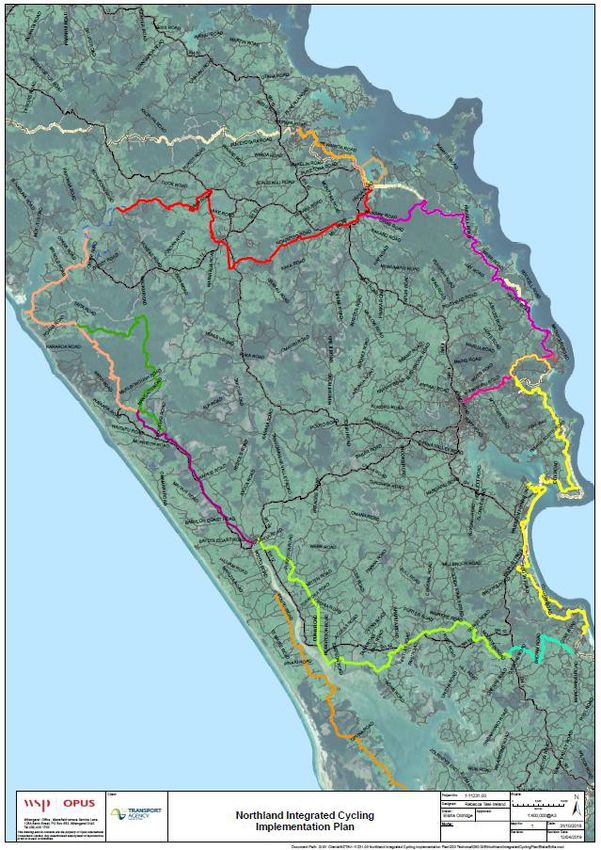
Contact Details             s9(2)(a)

                                            Mansfield Terrace Service Lane, 125A Bank St
                                            PO Box 553, Whangarei 0140
                                            New Zealand

                                            Telephone: +64 9 430 1700

                                            Document Details:
                                            Date:       05 June 2019
                                            Reference: 1-11231.00
                                            Status:     FINAL

                                            Prepared By

                                            Environmental Planner

                                            Reviewed By

                                            North West Area Manager

                                            North West Area Manager

www.ws p- o pu s.c o. nz   ©WSP Opus | 05 June 2019                                  Page i
Contents
1         Executive Summary .....................................................................................................................................................1

2         Introduction......................................................................................................................... 2

3         Overall Northland Cycling Plan............................................................................................. 4
          3.1       Overall Route and Project............................................................................................. 4
          3.2       The Network Effect..................................................................................................... 6
          3.3       Networked assumptions ............................................................................................. 7
          3.4       Networked effects ....................................................................................................... 7

4         Design Philosophy Statement .............................................................................................. 9
          4.1       Introduction ............................................................................................................... 9
          4.2       An Evolving Narrative ................................................................................................. 9

5         Trail Descriptions........................................................................................................................................................ 11
          5.1       Waoku Old Coach Road - (Hokianga Connection) ....................................................... 13
          5.2       Kaihu Valley Rail Trail ................................................................................................. 16
          5.3       Langs Beach to Ruakaka ............................................................................................. 18
          5.4       Opua to Paihia.......................................................................................................... 20
          5.5       Waitangi to Kerikeri ................................................................................................... 24

6         Overall Programme ........................................................................................................... 26
          6.1       Next Steps for Councils to Progress Priority Projects..................................................... 27
          6.2       Heartland Rides........................................................................................................ 28

7         Overall Project Risk Register .............................................................................................. 29

8         Alignment to Provincial Growth Fund................................................................................... 31

Supporting information: Preliminary Design Drawings.................................................................... 32

List of Figures
Figure 1: Overall Map of Routes ...........................................................................................................................................5
Figure 2:National and Regional Cycleway Benefits......................................................................... 8

List of Tables
Table 1: Routes Prioritised for First Stage of Delivery........................................................................ 3
Table 2: Project Timeline.............................................................................................................. 26
Table 3: Provincial Growth Fund Outcomes, Objectives and Criteria ................................................ 31

www.ws p- o pu s.c o. nz                                                   ©WSP Opus | 05 June 2019                                                                            Page ii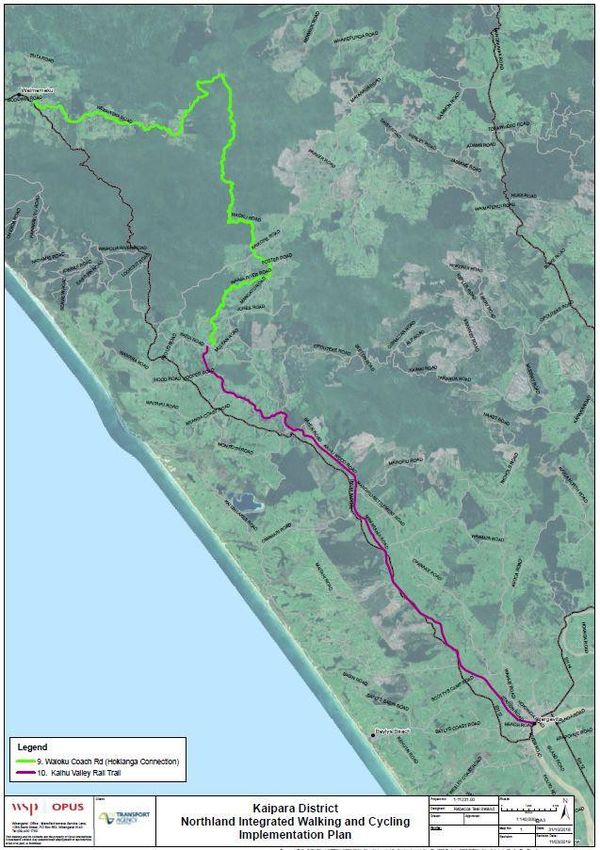
Document History and Status
 Revision           Date            Author                   Reviewed by    Approved by      Status

 1           05/04/2019                                                                   DRAFT
 2           09/04/2019                                                                   DRAFT
 3           12/04/2019                                                                   FINAL

                                    s9(2)(a)
Revision Details
     Revision                                                     Details
 1                  28/05/2019 Revised BCRs and Programming. Additional background information
                    from the NICIP – Problem Statements & Evaluation Framework (January 2019).

www.ws p- o pu s.c o. nz                       ©WSP Opus | 05 June 2019                               Page iii
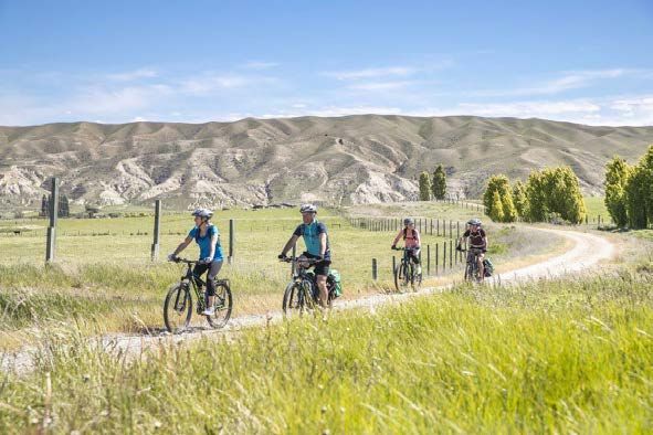
:

1       Executive Summary
The Northland Walking and Cycling Strategy was developed in 2017 by Northland’s various
councils and Northland Inc. Its aim is to contribute to the region’s economy through improved
infrastructure that would attract visitor’s region wide and all year round. The strategy prioritised 13
routes as meeting the vision for ‘Northland as one of the world’s best coastal walking and cycling
destinations where the journeys and stories are as impressive and memorable as the scenery’.

The Northland Integrated Cycling Implementation Plan now demonstrates a programme for
building these trails to deliver a network that could be installed in prescribed stages, prioritising
appropriate trails for early delivery.

The project seeks the early development of approximately 140km of off-road cycling and walking
tracks with an investment total of $19M and a benefit cost ratio (BCR) of 5.22. Through multi-
criteria analysis these trails have been assessed as ready for the first stage of delivery:

•       Waitangi to Kerikeri (13.7km);
•       Te Araroa Trail - Opua to Paihia Walkway (6.8km);
•       Opua to Paihia on-road cycle route via Aucks Road (8km);
•       Waoku Old Coach Road (53km);
•       Kaihu Valley Rail Trail (41km);
•       Langs Beach to Ruakaka (25km).

The first stage seeks to develop the above projects and add a total of approximately 140km of off
road trail to the existing 80km Pou Herenga Tai Cycle Trail. This creates a total of over 200km off
road trail, or 30% of the Twin Coast Discovery Route. An investment of $103M is required to
achieve the full 700km cycling network loop of Northland, which would roughly follow the Twin
Coast Discovery Route, an existing on-road loop.

Preliminary design and costings have been developed for each of these routes. The overall project
has been assessed against geotechnical requirements, implementation risks and alignment to the
Provincial Growth Fund.

The implementation of the trails will provide significant value to users as well as to local
communities. Together the trails form part of an integrated network with significant benefits
Northland wide. Central to the success of a network of walking and cycling trails across Northland
is making it legible and accessible as not only a place of pristine coastline and great forests, but
also a distinct cultural landscape with a long historical narrative that is still being written. Through
understanding a place as being ‘more than meets the eye’, a deeper appreciation, sense of
commitment and stewardship develops.

www.ws p- o pu s.c o. nz                   ©WSP Opus | 05 June 2019                                Page 1
:

2       Introduction
The existing Twin Coast Discovery Route is an 880km road network around Northland, which
travels along the east coast from Whangarei, through Kawakawa and then on to SH10 through
Kerikeri, before reconnecting with SH1 to Cape Reinga at the top of New Zealand. The route
follows the picturesque coastline of both of Northland’s east and west coasts as well as running
through dense kauri forests, small Northland towns, vineyards and orchards.

The existing Twin Coast Discovery Route is currently complemented by an 80km off-road New
Zealand Cycle Trail called Pou Herenga Tai (Twin Coast Cycle Trail), which runs from Opua to
Horeke. To fully develop an off-road trail around the Twin Coast Discovery Route requires the
development of approximately 700km (see Figure 1. Overall Map of Routes) of off-road cycleway
and a $103M investment.

There are currently approximately 20,000 people per annum utilising the existing Pou Herenga
Tai Trail, which runs from Opua to Horeke. With a fuller network of off-road trails, there is the
potential for over 100,000 cyclists per annum as evidenced by the successful New Zealand Cycle
Trail, which included 22 Great Rides, such as the Hauraki Rail Trail. MBIE’s 2016 evaluation of the
New Zealand Cycle Trails shows strong and lasting returns from investment in regional trails. In
2015, there were approximately 1.3 million trail users, 13.5% were international visitors, and the
overall benefits were $3.55 for every $1 invested.

The New Zealand Cycle Trails consist of 22 Great Rides and 24 Heartland Rides. The Great Rides are
led by MBIE and local authorities, and the Heartland Rides are led by NZTA and local authorities.

This implementation plan strongly aligns with the wider Twin Coast Discovery Route Business Case
(2017), and the Northland Walking and Cycling Strategy (2017), which both seek to provide greater
dispersal of visitors throughout the region and throughout the year, through improved transport
infrastructure. This, overlapped with improved visitor infrastructure, seeks to create investment and
employment opportunities throughout Northland. The economic benefit to Northland for the fully
developed Northland cycle trail network is 2% to 4% growth in GDP.

The Northland Integrated Cycling Implementation Plan project has used multi-criteria analysis to
assess the 13 routes detailed in the Northland Walking and Cycling Strategy (2017). The assessment
criteria are explained in the previous document, the Northland Integrated Cycling Implementation
Plan Problem Statements & Evaluation Framework. The criteria fell into three categories:

1. Strategic Alignment with regional and national objectives/goals outlined in the GPS, the PGF, the
Northland Economic Action Plan, etc.

2. The feasibility and deliverability of each trail, depending on factors such as land access, consents,
engineering challenges, community support, etc.

3. The estimated economic benefits from each trail, primarily the Net Present Value, the BCR, and
job numbers.
The assessment involved working with Northland’s councils to identify five high-value, and low-risk,
trails totalling approximately 140km (see Table 1) that could be developed with an investment total
of $19M. The Plan demonstrates a programme for building these trails to deliver a network that
could be installed in prescribed stages, developed preliminary designs for each trail.

The following trails have been assessed as ready for early delivery:

www.ws p- o pu s.c o. nz                    ©WSP Opus | 05 June 2019                                 Page 2
:

Table 1: Routes Prioritised for First Stage of Delivery
 Route                                                                  Length       Grade

 Waitangi to Kerikeri                                                   13.7km       Grade 2–3

 Opua to Paihia Walkway (Te Araroa Trail)                               6.8km        Walking track
 Opua to Paihia on-road cycle route via Aucks Road                      8km          Grade 4

 Waoku Old Coach Road                                                   53km         Grade 3-4

 Kaihu Valley Rail Trail                                                41km         Grade 1-2

 Langs Beach to Ruakaka                                                 25km         Grade 1-2

 Total                                                                  140km

Notes on Cycle Trail Grades
Grade 1 (Easiest) is off-road and suitable for absolute beginners
Grade 2 (Easy) is off-road and suitable for families
Grade 3 (Intermediate) is on- or off-road and may include some hills and traffic
Grade 4 (Advanced) is on- or off-road and will involve challenging terrain and/or busy traffic and is
only suitable for experienced cyclists.
Grade 5 (Expert) is for very experienced cycle enthusiasts only.

Additional Heartland Rides
In addition to these priority projects, there is potential for the early development of three
Heartland Rides. Heartland Rides are predominantly on-road cycle touring routes that are ‘low
cost’ and ‘low risk’ because they follow existing roads and do not require any consents or major
construction. They would be designated as part of the New Zealand Cycle Trail and would attract
experienced, adult cyclists. Although user numbers are relatively low, so are the costs of
implementation, and therefore BCRs are often high. The three Heartland Rides proposed for early
implementation would be:

     •    Ruakaka to Tutukaka Coast (Ngunguru): 98km, Grade 3-4;
     •    Tutukaka Coast (Ngunguru) to Kawakawa: 80km, Grade 4;
     •    Dargaville to Maungaturoto: 78km, Grade 4.

www.ws p- o pu s.c o. nz                     ©WSP Opus | 05 June 2019                                Page 3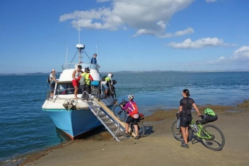
:

3       Overall Northland Cycling Plan
3.1     Overall Route and Project
The regional vision for walking and cycling in Northland would see ‘Northland as one of the
world’s best coastal walking and cycling destinations, where the journeys and stories are as
impressive and memorable as the scenery.’ The Northland Walking and Cycling Strategy (2018)
highlights four strategic focus areas:

1       Developing appealing and cohesive walking and cycling networks that connect Northland;
2       Growing walking and cycling participation and promoting Northland’s Coastal point of
        difference;
3       Improving community wellbeing, including creating economic opportunities; and
4       Ensuring the walking and cycling infrastructure and its use is sustainable.

Through this strategy, 13 cycle routes (see Figure 1) have been selected, which seek to achieve this
vision. Of the 13 cycle routes, this Implementation Plan has prioritised five projects for early delivery.
If the five projects proposed are implemented, then 30% of the 700km network will be off road.

The five projects (see Table 1) are planned for implementation in 2019-2020. They would attract an
additional 66,000 users per year to the current 20,000 using the existing Pou Herenga Tai cycle
trail. The five priority projects have a combined BCR of 5.22 and would create an estimated 265
jobs.

www.ws p- o pu s.c o. nz                    ©WSP Opus | 05 June 2019                                  Page 4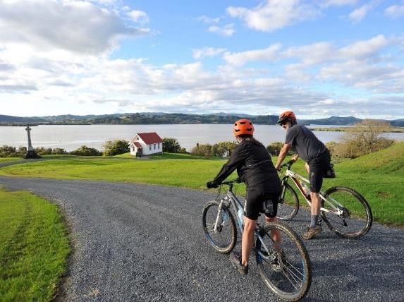
:

Figure 1: Overall Map of Routes

www.ws p- o pu s.c o. nz          ©WSP Opus | 05 June 2019   Page 5
:

3.2     The Network Effect

        3.2.1       The Individual Trails
                    The individual cycle routes will deliver riders from points of interest and destinations
                    across Northland and beyond via a network ranging from mountain bike trials to
                    relatively flat and easy rail trails to quiet country road experiences. Riders will choose
                    interconnected routes based on their ability, preferred start and finish points, local
                    attractions and time commitment.
                    Ferry crossings provide links for some of the rides, adding a dimension of interest
                    and interaction with Northland’s coast and waterways that will broaden the appeal
                    of the overall experience.
                    Most of these trails will be attractive to walkers, who may be looking for the same
                    features as cyclists – the off-road landscape and cultural immersion facilitated by
                    well-designed trails linking nodes with a range of food and rest options. There is
                    some alignment between the Te Araroa Trail and the Northland Cycleways along
                    the east coast at the Bay of Islands.

        3.2.2       The Trails Combined
                    In the initial BCA, use, spend and length of stay were determined for each trail in
                    isolation. While individual trails provide value to users as well as to local
                    communities, the separate trails will be part of an integrated network. As discussed
                    elsewhere, there will be five trails (Table 1) developed initially, with others added
                    over time as use increases and resources become available.
                    Networked effects are the additional benefits that we expect to accrue based on
                    activity generated by the combined set of priority trails that have been
                    recommended to the Steering Group. In this case, the combined priority trails are:
                           •   Opua to Paihia
                           •   Waitangi to Kerikeri
                           •   Waoku Old Coach Road (to SH12)
                           •   Kaihu Valley Rail Trail
                           •   Langs Beach to Ruakaka (Waipu Trail)

                    The following points are considered when looking at this set of trails in relation to
                    network effect:
                           •   Opua to Paihia. Two routes are proposed, one walking track and one
                               cycling route. There are no additional benefits to the wider Pou Herenga
                               Tai Great Ride from the walking track.
                           •   Waitangi to Kerikeri. This track will create a new start/finish point for riders
                               of the Pou Herenga Tai Great Ride. This will result in additional users across
                               the whole trail, and therefore increase length of stay by a further day for
                               many trail riders.
                           •   Waoku Old Coach Road connects to the proposed Kaihu Valley Rail Trail
                               and as well as the existing Kauri Coast Cycleway, which leads north to
                               Opononi and the Hokianga area. Users may therefore be attracted to ride
                               multiple trails. Those doing the Waoku Old Coach Road could continue
                               through to Dargaville along the Kaihu Valley Rail Trail as a connection to
                               routes heading south. There may be potential for attracting families where
                               they would all do Kaihu Valley Rail Trail and then the more advanced
                               would do Waoku Old Coach Road before returning to Dargaville. However,
                               they are different trails in terms of grade and so may also attract unique
                               user groups.
www.ws p- o pu s.c o. nz                          ©WSP Opus | 05 June 2019                                Page 6
:
• Langs Beach to Ruakaka (Waipu Trail) would eventually link to Pou
Herenga Tai in the north via the proposed Heartland Rides, thus creating
an attractive opportunity for cyclists to stay longer in Northland and ride
across to the West Coast.
• Overall, a network creates the ability to market a broader set of cycle trails
in the region that can result in a greater number of users.
• There may be an increase in expenditure as more amenities will be
available along these routes due to increased users and itineraries
(accommodation/food and cycling services – shuttles and rentals).
3.3 Networked assumptions
Considering the relationship of the prioritised trails and the improved marketing across all trails in
Northland, we have assumed;
• initial out-of-region and international visitor number increase of 5%
• out-of-region and international visitor number growth by an additional 0.5% per annum
• length of stay for multi-day riders sees 80% staying 1 night, 15% staying 2 nights, and 5%
staying 3 nights compared with 93% staying 1 night.
3.4 Networked effects
Based on the above assumptions, the BCA for all five trails combined results in benefits higher
than the sum of the BCA benefits for each of the five trails. The breakdown across BCA and
individual benefits is shown in the following table.
Opua to Waitangi Waoku Kaihu Langs Total Netw orked Difference
Paihia to Kerikeri Old Valley Beach to effects
Coach Rail Trail Ruakaka
Road
NPV $22.15 $14.56 $8.18 $37.57 $16.47 $98.19 $159.6 $61.41
BCR 17.58 11.873 4.59 4.19 3.34 5.22 7.86 na
Jobs 52 30 24 128 47 265 389 124
Total $1.34 $1.34 $2.28 $11.7 $7.03 $23.7 $23.7 0
costs
Total $23.49 $15.9 $10.47 $49.36 $23.49 $121.5 $182.94 $61.44
benefits
Visitor $16.25 $10.56 $8.41 $41.06 $15.31 $89.69 $135.9 $46.21
spend
Health $2.41 $2.36 $0.61 $2.18 $3.70 $11.89 $15.12 $3.23
Consumer $4.83 $2.97 $1.46 $6.12 $4.48 $19.9 $31.91 $12.01
surplus
The networked effect could improve benefits by $10.4M within a 15-year period. About $7.85M will
be from increased visitor spend, $700k from health benefits, and $1.85M from consumer surplus.
www.ws p- o pu s.c o. nz ©WSP Opus | 05 June 2019 Page 7:
Figure 2:National and Regional Cycleway Benefits
Benefit National Regional
Additional revenue from
Visitor Additional revenue from
international visitors net
international and out-of-
region visitors net of
Expenditure of imports and
intermediate goods
taxes, imports and
immediate goods
The value to additional The value to additional
Consumer domestic riders, over and local riders, over and
Surplus above the 'price' of
riding the trail
above the 'price' of
riding the trail
Avoided response costs
and treatment/ Avoided rehabilitation
Safety rehabilitation
(international and
costs
(for local users only)
domestic visitors)
Improvement in health
outcomes of domestic Improvement in health
Health riders outcomes of local riders
($ saved) ($ saved)
Travel time savings
Traffic Travel time savings
Response and
Response and
Diversion rehabilitation
rehabilitation
(local users only)
Improved wellbeing of Improved wellbeing of local
domestic users users
Social Improved spirit and wellbeing Improved spirit and
Cohesion within the local community for
more employment
wellbeing within the local
community from more
employment opportunities
opportunities
Increased visitor Increased visitor
Cultural spend, liveability,
vibrancy, adaptability
spend, liveability,
vibrancy, adaptability
Environmental, Environmental,
health, economic,
Environmental health, economic,
social social
Job generated in Job generated in
construction phase, construction phase,
Job Creation operations and as a operations and as a
result of visitor
result of visitor
spending spending
www.ws p- o pu s.c o. nz ©WSP Opus | 05 June 2019 Page 8: 4 Design Philosophy Statement 4.1 Introduction The age-old human experience of moving through the landscape, interpreting and articulating the experiences and sites along the way is the basis of narrative, storytelling. This takes place at human pace and scale, originally through walking, with riding a bicycle being a modern equivalent. Central to the success of a network of cycleways across Northland is making it legible and accessible as more than a place of pristine coastline and great forests, instead a distinct cultural landscape with a long historical narrative that is still being written. Through understanding a place as being ‘more than meets the eye’, a deeper appreciation, sense of commitment and stewardship develops. Narrative and experience has a direct application to the Northland Integrated Cycling Implementation Plan (NICIP) and can be applied at multiple scales. To attract users, the cycling network’s narrative needs to be a persuasive and compelling story of diverse yet interrelated journeys that engage the imagination, convincing people to commit to the experience. Also, at the local community level, those who know the narratives of landscape and culture have the opportunity to benefit from sharing them with those who visit to absorb them. And at the scale of individual rider, a layered experience of interpretative media, enhanced plantings, sculpture, heritage sites and other features increase a sense of and prolonged engagement with place. Northland’s rich cultural and environmental narratives are not often apparent to visitors, though local communities are often very open to sharing their stories and experiences, given the opportunity. Visitors travel great distances to see the most accessible key features of Northland’s cultural and landscape narratives, flocking to Waitangi for both Maori and Pakeha histories and to Tane Mahuta, an iconic piece of Aotearoa New Zealand’s environmental narrative. The full stories though are even richer, more complex and more compelling, requiring time moving through Northland at a human pace to read. Part of the original vision of the Northland Walking and Cycling Strategy was a loop composed of individual rides that circled Northland, loosely aligned with the Twin Coast Discovery Route. This is a compelling narrative. However, with a clearer understanding of each route’s characteristics, the likely users and their ambitions and requirements, the combined trails are now conceptualised as more of a network, providing strong connections between communities and key destinations. 4.2 An Evolving Narrative For people very familiar with Northland, immersed every day in a unique landscape and culture, features that impress visitors with their beauty and richness can seem ordinary. It can be hard to recall that mangroves for example, are an exceptional sub-tropical experience to many. Therefore, it is worth emphasising a couple of the layers of the cycling experience that are exceptionally Northland, as these have potential to make significant contributions to the overall long-term success and widest appeal of the cycle network. There are undoubtedly other layers that are worth investigation and development. East – Centre – West It is convenient to frame the Northland’s east as the holiday destination, the centre as the cultural heartland and the west as remote kauri stands and the Hokianga. Waitangi is well known as where Te Tiriti o Waitangi was signed, but Northland is steeped in authentic Aotearoa New Zealand www.ws p- o pu s.c o. nz ©WSP Opus | 05 June 2019 Page 9
:

culture, from marae to arts communities, while both shores have excellent coastal experiences
and unique ecology. The trail network will create accessible connections throughout these areas,
making their inherent integrated character apparent and appealing to visitors, and as a means of
improved socio-economic opportunities for local communities.

Ecology - Kauri

Kauri are arguably as iconic a piece of Aotearoa New Zealand’s sense of self as the pohutukawa
and the kiwi. Northland is home to all three. Kauri though, exist naturally only here, south to
Auckland and on Coromandel Peninsula. The development of the Northland cycleway network
coincides with kauri needing protection from die-back disease and with a need for heightened
awareness and improved stewardship. Creating well-designed gravel trails will help prevent the
spread of this disease from one area to another, while narratives around ecology and kaitiakitanga
present opportunities for local communities to spread awareness while developing business
opportunities.

www.ws p- o pu s.c o. nz                ©WSP Opus | 05 June 2019                             Page 10
:

5       Trail Descriptions
Among the trails currently being developed as part of the network are a range of grades, from low
grade 1–2 rides that are suitable for family groups and recreational riders, through to grade 3-4
rides, which are suited to experienced mountain bikers. Each ride has been examined individually
to understand how well it aligns with the project strategy, how easy or difficult it will be to build
and what economic benefits it is likely to deliver to local communities.

An overview of each trial is provided below, with brief outlines regarding:

Design Philosophy and Intent – what is the vision for this particular trail?

Trail Specific Opportunities and Constraints – With a thorough understanding of the intent for this
trail, what opportunities and constraints specific to this trail have become apparent? How will this
specific trail contribute to the overall network? How will it contribute to the local community and
its economy?

Land Access and Risk - What area of the trail runs along private land? What consultation has been
undertaken with these landowners? Are there any resource consent risks associated with the trail
development? Risk is defined as:

 Risk                      Land Owner Status                              Consenting Status

 No                        The route, and directly adjoining land, is     No resource consent required.
                           owned by Council.

 Low                       Small % of private landowners adjoining        Possibility of requiring resource
                           route. Consultation undertaken.                consent, unlikely to be notified.

 Medium                    Some private landowners, evidence of           Resource Consent required.
                           encroachment into route location. Low          Limited notification required.
                           to moderate level consultation
                           undertaken.

 High                      High % of private landowners. No               Resource consent required.
                           consultation undertaken.                       Public notification required.

Leadership and Stakeholders - Does the trail have a clear leader to take it through the funding,
construction and long-term maintenance processes? Have all stakeholders provided their support
of the project?

Geotechnical Requirements - Rock and soil type has been analysed on the route to determine
where additional structures may be required to stabilise land.

Design Assumptions – What factors and contextual considerations have been understood as
influences on the design process and outcomes?

Design Geometry and NZCT Design Guide Criteria – What specific engineering characteristics will
the trail have? These will contribute directly to the cycling experience.

Maintenance Implications and Requirements – Are there whole-of-life maintenance implications,
to what extent and has consideration been given to who will bear these?

Funding Recommendations - What funding stream does this trail align with?

www.ws p- o pu s.c o. nz                       ©WSP Opus | 05 June 2019                                   Page 11
: Developing cycling’s contribution to the regional economy entails prioritising the trails to arrive at relatively “easy wins”, which could be implementing as practicable. This is achieved through the MCA process, elsewhere in this document. The overall goal is an integrated system of cycle trails, with each contributing to the success of the whole network. www.ws p- o pu s.c o. nz ©WSP Opus | 05 June 2019 Page 12
:
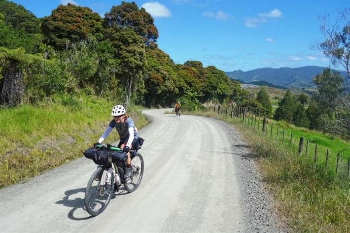
5.1 Waoku Old Coach Road - (Hokianga Connection)
Length: 53km, Grade: 3–4, Cost: $1.6M
5.1.1 Specific Design Philosophy and Intent
The trail begins at Waimamaku and ends at Donnellys Crossing.
Building on a piece of transport history, this open-secret mountain biking route
through native-bush clad hills has the potential to be a destination ride that also
draws bike-packers from afar. Improvements will avoid reducing the challenge of
the ride, which will be developed to have as little environmental impact as possible.
The trail links well with the Kaihu Rail Trail to the south and the Opononi and
Hokianga drawcard in the north.
5.1.2 Trail-specific Opportunities and Constraints
• Historical infrastructure such as handmade stone walls and culverts.
• Potential for involvement of tangata whenua in catering to visitors and maybe
trail / environmental stewardship / maintenance.
• Significant level of service change between this and the cycle trails that
connect to either end of it.
• Requires the participation of DOC and local tangata whenua.
• Existing track, being ridden in low numbers now by keen mountain bikers.
• With a route already established, and an existing body of users, it will be
relatively easy to increase user numbers through an upgrade to the existing
trail.
• Upgrading the trail to be gravel in wetter areas has the additional benefit of
reducing the risk of kauri die back becoming established.
5.1.3 Land Access and Risk
The overall land access risk is considered low due to the small number of
landowners adjoining the route. As the route is currently used as a walking track to
the public, utilisation of the route by the public is unlikely to generate significant
issues. Any bridges or other significant structures would require resource consent.
See supporting information for a more detailed assessment of each section of the
route.
5.1.4 Leadership and Stakeholders-
Stakeholders on this route are DOC, Far North District Council (FNDC), Kaipara
District Council (KDC) and Te Roroa. All stakeholders have provided support for the
proposal. Te Roroa and Bike Northland have expressed an interest in the leadership
role. Discussions between DOC, Te Roroa and FNDC are ongoing.
5.1.5 Geotechnical Requirements-
The geology along this route is complex, consisting of younger alluvium units on the
flat of valleys, units of the Northland Allochthon and as well Autochthonous units in
the low foothills and the steeper terrain predominantly Waipoua Basalt flows.
Overall, the terrain is gently rolling to steep to rugged. Given that the route for the
cycleway follows existing roads and an old coach road it is not anticipated that
significant earthworks will be required. There do not appear to be any largescale
instability features along the route, with most instability being small to medium
scale localised features, generally encountered on steeper slopes.
The flexibility of the geometric parameters allows the option for the route to be
shifted where possible to avoid the worst effects of any areas of instability that may
www.ws p- o pu s.c o. nz ©WSP Opus | 05 June 2019 Page 13:
be encountered. Where the route is too narrow, typically in steep terrain constrained
by gully features, timber pole retaining walls may be required to provide the
formation width of the cycleway. Structures of those types will be subject to
geotechnical investigation and design.
It is anticipated that geotechnical constraints for the Waoku Old Coach Road
section will be moderate. Moderate geotechnical constraints indicate minor levels
of geotechnical investigation and mitigation in the terms of retaining walls or
foundation improvement will be required for that route. It is expected that any
investigations and mitigation measures will be localised to specific features and
may be easily mitigated with route realignment.
5.1.6 NZCT Design Guide Criteria
Grade 3/4 - Off Road
Gradient 0–6.5 degrees for 90%
Absolute max – 10 degrees unsealed
Width Min 0.9m but up to 2m
Bends Min 2.5m radius
Surface Well compacted GAP 20
Grade 3/4 - On Road (Unsealed)
AADT 100
Operating Speed 60km/h
Gradient 0–6.5 degrees for 90%
Absolute max – 10 degrees unsealed
Width N/A
Bends N/A
Surface GAP 40
5.1.7 Maintenance Implications and Requirements
A well-draining aggregate trail that requires minimal maintenance aligned with its
expected use. Potential water erosion and trail damage will be insured against
through regular grade reversals and culverts where needed. In some flat areas,
boardwalk will be used.
Ongoing vegetation management will be required to maintain the route.
Operations and maintenance will be shared between FNDC/DOC/KDC.
5.1.8 Funding
The project has been prioritised based on multi criteria analysis against:
• Strategic Alignment;
• Trail Development;
• Cost.
The project has a benefit cost ratio (BCR) of 4.59.
Preliminary design has been undertaken with a proposed costing of $1.6M.
The findings support funding the Waoku Old Coach Road project.
www.ws p- o pu s.c o. nz ©WSP Opus | 05 June 2019 Page 14: Figure 3 Waoku Old Coach Road and Kaihu Valley Rail Trail Routes www.ws p- o pu s.c o. nz ©WSP Opus | 05 June 2019 Page 15
:

5.2     Kaihu Valley Rail Trail
Length: 41km, Grade: 1–2, Cost: $9.6M

        5.2.1       Specific Design philosophy and intent
                    The trail begins at Donnellys Crossing and ends at Dargaville.
                    Based on a long-disused railway, this will be a strong northward route from
                    Dargaville, linking several marae. A day’s easy ride ending at a node with
                    development potential as an appealing stop over on the way further north. This will
                    be a family-friendly rail-based trail with diverse places to stop along the way and
                    within easy reach of the coast. This trail links well with the Waoku Old Coach Road,
                    Kauri Coast Cycleway and the Kaipara Harbour Missing Link trails.

        5.2.2       Trail Specific Opportunities and Constraints
                    •      Need for bridges over water ways between sections of alignment that were
                           designed for train passage.
                    •      High estimated user numbers.
                    •      Strong cultural potential with several marae along the route.
                    •      Mostly off road, with a small portion of low-volume local roads.
                    •      Donnellys Crossing has potential to develop as a base for trail users, already
                           has basic accommodation.

        5.2.3       Land Access and Risk
                    The overall land access risk is considered low to medium as the route is a rail
                    corridor owned by KDC. There are 112 private landowners directly adjoining the
                    route. Consultation is in the early stages. Any bridges may require resource consent.
                    See supporting information for a more detailed assessment of each section of the
                    route.

        5.2.4       Leadership and Stakeholders-
                    Kaipara District Council (KDC) has taken the leadership role in this project. A
                    governance group has been established with representatives from Northland
                    Transportation Alliance, KDC, Te Roroa Iwi, DOC, Northland Chief Executive's Forum
                    and Northland Inc.

        5.2.5       Geotechnical Requirements-
                    The geology units along this route include: Waipoua Basalts at the northern end,
                    passing through foothills of Northland Allochthon soils and recent alluvium
                    deposits, to older alluvium deposits along most of the southern portion of the route
                    south of Kai Iwi Lakes to Dargaville.
                    Given most of the route will follow existing railway formation (disused), there will be
                    little earthworks associated with the formation of the cycleway route.
                    It is anticipated that the geotechnical constraints associated with this route will be
                    low. Low geotechnical constraints indicate little to minor levels of geotechnical
                    investigation and mitigation in the terms of retaining walls or foundation
                    improvement will be required for that route.

www.ws p- o pu s.c o. nz                        ©WSP Opus | 05 June 2019                                Page 16
:
5.2.6 Design Assumptions
• Assumed rights to use the rail bed by private and owners through decades
of informal use.
• The route will follow the abandoned rail way. This will be an ‘easy’
experience suitable for all abilities.
5.2.7 NZCT Design Guide Criteria
Grade 1/2 - Off Road
Gradient 0–3.5 degrees for 95%
Absolute max – 6 degrees unsealed or 7 degrees
sealed
Width Target 2m
Bends Min 4m radius
Surface Well-compacted GAP 20
Grade 1-2 trail, highly influenced determined by alignment with the railway; wide
consistent surface, flat, easy curves, minimum 2.2m wide for up to 90% of the trail,
with some sections of ‘single trail’ 1.5m width at bridges and/or other pinch points.
Relatively straight alignment, gentle climbs, wider profile.
5.2.8 Maintenance implications and requirements
With a well-constructed deep base inherited from the railway, there should be
lower maintenance requirements over whole of life.
5.2.9 Funding
The project has been prioritised based on multi-criteria analysis against:
• Strategic Alignment;
• Trail Development;
• Cost.
The project has a benefit cost ratio (BCR) of 4.19.
Preliminary design has been undertaken with a proposed costing of $9.6M.
The findings support the funding of the Kaihu Valley Rail Trail project.
www.ws p- o pu s.c o. nz ©WSP Opus | 05 June 2019 Page 17:
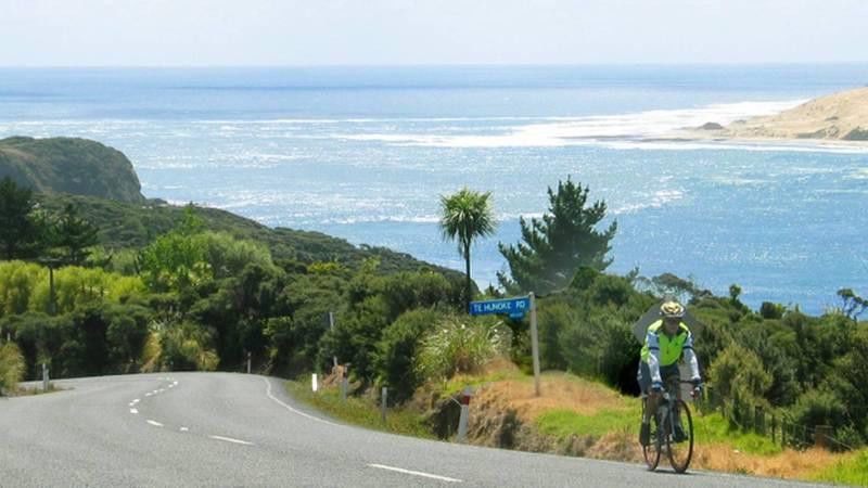
5.3 Langs Beach to Ruakaka
Length: 25km, Grade: 1–2, Cost: $5.8M
5.3.1 Design philosophy and Intent
The trail begins at Langs Beach and ends at Ruakaka Beach.
An all-abilities trail, Grade 1-2, providing opportunities for commuting and
recreation. The route follows the coastline of Langs Beach, Waipu Cove and
Ruakaka, meandering through sand dunes and small beach settlements. The trail is
the first stage of the Mangawhai to Tutukaka Coast route, which will be a multi-day
route along the stunning east coast of the Northland.
5.3.2 Trail Specific Opportunities and Constraints
• Some land access issues.
• There is potential to tie into Whangarei trails and provide bike access to the
city from rural coast areas.
• Great beaches, spectacular views to the ocean.
• Achieving an off-road route that is safe and provides a consistent level of
service.
• Important link in creating northward and southward options, integrating
Whangarei with the overall network. Health benefits for locals commuting or
riding recreationally.
5.3.3 Land Access and Risk
The overall land-access risk is considered low as a high percent of the route is on
Council road reserve. Alternative routes have been established to mitigate any risk
areas. Any bridges may require resource consent. supporting information for a more
detailed assessment of each section of the route.
5.3.4 Leadership and Stakeholders-
Whangarei District Council (WDC) has taken the leadership role in this project. WDC
has also obtained a letter of support from DOC for the Waipu section of the route.
The trail has strong community support with locals currently fundraising for the
route.
5.3.5 Geotechnical Requirements-
Lang’s Beach to Waipu Cove - The stratigraphic geology units along this route are
complex between Lang’s Beach and Waipu Cove, passing through beach dune
deposits, Waitemata Group sandstone and mudstone (Ruarangi Formation) and
Whangarei Limestone. Most of the route is following existing roads along the flat
dune sands and will involve minimal earthworks and low geotechnical constraints.
However, the route turns and follows the cliff-top Waipu walking track north of
Lang’s Beach. The walking track section, which crosses gentle to moderate terrain, is
to be enhanced with minor widening and will likely require small timber pole
retaining walls in places. Those structures will require geotechnical investigation and
design.
Waipu Cove to Ruakaka - From Waipu Cove north to Ruakaka, the geology is less
complex, consisting predominantly of Pleistocene-aged dune deposits and back-
dune alluvium, with occasional outcrop of Northland Allochthon mudstone. The
dune deposits are old and generally considered stable, however, careful
management of stormwater design will be required to ensure that no adverse
erosion effects are created. Most of the route is following an existing road formation
www.ws p- o pu s.c o. nz ©WSP Opus | 05 June 2019 Page 18:
and will either be built on existing road or built on minor widened portions. The
route is to be on flat to gentle terrain.
It is anticipated that geotechnical constraints associated with this route will be
generally low. Low geotechnical constraints indicate little to minor levels of
geotechnical investigation and mitigation in terms of retaining walls or foundation
improvement will be required for that route.
5.3.6 NZCT Design Guide Criteria
Grade 1/2 - Off Road
Gradient 0–3.5 degrees for 95%
Absolute max – 6 degrees unsealed or 7
degrees sealed
Width Target 2m (1.5m for bridges)
Bends Min 4m radius
Surface Well compacted GAP 20
Some Concrete
Some AC
5.3.7 Funding
The project has been prioritised based on multi-criteria analysis against:
• Strategic Alignment;
• Trail Development;
• Cost.
The project has a benefit cost ratio (BCR) of 3.34.
Preliminary design has been undertaken with a proposed costing of: $5.8M.
The findings support the funding of the Langs Beach to Ruakaka project.
www.ws p- o pu s.c o. nz ©WSP Opus | 05 June 2019 Page 19:
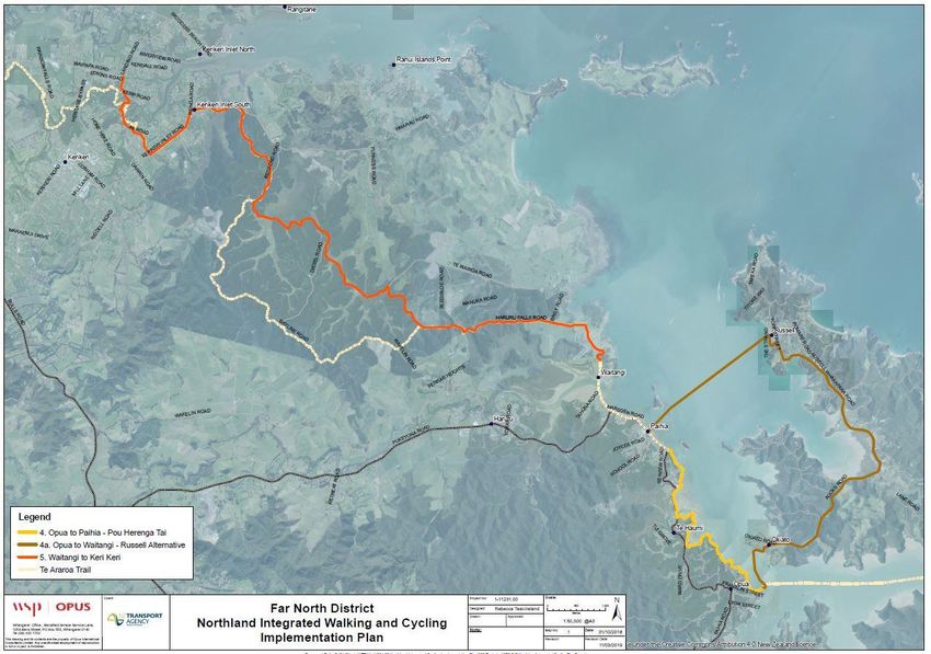
5.4 Opua to Paihia
Opua to Paihia Walkway: Length: 6.8km, Walking track, Cost: $984,000
Aucks Road Cycle Route: Length: 8km, Grade: 4, Cost: $250,000
5.4.1 Design philosophy and Intent
The renewal begins at Opua and ends at Paihia.
Two routes are being proposed, one for walkers and one for cyclists. Walkers range
from those looking to enjoy a short (2-hour) coastal experience, right through to the
Te Araroa Trail hikers, for whom this is only part of their 3,000 km journey to Bluff.
The walking route between Opua and Paihia will provide a land connection
between these two popular tourist locations. The walking track will provide a safe
land route and take walkers off the road.
The on-road cycling route begins at the ferry from Opua to Okiato. Cyclists hop off
the ferry at Aucks Road, with a scenic ride through the beautiful Russell vineyards,
rolling hills and boutique shops and cafes. The ferry then takes cyclists from Russell
through to Paihia. The ferry adds another element to the journey.
5.4.2 Trail Specific Opportunities and Constraints
• Requires greater ‘cycle awareness’ through signage and slower vehicle speeds.
• Great coastline, spectacular views to the ocean.
• Achieving an on-road route from Opua to Paihia that is suitable for Grade 3-4
cyclists.
• Important walking link in the Te Araroa Trail and an attraction for the many
tourists who visit the area.
5.4.1 Land Access and Risk
The overall land access risk is considered low as the Opua to Paihia route is an
upgrade of an existing track. The Aucks Road route is on road with the utilisation of
some road reserve. Resource consent may be required for the Opua to Paihia route,
however, the risk of this is low. See supporting information for a more detailed
assessment of each section of the route.
5.4.2 Leadership and Stakeholders-
Far North District Council (FNDC) has taken the leadership role in this project.
Stakeholder engagement will be led by FNDC.
5.4.3 Geotechnical Requirements-
Opua to Paihia - Te Araroa Trail
The geology units along this route include:
Kariotahi Group – Holocene to recent soils comprising loose sand, gravel and shell
underlying beaches and forming beach ridges and shell banks.
Found along the flat low-lying sections of the route, there are no signs of land
instability, and foundation conditions for subgrade purposes are suitable for the
cycleway construction. The soils are prone to erosion around stormwater outlets,
and design of culvert outlets will need to consider ways to prevent soil erosion that
could lead to problems with the track integrity.
These sections of the route have low geotechnical constraints.
www.ws p- o pu s.c o. nz ©WSP Opus | 05 June 2019 Page 20:
Waipapa Group – Jurassic-aged greywacke and minor argillite that weathers
residually to reddish brown silty clay and clay soils.
This material is found in all the hilly and topographically high areas along the route.
Land instability issues may occur at the heads of gully features, on steep slopes and
at the crest of cliffs on the coast. The track design parameters allow some flexibility
in the horizontal alignment to allow the track to be moved away from unstable land
features, and in locations where erosion of steep slopes has narrowed the track, it
may also be appropriate to construct low-height timber walls. In addition, where
the track crosses the head of gully features, careful management of stormwater will
be required. Any structures will be subject to geotechnical investigation and design.
In the case of enhancing an existing walking trail for walking purposes, it is not
anticipated that significant cutting or filling will be required and therefore the
geotechnical constraints are low. Low geotechnical constraints indicate little to
minor levels of geotechnical investigation and mitigation in terms of retaining walls
or foundation improvement that will be required for the route.
Opua to Paihia (via Aucks Road and Russell)
The geology units along this route include:
Tauranga Group Holocene to recent alluvium soils –comprising unconsolidated to
poorly consolidated mud, sand, gravel and peat deposits of alluvial, colluvial and
lacustrine origins.
Found along the flat low-lying sections of the route closer to Opua, there are no
signs of land instability and foundation conditions for subgrade purposes are
suitable for the cycleway construction as required to widen the road width, given
most of the route will be on existing road formation. The soils are prone to
settlement initially, so some undercutting, especially of peat, and ground
improvement will likely be necessary to facilitate widening.
These sections of the route have low geotechnical constraints.
Tauranga Group Pleistocene alluvium soils – comprising partly consolidated mud,
sand, gravel and peat or lignite of alluvial, colluvial, lacustrine, swamp and estuarine
origins.
Found along the flat low-lying sections of the route closer to Russell (including
Russell township), there are no signs of land instability, and foundation conditions
for subgrade purposes are suitable for the cycleway construction as required to
widen the road width, given most of the route will be on existing road formation.
The soils aren’t generally prone to settlement, however, some undercutting of peat if
encountered and ground improvement will be necessary to facilitate widening.
These sections of the route have low geotechnical constraints.
Waipapa Group – Jurassic-aged greywacke and minor argillite that weathers
residually to reddish brown silty clay and clay soils.
This material is found in all the hilly and topographically high areas along the route.
Land instability issues may occur at the heads of gully features, on steep slopes and
at the crest of cliffs on the coast. The cycleway design parameters outline this
cycleway route as following the existing road corridor, where it is expected that
much of the route will be accommodated in the existing road formation, however,
in locations where additional width may be necessary and the road is in steep
terrain, it is anticipated that timber pole retaining walls will be required. Structures
of those types will be subject to geotechnical investigation and design.
www.ws p- o pu s.c o. nz ©WSP Opus | 05 June 2019 Page 21:
In the case of using the existing road network to accommodate the cycleway, it is
not anticipated that significant cutting or filling will be required, and therefore the
geotechnical constraints are low. Low geotechnical constraints indicate little to
minor levels of geotechnical investigation and mitigation in terms of retaining walls
or foundation improvement that will be required for the route.
Design Assumptions
• That the Opua to Paihia route is a renewal of the existing walking track.
5.4.4 NZCT Design Guide Criteria
Opua to Paihia (via Aucks Road and Russell)
Grade 4 - On Road (Sealed)
AADT 1200
Operating Speed 80km/h
Gradient N/A
Width Min 1.0m
Bends N/A
Surface Chipseal
Opua to Paihia (Te Araroa Trail)
Gradient Existing
Width 1–1.5m
Surface Well compacted GAP 20
Boardwalk
Concrete (existing)
5.4.5 Funding
The project has been prioritised based on multi-criteria analysis against:
• Strategic Alignment;
• Trail Development;
• Cost.
The project has a benefit cost ratio (BCR) of 17.58.
Preliminary design has been undertaken with a proposed costing of:
• Opua to Paihia Walkway: $984,000;
• Opua to Paihia Cycle Route: $250,000.
The findings support the funding of the Opua to Paihia Walkway and Aucks Road
Cycle projects.
www.ws p- o pu s.c o. nz ©WSP Opus | 05 June 2019 Page 22: Figure 4 Opua to Paihia and Waitangi to Kerikeri Trail Routes www.ws p- o pu s.c o. nz ©WSP Opus | 05 June 2019 Page 23
:

5.5     Waitangi to Kerikeri
Length: 13.7km, Grade: 3, Cost: $997,000

        5.5.1       Design philosophy and Intent
                    The trail begins at Waitangi Mountain Bike Park and ends at Kerikeri township.
                    It complements the Pou Herenga Tai Cycle Trail, allowing for increased length of
                    experience and opportunity to stay locally. A grade 2-3 cycling experience to
                    connect residents and visitors based in Kerikeri to Waitangi, the Waitangi Mountain
                    Bike Park and to Paihia and the Pou Herenga Tai Cycle Trail.
                    This route will also be used by commuters, looking to incorporate daily exercise into
                    a healthy and enjoyable transport experience.
                    Encourages dispersal west, extending the cycling experience beyond the Bay of
                    Islands. Strong cultural component that could be built upon.

        5.5.2       Land Access and Risk
                    The overall land access risk is considered low as all landowners have provided
                    formal written support for the project. See supporting information for a detailed
                    assessment of the landowner risk.

        5.5.3       Leadership and Stakeholders-
                    Pou Herenga Tai Twin Coast Cycle Trail Trust and Far North District Council (FNDC)
                    have taken the leadership role in this project. Support has been provided by all
                    stakeholders.

        5.5.4       Geotechnical Requirements-
                    The geology units along this route include:
                    Tauranga Group Holocene to recent swamp alluvium soils – comprising
                    unconsolidated to poorly consolidated mud, sand, gravel and peat deposits of
                    alluvial, colluvial and lacustrine origins. Found along the flat low-lying sections at the
                    heads of valleys in the Waitangi Forest section. There are no signs of land instability.
                    Foundation conditions for subgrade purposes are anticipated to be suitable for the
                    cycleway construction, given most of the route will be on existing road formation fill.
                    In places, the alignment may require construction across swampy ground, in which
                    case subgrade improvement fill will likely be necessary as the swamp soils will not
                    be suitable for cycleway traffic.
                    These sections of the route have low geotechnical constraints.
                    Kerikeri Volcanic Group – comprising late to early Pleistocene-aged basalt, scoria
                    and ash soils.
                    The route crosses small portions of what has been mapped as basalt and scoria
                    deposits, as for a short length it runs along the edge of a basalt flow. Given the route
                    follows existing roads, it appears likely that the existing roads are constrained to
                    some extent by the terrain. All sections of volcanic terrain are gentle to moderately
                    sloping with no signs of land instability. Subgrade soils are all suitable for cycleway
                    construction, and it is considered that there will not be any geotechnical constraints
                    where the cycleway crosses volcanic terrain.
                    Waipapa Group – Jurassic-aged greywacke and minor argillite that weathers
                    residually to reddish brown silty clay and clay soils.

www.ws p- o pu s.c o. nz                        ©WSP Opus | 05 June 2019                                 Page 24
:
This material is found over most of the route alignment, typically in all the hilly and
topographically high areas along the route. Land instability issues may occur at the
heads of gully features, on steep slopes and at the crest of cliffs on the coast. The
cycleway design parameters outline this cycleway route as following the existing
roads, where it is expected that much of the route will be accommodated in the
existing road formation. However, in locations where additional width may be
necessary and the road is in steep terrain, it is anticipated that timber pole retaining
walls may be required. Structures of those types will be subject to geotechnical
investigation and design.
In the case of using the existing road network to accommodate the cycleway, it is
not anticipated that significant cutting or filling will be required, and therefore the
geotechnical constraints are low. Low geotechnical constraints indicate little to
minor levels of geotechnical investigation and mitigation in terms of retaining walls
or foundation improvement that will be required for that route.
5.5.5 Trail Specific Opportunities and Constraints
• Achieves an off-road route between two popular visitor bases.
• Opens up accommodation options and attractions outside Paihia for tourists
and locals.
• Provides an opportunity to work with tangata whenua on Treaty settlement
land.
• Requires working with the harvesting cycle of the forestry establishment.
NZCT Design Guide Criteria
Grade 3 - Off Road
Gradient 0–5 degrees for 95%
Absolute max – 8 degrees unsealed
Width Min 0.9m but up to 1.5m
Bends Min 3m radius
Surface Well compacted GAP 20
Grade 2 - On Road (Unsealed)
AADT 200
Operating Speed 60km/h
Gradient 0–3.5 degrees for 95%
Absolute max – 6 degrees unsealed
Width N/A
Bends N/A
Surface GAP 40
5.5.6 Funding
The project has been prioritised based on multi-criteria analysis against:
• Strategic Alignment;
• Trail Development;
• Cost.
The project has a benefit cost ratio (BCR) of 11.87.
Preliminary design has been undertaken with a proposed costing of $997,000.
The findings support the funding of the Waitangi to Kerikeri project.
www.ws p- o pu s.c o. nz ©WSP Opus | 05 June 2019 Page 25:
6 Overall Programme
The following timeline is proposed for project implementation of the thirteen projects:
Table 2: Project Timeline
Stage 1 Stage 2 Stage 3
No Route Name 2019-2020 2020-2023 2023-2026
1 Mangawhai to Tutukaka Coast (Ngunguru)
1b Langs Beach to Ruakaka
2 Whangarei to Tutukaka Coast (Ngunguru)
3 Tutukaka Coast (Ngunguru) to Kawakawa
4a Opua to Paihia walking track
(Te Araroa Trail)
4b Opua to Paihia
(Heartland Ride via Ferry and Aucks Road)
5 Waitangi to Kerikeri
6 Horeke to Maungungu
(Pou Herenga Tai enhancements)
7 Maungungu to Rawene (water taxi)
(Pou Herenga Tai enhancements)
8 Kauri Coast Cycleway 1
(Rawene to Donnellys Crossing via Tane Mahuta)
9 Waoku Old Coach Road (Donnellys Crossing to
Waimamaku)
10 Kaihu Valley Rail Trail (Dargaville to Donnellys
Crossing)
11 Kaipara Missing Link
(Dargaville to Helensville)
12a Dargaville to Maungaturoto Heartland Ride
12b Maungaturoto to Mangawhai
The Northland Walking and Cycling Strategy (2017) proposed that all 13 trails be built off-road.
Investigation during the development of this plan has indicated that this is not achievable in the
near-term for the following trails, or sections of trails:
Trail 1: Ruakaka to Tutukaka Coast section. An off-road alignment has not yet been found. Instead,
this would be progressed as an on-road Heartland Ride.
1
This route is being looke d at as part of a SH12 proje ct.
www.ws p- o pu s.c o. nz ©WSP Opus | 05 June 2019 Page 26: Trail 2: Whangarei to Tutukaka Coast. And off-road alignment has not yet been found and is considered challenging, but not impossible. Trail 3: Tutukaka Coast to Kawakawa. An off-road alignment has not yet been found. Instead, this would be progressed as an on-road Heartland Ride. Trail 7: Maungunu to Rawene. Would require a 200m-long bridge and land access is unlikely. Therefore it is considered infeasible, and an existing boat option will suffice. Trail 8: Kauri Coast Cycleway. This is an existing on-road Heartland Ride. Building a new trail through kauri forest would not be possible due to risks of spreading kauri die-back disease. Trail 11: Kaipara Missing Link. This is an existing on-road Heartland Ride. The Kaipara Package works will likely induce traffic to such a level that shoulder widening or an off-road trail is required between Dargaville and Te Kopuru. Trail 12: Dargaville to Mangawhai. An off-road route is not seen as a priority at this stage, and there is potential for an on-road Heartland Ride. The remaining trails are considered deliverable within two years and have a low risk profile. This is partly why they have been prioritised. 6.1 Next Steps for Councils to Progress Priority Projects Langs Beach to Ruakaka Whangarei District Council to survey the route and confirm land access with local land owners and the Department of Conservation. Local share of budget to be confirmed. Consents, if any, to be obtained. Opua to Paihia – Te Araroa Trail walking track Far North District Council to consult with hapu on proposed upgrade works. Local share of budget, if any, to be confirmed. Consents for any structures (ie, replacement of existing boardwalk) to be obtained. Opua to Paihia Heartland Ride via Aucks Road Far North District Council to confirm local share, if any. Land access is already confirmed. No consents required. W aitangi to Kerikeri Far North District Council and Pou Herenga Tai Trail Trust to develop/confirm governance model with local iwi and land owners for trail construction and management. Local share of budget, if any, to be confirmed. No consents required. W aoku Old Coach Road (Donnellys Crossing to W aimamamku) Department of Conservation, Kaipara District Council, Far North District Council and Te Roroa to develop governance model for this trail. Local share of budget to be confirmed. www.ws p- o pu s.c o. nz ©WSP Opus | 05 June 2019 Page 27
You can also read