Water &Atmosphere Extreme weather - Cook Strait quake - NIWA
←
→
Page content transcription
If your browser does not render page correctly, please read the page content below
Water & Atmosphere               September 2013

       Extreme weather
         How we cope with drought and storms

                           Cook Strait quake
                 Tsunamis from seabed landslides

                          Terrible tornadoes
                              The cycle of twisters

                              Chilled Calypso
           Why the coldest ocean is getting warmer
Water & Atmosphere
    September 2013

    Cover:
    The 'wets' are getting wetter and the 'drys' are getting drier. Can
    New Zealanders cope? (Dave Allen)

    Water & Atmosphere is published by the National Institute of Water
    & Atmospheric Research (NIWA).
    It is available online at www.niwa.co.nz/pubs/wa

    Enquiries to:                                                         4
    The Editor
    Water & Atmosphere                                                    News
    NIWA
                                                                          Strait quakes: NIWA monitors seabed
    Private Bag 14901
    Kilbirnie                                                             landslides near quake hotspots
    Wellington 6241
    New Zealand

    email: wa-editor@niwa.co.nz
                                                                          6
    ©National Institute of Water & Atmospheric Research Ltd 2013          In brief
    ISSN 1172-1014
                                                                          Winter storms, citizen scientists, sea
    Water & Atmosphere team:                                              urchins, returning eels, blue whales, and
    Editor: Mark Blackham                                                 baby whitebait
    Production: NIWA Communications and Marketing Team

                                                                          32
                                                                          Solutions
                                                                          NIWA's coastal monitoring

                                                                          34
                                                                          Portfolio
                                                                          Stormy times: Extremely wet weather

                                                                          38
                                                                          Profile
                                                                          The fun of fieldwork: Petra Chappell

    Water & Atmosphere is produced using vegetable-based inks on
    paper made from FSC certifed mixed-source fibres under the ISO
                                                                          40
    14001 environmental management system.
                                                                          Q&A
                                                                          Weather or not: NIWA's new and very
                                                                          local forecasting services

2   Water & Atmosphere        September 2013                                                          www.niwa.co.nz
12
                                                                          Dust bowled
                                                                          Lessons on adaptation
                                                                          and resilience from the
                                                                          2013 drought

                                          5
                                          New Zealand's
                                          tornado window
                                          Do twisters occur over
                                          decade-long cycles, and are
                                          we in one now?

                                                                          21
                                                                          Chilled Calypso
                                                                          Expeditions to the warming
                                                                          Southern Ocean

                                          28
                                          Urban thirst
                                          Preparing cities for Nature's
                                          water shortages

3   Water & Atmosphere   September 2013                                                                www.niwa.co.nz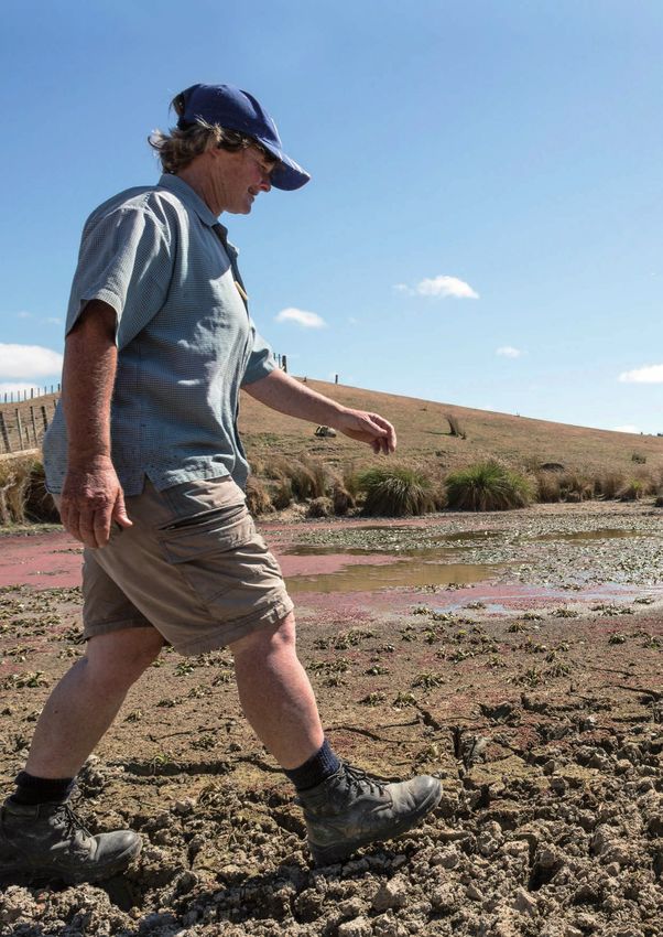
Cook Strait quakes too small
    for landslide-tsunami
    A seabed survey in Cook Strait by NIWA’s flagship research               150 metres to 2700 metres south of Cape Palliser. The
    vessel Tangaroa showed that the origin of the magnitude 6.5              canyon is the most prominent undersea feature of Cook
    July earthquake was a previously unknown ‘blind’ fault.                  Strait and is scarred by numerous large submarine
                                                                             landslides and active faults.
    Within three days of the quake, the vessel headed to Cook
    Strait to survey the seabed using a multibeam echosounder.               Mountjoy’s research paper is based on data collected on
    It surveyed an area crossing the epicentre to determine                  board Tangaroa in February 2011, and measurements of
    whether there were changes to the seafloor due to near-                  ocean currents in 2006. He says early indications from the
    surface faulting.                                                        July 2013 survey back up the assessment of how sediment
                                                                             falls and moves within the Strait.
    The survey, which remapped the deep canyon system,
    supported research by NIWA Ocean Geologist Dr Joshu                      This work identifies that sediment is transported into
    Mountjoy that showed the level of ground shaking generated               the canyons by the strong tidal currents that scour the
    by this earthquake was not sufficient to trigger submarine               seafloor of Cook Strait. Sediment is accumulating in the
    landslides – which pose a tsunami hazard in the area.                    central axis of Cook Strait Canyon at 400 metres water
                                                                             depth – the least stable region of the canyons. Landslide
    “This earthquake occurred near one of the least stable
                                                                             deposits in a sediment core sample taken further down the
    regions of Cook Strait Canyon,” says Mountjoy. “Despite the
                                                                             canyon support the modelling-based estimate of how often
    significance of the event in Marlborough and Wellington,
                                                                             landslides occur.
    it was well below the level of ground shaking required to
    trigger sediment failure.”                                               “Soft sediment landslides flow down the canyon, eroding
                                                                             the canyon floor, much like a river in flood carrying sand
    Mountjoy’s research on submarine canyons, soon to be
                                                                             and gravel,” says Mountjoy. “This type of erosion is the
    published in a special issue of the journal Deep Sea Research
                                                                             main mechanism by which canyons form, and is also very
    Part II, shows that about every 100 years a landslide in the
                                                                             important to biological communities,” he says.
    region will displace 50 million cubic metres of seabed – more
    than four times the size of the landslide on Mt Cook in 1991.            This work forms part of a larger, ongoing Natural Hazards
                                                                             Research Platform project by NIWA and GNS Science
    “While the landslides focused on in this study were too small
                                                                             focused on determining the hazard posed by landslide
    and far below the sea surface to cause tsunamis, they play
                                                                             tsunamis in Cook Strait.
    an important role in the development of the canyon. There
    have been landslides ten times bigger within the canyon                  Tangaroa had been stationed off the Marlborough coast
    walls, and we are still working to determine the hazard risk             mapping an area of Pegasus Basin as part of a Ministry of
    related to them,” he says.                                               Business, Innovation and Employment-funded (MBIE) Ocean
                                                                             Survey 20/20 project. NIWA acknowledges the cooperation of
    The Cook Strait Canyon starts just 10 kilometres off
                                                                             MBIE in enabling this timely diversion.
    Wellington’s south coast and plunges from a depth of

                                                                                         Wellington
           Blenheim

                        M6.6                        M6.5
                                                                                             Cook Strait Canyon
                                                               Sediment landslides

    Magnitude 6.6 and 6.5 earthquakes such as those hitting central
    New Zealand in July and August 2013 were too small to cause
    landslides that generate tsunamis, but there is evidence of bigger
    landslides in the past.

4       Water & Atmosphere       September 2013                                                                                 www.niwa.co.nz
New Zealand's
    tornado window                                                                                                        The tornado that
                                                                                                                  damaged Hobsonville in
                                                                                                                    2012 occured during a
                                                                                                                 period of slightly elevated
                                                                                                                 incidence of tornadoes in
                                                                                                                              New Zealand.

    New Zealand appears to be in a                                  Turner says that, until recently, damage estimates used
                                                                    international formulae. But New Zealand’s housing stock
    period of slightly elevated incidence of                        has a prevalence of different construction materials
    tornadoes, according to NIWA scientist                          and structural attributes, such as a timber frame with
    Dr Richard Turner.                                              weatherboard cladding and sheet-metal roofs. Tornado
                                                                    damage here generally results from weaker events than
    Dr Turner says that more tornadoes were reported over the       overseas.
    past decade than during the 1980s and 1990s.
                                                                    “So we’ve gone into the field to collect data about the sort
    “We're seeing more than we’ve seen for 40 years,” he said.      of damage caused by tornadoes as well as different types of
    “We’re experiencing about the same frequency as occurred        wind phenomena.
    during the fifties and sixties.”
                                                                    “We are collecting real New Zealand data for real New
    On average, there are about seven to ten moderate to strong     Zealand buildings, because relying on damage models
    tornado events reported in New Zealand each year. In the        developed overseas hasn’t always given us realistic results.
    past nine years, six people have been killed when tornadoes
    struck.                                                         “We can relate the actual damage and loss incurred to
                                                                    the likely range of wind speeds caused by a tornado (or
    The Insurance Council estimated the cost of the fatal           microburst) like those in Hobsonville in December 2012,
    tornadoes that hit Auckland in December 2012 at                 Albany in 2011 and Taranaki in 2007.
    $8.7 million. The tornado hit Hobsonville and Whenuapai,
    killing three builders and damaging almost 400 homes. The       “This will improve the ability of RiskScape to accurately
    Defence Force insurance bill for damaged property was           assess the impact of hazardous wind events such as
    $1.4 million. It cost power companies about $3.5 million to     tornadoes.”
    fix lines. The Auckland Council paid about $1.5 million for     Dr Turner is optimistic about current research. “NIWA is
    staff to clean up the area.                                     designing very-high-resolution weather forecast models
    Dr Turner says the history of tornadoes in New Zealand is       (which demand huge computational resources – NIWA’s
    not heavily studied and, because many go unobserved, it’s       supercomputer) to predict the occurrence of mesocyclones
    hard to discern historical frequency trends and relate them     (see sidebar: Tornado watch). If successful, this could
    to climate variations such as La Niña or the Pacific Decadal    potentially help forecasters identify mesocyclone formation
    Oscillation.                                                    between six and 12 hours in advance, increasing warning
                                                                    times.”
    “It’s hard to ascertain, especially from old newspaper
    accounts, the actual wind phenomena that caused damage.
    For instance, damage caused by microburst winds is often
                                                                      Tornado watch
    wrongly attributed to a tornado.
                                                                      In New Zealand, tornadoes are usually around 20 to 100
    “Taking this into account, there still does appear to be some     metres in diameter, last for a couple of minutes, and travel
    trend on decadal timescales,” he says.                            two to five kilometres during that time. Wind speeds are
                                                                      typically between 115 and 180 kilometres per hour. Local
    One strand of research is developing the NIWA and GNS             tornadoes are usually spawned from mesocyclones –
    Science ‘RiskScape’ tool, which estimates asset impacts and       spinning updrafts of air in thunderstorms.
    losses for various natural hazards. RiskScape has damage          Warning signs of tornadoes can include hail or heavy rain
    models that relate building and human impacts and losses          followed by dead calm or a fast, intense wind shift; and
    to wind hazard exposure.                                          large, dark, low-lying clouds.

5      Water & Atmosphere    September 2013                                                                               www.niwa.co.nz
In brief
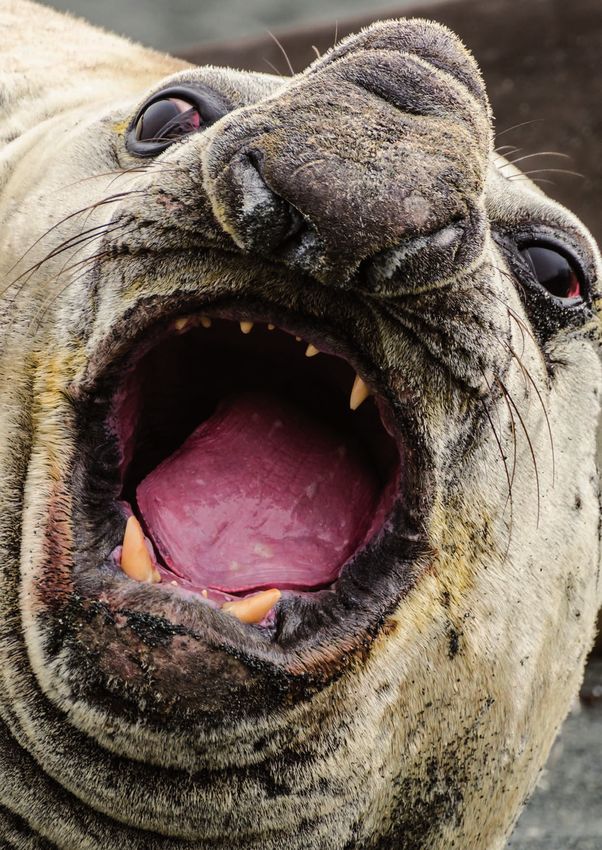
Large waves along the Esplanade, Owhiro Bay, Nearly one-third of the 50 known species of sea urchins, or tam o'shanters, can be seen in
Wellington. (Dave Allen) New Zealand waters. (NIWA)
Storms not record breakers The mystery of the tam o’shanter
Given the media coverage, you can The discovery of seven new species of hotspot for tam o’shanters in the
be forgiven for thinking that the June sea urchins, known as tam o’shanters, seamounts of the Bay of Plenty where
storms were the worst ever to hit New has helped resolve more than a nine separate species have been found.
Zealand. hundred years of confusion about their
“These urchins live in very deep water
distribution in New Zealand waters. The
One of the most discussed pieces of – up to 1200 metres – and don’t have
discovery was found in a collection of
evidence was a NIWA wave buoy off a hard shell like other more familiar
preserved samples of urchins in NIWA’s
Baring Head at Wellington Harbour. It species, such as their cousin kina,
Invertebrate Collection.
measured waves there at 15 metres that live in shallower waters. Instead,
high from peak to trough – the largest Araeosoma coriaceum had previously they have a flexible leathery outer
on record. This surpassed the previous been recorded off northern New skeleton – well adapted for the deepsea
‘record’ – anecdotal estimates that Zealand by the Challenger Expedition environment in which they live.”
wave height during the 1968 ‘Wahine in 1874 and again 100 years later by
New Zealand waters are rich with
Storm’ was 12 to 14 metres. fishing trawlers in the Hauraki Gulf.
diversity when it comes to this urchin
But examination of old specimens,
NIWA’s analysis shows that, while the group. There are about 50 known
new material and original descriptions
storms were extreme, they were not species of tam o’shanters in the world,
has led to the conclusion that the
record-breaking. with nearly a third of these found in
Challenger specimen had been
New Zealand waters. They are named
For example, the maximum 10-minute mislabelled, with its true locality
tam o’shanters because of their
average of sustained winds was unknown.
resemblance to a 19th-century Scottish
101 kilometres per hour at Wellington
The Hauraki Gulf specimen that cap. Keen followers of poetry will know
Airport. But sustained winds during the
followed had therefore been wrongly that the tam o’shanter cap was named
Wahine Storm reached 144 kilometres
identified. It was not A. coriaceum, but a after the eponymous hero of the poem
per hour – by far the strongest in the
new species now known as A. bakeri. by Robert Burns.
50 years of records.
Deepwater Fisheries Scientist Owen
Snowfall in the central South Island
Anderson said research on where
was also less than the 1973 record. In
the species live revealed a particular
Methven and Tekapo, snowfall from the
June storms was 99mm and 600mm
respectively, whereas the equivalent
measures in 1973 was 610mm and
670mm respectively.
6 Water & Atmosphere September 2013 www.niwa.co.nz
In brief

    NIWA Hydrologist Dr Christian Zammit measures snow depth on the roof of NIWA's Christchurch
    office. (Nelson Boustead)

    Kiwis become citizen scientists
    Social media hasn’t got the crowd-               Immediately before the June storms,          and operator Transpower, use the
    sourcing phenomenon all to itself.               NIWA went out to the public to increase      information to inform the design of the
    Science has long been a user of                  the scope of measurements. The public        lines providing electricity to consumers
    information gathered from a large                were invited to measure backyard             and to study the combined effect
    number of widespread people. Even                snowfall via the website and Facebook        of snow, ice and wind on overhead
    Darwin corresponded with amateur                 page.                                        conductors under New Zealand
    experts around the world, collecting                                                          conditions.
                                                     Hydrologist Dr Christian Zammit calls
    evidence from their local fieldwork to
                                                     it snow mobilisation. He’s using it to       “Citizen-collected information is
    support his theories.
                                                     collect snow information at the same         helping adapt our snowfall prediction
    The advantage is that amateur                    location over a long period of time.         model.”
    scientists can be in thousands of places
                                                     “We have very little New Zealand-            Clearly, citizen scientists will continue
    at one time, collecting a much larger
                                                     specific information about snowfall          to play an important part in helping
    pool of data than the official scientists
                                                     at repeated locations, so gathering          science. The potential benefit goes even
    can collect by themselves.
                                                     information from this storm is               further than collecting vast amounts
    In the digital and social media age, the         important. In the future, this               of data quickly. Citizen science can
    means for asking for, coordinating and           information could help prevent building      help develop a more scientifically
    collecting information has never been            collapses and stock loss, and indicate       literate society. It can build the capacity
    easier.                                          areas where power lines are vulnerable       for people to see their lives in terms
                                                     to ice, snow and wind.”                      of science, to collect and assess
    Throughout the June storms, NIWA
                                                                                                  information they receive in their
    mobilised its own teams in the South             Dr Zammit says the information is
                                                                                                  everyday lives and make choices based
    and North islands over a period of               important for the Building and Housing
                                                                                                  on what they learn.
    three days to gather much-needed                 Group at the Ministry of Business,
    information about snowfall at low and            Innovation and Employment to inform
    mid-range elevations. This generally             building standards and codes. The
    covers anything below 200 metres                 Group needs accurate information
    above sea level to under 900 metres              about how ground snow is translated
    (sub alpine).                                    into load on the roof. Electricity
                                                     providers, like national grid owner

7       Water & Atmosphere      September 2013                                                                              www.niwa.co.nz
In brief

    Dr Joshu Mountjoy preparing the applied acoustics boomer and hydrophone for operation off Kaikoura. (Dave Allen)

    Kaikoura tsunami hazard
    NIWA Ocean Geologist Dr Joshu                      So Environment Canterbury (ECan)                   “We are able to unravel the history of
    Mountjoy is checking the validity of               asked NIWA to resurvey the area                    sediment deposition and erosion in the
    a theory that a massive undersea                   in March this year, using state-of-                area during the last 20,000 years.”
    landslide could hit Kaikoura with a                the-art techniques to determine if
                                                                                                          The survey also used two coring
    13-metre-high tsunami.                             the submarine landslide scenario is
                                                                                                          techniques to collect seven seafloor
                                                       realistic.
    The effect of submarine landslides                                                                    sediment cores up to one metre long.
    is very real. Devastating tsunamis                 “We spent three days surveying the
                                                                                                          “We are analysing these to determine
    generated by submarine landsides                   head of the Kaikoura Canyon, mapping
                                                                                                          the rate at which sediment is
    occurred on the Grand Banks off                    the seabed, imaging the sediment and
                                                                                                          accumulating on the seafloor on
    Newfoundland in 1929 and Papua New                 rock beneath the seabed and sampling
                                                                                                          modern (last 100 year) timeframes.”
    Guinea in 1998, killing 28 and 2200                the sediment,” Dr Mountjoy said.
    people respectively.                                                                                  The project team is now assessing the
                                                       The survey used three different
                                                                                                          data collected over the three days to
    A 1999 scientific paper (Lewis and                 techniques.
                                                                                                          learn more about the way the sediment
    Barnes) posed that a large amount of
                                                       A hull-mounted echosounder imaged                  moves and accumulates in the canyon,
    sediment had recently accumulated
                                                       approximately eight square kilometres              and whether a landslide is realistic.
    in the head of Kaikoura Canyon. Work
                                                       of the seabed.                                     It will report to ECan later this year.
    published by Walters et al. (2006)
    showed that collapse of this sediment              “The bathymetry and backscatter data
    would cause a large tsunami.                       enable us to assess previous landslide
                                                       history and to map the distribution of
    The canyon feeds sediment directly
                                                       surface sediments.”
    into the 1500-kilometre-long Hikurangi
    Channel, which sweeps along the east               A multichannel boomer seismic
    coast of New Zealand 400 kilometres                refection system was used to ‘see’
    east of East Cape. The canyon is up                50 metres into the sediment and rock
    to 4000 metres deep and comes to                   below the seafloor.
    within 500 metres of the coast south of
    Kaikoura, closer than any other New
    Zealand submarine canyon.

8       Water & Atmosphere       September 2013                                                                                        www.niwa.co.nz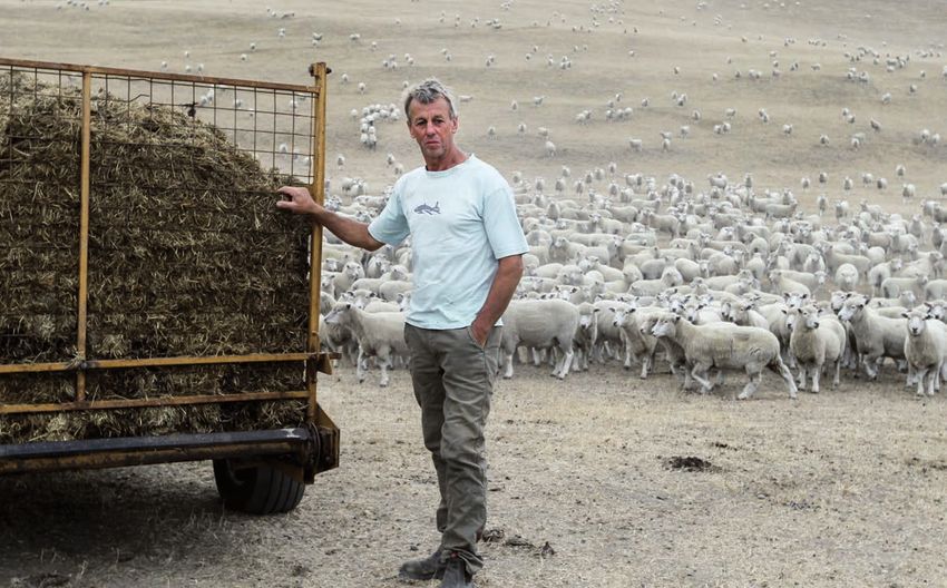
In brief

    Eye from the sky: Aerial photography is being used to map the shallow-water habitats of the      Signs of recovery: Eels are returning to Lake
    southern Kaipara Harbour.                                                                        Ōmāpare following efforts to improve the lake's
                                                                                                     health. (Rohan Wells)

    NIWA takes to the skies to map seabed                                                            Eels return to lake
    Aerial photography is being used to                Dr Mark Morrison, Marine Ecologist,           Eels are returning to Lake Ōmāpere in
    map the shallow-water habitats of                  said that underwater seagrass                 Northland, thanks to efforts to prevent
    the southern Kaipara Harbour. The                  meadows were critical to supporting           over-nutrification.
    technique allows NIWA scientists to                high numbers of juvenile snapper,
                                                                                                     The Northern Advocate reports that the
    identify seagrass meadows – important              trevally, parore, spotties, piper, pipefish
                                                                                                     1200-hectare lake about five kilometres
    for sustaining coastal fisheries such              and other species, particularly in
                                                                                                     north of Kaikohe fell to an average
    as snapper – down to their maximum                 northern New Zealand.
                                                                                                     depth of 2 metres after drainage that
    growing depth of 3 to 4 metres below
                                                       “This study examines what components          paved the way for nearby farming a
    the low tide mark.
                                                       of these habitats are most important to       century ago.
    By combining aerial photography with               small fish. It samples across seagrass
                                                                                                     Fertiliser runoff then fuelled the growth
    fish sampling, NIWA can map the                    habitat landscapes and quantifies
                                                                                                     of algae, which restricted fish life. Carp
    location of critical fish nurseries, and           where fish densities and numbers of
                                                                                                     were introduced to eat the algae, and
    monitor their health over time through             species are highest.
                                                                                                     the lake – unique because it is owned
    remote sensing.
                                                       “Sampling quantifies what fish species        by Māori – is recovering.
    Fish were collected using small, hand-             are associated with each habitat
                                                                                                     NIWA researchers helped the local
    hauled, fine-mesh beach seines, pulled             type and associated environmental
                                                                                                     community environmental group, Te
    up onto a specially designed ramp                  conditions. That means we can identify
                                                                                                     Roopū Taiao o Utakura, gather data
    deployed from an oyster barge. About               which factors are most critical for
                                                                                                     about fish stocks in Lake Ōmāpere and
    100 sites were sampled, spread across              supporting particular types of fish
                                                                                                     its outlet to the Hokianga Harbour, the
    150 square kilometres in the southern              species, so that the most important
                                                                                                     Utakura River.
    Kaipara.                                           habitats can be identified, mapped and
                                                       protected.”                                   The group was also helped by NIWA
    The habitats provide a range of
                                                                                                     Freshwater Fishery Ecologists Dr Erica
    important ecological ‘goods and                    The aerial photography was funded
                                                                                                     Williams and Dr Jacques Boubee.
    services’, such as seagrass material               by the Ministry for Primary Industries
                                                                                                     NIWA has produced two reports
    which finds its way into food webs and             (MPI), while the fish-sampling research
                                                                                                     for the project team: one on metal
    small invertebrates associated with                is being funded by the Ministry of
                                                                                                     levels in tuna from the Lake Ōmāpere
    seagrass meadows.                                  Business, Innovation and Employment
                                                                                                     catchment and the other analysing the
                                                       (MBIE).
                                                                                                     lake’s nutrient levels.

9       Water & Atmosphere       September 2013                                                                                         www.niwa.co.nz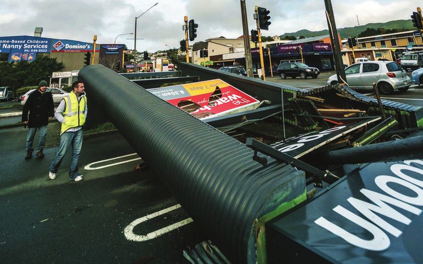
In brief

     National interest: Marine Ecologist Dr Leigh Torres shares with media her findings on blue whale   RV Tangaroa is equipped to scan the seafloor
     foraging habits. (Dave Allen)                                                                      and the sediment and rock beneath.

     Looking for the blue whales                                                                        Sweeping the floor
     It’s long been thought that blue whales            “We know they need to eat vast                      When Tangaroa was called to survey the
     only transit through New Zealand                   amounts of food to support theirenergy              site of the undersea earthquake that
     waters when migrating between the                  demands. So the south Taranaki coast                rocked Marlborough and Wellington,
     Antarctic and equatorial waters. But               could be a perfect place for them to                it was busy fulfilling the Government’s
     a ground-breaking NIWA study into                  feed.                                               Ocean Survey 20/20 initiative.
     their distribution patterns off the
                                                        “With just four confirmed blue whale                The cross-agency initiative, coordinated
     south Taranaki coast confounds this
                                                        foraging grounds in the Southern                    by Land Information New Zealand
     hypothesis.
                                                        Hemisphere, these findings add                      (LINZ) promotes research in the New
     NIWA’s study of historical whaling data,           considerably to human understanding                 Zealand marine environment.
     opportunistic sightings of blue whales             of one of the world’s most elusive
                                                                                                            Land Information Minister Maurice
     and seismic survey data since 1979                 creatures.”
                                                                                                            Williamson had announced a few weeks
     show that blue whales, occur more
                                                        The new information may also prompt                 earlier that LINZ would contribute
     regularly and with greater densities in
                                                        a rethink on how blue whales are                    $2.1 million this year to the Ocean
     the South Taranaki Bight than expected.
                                                        classified in New Zealand. Currently,               Survey 20/20 initiative. That will pay for
     NIWA Marine Ecologist Dr Leigh Torres              they’re classified as a migrant under               40 sailing days of Tangaroa.
     linked the observed sighting patterns of           the New Zealand Threat Classification
                                                                                                            "Two voyages will undertake seafloor
     blue whales with a prominent upwelling             System. This means they are not
                                                                                                            mapping of the southern Colville Ridge
     near the South Island’s Farewell Spit              given the same level of conservation
                                                                                                            off the coast of Auckland, geological
     to set out the hypothesis that blue                protections as other whales that
                                                                                                            and biological sampling, and mapping
     whales are using the area as a foraging            regularly use New Zealand coastal
                                                                                                            the seafloor in the Aotea and Reinga
     ground. The area is well known for                 waters.
                                                                                                            basins off the North Island’s west
     high zooplankton biomass, including a
                                                                                                            coast,” the Minister said.
     known prey item of blue whales, as a
     function of the upwelling plumes that                                                                  Another voyage will deploy ocean
     generate huge clouds of plankton that                                                                  bottom seismometers and pressure
     are transported into the South Taranaki                                                                recorders offshore from Gisborne to
     Bight.                                                                                                 monitor earthquake tremor activity over
                                                                                                            a two-year period.
                                                                                                            The data being collected by NIWA is
                                                                                                            available at a dedicated website:
                                                                                                            www.os2020.org.nz/.

10       Water & Atmosphere       September 2013                                                                                           www.niwa.co.nz
In brief
Suburban spawners: Ten years of NIWA research culminated in the discovery of a giant kokopu whitebait breeding area in a Hamilton stream.
(Bob McDowall)
Whitebait breeding sites found
A suburban Hamilton stream has A hand-held electronic tag reader was When the giant kokopu spawn, they lay
turned out to be the first spawning used to track the movement of fish in their eggs in the grasses and vegetation
ground ever found of the giant kokopu the stream during the day. At night, the on the bank where there is shade and
whitebait. scientists used spotlighting with a torch high moisture content to provide the
to find and then catch fish in a net so optimum conditions for hatching. But
NIWA’s 10-year research into the
they could identify them and check their hatching will only take place when the
species was rewarded with the
condition. stream rises again.
discovery of the breeding area earlier
this year by NIWA Fisheries Technician Last year, they found several ripe “This finally fills in the gap for all
Josh Smith and Fisheries Scientist (ready to breed) males, which made whitebait species. We know that
Dr Paul Franklin. them “reasonably confident” they spawning is a critical and susceptible
were spawning in the stream. Then it part of the life cycle. They require a
The elusive fish were found in
became a matter of narrowing down specific vegetation and water flow to
Bankwood Stream in Donny Park,
where and when the fish were actually lay and hatch eggs, which is a risky
near the suburb of Chartwell, a few
spawning. strategy. But the more the environment
kilometres from the Waikato River.
is modified by humans, the more risky
“In the first week of June this year, we
The team fitted electronic tags to 43 that strategy becomes,” Dr Franklin
finally found a couple of ripe females
adult giant kokopu and placed antennae said.
in the stream for the first time. We
at the lower end of the stream to detect
expected them to spawn on a bank “There is a good chance they are
any fish leaving.
when the water level was higher after spawning in other streams around
“When only one left, it gave us a good rain.” Hamilton and if we can provide and
idea that they were spawning in the protect the right kinds of habitat, others
A few days later, their endeavours paid
stream,” Dr Franklin said. may stay.
off when Smith discovered several
nests of eggs on the banks of the “If one of these habitats is not available,
Bankwood Stream. the species will ultimately die out.”
11 Water & Atmosphere September 2013 www.niwa.co.nzAngela Hunt crossing
a dry dam which is
normally used to supply
stock with drinking
water on Peter Gaskin's
Wairarapa farm.
(Dave Allen)
Dust bowled
The sun scorched New Zealand’s rural hinterland over
the summer of 2013. The drought reached across more of
the country than any other in the past 40 years. The heat
burnt through $2 billion dollars the country desperately
needed in the middle of an economic downturn.
Mark Blackham examines how the nation coped.
12 Water & Atmosphere September 2013 www.niwa.co.nzDust bowled
The New Zealand Herald photograph was Some farmers were spending upwards of $2000 a day to
buy stock feed. Many calculated that it was cheaper to send
designed to shock. A farm contractor held stock to slaughter earlier, and in greater numbers, than
a gun to the head of a cow. The headline usual. Forty per cent more cattle were killed than usual
proclaimed ‘Drought takes deadly toll’. during the period, and 23 per cent more sheep.
That same night, television news led with a story that the Lame cows that couldn’t walk to find grass were killed
Wellington region had only 20 days’ water left. rather than be left to starve. Hence, a busy time for the
slaughterman pictured by the New Zealand Herald.
It was 13 March 2013; the day New Zealanders turned from
loving the exceptional summer, to fearing it. Farming support networks were putting most of their time
into dealing with the emotional stress on farmers. The
A few days later the summer reached its driest point, Waikato Times published a story about an accountant who
according to NIWA’s calculations. The whole of the North talked down the gun a share milker had to his head.
Island was officially declared to be in drought on 15 March.
The economic cost was high. Treasury has estimated the
The first signs had been spotted by NIWA five months cost to be up to $2 billion over the entire period – knocking
earlier, when rainfall fell sharply below its average. By mid- 0.7 percentage points off the annual GDP.
November, a full month earlier than usual, the ground in
some areas of the North Island’s east coast had lost It was variously described as the worst drought in 30 years,
75 millimetres more water than it had received. Spurred by the worst in 70 years and the worst in history. NIWA has
the data, Primary Industries Minister Nathan Guy called the since calculated that no other drought in the past 40 years
situation a “‘green drought’, where the land looks green, but has been so intense over such a wide area of New Zealand.
still isn’t growing fast enough”. The emotional response to the drought confirmed our
Lower soil moisture levels mean less water for grass and nation’s sensitivity to weather and water, and particularly to
other plants, so growth is retarded. Lack of grass means its effect on our rural economy.
less for stock to eat. Federated Farmers President Bruce Wills summed up the
So by the time townies stopped sunbathing and heard reason for the acute reaction: ‘’We are a grass-fed economy.
Campbell Live say the drought was “becoming the worst in If the grass does not grow, the entire economy feels it.”
“grass
living memory”, farmers were already under great stress.
It was the widespread nature of the drought that hurt the
We are a grass-fed economy. If the
worst. With everywhere suffering, there was nowhere to does not grow, the entire
economy feels it.
”
move stock, and nowhere nearby to source stock feed.
Bruce Wills, President, Federated Farmers
Speed reading the drought
NIWA is a permanent member of Ministry for Primary could discuss ways of helping.”
Industries’ (MPI) National Adverse Events Committee – a Trish Burborough, MPI Policy Manager for the South Island,
group of experts and representatives from primary industry, sat on the Adverse Events Committee along with NIWA’s
rural support groups and government agencies. The representative, Dr Andrew Tait.
Committee discusses and shares information on the scale
“NIWA helped us understand the size and severity of drought
and nature of adverse events affecting the primary sector –
– to put it in historic context and establish that we were
such as drought, floods and snow – to coordinate recovery
indeed facing a significant adverse event.”
activities and help the primary sector to get back on its feet
quickly. Burborough says there was a particular focus on helping
farmers. “Farmers needed NIWA’s information for their
MPI's Resource Policy Manager, North Island Regions,
decisions on how to adapt.”
Stuart Anderson says NIWA kicked off each of the regular
meetings during the drought with a run-down on the climatic As the drought began to end, and particularly following
conditions and outlook. NIWA’s analysis of the 2013 drought, Anderson says
Committee discussion also focused on long-term adaptation.
“The national and local picture of climatic conditions, soil
dryness and the long-range seasonal outlook gave us the big “There’s a lot of interest in the causes of this particular
picture. Then each industry described how they were being drought. It was a different pattern to what we are used to.
impacted, and how they were coping.” People are worried about the prospect of more in the future
and asking, ‘What do we do?’ That’s why MPI continues to
“That understanding of the size and magnitude of the
invest in research on adaptations and resilience.”
drought, and how it was directly affecting people, meant we
13 Water & Atmosphere September 2013 www.niwa.co.nzDust bowled
Havelock North sheep farmer Bruno Chambers was forced to feed out silage, his winter feed, due to the exceptionally dry summer weather. (APN)
How hot was it? Which is why, when NIWA was asked by the Ministry
for Primary Industries (MPI) to review the drought, it
It was hot during the summer. The highest temperature concentrated on calculating levels of soil moisture.
reached was 35.1 degrees in Clyde and Gisborne in January. A useful method to estimate dryness is a soil moisture
NIWA’s records show that mean temperatures in February model that calculates potential evapotranspiration deficit
were above average, but not exceptionally so – the light (PED). PED is the amount of plant-available soil water
winds and clear skies meant the afternoon maximum needed to be added as irrigation, or replenished by rainfall,
temperatures were well above average, but the overnight to keep pastures growing. The model estimates the moisture
minimum temperatures were below average. deficit balance between the net loss of soil moisture by
evaporation and transpiration (evapotranspiration) and the
It was the sunniest February on record for numerous
gain by rainfall.
locations across both islands. Wellington and Hamilton
recorded their sunniest February on record, Tauranga PED was calculated on a daily basis at rainfall-measuring
experienced its second sunniest February, and Christchurch locations in NIWA’s climate station network, and at grid
observed its third sunniest February. points on the Virtual Climate Station Network (VCSN), which
are spaced about five kilometres apart over the country.
The real protagonist – the killer of grass and plants – was
not heat, but lack of water. As the growing season advances, evapotranspiration typically
exceeds rainfall, and the moisture deficit increases. The
February rainfall totalled less than 15 millimetres (a mere
higher the PED rating, the higher the water deficit, and
15 per cent of normal) in parts of Northland, Auckland and
the soil becomes drier. The typical threshold for moisture-
the Bay of Plenty.
constrained plant growth is about 75 millimetres of water
It was the driest February on record for Leigh (north deficit – reached by many North Island farms a month or
Auckland) and Milford Sound. In the case of Leigh, it was more earlier than usual during the 2012–13 growing season.
also the driest month (of any month) since records began
NIWA Principal Scientist, Climate Variability, Dr Brett Mullan
in 1966.
says the PED over the growing season from July 2012 to May
The dryness was widespread. Rainfall was less than 25 per 2013 was “one of the most extreme on record”.
cent of February’s norm around Taupō, parts of Gisborne and
Hawke’s Bay, and along the West Coast of the South Island.
14 Water & Atmosphere September 2013 www.niwa.co.nzAnomalous PED May – July
PED relative to the climatology
climatology
Averaged over 40 years: 1972 – 2012
July 2012 – May 2013
25 100 150 200 250 300 350 400
-50 -25 0 25 50 75 100 125
In high-altitude regions of
The highest PED deficits both islands, and on the
for the 2012–13 agricultural West Coast of the South
year occurred in eastern Bay Island, accumulated deficits
of Plenty and in southern are small. However, deficits
Hawke’s Bay. in excess of 400mm are
typical of eastern areas of
both Islands.
Data extracted from NIWA monthly summaries. Data extracted from NIWA monthly summaries.
Map graphic by Geographx. Map graphic by Geographx.
The maps above compare the scale of the 2013 drought (left) to the average conditions between 1972 and 2012 (right). They show moisture-level deficit
as predicted by the potential evapotranspiration deficit (PED) model. In practice, PED shows the amount of water which would be needed to keep
pastures growing as if they were not constrained by a shortage of water. Virtually the entire North Island had a water deficit at least 125mm greater
than normal, and most of the north and west of the South Island had a deficit more than 75mm above normal.
“The PED was the most severe and widespread since at least loss of $95,000 to $135,000 per farm. Meanwhile, costs went
1972, with one-third of the North Island having the highest up. Bay of Plenty Federated Farmers Provincial President
deficit in the VCSN data period.” Rick Powdrell says feed prices increased by 20 per cent,
raising the feed bill per farm to at least $25,000.
NIWA’s VCSN system goes back to 1972, but longer-term
station records go back to the early 1940s. So NIWA was Derek Spratt, Chairman of New Zealand’s Rural Support
able to calculate that in some regions it was the most severe Trust, was telling farmers to “forget about this season; start
drought since 1945–46. concentrating on next season”.
In total, the areas most affected were southern Northland, Financially squeezed and budget-conscious farmers had a
Auckland, Waikato, Bay of Plenty, the central North Island, flow-on effect throughout their communities.
Gisborne, Hawke’s Bay, Wairarapa, and parts of the north
Max Mason says dairy farmers had stopped spending.
and west of the South Island.
“The firms who supply the industry are often forgotten and
the drought will have impacted on their livelihoods and
Sunburnt
survival.”
According to the MPI's Pastoral Farm Monitoring Report, Around 22,000 people are employed in the $2 billion rural
farmers racked up $2.5 billion of debt with banks between contracting industry. Rural Contractors New Zealand Chief
January and April. Executive Roger Parton says many of their 450 members
have suffered flow-on effects from the drought. Farming
They needed loans to cover drops in production, lower value
contractors in the Bay of Plenty claim to have lost up to
of products sold when supply was high and increased costs
50 per cent of their work over the period.
of feed.
It wasn’t just the agricultural sector with dust between its
Tauranga Chamber of Commerce Chief Executive Max Mason
toes. Low lake levels due to drought lifted wholesale power
estimates that dairy farmers in the Bay of Plenty lost about
prices. The average wholesale price for power jumped to
$74 million from the drought.
about $250 per megawatt hour in Wellington and $400 per
DairyNZ recorded an 11 per cent drop in that region’s milk megawatt hour in the upper North Island – about four or five
production compared with the previous season, an average times normal levels.
15 Water & Atmosphere September 2013 www.niwa.co.nzDust bowled
Meridian Energy reported that the February rainfall into Lake “The adverse winter comes on the back of people having to
Te Anau was the lowest since records began 80 years ago. offload stock where appropriate and buying in extra feed at a
Other hydro power stations on low lakes were at Manapouri, high cost.
Lake Taupō and Lake Tekapo.
“This has led to a lower number of milkers in some cases,
April was Mighty River Power’s lowest month ever for hydro and lower lambing rates are still in the making. Beef + Lamb
production, contributing to a 16 per cent fall in electricity New Zealand estimates a drop of three million lambs in the
generation in the last quarter of its financial year. coming spring.”
And it wasn’t only sheep and cattle starving over summer. MPI's Resource Policy Manager, North Island Regions, Stuart
The drought is thought to have made it tough for many native Anderson says that although the rain returned and farms
species. started to recover over the good autumn conditions, the
economic and social impact of the drought continued.
Anecdotal reports from the far north said thirst and dry soil
were pushing the brown kiwi into residential areas. “The [July] snow makes it harder for farmers to see
themselves through the winter and manage feed supply and
A University of Canterbury study revealed that about a
pastures.”
quarter of the hardy but endangered native brown mudfish
died over the drought period. This effect on a fish known to He says the adverse event declaration of the drought
handle long periods without water has worried scientists that will remain in place until 30 September to “allow rural
the drought will have harmed less-resilient species. communities to get through winter and into early spring”.
According to Pete McIntosh, Hawke’s Bay Fish & Game New Federated Farmers' Katie Milne says the full effect on
Zealand Regional Manager, reduced river flow during the farmers is yet to become clear.
period changed the ecology of rivers, reducing the size and
“The drought has truly sunk its teeth into farmers. The
numbers of fish.
average sheep and beef production is down 10 to 20 per cent
“Drought
in live weights, and dairy 8 to 10 per cent for milk production.
is a protracted period of There are still a few issues yet to raise their heads.”
deficient precipitation resulting Although the picture for the rural sector is mixed, New
in extensive damage to crops, Zealand’s economy scraped through the drought with only a
resulting in loss of yield.
”
little pain.
Before the drought hit, the New Zealand economy was
National Drought Mitigation Center – USA
thought to be in relatively good shape. Although the high
Still burning
In early April, three long dry weeks after that controversial What caused the drought?
cow photo crystallised public concern, NIWA Principal
New Zealanders have begun to understand the
Scientist, Climate Variability, Dr Andrew Tait appeared on
fluctuations and impact of the El Niño and La Niña
TV3’s Firstline programme to declare that “the most likely
systems. Severe droughts in 1972–73 and 1997–98 were
outcome [for Autumn] is to get about normal rainfall for the both El Niño years. But this drought was caused by
three month period”. neither.
Within two weeks rain began falling. In many places it NIWA found that the dryness was due to slow-moving high
began falling hard. At Tauranga, the first three months of pressure systems over the Tasman Sea and New Zealand
the year were exceptionally dry – at 4mm (Jan), 31mm (Feb) during summer. These effectively blocked any other sorts
and 20mm (Mar). Yet this was followed in April by a total of of weather systems approaching the country.
284mm (236 per cent of normal). Dr Andrew Tait famously told TV3’s Firstline show: “The
climate got stuck.”
The coming of the rain was not the end of the drought. The
The unusual weather created a special challenge for
poor growing season, slow recovery of bores and weakened forecasters. “We had a lot of anticyclones sitting over the
financial state of agricultural communities meant New country. There were fewer patterns, so we were relying on
Zealand was ill-prepared for the heavy rains and snow of less useful information.”
winter. Dr Brett Mullan agrees that the latest drought was very
Katie Milne, Adverse Events Spokesperson for Federated different from others, but believes we’ll see more of these
Farmers, tells W&A that there will be a long-term "carry- sorts of droughts.
over" effect of the drought. “High-pressure anticyclones during summer is a trend
that is increasing, according to century-long pressure
“There is no doubt this year has been challenging to say records.”
the least.
16 Water & Atmosphere September 2013 www.niwa.co.nzDust bowled
Stock struggling in hot, dry weather – Te Ore Ore Bideford Road, Wairarapa. (Dave Allen)
New Zealand dollar, at US86 cents, was capping the The optimism was confirmed when, in August,
excitement of very high international milk prices, interest commentators said it would end up being a bumper season
rates were low, GDP was growing and imports were cheap. for the dairy industry. Fonterra announced that its 2013–14
season payout would be $7.50 per kilogram of milk solids.
The New Zealand Treasury’s Monthly Economic Indicators
Report in June said reduced agricultural production would
cut growth by about 0.7 percentage points over 2013. It says Horticulture smiles
the impact will be relatively short-lived, because the nation’s
growth will accelerate again “as the drought impacts fade Some primary industries did very well basking under the
over the second half of the year”. intense sun. The wine industry was cock-a-hoop over the
season.
But the experience of the 1997 and 2007 droughts is that
it takes about two years to get production back to normal Larry Morgan, Viticulturist at Te Mata Estate winery in
levels after such droughts. Those droughts put 2013 into Hawke’s Bay, tells W&A that the taste and quantity of the
perspective. The 2007–08 drought cost $2.8 billion. It is 2013 grape harvest will make it an “exceptional” year for
credited with combining with the global financial crisis to tip wine.
New Zealand into recession. “2013’s drought conditions concentrated both sugar and
That is why NZIER Principal Economist Shamubeel Eaqub acid in the grapes, giving remarkable quality. From fresh,
was able to tell W&A that the drought will knock between early-release whites, through to Hawke's Bay’s greatest full-
0.5 per cent and 1 per cent off GDP over two years. But he bodied reds, these wines will raise the bar for New Zealand
says that is relatively low by previous standards, and was only wine.”
made possible because New Zealand was in a reasonable Morgan says cool clear nights generally result in higher
condition to face the drought. acid levels in New Zealand grapes than achieved in other
“Going into the drought, the economy was forecast to grow countries. The acids in grapes are critical to the flavour and
by 2.5 to 3 per cent. Mortgage rates were low, businesses aroma of the wine.
optimistic, the Canterbury rebuild was under way and “The favourable balance of sugar and acid gives New
surveys were showing strong hiring and investment Zealand wines their unique taste. Daytime heat during the
intentions.” drought allowed sugar to rise to about 22 per cent of the
grape content, but cool clear nights prevented the grapes
from respiring their acid.”
17 Water & Atmosphere September 2013 www.niwa.co.nzDust bowled
Morgan says even some of the 2013 harvest wines already
coming onto the market are noticeable for the quality of their Declaring a drought
taste and aroma.
The National Drought Mitigation Center in the United
“Some of the finer wines won’t be available until 2015, but
States says a drought occurs when there is not enough
they will be absolute stunners.” rain for an activity or environmental sector for at least a
Even grapes need water, though. Throughout the four complete season, or more.
months of the drought, New Zealand’s vineyards applied A drought is not just a physical phenomenon, measured
about four litres of water per vine per day. Virtually all of by environmental factors. The Center says the stress of a
it was sourced from on-site bores drawing from the water drought results from “the interplay between the natural
table. event (less precipitation than expected) and the demand
people place on water supply”.
“We could see the bore level falling over the period, but it NIWA’s drought analysis was essential to New Zealand’s
never looked like running out,” Morgan said. understanding of the big picture, according to MPI
Resource Policy Manager, North Island Regions, Stuart
Learning to cope Anderson.
“Anecdotally we were told the drought was the worst
Bores into underground aquifers kept agriculture watered some farmers had experienced, but it is important to
during the drought when low river flows triggered have this analysis to understand how dry the regions were
compared with previous droughts.”
restrictions on water-take.
Declaring a drought matters administratively, because it
Dougall Gordon, Groundwater Scientist at Hawke’s Bay is the threshold at which the Government provides extra
Regional Council, was watching closely as the water in those funding through rural support trusts to support rural
bores emptied. He told W&A that his region’s bores were communities, and some people experiencing hardship
working overtime during the drought. may also be eligible for income support through Rural
Assistance Payments. Some tax measures can also be
“We know the aquifer was stressed, because some of the accessed through Inland Revenue.
groundwater monitoring bores hit their lowest recorded
The New Zealand Government needs to be requested
levels.” by local authorities to declare a drought. MPI collects
Despite the public alarm over lack of rain, the water supply information to help the Minister make the official decision.
was strained but not critical. In fact, it appears that the bores It considers the environmental factors using data supplied
quickly recovered once the drought broke. nationally by NIWA and locally by local authorities. It then
considers the operational effects – how people, stock and
“Monitoring data have shown that water levels in the aquifers commerce are faring.
recovered once the drought broke. The ‘normal’ predicted
winter rain restored groundwater levels to its normal long-
term range.” “This is why science to help underpin allocation decision-
making is so important, and over the long term the challenge
Gordon says the drought alerted people to the importance of
is to consider options for storing enough water for the times
security of supply of water.
it is needed.”
“Groundwater can provide a more secure supply at times of
While bores fed plants, animals needed more than just
drought, but taking too much groundwater has a cumulative
water. A crucial decision for farmers was whether to sell
effect on river flows when more water is abstracted from the
stock for slaughter or buy feed to keep them going.
system than is recharged.
Dairy farmer Kevin White, who manages a 350-cow herd in
Te Aroha, told Fairfax that he kept adjusting his plan every
10 days through the drought. His aim was to do what he
could afford to “keep a core group of cows milking and at a
healthy weight to set them up for winter”. In mid-March he
reduced the herd by about 70 cows so he could afford to feed
the rest.
Crucial to those sorts of decisions during the drought were
weather predictions and updated climate outlooks for the
next few months. Farmers needed to know if and when rain
Groundwater levels measured over the past five years in a well at would arrive. The longer it took, the tighter their budgets
Hawea, Hawke’s Bay. Although low by recent experience, the water would need to be.
level was still higher than at least seven other summers over the
previous 20 years.
18 Water & Atmosphere September 2013 www.niwa.co.nzDust bowled
NIWA’s analysis of the current climate, using observations The New Zealand economy may have been lucky this time
from both NIWA and MetService climate networks, and its around, but the rural sector was undoubtedly hard hit. With
outlook for the next 15 days to 3 months were regularly many parts of the country expected to spend more time in
presented during the drought to the National Adverse Events drought as the century progresses, New Zealand appears
Committee (NAEC) run by MPI. This Committee has met determined to adapt.
regularly over the past few years to maintain an ongoing
Nathan Guy says water storage is a crucial answer to current
assessment of the impacts of New Zealand’s variable climate
and future droughts. “We don’t have a shortage of water in
on primary production. NIWA weather and climate updates
this country – we don’t have an ability to store that water.”
are typically one of the first items on the NAEC agenda. The
updates are an important part of the mix of information that That work is well under way in one of the regions hardest
is used by MPI and other agencies for regional planning of and most regularly hit by drought – Hawke’s Bay. The
rural support during adverse-weather events. region is considering a proposal for a new dam (Tukituki
Catchment) and a water-storage scheme (Ruataniwha),
NIWA has also been supplying data to the Climate-Smart
which includes a dam and reservoir on the Makaroro River
Farmers website (http://climate-smartfarmers.wikispaces.
and irrigation canals on the Ruataniwha Plains.
com/). This project, in collaboration with PGG Wrightson
and funded by MPI under the Sustainable Farming Fund, NIWA is also part of a project in Canterbury aimed at vastly
maintains the site as a ‘wiki’ where farmers can get their improving the efficient management of irrigation by using
hands on weather data and tools, and discuss management evapotranspiration measurements to judge the timing and
options with other farmers. amount of irrigation.
“We’re working with specific farmers over a period of at least NIWA Water Resources Scientist Maurice Duncan says the
two years to determine what information is most useful for Environment Canterbury-sponsored project is producing
farmers to use in their decision making,” says Alan Porteous, data essential to establishing the economic justification for
Group Manager, Climate Data and Applications, at NIWA. irrigation and storage projects.
PGG Wrightson and NIWA have held workshops with farmers The project is showing that close monitoring of soil can
to develop or adapt a range of climate products, including enable many types of farming across many types of soil.
data sets, maps and derived information, specifically focused
“It’s a matter of understanding the flow of water through
to assist farmer decision making on a day-to-day basis.
soils to keep moisture within a sweet spot for plant growth.
Porteous says it’s not just about forecasting future weather.
“We can accurately measure the water flows of different
Being able to compare current weather conditions with past
soils – and assess how much additional water is required to
conditions helps farmers use their own records to judge
recharge soils.
what to do this time around.
“We’re learning how farmers can fine-tune their use of
Another NIWA tool helping the rural sector is the new NIWA
water – to keep plants growing with the minimum amount of
forecast subscription-based service (see Q&A, page 42).
irrigated water.”
The online tool creates a range of forecasts for properties
as little as 12 kilometres apart. Information and forecasts NIWA’s Canterbury irrigation project is a perfect example
calculated on NIWA’s supercomputer incorporate data from of the value of connecting weather science with farming
the NIWA weather station that best represents climatic techniques.
conditions on each property. Brett Mullan says on-farm water storage, irrigation and
Not surprisingly, the drought caused consternation about drought-resistant grasses hold some of the keys to getting
the long-term challenges of regular droughts as the climate through future dry periods in more comfort.
changes. Applying science to farming adaptation is not only possible, it
Finance Minister Bill English warned that farmers could not is essential, says Alan Porteous. “New Zealand experiences
expect government support over continuous droughts. a dry period in some region of the country almost every year.
It’s a fact of life here that we must plan for.”
Whether it’s daily decision making or long-term planning,
some adaptations appear necessary to get through future
droughts.
“We have to adapt – there is no doubt about it,” Federated
Farmers President Bruce Wills says.
19 Water & Atmosphere September 2013 www.niwa.co.nzDrought in
New Zealand Dry
Soil moisture deficit as of
17 March 2013 and regional conditions
Dry
Soil moisture deficit
Dry
More Dry More Wet
Sunny Dry
Hot Sunny
The highest summer (December 2012–February 2013) temperature
was 35.1°C, recorded three times during summer: at Clyde on
5 January, and at Gisborne on both 9 and 10 January.
February mean temperatures were above average, but not Dry Hot
exceptionally so – the light winds and clear skies meant the afternoon Dry
maximum temperatures were well above average, but the overnight
minimum temperatures were below average.
Dry
Dry
February rainfall totalled less than 15mm in parts of
Northland, Auckland, and the Bay of Plenty. It was the
driest February on record for Leigh and Milford Sound.
Rainfall was less than 25 per cent of February normal
around Taupo, in parts of Gisborne and Hawkes Bay,
and along the West Coast of the South Island.
Sunny
Sunny
It was the sunniest February on
record for numerous locations
across both Islands. Wellington
and Hamilton recorded their
sunniest February on record,
Dry
Tauranga experienced its
second-sunniest February, and
Christchurch observed its third-
sunniest February.
Sunny
Duration of drought
Dry Drought ‘peak’ months were February and March 2013.
Drought broke for much of the North Island in April.
Hot For example at Tauranga, the first three months of the year were
exceptionally dry – at 4mm (Jan), 31mm (Feb) and 20mm (Mar) –
followed by April total of 284mm (236 per cent of normal).
Data extracted from NIWA monthly summaries.
Map graphic by Geographx.
20 Water & Atmosphere September 2013 www.niwa.co.nzYou can also read