Werribee STRATEGIC DIRECTIONS STATEMENT SEPTEMBER 2018 - Water and catchments
←
→
Page content transcription
If your browser does not render page correctly, please read the page content below
Werribee
STRATEGIC DIRECTIONS
STATEMENT
SEPTEMBER 2018

                       Integrated Water
                       Management Forums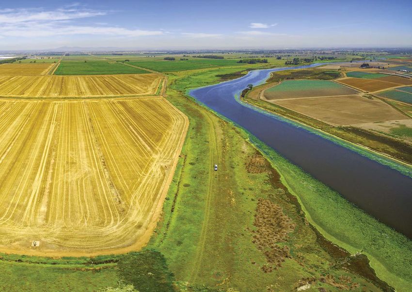
Acknowledgement of Victoria’s Aboriginal communities

The Victorian Government proudly acknowledges Victoria's Aboriginal communities and
their rich culture and pays its respects to their Elders past and present. The government
also recognises the intrinsic connection of Traditional Owners to Country and
acknowledges their contribution to the management of land, water and resources.

We acknowledge Aboriginal people as Australia’s first peoples and as the Traditional
Owners and custodians of the land and water on which we rely. We recognise and value
the ongoing contribution of Aboriginal people and communities to Victorian life and how
this enriches us. We embrace the spirit of reconciliation, working towards the equality
of outcomes and ensuring an equal voice.

© The State of Victoria Department of Environment, Land, Water and Planning 2018
This work is licensed under a Creative Commons Attribution 4.0 International licence.
You are free to re-use the work under that licence, on the condition that you credit the
State of Victoria as author. The licence does not apply to any images, photographs or
branding, including the Victorian Coat of Arms, the Victorian Government logo and the
Department of Environment, Land, Water and Planning (DELWP) logo. To view a copy
of this licence, visit creativecommons.org/licenses/by/4.0/

Printed by Finsbury Green, Melbourne

ISSN 2209-8232 - Print format
ISSN 2209-8240 - Online (pdf/word) format

Disclaimer
This publication may be of assistance to you but the State of Victoria and its
employees do not guarantee that the publication is without flaw of any kind
or is wholly appropriate for your particular purposes and therefore disclaims
all liability for any error, loss or other consequence which may arise from you
relying on any information in this publication.

Accessibility
If you would like to receive this publication in an alternative format,
please telephone the DELWP Customer Service Centre on 136 186 or email
customer.service@delwp.vic.gov.au or via the National Relay Service on 133 677,
www.relayservice.com.au.

This document is also available on the internet at www.delwp.vic.gov.au

Cover photograph
Werribee South coastline.
Photographer: Greg Brave
Integrated Water Management
is a collaborative approach
to water planning and
management that brings
together organisations with
an interest in all aspects
of the water cycle.
It has the potential to
provide greater value to our
communities by identifying
and leveraging opportunities
to optimise outcomes.
Contents
Foreword                                                                        1
Acknowledgements                                                                2

Chapter 1 The way forward                                                       3
Introduction                                                                    4
      Overview                                                                  4
      What is a Strategic Directions Statement?                                 4
Enduring collaboration                                                          5
      How we’re working together                                                5
      Recognising Aboriginal values in water planning and management            5
      Guiding principles for collaboration                                      6

Chapter 2 IWM in the region                                                     7
Regional context                                                                8
      Population                                                                8
      Climate change                                                           10
Vision and strategic outcomes                                                  11
      Collaboration to develop the shared vision and strategic outcome areas   11
Strategic outcomes for IWM                                                     12
      The case for IWM in the Werribee catchment                               14

Chapter 3 IWM opportunities                                                    21
Priority Portfolio                                                             22
Impact of IWM opportunities on the Forum’s strategic outcomes                  23
IWM opportunities: An overview of projects and strategies                      24
Priority Portfolio of IWM opportunities                                        28
Strategic enablers to put IWM into practice                                    35
Success stories                                                                36
Continued success through collaboration                                        38

Appendix                                                                       40
Additional IWM opportunities in the Werribee catchment                         40
Understanding the Werribee River catchment as a system                         41
Glossary of terms                                                              43
Foreword

The Integrated Water Management Forums position Victoria as a leader
in collaborative, state-wide water system planning and decision-making.

For the first time, Victoria’s water       The IWM Forums will help us better           As Lead Chair of the Metropolitan
sector, together with local and state     adapt to our changing climate while          and Regional IWM Forums, I would
government agencies and Traditional       we seize opportunities to grow and           like to acknowledge the tremendous
Owners, have committed to work            prosper in a sustainable water future.       contribution of the IWM Forum Chairs
as one to address some of the most                                                     and Forum Partners across Victoria
                                          They create an environment for IWM           who have worked together to forge a
urgent challenges of our time.
                                          advocacy and effective governance to         path to achieve meaningful and long-
In the face of climate change,            facilitate collaboration and innovation      term change that we can be proud of.
population growth and rapid               in water cycle management, service
urbanisation, we recognise our            delivery, urban design and planning.         Together with our regional and
shared responsibility to plan for                                                      metropolitan IWM Forum partners,
                                          As Chair of the inaugural Werribee           we look forward to delivering
water differently if we are to position
                                          IWM Forum, I would like to                   on our commitment to achieve
Victorian cities and towns to be
                                          acknowledge the deep commitment              transformational change in Victoria.
the most liveable and resilient
                                          of all Forum members and the hard
places in the world.
                                          work of the Working Group members
Through the work of the Werribee IWM      and DELWP staff to produce this
Forum, we acknowledge that climate        Strategic Directions Statement.
change is no longer a future problem.     The Statement demonstrates an                Rob Skinner
Our climate adaptation planning           ambitious commitment to protect              Chair of the Werribee IWM Forum
must progress ahead of the pace           Melbourne’s exceptional western              Lead Chair of the Metropolitan
of change and growth that we now          region and enhance the way                   and Regional IWM Forums
see spreading through our cities,         we live within our environment.
our catchment and across the state.

                                                                                   Western Port Strategic Directions Statement   1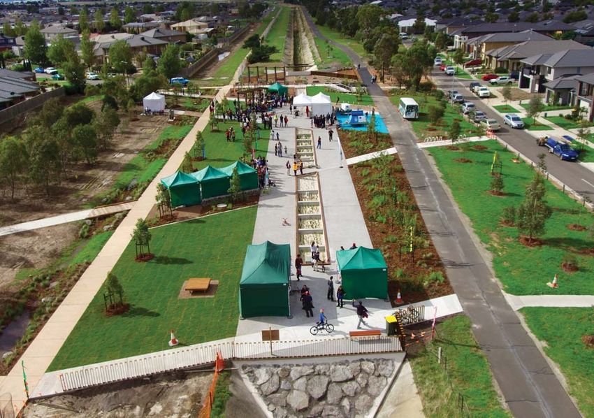
Acknowledgements

The inaugural Werribee Integrated Water Management Forum
was convened in December 2017 with subsequent Forums meeting
throughout 2018 to discuss and prioritise integrated water planning
and management in the Werribee Forum Area.

The Forum Area covers some of                    reserves and ecologically significant       Owners as traditional custodians
Victoria’s fastest urbanising greenfield         wetlands extending from the western         who have managed land and water
areas and will be the site of substantial        shores of Port Phillip Bay. Preservation    sustainably over thousands of
population growth in the coming                  and management of the catchment’s           generations and maintain an
years. Situated on the eastern extent            landscapes will have a positive impact      active connection to Country.
of the Victorian Volcanic Plain, a vast          on the long term health and security
geographic area characterised by                 of the region’s waterways.                  The Werribee Integrated Water
sweeping grasslands, stony rises and                                                         Management Strategic Directions
shallow lakes, the Werribee catchment            The Forum Area covers the traditional       Statement has been developed
contains a breadth of iconic Victorian           lands of the Wurundjeri, Wadawurrung        by the Werribee Integrated Water
landscapes expressive of the volcanic            and Bunurong people of the Kulin            Management Forum. Members of
creation of the region and the cultural          Nation. This region is abundant in          this Forum include the Chief Executive
history of early settlement. The Forum           Aboriginal cultural sites with a majority   Officers and Managing Directors
Area includes a major food bowl                  of these found near waterways and           of the following organisations:
for Victoria and Australia, numerous             the coast. The Werribee IWM Forum
nature conservation and wildlife                 acknowledges these Traditional

                                                                                             The Werribee IWM Forum is grateful to
                                                                                             the Werribee IWM Working Group for the
                                                                                             time and expertise they dedicated to
                                                                                             guide the development of this Strategic
                                                                                             Directions Statement.

2      Werribee Strategic Directions Statement
Chapter 1

Chapter 1
The way forward
An unprecedented opportunity
to progress water cycle planning
and management in Victoria
through collaboration.

Melton, Victoria. Photographer: Craig Moodie   Werribee Strategic Directions Statement    3
Introduction
Overview                                        The way in which land use and water
                                                planning occurs will be fundamental to
The Werribee catchment spans a                                                                 Integrated Water
                                                ensuring these aspirations are realised.
vast geographic area encompassing                                                              Management
some of Victoria’s most distinctive             The water cycle in the Werribee
                                                                                               IWM is a collaborative
landscapes. Windswept agricultural              catchment is overseen and managed
                                                                                               approach to water planning
plains and native grasslands meet               by several agencies. Enhanced
                                                                                               and management that brings
expansive natural forests throughout            communication and collaboration
                                                                                               together organisations with
the catchment. A mosaic of wetlands             is required to ensure plans and
                                                                                               an interest in all aspects of
and coastal environments dot the                investments are optimised to enable
                                                                                               the water cycle. It has the
western shores of Port Phillip Bay              shared community outcomes.
                                                                                               potential to provide greater
into which most of the region’s
                                                This approach is Integrated Water              value to our communities by
rivers and creeks flow.
                                                Management (IWM). A central premise            identifying and leveraging
The Werribee Forum Area contains                of IWM is the overall acceptance               opportunities to optimise
several densely populated urban                 that achieving liveability and                 outcomes.
areas and some of the fastest                   resilience is a shared responsibility.
developing suburbs in Victoria.
                                                The Integrated Water Management
Considered alongside challenges
                                                Framework for Victoria 2017 is             What is a Strategic
posed by global climate change,
                                                designed to help local governments,        Directions Statement?
the rapid transformation of the west
                                                water corporations, catchment
is impacting on the water cycle and                                                        This Strategic Directions Statement
                                                management authorities, Traditional
the health of waterways, including the                                                     (SDS) articulates the regional
                                                Owners and other organisations
Werribee River and other Forum Area                                                        context, shared vision and
                                                work together to ensure the water
rivers and creeks that flow directly to                                                     strategic water-related outcomes
                                                cycle efficiently contributes to
Port Phillip Bay. Balancing the needs                                                      for the Werribee catchment.
                                                the urban liveability of the region,
and function of Werribee’s water cycle
                                                with communities at the centre             It includes a prioritised list of
with future growth and development
                                                of decision-making.                        IWM opportunities developed
is a complex and urgent challenge
requiring careful management.                                                              in collaboration by the Werribee
                                                To assist with this, IWM Forums have
                                                                                           IWM Forum partners.
                                                been established across the state
The region’s water sector, local
                                                to identify, prioritise and oversee        Partners of the Werribee IWM
governments and Traditional Owners
                                                the implementation of critical             Forum are committing their
are working collaboratively to plan
                                                collaborative water opportunities.         best endeavours to:
and deliver projects and strategies
that will enhance the resilience and
                                                                                           • Ensure priority opportunities are
liveability of the Werribee catchment
                                                                                             progressed in line with the shared
and deliver enduring environmental,
                                                                                             vision and strategic outcomes of
economic and social benefits to
                                                                                             the Werribee catchment; and
local communities. Through ongoing
engagement with their communities,                                                         • Support the Department of
these organisations have heard that                                                          Environment, Land, Water and
thriving waterways are inextricably                                                          Planning to progress priority strategic
linked to community identity, amenity,                                                       enablers for IWM in Victoria.
value and sustained economic benefit
for the Werribee catchment.                                                                It is envisaged that the SDS will be a
                                                                                           living document which will be updated
                                                                                           to reflect the Werribee IWM Forum’s
                                                                                           current priorities and opportunities.

4     Werribee Strategic Directions Statement
Chapter 1

Enduring collaboration
How we’re working together            Each organisation has an important          Recognising Aboriginal
                                      role to play in the decision-making         values in water planning
The Werribee IWM Forum identifies,     and management of the catchment’s           and management
coordinates and prioritises areas     water, resources and assets.
that would most benefit from                                                       The Werribee IWM Forum is
collaborative and place-based water   Collaboration across IWM Forum              committed to working in partnership
management planning and projects.     partners will ensure balanced               with Aboriginal Victorians across
                                      consideration of the complex                landscapes, communities and
The Forum brings together 15          economic, environmental, cultural           natural resources.
organisations with an interest        and community benefits and impacts
in water cycle management             associated with the range of proposed       The Forum recognises that Traditional
across the Werribee catchment.        IWM opportunities. This collaborative       Owners throughout the metropolitan
These organisations include four      process allows for integrated solutions     Melbourne catchments, including
water corporations, seven local       that respond to individual business         the Wurundjeri, Bunurong and
governments, the Port Phillip         needs, as well as the needs of the          Wadawurrung people of the Kulin
and Westernport Catchment             broader catchment.                          Nation, are unique to Country and
Management Authority,                                                             their involvement in IWM planning will
representatives of Bunurong,          The Werribee IWM Forum partners             be specific to each planning area.
Wadawurrung and Wurundjeri            will continue to work together to build
Traditional Owner interests, the      inter-organisational trust and develop      Organisations involved in IWM have
Department of Environment, Land,      productive, enduring relationships to       obligations to involve Traditional
Water and Planning (DELWP) and        realise the shared vision for integrated    Owners and consider Aboriginal
the Victorian Planning Authority.     water management and delivery               values in their organisational activities.
                                      in the Werribee catchment.                  The Forum will continue to work with
To ensure IWM is successful and                                                   Traditional Owner groups to determine
enduring across the region, the       Further information on the IWM              the appropriate approach and level
Werribee IWM Forum partners commit    Forum’s governance and planning             of involvement in the broader IWM
to promote a collaborative and        framework is outlined in the Integrated     planning process for each Forum Area.
shared values culture within their    Water Management Framework for
own organisations and through their   Victoria 2017, available on the internet
work with local communities and       at www.delwp.vic.gov.au.
water cycle delivery partners.

The Werribee IWM Forum is governed
by an open and transparent
IWM planning process.

This process assumes a holistic,
whole-of-cycle approach
to determine water cycle
solutions, considering regulatory
accountabilities and service
delivery responsibilities.

                                                                     Werribee River Trail. Courtesy Zarnell Photography

                                                                                 Werribee Strategic Directions Statement    5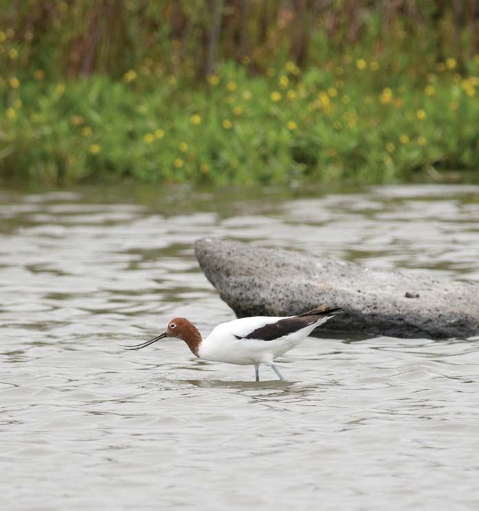
Guiding principles
for collaboration
The purpose of the Werribee IWM
Forum is to provide a collaborative IWM Forum
platform for overseeing, supporting
and, where necessary, facilitating
water’s contribution to resilience
and liveability in Victoria.
Applying an IWM approach,
the Forum will:
IWM Working Group
• Consider the collective community
needs in the regional context
and develop an overall strategic
direction accordingly.
• Complement and feed into existing
water and land planning processes,
collaborative networks, forums
IWM Project IWM Project IWM Project
and associations.
Group Group Group
• Commit best endeavours to facilitate
multi-stakeholder initiatives, share IWM Forum governance structure
organisational expertise and Further information on IWM Forum collaboration
advance sectoral learnings. and planning can be found in Chapter 3 of this SDS.
• Respect Traditional Owner rights
in water management planning.
• Ensure multiple benefits can
be delivered to the community
and the economy.
• Optimise investment in water
management projects and strategies
to deliver multiple benefits and best
community value solutions.
Port Phillip Bay (Western Shoreline) wetlands. Photographer: David Paul
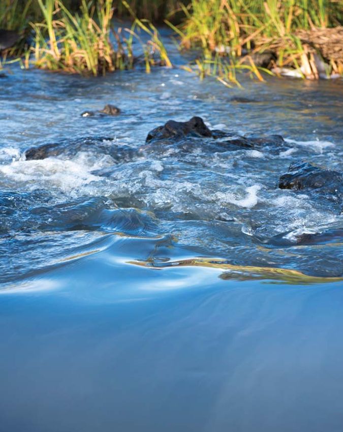
6 Werribee Strategic Directions StatementChapter 1 Chapter 2 IWM in the region Understanding why an integrated approach to water planning and management is critical to achieve better economic, environmental, cultural and community outcomes for the Werribee catchment. The Werribee River flows through agricultural land. Photographer: Greg Brave Werribee Strategic Directions Statement 7
Regional context
The Werribee IWM Forum Area encompasses some of Victoria’s most iconic
waterways and landscapes. The catchment covers an area of approximately
2,715 km2, extending along the southern reaches of the Great Diving Range
at the Wombat State Forest, south across dry, flat to gently undulating plains
scattered with volcanic features, to where grasslands join wetlands on the
western shoreline of Port Phillip Bay.

It is a geologically and ecologically            The Werribee catchment includes              The municipality of Wyndham is
diverse catchment with a rich                    areas of significant value where              one of the fastest growing urban
cultural history and, in recent                  Aboriginal people have lived for             areas in Australia with a population
times, the site of significant urban              thousands of years. Werribee is a word       that is expected to reach 400,000
growth on Melbourne’s fringe.                    derived from both the Wadawurrung            by 2050. Much of this growth will
                                                 and Boonwurrung words for backbone           occur in Point Cook, among the five
Agriculture dominates much of the                or spine. The name is thought to have        fastest growing Australian suburbs,
Werribee catchment with 67 per cent              its origin in the tree-lined course of the   as well as the suburbs of Tarneit and
of the area devoted to the production            Werribee River, which punctuated the         North Wyndham Vale. In the middle
of leafy vegetables, fruit and turf, as          landscape in contrast to the flat, bare       catchment, the City of Melton will
well as poultry, large scale grazing             plains surrounding the area. Many            experience a population growth rate
and crop operations. Only five per                Aboriginal artefacts, fish traps and          of nearly 150 per cent over the next
cent of the catchment is currently               burial sites have been found along           20 years. Protecting the Werribee
zoned for urban land use, though the             the region’s waterways, including            region’s ecologically-diverse and
region will undergo major residential            the Werribee River, which remains            fertile lands and waterways will
and economic development in the                  a place of significant cultural value         be a priority to ensure long term
coming years.                                    to the Wurundjeri, Wadawurrung               community liveability and resiliency.
The Werribee catchment sustains                  and Bunurong people.
a range of recreational activities,                                                           Climate change
including nature-based tourism,                  Population
bushwalking, fishing, cycling and                                                              The Werribee catchment presents
swimming. Commercial activities in               The Werribee IWM Forum Area has              several opportunities to demonstrate
the catchment include agriculture,               an estimated population of 575,000           regional growth planning and
manufacturing and wholesale trade,               people and is predicted to grow              development that is resilient to
as well as notable industries in                 to 1.35 million by 2040. The region          climate-related impacts. By 2040,
health, education and high-tech                  encompasses a major urban growth             average temperatures across the
research. The catchment hosts                    corridor and significant greenfield            Werribee catchment are expected
the Western Treatment Plant,                     residential development in Melbourne’s       to rise by an average of 1.3°C
operated by Melbourne Water,                     west will occur here over the next           under a medium climate change
which treats a significant proportion             20 to 30 years. Several towns in the         scenario, according to the Victorian
of Melbourne’s wastewater                        region have already transitioned             Government's Guidelines for Assessing
and produces recycled water.                     from a primarily rural to a primarily        the Impact of Climate Change on
                                                 urban municipality, including Melton         Water Supplies in Victoria 2016.
                                                 and Bacchus Marsh, while further             This will increase the impact of
                                                 densification and urban renewal               the urban heat island effect across
                                                 is anticipated for Altona, Werribee          the region, with higher density urban
                                                 and Sunshine West, which borders             areas experiencing greater heat
                                                 the Werribee and Maribyrnong                 vulnerability than more forested
                                                 catchments.                                  areas in the upper catchment.

8      Werribee Strategic Directions Statement
Chapter 2
Maribyrnong
Yarra
Werribee
Dandenong
Western Port
POPULATION GROWTH THE REGION
575,000 NOW (2018)
1,350,000 BY 2040 URBAN AREAS 5% 2,715km2
135% FORESTED 28%
CATCHMENT
AREA
INCREASE
AGRICULTURE 67%
14,000 110%
INCREASE VOLUME OF RECYCLED
OLYMPIC SIZED SWIMMING POOLS WATER PRODUCED
STORMWATER
WORTH OF WATER NEEDED TO COULD FILL THE MCG
PRODUCTION*
MEET RESIDENTIAL DEMAND* 11 TIMES*
*Anticipated change in water demand and production in greenfield growth areas from 2013-2050
Source: Department of Environment, Land, Water and Planning
Healthy Waterways Strategy 2013/14-2017/18, Melbourne Water
Victoria in future 2016
Werribee Strategic Directions Statement 9Extreme heat waves, wildfires heavy rainfall events will affect water
and drought will pose significant quality and the health of waterways To meet the challenge of
challenges for this characteristically from the upper reaches downstream climate change and prepare
dry country. Projections for Victoria’s to Port Phillip Bay. Coupled with Victoria’s water system for
future climate indicate an increase fast-growing residential populations, a range of possible climate
in the frequency and intensity of greenfield development and industrial futures, climate change
bushfires for the Werribee catchment demands, climate change impacts mitigation and adaptation
and neighbouring regions in Australia’s will place increased pressure on water actions will be embedded
southeast. The increased risk of services in the catchment. The region’s in all IWM Forum decisions.
bushfire poses a serious threat water security has declined over
to the catchment’s communities, recent decades, negatively impacting
infrastructure and high-value native productivity within the catchment’s increased storm surges will increase
grasslands, forests and ecosystems. two irrigation districts that together the costs and impacts of coastal
support major producers of fruits and flooding and shoreline erosion on
Whilst the catchment is predicted to vegetables in Victoria. Opportunities communities and marine ecosystems.
see a reduction in average annual to improve efficiency and tap The Western Treatment Plant,
rainfall over the next 20 years, the alternative sources of water will help an ecologically significant wetland
frequency and intensity of short mitigate climate related pressures listed under the Ramsar convention,
duration rainfall events is expected and better manage future risks. is at risk under climate change
to rise, increasing the risk of soil conditions due to sea level rise.
erosion and movement, riverine and Australia’s changing climate will pose Protection and improved resilience
flash flooding and high volumes of a serious threat to the wetlands and of this and other environmental
stormwater discharging pollutants coastal environments of the Werribee and economic assets is a priority
to waterways. Increased flows from catchment. Rising sea levels and for the Werribee catchment.
Understanding the Werribee catchment as a system
WASTEWATER
L E R DE
RD TREATMENT PLANT
E RG
RIV
ER
MAIN SUPPLY PIPES
WATERWAY
EEK
CR
RH
AR
WERRIBEE FORUM AREA
IW
SUNBURY
PY
RR
RI
DJ E
TE
WATERBODY
S
PYKES CREEK RESERVOIR
CR
DJERRIWARRH RESERVOIR
EE
GREENVALE RESERVOIR
K
MERRIMU RESERVOIR IRRIGATION DISTRICT
WE
R
RI
BACCHUS MARSH
BE
ER
I VE
R MELTON
MELTON RESERVOIR
WERRIBEE
PIPELINE TO GEELONG
WESTERN TREATMENT PLANT
Illustration indicative only. Not to scale.
10 Werribee Strategic Directions StatementChapter 2
Vision and strategic outcomes
The Werribee catchment is resilient and thriving.
Our growing communities are supported and the
health of our diverse environment is enhanced.
Collaboration to develop
the shared vision and
strategic outcome areas
The IWM Forum demonstrates a
robust and transparent process
of collaboration amongst local
governments and a range of
stakeholders with an interest in water.
Central within this process are the
community values, local interests
and place-based opportunities
represented by each Forum
Member organisation.
The IWM Forum recognises the
valuable contribution of these many
and diverse actors in supporting
a transformative approach to the
planning and management of our
wider water cycle. Each of these
organisations played a leading
role in determining a shared vision
for IWM unique to each of the five
metropolitan Melbourne catchments.
The seven primary strategic outcome
areas to achieve this vision, as well
as the secondary outcome areas
nested beneath each primary area,
were developed collaboratively
by the IWM Forum partners.
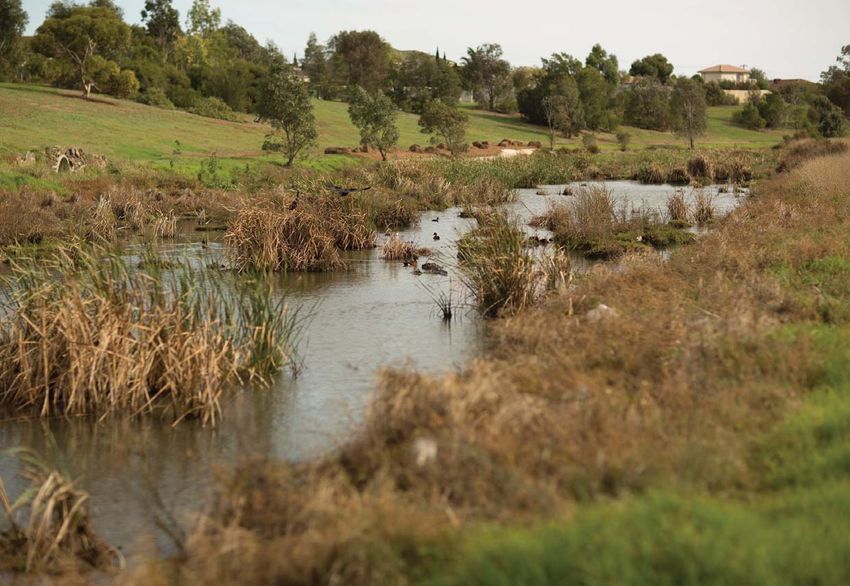
These outcomes acknowledge Kororoit Creek. Photographer: Christian Pearson.
the breadth of water plans, Courtesy Melbourne Water
environmental strategies and
land use plans developed by
each partner organisation.
Werribee Strategic Directions Statement 11Strategic outcomes for IWM
Outcomes
Safe, secure and affordable Effective and affordable Opportunities are optimised Healthy and valued waterways
supplies in an uncertain future wastewater systems to manage existing and future and marine environments
flood risks and impacts
Strategically balanced Meets or exceeds public health Appropriate levels of flood Management of the catchment
catchment-based and environmental standards management across the is integrated and includes
hierarchy of use catchment considering the whole water cycle
climate change impacts
Maximise the use of recycled
Development considers water for beneficial use Impacts from urban, peri urban,
precinct scale water balances Community and property irrigation and industrial activities
and servicing solutions resilient to local flood risk are mitigated to protect our
Waste-to-resource
across the catchment and waterways and the bay
opportunities are maximised
coastal environment
Fit for purpose water quality for beneficial outcomes
meets regulatory standards Ramsar wetlands are
and community expectations Development in the Werribee protected and sustained
Best practice centralised
catchment recognises
and decentralised septic
and mitigates exacerbated
Demand management and and sewerage systems and The health of waterway reaches
flooding risks
water-wise communities optimised onsite domestic and tributaries are improved
systems to deliver whole-of-
catchment benefits Coordinated urban and
Water available to maintain Waterways across the
flood management planning
valued passive and active catchment are improved and
processes across stakeholders
green community assets managed to maintain and
and organisations
protect coastal and marine
ecosystems in Port Phillip Bay
Climate-resilient fit for purpose
alternative sources of water,
such as stormwater and Reduced nutrient and sediment
recycled water, for a diverse discharges to both waterways
range of uses, including and Port Phillip Bay
agricultural and industrial use,
human consumption, ecological
Traditional Owner and
and cultural purposes, and
Aboriginal values, knowledge
recreational amenity
and practices are integrated
and protected in waterway
management and planning
12 Werribee Strategic Directions StatementChapter 2
The Werribee catchment is seeking to achieve seven
strategic outcomes through IWM. Each of these will have Low-emission solutions
a significant role in shaping the liveability, prosperity and IWM opportunities that minimise the release
resilience of Victoria’s cities and towns. These outcome of greenhouse gas (GHGs) emissions will be
considered by the Forum as solutions are
areas provide a guide to identify and prioritise the various
evaluated for implementation.
IWM opportunities included in Chapter 3 of this SDS.
Valued landscapes for Strengthened community Jobs, economic benefits
health and wellbeing knowledge and local values and innovation
reflected in place-based planning
Active and passive recreation Diverse landscapes that reflect Jobs and economic growth
supported by water local conditions, community values supported by water
and willingness to contribute
Urban landscapes retain moisture Innovative planning delivery and operation
for cooler, greener cities and towns Empowered, engaged and supported by feasible funding models
water literate community
Waterways and coastal environments Strong governance, collaboration,
are accessible as valuable open space Local water related risks and issues performance and accountability
understood, managed and mitigated
Aboriginal cultural values associated Alternative water is used beneficially
with waterways are protected Aboriginal values are understood to drive regional economic growth
and recognised early and included
in project planning and delivery
Biodiversity supported through Traditional Owner and Aboriginal
connected habitats within and along consultation, engagement, participation,
waterways and across landscapes Community values communicated to employment and economic development
IWM partners are incorporated into have been comprehensively implemented
the objectives and water cycle decision
making for place based projects
Secure alternative water to
enable long term investment
Planning and development
reflects the regional landscape
The regulatory environment supports
fit for purpose water in industry
Communities value the unique
regional landscape
Werribee Strategic Directions Statement 13The case for IWM in the
Werribee catchment
Over the coming years, the pace
of urban growth, development and
climate change will transform the
Werribee region, putting pressure Safe, secure and
on the catchment’s water cycle and affordable supplies in
resources, natural environments, an uncertain future
communities and industries. Adapting
to change and translating liveability
and water management objectives Six water corporations oversee water recovery and use. The West Werribee
into practice will involve working across supply for the Werribee catchment. Aquifer Storage and Recovery (ASR)
organisational boundaries to achieve These include Melbourne Water, Trial by City West Water investigated
the following strategic outcomes. City West Water, Western Water and the possibility of storing volumes
Southern Rural Water. Barwon Water of recycled water and stormwater
These outcomes are aligned with those
and Central Highlands Water oversee to help balance water supply and
reflected in the strategic plans and water supply to a very limited extent demand with future growth in the
environmental strategies of the within the catchment and as such, west. ASR is the process of recharging
Forum's partner organisations. are not included as standing members water into an aquifer for the purpose
of the Werribee IWM Forum. of storage and subsequent
withdrawal for other uses,
The catchment includes reservoirs including water supply, horticulture,
at Pykes Creek, Merrimu and Melton, industries and municipalities.
which hold water from both the
Werribee and Lerderderg River Water security is a concern in the
systems. The Werribee and Bacchus north and west areas of the Werribee
Marsh Irrigation Districts, two major catchment due to anticipated
food production regions in the of the population growth and greenfield
catchment, receive their irrigation development. Changes to the water
supplies from a combination of cycle driven by growth and climate
these storages. Part of the Upper change will mean more water will be
Stony Creek Reservoir is also located needed across the catchment for
within the catchment on its western urban, agricultural and environmental
boundary with the Barwon catchment. flow purposes. The catchment’s
residential population is expected
Aquifer Storage and Recovery Groundwater is accessed across the to double in next two decades,
(ASR) involves the capture and use catchment and is predominantly emphasising the need to diversify
of stormwater or recycled water to used for irrigation. Groundwater is the water supply system and reduce
recharge an aquifer for future recovery water that is beneath the earth's dependency on reservoirs.
and use. The aquifer provides not surface in pores and crevices of rocks
only the mechanism to store the and soil. The layers of soil and rock There is an opportunity to plan for
stormwater or recycled water, that contain useable quantities of the provision of secure water sources
but can also improve the quality. groundwater are called aquifers to provide reliable and fit for purpose
and these lie beneath all parts of supplies to the Werribee catchment’s
ASR schemes provide an alternative Victoria. Groundwater is allocated for growing communities, industries
to the construction of new surface consumptive use under the Water Act and developing precincts.
reservoirs, which can be expensive 1989. Recent years of low rainfall over
and difficult where available land is the Werribee catchment have resulted
scarce. Water stored underground in low reservoir storage stocks and the
through ASR does not experience use of aquifers to store and access
loss by evaporation, prolonging the treated recycled water for later
availability of water for use when
and where it’s needed most.
14 Werribee Strategic Directions StatementChapter 2
Opportunities
are optimised
Effective and to manage
affordable wastewater existing and
systems future flood
risks and
impacts
The majority of wastewater is used in either manufacturing Most of the flooding in the Werribee
generated in the Werribee catchment processes in Laverton or the catchment is a combination of riverine
is treated at Melbourne Water’s irrigation of recreational spaces and stormwater flooding, though
Western Treatment Plant, located within the community. coastal flooding and flash flooding
southwest of Werribee, 32 km from can also occur. Riverine flooding by
The Melton and Bacchus Marsh
Melbourne’s CBD. The plant processes the catchment’s major rivers, including
Recycled Water Plants treat
half of Melbourne’s sewage and the Werribee and Lerderderg Rivers
wastewater from their communities
produces almost 40 billion litres of and Kororoit Creek, occurs during
throughout the Werribee catchment.
recycled water to irrigate crops, periods of heavy and prolonged
Owned and operated by Western
parklands and sporting fields. rainfall where water levels rise and
Water, these plants supply recycled
Recycled water is wastewater that overflow the banks of the waterway.
water to residential and agricultural
has been collected and treated
users and generate significant Several low-lying areas in the region
so that it can be used again for a
liveability, food production and can also experience flash flooding,
variety of non-drinking purposes.
economic outcomes for the region. impacting communities, infrastructure
The Western Treatment Plant also As the west continues to grow, and amenities. Moorabool Shire in the
provides a wetland habitat for tens much of the wastewater generated catchment’s northwest is subject to
of thousands of migratory birds. in emerging communities will be riverine flooding and flash flooding in
The site is recognised as a wetland treated at these plants. Managing urbanised areas, such as Ballan and
of international importance under additional volumes of wastewater Bacchus Marsh. These areas
the Ramsar convention. generated from this growth and are particularly susceptible to
maintaining the health of waterways overflows from the Werribee River
The Werribee catchment also into which wastewater is discharged after prolonged periods of rain.
contains the smaller Altona Treatment will be a significant challenge for Melton West and Brookfield can
Plant, operated by City West Water. the Werribee catchment. There is also be affected by flooding from
The facility services over 20,000 an opportunity now for organisations Arnolds Creek or by heavy rainfall
industrial and residential properties to collaboratively determine the overwhelming local drainage systems.
in the catchment’s southern coastal best use for added volumes of Towards the catchment’s south,
communities, including Altona, recycled water produced from the dense suburban development means
Altona Meadows and Point Cook. Werribee catchment’s increased that rain water is not easily absorbed
Much of the treated wastewater wastewater generation. into the ground, tending to inundate
low-lying communities near the coast.
The Werribee catchment’s coastal
suburbs, including Altona, Seaholme
and Williamstown, lie on relatively flat
Ensuring alternative sources are fit for purpose terrain, with some parts lower than sea
level. Over the past decade, damage
The use of recycled water is an attractive water management strategy to meet
from flash flooding, storm surges
growing needs for water over the long term, particularly in drought prone areas.
and tidal flows from Port Phillip Bay
The use of recycled water and stormwater needs to be ‘fit for its purpose’ – have impacted on public and private
that is, an appropriate quality for the intended use. Appropriate opportunities infrastructure, including The Esplanade
for substitution of river and groundwater with treated recycled water foreshore area, which frequently
or stormwater include non–drinking uses in households and industry, floods due to storm surges.
and for agriculture, irrigating open spaces and gardens.
Werribee Strategic Directions Statement 15Healthy and valued
waterways and
marine environments
The Werribee catchment contains an diverse frog populations, a variety There is a need to investigate
array of significant and biologically of fish species and a range of birds, improved stormwater storage
diverse waterways ranging from lizards and butterflies. In parts of capabilities across the catchment,
expansive rivers, small ephemeral the mid and lower systems, native particularly in areas where
creeks and the western shoreline species are on the decline as stormwater harvesting and
of Victoria’s iconic Port Phillip Bay. streamside habitat corridors face management could reduce the risk
The catchment encompasses a the challenges of urbanisation, and cost of major rainfall events and
naturally arid landscape where agricultural and industrial activity minimise impacts, such as pollution,
many small waterways run dry and climate change impacts. to the bay’s marine environments.
during periods of low rainfall. Vegetation and habitat linking
works throughout the mid and The existing environmental
Major waterways in the Werribee lower catchment aim to improve entitlements for the Werribee
catchment include the Lerderderg, these populations, control pollution River do not fully address the flow-
Werribee and Little Rivers, as well as and invasive species and stabilise stressed nature of this important river
Toolern Creek, Kororoit Creek, Cherry waterway and environmental health system. Improving both the volume
Creek, Lollypop Creek, Laverton over the long term. and pattern of water flow across
Creek and Skeleton Creek. Several the upper and lower reaches is a
of these creeks and rivers comprise Water quality is considered fair for complex challenge. This challenge
their own sub-catchment through nearly half of the region’s waterways, includes considering water security
the broader Werribee Forum Area, indicating some evidence of stress for agricultural initiatives which do
and each flow directly to Port Phillip is apparent. Rivers and creeks in not compromise river health, as well
Bay. The Lerderderg River originates the forested upper reaches of the as understanding and improving
in the Wombat State Forest near catchment, including the upper environmental flow deficits.
Blackwood, meandering southeast Werribee and Lerderderg Rivers, are There is a need to investigate more
before reaching its confluence with in better condition than those near widespread use of alternative water
the Werribee River at the Melton urban and industrial areas. For rural to supplement environmental flows
Reservoir. One of only two Victorian areas and the lower catchment, in the Werribee catchment.
Heritage Rivers found in the five 42 per cent of waterways are in
metropolitan IWM Forum regions, poor condition or flow stressed, Further, there is an opportunity to
the Lerderderg River has retained however there is an overall trend of collaboratively manage the region’s
many of its natural features and improvement in water quality since increased development activity,
supports a range of environmental, the 2000s. Stormwater is among agricultural demands, increased
geological, cultural and recreational the major sources of pollution to stormwater volumes and nutrient
values for the Werribee catchment. waterways within the catchment. discharge to rivers and creeks,
According to the State of the Bays to ensure the health of the
Several small creeks join to form the 2016, 95 per cent of litter on Port catchment’s waterways and
Werribee River in the Wombat State Phillip Bay’s beaches, including Port Phillip Bay can be improved
Forest, on the southern slopes of those along the catchment’s for future generations.
the Great Dividing Range. The river western bay shoreline, was
flows approximately 110 km, meeting On the eastern boundary of the
transported from suburban streets
the Lerderderg River and farmlands Werribee catchment, wetlands,
through the stormwater system.
through Bacchus Marsh along sandy beaches and rocky shores
the way, before it eventually joins Wetlands play a key role in the span the coast from Williamstown,
Port Phillip Bay. The river supports treatment of stormwater within the 9 km southwest of Melbourne,
important agricultural districts and lower catchment. Most of the major to Point Wilson on the northern
provides water entitlements for rural rivers and creeks flowing through shores of Corio Bay. Many of the
communities and urban centres the region drain to wetland areas, major waterways within this part
throughout the catchment. Native including the Truganina Swamp, of the catchment flow through
animals at home in or near the Cheetham Wetlands and the coastal wetlands before draining
Werribee and Lerderderg systems Spit Wildlife Reserve, before to Port Phillip Bay.
include platypus, meeting Port Phillip Bay.
16 Werribee Strategic Directions StatementChapter 2
WE
RR
EK
IBE
E
CR
ER
RH
IVE
AR
R
IW
LE
RR
RD
PYR
DJ E
ER
PYKES CREEK RESERVOIR DJERRIWARRH RESERVOIR
DE
IT E S
RG
A designated Ramsar site along the
CRE
RI
MERRIMU RESERVOIR
VE
bay’s western shoreline links wetlands
R
EK
WE
R
near Altona and Werribee, through
RI
BE
ER KO
the Western Treatment Plant to Lake I VE RO
RO
R IT
Connewarre, south of Geelong. The CR
EE
K
Port Phillip Bay (Western Shoreline) MELTON RESERVOIR
WE
RR
and Bellarine Peninsula Ramsar site
IBE
ER
spans more than 22,000 hectares
IVER
and encompasses the Point Cook
S K EL E T
CH
ER
Marine Sanctuary, the largest marine
RY
ON
CR
sanctuary in Victoria, and the Spit
EE
CR
K
Wildlife Reserve. The sanctuary’s
E EK
LIT
TLE LO
RIV LLY
PO
richly diverse marine ecosystem ER PC
REE
K
hosts numerous species of fish,
invertebrates, molluscs, planktonic
and pelagic species, as well as 44
threatened bird species and 30
L IT T L
internationally important migratory E R IV
E R
bird species. In addition to their WESTERN TREATMENT PLANT
important ecological function,
the wetlands and nearby coastline
are a significant recreational resource,
Port Phillip Bay
providing an important open
space that is highly valued by
local communities.
Beyond the Ramsar boundary at The Werribee catchment contributes IWM outcomes to achieve healthy
Williamstown, the Jawbone Marine most of the total amount of nitrogen and valued waterways and marine
Sanctuary provides an important entering Port Phillip Bay. This nutrient environments in the Werribee
feeding and roosting habitat for is considered among the greatest catchment complement Melbourne
36 threatened bird species and 24 threats to the health of the bay Water’s draft Healthy Waterways
internationally important migratory and the marine species it supports, Strategy 2018. The strategy focuses
bird species. Basalt reefs, shallow leading to higher instances of algal on protecting and improving
inshore waters, mudflats and growth and phytoplankton blooms waterways in the Port Phillip and
seagrass beds encourage a variety affecting water quality and the Westernport region on behalf
of planktonic, pelagic and fish function of marine ecosystems. of the community. It identifies
species to visit and breed in these The Western Treatment Plant a range of priority areas and
shallow waters in the upper northwest contributes 54 per cent of total management actions for waterways,
corner of Port Phillip Bay. nitrogen to the bay, whilst the and many of these align with the
remaining areas of the Werribee strategic outcome areas and IWM
The bay continues to offer high water catchment contribute approximately opportunities identified by the
quality and an abundance of marine 6 per cent of total nitrogen to the Werribee IWM Forum Members
flora and fauna, despite the four bay from runoff. and further detailed in Chapter 3.
million people residing near its
333 km coastline. Along the coast, There is an opportunity to
water quality tends to be lower than incorporate improved planning
in the protected marine sanctuaries and waterway protection controls,
within the bay, and this is largely as well as strategies to manage
related to urban, industrial and nutrients, sediment and pollution,
agricultural influences on stormwater as the Werribee catchment
runoff to the bay. continues to urbanise.
Werribee Strategic Directions Statement 17Landscapes
for health and
wellbeing
Many of Victoria’s most iconic Only about one quarter of the The Western Grasslands Reserve,
landscapes are found throughout Werribee catchment reflects its a 15,000 hectare vegetation
the Werribee catchment. From natural vegetation before settlement community, aims to restore some of
expansive forests and vast dry plains and most of this is confined to the the last remaining native grasslands
scattered with volcanic stony rises, upper Werribee catchment where that once covered much of the
to marshy wetlands and sandy fern gullies and dry open forests Werribee catchment. The reserve
beaches on the western shores shelter hundreds of native and links the You Yangs to the Werribee
of Port Phillip Bay, the catchment threatened species. Grey kangaroos, River across the Victorian Western
characterises a variety of culturally wombats, wallabies, echidnas and Plains, a vast and largely flat
and historically significant settings. koalas are at home in the bushland plain studded with stony volcanic
of the Wombat State Forest, located rises. The area supports several
The Werribee catchment covers an 50 km west of Melbourne. The forest threatened plant and animal species
area of approximately 2,715 km2 and provides an important breeding of national significance, such as the
67 per cent of this land is devoted habitat for many migratory birds. Growling Grass Frog, the Golden
to agriculture. Only five per cent of More than 350 species of native Sun Moth and the Southern Brown
the catchment is zoned as urban, plants, including boldly coloured Bandicoot. Councils, communities
though recent years of development fungi and 25 rare and threatened and water industry partners are
in cities and towns on Melbourne’s plant species, can be found in the working to further restore native
fringe have dramatically changed forest. The 300-m deep Lerderderg vegetation through the west through
the landscape of the area. The west River gorge is a dominant feature sustainable land use management
is now one of the fastest growing of the Lerderderg State Park, practices that balance the dry,
regions in Australia, presenting new a haven for bushwalkers on the rocky landscapes typical of
challenges for the conservation of southeast corner of the Wombat the region with the necessity
natural environments for ecological State Forest. Both the Lerderderg to provide urban cooling.
and community benefit. There is an and Werribee gorges are recognised
opportunity to improve connections as landscapes of international and Increasing temperatures will place
through residential areas, linking state geomorphological significance. greater emphasis on the necessity
green corridors and parklands for Coupled with the Brisbane Ranges of green infrastructure to cool
improved community health and National Park, Victoria’s richest western landscapes and improve
wellbeing. Cycling and walking wildflower environment, these near- community liveability in this
tracks along the Werribee River natural forested regions contribute historically arid and rocky region.
Trail and the Federation Trail are enormous environmental value to In contrast to naturally lush and
examples of two well-used and well- the west and provide excellent forested neighbouring regions,
loved recreational assets connecting recreation opportunities for suburbs in the Werribee catchment
communities in the west. locals and visitors alike. have tree canopy coverage of only
five to 10 per cent, compared to
between 10 and 30 per cent in other
areas of metropolitan Melbourne.
Water is required to increase and
sustain canopy cover over the
landscape with vegetation
that may not naturally thrive
in these dry conditions.
18 Werribee Strategic Directions StatementChapter 2
Strengthened community
knowledge and local values
reflected in place-based planning
The Werribee catchment area holds Sunshine West, new employment Creek, Friends of Maribyrnong Valley
a wide range of values for Victorians, precincts will attract more residents and the Werribee River Association
including nature-based tourism, and further growth. are also working to improve planning
cultural heritage and recreation on and environmental protection in
and near rivers and Port Phillip Bay. Water demand will continue to grow the Werribee catchment. The Rivers
with the expansive newly planned of the West campaign aims to
The catchment encompasses the suburbs emerging in the west. There achieve legal reform in the planning
Traditional lands of the Wurundjeri, is an opportunity to integrate water and management of the west’s
Wadawurrung and Bunurong people planning and management with waterways.
of the Kulin Nation. More than 3,500 urban design and development to
Aboriginal cultural sites have been ensure innovative water infrastructure Other cross-government and water
recorded across the catchment, can service growing communities sector initiatives that seek to elevate
including scarred trees, fish traps, and deliver secure water supplies community priorities include the
camp sites, burials and ceremonial to homes, businesses and facilities. Greening the West and Greening the
sites. A majority of these are found Examples include water-sensitive Pipeline initiatives. Greening the West
close to waterholes, wetlands and urban design in new residential brings together 23 organisations to
rivers, including the Werribee River, estates, recycled water and improve urban greening, cooling and
which remains a place of significant stormwater harvesting to irrigate amenity by planting over one million
cultural value. The Werribee parklands and sporting fields and trees across western metropolitan
catchment derives its name from other public and private spaces, the Melbourne. In the catchment’s
both the Wadawurrung and provision of community amenities with southwest, the Greening the Pipeline
Boonwurrung words meaning water features and the maintenance project at Williams Landing has
backbone or spine, and is believed of open space and green wedges transformed an underutilised stretch
to refer to the tall trees that lined to support recreation and cooling of the heritage listed Main Outfall
the banks of the Werribee River in this naturally dry landscape. Sewer pipeline reserve into water-
in contrast with the flat, grassy sensitive parklands to better connect
plains of its surrounding area. The catchment’s local governments, the new communities of the west.
communities and water industry
Maintaining community liveability and partners are working together to The Western and Inner Metropolitan
enhancing cultural, social, ecological improve connections between Partnerships brings together
and recreational values of regional people and the landscape during community and business
waterways, parks and forests remain this period of change. Collaborative representatives with state and local
areas of focus as growth planning initiatives to strengthen community governments to identify priorities
continues in the west. The region knowledge of land and waterway for jobs, services and infrastructure
already encompasses some of the values are abundant and there within the region. Among a range
largest and fastest growing suburban are numerous community-led or of priorities, the Partnerships
populations in Australia, with new co-designed projects in the region provide advice to ensure ongoing
communities emerging in Point Cook, working to protect natural assets, environmental benefits and
Tarneit, Bacchus Marsh and North restore vegetation and improve connections to the environment
Wyndham Vale. Rural townships will community health and wellbeing. within each region.
continue to urbanise, transforming Notable examples include the Grow
the region with a network of satellite West project, which aims to enhance
cities on Melbourne’s fringe. In the native vegetation, create biolinks
municipality of Melton, the amount and protect natural landscapes
of urbanised area will triple by 2040, in the upper Werribee catchment.
while in already developed suburbs Groups including Environmental
such as Werribee, Altona and Justice Australia, Friends of Steele
Werribee Strategic Directions Statement 19Jobs,
economic
benefits and
innovation
The Werribee catchment covers a Planning is underway for the The Werribee National Employment
major growth corridor in Melbourne’s Western Irrigation Network (WIN), and Innovation Cluster (NEIC) is
west, one of the fastest growing an alternative water scheme led by a major employment hub for the
regions in Australia. It includes several Western Water for the catchment's catchment, providing around
areas designated for population agricultural region. The WIN will 8,400 jobs across health,
and economic growth, significant support future recycled water education and research industries.
transport and freight infrastructure customer supply to enable high The Werribee NEIC has the capacity
and fertile agricultural lands value agriculture, regional economic to host up to 50,000 more jobs
comprising a major Australian growth and liveability in the west. as the region matures, presenting
food bowl. new opportunities for economic
The Werribee catchment’s strong development and regional
The Werribee Irrigation District and industrial and manufacturing roots self-sustainability. Secure water
the Bacchus Marsh Irrigation District have contributed to the growth of supplies and adequate water
support two of Australia’s most Victoria’s largest State Significant management infrastructure for
productive food growing regions Industrial Precinct (SSIP). Spanning the water, wastewater and stormwater
and provide Victorians with fresh Altona, Laverton and Derrimut region, to support the catchment’s key
leafy vegetables, such as lettuce, the West SSIP provides strategically industries will be critical to its
broccoli and cauliflower, stone and located land for major industrial continued economic growth
pome fruit, market garden plants and developments linked to key freight and success.
turf. Water for agricultural irrigation and transport gateways, including
is derived from several reservoirs Melbourne’s second international
in the catchment and is further airport, Avalon Airport, the West Gate
supplemented by recycled water Freeway, Princes Freeway and the
from the Western Treatment Plant. Western Ring Road. Wholesale trade
Piping infrastructure modernisation accounts for around one quarter of
projects are underway to return water all industries in the West SSIP,
back to the environment and make followed by manufacturing (20 per
these regions more efficient, reliable cent) and transport and warehousing
and resilient to the drier climate (16 per cent). Several petrochemical
facing the Werribee catchment. and petroleum refining industries
are also located in the Werribee
Beyond the irrigation districts, catchment, as well as extractive
agricultural land in the catchment is resource industries, including Victoria’s
used for livestock grazing and crop largest producer of hard rock for
production. Ensuring the provision building and road construction.
of secure water supplies, including Managing the impact of these
recycled water for sustainable industries on waterway health
agriculture and irrigated cropping, is a central concern for the
will be vital to the catchment’s Werribee catchment.
ongoing productivity.
20 Werribee Strategic Directions StatementYou can also read