Weston Lea Ltd Amberfield Subdivision Peacockes - Subdivision Consent Application
←
→
Page content transcription
If your browser does not render page correctly, please read the page content below
Weston Lea Ltd
                                                                   Amberfield Subdivision
                                                                   Peacockes
                                                                   Subdivision Consent Application

                                                                   Integrated Transportation Assessment
                                                                   Report

                                                                   May 2018

TDG Ref: 13646 ita 180509 weston lea ltd amberfield subdivision,
peacockes ‐ final.docx
Weston Lea Ltd
                                                       Amberfield Subdivision
                                                       Peacockes
                                                       Subdivision Consent Application

                                                       Integrated Transportation Assessment
                                                       Report
                                                       Quality Assurance Statement

                                                       Prepared by:
                                                       Athul Harris
                                                       Transportation Engineer

                                                       Reviewed by:
                                                       Tony Penny
                                                       Principal Consultant

                                                       Approved for Issue by:
                                                       Tony Penny
                                                       Principal Consultant

                                                       Status:              Final

                                                       Date:                9 May 2018

9 May 2018   13646 ITA 180509 Weston Lea Ltd Amberfield Subdivision, Peacockes ‐ Final.docx
Weston Lea Ltd Amberfield Subdivision, Peacockes, Subdivision Consent Application
Integrated Transportation Assessment Report                                                                                                          Page 1

Table of Contents
Executive Summary ................................................................................................................................. 1

1.       Introduction .................................................................................................................................. 4
         1.1 General ............................................................................................................................... 4
         1.2 Site Location ....................................................................................................................... 4

2.       Existing Traffic Environment ......................................................................................................... 9
         2.1 Existing Road Network ........................................................................................................ 9
         2.2 Existing Traffic Volumes.................................................................................................... 14
         2.3 Accident History................................................................................................................ 18
         2.4 Existing Bus Services ......................................................................................................... 20
         2.5 Existing Active Transport Facilities ................................................................................... 21

3.       Transportation Planning ............................................................................................................. 22
         3.1 Future Roading Projects ................................................................................................... 22
         3.2 Peacockes Structure Plan ................................................................................................. 24
         3.3 Housing Infrastructure Fund ............................................................................................. 25

4.       Proposed Subdivision .................................................................................................................. 29
         4.1 General ............................................................................................................................. 29
         4.2 Peacockes Road (North) ................................................................................................... 29
         4.3 Peacockes Road (South) ................................................................................................... 35
         4.4 Residential Roads.............................................................................................................. 37
         4.5 Residential Road Cross‐sections ....................................................................................... 38
         4.6 Facilities for Active Modes................................................................................................ 42
         4.7 Public Transport Proposals ............................................................................................... 49

5.       Hamilton District Plan ................................................................................................................. 53
         5.1 Objectives and Policies ..................................................................................................... 53
         5.2 Rules ................................................................................................................................. 53

6.       Traffic Forecasts .......................................................................................................................... 55
         6.1 Previous 2016 Model Assessment .................................................................................... 55
         6.2 2013 Model Assessment of HIF and Southern Links ........................................................ 57

7.       Transportation Effects ................................................................................................................ 59
         7.1 Network Efficiency ............................................................................................................ 59
         7.2 Intersection Performance ................................................................................................. 59
         7.3 Road Safety ....................................................................................................................... 61
         7.4 Active Modes .................................................................................................................... 62

8.       Mitigation.................................................................................................................................... 63
         8.1 Peacockes Stage 1 Development ...................................................................................... 63

9 May 2018                      13646 ITA 180509 Weston Lea Ltd Amberfield Subdivision, Peacockes ‐ Final.docx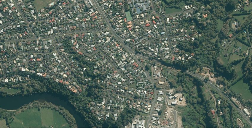
Weston Lea Ltd Amberfield Subdivision, Peacockes, Subdivision Consent Application
Integrated Transportation Assessment Report                                                                                                     Page 2

        8.2     Shared Path Proposal........................................................................................................ 63
        8.3     Lorne Street / Normandy Avenue Upgrade ...................................................................... 63
        8.4     HIF Proposals .................................................................................................................... 66
        8.5     Alternative Modes ............................................................................................................ 67

9.      Summary and Conclusions .......................................................................................................... 68

Appendix A
Peacockes Road Upgrade Drawings

Appendix B
Stage 1A Mitigation Measures

Appendix C
Hamilton District Plan Compliance Table

9 May 2018                   13646 ITA 180509 Weston Lea Ltd Amberfield Subdivision, Peacockes ‐ Final.docx
Weston Lea Ltd Amberfield Subdivision, Peacockes, Subdivision Consent Application
Integrated Transportation Assessment Report                                                                  Page 1

Executive Summary
        This Integrated Transportation Assessment (ITA) report has been produced to accompany
        the application for subdivision consent for a large area of land comprising approximately
        105 hectares between Peacockes Road and the Waikato River in the Peacockes area of
        Hamilton. This subdivision will be called “Amberfield” and will contain approximately 1,000
        residential lots and a neighbourhood centre. Its traffic effects on the road network were
        the subject of a significant transportation assessment undertaken by TDG in 2016. That
        assessment was based on the existing road network with only the addition of the Wairere
        Drive link and the Waikato Expressway included in the modelling of the projected traffic
        volumes on the road network for 2021. The assessment identified that the existing
        network with the committed future projects would be able to accommodate the traffic
        generated by the Amberfield subdivision safely and efficiently without significant adverse
        effects with some mitigation measures.

        Since that assessment the Government has introduced the Housing Infrastructure Fund
        (HIF) and identified Peacockes specifically as a candidate for such funding. The road
        network associated with the possible funding includes a new river bridge across the
        Waikato River which would enhance accessibility for the overall Peacockes area, the airport
        and the wider community. However the Amberfield subdivision application is being
        submitted on the basis of access being provided by the existing transportation network and
        committed future projects.

        Also since the earlier assessment, it has been confirmed that a new roundabout will be
        constructed on Ohaupo Road (SH3) south of Dixon Road within the next two years. This will
        make it easier for drivers to turn right onto SH3 from the adjacent area reducing the need
        for traffic from the Peacockes Stage 1 area to use the Waterford Road – Peacockes Road –
        Bader Street route. More capacity will therefore be available on this route for traffic
        generated by the proposed Amberfield subdivision and it is unlikely that the mitigation
        measures previously identified in the 2016 transportation assessment for Normandy
        Avenue at the Lorne Street intersection will need to be implemented.

        The Council has also subsequently adopted some proposed safety improvements to this
        route involving a roundabout at the Waterford Road/Peacockes Road/Plateau Drive
        intersection, cycle/pedestrian crossings and traffic calming in the vicinity of the local shops
        on Bader Street. In addition it is proposed that a further pedestrian/cyclist
        crossing/threshold will be provided at the urban boundary on Peacockes Road as part of
        mitigation measures associated with the subdivision. This will calm traffic entering the
        urban area and provide an interface with the shared pedestrian/cyclist path proposed to
        link the urban area with the Amberfield subdivision.

        The existing rural section of Peacockes Road is capable accommodating all of the traffic that
        will be generated by the proposed subdivision safely and efficiently provided the off‐road
        shared path is constructed along the east side of Peacockes Road to separate pedestrians
        and cyclists from traffic on the existing carriageway. While the rural section of Peacockes
        Road between the current urban boundary and the subdivision will be retained, it is
        proposed that the sections of Peacockes Road adjoining the site should be upgraded to an
        urban standard at the same time as the adjacent stages of the subdivision are developed.

        The subdivision north of the neighbourhood centre/east‐west arterial will be designed so
        that the access roads can be connected to either the proposed minor arterial road upgrade

9 May 2018                  13646 ITA 180509 Weston Lea Ltd Amberfield Subdivision, Peacockes ‐ Final.docx
Weston Lea Ltd Amberfield Subdivision, Peacockes, Subdivision Consent Application
Integrated Transportation Assessment Report                                                                  Page 2

        of Peacockes Road or to a collector road upgrade if the minor arterial is not programmed
        for construction in the same timeframe as the subdivision. In the latter event the existing
        road reserve would be widened on the eastern side utilising some of the land subject to the
        existing designation, so that a new carriageway could be constructed to the standard for an
        urban collector road. The collector road would be constructed on the same vertical and
        horizontal alignment as the future minor arterial. It would include a 9m wide carriageway
        with kerb and channel, kerbside parking/bio‐retention facilities, shared path and berm on
        the east side. The Council are to determine what would be constructed on the west side.

        The high level design for the upgrading of Peacockes Road to a minor arterial prepared by
        AECOM to inform the Southern Links designation process has been refined to better match
        the existing land form, to reduce construction costs, to reduce the amount of land required
        for earthworks and to enable the flexibility to upgrade the existing road to a collector road
        in the interim or to a minor arterial road directly. As discussed with the Council, a revised
        cross‐section is also proposed for the minor arterial replacing the swales with kerb and
        channel with alternating bio‐retention facilities and kerbside parallel car parking but
        retaining the same road formation width. Off‐road shared pedestrian/cyclist paths are also
        proposed on both sides.

        Council staff have advised that the rationale for the section of Peacockes Road south of the
        neighbourhood centre being classified a minor arterial in the Peacockes Structure Plan is to
        future proof the long term possibility that the additional Waipa District land inside the
        Southern Links Bypass might be developed for urban use. However this section of
        Peacockes Road is predicted by the Waikato Regional Transport Model (WRTM) to carry
        traffic volumes that do not justify the construction of a minor arterial for a very long time.
        Therefore it is proposed that when the adjacent sections of the Amberfield subdivision are
        developed, the existing road reserve will be widened by 3m on the eastern side to 23m and
        the existing road upgraded to a collector road standard. Given that this road is expected to
        operate in this format for many years, the design of the road alignment has been improved
        to ensure a high standard facility but again the extent of the reconstruction on the west
        side will be decided by the Council. Future upgrading to minor arterial standard would still
        be possible by widening the road reserve to the west if that is required in the long term.

        Peacockes Road is the spine road to which the subdivision road network will be connecting,
        and which provides all access between the subdivision and other areas. There will be three
        side roads off Peacockes Road north of the neighbourhood centre and five to the south
        providing access to the subdivision. The access roads link through to the riverside (or the
        gully) and a series of roads running parallel to the river and Peacockes Road provide further
        distribution of vehicles. All roads in the subdivision have cross‐sections that are generally
        consistent with those specified in the District Plan.

        A comprehensive network of cycleways / footpaths or shared paths are proposed to service
        the Amberfield subdivision and to link with the wider network of paths proposed under the
        Peacockes Structure Plan. The street network has a grid base with on and off‐street paths
        that support accessibility and permeability for pedestrians and cyclists. This and the other
        transportation locations are consistent with the objectives and policies of the Hamilton
        District Plan.

        It is proposed that provision should be made for a future bus route running along
        Peacockes Road to the neighbourhood centre and then using a loop through the southern
        area to improve service for residents on the “island” and to provide a turnaround for buses.

9 May 2018                  13646 ITA 180509 Weston Lea Ltd Amberfield Subdivision, Peacockes ‐ Final.docx
Weston Lea Ltd Amberfield Subdivision, Peacockes, Subdivision Consent Application
Integrated Transportation Assessment Report                                                                  Page 3

        This may change subsequently with further development to the south. It is also expected
        that a shorter route might be able to be justified to service the first stage of the subdivision
        and this will be discussed with the Regional Council as the subdivision develops.

9 May 2018                  13646 ITA 180509 Weston Lea Ltd Amberfield Subdivision, Peacockes ‐ Final.docx
Weston Lea Ltd Amberfield Subdivision, Peacockes, Subdivision Consent Application
Integrated Transportation Assessment Report                                                                  Page 4

1. Introduction

        1.1 General
        This Integrated Transportation Assessment (ITA) report has been produced to accompany
        the application for subdivision consent for a large area of land between Peacockes Road
        and the Waikato River in the Peacockes area of Hamilton. The total site subject to the
        subdivision consent application comprises approximately 139hectares of land . Excluding
        the two rural balance lots that will be created west of Peacockes Road, the site that will be
        subject to urban development and subdivision comprises approximately 105 hectares. An
        ITA is required by the Hamilton City Operative District Plan (the District Plan) for proposals
        that generate significant volumes of traffic and have the potential to create adverse
        transportation effects.

        This subdivision will be called “Amberfield” and will contain approximately 1,000 residential
        lots and a neighbourhood centre and therefore falls into the category of having the
        potential to generate significant traffic effects on the road network. This assessment is in
        accordance with the requirements for a “Broad ITA” contained in Table 15‐3b in Appendix
        15 of the District Plan.

        The main basis for the ITA is a significant transportation assessment undertaken in 2016
        when three reports were produced by TDG using the 2006‐based Waikato Regional
        Transport Model (WRTM) to assess the effects of the proposed subdivision. These reports
        are referenced in this report but for convenience the conclusions are summarised and
        included in later sections of this report. That assessment was based on the existing road
        network with only the committed roading projects, including the Wairere Drive link (to SH1)
        and the Waikato Expressway added for in the modelling of the projected traffic volumes on
        the road network for 2021.

        Since that assessment the Government has introduced the Housing Infrastructure Fund
        (HIF) and identified Peacockes specifically as a candidate for such funding. The road
        network associated with the possible funding includes a new river bridge across the
        Waikato River from the Wairere Link interchange on State Highway 1 (SH1) to Peacockes
        Road which would enhance the accessibility for the overall Peacockes area, the airport and
        the wider community. The Amberfield subdivision application is being submitted on the
        standalone basis of access being provided by the existing transportation network and
        committed future projects.

        1.2 Site Location
        The location of the subdivision site is illustrated in Figure 1 on the eastern side of Peacockes
        Road in the Peacockes Structure Plan Area. The proximity of the site to the Hamilton
        Central Business District (CBD) is clearly illustrated with the northern edge of the
        subdivision being some 4km away, the closest undeveloped land.

        It will be seen that the proposed subdivision is separated from the existing urban boundary
        by some 1.5 km. While the intervening Structure Plan Area is expected to be converted to
        urban development at some stage in the future, it is anticipated that the Amberfield
        subdivision will occur first and therefore the transportation effects of this subdivision

9 May 2018                  13646 ITA 180509 Weston Lea Ltd Amberfield Subdivision, Peacockes ‐ Final.docx
Weston Lea Ltd Amberfield Subdivision, Peacockes, Subdivision Consent Application
Integrated Transportation Assessment Report                                                                  Page 5

        application are based on retaining the existing rural form of Peacockes Road between the
        subdivision and the current urban boundary in the vicinity of the Hamilton City Council
        water treatment plant. However, a shared path and street lighting will be established along
        the rural section of road for safe use by pedestrians and cyclists.

        That section of Peacockes Road will provide the main access to the Amberfield subdivision
        with a relatively small amount of generated traffic heading south along Peacockes Road
        towards Raynes Road and on to the airport or SH1 or Stage Highway 3 (SH3).

9 May 2018                  13646 ITA 180509 Weston Lea Ltd Amberfield Subdivision, Peacockes ‐ Final.docx
LEGEND:

                                                                                                                                                                             PEACOCKE STRUCTURE PLAN AREA

                                                                                                                                                                             SUBDIVISION SITE

                                                                                                                                 H A CB
                                                                                                                                    MI D
                                                                                                                                      LT
                                                                                                                                        ON
20mm @ A3
 Wednesday, May 9, 2018 11:49:39 AM 0

                                            AERIAL PHOTO SOURCED FROM: LINZ

    REV                                     DATE         DRN   DESCRIPTION              CHK   APPR                                             DRN: AKJ   DATE: 09/05/2018      REV: 0
                                                                                                     WESTON LEA LTD - AMBERFIELD SUBDIVISION
                                        0   09/05/2018   AKJ   ISSUED FOR INFORMATION   N/A    N/A

                                                                                                     SUBDIVISION SITE LOCATION
                                                                                                                                               SCALE: 1:50,000 @ A3
                                                                                                                                               STATUS:
                                                                                                                                                                                                                1
                                                                                                                                               DWG NO: 13646_C4B                                            SHT 1 OF 1

X:\brCHC\OldData\13000-13999\13600-13699\13646 Peacocke Structure Plan Area, Hamilton-ChC Inputs\Drawings\ACAD\13646_C4B.dwg
Weston Lea Ltd Amberfield Subdivision, Peacockes, Subdivision Consent Application
Integrated Transportation Assessment Report Page 7
Figure 2 includes a series of photographs illustrating the existing configuration of Peacockes
Road at various locations along its length.
On reaching the urban area, the northern section of Peacockes Road connects to a
crossroad intersection with Waterford Road and Plateau Drive. Peacockes Road turns
through a right angle at this intersection and terminates at a T‐intersection with Norrie
Street. The main access route for the subdivision then proceeds around a bend into Bader
Street which connects to Normandy Avenue (SH3) at a traffic signalised T‐intersection.
Normandy Avenue connects to SH3 which leads to the south and west and to SH1 which
leads to the CBD and to the south.
At the Peacockes Road/Waterford Road intersection, a small amount of the traffic
generated by the Amberfield subdivision will continue into Waterford Road and Dixon
Street to reach local destinations. These local destinations include the Stage 1 subdivision
of Peacockes which is well advanced, and which ultimately will contain some 1,000
residential lots. (The location of Stage 1 is indicated later in Figure 12). Some traffic
generated by Stage 1 that currently uses the Peacockes Road‐Bader Street route for access
will be diverted to Ohaupo Road (SH3) when a new roundabout‐controlled intersection is
constructed on SH3 south of Dixon Road to relieve the delay for traffic turning right at the
existing SH3 / Dixon Road intersection at peak times. This effect was not included in the
2016 assessment because the imminent construction of the new roundabout had not been
confirmed at that time.
It is stressed that Dixon Road is not a major access route for the proposed Amberfield
subdivision because of the right turn delays at the SH3 intersection and because it is not the
shortest route for trips to more distant destinations. This will remain the case even with
the new roundabout.
9 May 2018 13646 ITA 180509 Weston Lea Ltd Amberfield Subdivision, Peacockes ‐ Final.docxBADER
S TREET
WE
ST
NO
AD
ON
RR
RO
IE
LE
ES
ST
K
A
OC
DR
RE
AC
I
PE
ET
VE
PL
PEACOCKES LANE
AT
EA
WATE
U
DR
RFOR
IV
E
D
ROAD
AMB VISION
SUBD
PEAC
ERFI
OCK
I
20mm @ A3
ES R
ELD
OAD
AD
O
R
N
O
IX
Wednesday, May 9, 2018 11:58:42 AM 0
D
AERIAL PHOTO SOURCED FROM: LINZ
REV DATE DRN DESCRIPTION CHK APPR DRN: AKJ DATE: 09/05/2018 REV: 0
WESTON LEA LTD - AMBERFIELD SUBDIVISION
0 09/05/2018 AKJ ISSUED FOR INFORMATION N/A N/A
PHOTOGRAPHS OF EXISTING ROADS
SCALE: 1:10,000 @ A3
STATUS:
2
DWG NO: 13646_C8B SHT 1 OF 1
X:\brCHC\OldData\13000-13999\13600-13699\13646 Peacocke Structure Plan Area, Hamilton-ChC Inputs\Drawings\ACAD\13646_C8B.dwgWeston Lea Ltd Amberfield Subdivision, Peacockes, Subdivision Consent Application
Integrated Transportation Assessment Report Page 9
2. Existing Traffic Environment
2.1 Existing Road Network
Figure 3 indicates the existing and proposed road network hierarchy as identified by the
Hamilton District Plan. The rural section of Peacockes Road is currently classified as a local
road but indicated in the District Plan as a “Proposed Minor Arterial Road”. The section of
Peacockes Road between Waterford Road and Norrie Street is a collector road. The section
of Norrie Street between Peacockes Road and Bader Street is also a collector road and this
collector road route continues along Bader Street to Normandy Avenue. The roads on the
route along Waterford Road and Dixon Road to SH3 are also classified as collector roads.
Normandy Avenue and Ohaupo Road are major arterials that form part of SH3.
The rural section of Peacockes Road consists of a 6.0m wide (approximately) sealed
carriageway without kerb and channel, with minimal gravel shoulders and large grass
berms within a 20m wide road reserve. It generally follows an alignment with sweeping
bends and relatively long straight sections. The vertical alignment is generally flat but there
are some sag and crest curves with limited visibility. The speed limit on Peacockes Road in
the rural area is 80 km/h.
Other than the sweeping bend at the northern end of the subdivision site, the alignment of
Peacockes Road in the vicinity of the subdivision is generally straight and runs in a north‐
south direction. To the north of the site the road proceeds through two bends before
arriving at the existing urban boundary in an east‐west direction.
9 May 2018 13646 ITA 180509 Weston Lea Ltd Amberfield Subdivision, Peacockes ‐ Final.docxSITE LOCATION
20mm @ A3
Wednesday, May 9, 2018 11:49:39 AM 0
WESTON LEA LTD - AMBERFIELD SUBDIVISION
DISTRICT PLAN TRANSPORT CORRIDOR HIERARCHY PLAN
3
SCALE: NTS
X:\brCHC\OldData\13000-13999\13600-13699\13646 Peacocke Structure Plan Area, Hamilton-ChC Inputs\Drawings\ACAD\13646_C4B.dwgWeston Lea Ltd Amberfield Subdivision, Peacockes, Subdivision Consent Application
Integrated Transportation Assessment Report Page 11
To the south of the subdivision Peacockes Road continues in the same rural format with a
series of bends before meeting Raynes Road at a T‐intersection which is controlled by a
Stop sign. Raynes Road heading to the east provides a connection towards the airport and
towards SH1. The short section of Raynes Road to the west connects at a Stop controlled T‐
intersection with SH3 which provides an alternative route to the airport and a route to the
south.
At the urban boundary to the north, the rural nature of Peacockes Road is transformed into
an urban road with kerb and channel. There is a footpath along the southern side. On the
northern side there is a grass berm only, which is about 5.0m wide, to a point about 85m
east of Riley Place where a footpath begins. The carriageway for this section of Peacockes
Road is approximately 10m wide which allows for kerbside parking on both sides.
At the crossroad intersection of Peacockes Road/Waterford Road/Plateau Drive, the
northern leg of Peacockes Road and the opposite leg of Plateau Drive are controlled by Give
Way signs. There are short median islands on the two Peacockes Road approaches (north
and east) to channelise the major movements at the intersection which are between the
two legs of Peacockes Road.
The carriageway of the section of Peacockes Road between Waterford Road and Norrie
Street varies from approximately 7m to 8m wide. While kerbside car parking is not banned
on either side of the road, there is little demand for car parking on this section and the two‐
way flow of traffic is not disrupted by parked vehicles. There is a footpath along the east
side of this road which connects at the half way point with a shared path that links across
an area with trees adjacent to the river to the Cobham Drive path at the SH1 river bridge.
The footpath continues along the east side of Peacockes Road and into Norrie Street.
At the T‐intersection of Peacockes Road with Norrie Street, the Peacockes Road leg is
controlled by a Stop sign. The bend in Peacockes Road immediately before the Norrie
Street intersection is relatively sharp (15m radius) and has restricted forward visibility for
vehicles travelling westbound because of a fence very close to the edge of the road.
The section of Norrie Street south of Peacockes Road is a cul‐de‐sac with an 8.5m wide
carriageway. The section heading to Bader Street has a similar carriageway with footpaths
on both sides. Car parking is allowed on both sides of Norrie Street but the shoulder
marked with “edge” lines is too narrow for a parking lane.
Bader Street has a footpath on both sides and a 11m wide carriageway which allows for car
parking on both sides within appropriate width (2.2m) edge lines. On the approach to the
Bader Street intersection with Normandy Avenue there is some angled parking on the north
side associated with a local shopping centre. The Bader Street approach to the traffic
signals at Normandy Avenue has two approach lanes, one of which allows exclusively for
right turns and one which allows for left and right turns as indicated in Figure 4.
Normandy Avenue includes two lanes in each direction divided by a central median. Some
120m to the north of Bader Street, Normandy Avenue intersects with Lorne Street at
another traffic signalised T‐intersection which is also indicated in Figure 4. Normandy
Avenue extends from Ohaupo Road (SH3) to Cobham Drive (SH1).
Waterford Road is a two‐lane road which continues from Peacockes Road to Dixon Road.
Both Waterford Road and Dixon Road have similar carriageways of approximately 10m with
9 May 2018 13646 ITA 180509 Weston Lea Ltd Amberfield Subdivision, Peacockes ‐ Final.docxWeston Lea Ltd Amberfield Subdivision, Peacockes, Subdivision Consent Application
Integrated Transportation Assessment Report Page 12
kerbside parking and footpaths on both side. They intersect at a crossroad roundabout
intersection and Dixon Road leads to SH3 where the approach to the intersection is
controlled by a Give Way and is only about 4.5m wide. This does not allow for the
formation of two lanes of traffic at peak times when a queue forms because of delays to
the right turning traffic. As a result, left turning vehicles tend to drive onto the roadside
which is partially sealed to bypass the right turning traffic queue.
The delay also causes traffic from the area to use the Peacockes Road‐Norrie Street‐Bader
Street route. However there are alternative routes for traffic which would turn right out of
Dixon Road onto SH3 at peak times. It can turn into Pelorus Street to get to Garden Heights
Avenue which links onto SH3 at a Give Way or continue along Glenview Terrace to Tomlin
Road which joins SH3 at a roundabout.
9 May 2018 13646 ITA 180509 Weston Lea Ltd Amberfield Subdivision, Peacockes ‐ Final.docxLORNE STRE
ET
NORM
ANDY
AVENU
E
EET
20mm @ A3
STR
BADER
Wednesday, May 9, 2018 11:58:42 AM 0
TREET
BEATTY S
WESTON LEA LTD - AMBERFIELD SUBDIVISION
EXISTING INTERSECTIONS ON NORMANDY AVENUE
4
SCALE: NTS
X:\brCHC\OldData\13000-13999\13600-13699\13646 Peacocke Structure Plan Area, Hamilton-ChC Inputs\Drawings\ACAD\13646_C8B.dwgWeston Lea Ltd Amberfield Subdivision, Peacockes, Subdivision Consent Application
Integrated Transportation Assessment Report Page 14
2.2 Existing Traffic Volumes
The existing traffic volume on Peacockes Road just beyond the current urban boundary is
approximately 1500 vpd. In the morning peak there is a strongly tidal movement with
some 140 vph travelling towards the city and only some 20 vph travelling in the reverse
direction. This indicates that Peacockes Road serves a rural residential catchment which
primarily has destinations in the city and that there are very few through traffic movements
using Peacockes Road to travel to destinations to the south.
The traffic volumes on Peacockes Road as it enters the urban area and joins into Norrie
Street and Bader Street increases gradually reaching a two‐way volume of some 9,000 vpd
on Bader Street at its intersection with Normandy Avenue.
At the intersection of Peacockes Road with Waterford Road and Plateau Drive the eastern
leg of Peacockes Road carries approximately 3,000 vpd while around the corner on the
northern leg of Peacockes Road the traffic volume is 5,000 vpd. Waterford Road carries
approximately 2,500 vpd while Plateau Drive is a small cul‐de‐sac with less than 100 vpd.
The traffic volume on Normandy Avenue increases from approximately 15,000 vpd south of
the Bader Street intersection to 30,000 vpd north of the intersection with Lorne Street.
Figures 5‐7 show the detailed peak hour and midday turning movement counts on
Normandy Avenue collected in April 2016. These demonstrate normal commuter route
peak hours for the morning and the evening with relatively high directional splits and even
splits through the middle of the day. In the morning peak there is a directional split on
Normandy Avenue and Bader Street of some 70/30 towards the CBD. In the evening peak
the directional split is 65/35 in the opposite direction.
9 May 2018 13646 ITA 180509 Weston Lea Ltd Amberfield Subdivision, Peacockes ‐ Final.docxWeston Lea Ltd Amberfield Subdivision, Peacockes, Subdivision Consent Application
Integrated Transportation Assessment Report Page 15
Figure 5: AM Peak Traffic Count on Normandy Ave (April 2016)
9 May 2018 13646 ITA 180509 Weston Lea Ltd Amberfield Subdivision, Peacockes ‐ Final.docxWeston Lea Ltd Amberfield Subdivision, Peacockes, Subdivision Consent Application
Integrated Transportation Assessment Report Page 16
Figure 6: Midday Traffic Count on Normandy Ave (April 2016)
9 May 2018 13646 ITA 180509 Weston Lea Ltd Amberfield Subdivision, Peacockes ‐ Final.docxWeston Lea Ltd Amberfield Subdivision, Peacockes, Subdivision Consent Application
Integrated Transportation Assessment Report Page 17
Figure 7: PM Peak Traffic Count on Normandy Ave (April 2016)
9 May 2018 13646 ITA 180509 Weston Lea Ltd Amberfield Subdivision, Peacockes ‐ Final.docxWeston Lea Ltd Amberfield Subdivision, Peacockes, Subdivision Consent Application
Integrated Transportation Assessment Report Page 18
2.3 Accident History
The New Zealand Transport Agency Crash Analysis System (CAS) was used to assess all the
injury crash records on the access routes to the proposed subdivision between 2007 and
2017. Figures 8‐10 outline the extent of the road network that has been reviewed and
provides an overview of reported crash locations.
Overall the only noticeable patterns in crashes over the ten year period that has been
examined are the concentration of crashes on Bader Street near the local shops close to
Normandy Avenue, crashes at the Bader Street‐Norrie Street bend and crashes at bends on
the rural section of Peacockes Road.
Peacockes Road
There were a total of 23 crashes recorded on Peacockes Road with 20 occurring on a 3km
rural section. Nine of the crashes involved injury and of these five were minor injury
crashes, three were serious injury crashes and one was a fatal crash.
Figure 8: Collision Diagram ‐ Peacockes Road (2007‐2017)
The fatal crash occurred 440m north of Gainsford Road on a windy section of Peacockes
Road south of the Amberfield subdivision boundary. The crash involved a car losing control
9 May 2018 13646 ITA 180509 Weston Lea Ltd Amberfield Subdivision, Peacockes ‐ Final.docxWeston Lea Ltd Amberfield Subdivision, Peacockes, Subdivision Consent Application
Integrated Transportation Assessment Report Page 19
on a curve and colliding head on with an oncoming vehicle. Inexperience was noted as a
factor.
Three other injury crashes involved cars losing control negotiating curves close to the fatal
crash site. There were also five non‐injury accidents recorded on this section of Peacockes
Road. This number of accidents on a relatively short section of road is indicative of an
existing safety issue. One of the bends in the section has chevron signs but does not have
advisory speed signs. It is considered that these should be provided along with additional
chevron signs as a response to the existing safety issue.
One injury accident occurred on a bend in Peacockes Road about 250m north of Stubbs
Road and adjacent to the subdivision site.
Another injury accident occurred at the bend in Peacockes Road near the northern end of
the proposed subdivision which is to be eased as part of the proposed upgrading of
Peacockes Road.
Two further injury accidents occurred when drivers lost control at the bend in Peacockes
Road at the intersection with Weston Lea Drive in 2011 and 2012. It may be that was
before the installation of the (55 km/h) advisory speed signs and/or the chevron signs.
However, in response to these accidents, it might be appropriate to investigate better
signage and trimming of overhanging trees to improve visibility.
The ninth injury accident occurred at the intersection of Peacockes Road with Waterford
Road and Plateau Drive involving a motor cyclist failing to give way. It is likely that the
probability of this type of accident occurring will diminish when the roundabout proposed
by Council is constructed at this intersection.
Bader Street
There were a total of 69 crashes on Bader Street over 50 of them in the vicinity of the local
shops near the intersection with Normandy Avenue. Fourteen were minor injury crashes
and one was a serious injury crash.
Figure 9: Collision Diagram – Bader Street (2007‐2017)
Nine of the minor injury crashes were due to vehicles failing to give way, two were due to
the vehicle losing control on a curve, and the other three were due to inattentive drivers,
9 May 2018 13646 ITA 180509 Weston Lea Ltd Amberfield Subdivision, Peacockes ‐ Final.docxWeston Lea Ltd Amberfield Subdivision, Peacockes, Subdivision Consent Application
Integrated Transportation Assessment Report Page 20
some involving alcohol. Many of these accidents will be addressed by the traffic
calming/safety measures proposed for Bader Street by Council (see Appendix B).
The serious injury crash occurred at the Normandy Avenue intersection when a driver failed
to give way to oncoming traffic when turning. This intersection is signal controlled and it is
unlikely that any improvement measures would be able to address this type of accident.
Norrie Street
There were a total of fourteen crashes on Norrie Street. Nine of these occurred on the
section of Norrie Street between Peacockes Road and Bader Street, of which three were
minor injury crashes.
Figure 10: Collision Diagram – Norrie Street (2007‐2017)
Two of the minor injury crashes involved vehicles losing control on the bend between Bader
Street and Norrie Street. The third injury crash was due to a driver failing to give way to
non‐turning traffic when turning. Most of these accidents will be addressed by the Council
improvement proposals for this route which involve road widening and adding median
islands at the Norrie Street intersections (bend) with Bader Street and Peacockes Road (see
Appendix B).
2.4 Existing Bus Services
The Hamilton urban area has a relatively intensive system of bus routes which link to a
central bus interchange.
In the vicinity of the Peacockes Structure Plan Area there is an existing bus route (No. 12)
which extends along Bader Street into Peacockes Road and then along Waterford Road. It
9 May 2018 13646 ITA 180509 Weston Lea Ltd Amberfield Subdivision, Peacockes ‐ Final.docxWeston Lea Ltd Amberfield Subdivision, Peacockes, Subdivision Consent Application
Integrated Transportation Assessment Report Page 21
loops though the local road network at Fitzroy and onto Dixon Road where a terminal is
provided. This route has a frequency of 30 minutes and operates between 7am and 9pm.
There is another bus routes (No. 7) which utilises Ohaupo Road to service the Glenview
urban area further to the west from Peacockes.
There are currently no bus services running down the rural section of Peacockes Road
passing the Amberfield subdivision site.
2.5 Existing Active Transport Facilities
The rural section of Peacockes Road passing the Amberfield subdivision site does not have
any facilities for cyclists or pedestrians. Currently cyclists share the road carriageway with
motor vehicles because with the carriageway only being 6m wide there is not sufficient
width for two cars to pass adjacent to a cyclist.
There are no footpaths along this rural section of Peacockes Road and the pedestrians who
use the road for recreation use the road carriageway or the grass berm when motor
vehicles are passing.
As described in Section 2.1, footpaths are provided along the urban sections of Peacockes
Road on at least one side. There are footpaths on both sides of Norrie Street and Bader
Street.
There is an existing network of cycleways and off‐road shared paths linking to and crossing
the section of Peacockes Road north of Waterford Road and also linking to Bader Street.
These paths connect at the SH1 river bridge to the path along Cobham Drive leading to the
CBD.
9 May 2018 13646 ITA 180509 Weston Lea Ltd Amberfield Subdivision, Peacockes ‐ Final.docxWeston Lea Ltd Amberfield Subdivision, Peacockes, Subdivision Consent Application
Integrated Transportation Assessment Report Page 22
3. Transportation Planning
3.1 Future Roading Projects
The arterial roads in the Peacockes Structure Plan area have been planned as part of the
long term Southern Links project. This includes a south‐western bypass of Hamilton City
linking to both SH3 and SH1 to the south.
Figure 11 indicates the Southern Links project road network designations and the other
major future roading projects that are committed for funding and construction as part of
the Hamilton arterial road network in the general vicinity of the Peacockes Structure Plan
area.
A major project which is currently under construction is the Waikato Expressway which
forms a bypass of the Hamilton urban area for SH1 on the eastern side of the city. This will
link back into the existing alignment of SH1 to the south of the city but north of the state
highway (SH21) link from SH3 passing the airport. This will provide an alternative route for
traffic from SH3 south to the eastern side of Hamilton and to the north of Hamilton. As a
result, this will reduce the traffic volumes on the section of SH3 (Ohaupo Road and
Normandy Avenue) from which access to the Amberfield subdivision will be obtained.
Figure 11 also shows the Wairere Drive link which will complete the inner circular route to
SH1 in the vicinity of the Hamilton Gardens. This is programmed for early completion and
construction has been started. It is being coordinated with an interchange at SH1 which
will allow for the future construction of a new link and river bridge connecting to the
Peacockes area.
Within the Peacockes area the Southern Links project allows for a north‐south arterial
formed as an extension of Cobham Drive and linking all the way to the southwestern links
bypass and on to SH3. The Wairere Drive link and new river bridge is part of a route that
links to the north‐south arterial at the northern end of the Peacockes area.
There will also be an east‐west arterial linking from a new intersection on SH3 south of
Dixon Road to the north‐south arterial and on to the neighbourhood centre proposed on
Peacockes Road within the Amberfield subdivision. It is understood that a roundabout is
currently being designed for the new intersection on SH3 and that it should be constructed
within the next two years. The initial section of the East‐West Arterial will be constructed
to allow development of Stage 1B of Peacockes and to provide existing traffic with better
access to SH3. This will reduce the amount of traffic from this area using the Waterford‐
Peacockes‐Bader route at peak times and leave more capacity on this route for traffic
generated by the Amberfield subdivision.
The Southern Links project also includes the urban upgrading of the section of Peacockes
Road from the new Wairere Drive river bridge link to the east‐west arterial to a minor
arterial standard road. A high‐level design has been prepared by AECOM for the City
Council which defines a roading designation that allows for significant earthworks identified
as part of the design process. However it is noted that the section of Peacockes Road south
of the east‐west arterial has not been designated for a minor arterial road as part of the
Southern Links project, even though it is classified as a future minor arterial in the District
Plan.
9 May 2018 13646 ITA 180509 Weston Lea Ltd Amberfield Subdivision, Peacockes ‐ Final.docx20mm @ A3
Wednesday, May 9, 2018 11:49:39 AM 0
WESTON LEA LTD - AMBERFIELD SUBDIVISION
SOUTHERN LINKS NETWORK DESIGNATIONS
11
SCALE: NTS
X:\brCHC\OldData\13000-13999\13600-13699\13646 Peacocke Structure Plan Area, Hamilton-ChC Inputs\Drawings\ACAD\13646_C4B.dwgWeston Lea Ltd Amberfield Subdivision, Peacockes, Subdivision Consent Application
Integrated Transportation Assessment Report Page 24
While the Southern Links projects are not “committed” in terms of budgeting, some of the
projects have been included in a proposal to the Government for funding through the
Housing Infrastructure Fund (HIF) which was recently introduced to help high growth urban
Councils with available land areas that require expensive infrastructure to facilitate further
residential development.
3.2 Peacockes Structure Plan
Figure 12 illustrates the Structure Plan produced for the Peacockes area showing the
proposed roading network that contains the elements described in the previous section. It
also indicates the general location of lesser roads including Collector Roads and
cycleway/walkway links.
Figure 12: Proposed Roading Network Contained Within Structure Plan
The Structure Plan area is split into stages. Stage 1 is indicated in blue with the Stage 1A
section above the east‐west arterial (shown as a dark blue minor arterial route) permitted
to accommodate approximately 660 lots. Stage 1B is the block to the south of the east‐
9 May 2018 13646 ITA 180509 Weston Lea Ltd Amberfield Subdivision, Peacockes ‐ Final.docxWeston Lea Ltd Amberfield Subdivision, Peacockes, Subdivision Consent Application
Integrated Transportation Assessment Report Page 25
west arterial and it will accommodate approximately 350 lots. The rest of the area is
labelled as Stage 2 and indicated in green.
Peacockes Road is also shown as a blue road indicating a minor arterial standard for its
entire length from the Waipa District boundary in the south to the new Wairere Drive and
river bridge link (indicated in red) which is a major arterial.
The existing section of Peacockes Road north of the Wairere Drive link extending to the
north‐south arterial is indicated as a “local transport corridor” which will be severed by the
north‐south arterial and form a cul‐de‐sac at that point.
A Collector Road is indicated on the east side of Peacockes Road from just south of the
east‐west arterial passing through the Amberfield subdivision before connecting back to
Peacockes Road at the Waipa District boundary. There is another Collector Road on the
west side of Peacockes Road near Peacockes Lane that links to Plateau Drive. However it is
understood from discussions with Council staff that Council no longer considers the
collector road classification for this road to be necessary.
The Structure Plan map also indicates that Weston Lea Drive will be severed by the link
from Wairere Drive and the new river bridge forming two cul‐de‐sacs; one using the
existing intersection with Peacockes Road and one which requires an extension of Weston
Lea Drive to form a new intersection on the north‐east side of Peacockes Road opposite
Peacockes Lane. The AECOM design indicates a future roundabout for this intersection.
A shared cycleway/walkway facility is proposed along Weston Lea Drive which is expected
to be grade‐separated from the new river bridge link. This connects across Peacockes Road
but will also link to Peacockes Road and the shared path which is proposed along Peacockes
Road. There are also links from Weston Lea Drive to the cycleway/walkway route that is
indicated following the full length of the Waikato Riverbank adjacent to the Peacockes
Structure Plan area and which is incorporated as part of the Amberfield subdivision
proposals. The riverside path is likely to form part of the Te Awa Cycleway that is planned
to follow the river from north of Hamilton to the south.
A cycleway link from Peacockes Road to the riverbank is shown on the Structure Plan as an
extension of the east‐west arterial. Another link follows the gully which separates the
“island” at the eastern extremity of the Amberfield subdivision on the bend of the Waikato
River.
3.3 Housing Infrastructure Fund
The HIF proposal includes elements of the Southern Links road network which was
indicated in Figure 11. Figure 13 indicates those elements intended to be constructed
under the HIF. It includes the Wairere Drive extension and the new river bridge link
extending to the future alignment of the north‐south arterial and on to link with Plateau
Drive.
9 May 2018 13646 ITA 180509 Weston Lea Ltd Amberfield Subdivision, Peacockes ‐ Final.docxWeston Lea Ltd Amberfield Subdivision, Peacockes, Subdivision Consent Application
Integrated Transportation Assessment Report Page 26
Figure 13: Infrastructure Intended to be Constructed Under the HIF and Related Costs
The HIF does not include funding for the construction of the north‐south arterial but does
include a budget for the purchase of land for the section of the north‐south arterial
between the existing road designation at Peacockes Road adjacent to the Council water
treatment plant through to the east‐west arterial.
The HIF road network proposal includes the new east‐west arterial and the urban upgrading
of Peacockes Road between the new river bridge link and the east‐west arterial. As
discussed before, the urban upgrading of this section of Peacockes Road (and the east‐west
arterial) will be to a minor arterial standard. Figure 14 indicates the cross‐section proposed
by the AECOM concept design which was used for the identification of the roading
designation for this section of Peacockes Road.
The cross‐section includes a 4m wide median (either flush painted or raised), two 3.5m
wide traffic lanes, 1.5m wide shoulders, 1m wide strip for services, 4m wide swales and a
3m shared path on one side and a 2m footpath on the other side. This requires a total road
formation width of about 29m. The road designation is significantly wider in locations (up
to 80m) where significant earthworks were identified.
9 May 2018 13646 ITA 180509 Weston Lea Ltd Amberfield Subdivision, Peacockes ‐ Final.docxWeston Lea Ltd Amberfield Subdivision, Peacockes, Subdivision Consent Application
Integrated Transportation Assessment Report Page 27
It is understood that the Hamilton City Council has received confirmation from the
Government for funding under the HIF to construct these elements in the relatively near
future. However the funding is still dependent on the outcome of the Council’s Draft 10‐
Year Plan which is currently being consulted on. Therefore final acceptance of the proposal
has not been confirmed and no definitive timeframe for the construction of the various
roading elements (and other infrastructure elements) has been identified at this time.
Accordingly, while the proposed subdivision has been designed to be consistent with the
roads to be constructed under the HIF, it is not dependent on any of those roads being
constructed before the subdivision can be fully developed.
9 May 2018 13646 ITA 180509 Weston Lea Ltd Amberfield Subdivision, Peacockes ‐ Final.docx1.00 1.50 1.50 1.00
BERM SHOULDER SHOULDER BERM
3.00 4.00 3.50 4.00 3.50 4.00 2.00
SHARED SWALE DRAIN TRAFFIC FLUSH MEDIAN TRAFFIC SWALE DRAIN FOOTPATH
PATH LANE LANE
20mm @ A3
Wednesday, May 9, 2018 12:02:58 PM 0
REV DATE DRN DESCRIPTION CHK APPR DRN: AKJ DATE: 09/05/2018 REV: 0
WESTON LEA LTD - AMBERFIELD SUBDIVISION
0 09/05/2018 AKJ ISSUED FOR INFORMATION N/A N/A
MINOR ARTERIAL URBAN UPGRADE OF PEACOCKES ROAD
SCALE: NTS
STATUS:
14
TYPICAL CROSS SECTION (AECOM) DWG NO: 13646_C6B SHT 1 OF 1
X:\brCHC\OldData\13000-13999\13600-13699\13646 Peacocke Structure Plan Area, Hamilton-ChC Inputs\Drawings\ACAD\13646_C6B.dwgWeston Lea Ltd Amberfield Subdivision, Peacockes, Subdivision Consent Application
Integrated Transportation Assessment Report Page 29
4. Proposed Subdivision
4.1 General
The subdivision proposed by Weston Lea Ltd for Stage 2 of the Peacockes Structure Plan
area will be a predominantly residential development containing a mixture of relatively low
density and some medium density housing.
Figure 15 shows the proposed road network for the Amberfield subdivision together with
the indicative lot configuration. The speed limit on all the roads within the subdivision (and
on the adjacent sections of Peacockes Road) will be 50 km/h.
Provision will be made for a neighbourhood centre adjacent to the junction of Peacockes
Road and the future east‐west arterial road. The neighbourhood centre area will be
retained in two super lots, informed by the Master Plan and subject to future land use and
subdivision consent applications.
4.2 Peacockes Road (North)
Peacockes Road is the spine road to which the subdivision road network will be connecting,
and which provides all access between the subdivision and other areas. Peacockes Road is
indicated to be a minor arterial road in the Peacockes Structure Plan (and a proposed minor
arterial road in the Hamilton District Plan roading hierarchy) for the entire length adjacent
to the subdivision and also to the north and south of the subdivision. It is proposed that
Peacockes Road will be upgraded under the HIF to an appropriate urban standard minor
arterial road. This will involve the easing of the bend in the existing road at the northern
end of the Amberfield subdivision and the construction of a wider road formation between
the new road associated with the new river bridge and the neighbourhood centre. The
widening will be largely on the eastern (Amberfield) side of the existing road reserve (see
Appendix A1).
The Council has had a high level preliminary design prepared by AECOM for the upgrading
of Peacockes Road to a minor arterial standard. This has been done as part of the Southern
Links project to inform the designation boundaries and has also been used in the HIF
negotiations with the Government. The designation is very wide as it allows for a 29m wide
road formation plus earthworks required for cut and fill on each side of the road.
The high‐level design has been revised slightly as part of this consent application process to
better fit the existing land form and to reduce the amount of earthworks required. By doing
this, the earthworks on the east side within the subdivision will be able to achieve land
levels which will allow the development of residential properties immediately adjacent to
the road formation. It is anticipated from discussions with Council staff that the Council will
partly surrender the existing road designation to release this land within the designation so
that it can be developed for residential lots.
9 May 2018 13646 ITA 180509 Weston Lea Ltd Amberfield Subdivision, Peacockes ‐ Final.docx13.5m
20mm @ A3
Wednesday, May 9, 2018 12:07:11 PM 0
WESTON LEA LTD - AMBERFIELD SUBDIVISION
PROPOSED ROAD HIERARCHY PLAN
15
SCALE: NTS
X:\brCHC\OldData\13000-13999\13600-13699\13646 Peacocke Structure Plan Area, Hamilton-ChC Inputs\Drawings\ACAD\13646_C9B.dwgWeston Lea Ltd Amberfield Subdivision, Peacockes, Subdivision Consent Application
Integrated Transportation Assessment Report Page 31
The earthworks for the subdivision and the access roads intersecting with Peacockes Road
will be designed to match the levels of the full minor arterial upgrading of Peacockes Road.
It would be possible to upgrade the existing road to a collector road standard initially. A
collector road would be consistent with the vertical and horizontal alignment of the minor
arterial so that subsequent further upgrading to the minor arterial could be achieved
readily. The collector road upgrading could be achieved relatively easily because it would
be generally offset to the eastern side of the existing road where it is adjacent to the
subdivision. At the northern end of the subdivision the alignment crosses to the western
side of the existing road where the current sharp bend is intended to be eased. So again the
construction can be largely undertaken clear of the existing road.
The collector road would include a 9m wide carriageway with kerb and channel, kerbside
parking/bio‐retention facilities, shared path and berm on the east side. As noted before,
the Council would decide what would be constructed on the west side.
The Council have agreed that the cross‐section for the minor arterial upgrade could be
changed to include kerb and channel as well as kerbside carparking interspersed with bio‐
retention facilities. The cross‐section proposed for the minor arterial standard section of
Peacockes Road north of the neighbourhood centre is illustrated in Figure 16a. The
carriageway is not altered but 3.5m is allocated on both sides for carparking and bio‐
retention instead of swales. It is proposed that 3.0m wide shared paths should be provided
on both sides together with 2.5m wide services strips. This retains the 29m wide road
formation on which the current designation is based.
There will be three side roads off Peacockes Road north of the neighbourhood centre
providing access to that area of the subdivision. The traffic using these access roads will be
dispersed by a local road running north‐south parallel to Peacockes Road. The three access
roads also link through to the riverside where a series of roads running parallel to the river
provide further distribution.
To reduce the number of intersections along Peacockes Road and to achieve appropriate
separation between intersections, some properties between the north‐south local road and
Peacockes Road will be served by either cul‐de‐sacs or accessways to rear lots. Lots
adjacent to Peacockes Road will be accessed directly from Peacockes Road as much as
possible. This together with the kerbside car parking proposed will create side friction
which helps to provide traffic calming and limit the operating speeds along Peacockes Road.
Council staff have advised that they favour access to properties directly off Peacockes Road
where this is practical.
9 May 2018 13646 ITA 180509 Weston Lea Ltd Amberfield Subdivision, Peacockes ‐ Final.docxYou can also read