Bushfire Resilient Communities - Technical Reference Guide for the State Planning Policy State Interest 'Natural Hazards, Risk and Resilience ...
←
→
Page content transcription
If your browser does not render page correctly, please read the page content below
Bushfire Resilient Communities
        Technical Reference Guide for the
      State Planning Policy State Interest
               ‘Natural Hazards, Risk and
                    Resilience - Bushfire’
                            October 2019
© State of Queensland, October 2019. Published by Queensland Fire and Emergency Services.

                                                   Licence: This work is licensed under the Creative Commons CC BY 4.0 Australia Licence. In essence,
                                                   you are free to copy and distribute this material in any format, as long as you attribute the work to
                                                   the State of Queensland (Queensland Fire and Emergency Services) and indicate if any changes have
                                                   been made. To view a copy of this licence, visit http://creativecommons.org/licenses/by/4.0/.

                    Attribution: The State of Queensland, Queensland Fire and Emergency Services.

                                  The Queensland Government supports and encourages the dissemination and exchange of information. However,
                                  copyright protects this publication. The State of Queensland has no objection to this material being reproduced, made
                                  available online or electronically but only if it is recognised as the owner of the copyright and this material remains
                                  unaltered.

                    Disclaimer: While every care has been taken in preparing this publication, the State of Queensland accepts no responsibility for
                    decisions or actions taken as a result of any data, information, statement or advice, expressed or implied, contained within. To the
2                   best of our knowledge, the content was correct at the time of publishing.

                    Any references to legislation are not an interpretation of the law. They are to be used as a guide only. The information in this
                    publication is general and does not take into account individual circumstances or situations. Where appropriate, independent legal
                    advice should be sought.

                    An electronic copy of this report is available on the Queensland Fire and Emergency Services website at www.qfes.qld.gov.au

                    © The State of Queensland (Queensland Fire and Emergency Services) 2nd October 2019.

                    The Queensland Government, acting through Queensland Fire and Emergency Services, supports and encourages the dissemination
                    and exchange of publicly funded information and endorses the use of the Australian Governments Open Access and Licensing
                    Framework http://www.ausgoal.gov.au/

                                                   All Queensland Fire and Emergency Services’ material in this document – except Queensland Fire and
                                                   Emergency Services’ logos, any material protected by a trademark, and unless otherwise noted – is
                                                   licensed under a https://creativecommons.org/licenses/by/4.0/legalcode

                    Queensland Fire and Emergency Services has undertaken reasonable enquiries to identify material owned by third parties and
                    secure permission for its reproduction. Permission may need to be obtained from third parties to re-use their material.

                    Sources for the images used in this document: Front and back covers – Source: QFES

                    Authors: For further information on this publication, please contact: The Sustainable Development Unit, Queensland Fire and
                    Emergency Services Email: sdu@qfes.qld.gov.au Telephone: (07) 3635 2540.

                    Disclaimer: To the extent possible under applicable law, the material in this document is supplied as-is and as-available, and
                    makes no representations or warranties of any kind whether express, implied, statutory, or otherwise. This includes, without
                    limitation, warranties of title, merchantability, fitness for a particular purpose, non-infringement, absence of latent or other defects,
                    accuracy, or the presence or absence of errors, whether or not known or discoverable. Where disclaimers of warranties are not
                    allowed in full or in part, this disclaimer may not apply. To the extent possible under applicable law, neither the Queensland
                    Government or Queensland Fire and Emergency Services will be liable to you on any legal ground (including, without limitation,
                    negligence) or otherwise for any direct, special, indirect, incidental, consequential, punitive, exemplary, or other losses, costs,
                    expenses, or damages arising out of the use of the material in this document. Where a limitation of liability is not allowed in full or
                    in part, this limitation may not apply.

                    Acknowledgement: QFES would like to extend its appreciation to the Department of State Development, Manufacturing,
                    Infrastructure and Planning (DSDMIP), other State Government Departments, Local Governments, Industry Associations and
                    individuals who contributed to the review process of these guidelines.

    Bushfire Resilient Communities – October 2019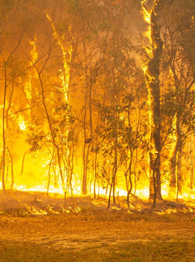
Table of Contents

         1.   Purpose			                                                                                       5
         2.   Policy approaches		                                                                              9
         		         2.1 Context                                                                                9
         		         2.2 Policy approaches                                                                      9
         3.   Background			                                                                                   11
         		         3.1 State Planning Policy Interactive Mapping System approach                             12
                    3.2 Factors affecting bushfire hazard and risk                                            13
         			 3.2.1                Potential fireline intensity                                                13
                          3.2.2   Fire weather severity                                                       13
         			              3.2.3   Slope                                                                       14
                          3.2.4   Fuel load and vegetation                                                    15
                    3.3 Potential bushfire impacts and attack mechanisms                                      15
                          3.3.1 Direct flame attack                                                           15
         			              3.3.2 Heat exposure                                                                 16   3
                          3.3.3 Ember attack                                                                  17
         4.   Process for preparation and review of statewide SPP IMS bushfire prone area mapping             18
                    4.1 Introduction                                                                          19
                    4.2 Methodology used for preparing the SPP IMS bushfire prone area mapping                19
         			 4.2.1                Creation of vegetation hazard class and potential fuel load maps            19
                          4.2.2   Creation of slope maps                                                      19
                          4.2.3   Creation of potential fire weather maps                                     19
                          4.2.4   Creation of potential fireline intensity maps                               19
                          4.2.5   Creation of potential bushfire intensity and potential impact buffer maps   19
                          4.2.6 Modify potential intensity of small patches and corridors                     20
                    4.3 Methodology for local government review of SPP IMS bushfire prone area mapping        23
         			 4.3.1                Undertake reliability assessment                                            23
                          4.3.2   Locally refine mapping                                                      23
         5.   Process for undertaking a Bushfire Hazard Assessment                                            25
                    5.1 Introduction                                                                          25
                    5.2 Overview: the three stages of a BHA                                                   25
                    5.3 Stage 1 – Reliability assessment                                                      25
         			 5.3.1                Approach                                                                    25
                          5.3.2   Data sources                                                                26
                          5.3.3   Procedure                                                                   26
                    5.4 Stage 2 – Hazard assessment                                                           26
         			 5.4.1                Approach                                                                    26
                          5.4.2   Procedure                                                                   27
                    5.5 Stage 3 – Separation and radiant heat exposure                                        28
         			 5.5.1                Approach                                                                    28
                          5.5.2   Procedure for calculating                                                   28
         6.   Process for undertaking a Vegetation Hazard Class Assessment                                    29
                    6.1 Introduction                                                                          30
                    6.2 Process                                                                               30
7.   Process for calculating asset protection zones		                                                      39
                             7.1 Introduction                                                                                39
                             7.2 Purpose of the Bushfire asset protection zone width calculator                              39
                             7.3 Options for calculating the radiant heat exposure                                           39
                             7.4 Bushfire asset protection zone width calculator components                                  39
                             7.5 Bushfire asset protection zone width calculator input parameters                            40
                  			 7.5.1               Fire weather severity                                                              40
                                  7.5.2   Vegetation hazard class (VHC)                                                      41
                                  7.5.3   Remnant status                                                                     41
                                  7.5.4   Slope type                                                                         41
                                  7.5.5   Effective fire slope                                                               41
                                  7.5.6   Site slope                                                                         41
                                  7.5.7   Distance from hazardous vegetation                                                 41
4                            7.6 Parametric constraints and variations                                                       42
                             7.7 Bushfire asset protection zone width calculator software and hardware requirements          42
                             7.8 Using the Bushfire asset protection zone width calculator                                   43
                             7.9 Bushfire asset protection zone width calculator results                                     43
                             7.10 Default asset protection zone width formula                                                44
                  8.   Process for preparing a Bushfire Management, Vegetation Management or Landscape Maintenance Plans		   45
                             8.1 Introduction                                                                                46
                             8.2 Management plan reporting                                                                   46
                             8.3 Bushfire hazard reports and Bushfire Management Plans                                       46
                             8.4 Vegetation Management Plans                                                                 46
                             8.5 Landscape Management Plans                                                                  46
                  			 8.5.1               Landscape design                                                                   46
                                  8.5.2   Plant selection                                                                    47
                                  8.5.3   Landscape management                                                               48
                                  8.5.4   Barriers                                                                           48
                  9.   Information that may inform development conditions		                                                  49
                             9.1 Static water supply                                                                         50
                             9.2 Assembly and evacuation areas                                                               50
                             9.3 Protective landscape treatments                                                             50
                             9.4 Asset protection zones for vulnerable uses, storage or manufacture of materials that are    50
                                 hazardous and community infrastructure for essential services
                  10. Expertise				                                                                                          51
                             10.1 Introduction                                                                               52
                             10.2 Suitably qualified and experienced                                                         52
                  11. Acronyms and abbreviations		                                                                           53
                  12. Glossary				                                                                                           54
                  13. Figures				                                                                                            56
                  14. References				                                                                                         57

    Bushfire Resilient Communities – October 2019
1. PURPOSE 5
1. Purpose

    The technical guidance in this document, Bushfire resilient                         Figure 1, illustrates the relationship between the SPP and
    communities (BRC), supports the State Planning Policy July 2017                     supporting guidance material.
    (SPP) and associated State Planning Policy state interest guidance                  The BRC:
    material –Natural hazards, risk and resilience – Bushfire (SPP
    guidance).                                                                          •     outlines factors affecting bushfire hazard and potential
                                                                                              bushfire risks and impacts
    The SPP outlines the state interests in land use planning and
    development that underpin the delivery of local and regional                        •     outlines the methodology used to prepare the statewide
    plans and development. These state interests include natural                              mapping of bushfire prone areas included in the State
    hazards, including bushfire, and risk and resilience measures.                            Planning Policy Interactive Mapping System (SPP IMS)
    The SPP guidance assists:                                                           •     provides technical guidance on procedures for:
    •    local governments to make or amend local planning                                    –     reviewing SPP IMS bushfire prone area mapping
         instruments                                                                          –     undertaking a Bushfire Hazard Assessment (BHA) and
    •    assessment managers and practitioners when applying the                                    Vegetation Hazard Class Assessment
         SPP assessment benchmarks to development applications                                –     calculating asset protection zone provisions
         (only where the state interests have not been integrated in
         local planning instruments).                                                         –     preparing a Bushfire Management Plan and Landscape
6                                                                                             		    Maintenance Plan
    The BRC provides technical guidance and the policy positions
    of Queensland Fire and Emergency Services (QFES) to state                           •     provides additional information to inform development
    agencies, local governments, and practitioners engaged in land                            conditions
    use planning for bushfire hazard and development activities that                    •     guides the identification of suitably qualified people for
    may be affected by bushfire hazard. This includes:                                        assessments identified in the BRC.
    •    making or amending state and local planning instruments                        This scope is summarised in Figure 2.
         such as planning schemes or regional plans
    •    designating land for community infrastructure
    •    making or assessing development applications.

                          State Planning Policy
                     Part E state interest statement,                                 State interest: natural hazards,
                        state interest policies &                                            risk and resilience
                       assessment benchamarks

                                                                              SPP - guidance material - Natural hazards
                                                                                     risk and resilience - bushfire

                              Supporting Material

                                                                                      Bushfire resilient communities

                  Figure 1: The relationship between the State Planning Policy (SPP) and the SPP natural hazards guidance material.

     Bushfire Resilient Communities – October 2019
STATE SPP-IMS MAPPING METHODOLOGY:
                                                   State Government initiated mapping
      A new methodology for Statewide mapping of bushfire prone areas in Queensland (CSIRO, 2014) process

              Fire weather severity – Section 3 – 3.2.2                                                       Fuel load             Potential
                                                                                    Slope –                      and                 fireline
                                                                                    Section                 vegetation –           intensity –
          Weather
          variables
                             Forest fire danger
                                   index
                                                        Climate
                                                        change           X          3 – 3.2.3      X           Section     =          Section
                                                                                                              3 – 3.2.4             3 – 3.2.1

      Mapping tasks:                                                                                                                       SPP-IMP mapping:
                                                                                                                                           – Very high potential
                                                                                                                                             bushfire intensity
          Create             Create             Create              Create             Create potential             Modify
        vegetation            slope           potential            potential           fireline intensity          potential               – High potential
       hazard class           maps          fire weather            fireline             and potential            intensity of               bushfire intensity
         and fuel            Section            maps               intensity             impact buffer           small patches             – Medium potential          7
        load maps           4 – 4.2.2          Section               maps                     maps                and corridor               bushfire intensity
          Section                             4 – 4.2.3             Section                  Section                Section                – Potential impact
         4 – 4.2.1                                                 4 – 4.2.4                4 – 4.2.5              4 – 4.2.6                 buffer

                                           LOCAL GOVERNMENT MAPPING REVIEW PROCESS:
                          Local Government initiated review of state-wide SPP-IMS mapping
                      Undertake reliability assessment  Section 4 – 4.3.1                                       Locally refine mapping  Section 4 – 4.3.2
                                                                                            consider
                                                Assess                 Tally               suitability              Follow the process used to create
                           Select
                                             reliability of         reliability           of mapping             SPP-IMS mapping, using improved local
                      representative
                                             BPA and VHC             results                                       vegetation and/or slope mapping
                     ‘cells of interest’
                                               mapping

                                                  DEVELOPMENT ASSESSMENT PROCESSES:
     Applicant initiated site level verification by undertaking a Bushfire Hazard Assessment (BHA)

                                                       Hazard assessment  Section 5 – 5.4

                                            Identify          Vegetation hazard           Identify site                                              Re-calculate
                                                                                                                           Prepare
       Reliability                            fire               class (VHC)                slope and                                              radiant heat flux
                                                                                                                           updated
      assessment                            weather              assessment                 effective                                              levels – Section
                                                                                                                         mapping –
        Section                             severity          Section 5 – 5.4 and             slope                                                   5 – 5.5 and
                                                                                                                       Section 5 – 5.4.2
        5 – 5.3                                                    Section 6                                                                           Section 7

                                              DEVELOPMENT ASSESSMENT PROCESSES:
                         Reports documenting outcomes of Bushfire hazard assessment, and
                            to demonstrate achievement of code assessment benchmarks

         Bushfire hazard report documenting
                   outcomes of BHA

         Bushfire Management Plan* (BMP) –                        Vegetation Management Plan (VMP) –                       Landscape Management Plan (BMP) –
                   Section 8 – 8.3                                           Section 8 – 8.4                                         Section 8 – 8.5

Figure 2: Overview of bushfire planning and assessment processes.
8                                                   2. POLICY APPROACHES

    Bushfire Resilient Communities – October 2019
2. Policy approaches

2.1 Context                                                                                             Policy 3 – The planning scheme or amendments following a
                                                                                                        risk assessment are based on the principle of avoidance as the
Bushfires can cause extensive social, economic and                                                      first priority, and then mitigation of the risk to an acceptable or
environmental damage. With the increasing occurrence of days of                                         tolerable level.
extreme heat and frequency of severe fire weather, the potential
impact of bushfires is of increasing concern in Queensland. The                                         The outcomes of the risk assessment should inform the drafting
impact of bushfires will vary across the state, depending on the                                        of the local planning strategic framework and assessment
severity of the bushfire, the proximity and exposure of people                                          benchmarks to ensure a clear approach to managing bushfire
and property to hazardous vegetation, and the vulnerability of                                          risk.
different land uses to bushfire hazard. Bushfire impacts can affect                                     Avoidance of the risk would include a local government
people and property through flame attack, ember attack, radiant                                         minimising the expansion or increased density of existing
heat exposure, wind and smoke attack, and convective and                                                development in mapped bushfire prone areas, particularly:
conductive heat exposure.
                                                                                                        •     vulnerable uses
Land use planning for bushfire hazard is one part of an integrated
                                                                                                        •     community infrastructure for essential services
disaster management strategy in mitigating the risks associated
with bushfire events to an acceptable or tolerable level.                                               •     materials that are hazardous in the context of bushfire
                                                                                                              hazard.
2.2 Policy approaches                                                                                                                                                                       9
                                                                                                        After this, managing bushfire risk should be based on achieving
The QFES policy approaches to land use planning for bushfire                                            an acceptable or tolerable level of risk for both existing and new
hazard include the following ten positions.                                                             development in bushfire prone areas.

Policy 1 – Mapping is robust and locally relevant.                                                      An acceptable risk is a level that is sufficiently low to require no
                                                                                                        new treatments or actions to allow communities to live with the
As a minimum, the State Planning Policy Interactive Mapping                                             risk without further action.
System (SPP IMS) bushfire prone area mapping must be
identified and applied to local government planning schemes.                                            A tolerable risk is low enough to allow the exposure to a natural
                                                                                                        hazard to continue but high enough to require new treatments or
Local governments should refine the SPP IMS bushfire prone                                              actions to reduce that risk. Communities can live with this level
area mapping, using the refinement process outlined in this                                             of risk, but as much as is reasonably practical should be done to
document, and then adopt the refined mapping in their specific                                          reduce the risk. This may include planning responses for:
planning scheme. QFES may be able to assist local governments
with limited resources, in this process.                                                                •     reducing the likelihood of the risk (avoidance)
                                                                                                        •     reducing the consequences of the risk (mitigation and
Policy 2 – A fit-for-purpose risk assessment informs plan-making                                              hazard management over time).
or amendments to achieve an acceptable or tolerable level of risk
to people and property in bushfire prone areas.                                                         What constitutes an acceptable or tolerable level of risk will
                                                                                                        vary among local government areas and community context. If
Local governments should undertake a risk assessment when                                               appropriate, community consultation could be undertaken to
making or amending a planning scheme.                                                                   understand tolerance levels to bushfire risk and identify possible
To understand the consequences of a potential bushfire event,                                           treatment options.
the risk assessment should consider the exposure, vulnerability                                         Note – Other responses may also be suitable for implementation via specific local
and resilience of communities and their assets to a bushfire as a                                       government instruments such as local laws or asset management plans.

first step in proposing a planning response. A risk assessment is
                                                                                                        Policy 4 – Disaster management capacity and capabilities are
a methodical assessment, considering the specific circumstances
                                                                                                        maintained to mitigate the risks to people and property to an
of the local government area. Preferably, the risk assessment:
                                                                                                        acceptable and tolerable level.
•       will be consistent with AS/NZS ISO 31000:2018 Risk
                                                                                                        Mitigation involves a local government including provisions in its
        Management – Principles and Guidelines1
                                                                                                        planning scheme to ensure subdivision layout:
•       is undertaken by a suitably qualified person (further detailed
                                                                                                        •     locates low fuel separation areas, such as roads, managed
        in Section 10).
                                                                                                              open spaces and large lots, to separate people from hazard
A comprehensive risk assessment may not be required for every
                                                                                                        •     does not hinder emergency service access and functions
planning scheme amendment, depending on the scope of the
                                                                                                              through active measures including:
proposed instrument and whether an assessment has been
previously undertaken.                                                                                        –     ensuring sufficient access areas (e.g. via perimeter roads
                                                                                                                    or fire trail and working areas) for firefighters and
QFES can provide advice to local governments early in the
                                                                                                                    vehicles between assets and vegetation
planning process to scope a risk assessment that is suited to
the nature of the proposed scheme amendments (i.e. a risk                                                     –     allowing for vegetation management and wildfire
assessment that is fit-for-purpose).                                                                                response to provide opportunities to establish
Note – The Queensland Government has endorsed the Queensland Emergency Risk                                         control lines from which hazard reduction or back-
Management Framework (QERMF) as the state’s approach to emergency and disaster                                      burning operations can occur
risk management. State–wide assessments conducted under this framework provide
key information relevant to local assessments, and are held by Local or District Disaster
Management Groups.

1 It is acknowledged that ISO 31000–2018 is a generic standard for a broad range of risk assessments.
•    allows safe access and egress routes                            The local government should include provisions in its planning
     •    ensures water supply in both reticulated and non-reticulated    scheme which articulate this policy position.
          areas.                                                          If located in a bushfire prone area, the risks to public safety and
     Mitigation also involves local governments including provisions      the environment from the release of these materials during and
     in their planning scheme for Bushfire Management Plans (BMPs)        after a bushfire event must be mitigated by positioning it:
     for ongoing vegetation management that maintains identified low      •    outside any asset protection zone applying to other buildings
     fuel separation areas.                                                    or structures on the site

     Policy 5 – Lot and neighborhood layout and design mitigates the      •    as close to the edge of the bushfire prone area as possible.
     risks to people and property to an acceptable and tolerable level.   If located in a bushfire prone area, the storage or manufacture of
     Mitigation involves local governments including provisions in        materials that are hazardous in the context of a bushfire must be
     their planning scheme for:                                           managed through:

     •    new subdivision design to minimise the interface with           •    maintenance of appropriate disaster management capacity
          bushfire prone areas and facilitate connections to safe              and capabilities
          evacuation routes                                               •    mitigation of the risks to people and property to an
     •    landscape design and management that does not increase               acceptable and tolerable level (see Policy 4).
10
          the level of bushfire risk or mechanisms of bushfire attack.    Policy 9 – The protective function of vegetation arrangements
     The key mitigation approach for houses involve a local               that can mitigate bushfire risk are maintained.
     government defining all or part of its area as a designated          Local governments should include provisions in their planning
     bushfire prone area in accordance with section 12 of the Building    schemes to mandate BMPs that uphold the protective function of
     Regulation 2006. This in turn triggers the requirement for           vegetation arrangements, such as species selection, landscape
     adherence to Australian Standard 3959–2018 Construction of           design and ongoing vegetation management.
     buildings in bushfire-prone areas at the building development
     application stage.                                                   Policy 10 – Community infrastructure for essential services
                                                                          are not located in bushfire prone areas unless there is an
     Policy 6 – Vulnerable uses are not located in bushfire prone         overwhelming community need for the development of a new or
     areas unless there is an overwhelming community need for the         expanded service and there is no suitable alternative location,
     development of a new or expanded service, there is no suitable       and further, the infrastructure can be demonstrated to function
     alternative location and site planning can appropriately mitigate    effectively during and immediately after a bushfire event.
     the risk.
                                                                          Local governments should include provisions in their planning
     The local government should include provisions in its planning       schemes which articulate this policy position.
     scheme which articulate this policy position.
                                                                          If located in a bushfire prone area, community infrastructure for
     If located in a bushfire prone area, vulnerable uses maintain        essential services must be secured by:
     disaster management capacity and capabilities, and mitigate the
     risks to people and property to an acceptable and tolerable level    •    maintenance of appropriate disaster management capacity
     (see Policy 4).                                                           and capabilities
                                                                          •    mitigation of the risks to people and property to an
     Policy 7 – Revegetation and rehabilitation avoids an increase in          acceptable and tolerable level (see Policy 4).
     the exposure or severity of bushfire hazard.
     Local governments should include provisions in their planning
     schemes which articulate this policy position and do not result
     in an unacceptable level of risk or an increase in the potential
     bushfire intensity level.

     Policy 8 – Development does not locate buildings or structures
     used for the storage or manufacture of materials that are
     hazardous in the context of a bushfire within a bushfire prone
     area unless there is no suitable alternative location.

     Bushfire Resilient Communities – October 2019
3. BACKGROUND 11
3. Background
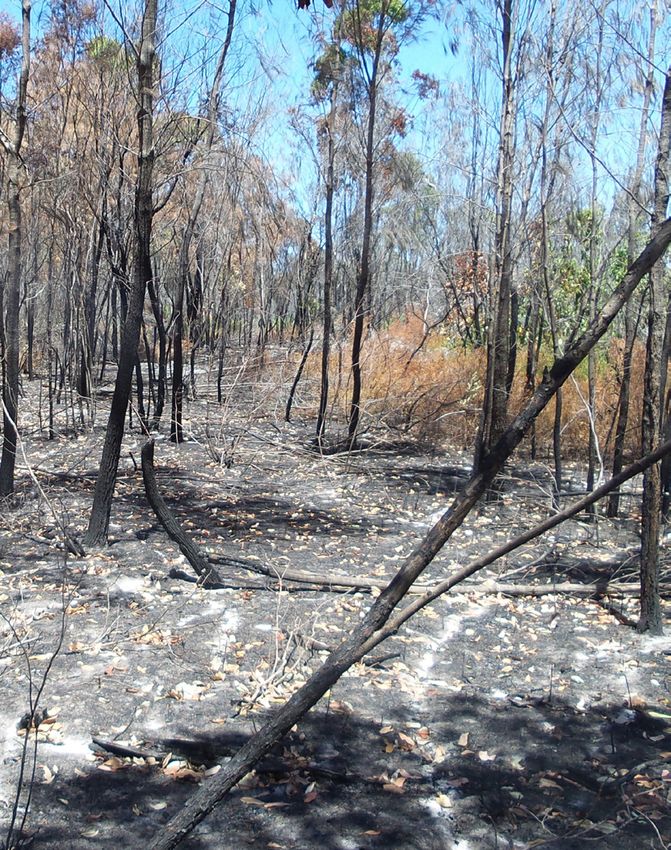
3.1 State Planning Policy Interactive Mapping Bushfires in these areas have the potential for high to extreme
System approach levels of flame attack, radiant heat and ember attack as a result of
high potential fuel levels, slope and fire weather severity.
The State Planning Policy July 2017 (SPP) identifies bushfire
prone areas as those with a medium potential bushfire intensity, Potential impact buffer areas in the SPP IMS bushfire prone
high potential bushfire intensity or very high potential bushfire area mapping comprise land adjacent to potentially hazardous
intensity with an additional 100 metre potential impact buffer, vegetation that is also at risk of significant bushfire attack from
representing that part of the landscape that could support a embers, flames or radiant heat. Potential impact buffer areas
significant bushfire or be subject to significant bushfire attack. include all land within 100 metres of areas mapped as medium,
high or very high potential bushfire intensity. This 100 metre
Bushfire impacts in a bushfire prone area are potentially harmful width was informed by findings indicating 78 per cent of fatalities
to people and property. occur within 30 metres and 85 per cent of fatalities occur within
The areas mapped as medium, high or very high potential 100 metres of hazardous vegetation (the forest edge) in Australia.2
bushfire intensity in the State Planning Policy Interactive The mapping of these two different layers – potential intensity
Mapping System (SPP IMS) bushfire prone area mapping include and impact buffer areas – identifies the potential severity of
potentially hazardous vegetation that could support a significant bushfires and their potential exposure as seen below in Figure 3.
bushfire. These areas have a 4,000–20,000, 20,000–40,000 or
12 40,000+ kW/m potential fireline intensity respectively (further
described in Section 3.2.1).
Figure 3: Example of a mapped bushfire prone area, including the potential impact buffer High Potential Potential
(land within 100 linear metres of mapped vegetation of greater than 4,000k/Wm fireline intensity). Bushfire Intensity Impact Buffer
Source: SPP IMS
2 Life and house loss database description and analysis - https://publications.csiro.au/rpr/download?pid=csiro:EP129645&dsid=DS2
Bushfire Resilient Communities – October 20193.2 Factors affecting bushfire hazard and risk Crown fires have the potential to dramatically increase fire
intensity with the addition of the crown fuel and changes to
3.2.1 Potential fireline intensity the wind field. This will produce a related increase in ember
production and spotting.
A new methodology for statewide mapping of bushfire prone
areas in Queensland (CSIRO, 2014)3,4,5, used to produce the Fireline intensity greater than 30,000 kW/m is commonly
current statewide Bushfire Prone Area map improved upon understood as blow-up conditions. Intensities exceeding 30,000
the previous SPP1/03 bushfire hazard mapping methodology kW/m were a defining feature of the 2009 Black Saturday Fires.11
approach by providing more in-depth consideration of regional Vegetated parts of the landscape that would carry a vegetation
differences in fire weather severity and diversity of vegetation fire at a intensity lower than 4,000 kW/m are categorised as grass
types. Accordingly, bushfire prone areas were identified, mapped fire prone land or low hazard areas (e.g. rainforest or water or
and categorised as a function of potential fireline intensity (kW/m).
FIRE POTENTIAL
FUEL
SLOPE WEATHER FIRELINE
LOAD 13
SEVERITY INTENSITY
Figure 4: Method for calculation of potential fireline intensity.6
Potential fireline intensity is a function of fire weather severity non-vegetated urban areas). In the event of a fire, direct manual
(measured by the Forest Fire Density Index or FFDI), landscape attack at fire’s head or flanks by firefighters with hand tools and
slope and fuel load (refer Figure 4) based on classified vegetation water is possible. This is the level of fireline intensity where most
communities according to the method described by the CSIRO planned burning takes place.
methodology cited above. Very little spot fire activity occurs at less than 1,000 kW/m.12
Fireline intensity is a measure of energy released from the flame Constructed breaks should hold fires at the upper end of the
or combustion zone, one of whose sides is a unit length of fire scale, however, will still be challenging if the fuels are prone to
front (measured in kilowatts per metre of flaming front).7 The ember production and spotting.13
intensity depends on the heat of combustion of the fuel, the
forward rate of spread and the amount of fine fuel consumed in 3.2.2 Fire weather severity
the flaming front. This is a good predictor of the available energy
Fire weather severity (FWS) for land use planning in Queensland is
that can be released from a fire based on certain weather, fuel
determined using three inputs under the methodology. These are
and topographical information. The impact of this released energy
weather variables, FFDI and climate change.
affects the success of suppression efforts and scale of damage.
Potential fireline intensity is a standardised measure of the rate Weather variables
that an advancing head fire would consume fuel energy per
second, per metre of the fire front.8 FWS is influenced by a range of weather variables including
wind speed, relative humidity, temperature and atmospheric
Areas identified as a medium, high or very high potential bushfire
stability, as well preceding drought conditions.
intensity in the SPP bushfire prone area mapping have a 4,000 k/
Wm + fireline intensity. Winds increase the rate of fire spread by ‘driving’ or tilting
A fireline intensity of 4,000 kW/m is estimated to be the flames forward, increasing the rate at which the unburnt fuels
approximate threshold for the effective and safe direct attack ahead of the fire are preheated, thus increasing the rate of
on a head fire with aircraft and machinery as very vigorous or spread and the intensity of bushfires.14
extremely intense surface fire control efforts on head may fail and Wind and convective updraughts carry burning embers ahead
be dangerous.9 of the fire front. Embers are mainly burning fragments of bark,
The threshold for continuous crown fire is 10,000 kW/m. leaves and twigs, which have the potential to ignite new fires
Control in this scenario is extremely difficult and all efforts at in suitably recipient fuels and/or infrastructure. Strong winds
direct control are likely to fail. Direct attack is rarely possible. can also cause burning trees or branches to strike buildings or
Suppression action must be restricted to the flanks and back of fences and block access and evacuation routes.
the fire.10
3 Leonard, J., Newnham, G, et al. (2014), A new methodology for State-wide mapping of bushfire prone areas in Queensland. 11 Cruz et al. (2015), Empirical based models for predicting head fire rate of spread in Australian fuel types.
4 The method for determining potential fireline intensity for small patches and corridors of vegetation has been refined as 12 Gould et al. (2008), Project Vesta: Fire in Dry Eucalypt Forest: Fuel structure, Fuel Dynamics and Fire Behaviour.
described in Leonard, J. and Opie, K (2017), Estimating the potential bushfire hazard of vegetation patches and corridors. 13 Alexander and DeGroote (1989) https://fireandemergency.nz/assets/Documents/Research-and-reports/Report-21-Fire-
5 Potential fuel loads and vegetation hazard classes were updated for SEQ in 2017, information available from QFES. Behaviour-as-a-factor-in-Forest-and-Rural-Fire-Supression.PDF
6 Leonard, J., Newnham, G, et al. (2014), A new methodology for State-wide mapping of bushfire prone areas in Queensland. 14 Byram, GM (1959), Combustion of forest fuels.
7 Byram, GM (1959), Combustion of forest fuels and Tangren CD (1976), The trouble with fire intensity.
8 Leonard, J. and Blanchi, R (2012), Queensland bushfire risk planning project.
9 Alexander and DeGroote (1989) https://fireandemergency.nz/assets/Documents/Research-and-reports/Report-21-Fire-
Behaviour-as-a-factor-in-Forest-and-Rural-Fire-Supression.PDF
10 Ibid.Relative humidity (RH) is the ratio of moisture actually in the air Climate change
versus the maximum amount of moisture which the air could
Climate change projections indicate an increase in the
hold at the same temperature. RH is a measure of the drying
likelihood, intensity and extent of areas affected by bushfires
power of the air and this affects the fine fuel moisture content.
and extended fire seasons. Climate change projections were
RH is expressed as a percentage with moisture saturation (fog)
incorporated into the SPP mapping of bushfire prone areas.
being 100 per cent. As air can hold more moisture at higher
temperatures, the RH alone does not give an absolute measure This was achieved by incorporating an adjustment to the
of moisture content. gridded weather temperature and relative humidity data
used to calculate 5% AEP fire weather event FFDI to reflect the
When the RH is high, the fine fuels absorb moisture from the
expected climate in 2050 using an Intergovernmental Panel on
atmosphere. Under drying conditions (decreasing RH), the
Climate Change A1FI climate scenario.18
moisture of the fine fuels is desorbed to the atmosphere,
lowering the fine fuel moisture content and increasing the
3.2.3 Slope
likelihood of fire ignition. Very low levels of humidity support
extreme bushfire behaviour. The slope of the land is a major determinant of fire behaviour,
particularly the slope of the land under vegetation that
Air temperature also plays a significant role in affecting
contributes to bushfire hazard.
14 atmospheric conditions, winds and fuel moisture content.
Fire burns faster as it travels up a slope, via preheating of
Weather variables do not operate in isolation from each other
unburnt fuels ahead of the fire, increasing the rate of spread
(or other factors that influence fire behaviour). For example, low
and fireline intensity. Conversely, fires move more slowly as
humidity coupled with high temperatures and hot winds dry out
they travel downslope. Fireline intensity (kW/m) is a function of
vegetation, increasing bushfire potential.
the rate of spread.19
Forest Fire Danger Index As a general rule, the rate of fire spread (and fireline intensity)
The McArthur Forest Fire Danger Index (or FFDI) is the most
15 doubles up a 10-degree slope and quadruples up a 20-degree
common proxy of fire weather severity in Australia and is used slope of the land.20,21
for bushfire hazard assessments, emergency management Where slope under hazardous vegetation is located downhill
and in regulations such as the Australian Standard 3959–2018 from the edge of the hazardous vegetation nearest to the asset
Construction of buildings in bushfire-prone areas. location, it is considered ‘downslope’ irrespective of the slope
Unlike Queensland’s adoption of AS 3959–2018 that uses a of land between the asset and the edge of the hazardous
single FFDI value for all of Queensland (40), the estimate of vegetation.
fire weather severity used as an input to identifying the SPP Where the slope under hazardous vegetation is located uphill
bushfire prone areas in Queensland recognises that weather from the edge of the hazardous vegetation nearest to the site,
conditions vary across the state. it is considered ‘upslope’ irrespective of the slope of land
Spatially explicit 5% annual exceedance probability (AEP) fire between the site and the edge of the hazardous vegetation.
weather event FFDI values for Queensland have been estimated Accordingly, development located above hazardous vegetation
from a gridded (83 kilometre, three-hourly resolution) (the vegetation is ‘downslope’) is typically subject to higher
prediction of FFDI from long-term spatial weather products levels of potential ember attack, radiant heat, convective
produced by the Australian Bureau of Meteorology (BoM).16 heating and longer flame lengths than development which
The adopted FFDI values reflect a 5% AEP weather event. is located below hazardous vegetation (the vegetation is
Adopted FWS (i.e. 5% AEP fire weather event FFDI) values ‘upslope’).
for Queensland vary from 50 in Southeast Queensland and A statewide 25 metre resolution digital terrain model (DTM)
Cape York bioregions to 130 in the south-western parts of the was used to produce a statewide map of maximum landscape
state.17 slope, representing the maximum potential slope of the
The identification of location-specific FWS for the purposes landscape which could influence the rate of bushfire spread
of determining bushfire hazard is described in section 5.4.2 and fireline intensity.22 The SPP map of maximum landscape
of this document. SPP mapping data of FWS can be obtained slope can be obtained in raster format from the Queensland
in raster format from the Queensland Government data portal Government data portal under the title ‘Bushfire hazard area –
under the title ‘Bushfire hazard area – Bushfire-prone area – Bushfire-prone area – inputs – Queensland’.
inputs – Queensland’. The methodology used in section 5 describes procedures for
measuring localised slope when determining suitable asset
protection zone widths from hazardous vegetation.
15 McArthur, AG (1967), Fire behaviour in eucalyptus forests. 19 Byram, GM (1959), Combustion of forest fuels.
16 Leonard, J., Newnham, G, et al. (2014), A new methodology for State-wide 20 Assumes that slope and wind direction are aligned.
mapping of bushfire-prone areas in Queensland. 21 Leonard, J. and Blanchi, R (2012), Queensland bushfire risk planning project.
17 Ibid. 22 Byram, GM (1959), Combustion of forest fuels.
18 Ibid.
Bushfire Resilient Communities – October 20193.2.4 Fuel load and vegetation Continuous vegetation, such as forest, shrubland or grass,
Vegetation is the primary source of fuel and combustion of fuel has a generally uniform distribution of fuel that supports a
powers a bushfire. continuous flame front under a range of weather conditions.
In contrast, non-continuous vegetation or land uses, such as
In general, vegetation communities with a higher quantity of built-up areas or water bodies, are not expected to support a
fuel available to burn (i.e. fuel load) will tend to give rise to continuous flame front because they do not contain sufficient
higher intensity fires and present a higher risk to people and fuel load to carry a fire.
property. However, the fuel arrangement and composition,
not just the quantity (load) also contributes to the rate of fire The SPP VHC and associated potential fuel load input data
spread and fireline intensity. Only total fuel load is used in this can be obtained in shapefile format from the Queensland
planning process. Government data portal under the title ‘Bushfire hazard area
– Bushfire-prone area – inputs – Queensland’. The format for
Under the SPP’s planning parameters, the potential fuel load VHC categorization in Queensland is described in Figure 6 .
that a vegetation community would normally accumulate 10
years after a fire is used to estimate the fireline intensity and 3.3 Potential bushfire impacts and attack
bushfire hazard, not the actual fuel load on any particular day mechanisms
or year. This approach ensures consistency in planning and
The main sources of direct bushfire attack that give rise to loss 15
design.
of life, and damage to property and infrastructure are25:
The potential fuel load represents the ambient fuel load that is
• direct flame contact
combustible under severe weather conditions. It is calculated
as the sum of surface fuel load, near-surface fuel load, elevated • radiant heat exposure
fuel load and standing bark fuel. The potential fuel load • convection and conduction
represents the 80th percentile fuel load for each fuel category • ember attack
based on the long-term unburnt condition.23
• wind and smoke attack.26
Long-term and sustained reduction of fuel load by clearing,
These attack mechanisms are not mutually exclusive and rarely
cultivation or management of vegetation reduces the potential operate in isolation. People and property are often subject to a
fireline intensity and hazard level. combination of bushfire attack vectors.
The availability of fuel is a function of its moisture content, Although bushfire attack vectors operate at a range of spatial
type, structure, arrangement and the size and severity of the scales, measures to reduce or mitigate the effects of direct
fire. flame contact, radiant heat exposure and ember attack occur
at scales that can be addressed via land use planning and
Fine fuel load, structure and composition, is described using
development assessment frameworks. The following sections
a series of vegetation hazard classes (VHCs). VHCs are based describe these three bushfire attack mechanisms and their
on the Queensland Herbarium’s statewide regional ecosystem potential impacts.
mapping at the broad vegetation group24 level, and several
other mapping data sets such as foliage projective cover 3.3.1 Direct flame attack
mapping. Direct flame contact occurs when flames from a bushfire are in
Hazardous vegetation within rural and urban landscapes is direct contact with a building, structure or people resulting in
frequently fragmented, giving rise to smaller patches and ignition, burns and radiant heat exposure effects (‘flame zone’).
Direct flame contact is only an issue for development that is
narrow corridors of vegetation that are very likely to have
directly adjacent to bushfire prone areas. Direct flame contact
lower fireline intensities than larger expanses of continuous
can cause:
vegetation.
• rapid, pilot ignition of fuel and structures consisting of
The spatial context of these patches and corridors of vegetation flammable materials such as timber fences, powerline
has a major influence on the likelihood of fire arrival, the poles and timber homes
severity of a fire at the boundary of the patch, and the
• burns to exposed skin.
behaviour of a fire within the patch.
Flame contact has obvious and significant impacts on people,
Because of the potential contribution of grass fires to the property and emergency services.
intensity of fire in tree- or shrub-dominated hazardous
vegetation, bushfire hazard assessment of patches and
corridors needs to take account of the fuel properties of
adjacent vegetation or other land uses.
23 The long-term unburnt condition represents greater than 10 years without burning.
For further information see Leonard, J., Newnham, G, et al. (2014), A new methodology for State-wide mapping of bushfire-prone areas in Queensland.
24 Neldner, VJ, and Niehus et al. (2015), The vegetation of Queensland: Descriptions of broad vegetation groups.
25 Leonard, J. and Blanchi, R (2012), Queensland bushfire risk planning project.
26 Wind attack is an indirect or secondary source of bushfire attack. Wind-driven attack may extend flame lengths and height, increasing ignition likelihood and radiant
heat exposure. Wind is also responsible for promulgating burning embers and smoke. Although smoke has a negligible impact on buildings and structures, direct
impacts on civilians and emergency services can be significant in terms of health and visibility.3.3.2 Heat exposure Exposure to radiant heat can:
Heat transfer occurs via three processes: • distort, crack and warp materials (e.g. glass windows and
1. Convection: the transfer of heat via the movement of hot plastic tanks) leading to structural failure and provide
air. Under certain circumstances, bushfires can generate opportunities for ember attack
sufficient heat to modify the atmospheric conditions • cause ignition of exposed materials such as walls, fences
around the fire, creating a convection column that can and powerline poles
transport embers and burning debris. This represents 60 • limit the ability of emergency services to safely operate
per cent to 80 per cent of the total heat generated by a (refer to Figure 5)
bushfire.
• cause death or injury to people, even at low levels of
2. Conduction: the transfer of heat within the fuel itself. radiation exposure (refer to Figure 5).
This is significant during the initiation of a bushfire but
insignificant in terms of radiant heat exposure. This The potential impacts of radiant heat exposure on people,
represents about two per cent of the total heat generated property and emergency services (expressed as radiant heat
by a bushfire. flux, kW/m2) are indicated in Figure 5.
3. Thermal radiation or radiant heat: the transfer of heat by Evidence suggests that fatalities inside structures are strongly
means of electromagnetic waves. The transfer of heat by associated with high levels of radiant heat exposure and
16 radiation involves the carrying of energy from an origin to possible flame contact.27, 28
the space surrounding it in straight lines in all directions.
The energy is carried by electromagnetic waves and does
not involve the movement or the interaction of matter.
This represents 20 per cent to 40 per cent of the total heat
generated by a bushfire.
Radiant heat
flux (kW/m2) Potential effects
• unpiloted ignition of timber walls and fences
Greater than • direct flame contact likely
40
• extreme levels of radiant heat
• failure of toughened glass
29–40 • direct flame contact possible, extreme levels of radiant heat
• unpiloted ignition of some timber species after prolonged exposure (e.g. several minutes)29
19 • failure of screened float glass
16 • blistering of skin with > 5 seconds exposure
• failure of plain glass
12.5
• piloted ignition of dry timber elements after prolonged exposure (e.g. several minutes)30
• fabrics inside a building could ignite spontaneously with long exposure
10 • critical limit for emergency services – firefighters cannot operate
• life threatening with < 1 minute exposure in protective clothing.
7 • fatal to an unprotected person after exposure for several minutes
4.7 • firefighter in protective clothing will feel pain (60 seconds exposure)
3 • firefighters can operate for a short period (10 minutes)
• pain is felt on bare skin after 1 minute exposure (non-fatal)
2 • firefighters with protective clothing can withstand this exposure level for a few minutes however,
they are likely to experience rise in core body temperature
1 • maximum for indefinite skin exposure
0.5 • direct sunlight at noon on a bright sunny day
Figure 5: Potential effects of radiant heat.31
27 Blanchi, R, Leonard, J, et al. (2012), Life and house loss database description and analysis: Final report.
28 Blanchi, R, Leonard J, et al. (2014), Environmental circumstances surrounding bushfire fatalities in Australia 1901-2011.
29 Subject to exposure time, timber species and dryness of timber.
30 Blanchi, R, Leonard, J, et al. (2012), Life and house loss database description and analysis: Final report.
31 NSW Rural Fire Service (2010), Planning for bush fire protection.
Bushfire Resilient Communities – October 20193.3.3 Ember attack • Penetrate small gaps and holes, infiltrating buildings
Embers are small pieces of burning foliage, twigs and bark and structures, resulting in single or multiple sources of
which are transported by wind, often ahead of the fire front. The ignition.
main sources of embers are tree bark, fine litter and other fine • Accumulate around vegetation, buildings or other
fuels. structures (e.g. roof gutters, decks and patios), resulting
Ember attack is the main cause of damage to and loss of in slow onset ignition which can then engulf buildings
houses in Australia due to bushfire. Burning or ‘live’ embers are and structures during or after a fire front passes. The
problematic because they can: accumulation of embers and ember density are estimated
to be responsible for up to 90 per cent of ignitions leading
• Travel long distances and lead to ‘spotting’ by starting new to building loss in an urban environment.32
fires ahead of the fire front (including fuel sources around
homes such as fences, outdoor furniture and surface and Through spotting, embers are a major contributor to the failure
near-surface fuels in gardens) up to 40 kilometres under of fire containment methods and suppression. This can have
severe conditions; however, 80 per cent of ‘spotting’ direct impacts on people and property during a bushfire.
occurs within 100 metres of hazardous vegetation.
32 Blanchi, R, Leonard, J, et al. (2012), Life and house loss database description and analysis: Final report. 1718
4. PROCESS FOR PREPARATION AND REVIEW OF STATEWIDE
SPP IMS BUSHFIRE PRONE AREA MAPPING
Bushfire Resilient Communities – October 20194. Process for preparation and review of statewide SPP IMS
bushfire prone area mapping
4.1 Introduction Details of fuel continuity of vegetation hazard classes, life form,
height, and relative density of vegetation structural classes are
The State Planning Policy July 2017 (SPP) identifies the State provided in Figures 12 to 16 in section 6.
Planning Policy Interactive Mapping System (SPP IMS) bushfire
prone area mapping layer as a tool to be localised for, and 4.2.2 Creation of slope maps
appropriately integrated into, local governments’ planning
instruments in a way that achieves the state’s interest. Landscape scale slope maps are created from a 25 metre
resolution digital terrain model by calculating the maximum slope
In some circumstances, the bushfire prone area footprint may (in degrees) from the central pixel in a group of 9 x 9 cells to the
change after local verification, more accurately depicting potential eight adjoining cells in that group.
bushfire hazard. This provides a higher accuracy product to inform
hazard and risk assessment processes for decision makers.
4.2.3 Creation of potential fire weather maps
4.2 Methodology used for preparing the SPP IMS A potential severe fire weather map is created by a four-stage
bushfire prone area mapping process:
The creation of the SPP IMS bushfire prone area mapping involved 1. Develop a gridded prediction of FFDI for Queensland, on
the following steps and processes. an 83 kilometre grid and at three-hourly intervals, over the
period from 1979 to 201134 from temperature, wind, relative 19
4.2.1 Creation of vegetation hazard class and potential humidity and precipitation weather products produced by
fuel load maps BoM.
Vegetation hazard classes (VHCs) and associated potential 2. Incorporate future climate trends to 2050 by
fuel load maps are prepared from a combination of regional adjusting temperature and relative humidity using the
ecosystem maps, foliage project cover maps, land use maps, Intergovernmental Panel on Climate Change A1FI climate
water body maps and tree plantation maps (for additional scenario.35
information, refer to section 6).
3. Calculate the 5% AEP (i.e. 5% chance of occurring in any
given year) FFDI based on a statistical distribution of FFDI
22. 1
for each cell of the adjusted BoM weather grid.
4. Resample the 83 kilometre BoM grid to 25 metre and
to modify near-coastal FFDI estimates to account for an
underestimation of FFDI in BoM grid cells that span both
• Broad vegetation • Vegetation
Figure 6 group(1:2 m) Structure Class
land and ocean.
VHCs are described according to a binomial coding system, a 4.2.4 Creation of potential fireline intensity maps
combination of the vegetation community’s broad vegetation
The three inputs – potential fuel load, potential severe fire
group (BVG) classification (1:2 million) and the structural
weather and maximum slope – are combined using equation 1
characteristics of the vegetation (Figure 6).
below to calculate potential fireline intensity (PFI).
The first part of the VHC code refers to the 35 broad vegetation
groups (1:2 million) in Queensland, according to Neldner et Equation 1. Calculation of potential fireline intensity:
al. (2015)33, with an additional eight categories representing PFI = 0.62 PFL 2 FFDI exp (0.069 Slope)
built-up areas such as urban centres and towns, developed rural
areas, cultivated areas (intensive and broad acre agriculture Where:
and plantations) and water bodies. The second part of the code PFI = potential fireline intensity (kW/m)
describes six vegetation structure classes (refer Figure 16) ranging
PFL = potential fuel load (tonnes / ha)
from mid-dense trees to shrubs to nil vegetation.
FFDI = potential severe fire weather (FFDI)
Where a patch or corridor of continuous tree- or shrub-dominated
vegetation is surrounded by a continuous fuel type (such as Slope = max slope (+20 < slope < -15, degrees)
unmanaged grassland, horticulture or cropping areas), fires that
enter that patch of trees or shrubs from the adjacent grassland 4.2.5 Creation of potential bushfire intensity and potential
can quickly achieve a fireline intensity comparable to larger impact buffer maps
patches of continuous tree or shrub vegetation. Potential bushfire intensity maps are generated by classifying
On the other hand, where a patch or corridor of hazardous tree- the potential fireline intensity for inclusion in the bushfire prone
or shrub-dominated vegetation is surrounded by discontinuous area as 4,000+ kW/m, with an additional potential impact buffer
fuel (such as grassland under 10 centimeters or low-hazard areas of 100 linear metres width delineated around the extent of
such as densely built-up areas or water), a larger patch size and hazardous vegetation identified as bushfire prone. The potential
width of vegetation is required before a fire would reach sufficient impact buffer forms part of the bushfire prone area.
intensity to pose a significant threat to life or property (i.e. fireline
intensity greater than 4,000 kW/m).
33 Neldner, VJ, and Niehus et al. (2015), The vegetation of Queensland: Descriptions of broad vegetation groups.
34 This year range maybe extended to the present year depending on available datasets from the BoM.
35 This report and additional information regarding more recent climate scenarios can be found at
https://www.ipcc.ch/report/emissions-scenarios/ accessed August 2019.4.2.6 Modify potential intensity of small patches and two hectares. These areas are not likely to ignite due to their
corridors disconnection with fuels that can carry running fire fronts. If
ignited they are most likely to be caused by point ignitions that
The SPP IMS bushfire prone area mapping layer has been
require both distance and area to develop into a fire front of
further refined in some regions of Queensland. This process
considerable hazard.
involves applying the following patch and corridor mapping
rules to reflect the likelihood of lower fireline intensities in If a fire front emerges from a one hectare patch, it is likely to
smaller vegetation patches and vegetation corridors. be narrow and significantly less intense than a fire front that
has had sufficient time and area to develop. The combination
Step 1
of these likelihood and intensity estimates deem it to be
Remove sub-hectare areas of continuous fuel (i.e. surrounded equivalent to a less than 4,000 kW/m fireline intensity and,
by either no fuel or non-continuous fuel) that are further accordingly, are considered as low hazard for the purpose of
than 100 metres from any other continuous fuel greater than land use planning and development assessment.
20
(a) Example of vegetation patches of 1ha of small isolated vegetation patches < 1ha
Figure 7: Characteristics of appropriate sub-hectare area removal. Source: Leonard et al 2017.
Step 2
Downgrade the effective fuel load of continuous vegetation fronts. If ignited, these patches are most likely to be ignited by
patches measuring (a) 1 to 2 hectares (by 66 per cent), and (b) point ignitions that require both distance and size to develop
2-3 hectare patches (by 50 per cent) if the patch is surrounded into a significant fire front of high intensity.
by either non-continuous fuel or a low-hazard vegetation or If a fire front emerges from these patches, it is likely to
land use type, and if the patch is further than 100 metres from be narrow and of significantly lower intensity than a fire
any other continuous-fuel vegetation patch greater than two front that has had sufficient time and size to develop. The
hectares. combined effect of both lower ignition likelihood and lower
Patches of this size (< 3 hectares) and proximity to larger fireline intensity is likely to result in a fireline intensity that is
patches of continuous vegetation are less likely to ignite due to significantly less than larger areas of continuous vegetation.
their disconnection with vegetation that can carry running fire
PATCH SIZE APPROX. PATCH DIMENSIONS ASSUMED DECREASE OF FIRE-LINE INTENSITY
(a) 0.5 – 2 hectares 100m x 100m – 100m x 200m 66%
(b) 2 – 3 hectares 100m x 200m – 150m x 200m 50%
Bushfire Resilient Communities – October 201921 (a) Greater than 2 hectares patch prior to fuel load downgrade (b) Less than 2 hectares patch after fuel load downgrade (a) Patch between 2 to 3ha prior to fuel load downgrade (b) Patch between 2 to 3ha after fuel load downgrade Figure 8: Characteristics of effective fuel load downgrades for small patches. Source: Leonard et al 2017.
You can also read