Catahoula Lake Amicus Curiae Brief Submitted January 28, 2019 By NSPS - UW ...
←
→
Page content transcription
If your browser does not render page correctly, please read the page content below
Catahoula Lake Amicus Curiae Brief Submitted January 28, 2019 By NSPS
NSPS in Supporting Professional Surveyors
Crooks vs. State of Louisiana
• Beginning with the important task that NSPS completed to explain and
  defend the Public Land Survey System through a large portion of the United
  States
• The following situation was brought to NSPS’s attention with very little
  time to react, analyze and make a determination of possible involvement
• NSPS made this commitment to become involved and complete a full
  supportive legal brief within a 2 week period
• While the final outcome is undetermined, our members need to know the
  facts of the case, how NSPS became involved and what extent NSPS
  engaged in the final brief for submission to the Louisiana State Supreme
  Court
How NSPS did get involved?
• Case started in 2004 and but was not brought to our attention until less
  than 2 weeks before a brief was due, January 28, 2019, to the State of
  Louisiana Supreme Court
• No one informed the Louisiana Surveying Association until the day before
  NSPS was informed
• The issue was that the court rule a 43,000 acre lake meandered on 4
  different GLO plats was a river and erroneously surveyed as a lake
• The court then gave the property rights between the highwater mark of the
  “Lake” to the low water of the “River” to 54 adjoining land owners (In
  Louisiana rights are to Ordinary High Water for Lakes and Ordinary Low
  Water for Rivers)
• The Court was, in our collective professional opinion, in error by their
  ruling

Issues not considered by NSPS
• Whether or not the water in question is in fact a “Lake” or “River”
• Personalities of parties involved
• Decision of the case

Amicus Curiae Brief • A bystander (usually a counselor) who interposes and volunteers information upon such matter of law in regard to which the judge is doubtful or mistaken. • Also a person who has no right to appear in a suit but is allowed to introduce argument, authority, or evidence to protect his interest. As defined in Blacks Law Deluxe fourth addition

Amicus Curiae Court Rules

• May be filed only by leave of court.
• Must satisfy at least one:
   1.   Interest in similar case

   2. Matters of fact or law that might otherwise escape court attention

   3. Substantial, legitimate interests likely affected by outcome and not
        adequately protected by parties
Attorney General feedback to NSPS

Existing Amicus       NSPS
• Governmental        • Policy and technical expertise on
                        survey issues
• Conservation
                      • Law that applies
• Recreation
                      • Title/land tenure/ownership

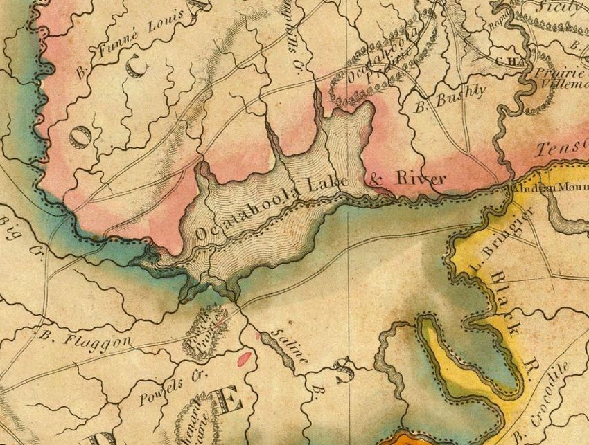
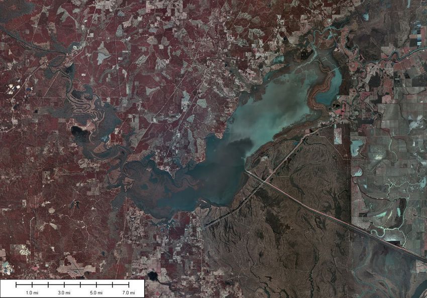
Part of the year most of the lake
is at low water
• Not uncommon for Louisiana back waters
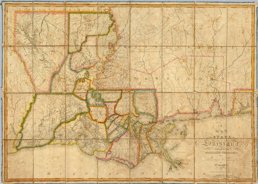
• Allows for easier access to mineral reserves• This map prepared by William Darby by himself over of the entire 33,000,000 acres of Louisiana and about 20,000,000 acres of Mississippi. • Darby would have had to survey 8,200 acres per day seven days a week for all eleven years of his work, and he stated that most of his work was research.
Points NSPS considered
• In reviewing the decision and the appeal, there was very little to no
  references to the GLO plats.
• In case testimony very little was referred to concerning the GLO plats
• At issue was that a explorers cartography map was held over the GLO
  plats
• The cartography map prepared by Darby (1817), covers 33,000,000
  acres of Louisiana along with 20+ million acres of Mississippi and
  Alabama
• If lands are erroneously surveyed or missed by the GLO then they
  would be considered “Omitted Lands”
• If “Omitted Lands”, then BLM needs to survey the lands before they
  can be patented
the 36-foot contour matches the GLO astonishingly well in
all areas of the lake except the areas shaded in green
How did this happen??
• The expert witness for the State was a multi-licensed individual with a
  minimal knowledge of BLM procedures
• He did his doctrine thesis on this very lake and seemed overly
  confident in his testimony concerning this fact
• The strongest position argued in this case was that the lake was
  indeed a lake and not a river
• The state’s attorney felt the opposing side didn’t have a valid case
• Counsel for the state didn’t protect his witness’s expert standing
• The states expert witness was impeached (based upon conflicting
  evidence in his presentation) and all his testimony was not considered
  a basis for the case
Exhibits from a previous case
• Educating your the attorney has to be the highest importance when
  going to court
• No matter how much you know, if your attorney can’t represent it,
  you can be doomed
• If you are not a expert in the subject matter, you should always
  request that someone with the needed expertise is brought into the
  case
• The following exhibits demonstrate why education of the attorney is
  so very important and that previous testimony can always be brought
  forwarded in a different light
NSPS did not argue whether or
            not this was a Lake or a River
• Our Amicus Brief was on Procedure to be used if an error is suspected
  on a government plat. The brief outlined the history and rules
  pertaining to the possibility and ownership of Omitted Lands.
NSPS First Draft – Outline of Argument • Decision ignores rules of professional surveying – introduces uncertainty into future retracement 1. History of PLSS – design, development & intent 2. Role of Professional Surveyor in retracement 3. Navigable waters & GLO instructions – patented to OHWM 4. GLO in Catahoula Basin 5. Court did not acknowledge GLO in decision
Supporting Law

        Constitution

   US Code (Title 43 CFR)

Manual (Law, Case Law, Policy)
Jackson’s Argument • Decision ignored the law applicable to surveying and introduced uncertainty into the surveying profession 1. Surveying law – why it is important 2. Significant legal error to base decision on cartography map not GLO 3. If plaintiffs believed GLO in error, procedure not followed to correct • Consequences to NSPS and surveying if allowed to stand
To Emphasize:

“There cannot be a correct decision on the ownership
of property without starting with a survey that utilizes
the Public Land Survey System.”
To Emphasize:
“Great confusion & litigation would ensue if the
judicial tribunals . . . were permitted to interfere and
overthrow the public surveys on no other ground than
an opinion that they could have the work in field
better done and divisions more equitably than the
[GLO] could do.”
Cragin v. Powell, 128 U.S. 691 (1888)
STATEMENT OF INTEREST
The National Society of Professional Surveyors ("NSPS") submits this Amicus
Curiae Brief (the "Brief') because there are matters of fact or law that might
otherwise escape the court's attention, and the NSPS has substantial,
legitimate interests that will likely be affected by the outcome of the case
and which interests will not be adequately protected by those already party
to the case. Specifically, the decisions of the district court and Third Circuit
Court of Appeal will allow for mass litigation and upheaval to an industry and
set of laws which has historically been the basis of the location of public and
private property rights. The foundation of public and private property rights
are the plats developed by the United States General Land Office ("GLO"}.
The Public Land Survey System ("PLSS") was designed to eliminate confusion
regarding title and land locations. The district court and Third Circuit based
their decision on evidence which ignores the historic GLO plats that are the
very foundation of a land ownership in the United States. These decisions
will cause radical confusion and change to a system of public surveying which
has its roots and foundations dating back to 1785.
I. The decisions of the District Court and Third Circuit Court of Appeal ignored the law applicable to surveying and introduced uncertainty into the surveying profession The district court and subsequent Third Circuit decisions ignore the long- established laws of land surveying and land disposal that were enacted by the United States Congress. The ruling that the existence of a river channel shown on a cartography map is an authoritative source over GLO plats, which are performed consistent with specific laws and standards, will cause total upheaval to property rights and ownership across the United States. The entire land tenure system in public domain states of the United States is based upon GLO surveys as recorded in the official plats. Federal law directs the profession of land surveying to follow long-standing policies and procedures to retrace original and subsequent property boundaries. It is impossible to conform the Court's decision with professional standards and laws of surveying.
CONCLUSION
If this Honorable Court affirms the district court and Third Circuit's
determination that Catahoula Lake is a river, then it is impossible to apply
the laws of surveying in this situation. Any land surveyor retained to locate
the land that was never located by the GLO would find no professional
guidance to accomplish that task. Uncertainty would surround any
retracement surveys that involved water basins similar to Catahoula Lake.
Courts of other states, which consistently apply the PLSS system with its
predictable instructions, may be influenced by the precedent set by
Louisiana and these decisions. Such a result would have a negative impact
on many members of the National Society of Professional Surveyors. For
this reason, we respectfully ask that you consider the information shared in
this Amicus Curiae brief.
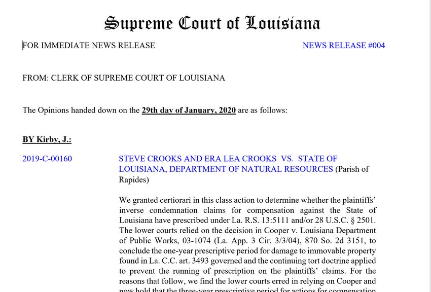
Crooks vs State of Louisiana
Court has accepted our brief
    NSPS received email from our attorney Jackson Logan:
Please find the attached correspondence from the Louisiana Supreme
Court granting our Motion for Leave to File our Amicus brief. In plain
 English, that means the Court will consider NSPS's brief and point of
                                view.
Questions?
You can also read