In brief environmental impact statement - The Department of State Development, Tourism and ...
←
→
Page content transcription
If your browser does not render page correctly, please read the page content below
:: in brief

environmental impact statement

OCTOBER 2006

Contents
1.       Introduction                              1            4.2.1   Tunnel Alignment                    20
1.1      Background to the Airport Link Project    1            4.2.2   Tunnel Profile                      21
      1.1.1 Strategic Planning                     1            4.2.3
                                                                   Connections to the Surface
                                                                   Road Network                             21
   1.1.2 Pre-Feasibility Study                     1
                                                             4.2.4 Ventilation Systems & Outlets            24
   1.1.3 Detailed Feasibility Studies              1
                                                          4.3 ‘Do Nothing’ Option                           24
1.2 Who are the Proponents?                        2
1.3 What is the purpose of the EIS?                2
      1.3.1   Consultation & Engagement            2      5.       Traffic & Transport                      25
      1.3.2   On-going Process                     4      5.1      Study Approach                           25
                                                                5.1.1 Modelling & Forecasting               25
2.       What is the Airport Link Project?         5      5.2      Existing Transport System Performance    26
                                                          5.3      Future Conditions without Airport Link   27
2.1   What is the Purpose of the Project?          5
                                                          5.4      Operational Effects                      27
2.2   What is the Project?                         5
                                                                5.4.1 Demand for Airport Link               27
   2.2.1 Airport Link Overview                     5
                                                                5.4.2 Traffic Volume Effects,
   2.2.2 Project Design                            6                     Mitigations and Benefits           28
   2.2.3 Project Delivery (Construction)           9
                                                             5.4.3 Network Performance Effects              28
   2.2.4 Tunnel Management                        11
                                                             5.4.4 Intersection Performance Effects         29
2.3 EIS & Approvals                               11
                                                             5.4.5 East-West Arterial & Nudgee Road         30
   2.3.1 Environmental Impact Statement           11
                                                          5.5 Construction Effects                          32
   2.3.2 State Legislation                        12      5.6 Traffic & Transport Conclusions               34

3.       The Need for the Project                 13      6.       Environmental Conditions & Impacts       35
3.1      Problem Definition                       13      6.1   Land Use & Planning                         35
   3.1.1 Population growth                        13         6.1.1 Existing Conditions                      35
   3.1.2 Increased Vehicle Trips                  14         6.1.2 Predicted Land Use Impacts               35
   3.1.3 Issues with Existing Road Network        15         6.1.3 Proposed Mitigation for
   3.1.4 Declining Levels of Service              15                Land Use Changes                        36
3.2 Project Justification                         15      6.2 Waste Management                              36
   3.2.1 Network Performance                      15         6.2.1 Waste Streams                            36
   3.2.2 Travel Times                             15         6.2.2 Waste Management Strategies              36
   3.2.3 Vehicle Operating Costs                  17      6.3 Topography, Geomorphology, Geology & Soils    37
      3.2.4
         Environmental Costs of Traffic                      6.3.1 Existing Environment                     37
         Congestion                               17         6.3.2 Predicted Impacts – Topography,
   3.2.5 Social Costs of Traffic Congestion       17                Geology, Soils                          37
   3.2.6 Livability                               18         6.3.3 Impact Mitigation – Topography,
   3.2.7 Economic Benefits of Airport Link        18                Geology, Soils                          38
3.3 Summary of Benefits of Airport Link           18      6.4 Groundwater Quality                           38
                                                             6.4.1 Existing Conditions - Groundwater        38
                                                             6.4.2 Predicted Impacts – Groundwater          38
4.       Project Development                      20
                                                                6.4.3   Impact Mitigation –
4.1      Initial Development of the Project       20                    Groundwater Quality                 39
4.2      Options for Concept Development          20      6.5      Surface Water Quality                    39

                                                   PAGE - i
6.5.1   Existing Conditions – Surface Water   39         6.12.3 Mitigation of Hazard & Risk           58
      6.5.2   Predicted Impacts – Surface Water     40         6.12.4 Flooding Hazards                      59
   6.5.3 Impact Mitigation – Surface Water          40      6.13 Urban Design & Visual Environment          60
6.6 Air Quality                                     40            6.13.1 Existing Character & Environment   60
   6.6.1 Existing Conditions – Air Quality          40            6.13.2 Urban Design Principles            60
      6.6.2   Predicted Construction Impacts        41            6.13.3 Urban Design Strategies,
                                                                         Outcomes & Mitigation              61
      6.6.3   Construction Impact Mitigation        41
      6.6.4   Predicted Operational Impacts         42
      6.6.5 Effects on Public Health                44      7.       Environmental Management               62
6.7      Noise & Vibration                          45
      6.7.1 Existing Conditions                     45
      6.7.2 Construction Impact                             8.       Urban Regeneration                     63
              Assessment Criteria                   46      8.1      Approach to the Challenge              63
      6.7.3
          Operational Impacts &                                   8.1.1 Community Expectations              63
          Mitigation Measures                       49
                                                                  8.1.2 Implementing Urban Regeneration     63
6.8 Flora & Fauna                                   51
   6.8.1 Flora & Fauna Values                       51
   6.8.2 Impacts on Flora & Fauna                   51      9.       Conclusions & Recommendations          65
   6.8.3 Mitigation of Flora & Fauna Impacts        52      9.1   Rationale for Airport Link Project        65
6.9 Cultural Heritage                               52      9.2   Integrated Transport Solution             65
   6.9.1 Heritage Places & Sites                    53      9.3   Economic Implications                     66
6.10 Social Conditions                              54      9.4   Design for Sustainability                 66
   6.10.1 Existing Social Conditions                54         9.4.1 Project Delivery Impacts
   6.10.2 Social Impacts                            54                 & Mitigation Measures                67
   6.10.3 Mitigation of Social Impacts              55         9.4.2 Operational Impacts
                                                                       & Mitigation Measures                68
6.11 Economic Conditions                            55
                                                               9.4.3 Approach to Environmental
   6.11.1 Economic Environment                      55
                                                                       Management                           69
   6.11.2 Economic Growth                           56      9.5 Urban Mitigation Works                      70
   6.11.3 Other Indicators                          56      9.6 Recommendations                             74
   6.11.4 Economic Analysis                         57         9.6.1 Recommendation 1                       74
6.12 Hazard & Risk                                  57         9.6.2 Recommendation 2                       74
   6.12.1 Existing Values                           57
   6.12.2 Hazard & Risk Impacts                     58

                                                     PAGE - ii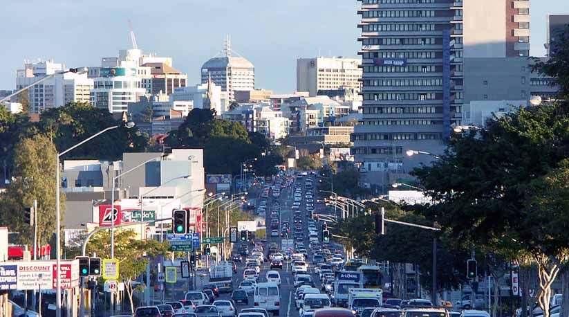
1.         Introduction                                                1.1.2     Pre-Feasibility Study
                                                                       Prior to undertaking this Environmental Impact Statement
1.1        Background to the Airport Link Project                      (EIS), the Brisbane City Council commissioned the TransApex
                                                                       pre-feasibility study into the most desirable means of
1.1.1      Strategic Planning                                          delivering the Airport Link Project. The pre-feasibility study,
The Queensland Government and Brisbane City Council has                completed in March 2005, found that the Airport Link Project
long recognised the need for a balanced and integrated                 was both financially and technically viable and would:
response to the traffic and transport issues arising from
sustained population growth and economic activity in the               x support integrated land use and sustainable transport
South East Queensland region.                                             outcomes;
                                                                       x improve access to Brisbane’s middle and inner-ring
The South East Queensland Regional Plan and the South East                northern suburbs;
Queensland Infrastructure Plan and Program 2005 – 2026                 x reduce traffic congestion on certain arterial roads in the
have been promulgated by the Queensland Government                        northern suburbs;
to provide a framework for sustainable development in the
                                                                       x provide for efficient cross-city traffic, leading to
region in response to the forecast population growth over
                                                                          environmental and economic benefits for the
the twenty years to 2026.
                                                                          community;
The South East Queensland Infrastructure Plan and Program              x improve journey times for trips in the northern suburbs;
(SEQIPP) provides in-principle support for the Airport Link            x facilitate improved access to the airport, seaport and
Project as part of an integrated approach to addressing the               Australia TradeCoast;
future transport needs of Greater Brisbane. SEQIPP identifies          x lead to desired land use and economic outcomes by
                                                                          supporting inner-city urban renewal; and
                                                                       x support Council’s vision as outlined in Living in Brisbane
                                                                          2010.

                                                                       1.1.3     Detailed Feasibility Studies
                                                                       Following the pre-feasibility study, the Queensland
                                                                       Government and the Brisbane City Council resolved to
                                                                       proceed to detailed feasibility studies. These studies include:

                                                                       x an engineering feasibility study culminating in a
                                                                          preliminary concept design on which the EIS is based;
                                                                          and
                                                                       x an environmental impact statement (EIS), including a
                                                                          traffic and transport analysis.

                                                                       The Airport Link Project has been investigated and the concept
                                                                       developed in parallel with and during the course of this EIS
                                                                       process. The EIS investigations included a comprehensive
a need to address public transport infrastructure, freight             process of community and stakeholder engagement and
transport links to the Australia TradeCoast, supporting active         consultation. The EIS and consultation processes were
transport choices, and improving road infrastructure. Airport          integrated with the design development process to address
Link is a key element of the road infrastructure identified            community and technical issues as they arose, with the
in SEQIPP as being necessary to cater for increasing travel            intended outcome being a robust and sustainable project.
demand based on sustained regional population growth.
                                                                       Should the Airport Link Project proceed, subsequent phases
The Airport Link Project is also a key element of the Transport        in project development will include a tendering phase and
Plan for Brisbane and the Trans Apex initiative. It is intended to     a construction phase, ahead of operation. The intended
address deficiencies in the orbital road network of Brisbane           operational life of the Airport Link Project is in the order of
and to provide relief to congested roads in Brisbane’s                 100 years.
northern suburbs, connect activity centres, and provide a
sound basis for future traffic management. These objectives
can be achieved by linking to strategic road connections
allowing cross-city travel movements to bypass the Central
Business District and inner suburbs.

                                                                 PAGE - 1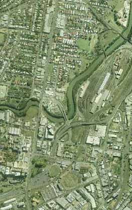
1.2       Who are the Proponents?
The Queensland Government and the Brisbane City
Council are the Proponents for this detailed feasibility                                     RBH
phase of the Airport Link Project. The agencies of the
Queensland Government with a key interest in the detailed
feasibility study process are the Department of Main Roads,
Queensland Transport and Queensland Treasury. The
                                                                                                                            WINDSOR
detailed feasibility study is being managed out of Brisbane
City Council’s Major Infrastructure Projects Office on behalff
of the Proponents. All parties have long and established
records in the delivery of major infrastructure projects.
                                                                                                              BOWEN HILLS
On completion of the Coordinator-General’s EIS Evaluation                                                   ICB
Report process, the Proponents will determine whetherr
                                                         e
or not to proceed to the next phase of the Project (ie the
tendering phase).                                                      Figure ES-1 Airport Link Alignment

The contractual arrangements between the Proponents
and a tenderer are not the subject of discussion in this               x government interests – Commonwealth, State and local
EIS. However, it is understood that the arrangements may                  government entities;
be drawn up as a ‘public private partnership’, generally               x stakeholder interests – ranging from peak bodies, major
following the guidelines for this purpose provided by the                 landowners and industry groups, through to indigenous
Queensland Government.                                                    groups; and
                                                                       x community interests – including community action
1.3       What is the purpose of the EIS?                                 groups, local interest groups, community liaison groups,
                                                                          community information sessions and local residents.
This EIS has been prepared in response to the terms of
reference set by the Coordinator-General in accordance
                                                                       For all sectors, the approach entailed dissemination of
with Sections 29 and 30 of the State Development and
                                                                       detailed information about the project design and potential
Public Works Organisation Act 1971. The purpose of the
                                                                       impacts to each of those groups through a range of media
EIS is to describe the existing environmental conditions, to
                                                                       and communications techniques. The consultation process
assess the potential impacts of the Airport Link Project and
                                                                       provided a number of opportunities for governmental
to provide information on which the Coordinator-General’s
                                                                       agencies, stakeholders and community members to
evaluation report can be based. The EIS is also an important
                                                                       participate in consultation and to learn about the Project and
tool for informing both decision-makers in the Queensland
                                                                       its potential benefits and impacts.
Government and the Brisbane City Council, as well as key
community stakeholders and the community at large.                     Processes & Participation
                                                                       The Commonwealth Minister of the Environment and
1.3.1     Consultation & Engagement                                    Heritage was formally consulted through a referral of the
Outline                                                                Airport Link Project under the Environment Protection and
The Airport Link Project differs from most other major                 Biodiversity Conservation (EPBC) Act 1999 to determine
transport projects delivered in Brisbane in recent years, in that      whether the project was a ‘controlled action’ under the
it is proposed to be situated through mostly inner suburban            Act. The Minister’s delegate responded, in a letter dated 19
areas undergoing a process of demographic change. From                 January 2006, that the Airport Link Project, as documented,
the outset, it was evident that community interest in the              was a controlled action, due to the proposal to place spoil
development of the project concept was high and would                  at a site currently not approved for such works and with
remain so through the concept development and project                  potential to impact on the Moreton Bay and Ramsar wetland.
implementation phases.                                                 That spoil placement site was removed from the Project and
                                                                       a request was made for a reconsideration. In a letter dated
Consequently, preparation of this EIS, the concept design              20 March 2006, the Minister advised that on the basis of the
and reference design has relied on a multi-layered approach            new information the Project is not a controlled action under
to consultation. Consultation activities have been directed            the EPBC Act.
to:

                                                                 PAGE - 2
STAFFORD RD                    D
                                                                                                  GYMPIE R

                LUTWYCHE RD
                                                                                                   KEDRON

                                           LUTWYCHE

                                                                                     Ke
                                                                                       dr
                                                                                       on
                                                                                            Br
                                                                                            oo
                                                                                             k
                                                                         WOOLOOWIN

Stakeholder and agency consultation included briefings with:

x the traditional owners of the area – the Jagera and the
   Turrbal, with both groups providing cultural heritage surveys
   of the corridor;
x The Coordinator-General – general EIS matters, approvals,
   air quality;
x Queensland Health – air quality, health risk assessment,
   operational issues for the major hospitals;
x Department of Main Roads, Queensland Transport including
   TransLink, and Queensland Rail – road network and transport
   aspects of construction & operational phases of Airport
   Link;
x Department of Emergency Services – property impacts for                           CLAYFIELD
   the Kedron campus as well as operational issues for response
   to incidents in the tunnel system;
x Department of Education – impacts on schools adjacent to
   the project alignment in terms of air quality, noise and traffic                                        SANDGATE RD
   safety for drop-off and pick-up activities;
x Department of Communities – housing and disability                                                        TOOMBUL
   services, programs;
x Brisbane City Council (Active Transport, City Design, City
   Planning, Community & Economic Development, Major
   Infrastructure Projects Office, Urban Management, Urban
   Renewal Brisbane).
                                                                                                 EAST W

Community consultation addressed multiple interests: property
                                                                                                   EST

owners in four suburbs; residents in ten or more neighbourhoods
near proposed Airport Link infrastructure; community members
                                                                                                      Sc
                                                                                                        AR

                                                                                                         hu

and stakeholder groups from the study corridor; and Brisbane
                                                                                                            lz
                                                                                                             TE

motorists and residents at large. Community consultation
                                                                                                               Ca
                                                                                                                RI

                                                                                                                  na
                                                                                                                   AL

included:
                                                                                                                     l

x direct engagement with local residents, property owners,
   businesses, facility managers, service providers and sundry
   stakeholders in Bowen Hills, Windsor, Lutwyche, Wooloowin,
   Kedron, Kalinga, Nundah, Clayfield and adjacent suburbs;
   and

                                                              PAGE - 3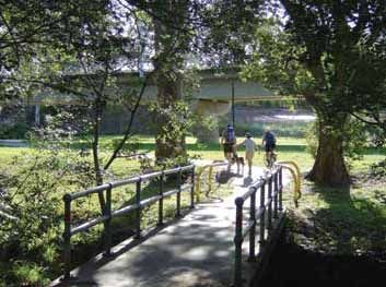
x provision of information to the general community              The Coordinator-General will assess the EIS against the
   through newsletters, displays, the dedicated information       terms of reference and will have regard for the submissions
   telephone line, email, stakeholder briefings, the website,     received. The Coordinator-General may ask the Proponents
   fact sheets and media liaison.                                 for additional information as a consequence of this
                                                                  assessment and review process.
Newsletters were distributed to approximately 147,000
households on five separate occasions up to and during the        Submissions to this EIS should be in writing, signed by
preparation of the EIS. The newsletters sought to inform          each person making the submission, state the name and
people about the detailed feasibility studies, the corridor       address of each person making the submission and state the
assessment outcomes, the design development and the               grounds of the submission and the facts and circumstances
impact assessment outcomes.                                       relied on in support of those grounds. Submissions should
                                                                  be addressed to:
Participation in the consultation process has been high,
with approximately 2,100 people attending community                    Airport Link Project Manager
information sessions, approximately 630 people attending               The Coordinator-General
staffed library displays, and approximately 2,700 community            PO Box 15009
inquiries through the 1800 telephone service, project email            City East, Qld 4002
and comment forms provided with Newsletter 1. Direct
consultation in these activities sought to provide more              or email:
detailed information around the themes covered in each            airportlink.manager@coordinatorgeneral.qld.gov.au
of the newsletters, including concept design development,
property impacts, neighbourhood amenity, traffic and access,      Copies of all submissions will be provided to the project
construction impacts, visual amenity and air quality.             Proponents. Submissions will be regarded as public
                                                                  documents unless confidentially is specifically requested.
1.3.2     On-going Process                                        Identical ‘form letters’ submitted separately but by multiple
The EIS is being displayed for comments and submissions           parties will be treated as one submission.
from the community, stakeholders and government agencies.
Written submissions received in relation to the EIS are taken     Submissions should be received by the Coordinator-General
to be submissions relating to a subsequent development            on or before the last day of the submission period.
application for impact assessable development under the
                                                                  Finally, the Coordinator-General will issue an evaluation report
Integrated Planning Act 1997 (IPA).
                                                                  on the EIS and may recommend that the project proceed,
                                                                  proceed subject to conditions which may be included in
                                                                  the report, or ought not to proceed. It is possible that the
                                                                  project could be modified as a consequence of a submission
                                                                  made to this EIS. Any change of significance to the project
                                                                  described and assessed in this EIS may become the subject
                                                                  of further evaluation by the Coordinator-General, or even
                                                                  the subject of further investigation, consultation, display and
                                                                  assessment.

                                                            PAGE - 4
by traffic congestion become available for redevelopment
2.        What is the Airport Link                                     and other areas have reduced potential for blight as a
          Project?                                                     consequence of future traffic congestion;
                                                                    x responding to existing and forecast future traffic
                                                                       congestion with greatly reduced surface impacts as
2.1       What is the Purpose of the Project?
                                                                       compared with the provision of additional road capacity
The Airport Link Project is intended to ease traffic congestion        as surface improvements either to existing arterial roads
in the northern suburbs by providing an alternative, high-             or as new roads requiring property acquisitions and
speed link with the Central Business District (CBD) bypass             extensive surface works.
network and beyond, for airport and northern suburbs traffic
using the East West Arterial, Sandgate Road, Gympie Road
and Lutwyche Road.
                                                                    2.2       What is the Project?
The Airport Link Project will link the Brisbane Airport to
southern and south-western suburbs via the North-South              2.2.1     Airport Link Overview
Bypass Tunnel (NSBT) and to western suburbs via the Inner           The Airport Link Project is a system of road tunnels, with the
City Bypass, completing another sector of the City’s orbital        main running tunnels approximately 5.7km in length and
road network. The project will provide a range of other             the overall project being approximately 6.7km in length. The
connections including linking the Brisbane Airport and              Project will be constructed mostly in rock below Lutwyche Road
Australia TradeCoast with the north-western suburbs, and            to Kedron and then under the suburbs of Wooloowin and
linking the northern suburbs with the CBD. The Airport Link         Clayfield. It will link with the NSBT, the Inner City Bypass and
Project is one of a number of transport initiatives to manage       Lutwyche Road in the south, with Gympie Road and Stafford
the effects and demands of sustained population growth              Road in the north-west, and with Sandgate Road and the East
while adhering to a strategy of seeking to build a better, more     West Arterial in the north-east. The Project will include:
liveable city.
                                                                    x two separate parallel north-south tunnels
At the broad strategic level, there are beneficial outcomes            each carrying three lanes of traffic in each
expected from the Airport Link Project, including:                     direction between Bowen Hills and Kedron;
                                                                    x two separate east-west tunnels each
x easing of traffic congestion on key arterial roads in the           carrying two lanes of traffic in each direction
   northern suburbs, such as Lutwyche Road and Sandgate                between Kedron and Clayfield;
   Road, and improving travel time reliability, particularly
                                                                    x tunnel portals at Bowen Hills, Kedron and
   for freight vehicles and surface public transport;
                                                                       Clayfield, with cut and cover and transition
x creating opportunities for enhanced public transport                sections at each to connect with the surface
   operations on freed-up surface arterial roads, possibly             road network;
   supported by high-occupancy vehicle (HOV) and bus lanes
                                                                    x elevated structures across Enoggera Creek
   on Lutwyche Road and HOV lanes on Sandgate Road;
                                                                       linking the mainline tunnels in Windsor with
x improving the travel environment of pedestrians and                 the ICB and the surface road network in
   cyclists on the surface network and providing flexibility           Bowen Hills;
   for travel mode share;
                                                                    x elevated structures across Kedron Brook
x relieving congestion-induced constraints on accessibility           linking Lutwyche Road, Kedron Park Road
   and mobility in the inner northern suburbs by providing             and the mainline tunnels from the south
   an alternative high-speed, underground route for cross-             with Gympie Road and Stafford Road to the
   city, orbital and radial trips;                                     north;
x easing congestion-related air pollution along the                x safety systems including safety exits, fire
   benefited arterial routes and with little impact, if any, to        protection and monitoring systems;
   the regional airshed while catering for increased travel
                                                                    x a ventilation system to manage air quality
   demand;
                                                                       in the tunnels and near portals, including
x reducing road traffic noise for properties fronting the             an elevated ventilation outlet near each of
   benefited arterial routes (eg Lutwyche Road, Sandgate               the connections in Bowen Hills, Kedron and
   Road);                                                              Clayfield;
x enhancing connections between the major employment               x surface road improvements at local
   centres, such as the CBD, Royal Brisbane Hospital and               intersections and around the connections
   the University of Queensland, with the Brisbane Airport             to the tunnel; and
   and the Australia TradeCoast;
                                                                    x allowances in the design for concurrent or
x creating manageable and beneficial impacts on land use              subsequent implementation of the Northern
   patterns in the inner northern suburbs, as areas blighted           Busway Project.

                                                              PAGE - 5
LEGEND

Figure ES-2 Longitudinal Alignment

The general plan of the tunnel is shown in Figure ES-1 and      Such grades take into account the effects of steeper grades
its longitudinal alignment is shown in Figure ES–2.             on vehicle speeds and the quantity of vehicle emissions
                                                                with regards in-tunnel traffic safety and ventilation system
                                                                requirements. Due to surface constraints, it was necessary
2.2.2       Project Design
                                                                to exceed these values in certain areas of the ramps. A
There are many aspects to tunnel design, including road         minimum grade in each tunnel of 0.5% was adopted to
design, tunnel construction, ventilation design, structural     ensure adequate performance of the longitudinal drainage
design aspects and design of surface buildings and works.       system.
Volume 2 of the EIS provides illustrative drawings as
indications of how construction of this type might
be carried out. Such drawings include plans,
cross-sections and longitudinal sections.

In-Tunnel Road Design
To achieve the project objectives and to
remain consistent with the performance of
motorways within the Brisbane urban road
network, the mainline tunnels from Windsor
to Clayfield are designed for a speed of
90km/h but will be signposted for maximum
speed of 80km/h. Slower design speeds
have been adopted for connections to the
local road network at each connection.

The desirable maximum vertical grades
adopted for the Airport Link Project are
5% for inclines and 7% for declines.

                                                          PAGE - 6
It is intended that each tunnel between Bowen Hills                  lanes flood free from local portal inflows from rainfall. The
and Kedron has three traffic lanes whereas the tunnels               tunnel approaches have been designed to remain above the
between Kedron and Clayfield will each have two lanes.               flood level of a 10,000 ARI flood event.
The configuration of traffic lanes and shoulders will allow
sufficient room for traffic to pass a broken-down vehicle.           The in-tunnel drainage system would respond automatically
The clearance height and the lane configuration have been            to different events. Water from storm runoff would be
factored into the reference design for the tunnel ventilation        treated differently from spills, fire deluge water or water
system.                                                              used to wash down the tunnel. Groundwater seepage into
                                                                     the tunnel would also be treated separately.
Surface Road Design
                                                                     Specially designed grated inlet pits that incorporate flame
The surface road connections are to be designed and                  traps are designed to collect stormwater from the portals,
constructed in accordance with accepted standards. Key               plus that carried into the tunnel on vehicles for transfer to
criteria for the surface road designs include:                       the dedicated “clean water” sumps at the sag points of
                                                                     each tunnel. After passing through silt, debris and grease
x assuring road users of safe and efficient traffic conditions;     traps, this water would be pumped through rising mains and
   and                                                               directed to the surface stormwater system.
x avoidance of congestion that could lead to queuing
   back into the tunnels.                                            Spillage, fire deluge and wash-down water captured by the
                                                                     tunnel stormwater drainage system, would be diverted and
The surface roads in Windsor and Bowen Hills will connect            stored in dedicated wastewater sumps at the tunnel sag
with the NSBT via an extensive array of road connections.            points to be pumped out and removed for treatment at an
Some of these require elevated road structures over                  appropriate receiving facility.
Enoggera Creek to connect the Airport Link Project with
the Inner City Bypass (ICB) westbound, the NSBT and with             Groundwater seeping into the tunnel in those lengths where
O’Connell Terrace and Campbell Street. The connections from          the tunnel is not fully lined would be collected in a dedicated
O’Connell Terrace have the potential to impact on The Mews           seepage water system and pumped via rising mains to the
apartments if there is no mitigation in the design treatments.       surface stormwater system.
Detailed design studies are required to investigate the most
appropriate means of providing this linkage while minimising         Tunnel Ventilation
the impacts on the visual amenity of The Mews.                       The tunnel system is to be ventilated mechanically to
                                                                     maintain acceptable air quality in each tunnel based on
The surface roads connecting the Project with Gympie Road            air quality standards recommended by the Permanent
and Stafford Road in Kedron will involve elevated structures         International Association of Road Congresses (PIARC). The
to provide free-flowing traffic conditions from those roads          reference design for this EIS will achieve the following air
to and from the tunnels. In order to accommodate the                 quality standards:
predicted traffic flows through this location, the Project will
involve an extensive surface footprint as well as the elevated       x a peak of 70ppm (parts per million) of carbon monoxide
roads crossing Kedron Brook. Furthermore, the potential                 (CO) for normal traffic flows and 90ppm in extreme
road traffic noise in this location may require extensive               congestion1;
mitigation measures, which in turn could impact on nearby
                                                                     x an average of 1ppm of nitrogen dioxide (NO2); and
residential properties in terms of their scale and alteration of
streetscape values. Detailed design studies are also required        x a visibility limit of 0.005m-1.
to investigate the most appropriate response for this locality,
having regard to the required traffic functions and the              While air flow through the tunnel will be aided by vehicle
character and amenity.                                               movements, known as the ‘piston effect’, a system of jet fans
                                                                     located in the roof of each tunnel will ensure air is moved
The surface road connections at Clayfield are to be situated         towards the ventilation outlet. By drawing large quantities
in Kalinga Park just to the west of Sandgate Road, resulting         of fresh air in through the tunnel portals, this system dilutes
in the removal of a number of mature trees and placing road          the in-tunnel air as part of an overall approach to achieving
infrastructure in an area of local open space value. The urban       high quality air conditions in the tunnel. The operation of
design and landscaping treatments of these connections will          high-speed air extraction into the ventilation outlet will draw
need to address local community concerns in terms of visual          external air back into the tunnels at the exit portals, with the
impact, road traffic noise, connectivity for pedestrians and         aim of avoiding ‘portal emissions’ of vitiated air.
cyclists, and landscape rehabilitation.
                                                                     A ventilation outlet, supported by a fan station and potential
                                                                     provision for air treatment facilities, is proposed to be
Drainage
Tunnel drainage has been designed to maintain all traffic            1    Extreme traffic congestion is reached when traffic flows slow
                                                                          below 10km/hr.

                                                               PAGE - 7
Kedron/Lutwyche
situated at each of the main connections to the surface road North-Western
ventilation
network. That is, a ventilation station and ventilation outlet station
will be situated adjacent to the southern connections at
Windsor for the southbound tunnel, adjacent to the north-
EA
TB
S
western connections at Kedron for both the north-bound O UN
DM
A IN
and west-bound tunnels, and adjacent to the north- TU
N NEL
eastern connection at Clayfield for the eastbound Toombul/Clayfield
tunnel. NN
EL
WE
ST
BO
North-Eastern
ventilation
TU UN
IN DM station
MA AI
N
D
The tunnel ventilation system design is BO
UN
TU
EL
NN
TH NN
intended to expel air at high
EL
R
NO TU Sandgate Rd
A IN
velocities, up to 20 metres UN
D
M East-West Arterial
BO
per second, or in excess UT
H East-West Arterial
SO
of 70km/hr, into Southern Sandgate Rd
ICB/City ventilation
the environment for station LEGEND
dispersion and dilution by Bowen Hills/Windsor
Jet Fan Ventilation Station
Location to be investigated
local climatic conditions. To ICB/City
Air Flow
achieve desired ambient air quality
at ground level, the ventilation outlets tunnel operation in the event of failure at any connection
are proposed to be at least 30 metres high to optimise the to the grid. This full level of redundancy would be provided
dispersion of air from the tunnel. While a lesser height may throughout the electrical distribution system to the final
be less visually obvious, there may also be a slight reduction in circuits. In this way, the failure of any one element ought not
dispersion and therefore dilution of the emitted air from the affect the performance of the system.
ventilation outlet. Community input during the preliminary
consultation process sought an optimal air quality outcome In the event of a complete failure of supply to the tunnel,
ahead of visual impact considerations. an Un-interruptable Power Supply (UPS) is provided. This UPS
runs the essential systems until such time as main power
Each tunnel is to be equipped with a separate smoke duct to is restored. During this period the tunnel would be closed.
the ventilation system. The smoke ducts remove smoke from Essential systems include emergency lighting, directional signs,
fire zones and expel it to the ventilation outlets, allowing some monitoring and controls, and some roadway lighting.
people to be evacuated safely from fire zones within the
tunnel and fire-fighters and other emergency services Tunnel illumination in zones allows motorists’ vision to adjust
personnel to approach closer to a major incident site. gradually from the ambient conditions to in-tunnel driving
conditions. Other lighting elements provided in tunnels
Emergency & Other Services would include:
Access for emergency services is proposed by road from any x directional signage, guiding pedestrians towards the
of the connections. Cross-passages constructed along the cross passages in the event of an incident; and
tunnels at 120 metre intervals are to provide fire-proof safe
x exit signage and emergency lighting in cross passages
havens for motorists in the event of a major incident. People
and egress tunnels.
could be directed from these passages into the other tunnel
once traffic flows there have been controlled and determined
as being safe for evacuation. Emergency services could also Integration with proposed Northern Busway
access an accident site from these cross-passages. The detailed feasibility studies for the Airport Link Project
have investigated opportunities for integration with the
Tunnel design includes fire and life safety measures, including proposed Northern Busway in concept development
a deluge sprinkler system and a zone-based smoke extraction and possibly in project delivery. The Northern Busway
system. is proposed to connect the Inner Northern Busway (INB)
at the Royal Children’s Hospital (RCH) at Herston with
When fully operational the tunnel system, including the
Windsor, Lutwyche,Kedron, Chermside, Aspley and Bracken
ventilation system, would require a high-capacity connection
Ridge. The reference design alignment for the mainline
to the State electricity supply grid. Two 11 kV feeders at the
Airport Link tunnels has been based on accommodating
north-western connection would be supplied from different
the proposed Northern Busway including the replacement
bulk supply systems. Each feeder would be capable of
of the existing bridge over Kedron Brook to carry three
supplying 5 MW of power, thus providing uninterrupted
lanes of outbound Lutwyche Road traffic plus the Northern
power to the tunnel should there be a feeder or substation
Busway. The Kedron Brook section of the proposed
outage. All electrical systems are designed to maintain full
busway, including the bus station and worksites,is located
PAGE - 8directly adjacent to proposed Airport Link surface works. x Tunnelling by drill and blast techniques – may be employed
The potential for particular service integration features in areas requiring particularly careful construction works
between Airport Link and the proposed Northern Busway such as those in proximity to sensitive land uses or in
will depend on the detailed design and concurrent areas where the rock hardness is greater than is desirable
construction options for both projects. for economic tunnelling by machine.
2.2.3 Project Delivery (Construction) In broad terms the construction program would reflect
several distinct tasks, including:
Methods
Under the reference project, the tunnel system is to be x establishment and preliminary site works, including
constructed by several means and to achieve depths below construction of the sheds over each of the tunnel
ground level in the order of 60 metres. While the actual portals;
construction methods chosen for the Airport Link Project will x demolition of existing buildings and modification to
be determined following the tendering process and detailed utilities;
design and construction planning, it has been assumed for x constructing surface roadworks;
the purpose of assessment in this EIS that the four most x undertaking ‘cut and cover’ works adjacent to Kedron
commonly used construction methods likely to be engaged Brook to connect the north-south and east-west tunnels
on the Project are: and at Clayfield and Toombul to connect with the East
West Arterial;
x Cut and cover construction – construction of surface
entries by a ‘cut and cover’ technique typically involving x new bridgeworks over Enoggera Creek at the southern
the use of excavators, with work at depth being connection and over Kedron Brook at the north-western
conducted after surface covers, or lids, have been put in connection;
place to contain noise and other impacts; x modifications to existing structures, such as the Bowen
x Tunnelling by roadheaders – a technique, possibly for the Bridge Road bridge, the Horace Street bridge, access
north - south tunnels and near other surface connections, ramps onto the Inner City Bypass and the Lutwyche/
to achieve required cross-sections for the designed lane Gympie Road bridge over Kedron Brook;
widths and configurations with low impacts in terms of x tunnelling construction works on the mainline tunnels
regenerated noise and vibrations at the surface; between Windsor and Kedron, most likely using
x Tunnelling by a tunnel boring machine – possibly using roadheaders from each end; and
an earth pressure balance machine between Kedron x tunnelling construction works on the mainline tunnels
and Clayfield where poorer geotechnical conditions between Kedron and Clayfield, most likely using TBM(s)
require the tunnels to be lined as soon as possible after to address local ground conditions and groundwater
excavation to prevent groundwater drawdown and regimes.
settlement impacts on surface properties; and
The construction methods and the timing and location of
construction activity ultimately will be determined finally
after detailed design and construction planning is completed.
Major changes from the construction method described
in this EIS may require further investigation and possibly
consultation with potentially affected communities.
Construction Traffic Management
During during construction, a carefully programmed and
managed traffic and access strategy to minimise disruption
to daily traffic operation would include traffic diversions and
management in:
x Lutwyche Road in Windsor, Lutwyche and Kedron;
x Bowen Bridge Road and Federation Street;
x O’Connell Terrace, Mayne Road and Campbell Street,
Sneyd Street and Horace Street;
x Kedron Park Road, Gympie Road and Stafford Road;
and
x Sandgate Road, East West Arterial Road near their
intersection.
Tunnel Boring Machine (TBM)
PAGE - 9Access would be modified to the following streets:
x Norman Street, Perry Street, Colton Avenue and Windsor
Avenue;
x Suez Street and Swan Street; and
x Leckie Road and Arnott Street;
The approach to be taken to traffic management during
construction will be resolved through the development of
comprehensive construction traffic management plans prior
to the commencement of construction works. Consultation
and community awareness programs would provide
information about planned changes in traffic conditions
during construction.
Construction Worksites
Construction worksites will be established:
x at the southern connection in Windsor, on land situated
between Federation Street, Lutwyche Road and Enoggera
Creek, adjacent to the NSBT worksite. Other construction
works will be conducted in O’Connell Terrace, Campbell
Street and around NSBT infrastructure;
x at the north-western connection in Kedron and
Lutwyche, the work site will be divided into two areas:
- one area will be between the north and south-
While the scale and bulk of the worksheds may be out of
bound carriageways of Lutwyche Road between
context with the localities in which they are to be situated,
Norman Avenue and Kedron Brook, after the
they will be in place only for the construction phase and will
northbound carriageway is relocated further to the
provide protection from construction impacts. The external
west in early project works; and
treatments of the sheds and worksite landscaping should
- the other will be to the north of the Lutwyche take into account and seek to mitigate the potential visual
Road/Kedron Park Road intersection over most of impact of these structures.
the existing Emergency Services site; and
x at the north-eastern connection in Kalinga Park Clayfield Construction Works
and along the northern side of the East West Arterial
Construction works are likely to proceed from more than
and south of Schulz Canal.
one worksite at any one time. It is also likely that, once
works have progressed below the surface and have been
Each of the worksites will include one or more worksheds covered, construction will proceed in two shifts over a 24-
and other enclosures to control and mitigate the impacts hour day. Works conducted above the surface, except for
of construction, such as noise and dust. It is proposed that spoil haulage, will be limited to the usual hours of work
activities supporting tunnelling works be conducted within (6.30am – 6.30pm Monday to Saturday, with no work on
the worksheds, while construction spoil is to be stored, Sundays or public holidays) to maintain acceptable levels
handled and loaded into haulage vehicles within acoustic of amenity for neighbours. Some out of hours work may
and ventilated enclosures. Construction spoil may be moved be necessary to avoid undue traffic disruptions, such as the
around within the worksites by conveyor, to access the most transport and installation large construction equipment or
convenient spoil loading areas with the least impact. components to worksites.
The sheds will be large enough to allow spoil to be stockpiled
and loaded into trucks for removal from the site. To keep pace Spoil
with the rate of tunnelling, removal of spoil from the site could Large amounts of spoil will be removed from each worksite.
be continuous 24 hours per day during the working week and Approximately 2,400,000m3 of loose spoil will be removed
12 hours on Saturday (ie 6.30am Monday to 6.30 pm Saturday, from the Airport Link excavations. Depending on the final
with no haulage at any time on Sundays or public holidays). construction method, it is likely that the major proportion
of spoil will be removed from the north-western worksite
PAGE - 10(about 1,400,000m3), with about 700,000m3 being removed x support workshops; and
from the southern worksite and about 300,000m3 through x other office space.
the north-eastern worksite. A number of potential spoil
placement sites have been identified during the investigations
All data collected by the in-tunnel monitoring systems will
for the EIS. They include:
be processed for reporting purposes and the entire tunnel
x land proposed for the Gateway Upgrade Project at operating services will be controlled from this location. It
or near the old Brisbane airport site in the Australia may also provide water tankers with water for the tunnel
TradeCoast Central precinct; wash down operations and house the pressure booster for
use by the fire brigade. Parking and marshalling areas for
x land at Clunies Flat in the Port of Brisbane; maintenance and emergency vehicles are also required.
x land in the Port of Brisbane at Fisherman Islands; and
x Proposed recycling facility at Viola Place, Eagle Farm. Electronic Tolling System
The Airport Link Project is proposed on the basis of an
Spoil placement will require careful management to avoid electronic tolling system. No booths for cash payment are
impacts such as dust and wind erosion, soil erosion and to be used. Payment of the toll is likely to be by E-Toll where
sedimentation due to surface run-off, and the spread of motor vehicles using the tunnel need to be fitted with
pests (eg. fire ants and weeds). transponders. A process would be needed to handle casual
users. While it is desirable that the toll transponders will enjoy
While the Contractor might find suitable alternative sites, inter-operability with other tolled roads in Australia, this is
approval for the use of such sites may be required prior to a matter for contractual resolution should the Proponent
commencement of placement. The preferred haulage route decide to proceed with the Project. Should inter-operable
to a spoil placement site includes the preferential use of the tollways be established for the Airport Link Project, patrons
arterial road network of the City and the region and the could then access other tolled roads, which in South East
avoidance of local roads, in particular residential streets. Queensland, include the Gateway Motorway, the Logan
Motorway, and on its completion, the North-South Bypass
The use of rail for spoil haulage has been investigated for Tunnel.
the removal of spoil through the southern worksite owing
to the proximity of rail infrastructure in Mayne and Bowen Monitoring, operation and administration of the tolling
Hills. There is no conveniently located or accessible rail system may be performed at the Tunnel Control Centre or
infrastructure for rail haulage of spoil from other worksites. off-site.
It should be noted that rail haulage requires double handling,
at least at the point of arrival prior to placement at one of
the placement sites nominated above. 2.3 EIS & Approvals
Within the applicable legislative regime for the Airport Link
2.2.4 Tunnel Management Project, this EIS has identified a range of approvals necessary
Operation and maintenance of the tunnel system requires before the project can proceed. In addition to these approvals,
an integrated approach involving the tunnel operators, the Airport Link Project has to be approved in the financial
the Brisbane City Council, the Queensland Government, context and from a tendering standpoint.
including Department of Emergency Services, Queensland
Transport, the Environmental Protection Agency, and other 2.3.1 Environmental Impact Statement
key stakeholders. The daily operation of the tunnel also The Airport Link Project was declared a significant project
requires an integrated approach to traffic management, for which an EIS is required under section 26(1)(a) of the
incident responses, air quality management, toll collections State Development and Public Works Organisation Act 1971
and general maintenance. (SDA) in October 2005. Consequently, the Project has to
be assessed through an environmental impact statement
Tunnel Control Centre process in accordance with terms of reference established
A tunnel control centre is required to monitor and control by the Coordinator-General. The EIS will be evaluated by
a number of services for the safe and effective operation of the Coordinator-General who will then issue a report. That
the tunnel. The tunnel control centre would be a dedicated report may be subject to a number of conditions. In addition,
building near one connection for swift access. It will the report becomes a concurrence agency response in
include: relation to any development application made under the
Integrated Planning Act 1997 (IPA). Alternatively, if required,
x the incident control room supporting fire protection and the Coordinator-General’s report may inform a decision by a
emergency services; Minister to designate all or part of the Airport Link Project
x the traffic control room and communications room; for community infrastructure under the IPA.
PAGE - 112.3.2 State Legislation
The Airport Link Project will constitute ‘development’ as
defined under the IPA. Aspects of the Airport Link Project are
likely to constitute assessable development, either the IPA, or
under the provisions of Brisbane City Plan 2000. Approvals
for the Airport Link Project under State legislation are likely
to include those activities set out in Table 2-1.
Table 2-1 – Approvals
Determining
Activity Approval
Authority
Development
Operational works including Coastal Protection and BCC, EPA
tidal works Management Act
(IDAS process under IPA)
Operational work (removal, Fisheries Act (IDAS process DPIF
disturbance or destruction of a under IPA) Windsor War Memorial Park
marine plant)
Building work IPA BCC
Reconfiguration of a lot IPA BCC
Material change of use for ERA Environmental Protection Act, BCC, EPA Any aspect of assessable development under City Plan, which
(EP Act) IPA is not included in a designation of community infrastructure,
Material change of use EP Act, IPA BCC, EPA will require a development approval before commencement
involving contaminated land of the activity triggering the development (eg operational
Environmental works). Other aspects of development, such as a material
Disposal permit to Environmental Protection Act EPA change of use for an environmentally relevant activity, will
contaminated land
require a development approval regardless of any designation
Cultural Heritage Aboriginal Cultural Heritage DNRMW,
Act, Queensland Heritage Act, Qld Heritage
for community infrastructure.
IPA Council
Other Prior to construction, other development approvals may be
Works on a State road Transport Infrastructure Act DMR
required with the coming into force of further amendments
Works in a Rail corridor Transport Infrastructure Act QT, Qld Rail
to the IPA, as other State legislation is rolled into IPA, and
Local actions (eg blasting) Local laws BCC amendments to the Transport Planning and Coordination Act
1994 take effect with regards works on State-controlled
Table Notes: roads.
DNRMW – Department of Natural Resources, Mines & Water
EPA – Environmental Protection Agency
DMR – Queensland Department of Main Roads
DPIF – Queensland Department of Primary Industries & Fisheries
PAGE - 12x consists of poorly defined traffic routes that are difficult
3. The Need for the Project to navigate; and
The Airport Link Project has been proposed to respond to x inhibits the movement and patronage of public
population growth and related increases in travel demand transport.
in Brisbane. It should also be considered as part of a wider,
balanced solution to regional and local imperatives for
Even with major increases in non-motorised and public
integrated planning and transport infrastructure delivery.
transport travel, the existing road network will not sustain
future travel demands generated by growth in population
3UREOHP'H¿QLWLRQ and the economy. A range of transport infrastructure
solutions are becoming critical and increasingly urgent to
The Transport Plan for Brisbane, TransApex and the South maintain a liveable city.
East Queensland Regional Plan (SEQRP) identify the need
for a system of motorway-standard orbital roads to address
the high-levels of congestion in Brisbane and enhance 3.1.1 Population growth
accessibility. These plans and policy objectives also include South-East Queensland has experienced high and sustained
initiatives for public transport as well as alternatives such population growth since the 1980s, growing at an average
as walking and cycling. These are required to support the of 55,300 persons each year (or over 1,000 people per week)
desired urban form for the predicted population growth in between 1986 and 2004. It is estimated that by 2026, SEQ
SEQ over the next two decades. will be home to 3.71 million people – an increase from 2.77
million in 2006 at an average increase per year from 2001 to
Brisbane’s transport infrastructure has not always been 2026 of 50,000 people.
implemented in response to demand, or strategically
developed to encourage sustainable travel behaviour. The Brisbane is the fastest growing metropolitan area in Australia.
result is a transport network that: The Brisbane metropolitan area growth represents more than
a quarter of all projected population growth in Australia over
x has a predominantly radial, CBD focus with few if any the next 25 years from 1.8 million in 2004 to 2.6 million in
options to bypass the city centre on existing surface 2026.
roads;
x has poor road connectivity between Brisbane Airport, Table 3-1 presents estimated populations, employment and
the CBD and western areas; person trips for the Brisbane metropolitan area for the ABS
Medium Series population scenario. As land use and growth
x has limited capacity on major roads like the Western
patterns vary across the metropolitan area, changes to travel
Freeway, Riverside Expressway and Lutwyche Road;
demand are forecast, particularly at key locations served by
x ends motorways at arterials producing a discontinuous the Project such as Brisbane Airport, the Australia TradeCoast
motorway system; (ATC) North precinct and Chermside regional centre.
x draws traffic though local centres;
x has high numbers of signalised intersections along major
roads like Lutwyche Road, Sandgate Road, Gympie Table 3-1 Brisbane Metropolitan Area Population Forecasts
Road;
Year Population (1) Employment (2) Total Person Trips (3)
2004 1,773,000 804,800 6.1 million
2012 2,074,500 1,025,400 7.2 million
2016 2,221,500 1,130,900 7.7 million
2022 2,439,600 1,253,500 8.4 million
2026 2,583,700 1,320,500 8.8 million
Table Notes:
(1)
Source: Australian Bureau of Statistics – Medium Series, 2005.
(2)
Employment opportunities consistent with ABS Medium population
projection.
(3)
Trips by all modes including walk/cycle on an average weekday.
Sandgate Road, Toombul
PAGE - 133.1.2 Increased Vehicle Trips Table 3-2: Forecast Growth in Weekday Travel Demand - Metropolitan
Area
Growth in population and consequent travel demand is
placing enormous pressure on Brisbane’s existing road and Parameter 2004 2012 2016 2022 2026
public transport services – particularly in the CBD and the Person Trips
inner suburbs. by Motorised
Travel Modes 5,519,200 6,530,200 6,987,900 7,657,400 8,093,700
Figure 3-1 summarises the estimated growth in the travel Public
Transport Trips 415,400 607,100 677,000 807,200 895,600
task (in terms of person trips) by the various travel modes
% PT Trips 7.5% 9.3% 9.7% 10.5% 11.1%
– vehicle, public transport, and walk/cycle travel. This
Car/Light
demonstrates how travel demand is forecast to grow in a Vehicle Trips 3,611,000 4,239,800 4,534,300 4,940,700 5,216,500
sustained manner across all modes. Commercial
Vehicle Trips 177,600 231,000 249,700 272,200 287,600
Total Vehicle
Trips 3,788,600 4,470,900 4,783,900 5,212,900 5,504,100
Figure 3-1: Forecast Growth in Average Weekday Travel Demand
Within Brisbane Metropolitan Area (including commercial vehicles) % Growth in
Vehicle Trips
compared to
2004 18% 26% 38% 44%
10
Public Transport Trips
9 Walk and Cycle Trips
8
Commercial Vehicle Trips
Car/Light Vehicle Trips
These forecasts show that even with significant growth in
7
public transport mode share, a sustained growth in vehicle
travel demand is indicated both at the Brisbane Metropolitan
Person Trips (million)
6
5
area level and within the Inner North area. In the metropolitan
4
area 44% more vehicle trips are expected by 2026, even with
3
the number of public transport trips more than doubled.
2
Within the study corridor, north-south travel movements
1 within the Inner North area are forecast to increase by 49%
0 between 2004 and 2026, a sustained growth rate of 1.8%
2004 2012 2016 2022 2026
Year pa. East-west demands are forecast to grow by 55% to 65%
in a similar period, a growth rate of over 2.0% pa. These
growth trends are similar for commercial vehicle movements,
indicating that the adverse effects of truck travel through
the surface network in the Inner North areas to the rapidly
Average weekday traffic volumes have been forecast growing Australia TradeCoast (ATC) precinct will become
for roads in the Brisbane Metropolitan Area for the years even more significant over time.
2012, 2016, 2022 and 2026, for a road network that does
not include the proposed Airport Link. Estimated average The Airport Link Project has been considered in TransApex
weekday traffic volumes for 2004 have also been identified to and the Transport Plan for Brisbane as part of a balanced
allow comparison. The travel demand forecasts incorporate and integrated approach to relieve inner-city congestion
the effects of significant enhancements in public transport. and address the City’s transport challenges. Other measures
Table 3-2 summarises the growth in travel demand at the include enhanced public transport services on important
metropolitan level. routes, and enhanced opportunities for cycle and pedestrian
trips, providing greater flexibility in the transport system.
PAGE - 143.1.3 Issues with Existing Road Network congested networks experience restrictions to their
Brisbane’s existing road network originated as a pattern accessibility; and
of intercity links to other towns and regional centres. The x community safety and security are compromised due to
major roads that grew from these early transport links delays for emergency vehicles.
now form a series of radial corridors focused on the CBD. Assessment of travel demand in Brisbane’s inner north
Ipswich Road, Lutwyche Road, Logan Road and the Pacific indicates that on the arterial roads currently about 60% of
Motorway are examples of the radial structure of Brisbane’s trips are cross-city, 35% are destined for the Central City, with
existing road network. More recent projects such as the only 5% local traffic. Much of the traffic congestion in the
Gateway Motorway, ICB, Logan Motorway and NSBT have arterial network in the inner north of Brisbane’s radial road
been constructed or are planned to address deficiencies in system is caused by traffic wanting to get “somewhere else”
the road network structure. but being forced to use the roads through the suburbs.
3.1.4 Declining Levels of Service
The impact of through traffic is evident from the analysis of
average peak travel speeds for some of the major cross-city
routes. With increased demand and higher congestion levels,
there is a general decline predicted in the level of service on
the road network in future years. Peak period journey travel
times are forecast to increase significantly compared to the
current level. For example, without the Airport Link Project,
and with enhanced mode share to public transport, traffic
volumes through the Lutwyche shopping precinct would
grow by over 30% by 2026.
Figure 3-2 illustrates the forecast decline in travel speed for
two examples of typical journeys through the Inner North
area. By 2016, for an AM peak period trip from Chermside
to Fortitude Valley, an average travel speed of 25 km/hr is
forecast compared to 31 km/hr currently. This declines to
less than 20 km/hr by 2026. A more severe deterioration is Lutwyche Road
forecast for the PM peak, with forecast 2026 northbound
PM peak speed of only 14 km/hr.
3URMHFW-XVWL¿FDWLRQ
Similarly, on Sandgate Road, even greater growth would The justification for proceeding with the Airport Link Project
occur due to its proximity to the ATC precinct and its can be found in a number of key performance indicators,
connecting role to the Brisbane CBD. Almost a doubling of including network performance, travel time savings, savings
current traffic levels is likely by 2026, and a sharp decline in vehicle operating costs, reduced environmental costs and
in level of service would be associated with this demand reduced social impacts.
growth. An AM peak period southbound trip from Hendra
to Milton in 2026 would experience an average travel speed
of 27 km/hr (compared to 40 km/hr currently), with the PM 3.2.1 Network Performance
peak speed of only 20 km/hr for the northbound trip. The traffic analysis indicates that Airport Link will be effective
in shifting traffic flows from lower order roads in the network
Increasing levels of congestion on the road network will have (local, district and suburban routes) and travel to motorway
a range of consequences: routes. The arterial road network also benefits by reductions
in travel distance and time. A very small (You can also read