INTERMUNICIPAL DEVELOPMENT PLAN - Vulcan County & Village of Milo Bylaw No. 00 000 & Bylaw No. 00 00
←
→
Page content transcription
If your browser does not render page correctly, please read the page content below
Vulcan County & Village of Milo
INTERMUNICIPAL DEVELOPMENT PLAN

   Bylaw No. 00‐000 & Bylaw No. 00‐00
           DRAFT April 2021
© 2021 Oldman River Regional Services Commission
Prepared for Vulcan County and the Village of Milo
This document is protected by Copyright and Trademark and may not be reproduced or modified in any manner, or for any purpose, except by
written permission of the Oldman River Regional Services Commission. This document has been prepared for the sole use of the Municipality
addressed and the Oldman River Regional Services Commission. This disclaimer is attached to and forms part of the document.TABLE OF CONTENTS
PART 1 Introduction .......................................................................................................... 1
1.1 Legislative Requirements .................................................................................................. 1
Figure 1 – Planning Document Hierarchy Flowchart ................................................. 3
1.2 Plan Goals ......................................................................................................................... 4
1.3 Plan Preparation Process & Procedure for Adoption ....................................................... 5
PART 2 Coordinated Growth Management Strategy .......................................................... 6
2.1 Plan Area ........................................................................................................................... 6
2.2 Background ....................................................................................................................... 6
2.3 General Plan Policies ......................................................................................................... 7
2.4 Agricultural Practices ........................................................................................................ 8
2.5 Future Land Use ................................................................................................................ 9
2.6 Transportation ................................................................................................................ 12
2.7 Environmental & Historical Matters ............................................................................... 13
2.8 Utilities & Servicing ......................................................................................................... 15
2.9 Growth and Annexation .................................................................................................. 17
PART 3 Plan Implementation ........................................................................................... 21
3.1 Plan Validity & Amendment ............................................................................................ 21
3.2 Intermunicipal Referrals ................................................................................................. 22
Figure 2 – Intermunicipal Development Plan Referral Flowchart ............................ 23
3.3 Dispute Resolution .......................................................................................................... 24
Figure 3 – Dispute Resolution Flow Chart ................................................................ 26
3.4 Plan Implementation ...................................................................................................... 27
3.5 Mutual Benefit & Cooperation ....................................................................................... 28
Vulcan County and Village of Milo
Intermunicipal Development Plan Bylaw No. ____ and Bylaw No. ____ iPART 4 Maps .................................................................................................................... 30
Map 1 Location
Map 2 Intermunicipal Development Plan Area
Map 3 Confined Feeding Operation Exclusion Area
Map 4 Future Land Use Concept
Map 5 Transportation and Regional Growth Concept
Map 6 Soil Capability for Agriculture
Map 7 Existing Land Use
Map 8 Land Use Zoning
Map 9 Historical Annexation
Vulcan County and Village of Milo
ii Intermunicipal Development Plan Bylaw No. ____ and Bylaw No. ____PART 1 Introduction
PART 1
Introduction
Vulcan County (County) and the Village of Milo (Village) recognize that the land surrounding the Village is of
mutual interest, warranting a collaborative approach to planning. The Intermunicipal Development Plan (IDP
or Plan) is based on creating a shared vision for future growth by establishing and agreeing to a long‐term
strategy for planning and development which attempts to balance the interests of each municipality. The Plan
is intended to foster ongoing collaboration and cooperation between the County and Village by providing a
forum to discuss planning matters in the context of each municipality’s land use philosophy. The key policy
areas of the Plan include:
Collaboration,
Land Use,
Future Growth,
Transportation, and
Utilities, Servicing and Drainage.
The Plan is intended to provide guidance to decision‐makers and establishes planning policy that applies to
lands in the fringe and within the Village; however, each municipality is ultimately responsible for making
decisions within their jurisdiction using the policies and procedures as agreed upon in this Plan.
1.1 Legislative Requirements
In order to foster cooperation and mitigate conflict between municipalities, the Municipal Government Act,
Revised Statutes of Alberta 2000, Chapter M‐26 with amendments (MGA) has included two mechanisms within
the planning legislation which allows a municipality to:
1. include policies regarding coordination of land use, future growth patterns and other infrastructure
with adjacent municipalities in their municipal development plans [section 632(3)(iii)] if no
intermunicipal development plan exists with respect to those matters; and
2. complete and adopt an intermunicipal development plan with adjacent municipalities to address the
above matters.
Specifically, the Municipal Government Act states:
631(1) Two or more councils of municipalities that have common boundaries that are not members of a
growth region as defined in section 708.01 must, by each passing a bylaw in accordance with this Part or in
accordance with sections 12 and 692, adopt an intermunicipal development plan to include those areas of
land lying within the boundaries of the municipalities as they consider necessary.
Vulcan County and Village of Milo
Intermunicipal Development Plan Bylaw No. ____ and Bylaw No. ____ 1631(1) Subject to subsections (2) and (3), 2 or more councils of municipalities that have common boundaries
and that are not members of a growth region as defined in section 708.01 must, by each passing a bylaw in
accordance with this Part or in accordance with sections 12 and 692, adopt an intermunicipal development
plan to include those areas of land lying within the boundaries of the municipalities as they consider
necessary.
631(8) An intermunicipal development plan
(a) must address
(i) the future land use within the area,
(ii) the manner of and the proposals for future development in the area,
(iii) the provision of transportation systems for the area, either generally or specifically,
(iv) the co‐ordination of intermunicipal programs relating to the physical, social and economic
development of the area,
(v) environmental matters within the area, either generally or specifically, and
(vi) any other matter related to the physical, social or economic development of the area that the
councils consider necessary,
and
(b) must include
(i) a procedure to be used to resolve or attempt to resolve any conflict between the municipalities
that have adopted the plan,
(ii) a procedure to be used, by one or more municipalities, to amend or repeal the plan, and
(iii) provisions relating to the administration of the plan.
It is noted that the paramountcy of the IDP is established within the “Plans Consistent” (section 638) portion
of the Municipal Government Act:
638(1) In the event of a conflict or inconsistency between
(a) an intermunicipal development plan, and
(b) a municipal development plan, an area structure plan or an area redevelopment plan
in respect of the development of the land to which the intermunicipal development plan and the municipal
development plan, the area structure plan or the area redevelopment plan, as the case may be, apply, the
intermunicipal development plan prevails to the extent of the conflict or inconsistency.
In addition to Municipal Government Act requirements, the South Saskatchewan Regional Plan (SSRP) became
effective September 1, 2014 which introduced additional requirements when addressing land use matters. The
SSRP uses a cumulative effects management approach to set policy direction for municipalities for the purpose
of achieving environmental, economic and social goals within the South Saskatchewan Region until 2024.
Pursuant to section 13 of the Alberta Land Stewardship Act (ALSA), regional plans are legislative instruments.
The SSRP has four key parts including the Introduction, Strategic Plan, Implementation Plan and Regulatory
Details Plan. Pursuant to section 15(1) of ALSA, the Regulatory Details of the SSRP are enforceable as law and
Vulcan County and Village of Milo
2 Intermunicipal Development Plan Bylaw No. ____ and Bylaw No. ____bind the Crown, decision makers, local governments and all other persons while the remaining portions are
statements of policy to inform and are not intended to have binding legal effect.
Figure 1: Planning Hierarchy Flowchart
Provincial Legislation
South Saskatchewan Regional Plan
Intermunicipal Development Plan
Municipal Development Plan
Area Structure/Redevelopment Plan
Land Use Bylaw
Subdivision
Development
The Regional Plan is guided by the vision, outcomes and intended directions set by the Strategic Plan portion
of the SSRP, while the Implementation Plan establishes the objectives and the strategies that will be
implemented to achieve the regional vision. As part of the Implementation Plan, Section 8: Community
Development includes guidance regarding Planning Cooperation and Integration between municipalities with
the intention to foster cooperation and coordination between neighbouring municipalities and between
municipalities and provincial departments, boards and agencies. Section 8 contains the following broad
objectives and strategies:
Objectives:
Cooperation and coordination are fostered among all land use planners and decision‐makers
involved in preparing and implementing land plans and strategies.
Knowledge sharing among communities is encouraged to promote the use of planning tools and
the principles of efficient use of land to address community development in the region.
Strategies:
8.1 Work together to achieve the shared environmental, economic, and social outcomes in the
South Saskatchewan Regional Plan and minimize negative environmental cumulative effects.
8.2 Address common planning issues, especially where valued natural features and historic
resources are of interests to more than one stakeholder and where the possible effect of
development transcends jurisdictional boundaries.
Vulcan County and Village of Milo
Intermunicipal Development Plan Bylaw No. ____ and Bylaw No. ____ 38.3 Coordinate and work with each other in their respective planning activities (such as in the
development of plans and policies) and development approval processes to address issues of
mutual interest.
8.4 Work together to anticipate, plan and set aside adequate land with the physical infrastructure
and services required to accommodate future population growth and accompanying
community development needs.
8.5 Build awareness regarding the application of land‐use planning tools that reduce the impact of
residential, commercial and industrial developments on the land, including approaches and best
practices for promoting the efficient use of private and public lands.
8.6 Pursue joint use agreements, regional services commissions and any other joint cooperative
arrangements that contribute specifically to intermunicipal land use planning.
8.7 Consider the value of intermunicipal development planning to address land use on fringe areas,
airport vicinity protection plans or other areas of mutual interest.
8.8 Coordinate land use planning activities with First Nations, irrigation districts, school boards,
health authorities and other agencies on areas of mutual interest.
The above strategies are to be considered by both municipalities when developing policy within this IDP and
when rendering land use decisions pertaining to development within the Plan Area. Other strategies contained
in the SSRP should be considered in the context of each municipality’s Municipal Development Plan, Land Use
Bylaw, and other statutory plans and through policies found within this Plan.
1.2 Plan Goals
The intended goals of the Intermunicipal Development Plan are:
1. To provide for a continuous planning process that facilitates ongoing consultation, collaboration, and
coordination between the two municipalities.
2. To establish a planning approach defined in a land use and transportation concept that will facilitate
an integrated road network and management plan as well as promote compatible and complementary
land uses.
3. To recognize the importance of the existing agricultural pursuits located within the fringe area and
need to minimize fragmentation of these lands.
4. To provide a clear policy framework that serves to guide future planning decisions for lands located
within the Plan Area, affording more certainty for and better coordination of development within the
Plan Area.
5. To encourage and support cooperation and enable mutually beneficial economic opportunities to
occur between the two municipalities.
Vulcan County and Village of Milo
4 Intermunicipal Development Plan Bylaw No. ____ and Bylaw No. ____1.3 Plan Preparation Process & Procedure for Adoption An Intermunicipal Development Plan Committee of two Council members from the Village and one Council member from the County, as well as support staff from each municipality, met multiple times throughout the plan preparation process in 2019 and 2020. A detailed background study and report was prepared in support of the plan preparation process and reviewed by the Committee. The study area analysis undertaken reviewed the existing land use conditions and constraints, transportation systems, zoning, environmental and cultural resources, provincial land use, topography and soils, annexation history, and subdivision and title configurations, amongst other matters. In April of 2021, a direct notice was mailed to all landowners within the plan area as well as the Village of Milo to seek input into the draft plan. Submissions were received and reviewed and considered by the Committee prior to the preparation of the final plan. Vulcan County and Village of Milo Intermunicipal Development Plan Bylaw No. ____ and Bylaw No. ____ 5
PART 2 Coordinated Growth Management Strategy
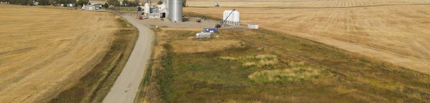
PART 2
Coordinated Growth Management Strategy

2.1 Plan Area
The Intermunicipal Development Plan Area (also referred to as the IDP Area or Plan Area) consists of
approximately 12,963 acres (5,246 ha) and is illustrated on Map 2. Land Use and Transportation Concepts have
been developed for the Plan Area to efficiently manage growth and assist decision makers in the review of
subdivision and development proposals by identifying general locations for future land uses and major
transportation routes and road linkages.

2.2 Background
The Intermunicipal Development Plan Area is located in the northern portion of Vulcan County, bounded by
the Siksika Nation to the north. The Village is located approximately 136 kilometers southeast of Calgary and
approximately 46 kilometers northeast of the Town of Vulcan. The primary roadways near Milo include
Highway 542 and 842, in addition to Range Road 234 (Buffalo Hills/Marshall Road), which is commonly travelled
by residents living in the vicinity travelling between Arrowwood and Milo.

Agriculture is the primary land use within the region, including a variety of crop and livestock production. Class
2 through 5 soils, based on the Canada Land Inventory (CLI) soil capability index are found within the Plan Area
(Map 6). A significant portion of land within the Plan Area consists of agricultural use which includes primarily
dryland farming with minimal irrigation in the area. The other notable characteristic within the Plan Area is
Lake McGregor Reservoir (Lake McGregor) which is situated in the southwest portion of the Plan Area and has
attracted country residential and rural recreational development along the northern portion of the lake,
including the proposed Crystal Blue Harbour development and the existing Milo/Lakeview Estates community
(see Map 4). Other country residential developments within the Reservoir Area Structure Plan (2020) exists
outside of the Plan Area, and is depicted on Map 5.

The opportunity presented by the waterbody also comes with the responsibility to manage land use
appropriately. Water from the three system reservoir is managed and allocated by Alberta Environment &
Parks and the Bow River Irrigation District (BRID). BRID’s infrastructure provides water to the Village of Milo,
as well as other downstream municipalities. To find balance between the Lake’s primary water supply function,
while preserving habitat and biodiversity, proposed recreational and residential land uses must be carefully
evaluated for suitability. Bank erosion, particularly acute on the east side of the Lake’s north end as a result of
strong winds and ice accumulation, has been recently comprehensively evaluated in the McGregor Reservoir
Shoreline Erosion Study (Alberta Environment and Sustainable Resources, May 2014 Report Number 13‐1326‐0034)
and must be a consideration in the review of subdivision and development proposals.

 Vulcan County and Village of Milo
 Intermunicipal Development Plan Bylaw No. ____ and Bylaw No. ____                                                6
There were a total of 13 County subdivisions approved within the Plan Area between 1985 and 2019,
predominantly for country residential development. Restrictions to potential growth and development
identified in the Plan Area include seasonal drainage courses, wetland areas, and oil and gas wells. The Village’s
sewage lagoon, new waste transfer station and old land fill site restrict the development of residences, schools,
hospitals, and food establishments within 300 metres. Historically, the Village has had three annexations since
its incorporation, the most recent of which occurred in 2009 resulting in the Village acquiring 114.04 acres
(46.15 ha) of land. In addition, land adjacent to Village on the NE 31‐18‐21 W4M is a possible annexation that
is being considered by the Village.

2.3 General Plan Policies
Intent
         These general policies are applicable to all lands within the Plan Area (Map 2) and are intended to
         enable the implementation of an effective coordinated growth management strategy but it is
         recognized that applications or proposals may be submitted by landowners or developers that are not
         be specifically addressed through the IDP policies. In such situations, the two municipalities should
         consult and determine if the proposal is reasonable or not, or if amendments to the IDP may be needed
         to enable the proposal to proceed if supported by both the County and the Village.

Policies
2.3.1    Existing land uses with valid development permits issued on or before the date of adoption of this Plan
         may continue to operate in accordance with the provisions of the Vulcan County Land Use Bylaw,
         Village of Milo Land Use Bylaw and the Municipal Government Act, as applicable. New applications for
         subdivision and development on these lands are subject to this Plan’s policies.

2.3.2    The County and Village shall consider further intermunicipal cooperation and integration of land use
         planning with engineering, servicing, and utility studies in order to help both municipalities achieve
         greater efficiencies and provide better services to residents and businesses.

2.3.3    Any application submitted for redesignation of land under the County’s jurisdiction may be required
         to be accompanied by a professionally prepared Area Structure Plan containing the information
         requirements as prescribed in the Vulcan County Land Use Bylaw and Municipal Development Plan.

2.3.4    The required plans, design schemes or other reports in support of major subdivisions/developments
         must be professionally prepared and engineered.

2.3.5    The County and Village agree to encourage responsible development within the Intermunicipal Plan
         Area by ensuring that decisions regarding land use are made with the best information available as
         some areas are more appropriate to locate specific developments than others due to environmental

                                                                              Vulcan County and Village of Milo
  7                                          Intermunicipal Development Plan Bylaw No. ____ and Bylaw No. ____
constraints, shoreline erosion and potential flooding, ease of servicing, legal and physical access and
compatibility with adjacent land uses.
2.3.6 The County and Village agree to encourage, through various initiatives including working with private
landowners and community groups, and regulate, through their respective Land Use Bylaws, a high
aesthetic standard and focus on design and appearance for the lands (including the built form and the
landscape) adjacent to the principal roadway corridors entering and leaving the Village (see Map 2).
For clarity, this policy is intended to help create a physical environment that will leave visitors to the
Village and surrounding region with a positive impression of the community.
2.3.7 Each municipality will be responsible for making decisions within their own respective municipal
boundaries, having regard for the IDP policies and the guiding principles of collaboration and
consensus making.
2.4 Agricultural Practices
Intent
Agricultural activities are to continue to operate under acceptable farming practices within the Intermunicipal
Development Plan boundary. The County and Village both recognize that it is the jurisdiction of the Natural
Resources Conservation Board (NRCB) to grant approvals and regulate confined feeding operations (CFOs),
which are defined in the Agricultural Operations Practises Act along with a threshold for when an approval is
required in the Part 2 Matters Regulation. However, both municipalities agree it is desirable to specifically
regulate intensive agricultural operations in an attempt to minimize potential nuisance and conflict between
land uses, especially residential, and CFOs within close proximity to the Village. The County currently has policy
in their Municipal Development Plan which excludes the development of CFO’s on lands near waterbodies,
water courses and urban settlement.
Policies
2.4.1 Priority is placed on the preservation of arable lands for agriculture production and promoting
diversification of the agricultural sector by supporting many types of agricultural operations.
Premature development of existing agriculture lands within the Plan Area should be avoided and such
lands should continue to be used for agricultural purposes until it is necessary to change to another
use.
2.4.2 Both municipalities recognize the importance of existing extensive agricultural (cultivation and
grazing) uses of land within the Plan Area of the County’s portion of the Intermunicipal Development
Plan Area. These agricultural activities can continue to operate under acceptable farming practices
and may be protected provided they are operating in accordance with the Agricultural Operation
Practices Act.
Vulcan County and Village of Milo
Intermunicipal Development Plan Bylaw No. ____ and Bylaw No. ____ 82.4.3 Both municipalities will work cooperatively in encouraging and supporting ‘considerate’ good
neighbour farming practices, such as for dust, weed, and insect control adjacent to developed areas,
through best management practices and Alberta Agriculture guidelines.
2.4.4 If disputes or complaints in either municipality should arise between citizens and agricultural
operators, the municipality receiving the complaint will attempt to direct the affected parties to the
appropriate agency, government department or municipality for consultation or resolution, wherever
possible.
2.4.5 New confined feeding operations (CFOs) and expansions are not permitted to be established within
the combined existing Confined Feeding Exclusion Area and the Milo Intermunicipal Development Plan
Confined Feeding Exclusion Area (Map 3).
2.4.6 Vulcan County will amend its Municipal Development Plan to extend the CFO Exclusion Area
surrounding the Village of Milo to the extent illustrated in Map 3 (in order to ensure the IDP and the
County MDP are consistent with one another).
2.4.7 In regard to manure application on lands in the CFO Exclusion Area, the standards and procedures as
outlined in the Agricultural Operation Practices Act, Standards and Administration Regulation shall be
applied.
2.5 Future Land Use
Intent
To address the matter of future land use within the Plan Area, possible expansion areas for have been identified
in (Map 4 and a regional development concept is depicted in Map 5. The following policies will direct future
growth and development of both municipalities.
Policies
2.5.1 Future land use within the Plan Area will continue to be primarily for extensive agriculture, with the
exception of the potential future urban growth areas depicted generally on Map 4. This does not
preclude the establishment of non‐agricultural land uses within the Plan Area. Decisions on
applications for non‐agricultural land uses shall be made in the context of the policies of this Plan and
other relevant planning documents.
2.5.2 The future growth areas illustrated on Map 4 and Map 5 establish, generally, the location of potential
urban expansions areas within the Plan Area. The boundaries of the future growth areas on Map 4
are general approximations and are not intended to be exact boundaries.
Vulcan County and Village of Milo
9 Intermunicipal Development Plan Bylaw No. ____ and Bylaw No. ____2.5.3 The Village sewer lagoons and the regional waster transfer site are situated within the W ½ 5‐19‐21‐
W4M in Vulcan County and a non‐operating landfill site is located in SW ¼ 6‐19‐21 W4M. Both
municipalities shall consider the following required provincial setbacks to these facilities when making
decisions on subdivision and development proposals in the area:
(a) In accordance with Sections 12 and 13 of the Subdivision and Development Regulation, a
subdivision authority shall not approve an application for the subdivision for a school, hospital,
food establishment or residential use if the application would result in a property line of a lot
created by subdivision for any of those uses being located within 300 metres of an operating
wastewater treatment plant, an operating transfer site or non‐operating landfill site.
(b) In accordance with Sections 12 and 13 of the Subdivision and Development Regulation, a
development authority shall not issue a development permit for a school, hospital, food
establishment or residential use if the building site is located within 300 metres of an operating
wastewater treatment plant, an operating transfer site or non‐operating landfill site.
2.5.4 Any discretionary uses approved by the County within the Plan Area should be compatible with
adjacent land uses and the Intermunicipal Development Plan Future Land Use Concept (refer to Map
4).
Residential Development
2.5.5 Residential subdivision applications will be required to demonstrate consistency with the intent of the
Future Land Use concept (Map 4). Proposals for subdivision that are not consistent with the Future
Growth Directions and land use concept may be considered on a case‐by‐case basis upon consultation
with the Village of Milo.
2.5.6 Residential developments are encouraged to incorporate architectural controls or other tools in order
to establish and maintain high quality, attractive residential communities that help promote the area
as a destination for permanent and seasonal residents.
2.5.7 Land immediately to the west and south of the current Village boundary, in the W ½ 36‐18‐22 W4M
and the S ½ 31‐18‐21 W4M, is identified as a suitable location for future Village residential growth,
when required, due to the likely ease of providing municipal servicing. This area would be primarily
urban residential land use in conjunction with the associated public uses needed by an urban
community (i.e. parks, recreation and institutional uses).
2.5.8 Vulcan County has approved the Crystal Blue Habour Area Structure Plan, located in the NW ¼ 26‐18‐
22 W4M and SW ¼ 26‐18‐22 W4M, which proposes recreational residential development on 220 acres
of land within the Plan Area. Both Municipalities acknowledge the potential impacts and benefits of
the development and should continue to work collaboratively to ensure the best outcome to the
project.
2.5.9 Vulcan County shall require the proponent/developer for both smaller multi‐lot subdivisions (3 to
10 lots) and major large‐scale developments within the Plan Area to prepare an Area Structure Plan
Vulcan County and Village of Milo
Intermunicipal Development Plan Bylaw No. ____ and Bylaw No. ____ 10that demonstrates good planning, appropriate servicing and appropriate access to service the
development.
2.5.10 The minimum lot size for a privately serviced country residential lot shall be 0.8 ha (2 acres) in size
within the Plan Area.
2.5.11 Proposals for subdivision of existing county residential lots in either Milo Estates or Lakeview Estates
within the Plan Area shall meet the minimum 0.8 ha (2.0 acre) parcel size, for both the proposed and
residual lot, and shall demonstrate that on‐site sewage disposal can be accommodated in accordance
with the current Private Sewage Treatment Systems Code of Practice and Regulation for all lots
affected by the subdivision.
2.5.12 The municipalities recognize the notion of a country residential corridor along the lakeshore areas
from Milo Estates in the N ½ 25‐18‐22 W4M, to as far south as Sunset Marks in SE ¼ 32‐17‐21 W4M
(outside of the Plan Area) and developments even further south (Map 5). The potential opportunities
and challenges brought about by a semi‐contiguous linear corridor along the lakeshore include matters
like efficiency in utility servicing and transportation (including vehicular and non‐motorized trails), as
well as issues like habitat disruption and bank erosion. The municipalities agree to monitor this matter
as part of the ongoing management of the Plan Area and in the context of broader intermunicipal
issues and opportunities.
Commercial and Industrial Development
2.5.13 Non‐residential subdivision applications will be required to demonstrate consistency with the intent
of the Future Growth Directions concept (Map 4). Proposals for subdivision that are not consistent
with the Future Growth Directions and land use concept may be considered on a case‐by‐case basis
upon consultation with the Village of Milo.
2.5.14 Generally, future commercial and industrial developments are viewed as more appropriately located
within the Village in order to retain the primarily agricultural and residential nature of the Plan Area.
However, complimentary commercial and industrial developments may be directed to be located
within the E ½ 31‐18‐21 W4M, especially those developments that would benefit from the close
proximity to an urban centre.
2.5.15 The County should not approve isolated heavy industrial uses, as defined in the Vulcan County Land
Use Bylaw, that are likely to generate unsightly conditions, noise, odour, or other emissions, to the
west and south of Milo due to factors such as the prevalent wind patterns, proximity to urban uses,
and the location of future residential and recreational uses.
Recreational Development
2.5.16 The opportunity for future recreational oriented development in the Plan Area may be viewed as
appropriate due to the recreational nature and opportunities provided by Lake McGregor.
Vulcan County and Village of Milo
11 Intermunicipal Development Plan Bylaw No. ____ and Bylaw No. ____2.5.17 The opportunity for future recreational/commercial (ie. campgrounds) in the Plan Area may be
supported where it has been demonstrated that the development has been located such that
environmental impacts can be mitigated and that appropriate servicing is in place to support the
development.
2.5.18 The municipalities shall continue to work collaboratively to encourage the development of a marina
or boat launch area that services the north end of Lake McGregor to promote safety and recreational
opportunities.
2.5.19 The municipalities should continue to monitor the status of the provincial recreation area, including
the campground, in the E ½ 35‐19‐22 W4M and explore opportunities to work together to enhance
and promote the area for recreation.
2.6 Transportation
Intent
Policies are intended to foster enhanced coordination in the provision of linked road networks to ensure that
these roads are functional, compatible and logical in order to facilitate orderly and planned growth that does
not compromise future development.
Policies
2.6.1 The future roadway system in close proximity to the Village should be an extension of the existing grid
pattern system within the Village and will need to be defined in more detail at the Area Structure Plan
and subdivision stage. Where logical road grid extensions corridors are identified they shall be
preserved to ensure they are available when needed in the future. Subdivision and development
applications shall be required to demonstrate that their proposal will not compromise the integrity of
the future roadway system.
2.6.2 The County may require dedication of road right‐of‐way on the final plan of subdivision for any
proposal located 0.5 miles (0.8 km) or closer to the Village boundary.
2.6.3 If road dedication is a condition of subdivision approval, the landowner or developer will be required
to enter into a development agreement for road construction and associated costs.
2.6.4 Road construction may be deferred to a later subdivision or development stage subject to a deferred
servicing/development agreement with either the County or Village as applicable.
2.6.5 Each municipality must be notified of any development or subdivision proposal in the other
municipality that will result in access being required from an adjoining road under its control or
management.
Vulcan County and Village of Milo
Intermunicipal Development Plan Bylaw No. ____ and Bylaw No. ____ 122.6.6 Both municipalities recognize the need to coordinate regional and provincial transportation plans and
municipal land use plans to ensure proper planning of development adjacent to highways of provincial
interest.
2.6.7 The County and Village will consult with Alberta Transportation regarding the implementation of this
Plan. A developer/landowner may be required to conduct traffic studies with respect to impact and
access onto Highway 542 or 842 and any upgrading identified by traffic studies will be implemented
at the sole cost of the developer/landowner and to the satisfaction of Alberta Transportation.
2.6.8 With respect to future growth and development for the Plan Area, it is recognized that no additional
direct access to Highway 542 or 842 will be permitted without the authorization of Alberta
Transportation. Any additional proposed new road access linkages shall be determined in consultation
with the provincial department with consideration for the need of preparing an Area Structure Plan
and a Traffic Impact Assessment (TIA).
2.6.9 Isolated industrial/commercial uses or multi‐lot residential developments will be reviewed on a case‐
by‐case basis in consultation with Alberta Transportation at the time of development to determine
potential highway impacts, and any required intersection upgrades or improvements that may be
required shall be provided at the sole cost of the developer/landowner.
2.6.10 The County and Village recognize the Buffalo Hills / Marshall Road (Range Road 234) as an important
transportation linkage to the Plan Area. The municipalities shall have regard for the regional
significance of this roadway, providing connection between the Village of Milo and regional
destinations, and should explore partnering to create a strategy for the upgrade and maintenance of
the road.
2.6.11 The intersection of Highway 542 and Range Roads 214 and 215 (respectively) may be subject to future
upgrades/improvements when warranted by the Traffic Impact Assessment (TIA) as the area further
develops out. This will be determined in consideration of the findings and recommendations as
identified in a professionally engineered Traffic Impact Assessment with respect to Policy 2.6.8, or
upon the direction or request of Alberta Transportation (Map 5).
2.6.12 The County and Village recognize the importance of connecting recreational developments in the Plan
Area to the Village and both municipalities should continue to support an expanded trail system within
the Plan Area.
2.7 Environmental & Historical Matters
Intent
Policies in this section address the shared concerns of both municipalities regarding the natural environment
and suggests ways to address the concerns.
Vulcan County and Village of Milo
13 Intermunicipal Development Plan Bylaw No. ____ and Bylaw No. ____Policies
2.7.1 The County and Village recognize the importance of riparian areas and their preservation as part of
the planning and development approval process. Each municipality shall consider if an environmental
impact assessment is needed to make a decision on a development application and shall consider the
recommendations in the Stepping Back from the Water: A Beneficial Practice Guide to New
Development Near Water Bodies in Alberta’s Settled Region (2012) and the Reservoir Lands Guideline
(2005) documents.
2.7.2 The municipalities recognize the importance of wetlands to the environment, society and the
economy, and endeavor to protect sensitive areas by adhering to the Alberta Wetland Policies
mitigation hierarchy of avoidance, minimization and replacement. Where lands are likely to contain
wetlands, a wetland assessment shall be required prior to a decision being made on a development
application.
2.7.3 Both municipalities recognize they may request the dedication of environmental reserve or an
environmental reserve easement for the protection of watercourses, natural drainage courses,
wetland areas and other areas where deemed applicable within the Plan Area, as the Municipal
Government Act authorizes that a municipality may request:
(a) the dedication of a minimum 6‐metre strip abutting a water course; and
(b) the dedication of lands consisting of a swamp, gully ravine, coulee or natural drainage course;
and
(c) the dedication of land that is subject to flooding or is unstable.
2.7.4 Prior to any rezoning, subdivision or development approval, consideration shall be given to the
McGregor Reservoir Shoreline Erosion Study (Alberta Environment and Sustainable Resources, May 2014
Report Number 13‐1326‐0034) to ensure that lands proposed to be developed are either not identified
as affected by shoreline erosion or that a plan to address erosion is prepared in support of the
development.
2.7.5 Both municipalities agree to encourage low impact development practices and sustainable design
measures, including initiatives like green roofs, bio‐retention areas, porous pavement, water re‐use,
bio‐swales, naturalized storm ponds and other initiatives in order to reduce storm water quantity and
achieve positive environmental outcomes.
2.7.6 Developers undertaking subdivision or development in either municipal jurisdiction are required to
address storm water drainage management as part of their proposal, and are responsible for obtaining
any necessary approvals from Alberta Environment and Parks that may be required with respect to
the provincial Water Act or Environmental Enhancement & Protection Act.
2.7.7 Each municipality is responsible for referring subdivision and development applications to the Alberta
Director of Culture and Tourism for the province as required under applicable provincial legislation.
On any lands identified as a site of a potential historic resource, the developer shall be responsible at
Vulcan County and Village of Milo
Intermunicipal Development Plan Bylaw No. ____ and Bylaw No. ____ 14their expense of undertaking any required archeological or paleontological study or complying with an
order of Alberta Culture and Tourism and obtaining any necessary clearances and approvals as it
relates to their proposal and compliance with the Historic Resources Act (HRA).
2.8 Utilities & Servicing
Intent
Both municipalities desire quality development with consistent, efficient and acceptable servicing standards
that account for and manage cumulative impacts.
Policies
2.8.1 Both municipalities recognize the importance of efficient provision of utilities and services and agree
to coordinate, wherever possible, to determine appropriate locations and alignments of any utility or
servicing infrastructure required to serve a proposed subdivision or development within the Plan Area.
2.8.2 Proposed subdivision or development in the Plan Area may benefit from a sharing of municipal services
from the Village. Where urban services are proposed by a developer, an agreement must be discussed
between the Village and the County prior to an application being deemed complete. It is
acknowledged that, although these circumstances may arise and benefit all parties concerned:
(a) the Village of Milo is not committed to providing any new services outside the Village boundaries,
and
(b) Vulcan County will not approve any application requiring urban services until a servicing
agreement has been negotiated with the Village on the developer’s behalf.
2.8.3 Both municipalities agree in principle that existing and future developments outside of the Village that
receive the benefit of Village services through the Village distribution network should be required to
pay toward the use of Village facilities. This payment could come in the form of a one‐time lump sum,
a rate surcharge, or any other acceptable form of remuneration.
2.8.4 Information for major servicing infrastructure proposed by one municipality shall be provided to the
other municipality to allow for collaboration and coordinated planning.
2.8.5 Prior to any subdivision or development approval which proposes the use of municipal water or sewer
under the adjacent municipality’s control or management, the developer/landowner must obtain
approval in writing from the applicable municipality regarding the use of such infrastructure to serve
the development or subdivision.
2.8.6 When municipal water and wastewater services are proposed for lands outside the Village of Milo:
Vulcan County and Village of Milo
15 Intermunicipal Development Plan Bylaw No. ____ and Bylaw No. ____(a) it is the responsibility of the developer/landowner to enter into an agreement with the
municipality that has jurisdiction for the decision. Any costs associated with connecting to
municipal water and wastewater, including extending waterlines and installing associated
infrastructure will be defined in the agreement and typically will be at the expense of the
developer/landowner;
(b) the location of the required infrastructure to provide those services may be approved by the
County based on discussions and negotiations between the County, the Village and the
developer/landowner; and
(c) where municipal water or wastewater services have been extended into the County, the
agreement for services between the two municipalities will stipulate the method to collect user
fees.
2.8.7 When municipal water and wastewater services are available to service any proposed subdivision or
development, the developer/landowner may be required to connect to such services.
2.8.8 If a private sewage system is proposed to serve a subdivision in Vulcan County within the Plan Area,
the development/landowner shall be required to undertake a professional soil test/analysis and report
prior to a decision being made on the application in order to determine the cumulative impact and
site suitability of the private sewage system and to ensure that any applicable provincial and municipal
regulations can be met.
2.8.9 Both the County and Village acknowledge that the use of a holding tank system, for private wastewater
management, is not a self‐sustaining method of waste disposal as it relies on the availability of an
approved offsite wastewater treatment facility. In an effort to reduce the potential load on the
Village’s municipal infrastructure, the use of holding tanks within the Plan Area will be generally
discouraged and only considered in cases where the volume of daily waste produced is considered low
and/or if no other reasonable alternative is available.
2.8.10 Where both municipalities agree that Village services will be provided within the Plan Area, the County
and Village should negotiate an agreement regarding the sharing of potential revenues and
expenditures related to the proposed subdivision or development.
2.8.11 The County and Village recognize that there may be areas of mutual opportunity and benefit in the
provision of municipal infrastructure and other services and agree to discuss in good faith these
opportunities as they may arise.
2.8.12 As the County and Village are required to negotiate and enter into an Intermunicipal Collaborative
Framework (ICF) regarding the delivery of services, both parties recognize that the provision of
municipal services, including water and sewer, may be generally addressed through the ICF but the
specific details and terms are preferred to be provided through a separate agreement.
2.8.13 In respect of previous policy 2.8.10, if the County and Village experience difficulty on agreeing to the
terms of a separate agreement that relates to the provision of municipal services from one
Vulcan County and Village of Milo
Intermunicipal Development Plan Bylaw No. ____ and Bylaw No. ____ 16municipality to the other, the mediation and arbitration process as outlined in the Intermunicipal
Collaborative Framework (ICF) shall be followed.
2.9 Growth and Annexation
Intent
In order to allow for the planning and installing of costly infrastructure, the County and Village have identified
potential growth areas for both municipalities (Map 4 & 5). Future annexation of any of these lands will occur
in the framework and context of long‐range planning documents and in consultation with the County.
Policies
Vulcan County Growth
2.9.1 Vulcan County recognizes the growth pressures for residential and recreational properties in proximity
to lakeshore areas within the municipality and has identified the potential for additional development
that is complementary with the existing development, specifically within the vicinity of the north shore
of Lake McGregor within the Plan Area.
2.9.2 Vulcan County has the potential to develop further residential or recreational development along the
shores of Lake McGregor and have adopted the Reservoir Area Structure Plan (Vulcan County, Bylaw
No. 2020‐15) to support orderly development.
2.9.3 The densities for future proposed grouped country residential developments within the Plan Area
should be determined by Vulcan County at the area structure plan and/or reclassification stage, in
consultation with the Village, and should be based on the method of sewage disposal and water
supply. Higher densities will only be permitted in areas that have demonstrated the ability to
accommodate the required servicing capacity.
2.9.4 No development shall be allowed on a parcel that is not large enough to support any required on‐site
water supply and sewage disposal systems to the required standard and every development shall be
required to install sewage disposal systems which have been approved by the authority having
jurisdiction.
Village Growth
2.9.5 The County and Village will attempt to protect potential growth areas identified in Map 4 by the Village
from conflicting or incompatible land uses and premature fragmentation.
2.9.6 The Future Growth Directions concept illustrated on Map 4 establishes, generally, the preferred Village
growth areas within the Plan Area based on existing, topography, and availability of services. The
Vulcan County and Village of Milo
17 Intermunicipal Development Plan Bylaw No. ____ and Bylaw No. ____future land uses will need to be more fully defined and planned through additional planning and
engineering studies for the area when required.
2.9.7 The Village of Milo has adopted a Municipal Development Plan (MDP) as required by the province, and
the Village will attempt to implement the future growth and development strategies as outlined in the
MDP as best it can prior to commencing an annexation process, unless unique circumstances present
themselves in which earlier annexation is viewed as necessary.
2.9.8 As an alternative to annexation, the County and Village agree to discuss potential joint ventures in the
form of Joint Development Areas. These Joint Development Areas will have a defined project location
subject to a cost and revenue sharing agreement, be negotiated in good faith, and will include co‐
operative cost and revenue sharing to the benefit of both municipalities.
2.9.9 Any agreed to Joint Development Areas will be discussed and planned in good faith by both
municipalities, with consideration for the servicing matters and policies outlined in this Plan, the
provision of a separate servicing agreement which addresses expenditure and revenue sharing, and
the framework for the delivery of municipal services and dispute resolution process as stipulated in
the adopted Intermunicipal Collaborative Framework (ICF).
Village Annexation
2.9.10 When the Village determines that annexation of land is necessary to accommodate growth, it will
prepare and share with the County a growth strategy/study which indicates the necessity of the land,
describes how land has been utilized to its fullest potential within the Village, outlines proposed uses
of the land, servicing implications, and any identified financial impacts to both municipalities, while
addressing the Municipal Government Board’s “Annexation Principles” and demonstrating consistency
with the relevant portions of the South Saskatchewan Regional Plan.
2.9.11 Annexation involves a number of stakeholders that need to be involved in the process including:
(a) land owners directly affected by the application must be part of the negotiation process;
(b) Village of Milo, who must make the detailed case for annexation and be a major participant in
any negotiations;
(c) Vulcan County, who must evaluate the annexation application and supporting documentation for
the impact on its financial status and land base as well as ratepayer issues. The County will, as
part of the negotiation with ratepayers, wish to see arrangements regarding, but not limited to:
property taxes of ratepayers,
use of land continuing as agriculture until needed for development,
ability to keep certain animals on site;
(d) authorities such as Alberta Transportation and Alberta Environment and Parks; and
(e) the Municipal Government Board, who will evaluate the application and responses from the
stakeholders.
Vulcan County and Village of Milo
Intermunicipal Development Plan Bylaw No. ____ and Bylaw No. ____ 182.9.12 Annexation boundaries shall follow legal boundaries and natural features to avoid creating fragmented
patterns of municipal jurisdiction.
2.9.13 Notwithstanding Policy 2.9.12 above, the County or Village may initiate an application for annexation
if the proposal is for a minor boundary adjustment to accommodate existing title property line
reconfigurations, roads, canals, or utility rights‐of‐way that may be split by municipal jurisdiction
boundaries and the two municipalities agree the annexation proposed is minor and logical.
2.9.14 Within one‐year after a Municipal Government Board Order approving an annexation, the
Intermunicipal Development Plan Committee shall review the IDP boundary to determine whether a
need to amend the Plan boundary, or any other planning matter or boundary, is warranted.
Vulcan County and Village of Milo
19 Intermunicipal Development Plan Bylaw No. ____ and Bylaw No. ____PART 3 Plan Implementation
PART 3
Plan Implementation
3.1 Plan Validity & Amendment
Intent
The intent is to keep the Plan current and in conformity with any provincial regulations or initiatives. As a
result, this Plan may require amendments when necessary.
Policies
3.1.1 This Plan comes into effect on the date it is adopted by both the County and Village. It remains in
effect until by mutual agreement of both municipalities it is replaced. In respect of this:
(a) either municipality may request that the Plan be repealed and replaced with a new IDP upon
serving written notice to the other municipality; and
(b) the dispute resolution process stipulated in Part 7 will be undertaken should the municipalities
be unable to reach an agreement.
3.1.2 Amendments to this Plan may be necessary from time to time to accommodate agreed to updates or
changes and/or unforeseen situations not specifically addressed in the Plan; any amendments must
be adopted by both Councils using the procedures established in the Municipal Government Act. No
amendment shall come into force until such time as both municipalities adopt the amending bylaw.
3.1.3 Requests for amendments to this Plan, by parties other than the County or Village, may be made to
the municipality in which the request originated and be accompanied by the applicable fee to each
municipality for processing amendments to a statutory plan.
3.1.4 If agreed to by both municipalities, a joint public hearing may be held in accordance with the Municipal
Government Act for any amendments to this Plan.
3.1.5 The Plan Area is hereby established as depicted on Map 2. The geographical or relative boundaries of
any variable presented on the maps contained in this Plan, with the exception of the boundaries of
the Plan Area, shall be interpreted as an approximation and not an exact depiction of its actual or full
extent.
3.1.6 Municipal staff are encouraged to meet annually to review the policies of the Plan and discuss land
use planning matters, issues and concerns on an ongoing basis. Municipal staff may make
recommendations to be considered by their respective Councils to amend the Plan to ensure the
Vulcan County and Village of Milo
Intermunicipal Development Plan Bylaw No. ____ and Bylaw No. ____ 21policies remain relevant and continue to meet the needs and protect the interests of both
municipalities.
3.1.7 A formal review of the Plan will occur within 10 years from the date the IDP is adopted by both
municipalities.
3.2 Intermunicipal Referrals
Intent
To establish a process for consistent and transparent sharing of information necessary to make decisions in
accordance with the intent of the Plan.
Policies
Referral Process
3.2.1 Any of the following that affect lands within the Plan Area or land within the Village of Milo adjacent
to the corporate boundary will be forwarded to the other municipality for comment prior to a decision
being made on the application or document:
Municipal Development Plans
Area Structure Plans and/or Area Redevelopment Plans
Conceptual Design Schemes and Overlay Plans
Land Use Bylaws (new or any amendments that affect/apply to the Plan Area)
Subdivision Applications
Discretionary Use Development Applications
The receiving municipality may request the above‐mentioned document(s) or application(s) be
referred to the Intermunicipal Development Plan Committee for comment prior to a decision being
rendered.
3.2.2 Any changes to the documents or applications referred to in Policy 3.2.1 that may have an impact on
the Plan or municipal expansion will be recirculated to the other municipality and if deemed necessary
by either municipality, the Intermunicipal Development Plan Committee prior to second reading or
approval of the document. Based on the significance of the changes, the municipality processing the
proposal will consider convening a new public hearing or meeting.
3.2.3 The municipalities are encouraged to refer to each other for comment on major land use or planning
matters that have the potential to impact the other jurisdiction, even if it involves lands that may not
be located within the Plan Area.
3.2.4 Where an intermunicipal referral is required by the Municipal Government Act or the policies
contained in this Plan, both municipalities agree to share mailing address and property ownership
Vulcan County and Village of Milo
22 Intermunicipal Development Plan Bylaw No. ____ and Bylaw No. ____You can also read