JURONG Heritage trail - National Heritage Board
←
→
Page content transcription
If your browser does not render page correctly, please read the page content below
The Jurong Heritage Trail is part of the National Heritage Board’s ongoing efforts     » discover our shared heritage

                                                                                       JURONG
to document and present the history and social memories of places in Singapore.
We hope this trail will bring back fond memories for those who have worked, lived
or played in the area, and serve as a useful source of information for new residents

                                                                                       Heritage Trail
and visitors.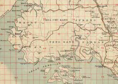
» ContentS                                                                  » AREA MAP of
Early History of Jurong
Historical extent of Jurong
                                                                    p. 2
                                                                            Jurong
                                                                            Heritage Trail
The Orang Laut and early trade routes
Early accounts of Jurong
The gambier pioneers: opening up the interior
Evolution of land use in Jurong
Growth of Communities
Villages and social life
                                                                    p. 18
                                                                            MARKED HERITAGE SITES
Navigating Jurong
Beginnings of industry: brickworks and dragon kilns                         1.   “60 stalls” (六十档) at Yung Sheng Road and “Market I”
Early educational institutions: village schools, new town schools
and Nanyang University                                                      2. 	Around the Jurong River
Tide of Change: World War II                                        p. 30
101 Special Training School                                                 3.   Former Jurong Drive-In Cinema
Kranji-Jurong Defence Line
Backbone of the Nation: Jurong in the Singapore Story               p. 35
                                                                            4. 	Science Centre Singapore
Industrialisation, Jurong and the making of modern Singapore
Goh’s folly?
Housing and building a liveable Jurong                                      5.   Former Jurong Town Hall
Heritage Sites in Jurong                                            p. 44
Hawker centres in Jurong                                                    6.   Jurong Railway
Hong Kah Village
Chew Boon Lay and the Peng Kang area                                        7. 	Pandan Reservoir
SAFTI
Former Jurong Town Hall
Jurong Port
                                                                            8. Jurong Hill
Jurong Shipyard
Jurong Fishery Port                                                         9.   Jurong Port and Shipyard
The Jurong Railway
Jurong and Singapore’s waste management                                     10. 	SAFTI
Jurong Lake
Chinese Garden and Japanese Garden                                          11.	THE ORIGINS OF PENG KANG AND BOON LAY
Jurong Hill
Jurong Bird Park
Pandan Reservoir and Sungei Pandan                                          12. Hong Kah Village
Former Jurong Drive-In Cinema
Former Tang Dynasty City
Science Centre Singapore
Religious Institutions in Jurong                                    p. 67
Masjid Hasanah
Tong Whye Temple
Tuas Tua Pek Kong Temple
Arulmigu Murugan Temple
Church of St Francis of Assisi
Our Museum @ Taman Jurong                                           p. 71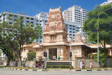
1

Introduction

F
     ar. Industrial. These are two of the more      when Jurong was the koo chye (Chinese chive)
     common responses that the mention of           capital of Singapore.
     Jurong elicits from Singaporeans. Others
may remember factories, ports and shipyards         There was also the storied area of Tanjong
that they or a relative worked at, with industry    Balai, today part of Jurong Port but previously a
changing the lives of families and mirroring        millionaire’s estate, a spy and guerrilla training
the wider national picture. Some will always        camp, where the Japanese military attempted
associate with Jurong the smell of roasted          to build a submarine base and the site of
cocoa, wafting to Boon Lay Bus Interchange          one of the first beauty contests in Singapore
from chocolate factories nearby. Those serving      and Malaysia. The traffic jams caused by the
National Service or working in the military         former Nanyang University’s opening, a day
recall being challenged physically and mentally     Jurong old-timers still recollect easily.
in camps in Jurong, including the seemingly
endless charges up the merciless, almost            The industrial story too, presents a fascinating
legendary Peng Kang Hill.                           canvas of social histories. Many know that the
                                                    Jurong Industrial Estate was initially considered
While its transformation into one of the            to be such a gamble that it was labelled Goh’s
most significant industrial towns in Asia is        Folly, after its mastermind Dr Goh Keng Swee.
undoubtedly the area’s most familiar face,          Less well-known are the myriad, inventive
there are many more facets of history, culture      ways Dr Goh engineered to ensure the survival
and heritage that make up the Jurong story.         of the industrial estate, including the threat of
                                                    a tollgate to persuade workers to live in Jurong.
There’s the ancient maritime trade route that
wound through the waters off Pulau Samulun,         These are the stories, personal memories and
today part of Jurong Shipyard. What is now          narratives presented in this Jurong Heritage
Jurong Island was a maze of island hideouts, to     Trail booklet. They serve to shine a light on
which pirates would disappear into after raids      the way people lived, worked and played
on passing vessels. And then there were the         in the area, and shaped it in their individual
gambier pioneers in the early years of the 1800s,   ways. Through the sites highlighted in this
paving the way for large-scale settlement           trail, explore the legacies of old Jurong and
in Jurong even as they permanently altered          and immerse yourself in the tales of this ever
its natural environment. The kampong days           evolving town.
2
» our heritage
Early history
of Jurong
Historical extent of Jurong in official maps. In a 1911 map, the area marked
L
as Jurong is only a fraction of the locale we know
ike a number of other places in Singapore,
today, bounded by Jurong Road in the south,
the boundaries of Jurong have shifted
Choa Chu Kang in the north and west, and Bukit
with time, land use and ownership. The
Timah Road in the east. However, community
areas that we know today as Jurong West and
leader Ng Lee Kar (b. 1904), who lived in the
Boon Lay were once Peng Kang, while Jurong
area from the 1920s, remembered the extent of
itself was a smaller slice of land between Peng
Jurong differently:
Kang and Bukit Timah, roughly where Bukit
Batok is today. What is now Jurong Island
“Jurong, as I know, is bounded by Bukit Timah
was a cluster of small islands that guarded
Road — so called seven miles (7th milestone).
a significant sailing trade route and housed
Orang Laut and Malay villages long before Sir The extended road beyond 7 miles is called
Stamford Raffles landed in 1819. Jurong. From that road leading to the sea,
and even to Pasir Laba, opposite Johor, is also
The space that Jurong occupies in the public called Jurong. Jurong encompasses a very
psyche too has defied the boundaries laid down broad boundary.”
Courtesy of Great Britain, War Office, National Library of Australia, G080401936
Jurong and its surrounding areas in a 1911 map of Singapore.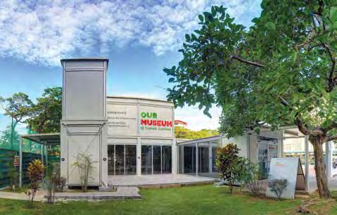
Courtesy of Singapore Land Authority
Singapore mileage along roads, 1936. The line in red indicates Jurong Road.

His Jurong then, spanned Pandan and Peng                         no lights. When Nantah (Nanyang University)
Kang in the south and reached Tuas in the                        opened in 1956, there were traffic jams all the way
west. Ng’s memories of Jurong as an area, like                   to the 11th milestone. That day, there was no way
that of many Singaporeans, is shaped by the                      for us to travel along the road.”
stretch of Jurong Road, the first part of which
was laid from Bukit Timah Road between 1852                      While the traverse of Jurong Road defined the
and 1853. This first section of the road ran from                area in popular memory, it is likely that the
the 7th milestone of Bukit Timah Road to the                     name itself came from Sungei Jurong. The river
head of the Jurong River. When exactly the rest                  is named on a 1828 map from one of the earliest
of the road was constructed is not known, but                    colonial surveys of Singapore, the Plan of British
by 1936 Jurong Road and Upper Jurong Road                        Settlement of Singapore by Captain Franklin and
stretched from the 7th milestone to the 18th                     Lieutenant Jackson (see page 9).
milestone at the Tuas coast in the west. Before
the development of Jurong in the 1960s, Jurong                   The roots of the name Jurong is more of a
Road was a two-lane carriageway, as Francis                      mystery however. It may derive from the Malay
Mane (b. 1958) recalled:                                         words jerung (a voracious shark), jurang (a gap
                                                                 or gorge) or penjuru (corner). The area between
“One way up, one way down. If there’s a major                    Sungei Jurong and Sungei Pandan was named
accident, that’s it. Really jialat (terrible).”                  Tanjong Penjuru (Cape Penjuru).

Tan Kim Leong (b. 1951) added:                                   In its pristine state before large-scale human
                                                                 habitation or development, the Jurong area
“Two cars could barely squeeze past each other on                comprised the three types of ecological
Jurong Road. There were many accidents, because                  habitats common to Singapore. The coastal
the road was very narrow and at night, there were                and riverbank areas were largely mangrove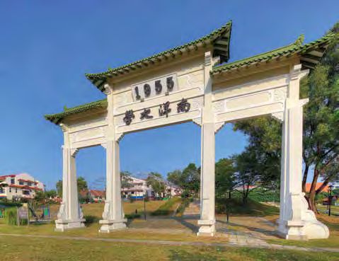
4

    forests with an outer line of mud and sand,         habitats for a diverse range of wildlife and
    corresponding to today’s Sungei Jurong, Jurong      important for natural coastal protection,
    Lake, Sungei Pandan and Pioneer areas.              were gradually cleared for firewood, to make
                                                        charcoal, timber for kelongs (fishing platforms)
    Further inland, making up today’s Boon Lay,         and boat building. In Jurong today, only small
    Jurong West and Jalan Ahmad Ibrahim was             fringes of mangrove forest exist at the mouth of
    lowland Dipterocarp forest. The three Mass          Sungei Pandan.
    Rapid Transit (MRT) stations of Joo Koon,
    Pioneer and Boon Lay stand on what used to be       Freshwater swamp forests were associated with
    freshwater swamp forest.                            rivers and streams like Sungei Jurong, Sungei
                                                        Pandan and their numerous tributaries, and were
    The Dipterocarp forests were denuded within         periodically inundated through rainfall runoff
    a century of colonisation from 1819, through        and water inflow from surrounding terrain. This
    uncontrolled timber harvesting and forest           produced a habitat that had different flora from
    clearance for agriculture. Mangrove forests,        Dipterocarp forests, and fertile alluvial soil (land
                                                        formed by deposits from flowing water) that
                                                        became highly sought after for agricultural land.

                                                        In 1932, Edred J. H. Corner, the assistant director
                                                        of the Botanic Gardens, made a systematic study
                                                        of one of the last remaning plots of the freshwater
                                                        swamp forests of Jurong, to the south of the 15th
                                                        milestone. He concluded that in terms of tree and
                                                        plant species, Jurong was distinct from similar
                                                        swamp forests in Mandai and the Pontian and
                                                        Sedili River regions in Johor, with 15 tree species
    Jurong was an area of mangrove swamps and jungle.   that were not found in the other areas.

    Sungei Jurong, with mangroves on the far bank.
5

                                                                                                   Courtesy of Singapore Botanic Gardens

Scenes of Jurong’s natural landscape in the 1930s.

The Orang Laut and                                   other parts of Southeast Asia since at least
early trade routes                                   the 16th century, and likely earlier than that.
                                                     Orang Laut sukus, or tribes, that were recorded
These days, the sounds of Pulau Samulun
                                                     as resident in Singapore when Raffles arrived in
are an industrial soundtrack of vessels being
                                                     1819 include the Orang Biduanda Kallang, the
constructed and deconstructed. A small island
                                                     Orang Galang, the Orang Gelam, the Orang
facing the mouth of the Jurong River, Pulau
                                                     Seletar and the Orang Selat.
Samulun is today home to Jurong Shipyard, but
its maritime heritage stretches back centuries.
                                                     These tribes lived in places like the Kallang
An important clue to the identity of the first       River, Geylang, Kampong Glam and the Seletar
settlers in Jurong that we know of lies in its       River, while a 16th century settlement around
name — Samulun is derived from Sembulun, the         the Keppel Harbour area has been hypothesised
name of one of the tribes of the Orang Laut.         to be home to the Orang Selat. While virtually
                                                     nothing is known of the Orang Sembulun apart
The Orang Laut were sea and river-based              from their name, they may have been related to
nomads that have lived in Singapore and in           the Orang Selat, given their proximity.
6

    Villagers standing by rubber trees on Pulau Samulun, 1963.

    The Orang Laut shared a symbiotic relationship               must pass”), after which the route passes
    with the more settled Malays, often serving as               between the mainland and Sentosa.
    the naval forces of a number of Malay kingdoms.
    However, the two peoples were culturally distinct            Linschoten based his instructions on the
    until the 20th century, when the Orang Laut began            knowledge of Portuguese and Spanish navigators
    to be assimilated into Malay communities in                  in the late 16th century. The Portuguese, who
    Singapore, Malaysia and Indonesia.                           sought to avoid the Straits of Johor as they
                                                                 were often in conflict with the Johor Sultanate,
    References to the waters around Pulau                        used Orang Laut or Malay ship pilots known
    Samulun can be found from the 16th century,                  as batins to guide their vessels through the
    pointing to the fact that this area was a                    tricky, shoal and sandbank-laden waters of
    significant zone on the ancient maritime Silk                southern Singapore. Linschoten’s detailing of
    Road. In his 1595 publication, Reysgeschrift                 the Selat Sembilan showed that the strait was
    vande Navigatien der Portugaloysers in Orienten,             familiar to the Orang Laut and the Malays.
    Dutch author Jan Huyghen van Linschoten
    detailed sailing directions for a journey                    The nomadic Orang Laut gradually settled
    between Malacca and Macau, a leg of the                      into kampongs after 1819, including Kampong
    venerable and lucrative trade routes between                 Tanjong Kling, Kampong Damar Daut,
    China, India and Europe. From the southern                   Kampong Sungei Pandan and Kampong
    end of the Straits of Malacca, Linschoten                    Penjuru in the Jurong area and nearby
    describes an eastward route through the Selat                islands. These kampongs were said to be
    Sembilan (“the first straits through which you               former pirate hideouts, with the raiders of the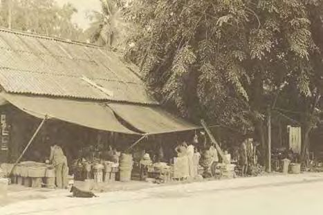
7

straits assaying forth and then disappearing                       Earl went on to describe the pirate bands as
back into the bewildering maze of islands,                         originating from the leadership of local Malay
mangroves and rivers they knew like the back                       chieftains, who gathered:
of their hands.
                                                                   “as many restless spirits as he can muster, and sails
While the Orang Laut were labelled pirates,                        for one of the most retired islands.... Here he erects
particularly by European traders between 1819                      a village as a depot for slaves and plunder, and
and the 1830s, later scholars have taken a more                    then lies in wait with his armed perahus... Should
nuanced view. Acts of piracy in the waters                         the chief be eminently successful, he soon gains
around Singapore were well documented,                             a large accession to his force, and his village
from the 19th century Bugis chronicle Tuhfat                       increases to a small town, while his fleet of
Al-Nahfis to numerous European accounts in                         perahus becomes sufficiently numerous to be
the 1800s. The victims of piracy and violence                      subdivided into several squadrons, which cruise
on the straits were of every stripe of seafaring                   in the various straits and channels.”
traders — from Malay and Bugis vessels to
Chinese junks and European ships.                                  Captured vessels were plundered and burnt,
                                                                   and their goods taken back to Singapore to be
An account by author George Earl provides the 19th                 resold by the pirates. Crews and passengers
century European perspective:                                      had the sad fate of being sold as slaves for
                                                                   plantation labour, and piracy occupied many a
“The Malay pirates absolutely swarm in the                         page of the European newspapers in Singapore
neighbourhood of Singapore, the numerous islands                   in the 1830s. While violence and robbery on the
in the vicinity, the intersecting channels of which                seas undoubtedly occurred in that period, later
are known only to themselves, affording them a                     scholars and historians have placed these acts
snug retreat...”                                                   in context (see box story).

Linschoten’s navigational instructions published in 1595 were text-based. This illustration of the route is adapted from C. A.
Gibson-Hill’s 1954 paper Singapore: Notes on the history of the Old Strait, 1580–1850.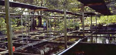
8

                                                         Orang Laut group. Unfortunately, any knowledge
    Raiders or guardians of the straits?                 of a possible Bajau Laut haven there has not
    For centuries, the Malay and Orang Laut sea          survived to our times.
    captains had derived their authority from
    local Sultans to patrol the waters and demand        Early accounts of Jurong
    tribute from trading vessels. They acted             Captain Franklin and Lieutenant Jackson’s 1828
    as the naval forces of various sultans and           map details a number of natural features in Jurong
    were not rogue pirates
    — a distinction made
    clear by the existence
    of the perompak, sea
    bandits who enjoyed no
    royal sanction.

    With the arrival of the
    British, Malay lines of
    control over the waters
    were      disrupted.     The
    subsequent       acts     of
    ‘piracy’ are now viewed
    by some scholars as rebel
    privateering during a
    time of conflict instead.
    A privateer was an armed Kampong Teban, a fishing village in Jurong, in the 1950s.
    vessel commissioned by
    a governing authority to attack the merchant        including the Jurong and Pandan rivers, Pulau
    shipping activities of their enemies.               Damar Laut, the Selat Sembilan as well as the
                                                        islands Pulau Pese (Pulau Pesek), Pulau Sakra,
    Other scholars also note the British policy of free Pulau Butun, Pulau Saraya (Pulau Seraya) and Pulau
    trade clashed with the traditional taxes imposed    Ayer Chawan. In the Tuas area, Tanjong (referring
    by Malay chiefs based at riverine settlements,      to a cape or promontory) Kampong, Tanjong Rawa
    and the British often classified such disputes      and Tanjong Gull (Tanjong Gul) are named.
    as piracy. Whether the Orang Laut of Pulau
    Samulun and the early inhabitants of Jurong and     Interestingly, a well is marked on the mainland
    the nearby islands, were pirates or rebels may      overlooking Selat Sembilan. A newspaper
    well be a matter of perspective.                    report from 1848 notes that the well at Ayer
                                                        Trujun (Ayer Terjun) was well-known among
                                                        the Malays for the quality of its water, second
    Apart from their naval exploits, the lives of the   only to that of Pulau Ayer Brani. However, Ayer
    Orang Laut in the Jurong area were likely similar   Terjun lies further up the Sungei Jurong, some
    to those of other tribes elsewhere in Singapore     distance from the well on the map.
    and Southeast Asia. They carried out subsistence
    fishing, gathered plants and fruits from the forest In 1848, government surveyor John Turnbull
    for medicine and food, and utilised freshwater      Thomson surveyed the rivers and creeks of the
    streams. The mangroves and swamp forests of         island, and included notes on Sungei Jurong
    Jurong would also have provided mangrove timber     and Sungei Pandan. Thomson described Sungei
    and Nipah palms for their homes and boats.          Jurong as “a large creek which divides at
                                                        the top into two branches, the east one being
    The northern section of Tuas was named Bajau        called by the Chinese the Jurong, and the west
    in early 19th century maps, referencing another     Peng Kang... The Chinese here are numerous
9
Map of Singapore by Captain Franklin of the East India Company’s Quarter-Masters Department, prepared in the early 1820s.
and there are also several Malay villages.” also had stopovers in Singapore, Cape Town,
Sungei Pandan was “a large creek with Mauritius, Hong Kong and Shanghai.
Chinese and Malays (resident) at the head”,
while a tributary, Sungei Pandan Kichi, was In Singapore, the American East India
unpopulated and not cultivated. Squadron of two frigates and two sloops-of-
war surveyed the Jurong River and reported
Thomson also observed pukats in both of on the local flora, fauna and geography. Peter
the rivers — these were large, open boats Wilhelm Heine and Eliphalet Brown, the
that could seat up to 35 people and used expedition’s two official artists, produced
for transporting trade goods particularly a lithograph that is the earliest known
between coastal and riverine towns. It is illustration of the Jurong River.
likely that the pukats Thomson saw at Jurong
moved gambier, pepper and other agricultural The print shows stilt houses typical of Malay
products to the markets and port in town for kampong residences, a canoe with the United
export. States flag on the river, the lush vegetation
ubiquitous of Jurong at the time and a fire
Another early account of Jurong comes beyond the trees in the background. This
courtesy of one of the most infamous possibly was a reference to the frequent fires in
expeditions in world history. The American town in the 19th century. Two crude structures
expedition of 1852–1853 led by Commodore in the background, on the right of the print,
Matthew Calbraith Perry is better known for seem to house fires and may represent the
forcing the opening of then isolationist Japan to cauldrons used to boil gambier leaves for the
world trade and diplomacy, but the expedition industry then prevalent in Jurong.10
Print of Jurong by Peter Wilhelm
Heine and Eliphalet Brown, 1853.
Francis Hawks, the keeper of the expedition The gambier pioneers:
journal, described the surroundings thus: opening up the interior
While the Orang Laut and the Malays built their
“Inland, the surface of the country is diversified small villages along the Jurong River and in
with low hills and shallow valleys, while the sea coastal areas, Jurong remained for the most part
shore is low and overgrown with mangroves, and a pristine, forbidding snarl of jungle, swamp and
occasionally broken by the entrances of salty creeks, large swathes of land saturated with mangroves.
which, penetrating sometimes to the extent of six Tigers found isolated and rural areas like Jurong
or seven miles, overflow their banks, and convert to be most amenable hunting grounds, while
their neighbouring soil into marsh. The artists of the crocodiles thrived in the waterways in the area,
expedition have supplied a view of (Jurong), which staring laconically at travellers.
will give an idea of the characteristic scenery.”
After the establishment of the British colony
The lithograph and the expedition reports on from the 1820s however, Singapore’s population
Singapore were later published in 1856’s The began to grow exponentially and while the
Narrative of an American Squadron to the China majority of the new settlers stayed in town,
Seas and Japan. some ventured into unknown country. Many of
these newcomers were plantation owners and
Another account of early Jurong comes from workers, and like a number of other places in
a 1904 newspaper report of a police raid on Singapore’s interior, the jungles of Jurong were
a currency counterfeiting operation deep in cleared for agriculture and human habitation.
the jungles of Jurong provides an idea of the
landscape, penetrable only with great effort: The new settlers were predominantly Chinese, with
the Hokkiens in the majority, and they painstakingly
“Last night at 10.45 Insp. Branagan and a party of scoured parts of Jurong of its jungle, carried out
detectives raided a house situated four miles from rudimentary land reclamation by filling in swamps
the 9th milestone Jurong Road in the jungle. It and made a living the best they knew how.
would have been a difficult matter even in daylight
to get to the house, but at night it was extremely The answer for most was gambier and pepper
dangerous as the path led through dense jungle — complementary cash crops often planted
and swamp, and across many streams which were together that promised riches but only delivered
bridged by a single pole. Man-holes abounded and survival for all but a few fortunate individuals.
when the party arrived at the house they were Gambier’s legacy was apparent from the naming
rather done up and some presented a wretched of the Peng Kang area, now part of Jurong, from
appearance, having been unfortunate enough to the Hokkien term for the boiling of gambier
fall into swamp holes.” leaves as part of the production process.11
to new ground, clearing yet more
primary forest and jungle. Gambier
leaves also needed to be boiled
after harvesting, necessitating yet
more felling of trees for firewood.
There were already some 20
gambier plantations in Singapore,
owned by Malays and Chinese,
when Raffles arrived in 1819, but a
gambier boom in the 1830s after
a surge in demand and prices led
to an expansion of plantations
into the north and west interior
of Singapore, including Jurong.
By the 1840s, there were around
600 gambier plantations across
the island, worked by some
6,000 mainly Chinese labourers.
A gambier and pepper plantation, 1900s. Some considered the gambier
industry a cornerstone of the
The pattern of land clearance, crop cultivation and economy, not by the export dollars it fetched,
settlement evolved into the kangchu system in but by the number of jobs it created.
Singapore, Johor and other parts of Malaya. The
kangchus (literally ‘lord of the river’ in Teochew) Other than the Orang Laut and Malays who lived
were Chinese headmen who organised labour, on subsistence farming and fishing, the majority
supplies, capital and the transport to markets. of people living in Jurong at this time worked
in the plantations. A report to the Municipal
They were often chiefs of the kangkars (‘foot Committee in 1855 provides a snapshot of the
of the river’ in Teochew) as well, a term that plantation industry in Jurong, listing 20 clearings
referred to riverine villages that handled the (plantations) in Peng Kang, three in Sungei Jurong,
produce from the plantations and housed 14 in Pulo Dammar (either Pulau Damar Daut or
labourers as well as the entire plantation area Pulau Damar Laut) and five in Sungei Pandan.
linked to the settlement. The kangchu legacy
lives on in the place names of Choa Chu Kang, These contained more than 600,000 gambier
Lim Chu Kang and Yio Chu Kang among others. trees, some 67,000 pepper vines and around 1,700
nutmeg trees. The local yield was 2,002 piculs of
Bangsals were the plots of land on which the gambier, 1,498 piculs of pepper and some 7,625
gambier, pepper and other crops were actually nutmegs. The number of labourers working in these
planted, averaging between 10 and 50 acres, four locations — just under 300 — gives some
and usually worked by nine or 10 men. Besides indication of the population in Jurong at the time.
the planted plots, they contained attap and
wood huts for the labourers, built cheaply from It is likely though that there were numerous
materials obtained from the surrounding forest, plantations in the area not assessed in this
as well as cauldrons to boil the gambier. report, a fact acknowledged by the report itself
stating that plantation owners were “materially
Gambier, used in the dyeing and tanning understating” their actual production. Other
industries in Asia and Europe, was a voracious owners likely did not make themselves known
crop however; it exhausted the fertility of the soil to the colonial authorities, having set up their
after a handful of years and cultivators moved on plantations without legal title.12
A member of the Singapore Agricultural and to the Legislative Council in 1883, the Colonial
Horticultural Society (the members of which Engineer and Surveyor-General Major Henry
were mainly European) provided an account of Edward McCallum summed it thus:
his visit to a Chinese-owned coffee plantation
in Jurong in 1837: “If the honourable members at the other end of
the table had been out in the country districts as
“We pulled one to two miles from the mouth of much as some of the Government members have,
the Jurong, landed on the left bank of the river, they would see the necessity of granting some such
and after walking about a mile through the jungle powers as we now ask for the protection of the lands
came to the clearing, on the slope of a low hill. The of the Crown. Chinese have entered these lands
soil appeared a rich, light mould, rather sandy. without any claim or title, and they have cleared,
The forest trees had been cut down and allowed changkoled, planted exhaustive crops, cleared out
to remain as they fell, to decay in process of time. again, and left the country one vast desert. The
The ground was half covered with the stumps and districts of Jurong and West Bukit Timah furnish a
felled trees, and in the clear spaces young coffee specimen of what has been done.”
plants were inserted very much at random.”
While gambier was economically the most
The observer from the society expressed surprise successful crop in Singapore in the 19th century,
at the Chinese style of coffee planting, with the it did not prove the making of more than a
plants entirely without the benefit of shade but few notable individuals. Most of the gambier
appearing to thrive. The differences between planters were smallholders, having ventured into
Chinese and European planters were also laid bare; the jungle on capital borrowed from merchants
the Chinese owner of the plantation contrasted in town. They were also obliged to purchase
his style of clearing land — merely chopping the supplies from these merchants, and sell them
trees down and leaving to them to decay amid their gambier at preferential prices.
his plantation — with the more elaborate and
expensive methods used by the Europeans. In the Coupled with gambier prices that were often in
long run, Chinese and Asian plantations of gambier flux in the mid-1800s, many smallholder planters
and pepper would outlast European efforts with made barely enough to cover their expenses. For
nutmeg, sugar and other spices in the 19th century. this meagre living, they endured tropical diseases,
unforgiving weather, robberies arising from a lack
For the most part, the Chinese planters were of effective policing in the rural areas and a series
preoccupied with producing export-oriented cash of communal conflicts that roiled the gambier
crops, turning a profit and returning to China. industry from the 1830s.
Their success with gambier, pepper and tapioca
economically surpassed all other agricultural Not all Chinese plantation owners worked
efforts before the introduction of rubber, but their land without legal title. A newspaper
their methods often left the soil exhausted and advertisement from 1854 details estates put
unusable after which they simply moved on to up for sale after the death of Keong Kong
fresh ground, causing consternation among the Tuan, including a nutmeg plantation at the 8th
European community. milestone of Sungei Jurong. Keong, a wealthy
Peranakan merchant, was one of the first in
Besides the fact that Singapore was rapidly the Chinese community to hold land titles
being cleared of its primary forests and jungles, recognised by the colonial administration.
many Chinese planters did not pay rent for their
plantations or taxes for their produce, as the In 1903, some 75 acres of agricultural land in
colonial system of land taxation and assessment Pulau Damar, Jurong, Tanjong Gul and Peng
was dysfunctional until the late 1800s. The Kang was purchased by See Chuan Kiat for
European complaints were valid, even if they $2,800. The sales implied the existence of legal
were coloured by colonial prejudice. In a report title and legal recognition of the land holdings.13
Forest reserves in Jurong and Tuas trees. The leaves all come together, as if you were
walking in a tunnel.”
By the late 1870s, the primary forests of Singapore
had largely been denuded by decades of As director of the Singapore Botanic Gardens in
unregulated and unchecked forest clearance for the late 1800s, Henry Norman Ridley managed the
cash crop plantations and farming. Around this forest reserves and instituted one of the earliest
time, the colonial government began to take an schemes for sustainable timber management,
interest in the state of the island’s natural forests. with harvested mangroves allowed to recover
for several years. However, management of the
An 1883 report found that the few remaining forest reserves later came under the charge of
patches of uncut forests were isolated and the Collector of Land Revenue, who allowed
surrounded by wide areas of lallang grass and indiscriminate logging. By the early 20th century,
brushwood, growing on abandoned gambier all of the mangrove forests in Singapore had been
plantations. These represented 10% of Singapore’s stripped of their bakau.
original forest cover, the rest having been lost in
less than 70 years of human intervention. By 1936, the only remaining forest reserve
in Jurong was the Pandan reserve. Much of
A Forestry Department was set up in 1884 to this area underwent redevelopment as part
safeguard remaining forests by demarcating and of Jurong New Town in the late 1960s, having
protecting forest reserve areas from illegal timber lost its status as a forest reserve. Today, what
harvesting and clearance. Labourers employed by remains are fringes of mangroves at the mouth
the department also marked and cleared boundary of the Sungei Pandan, between the Pandan Tidal
paths, built bridges and replanted native trees on Gates and the Sungei Pandan Bridge.
former gambier land within the reserves.
The mangrove fringes still retain a marvellous
Three of the forest reserves were in the Jurong diversity of flora and fauna, and visitors can
area — a 166.7ha area around both banks of the spot and hear birds such as grey herons, striated
snaking Sungei Jurong, a 874.9ha zone at Sungei herons, pied fantails, ashy tailorbirds, Asian
Pandan (the largest on the island) and a 612.7ha paradise flycatchers and white-bellied sea
area around Sungei Blukang, in Tuas. These areas eagles. In and between the mangroves and nipah
contained swathes of mangroves, which were palms, the keen-eyed can pick out mud lobsters,
some of the most biodiverse habitats in Singapore. mudskippers, tree lizards, horseshoe crabs and
Growing around the many rivers and tidal dog-faced water snakes.
swamps of both areas, mangroves
contained the much sought-after
bakau timber, used for firewood
and in charcoal production.
The leaves of the bakau trees, which
tended to closet together, made
for some extremely shady areas in
Jurong, as Haji Shafie Mohammad
Arif (b. 1943) remembered:
“I tell you, after 4pm, you scared
to go into the kampong already.
4pm you know! You can’t even see
sunshine! Because of the bakau A stretch of mangroves at the mouth of Sungei Pandan today.14
Evolution of land use in Jurong The Chinese often planted interim cash crops
such as pineapple or gambier among the rows
Rubber and agriculture of rubber trees, and these crops that yielded
With the gambier industry in Singapore waning their produce within 18 months generated
in the late 1800s, a new cash crop began to cash flow while the rubber trees matured.
dominate the plantation landscape, including
in Jurong. This was rubber, introduced to With the revenue from these interim crops,
Singapore and Malaya in 1877 after Henry and smaller capital investments in their
Ridley brought hevea brasiliensis seeds from rubber plantations than that of their European
Brazil via Kew Gardens in the United Kingdom counterparts, it cost Chinese planters around 150
and planted them in the Botanic Gardens. Straits dollars per acre of their rubber estate. This
was in contrast to European estates that could
Ridley promoted rubber to planters in Malaya require up to four times the capital investment.
and Singapore, but the crop did not catch
on due to its limited commercial appeal Rubber eventually replaced gambier as the go-to
and maturation period of seven years. He crop, and large rubber estates began to dominate
persevered over the next two decades however, the landscape in Jurong. Prominent business
experimenting with various aspects of rubber leaders who owned rubber estates in Jurong
planting and achieved a breakthrough with included Chew Boon Lay and Tan Lark Sye, and the
the herringbone method of tapping, which Sembawang Rubber Plantations Limited company
allowed cultivators to extract the rubber latex formed by Lim Boon Keng, Tan Chay Yan and Lee
in a controlled fashion without killing the tree. Choon Guan had holdings in the area. Members
of the Chettiar community also owned estates
In the early 1900s, worldwide demand for here, including Chithambaram Chettiar Estate
rubber surged with the booming automobile and Arunachalam Chettiar Estate near Kampong
industry requiring the product for pneumatic Sungei Jurong at the head of the river.
tyres. By 1920, half of the global production of
rubber came from Malaya and much of this was Chew’s plantation, which had begun with
sold through Singapore, making the island the gambier in the 19th century before shifting to
rubber capital of the world. The rubber industry rubber, was so extensive and prominent that
was the making of millionaires like Tan Kah Kee, it eventually lent its name to the Boon Lay
Tan Lark Sye, Lee Kong Chian and Lim Nee Soon. area. Located behind Jurong Village on the
13.5 milestone of Jurong Road, the estate also
Unlike estate agriculture elsewhere in Asia spawned a Boon Lay Road.
at the time, which was largely dominated by
Europeans, almost all of the rubber plantations Other rubber holdings in Jurong included the
in Singapore and Johor were owned by locals. Bajau, Jurong, Lokyang, Yun Nam, Chong Keng,
A rubber plantation in Singapore, 1900s.15
Singapore’s first President Yusof Ishak,
Puan Noor Aishah and Member of
Parliament Chor Yeok Eng visiting a
vegetable farm in Jurong, 1967.
Seng Toh and Lee Gek Poh estates. The islands relatives then come casually...in the past, it was very
of Pulau Pesek, Pulau Ayer Chawan, Pulau easy, those familiar with the landowner can tell him:
Merlimau, Pulau Seraya and Pulau Samulun ‘I have relatives who want to come here and build a
also featured extensive rubber and pineapple house.’ Just inform him, he will also be happy. You
cultivation alongside their kampongs, but there build a house, rear chickens, rear pigs, rear ducks
is little indication of their ownership. and the soil will be fertile...(it would be) good for
the rubber trees. When we planted vegetables, we
The rubber estates drew more people to chose lower ground (near the plantations). (The
Jurong, providing employment and encouraging water used in the plantation) could flow through
settlement. Ng Lee Kar recalled the word on the and (help) irrigate our vegetables.
ground as the plantations expanded:
“People in Shui Dui Nei mostly planted fruits...I think
“The tenants in Jurong were predominantly about 70% to 80% of the people there planted
Hokkien. Many were farmers, the others were fruits, those who planted vegetables were in the
plantation workers — rubber tappers or casual minority. There was a mix. Some who planted fruits
labourers employed to weed grass. had less livestock, while others went to do rubber
tapping when they were free.”
“The vast tracts of land needed weeding. Men were
employed to do the job. If they agreed to stay in the Jurong gradually became an important centre
rubber plantation, they would be given money. In of agricultural production for Singapore after
the past all of us lived in attap houses. The towkay farmland in the Rochor and Kallang districts
(business, or in this case plantation owner) usually was redeveloped for other uses. With the
provided us money to buy attap leaves to erect a island’s population steadily growing in the 20th
house. Very often, the planter (would) willingly century, demand for fresh vegetables, fruits,
stay. All he needs to pay is a token sum of a few pork and poultry swelled, and new farms took
cents. The towkay hoped workers could stay there up land freed up by abandoned plantations
to save him the trouble to weed the grass.” as well as on the quickly vanishing patches of
forest. An improved and more extensive road
Former shopkeeper Tan Kim Wah (b. 1911) also has system also allowed farmers in Jurong to get
memories of how the population in Jurong grew: their produce to markets elsewhere while it
was still fresh.
“(of Shui Dui Nei village) it must be someone with
the surname Lin who started development there. As remembered by Ng and Tan, vegetable and
Rearing fowl, growing vegetables and fruits. Their fruit farms dotted the landscape and provided16
a living for many families, with vegetable and between Pandan and Jurong rivers, and they have
fruit farmers also rearing chickens, ducks and planted up well, but it is a nearly hopeless job for
pigs to sell. Fruit farms planted local favourites them to get their produce to market and especially
such as rambutan, pulasan, pineapple and buah was this so until the embankment was metalled by
susu (passion fruit), and some of these farms private enterprise.”
maintained the agricultural character of Jurong
until the 1970s. Abdul Karim, who served his At that point in time, the villages on the coast
national service in the late 1960s, remembered and around the Sungei Pandan and Sungei
his army unit scoring quick snacks of rambutans Jurong, including Tanjong Balai, Pulau Damar
during field training in the Jurong area. Daut, Tanjong Kling and Pulau Samulun, all
lacked road access. The residents in these
One crop that became associated with Jurong places travelled mainly by boats including
and spread wide throughout the island was koo traditional Malay koleks, whether the children
chye (Chinese chives). As Tan recalled, koo chye to the school at Tanjong Kling or farmers
farms near the Chongqing plantation at the bringing their produce to the market at Pasir
15th milestone produced the bulk of the chives Panjang. The seaward trek to Pasir Panjang
consumed in Singapore: involved navigating choppy waters and an
entire day’s journey, according to the penghulus
“Koo chye for the entire Singapore comes from (chiefs) of the kampongs.
that place, there was very little coming from
other places. Jurong 15th milestone was famous Fishing and prawn farming
and there could be several hundred kilograms of The fishing industry has long featured in
koo chye harvested for sale each other. If people the Jurong story, from the Orang Laut and
cooked char kway teow (noodles fried
in dark soya sauce), frying the noodles
with koo chye would make it very
delicious. People like us use it to make
koo chye kueh, also very delicious.”
While the improvement and
expansion of roads in Jurong was
carried out gradually throughout
the 20th century, the progress
was painstakingly slow at times.
Even in the 1930s, an observer
in The Singapore Free Press wrote
that exploring the west coast of Tuas Village in Jurong, 1978.
Singapore, including Jurong, was “far
more (easy) by aeroplane than by
road, for the simple reason that there
are no roads.” Noting that property
owners in the area had constructed
roads at their own expense, the same
writer added:
“Some short time ago, the
government was responsible for the
placing of about 1,000 Chinese fruit
and vegetable growers on the low Small cluster of coffeeshops, shophouses and seafood restaurants at the
lying land north of the so-called road end of Tuas, near the sea, 1978.17
Malay fisher folk on the tanjongs (headlands)
overlooking the Samulun Strait to the fishing
villages of Tuas. Some residents recall days
when fleets of up to 200 fishing boats landed
at Tuas, their catch bound for the fishing port
and seafood shacks that sprouted nearby.
Tuas itself derives its name from the Malay
word menuas, meaning to haul up fishing
nets. The nets in question were used in a
local method of fishing, in which coconut
fronds and leafy branches were floated in
Prawn farmers at work in Jurong, 1960.
the water with the nets hanging underneath.
The setup was used in shady areas, with the
shade attracting the fish and trapping them in
the nets hauled up by the fisher folk in boats.
From the early 1900s, carp and prawn farmers
carried out aquaculture in the rivers and water
features of Jurong. Carp was introduced by the
Chinese, who brought the practice from China,
and involved five different species. Only the
common carp was bred in Singapore, while
the fry for the other species was obtained
from China. The high-yielding carp farms were
a popular food in Singapore, but gradually lost A fishing village in Jurong, 1956.
favour with fish farmers after World War II.
Prawn ponds were installed in muddy river
estuaries and mangrove swamps, making the
riverine areas of Jurong a perfect fit. Official
estimates in the 1950s counted some 1,000
acres being used as prawn ponds in Singapore,
and half of them were located in Jurong.
The Jurong ponds were among the most
productive on the island as well, yielding up to
1,000 kilograms of prawns per acre compared
to less than 45 kilograms per acre in Pulau Ubin.
While prawn ponds could be constructed on land
that was not suitable for agriculture, the problem
of mosquito breeding was hard to overcome.
Around the rivers of Jurong, the Malays in
fishing villages combined prawn farming with
net fishing. Living in stilt houses with their boats
tethered nearby, the fisher folk had the pick of
the aquatic harvest, but often had to deal with
flooding when the rivers broke their banks. In
those times of inundation, the stilts that raised
Prawn farming, 1960s. the level of their houses showed their worth.18
» our heritage
Growth
of communities
VILLAGES AND SOCIAL LIFe
W
hile the Orang Laut and Malay
villages on the coasts and rivers had
been rooted in Jurong before the
arrival of the British in 1819, the colonial period
brought new settlers to the area. Among the
first settlers to take on the backbreaking task
of clearing forests and swamps for plantations
and human habitation were the Hokkiens from
Ann Kway (Anxi) county in China.
These early settlers were likely labourers
on the gambier and pepper plantations, and
who later drew their friends and relatives
from their hometown to Jurong. The Ann
Kway Hokkiens settled in small villages,
usually organised by surname, and were
known for their starfruit farms in Jurong.
Some of these villages were at Lorong Ratna
in today’s Nanyang Technological University
campus, around Jalan Boon Lay, the 16th Young villagers brushing their teeth using a water standpipe.
milestone of Upper Jurong Road and in the
Ulu Pandan area, then called Da Gang Nei. comes from the Hokkien and Teochew term
The last was settled by Ann Kways with the for “bestowing a religion”, which was also the
surname Chua, who cleared the forested area colloquial name for Chinese Christians.
braving tigers, snakes and the crocodiles of
the Sungei Pandan. The second most populous Chinese dialect
group in Jurong was the Teochews, many with
They also founded nine schools between the the surname Lin and hailing from the Jieyang
7th milestone and the 18th milestone of Jurong province. The majority of Teochews lived at
Road, including Joo Long Public School, and a the 18th milestone in the west, and many were
host of temples honouring a diversity of deities. fishermen. Other occupations that the Teochews
Other Hokkiens in Jurong included those from filled included plantation and fruit farm workers.
the Jinjiang and Yongchun counties of China.
While villages and kampongs were usually
One of the first villages with a significant Ann established by a single community, the years
Kway population was Hong Kah Village, also often brought diversity. For example, Huat Choe
notable for its establishment in the early 1800s Village between Jurong Road and Nanyang
by Chinese Christians. The name of the village Avenue was originally predominantly Chinese,19
but by 1957 the Malays there (276 people) Malays were fishermen. Even now, some still have
outnumbered the Chinese (188 people). their own boats — they maintain the fisherman
lifestyle. They keep their boats at Sungei Jurong.
Old maps and a street directory from 1966 provide
a snapshot of the many villages and kampongs “My family members were fishermen. At the time,
between the 8th and 18th milestones of Jurong one kilo of fish is 20 to 30 cents. Now you can get in
Road before its redevelopment in the late 1960s: the market for $7 to $8. If you have a big boat, you
can go far away and get bigger catches. Sometimes, a
Kampong Ulu Pandan single cent also cannot get. Sometimes, (we earn) just
Located on the 10th milestone, this kampong enough for the family to eat. Anything extra, we sell.”
derived its name from the pandan plant used for
cooking and in the old days, to weave mats. Kampong Pulau Damar Darat,
Kampong Tanjong Balai and Tanjong Kling
Kampong Tebing Terjun These three villages formed a crescent shape
The name of this kampong hints at a fascinating around the coastline between the mainland and
origin story. In Malay, the phrase tebing terjun Pulau Damar Laut. Between Tanjong Kling and
refers to a dive off a cliff. To add to the intrigue, Bukit Peropok (today’s Jurong Hill) to its north,
the kampong was sited right by a tributary of the there were three islands standing in the midst
Sungei Jurong with the macabre name of Sungei of swamps and waterways like Sungei Peropok,
China Mati (Dead Chinese River). Sungei Simpang Pak Chalong and Sungei
Simpang Pak Bono. These islands were Pulau
Kampong Tanjong Penjuru Setunas, Pulau Sekuching and Pulau Mah Midah.
This kampong was located between the coast at
Tanjong Penjuru and the Jurong forest reserve and In 1909, Pulau Damar Darat was described in
its multitude of tributaries and streams. These The Straits Times as “a hillock rising up from
waterways included Sungei Mak Pusah (‘Difficult a country rich in cultivation. Mangosteens,
Mother River’), Sungei Sembilan (‘Ninth River’), gambier, pepper, pineapples and durians are
Sungei Sangkut Kail (‘Tangled Hook River’), planted plentifully, and seem to find a ready sale
Sungei Bakau Rungkup (‘Mangrove River’), among dealers in the neighbouring hamlets.
Sungei Che Dris, Sungei Tanjong (‘Headland Timber, some of remarkably fine growth, is to be
River’) and Sungei Karang (‘Coral River’). found on all sides, while hills of laterite and, in all
probability, containing granite are noticeable.”
In 1931, a newspaper report described Tanjong
Penjuru as “a small kampong of 100 souls, Malay Tanjong Balai was in 1931 “a kampong of some
and a few Chinese, mostly fishermen. Here there 40 people, with no access to Singapore other
has been laid out in excellent manner gardens...” than the sea”, while Pulau Damar Darat held
“about 50 Malays whose children have to row in
Haji Shafie Mohammad Arif remembered kolehs (boats) to get to school.”
growing up in Tanjong Penjuru:
“I lived at Tanjong Penjuru, where Caltex (Chevron)
is now located (at 210 Jalan Buroh). The place was
called Kampong Tanjong Penjuru.
“I’m a 100% kampong man! Kampong Tanjong
Penjuru consisted of mainly Malays. The Chinese
usually operated the provision shop. Population-
wise, only 200 people lived in the kampong, Very
small. They were (mostly) fishermen, who lived by
the sea. Prawn ponds belonged to the Chinese. The Students on an excursion at Tanjong Kling, 1951.20
Tanjong Kling, with a Malay school and police Lokyang Village
station, was one of the focal points of the area Located between the 15th and 16th milestones,
and had a population of about 500 in the 1930s. this village likely took its name from a former
plantation. The Jurong Estate stood to its west,
Tuas Village and the Bajau and Yun Nam Estates to its north.
Tuas Village was located at the 18th milestone
of Jurong Road, in today’s Pioneer area, with Kampong Sungei Jurong
Sungei Tuas, Sungei Che Mat Gun and Tanjong Sandwiched in between the Chithamparam
Tuas nearby. The village was said to have been Chettiar Estate and the Arunachalam Chettiar
founded in the 1880s, with gambier planter Estate, this kampong was on the 11th milestone
Zheng Wan Bao among the pioneers. of Jurong Road.
Hong Kah Village
Established by Chinese Christians, this village
stood at the 12th milestone. A little further up
Jurong Road was Kampong Ulu Jurong, and
the Jurong Brickworks. Like most of the other
villages in Jurong, Hong Kah consisted of wood
and attap houses. Unlike some of the other
villages however, some of the houses in Hong
Kah had cement floors, a sign of relative wealth.
Chinese houses hung a board (zhao pai) above
their doorways, inscribed with the family
The Tanjong Kling police station, 1930. surname and some with the details of their clan
ancestry and village back in China. The houses
were often attacked by termites and white
ants, necessitating repairs and sometimes
complete rebuilds.
There would have been little variation in the
architectural styles across the kampongs of
Jurong, apart from the coastal and riverine villages
featuring stilt houses. What was common to both
stilt houses and inland houses was the attap roof,
made from the tough, sinewy leaves of the nipah
palm, rumbia or bertam. It was only after World
Workers rolling up cane for a kelong in Tuas Village, 1970s. War II that the majority of kampong houses
made the switch to the more expensive, but less
By the 1940s, there were some 2,000 Chinese flammable zinc roofing. Tan Kim Wah recalled:
and Malay fishermen living in Tuas Village. Former
Tuas Village resident Li Xi Mei remembered: “Most of (our houses) were covered with attap,
it was after the war that more people used sha
“There were little wooden huts with hills with li (zinc) to cover. Wood houses, the walls were
coconut and fruit trees behind them, and forests. nailed wood boards, the roof was covered by
(Sungei Tuas) was only a hundred metres from attap. Most people after the war did not want
my house. Whenever the tide was high, there to use attap to build houses, because attap was
was a ‘swimming pool’ extending from the front more dangerous. When (people were) careless
of my house to as far as the eye can see. We sometimes fire could easily start, after that
could fish, swim or row boats.” nobody wanted to use attap to build houses.”21
The numerous villages were served by a number markets in the area, and despite the proximity
of marketplaces, with perhaps the largest being at of the fishing villages of Tuas, fresh fish was
the 10.5 milestone. In the 1920s, the other markets seldom available for sale — with the exception
were at the 12th, 13th, 15th and 16th milestones. of ikan bilis (anchovies).
Soh Ah Choo (b. 1949) remembered the comings
and goings at the 10.5 milestone market: With Singapore long established as a centre of
cross-border trade, even the seemingly humble
“There was a market here for a long time, before provision shop in rural Jurong stocked vegetables
they built a permanent market in the 1960s. and foods from other countries, including China.
People would bring their vegetables, like kiam Of course, many residents would have been
chye (salted vegetables) and chye sim (mustard farmers themselves and their own vegetable
greens), pigs, chickens and fish from the villages in produce and livestock filled their tables.
Tuas to sell. There was also food like noodles and
snacks like kua ci (winter melon seeds) and soon Most of the foods that reached Singapore from
kueh (turnip dumplings). China then were dried or preserved, including
the cai poh (salted dried radish bits) that remains
an integral and familiar component of hawker
favourites like chwee kueh (rice cakes with
salted radish) today. Back then, common dishes
on the tables of the Chinese in Jurong included
soup with cai poh and fried black beans, as
Ng Lee Kar reminisced:
“Many of our dishes included dried foods from
China. All the workers in the plantations ate black
beans and cai poh. There usually would be pork
once every few days, but not even once a month was
there any chicken to eat, unlike the current lifestyle
where chicken is available every day. Personally I
did not get to eat (chicken meat) more than a few
times a year, only on big occasions with banquets.
To me, eating chicken rice (whenever you want) is
something that only started in the 1970s.”
The markets and backyard farms of Jurong were
not the only sources a hungry resident could turn
Attap roofed house on Jurong Road, 1950.
to. Even though the distances between kampongs
My friend was selling bao (buns), so I would help and even some houses could stretch for long
her make bak pao (meat buns) and sell them at the kilometres under the unforgiving sun, enterprising
market. After Jurong was developed, many of the peddlers went from door to door to sell biscuits,
hawkers from this market moved to Yuhua Market fruits, local snacks and fish purchased from the
(on Jurong East Avenue 1).” villages of Tuas. Ng remembered:
Many of the provision shops sold animal feed “That time there was no need for licenses. If you have
and grain, catering to the farmers in the district. anything to sell, you can freely take it to sell. You are
Some residents bought their vegetables, rice a hawker, if you have anything then you can go to
and other staples from the provision shops, houses to see if anyone wants to buy. Those houses
as there were no wet markets in Jurong until are scattered...(hawkers) have to walk very far before
after World War II. It was only from the 1920s reaching one house. You keep on selling until night
that fresh pork was available every day at the time or (until) you finish selling your things...22
Provision shop along Jurong Road, 1986.
“Hawkers also sold those things that children like we were not given the rights of a citizen. We applied
to eat, like biscuits or fruits, all sorts. More people for a public water pipe (standpipe or public tap) to
bought you zha kueh (dough fritters), seldom roti be installed at the 15th milestone. How long did it
(bread). In the past, (not many) people ate roti, take? We waited patiently for six years!”
now all of us Singaporeans eat it. In the past roti
was eaten by Indians or westerners, people like us Navigating Jurong
from China very seldom eat it.” Residents of other locales often express the
sentiment that Jurong is “far”. It is a vague
Colonial-era Jurong came under the purview of concept that doesn’t always hold water, given
the Rural Board, and governance, services and the relative size of Singapore in the first place.
infrastructure was all too often of an uneven As a district however, Jurong spans almost
quality, if they arrived at all. Ng recalled: the whole of the island’s southwest sector,
and getting around before the days of mass
“The British were concerned with improving the public transport and automobiles presented
infrastructure of the city, paying least attention to a challenge indeed. It was only from the 1930s
the rural areas... We too had to pay taxes. However, that bus services reached Jurong; before that,
people moved goods on bullock
carts, rode rickshaws, cycled or
simply walked. And if Jurong is
“far”, the western slice of Tuas
must represent the epitome of
distance in Singapore.
Madam Jeam Lau Ah Lang
reminisced:
“I was living in Tuas and my school
was in Bukit Timah. I had to wake
up at 5am just so that I could get
to school on time. There (was) no
proper transportation then and I
Workers installing a water standpipe in Jurong in 1959. had to cycle to and from school.”You can also read