Preliminary Geo-Environmental Risk Assessment - Flintshire
←
→
Page content transcription
If your browser does not render page correctly, please read the page content below
Preliminary Geo-Environmental Risk Assessment
Liverpool Road, Ewloe, CH5 3AW
Delta-Simons Project Number 20-1020.01

  Preliminary Geo-Environmental Risk Assessment
  Liverpool Road, Ewloe
  Presented to Lane End Development Construction Ltd
  Issued: March 2021
  Delta-Simons Project No. 20-1020.01

Environment | Health & Safety | Sustainability
Preliminary Geo-Environmental Risk Assessment
Liverpool Road, Ewloe, CH5 3AW
Delta-Simons Project Number 20-1020.01

Report Details
 Client                      Lane End Development Construction Ltd

 Report Title                Preliminary Geo-Environmental Risk Assessment

 Site Address                1 Liverpool Road, Ewloe, Deeside, CH5 3AW

 Project No.                 20-1020.01

 Delta-Simons Contact        Melanie Booth (melanie.booth@deltasimons.com)

Quality Assurance
  Issue                  Issue                                                  Technical
            Status                     Comments               Author                               Authorised
   No.                    Date                                                   Review

   01        Final     19/08/2020
                                                          Matthew Story       Melanie Booth      Sabine Sargeant
                                                            Graduate             Senior             Principal

                                    Update following
                                        a revised
   02        Final     19/03/2021
                                       proposed
                                    development plan      Matthew Story      Lizzy Moorhouse     Sabine Sargeant
                                                            Graduate              Senior            Principal

About us
Delta-Simons is a trusted, multidisciplinary environmental consultancy, focused on delivering the best possible
project outcomes for customers.
Specialising in Environment, Health & Safety and Sustainability, Delta-Simons provide support and advice within
the property development, asset management, corporate and industrial markets. Operating from across the UK
we employ over 120 environmental professionals, bringing experience from across the private consultancy and
public sector markets.
                         Delta-Simons is proud to be a founder member of the Inogen Environmental Alliance,
                         enabling us to efficiently deliver customer projects worldwide by calling upon over 5000
                         resources in our global network of consultants, each committed to providing superior
                         EH&S and sustainability consulting expertise to our customers. Inogen Environmental
                         Alliance offers its clients more consultants, with more services in more countries than
                         the traditional multinational consultancy.
                         Delta-Simons is a ‘Beyond Net-Zero’ company. We have set a Science-Based Target
                         to reduce our Scope 1 and Scope 2 carbon emissions in line with the Paris Agreement
                         and are committed to reducing Scope 3 emissions from our supply chain. Every year we
                         offset our residual emissions by 150% through verified carbon removal projects linked to
                         the UN Sustainable Development Goals.
                         Therefore, our consultancy services to you are carbon positive.
If you would like support in calculating your carbon footprint and playing your part in tackling the global climate
crisis, please get in touch with your Delta-Simons contact above who will be happy to help.

Environment | Health & Safety | Sustainability
Preliminary Geo-Environmental Risk Assessment
Liverpool Road, Ewloe, CH5 3AW
Delta-Simons Project Number 20-1020.01

Executive Summary
 Brief                  Delta-Simons was instructed by Lane End Developments Ltd to produce a Preliminary
                        Geo-Environmental Risk Assessment for the Site located on Liverpool Road, Ewloe,
                        Deeside, CH5 3AW (hereafter referred to as the ‘Site’). The Site is proposed for the
                        construction of low-rise residential properties with private gardens and apartment
                        blocks with associated landscaping and access roads.

 Site Use &             The Site is currently undeveloped agricultural land, with a residential property and
 Surrounding Area       associated outbuildings in the south-west of the Site. It is located within a
                        predominantly rural / suburban area and is surrounded by mostly residential properties
                        with some commercial properties and is adjacent to the A494.

 Environmental          The Site is likely underlain by a sequence of granular and cohesive superficial deposits,
 Setting                and bedrock of the Hollin Rock, Bowland Shale Formation and the Pennine Middle Coal
                        Measures. Natural Resources Wales classify the superficial deposits of Devensian Till
                        as Secondary Undifferentiated strata and the Head deposits as Secondary A Aquifers.
                        The Hollin Rock bedrock is designated as a Secondary A Aquifer and the Bowland
                        Shale Formation is a Secondary Undifferentiated Aquifer. The Site is not located within
                        a source protection zone. A small pond is located on-site. The nearest off-site surface
                        water feature is a covered reservoir located adjacent to the north-east of the Site.

 Contamination          Potentially infilled sand and gravel extraction pits may represent a localised source of
 Potential Sources      contamination. The underlying coal measures may represent a ground gas source.

 Contaminated           There is considered to be a Low risk of enforcement action by the regulatory authorities
 Land Risk              under Part 2A of the Environmental Protection Act 1990, the Environmental Permitting
 Associated with        (England and Wales) Regulations 2016 or the Environmental Damage Regulations
 Ownership              2015. The potential for legal action by surrounding landowners / Third Parties based
                        on the potential for contamination to migrate off-Site (ongoing or historically) and result
                        in private or statutory nuisance is considered to be Low.

 Development            Widespread contamination is considered unlikely and the preliminary risk assessment
 Considerations         has identified a Low to Moderate risk of soil/groundwater contamination and hazardous
                        ground gas at the Site. Asbestos may be present within the localised Made Ground.
                        The British Geological Survey Radon Report indicates that the central and eastern
                        parts of the Site lies within a radon Affected Area, where between 3% and 30% of
                        homes are above the National Radiological Protection Board (NRPB) recommended
                        “action level” for radon, requiring basic to full radon protection measures in new
                        buildings. It should be agreed with the Local Authority whether the Site can be zoned
                        with regards to radon protection measures. At this stage, it would be prudent to allow
                        for full radon protection measures across Site.
                        The Site is located in an area that has been subjected to historical mining; however,
                        the Site is not within a Coal Authority development high risk area and it is considered
                        unlikely that the Site was subject to historical bell pitting due to the substantial thickness
                        of drift deposits and the underlying sandstone.

 Recommendations        It is recommended that an intrusive Site investigation is undertaken to assess the
                        potential for contamination, shallow ground conditions and ground gases to impact on
                        the proposed development. The investigation will also refine the Site-specific ground
                        model and groundwater regime and enable a preliminary assessment of foundation
                        and engineering solutions to be made.

 This is intended as a summary only. Further detail and the limitations of the assessment is provided within
 the main body of the Report.

Environment | Health & Safety | Sustainability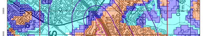
Preliminary Geo-Environmental Risk Assessment
Liverpool Road, Ewloe, CH5 3AW
Delta-Simons Project Number 20-1020.01

Table of Contents
1.0 INTRODUCTION ...............................................................................................................................................................1
   1.1 Appointment ............................................................................................................................................ 1
   1.2 Context & Purpose ................................................................................................................................. 1
   1.3 Scope of Works ...................................................................................................................................... 1
   1.4 Limitations............................................................................................................................................... 2
2.0 SITE CONTEXT & DATA REVIEW.................................................................................................................................3
   2.1 Site information ....................................................................................................................................... 3
   2.2 Environmental Setting ............................................................................................................................ 4
   2.3 Historical Use of the Site & Surrounding Area ....................................................................................... 6
   2.4 Environmental Database Review ........................................................................................................... 7
   2.5 Planning Review/Regulatory Enquiries .................................................................................................. 7
3.0 CONCEPTUAL SITE MODEL .........................................................................................................................................8
   3.1 Introduction ............................................................................................................................................. 8
   3.2 Potential Contamination Sources ........................................................................................................... 8
   3.3 Potential Pathways ................................................................................................................................. 8
   3.4 Potential Receptors ................................................................................................................................ 8
4.0 PRELIMINARY GROUND ENGINEERING APPRAISAL ......................................................................................... 12
   4.1 Preliminary Ground Model .................................................................................................................... 12
   4.2 Plausible Geohazards .......................................................................................................................... 12
5.0 DEVELOPMENT CONSIDERATIONS........................................................................................................................ 13
   5.1 Potential Remediation Requirements & Solutions................................................................................ 13
   5.2 Geotechnical Considerations................................................................................................................ 13
6.0 CONCLUSIONS & RECOMMENDATIONS ............................................................................................................... 15
   6.1 Land Contamination ............................................................................................................................. 15

Appendices
Appendix A                Limitations
Appendix B                Risk Definitions

Appendix C                Landmark Envirocheck® Report
Appendix D                Historical Maps
Appendix E                Radon Report
Appendix F                CON29 Mining Report
Appendix G                Proposed Development Plan
Appendix H                Photographic Log
Appendix I                Regulatory Correspondence

Environment | Health & Safety | Sustainability
Preliminary Geo-Environmental Risk Assessment
Liverpool Road, Ewloe, CH5 3AW
Delta-Simons Project Number 20-1020.01                                                                                       Page 1

1.0 Introduction
1.1 Appointment
Delta-Simons Environmental Consultants Limited (“Delta-Simons”) was instructed by Lane End Development
Construction Ltd (the “Client”) to prepare a Preliminary (Geo-Environmental) Risk Assessment for proposed
residential properties located off Liverpool Road, Ewloe, Deeside, CH5 3AW (the “Site”).

1.2 Context & Purpose
The proposed development for the Site comprises the construction of up to 130 dwellings, including residential
properties with private gardens and apartment blocks with associated landscaping and access roads.

The aim of this report is therefore to support the submission of a planning application for the proposed
development. To that end this study assesses the likely environmental and geotechnical issues associated with
soil and groundwater conditions that may affect the proposed development of the Site. This report is designed
in general accordance with guidance on Land Contamination: Risk Management pages of the web pages, the
relevant requirements of the National Planning Policy Framework 2019 (NPPF) (paragraphs 170 & 178-180) 1
and the Planning Practice Guidance (Land Affected by Contamination) 2.

1.3 Scope of Works
       Review of the environmental setting of the Site, including the current use / status of the Site and surrounding
       area, and review of the geology, hydrogeology and hydrology;
       Review of the historical activities of the Site and surrounding area;
       Review of regulatory information relating to the Site;
       Review of the online planning records for the Site;
       Consult with and review information from the Local Authority in relation to Part 2A of the 1990 Environmental
       Protection Act;
       Completion of a Site reconnaissance by undertaking a visual inspection of readily accessible areas of the
       Site;
       Review of Client provided relevant reports relating to the Site or surrounding area;
       Development of an outline Conceptual Site Model and undertake a Preliminary Risk Assessment with
       respect to potential contamination focussed on the proposed land use;
       Identification of potential contamination risks and / or liabilities associated with the proposed acquisition of
       the Site; and
       Provision of a commentary on potential land contamination and geotechnical constraints in the context of
       the proposed development.
In completing this Assessment, Delta-Simons has utilised the following data sources and third-party information:

       Current and Historical Ordnance Survey (OS) maps;
       British Geological Survey (BGS) data;
       BGS Radon Report (ref: BGS_309548/12329, dated 3rd August 2020)
       Coal Authority (CA) online data;
       CON 29M Coal Mining Report (ref: 245758497_1, dated 25th June 2020)
       MAGIC online data;
       A Landmark Envirocheck® Report for the Site (Ref. 245435850_1_1, dated June 2020); and,

1   https://assets.publishing.service.gov.uk/government/uploads/system/uploads/attachment_data/file/810197/NPPF_Feb_2019_revised.pdf
2
    https://www.gov.uk/guidance/land-affected-by-contamination

Environment | Health & Safety | Sustainability
Preliminary Geo-Environmental Risk Assessment
Liverpool Road, Ewloe, CH5 3AW
Delta-Simons Project Number 20-1020.01                                                                   Page 2

    Historical Maps included as part of the Envirocheck® Report.

1.4 Limitations
The standard limitations associated with this assessment are presented in Appendix A. In addition, there are
the following specific limitations that apply to this assessment:

    The Consultant undertaking the Site inspection observed for evidence of invasive species, particularly
    Japanese Knotweed. It should be noted however that the Consultant is not a trained ecologist and a
    separate survey undertaken by an experienced Ecologist should be completed to provide a robust
    assessment; and
    A detailed review of all overhead or underground services is outside the scope of this assessment.

Environment | Health & Safety | Sustainability
Preliminary Geo-Environmental Risk Assessment
Liverpool Road, Ewloe, CH5 3AW
Delta-Simons Project Number 20-1020.01                                                                     Page 3

2.0 Site Context & Data Review
2.1 Site information

 Figure 1: Contains OS data © , Crown Copyright and Database
 Right (2020)

             Figure 1: Site Location Map                                   Figure 2: Site Layout Plan

 Co-ordinates             Centred approximately at             Elevation                  ~80 m AOD
                          National Grid Reference
                          330050, 366860.                      Area                       5.73 Ha
                          The Site is located adjacent to the A494 within the Welsh county of Sir y Fflint
 Site Location
                          (Flintshire) approximately 1 km west of Deeside.

 Current Site Use         The Site is currently undeveloped agricultural land, with a residential property and
                          associated outbuildings in the south-west of the Site, which forms one of the access
                          points. The south of the Site is accessed through the property located in the south-west
                          corner, with the north of the Site accessed through a gate off Old Ashton Hill Road.

 Proposed                 The proposed development for the Site is the construction of residential dwellings,
 Development              vehicle access roads, footpaths, open landscape and a pond/attenuation feature. The
 Description              dwellings include detached and semi-detached multi storey properties, bungalows and
                          apartments.
                          A plan of the proposed development is presented in Appendix G.

 Site                     Delta-Simons conducted a Site visit on 30th June 2020. A series of Site photographs
 Reconnaissance           are presented as Appendix H, and pertinent information that was observed or reported
                          on-Site is summarised as follows:
                               The Site comprises the property off Liverpool Road and three fields; the south-
                               eastern two fields are connected and are accessed through the yard of the
                               residential property on Liverpool Road. The north-western field is accessed through
                               a padlocked gate off Old Ashton Hill;
                               The property on Liverpool Road was occupied at the time of the walkover, with a
                               number of old vehicles, timber, metalwork and vegetation present in the yard;

Environment | Health & Safety | Sustainability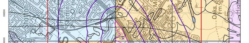
Preliminary Geo-Environmental Risk Assessment
Liverpool Road, Ewloe, CH5 3AW
Delta-Simons Project Number 20-1020.01                                                                     Page 4

                            The north-western field appears to be in frequent use by dog-walkers and the south-
                            eastern fields are in use as grazing for six horses;
                            The topography of the north-western field is generally flat and in keeping with the
                            surrounding area. The south-eastern fields are generally flat in the south, with a
                            gentle slope towards the south. Towards the north-eastern part of Site, the
                            topography slopes towards the north with an elevation change of approximately 6
                            m;
                            An undeveloped parcel of land, containing a shed, is present adjacent to the north-
                            west of the Site. The boundary with this parcel of land is marked by a fence, with
                            an approximate 1.5 m drop at the southern boundary and an approximate 0.8 m
                            increase in ground level at the northern boundary;
                            An ephemeral pond is present in the centre of the north-western field and was dry
                            at the time of the Site walkover;
                            The north-eastern tip of the Site comprised a wooded area at a higher elevation
                            than the surroundings, with a gully present through the woodland. Concrete blocks
                            approximately 1 m by 1 m were present throughout the wooded area, with bricks
                            and plastic netting noted. A number of animal burrows were noted within this area.

 Current                North      Residential properties (WNW) and covered reservoir (NW)
 Surrounding Area
                        East       Broadleaved Woodland (National Forest Inventory)

                        South      Ashton Expressway (A494) duel carriageway (S) and petrol filling station
                                   and MOT workshop (SW)

                        West       Residential properties

                        The petrol filling station (PFS) and MOT workshop to the south-west are considered to
                        represent potential off-Site sources of contamination.

2.2 Environmental Setting

 Published              From published British Geological Survey mapping (1:50,000 scale map, sheet 108,
 Geology                Flint), the Site is indicated as being underlain by superficial deposits of Devensian Till
                        to the west and Head deposits of clay, silt, sand and gravel to the east. Most of the
                        Site is underlain by bedrock of the Hollin Rock (sandstone), with the Pennine Middle
                        Coal Measures Formation beneath (mudstone, siltstone and sandstone). The north-
                        eastern tip is underlain by bedrock of the Boland Shale Formation (mudstone), which
                        has a faulted contact with the Hollin Rock. On Site, the bedrock is displaced by three
                        faults, trending WNW-ESE, NW-SE and N-S.
                        Made Ground is recorded at the south-eastern tip of the Site due to the A494 road
                        cutting and embankment.

 Specific Ground        There are 3 BGS boreholes recorded on Site approximately 30m from the southern
 Conditions             boundary of, and running parallel with, the A494 (from NE to SW, refs: SJ36NW45/14,
                        SJ36NW45/6 and SJ36NW45/7). These boreholes from 1960 record (from NW to SE):
                        SJ36NW45/14
                            Soil to 0.3 m bgl;
                            Sandy clay to 0.9 m bgl;
                            Coarse sand to 2.4;
                            Sand and gravel to 5.4 m bgl; and

Environment | Health & Safety | Sustainability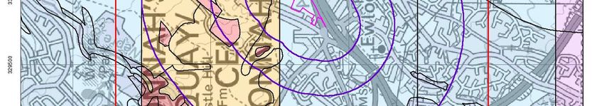
Preliminary Geo-Environmental Risk Assessment
Liverpool Road, Ewloe, CH5 3AW
Delta-Simons Project Number 20-1020.01                                                                     Page 5

                            Clay and gravel to 6.1 m bgl.
                        SJ36NW45/6
                            Soil to 0.2 m bgl;
                            Clay to 1.5 m bgl;
                            Sand and gravel to 4.7 m bgl;
                            Sandy clay with traces of coal to 6.8 m bgl; and
                            Coarse sand and gravel, boulders and clay bands to 9.1 m bgl.
                        SJ36NW45/7
                            Soil to 0.3 m bgl;
                            Sandy clay to 2.3 m bgl;
                            Red clay to 3.4 m bgl;
                            Sand and gravel to 7.0 m bgl;
                            Coarse sand to 8.7 m bgl;
                            Sand and gravel to 9.5 m bgl; and
                            Sand to 11.3 m bgl.
                        The depth to bedrock is approximately 15.3 m inferred from borehole SJ26NE793
                        located less than 10 m south of the south-west corner of the Site.

 Hydrogeology           Natural Resources Wales (NRW) classify the superficial deposits of Devensian Till as
                        Secondary Undifferentiated strata and the Head deposits as Secondary A Aquifers.
                        The Hollin Rock bedrock is designated as a Secondary A Aquifer and the Bowland
                        Shale Formation is a Secondary Undifferentiated Aquifer.
                        The NRW data also indicates that the Site is not in a designated groundwater Source
                        Protection Zone. According to the Envirocheck® Report, there are two licensed
                        abstraction records for groundwater located 902 m north-west of the Site with extraction
                        from a depth of 50 m, for use as bottled water.

 Hydrology              The nearest surface water feature is a small pond in the centre of the Site .
                        The nearest off-Site water feature is a raised covered reservoir to the north-east of the
                        Site, operated by Dwr Cymru Cyfyngedig (Welsh Water).
                        According to the Envirocheck® Report, there are no licensed abstraction records from
                        surface water located within 500 m of the Site. According to the Envirocheck® Report
                        there was discharge consent operated by Dwr Cymru Cyfyngedig for water treatment
                        on the Site between 1989 and 1994.

 Coal Mining            Reference to the Coal Authority (CA) on-line viewer indicates that the Site is within a
                        Coal Mining Reporting Area but is not within a Development High Risk Area. According
                        to the Envirocheck® Report, the Site is within potential mining areas of Mare Hey,
                        Hawarden and Aston Hall.
                        The CON29 report (provided in Appendix F) lists that the property is in a surface area
                        that could be affected by underground mining in three seams of coal at 70m to 210m
                        depth, and last worked in 1906. The CA report states that any movement in the ground
                        due to coal mining activity associated with these workings should have stopped by now.
                        There are no known coal mine entries recorded on or within 20 m of the Site.
                        The Site is located in an area which has historically been subject to bell pit mining.
                        However, it is considered that the potential for historical bell pits to be present on the

Environment | Health & Safety | Sustainability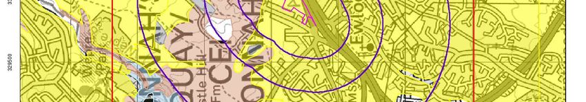
Preliminary Geo-Environmental Risk Assessment
Liverpool Road, Ewloe, CH5 3AW
Delta-Simons Project Number 20-1020.01 Page 6
Site is unlikely due to the substantial thickness of superficial deposits and sandstone
bedrock underlying the Site.
Radon Gas The majority of the Site lies within radon Affected Areas, where between 3% and 30%
of homes are above the National Radiological Protection Board (NRPB) recommended
“action level” for radon. As such, radon protection measures will be required in the
construction of new dwellings. The radon classifications for the Site are summarised
below:
The south-west of the Site lies within a 0-1% Affected Area, where radon protection
measures are typically not required;
The centre of the Site lies within a 3-5% Affected Area, where basic radon
protection measures are required;
The south-east of the Site lies within a 5-10% Affected Area, where basic radon
protection measures are required; and,
The north-east of the Site lies within a 10-30% Affected Area, where full radon
protection areas are required.
The BGS Radon Report is included in Appendix E. It should be agreed with the Local
Authority whether the Site can be zoned with regards to radon protection measures. At
this stage, it would be prudent to allow for full radon protection measures across Site.
Ecological The National Forest Inventory (GB) records the northern tip of Site as a Broadleaved
Receptors Woodland. It is understood from information provided within the Envirocheck® Report
that there are no statutory ecological receptors recorded within 500 m of the Site.
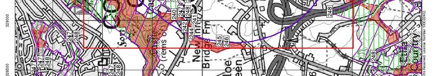
Heritage Interest According to historicwales.gov.uk, the closest area of heritage interest is located
approximately 110 m to the north of the Site associated with a Grade II Listed Building
(Church of the Holy Spirit, Flintshire).
Environmental The Site is considered to be of a low to moderate environmental sensitivity given the
Sensitivity presence of Secondary A Aquifers within the Hollin Rock bedrock and the Head
superficial deposits.
2.3 Historical Use of the Site & Surrounding Area
Approach The historical development of the Site and surrounding area has been assessed
through a review of data provided within the Envirocheck® Report. A summary of the
key historical Site uses and developments in the surrounding area is presented below.
Copies of pertinent historical maps are included as Appendix D.
Historical The Site appears to have been in agricultural use from 1869 until prior to 1963. From
Features On-Site 1964, disused sand and gravel extraction pits were present in the centre and south of
the Site, which appear to have been infilled by 1970. The A494 was constructed
between 1964 and 1967, which included the construction of embankments along the
southern margin of the Site.
The pond in the centre of the Site has been present since 1869 until the present day.
The potential infill of the sand and gravel pits on Site are considered to represent a
potential source of contamination.
Potentially Potential sources of contamination within 200 m of the Site include:
Contaminative
Sand pits, adjacent to the north of the Site in the vicinity of Holly House from circa
Historical
1871 until circa 1912, and adjacent to the south of the Site, labelled in the south as
Features Off-Site
disused by 1964. These may represent infilled ground and potential sources of
ground gas;
Environment | Health & Safety | SustainabilityPreliminary Geo-Environmental Risk Assessment
Liverpool Road, Ewloe, CH5 3AW
Delta-Simons Project Number 20-1020.01 Page 7
An electricity substation, located approximately 90 m north-east, from circa 1991
until present day; and
A landfill shown 208 m to the north of the Site operating until 1986, recorded to
have accepted inert and commercial waste.
2.4 Environmental Database Review
Approach The Landmark Envirocheck® Report provides a database of environmental information
held by various statutory bodies including NRW, Local Authority (LA) and Health &
Safety Executive (HSE) amongst others. A full copy of the Envirocheck® Report is
provided in Appendix C and the most relevant information is summarised below.
Features On-Site The Landmark Envirocheck® Report lists the Site as within an area of mostly natural
ground with potentially infilled land, associated with the former sand and gravel pits.
Potentially Pertinent entries included within the Landmark Envirocheck® Report located within 100
Contaminative m from the Site include two Contemporary Trade Directory Entries associated with a
Features Off-Site garage, Castle Garage Ewloe, (located approximately 30 m south-west) and a cleaning
material and equipment retailer, T D C Services (located approximately 30 m south-
west ), . The Garage is listed as an obsolete fuel station.
Implications for The potentially infilled land in the former sand and gravel pits, both on Site and within
Land the vicinity of the Site are considered a potential source of contamination. The potential
Contamination sources of contamination identified will be considered in the Preliminary Risk
Risk Assessment.
2.5 Planning Review/Regulatory Enquiries
On-line Planning Flintshire County Council Date Accessed 14/07/2017
Portal
Findings There are no historical or current planning applications listed for the Site.
The garage adjacent to the Site has planning permission for car services and the
erection of a garage workshop (ref: 042739 and 043565).
No additional potentially contaminative activities or other information pertinent to this
assessment was identified from the historical planning records.
Part 2A of the Flintshire County Council have confirmed that they do not intend to carry out a detailed
Environmental inspection of the subject Site, pursuant to the provisions of Part 2A of the
Protection Act Environmental Protection Act 1990, at present.
(EPA) 1990
The Council noted that the Site is likely to be underlain by deep and shallow coal
measures, and that bell pits were excavated to extract shallow coal in the past. The
Council did not indicate that bell pits are present on-Site, however, they did note that
elevated concentrations of gas (likely to be associated with coal measures/coal mining
activities) were identified at a nearby site where bell pits were confirmed to be present.
Gas protection measures were required for the properties constructed at the nearby
site.
The Council’s response is included within Appendix I.
Environment | Health & Safety | SustainabilityPreliminary Geo-Environmental Risk Assessment
Liverpool Road, Ewloe, CH5 3AW
Delta-Simons Project Number 20-1020.01 Page 8
3.0 Conceptual Site Model
3.1 Introduction
A Conceptual Site Model (CSM) represents the relationships between contaminant sources, pathways and
receptors, to support the identification and assessment of Possible Contaminant Linkages (PPL).
3.2 Potential Contamination Sources
Identified potential contamination sources are presented in the following table:
Reference Source Location Dates Present Potential Associated
Contaminants of Concern
S1 Potentially infilled Centre and Pre 1963 to Ground gas and potential
ground associated south of Site 1970 contaminants from backfill of
with sand and gravel extraction pits
abstraction pits
S2 Coal measures Site-wide Geological Methane, Carbon dioxide
S3 Radon bearing strata Central and Geological Radon
eastern part of
Site
S4 Petrol Filling Station 30 m south-west 2007 to present Petroleum hydrocarbons
and garage
S5 Electricity substation 90 m north-west 1991 to present Polychlorinated biphenyls
(PCBs)
3.3 Potential Pathways
The potential pathways are considered to be as follows:
P1 - Direct contact, ingestion or inhalation of soil bound contaminants / dust during or following
redevelopment.
P2 - Inhalation of organic vapours associated with contamination.
P3 - Migration of ground gas / vapours into on-Site buildings causing cancer, asphyxiation or risk of
explosion.
P4 - Leaching of contamination into groundwater followed by migration of groundwater to the wider
groundwater environment or discharge to surface waters.
P5 - Direct contact between aggressive ground conditions and new infrastructure.
3.4 Potential Receptors
Relevant potential receptors are considered to include:
R1 - Construction workers.
R2 - Third parties during construction (adjacent Site users and adjacent residents).
R3 - Future Site users and maintenance workers.
R4 - The adjacent water reservoir.
R5 - The underlying aquifers.
Environment | Health & Safety | SustainabilityPreliminary Geo-Environmental Risk Assessment
Liverpool Road, Ewloe, CH5 3AW
Delta-Simons Project Number 20-1020.01 Page 9
R6 - The Built Environment (new buildings and infrastructure / utilities).
Environment | Health & Safety | SustainabilityPreliminary Geo-Environmental Risk Assessment
Liverpool Road, Ewloe, CH5 3AW
Delta-Simons Project Number 20-1020.01 Page 10
Contaminant Linkage Assessment
Risk Requires
Source(s) Pathway(s) Receptor(s) Justification & Mitigation (if required)
Rating Investigation
Given the history of the Site, it is considered likely that there are Made Ground
deposits on-Site, associated with backfill of the former sand and gravel pits. It is
recommended that intrusive investigation is undertaken to investigate the potential
presence and composition of Made Ground on-Site.
The risk posed to future residents is considered to be low to moderate, as the
nature of material which may have been used to backfill the extraction pits is
unknown. The risk posed to construction workers and off-Site human receptors
S1 Potentially during the redevelopment of the Site is considered low as safe working procedures
infilled ground should be implemented, good standards of personal hygiene should be observed
Low to
from potentially P1, P2, P3, R1, R2, R3, R4, and appropriate levels of personal protective equipment (PPE) provided and
Moderate Y
infilled sand and P4, P5 R5, R6 utilised to reduce the potential risks.
Risk
gravel
abstraction pits The risk posed by hazardous ground gases is also considered to be low, as
although the nature of potential Made Ground is unknown, given the length of time
since backfilling would have taken place, it is anticipated that the current gas
generation potential of Made Ground would be low.
There is no plausible contaminant linkage between the potentially limited Made
Ground and the underlying aquifers and the adjacent watercourses. However,
contamination sources are historical and any mobile fraction may have already
migrated and / or degraded.
There is the potential for hazardous ground gases on Site associated with the
underlying Pennine Middle Coal Measures. Given the presence of granular
superficial deposits, the risk to future Site users is considered to be low to
Low to moderate.
S2 Coal
P3 R1, R2, R3, R6 Moderate Intrusive investigation and ground gas monitoring is recommended to assess the Y
Measures
Risk current ground gas regime. It should be noted that Flintshire County Council
advised that similar residential schemes in the area required ground gas
protection measures to be incorporated into newly constructed properties, and gas
protection measures may be required on this Site.
Environment | Health & Safety | SustainabilityPreliminary Geo-Environmental Risk Assessment
Liverpool Road, Ewloe, CH5 3AW
Delta-Simons Project Number 20-1020.01 Page 11
Contaminant Linkage Assessment
Risk Requires
Source(s) Pathway(s) Receptor(s) Justification & Mitigation (if required)
Rating Investigation
The majority of the Site lies within an area where 3-30% of homes are above the
S3 Radon High National Radiological Protection Board (NRPB) recommended “action level” for
P3 R3 N
bearing strata Risk radon. BRE211 (2015) indicates that basic to full radon protective measures are
necessary in the construction of new buildings at the Site.
The petrol filling station and garage to the south-west of Site are considered to
S4 Petrol filling P1, P2, P3, R1, R2, R3, R4, represent a low risk to the Site, given the superficial deposits beneath this area
Low Risk N
station (off-Site) P4, P5 R5, R6 are recorded to comprise Glacial Till, which will limit the migration of potential
contamination .
The petrol filling station and garage to the south-west of Site are considered to
S5 Electricity
P1, P2, P3, R1, R2, R3, R4, represent a low risk to the Site, given that the superficial deposits beneath this
Substation (off- Low Risk N
P4, P5 R5, R6 area are anticipated to comprise Glacial Till, which will limit the migration of
Site)
potential contamination.
Environment | Health & Safety | SustainabilityPreliminary Geo-Environmental Risk Assessment
Liverpool Road, Ewloe, CH5 3AW
Delta-Simons Project Number 20-1020.01 Page 12
4.0 Preliminary Ground Engineering Appraisal
4.1 Preliminary Ground Model
Based on the available information, it is anticipated that the Site is likely underlain by a sequence of Topsoil and
localised Made Ground (in locations of potentially infilled ground), underlain by Glacial Till in the west and Head
deposits in the east. The Site is underlain by bedrock of the Hollin Rock, Pennine Middle Coal Measures and
Bowland Shale Formation.
The Site is not located within a coal mining Development High Risk Area and the CON29M report indicates the
shallowest seam present beneath the Site is approximately 70 m bgl. It is considered unlikely that the Site was
subject to historical bell pitting due to the substantial thickness of drift deposits and the underlying sandstone.
4.2 Plausible Geohazards
The geohazards listed below have been identified to follow guidance presented in the HA document HD22/08
‘Managing Geotechnical Risk’ (2008) which aims to identify and manage the geotechnical risks associated with
a scheme throughout its lifespan, from planning to construction to maintenance.
The following geohazards are considered to be substantial ground related risks associated with the proposed
development. A substantial risk is defined by Delta-Simons in Appendix B.
Deep Made Ground may be present on Site, associated with backfilling of the former sand and gravel
abstraction pits. Made Ground is typically variable in nature and strength with a potentially low bearing
capacity and unacceptable levels of total/differential settlement may occur;
Given the change in topography across the Site, it is considered that cut and fill works will be required to
create a development platform;
Perched or shallow groundwater;
Potential for aggressive ground conditions; and
The bedrock on Site is displaced by three NW-SE trending faults, which may pose a geotechnical risk.
Potential solutions and further steps to address the aforementioned issues are discussed in Section 5.
Environment | Health & Safety | SustainabilityPreliminary Geo-Environmental Risk Assessment
Liverpool Road, Ewloe, CH5 3AW
Delta-Simons Project Number 20-1020.01 Page 13
5.0 Development Considerations
5.1 Potential Remediation Requirements & Solutions
Soils The risk of the Site requiring widespread remediation to protect end users is considered
to be low, although localised remedial measures, for example provision of a clean soil
cover for proposed soft landscaping and gardens, may be required in areas of Made
Ground.
If contamination and / or asbestos containing materials (ACMs) are identified and if
Site-won material requires off-Site disposal, then this may have an impact on waste
disposal costs.
Groundwater Widespread groundwater contamination is not anticipated. If shallow groundwater is
present, dewatering its likely to be required during earthworks and development.
Ground Gas and The British Geological Survey Radon Report indicates that the central and eastern
Radon parts of the Site lies within a radon Affected Area, where between 3% and 30% of
homes are above the National Radiological Protection Board (NRPB) recommended
“action level” for radon, requiring basic to full radon protection measures in new
buildings. It should be agreed with the Local Authority whether the Site can be zoned
with regards to radon protection measures. At this stage, it would be prudent to allow
for full radon protection measures across Site.
Given the underlying coal measures and potentially infilled land present on Site, it is
considered that there is also a ground gas risk associated with these sources. It should
be feasible to install measures to protect against both radon and ground gases;
however, this should be agreed with the Local Authority.
Building Fabric & Widespread contamination at the Site is considered unlikely. However, services are
Services recommended to be placed in clean corridors. A drinking water pipeline assessment
may be required following soils chemical results. Aggressive ground chemistry may
attack buried concrete and therefore there may be a requirement for protection
measures to be put in place at the Site.
5.2 Geotechnical Considerations
Foundations & The shallow ground conditions are anticipated to comprise Glacial Till and Head
Floor Slabs deposits overlying bedrock of the Hollin Rock, Bowland Shale Formation and the
Pennine Middle Coal Measures. Deep Made Ground deposits may be present in the
east, south and centre of the Site associated with historical sand and gravel extraction.
Pending the results of a ground investigation, shallow spread foundations may be
feasible bearing on the glacial Till deposits locally deepened in the presence of trees
in the west of the Site. Foundations may require deepening in areas where significant
depths of fill are present in the east, south and centre of the Site, piling or vibro may be
more suitable in areas of fill alternatively raft foundations could be placed on suitable
engineered backfill.
The underlying clay deposits at the Site may pose a risk to the foundations of the
proposed development because of frost heave and shrink and swell associated with
trees.
Groundworks Given the change in topography across the Site, it is considered that cut and fill works
will be required as part of an earthworks programme. Should the pond require
backfilling, it is recommended that any soft, loose or organic soil is removed, and
replaced with a suitable fill material.
Environment | Health & Safety | SustainabilityPreliminary Geo-Environmental Risk Assessment
Liverpool Road, Ewloe, CH5 3AW
Delta-Simons Project Number 20-1020.01 Page 14
External Works California Bearing Ratio testing will be required to determine road construction
thickness. Consideration will need to be given for the potential for differential settlement
to affect road surfaces and services and appropriately mitigated within the design.
Ground Instability The Envirocheck® Report indicates that there is a low risk of compressible, dissolution,
running sand and shrinking/swelling clay ground hazards.
The Site is not located within a coal mining Development High Risk Area and the
CON29M report indicates the shallowest seam present beneath the Site is
approximately 70 m bgl. It is considered unlikely that the Site was subject to historical
bell pitting due to the substantial thickness of drift deposits and the underlying
sandstone.
Environment | Health & Safety | SustainabilityPreliminary Geo-Environmental Risk Assessment
Liverpool Road, Ewloe, CH5 3AW
Delta-Simons Project Number 20-1020.01 Page 15
6.0 Conclusions & Recommendations
6.1 Land Contamination
Contamination There is considered to be a Low risk of enforcement action by the regulatory authorities
Risks Associated under Part 2A of the Environmental Protection Act, the Water Resources Act or the
with Ownership Environmental Damage Regulations. The potential for legal action by surrounding
(Current Use) landowners / Third Parties based on the potential for contamination to migrate off-Site
(ongoing or historically) is considered to be Low.
Potential Widespread contamination is considered unlikely and the preliminary risk assessment
Contaminated has identified a Low risk of soil/groundwater contamination and a Moderate risk of
Land Development hazardous ground gas at the Site. Asbestos may be present within the Made Ground.
Risks
The British Geological Survey Radon Report indicates that the central and eastern
parts of the Site lies within a radon Affected Area, where between 3% and 30% of
homes are above the National Radiological Protection Board (NRPB) recommended
“action level” for radon, requiring basic to full radon protection measures in new
buildings. It should be agreed with the Local Authority whether the Site can be zoned
with regards to radon protection measures. At this stage, it would be prudent to allow
for full radon protection measures across Site.
Plausible The Site is not located within a coal mining Development High Risk Area and the
Geotechnical CON29M report indicates the shallowest seam present beneath the Site is
Development approximately 70 m bgl. It is considered unlikely that the Site was subject to historical
Risks bell pitting due to the substantial thickness of drift deposits and the underlying
sandstone.
The underlying clay deposits at the Site may pose a risk to the foundations of the
proposed development due to the effects of frost heave and shrink and swell
associated with trees.
Potential shallow perched groundwater may be a risk during and post development.
Recommendations To identify uncertainties/data gaps in preliminary CSM that have the potential to affect
the risk assessment findings and any conclusions subsequently drawn, intrusive
investigation is recommended to assess the following:
Presence, thickness and nature of any Made Ground;
Presence, concentrations and leachability of substances of concern in shallow soils
(including Made Ground) on-Site;
Presence of substances of concern in any perched water/soil pore water or shallow
groundwater beneath Site;
Likelihood of significant ground gas and/or soil vapour intrusion into future on-Site
and off-Site buildings; and,
Characteristics of the shallow superficial deposits for foundation design.
Environment | Health & Safety | SustainabilityPreliminary Geo-Environmental Risk Assessment Liverpool Road, Ewloe, CH5 3AW Delta-Simons Project Number 20-1020.01 Appendix A – Limitations Environment | Health & Safety | Sustainability
Preliminary Geo-Environmental Risk Assessment
Liverpool Road, Ewloe, CH5 3AW
Delta-Simons Project Number 20-1020.01

Limitations
The recommendations contained in this Report represent Delta-Simons professional opinions, based upon the
information listed in the Report, exercising the duty of care required of an experienced Environmental
Consultant. Delta-Simons does not warrant or guarantee that the Site is free of hazardous or potentially
hazardous materials or conditions.

Delta-Simons obtained, reviewed and evaluated information in preparing this Report from the Client and others.
Delta-Simons conclusions, opinions and recommendations has been determined using this information. Delta-
Simons does not warrant the accuracy of the information provided to it and will not be responsible for any
opinions which Delta-Simons has expressed, or conclusions which it has reached in reliance upon information
which is subsequently proven to be inaccurate.

This Report was prepared by Delta-Simons for the sole and exclusive use of the Client and for the specific
purpose for which Delta-Simons was instructed. Nothing contained in this Report shall be construed to give
any rights or benefits to anyone other than the Client and Delta-Simons, and all duties and responsibilities
undertaken are for the sole and exclusive benefit of the Client and not for the benefit of any other party. In
particular, Delta-Simons does not intend, without its written consent, for this Report to be disseminated to
anyone other than the Client or to be used or relied upon by anyone other than the Client. Use of the Report
by any other person is unauthorised and such use is at the sole risk of the user. Anyone using or relying upon
this Report, other than the Client, agrees by virtue of its use to indemnify and hold harmless Delta-Simons from
and against all claims, losses and damages (of whatsoever nature and howsoever or whensoever arising),
arising out of or resulting from the performance of the work by the Consultant.

Environment | Health & Safety | Sustainability
Preliminary Geo-Environmental Risk Assessment
Liverpool Road, Ewloe, CH5 3AW
Delta-Simons Project Number 20-1020.01

Appendix B – Risk Definitions

Environment | Health & Safety | Sustainability
Contaminated Land Risk Definitions
The following methodology is based on the methodology presented in CIRIA C552 Contaminated Land
Risk Assessment: A Guide to Good Practice 2001. It requires the classification of the:

    Magnitude of the potential consequence (severity) of the Risk occurring: and
    Magnitude of the Probability (likelihood) of the Risk occurring.
The classifications are then compared to indicate the risk presented by each pollutant linkage.

Consequence to Receptor Definition Matrix

                          Human Health               Controlled Waters                Buildings/Services

                                                  Sensitive controlled water
  Severe          Acute or chronic permanent
                                                  pollution ongoing, or just         Catastrophic collapse
Consequence        impact on human health.
                                                       about to occur.

  Medium         Chronic permanent impact on        Gradual pollution of
                                                                                    Degradation of materials
Consequence             human health              sensitive controlled water

                                                                                Damage to building rendering it
    Mild          Chronic temporary impact on     Gradual pollution of non-
                                                                                unsafe.to occupy (eg foundation
Consequence              human health             sensitive controlled water
                                                                                damage resulting in instability).

                Non-permanent health effects to                                Easily repairable effects of damage
   Minor        human health (easily prevented      Slight discoloration of       to buildings, structures and
Consequence       by means such as personal                  water                services, i.e discoloration of
                    protective clothing etc).                                                concrete

Probability Definitions

 Probability     Definition in Context

                 There is a pollution linkage and an event that either appears very likely in the short term and
 Higher          almost inevitable over the long term, or there is evidence at the receptor of harm or pollution.
                 Positive evidence of source, pathway and receptor.

                 There is a pollution linkage and all the elements are present and in the right place, which
                 means that it is probable that an event will occur. Circumstances are such that an event is
 Likely          not inevitable, but possible in the short term and likely over the long term.
                 Suspect source, pathway, and receptor

                 There is a pollution linkage and circumstances are possible under which an event could
 Low             occur.
 Likelihood      However, it is by no means certain that even over a longer period such event would take
                 place, and is less likely in the shorter term.

                 There is a pollution linkage but circumstances are such that it is improbable that an event
 Unlikely        would occur even in the very long term
                 No evidence of hazard, pathway, and receptor

Environment | Health & Safety | Sustainability
Standard Risk Matrix
Consequence/Magnitude of impact
Severe Medium Mild Minor
High Very High High Moderate Moderate/Low
Probability
Likely High Moderate Moderate/low Low
Low Likelihood Moderate Moderate/low Low Very Low
Unlikely Moderate/low Low Very Low Very Low
Classified risks and likely action
Significance Definition/Comments
Level
Very High Risk There is a high probability that severe harm could arise to a designated receptor from an
identified hazard, OR, there is evidence that severe harm to a designated receptor is
currently happening.
This risk, if realised, is likely to result in a substantial liability. Urgent investigation (if not
undertaken already) and remediation are likely to be required.
Demonstrable contaminated land situation, highest threat & liability level, urgent action
recommended.
High Risk Harm is likely to arise to a designated receptor from an identified hazard.
Realisation of the risk is likely to present a substantial liability. Urgent investigation (if not
undertaken already) is required and remedial works may be necessary in the short term
and are likely over the longer term.
Likely contaminated land situation, risk assessment and action recommended.
Moderate It is possible that harm could arise to a designated receptor from an identified hazard.
However, if is either relatively unlikely that any such harm would be severe, or if any harm
were to occur it is more likely that the harm would be relatively mild
Investigation (if not already undertaken) is normally required to clarify the risk and to
determine the potential liability. Some remedial works may be required in the longer term.
Plausible contaminated land situation, risk assessment and possible action
recommended.
Low Risk It is possible that harm could arise to a designated receptor from an identified hazard, but
it is likely that this harm, if realised, would at worst normally be mild.
Unlikely contaminated land situation, possible risk assessment and possible action.
Very Low Risk There is a low possibility that harm could arise to a receptor. In the event of such harm
being realised it is not likely to be severe.
Negligible risk, no action recommended except vigilance for changes in conditions.
Environment | Health & Safety | SustainabilityGeotechnical Risk Classification
The geohazards listed in the report within Section 4 follow guidance presented in Clayton, C.R.I. (2001)
Managing Geotechnical Risk, Thomas Telford and the Highways Agency document HD22/08 ‘Managing
Geotechnical Risk’ (2008) which aims to identify and manage the geotechnical risks associated with a
scheme throughout its lifespan, from planning to construction to maintenance.
For each geohazard the probability of the hazard occurring (P) has been considered together with the
impact it would have (I) if it were to happen to calculate the risk rating between 1 and 25.
Risks that fall within Moderate, Significant and Severe categories below are considered to be
substantial and are therefore listed within the report.
Probability (P) Impact (I) (R) Risk
Very Likely (VLk) 5 Very High (VH) 5 20 – 25 Severe
Likely (Lk)
Plausible (P)
4
3
X High (H)
Medium (M)
4
3
= 15 – 19
10 – 14
Substantial
Moderate
Unlikely (U) 2 Low (L) 2 5–9 Minor
Very Unlikely (VU) 1 Very Low (VL) 1 1–4 Negligible
Environment | Health & Safety | SustainabilityPreliminary Geo-Environmental Risk Assessment Liverpool Road, Ewloe, CH5 3AW Delta-Simons Project Number 20-1020.01 Appendix C – Envirocheck® Report Environment | Health & Safety | Sustainability
Groundwater Vulnerability

Site Sensitivity Context Map - Slice A

Order Details
Order Number:                   245435850_1_1
Customer Ref:                   20-1020.01
National Grid Reference:        330050, 366860
Slice:                          A
Site Area (Ha):                 5.73
Search Buffer (m):              1000

Site Details
Bali Hai, Ferry Hill, Ewloe, DEESIDE, CH5 3AW

                                              Tel:   0844 844 9952
                                              Fax:   0844 844 9951
                                              Web:   www.envirocheck.co.uk

A Landmark Information Group Service v15.0   22-Jun-2020                 Page 1 of 6
Bedrock Aquifer Designation
Site Sensitivity Context Map - Slice A
Order Details
Order Number: 245435850_1_1
Customer Ref: 20-1020.01
National Grid Reference: 330050, 366860
Slice: A
Site Area (Ha): 5.73
Search Buffer (m): 1000
Site Details
Bali Hai, Ferry Hill, Ewloe, DEESIDE, CH5 3AW
Tel: 0844 844 9952
Fax: 0844 844 9951
Web: www.envirocheck.co.uk
A Landmark Information Group Service v15.0 22-Jun-2020 Page 2 of 6Superficial Aquifer Designation
Site Sensitivity Context Map - Slice A
Order Details
Order Number: 245435850_1_1
Customer Ref: 20-1020.01
National Grid Reference: 330050, 366860
Slice: A
Site Area (Ha): 5.73
Search Buffer (m): 1000
Site Details
Bali Hai, Ferry Hill, Ewloe, DEESIDE, CH5 3AW
Tel: 0844 844 9952
Fax: 0844 844 9951
Web: www.envirocheck.co.uk
A Landmark Information Group Service v15.0 22-Jun-2020 Page 3 of 6Source Protection Zones
Site Sensitivity Context Map - Slice A
Order Details
Order Number: 245435850_1_1
Customer Ref: 20-1020.01
National Grid Reference: 330050, 366860
Slice: A
Site Area (Ha): 5.73
Search Buffer (m): 1000
Site Details
Bali Hai, Ferry Hill, Ewloe, DEESIDE, CH5 3AW
Tel: 0844 844 9952
Fax: 0844 844 9951
Web: www.envirocheck.co.uk
A Landmark Information Group Service v15.0 22-Jun-2020 Page 4 of 6Sensitive Land Uses
Site Sensitivity Context Map - Slice A
Order Details
Order Number: 245435850_1_1
Customer Ref: 20-1020.01
National Grid Reference: 330050, 366860
Slice: A
Site Area (Ha): 5.73
Search Buffer (m): 1000
Site Details
Bali Hai, Ferry Hill, Ewloe, DEESIDE, CH5 3AW
Tel: 0844 844 9952
Fax: 0844 844 9951
Web: www.envirocheck.co.uk
A Landmark Information Group Service v15.0 22-Jun-2020 Page 5 of 6BGS Flood GFS Data
Site Sensitivity Context Map - Slice A
Order Details
Order Number: 245435850_1_1
Customer Ref: 20-1020.01
National Grid Reference: 330050, 366860
Slice: A
Site Area (Ha): 5.73
Search Buffer (m): 1000
Site Details
Bali Hai, Ferry Hill, Ewloe, DEESIDE, CH5 3AW
Tel: 0844 844 9952
Fax: 0844 844 9951
Web: www.envirocheck.co.uk
A Landmark Information Group Service v15.0 22-Jun-2020 Page 6 of 6Envirocheck ® Report:
Datasheet
Order Details:
Order Number:
245435850_1_1
Customer Reference:
20-1020.01
National Grid Reference:
330050, 366860
Slice:
A
Site Area (Ha):
5.73
Search Buffer (m):
1000
Site Details:
Bali Hai, Ferry Hill
Ewloe
DEESIDE
CH5 3AW
Client Details:
Ms M Booth
Delta Simons
Suite 4A
One Portland Street
Manchester
M1 3BE
Order Number: 245435850_1_1 Date: 22-Jun-2020 rpr_ec_datasheet v53.0 A Landmark Information Group ServiceContents
Report Section Page Number
Summary -
Agency & Hydrological 1
Waste 21
Hazardous Substances -
Geological 32
Industrial Land Use 41
Sensitive Land Use 49
Data Currency 50
Data Suppliers 56
Useful Contacts 57
Introduction
The Environment Act 1995 has made site sensitivity a key issue, as the legislation pays as much attention to the pathways by which contamination could spread,
and to the vulnerable targets of contamination, as it does the potential sources of contamination.
For this reason, Landmark's Site Sensitivity maps and Datasheet(s) place great emphasis on statutory data provided by the Environment Agency/Natural Resources
Wales and the Scottish Environment Protection Agency; it also incorporates data from Natural England (and the Scottish and Welsh equivalents) and Local
Authorities; and highlights hydrogeological features required by environmental and geotechnical consultants. It does not include any information concerning past
uses of land. The datasheet is produced by querying the Landmark database to a distance defined by the client from a site boundary provided by the client.
In this datasheet the National Grid References (NGRs) are rounded to the nearest 10m in accordance with Landmark's agreements with a number of Data Suppliers.
Copyright Notice
© Landmark Information Group Limited 2020. The Copyright on the information and data and its format as contained in this Envirocheck® Report ("Report") is the
property of Landmark Information Group Limited ("Landmark") and several other Data Providers, including (but not limited to) Ordnance Survey, British Geological
Survey, the Environment Agency/Natural Resources Wales and Natural England, and must not be reproduced in whole or in part by photocopying or any other
method. The Report is supplied under Landmark's Terms and Conditions accepted by the Customer.
A copy of Landmark's Terms and Conditions can be found with the Index Map for this report. Additional copies of the Report may be obtained from Landmark,
subject to Landmark's charges in force from time to time. The Copyright, design rights and any other intellectual rights shall remain the exclusive property of
Landmark and /or other Data providers, whose Copyright material has been included in this Report.
© Environment Agency & United Kingdom Research and Innovation 2020. © Natural Resources Wales & United Kingdom Research and Innovation 2020.
Natural England Copyright Notice
Site of Special Scientific Interest, National Nature Reserve, Ramsar, Special Protection Area, Special Conservation Area, Marine Nature Reserve data (derived from
Ordnance Survey 1:10000 raster) is provided by, and used with the permission of, Natural England who retain the copyright and Intellectual Property Rights for the
data.
Scottish Natural Heritage Copyright
Contains SNH information licensed under the Open Government Licence v3.0.
Ove Arup Copyright Notice
The Mining Instability data was obtained on licence from Ove Arup & Partners Limited (for further information, contact mining.review@arup.com). No reproduction or
further use of such Data is to be made without the prior written consent of Ove Arup & Partners Limited. The supplied Mining Instability data is derived from publicly
available records and other third party sources and neither Ove Arup & Partners nor Landmark warrant the accuracy or completeness of such information or data.
Peter Brett Associates Copyright Notice
The cavity data presented has been extracted from the PBA enhanced version of the original DEFRA national cavity databases. PBA/DEFRA retain the copyright &
intellectual property rights in the data. Whilst all reasonable efforts are made to check that the information contained in the cavity databases is accurate we do not
warrant that the data is complete or error free. The information is based upon our own researches and those collated from a number of external sources and is
continually being augmented and updated by PBA. In no event shall PBA/DEFRA or Landmark be liable for any loss or damage including, without limitation, indirect
or consequential loss or damage arising from the use of this data.
Radon Potential dataset Copyright Notice
Information supplied from a joint dataset compiled by The British Geological Survey and Public Health England.
Natural Resources Wales Copyright Notice
Contains Natural Resources Wales information © Natural Resources Wales and Database Right. All rights Reserved. Contains Ordnance Survey Data. Ordnance
Survey Licence number 100019741. Crown Copyright and Database Right. Contains Natural Resources Wales information © Natural Resources Wales and
Database Right. All rights Reserved. Some features of this information are based on digital spatial data licensed from the Centre for Ecology & Hydrology © NERC
(CEH). Defra, Met Office and DARD Rivers Agency © Crown copyright. © Cranfield University. © James Hutton Institute. Contains OS data © Crown copyright and
database right 2020. Land & Property Services © Crown copyright and database right.
Report Version v53.0
Order Number: 245435850_1_1 Date: 22-Jun-2020 rpr_ec_datasheet v53.0 A Landmark Information Group ServiceYou can also read