Research Report 2020 - Leibniz-Institut für Angewandte Geophysik
←
→
Page content transcription
If your browser does not render page correctly, please read the page content below
Research Report 2020
VOR WOR T                                                                                                PREFACE

                                                            Liebe Leserinnen und Leser,                                            Dear Readers,

                                                            Das Leibniz-Institut für Angewandte Geo-                              The Leibniz Institute for Applied Geophysics
                                                            physik blickt auf ein aufregendes, aber                                      looks back on an exciting, but successful
                                                            erfolgreiches Jahr 2020 zurück. Be-                                              year 2020. Back in January, the com-
                                                            reits im Januar schuf die Zusage                                                   mitment of the Lower Saxony state
                                                            der Niedersächsischen Landes-                                                         government to continue funding
                                                            regierung zur Weiterfinanzie-                                                          the institute beyond 2022
                                                            rung des Institutes über das                                                           created the necessary basis for
                                                            Jahr 2022 hinaus die notwen-                                                           LIAG‘s ongoing existence, with
                                                            dige Basis für den Fortbe-                                                             the aim of rejoining the Leibniz
                                                            stand des LIAG, mit dem Ziel                                                           Association as soon as possible.
                                                            einer schnellstmöglichen Wie-                                                         However, the Corona pandemic
                                                            deraufnahme in die Leibniz-Ge-                                                     brought major challenges soon
                                                            meinschaft. Die Corona-Pandemie                                                 thereafter, as the restrictions led in
                                                            brachte bald darauf aber große Heraus-                                     part to delays in project and field activities
                                                            forderungen mit sich, da die Einschränkungen                         at a national and international level. However,
                                                            teilweise zu Verzögerungen von Projekt- und Geländeak-       with a hygiene concept developed at an early stage at
                                                            tivitäten im In- und Ausland führten. Mit einem frühzeitig   the Geocentre, it was possible to continue quickly active
                                                            ausgearbeiteten Hygienekonzept im Geozentrum konnte          research and further develop LIAG‘s scientific orientation.
                                                            jedoch schnell aktiv weitergeforscht und die wissenschaft-   In the first year after the end of our membership in the

               Making the invisible visible:                liche Ausrichtung des LIAG weiterentwickelt werden. Im       Leibniz Association, we thus achieved important milesto-
                                                            ersten Jahr nach Beendigung der Mitgliedschaft in der        nes in the institute‘s development. In numerous internal
Future-oriented, geophysical exploration of processes and   Leibniz-Gemeinschaft haben wir auf diese Weise wichtige      and external, national and international workshops, we

            developments in the subsurface.                 Meilensteine im Rahmen der Institutsentwicklung er-          developed concepts for a future Institute of Environmen-
                                                            reicht. In zahlreichen internen und externen, nationalen     tal Geophysics, and are currently summarizing them to
                                                            und internationalen Workshops erarbeiteten wir Konzepte      one and specifying it. The focus here lies on the research
                                                            für ein zukünftiges Institut für Umweltgeophysik, welche     areas of groundwater geophysics and geohazards. In ad-
                                                            derzeit zusammengefasst und präzisiert werden. Im Fokus      dition, the establishment of a core administration, which
                                                            stehen hierbei die Forschungsbereiche Grundwasser-Geo-       was emphatically required in the past two evaluations,
                                                            physik und Geogefahren. Der in den beiden vergangenen        is in full swing. Furthermore, we have further expanded
                                                            Evaluierungen mit Nachdruck vertretene Aufbau einer          science management and relaunched the Research
                                                            Kernverwaltung ist zudem in vollem Gange. Des Weiteren       Report 2020. Now it has an appealing modern format,
                                                            haben wir das Wissenschaftsmanagement weiter aus-            with many interesting contributions from staff about
                                                            gebaut und den Forschungsbericht 2020 neu aufgelegt.         internally and externally funded projects in this year.
                                                            Dieser erscheint erstmals in ansprechendem modernen
                                                                                                                         We hope you enjoy reading it and we are looking for-
                                                            Format mit vielen interessanten Beiträgen der Mitarbei-
                                                                                                                         ward to your response.
                                                            tenden über intern und extern finanzierte Projekte aus
                                                            diesem Jahr.

                                                            Wir wünschen viel Lesefreude und sind neugierig
                                                            auf die Resonanz.

                                                                                                                                       Prof. Dr. Manfred Frechen
                                                                                                                                          Kommissarischer Direktor
                                                                                                                                             Acting Director
CONTENTS

                                               LIAG IN FOCUS

                        Our expertise and mission statement
                                                                  06

                                                                  08
                                                                       1        64
                                                                                     Loess-palaeosol sequences in northern Iran
                                                                                     and their paleoclimatic significance

                                                                                     Identifying and analysing near-surface concealed
                                                                                66
                                Organisation and committees       10                 fault structures and weak zones

             Institute development – Reviewing our progress       12                 REGROUP: Reconstruction of rainfall distribution
                                                                                68
                                                                                     in Europe using soil properties
                                The challenge of a pandemic       16
                                                                                     Mysteries of Lake Ohrid – Researching the oldest
                                                                                70
                                                                                     lake in Europe

                                  RESEARCH TOPIC PROFILES         18
                                                                       2
    Groundwater Geophysics: Understanding the elixir of life

             Geothermics: Renewable energy from the deep
                                                                  20

                                                                  26
                                                                           4    72

                                                                                74
                                                                                     LIAG AT A GLANCE

                                                                                     Facts and figures
        Sediments through the Ages: Learning from the past        32            76   Finances
                          Geohazards: When the earth moves        38           77    Employees

                                                                                78   New and ongoing projects

       SELECTED PROJECTS: REGIONAL TO INTERNATIONAL

                      Overview: Where we conduct research
                                                                  44

                                                                  46
                                                                       3       86

                                                                               92
                                                                                     Publications in specialist journals

                                                                                     Courses

   3D visualisation of glacial structures in the Tannwald basin   48           92    Lectures

                Climate reconstruction: Neanderthal survival                   95    Departments and functions
                                                                  50
                      through the ice ages in Lower Saxony                           Collaborations
                                                                               96
  Sustainable exploitation of the Malm geothermal reservoir
                                                                  52           98    Support of young scientists
                         in the Munich Metropolitan Region
                                                                                     Software development, specialist information
       The influence of groundwater flow on heat transport                     100
                                                                  54                 service and research data infrastructure
and temperature distribution in the play type foreland basins

           TOPSOIL: Understanding the water under our feet        56

     go-CAM: Protecting groundwater using a planning tool
                       and saltwater early warning system

           MoreSpin: Innovative, mobile soil moisture sensor
                                                                  58
                                                                           5   102   LIAG PROSPECTS

                                                                           6
                                                                  60
           for high-resolution water content measurements
                                                                               106   IMPRINT
                            Dating stone age tools in Zambia      62
1
LIAG IN FOCUS
LIAG in focus

Our expertise
		and mission

The Leibniz Institute for Applied Geophysics is an inde-           topics nationally and internationally. We handle basic       Exclusively research-related services
pendent, non-university research institute, based in Ha-           research, process research and applied research and,
                                                                                                                                We also conduct autonomous and independent re-
nover, Germany. We use applied geophysical methods                 in this way, cover an indispensable proportion of the
                                                                                                                                search in national and international contexts in close
to explore future-oriented issues that are of importance           necessary research. Our many years of specialisation in
                                                                                                                                collaboration with university institutes, other research
to society. The focus of our research is the exploration           near-surface geophysical applications, our equipment
                                                                                                                                facilities, the state geological services and industrial
of the usable subsurface and the development of                    and data infrastructure, and our resulting scope for
                                                                                                                                partners. As a research institute, LIAG only conducts
measuring techniques and evaluation methods. The                   combining diverse, interdisciplinary geophysical meth-
                                                                                                                                contract work or provides services in exceptional cases.
institute has over 50 years of geophysical research ex-            ods within the institute make LIAG unique in Germany.
                                                                                                                                This applies if the projects are research-related and
perience.
                                                                   LIAG’s principle fields of work                              cannot be conducted in any other way, if the issue on
Unique specialist expertise and facilities                                                                                      hand has research potential worthy of publication that
                                                                      Geophysical investigation of structures in the sub-       fits the institute’s profile, or if industrial companies lack
Our research activities are centred on the Earth’s upper              surface to determine and record the geological            the particular expert knowledge.
crust and the depths that can be influenced by hu-                    morphology and as a basis for understanding pro-
mans. This zone is relevant for immediate commercial                  cess sequences and the physical parameters that           Integration into the Geozentrum
exploitation and the provision of services. Our aim is to             control them.
                                                                                                                                One special aspect of LIAG is that we are integrated
understand, preserve and protect geopotential resourc-
                                                                      The exploration of processes in the geosphere, i.e.       into the Geozentrum Hanover. Along with the Federal
es, such as groundwater, soil, energy sources and raw
                                                                      their origins, their temporal and spatial sequences       Institute for Geosciences and Natural Resources (BGR)
materials, and to develop them for vital and sustain-
                                                                      and correlations and their impact on the geosphere        and the State Office for Mining, Energy and Geology
able use. It is also essential to understand geohazards
                                                                      and the environment.                                      (LBEG), LIAG benefits from a shared infrastructure for
caused, for example, by land movements, sinkholes or
                                                                                                                                administration, buildings, IT, vehicles, workshops and
other environmental changes. Due to the increasing                    Devising new measurement methods and further
                                                                                                                                laboratories and one of the most extensive specialised
vulnerability of populated areas, it is vital to promptly             improving them, interpretation techniques and sys-
                                                                                                                                geoscientific libraries in the world. Large-scale devices,
identify, evaluate and potentially minimise the resulting             tems of equipment for solving the aforementioned
                                                                                                                                measuring systems, research sites and project locations
damage.                                                               tasks.
                                                                                                                                are frequently shared.
                                                                                                                                The particular benefit of being integrated into the
Against this backdrop, the institute focusses on the               LIAG is also involved in political consultancy, public re-
                                                                                                                                Geozentrum is that we can communicate directly with
overarching topics of groundwater geophysics, geo-                 lations, support for young researchers, and the transfer
                                                                                                                                the applied geosciences and have immediate access to
hazards, sediments through the ages (paleoclimate/                 of knowledge. Internally, LIAG also actively supports
                                                                                                                                a breadth of specialist knowledge that is unique within
climate dynamics) and geothermal energy. We address                equality standards and is dedicated to meeting em-
                                                                                                                                Germany and, in some cases even internationally. This
issues that have great societal relevance and that aim             ployees’ needs, such as promoting advanced training.
                                                                                                                                also gives rise to synergetic and cooperative research
to generate added value for stakeholders. No other                 Researchers at LIAG actively participate in academic
                                                                                                                                campaigns.
facility has a comparable range of services in the area            teaching and delivered lectures at five universities in
of applied geophysics connected to the key topics of               2020. Furthermore, LIAG employees provide extensive
groundwater systems, geoenergy systems, terrestrial                services for the scientific community as reviewers and
sediment systems and targeted methodological devel-                committee members.
opment. No other institute dedicates their entire range
of services to application-oriented questions in this
scientific sector. LIAG is able to address socially relevant

                                                               8                                                                                                                                9
LIAG in focus
Organisation and committees Advisory board
MR Norbert Conrad (Chair)
Lower Saxony Ministry of Industry, Labour, Transport and Dr Gabriele Uenzelmann-Neben
Digitalisation, Alfred Wegener Institute for Polar and Marine Research,
Hanover (DE) Bremerhaven (DE)
Dr Peer Hoth (Deputy chair) Dr Wolf Junker
Federal Ministry for Economic Affairs and Energy, Federal Ministry of Education and Research,
Berlin (DE) Bonn (DE)
Prof. Hans-Jürgen Götze Dr Michael Neubert
Christian-Albrecht University of Kiel, Baker Hughes INTEQ GmbH,
Institute of Geosciences, Celle (DE)
Kiel (DE)
Ltd. GD Sabine Rosenbaum
Dr Birgit Fritz-Taute State Office for Agriculture, Environment and Rural Areas,
Senate Department for Enviroment, Transport and Climate Schleswig-Holstein,
Protection, Flintbek (DE)
Berlin (DE)
Prof. Brigitte Urban
Claudia Mitsch-Werthwein Leuphana University of Lüneburg,
Ministry of the Environment, Climate Protection and Institute of Ecology,
the Energy Sector, Lüneburg (DE)
Stuttgart (DE)
Dr Birgit Nolte
Lower Saxony Ministry for Science and Culture, Hanover (DE)
Scientific advisory committee
Dr Gabriele Uenzelmann-Neben (Chair) Prof. Jörg-Detlef Eckhardt
Alfred Wegener Institute for Polar and Marine Research, State Office for Geology, Raw Materials and Mining,
Bremerhaven (DE) Freiburg Regional Council,
Freiburg (DE)
LIAG structure Prof. Thomas Bohlen (Deputy Chair)
Karlsruhe Institute of Technology (KIT), Prof. Andreas Lang
The institute’s constitution is based on two bodies: the tinuous evaluation of the Institute’s research activities Geophysical Institute (GPI), University of Salzburg,
and, to this end, conducts internal assessments that Karlsruhe (DE) Department of Geography and Geology,
advisory board and the director. The advisory board is
Salzburg (AT)
the decision-making body for all significant institute are submitted to the advisory board. It consists of nine Dr Oliver Kuras
matters and exercises the employer’s duty of care. The respected figures from different fields: four from the Environmental Science Centre, Prof. Hansruedi Maurer
board has eleven members: The federal state of Lower higher education sector, two from the state geological Keyworth, Nottingham (UK) Swiss Federal Institute of Technology (ETH) Zurich,
service, two from the non-university research facility Institute of Geophysics,
Saxony and the federal government each nominate
Prof. Gudrun Massmann Zurich (CH)
two members, each university supplies one person, the sector and one from the industrial sector. Two members Carl von Ossietzky University of Oldenburg,
German national/regional committee for soil research must be from outside Germany and one member must Working Group for Hydrogeology and Landscape Hydrology, Dr Dirk Orlowsky
supplies two members, and the state geological service belong to the Leibniz University Hanover. The members Oldenburg (DE) DMT GmbH Explorationsseismik & Geosurvey,
Essen (DE)
(SGD) nominates one person. The areas of industry and of the advisory committee are proposed by the insti-
Prof. Insa Neuweiler
geosciences are represented by one person each and tute’s directors and appointed by the advisory board. Leibniz University Hanover,
the scientific advisory committee is represented by the The term of office is four years. The current advisory Institute of Fluid Mechanics and Environmental Physics in Civil
committee was reconstituted in 2020. Engineering, Hanover (DE)
current chair. By statute, the director is nominated by
means of a joint appointment process with a German
university. The institute also has an internal research committee,
Internal research committee
whose members are selected from within LIAG. This
The institute is advised by a scientific advisory com- committee provides advice on issues of scientific orien- Dr Christian Zeeden (Spokesperson)
Dr Manfred W. Wuttke (Deputy spokesperson)
mittee (WB) on questions of scientific relevance. The tation and research planning.
Dr Jan Igel
scientific advisory committee is responsible for the con- Dr Sumiko Tsukamoto
Dr Thomas Burschil
10 11
LIAG in focus

                                      Institute development –
                                           Reviewing our progress

On 21/01/2020, a cabinet decision created the neces-              of Science and Culture (MWK). A further crucial point
sary conditions for continued financial support from              is the continued development of our research strategy
the state of Lower Saxony. This secured the future of the         on the basis of overarching key issues concerning the      Dr Berend Lindner, state secretary of the Lower Saxony Ministry of Industry, Labour,
institute after the termination of its membership in the          use and exploration of the upper geosphere.                Transport and Digitalisation, launched the future workshop together with
                                                                                                                             Prof. Manfred Frechen, acting director of LIAG.
Leibniz Association. The state of Lower Saxony views
LIAG as a vital component of the national research                Strengthening the line of research with an
community. It considers the methodical and scientific             external commission of experts
expertise and the advisory services of the institute to be                                                                   ministries (MW and MWK), from institutes in the Helm-       “The workshop provides the committees with an im-
indispensable in connection with the current societal,            Hence, LIAG continues to drive forward its reorien-        holtz Association, and from universities. Discussions       portant basis for making further decisions concerning
economical and environmental issues related to the                tation this year. The institute has initiated its own      were focused on future concepts                                           research strategies”.
exploration and utilisation of the subsurface. For this           two-day future workshop to strengthen the scientific       prepared by LIAG (on the topics                       ››
                                                                                                                                                                           We must utilise and
                                                                                                                             of groundwater, georisks and          strategically develop LIAG’s        State secretary Dr Lindner also considered
reason, the state of Lower Saxony will provide funding            strategy: Eleven external national and international
                                                                                                                             climate dynamics) and by the ex-      indisputable existing wealth the future workshop to be a significant
once joint funding from the federal and state govern-             researchers with recognised expertise in geoscientific
                                                                                                                             ternal guest experts based on the of professional and method- step: “The state government wants LIAG to
ments is discontinued at the end of 2022. Every effort
will be made to ensure the readmission of LIAG into the
                                                                  topics and geophysics discussed potential lines of re-
                                                                  search on the 7th and 8th of September. The event was      evaluation report from the senate ological expertise.                         ‹‹
                                                                                                                                                                                                       be readmitted to the Leibniz Association.
Leibniz Association as soon as possible by implement-             launched by Dr Berend Lindner, state secretary of the      of the Leibniz Association. Further                                       This will require a reorientation of both
ing the recommendations from the last evaluation. A               Lower Saxony Ministry of Industry, Labour, Transport       topics under debate included current methodological         subject matter and strategy within the institute. The
central issue is the modification of internal structures          and Digitalisation. Guests included the president of the   expertise, available equipment and the entire infra-        subject areas addressed must be adapted to cover key
and the development of an own internal administration             German Geophysical Society, Prof. Heidrun Kopp, and        structure of LIAG.                                          scientific and sociopolitical issues of the present and
management, which will systematically and efficiently             Prof. Hildegard Westphal of the Leibniz Centre for Trop-                                                               the future. To this end, we must utilise and strategically
support the future scientific development of LIAG. In             ical Marine Research, the former scientific vice presi-    “With the assistance of external scientific experts, we     develop LIAG’s indisputable existing wealth of profes-
addition, there must be a change of ministry from the             dent of the Leibniz Association. They held discussions     planned a reorientation of the institute while retaining    sional and methodological expertise”.
Lower Saxony Ministry of Economics, Labor, Transport              along with further figures from the Federal Ministry       our unique selling point in the research landscape”,
and Digitalization (MW) to the Lower Saxony Ministry              for Economic Affairs and Energy, from Lower Saxony         explains Prof. Manfred Frechen, acting director of LIAG.

                                                             12                                                                                                                                         13
LIAG in focus
Acting director
Scientific advisory committee of the institute
at their twice-yearly meeting:
The committee counsels the advisory
board with regard to LIAG’s research
orientation. In October, they proposed
the springboard topics of groundwater
geophysics and geohazards.
Concept formulation: Groundwater Geophysics
and Geohazards as springboard topics
The scientific advisory committee reconstituted on 8th ed into investigations of these two topics. It was also
October 2020 with Dr Gabriele Uenzelmann-Neben emphasised that LIAG is renowned for a wide range of
(AWI Helmholtz Centre for Polar and Marine Research) methodological expertise in applied geophysics, mak-
as chair and Prof. Thomas Bohlen (Geophysical Institute ing us unique in Germany, if not globally.
of KIT) as her deputy. The committee rated the topics
of geohazards and groundwater geophysics that were On 4th November 2020, the advisory board met as the
identified by LIAG and the commission of experts as supreme body of LIAG to discuss these recommenda-
being suitable. These topics represent the initial basis tions. They agreed that LIAG management will expand
for developing an institute of environmental geophys- the concept in detail in consultation with the scientific
ics and must be further substantiated and elaborated advisory committee. They will further refine the subject
by investigations of key scientific importance. For matter and structure of the concept with regard to the ›› At LIAG, we are
springboard topics of groundwater geophysics and
Prof. Manfred Frechen and Prof. Gerald Gabriel after highly motivated to develop a
instance, how the effects of climate change or aspects inauguration to their new positions.
strategy for orienting our work
of the impending energy revolution can be incorporat- geohazards.
towards forming an institute of
environmental geophysics in
collaboration with and building
on the strengths and geo-
Following the decision of the advisory board, LIAG also physical expertise
officially appointed Prof. Manfred Frechen as the acting of our researchers. en‹‹rech
director. Prof. Gerald Gabriel took up the office Prof. F
red
Prof. Manf
Frechen previously held as deputy director. The two
currently head the research fields of Geochronology
and Seismic, Gravimetry, and Magnetics at the institute, institute as deputy director for two years. Prof. Gerald
respectively. The highest executive positions in LIAG Gabriel has worked in the Seismic, Gravimetry, and
are formally and entirely filled based on the decision of Magnetics department at LIAG since 1998 and also
the advisory board as the supreme body of the insti- worked in LIAG’s predecessor organisation. He has
tute. Prof. Manfred Frechen has been the section head been the head of the department since 2016.
LIAG management (left to right): Prof. Gerald Gabriel, Dr Thomas Wonik, of Geochronology at LIAG since 2001; he managed the
Prof. Manfred Frechen, Prof. Inga Moeck, Prof. Mike Müller-Petke; far right:
Dr Sumiko Tsukamoto.
14 15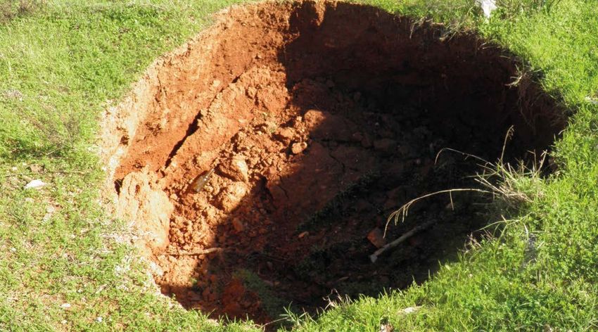
V

The challenge of a pandemic
		Ongoing research
				 under the threat of COVID-19

                                                                   T          he year 2020 was dominated by the COVID-19
                                                                              pandemic. It had a massive impact on de-
                                                                              velopment and research at LIAG as well as
                                                                   on national and, in particular, international research
                                                                   projects. All employees had to make major changes to
                                                                                                                                     A combination of patience and digital solutions

                                                                                                                                     Organising necessary business trips and fieldwork for
                                                                                                                                     ongoing projects was a further complication. Here too,
                                                                                                                                     the implementation options available to partner organ-
                                                                                                                                     isations and external participants were determined by
                                                                   their working methods. However, the three establish-
                                                                                                                                     the hygiene protocol of the three establishments. We
                                                                   ments within the Geozentrum (BGR, LBEG and LIAG)
                                                                                                                                     even had to postpone some investigations and project
                                                                   established a joint hygiene protocol that allowed the
                                                                                                                                     launches, especially in high-risk regions and more dis-
                                                                   institute to continue operating.
                                                                                                                                     tant countries. The majority of conferences, meetings
                                                                                                                                     and trade fairs in which LIAG usually participates were
                                                                   Right at the beginning of the pandemic, LIAG shift-
                                                                                                                                     cancelled or held as digital events. Likewise, lectures,
                                                                   ed almost all regular operations to mobile working
                                                                                                                                     teaching assignments and policy consultations were
                                                                   arrangements. The laboratories and surveying assign-
                                                                                                                                     mainly conducted online.
                                                                   ments were initially shut down in line with COVID-19
                                                                   directives. In-house laboratory operations resumed in
                                                                                                                                     LIAG is well-prepared to continue our research during
                                                                   mid-May under a provision stipulating that only 30 per-
                                                                                                                                     the pandemic thanks to continuous monitoring of the
                                                                   cent of employees were permitted to be present in the
                                                                                                                                     infection incidence by the Geozentrum crisis team, ad-
                                                                   offices, subject to strict hygienic measures. In this man-
                                                                                                                                     herence to the joint hygiene protocols, and the use of
                                                                   ner, the institute ensured that those scientists who re-
                                                                                                                                     mobile working alternatives.
                                                                   quired advanced technology for their work could con-
Masks are mandatory during daily collaborations:
Dr Thomas Günther, LIAG (left) and Dr Olaf Josafat                 tinue their research projects. However, mobile working
Cortés Arroyo, BGR, installing a ground station for the            from home was always deemed to be a vital method
joint DESMEX II project investigating ore deposits in
                                                                   of protection during the entire period given the overall
the Harz mountains.
                                                                   situation in Germany. This helped to keep working ca-
                                                                   pacity and efficiency at a very high level while keeping
                                                                   the infection incidence in the offices thankfully low.

                                                          16                                                                    17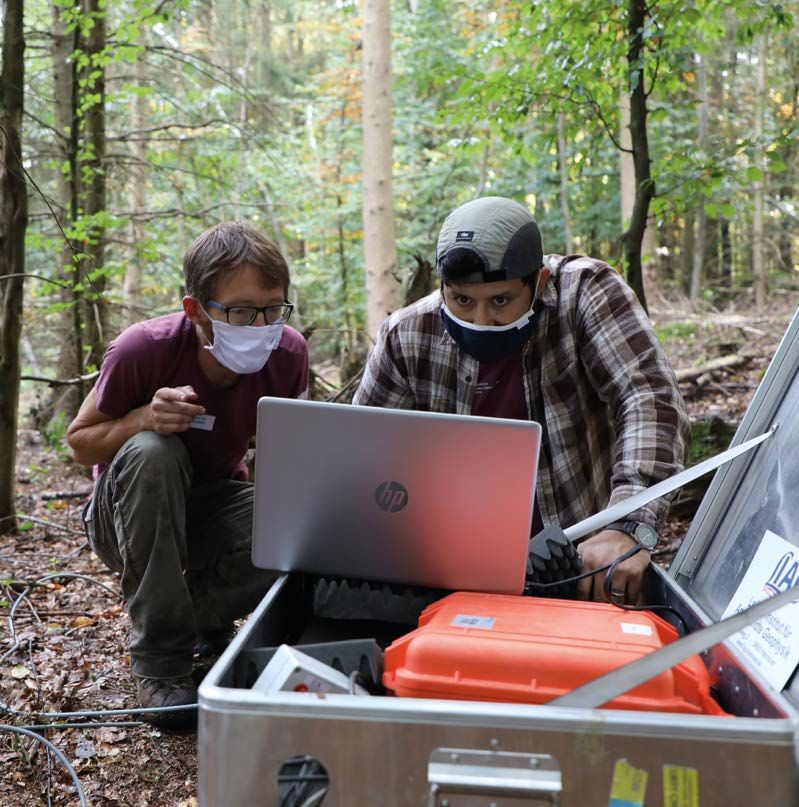
2
                  RESEARCH TOPIC PROFILES

  Groundwater Geophysics
           Geothermics
Sediments through the Ages
             Geohazards
Groundwater Geophysics Observing and understanding the elixir of life Drought, salinisation, contamination: Problems that threaten our groundwater and, therefore, our foundation of life. The first comprehensive, global water-related objective has been determined in the United Nations’ 2030 Agenda for Sustainable Development. In particular, the secondary goal of ensuring availability and sustain- able management of water and sanitation for all requires a deeper understanding of the structures and effective processes that take place in groundwater systems. Natural groundwater systems are the most important resources of drinking water. However, to use these sustainably, a great deal of research is required to investi- gate aquifers and the protective function of the layers above them. The necessary integration of geophysical, hydrological, geological and geochemical findings is a challenge that science has only just begun to tackle. This applies to measuring technologies used in the field and in laboratories, where observations and mea- surement results are on a variety of different spatial and temporal scales. It also applies to modelling linked processes, a task that can only be achieved using numerical simulations.
Groundwater Geophysics
Making processes and structures in
the soil and groundwater visible
Coastal aquifers – The basis of life for millions of humans
According to the 2010 Eurostat regional yearbook sur- agriculture, infrastructure expansion and conservation
vey, 43 percent of Europeans (around 196 million per- of nature are just a few key words that are of constant
sons at that time) were living in coastal regions in 2007, relevance to coastal aquifer research.
with 50 percent living less than 50 kilometres from the
The institute contributes to numerous international
sea. Around the world, the number was approximately
projects – currently mainly in northern European
over one billion citizens, according to the World Ocean
coastal regions. However, the methodology developed
Review. What is more, the foundation of the lives of
and applied by LIAG is not generally restricted to coast-
these people is not only threatened by global warming
Borkum.
al areas and can be applied to other research contexts.
and the associated rising sea levels. The availability of
drinking water from groundwater resources is closely
of
Localising and monitoring salinisation for
tograph
connected to the ocean, and consequently linked to
more efficient groundwater management
saltwater. The freshwater/saltwater transition does
l pho
not follow the coastline in subsurface layers that carry Data that allows us to draw conclusions concerning
a
groundwater. On the contrary, it is a dynamic system
Aeri
the structure of the lithosphere, its condition and vari-
of geological circumstances, precipitation, changing ations forms the basis for effective groundwater man-
sea levels and the effects of aquifer utilisation. We agement and is indispensable for predicting future
must describe and understand this dynamic system in changes to the aquifers. During national and interna-
order to be able to detect future changes at an early tional projects such as TOPSOIL (page 56) and goCAM
stage, facilitate sustainable and needs-based use, and (page 58), LIAG collects data that demonstrates the sa-
prevent conflict. Coastal aquifer research is therefore linisation of aquifers or records even the most minute
In the field of groundwater research, LIAG focuses on the application, development and optimal use of also an integral part of societal processes. Tourism and changes in subsurface salinisation over long periods
state-of-the-art geophysical technologies for the detailed investigation of the shallow subsurface. We con-
duct investigations for the sustainable management of drinking water resources, working with partners from
the fields of scientific research and practical application. Our research is conducted within the framework of
medium- and long-term forecasts of the dynamic development and the protection of our drinking water re-
sources.
LIAG makes geophysical observations of the (partially saturated) soil, the (fully saturated) aquifer and the
transition zone as a whole and as a part of the critical zone. The critical zone is the dynamic range of interac-
tion between the atmosphere, hydrosphere, biosphere and upper lithosphere and extends from the treetops
to the base of the aquifers. Investigating the temporal dynamic changes and highly variable spatial structures
forms the basis for understanding the transport processes that occur there. These include the ingress of nu-
trients and contaminants into groundwater, exchange with the atmosphere and, consequently, interaction
with climatic changes. Processes in the coastal regions, such as groundwater salinisation, the impact of rising
sea levels or freshwater discharge into the ocean are also extremely important. To this end, we are developing
long-term recording systems, high-resolution, ground-based methods and drone-based measurement sys-
tems that are capable of closing the gap between large-scale remote sensing methods with low depth pene-
tration and measurements on the ground.
The current changes in climate and environmental conditions remind us of the complex interdependencies
that necessitate a wide-ranging approach and comprehensive view of the natural systems. For this reason, The SAMOS electrode
LIAG contributes its geophysical expertise to this area of research and focuses on understanding coastal aqui- system measures the
fers and soils. entire saltwater/freshwater
transition zone over several
metres.
22 23Groundwater Geophysics
New horizons:
Drone-based surveys
for large-scale explorations
Large-scale investigations of the three-dimensional subsurface are
of extreme interest to many fields of research. But extensive survey
flights in helicopters or planes are often too expensive. As a product of
the joint project Deep Electromagnetic Sounding for Mineral EXplora-
tion (DESMEX, funded by the BMBF (German Federal Ministry of Edu-
cation and Research), LIAG has opened up a new field of research
by measuring electromagnetic fields from the air
using modern drone technology. Supplemented by
Georadar records high-precision
structural information in the methodological developments, this looks to be a
lithosphere. This is combined with
nuclear magnetic resonance mea- very promising field for future research
surements and with geoelectric and application.
ion.
data to determine porosity, hy-
Usin
uisit
draulic conductivity and salinity.
The transmitting and receiving
g
acq
dro
antennas of the georadar are con-
ta
ne
da
nected by cables to the recording
s
sim
ale
unit carried by the operator. fie
-sc
pli
s ge
th
e s lar
inv
est ort
iga supp
tion an d
of s tructures in the subsurface
using permanently installed measuring instruments. cal models and analyse future changes in scenarios. Determining soil moisture and structures
To do so, we perform electromagnetic measurements LIAG develops innovative methods and combinations non-destructively and on a large scale
from helicopters, on the ground and in boreholes. of methods to explore structures and parameters in
A multitude of soil processes are directly influenced As when attempting to understand groundwater sys-
Some measurements are evaluated using newly devel- greater detail. For instance, high-precision structural
by soil moisture, its spatial distribution and changes tems, large-scale data sets are also essential for under-
oped algorithms and we even develop new measuring information from georadar can be combined with
over time. Modern geophysical procedures, including standing processes and structures in the soil. Drones
instruments specifically for this purpose. The future nuclear magnetic resonance (NMR) measurements
those based on NMR (the basis of medical magnetic can be a valuable source of direct and detailed data,
clearly points in two directions: (1) Fast, cost-effective and geoelectric data acquisition to determine porosity,
resonance imaging), enable subsurface water to be de- including depth information. Models can be used to
and large-scale investigations for visualising the litho- hydraulic conductivity and salinity. In this way, we can
tected directly using non-destructive methods. In the link this data with information from satellite measure-
sphere using drone-based technology, and (2) Moni- obtain an ever more precise view of the subsurface.
MoreSpin project (page 60), LIAG expanded this meth- ments (with low depth ranges and a coarse measure-
toring changes with high temporal resolution.
od to obtain precise information about soil moisture ment grids), soil science and meteorology data. In this
Soil – Our daily bread
in the soil zone. Other techniques include georadar, way, complementary methodological principles are
Describing subsurface hydrogeology
Soils are the interfaces between the atmosphere, lith- which enables soil structures to be visualised in great combined for use in drone-based measurements of
with precision
osphere, biosphere and hydrosphere. As such, they detail, and geoelectric methods that provide fascinat- groundwater and soil.
Visualising salinisation zones is an important tool for are not only generated by weathering processes, but ing insights into the dynamic dispersal and transport
analysing coastal aquifers, but not the only one. Clayey are directly subjected to (changing) environmental of water and nutrients into the soil.
layers protect the aquifers from contamination and conditions. Soils perform a multitude of services within
their low permeability isolates the saturated litho- the ecosystem, including carbon sequestration and
sphere. But the permeability and porosity of aquifers supporting biodiversity, and also serve as foundations
also varies. We need to know their orientation, depth for buildings. Last but not least, they are also one of the
and hydraulic parameters within the subsurface to foundations of human nutrition as a component of the
be able to visualise the hydraulic system in numeri- water cycle and nutrient cycle.
24 25Geothermics Renewable energy from the deep One of the greatest challenges of this century is the abandonment of fossil energy sources in favour of renewable energy. In Germany, the energy revolution is deter- mined by political, societal and financial factors. But questions remain concerning how this sweeping transformation of the energy sector can be accomplished. One of the fundamental questions is the energy source. Back in 2016, LIAG, working in collaboration with the German Geothermal Association (BVG), pointed out that the urgently needed heating transition (from fossil to renewable energy) can only be managed by using geothermal energy. As a result, LIAG published the much-noted brochure Wärmewende mit Geothermie (heating transition using geothermal ener- gy) in 2018, based on LIAG’s scientific publications and the Geothermal Information System GeotIS. In this brochure, LIAG called for the use of medium-depth geothermal energy. Only now is this method economically viable, thanks to new technological developments on the heat pump market. LIAG resumed researching medium-depth geothermal energy in 2020. The following chapter introduces the specific research topics and information systems used in the field of geothermal energy.
Geothermics
Discovering and understanding
geothermal reservoirs
Geological Data Act (GeolDG), LIAG has recently been whose board LIAG is represented) and (2) the North
looking at artificial intelligence methods for processing German Geothermal Conference in Hanover in coop-
seismic data. By adding these new areas, the institute eration with the LBEG and the BGR. The institute also
joined the field of medium-depth geothermal energy holds a leading scientific role as editor-in-chief of the
y.
and siliciclastic geothermal reservoirs in 2020. In the journal Geothermal Energy (Springer Nature). LIAG
an
medium term, our aim is to use data mining, deep covers the increasing demand for geothermal pros-
erm
learning and machine learning to inspect, analyse and pecting studies in projects that are in the institute’s
, G
i ch
interpret geophysical and geological exploration data. area of interest. Due to our experience in planning
Mun
To this end, LIAG is working in close collaboration with and conducting research drilling and our in-house
m,
R ie
the Heisenberg Chair of Computational Geosciences at Borehole Geophysics Department, the institute is an
n
ities i
GAUG. LIAG also played a leading role in submitting an important point of contact for the field of geothermal
Munich city util
NFDI4Earth application to the German Research Foun- drilling.
dation (DFG).
Our present research activities and co-operations are
Transfer of knowledge and networking strongly oriented towards the unanswered questions
nt run by
posed by ongoing geothermal projects currently
One of our noteworthy accomplishments is the devel- being developed or conducted in the German states
g pla
opment of the first deep geothermal energy e-learning of Bavaria and Mecklenburg-Western Pomerania. Our
atin
modules in the LIAG GeoFaces project. These modules third-party-funded projects cover corresponding
t he
are provided free of charge on the GeotIS website. Our topics and are presented with examples in the descrip-
tric
dis applied geothermal research is conducted in collab- tions of our services.
al
rm
oration with GAUG, the home of the shared Chair of
e
th
eo
G
Applied Geothermics and Geohydraulics (Jülich Model). Geothermics across Germany: Between
We work in close cooperation with the Fraunhofer In- temperature distribution models and
stitute IEG through an honorary professorship for the reservoir simulations
exploration and geology of geothermal reservoirs at
Since its foundation, LIAG has been involved in applied geothermal research, based on over 50 years of
the Bochum University of Applied Sciences. LIAG provides the one-of-a-kind GeotIS platform and
research experience in earlier departments. The dataset from which the well-known and widely used German
FIS geophysics information system for geothermal re-
geothermal information system, GeotIS, has been developed through over more than 15 years of research
In addition, LIAG is involved in organising the two most search across Germany. Understanding the process of
from third-party projects, is correspondingly extensive. GeotIS is the foundation and starting point for all
important geothermal energy conferences in Germany: thermal transport in Earth’s upper crust and the result-
research activities in the field of geothermics. Within the field of geothermics, the institute specialises par-
(1) the German Geothermal Conference (DGK) in coop- ing temperature distribution is of huge scientific and
ticularly in geological and geophysical reservoir characterisation, reservoir modelling in the area of reservoir
eration with the German Geothermal Association (on economic interest.
engineering and, in collaboration with our partner university Georg August University of Göttingen (GAUG),in
reservoir genesis. Research conducted by LIAG is more involved in practical projects than any other research
institution.
Current research topics in 2020
Our current research topics deal with reservoir predic- physical reservoir characterisation by evaluating and
tions and the sustainable use of reservoirs. Uniquely, interpreting cross-correlated borehole logs. In this way,
LIAG’s research activities include the validation of we can determine the integrity of specific reservoirs.
thermally coupled reservoir simulations using operat- We generate thermally/hydraulically/mechanically
Temperature distribution
ing data from practical projects. Our specific research coupled simulations from a geosystem scale down to in Germany at 1000, 2000,
the reservoir and borehole scale. We also develop new, and 3000 metres under the
activities are focussed on carbonates and currently
surface.
encompass the verification of new methods of analysis validated temperature models and lithosphere models
1000 metres 2000 metres 3000 metres
for seismic velocity data and attributes for improved in GeotIS. To cope with these now considerable quan-
reservoir diagnosis. The institute also performs petro- tities of data and in the run-up to the new German
28 29Geothermics
Challenges in modelling temperature distribution researches the characterisation and validation of Sandstones in focus for medium-depth Analysis and interpretation of
medium-depth geothermal energy in northern Ger- geothermal energy seismic attributes
In 2020, LIAG calculated a new 3D temperature model many with the first application of machine learning
for all of Germany, Upper Austria and other neigh- to process seismic data and drilling success forecasts. Lower Cretaceous sandstones in Lower Saxony are The Molasse basin is the only foreland basin in the
bouring regions using modern geostatistical methods. Both projects involve deep drilling, hydraulic tests and a potential reservoir of medium-depth geothermal world where hydrothermal heat and energy is success-
Calculating a temperature model of this size was a borehole geophysics, which illustrates and underlines energy. The map of Valanginian deposits newly issued fully produced. LIAG contributed considerably to this
scientific challenge as it required more than 12,000 LIAG’s outstanding expertise in the field of deep bore- by the LBEG provides data that allows simulations of a success with their research activities in geophysical
boreholes to be factored in and weighted differently. holes (down to 6000 metres). geothermal doublet system to be generated. For this reservoir characterisation. Geothermal resources are
For this reason, we are continuing our research into reason, LIAG systematically investigated Lower Creta- mainly located in the fractured, karstified carbonates
temperature distribution modelling and expanding it Regional geothermics: Potential uses of ceous rocks in Lower Saxony in collaboration with the of the Upper Jurassic at a depth of 2000 to 5000 me-
to include uncertainty analysis. The present 3D tem- Lower Cretaceous strata for the heating Leibniz University Hanover (LUH) and in consultation
perature model can be viewed at no charge in either transition in Lower Saxony with the LBEG. The research was conducted within the
GeotIS or FIS geophysics and raster datasets of any framework of a master’s thesis using thermal-hydraulic
desired sections can be downloaded. Further progress has also been made with regional reservoir simulations with the latest reservoir parame-
research; for example, the potential uses of medi- ters regarding geothermal potential. Previously, it was
Simulating reservoir processes um-depth geothermal energy in Lower Saxony. The not known whether sustainable geothermal energy
thermal potential of medium-depth geothermal ener- management was possible using Lower Cretaceous
LIAG is involved in the REgine research project in gy (depth range of 400 metres to around 2000 metres) rocks.
collaboration with Munich city utilities (SWM) and is currently underutilised in Germany.
the Technical University of Munich (TU Munich). This Model of a geothermal doublet system
project studies the validated characterisation and sim-
ulation of carbonate reservoirs. Amongst other things, The results show that it would be possible to operate
we are attempting to trace a supposed thermal infiltra- hydrothermal doublet systems in Lower Cretaceous
tion to the south of Munich using a thermal-hydraulic sandstones at many sites in Lower Saxony
reservoir simulation that includes the adjacent fields over a period of more than 35 years while maintaining
(page 52). A further thermal-hydraulic simulation that reservoir integrity. Each doublet system could pro-
Interpretation results of seismic attributes shows the fault populations
we generated during the PlayType project is a compre- duce over 8 MW of thermal output. For instance, three separated by Rupelian clay.
hensive basin model. This model is intended to clarify doublet systems could already cover 50 percent of the
the influence of global climate change (ice ages) on heating requirements of the town of Emlichheim. But it
temperature development in the lithosphere and, ulti- is not only Lower Cretaceous rocks that have geother- tres. The 3D seismic reflection data that was collected
mately, to explain the thermal anomaly in the mal potential. In future, other reservoirs are to be inves- 30 kilometres to the south of Munich near Geretsried
Molasse basin in eastern Bavaria (page 54). tigated using similar methods to assess their potential helped us to understand the tectonic development of
with greater detail. complex structures at the Alpine deformation front.
Research in the area surrounding nine
geothermal deep boreholes Determining the geothermal potential Fault development hypothesis
of faults for drilling targets
LIAG is also involved in the ZokrateS project in collabo- The results clearly show that the phases of fault activ-
ration with Ruhr University Bochum (RUB). This project The origins of faults in the deep lithosphere and their ity correlate with the development of stress fields as
is investigating an innovative reservoir treatment to relation to geodynamic processes in the upper crust the Alpine Orogeny advanced. One key observation
increase productivity and as well as thermally/hydrau- are also of geoscientific interest. Furthermore, detailed resulting from this study is that fault populations in the
lically/mechanically coupled reservoir simulations for seismic interpretations and systematic structural anal- Mesozoic and Cenozoic deposits are separated by the
the development of the first petrothermal yses of fractured geothermal reservoirs can streamline thick Tertiary Rupelian clay formation and consequent-
heating project in Germany. LIAG is collaborating geothermal exploration and field development strate- ly developed independently from one another both
with GAUG on the mesoTherm project. This project gies. The PlayType project was conducted in collabora- temporally and spatially.
tion with GAUG and SWM. The example of the German
Temperature distribution of Valanginian rocks and heating requirements of the towns of Molasse basin was used to examine the local geody-
Meppen, Neuenhaus and Emlichheim in the Emsland region and the county of Bentheim
based on GeotIS and the Pan-European Thermal Atlas 4.3 (2018). namical development of faults using detailed seismic
data processing and interpretation. This allowed the
lithosphere to be classified using an innovative me-
chanical stratigraphy.
30 31Sediments through the Ages Learning from the past Understanding past climate and environmental changes is an essential require- ment when generating detailed scenarios of future climate developments. Conti- nental sediments give us the option of investigating terrestrial climate systems, as opposed to marine sediments. Sediments of this kind react more quickly to local climate changes, such as transitions between interglacial and glacial periods, vari- ations in monsoon circulation, local tectonic changes and landform development. At LIAG, we can apply a wide range of geophysical methods to terrestrial sedi- ments to draw robust conclusions on the development of the climate and derive a cross-regional and internally consistent picture of landscape and climate evolution. This also includes reconstructing climate changes and environmental changes that affected the lifetimes of early hominids.
Sediments through the Ages

Following the trail of the past

                                                                                                                 Drilling platform on barge
                                                                                                                 on Lake Towuti (Indonesia),
                                                                                                                 where an international team

                                                                                                           .
                                                                                              les in Zambia
                                                                                                                 of researchers have drilled
                                                                                                                 various boreholes and taken
                                                                                                                 measurements.

                                                                                                      mp
                                                                                              iment sa
                                                                                                  ed
                                                                                            ing s
                                                                                                                         Unexplored climate archive: The secrets of old sediment basins

                                                                                        Tak
                                                                                                                         LIAG is particularly interested in studying sediment             LIAG’s research using the example of Lake Ohrid (page
                                                                                                                         basins, such as old lakes or overdeepened Alpine val-            70). The institute is also involved in a drilling project in-
                                                                                                                         leys resulting from glacigenic influences. In such places        vestigating climate dynamics during the Lower Jurassic
                                                                                                                         such as these, extremely thick layers of sediment can            period (around 200-174 million years ago) in England.
                                                                                                                         be deposited in a relatively short time and are largely
   LIAG uses geophysical methods to obtain evidence of the structural and climatic development of selected               undisturbed by other influences. Continental sedimen-            Insights into ice ages in overdeepened Alpine valleys
sediment systems by working in collaboration with national and international partners. The research is also              tary basins have a much better chronological resolu-
characterised by multidisciplinary approaches. For instance, we use various luminescence dating methods                  tion than most marine climate archives.                          As we have insufficient knowledge of how continental
to determine the age of sediments. LIAG has an in-house geochronology laboratory that the institute uses to                                                                               environmental systems in Central Europe responded to
conduct research at the forefront of global science. For instance, we can reconstruct the chronology of past             Climate reconstructions using lake sediments                     past climate fluctuations, the institute is also involved
changes in precipitation by dating lake and fluvial sediment patterns and loess-palaeosol sequences. When                                                                                 in the exploration of glacially overdeepened Alpine
combined, the methods provide us with information concerning wind conditions in the past. Innovative appli-              Some LIAG research activities have been conducted                valleys and basins. The multidisciplinary analysis of
cations in thermochronology allow us to reveal the history of erosion in mountain valleys that are affected by           under the umbrella of the International Continental              Quaternary sediments enables us to deduce informa-
glaciation and changing precipitation.                                                                                   Scientific Drilling Program (ICDP) for many years. In            tion about the spatial distribution and temporality of
                                                                                                                         2020, we conducted research at the following sites and           the various ice ages in the Alpine region. These issues
We also use palaeomagnetic and geomagnetic dating methods. In this way, researchers at LIAG investigate                  lakes: Towuti (Indonesia), Ohrid (North Macedonia),              will be tackled by the ICDP project Drilling Overdeep-
changes in sedimentation conditions using petromagnetic proxies. We also employ geophysical borehole                     Bosumtwi (Ghana) and Junin (Peru). The boreholes                 ened Alpine Valleys (DOVE), in which the institute plays
measurements to make statements concerning the lithological properties of the sedimentary sequences                      are several hundred metres deep and have been                    a leading role. LIAG is currently preparing to drill a
drilled. Seismic investigations are the basis for generating structural models of the lithosphere and enable             drilled from floating platforms in recent years. These           research borehole to investigate this same topic in the
us to create 3D visualisations of sedimentary bodies. We also investigate climate-sensitive parameters using             are joined by drilling projects in several now dry lakes,        Tannwald basin in Baden-Wuerttemberg (page 48).
cyclostratigraphic analysis to generate, for example, age-depth models from the geophysical properties of the            such as Lake Chalco (Mexico) and the Lake Fucino                 We are also sinking a 500-metre-deep borehole in the
sediment alone.                                                                                                          (Italy). These latter projects are also exploring the in-        section of the northern Upper Rhine Graben located
The combination of all these methods allows us to draw reliable conclusions concerning the age and natural               formation archived in the sediments concerning the               in the state of Hesse. This will access the fluvial-aeolian
sedimentation dynamics of terrestrial geological archives. The overarching objective is to derive a cross-re-            climate conditions and environmental conditions from             and fluvial-lacustrine archive and enable us to explore
gional and internally consistent image of landscape evolution and climate evolution from the local and                   1.3 million years ago to the present day in a wide range         the glacial and interglacial periods of the Quaternary,
regional findings. This work is being conducted in national and international projects.                                  of climate zones from the tropical Pacific to the Medi-          ideally going back to approximately 2.6 million years
                                                                                                                         terranean. We will present the results and potential of          before the present.

                                                      34                                                                                                                             35
Sediments through the Ages
Dating sedimentary deposits using optically stimulated and functional revolution that took place in the Middle
luminescence (OSL) and related methods is an essen- Stone Age and Early Stone Age (page 62) among our
tial tool for the chronological classification of climate human ancestors. Similar investigations are being con-
data archived in the sediment (going back to approxi- ducted in the Sudan and in Germany.
mately 300,000 years before present). NMR enables us
to make deductions concerning the bonding force of LIAG and other partners involved in the Lichtenberg
water in the pore volume. From this we can derive the project are questioning why Neanderthals settled
spectrum of potential natural variation in soil moisture. in northern Lower Saxony (Wendland) although
For instance, we used NMR to considerably reduce the the Ice Age presented inhospitable conditions. The
number of implausible OSL age estimations from the Lichtenberg basin was a shallow lake approximately
Toshan loess plateau in Iran. 120,000–80,000 years ago, i.e. from the Eemian inter-
glacial period to the Early Weichselian glacial period.
Reconstructing the climatic living New investigations making use of LIAG methodologi-
conditions of our human ancestors cal expertise show that the local climate and, therefore,
Grey/yellow loess layers and also the vegetation at this site varied widely. This was
dark brown palaeosols near
Neka-Abelou in northern Iran: Where, how and under what conditions did our hu- due to the lake being connected to the river Elbe at
Dating results show that some man ancestors live and what were the effects of climat- different periods in the past (page 50).
of the sediments are more than
200,000 years old.
ic changes? Investigating sediments at a wide variety
of sites helps us to reconstruct climatic conditions. At Consequently, it is possible to reconstruct the past en-
the same time, it helps us to understand the lifestyles vironmental and climatic conditions from the chang-
and behaviours of our human ancestors as well as ing sediments by taking advantage of combined geo-
their development of tools. Researchers at LIAG use physical expertise and diverse methods. For instance,
OSL and electron spin resonance (ESR) dating meth- we can draw fundamental conclusions regarding
ods to narrow down the time at which various types climatic history, evolutionary history and their dynam-
of sediments were deposited. For example, we dated ics. At the same time, this potentially allows us to make
sediments found in the vicinity of Stone-Age tools in statements regarding future developments.
What loess tells us about the past Combining methods opens up new Zambia to ascertain the progress of the technological
reconstruction options
Loess is a valuable environmental and climatic archive:
this type of sedimentary geoarchive is widespread In addition to utilising established methods, such as
in the middle latitudes and has huge potential for rock magnetism and grain size analysis, we develop
enabling us to understand global climate dynamics new techniques, and test and improve them until they
through research projects. This is because loess is are ready for application. Reconstructing wind direc-
formed by the solidification of aeolian dust. The dust tions and directions of flow from the orientation of
can be blown out of, for example, dry riverbeds or particles is usually a labour-intensive and challenging
lakes in large quantities and fine components can be exercise. The way that LIAG meets this challenge sets
transported through the air over great distances. us apart from other institutions in the world. One key
In a some places (lower Danube basin, Tajikistan, Chi- method is determining the anisotropy of magnetic
na), dust deposits are several hundred metres thick. susceptibility. X-ray microtomography (µ-CT) allows
Determining physical properties is vital for understand- sample material to be characterised in high spatial
ing climatic evolution. For this reason, LIAG conducts resolution with regard to mineralogical, structural and
research at various sites (in Iran, in India, Croatia, Roma- geometric material properties. We can formulate more
nia and Serbia in addition to those already mentioned) robust conclusions concerning wind and flow fields
investigating loess and palaeosol sequences (see pag- by combining the results of volume integral magnetic
es 64 and 68 for examples). anisotropy with µ-CT datasets.
ns.
tio
s
ec
i bing
d e scr
nd
pl es a
am
Fieldwork: Taking s
36 37You can also read