West Gippsland Waterway Strategy 2014-2022
←
→
Page content transcription
If your browser does not render page correctly, please read the page content below

WEST GIPPSLAND CATCHMENT MANAGEMENT AUTHORITY

    West Gippsland
Waterway Strategy
       2014-2022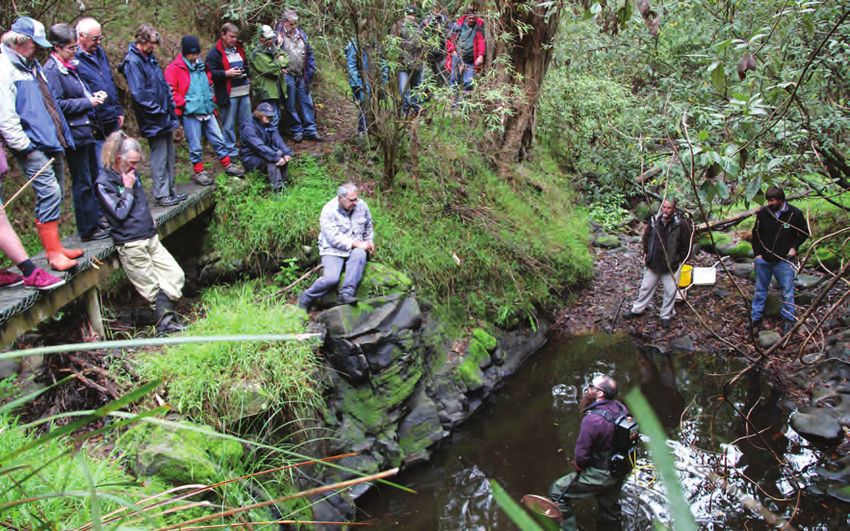
Acknowledgements
                                                           The development of this West Gippsland Waterway
                                                           Strategy has involved the collective effort of
                                                           a number of individuals and organisations. In
                                                           particular:

                                                           Primary Author – Michelle Dickson (WGCMA)

                                                           Contributing Authors:

                                                           •   Tracey Jones, Eleisha Keogh, Mandy Leggett,
                                                               Rachael Millar (WGCMA)
                                                           •   Mark Stacey (Alluvium Consulting)
                                                           •   Geoff Park (Natural Decisions)
                                                           •   Taylor Hunt (DEPI)

                                                           Technical input from WGCMA staff: Matt Bowler,
                                                           Richard Allen, Dan Cook, Rod Johnston, David Stork,
                                                           Tammy Logan.
Disclaimer
                                                           Steering Group members: Ian Gibson and Ian Hill
This publication may be of assistance to you but the
                                                           (WGCMA board), Martin Fuller, Kylie Debono, Dan
West Gippsland Catchment Management Authority
                                                           Garlick, Adam Dunn.
(WGCMA) and its employees do not guarantee that
the publication is without flaw of any kind or is          Information on Aboriginal cultural and community
wholly appropriate for your particular purpose. It         values and the priorities of Traditional Owners was
therefore disclaims all liability for any error, loss or   prepared by Mandy Leggett, Aboriginal Cultural
other consequence which may arise from you relying         Heritage Officer with WGCMA on behalf of the
on any information in this publication.                    Gunaikurnai Land and Waterways Aboriginal
                                                           Corporation (GLaWAC) and the BoonWurrung
The level of government investment in this Strategy
                                                           Foundation. It has contributions from GLaWAC
will depend upon budgets and government
                                                           elders, board, staff and community members.
priorities.
                                                           BoonWurrung Foundation director Aunty Caroline
Copyright                                                  Briggs and Anne Fildes.
© West Gippsland Catchment Management
Authority                                                  Acknowledgement of Country
                                                           We would like to acknowledge and pay our
First published 2014. This publication is copyright.
                                                           respects to the Traditional Land Owners and other
No part may be reproduced by any process except in
                                                           indigenous people within the catchment area: the
accordance with the provisions of the Copyright Act
                                                           Gunaikurnai, The Bunurong and Boon Wurrung,
1968.
                                                           and the Wurundjeri people. We also recognise the
                                                           contribution of Aboriginal and Torres Strait Islander
Accessibility                                              people and organisations in Land and Natural
This document is available in alternative formats          Resource Management.
upon request.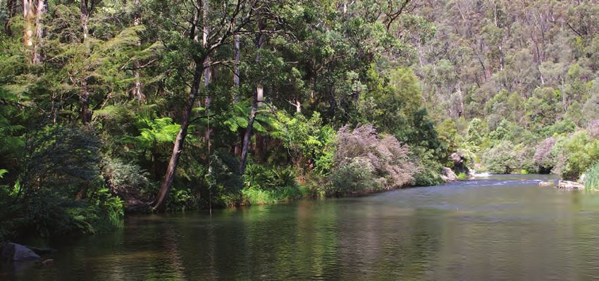
Contents
List of Figures                                                                           4

List of Tables                                                                            5

Abbreviations                                                                             5

Chair’s Foreword                                                                          6

Executive Summary                                                                         7
Document Structure                                                                        9

Part A – Overview and Strategic Context                                                  10

1   Context                                                                              10
    1.1 Scope                                                                            10
    1.2 Vision                                                                           11
    1.3 Scale of Management                                                              11
    1.4 Legislation and Policy                                                           12
    1.5 Waterways with Formally Recognised Significance                                  15
    1.6 Roles and Responsibilities                                                       15
    1.7 Review of the West Gippsland River Health Strategy                               16

2   Waterways                                                                            18
    2.1 Overview                                                                         18
    2.2 Rivers and creeks                                                                19
    2.3 Estuaries                                                                        20
    2.4 Wetlands                                                                         20
    2.5 Internationally and Nationally Significant Wetlands                              21
    2.6 Condition of Rivers in the Region                                                22
    2.7 Condition of Wetlands in the Region                                              23

Part B – Management Responses to Waterway Threats                                        24
3   Introduction                                                                         24
    3.1 Riparian Land                                                                    24
    3.2 Water Quality                                                                    25
    3.3 Estuaries                                                                        26
    3.4 Urban Waterways and Development                                                  27
    3.5 Works on Waterways Approvals                                                     28
    3.6 Environmental Water                                                              28
    3.7 Groundwater Development Ecosystems (GDEs)                                        30
    3.8 Invasive Plants and Animals                                                      31
    3.9 Flooding, Storm and Bushfire                                                     32
    3.10 Threatened Plants and Animals                                                   34
    3.11 Climate Change                                                                  35

                                                 West Gippsland Waterway Strategy 2014-2022 | 1
Part C – Approach to Prioritisation                                     36

  4   Introduction                                                         36
      4.1 Principles for Development and Implementation of the Strategy    36
      4.2 Asset Based Approach                                             37
      4.3 Consultation                                                     38
      4.4 Vision and Goals                                                 39
      4.5 High value waterways                                             40

  5   Description of Prioritisation Process                                40
      5.1 Types of Priorities                                              43
      5.2 Management Activities in Non-Priority Areas                      45
      5.3 Program Logic and Targets                                        46

  6   Fishery Management Priorities                                        47

  7   Aboriginal Cultural Values and Participation                         48
      7.1 Gunaikurnai                                                      48
      7.2 Boon Warrung / Bunurong                                          49
      7.3 Wurundjeri                                                       50
      7.4 Traditional Owner and Aboriginal Communities’ Priorities         50
      7.5 Overall Outcomes – Common Priorities                             50

  Part D – Work Program                                                   52
  8   Implementation                                                       52
      8.1 Roles and Responsibilities                                       52
      8.2 Resourcing                                                       52
  9   Work Program                                                         52
      9.1 Cost Estimates                                                   53
      9.2 Responsibilities                                                 53
  10 Strategic Management Program                                          53
  11 Gippsland Lakes and Wetlands Management Unit                          56
  12 Avon and Perry Rivers Management Unit                                 62
  13 Lower Latrobe, Thomson and Macalister Management Unit                 66
  14 Mid Latrobe Management Unit                                           71
  15 Upper Thomson, Latrobe, Macalister and Avon Management Unit           76
  16 Giffard Plain and Merriman Creek Management Unit                      81
  17 Strzelecki Management Unit                                            85
  18 Bunurong Coast and Inlets Management Unit                             89
  19 Tarwin and Powlett Rivers Management Unit                             93
  20 Wilsons Promontory Management Unit                                    98
  21 Corner Inlet Management Unit                                         101

2 | West Gippsland Catchment Management Authority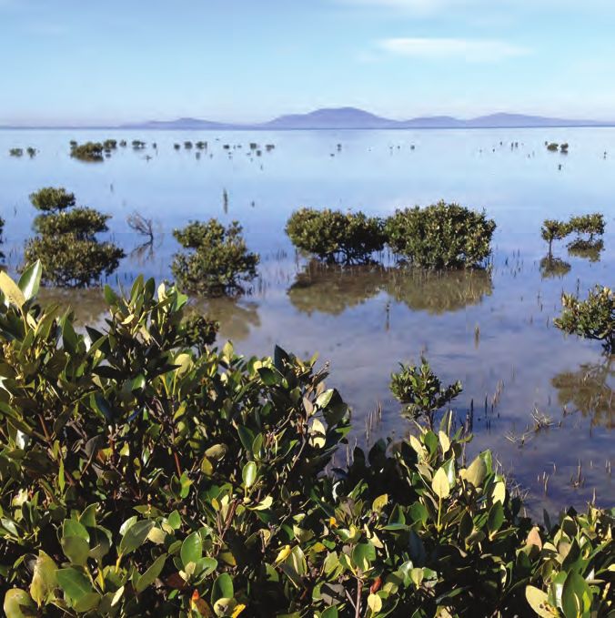
22 Corner Inlet Ramsar Site Management Plan                                               106
   22.1 Criteria met for Ramsar and other important values                                107
   22.2 Critical components processes and services                                        109
   22.3 Land Management Arrangements                                                      111
   22.4 Community Participation                                                           111
   22.5 Limits of Acceptable Change                                                       112
   22.6 Threats, risk assessment and prioritisation of actions for Corner Inlet           112
   22.7 Ramsar Site Monitoring Evaluation and Reporting                                   112
   22.8 Work program for the Corner Inlet Ramsar Site                                     113

23 Monitoring, evaluation and reporting                                                   117
   23.1 Adaptive Management                                                               117
   23.2 Monitoring                                                                        118
   23.3 Evaluation                                                                        118
   23.4 Reporting                                                                         119
   23.5 Kowledge gaps and research                                                        120
   23.6 Adaptive management                                                               120

24 References                                                                             121

Appendices (available on CD)
Appendix one – Legislation and Policy                                                       2
Appendix two – Roles and responsibilities                                                   3
Appendix three – Learnings from the RHS                                                     6
Appendix four – Regional goals and intent statements                                        8
Appendix five – High value waterways                                                       10
Appendix six – Supporting tools                                                            18
Appendix seven – Regional goals and prioritisation results                                 19
Appendix eight – RCS and Waterway Strategy priorities                                      31
Appendix nine – Limits of Acceptable Change for the Corner Inlet Ramsar Site               33
Appendix ten – Detailed method for Ramsar Site planning                                    37
Appendix eleven – Corner Inlet Ramsar site LACs and Monitoring Requirements                43
Appendix twelve – Communications and Engagement Activities and Outcomes                    50

                                                   West Gippsland Waterway Strategy 2014-2022 | 3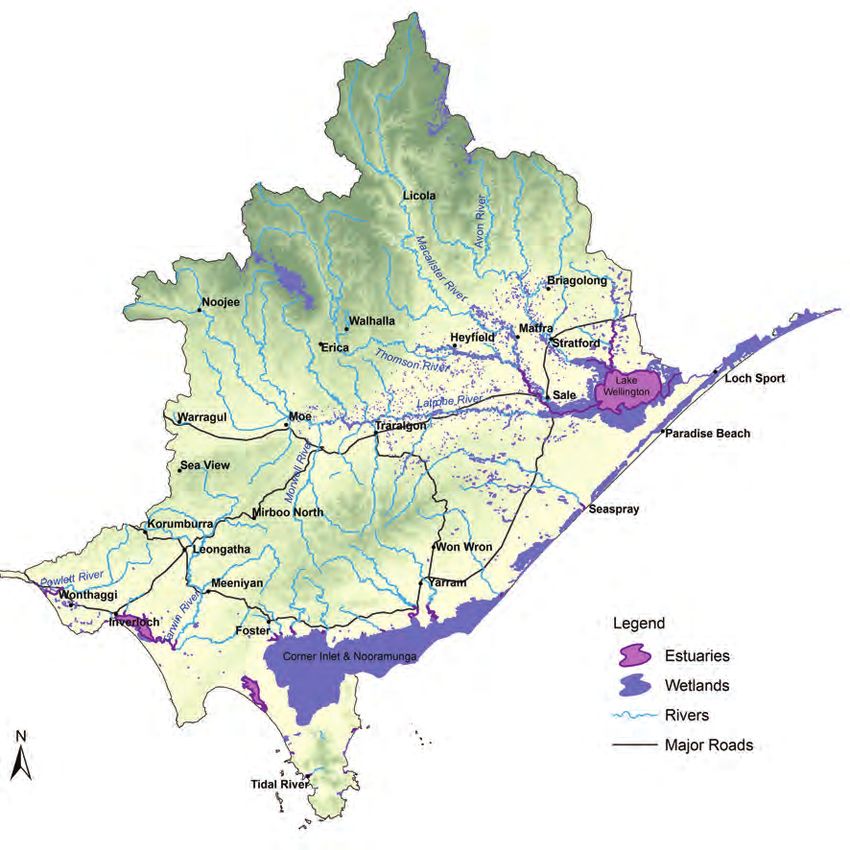
List of Figures
  Figure 1     Waterway Management Units                                                     12
  Figure 2     The planning framework for the West Gippsland Waterway Strategy               13
  Figure 3     Major waterways in the West Gippsland Region                                  18
  Figure 4     Index of Stream Condition Results                                             23
  Figure 5     Process for identifying priority waterways                                    40
  Figure 6     Summary of outcomes from prioritisation                                       43
  Figure 7     Priority rivers and estuaries in the West Gippsland region                    44
  Figure 8     Priority wetlands in the West Gippsland region                                45
  Figure 9     Program Logic for the Waterway Strategy                                       46
  Figure 10    Gunaikurnai clan map                                                          49
  Figure 11    Conceptual diagram of Gippsland Lakes and Wetlands management unit            56
  Figure 12    Map of priorities for Gippsland Lakes and Wetlands management unit            58
  Figure 13    Map of the Lower Latrobe wetlands                                             58
  Figure 14    Conceptual Diagram of the Avon and Perry rivers management unit               62
  Figure 15    Map of priorities for Avon and Perry Rivers management unit                   63
  Figure 16    Conceptual diagram of the Lower Latrobe, Thomson and Macalister
  		           management unit                                                               66
  Figure 17    Map of priorities for Lower Latrobe, Thomson and Macalister management unit 67
  Figure 18    Conceptual diagram of the Mid Latrobe management unit                         71
  Figure 19    Map of priorities for the Mid Latrobe management unit                         72
  Figure 20    Conceptual diagram of the Upper Thomson, Latrobe, Macalister and
  		           Avon management unit                                                          76
  Figure 21    Map of priorities for Upper Thomson, Latrobe, Macalister, Avon
  		           management unit                                                               77
  Figure 22    Conceptual diagram of the Giffard Plain and Merriman Creek management unit    81
  Figure 23    Map of priorities for Giffard Plain and Merriman Creek management unit        82
  Figure 24    Conceptual diagram of the Strzelecki management unit                          85
  Figure 25    Map of priorities for Strzelecki management unit                              86
  Figure 26    Conceptual diagram of the Bunurong Coast and Inlets management unit           89
  Figure 27    Map of priorities for Bunurong Coast and Inlets management unit               90
  Figure 28    Conceptual diagram of the Tarwin and Powlett Rivers management unit           93
  Figure 29    Map of priorities for Tarwin and Powlett Rivers management unit               94
  Figure 30    Conceptual diagram of the Wilsons Promontory management unit                  98
  Figure 31    Map of priorities for the Wilsons Promontory management unit                  99
  Figure 32    Conceptual diagram of the Corner Inlet management unit                       101
  Figure 33    Map of priorities for the Corner Inlet management unit                       102
  Figure 34    Corner Inlet Ramsar Site management arrangements                             106
  Figure 35    Conceptual Model of Components, Processes and Services/Benefits at
  		           Corner Inlet                                                                 109
  Figure 36    Adaptive Management Cycle                                                    117

4 | West Gippsland Catchment Management Authority
List of Tables
Table 1    Summary of objectives for environmental entitlements in West Gippsland         29
Table 2    Priorities for Traditional Owners                                              51
Table 3    Strategic Management Program                                                   53
Table 4    Gippsland Lakes and Wetlands Work Program                                      59
Table 5    Avon and Perry Rivers Work Program                                             64
Table 6    Lower Latrobe, Thomson and Macalister Work Program                             68
Table 7    Mid Latrobe Work Program                                                       73
Table 8    Upper Thomson, Latrobe, Macalister and Avon Work Program                       78
Table 9    Giffard Plain and Merriman Creek Work Program                                  83
Table 10   Strzelecki Unit Work Program                                                   87
Table 11   Bunurong Coast and Inlets Work Program                                         91
Table 12   Tarwin and Powlett Rivers Work Program                                         95
Table 13   Wilsons Promontory Works Program                                              100
Table 14   Corner Inlet Work Program                                                     103
Table 15   Summary of critical components, processes and services/ benefits of the
		         Corner Inlet Ramsar Site (taken from BMT WBM, 2011a)                          110
Table 16   Work Program for the Corner Inlet Ramsar Management Plan                      113

Abbreviations
AVIRA      Aquatic Values Identification and Risk Assessment
BMP        Best Management Practice
CIFHA      Corner Inlet Fisheries Habitat Association
CMA        Catchment Management Authority
Cwlth      Commonwealth
ECD        Ecological Character Description
ESO        Environmental Significance Overlay
EWMP       Environmental Water Management Plan
DEPI       Department of Environment and Primary Industries
DSE        Department of Sustainability of Environment (now part of DEPI)
DPI        Department of Primary Industries (now part of DEPI)
GDE        Groundwater Dependent Ecosystem
INFFER     Investment Framework for Environmental Resources
IPA        Invasive Plant and Animal
LAC        Limit of Acceptable Change
LMP        Local Management Plan
MERI       Monitoring Evaluation Reporting and Improvement
RCS        Regional Catchment Strategy
RHS        River Health Strategy
VWMS       Victorian Waterway Management Strategy
VRHS       Victorian River Health Strategy
VROT       Victorian Rare or Threatened Species
WBCS       Waterway Benefit: Cost Scoring
WGCMA      West Gippsland Catchment Management Authority

                                                  West Gippsland Waterway Strategy 2014-2022 | 5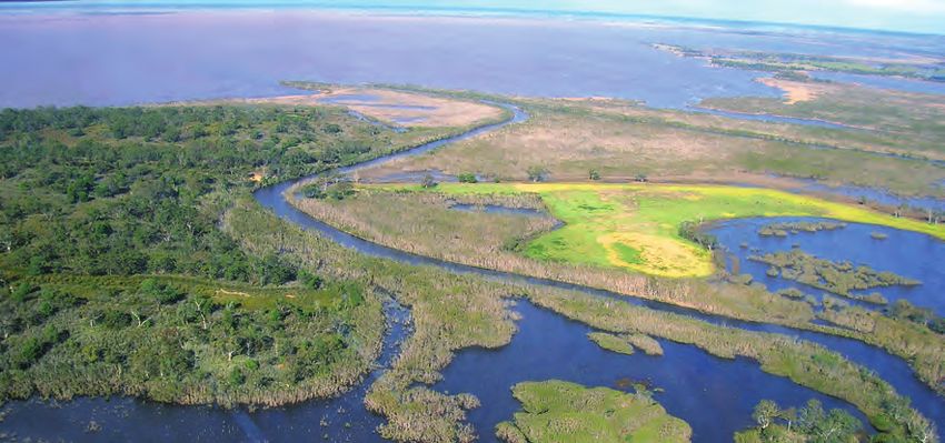
Chair’s Foreword
  The health of the waterways in West Gippsland is critical to the sustainability of our region.
  These waterways support the regional and state economy by providing water for agriculture,
  industry and for urban and rural communities, including part of Melbourne’s water supply.
  Our iconic coastal wetlands and inlets including the Gippsland Lakes, Anderson Inlet and
  Corner Inlet attract tourists to our beautiful region. Waterways are also valued for the
  recreational opportunities they provide, their cultural values and their role in the landscape
  supporting a range of ecological processes.

  This West Gippsland Waterway Strategy forms a sub strategy to the West Gippsland Regional
  Catchment Strategy, implements the policy framework from the Victorian Waterway
  Management Strategy 2013 and builds on the achievements and learnings from the previous
  West Gippsland River Health Strategy. In framing this Strategy we are mindful of our
  obligations under the Catchment and Land Protection Act 1994 and Water Act 1989 as well
  as other relevant legislation for the management waterways in the region.

  This Waterway Strategy identifies the priority waterways in the region and sets out a realistic
  eight year work program of management activities which are practical, feasible and cost
  effective. The priority waterways have been identified through a robust, evidence based
  process linking waterways to a set of Regional Goals through an analysis of their values
  and the risks to those values. Priorities have been identified for waterways at risk and those
  where values or past works are to be maintained.

  However, activities may also be required outside these priorities, where there is strong
  community support, where action is required in order improve or maintain the values of a
  priority waterway or in responding to natural disasters such as bushfire and flood.

  This Waterway Strategy is broader in scope than the previous River Health Strategy,
  by addressing rivers, wetlands and estuaries in an integrated approach. The Waterway
  Strategy has been prepared in cooperation with our partner organisations and a variety of
  communities across the West Gippsland region. We look forward to continuing to work with
  our regional stakeholders throughout the implementation of this Waterway Strategy for the
  improvement, resilience and management of our region’s natural resource environment.

  Angus Hume
  Chair

6 | West Gippsland Catchment Management Authority
Executive Summary

Executive Summary
Waterways in the West Gippsland region provide a range of important community uses such
as supply of water for industrial, agricultural and domestic use, recreational pursuits such as
kayaking, bird watching, hunting and fishing, and providing habitat for plants and animals.

The purpose of the West Gippsland Waterway Strategy (the Strategy) is to ensure the future
management of waterways provides the appropriate environmental conditions to support
the range of identified values (environmental, social, cultural and economic).

The Strategy builds on the achievements and learnings from the previous West Gippsland
River Health Strategy (2005), but is wider in its scope addressing rivers, estuaries and
wetlands. It provides a framework for waterway management that is consistent with
the Victorian Waterway Management Strategy (2013) and the West Gippsland Regional
Catchment Strategy (2013).

The 50 year vision for the Strategy is: Our rivers, estuaries and wetlands are well managed
to provide connectivity across our landscape, and are widely valued and appreciated for the
benefits they provide.

The regional goals are listed below.
• Maintain and improve the habitat and condition of waterways to support water
  dependent animals and plants.
• Reduce future impacts to public infrastructure resulting from physical changes to a
  waterway associated with floods and storms.
• Maintain the ecological character of significant wetlands and estuaries.
• Provide system connectivity between rivers, estuaries and wetlands.
• Improve the condition of urban waterways in partnership with local government.
• Maximise the ecological outcomes from the available environmental water.
• Support community use, participation, advocacy and stewardship in the region’s
  waterways.
• Maintain and improve the values of Heritage Rivers.
• Provide appropriate environmental conditions to support the economic values of
  waterways in the region.

The development of the Strategy has included the identification of high value waterways
and the use of regional goals to help identify priority waterways for the eight-year planning
period from 2014–2022.

A work program of management activities for priority waterways was developed to
guide investment over this eight-year period. The Strategy also identifies priorities for
environmental water management, together with the complementary management
activities required at these sites.

                                                    West Gippsland Waterway Strategy 2014-2022 | 7
Executive Summary

  Implementation of management activities will be based on a set of principles drawn from
  the Victorian Waterway Management Strategy (VWMS) including:
  • using a partnership approach
  • ensuring waterway management is considered within the context of integrated
    catchment management, using appropriate delivery mechanisms with consideration to
    public versus private benefits and the cost sharing principles set out in the VWMS
  • ensuring value for money through investment
  • taking a seasonally adaptive approach based on an understanding of short to medium
    term trends in climate
  • using evidence-based decision making, drawing on local knowledge, science and expert
    opinion.

  The regional work program provides clear direction to guide investment in waterway
  management. These work priorities will provide guidance to West Gippsland Catchment
  Management Authority (WGCMA), local, state and Australian governments, community
  groups and corporate or individual partners about where investment is required in the
  region over an eight year period.

  This Strategy provides investors with confidence that their annual funding of management
  activities is linked to a longer term strategic plan and leads to improvements in waterway health.

  The content required for waterway strategies was outlined in guidelines published by the
  Department of Environment and Primary Industries (DEPI) and guidance notes developed in
  partnership with CMA waterway managers.

8 | West Gippsland Catchment Management Authority
Executive Summary
Document Structure
This Strategy is divided into four main sections – parts A, B, C and D.
Part A covers this introduction, the context of this Strategy and an overview of waterways in
the West Gippsland region. This includes:
• the scope, vision and objectives of the Strategy
• an overview of the legislation and policy relevant to this Strategy
• an explanation of the roles and responsibilities of WGCMA
• a review of the West Gippsland River Health Strategy and its achievements
• an overview of rivers, wetlands and estuaries in West Gippsland, and their environmental,
cultural, social and economic values.
Part B sets out a discussion of the major waterway threats in the region and the
management responses to them including:
• riparian land
• water quality
• estuaries
• urban waterways and development
• works on waterways approvals
• environmental water
• groundwater dependent ecosystems
• invasive plants and animals
• flooding, storm and bushfire
• threatened plants and animals
• climate change.
Part C describes the approach taken for the prioritisation of waterways and the development
of targets and a work program for these priorities. This includes:
• an overview of the approach taken including the guiding principles, the assets based
approach and consultation undertaken
• the vision and goals of the Strategy
• a discussion of the identification of high value waterways, types of priorities, Aboriginal
priorities and fishery management priorities.
Part D sets out the work program, how it will be implemented and evaluated. This includes:
• tables showing the regional work program from 2014 to 2022
• how the program will be implemented, resourced and the roles and responsibilities for
each agency
• monitoring, evaluation and reporting on the work program
• the consultation process
• references
• appendices.
West Gippsland Waterway Strategy 2014-2022 | 9Part A – Overview and
Strategic Context
1 Context
This section describes the scope and outlines the policy and legislative
context of this Strategy.
1.1 Scope
The Strategy focuses on the management of rivers, their associated estuaries and floodplain
and non-riverine wetlands.
The focus for wetlands is largely on natural wetlands, although it is acknowledged that many
constructed wetlands, particularly in urban settings, have important social values.
The Strategy does not include the shallow marine waters except for those listed as wetlands
of National Importance or International Importance (Ramsar sites). The management of
water resources (groundwater and surface water) with the exception of environmental
water is not addressed in this Strategy. The management of floodplains and managing for
flood risk is not within the scope of this strategy, these issues will be addressed in regional
floodplain management strategies (when developed).
The objectives of the Strategy are to:
• identify the region’s high value waterways (environmental, social, cultural and economic
values)
• determine a subset of priority waterways
• establish targets for priority waterways
• set out an eight-year work program that identifies management activities for priority
waterways
• set out the management plan for Corner Inlet Ramsar Site
• establish a monitoring and evaluation framework to determine the success of
implementing the Strategy.
10 | West Gippsland Catchment Management AuthorityOverview and Strategic Context – Part A
1.2 Vision
The vision and regional goals for waterway management are central to the logic framework
of this Strategy and are set out below. The Vision describes the long term aim of waterway
management and the regional goals help to identify priority waterways.
Our rivers, estuaries and wetlands are well managed to provide connectivity across our
landscape, and are widely valued and appreciated for the benefits they provide.
Regional goals
• Maintain and improve the habitat and condition of waterways to support water
dependent animals and plants.
• Reduce future impacts to public infrastructure resulting from physical changes to a
waterway associated with floods and storms.
• Maintain the ecological character of significant wetlands and estuaries.
• Provide system connectivity between rivers, estuaries and wetlands.
• Improve the condition of urban waterways in partnership with local government.
• Maximise the ecological outcomes from the available environmental water.
• Support community use, participation, advocacy and stewardship in the region’s
waterways.
• Maintain and improve the values of Heritage Rivers.
• Provide appropriate environmental conditions to support the economic values of
waterways in the region.
1.3 Scale of Management
The term ‘reaches’ is used to describe a section of river (generally 20-30 km long) or a section
of an estuary and is the common planning unit for management.
The planning for wetlands has occurred at two different scales based on the approach used
in the West Gippsland Wetlands Plan. Planning at the individual site scale has been used
for those wetlands that have International or National significance. Planning for all other
wetlands has been undertaken at the broader management unit levels with priorities based
on the type of wetland. This means that the priority level of individual wetlands will need to
be informed by site based assessments of condition and values.
The three river basins within West Gippsland defined by the Australian Water Resources
Council (AWRC) are the Thomson, Latrobe and South Gippsland river basins. The Strategy
considers all three river basins and their associated tributary systems. Each river basin has a
direct influence on high value lakes and coastal environments including the Gippsland Lakes
and Corner Inlet Ramsar sites and Anderson Inlet, Shallow Inlet and the Powlett River estuary.
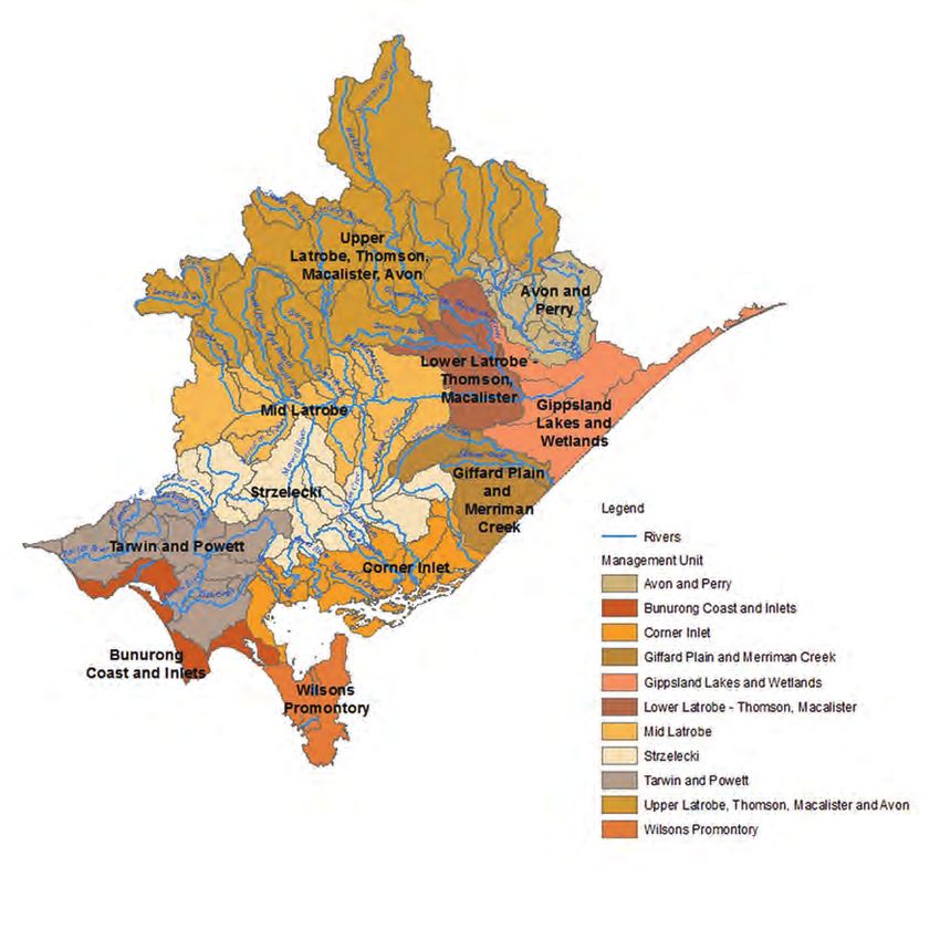
Within the region a number of management units have been defined. Management
units are aggregations of reaches and wetlands and have been defined by topographical
data, land use, river form and process and local knowledge. The definition of boundaries
has also been influenced by considering internal and external operational and reporting
requirements. Unlike the previous sub-catchments defined for waterway management these
management units are not aligned to the River Basins. Figure 1 shows the management units
for West Gippsland.
West Gippsland Waterway Strategy 2014-2022 | 11Part A – Overview and Strategic Context Figure 1 Waterway Management Units 1.4 Legislation and Policy Preparing this Strategy for the West Gippsland region is a statutory requirement for WGCMA under the Water Act 1989. This Strategy replaces the West Gippsland River Health Strategy. It has been prepared in line with the Victorian Waterway Management Strategy, Department of Environment and Primary Industry guidance notes and relevant sustainable water strategies. It also complements relevant sub-strategies such as urban waterway management plans and the Corner Inlet Water Quality Improvement Plan. The Strategy is part of the bigger picture of waterway management. It is consistent with the planning framework established through the Regional Catchment Strategy (RCS) (2013) and the Victorian Waterway Management Strategy, which updates the Victorian River Health Strategy (2002). The RCS includes a long term vision for the region, identifies regionally significant land, water and biodiversity assets and priorities, and sets 20 year condition objectives and six year management measures. Long term objectives in the RCS will be implemented through this Strategy. The Strategy provides the framework to guide WGCMA in partnership with the community to manage our rivers, wetlands and estuaries to support environmental, social, cultural and economic values. 12 | West Gippsland Catchment Management Authority
Overview and Strategic Context – Part A

Central and Gippsland region sustainable water strategies investigate the range of potential
changes to water availability under several climate change scenarios. They also examine
future consumptive demand and environmental needs and set out proposed options to
balance and secure water for all users.

The Gippsland Regional Growth Plan provides broad direction for land use and development
across regional Victoria (GLGN and DTPLI 2014). The Regional Growth Plan has as one it is
key principles to promote a healthy environment by valuing the region’s environmental and
heritage assets, and by minimising the region’s exposure to natural hazards and risks. The
Regional Growth Plan identifies a range of actions that aim to reduce the risks to waterways
from future growth.

When finalised the Victorian Floodplain Management Strategy will provide a consistent
statewide framework for the management of flood related issues and provide for the
preparation of regional floodplain management strategies.

                           Waterway Management Planning Framework

                           State policy frameworks for managing waterways
     West                   Victorian Waterway Management Strategy
  Gippsland                                                                               Sustainable
   Regional               Regional priority waterways and targets (eight years)              Water
  Catchment                                                                                Strategies
   Strategy                West Gippsland Regional Waterway Strategy

                                        Sub strategies and plans
                  Environmental       Gippsland                               Urban
                      Water                             Corner Inlet
                                        Lakes              WQIP             Waterway
                   Management        Ramsar Plans                        Plans and MoUs
                       Plans

                              Detailed information on targets and actions
                                   Annual planning and reporting

Figure 2 The planning framework for the West Gippsland Waterway Strategy

At the federal level, since 2004, water reform has been guided by the National Water
Initiative (NWI). The NWI recognises the need to build on the water reforms of the 1994
Council of Australian Government (COAG) agreement to ensure increased productivity and
efficiency of Australia’s water use. It includes clear steps to return river and groundwater
systems to environmentally sustainable levels of extraction and achieve integrated
management of environmental water. The Environment Protection and Biodiversity
Conservation Act 1999 (Cwlth) provides the Australian government with a legal framework
to protect and manage Ramsar sites, nationally and internationally important flora, fauna,
ecological communities and heritage places defined in the Act as matters of national
environmental significance.

                                                         West Gippsland Waterway Strategy 2014-2022 | 13
Part A – Overview and Strategic Context
The Native Title Act 1993 (Cwlth)
provides a framework for the protection
and recognition of native title. The Act
gives Aboriginal Australians who hold
native title rights and interests – or
who have made a native title claim –
the right to be consulted and, in some
cases, to participate in decisions about
activities proposed to be undertaken
on the land. The Victorian Government
introduced the Aboriginal Heritage Act
2006. This Act replaces Part IIA of the
Commonwealth Aboriginal and Torres
Strait Islander Heritage Protection Act
1984 and the State Archaeological
and Aboriginal Relics Preservation
Act 1972. The Act links the protection
of Aboriginal cultural heritage more
directly with planning and land
development processes.
Under the Water Act 1989, the Victorian
Government retains the overall right to
Pictured: Thomson River, near Horseshoe Bend the use, flow and control of all
surface water and groundwater
on behalf of all Victorians. All water taken for consumptive purposes is done so under
entitlements set out in the Water Act 1989. The Water Act 1989 also defines the
Environmental Water Reserve (EWR) as the amount of water set aside to meet environmental
needs. The Victorian Environmental Water Holder was established in 2011, under the Water
Act 1989, as an independent statutory body responsible for making decisions on the most
efficient and effective use of Victoria’s environmental entitlements.
The key state wide policy framework for water quality protection in Victoria is the State
Environment Protection Policy (Waters of Victoria) (SEPP (WoV)). It provides a statutory
framework for state and local government agencies, businesses and communities to work
together to protect and rehabilitate Victoria’s surface water environments. The SEPP (WoV)
identifies beneficial uses of water and sets the environmental quality objectives and policy
directions required to address higher risk impacts and activities. Other relevant Victorian
legislation is the Flora and Fauna Guarantee Act 1988 (FFG Act) which legislates for the
conservation of threatened species and communities and for the management of potentially
threatening processes, and the Coastal Management Act 1995 which establishes a framework
for coordinated strategic coastal planning in Victoria and provides for the use, development
and protection of coastal crown land.
At the regional level, the Catchment and Land Protection Act 1994 establishes regional
catchment strategies as the primary framework for integrated management of land, water
and biodiversity in each of the ten catchment regions of Victoria.
For the purposes of the Victorian Planning Provisions (at clause 12.03), this Waterway
Strategy is considered an approved management plan and therefore must be considered in
planning decisions. More information on how the Victorian Planning Provisions influence
waterway management can be found in the Opportunities and Challenges section in this
Strategy.
Other state and federal government legislation, policies and initiatives relevant to this
Strategy are shown in Appendix one.
14 | West Gippsland Catchment Management AuthorityOverview and Strategic Context – Part A
1.5 Waterways with Formally Recognised Significance
The Convention on Wetlands of International Importance (the Ramsar Convention) provides
the framework for national action and international cooperation for the conservation and
wise use of wetlands and their resources. The Convention encourages member countries to
nominate sites containing representative, rare or unique wetlands, or that are important
for conserving biological diversity, to the List of Wetlands of International Importance
(Ramsar sites). Ramsar sites are a matter of national environmental significance under the
Environment Protection and Biodiversity Act 1999.
The Gippsland Lakes and Corner Inlet are two of the 11 wetlands in Victoria listed under
the Ramsar Convention in recognition of the significant coastal wetland values and features
present. The Gippsland Lakes Ramsar Site extends into the East Gippsland Catchment
Management Authority region whilst Corner Inlet is wholly within the WGCMA region.
As a Contracting Party to the Ramsar Convention, Australia is required to maintain the
ecological character of its Ramsar sites at the time they were listed through conservation
and wise use. The ecological character is defined by the Convention as “the combination of
the ecosystem components, processes and benefits/services that characterise the wetlands
at a given point in time”. A change in ecological character is the “human induced adverse
alteration of any ecosystem component, process and or ecosystem benefit/service.”
An ecological character description has been completed for Corner Inlet and the Gippsland
Lakes (BMT WBM 2011 and 2011a). The ecological character descriptions define limits of
acceptable change (LACs) for ecosystem services/benefits (values) and physical, chemical and
biological ecosystem components and processes that are considered critical to the ecological
character of the Ramsar site. It also recommends monitoring needs for each Ramsar site.
Planning for the region’s two Ramsar sites has occurred concurrently with this Strategy.
Management planning for the Corner Inlet Ramsar Site has been included in this document;
however the Gippsland Lakes Ramsar Plan will be a stand-alone document and is being
developed in partnership with the East Gippsland Catchment Management Authority,
Gippsland Lakes Ministerial Advisory Committee, Department of Environment and Primary
Industries and Parks Victoria.
1.6 Roles and Responsibilities
WGCMA coordinates the integrated management of land and water resources within the
West Gippsland region under the Catchment and Land Protection Act 1994. It aims to achieve
ecologically and economically sustainable development of natural resource based industries,
protect land and water resources and conserve natural and cultural heritage.
WGCMA is an independent authority mandated by the Victorian Government. It operates
mainly under the Catchment and Land Protection Act 1994 and Water Act 1989.
Under Part 10 of the Water Act 1989, CMAs are also designated with specific responsibility
for the management of waterways, drainage and floodplains.
Established in 1997, WGCMA has fulfilled its responsibilities by taking a partnership
approach, working with communities, industries and government agencies to maintain and
improve the condition of the region’s natural resource assets.
The goals of the Strategy will be achieved through a range of partnerships regardless of
land tenure.
West Gippsland Waterway Strategy 2014-2022 | 15Part A – Overview and Strategic Context Pictured: working in partnership with Landcare, landowners and community groups to improve the condition of natural resources. WGCMA works with the agencies responsible for managing public land including DEPI, Parks Victoria, water authorities, Traditional Owners and local government. WGCMA also works directly with private landholders and in partnership, industry bodies and community groups to ensure the successful completion of priority actions and the establishment of formal agreements to underpin these projects. Further detail on the roles and responsibilities of partner agencies and community groups is contained in Appendix two. 1.7 Review of the West Gippsland River Health Strategy The Victorian River Health Strategy (VRHS) (DNRE 2002) provided an over-arching framework for communities to work in partnership with government to manage and restore Victorian rivers over the long term. The VRHS set out the regional planning process which included the development of regional river health strategies for each catchment management authority region to integrate all river-related management plans. The purpose of the West Gippsland River Health Strategy (RHS) was to balance protecting, maintaining and enhancing the environmental values of natural river systems and the processes required to sustain river health, while maintaining or improving additional social and economic values important to the local community. The RHS provided a plan to allow coordinated action to be taken over a five year period to maintain or improve the health of rivers. 16 | West Gippsland Catchment Management Authority
Overview and Strategic Context – Part A

A review of the RHS was completed in 2012 to inform this Strategy. The review found
that overall, the RHS successfully guided river health work in the region for the WGCMA
and some partner organisations. The adaptive management principle was applied with
management approaches changing as a result of the experience and knowledge gained
during implementation of the RHS and in response to unplanned events such as bushfire
and flood. Improved knowledge of program logic and MERI processes can be applied to the
development and implementation of this Strategy, and improved community engagement
mechanisms can be incorporated into waterway activities and the design of the Strategy itself.
Finally, an increased focus on communication of the Strategy with stakeholders throughout
its life will result in higher levels of ownership, alignment of effort and resources, and an
understanding of progress toward outputs and outcomes at any point in time.

The major achievements from the RHS from 2005 – 2012 are detailed below. More detail on
the learnings from the RHS can be found in Appendix three.

Environmental flows        • Delivery of annual seasonal watering program for the
                             Thomson, Macalister and Latrobe rivers and Latrobe Wetlands.
                           • Environmental flow assessments for the Tarra, Avon, Latrobe,
                             Powlett and Tarwin rivers.
                           • Environmental Risk Management arrangements implemented
                             during drought conditions on the Thomson, Macalister, Tarwin,
                             Powlett rivers and Easterbrook Creek where flows were
                             qualified for critical human needs.
                           • Identification of environmental flow requirements to inform
                             management of the Gippsland Lakes and Corner Inlet Ramsar
                             sites.

Stock exclusion            • 310 ha riparian vegetation improved by 224 km fencing to
                             exclude stock.
                           • 405 off-stream watering points provided.

Revegetation               • 1,100 ha riparian land revegetated and fenced along 373km
                             waterways.

Wetland improvement        • 205 ha wetlands fenced to exclude stock.

Invasive species control   • 464 ha aquatic weeds (Spartina) controlled.
                           • 1,585 ha riparian weed control (willow) and an additional 580
                             ha other woody weed control.

Waterway stabilisation     • 16 km of waterway stabilised through works to address bank
                             erosion at 44 sites.
                           • 46 km of streambed erosion addressed through construction of
                             waterway structures.

                                                   West Gippsland Waterway Strategy 2014-2022 | 17
Part A – Overview and Strategic Context 2 Waterways 2.1 Overview West Gippsland is a diverse region, characterised by areas of natural forest, areas of high conservation value, fertile floodplains for agriculture, coastal wetlands, inlets and estuaries. The region is a significant contributor to the Victorian economy in particular through power production in the Latrobe Valley and from agribusiness including forestry and farming. A brief description of the region’s waterways is provided in this section. Figure 3 Major waterways in the West Gippsland Region 18 | West Gippsland Catchment Management Authority
Overview and Strategic Context – Part A

Pictured: Thomson River

2.2     Rivers and creeks
WGCMA is responsible for over 40,000 km of designated waterways across the region,
including major rivers and creeks and the tributaries that flow into them. These waterways
flow to the Victorian coast, discharging either through the Gippsland Lakes, to coastal inlets
and embayments (Anderson Inlet, Shallow Inlet, Corner Inlet) or directly to Bass Strait and
the Southern Ocean.

In the north of the region, the Thomson, Macalister and Avon and Perry rivers flow from
alpine areas and the forested slopes of the Great Dividing Range. The Thomson and
Macalister rivers have their flow regulated in the mid to upper catchments by the major
storages of Thomson Reservoir (primarily for Melbourne’s domestic supply) and Lake
Glenmaggie (for the Macalister Irrigation District). Further downstream on the Thomson
River, Cowwarr Weir also diverts water for the Macalister Irriagation District (MID).

The Avon and Perry rivers in the far east of the region are unregulated. The upstream
reaches of the Avon River flow through wilderness areas before entering land used for
grazing and irrigated horticulture. The Perry River is a chain of ponds waterway and is
ephemeral for much of its length. The Perry joins the Avon River upstream of the estuary and
then flows to Lake Wellington.

In the central part of the region is the Latrobe River. The catchment of the Latrobe River
features areas of remnant forest through the Strzelecki Ranges and the Great Dividing
Range, where tributary streams rise and flow to the Latrobe River and ultimately to Lake
Wellington. Although much of the land has been cleared for agriculture, the dominant land
use is mining for brown coal, used at major thermal power stations – Loy Yang, Hazelwood
and Yallourn – providing the majority of Victoria’s electricity. Blue Rock Dam and Moondarra
Reservoir are two major storages on tributaries of the Latrobe River, with Lake Narracan
located on the Latrobe itself just upstream of the Yallourn power station.

In South Gippsland, the waterways are short and flow from the Strzelecki and Hedley Ranges
through productive agricultural land as well as areas of high conservation value (including
Wilsons Promontory and the Tarra Bulga National Park). The major rivers of South Gippsland
include the Powlett, Tarwin, Franklin, Agnes, Albert and Tarra rivers. Further east are
Bruthen and Merriman Creek. All South Gippsland rivers are unregulated; however there are
a number of off-stream storages in the Tarwin and Powlett river catchments and off takes for
domestic township water supply on a number of rivers and creeks.

                                                   West Gippsland Waterway Strategy 2014-2022 | 19
Part A – Overview and Strategic Context 2.3 Estuaries The West Gippsland coast has over twenty estuaries; these include the brackish mouths of rivers and streams that directly flow into the ocean or a large embayment (including those that flow into Corner Inlet), there are also coastal barrier lagoons (Gippsland Lakes) and coastal inlets (Anderson and Shallow inlets). A number of these estuaries fall within areas listed as nationally and internationally significant wetlands and have important environmental, social, cultural and economic values. Due to their location at the bottom end of catchments estuaries are influenced by a range of catchment processes including land use, development and extraction of water. 2.4 Wetlands There are over 1,500 wetlands larger than one hectare in the West Gippsland region. Together they total more than 44,000 ha. Wetland loss in West Gippsland has been significant. The greatest losses have been to freshwater wetlands in particular freshwater meadows and deep freshwater marshes (WGCMA 2007). Pictured: Top – Tarwin River, Bottom – Heart Morass, near Sale 20 | West Gippsland Catchment Management Authority
Overview and Strategic Context – Part A
2.5 Internationally and Nationally Significant Wetlands
The West Gippsland region has a number of significant wetlands and wetland complexes,
including two internationally important Ramsar sites and eleven sites listed as nationally
important under the Directory of Important Wetlands Australia.
Within the Thomson and Latrobe catchments there are five wetlands and wetland complexes
listed as nationally important, these include: alpine and montane wetlands located in
the upper catchments; Caledonia Fen and Lake Tarli Karng and the Billabong, a remnant
floodplain wetland in the Perry River system. The lower Thomson and Latrobe catchments
include part of the Gippsland Lakes Ramsar Site and the nationally listed Lake Wellington
Wetlands and Lake Victoria Wetlands (WGCMA 2007).
In South Gippsland, Corner Inlet is a significant wetland of national and international
importance. Four other wetlands of national importance in South Gippsland are: Bald Hills
Wetland, a rehabilitated wetland of the once extensive floodplains of the Tarwin River
system, the Powlett River estuary, Anderson Inlet and Shallow Inlet.
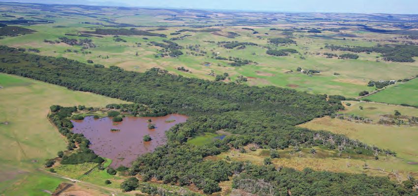
Pictured: an aerial view of Bald Hills wetland
West Gippsland Waterway Strategy 2014-2022 | 21Part A – Overview and Strategic Context
2.6 Condition of Rivers in the Region
The condition of rivers in Victoria is assessed using the Index of Stream Condition (ISC).
The ISC brings together data from a variety of sources to give a detailed overview of river
and stream condition across the state. The ISC is made up of five sub-indices – hydrology,
streamside zone, physical form, water quality and aquatic life. The ISC has been completed
three times for rivers, in 1999, 2004 and 2010. The results of 2010 ISC benchmarking exercise
for West Gippsland are summarised in Figure 4 and below.
• Over half (55%) of the stream length in the Thomson basin was found to be in good or
excellent condition. Of the remainder, 41% of stream length was in moderate condition
and just 3% and 1% in poor and very poor condition respectively (DEPI 2013b).
• One-third (34%) of the stream length in the Latrobe basin was in good or excellent
condition, with a further 44% in moderate condition, 9% in poor condition and 13% in
very poor condition (DEPI 2013b).
• Almost three-quarters (74%) of the stream length in the South Gippsland basin was in
moderate condition. Of the remainder, 10% was in good condition, 10% was in poor
condition and 5% was in very poor condition. Only 0.4% (representing 1 reach) of stream
length was found to be in excellent condition (DEPI 2013b).
Pictured: Top – Corner Inlet, Bottom – Aerial view of Avon River and Perry River
delta, Clydebank Morass and Lake Wellington
22 | West Gippsland Catchment Management AuthorityOverview and Strategic Context – Part A
Figure 4 Index of Stream Condition Results (DEPI 2013b)
2.7 Condition of Wetlands in the Region
The Index of Wetland Condition (IWC) was developed to assess the condition of Victoria’s
wetlands. The IWC has 13 variables that measure six aspects of wetland condition including;
the wetland catchment, physical form, hydrology, water properties, soils and biota (Papas
and Maloney 2012). Seventy-two wetlands in the West Gippsland region were assessed
between 2009 and 2013 using the IWC, 26 of these were part of a statewide assessment
of wetland condition and the remainder were completed to inform the selection and or
monitoring for onground works.
Of the sites assessed, the majority were in moderate to good condition (18 and 29
respectively), 12 were in excellent condition and 15 were in poor to very poor condition.
Wetlands in the moderate – very poor categories had much lower scores for the catchment
and hydrology subindexes.
West Gippsland Waterway Strategy 2014-2022 | 23You can also read